Tour du Mont Blanc
How would you rate Tour du Mont Blanc?
Tap a star to share your experience and help other hikers.
Tour du Mont Blanc: A Complete Hiking Guide
HikeList Score
Tour du Mont Blanc scored 89/100 on HikeList's trail-quality metrics.
See score breakdownHide breakdown
- Ideal length 92
- Balanced challenge 80
- Scenery & wildness 98
- Varied terrain 94
- Accommodation 75
- Food & support 88
- Path quality 98
- Season flexibility 76
Computed from length, challenge, scenery & wildness, terrain variety, accommodation, food & support, path quality and season flexibility.
The Tour du Mont Blanc is a 170 km alpine loop around the Mont Blanc massif through France, Italy and Switzerland. The classic itinerary takes 11 walking days and is hard: expect long mountain stages, roughly 10,000 m of total ascent, rocky paths, high passes and frequent 700–1,000 m climbing days. It suits fit hikers who want a well-waymarked hut-to-hut trek with major alpine scenery, without technical climbing, glacier travel or permit requirements.
Route Overview
The traditional start and finish is Les Houches in the Chamonix valley, with Courmayeur and Champex-Lac also used as alternative start points. First-timers usually walk anticlockwise. The classic circuit links Les Contamines-Montjoie, Les Chapieux, Courmayeur, La Fouly, Champex-Lac, Trient, Tre-le-Champ / Argentiere and the Chamonix valley, crossing major cols including Col du Bonhomme, Col de la Seigne, Grand Col Ferret and Col de Balme. It is a true loop, so logistics are simpler than point-to-point alpine traverses such as the Alpine Pass Route. For another hut-to-hut comparison, see the Dolomites’ Alta Via 1 or the harder Alta Via 2.
History of the Tour du Mont Blanc
The idea of circling the Mont Blanc range dates back to 1767, when Swiss scientist Horace-Benedict de Saussure made the first recorded circumnavigation of the massif. The modern waymarked route was created between 1950 and 1952 by the CNSGR Savoie. It became the first international GR, or grande randonnee, footpath and overlaps the long-distance GR5 in places. Today the route is also linked with the Ultra-Trail du Mont-Blanc, run on and around the TMB.
Notable highlights
- Mont Blanc massif (4,808 m): The route circles the highest mountain in the Alps, with repeated views of the white summit, glaciers and surrounding peaks from different sides of the range.
- Col de la Seigne (2,516 m): This pass marks the crossing from France into Italy’s Val Veni and gives a sudden wide view of the Italian face of the massif, including the Miage and Brenva glaciers.
- Grand Col Ferret (2,537 m): The high pass from Italy’s Val Ferret into Switzerland is one of the classic thresholds of the trek, with big alpine views in both directions.
- Courmayeur: This Italian mountain town sits roughly halfway round the circuit and is a popular rest stop, with a clear change in culture, food and valley scenery beneath the southern flank of the massif.
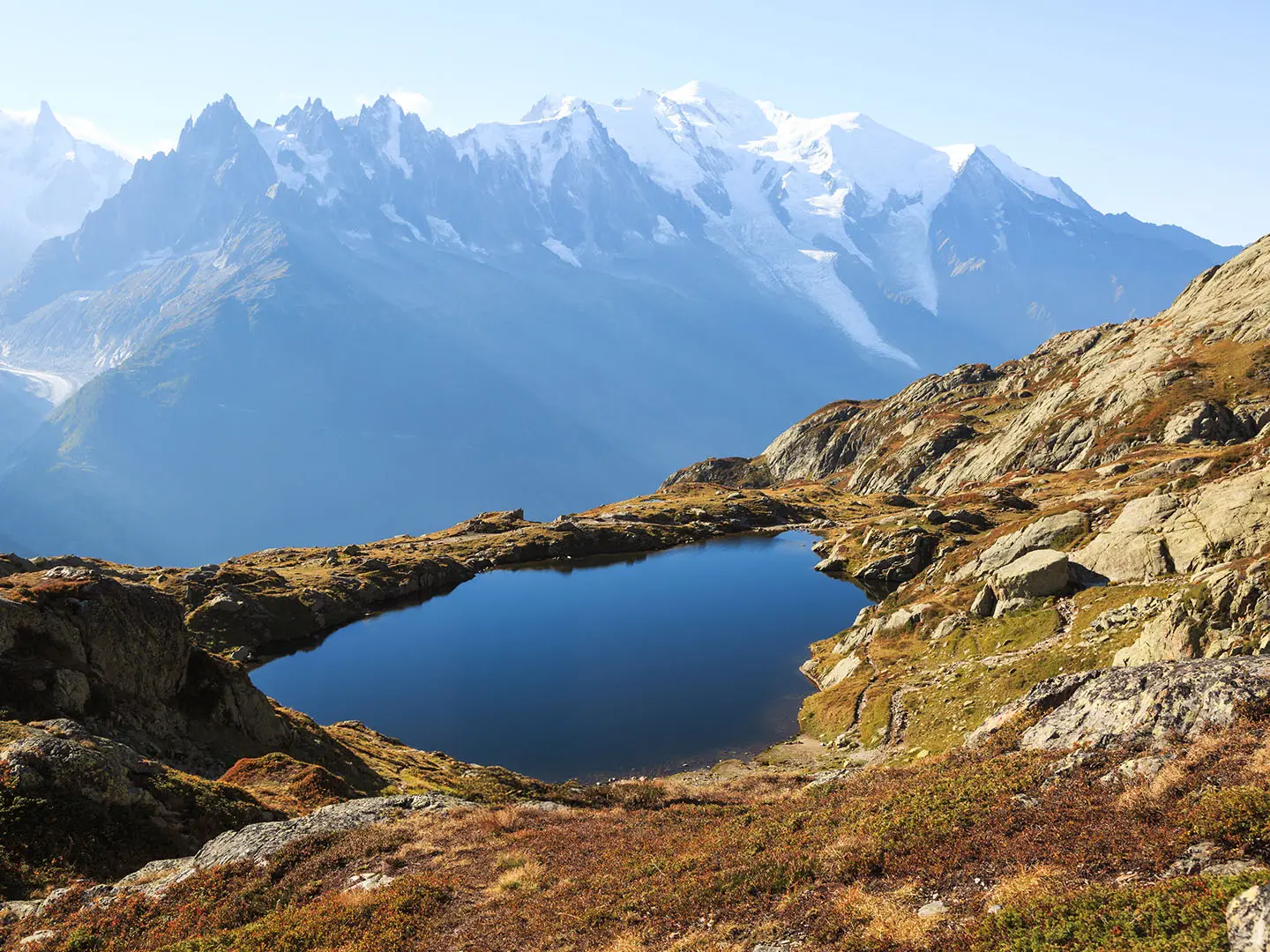
- Lac Blanc and the Aiguilles Rouges: The final French stages use balcony trails above the Chamonix valley, where Lac Blanc and the Aiguilles Rouges give direct views across to the Mont Blanc range.
- Fenetre d’Arpette (2,665 m): This demanding Swiss variant is one of the joint high points of the tour and is known for close views of the Trient glacier.
Challenges to expect
The TMB is non-technical, but it is still a strenuous alpine trek. Expect rocky and uneven paths, long climbs and descents, occasional narrow or mildly exposed sections, and possible snow patches on high passes early in the season. Weather is less settled in June and September. Accommodation is plentiful but summer beds in refuges, gites, hotels and campsites should be booked well in advance.
HikeList Score
Tour du Mont Blanc scored 89/100 on HikeList's trail-quality metrics.
See score breakdownHide breakdown
- Ideal length 92
- Balanced challenge 80
- Scenery & wildness 98
- Varied terrain 94
- Accommodation 75
- Food & support 88
- Path quality 98
- Season flexibility 76
Computed from length, challenge, scenery & wildness, terrain variety, accommodation, food & support, path quality and season flexibility.
 France
 Italy
Italy Switzerland
Show more data Show less
- Mountainous
- Forest
- Valley
- Alpine
- Rocky
- Dirt
- Gravel
- Huts
- Hotels
- Campsites
- Family Friendly
- Pet Friendly
- Restrooms
- Water Sources
- Campsites
- Shelters
Download Our Full Guide to Tour du Mont Blanc FREE!
Get our comprehensive guide to this hike for free. Save it for later reading or print out at home.
Articles related to this hike
In these collections
Photos from hikers
Taken on the trail by people who've reviewed Tour du Mont Blanc.
Tour du Mont Blanc: The Complete Guide
 i
Image by sanderstock
i
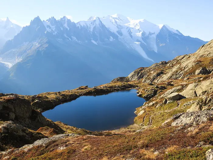
Image by sanderstock The Tour du Mont Blanc is the classic alpine circuit: a hard, non-technical trek of around 170 km around the Mont Blanc massif. It links France, Italy and Switzerland on a waymarked loop through high passes, balcony paths, valleys, refuges and mountain towns.
Most walkers start at Les Houches in the Chamonix valley and walk anticlockwise. The route crosses the Beaufortain, drops into Italy’s Val Veny and Val Ferret around Courmayeur, continues through the Swiss Val Ferret and Champex-Lac, then returns to France over the frontier ridge.
Its appeal is practical as much as scenic. You get repeated, changing views of Mont Blanc, the Aiguilles and the Grandes Jorasses, but also regular refuges, gîtes, buses and valley services that make an independent hut-to-hut trek realistic.
The TMB still asks a lot. Expect long mountain days, big climbs and descents, rocky paths, passes above 2,300 m, possible early-season snow and accommodation that must be booked well ahead in the busy summer season.
This guide covers stages, day planning, accommodation, food, transport, terrain and the common mistakes to avoid.
Stage-by-Stage Guide
The stages below follow the classic 11-day anticlockwise itinerary from Les Houches. Distances are approximate because TMB variants, accommodation choices and local waymarking options can change the exact line walked on the day.
Stage 1: Les Houches to Les Contamines-Montjoie — approx. 16 km
The opening stage leaves the Chamonix valley and quickly establishes the character of the Tour du Mont Blanc: a sizeable climb, a long descent and constant changes between woodland, pasture and village tracks. The route passes through or near Bionnassay and the Col de Voza area before dropping towards Les Contamines-Montjoie.
Underfoot, expect a mix of forest paths, farm tracks and stony mountain trail rather than a gentle valley walk. This is not one of the highest days, but it is still a full alpine stage and is a poor place to discover that boots, poles or pack weight are wrong.
Food and water are straightforward at Les Houches and Les Contamines-Montjoie. Intermediate availability depends on the exact line and seasonal opening, so do not plan the day around an unbooked café or refuge without checking first.
Les Contamines-Montjoie is a regular TMB staging point with accommodation in the village area, including walker-focused options. Beds should still be booked well ahead in summer, especially for July and August.
Transport is easiest at the start: Les Houches is reached from Chamonix by the Mont Blanc Express train or local bus. Les Contamines-Montjoie is one of the valley locations linked by bus services on the wider route, but current timetables should be checked before using it as a start, finish or escape point.
Navigation is generally helped by GR TMB waymarking, but the first day has enough tracks, hamlets and ski-area infrastructure to make a map or GPS track worthwhile. Watch for variant choices around the higher ground; the Col du Tricot option is a known harder variant and should be treated as a deliberate route choice, not an accidental detour.
Stage 2: Les Contamines-Montjoie to Les Chapieux — approx. 20 km
This is one of the first genuinely big mountain stages of the tour. From Les Contamines-Montjoie the route heads through Notre-Dame de la Gorge before climbing onto open alpine ground for the Col du Bonhomme and Col de la Croix du Bonhomme.
The terrain becomes more exposed to weather than on Stage 1, with long climbs, stony paths and pass approaches that can hold snow early in the season. The descent towards Les Chapieux is also a meaningful part of the day, so save energy for the second half rather than treating the cols as the finish.
Key landmarks are Notre-Dame de la Gorge, the Col du Bonhomme, the Col de la Croix du Bonhomme and the Refuge de la Croix du Bonhomme area. The views open out across high alpine pasture and into the wilder Beaufortain side of the route.
Food and water should be planned carefully. Les Contamines-Montjoie is the reliable start point, and Les Chapieux is the overnight hub; anything between them depends on refuge opening dates and should be checked before travelling.
Accommodation is available at or around Les Chapieux, with some itineraries instead using the Refuge de la Croix du Bonhomme. This is a section where booking order matters: if Les Chapieux is full, the whole rhythm of the next day can change.
Public transport and road access are more limited than in the Chamonix valley. Do not rely on making last-minute transport changes from Les Chapieux without checking current options in advance.
In poor weather, the Bonhomme crossing can feel much more serious than its technical grade suggests. Early-season snow, low cloud and wind are the main concerns; carry proper layers, know the forecast and keep the map accessible rather than buried in the pack.
Stage 3: Les Chapieux to Rifugio Elisabetta — approx. 15 km
Stage 3 crosses from France into Italy over the Col de la Seigne, one of the great frontier passes of the TMB. The stage usually feels shorter than the previous day in distance, but it still includes a major climb and a high pass at 2,516 m.
The route passes the Refuge des Mottets area before climbing towards the col. From the pass, the character changes immediately as the Italian side of the Mont Blanc massif comes into view, including the Val Veny landscape and the Miage and Brenva glacier side of the range.
The walking is classic high alpine terrain: open pasture lower down, then rockier and more exposed ground near the pass. Snow patches are possible early in the season, and the crossing should be treated seriously in mist, stormy weather or strong wind.
Food and water are normally planned around Les Chapieux, Refuge des Mottets if open, and Rifugio Elisabetta at the end. Opening dates and meal availability at refuges should be checked before travelling, especially in June and September.
Rifugio Elisabetta is a classic Italian overnight stop beneath the glaciers at the head of Val Veny. It is a remote refuge-style night rather than a town stop, so book ahead, carry cash and arrive with essentials rather than expecting full valley services.
This is the first border crossing of the standard anticlockwise route. Passport checks are not normally part of the walking day, but Switzerland is outside the EU later in the trek and carrying valid travel documents is still sensible.
Navigation is usually clear on the GR TMB, but the simplicity of the pass crossing should not lead to complacency. In poor visibility, stay disciplined at junctions and avoid following informal lines across snow or scree unless they match the intended route.
Stage 4: Rifugio Elisabetta to Courmayeur — approx. 18 km
This stage descends through the Italian side of the massif, moving from a high refuge setting in Val Veny towards the Aosta-valley town of Courmayeur. It is a satisfying change of scale: from remote mountain paths to one of the main service centres of the whole trek.
Expect more descent than the profile may suggest at first glance, with stony paths, pasture and valley approaches underfoot. The views back to the southern flank of Mont Blanc and the Italian glaciers are a major part of the day.
Food and water are available at Rifugio Elisabetta at the start and in Courmayeur at the end. Intermediate services depend on season and exact route choice, so carry enough for a full walking day.
Courmayeur is one of the best places on the TMB to recover, resupply and adjust plans. It has a wider range of accommodation than the remote refuges, from simple walker accommodation to hotels, and is a common place for a rest night.
Public transport is also better here than on the high sections. Courmayeur is one of the main linked valley towns on the loop, making it a practical point to join, leave, shorten or restart the trek.
Navigation into a larger town needs attention because waymarks, roads and local paths can become less obvious among buildings and valley infrastructure. Keep following the TMB line until the chosen accommodation or town access point is clear.
The main warning is not technical difficulty but accumulated fatigue. After the first three mountain days, the long descent into Courmayeur can be hard on knees and feet; trekking poles and an early start help keep the day controlled.
Stage 5: Courmayeur to Rifugio Bonatti — approx. 13 km
Although shorter in distance, this stage should not be treated as an easy rest day. The route climbs out of Courmayeur to regain height above the Italian Val Ferret, with Rifugio Bertone and Rifugio Bonatti forming the key mountain landmarks.
The walking becomes a high balcony-style traverse, with superb views across to the Grandes Jorasses and the Italian side of the Mont Blanc massif. This is one of the finest scenic sections of the route when the weather is clear.
Terrain is mainly mountain path, with sustained ascent out of town and uneven sections along the hillside. The balcony character means the route is exposed to sun, wind and weather, even where the walking is non-technical.
Food and water are reliable in Courmayeur before setting off. Rifugio Bertone and Rifugio Bonatti are important refuge points, but opening dates and meal availability should be checked before relying on them.
Rifugio Bonatti is a major TMB overnight stop and is very popular. Booking well in advance is essential in the main season, and carrying cash is wise for remote refuge expenses.
Transport flexibility drops once the route has climbed away from Courmayeur. Courmayeur itself is the practical transport hub; on the high balcony, plan as if the day must be completed on foot unless a specific exit has been arranged.
Navigation is usually straightforward on the signed TMB, but there can be tempting side paths and refuge access tracks. Stay alert after leaving Courmayeur and when passing Rifugio Bertone so that the intended line towards Rifugio Bonatti is not missed.
Stage 6: Rifugio Bonatti to La Fouly — approx. 20 km
Stage 6 is one of the defining days of the Tour du Mont Blanc. It crosses the Grand Col Ferret at 2,537 m, the highest pass on the standard main route, and moves from Italy into Switzerland.
The route passes the Arnouvaz / Rifugio Elena area before the long climb to the Grand Col Ferret. From the col, the descent leads into the Swiss Val Ferret and onwards to La Fouly.
This is high alpine walking with a sustained pass crossing, rocky and stony ground, and a long descent after the border. Snow can linger on the upper approaches early in the season, and the day is exposed to rapid weather changes.
Food and water should be planned around Rifugio Bonatti, Rifugio Elena or Arnouvaz if open, and La Fouly at the end. Do not assume every refuge or valley facility is open outside the core summer season.
La Fouly is a Swiss village staging point with accommodation used by TMB walkers. From here the currency changes to Swiss francs, so carry CHF or a suitable payment method; some remote accommodation may still prefer or require cash.
The Swiss Val Ferret has valley bus links, making La Fouly one of the more practical places to shorten, skip or rejoin stages. Timetables and seasonal operation should be checked before making fixed plans around them.
Navigation over the Grand Col Ferret is normally clear in good conditions, but mist or snow can make the pass approach more serious. This is not a day for taking casual shortcuts: stay on the marked route and be prepared to turn conservative if the weather deteriorates.
Stage 7: La Fouly to Champex-Lac — approx. 15 km
After several high-pass days, the walk from La Fouly to Champex-Lac is a lower Swiss valley stage. It passes through or near Praz de Fort and Issert before climbing towards the lake resort of Champex-Lac.
The terrain is generally less severe than the Bonhomme, Seigne or Grand Col Ferret crossings, with more forest, village and valley walking. That does not make it a rest day: there is still ascent and descent, and the cumulative fatigue of the tour often becomes noticeable here.
The main appeal is the change of pace. Villages, woodland and Swiss valley scenery replace the bigger, rawer pass terrain for much of the day, before the route reaches Champex-Lac and its lake setting.
Food and water are available at La Fouly and Champex-Lac. Any use of services in smaller places such as Praz de Fort or Issert should be checked before travelling, as opening and availability can vary.
Champex-Lac is a key TMB accommodation hub and a natural place to reassess the next day’s route choice. It has more of a resort feel than the remote refuges, but summer beds still need advance booking.
Public transport is more practical here than on the high cols: both the Swiss Val Ferret side and Champex-Lac are part of the route’s broader bus-linked valley network. Confirm current schedules before using transport to shorten or skip a day.
Navigation can be more fiddly on lower valley stages because there are more junctions, settlement paths and local tracks. Keep checking the waymarks through villages rather than assuming the broadest path is the TMB.
Stage 8: Champex-Lac to Trient — approx. 16 km
This stage is defined by a major route choice. The easier Alp Bovine route is the main alternative, while the Fenêtre d’Arpette is a demanding high variant reaching 2,665 m, one of the joint highest points associated with the TMB.
The Fenêtre d’Arpette variant is a serious mountain option with close views towards the Trient glacier in suitable conditions. It should be chosen only with adequate fitness, stable weather and suitable pass conditions; snow, poor visibility or fatigue make the lower alternative the more sensible choice.
Whichever line is taken, the day ends at Trient, with the route turning back towards the French frontier. Expect mountain paths, sustained ascent and descent, and more demanding terrain if taking the high variant.
Food and water are reliable at Champex-Lac and Trient. Intermediate availability depends strongly on the chosen route and seasonal openings, so carry enough food and water for the full stage.
Trient is a regular overnight stop on the Swiss section. Accommodation is more limited than in larger towns, so booking ahead is important and flexibility may be needed if walking during peak season.
Champex-Lac and Trient are both among the route locations linked by valley buses. This makes Stage 8 one of the more practical places to change plans, but transport should be arranged around current timetables rather than assumptions.
Navigation matters more than usual because of the variant decision. Decide before leaving Champex-Lac which route is being taken, then follow that line deliberately; do not drift onto the Fenêtre d’Arpette route by mistake.
Stage 9: Trient to Tré-le-Champ / Argentière — approx. 14 km
Stage 9 crosses back from Switzerland into France over the Col de Balme. It is one of the great psychological milestones of the tour, bringing the route back above the Chamonix valley with a full-length view towards Mont Blanc in clear weather.
The walking involves another pass crossing, though lower than the Grand Col Ferret, followed by descent towards Le Tour and onward to Tré-le-Champ or Argentière depending on the chosen overnight stop. The terrain remains alpine: open slopes, stony paths and changing weather exposure near the col.
The Col de Balme is the key landmark, both as a frontier pass and as a viewpoint. On a clear day, the return to the French side gives one of the most memorable broad views of the route.
Food and water are available at Trient before departure and at the Chamonix-valley end of the stage. Services at Le Tour, Tré-le-Champ and Argentière vary by exact stop and season, so check accommodation and meal arrangements before committing to the stage plan.
Accommodation is commonly taken at Tré-le-Champ or Argentière. Argentière generally gives more of a valley-base feel, while Tré-le-Champ keeps the route close to the next day’s balcony section.
Once back in the Chamonix valley, transport options become more useful again, with local buses and the Mont Blanc Express serving the valley area. Exact stops and timetables should be checked before relying on them for a schedule-critical transfer.
Navigation over the pass is usually clear, but the descent side has enough route options and valley tracks to require attention. In poor visibility, take care not to leave the intended TMB line too early.
Stage 10: Tré-le-Champ / Argentière to La Flégère — approx. 11 km
This is a shorter stage in distance but not necessarily an easy one. It follows the Aiguilles Rouges side of the Chamonix valley, with high balcony walking and close views across to the Mont Blanc range.
The stage is associated with the Tré-le-Champ balcony options, including a variant with ladders and cables. These are not technical climbing, but they are awkward with a large pack and unsuitable for anyone uncomfortable with exposure.
Lac Blanc and the Aiguilles Rouges are the major scenic draws in this part of the tour. In clear conditions, the route gives some of the best direct views across to the glaciers, aiguilles and main Mont Blanc massif.
Terrain is rocky and uneven in places, with short steep or mildly exposed sections depending on the line taken. Early snow is less of a standard concern here than on the highest cols, but alpine weather still matters and wet rock can make the ladder/cable variant less comfortable.
Food and water are available at the start in the Chamonix-valley settlements, and La Flégère is the end point for this stage. Any refuge, restaurant or accommodation availability at La Flégère should be checked before travelling, especially outside peak summer.
Public transport is easier down in the valley than on the balcony itself. Once committed to the high traverse, plan the day as a mountain stage rather than assuming a simple road escape.
Navigation requires care because several paths and variants exist above the valley. If avoiding ladders and cables, choose the appropriate line in advance and do not follow other walkers blindly.
Stage 11: La Flégère to Les Houches — approx. 12 km
The final stage completes the loop above the Chamonix valley, usually over the Le Brévent / Planpraz side before descending to Les Houches. It is a fitting finish, but it remains a real mountain day rather than a ceremonial stroll.
The route forms part of the final French balcony section, with wide views across to the Mont Blanc massif. In good weather this is one of the most rewarding viewpoints of the whole circuit, showing the mountains that the route has spent the previous days circling.
Expect rocky mountain paths, ascent and a long final descent. Tired legs are the main issue: slips and knee strain often become more likely late in the trek, especially on loose or uneven ground.
Food and water should be planned around La Flégère at the start and Les Houches at the finish. Do not rely on intermediate services around Le Brévent or Planpraz unless current opening has been checked.
Les Houches has accommodation and onward access to Chamonix valley transport. It is the traditional start and finish point, with the Mont Blanc Express train and local buses connecting it with Chamonix in minutes.
Navigation on the last day should still be taken seriously. The presence of nearby valley infrastructure and multiple paths can make the finish feel obvious before it is; keep following the signed TMB line until the descent to Les Houches is complete.
Weather remains a genuine factor until the final descent is over. If the high balcony section is in cloud, wind or poor conditions, conservative timing and route decisions are still required, even on the last stage.
Recommended Itinerary
The standard Tour du Mont Blanc itinerary is an 11-day anticlockwise circuit from Les Houches. Distances are approximate: the exact total changes with variants such as Col des Fours, Fenêtre d'Arpette, the Tré-le-Champ ladders and the Le Brévent finish, so check official mapping before booking fixed accommodation.
Standard 11-day itinerary
| Day | From | To | Approx. distance | Why this stage makes sense | Services/accommodation notes |
|---|---|---|---|---|---|
| 1 | Les Houches | Les Contamines-Montjoie | 16 km | A logical first day out of the Chamonix valley, crossing the Bionnassay / Col de Voza area before reaching a well-used valley staging point. It gives a firm introduction without committing immediately to the higher, more remote cols. | Les Houches is easily reached from Chamonix by the Mont Blanc Express train or local bus. Les Contamines-Montjoie has mixed accommodation and is a sensible place to have the first night booked well ahead. |
| 2 | Les Contamines-Montjoie | Les Chapieux | 20 km | One of the first major mountain days, crossing the Col du Bonhomme and Col de la Croix du Bonhomme before descending towards Les Chapieux. Expect a serious alpine stage, especially early in the season if snow remains high up. | Accommodation should be fixed in advance. Refuge de la Croix du Bonhomme is an important refuge on this section, and some itineraries regroup the day around it rather than continuing to Les Chapieux. |
| 3 | Les Chapieux | Rifugio Elisabetta | 15 km | This stage crosses the Col de la Seigne into Italy and reaches the head of Val Veny. It is shorter on paper than Day 2, but still crosses high alpine ground. | Rifugio Elisabetta is a classic overnight stop and should be booked months ahead in peak season. Carry some cash, as remote huts may not always be card-friendly. |
| 4 | Rifugio Elisabetta | Courmayeur | 18 km | A rewarding descent through the Italian side of the massif to Courmayeur, giving a change from refuge life to a proper mountain town. It also sets up a useful resupply and recovery point before the Val Ferret balcony stages. | Courmayeur has the widest range of accommodation on the Italian side, from simple stays to hotels. It is the best place on the standard itinerary to plan laundry, food shopping and a more comfortable night if wanted. |
| 5 | Courmayeur | Rifugio Bonatti | 13 km | A shorter but still climbing day, leaving Courmayeur for the Italian Val Ferret side of the route. Stopping at Rifugio Bonatti keeps the following Grand Col Ferret day manageable. | Rifugio Bonatti is a popular refuge and needs early booking. Some walkers stage via Rifugio Bertone depending on availability and how they want to divide the Italian section. |
| 6 | Rifugio Bonatti | La Fouly | 20 km | This is a big border-crossing day over the Grand Col Ferret, the highest pass on the standard main route. The descent into Switzerland makes it one of the defining stages of the trek. | La Fouly is the first Swiss overnight on this itinerary. Budget in Swiss francs for the Swiss stages, and do not assume euro prices or payment habits will apply. |
| 7 | La Fouly | Champex-Lac | 15 km | A lower and generally less severe stage through the Swiss Val Ferret towards Champex-Lac. After the Grand Col Ferret, it works well as a transition day before the choice of routes beyond Champex. | Champex-Lac is a useful Swiss staging point with accommodation around the lake resort. It is also the decision point for the main Alp Bovine route or the harder Fenêtre d'Arpette variant on the following stage. |
| 8 | Champex-Lac | Trient | 16 km | The standard itinerary continues towards Trient, with the option of the demanding Fenêtre d'Arpette variant in suitable conditions. The easier Alp Bovine line is the main alternative and is the more sensible choice in poor weather or with tired legs. | Book Trient accommodation in advance, particularly in July and August. If planning Fenêtre d'Arpette, check current conditions before committing, as it is one of the hardest high variants on the tour. |
| 9 | Trient | Tré-le-Champ / Argentière | 14 km | This stage crosses back into France over the Col de Balme, with the route turning towards the Chamonix valley. It is a natural point to re-enter France before the final balcony sections. | Tré-le-Champ and Argentière are common overnight options on the French side. Local transport in the Chamonix valley can help with logistics, but any plan depending on it should be checked before travelling. |
| 10 | Tré-le-Champ / Argentière | La Flégère | 11 km | A shorter day along the Aiguilles Rouges side of the Chamonix valley, often used to enjoy the balcony walking rather than rush the finish. The Tré-le-Champ variant includes ladders and cables, so avoid it if conditions or confidence are poor. | Accommodation at or around La Flégère must be secured in advance. If using Chamonix-valley lodging instead of staying high, check access and transport before booking. |
| 11 | La Flégère | Les Houches | 12 km | The final stage completes the circuit via the Chamonix balcony, commonly closing the loop over Le Brévent / Planpraz before descending to Les Houches. It gives a strong finish with direct views across to the Mont Blanc massif. | Les Houches returns you to the traditional start/finish. Chamonix is close by for onward transport, with local train and bus links in the valley. |
Slower itinerary: 12–14 days
A slower Tour du Mont Blanc suits first-time alpine trekkers, walkers carrying heavier packs, anyone wanting more weather flexibility, and those planning to include harder variants such as Col des Fours or Fenêtre d'Arpette only in good conditions.
The simplest way to slow the route is to add a rest or half-rest day in Courmayeur, then avoid combining stages on the Swiss and final French sections. Courmayeur is the most practical recovery point because it has town accommodation and services rather than only mountain-hut facilities.
Extra nights can also be used to re-group the harder early French and Italian stages around places already on the route, such as Refuge de la Croix du Bonhomme, Les Chapieux, Refuge des Mottets, Rifugio Elisabetta, Rifugio Bertone, Rifugio Bonatti, Arnouvaz / Rifugio Elena, La Fouly, Champex-Lac, Trient and Tré-le-Champ / Argentière. Exact stage splits depend on bed availability and chosen variants, so check official mapping before booking.
Faster itinerary: 7–10 days
A faster schedule is only sensible for very fit hikers who are already comfortable with repeated 5–9 hour alpine days, large daily ascent and descent, and rocky mountain paths. It is not the best plan for a first hut-to-hut trek unless there is strong mountain fitness and a willingness to skip variants in poor weather.
The usual way to shorten the tour is to combine some of the shorter standard stages, especially around Courmayeur to Rifugio Bonatti and on the final Chamonix-valley balcony, or to use valley buses where they fit the plan. Do not rely on transport to rescue an over-ambitious itinerary without checking timetables before travelling.
A fast itinerary leaves little margin for storms, early-season snow on the cols, fatigue or full refuges. Accommodation must still be booked in sequence, and any day combining two standard stages should be checked against ascent, descent and current trail conditions rather than distance alone.
Planning the Route
How many days to allow
The classic 11-day itinerary is the most balanced plan for most independent walkers. It keeps the route as a proper hut-to-hut alpine trek without forcing repeated very long days, and it lines up well with the usual accommodation hubs around the circuit.
Fast itineraries of 7–9 days are possible, but they suit very fit walkers who are comfortable combining stages and handling long climbs and descents day after day. They also leave less margin for poor weather, tired legs or a high-pass variant becoming unsuitable.
Allowing 12–14 days gives more flexibility. This is useful if you want a rest day in Courmayeur or Chamonix, prefer shorter walking days, or want time to choose demanding variants such as Col des Fours or Fenêtre d’Arpette only when conditions are right.
| Plan | Best for | Main trade-off |
|---|---|---|
| 7–9 walking days | Very fit, experienced mountain walkers | Longer days and less weather margin |
| 10–11 walking days | Most fit hut-to-hut walkers | Still strenuous, but well matched to the standard stages |
| 12–14 days | Walkers wanting rest days, variants or a slower pace | More nights to book and higher overall cost |
Let accommodation shape the itinerary
On the Tour du Mont Blanc, daily stages are strongly dictated by where beds are available. The key overnight stops include Les Contamines-Montjoie, Les Chapieux, Rifugio Elisabetta, Courmayeur, Rifugio Bonatti, La Fouly, Champex-Lac, Trient, Tré-le-Champ or Argentière, and La Flégère.
Book refuges, rifugi and gîtes well in advance, especially for July and August. Once those beds are fixed, the rest of the plan usually follows: start time, food carry, transport options and whether a variant is realistic on that day.
Do not assume that turning up on the day will work in peak season. Remote huts may also prefer or require cash payment, so carry some euros for France and Italy and Swiss francs for Switzerland.
Choosing a direction and start point
Les Houches is the traditional start and finish, with easy access from Chamonix by the Mont Blanc Express train or local bus. Starting there also puts the first major pass-crossing early in the route, before the Italian and Swiss sections.
Courmayeur and Champex-Lac are practical alternative start points if transport or accommodation makes them more convenient. Because the route is a loop, changing the start point does not change the character of the trek, but it can affect how easily you build in rest days and where you finish.
Most walkers follow the circuit anticlockwise. Planning clockwise is possible, but accommodation availability and stage logic should be checked carefully before committing.
Building in variants
Decide likely variants before booking, but keep the final decision flexible until local conditions are known. The main planning choices are the higher, harder options versus the standard route where alternatives exist.
The Col des Fours and Fenêtre d’Arpette both reach 2,665 m and are demanding high variants, not casual detours. The Fenêtre d’Arpette is commonly weighed against the easier Alp Bovine route from Champex-Lac towards Trient.
The Tré-le-Champ balcony variant includes ladders and cables, so it is a poor choice for walkers uncomfortable with steep or mildly exposed ground. Early-season snow, storms or low cloud can make high variants inappropriate even for strong walkers.
Shortening, skipping and section hiking
The TMB is easier to shorten than many alpine treks because several valleys have bus links. Transport can help around Les Contamines-Montjoie, Courmayeur, the Swiss Val Ferret, Champex-Lac and Trient, making it possible to skip a stage, escape bad weather or reduce a long day.
Section hiking is practical. The most straightforward sections are those beginning or ending in accessible valley towns such as Les Houches, Courmayeur, La Fouly, Champex-Lac, Trient and Argentière, but bus and train timetables should be checked before travelling.
If planning only part of the circuit, avoid creating an itinerary that depends on a single tight transport connection after a hard mountain day. Alpine weather, snow on high cols and slow descents can all make stage times unpredictable.
Food, water and daily logistics
Many overnight stops are refuges, rifugi, gîtes or auberges, often booked on a half-board basis. That usually covers the evening meal and breakfast, but daytime food still needs planning for each stage.
Carry enough food for the walking day, particularly on the high-pass stages between settlements and refuges. Courmayeur and Chamonix are the main valley towns for wider resupply, while smaller villages and refuges should be treated as stage supports rather than guaranteed full resupply points.
Leave each overnight stop with enough water for a full mountain stage. Do not rely on finding services on the cols themselves, and check with accommodation staff if the next day crosses a long high section.
Navigation and maps
The GR Tour du Mont Blanc is waymarked through France, Italy and Switzerland, and part of the French section overlaps the GR5. Waymarking is useful, but it should not be the only navigation tool on a high alpine trek.
Carry a proper map or guidebook, and have offline digital mapping or a GPX track available. This matters most at variant junctions, in bad visibility, and on the balcony trails above the Chamonix valley where there are multiple path options.
Recommended planning tools include the Cicerone Tour of Mont Blanc guidebook and map booklet, IGN and Swisstopo 1:25,000 mapping, and offline GPX navigation. Battery management is part of the navigation plan, not an afterthought.
Weather, snow and timing
Plan the route for the main walking season, broadly mid or late June to mid-September. July and August are busiest, while June and September can be quieter but bring a higher chance of closed refuges, unsettled weather or snow remaining on high passes.
The most weather-sensitive days are the major cols: Col du Bonhomme, Col de la Croix du Bonhomme, Col de la Seigne, Grand Col Ferret, Col de Balme, and the optional high variants. These should not be treated as fixed regardless of conditions.
Check pass conditions and refuge opening dates before travelling, then keep checking as the trek approaches. If a high variant is in doubt, plan the standard route or use valley transport rather than forcing the original schedule.
Permits, borders and money
No glacier travel, climbing permit or mountaineering permit is required for the normal walking route. The practical paperwork is accommodation booking, travel insurance suitable for alpine hiking, and any current hut or route booking arrangements. This should be checked before travelling.
The route crosses France, Italy and Switzerland. Passport checks are not normally part of the walking day, but carry valid travel documents; Switzerland is outside the EU.
Use euros in France and Italy and Swiss francs in Switzerland. Cards are useful in towns, but remote huts may not take them, so carry cash in both currencies.
Towns, Villages and Overnight Stops
The Tour du Mont Blanc is unusually well served for an alpine trek, but the quality and type of stop changes sharply from valley towns to high refuges. In France and Italy use euros; in Switzerland use Swiss francs. Carrying some cash is sensible, especially for remote huts and small gîtes where card payment may not be available.
Beds in refuges, rifugi, gîtes d'étape and auberges should be booked well ahead for the main summer season. Most remote overnight stops are best treated as half-board accommodation rather than full resupply points; check current opening dates, meal arrangements and payment methods before travelling.
Les Houches
Les Houches is the traditional start and finish of the circuit in the Chamonix valley. It is the most straightforward place to begin if following the classic anticlockwise itinerary, with Chamonix only a short journey away by the Mont Blanc Express train or local bus.
For an overnight stop, Les Houches works well before day one or after completing the loop. Accommodation is more valley-based than hut-based, so expect hotels, gîtes or similar rather than a remote refuge atmosphere.
Food and basic town services are easier here than at the high passes and refuges. If arriving from Geneva or Chamonix, this is a sensible place to sort last-minute supplies before leaving the valley.
Chamonix
Chamonix is not the traditional trailhead, but it is the main valley base for many walkers starting or finishing via Les Houches. Geneva has direct shuttle buses and coaches to Chamonix, and Les Houches is then reached in minutes by local transport.
It is a useful pre- or post-trek overnight if flight, coach or train timings do not align with a same-day start. Chamonix also has a wider spread of valley accommodation than the smaller mountain stops on the route.
Most walkers should not plan to return to Chamonix during the trek unless deliberately using valley transport to shorten or skip stages. The final French balcony section over La Flégère, Le Brévent and Planpraz sits above the Chamonix valley before the route returns to Les Houches.
Bionnassay / Col de Voza
Bionnassay and the Col de Voza area come early on the first stage between Les Houches and Les Contamines-Montjoie. For most classic itineraries this is a passage point rather than the first overnight.
It can be useful when building a slower start, but do not assume a broad choice of accommodation or services without checking ahead. If using it to break the day, confirm lodging, food and onward route details before committing.
Transport options from this part of the route should not be assumed as a substitute for the main valley links. This should be checked before travelling.
Les Contamines-Montjoie
Les Contamines-Montjoie is the first major overnight stop on the standard anticlockwise itinerary from Les Houches. It sits in the Montjoie valley before the route climbs towards Notre-Dame de la Gorge, the Col du Bonhomme and the Col de la Croix du Bonhomme.
It is a strong place to overnight because it has valley accommodation rather than only high refuge beds. The briefed route also notes valley buses linking Les Contamines with other parts of the circuit, making it a practical point for starting, stopping or adjusting an itinerary.
Use Les Contamines-Montjoie as a serious resupply and organisation point before the higher, more committing French section ahead. Food availability, shop opening and accommodation details still need checking at the time of booking, particularly outside peak summer.
Notre-Dame de la Gorge
Notre-Dame de la Gorge is passed after Les Contamines-Montjoie as the route leaves the valley and heads towards the first major high cols. It is normally a route landmark rather than a main overnight stop on the classic 11-day schedule.
It is useful as a last lower-valley point before the long climb towards the Bonhomme area. Do not rely on it for extensive services unless these have been checked in advance.
Refuge de la Croix du Bonhomme
Refuge de la Croix du Bonhomme sits high on the French section around the Col de la Croix du Bonhomme. Some itineraries use it as an overnight instead of descending to Les Chapieux, which changes the balance of the early stages.
This is a mountain refuge stop, so expect simple shared accommodation and meal-based logistics rather than town services. Booking ahead is essential in summer, and opening dates can be affected by the season and snow conditions on the high cols.
It is useful for walkers wanting to stay high and avoid a longer descent at the end of the Bonhomme stage. It is less suitable if a hiker needs broader food choice, shops or easy transport.
Les Chapieux
Les Chapieux is the standard second-night stop on the 11-day itinerary, reached after the Bonhomme passes from Les Contamines-Montjoie. It is a small mountain settlement rather than a full resort town.
Accommodation is more limited than in the Chamonix valley or Courmayeur, so reservations matter. It is a practical staging point before the route continues towards Refuge des Mottets and the Col de la Seigne.
Treat Les Chapieux as an overnight and meal stop, not as a guaranteed full resupply hub. If relying on any specific food, camping or transport arrangement, this should be checked before travelling.
Refuge des Mottets
Refuge des Mottets lies between Les Chapieux and the Col de la Seigne, on the approach to the France–Italy crossing. It is commonly used by walkers who split the stage differently from the classic Les Chapieux to Rifugio Elisabetta day.
As with other remote refuges, expect simple accommodation, often dormitory-style, with food arranged through the refuge rather than through nearby shops. Book early and confirm payment method, meal times and opening dates.
It is a useful overnight for reducing the size of the Col de la Seigne day. It is not a place to depend on for wider services or onward transport without checking current arrangements.
Rifugio Elisabetta
Rifugio Elisabetta is a classic Italian refuge at the head of Val Veny, normally reached after crossing the Col de la Seigne from France. It is one of the key high overnight stops on the Tour du Mont Blanc and sits before the descent towards Courmayeur.
This is a strong overnight choice for the standard itinerary, but it must be booked well in advance in July and August. Expect refuge logistics: shared sleeping arrangements, set meals, limited privacy and fewer payment options than in a town.
There are no town-style services here, so carry anything needed from the previous valley stop. Its main practical value is position: it breaks the crossing into Italy and places the next day well for the Val Veny section into Courmayeur.
Courmayeur
Courmayeur is the main Italian town on the route and a natural halfway reset point. It sits below the southern side of the Mont Blanc massif after the Val Veny section and before the climb towards Rifugio Bertone and the Italian Val Ferret balcony.
This is one of the best places on the circuit for a hotel night, rest day or gear reorganisation. The route information specifically identifies Courmayeur as a lively Aosta-valley mountain town, with a clear change of language, food and culture from the French side.
Courmayeur is also an important transport point, with valley buses linking it into the wider route system. Walkers using baggage transfer, skipping a stage or joining the circuit part-way commonly build itineraries around this kind of valley hub.
Use euros here. Before leaving, settle any cash needs for the Italian refuges ahead and the Swiss section beyond, where the currency changes to Swiss francs.
Rifugio Bertone
Rifugio Bertone is above Courmayeur on the climb out of town towards the Italian Val Ferret balcony. It is a useful accommodation point for walkers who want a shorter day out of Courmayeur or a high overnight before continuing towards Rifugio Bonatti.
It is a refuge rather than a village, so plan around booked lodging and meals. Do not assume shops, flexible restaurant choice or easy transport from the door.
Its practical role is itinerary shaping: stopping here can make the Courmayeur-to-Bonatti section less compressed. Confirm current opening and bed availability well ahead, especially in the busiest summer weeks.
Rifugio Bonatti
Rifugio Bonatti is one of the major Italian overnight stops on the classic 11-day schedule, reached from Courmayeur after the balcony section above Val Ferret. It faces the Grandes Jorasses and is positioned before the Grand Col Ferret crossing into Switzerland.
For most walkers it is a highly logical overnight before the long day to La Fouly. As a modern mountain refuge, it should still be treated as remote accommodation: book ahead, expect shared facilities and check payment arrangements.
There are no town services here, so arrive with any snacks, personal items and cash needed for the next day. The following stage crosses the highest pass on the standard route, so weather, snow and timing matter more than comfort stops.
Arnouvaz / Rifugio Elena
Arnouvaz and Rifugio Elena sit further up the Italian Val Ferret, below the approach to the Grand Col Ferret. They are useful for walkers who want to split the Bonatti-to-La Fouly stage or adjust the Italian side of the crossing.
Rifugio Elena is a refuge option, not a village resupply base. Accommodation, meals, payment and opening dates should be checked before travelling.
This area is particularly relevant if bad weather or fatigue makes the Grand Col Ferret day too long from the previous stop. Do not rely on transport here unless current local services have been checked in advance.
La Fouly
La Fouly is the first main Swiss overnight stop after crossing the Grand Col Ferret from Italy. It sits in the Swiss Val Ferret and is the standard end point for the stage from Rifugio Bonatti.
It is a practical place to recover after one of the harder border-crossing days. The route information notes valley buses in the Swiss Val Ferret, so La Fouly can also be useful for shortening, skipping or rejoining stages.
Use Swiss francs in this part of the route. Accommodation and food should still be booked or checked ahead, as summer demand affects even valley stops on the TMB.
Praz de Fort / Issert
Praz de Fort and Issert are passed between La Fouly and Champex-Lac on the Swiss section. On the classic 11-day schedule they are intermediate route settlements rather than the main overnight.
They may be useful if designing a shorter day through the valley, but do not assume a wide choice of accommodation, shops or transport without checking. This should be checked before travelling.
Their main value is as lower-level staging points between the high Grand Col Ferret crossing and Champex-Lac. For most walkers, Champex-Lac remains the more obvious overnight target.
Champex-Lac
Champex-Lac is a key Swiss staging point, reached after La Fouly and before the route turns towards Trient. It is a lake resort in a forested alpine setting and is one of the more restful overnight stops on the circuit.
It is also an important decision point. From here, walkers commonly choose between the demanding Fenêtre d'Arpette variant and the easier Alp Bovine route towards Trient.
Accommodation should be booked in advance, particularly if aiming for a specific itinerary date. Valley buses link Champex with other points on the route, which makes it a useful place to pause, shorten a schedule or avoid continuing in poor conditions.
Use Swiss francs, and do not leave Champex-Lac without checking the weather and route conditions for the next day. The Fenêtre d'Arpette is one of the highest and most demanding variants on the entire tour.
Trient
Trient is the standard overnight after Champex-Lac on the Swiss side, whether reached by the main Alp Bovine option or after taking the Fenêtre d'Arpette variant. It sits before the climb to the Col de Balme and the return to France.
It is a practical overnight rather than a large service town. Accommodation should be reserved, and food arrangements should be understood before arrival.
The route information notes valley buses linking Trient, making it useful for itinerary changes or for walkers needing to leave or rejoin the circuit. Check current timetables before relying on this.
Col de Balme
Col de Balme is the frontier pass back into France above Le Tour. It is a pass crossing and viewpoint rather than a standard overnight stop.
Do not plan on it as a resupply point. Its practical importance is timing: from Trient, the climb to Col de Balme and descent towards Le Tour, Tré-le-Champ or Argentière form the transition back into the Chamonix valley side of the route.
Weather can change quickly on this ridge, so avoid treating the pass as a place to linger if conditions are deteriorating. Accommodation should be planned lower down on either side.
Le Tour / Tré-le-Champ / Argentière
Le Tour, Tré-le-Champ and Argentière are the main French-side options after crossing back from Switzerland over the Col de Balme. The classic itinerary often ends this stage at Tré-le-Champ or Argentière before the final balcony days above the Chamonix valley.
These places are useful because they offer more flexibility than the high refuges. Walkers can choose a stop according to bed availability, desired distance and whether they plan to take the Tré-le-Champ balcony variant with ladders and cables.
Transport in the Chamonix valley makes this area more forgiving than the remote middle of the tour. Timetables, exact stops and seasonal services should still be checked before travelling.
La Flégère
La Flégère is the standard final high overnight on the 11-day itinerary, reached after the balcony section from Tré-le-Champ or Argentière. It positions walkers for the final day over Le Brévent and Planpraz back to Les Houches.
This is a high mountain stop rather than a town. Accommodation should be booked early, and walkers should not rely on broad food or shop options here.
Its main advantage is route position: staying at La Flégère keeps the final stage on the high balcony above the Chamonix valley rather than forcing a valley detour. Check current opening and any local access arrangements before building it into a fixed itinerary.
Le Brévent / Planpraz
Le Brévent and Planpraz are key points on the final French balcony section above Chamonix. They are usually passed on the last day from La Flégère to Les Houches rather than used as main overnight stops.
Plan this section as a mountain day, not as a town-services day. Carry food and water appropriate for the final stage unless current facilities have been checked in advance.
The practical reason to include this line is the finish: many walkers close the loop over Le Brévent and Planpraz for the full high-level return to Les Houches. If weather is poor, valley transport in the Chamonix area may offer alternatives, but this should be checked before relying on it.
Getting to the Start
Les Houches, in the Chamonix valley, is the traditional start and finish of the Tour du Mont Blanc. Most walkers first travel to Chamonix, then make the short onward journey to Les Houches by local train, bus or taxi.
Because the route is a circuit, starting in Les Houches is logistically simple: you can finish back where you began, which helps with luggage storage, onward travel and any vehicle arrangements. Courmayeur and Champex-Lac are also common alternative start points, but they make most sense if your accommodation plan or travel route already fits them.
By train
The practical rail approach is to reach the Chamonix valley, then use the Mont Blanc Express narrow-gauge train to Les Houches. The journey from Chamonix to Les Houches takes only minutes, making it easy to stay in either place the night before starting.
Timetables vary by season and time of day, especially if arriving late or travelling outside the main summer walking season. This should be checked before travelling.
If starting at an alternative point, train access is less straightforward and usually needs to be combined with buses or other local transport. Courmayeur and Champex-Lac are useful alternative starts, but the simplest public-transport start remains Les Houches via Chamonix.
By bus
Local buses link Chamonix and Les Houches, and they are a straightforward way to reach the trailhead from accommodation in the Chamonix valley. They are also useful if staying in Chamonix but wanting an early start from Les Houches without using the train.
Longer-distance coaches and shuttle buses run to Chamonix from Geneva, which is the main international gateway for the route. From Chamonix, continue to Les Houches by local bus, Mont Blanc Express train or taxi.
Within the wider TMB area, valley buses link places such as Les Contamines, Courmayeur, the Swiss Val Ferret, Champex and Trient. These are useful for shortening stages, skipping a section in bad weather, or joining the loop away from Les Houches, but services and seasonal coverage should be checked before relying on them. This should be checked before travelling.
By car
Driving to the Chamonix valley can be convenient because the TMB finishes back at Les Houches. It works best if long-stay parking is arranged before the trek and the vehicle can be left securely for the full itinerary.
Do not assume that a hotel, gîte or campsite will automatically allow parking for the whole walk, especially in the busy July–August period. Long-stay parking options, restrictions and any charges should be checked before travelling.
A car is not needed once on the route. The TMB crosses France, Italy and Switzerland on foot, and valley buses can help with stage adjustments if needed.
From the nearest airport
Geneva is the nearest major international airport for the Tour du Mont Blanc start. Direct shuttle buses and coaches connect Geneva with Chamonix, typically taking about 1–1.5 hours, then Les Houches is a short onward trip by Mont Blanc Express train, local bus or taxi.
Allow enough margin between a flight arrival and the first walking day. Delayed flights, late transfers or missed local connections can quickly turn into a problem if the first night’s refuge or gîte is fixed and prepaid.
For late arrivals, a taxi between Chamonix and Les Houches may be the simplest fallback. Availability and cost should be checked before travelling, particularly in peak season.
Where to stay before starting
Les Houches is the most convenient place to stay if you want to step straight onto the traditional anticlockwise route on day one. It also simplifies finishing the circuit, collecting luggage and making onward transport arrangements.
Chamonix is another practical base, with more valley services and quick train or bus access to Les Houches in the morning. It is a sensible choice if arriving by airport shuttle or coach from Geneva.
Book the pre-trek night well in advance for July and August. The wider TMB accommodation system is busy in summer, and the same applies to the Chamonix valley at the start and end of the walk.
If beginning from Courmayeur or Champex-Lac instead, build the start around confirmed accommodation and transport rather than assuming same-day connections will line up. These alternative starts can work well for section-hikers, but Les Houches remains the simplest default trailhead.
Getting Home from the Finish
The Tour du Mont Blanc is a loop, so the finish is normally the same place as the start: Les Houches, in the Chamonix valley. That makes onward travel simpler than on a linear trail, especially if luggage, accommodation or transfers were arranged from the valley at the beginning.
Most walkers should plan the final day with onward transport in mind. The last stage over the Chamonix-side balcony trails can still be a proper mountain day, so avoid booking tight same-day flight or long-distance train connections unless there is plenty of margin.
By train
Les Houches is served by the Mont Blanc Express, the narrow-gauge railway running through the Chamonix valley. From Les Houches, use the train for the short journey back to Chamonix or to connect with other valley transport.
Services are useful for hikers because they link the main valley settlements without needing a taxi, but exact times vary by date and season. Check the current Mont Blanc Express timetable before fixing onward connections, especially if finishing late in the afternoon.
If accommodation or luggage storage is in Chamonix rather than Les Houches, the train is usually the simplest way to get back there after closing the loop.
By bus
Local buses also connect Les Houches and Chamonix. They are useful if the train timing is poor, if accommodation is away from the station, or if you are travelling with others and want a straightforward valley transfer.
Bus timetables are seasonal and timetable-dependent. This should be checked before travelling, particularly for evening departures and for the shoulder-season periods in June and September.
For onward international travel, shuttle buses and coaches run between Chamonix and Geneva. Journey times are typically about 1–1.5 hours, but the exact schedule, pick-up point and booking requirements should be checked before committing to a same-day flight.
By car/taxi
Because the route finishes where it starts, walkers who left a car in the Chamonix valley can return to the same base rather than arranging an end-to-end transfer. If the car is not at the exact finishing point in Les Houches, use the Mont Blanc Express, local bus or a short taxi transfer within the valley.
Taxis are the most flexible option if you finish late, miss a bus or need to reach accommodation with heavy kit. They should be booked ahead where possible during the busy TMB season, as demand in the Chamonix valley can be high.
Taxi fares, availability and evening service vary. Confirm current prices and booking arrangements before relying on a taxi for an onward connection.
From the nearest airport
The main airport for leaving the TMB is Geneva, reached from Chamonix by direct shuttle buses and coaches. The usual route is: finish in Les Houches, take the Mont Blanc Express or local bus to Chamonix, then continue by booked shuttle or coach to Geneva.
Allow generous time between the final walking day and any flight. Mountain weather, tired legs, a late start, route variants above Chamonix and valley transport timings can all make same-day departures tighter than they look on paper.
Switzerland is outside the EU, and the TMB crosses borders during the walk, so carry the correct travel documents for onward travel even though passport checks are not normally part of the trail itself.
Where to stay at the finish
Staying overnight in the Chamonix valley after finishing is often the least stressful option. It gives a buffer for bad weather or a slow final stage, and makes the next morning’s train, bus, shuttle or airport transfer much easier.
Chamonix has the widest choice of valley accommodation and onward transport links. Les Houches is more convenient if you want to finish, shower and stop immediately at the end of the loop.
Book the final night in advance for July and August. The TMB is very busy in summer, and accommodation in the valley can fill quickly during peak trekking weeks and major mountain events.
Which Direction Should You Walk?
The Tour du Mont Blanc is traditionally walked anticlockwise from Les Houches. That is the standard direction used by most 11-day itineraries: Les Houches, Les Contamines-Montjoie, Les Chapieux, Val Veny, Courmayeur, the Italian and Swiss Val Ferret, Champex-Lac, Trient, then back into France over Col de Balme before finishing above the Chamonix valley.
Because the TMB is a loop, it can also be walked clockwise. The reverse direction is perfectly viable, but it is less common and needs a little more care when matching accommodation bookings to the usual stage pattern.
Anticlockwise: the standard choice
Anticlockwise has the simplest planning flow. It follows the classic accommodation sequence and lines up naturally with the main trail towns and refuges: Les Contamines-Montjoie, Les Chapieux, Rifugio Elisabetta, Courmayeur, Rifugio Bonatti, La Fouly, Champex-Lac, Trient and the Chamonix-valley finish.
It also gives a strong scenic progression. The route builds from the Chamonix valley into the French high passes, crosses Col de la Seigne into Italy for the first big view of the Italian side of the massif, reaches Courmayeur around the middle of the trip, then crosses Grand Col Ferret into Switzerland before returning to France over Col de Balme.
The finish is one of the main arguments for anticlockwise. Most walkers close the loop over La Flégère, Le Brévent and Planpraz, with the final French balcony trails facing across to the Mont Blanc range before dropping back towards Les Houches. Psychologically, that makes a stronger ending than reaching those balcony paths on the first or second day.
Clockwise: when it can make sense
Clockwise is worth considering if accommodation availability forces it. Beds in refuges and gîtes fill months ahead in summer, and reversing the itinerary may sometimes open up workable dates when the standard sequence is full.
It can also suit walkers starting from an alternative point such as Courmayeur or Champex-Lac. Both are common start points on the loop, so the “direction” question is not only about Les Houches; it is about how the booked stages fit together around the circuit.
The trade-off is that the classic scenic rhythm is reversed. The Chamonix balcony and Col de Balme sections come early, while the French approach via Les Chapieux and Les Contamines-Montjoie comes later. That is not worse in mountain terms, but it changes the feel of the journey.
Is one direction easier?
There is no clear “easy” direction. The TMB has about 10,000 m of cumulative ascent whichever way it is walked, and the major passes still have to be climbed and descended.
In practice, difficulty is shaped more by the daily stage length, weather, snow on high cols, pack weight and variant choices than by direction. The Col des Fours and Fenêtre d’Arpette variants are demanding whichever way they are taken, and the standard Grand Col Ferret, Col de la Seigne and Col de la Croix du Bonhomme crossings remain serious mountain days in either direction.
No route-wide wind or prevailing-weather advantage is reliable enough to choose a direction around. Weather in the Mont Blanc massif changes quickly, so the practical priority is to keep plans flexible and check conditions for the high passes before committing to each stage.
Recommendation
For most independent hikers, walk the Tour du Mont Blanc anticlockwise from Les Houches. It is the traditional and most common direction, matches the classic accommodation flow, gives the cleanest France–Italy–Switzerland progression, and saves the Chamonix balcony finish for the end.
Choose clockwise only if it solves a booking problem, suits an alternative start point, or deliberately avoids the busiest flow of walkers. The route is hard in both directions, so pick the direction that gives the best accommodation plan rather than expecting one way to be substantially easier.
Accommodation Along the Route
Accommodation is one of the main planning constraints on the Tour du Mont Blanc. The route is well served by mountain refuges, rifugi, gîtes d’étape, auberges, hotels and some campsites, but demand is very high in the main summer season and the smaller mountain stops have little spare capacity.
For July and August, refuges and gîtes should be booked months ahead. June and September are quieter, but opening dates are more variable and high passes can still be affected by snow early in the season, so refuge opening dates and stage conditions should be checked before travelling.
How the accommodation works
Most walkers use a hut-to-hut or inn-to-inn pattern, with half-board in mountain refuges and gîtes and more hotel-style accommodation in the valley towns. Dormitory beds are common in the higher refuges, while private rooms are more realistic in larger settlements such as Les Houches, Les Contamines-Montjoie, Courmayeur, La Fouly, Champex-Lac, Argentière and the wider Chamonix valley.
The most constrained nights are usually the mountain-refuge stages: Refuge de la Croix du Bonhomme, Refuge des Mottets, Rifugio Elisabetta, Rifugio Bertone, Rifugio Bonatti, Rifugio Elena and La Flégère. These are the places where an itinerary can be forced by availability rather than by ideal walking distances.
Courmayeur is the strongest mid-route reset point, with the widest choice on the Italian side and the best opportunity to add a rest day. Les Houches, Chamonix-valley villages, La Fouly and Champex-Lac also work well for walkers who want more comfort than a dormitory every night.
Carry some cash, especially for remote refuges, as card payment cannot always be relied on. The route crosses France and Italy, where the euro is used, and Switzerland, where the Swiss franc is used.
Best overnight stops and pressure points
| Place | Accommodation level | Best for | Notes |
|---|---|---|---|
| Les Houches | Good | Start/finish night; easy access from the Chamonix valley | Traditional start and finish. Also practical if arriving by Mont Blanc Express train or local bus from Chamonix. |
| Bionnassay / Col de Voza | Limited | Splitting or adjusting the first stage | Useful only if building a shorter first day. This should be checked before travelling. |
| Les Contamines-Montjoie | Good | First main overnight from Les Houches | A strong valley stop with gîtes, auberges and hotel-style options. Book ahead in peak season. |
| Notre-Dame de la Gorge | Limited | Starting the climb towards the Bonhomme passes | Better treated as a route point than a default overnight hub unless accommodation has been arranged in advance. |
| Refuge de la Croix du Bonhomme | Limited | High-refuge night between Les Contamines-Montjoie and Les Chapieux | A useful alternative to sleeping in Les Chapieux, but capacity is limited and conditions can be exposed in poor weather. |
| Les Chapieux | Limited | Standard night after the Col du Bonhomme / Col de la Croix du Bonhomme | A small and important staging point. Availability here can shape the early French itinerary. |
| Refuge des Mottets | Limited | Shortening or reshaping the stage before Col de la Seigne | Practical for walkers who do not want to combine Les Chapieux to Rifugio Elisabetta in one push. Book well ahead. |
| Rifugio Elisabetta | Limited | Classic Italian refuge night at the head of Val Veny | One of the key mountain-refuge nights on the TMB. Beds should be secured early for July and August. |
| Courmayeur | Good | Rest day, resupply, hotel night, itinerary reset | The best-served town on the Italian side and a natural place for a more comfortable night or a pause. |
| Rifugio Bertone | Limited | High balcony alternative after Courmayeur | Useful for splitting the Courmayeur to Val Ferret section. Capacity is limited, so availability needs to be planned into the itinerary. |
| Rifugio Bonatti | Limited | Classic Val Ferret balcony overnight | A very popular refuge stage facing the Grandes Jorasses. Book early and do not assume walk-up beds in summer. |
| Arnouvaz / Rifugio Elena | Limited | Staging before or after the Grand Col Ferret | Helpful for adjusting the crossing into Switzerland. This is a constrained mountain-stage area rather than a broad accommodation hub. |
| La Fouly | Good | First Swiss valley night after Grand Col Ferret | A practical Swiss stop with more flexibility than the high refuges, though peak-season booking is still advised. |
| Praz de Fort / Issert | Limited | Breaking up the La Fouly to Champex-Lac section | Better suited to itinerary adjustment than as a default TMB overnight. This should be checked before travelling. |
| Champex-Lac | Good | Restful Swiss stop; choice point for Alp Bovine or Fenêtre d’Arpette | A strong overnight hub before the route towards Trient. Also a sensible place to pause if weather affects the high variant. |
| Trient | Limited | Standard Swiss night before returning to France | Important staging point, but not a large resort-style accommodation hub. Book ahead. |
| Col de Balme | Limited | Frontier-ridge staging only if specifically booked nearby | Do not rely on the pass itself as an accommodation solution. Plan the night in Trient, Le Tour, Tré-le-Champ or Argentière unless a specific booking is held. |
| Le Tour / Tré-le-Champ / Argentière | Good | Chamonix-valley re-entry; flexible final stages | A practical area for walkers returning into France, with better options than the high balcony refuges. |
| La Flégère | Limited | Final high-balcony overnight above the Chamonix valley | Useful for the classic high finish, but capacity is limited and it should be booked well ahead. |
| Le Brévent / Planpraz | None | Day route towards the finish | Treat this as part of the final walking day rather than an overnight stop unless a specific current accommodation option has been arranged. This should be checked before travelling. |
| Chamonix valley | Good | Pre- or post-trek nights; flexible transport base | Not the traditional start of the circuit, but very useful before or after the trek and for access to Les Houches. |
Booking strategy
Book the route in walking order rather than reserving isolated “favourite” huts first. A single unavailable refuge can force a different stage length, especially between Les Contamines-Montjoie, Les Chapieux, Refuge des Mottets and Rifugio Elisabetta, or between Courmayeur, Rifugio Bonatti, Rifugio Elena and La Fouly.
If using the classic 11-day itinerary, secure the limited mountain nights first, then fill in the larger valley stops. Courmayeur and Champex-Lac are good places to add flexibility, because they work well as rest points and have stronger accommodation choice than the high refuges.
Weekend pressure and holiday-season demand can make the popular refuges difficult even outside the busiest weeks. Prices, deposits, cancellation rules and meal arrangements vary by property and should be confirmed before booking.
Inn-to-inn, luggage transfer and awkward gaps
The TMB works well for hut-to-hut walkers and can also be planned as an inn-to-inn trek, but a fully hotel-only itinerary is more restrictive because some key stages naturally fall at mountain refuges or small villages. Walkers wanting private rooms every night should expect to adapt the route, use valley transport in places, or book very early.
Luggage transfer can make the trek easier, but it is not a substitute for accommodation planning. Baggage services may not serve every high refuge or remote overnight point, so each booked stop needs to be checked against the transfer provider’s coverage before committing.
Valley buses link several useful points, including Les Contamines, Courmayeur, the Swiss Val Ferret, Champex and Trient, and can help shorten or skip stages when accommodation, weather or fitness require it. Taxi or private transfer options may also help in valley sections, but current availability and prices should be checked before travelling.
Camping is possible in the wider accommodation mix on the TMB, but it is not the simplest way to avoid booking pressure. Campsites, local rules, opening dates and whether camping fits a particular stage should be checked carefully before relying on it.
Camping and Wild Camping
Camping is possible on the Tour du Mont Blanc, but it needs more planning than a hut-to-hut itinerary. The route crosses France, Italy and Switzerland, and camping rules, land ownership and local restrictions change as you move between valleys and across borders.
The safest approach is to use official campsites in or near the valley settlements and to treat wild camping as something that must be checked locally before relying on it. Do not assume that pitching beside the trail, near a refuge or on open pasture is permitted.
Campsites and camping logistics
The TMB has campsites as part of its wider accommodation mix, especially around lower valley stops and larger settlements. These are the practical places to plan around, rather than the high cols or remote refuge stages.
Camping works best where the route drops into or near places such as Les Contamines-Montjoie, Les Chapieux, Courmayeur, La Fouly, Champex-Lac, Trient and the Chamonix valley. Exact campsite locations, opening dates, booking requirements and prices should be checked before travelling.
A camping itinerary may not line up neatly with the classic 11-day refuge itinerary. Some days may need to be shortened or lengthened, and valley buses can be useful where a campsite sits away from the day’s natural walking finish.
Carrying camping gear also changes the difficulty of the trek. The TMB already involves repeated 700–1,000 m climbs and descents, rocky paths and several passes above 2,300 m; a full camping load makes the route noticeably harder and slower.
Wild camping and bivouacking
Wild camping on the TMB is not a single-rule issue. The trail crosses three countries, multiple communes and areas of private alpine pasture, and local rules can change around protected areas, refuges, villages and ski infrastructure.
Where overnight bivouacking is tolerated in some alpine areas, it is normally treated differently from setting up a full camp. That distinction is local and should be checked before travelling, ideally with the relevant tourist office, refuge, campsite or local authority for the valley concerned.
Do not pitch on cultivated land, grazing pasture, close to buildings, beside refuges without permission, on narrow paths, or anywhere signs prohibit camping. If permission is uncertain, use an official campsite or booked accommodation.
Sections that suit camping best
Camping is most straightforward on the lower, more accessible parts of the route where villages, transport and services are closer together. The Chamonix valley, the approaches around Les Contamines-Montjoie, Courmayeur, the Swiss valley stages around La Fouly and Champex-Lac, and the Trient / Argentière side of the loop are more practical than the high mountain crossings.
The least convenient sections are the high pass stages and refuge-linked nights, such as the approaches to Col de la Croix du Bonhomme, Col de la Seigne, the Italian Val Ferret balcony, Grand Col Ferret and the high Swiss variants. These areas are exposed, weather-affected and not good places to improvise a campsite.
Water, food and facilities
Plan water around villages, campsites, refuges and other staffed accommodation rather than assuming every high section has reliable water. Natural water on alpine routes should be treated unless it is clearly signed as potable.
Food resupply is easiest in the larger settlements, especially Chamonix valley and Courmayeur. Smaller villages and remote refuges should not be relied on for full camping resupply without checking opening times and services in advance.
Some remote accommodation may prefer or require cash, and the route uses both euros in France and Italy and Swiss francs in Switzerland. Campers should still carry enough cash for campsite fees, refuge drinks or meals, transport and emergencies.
Leave No Trace and fire rules
Campers must be especially strict about impact on the TMB because the route is busy and much of the land is used for farming, grazing, tourism and mountain infrastructure. Pack out all rubbish, including food waste, tissues and sanitary products.
Use toilets at campsites, refuges and villages wherever possible. If there is no facility, waste must be buried well away from paths, buildings and water sources, and toilet paper should be packed out.
Open fires are not appropriate on this route and may be prohibited locally, particularly in dry periods. Stove use may also be restricted by local rules or conditions, so this should be checked before travelling.
Seasonal concerns for campers
The usual TMB season is mid/late June to mid-September, but early-season snow can remain on the high cols and September weather can be unsettled. Campers have less shelter margin than hikers sleeping in refuges, so a proper alpine tent, warm sleep system and waterproof kit are essential.
Refuge and campsite opening dates vary across the season. A camping plan that depends on valley facilities, showers, food or staffed accommodation should be checked carefully before booking travel.
Food, Water and Resupply
The Tour du Mont Blanc is usually a hut-to-hut trek rather than a wilderness food carry. Most walkers rely on half-board in refuges, gîtes or hotels for breakfast and evening meals, then carry lunch and snacks for the day.
Resupply is easiest in the valley settlements, especially Les Houches/Chamonix and Courmayeur. Smaller places such as Les Chapieux, La Fouly, Champex-Lac, Trient, Tré-le-Champ and Argentière are useful staging points, but services are more limited and opening hours can be seasonal.
Remote refuges such as Refuge de la Croix du Bonhomme, Rifugio Elisabetta, Rifugio Bertone, Rifugio Bonatti, Rifugio Elena and La Flégère should be treated primarily as accommodation and meal stops, not full resupply points. Ask when booking whether dinner, breakfast and packed lunches are available, and do not assume a refuge will have a wide choice of snacks to buy.
How much food to carry
On a typical TMB stage, carry a full day’s hill food: lunch plus enough high-energy snacks for 5–9 hours of walking. Even where there is a refuge or village on the route, long climbs, bad weather, early starts or closures can make it impractical to depend on buying food during the day.
For the higher and more remote crossings — especially Les Contamines-Montjoie to Les Chapieux, Les Chapieux to Rifugio Elisabetta, Rifugio Bonatti to La Fouly, and Champex-Lac to Trient if taking the Fenêtre d’Arpette variant — start with food for the full stage. These are not days to rely on finding an open café at the right moment.
Courmayeur is the best mid-route place to restock properly on the Italian side. Les Houches, Chamonix and the Chamonix valley settlements are the obvious places to buy food before starting or after finishing the loop.
Water planning
Refill at accommodation before leaving each morning, and again at staffed refuges or villages where possible. On the open alpine sections between settlements, do not assume there will be a reliable treated water source exactly when needed.
For most stages, 1.5–2 litres is a sensible starting carry for temperate conditions, with more needed in hot weather, on long exposed climbs, or if walking variants with longer gaps between services. The route has big ascents and descents every day, so dehydration becomes a real performance and safety issue.
Natural water should be treated with caution. Much of the route crosses alpine pasture and livestock areas, so streams and troughs should not be assumed safe untreated; filter, boil or chemically treat natural water if using it.
Closures, payment and timing
July and August are busy but have the widest range of open services. In June and September, refuges and village businesses may be closed, on reduced hours, or affected by snow and weather on the high cols. This should be checked before travelling.
Rural shops and small food outlets may close for part of the day, on Sundays, or outside the main walking season. Build a reserve into the food plan rather than arriving late in a small village with no backup.
The route crosses France, Italy and Switzerland. Use euros in France and Italy, Swiss francs in Switzerland, and carry some cash because remote huts may not take cards.
| Section | Food availability | Water availability | Notes |
|---|---|---|---|
| Les Houches to Les Contamines-Montjoie | Best supplied at the start and finish; limited options should be expected on the walking route itself. | Refill before leaving Les Houches and again at accommodation in Les Contamines-Montjoie. | Carry lunch and snacks from the start rather than relying on intermediate food. |
| Les Contamines-Montjoie to Les Chapieux | Limited once above the valley; Refuge de la Croix du Bonhomme may be a meal/accommodation point depending on itinerary and opening. | Start full; refill only where treated water is available at accommodation/refuges. | A long mountain day over Col du Bonhomme and Col de la Croix du Bonhomme, so carry a complete day’s food. |
| Les Chapieux to Rifugio Elisabetta | Limited; Refuge des Mottets and Rifugio Elisabetta are the key staffed points on this stage. | Refill before setting off and at staffed accommodation where possible. | Crosses Col de la Seigne into Italy; do not count on buying substantial food between booked stops. |
| Rifugio Elisabetta to Courmayeur | Refuge meal service at the start; Courmayeur is the major resupply point at the end. | Refill at Rifugio Elisabetta and again in Courmayeur. | Plan to restock in Courmayeur for the Italian Val Ferret stages. |
| Courmayeur to Rifugio Bonatti | Courmayeur has the best food-buying opportunity; Rifugio Bertone and Rifugio Bonatti are refuge stops rather than full resupply hubs. | Leave Courmayeur with enough water; refill at staffed refuges where available. | Carry lunch/snacks even if planning to stop at a refuge. |
| Rifugio Bonatti to La Fouly | Limited between the Italian refuges and La Fouly; Rifugio Elena/Arnouvaz are the main named intermediate stops. | Start full and refill only at reliable staffed points; natural sources should be treated. | Crosses the Grand Col Ferret, the highest pass on the standard route. Carry food and water for a full mountain stage. |
| La Fouly to Champex-Lac | Better village-to-village logistics than the high-pass days, but still do not rely on constant services. | Refill in La Fouly and Champex-Lac; top up at accommodation where possible. | A useful Swiss resupply section, though opening hours should be checked. |
| Champex-Lac to Trient | Food availability depends heavily on the chosen route and what is open; carry a full day’s food. | Start with enough water for the full route, especially if taking the Fenêtre d’Arpette variant. | The Fenêtre d’Arpette is a demanding high variant; the Alp Bovine route is the easier main alternative. |
| Trient to Tré-le-Champ / Argentière | Limited between Trient and the Chamonix valley side; expect better options once back in French valley settlements. | Refill in Trient and at the day’s finish. | Crosses Col de Balme back into France; carry lunch and snacks from Trient. |
| Tré-le-Champ / Argentière to La Flégère | Food is more available in the Chamonix valley settlements than on the high balcony route. | Refill before climbing; La Flégère may provide a staffed stop when open. | If taking the Tré-le-Champ ladders/balcony variant, do not rely on mid-route resupply. |
| La Flégère to Les Houches | Limited on the high balcony and Brévent/Planpraz section; full resupply is available back in the Chamonix valley. | Leave with enough water for the exposed final mountain section; refill at staffed stops only if open. | Treat this as a proper mountain day despite ending back at Les Houches. |
Terrain, Conditions and Difficulty in Practice
The overall character underfoot
The Tour du Mont Blanc is a hard mountain walk rather than a technical mountaineering route. There is no glacier travel or climbing on the standard trail, but the route is consistently alpine: long ascents, long descents, rougher ground at height and repeated pass crossings above 2,300 m.
Lower sections move through forest, meadow and settled valley edges, often on woodland paths, farm tracks and easier walking surfaces. Higher up, the route becomes more open and stonier, crossing alpine pasture, moraine-influenced ground and rocky approaches to cols.
This is not primarily a road-walking trail. Any easier valley or track sections should be treated as recovery between mountain stages rather than as the defining terrain of the route.
Climbs and descents are the real difficulty
The main physical challenge is the repeated height gain and loss. Most stages involve a substantial climb and descent, commonly in the range of 700–1,000 m each day, with the full circuit accumulating around 10,000 m of ascent.
The difficulty is therefore cumulative. A single day may feel manageable for a fit hillwalker, but the strain builds through the week, especially on knees and calves during long stony descents.
The major pass days are where the route feels most alpine. Col du Bonhomme and Col de la Croix du Bonhomme, Col de la Seigne, Grand Col Ferret and Col de Balme all involve sustained climbing onto exposed, open ground, followed by descents that can be tiring if the surface is loose, wet or snow-covered.
Rocky ground, loose descents and uneven paths
The TMB is well used and waymarked, but it is not a smooth constructed path throughout. Expect stony mountain tracks, narrow footpaths, rough steps, loose gravelly sections and rocky descents where trekking poles are useful.
The descents can be harder than the climbs in practice. Loose stones, tired legs and a full pack make it easy to lose rhythm, particularly after high passes or when dropping back into valley settlements such as Les Chapieux, Courmayeur, La Fouly, Champex-Lac, Trient or the Chamonix valley.
Good footwear matters. Lightweight trail shoes are used by many alpine walkers, but the route demands secure grip, foot protection and enough support for repeated rough descents with a multi-day pack.
Exposure and technical sections
The standard route is non-technical, but it is still a high alpine trek with occasional steep and mildly exposed ground. A steady head for height is useful, particularly on balcony paths and on traverses where the slope falls away below the trail.
The Tré-le-Champ balcony variant is the clearest place where the terrain becomes more technical, with a few ladders and cables. These are short rather than mountaineering in character, but they are not ideal for anyone uncomfortable with exposure, poor weather or a heavy, unbalanced pack.
The optional high variants increase the seriousness. Col des Fours and the Fenêtre d'Arpette both reach 2,665 m and are demanding alternatives, not casual shortcuts. The standard route’s highest pass is the Grand Col Ferret at 2,537 m, which is already a significant high-mountain crossing.
Mud, snow and wet conditions
Mud is not the main defining problem on the TMB, but lower forest, meadow and pasture sections can become wet and slippery after rain or during snowmelt. On these sections, the difficulty is usually traction rather than navigation.
Snow is a more important seasonal issue. High cols can hold snow patches early in the season, especially around the higher passes such as Col du Bonhomme, Col de la Croix du Bonhomme, Col de la Seigne and Grand Col Ferret. Snow on steep or traversing ground can turn an otherwise straightforward path into a much more serious undertaking.
June and September require particular caution. They are quieter than July and August, but conditions are less settled, some refuges may be closed, and snow or poor weather can affect the high ground. Current pass conditions should be checked before travelling.
Pasture, tracks and working mountain land
Much of the lower and mid-level walking passes through alpine pasture and farmed mountain landscapes. Stay on the signed trail, respect any fences or gates encountered, and avoid cutting corners across meadows, especially where the path is engineered to control erosion.
Stiles, gates and field boundaries are not the main obstacle in the way they can be on some lowland routes. On the TMB, the practical challenges are gradient, altitude, weather exposure and rougher mountain surfaces.
Variants can change the difficulty sharply
The classic route is already hard, but variants can make individual days significantly tougher. The Fenêtre d’Arpette is a demanding high option above Champex-Lac, while the Alp Bovine route is the easier main alternative between Champex-Lac and Trient.
Col des Fours is another high variant and should be treated as a serious weather-dependent choice. The Tré-le-Champ ladders add exposure and a short section of more hands-on movement compared with easier options into the Chamonix valley.
Choose variants according to conditions and energy levels, not just scenery. A high variant in clear, stable weather can be a highlight; the same choice in snow, wind, cloud or late-day fatigue can make the stage disproportionately hard.
What makes the TMB easier or harder in reality
The route is easier with a light hut-to-hut pack, booked accommodation and a realistic 10–11 day schedule. It becomes harder when compressed into fewer days, walked with camping weight, or attempted without spare capacity for weather delays and fatigue.
Waymarking is a major advantage, and the trail is signed across France, Italy and Switzerland. Even so, open cols, poor visibility and snow patches can make navigation more serious, so a proper map, guidebook or reliable GPX track should still be carried.
Valley transport can reduce the consequences of a bad day, as buses link places such as Les Contamines, Courmayeur, the Swiss Val Ferret, Champex and Trient. That does not make the high stages easy, but it gives useful flexibility if injury, weather or exhaustion forces a change of plan.
Weather and Best Time to Walk
The normal walking season for the Tour du Mont Blanc is mid/late June to mid-September. This is when the route is most realistic as a hut-to-hut trek, although exact refuge and gîte opening dates vary and should be checked before travelling.
The best balance for most walkers is July to August: high passes are more likely to be clear, accommodation is generally open, and transport in the valleys is easiest to use. The trade-off is crowding, especially on the classic stages between Les Houches, Courmayeur, La Fouly, Champex-Lac and Trient, so beds need booking months ahead.
Month-by-month planning
| Period | What to expect | Practical advice |
|---|---|---|
| Mid/late June | Quieter, but early-season snow can remain on the high cols, particularly on open passes such as Col de la Croix du Bonhomme, Col de la Seigne and Grand Col Ferret. Some refuges may not yet be open. | Only plan a June crossing if prepared to change stages, avoid high variants and check current pass and accommodation conditions before travelling. |
| July | Main season conditions, long walking days and generally the most reliable access to huts and services. Snow patches can still linger early in the month on higher ground. | A strong choice for a first TMB, but book well ahead and start early on long pass days. |
| August | Peak season and the busiest period on the trail. Warm valley conditions can contrast sharply with cold, wind or cloud on the cols. | Expect full refuges and busy paths. Carry enough water between services and keep waterproofs accessible, not buried in the pack. |
| September | Quieter and often attractive for experienced walkers, but weather is less settled, days are shorter and some accommodation begins to close later in the month. | Build in more flexibility, check refuge closing dates carefully and avoid relying on late-season services without confirmation. |
| Outside the normal season | The TMB is not a standard walking-season trek. High passes can be snow-covered and refuge/transport logistics become much more limited. | Treat this as alpine winter or shoulder-season mountain travel, not a normal hut-to-hut hike. This should be checked before travelling. |
Weather hazards that matter on the TMB
The TMB crosses repeated high passes above 2,300 m, with the standard route reaching Grand Col Ferret at 2,537 m and optional variants such as Col des Fours and Fenêtre d'Arpette reaching 2,665 m. Conditions on these cols can be very different from the valley towns: clear and warm in Courmayeur or Chamonix does not guarantee easy weather on the next pass.
Fast changes in weather are a key planning issue. Rain, wind, fog and cold conditions can make navigation and footing harder on the rocky and sometimes loose pass approaches and descents. The final French balcony sections around La Flégère and Le Brévent also need respect in poor visibility, despite their proximity to the Chamonix valley.
Snow is the main early-season complication. It is most relevant on the higher cols and on demanding variants, where remaining snow patches can make otherwise non-technical paths feel much more serious. If conditions are poor, the safer decision is often to stay on the main route, use a valley option where available, or wait for an updated forecast rather than pressing onto a high variant.
Trail surface by season
In settled summer weather, the route is mostly a mix of woodland tracks, farm tracks, alpine pasture paths, stony mountain trails and rocky pass crossings. Good boots or robust trail shoes with reliable grip are appropriate; lightweight road-running footwear is a poor match for the long descents and loose ground.
After rain, expect slippery rock, greasy earth on forest sections and slower progress on steep descents. This matters because most stages involve both a major climb and a major descent, often with 700–1,000 m of height gain and loss in a day.
Early in the season, snow patches can interrupt the line on high ground. Later in the season, the bigger issue is usually shorter daylight and reduced accommodation availability rather than snow-free access alone.
Daylight, starts and daily timing
Classic TMB stages commonly take 5–9 hours of walking, before breaks, weather delays or route-finding pauses. Even in summer, early starts are sensible on the longer pass days, especially Les Contamines-Montjoie to Les Chapieux, Les Chapieux to Rifugio Elisabetta, Rifugio Bonatti to La Fouly, and Champex-Lac to Trient if taking the Fenêtre d'Arpette variant.
Do not plan days around arriving at a refuge just before dark. Mountain weather often worsens later in the day, and fog or rain can make the last descent slower than expected. In September, shorter days make conservative timing more important.
Accommodation and seasonal availability
Accommodation is plentiful in season, but the season is short. Many refuges and gîtes operate roughly from mid-June to mid/late September, and exact dates vary by hut, country and snow conditions. Opening dates should be checked before booking travel.
July and August are the hardest months for availability, not because services are closed, but because beds fill quickly. For a continuous hut-to-hut itinerary, reserve accommodation well in advance and avoid assuming that a nearby alternative will have space on the day.
Winter and off-season walking
The Tour du Mont Blanc should not be treated as a normal winter hiking route. The same waymarked summer path crosses high alpine terrain, passes above 2,500 m and remote refuge sections where snow and closed accommodation can fundamentally change the nature of the journey.
A winter or early spring circuit is outside the scope of ordinary long-distance hiking logistics. For most walkers, the realistic choice is to plan within the normal summer season or postpone until the refuges, passes and valley transport are operating reliably.
Safety Notes
The Tour du Mont Blanc is a hard, non-technical alpine trek: no glacier travel or climbing is required on the standard route, but the safety margin depends on fitness, weather judgement and sensible daily decisions. Expect long days, repeated 700–1,000 m climbs and descents, rocky paths, loose pass descents and several crossings above 2,300 m.
Emergency help and communications
The emergency number to know for this route is 112, used for emergency assistance across the countries crossed by the TMB. Save relevant local emergency and accommodation contact details before leaving each morning, and keep a paper or offline record in case a phone battery dies.
Mobile signal should not be treated as guaranteed in high valleys, on passes or between refuges. Download offline maps/GPX files, carry a proper map or guidebook, and make sure someone knows the day’s intended destination, especially if walking solo.
Weather, snow and exposure
Weather can change quickly on the open alpine sections. The Col du Bonhomme, Col de la Croix du Bonhomme, Col de la Seigne, Grand Col Ferret, Col de Balme and the final Chamonix balcony sections are all places where poor visibility, wind, thunderstorms or cold rain can make navigation and movement much harder.
Early in the season, snow patches may remain on the high cols. This is particularly relevant in June and into early summer, and should be checked locally before committing to a high pass or variant.
Carry waterproofs, warm layers, gloves/hat, sun protection and enough food for delays, even in settled weather. In hot spells, the long climbs out of valleys and over exposed pasture can be draining, so start early and manage water carefully.
Variants and higher-risk choices
The standard TMB is already strenuous; the higher variants should be chosen only when conditions and fitness are suitable. The Col des Fours and Fenêtre d’Arpette both reach 2,665 m and are demanding options, while the Tré-le-Champ balcony variant includes short ladder/cable sections.
In poor visibility, snow, storms or high wind, the safer choice is usually the main route or the lower alternative, such as the Alp Bovine route instead of the Fenêtre d’Arpette. Do not let accommodation pressure or a fixed itinerary force a bad mountain decision.
Remote sections and escape planning
Although the TMB is popular and well served by refuges, several stages involve long stretches between settlements. The days over the Col de la Croix du Bonhomme, Col de la Seigne and Grand Col Ferret are committing mountain days where turning back or shortening the route becomes harder once high on the pass approach.
Know the next staffed refuge, village or road access before setting off. Valley buses can help shorten or skip some stages around Les Contamines, Courmayeur, the Swiss Val Ferret, Champex and Trient, but current timetables and operating dates should be checked before travelling.
Livestock, paths and valley sections
Much of the route crosses alpine pasture and farm tracks. Give livestock plenty of space, avoid walking between animals and young, and keep food packed away around huts and grazing areas.
There is some walking on tracks, lanes and valley approaches near villages and accommodation hubs. Stay alert for local traffic, service vehicles and buses, particularly when tired at the end of a stage.
Water and daily checks
Do not assume every stream or trough is safe to drink from. Refill at reliable points such as accommodation, villages and staffed refuges where possible, and carry enough for the full day if the next dependable source is uncertain.
Before leaving each morning, check:
- the day’s weather forecast, including storm risk and wind on passes;
- snow or difficult conditions on the next col or chosen variant;
- the route choice for the day and any lower alternative;
- the distance, ascent and expected walking time to the next booked stop;
- whether refuges, shops or transport options are open that day;
- phone charge, offline maps, cash and key documents for the next border/valley section.
Solo hiking
Solo hiking is feasible on the TMB, but the route should still be treated as serious mountain terrain. Start early, avoid exposed variants in marginal conditions, keep accommodation informed if arrival will be late, and make conservative choices when tired or weather deteriorates.
Gear Recommendations
The Tour du Mont Blanc is non-technical, but it is still a high alpine trek with repeated 700–1,000 m climbs and descents, rocky paths, loose pass descents and several cols above 2,300 m. Pack for long mountain days rather than for low-level hut walking.
A light but robust kit list works best: enough protection for bad weather and cold passes, without carrying unnecessary weight over roughly 10,000 m of ascent.
Footwear
Choose footwear that is already broken in and comfortable for consecutive 5–9 hour days. The route mixes woodland tracks, farm tracks, stony mountain paths, moraine and rocky pass approaches, so footwear needs a grippy sole and enough support for long descents.
Lightweight walking boots or sturdy trail shoes both work for experienced hikers, but ankle support and underfoot protection become more important if carrying a full pack or camping kit. Early in the season, when snow patches can remain on high cols such as the Col du Bonhomme, Col de la Croix du Bonhomme, Col de la Seigne and Grand Col Ferret, waterproof footwear is more useful than in high summer.
Waterproofs and Warm Layers
Carry proper waterproofs, not just a shower jacket. Weather can change quickly around the Mont Blanc massif, and the route spends long periods above the valleys where retreat may be slow.
A practical clothing system is:
| Item | Why it matters on the TMB |
|---|---|
| Waterproof jacket | Essential for exposed cols, balcony paths and long days between refuges |
| Waterproof trousers | Worth carrying for cold rain, wind and early/late season conditions |
| Warm mid-layer | Needed for high passes, hut evenings and cool starts |
| Light insulated layer | Useful in June, September, or for rest stops on exposed ground |
| Hat and gloves | Small weight, high value above 2,300 m and in poor weather |
Avoid relying on valley weather alone when packing for the day. Conditions in Courmayeur, Chamonix or Champex-Lac can be very different from those on the Grand Col Ferret or the high optional variants.
Navigation
The GR Tour du Mont Blanc is waymarked through France, Italy and Switzerland, but navigation still needs to be treated seriously. Cloud, snow patches, route variants and busy junctions can all make decision-making harder.
Carry a dedicated map or guidebook, and keep a digital map or GPX track available offline. Recommended planning resources include the Cicerone Tour of Mont Blanc guidebook and map booklet, IGN/Swisstopo 1:25,000 mapping, and offline mapping apps such as Komoot or a GPX-capable navigation app.
A phone alone is a weak plan unless it has offline maps, enough battery and a waterproof case or dry bag. A small power bank is sensible, especially for walkers using a phone for navigation, photography and accommodation communication.
Water and Food Carry
Do not assume every high section has easy resupply. Valley villages, refuges and towns are frequent enough to make the TMB manageable without carrying several days of food, but some stages involve long climbs over open ground before the next reliable service point.
Most walkers should start each day with enough water for several hours of climbing, plus spare capacity for hot exposed sections. A flexible bottle or bladder system is useful because water needs vary sharply between cool forest stages and sunny alpine pasture or rocky pass days.
Food carry is usually based around snacks and a packed lunch rather than full expedition rations, especially for hut-to-hut walkers on half-board. Still, carry emergency calories each day: delays, weather changes and slow descents are common enough on a hard alpine route.
Trekking Poles
Trekking poles are strongly recommended. The TMB is as demanding on descents as on climbs, with long drops from passes such as the Col de la Seigne, Grand Col Ferret and Col de Balme, plus rocky and sometimes loose ground.
Poles reduce strain on knees and help with balance when tired, particularly if carrying a heavier camping pack. They can also be useful on early-season snow patches, though they are not a substitute for sound judgement about conditions.
Sun, Heat and Insects
High alpine sun can be strong even when the air feels cool. Carry sunglasses, high-factor sun cream and a brimmed cap or sun hat, particularly for the open pastures, moraine approaches and balcony trails above the Chamonix valley.
Insect protection is worth packing for lower, warmer sections through forest, meadow and valley terrain. It does not need to dominate the kit list, but a small repellent can make evenings and still sections more comfortable.
Seasonal Extras
For mid/late June and some September itineraries, pack more conservatively. Snow can remain on high cols early in the season, refuges may have shorter opening periods, and unsettled weather is more likely outside the main July–August window.
Consider extra warmth, waterproof gloves, a warmer hat and footwear suited to damp or snowy ground. Any need for specialist traction equipment depends on current pass conditions and should be checked before travelling.
Inn-to-Inn and Refuge Hikers
Hut-to-hut walkers can keep packs relatively light because accommodation is plentiful and many refuges, rifugi, gîtes and auberges offer half-board. The key is not to cut safety items: waterproofs, warm layers, navigation, headtorch, first-aid basics, water capacity and food for the day still belong in the pack.
Dormitory accommodation means earplugs and a small towel are useful. Carry cash as well as cards, because remote huts may not take cards, and remember that the route uses euros in France and Italy and Swiss francs in Switzerland.
Pack light enough for repeated climbs but not so light that a cold, wet pass crossing becomes a problem. A compact power bank is sensible if phone navigation, bookings and transport information are all being managed on the device.
Campers
Camping is possible on the TMB, with campsites among the accommodation options, but camping adds weight to an already strenuous route. A lightweight tent, sleep system and cooking setup should be chosen with the daily ascent in mind rather than campsite comfort alone.
Keep the shelter system weatherworthy: alpine rain, wind and cool nights are realistic even in summer. Campsite availability, local camping rules and any restrictions should be checked before travelling, especially across the three countries on the loop.
Campers need a more deliberate food and fuel plan than refuge walkers. Resupply opportunities exist in valley settlements and larger places such as Courmayeur, but do not depend on buying everything at remote high refuges.
Fast, Light and Section Hikers
Fast or section hikers can reduce spare clothing and overnight kit only if the day’s escape options, weather and transport links are clear. Valley buses can help shorten or skip stages around places such as Les Contamines, Courmayeur, the Swiss Val Ferret, Champex and Trient, but timetables and seasonal operation should be checked before travelling.
Even on a short section, carry waterproofs, warmth, navigation, water, food and a headtorch. The final balcony trails around La Flégère and Le Brévent, the Tré-le-Champ variant with ladders/cables, and high passes such as Grand Col Ferret are not places to rely on minimal urban running kit.
A smaller pack is an advantage only if it still covers bad weather, delays and route-finding. For long single-day pushes, a power bank and offline mapping become more important, not less.
Budget and Costs
The Tour du Mont Blanc is not a permit-fee trek: there is no walking permit to budget for on the route. The main costs are accommodation, meals, transport to and from the Chamonix valley, and any optional extras such as luggage transfer, taxis or package support.
Costs vary sharply by country and comfort level. France and Italy use the euro (€), while the Swiss stages through La Fouly, Champex-Lac and Trient use the Swiss franc (CHF). Check current prices before booking, especially for refuges, gîtes, hotels and transport.
Main cost drivers
| Cost | What to budget for | Practical notes |
|---|---|---|
| Accommodation | Campsites, dorm beds in refuges/rifugi and gîtes, private rooms, hotels | Dormitory half-board in mountain refuges is the usual baseline cost. Hotels in Chamonix, Courmayeur and Swiss villages increase the budget substantially. |
| Food | Breakfasts, packed lunches, evening meals, snacks and drinks | Half-board usually reduces daily planning, but lunches, drinks and trail snacks are extra. Valley towns are the best places to resupply. |
| Transport to start | Geneva to Chamonix, then local train or bus to Les Houches | Geneva is the nearest international airport. Shuttle buses and coaches run to Chamonix, with the Mont Blanc Express train and local buses linking Chamonix and Les Houches. Current fares should be checked before travelling. |
| Local transport | Valley buses, occasional taxis, stage-shortening transfers | Buses link places such as Les Contamines, Courmayeur, the Swiss Val Ferret, Champex and Trient. Taxis are useful as a fall-back but are a much more expensive option, especially cross-border. |
| Luggage transfer | Optional bag movement between accommodation stops | Useful for reducing pack weight, but it adds a significant extra cost and must match the accommodation itinerary. Availability and prices should be checked before booking. |
| Guided or self-guided packages | Accommodation booking, route notes, luggage transfer and sometimes support | More expensive than arranging the trek independently, but can remove much of the booking work on a busy route where beds fill months ahead. |
Budget approach
The lowest-cost approach is to camp where this fits the itinerary, use public transport rather than taxis, carry some food from valley shops, and keep paid extras to a minimum. This can reduce accommodation costs, but it means carrying more weight on a hard alpine route with long climbs and descents.
Camping needs careful stage planning. Campsites are part of the accommodation mix on the TMB, but do not assume that every standard stage end has a convenient camping option or that informal camping rules are the same in France, Italy and Switzerland. This should be checked before travelling.
Mid-range approach
Most independent walkers should budget around dormitory accommodation in refuges, rifugi and gîtes, normally with half-board where available. This is the standard hut-to-hut model for the TMB and keeps pack weight manageable because evening meals and breakfasts are handled by the accommodation.
Extra costs still add up: packed lunches, drinks, snacks, occasional café stops, laundry, replacement kit, and local buses if a stage is shortened. Carry some cash, as remote huts may not take cards reliably.
Comfortable approach
A more comfortable TMB uses private rooms where available, hotels in valley towns such as Chamonix and Courmayeur, luggage transfer, and occasional taxis or private transfers. This is the least physically demanding way to handle the logistics, but it is also the most expensive and still requires early booking in July and August.
Private rooms are limited in many mountain refuges and may not be available at all on some stages. Comfortable itineraries are easiest to arrange when overnight stops are chosen around valley accommodation rather than only high mountain refuges.
Food and drink budgeting
Half-board is usually the simplest option in refuges and gîtes because it removes the need to source an evening meal after a long day. Lunch is often the variable cost: some walkers buy packed lunches from accommodation, while others resupply in places such as Les Contamines-Montjoie, Courmayeur, La Fouly, Champex-Lac, Argentière or Chamonix.
Switzerland is likely to be the most expensive part of the loop for food and accommodation. Plan for the La Fouly, Champex-Lac and Trient section to lift the average daily spend compared with the French and Italian stages.
Transport and contingency costs
Public transport is the normal way to keep access costs under control. Geneva has direct shuttle and coach links to Chamonix, and Les Houches is reached from Chamonix by the Mont Blanc Express train or local bus.
Within the loop, valley buses can shorten or skip stages in bad weather, injury or fatigue. Keep a contingency fund for transport changes, an unplanned hotel night, or a taxi if a bus connection is missed. Current timetables and prices should be checked before travelling.
Booking and payment tips
Book accommodation months ahead for the main summer season, especially for July and August. A late-booked itinerary usually costs more because the cheapest dorm beds, convenient stage stops and simple rooms may already be full.
Carry a mix of payment options: bank card, euros for France and Italy, and Swiss francs for the Swiss section. Avoid relying entirely on card payment in remote refuges, and confirm current prices before booking.
Luggage Transfer, Guided Tours and Support Services
The Tour du Mont Blanc is one of the best-supported long-distance treks in the Alps, but support is not the same as a fully serviced lowland walk. The route crosses three countries, uses a mix of valley towns and mountain refuges, and includes several high passes where poor weather can make logistics more complicated.
Support services are most useful if you want to reduce pack weight, avoid managing cross-border accommodation bookings, or add professional help with route choices and weather decisions. They are less necessary for experienced hut-to-hut walkers who are comfortable booking refuges directly and carrying a compact alpine pack.
Luggage transfer
Luggage-transfer services can move a main bag between selected overnight stops on the TMB, usually allowing walkers to carry only a daypack. This suits hikers staying mainly in hotels, auberges, gîtes and road-accessible valley accommodation around places such as Les Contamines-Montjoie, Courmayeur, La Fouly, Champex-Lac, Trient, Argentière and Les Houches.
Coverage is not always straightforward for mountain-refuge itineraries. Some overnight stops sit high on the route rather than in valley villages, so baggage may not be deliverable to every refuge or may require an adjusted itinerary. If luggage transfer is important, book accommodation and baggage support together, and check exactly which nights are covered before committing.
Even with baggage transfer, you must carry proper alpine day kit. On the TMB that means waterproofs, warm layers, food, water, map or navigation device, headtorch, first-aid basics, phone, documents, cash and anything needed if a stage takes longer than planned. Do not send passports, bank cards, essential medication or irreplaceable items in a transferred bag.
Ask the operator about bag weight limits, labelling, collection times, delivery times and what happens if a stage is changed because of weather. Prices, baggage rules and seasonal operating dates vary; confirm current details when booking.
Self-guided walking packages
Self-guided TMB packages are a common option for walkers who want to hike independently but do not want to organise every refuge, gîte, hotel and transfer themselves. These packages typically include pre-booked accommodation, itinerary planning, route notes or mapping information, and luggage transfer where the chosen itinerary allows it.
This is particularly useful on the Tour du Mont Blanc because beds in July and August can fill months ahead, and the route crosses France, Italy and Switzerland. A package can also help smooth practical details such as using euros in France and Italy, Swiss francs in Switzerland, and matching each day’s distance to available accommodation.
A self-guided package does not remove the need for mountain judgement. You still need to navigate, monitor weather, decide whether to take optional variants such as the Fenêtre d’Arpette or the easier Alp Bovine route, and carry enough kit for high alpine conditions.
Before booking, check what is actually included: accommodation type, meals, luggage transfer coverage, local transport, emergency contact arrangements, changes for bad weather, and whether the itinerary uses the main route or harder variants. Current prices should be checked before booking.
Guided tours
Guided TMB trips suit hikers who want a leader to manage the day-to-day route decisions, pace, group safety and high-pass conditions. They are especially sensible for first-time alpine trekkers, solo walkers who prefer a group, or anyone unsure about weather decisions on cols such as the Col de la Seigne, Grand Col Ferret, Col de Balme or the optional Fenêtre d’Arpette.
Guided itineraries vary from full-circuit 10–11 day trips to shorter sections and higher-pace versions. Some use refuges and gîtes, while others build in more valley accommodation and transport. Group pace and rest breaks are usually fixed, so check the daily ascent, descent and walking hours carefully before booking.
Guided tours should be booked well ahead for peak summer, especially if the itinerary includes popular refuges. Check what is included in the price, whether luggage transfer is part of the package, what equipment is required, and what happens if weather or snow affects a high pass.
Taxi, shuttle and valley-bus support
The route has useful transport support at several points, but it should be treated as a backup or planning tool rather than something available everywhere on demand. Geneva has shuttle and coach links to Chamonix, and Les Houches is reached from Chamonix by the Mont Blanc Express train or local bus.
Within the loop, valley buses link places including Les Contamines-Montjoie, Courmayeur, the Swiss Val Ferret, Champex-Lac and Trient. These services can help shorten a stage, skip a road or valley section, reach accommodation off the walking line, or recover from a bad-weather delay.
Taxis and private transfers are useful when bus times do not work, when a walker needs to leave the route, or when luggage and accommodation logistics require a specific pickup. Cross-border transfers can be more expensive and less flexible than local valley journeys, and prices vary by country and season. This should be checked before travelling.
What to arrange in advance
| Service | When to book | Key checks |
|---|---|---|
| Accommodation | Months ahead for July and August | Refuge and gîte opening dates, half-board, payment method, cancellation rules |
| Luggage transfer | Once the overnight itinerary is fixed | Which stops are covered, bag limits, collection and delivery times, missed-stage procedure |
| Self-guided package | As early as possible for peak season | Accommodation standard, luggage coverage, route notes, included meals, support contact |
| Guided tour | Well ahead of summer | Group size, fitness level, variants used, equipment list, bad-weather plan |
| Taxi or private transfer | Ahead for fixed transfers; locally for contingencies where possible | Pickup point, cross-border costs, payment method, evening availability |
For independent walkers, the main priority is to secure beds first, then build any luggage transfer or taxi support around those bookings. On this route, accommodation availability often dictates the practical itinerary more than the map does.
Shorter Hikes and Best Sections
The Tour du Mont Blanc works well as a section hike because several valleys on the loop have bus access and established accommodation. The main limitation is that the best terrain is high, so many “short” options still involve a full alpine day with a major climb or descent.
Use the distances below as planning estimates. Variants, accommodation choice and exact start or finish points can change the mileage.
| Best for | Section | Approx. distance | Why choose it | Transport notes |
|---|---|---|---|---|
| Best day walk | Trient to Tré-le-Champ / Argentière via Col de Balme | 14 km | A compact high-level crossing back into France, with the classic view down the Chamonix valley towards Mont Blanc from Col de Balme. | Trient is on the Swiss side of the route and is linked by valley buses. Finish transport from Tré-le-Champ / Argentière should be checked before travelling. |
| Best public-transport taster | Les Houches to Les Contamines-Montjoie | 16 km | The easiest section to organise from the Chamonix valley, giving a proper first taste of the route without committing to remote refuge logistics. | Les Houches is reached from Chamonix by the Mont Blanc Express train or local bus. Les Contamines-Montjoie is linked by valley buses. |
| Best weekend section | Courmayeur to La Fouly via Rifugio Bonatti and Grand Col Ferret | 33 km over 2 days | One of the strongest short slices of the TMB: the Italian Val Ferret balcony, Rifugio Bonatti, views to the Grandes Jorasses and the standard route’s highest pass, Grand Col Ferret. | Courmayeur is a major access point on the Italian side. La Fouly sits in the Swiss Val Ferret, which is linked by valley buses. Book the overnight stop well ahead in summer. |
| Best 3-day section | Les Contamines-Montjoie to Courmayeur | 53 km over 3 days | A big, satisfying mini-TMB: Col du Bonhomme, Col de la Croix du Bonhomme, Les Chapieux, Col de la Seigne, Rifugio Elisabetta and the descent into Courmayeur. | Les Contamines-Montjoie and Courmayeur are both practical access points using valley transport. Any onward cross-border connection should be checked before travelling. |
| Best for big scenery | Tré-le-Champ / Argentière to Les Houches via La Flégère and Le Brévent | 23 km over 2 days | The final Chamonix-valley balcony gives sustained views across to the Mont Blanc massif, the Aiguilles Rouges and the Lac Blanc area. It is a strong choice if the aim is maximum mountain panorama in minimum time. | This section is based in the Chamonix valley, with Les Houches served by train or local bus from Chamonix. Exact access to Tré-le-Champ / Argentière should be checked before travelling. |
| Best for beginners | La Fouly to Champex-Lac | 15 km | A gentler-feeling Swiss valley stage compared with the high cols, passing through Praz de Fort / Issert before reaching the lake resort of Champex-Lac. It is still a mountain walk, but it avoids the biggest pass crossings. | La Fouly in the Swiss Val Ferret and Champex-Lac are both linked by valley buses. This is one of the more straightforward point-to-point stages to arrange. |
| Best for villages and accommodation | La Fouly to Trient via Champex-Lac | 31 km over 2 days | A comfortable Swiss section with regular settlement stops, a night in Champex-Lac and a finish at Trient before the route turns back towards France. | Valley buses link the Swiss Val Ferret, Champex-Lac and Trient. Accommodation still needs booking ahead in the main season. |
| Best camping-friendly approach | Les Houches to Les Contamines-Montjoie | 16 km | The most sensible camping taster is a valley-accessible stage rather than a remote high-refuge section. It keeps logistics simple and avoids relying on informal camping near high cols. | Use Chamonix-valley transport to Les Houches and valley buses from Les Contamines-Montjoie. Campsite availability, booking rules and any local camping restrictions should be checked before travelling. |
Choosing the right shorter section
For the simplest logistics, start with a French or Swiss valley stage such as Les Houches to Les Contamines-Montjoie or La Fouly to Champex-Lac. These give a realistic feel for the waymarking, terrain and daily effort without forcing a difficult exit from a high pass.
For the best “real TMB” experience in limited time, Courmayeur to La Fouly is hard to beat. It includes a famous refuge, a high balcony path and the Grand Col Ferret, so it feels like a complete alpine journey rather than just a valley walk.
For a more ambitious short trip, Les Contamines-Montjoie to Courmayeur is the standout 3-day option. It crosses from France into Italy over the Col de la Seigne and includes some of the most memorable early stages of the anticlockwise route.
Whichever section is chosen, do not assume buses remove the need for mountain fitness. Transport helps at the valley ends, but the cols themselves are walked on foot, and early-season snow or poor weather can make even a short TMB section significantly harder.
Highlights and Points of Interest
The Tour du Mont Blanc is best understood as a sequence of major viewpoints rather than a single summit objective. The most rewarding places to slow down are the high cols, the Italian balcony above Val Ferret, Courmayeur, Champex-Lac and the final Aiguilles Rouges balcony above the Chamonix valley.
Key highlights in route order
| Highlight | Where it fits | Why it matters | Extra-time note |
|---|---|---|---|
| Mont Blanc massif, the Aiguilles and the Grandes Jorasses | Seen repeatedly from France, Italy and Switzerland | The route circles the highest mountain in the Alps, so the views change constantly: white summit, glaciers, granite spires and the satellite peaks of the massif. | Clear-weather days are worth using well. If the forecast is poor, the final Chamonix-valley balcony can be one of the best places to protect for visibility. |
| Col du Bonhomme and Col de la Croix du Bonhomme | Between Les Contamines-Montjoie and Les Chapieux | The first serious double pass-crossing of the classic anticlockwise itinerary, with open alpine ground and a strong sense of leaving the lower valleys behind. | Early summer snow can linger here, so do not treat this as a gentle warm-up stage. Check conditions before travelling. |
| Col de la Seigne | Crossing from France into Italy above Val Veny | One of the great frontier moments of the trek, with the Italian side of the Mont Blanc massif opening out ahead, including views towards the Miage and Brenva glaciers. | If staying at Rifugio Elisabetta, it is worth arriving with enough daylight to enjoy the setting rather than rushing in late. |
| Rifugio Elisabetta | At the head of Val Veny | A classic Italian mountain refuge below the glaciers, and one of the most memorable overnight positions on the southern side of the massif. | Beds are in high demand in summer; book well ahead and carry some cash for remote refuges. |
| Courmayeur | Roughly halfway through the classic circuit | The main Italian town on the route, with a clear change of language, food and mountain culture after the French stages. | A practical place for a rest, resupply or shorter day if the itinerary allows. It is also a good point to reset before the Italian Val Ferret balcony stages. |
| Rifugio Bonatti and the Italian Val Ferret balcony | Between Courmayeur and the Grand Col Ferret approach | Rifugio Bonatti is set high above the valley facing the Grandes Jorasses, giving one of the finest hut locations on the route. | This is a stage where rushing is a mistake: the interest is the sustained balcony walking and the big south-side views of the massif. |
| Grand Col Ferret | Between Italy and Switzerland | The highest pass on the standard main route at 2,537 m, crossing from Italy’s Val Ferret into the Swiss Val Ferret. | Treat this as a major mountain crossing. Weather and early-season snow can change the character of the day quickly. |
| Champex-Lac | Swiss staging point after La Fouly | A quiet alpine lake resort ringed by forest and peaks, and one of the calmer places on the circuit. | A natural place to slow the pace before choosing between the main Alp Bovine route and the harder Fenêtre d’Arpette variant. |
| Fenêtre d’Arpette | Optional high variant above Champex-Lac | One of the two joint high points of the Tour du Mont Blanc at 2,665 m, known for close views of the Trient glacier. | This is a demanding variant, not a casual detour. The easier Alp Bovine route is the main alternative, and conditions should be checked before committing. |
| Col de Balme | Frontier pass from Switzerland back into France above Le Tour | A famous return-to-France viewpoint, with a full-length view down the Chamonix valley towards Mont Blanc. | In clear weather this is one of the most satisfying panoramic moments of the whole circuit. |
| Lac Blanc, La Flégère, Le Brévent and the Aiguilles Rouges | Final French balcony above the Chamonix valley | The Grand Balcon Sud and the high trails above Chamonix look directly across to the Mont Blanc range, making the final stages visually exceptional. | If taking the Tré-le-Champ balcony variant, expect short steep or mildly exposed sections with ladders and cables. The La Flégère / Le Brévent finish is worth keeping flexible in poor weather if possible. |
Towns and cultural stops worth lingering in
Courmayeur is the strongest candidate for an extra night on the loop. It sits beneath the southern flank of Mont Blanc and gives the clearest cultural shift of the trek: Italian language, Aosta-valley food and a livelier town atmosphere than the high refuge stops.
Champex-Lac is quieter and more restful. It suits walkers who want a slower Swiss stage, a lakeside pause, or time to assess whether the Fenêtre d’Arpette variant is sensible for the next day.
Chamonix, Les Houches and the upper Chamonix valley frame the start and finish. Most walkers close the loop over La Flégère and Le Brévent, so it is worth avoiding an overly tight onward travel plan if good weather is forecast for the final balcony.
Historic and route-interest points
The Tour du Mont Blanc has a long association with alpine exploration: Geneva scientist Horace-Bénédict de Saussure made a recorded tour of the Mont Blanc massif in 1767. The modern waymarked GR Tour du Mont Blanc was created around 1950–1952 and is regarded as the first international GR long-distance footpath, overlapping the GR5 for part of the French section.
The route is also linked with the Ultra-Trail du Mont-Blanc, the major trail-running race held in the same mountain area. For hikers, that connection is mainly of practical interest: during major event periods, accommodation and transport around the Chamonix valley and key trail towns can be especially busy.
Natural features to watch for
The main natural interest is the repeated transition between forest, alpine pasture, moraine and rocky pass terrain. The glaciers are most prominent from the Italian side around Val Veny, from the high refuges below the massif, and on the Fenêtre d’Arpette variant with views of the Trient glacier.
This is not primarily a wildlife-focused itinerary. The defining features are the cols, valleys, glaciers and balcony paths, so planning extra time around viewpoints and weather windows is usually more rewarding than building the schedule around wildlife watching.
Common Mistakes and Planning Tips
Booking beds too late
Mistake: treating the Tour du Mont Blanc like a route where accommodation can be arranged a few days ahead. In July and August, refuge and gîte beds on the classic stages can fill months in advance, especially around Les Chapieux, Rifugio Elisabetta, Rifugio Bonatti, La Fouly, Champex-Lac and Trient.
Fix: book the whole chain of accommodation before committing to travel dates. If one key refuge is full, adjust the stage plan rather than forcing an over-long mountain day. Check current opening dates before booking flights or transfers, particularly for mid-June and September.
Underestimating the physical effort
Mistake: assuming the TMB is moderate because it is famous, well-waymarked and non-technical. The route still involves repeated 5–9 hour days, big climbs and descents, rocky tracks and around 10,000 m of cumulative ascent.
Fix: train for back-to-back hill days, not just single long walks. The descents matter as much as the climbs, so prepare legs and knees for sustained downhill walking on stony paths. A 7-day itinerary is only sensible for very fit walkers who are comfortable with long alpine days.
Planning by distance rather than ascent
Mistake: judging stages only by kilometres. A 13–16 km TMB day can still be hard if it includes a major pass, a long descent or a high balcony section.
Fix: plan each day around ascent, descent, terrain and accommodation position. Pay particular attention to the early French passes, the crossing into Italy over the Col de la Seigne, the Grand Col Ferret into Switzerland, and the final Chamonix balcony stages.
Adding high variants without a fallback
Mistake: treating the Col des Fours, Fenêtre d'Arpette, Col du Tricot or the Tré-le-Champ ladder variant as automatic parts of the route. These options can be more strenuous, more exposed or more affected by snow and weather than the standard line.
Fix: decide preferred variants in advance, but keep the main route as a realistic fallback. The Fenêtre d'Arpette and Col des Fours both reach 2,665 m and should not be forced in poor weather, lingering snow or when the group is already tired. For Champex-Lac to Trient, the Alp Bovine route is the easier main alternative to the Fenêtre d'Arpette.
Ignoring early-season snow and late-season closures
Mistake: assuming that summer conditions apply from the moment refuges start opening. High cols such as the Col du Bonhomme, Col de la Croix du Bonhomme, Col de la Seigne and Grand Col Ferret can hold snow patches early in the season.
Fix: check current pass conditions before travelling and again locally before committing to high crossings. In June and September, also check refuge opening dates, public transport timetables and whether any seasonal services are running. This should be checked before travelling.
Relying only on waymarks or a phone signal
Mistake: assuming that a popular GR route needs no navigation preparation. The TMB is signed across France, Italy and Switzerland, but cloud, snow patches, fatigue, construction diversions or variant junctions can still make navigation awkward.
Fix: carry offline mapping, a current guidebook or map booklet, and a GPX track that matches the intended variants. Keep enough battery capacity for long days, and know the names of the next pass, refuge and valley destination as they appear on local signs.
Forgetting the three-country logistics
Mistake: planning as if the whole walk is in France. The route crosses into Italy and Switzerland, which affects currency, language, payment and mobile roaming arrangements.
Fix: carry euros for France and Italy and Swiss francs for Switzerland, with some cash for remote refuges where cards may not be accepted. Switzerland is outside the EU, so check phone roaming, bank card charges and travel-document requirements before departure.
Assuming every stop has full resupply
Mistake: expecting every village, refuge or pass to provide the same level of food and supplies. The TMB has plenty of accommodation, but services vary sharply between valley towns, small villages and high refuges.
Fix: carry enough food and water for the full walking day, especially on pass-crossing stages and high balcony sections. Use larger stops such as Chamonix and Courmayeur for more substantial resupply, and check meal arrangements when booking refuges or gîtes.
Leaving transport planning until something goes wrong
Mistake: only looking at buses and trains after bad weather, injury or fatigue has already disrupted the itinerary. The TMB has useful valley transport, but it still needs planning around timetables and where the trail drops into valleys.
Fix: note the practical exit and shortening points before starting. Valley buses link places including Les Contamines-Montjoie, Courmayeur, the Swiss Val Ferret, Champex-Lac and Trient, while Les Houches is reached from Chamonix by the Mont Blanc Express train or local bus. Current timetables should be checked before travelling.
Treating the final Chamonix stages as an easy finish
Mistake: mentally finishing the trek once back in the Chamonix valley area. The standard closing stages over La Flégère, Le Brévent and Planpraz still involve high mountain walking, rocky paths and exposure to fast-changing weather.
Fix: keep enough time, energy and good-weather flexibility for the final balcony. If using the Tré-le-Champ balcony variant, be comfortable with short ladder and cable sections; otherwise choose a less exposed line where appropriate.
Packing too much for hut-to-hut walking
Mistake: carrying a heavy expedition-style pack on a route where most walkers use refuges, gîtes and hotels. Extra weight makes the repeated climbs and long descents much harder.
Fix: pack for alpine hut-to-hut walking: waterproofs, warm layers, sun protection, navigation, first-aid essentials and a sleep sheet or hut items as required by the accommodation. If using luggage transfer, arrange it before the trip and check exactly which stops it serves.
Not building in weather flexibility
Mistake: fixing an itinerary so tightly that every high pass must be crossed on a specific day regardless of conditions. The TMB crosses several high cols above 2,300 m, where wind, thunder, snow patches or poor visibility can change the character of a stage quickly.
Fix: leave margin where possible, especially if travelling outside peak summer or planning high variants. Check the mountain forecast daily at refuges and valley stops, and be prepared to use the standard route, a valley bus or a shorter stage rather than pushing over an exposed pass in poor conditions.
Final Advice
The Tour du Mont Blanc is best suited to fit hillwalkers who are comfortable with repeated long days, big climbs and rough alpine paths, but who do not want a technical mountaineering route. It is a strong choice for a first hut-to-hut trek in the Alps, provided training, footwear, wet-weather kit and navigation are taken seriously.
The single most important planning task is accommodation. Refuges, rifugi and gîtes on the classic 11-day line fill well ahead of the summer season, especially in July and August, and a missed booking can make a stage awkward to rework. Opening dates, half-board arrangements, payment methods and any current booking conditions should be checked before travelling.
Treat the high passes with respect. The route has no glacier travel and no permit requirement, but Col de la Croix du Bonhomme, Col de la Seigne, Grand Col Ferret and the optional high variants can feel very different in poor weather or with early-season snow. Fenêtre d'Arpette and Col des Fours should be chosen only when conditions, fitness and timing are right; the main alternatives are there for a reason.
For most walkers, the full circuit is the most rewarding way to experience the route. The changing character of France, Italy and Switzerland — from Les Contamines-Montjoie and Les Chapieux to Courmayeur, La Fouly, Champex-Lac and back towards the Chamonix valley — is a major part of the appeal. The final balcony paths around La Flégère and Le Brévent are especially satisfying when the weather is clear, with the Mont Blanc massif laid out across the valley.
Section hiking is still practical. Les Houches, Courmayeur, Champex-Lac and several valley settlements have transport links that allow a shorter trip, an exit in bad weather or a skipped stage if needed. This flexibility is useful, but it should not be used as an excuse to under-plan: buses, trains, refuge places and seasonal services should all be checked before travelling.
Carry euros for France and Italy, Swiss francs for Switzerland, and do not rely entirely on cards in remote huts. Keep the pack light but properly alpine: warm layers, waterproofs, sun protection, a reliable map or GPX, and enough food and water for exposed pass crossings all matter more here than extra comforts.
The best final recommendation is simple: book early, train for continuous ascent and descent, keep one or two flexible decisions for weather-dependent variants, and resist turning every day into a race. Walked with realistic pacing, the Tour du Mont Blanc remains one of Europe’s finest non-technical long-distance mountain treks.
The hike begins in Les Houches, just outside Chamonix, and gradually climbs through lush forests and small mountain hamlets. The trail passes the church of Notre-Dame de la Gorge before entering the Montjoie Valley. Expect a mix of shaded woodland and open alpine meadows, finishing in the picturesque village of Les Contamines.
Leaving Les Contamines, the route climbs steadily through woodland and past historic Roman bridges. The day’s highlight is the ascent to Col du Bonhomme and Col de la Croix du Bonhomme, two high mountain passes offering sweeping alpine views. You descend into the remote hamlet of Les Chapieux for the night.
Today’s trek follows a remote valley along the Route du Col de la Seigne, crossing into Italy. The climb to Col de la Seigne rewards you with spectacular views of the Italian side of the Mont Blanc massif, before descending to the splendid Rifugio Elisabetta, perched at the edge of the glacier.
The route descends into Val Veny before climbing up to the Mont Favre spur, offering outstanding views of the south face of Mont Blanc. After an extended ridge walk, you descend steeply into the lively Italian alpine town of Courmayeur, known for its exceptional food and mountain atmosphere.
After departing Courmayeur, a steep ascent takes you to the Bertone hut, with impressive vistas over the Val Ferret. The trail traverses high above the valley, passing by mountain huts and wildflower meadows, before reaching the beautifully situated Rifugio Bonatti.
This day involves a steady climb to the Grand Col Ferret, marking the border between Italy and Switzerland. After the pass, descend into Swiss meadows and through alpine hamlets before reaching the charming village of La Fouly nestled in the Swiss Val Ferret.
This section is more gentle, following the river valleys past quaint Swiss villages and farmlands. The final segment climbs steadily to the alpine lake resort of Champex-Lac, a serene spot surrounded by forests and mountain peaks.
Leaving Champex-Lac, the trail ascends to the Alp Bovine or, as an alternative, via the more challenging Fenetre d’Arpette, with both options offering panoramic views of the Rhône Valley. The day finishes with a descent to the small village of Trient.
Today’s trek begins with a climb to the Col de Balme, crossing back into France with sweeping views of the Mont Blanc massif. The route descends through alpine meadows and forests to reach the charming village of Argentière in the Chamonix Valley.
A classic section of the route, this day follows the Grand Balcon trail, a famous panoramic traverse above the Chamonix Valley. The path offers some of the best views of Mont Blanc and the surrounding glaciers, finishing at the mountain station of La Flégère.
The final day continues along the panoramic ridge toward Le Brévent before descending steeply back to Les Houches. This section is celebrated for its breathtaking mountain views—a fitting end to the Tour du Mont Blanc trek.
Reviews
How would you rate Tour du Mont Blanc?
Tap a star to start your review — you could be the first.