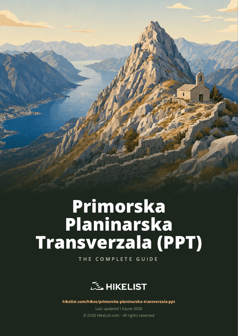
Primorska Planinarska Transverzala (PPT)
How would you rate Primorska Planinarska Transverzala (PPT)?
Tap a star to share your experience and help other hikers.
Primorska Planinarska Transverzala: Montenegro’s Coastal Mountain Traverse
HikeList Score
Primorska Planinarska Transverzala (PPT) scored 87/100 on HikeList's trail-quality metrics.
See score breakdownHide breakdown
- Ideal length 94
- Balanced challenge 84
- Scenery & wildness 98
- Varied terrain 64
- Accommodation 84
- Food & support 81
- Path quality 98
- Season flexibility 89
Computed from length, challenge, scenery & wildness, terrain variety, accommodation, food & support, path quality and season flexibility.
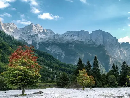
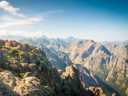
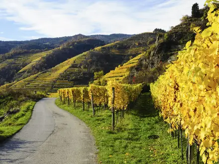
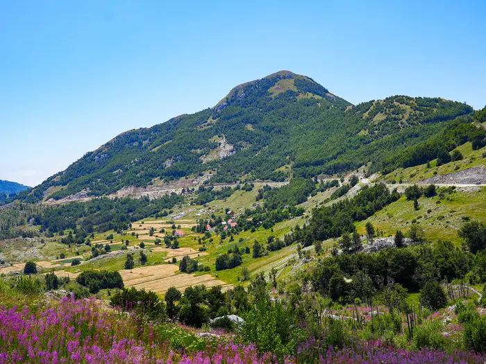
The Primorska Planinarska Transverzala is a hard, roughly 180 km point-to-point thru-hike across the coastal mountains of Montenegro. Usually walked in about 10 days, it links Rumija, Lovcen and Orjen between Bar and Herceg Novi, with around 8,000 m of ascent and a high point of 1,894 m on Zubacki Kabao. This is a rugged karst route for experienced hikers: expect scarce water, exposed limestone, steep rocky climbs, overgrown sections and navigation that cannot be left to waymarks alone.
Route Overview
The PPT runs the full Montenegrin Adriatic littoral between Bar in the south, near the Albanian border, and Herceg Novi in the north, near the Croatian border. It can be walked either direction: Bar to Herceg Novi climbs first into Rumija, continues across Lovcen National Park and finishes over the Orjen massif; the reverse ends with the descent to Bar. Key places include Stari Bar, Rumija summit, Jezerski vrh and the Njegos Mausoleum, Njegusi, Brajici, Crkvice, Orjensko Sedlo and Zubacki Kabao. Brajici is noted for resupply, a restaurant and a bus stop. For shorter coastal walking, compare the Bar to Old Ulcinj Trail or the Budva to Sveti Stefan Coastal Path.
Coastal heritage on the PPT
Opened in 2006 by Montenegrin hiking and mountaineering clubs, the Primorska planinarska transverzala links old shepherds’ paths, village routes and Austro-Hungarian military roads into one coastal high route. It later became the Montenegro section of the Via Dinarica Blue Trail. The trail also crosses places central to coastal Montenegrin history: Rumija’s summit church and Jovan Vladimir cross procession, Lovcen’s Njegos Mausoleum, and the fort-ringed Orjen and Bay of Kotor landscape.
Notable highlights
- Mount Rumija (1,594 m): The southern massif rises between Lake Skadar and the Adriatic above Bar. Its summit is marked by the small Holy Trinity church and is tied to the annual cross procession from Velji Mikulici.
- Lovcen National Park and the Njegos Mausoleum: The route passes Jezerski vrh, where the mausoleum of poet-ruler Petar II Petrovic-Njegos stands high above the Bay of Kotor. It is one of the clearest cultural landmarks on the trail.
- Orjen massif, Subra and Zubacki Kabao: Orjen gives the PPT its high point on Zubacki Kabao at 1,894 m. The Subra area is known for a dramatic rocky amphitheatre and rope-assisted scrambling on parts of the climb.
- Austro-Hungarian forts and military roads: Around Orjen and the Bay of Kotor, the trail uses old military roads and passes ruined stone forts such as Tvrdava Sveti Andrija.
- Abandoned karst villages and dry-stone landscapes: Long sections pass deserted limestone settlements, terraced fields, chapels, churches and cisterns that show the area’s former shepherding life.
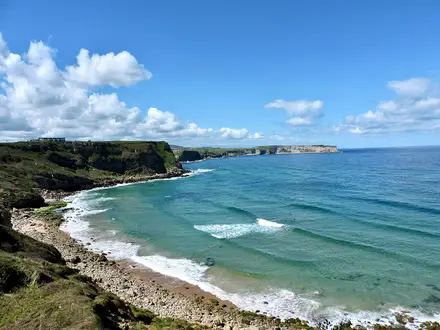
- Adriatic and Bay of Kotor views: This is a mountain route, not a beach walk, but the bare ridges give frequent views over the Adriatic and the fjord-like Bay of Kotor.
Challenges to expect
Water is the main planning problem: the karst has almost no running streams, and cisterns or wells can be low or dirty, so carry capacity and treatment are essential. Expect rough limestone, steep climbs, exposed ridges, overgrown sections and inconsistent marking. Late September or early autumn is the best window; midsummer heat is harsh, spring can be wet and October may bring early snow on high massifs. For other tough Montenegrin mountain days, see the Bobotov Kuk Summit Trail or easier Black Lake Loop.
HikeList Score
Primorska Planinarska Transverzala (PPT) scored 87/100 on HikeList's trail-quality metrics.
See score breakdownHide breakdown
- Ideal length 94
- Balanced challenge 84
- Scenery & wildness 98
- Varied terrain 64
- Accommodation 84
- Food & support 81
- Path quality 98
- Season flexibility 89
Computed from length, challenge, scenery & wildness, terrain variety, accommodation, food & support, path quality and season flexibility.
Show more data Show less
- Mountainous
- Coastal
- Dirt
- Rocky
- Huts
- Campsites
- Wild Camping Spots
- Hotels
- Pet Friendly
- Water Sources
- Campsites
- Shelters
Download Our Full Guide to Primorska Planinarska Transverzala (PPT) FREE!
Get our comprehensive guide to this hike for free. Save it for later reading or print out at home.
Photos from hikers
Taken on the trail by people who've reviewed Primorska Planinarska Transverzala (PPT).
Primorska Planinarska Transverzala (PPT): The Complete Guide
 i
Image by Alexandre ROSA
i
Image by Alexandre ROSA The Primorska Planinarska Transverzala is Montenegro’s hard coastal-mountain traverse: a point-to-point line from Bar / Stari Bar to Herceg Novi across Rumija, Lovćen and Orjen. It is a mountain route above the Adriatic, not a beach walk, with about 180 km of bare limestone, old tracks and exposed ridges.
The appeal is direct and practical: big sea views from serious karst terrain. The trail links Stari Bar, Rumija, Ivanova Korita, Jezerski vrh, Crkvice, Orjensko sedlo and Zubački Kabao, the 1,894 m high point of the route and the highest summit of the eastern Adriatic.
This is a walk for experienced, fit and self-sufficient hikers. Water is scarce, shade is limited, waymarking is patchy, and long sections can be overgrown enough to make GPS navigation essential rather than optional.
Most walkers plan around ten stages and should be ready to carry camping kit, food and a large water capacity. Huts and settlements exist in places, but they are too sparse and uncertain to treat as a fully serviced hut-to-hut route.
This guide covers stages, days, accommodation, food and water, transport, terrain and common mistakes.
Stage-by-Stage Guide
Stage distances on the PPT should be treated as planning approximations rather than exact daily measurements. Variants, summit detours and accommodation choices can change the length of a day, and the route is too water-scarce and inconsistently marked to walk from waymarks alone. Carry a GPX track, map, large water capacity and treatment from the first stage.
Stage 1: Bar / Stari Bar to Rumija massif high camp — approx. 18 km
The opening stage leaves the coast at Bar, with most walkers starting around Stari Bar before climbing into the Rumija massif. It is a hard first day because the route gains height quickly from near sea level into bare limestone mountain terrain, with little shade once above the settled area.
Underfoot, expect a mix of stony paths, rocky ground and rough karst rather than a smooth coastal trail. The climb gives an immediate sense of the PPT’s character: dry-stone landscapes, exposed slopes and open mountain going above the Adriatic.
Bar and Stari Bar are the last dependable service points before the mountain stages begin. Buy food and fill all bottles before leaving; there should be no assumption of reliable water once on the Rumija slopes. Water treatment is essential for any cistern or well used later on the route.
Accommodation at the end of this stage is normally a high camp or another self-sufficient arrangement in the Rumija massif. Do not rely on a hut, staffed shelter or food at the end of the day unless it has been arranged in advance. This should be checked before travelling.
Bar is one of the easiest access points on the whole trail, with coastal buses and a rail link from Podgorica and the Belgrade–Bar line. Once above Stari Bar, practical public transport disappears, so this is also the point where bail-out planning becomes much harder.
Navigation matters from day one. The red-and-white blazes and Via Dinarica markings cannot be relied on continuously, and the transition from town edge to mountain paths is exactly where missed turns can cost time and water.
Stage 2: Rumija massif to Sutorman pass — approx. 18 km
This stage continues across Rumija, the southern coastal massif rising between Bar, the Adriatic and Lake Skadar. Depending on the previous night’s camp and chosen line, it is the logical stage for the summit area of Rumija, around 1,595 m, with the small Holy Trinity church on the peak as the main landmark.
The terrain remains rough and dry: limestone ridges, stony tracks, sinkholes and exposed karst slopes. The walking is demanding underfoot even where the gradient eases, because rock, broken path and vegetation make progress slower than the map distance suggests.
There are no reliable food services to plan around between the Rumija high ground and Sutorman. Water is the key constraint; carry enough from the previous known source and treat anything taken from cisterns or wells. In hot weather, this stage can feel considerably harder than its distance.
Sutorman pass is a practical staging point, but it should not be treated as a guaranteed resupply or accommodation stop. Plan to camp or have a pre-arranged pick-up or stay. Any road access, transfer or local accommodation here should be checked before travelling.
Navigation across Rumija can be awkward where markings fade or the path becomes overgrown. Keep a close eye on the GPX through any indistinct karst ground, especially in poor visibility or late in the day.
Stage 3: Sutorman pass to Lovački dom above Brajići — approx. 20 km
This is a long linking stage between the Rumija sector and the approach towards the Lovćen side of the trail. It is less about a single summit objective and more about keeping steady progress across dry, broken coastal mountain terrain.
Expect a mixture of rough path, stony track, occasional gravel or macadam mountain road and overgrown sections. The PPT often follows older local routes rather than engineered hiking paths, so pace can be slow even when the elevation profile looks manageable.
Food and water should be carried from the start of the day. Do not assume there will be a usable source at the exact point where it is needed; karst water points can be dry, dirty or difficult to find. Treatment should be used for any non-mains water.
The end point, Lovački dom above Brajići, should be treated cautiously for overnight planning. Its current availability, access and facilities should be checked before travelling, and a tent or other self-sufficient sleep system is the safer planning assumption.
There is very limited public transport in the mountain interior, and none should be assumed for this stage. A forced exit may require a long walk to a road or a pre-arranged lift.
Navigation is one of the main challenges. Watch for faded blazes, vegetation covering the line and junctions on rough tracks where an old road can pull walkers away from the intended route.
Stage 4: Lovački dom to Brajići — approx. 16 km
This shorter stage brings the route down towards Brajići, one of the few named settlements on the PPT with known public transport access. It can work as a useful recovery stage after the longer, drier ground to the south, but it should not be underestimated.
The walking is still typical coastal karst: rocky, dry and occasionally overgrown, with a mix of path and track. Near Brajići there may be short sections on or close to minor roads or asphalt, but the day is still a mountain stage rather than a road walk.
Brajići has a bus stop, making it one of the more practical places for joining, leaving or section-hiking the PPT. Bus times and operating days should be checked before travelling, as the mountain interior has almost no wider public transport network.
Do not build a food plan around Brajići unless current services have been checked in advance. Private rooms or local arrangements may be possible in some settlements on the route, but availability should be confirmed before relying on them. Carry enough food to continue if nothing is available.
Water remains uncertain. Arrive with a margin rather than an empty bottle, and treat any water not taken from a dependable mains source.
Navigation around settled areas can be as awkward as remote ground, because tracks, lanes and older paths intersect. A GPX track is particularly useful through approach roads and village edges where waymarks may be missing or easy to overlook.
Stage 5: Brajići to Ivanova Korita — approx. 20 km
This stage takes the PPT into the Lovćen sector and towards Ivanova Korita, the green karst plateau around 1,250 m used as a hiking base within Lovćen National Park. It is a significant mountain day, with a shift from the long southern traverse into the better-known Lovćen landscape.
The terrain is a mix of limestone path, stony track, karst depressions and open slopes. Although Lovćen is more visited than some parts of the PPT, the route itself still demands proper mountain navigation and should not be treated like a waymarked park stroll.
Ivanova Korita is one of the more practical overnight points on the whole route. Accommodation or services may be more realistic here than on the remote stages, but hut, room and food availability should still be checked before travelling. Carry enough food to remain independent if plans fall through.
Water should not be assumed between Brajići and Ivanova Korita. Fill before leaving if possible, carry a full day’s supply, and treat any water taken from cisterns or wells.
Public transport in this mountain section is limited. Brajići is the key known bus-access point before the stage; beyond that, onward travel should be planned as a private transfer or a continuation on foot unless current local transport has been checked.
Waymarking may improve in places but remains inconsistent overall. The national park setting does not remove the need for map and GPS, especially where the route crosses open karst rather than a single obvious track.
Stage 6: Ivanova Korita to Velji Zalazi — approx. 18 km
This is one of the cultural highlight stages of the PPT, crossing the Lovćen area from Ivanova Korita towards Velji Zalazi. The route passes close to Njeguši and reaches Jezerski vrh, 1,657 m, where the Njegoš Mausoleum stands above the Bay of Kotor.
The mausoleum is reached by 461 steps and is the clearest built landmark on the trail. It is a worthwhile but committing detour in poor weather or late in the day should be judged carefully, because the descent towards Velji Zalazi still leaves demanding ground ahead.
Terrain varies between mountain paths, stony tracks, dry karst hollows and older village routes. There are broad views towards Boka Kotorska, the Bay of Kotor, but the exposed ground also means sun, wind and poor visibility can all affect progress.
Njeguši lies near the route and is known for pršut and cheese, but any food stop, accommodation or resupply there should be checked before travelling. Do not assume that a near-route village automatically solves the food plan.
Velji Zalazi should be treated as a remote overnight point rather than a service village. Plan for a self-sufficient camp or pre-arranged local accommodation, with enough food and water to continue the following day if necessary.
Navigation requires care leaving the busier Lovćen area and moving back into quieter karst settlements and terraces. Old village tracks, dry-stone boundaries and overgrowth can make the correct line less obvious than the landmarks suggest.
Stage 7: Velji Zalazi to Tvrđava Sveti Andrija — approx. 18 km
This stage runs through the dry-stone and abandoned-village landscapes above Boka Kotorska, heading towards Tvrđava Sveti Andrija, an Austro-Hungarian fort. It is a strong example of the PPT’s mixture of mountain walking, old military infrastructure and former shepherding terrain.
The walking is likely to feel rougher than the distance suggests. Expect rocky paths, terraces, stony tracks and sections where vegetation can slow progress or obscure the way. Old engineered military roads may make parts of the going easier, but they do not remove the need for route-finding.
Views towards the Bay of Kotor are a major reward on this stage, especially from the open limestone slopes and fort area. These same open slopes also mean exposure to heat and sun, with little shade and no dependable surface water.
There should be no assumption of food or accommodation at Tvrđava Sveti Andrija. Treat the fort area as a remote landmark and plan a self-sufficient overnight or a pre-arranged alternative.
Public transport should not be relied on for this stage. Any road pick-up or exit route needs to be planned in advance and checked before travelling.
Navigation around old military tracks and ruined structures can be confusing because several lines may look plausible. Stay disciplined with the GPX and avoid following a good-looking track simply because it is clearer than the marked line.
Stage 8: Tvrđava Sveti Andrija to Crkvice — approx. 18 km
This stage continues through the Austro-Hungarian military landscape towards Crkvice, an abandoned garrison settlement on the approach to Orjen. The day has a strong historical character, with ruined stone infrastructure, old roads and the sense of moving into the wetter, higher northern massif.
Underfoot, expect a mix of stony military road, rough track, limestone path and overgrown sections. The old roads can be useful for progress, but they can also create navigational traps where multiple spurs and junctions appear.
Crkvice has ruins, a war monument and a large water cistern. The cistern is an important planning point, but water quality can be variable; treatment is essential, and no single source should be treated as guaranteed without a current check.
Food and accommodation at Crkvice should not be assumed. Plan to camp or continue only if daylight, water and energy allow. The area’s abandoned character makes self-sufficiency more important than on stages ending in active villages.
There is no useful public transport to rely on here. Crkvice may be a logical access or exit point only with a planned vehicle arrangement, and this should be checked before travelling.
Weather deserves more attention from this point north. Crkvice was historically known as an exceptionally wet garrison settlement, and Orjen can catch poor weather; wet limestone, mist and cold rain can quickly make navigation and footing more difficult.
Stage 9: Crkvice to Orjensko sedlo / Vrbanj — approx. 18 km
This is the approach into the Orjen massif, the highest and most rugged part of the PPT. The stage either ends around Orjensko sedlo, the saddle below the high Orjen peaks, or continues towards Vrbanj depending on pace, weather, water and accommodation plans.
The terrain becomes more serious: bare limestone, sinkholes, rough karst, exposed slopes and old mountain routes. Progress can be slow, and the lack of surface water makes conservative planning essential.
Orjensko sedlo has a mountain hut, but hut availability on the PPT is not something to assume. Many huts on or near the route can be locked or require prior arrangement. This should be checked before travelling, and a tent remains the safer assumption.
If continuing to Vrbanj, the day can become significantly more committing. Do not add distance casually from Orjensko sedlo unless there is enough daylight, water and certainty about the overnight plan.
Food resupply should not be expected between Crkvice and the Orjen overnight points. Carry enough to cover delays, especially if bad weather, navigation problems or a closed hut force a change of plan.
Navigation on Orjen is critical. Patchy markings, rocky ground and poor visibility can combine badly here, and early snow is possible on Orjen in October while spring can leave lingering snow high on the route.
Stage 10: Vrbanj over Orjen to Herceg Novi — approx. 18 km
The final stage crosses or completes the Orjen section before descending to Herceg Novi on the coast. Depending on where the previous night was spent, this may include the high route over Zubački Kabao, 1,894 m, the highest point of the PPT and the highest summit of the eastern Adriatic.
Zubački Kabao is reached from Orjensko sedlo on the oldest waymarked mountain path in Montenegro, originally cut by the Austro-Hungarian army in the 1880s. It is a major objective, but it should be skipped or delayed in unsafe weather, poor visibility, lingering snow or if water is running low.
Subra, 1,679 m, is an optional Orjen objective from the Vratlo hut area, with a dramatic rocky amphitheatre and rope-assisted, via-ferrata-style scrambling. This is not a casual add-on for tired walkers at the end of a thru-hike; only include it with suitable conditions, time, confidence on exposed limestone and a confirmed plan for the night or descent.
The descent towards Herceg Novi can still be hard on tired legs. Expect rocky paths, stony tracks, possible old military-road sections and short asphalt nearer the coast. Do not mentally finish the trail until the waymarks bring you down to town level.
Water remains a concern until reaching dependable town services. Carry enough from the last known source or hut area, and treat any cistern or well water used on the way down.
Herceg Novi is the practical northern terminus, with accommodation, food and onward coastal buses. The waymarks begin at the Herceg Novi bus station for walkers travelling southbound, making the station a useful reference point for finishing, starting in reverse or arranging onward travel.
Navigation should remain active all the way into town. Final descents often involve junctions, tracks and short road sections, and a missed turn near the end can still add unnecessary distance and heat exposure.
Recommended Itinerary
The most practical way to plan the PPT is as a 10-day northbound traverse from Bar / Stari Bar to Herceg Novi. The stage distances below are approximate planning figures, not booking-grade measurements: route variants, summit detours and navigation choices can change the day’s total, so check mapping and your GPX before committing to accommodation or water carries.
Water and shelter dictate the itinerary more than distance. Several overnight points are not serviced places in the usual trail sense, and huts may be locked, so each day should be planned with a tent, food, water capacity and treatment unless a specific hut or private arrangement has been checked in advance.
Standard 10-day itinerary
| Day | From | To | Approx. distance | Why this stage makes sense | Services/accommodation notes |
|---|---|---|---|---|---|
| 1 | Bar / Stari Bar | Rumija massif high camp | 18 km | A direct first climb from the coast into the Rumija massif, gaining height early and avoiding an overlong push to Sutorman on day one. | Bar / Stari Bar is the last reliable full-service point before the mountains. Expect to camp high unless specific local accommodation has been arranged. Carry enough water from the start and treat any cistern or spring water found en route. |
| 2 | Rumija massif | Sutorman pass | 18 km | Keeps the Rumija crossing to a manageable second day, with rocky karst terrain and limited shade rather than easy coastal walking. | Sutorman is a pass area rather than a dependable service stop. Plan this as a self-sufficient camp or arranged pickup/overnight; this should be checked before travelling. |
| 3 | Sutorman pass | Lovački dom above Brajići | 20 km | A longer linking stage across the southern part of the traverse, keeping the route moving towards the Brajići access area. | Do not assume the Lovački dom is open or usable. Treat it as a navigation point unless access has been arranged in advance; carry shelter and water. |
| 4 | Lovački dom | Brajići | 16 km | A shorter day after the longer approach, useful for dealing with overgrown sections and for reaching one of the few named access points on the route. | Brajići has a bus stop, making it one of the few realistic entry, exit or resupply-adjacent points in the mountain interior. Current transport and any local services should be checked before travelling. |
| 5 | Brajići | Ivanova Korita | 20 km | This stage carries the route into Lovćen National Park and reaches Ivanova Korita, one of the more practical mid-route bases. | Ivanova Korita is a hiking base on Lovćen and a better prospect for organised accommodation than most wild sections, but availability should still be confirmed before booking. |
| 6 | Ivanova Korita | Velji Zalazi | 18 km | A strong Lovćen stage taking in the high cultural section around Jezerski vrh and moving north towards the abandoned karst villages above Boka Kotorska. | Services thin out again after Ivanova Korita. Njeguši lies near the route and may be useful only if deliberately built into the plan; do not rely on unplanned resupply. |
| 7 | Velji Zalazi | Tvrđava Sveti Andrija | 18 km | Links the abandoned dry-stone landscapes with the Austro-Hungarian military road and fort terrain above the Bay of Kotor. | Treat this as a remote mountain stage. Overnighting near ruined settlements or fort areas requires full self-sufficiency and careful water planning. |
| 8 | Tvrđava Sveti Andrija | Crkvice | 18 km | A logical approach to the Orjen side of the route, using the historic military landscape before reaching the old garrison settlement of Crkvice. | Crkvice has ruins, a war monument and a large cistern, but water quality and reliability must not be assumed. Carry treatment and enough reserve capacity. |
| 9 | Crkvice | Orjensko sedlo / Vrbanj | 18 km | Positions the route for the Orjen high point and the final descent towards Herceg Novi, without overloading the summit day. | Orjensko sedlo has a hut, and the wider Orjen area includes huts such as Vratlo/Subra, but huts may be locked. Confirm access before relying on them; otherwise plan to camp. |
| 10 | Vrbanj, over Orjen | Herceg Novi | 18 km | The final mountain day crosses the Orjen high section, with Zubački Kabao as the route’s high point if included, then descends to the coastal finish. | Herceg Novi has onward coastal buses, and the waymarks start at the bus station when walking in reverse. Subra is an optional Orjen objective with rope-assisted scrambling and should only be added by suitably equipped hikers in good conditions. |
Slower variant
A slower plan suits hikers carrying heavier camping loads, walking in hotter weather, wanting time for Lovćen and Orjen, or expecting slow progress through overgrown sections. Rather than forcing fixed extra stages, add one or more buffer nights around the places with the best access or camping logic: Brajići, Ivanova Korita, Crkvice, Orjensko sedlo or Vrbanj.
This does not remove the main constraint: water. Shorter days can still be difficult if the next reliable cistern is uncertain, so the slower version should be built around current water information, hut status and a checked GPX track, not just around kilometre totals.
Good uses for extra time include:
- a buffer at or near Ivanova Korita for the Lovćen section and Jezerski vrh;
- a shorter approach to Crkvice before entering the Orjen massif;
- an extra Orjen day if adding Zubački Kabao carefully, or the optional Subra area from the Vratlo side;
- a weather buffer in late season, when early snow is possible on Lovćen or Orjen.
Faster variant
A faster itinerary is only sensible for very fit, experienced hikers who are comfortable moving long days over bare limestone with limited water and imperfect waymarking. The route is sometimes completed in far less than ten days, but compressing stages means carrying more water between uncertain sources and having less margin for navigation problems, heat or locked huts.
The usual way to go faster is to combine parts of adjacent standard stages where conditions, daylight and water allow. Do not simply double days on paper: the rough karst, bushwhacking and Orjen scrambling can make an 18–20 km stage feel much longer than the distance suggests. Check official mapping before booking or committing to any compressed schedule.
Planning the Route
How many days to allow
The standard PPT schedule is ten walking days, with most stages around 16–20 km. That is a sensible planning baseline because the route is slow for its distance: rough limestone, heat, overgrowth, navigation checks and heavy water carries all reduce pace.
Strong hikers can move faster, but the trail is not well suited to a rushed schedule unless fitness, navigation and water planning are already very strong. A slower plan is often more practical than an aggressive one, especially if using camps rather than guaranteed accommodation.
Build in at least some margin before onward travel from Herceg Novi or Bar. Bad weather on Lovćen or Orjen, locked huts, poor visibility, an unreliable cistern or a long overgrown section can all disrupt a tight itinerary.
Are the stages fixed?
The daily stages are a guide rather than a rigid hut-to-hut structure. Unlike many Alpine routes, the PPT is not naturally dictated by a reliable chain of staffed huts, villages and food stops.
Accommodation is sparse and mixed. There are huts on Lovćen and around Orjen, including Orjensko sedlo and Vratlo/Subra, but some huts are often locked and should not be treated as guaranteed unless arranged in advance. Elsewhere, expect a combination of wild camping, occasional restaurants or private rooms arranged locally, and proper hotel/apartment choice only at the coastal ends and where the route comes close enough to settlements.
For that reason, plan the route around water, camp options and escape points first, then fit the mileage around those constraints. The approximate ten-day split works because it breaks the traverse into manageable walking days, not because each endpoint has dependable services.
Direction of travel
The route is commonly walked northbound from Stari Bar / Bar to Herceg Novi, climbing first into the Rumija massif and finishing by descending from Orjen to the coast. This direction also leaves the highest and roughest mountain section, Zubački Kabao on Orjen, for the final part of the walk.
Walking southbound is also practical. Herceg Novi is a strong trailhead because the waymarks begin at the bus station, and coastal buses make it straightforward to reach. In reverse, the Orjen high ground comes early, so weather, snow conditions and water planning need to be sorted before starting.
Choose direction mainly around transport, weather and personal preference. There is no reason to treat one direction as officially superior.
The main planning constraints
| Constraint | What it means in practice |
|---|---|
| Water | This is the key issue. The karst has very little surface water, and walkers rely on cisterns and wells of variable quality. Carry large capacity, commonly 3–4 litres in hot conditions, plus treatment. Current water reliability should be checked before travelling. |
| Navigation | Red-and-white Balkan blazes and Via Dinarica signage exist, but marking is patchy and overgrown in places. A downloaded GPX track, offline mapping and the ability to navigate without waymarks are essential. |
| Accommodation | Do not plan it as a serviced hut route. Huts may be locked, and mid-route lodging is limited. Carry camping equipment unless every night has been arranged in advance. |
| Food | Resupply is very limited away from the coast and larger settled areas. Plan food carries between dependable stops rather than assuming villages will have shops or meals. |
| Weather | Late September and early October are the most reliable planning window. Midsummer increases heat and water stress; spring can be wet with lingering snow high; October can bring early snow on Lovćen and Orjen. |
| Transport | Bar and Herceg Novi are the practical access points. The mountain interior has almost no public transport, though Brajići has a bus stop. Transfers away from the main coastal corridor should be checked before committing to an itinerary. |
Shortening, extending and section hiking
Shortening the PPT mid-route is possible in principle but not always simple. The route crosses remote karst country where public transport is scarce, and there is no railway through the mountain interior.
The most practical section-hike anchors are the coastal ends, Bar and Herceg Novi, plus places where the route reaches or nears settled areas such as Brajići, Ivanova Korita, Njeguši, Crkvice and Vrbanj. However, onward transport from these mountain locations is not something to assume. This should be checked before travelling.
A massif-by-massif approach can work well for experienced hikers with flexible logistics: Rumija in the south, Lovćen in the middle, and Orjen in the north. This reduces the food and water burden compared with a continuous thru-hike, but each section still needs the same navigation, weather and water planning as the full trail.
Extending the route is usually a matter of adding summit or local detours, rather than lengthening the core traverse. Subra on Orjen is an optional objective with a dramatic rocky amphitheatre, but it includes rope-assisted, via-ferrata-style scrambling and should only be added in suitable conditions by hikers comfortable on exposed limestone.
Practical booking order
Plan in this order:
- Choose a season window — late September or early October if possible; avoid underestimating midsummer heat.
- Decide direction — Bar to Herceg Novi, or reverse from Herceg Novi bus station.
- Download route data — carry a GPX track and offline maps before leaving the coast.
- Mark water points and dry stretches — then decide water capacity and where to camp.
- Confirm huts or rooms — especially on Lovćen and Orjen; do not rely on huts being open without checking.
- Plan food carries — assume limited resupply between coastal towns and the few settlement areas.
- Check access transport — coastal buses and the Bar rail link are useful; mountain transport is limited.
- Leave buffer time — especially before flights, international buses or fixed onward bookings.
Permits and access
There is no route-wide permit structure to plan around from the trail information. The PPT does, however, pass through Lovćen National Park and uses huts and mountain infrastructure whose current access arrangements can change.
Any current national park rules, hut access, water availability and local restrictions should be checked before travelling.
Towns, Villages and Overnight Stops
Accommodation planning on the PPT is much tighter than on better-served European long-distance trails. Bar and Herceg Novi are the only clearly full-service end points; between them, overnight stops are a mix of sparse mountain huts, possible local arrangements, exposed camps and places where there may be no service at all.
Do not build an itinerary around unlocked huts, shops or reliable cafés unless they have been checked before travelling. A tent or bivvy system, food-carrying capacity, water treatment and enough water capacity for long dry karst stages are part of the normal planning for this route.
Bar / Stari Bar
Bar is the practical southern trailhead, with walkers commonly starting from Stari Bar below the first climb into the Rumija massif. It is the best place to arrive, sleep indoors and organise food before committing to the mountains.
Accommodation is easiest here compared with the rest of the route, with hotels and apartments available in the coastal town. Stari Bar itself is also the main cultural landmark at the start, but for hiking logistics the important point is that this is the last dependable full-service base before several rough, dry stages.
Bar has frequent coastal bus connections and a train link from Podgorica, as well as the Belgrade–Bar line. Check current bus and train times before fixing the first day’s walking plan.
Rumija massif / Rumija summit
Rumija is the first major mountain section northbound, rising above Bar and Lake Skadar to the summit at about 1,595 m. The standard first stage uses a high camp in the Rumija massif rather than a serviced village stop.
There should be no assumption of accommodation, shops, cafés or reliable water on the mountain. This is a self-sufficient overnight: carry enough food and water from Bar, and choose a camp spot with exposure, wind and karst ground in mind.
The summit is a major landmark rather than an overnight base, with the small Holy Trinity church on top. It is useful for orientation, but not for supplies.
Sutorman pass
Sutorman is a pass and stage end between the Rumija section and the onward traverse towards Brajići. It is a useful place to break the route, but it should not be treated as a guaranteed resupply or accommodation stop.
Plan this as another self-sufficient halt unless an onward transfer, local arrangement or specific lodging has been organised in advance. This should be checked before travelling.
The pass is associated with the Sutomore side of the mountains, but the brief does not make it a dependable public-transport or service point on the PPT itself. Carry enough food and water to continue if nothing is available.
Lovački dom above Brajići
Lovački dom is used as an overnight point in the standard stage pattern before reaching Brajići. It sits in the mountains above the village and is more useful as a route waypoint than as a place where services can be assumed.
Do not rely on it as an open, staffed accommodation option unless arrangements have been made in advance. This should be checked before travelling.
For planning purposes, treat this stop like a mountain shelter or camping stage: bring food, water treatment and a fall-back plan if the building is locked or unusable.
Brajići
Brajići is one of the more important mid-route planning points because the PPT passes through the village and there is a bus stop. It is a logical place to reset the itinerary, meet a transfer, or arrange a local overnight if needed.
Accommodation and meals should not be assumed without prior arrangement. The route’s general accommodation pattern includes occasional restaurants or private rooms arranged with locals, and Brajići is one of the more sensible places to try this, but current availability should be checked before travelling.
The bus stop makes Brajići unusual on this trail, as the mountain interior otherwise has almost no public transport. Check the current timetable before relying on it for a section hike, bail-out or rest-day link.
Ivanova Korita
Ivanova Korita is a green karst plateau at around 1,250 m in Lovćen National Park and is used as a hiking base midway across Lovćen. It is one of the better places on the route to plan an indoor or semi-serviced overnight, provided availability is checked ahead.
The standard northbound itinerary reaches Ivanova Korita from Brajići and continues next towards Velji Zalazi, so it works well as a mid-route pause before the more remote northern half. It is also the most practical base for the Lovćen section around Jezerski vrh and the Njegoš Mausoleum.
Food and accommodation options can change seasonally, and hut or lodging status should be checked before travelling. Do not arrive without enough food and water to continue if services are closed.
Njeguši
Njeguši sits near the route rather than as a guaranteed on-line overnight in the standard stage list. It is still relevant because it is one of the few named villages close to the Lovćen section and is known for pršut and cheese.
It may be useful for hikers who build in a detour, arrange a pick-up, or want a food stop near Lovćen. Exact access from the route, opening times, accommodation and transport should be checked before travelling.
Do not assume that passing near Njeguši removes the need to carry food across Lovćen. Treat it as a possible useful side-stop, not a core resupply unless planned deliberately.
Jezerski vrh / Njegoš Mausoleum
Jezerski vrh is a major Lovćen landmark, with the Njegoš Mausoleum reached by 461 steps. It is a place to visit on the route, not a practical overnight stop.
Accommodation should be planned at Ivanova Korita, in an arranged local stop, or by camping elsewhere on the itinerary rather than on the summit. Food, water and opening arrangements around the mausoleum should be checked before travelling if they matter to the day’s plan.
This is also a point where weather and visibility can affect timing. Allow enough margin for the descent and onward navigation rather than treating the mausoleum visit as a quick roadside stop.
Velji Zalazi
Velji Zalazi is a standard overnight point after Ivanova Korita on the northbound itinerary. It belongs to the quieter, more isolated part of the PPT, where abandoned karst villages, terraces, chapels and cisterns are part of the landscape.
There is no dependable accommodation or shop information for Velji Zalazi in the route facts. Plan to be self-sufficient and camp unless a local arrangement has been made in advance.
Water is a key concern here as throughout the karst sections. Any cistern or local source should be treated, and its reliability should be checked before travelling where possible.
Tvrđava Sveti Andrija
Tvrđava Sveti Andrija is a ruined Austro-Hungarian fort and a standard stage end between Velji Zalazi and Crkvice. It is a strong navigation and history landmark, but not a serviced settlement.
This is not a place to expect accommodation, food or shops. Treat it as a remote camp or bivvy-style stop unless a separate transfer or arrangement has been organised.
The surrounding section uses old Austro-Hungarian military roads and rough karst terrain. Carry enough water for the night and the onward stage to Crkvice, allowing for slow progress on overgrown or stony ground.
Crkvice
Crkvice is an abandoned Austro-Hungarian garrison settlement on the approach to Orjen, with ruins, a war monument and a large water cistern. It is an important practical waypoint because water sources are so limited on the PPT.
The cistern should not be treated as clean drinking water without treatment. Quality and availability can vary, so carry treatment and enough spare capacity to avoid being dependent on one source.
There are no dependable services, shops or accommodation indicated for Crkvice. It works as a remote overnight or staging point before Orjensko sedlo and Orjen, but only for hikers carrying their own shelter and food.
Orjensko sedlo
Orjensko sedlo is the key saddle below the Orjen high ground and is associated with a mountain hut. It is one of the most important northern mountain stops, especially before or after climbing Zubački Kabao.
Hut availability must be checked before travelling, as huts on this route can be locked. Do not rely on arriving to an open bed, food or water unless this has been arranged.
The saddle is also the approach to the trail’s highest summit, Zubački Kabao, reached by the old waymarked mountain path cut in the Austro-Hungarian period. Weather, water and daylight margins matter here because the terrain is rocky, exposed and remote.
Zubački Kabao
Zubački Kabao, also called Veliki Kabao, is the 1,894 m high point of the PPT and the highest summit of the coastal Dinaric belt above the eastern Adriatic. It is a summit objective, not an overnight stop.
There are no services on the summit. Plan the climb from Orjensko sedlo or the relevant Orjen stage with enough water, food and time to descend safely.
Snow can arrive early on Orjen in October, and the route’s rough limestone terrain makes poor weather more serious than the modest altitude may suggest. Conditions should be checked before committing to the summit day.
Subra / Vratlo hut
Subra is an optional Orjen objective at 1,679 m, known for its rocky amphitheatre and rope-assisted, via-ferrata-style scrambling. It is not necessary for completing the PPT unless included as a variant or side trip.
The Vratlo/Subra hut area may be useful for an Orjen overnight, but hut status should be checked before travelling because huts on the route are often locked. Carry a shelter and enough food if using this part of Orjen as a staging point.
Only add Subra if the group is comfortable with exposed limestone and rope-assisted scrambling. It should not be used as a casual shortcut or wet-weather alternative.
Vrbanj
Vrbanj is used in the standard itinerary as the final mountain staging point before the descent to Herceg Novi, or as part of the Orjensko sedlo / Vrbanj overnight split. It is important because it allows the last day over Orjen and down to the coast to be managed more realistically.
Accommodation, food and transport availability are not dependable from the route facts. This should be checked before travelling, and hikers should be ready to camp or continue if no arranged option is available.
From Vrbanj the route is nearing the coast, but the PPT remains a mountain walk until the final descent is complete. Keep enough water and food for the last stage rather than assuming easy services immediately after leaving Orjen.
Herceg Novi
Herceg Novi is the northern terminus at the mouth of the Bay of Kotor, near the Croatian border. For northbound hikers it is the first fully practical end-of-trail base after descending off Orjen.
Accommodation is much easier here than in the mountains, with hotels and apartments in the coastal town. It is the sensible place for a final overnight, onward travel and recovery after the remote Orjen stages.
Herceg Novi sits on the main coastal bus route, and the PPT waymarks begin at the bus station for hikers walking southbound. Check current bus times before booking onward connections or planning a reverse-direction start.
Getting to the Start
The usual southern start is Bar, with many walkers beginning the climb from Stari Bar, the old town below the Rumija massif. The PPT can also be walked in reverse from Herceg Novi, where the waymarks begin at the bus station.
By train
Bar is the railhead for the southern start. It has a train link from Podgorica and is on the Belgrade–Bar line, making it the most practical railway access point for walkers starting northbound.
There is no railway access into the mountain sections of the PPT. Once on the route, plan as if there are no useful rail bail-out options until the coastal finish; the interior is a karst mountain traverse rather than a valley-to-valley walk with public transport.
Train times, seasonal changes and any disruption on the Belgrade–Bar line should be checked before travelling.
By bus
Bar is well served by coastal buses and is the main public-transport hub for the southern trailhead. From Bar, walkers commonly continue to Stari Bar to start the climb into Rumija.
Herceg Novi, the northern end of the PPT, also sits on the main coastal bus route. If walking the trail in reverse, this is the simplest public-transport start: the waymarks begin right at Herceg Novi bus station.
The mountain interior has almost no public transport. Brajići is an exception with a bus stop on the route, but it should not be relied on as a general solution for mid-route access or exit without checking current services in advance. This should be checked before travelling.
By car
Driving to Bar is possible in logistical terms, but the PPT is a point-to-point traverse ending around 180 km away in Herceg Novi. Leaving a car at the start means arranging a return transfer along the coast after the hike, usually by bus or another private transfer.
Long-stay parking details for Bar or Stari Bar are not fixed trail infrastructure. If leaving a vehicle for the full traverse, arrange secure parking with accommodation or a local provider before starting. This should be checked before travelling.
For a northbound hike, a short local transfer from Bar to Stari Bar may be useful if accommodation or transport drops you in modern Bar rather than at the old town. Taxi availability and fares should be checked locally before relying on them.
From the nearest airport
No single airport is the official gateway for the PPT. The practical approach is to fly into Montenegro or the wider Adriatic region, then reach Bar via the coastal bus network or by train from Podgorica.
For a reverse, southbound hike, aim for Herceg Novi by coastal bus. Exact airport-to-coast connections change by season and operator, so onward transport should be checked before booking flights.
Where to stay before starting
Bar and Stari Bar are the sensible places to stay before a northbound start. They offer the best chance to arrive, buy food, sort fuel or last-minute supplies, and begin early on the climb into Rumija.
Do not plan on convenient accommodation immediately once the route leaves the coast. The PPT quickly becomes a self-sufficient mountain route with sparse huts, unreliable hut access and very limited resupply, so use Bar or Stari Bar to finish packing and fill water before setting off.
If starting in reverse, Herceg Novi is the equivalent pre-hike base. It is on the coastal bus route, has the trail waymarks at the bus station, and is a more practical place to organise supplies than the Orjen mountain section above it.
Getting Home from the Finish
The north-bound PPT finishes in Herceg Novi, on the northern Montenegrin coast at the mouth of the Bay of Kotor. This is one of the easier logistics points on the route: the waymarks begin at the Herceg Novi bus station, so a completed north-bound walk brings you directly to the town’s main onward-transport hub rather than a remote trailhead.
By train
There is no useful railhead at the mountain finish. The practical public-transport option from Herceg Novi is the coastal bus network.
If onward rail travel is needed, plan to connect by bus along the coast to a rail hub such as Bar, which has a train link from Podgorica and sits on the Belgrade–Bar line. Timetables, connections and same-day feasibility should be checked before travelling, especially outside the main summer season.
By bus
Herceg Novi sits on Montenegro’s main coastal bus route, and the bus station is the key place to arrange onward travel after the trail. Buses are the normal way to leave the finish, whether heading south along the coast, returning towards Bar, or connecting onwards to larger transport hubs.
Do not assume a late finish from Orjen will leave enough time for same-day onward travel. The final day descends from high, rocky karst terrain into town, and delays from heat, navigation or tired legs are realistic. Check current bus times before committing to accommodation or flights.
If walking the PPT in reverse, the same point applies in the opposite direction: Herceg Novi bus station is also the most straightforward place to arrive before starting south-bound.
By car/taxi
A private transfer or taxi is the simplest option if you need to reach a specific accommodation, airport connection or a parked car without waiting for a bus. This is particularly useful after a late arrival in Herceg Novi or if carrying full camping kit and several days of food residue from the Orjen section.
For longer transfers, arrange the vehicle in advance rather than relying on finding a driver at short notice at the end of the walk. Prices, availability and journey times are timetable- and season-dependent, so confirm current details before booking.
From the nearest airport
Airport transfers from Herceg Novi are not part of the trail infrastructure, so treat them as a separate journey from the finish. Use the Herceg Novi bus station for public-transport connections, or pre-book a taxi/private transfer if a flight time leaves little margin.
Because the PPT is remote and the final stages over Orjen can take longer than planned, avoid booking a flight for the same evening unless there is a large buffer. Current airport routes, bus connections and transfer times should be checked before travelling.
Where to stay at the finish
Herceg Novi is the best place to stay after finishing north-bound. Unlike the mountain stages, it has normal town accommodation, including hotels and apartments, and gives a straightforward base for washing kit, eating properly and sorting onward transport.
Staying overnight is the safer plan if the final stage has been long, hot or slow, or if the descent from Orjen runs into the evening. It also removes pressure to rush the last day for a bus connection after ten demanding days of water-scarce karst walking.
Which Direction Should You Walk?
The PPT can be walked in either direction, but the usual and most natural line is north-bound from Bar / Stari Bar to Herceg Novi. Walkers commonly start at Stari Bar, climb into the Rumija massif, cross Lovćen, then finish over Orjen with the descent to Herceg Novi.
The reverse direction is perfectly valid. It is especially tidy logistically because the waymarks begin at Herceg Novi bus station, so a south-bound start can be straightforward if arriving by coastal bus.
North-bound: Bar / Stari Bar to Herceg Novi
North-bound gives the route its best overall progression. It starts with the immediate climb from the coast into Rumija, then builds through the middle section around Brajići, Ivanova Korita and Lovćen before reaching the highest and roughest massif, Orjen, near the end.
This direction also gives a strong psychological finish. After days of karst ridges, dry stone landscapes, old military roads and high exposed ground, the final descent to Herceg Novi provides a clear coastal endpoint with full town services.
Transport is good at both ends, but Bar has the extra advantage of a railway link from Podgorica and the Belgrade–Bar line, as well as coastal buses. That makes it a convenient place to begin, stock up and reach Stari Bar for the first climb.
The main downside is that the hardest high-mountain ground comes late. Orjen, Zubački Kabao and the rough limestone around Orjensko sedlo are reached after a week of walking, when fatigue and water planning mistakes can start to matter.
South-bound: Herceg Novi to Bar / Stari Bar
South-bound puts Orjen almost immediately in the route. That means the high point, the roughest karst and the most committing mountain terrain arrive early, before the body has settled into the rhythm of a long traverse.
For strong hikers who prefer to tackle the hardest section while fresh, this can make sense. It also works well if travel plans place Herceg Novi first, as the trail markings start right at the bus station.
The trade-off is that the route’s drama can feel front-loaded. After Orjen and Lovćen, the final stages through Rumija still have serious climbing and water issues, but the sense of building towards the high point is lost.
Finishing at Bar is practical because the town has buses and rail connections, but the walking finish is generally less distinctive than descending into Herceg Novi after completing the full north-bound traverse.
Does one direction make the walking easier?
Neither direction makes the PPT an easy hike. The same core problems remain: scarce water, exposed limestone, overgrown sections, inconsistent waymarking and long rocky ascents and descents.
North-bound spreads the difficulty well, but saves Orjen for the final part of the traverse. South-bound hits Orjen early, which may suit very fit hikers but is a harsh introduction if packs are heavy with food, water and camping kit.
There is no reliable direction-specific weather advantage to plan around. Heat, lack of shade, exposed ridges and water scarcity matter far more than walking north or south; in either direction, early starts and careful water carrying are essential.
Accommodation and resupply flow
There is no major accommodation advantage in either direction. The PPT has sparse and sometimes uncertain mountain accommodation, with huts around Lovćen and Orjen but several huts often locked; availability should be checked before travelling.
Both directions require self-sufficiency, including camping capability, food carries, water treatment and enough capacity for dry stretches. Bar and Herceg Novi are the only reliable full-service endpoints, with limited options once committed to the mountain interior.
Recommendation
For most hikers, walk north-bound from Bar / Stari Bar to Herceg Novi. It is the standard direction, has good start logistics via Bar, gives the route a better scenic and psychological build-up through Rumija, Lovćen and Orjen, and finishes with a satisfying descent to the coast at Herceg Novi.
Choose the reverse only if transport or accommodation plans strongly favour starting in Herceg Novi, or if tackling Orjen and the highest ground at the beginning is a deliberate preference.
Accommodation Along the Route
Accommodation is one of the main constraints on the Primorska Planinarska Transverzala. This is not an inn-to-inn trail: the route spends long stretches on bare karst ridges, through abandoned villages and over remote passes where there is no dependable lodging, no regular resupply and very little water.
Most walkers should plan around a mixed system: hotels or apartments at the coast, a small number of mountain huts or local rooms where they can be arranged, and wild camping or bivouac-style nights for the remote sections. A tent or reliable shelter, sleeping system, food carry and water treatment are part of the normal planning for this route, not emergency extras.
Where accommodation is strongest
Bar / Stari Bar and Herceg Novi have the best accommodation choice. These are the sensible places to spend the night before starting and after finishing, and they are also the easiest places for transport, food shopping and last-minute logistics.
Ivanova Korita is the strongest mid-route base, as it is a recognised hiking area on Lovćen. It is still not a place to approach casually on a tight schedule: accommodation, hut status and food availability should be checked before travelling, especially outside the main season or if arriving late in the day.
Around Orjen, the named mountain-hut options include Orjensko sedlo and the Vratlo/Subra area. Several huts on the PPT are often locked, so they should be treated as pre-arranged accommodation only. Do not build an itinerary that depends on an unlocked hut unless access has been arranged in advance.
Place-by-place accommodation planning
| Place | Accommodation level (good/limited/none) | Best for | Notes |
|---|---|---|---|
| Bar / Stari Bar | Good | Pre-trail night, food shopping, transport connections | Best southern base. Stay here before climbing into the Rumija massif rather than starting late and being forced into a dry high camp. |
| Rumija massif / high camp | None | Self-sufficient camping | No dependable accommodation on the high route. Carry enough water from known sources and treat any water taken from cisterns or wells. |
| Sutorman pass / Sutomore side | Limited | Flexible section plans, possible descent or transfer | On-route lodging should not be assumed. If using accommodation off the line towards the coast, transfers and availability should be checked before travelling. |
| Lovački dom above Brajići | Limited | Possible staged overnight if access is arranged | Treat as an uncertain/arranged stop, not a guaranteed open hut. This should be checked before travelling. |
| Brajići | Limited | Mid-route road access, possible local arrangement | One of the more useful logistical points because the route reaches a settlement and there is a bus stop. Accommodation and food options should be arranged or checked in advance. |
| Ivanova Korita | Limited | Best mid-route organised overnight on Lovćen | A practical place to break the route across Lovćen National Park. Book or arrange ahead; do not assume late walk-in availability. |
| Njeguši area | Limited | Possible off-route food or local-room option | The village is near the route rather than a guaranteed overnight on it. Any use as an accommodation stop requires prior checking and may alter the day’s distance. |
| Velji Zalazi | None | Wild camp / self-sufficient overnight only | Plan as a remote karst stop. There should be no expectation of services, shops or formal lodging. |
| Tvrđava Sveti Andrija | None | Wild camp / bivouac-style stop | A ruined fort area, useful as a route landmark rather than an accommodation base. Carry food, shelter and water capacity. |
| Crkvice | None | Remote stage break, water-planning point | An abandoned Austro-Hungarian garrison settlement with ruins and a large cistern. Do not treat it as a lodging stop; water quality still needs treatment and should be checked where possible. |
| Orjensko sedlo | Limited | Hut-based Orjen overnight if arranged | There is a hut in the Orjen area, but hut access can be locked or seasonal. Confirm access before relying on it. |
| Vratlo / Subra area | Limited | Optional Subra extension, hut-based plan if arranged | Useful for hikers adding the Subra area, but the hut should be treated as arranged accommodation only. This should be checked before travelling. |
| Vrbanj | Limited | Final Orjen logistics before descending to Herceg Novi | A possible staging point before or after the high Orjen section, but accommodation should not be assumed without prior checking. |
| Herceg Novi | Good | Finish night, recovery, onward coastal transport | Best northern base, with the route waymarks beginning/ending at the bus station. Book ahead in busy coastal periods. |
Booking strategy
Book the first and last nights in Bar / Stari Bar and Herceg Novi before committing to transport. In summer and at weekends, coastal accommodation can become tighter and more expensive, so advance booking is the safest approach.
For the mountain section, the priority is not conventional booking but access confirmation. Any hut, hunting lodge, private room or local arrangement should be confirmed before travelling, with a back-up plan that does not depend on it being open.
Carry enough cash for small local payments where card use may not be available. Montenegro uses the euro, but remote settlements and mountain facilities should not be expected to offer card payment.
Does luggage transfer or taxi support make it easier?
The PPT has very limited support infrastructure in the mountains. There is no established luggage-transfer system that makes the full route work as a conventional inn-to-inn walk.
Taxi transfers can help with selected awkward gaps where the trail comes near roads or settlements, especially around the coast-facing sections and Brajići. They are not a substitute for mountain self-sufficiency on the Rumija, Lovćen and Orjen high sections. Any transfer plan should be arranged in advance and checked before travelling.
Is the PPT suitable for inn-to-inn walkers?
Not in the usual sense. A continuous accommodation-only itinerary is unrealistic unless the route is heavily modified with off-route descents, road transfers and pre-arranged private lodging.
For most independent hikers, the practical choice is to carry camping equipment and use formal accommodation only where it naturally fits: Bar / Stari Bar, possibly Brajići or Ivanova Korita if arranged, the Orjen huts if confirmed, and Herceg Novi at the finish.
Camping and Wild Camping
The PPT is best treated as a self-sufficient camping route, but not as a campsite-to-campsite trail. Accommodation is sparse, huts may be locked, and there is no dependable chain of formal campsites directly on the route. A tent or bivvy set-up gives useful flexibility, especially on the long karst sections between Bar, Lovćen and Orjen.
Wild camping is part of the practical reality of walking this route, but permission and local rules matter. Montenegro’s camping regulations, National Park rules and any local restrictions should be checked before travelling, especially for Lovćen National Park and around settlements, huts and private land. Do not assume that pitching anywhere is automatically permitted.
Formal camping and huts
There are hotels and apartments at the coastal ends in Bar and Herceg Novi, but those are trailhead options rather than mountain camping bases. Mid-route accommodation is limited to a small number of mountain huts, occasional local rooms or restaurants, and informal arrangements.
Huts mentioned on or near the route include facilities on Lovćen and around Orjen, such as Orjensko sedlo and Vratlo/Subra. Several huts are often locked, so they should not be treated as guaranteed shelter unless access has been arranged in advance. Hut status, opening, keys and any option to camp nearby should be checked before travelling.
Where camping is most practical
The route has many exposed limestone ridges where pitching is awkward, windy or unsafe. Better camps are usually found on flatter ground in karst valleys, near old tracks, around abandoned village areas or at lower saddles — always avoiding cultivated ground, enclosed private land, cistern surrounds and obvious livestock areas.
Useful planning areas include:
| Route section | Camping practicality | Main cautions |
|---|---|---|
| Bar / Stari Bar to Rumija | Often requires a high-camp approach if splitting the first climb | Exposed ground, little water, hot ascent from the coast |
| Rumija to Sutorman | Possible, but the terrain is rocky and water is the limiting factor | Avoid exposed ridges in bad weather |
| Sutorman to Brajići / Lovački dom area | More useful for spacing the middle stages | Do not rely on buildings being open; check water |
| Brajići to Ivanova Korita | Camping may be restricted because the route enters Lovćen National Park | Check park rules before planning to wild camp |
| Ivanova Korita to Velji Zalazi | Potentially useful if not staying in accommodation | Respect village land, chapels, terraces and cisterns |
| Velji Zalazi to Crkvice | Remote and suitable only for self-sufficient hikers | Water and navigation are major constraints |
| Crkvice to Orjensko sedlo / Vrbanj | Important camping zone before or after the Orjen high section | Check hut access; exposed karst and weather risk |
| Orjen to Herceg Novi | Long descent options depend on timing and conditions | Do not camp close to the town unless using lawful accommodation |
Water determines every camp
Water is the biggest camping constraint on the PPT. The coastal mountains are limestone karst with very little surface water, and hikers rely heavily on cisterns and wells of variable quality. Some water may be dirty or contaminated, and dry spells can make sources unreliable.
Plan each camp around water before choosing the pitch. Carry enough capacity for the walking day, evening camp and the following morning; in hot conditions this often means carrying a heavy load. Treatment is essential, and every listed or expected source should be checked against current trail information before relying on it.
Avoid camping immediately beside cisterns or wells. These are shared resources for locals, livestock and other walkers, and the area around them must be kept clean.
Lovćen National Park, private land and settlements
Lovćen National Park is the section where camping rules most need checking locally. The route passes Ivanova Korita and Jezerski vrh, both popular and managed areas, so use authorised accommodation or camping arrangements where required. Wild camping in protected areas should not be assumed to be allowed.
Elsewhere, much of the route passes abandoned villages, dry-stone terraces, chapels and old shepherding landscapes. Some places may look unused but still be privately owned or seasonally used. Camp discreetly, arrive late, leave early, and ask permission where there are people, houses, livestock or active land.
Fire, weather and seasonal concerns
Do not make open fires. The route has long dry, sun-exposed sections, and summer fire risk can be serious. Use a stove only where allowed, keep it stable on bare ground, and avoid cooking in wind on dry grass or scrub.
Midsummer camping is hard because heat, sun exposure and water scarcity are at their worst. Late September and early October are generally the most practical window, but cold nights and early snow are possible on Lovćen and Orjen in October. Spring can be wet, with lingering snow high on the route.
Choose sheltered sites below ridgelines rather than pitching on summits or exposed passes. The bare karst offers little protection from wind, lightning or rapid weather changes.
Low-impact camping rules for the PPT
Keep camps small, discreet and temporary. Use durable ground where possible, avoid damaging dry-stone walls or terraces, and never move stones from cultural features, chapels, old roads or ruins.
Pack out all rubbish, including food scraps and toilet paper. Toilet waste should be buried well away from paths, camps, wells and cisterns. In dry karst terrain, waste breaks down slowly, so extra care is needed around popular stopping points and water sources.
The safest approach is to plan as if every night may require a self-sufficient wild camp, while still checking huts, local accommodation, National Park rules and water conditions before departure.
Food, Water and Resupply
Food and water are the main logistical constraints on the PPT. This is not a village-to-village trail with regular shops, cafés and fountains; it is a rugged karst traverse where long sections pass abandoned villages, dry-stone terraces, ridges and old military roads with very limited services.
Plan to start with most of the food needed for the mountain sections, and treat any mid-route food stop as useful rather than guaranteed. Water is more serious: the route crosses limestone karst with very little surface water, so walkers rely largely on cisterns and wells of variable quality.
Food planning
Bar / Stari Bar and Herceg Novi are the dependable places to buy food before or after the trail. Stock up properly before leaving Stari Bar if walking northbound, or before climbing from Herceg Novi if walking southbound.
Mid-route resupply is limited. Brajići, Ivanova Korita, Njeguši near the route, Vrbanj and occasional private rooms or restaurants may help, but opening times, seasonal operation and availability should not be assumed. This should be checked before travelling.
Carry enough food to be self-sufficient across multi-day gaps. A practical approach is to leave each major settlement or road-access point with at least two to three days of food, plus an emergency margin in case overgrown paths, heat or navigation slow the day down.
Mountain huts on and around Lovćen and Orjen, including places such as Orjensko sedlo and Vratlo/Subra, should not be treated as food resupply points unless access and services have been arranged in advance. Several huts can be locked.
Water planning
Water is the defining issue on the PPT. The bare limestone terrain absorbs water quickly, and there is very little reliable running water on the route. In hot weather, the exposed ridges and long rocky climbs can make water consumption much higher than on a shaded mountain trail.
Carry a large water capacity. In warm conditions, 3–4 litres is a common minimum starting load for a day, and more may be needed if camping away from a dependable refill. Dry camps require extra water for dinner, breakfast and the next morning’s walking.
Most refill points are likely to be cisterns or wells rather than clear mountain streams. Water quality can be poor, dirty or contaminated, so carry a reliable treatment method and enough capacity to wait out a bad source. A filter plus chemical treatment or another robust purification system is sensible.
Crkvice is an important named point on the route and has a large water cistern, but no single source on this trail should be treated as permanently reliable without current information. Water-source reliability should be checked before travelling, especially in midsummer or after long dry periods.
Section-by-section resupply guide
| Section | Food availability | Water availability | Notes |
|---|---|---|---|
| Bar / Stari Bar to Rumija massif | Good at the start in Bar / Stari Bar; none once committed to the climb unless arranged locally | Very limited once in the Rumija karst | Leave Stari Bar with food for the first mountain stages and a full water carry. Do not rely on finding water high on Rumija. |
| Rumija massif to Sutorman pass | No dependable food resupply | Scarce; expect dry karst terrain | Carry enough from the start to cover delays. Treat this as a self-sufficient mountain section. |
| Sutorman pass to Lovački dom / Brajići area | Limited and uncertain; do not assume food at Lovački dom | Limited; cisterns or wells may be the only options | Brajići is a useful planning point, but current food and water options should be checked before travelling. |
| Brajići to Ivanova Korita | Possible limited services around Brajići or Ivanova Korita, but seasonal operation should be checked | Limited between settled points | Ivanova Korita is a hiking base on Lovćen, but walkers should still arrive with food and water rather than relying on a guaranteed resupply. |
| Ivanova Korita / Lovćen to Velji Zalazi | Limited; Njeguši lies near the route, but any detour or resupply plan should be checked | Scarce on the higher karst sections | This is a key place to plan carefully: Lovćen has major landmarks, but the trail is still a mountain traverse, not a serviced walking route. |
| Velji Zalazi to Tvrđava Sveti Andrija | No dependable food resupply | Scarce; expect cisterns or wells only where present | Long, remote-feeling terrain around abandoned villages and old military roads. Carry food and water for a full dry day. |
| Tvrđava Sveti Andrija to Crkvice | No dependable food resupply | Crkvice has a large cistern, but condition and availability can vary | Do not arrive at Crkvice empty unless current water information is reliable. Treat all cistern water before drinking. |
| Crkvice to Orjensko sedlo / Vrbanj | Very limited; huts should not be relied on for food unless arranged | Limited; hut water and cistern reliability should be checked | Orjen is high, rocky and exposed. Carry enough water for the climb, the night if camping, and possible hut closure. |
| Vrbanj over Orjen to Herceg Novi | Limited before the descent; good once in Herceg Novi | Limited high on Orjen; dependable services only at the finish | Keep enough water for the final high section and descent. Herceg Novi is the reliable end-point resupply. |
Practical carrying strategy
For a standard ten-stage walk, the safest assumption is that food resupply between the coast and the mountain villages will be irregular. Lightweight, calorie-dense food is preferable because water-carrying already adds significant pack weight.
Each morning, leave with enough water to reach the next known or expected source, plus a reserve. If camping high or away from a settlement, add evening and morning water before leaving the last source.
Do not plan around untreated natural water. On this route, “water source” often means a cistern or well, and it may be dirty, low, stagnant or unusable. Always carry treatment, and have a backup plan if a source fails.
Seasonal opening hours, Sunday trading, restaurant availability, hut access and private-room arrangements can change. Any plan that depends on buying food or obtaining water at Brajići, Ivanova Korita, Njeguši, Crkvice, Orjensko sedlo, Vrbanj or a hut should be checked before travelling.
Terrain, Conditions and Difficulty in Practice
The PPT is hard less because of any single technical obstacle and more because the terrain keeps taking energy: rough limestone underfoot, repeated steep climbs and descents, hot exposed ridges, scarce water and sections where the path is overgrown or poorly marked. Treat the route as a rugged mountain traverse, not as a coastal walking trail with regular services.
Daily distances on the standard itinerary look moderate, but the route totals roughly 8,000 m of ascent over about 180 km. On rocky karst, that is slow walking: feet work constantly, poles are useful, and progress can be much slower than on a maintained alpine path or a graded British national trail.
Underfoot: limestone, stony tracks and rough karst
The dominant surface is bare Dinaric karst: limestone ridges, rocky slopes, sinkholes, grassy karst valleys and dry terraces. Expect hard, uneven ground for long stretches, with loose stones and sharp rock that punish light footwear and make descents tiring.
There are also sections on dirt tracks, gravel or macadam mountain roads, and old Austro-Hungarian military roads, particularly around the Bay of Kotor and Orjen approaches. These can give faster walking than the rougher path, but they are still exposed, dry and often stony rather than smooth.
Short asphalt sections occur near the start and finish, around Bar / Stari Bar and Herceg Novi, and where the route nears settlements or roads. Road walking is not the character of the trail, but it does form part of the transition between the coastal towns and the mountains.
Climbs and descents
The route repeatedly climbs from coastal or lower karst terrain onto high ridges and massifs, then drops again through rough valleys, abandoned villages and passes. The first major effort is the climb from Stari Bar into the Rumija massif, with Rumija rising steeply above the Adriatic and Lake Skadar side of the range.
Lovćen brings another sustained upland section around Ivanova Korita, Jezerski vrh and the wider national park area. The final mountain block, Orjen, is the highest and most severe part of the traverse, culminating at Zubački Kabao at 1,894 m if following the high-point line.
Do not judge difficulty by altitude alone. None of the peaks are Himalayan in height, but the combination of heat, water-carrying, rough limestone and repeated ascent makes the trail demanding throughout.
Technical ground and exposure
Most of the PPT is hiking rather than climbing, but it is not a smooth footpath. Steep rocky steps, loose limestone, narrow worn lines through karst and rough descents all require care, especially with a multi-day pack.
Orjen is the most technical area. The route over and around Orjensko sedlo and Zubački Kabao uses rugged mountain terrain, and some sections on Orjen involve rope-assisted scrambling. The optional Subra area is especially rocky, with a dramatic limestone amphitheatre and rope-assisted, via-ferrata-style scrambling from the Vratlo hut side.
Anyone uncomfortable with exposure, hands-on rock or fixed-rope terrain should study the intended GPX and stage notes before committing to Orjen variants. This should be checked before travelling, particularly if weather, snow or hut access affects the chosen line.
Overgrowth and route-finding difficulty
Overgrown path is one of the practical difficulties of the PPT. The route links old shepherds’ paths, village routes, military roads and mountain trails, and not all of these receive the same level of use or maintenance.
Red-and-white Balkan blazes and Via Dinarica signage exist, but they are patchy and can disappear in vegetation or confusing karst terrain. A downloaded GPX track, offline mapping and the ability to navigate without visible waymarks are essential.
In overgrown sections, progress can become slow and frustrating even where the gradient is modest. Long trousers or durable leg protection are sensible, and daylight margins matter: losing the line late in the day can turn a manageable stage into a serious problem.
Mud, water and wet ground
This is not a boggy trail. The karst drains quickly and has very little surface water, so mud is usually a secondary issue compared with dryness, heat and exposed rock.
After rain, however, limestone can become slippery, particularly on polished rock, steep slabs, old stone tracks and descents through abandoned terraces. Spring can be wet, so expect poorer footing and slower movement even though water scarcity remains a planning concern.
Water availability affects difficulty directly. Because natural running water is rare, hikers often rely on cisterns or wells of variable quality; carrying 3–4 litres in heat is common. Treatment is essential, and water-source reliability should be checked before travelling.
Shade, heat and exposure
Much of the route crosses bare limestone ridges and open karst with little shade. In summer, the sun exposure can make otherwise ordinary climbs feel severe, especially where there is no reliable water until the next cistern, hut area or settlement.
Midsummer is the hardest time for most hikers: heat is intense, water scarcity is at its worst and long exposed stages leave little room for mistakes. Early starts, sun protection and conservative water planning become more important than speed.
Wind and weather can also be more serious than the coastal location suggests. Lovćen and Orjen are real mountain environments, and exposed ridges should not be treated as benign simply because the Adriatic is visible below.
Seasonal changes in conditions
Late September and early October are generally the most practical window: temperatures are usually more manageable than midsummer, while high winter conditions are less likely than later in the year. Even then, water sources and hut status should be checked before travelling.
April and May can be wet, and snow may linger on higher ground. Wet limestone, colder nights and uncertain high-level conditions can make the trail feel significantly harder than its distance suggests.
October can bring early snow on Orjen and Lovćen. If snow is present, the difficulty changes sharply: waymarks can be hidden, limestone hazards become harder to read, and rope-assisted or exposed sections may no longer be appropriate for ordinary hiking equipment.
Livestock, villages, gates and old terraces
The PPT passes through abandoned karst villages, dry-stone landscapes, former shepherding areas, terraces and chapels. These areas can be rough underfoot, with collapsed walls, stony lanes and indistinct old paths rather than neatly maintained countryside walking.
Do not expect a trail infrastructure of regular stiles, signposted field gates and fenced pasture boundaries. The practical issue is more often finding the correct line through old settlements, terraces and scrub than negotiating formal field furniture.
What makes the PPT harder in practice
| Factor | Practical effect on the trail |
|---|---|
| Rough limestone | Slower pace, higher foot fatigue, more care needed on descents |
| Scarce water | Heavier pack, stricter stage planning, less margin in heat |
| Patchy waymarking | GPX and map navigation required; slower progress in confusing terrain |
| Overgrown sections | Bushwhacking, scratches, hidden rocks and reduced walking speed |
| Exposed ridges | High heat load in summer; greater seriousness in wind, rain or snow |
| Orjen terrain | The most rugged high-mountain section, with some rope-assisted scrambling |
| Sparse accommodation and services | Less ability to shorten days or recover easily after a hard stage |
The easiest moments are generally on old military roads, gravel or macadam tracks, and the more open plateaux around settled or formerly settled areas. The hardest moments are the steep rocky climbs, overgrown linking paths and exposed Orjen sections where navigation, water and terrain all matter at once.
Weather and Best Time to Walk
The best window for the Primorska Planinarska Transverzala is late September to early October. This usually gives the best compromise between manageable temperatures, reduced midsummer water stress and still-reasonable daylight for 10 long mountain days.
This is not a shaded coastal stroll. The route spends long periods on bare limestone ridges and karst plateaux above the Adriatic, with little shade and very little reliable surface water. Weather affects not just comfort, but daily water-carrying, navigation, camping choices and the safety of exposed rocky sections.
Seasonal planning
| Season | Practical implications |
|---|---|
| April–May | Spring can be wet, and snow may linger on higher ground. Expect heavier undergrowth, slippery limestone after rain and more uncertainty around high sections on Lovćen and Orjen. Water may be less desperate than in summer, but cisterns and wells still need checking and treating. |
| June–August | Possible, but the hardest period for most hikers. Heat on the exposed karst can be severe, shade is limited, and water scarcity is at its worst. Long carries of 3–4 litres may be needed in hot conditions, and early starts become essential. Avoid committing to exposed ridges during thunderstorms. |
| Late September–early October | The preferred thru-hiking window. Temperatures are generally more suitable for sustained climbing and water demand is lower than in high summer. Days are shorter than midsummer, so slow parties should start early and avoid overloading the itinerary. |
| Mid–late October | Increasingly uncertain. Early snow can affect Orjen and Lovćen, and poor weather can make limestone, scrambling and navigation more serious. This should be checked before travelling. |
| Winter | Not a normal season for this route as a 10-day thru-hike. The high point on Orjen reaches 1,894 m, and snow, ice, poor visibility and closed or locked huts can turn the PPT into a winter mountaineering undertaking rather than a hiking route. |
Heat and water are the main summer risks
In midsummer, the combination of exposed limestone, long climbs and scarce water makes the PPT significantly harder than its distance suggests. The route crosses dry karst terrain where hikers depend on cisterns and wells of variable quality, not regular streams.
If walking in hot weather, plan stages around water first and distance second. Carry enough capacity for long dry sections, treat all doubtful water, and avoid assuming that a mapped cistern will be usable. Water-source reliability should be checked before setting off.
Rain, fog and slippery limestone
Rain changes the character of the route quickly. Bare limestone can become greasy, rocky descents slow down, and overgrown sections are harder to read when wet. Fog or low cloud also makes the patchy waymarking more problematic, especially on broad karst ground where paths can fade.
A GPX track and proper map navigation are essential in all seasons, but especially in poor visibility. Do not rely on red-and-white blazes alone.
Snow and cold on Lovćen and Orjen
The PPT reaches high mountain terrain on Lovćen and Orjen, including Jezerski vrh on Lovćen and Zubački Kabao on Orjen. Snow can linger high in spring, and early snow is possible in October.
The Orjen section deserves particular caution because it includes the trail’s high point and some more serious rocky terrain, with optional rope-assisted scrambling around Subra. If snow, ice or storms are forecast, this part of the route may be unsuitable for ordinary hiking plans.
Daylight and daily timing
The standard itinerary gives roughly ten 16–20 km mountain days, with about 8,000 m of total ascent across the whole route. In late September and October, shorter daylight makes efficient starts important, particularly where navigation is slow or the path is overgrown.
In summer, the issue is less daylight and more heat. Start early, take exposed climbs before the hottest part of the day where possible, and do not plan to reach the next water source with an empty bottle.
Accommodation and seasonal availability
Do not plan the PPT around guaranteed indoor accommodation. A few huts exist on or near the route, including around Lovćen and Orjen, but some are often locked and availability can change.
Season affects small services as well as weather. Restaurants, private rooms and hut access should be confirmed before relying on them, especially outside the main visitor season. A tent, food carry and water treatment are part of normal planning for this trail.
Safety Notes
The PPT is a serious mountain route, not a coastal promenade. The main safety issues are scarce water, inconsistent waymarking, exposed limestone terrain, heat, sudden cold or snow on the higher massifs, and long sections where help, transport and supplies are limited.
Emergency planning and communication
Save the relevant Montenegrin emergency numbers and any current mountain-rescue contact details before starting. This should be checked before travelling.
Do not assume continuous mobile signal on the mountain sections, especially away from Bar, Brajići, Ivanova Korita, Vrbanj and Herceg Novi. Carry offline maps, a GPX track, a power bank and a paper or backup map sufficient to navigate if the phone fails.
Leave a daily plan with someone off-trail, especially if walking solo. Include the intended start and finish point, any planned summit detours such as Zubački Kabao or Subra, and when to raise concern if contact is lost.
Navigation and remoteness
The route is waymarked with red-and-white Balkan blazes and Via Dinarica signage, but the marking is patchy and some sections are overgrown. Treat waymarks as useful confirmation, not as the primary navigation method.
Long sections pass abandoned villages, karst ridges, old military roads and rough paths with very limited services. If a hut, cistern or village stop is essential to the day’s plan, its current status should be checked before relying on it.
Start early enough to finish difficult stages in daylight. This matters particularly on overgrown sections, rocky descents, and around Orjen, where the terrain can slow progress significantly.
Water safety
Water is the critical safety issue on the PPT. The karst landscape has very little running surface water, and hikers commonly rely on cisterns and wells of variable quality.
Carry enough capacity for long dry sections; in hot conditions, 3–4 litres is commonly used as a planning figure. Treat all doubtful water, and do not assume a cistern will be full, clean or usable when you arrive.
Each morning, check the next reliable water point, the distance to it, and whether there is a realistic fallback. If the day depends on a single source, build in a margin rather than leaving camp with the minimum amount.
Heat, sun and weather exposure
Much of the trail crosses bare limestone ridges and open karst with little shade. In midsummer, heat and dehydration can become the main hazards, especially on long climbs out of Bar, across Rumija, Lovćen and Orjen, and on exposed stony tracks.
Late September and early October are generally the most practical window, but the higher ground still needs mountain clothing. Spring can be wet with lingering snow high up, and October can bring early snow on Orjen and Lovćen.
Carry sun protection, a warm layer and waterproofs even when starting from the coast in warm weather. The route climbs to 1,894 m on Zubački Kabao, and conditions at height can be very different from Bar or Herceg Novi.
Limestone, scrambling and falls
Underfoot conditions are often rocky, loose and uneven. Bare limestone can be awkward when dry and more hazardous when wet, especially on steep descents and around sinkholes, terraces and broken karst.
Orjen includes the most technical terrain on the route, with rope-assisted scrambling in places and an optional Subra detour involving via-ferrata-style scrambling. Do not commit to these sections in poor weather, fading light or if carrying a heavy pack beyond your comfort level.
Trekking poles can help on long stony descents, but they are no substitute for hands-on movement where the route becomes steep or exposed. Keep enough time and energy in reserve for the descent, not just the summit.
Roads, villages and animals
The PPT includes old Austro-Hungarian military roads, gravel or macadam tracks, and short asphalt sections near the ends of the route. Stay visible on road sections, expect occasional vehicles, and avoid walking on roads after dark if possible.
Around rural hamlets, abandoned settlements and mountain tracks, give any livestock, dogs or working animals plenty of space. Do not enter enclosed areas or approach animals unnecessarily.
Solo hiking
Solo hikers should be comfortable with self-rescue decisions: turning back, bypassing optional summits, dry camping, and changing plans when a water source, hut or weather window does not work out. This is not a route where daily accommodation, food and water can be assumed.
A satellite messenger or similar emergency device is worth considering for solo walkers, particularly for the longer middle and northern sections where public transport and settlements are sparse.
Daily pre-start checks
Before setting off each day, check:
- the day’s GPX track and any known overgrown or confusing sections;
- the next water source, its reliability, and a fallback plan;
- weather for Rumija, Lovćen or Orjen as relevant, not just the coast;
- whether any planned hut is open or likely to be locked;
- food carried versus the next realistic resupply;
- daylight remaining for the full stage, including delays;
- battery level and offline access to maps;
- whether optional summits or scrambling sections are sensible in the conditions.
The safest approach is to treat each stage as a self-sufficient mountain day, even when the map appears close to the coast.
Gear Recommendations
The PPT needs kit for a dry, rocky mountain traverse, not a coastal walk. The main gear priorities are water capacity, reliable navigation, sun protection, footwear that can cope with sharp limestone, and enough self-sufficiency for long gaps between services.
Footwear and clothing
Use sturdy hiking shoes or boots with a grippy sole and enough underfoot protection for bare karst, stony tracks and steep rocky descents. Very light road-style trainers are a poor choice for the sharper limestone and loose ground, especially with a multi-day pack.
Overgrown and bushwhacked sections make long trousers or robust leggings useful, even in warm weather. A light long-sleeved sun shirt is often more practical than walking all day with exposed arms on the open ridges.
Carry waterproofs even outside spring. April and May can be wet, while Lovćen and Orjen are high enough for cold, rough weather and early snow in October. A warm layer, hat and gloves are sensible for camps, exposed saddles and the Zubački Kabao section, particularly in late September or October.
Navigation
Do not rely on the red-and-white blazes alone. Marking is patchy and the path is overgrown in places, so carry:
- a downloaded GPX track on a phone or GPS device;
- offline maps covering Rumija, Lovćen and Orjen;
- a paper map and compass as backup;
- enough battery capacity to navigate for several days between reliable charging points.
A power bank is strongly recommended. Phone navigation is useful on this route, but only if the device remains charged when waymarks disappear or an overgrown section obscures the path.
Water carrying and treatment
Water is the key gear issue on the PPT. The karst has very little surface water, and walkers often depend on cisterns or wells of variable quality.
Carry capacity for at least 3–4 litres in hot conditions, and be ready to carry more where the next reliable source is uncertain. A filter, chemical treatment or another reliable purification method is essential; do not assume cistern water will be clean enough to drink untreated.
Soft bottles or water bags help when a long dry carry is needed, while a tougher bottle is useful for daily use on rocky ground. Current water-source reliability should be checked before travelling.
Food and cooking
Resupply is very limited mid-route, so food planning should be based on multi-day carries rather than daily shops. Bar, Herceg Novi and the places where the route nears the coast are the only dependable points to expect fuller services.
A stove is useful for campers and for anyone not certain of eating at huts, restaurants or private accommodation. Some huts are often locked and should not be treated as guaranteed food or shelter points. Hut availability should be checked before travelling.
Camping and sleeping gear
A tent or other proper shelter is important for most thru-hikers, because accommodation is sparse and mixed. The route includes mountain huts around Lovćen and Orjen, but some may be locked, and wild camping is often part of a realistic plan.
Choose a shelter that can pitch on hard, stony ground, and carry a sleeping system warm enough for exposed high camps rather than only coastal temperatures. A compact sleeping mat with decent insulation is more useful here than a purely ultralight summer mat if walking in spring or autumn.
Trekking poles and scrambling kit
Trekking poles are highly recommended for the repeated rocky climbs and descents, especially with heavy water carries. They also help on loose stony tracks and long descents towards the coast.
Some sections on Orjen involve rope-assisted scrambling, and the optional Subra area is more serious and via-ferrata-like in character. Footwear with secure edging and good grip matters here. Lightweight gloves can be useful on fixed ropes or rough limestone; take additional scrambling protection only if it matches personal competence and the exact route being attempted.
Sun, heat and seasonal extras
There is little shade on much of the route. In summer, the combination of bare limestone, exposed ridges and scarce water makes heat management a serious safety issue.
Carry a sun hat, sunglasses, high-factor sunscreen and clothing that covers the shoulders and arms. Electrolytes can be useful during hot stages with heavy sweating and long water carries.
Seasonal adjustments matter:
| Season | Gear implications |
|---|---|
| Spring | Waterproofs, warmer layers and caution for lingering snow on higher ground. |
| Summer | Maximum water capacity, strong sun protection and an early-start routine. |
| Late September / early October | Often the best balance, but still carry cold-weather layers for Lovćen and Orjen. |
| October | Be prepared for early snow on Orjen and Lovćen; conditions should be checked before travelling. |
Different approaches
Campers and self-sufficient thru-hikers
This is the most realistic setup for the full PPT. Carry shelter, sleep system, stove, water treatment, several days of food capacity, navigation backups and a power bank. Pack weight will be higher than on well-serviced European hut routes, largely because of water and food.
Inn-to-inn hikers
A pure inn-to-inn approach is not a reliable plan for the whole route. Accommodation exists at the coastal ends and in limited places where the route nears villages or mountain huts, but the interior sections are sparse and some huts may be locked.
Anyone trying to minimise camping kit should still carry an emergency shelter or bivvy, water treatment, extra food and enough warm clothing to sit out a failed accommodation plan. Current hut, room and transport options should be checked before travelling.
Fast hikers, trail runners and section hikers
Fast parties can reduce sleeping and cooking kit if moving between known support points, but should not cut navigation, water treatment or emergency layers. The route’s difficulty comes from karst terrain, heat, overgrowth and water scarcity, not just distance.
For day or section attempts, start with the same assumptions: limited shade, uncertain water, inconsistent waymarking and rocky ground. A light pack is useful, but a phone with offline GPX, backup power, 3–4 litres of capacity in heat, waterproofs and a warm layer remain core safety items.
Budget and Costs
Montenegro uses the euro (€). The PPT can be walked relatively cheaply compared with serviced Alpine routes, but that is mainly because there are very few places to spend money once you leave the coast. Most of the budget goes on food carries, accommodation at the start/end, occasional huts or private rooms, and any taxi transfers needed to solve transport, weather or resupply problems.
Exact prices vary by season and availability, especially in Bar, Herceg Novi and the coastal tourist belt. Current accommodation, transport and hut prices should be checked before booking.
Main cost factors
| Cost item | What to expect on the PPT | Planning advice |
|---|---|---|
| Accommodation | Sparse in the mountains. Expect hotels/apartments in Bar and Herceg Novi, a few huts around Lovćen and Orjen, occasional private rooms or restaurants near settlements, and otherwise wild camping. | Do not build a budget around guaranteed hut beds. Several huts may be locked, so carry shelter unless every overnight stop has been arranged in advance. |
| Food | Resupply is very limited mid-route. Food costs depend heavily on how much is bought before leaving Bar and how often the route is left for a town or village. | Budget for several days of carried food at a time. Buying meals on the mountain should be treated as occasional, not reliable. |
| Water | The karst has very little running water; hikers rely on cisterns and wells of variable quality. | There may be no direct cost, but budget for water treatment, extra carrying capacity and possibly taxi/resupply detours in hot or dry conditions. |
| Transport to/from trail | Bar and Herceg Novi are both well connected by coastal bus. Bar also has a train link from Podgorica and the Belgrade–Bar line. | Public transport is the budget option. Check current bus and train times before fixing accommodation. |
| Local transport | The mountain interior has almost no public transport, though Brajići has a bus stop. | Taxis may be the practical option for bail-outs, skipped sections or reaching accommodation off-route. Agree the fare before travelling. |
| National park / attractions | The route passes through Lovćen National Park and by the Njegoš Mausoleum on Jezerski vrh. | Any current entrance or attraction fees should be checked before travelling. |
| Campsites | Formal campsite infrastructure is not a core part of the PPT. | Plan around wild camping and self-sufficiency rather than booked campsites. |
| Luggage transfer | This is not a normal luggage-transfer trail. | Expect to carry all overnight kit, food and water. Commercial luggage support should not be assumed. |
| Guided/self-guided packages | The PPT is a rugged, self-reliant route rather than a mainstream packaged walking holiday. | Independent planning is the normal approach. Any guide or custom support should be arranged privately and priced directly with the operator. |
Budget approach
A low-cost PPT means wild camping for most nights, carrying food from the coast, using buses or trains to reach Bar and leave Herceg Novi, and avoiding off-route transfers unless necessary. This is the cheapest way to complete the route, but it requires the highest level of self-sufficiency: tent, sleeping kit, stove or cold-food plan, large water capacity, treatment and navigation.
This approach should still include a contingency fund. A forced taxi transfer, an extra night in Bar or Herceg Novi, or replacing food and water after a hot stage can quickly become the biggest unplanned expense.
Mid-range approach
A mid-range plan usually mixes wild camping with paid accommodation where the route allows it: a room before starting in Bar, possible arranged lodging or hut use around Lovćen or Orjen, and a recovery night in Herceg Novi at the end. This reduces fatigue and allows better washing, charging and food organisation, but it cannot remove the need to carry camping equipment.
For this route, “mid-range” does not mean daily guesthouses. The key limitation is availability, not just budget. Hut status, private-room options and food availability should be checked before travelling.
Comfortable approach
A more comfortable PPT is possible only with compromises. Accommodation can be upgraded at the coast and where the route nears settlements, and taxis can be used for access, bail-outs or detours to rooms and meals. However, the central mountain stages remain remote, water-scarce and poorly served.
A comfortable budget should allow for private transfers, extra nights around Bar or Herceg Novi, and flexible accommodation if weather, heat or navigation delays the itinerary. Even then, this remains a mountain traverse rather than a hotel-to-hotel walking route.
Costs that are easy to underestimate
The biggest hidden cost is usually not accommodation; it is logistics. Heavy water carrying, limited resupply and patchy transport mean that a single taxi or off-route accommodation night may cost more than several self-sufficient trail days.
Also budget for consumables that matter on this route: water treatment, sun protection, power-bank capacity, replacement food and extra gas or stove fuel if cooking. These are practical safety costs on a dry karst route, not luxuries.
Cash and booking practicalities
Carry enough euros for small, local and unplanned costs in the mountain section. The PPT passes long stretches without dependable services, and any hut, local room, meal or taxi should not be assumed to work like a booked urban hotel.
Accommodation in Bar and Herceg Novi should be booked or priced in advance during busier coastal periods. Mountain huts, local stays, transport times and any Lovćen-related fees should be checked before travelling.
Luggage Transfer, Guided Tours and Support Services
Luggage transfer
Do not plan the Primorska Planinarska Transverzala as a standard inn-to-inn walk with daily baggage transfer. The route is a rugged mountain traverse with sparse accommodation, limited road access, locked or uncertain huts in places, and several nights where wild camping or very basic arrangements may be needed.
Most hikers should assume they will carry their own overnight kit, food and large water capacity. A lightweight daypack approach only works if the itinerary is redesigned around private vehicle support, with pickups and drops arranged at the few road-accessible points on or near the route.
Possible places to investigate for supported access include Sutorman, Brajići, Ivanova Korita, Crkvice, Orjensko sedlo, Vrbanj and the coastal towns at either end. Vehicle access, driver availability and road conditions should be checked before travelling, and should not be assumed for every stage.
If travelling with non-hiking luggage, the simplest solution is usually to store it at accommodation in Bar, Stari Bar or Herceg Novi, then retrieve it after the hike using the coastal bus network. Luggage storage policies vary, so this should be agreed with the accommodation before booking.
Self-guided packages
This is not a route with a well-developed commercial self-guided walking-holiday infrastructure. Expect to organise accommodation, GPX navigation, food carries, water planning and transfers independently.
A self-guided PPT itinerary is realistic for experienced hikers who are comfortable with Balkan waymarking, rough karst terrain and wild-camping logistics. It is a poor choice for anyone expecting pre-booked rooms every night, luggage forwarding and daily route notes backed by an operator.
Before committing to a self-guided traverse, line up the essentials:
| Item to arrange | Practical note |
|---|---|
| GPX track and offline maps | Waymarking is patchy and overgrown in places; do not rely on blazes alone. |
| Hut and accommodation status | Several huts may be locked or unavailable; this should be checked before travelling. |
| Water plan | Cisterns and wells are variable and may be dirty; carry treatment and enough capacity. |
| Food carry | Resupply is very limited once away from the coast. |
| Trailhead transport | Bar and Herceg Novi are the reliable transport hubs; the mountain interior has very little public transport. |
Guided hiking options
A guide can make sense on this route, but should be treated as mountain support rather than a conventional holiday escort. The main value is local route knowledge, water-source planning, navigation through overgrown sections, communication with hut keepers or local hosts, and judgement on difficult terrain.
Guided support is particularly useful for hikers who want to include the Orjen high ground, Zubački Kabao, or the optional Subra area with its rope-assisted scrambling. It may also suit strong walkers who are new to Montenegro’s karst mountains but are fit enough for long, rough days.
For a full traverse, book well ahead and be clear about the style of trip required: hut-based where possible, camping-supported, or vehicle-supported from roadheads. The guide or operator should also clarify whether they provide camping equipment, transport, water drops, food logistics and help with accommodation bookings.
Do not assume a guide removes the need for self-sufficiency. The PPT still requires strong fitness, proper footwear, sun protection, water capacity, navigation backup and the ability to cope with exposed limestone terrain.
Taxi and private transfers
Taxis and private transfers are most useful at the beginning and end of the route, and for planned bail-outs or rest-day logistics where the trail approaches roads. Bar has bus links along the coast and a rail connection from Podgorica and the Belgrade–Bar line; Herceg Novi is on the main coastal bus route, with the PPT waymarks beginning at the bus station.
In the mountains, public transport is very limited. Brajići has a bus stop, but elsewhere it is safer to assume that any transfer will need to be pre-arranged privately.
Private transfers may help with:
- reaching Stari Bar or accommodation before starting;
- returning from Herceg Novi to Bar after finishing, or vice versa if walking southbound;
- leaving the route early from a road-accessible point;
- linking a shortened itinerary to the coast;
- meeting support at agreed roadheads.
Prices vary by distance, vehicle, waiting time and season, so confirm current costs before booking. For mountain pickups, agree the exact meeting point in advance, carry the driver’s number offline, and do not rely on mobile signal being available when needed.
When support is worth paying for
Support is most worthwhile if time is limited, if the group wants to reduce uncertainty around water and accommodation, or if the Orjen section feels beyond the party’s navigation and scrambling confidence. It is also useful for section-hikers who want to sample Rumija, Lovćen or Orjen without committing to the whole 10-day traverse.
Independent, experienced thru-hikers will often gain less from support services than from careful pre-planning, a reliable GPX track, a realistic food and water strategy, and flexibility in the itinerary. On the PPT, the key service is not luggage transfer; it is dependable local transport or guiding arranged before entering the remote sections.
Shorter Hikes and Best Sections
The PPT can be section-hiked, but it is not an easy route to dip in and out of. Once away from Bar, Herceg Novi and Brajići, public transport is very limited, water is scarce and several logical endpoints are remote passes, huts or abandoned settlements.
Distances below use the standard stage split as planning figures. Always carry a GPX track, enough water capacity and treatment, and pre-arrange any mountain pick-ups before committing to a short section.
Best day walk: Ivanova Korita to Velji Zalazi
| Detail | Practical notes |
|---|---|
| Start / finish | Ivanova Korita to Velji Zalazi |
| Approximate distance | About 18 km |
| Best for | Lovćen National Park, Jezerski vrh, the Njegoš Mausoleum and high views over Boka Kotorska (Bay of Kotor) |
| Transport | Ivanova Korita is a known hiking base, but Velji Zalazi is not a public-transport finish. Arrange a pick-up or continue as part of a longer section. This should be checked before travelling. |
This is the strongest single-stage taste of the central PPT because it combines mountain scenery with the route’s clearest cultural landmark: the Njegoš Mausoleum on Jezerski vrh. It is still a proper mountain day, not a casual sightseeing walk, and water should not be assumed on the route.
For a less committing outing, base yourself at Ivanova Korita and walk a local out-and-back towards Jezerski vrh and the mausoleum instead of continuing to Velji Zalazi. The exact distance depends on the chosen start point and path, so this should be checked before travelling.
Best weekend section: Crkvice to Herceg Novi over Orjen
| Detail | Practical notes |
|---|---|
| Start / finish | Crkvice to Herceg Novi, via Orjensko sedlo / Vrbanj and Zubački Kabao |
| Approximate distance | About 36 km over two standard stages |
| Best for | The route high point, Orjen limestone terrain, Austro-Hungarian roads and a full mountain-to-coast finish |
| Transport | Herceg Novi is straightforward by coastal bus and the waymarks begin at the bus station. Crkvice is remote; arrange access in advance. Hut status around Orjen should be checked before travelling. |
This is the most rewarding short section for experienced hikers who want the hardest, highest character of the PPT without walking the full traverse. It includes Orjensko sedlo and Zubački Kabao, the 1,894 m high point of the route and the highest summit of the eastern Adriatic.
It is also one of the more serious short options. Expect exposed karst, limited water and possible scrambling or rope-assisted ground if adding the optional Subra side trip from the Vratlo hut area.
Best 3–5 day section: Brajići to Crkvice
| Detail | Practical notes |
|---|---|
| Start / finish | Brajići to Crkvice, via Ivanova Korita, Jezerski vrh, Velji Zalazi and Tvrđava Sveti Andrija |
| Approximate distance | About 74 km over four standard stages |
| Best for | A compact cross-section of the PPT: Lovćen, mausoleum, abandoned karst villages, dry-stone landscapes and Austro-Hungarian fortifications |
| Transport | Brajići has a bus stop, making it one of the few realistic intermediate access points. Crkvice is remote, so onward transport must be arranged. |
This is the best multi-day sampler because it avoids the long commitment of the whole trail while still giving a genuine sense of the PPT’s character. It links the Lovćen section with the rougher, quieter country towards the Bay of Kotor and Orjen.
Do not treat this as a hut-to-hut walk. Accommodation and resupply are sparse, huts may be locked, and a tent or fully self-sufficient overnight plan is sensible unless every stop has been arranged in advance.
Best section for scenery: Bar / Stari Bar to Sutorman over Rumija
| Detail | Practical notes |
|---|---|
| Start / finish | Bar / Stari Bar to Sutorman pass |
| Approximate distance | About 36 km over two standard stages |
| Best for | A dramatic start from the Adriatic into the Rumija massif, the summit of Rumija and the Holy Trinity church on the peak |
| Transport | Bar has coastal buses and a train link from Podgorica. Sutorman pass is not a simple public-transport finish; arrange exit logistics before starting. |
This is the best southern section and the clearest way to experience the PPT’s coastal-mountain contrast in a short trip. The climb out of Stari Bar is demanding, and the high camp in the Rumija massif requires careful water planning.
Choose this only if comfortable carrying overnight kit and enough water through dry karst terrain. Midsummer heat can make this section especially punishing.
Best section for public transport: Bar / Stari Bar to Brajići
| Detail | Practical notes |
|---|---|
| Start / finish | Bar / Stari Bar to Brajići, via Rumija and Sutorman |
| Approximate distance | About 72 km over four standard stages |
| Best for | The most practical shorter point-to-point using known transport nodes |
| Transport | Bar is served by buses and rail; Brajići has a bus stop. Current bus times should be checked before travelling. |
This is the most realistic section for hikers trying to avoid private transfers, because it starts at a major coastal hub and ends at the only named intermediate point on the route with a bus stop. It is still a hard four-day mountain traverse, with scarce water and limited resupply.
Do not choose it purely because the transport is simpler. The Rumija and Sutorman stages are rugged, exposed and require the same self-sufficiency as the full trail.
Best for villages, culture and accommodation potential: Brajići to Velji Zalazi
| Detail | Practical notes |
|---|---|
| Start / finish | Brajići to Velji Zalazi, via Ivanova Korita, Njeguši near the route and Jezerski vrh |
| Approximate distance | About 38 km over two standard stages |
| Best for | Lovćen heritage, the Njegoš Mausoleum, Ivanova Korita and the historic Njeguši area |
| Transport | Brajići has a bus stop. Velji Zalazi is a remote finish, so pre-arranged pick-up is needed. Accommodation should be confirmed before relying on it. |
This is the best short section for hikers more interested in Lovćen’s cultural landmarks than in the roughest Orjen terrain. Ivanova Korita gives the section a useful mid-route base, and Njeguši lies near the route as one of the most important historic villages in the area.
Accommodation is still not dense. Private rooms, huts or local arrangements should be treated as something to organise in advance, not something to find casually at the end of the day.
Best camping sampler: Bar / Stari Bar to Sutorman
| Detail | Practical notes |
|---|---|
| Start / finish | Bar / Stari Bar to Sutorman pass |
| Approximate distance | About 36 km over two standard stages |
| Best for | A short self-sufficient PPT experience with a high camp in the Rumija massif |
| Transport | Bar is the easy access point. Exit from Sutorman must be planned before setting off. |
The first two stages make the most obvious short camping itinerary because the standard route already assumes a high camp in the Rumija massif. It gives a real taste of the PPT’s water-carrying, exposed limestone and remote overnight logistics without committing to the full 10 days.
Carry water treatment and enough capacity for dry conditions. Local camping rules and any land-use restrictions should be checked before travelling.
Highlights and Points of Interest
The PPT is a mountain traverse rather than a coastal sightseeing walk, but its best moments come from the contrast between bare limestone ridges and the Adriatic far below. The most rewarding places to slow down are the three main massifs — Rumija, Lovćen and Orjen — plus the abandoned military and shepherding landscapes between them.
Stari Bar and the climb into Rumija
Stari Bar is the most atmospheric starting point for a north-bound walk. The ruined Ottoman and Venetian old town sits below the first major climb, making it worth allowing time before committing to the exposed Rumija massif.
Above Bar, the trail quickly leaves the coast behind and enters hard limestone country. This opening section sets the tone for the whole route: steep ground, little shade, dry stonework and wide views back towards the Adriatic.
Mount Rumija and the southern coastal ridge
Mount Rumija, about 1,595 m, is the first major summit objective. It rises between Bar, the Adriatic and Lake Skadar, giving one of the clearest examples of why the PPT is a coastal mountain route rather than a seaside path.
The summit is crowned by the small Holy Trinity church, placed on the peak in 2005. Rumija is also tied to the annual Pentecost cross procession carried up from Velji Mikulići in honour of Saint Jovan Vladimir, giving the mountain strong local cultural significance as well as route value.
Sutorman to Brajići: quieter karst country
The middle ground between Rumija and Lovćen is less dominated by single-name landmarks, but it is important to the character of the trail. Expect long, rough passages through limestone ridges, dry valleys, old village routes and overgrown sections where navigation matters more than sightseeing.
This is a good part of the route to notice the abandoned dry-stone landscapes: terraces, hamlets, chapels and cisterns from the region’s former shepherding life. These features are not side attractions so much as part of the walking environment, and they often mark the few human traces in otherwise dry karst terrain.
Ivanova Korita and Lovćen National Park
Ivanova Korita is the main green plateau on Lovćen, at around 1,250 m, and one of the more obvious places to pause on the route. It functions as a hiking base midway through Lovćen National Park and breaks up a demanding traverse with a more settled mountain landscape.
For hikers with spare time, this is one of the better locations on the PPT to avoid rushing. It sits close to the route’s most important cultural landmark on Lovćen and is more practical for a rest or reset than many of the wilder, water-scarce sections.
Jezerski vrh and the Njegoš Mausoleum
The Njegoš Mausoleum on Jezerski vrh, 1,657 m, is the clearest cultural highlight of the PPT. The mountaintop tomb of Petar II Petrović-Njegoš is reached by 461 steps and stands in one of the most commanding positions above the Bay of Kotor.
This is a place to allow time rather than treating it as a quick summit tick. In clear weather, the views over Boka Kotorska (Bay of Kotor), the surrounding limestone mountains and the Adriatic are among the strongest panoramas of the whole traverse.
Njeguši
Njeguši lies near the route and is historically important as the birthplace of the Petrović-Njegoš dynasty. It is also known for pršut, the local smoked ham, and cheese.
If the itinerary allows a detour or timing works with accommodation and supplies, Njeguši is one of the more interesting cultural stops near the PPT. Any opening times, food availability or practical services should be checked before travelling.
Bay of Kotor viewpoints
The PPT repeatedly overlooks Boka Kotorska, especially on the Lovćen and Orjen sides of the route. These are not beach or harbour viewpoints from sea level; they are high, exposed mountain panoramas across the fjord-like bay and out towards the Adriatic.
The best conditions are clear, stable days, when the bare ridges give long views and strong route orientation. In hot weather, those same open ridges also mean harsh sun exposure, so viewpoints often coincide with sections where water and timing matter.
Tvrđava Sveti Andrija and Austro-Hungarian military roads
North of Lovćen, the route increasingly meets the remains of Austro-Hungarian military infrastructure. Tvrđava Sveti Andrija is one of the key ruined stone fort sites on the traverse.
The old engineered military roads are just as significant for walkers as the forts themselves. They give parts of the PPT a very different feel from the rough shepherds’ paths: broad, deliberate lines across difficult limestone terrain, built for military movement rather than recreation.
Crkvice
Crkvice is one of the most memorable historical stops on the way towards Orjen. It was an Austro-Hungarian garrison settlement and is now an abandoned place of ruins, a war monument and a large water cistern.
Its position makes it more than a curiosity: it sits on the approach to Orjen, where water planning becomes especially important. The cistern is a notable landmark, but water quality and availability should be checked and treatment carried.
Orjensko sedlo and Zubački Kabao
Orjensko sedlo is the key saddle below the final high mountains of the route. From here the PPT reaches Zubački Kabao, also called Veliki Kabao, at 1,894 m — the highest point of the trail and the highest summit of the eastern Adriatic coastal belt.
The ascent follows the oldest waymarked mountain path in Montenegro, cut by the Austro-Hungarian army in the 1880s for Crown Prince Rudolf’s 1886 ascent. This gives the summit day both historical interest and real mountaineering character, with rugged limestone underfoot and exposed high-karst terrain.
Subra and the Orjen limestone amphitheatre
Subra, 1,679 m, is an optional Orjen objective rather than a compulsory part of the standard PPT line. Its attraction is the dramatic rocky amphitheatre and rough limestone scenery around the Vratlo hut area.
This option is only suitable for hikers comfortable with harder terrain, as the area includes rope-assisted, via-ferrata-style scrambling. It should not be treated as a casual sightseeing detour, especially with a full pack, poor weather or limited water.
Herceg Novi descent
The north-bound finish descends from the Orjen side towards Herceg Novi, at the mouth of the Bay of Kotor. After days of dry, exposed karst, the return to the coast is one of the more satisfying transitions on the route.
Herceg Novi is also practical rather than just scenic: it sits on the main coastal bus route, and the waymarks begin at the bus station for hikers walking the PPT in reverse. This makes it the natural place to build in recovery time after completing the traverse.
Best places to spend extra time
| Place | Why pause here | Planning note |
|---|---|---|
| Stari Bar | Ruined Ottoman/Venetian old town below the first climb | Best enjoyed before starting the exposed Rumija ascent |
| Rumija | Major summit above Bar, the Adriatic and Lake Skadar, with the Holy Trinity church | Exposed and dry; carry enough water for the climb |
| Ivanova Korita | Green karst plateau and useful Lovćen base | One of the more logical mid-route places to slow down |
| Jezerski vrh / Njegoš Mausoleum | Main cultural landmark, 461 steps and wide Bay of Kotor views | Allow time in clear weather; conditions affect the value of the viewpoint |
| Njeguši | Historic village near the route, linked to the Petrović-Njegoš dynasty and local food traditions | Services and opening times should be checked before travelling |
| Tvrđava Sveti Andrija | Ruined Austro-Hungarian fort and military-road landscape | Interesting for walkers who enjoy route history, not just summits |
| Crkvice | Abandoned garrison settlement, war monument and large cistern | Water availability and quality should not be assumed |
| Orjensko sedlo / Zubački Kabao | Highest point of the PPT and the eastern Adriatic coastal belt | A major mountain day; weather, navigation and water all matter |
| Subra | Optional Orjen limestone amphitheatre and scrambling terrain | Only for suitably equipped hikers comfortable with rope-assisted ground |
Common Mistakes and Planning Tips
| Common mistake | Better plan |
|---|---|
| Treating the PPT as a scenic coastal walk | Plan for a hard mountain traverse: bare limestone, steep climbs, little shade, overgrown sections and around 8,000 m of total ascent. The sea is often visible, but the walking is inland, rocky and demanding. |
| Assuming water will appear regularly | Carry large water capacity and treatment from the start. The karst has very little running water; walkers rely on cisterns and wells, and their reliability and cleanliness vary. Water-source status should be checked before travelling. |
| Trusting the waymarks alone | Download a GPX track before setting off and carry a reliable offline map. Red-and-white Balkan blazes and Via Dinarica signage exist, but marking is patchy and some sections are overgrown enough to make route-finding slow. |
| Assuming every village has food or accommodation | Treat mid-route resupply as limited. Bar and Herceg Novi are the dependable town bases; elsewhere, plan food carries carefully and do not assume that a village, pass or hut has supplies. |
| Relying on huts being open | Confirm hut availability before building an itinerary around them. Some huts on or near the route are often locked, including in the Lovćen and Orjen areas, so a tent and self-sufficient overnight plan are essential. |
| Underestimating the standard 10-day schedule | The daily distances look moderate on paper, but 18–20 km on hot, rough karst with heavy water is slower than the same distance on a maintained trail. Build in time for navigation errors, bushy sections, summit detours and heat. |
| Starting in midsummer without adjusting water and pace | Midsummer brings harsh heat and the worst water scarcity. Late September and early October are the most practical window for many hikers, while spring can be wet with lingering snow high up, and October can bring early snow on Lovćen and Orjen. |
| Ignoring forecast changes on exposed ridges | Check conditions before committing to the higher sections, especially Rumija, Lovćen and Orjen. There is little shade or shelter on the bare limestone, and poor weather makes navigation and scrambling more serious. |
| Treating Orjen as just another walking day | The Orjen section includes the route high point, Zubački Kabao, and some rope-assisted scrambling in the massif. The optional Subra area is more technical still, with via-ferrata-style rocky ground; avoid it unless conditions, ability and equipment are suitable. |
| Planning transport from the mountains rather than the coast | Use Bar and Herceg Novi as the main access points. Coastal Montenegro has good bus links, Bar also has rail access from Podgorica and the Belgrade–Bar line, and Herceg Novi waymarks begin at the bus station; the mountain interior has almost no public transport, apart from limited possibilities such as Brajići. Current timetables should be checked before travelling. |
| Following an old track blindly | Route variants, overgrowth and detours can change the practical line on the ground. Load a current GPX, but still navigate actively: compare the track with mapped paths, visible blazes and safe terrain rather than forcing a line through impassable scrub or broken limestone. |
| Forgetting that this is a point-to-point route | Decide early whether to walk Bar to Herceg Novi or in reverse, then arrange onward travel from the finish. Both ends are straightforward coastal transport hubs, but there is no railway through the mountains and few easy exit options between the massifs. |
Final Advice
The PPT is best suited to experienced, fit hikers who are comfortable being self-sufficient for long, dry mountain days. It is not a casual coastal trail: the route stays in rugged karst country above the Adriatic, with rocky ground, exposed ridges, overgrown sections, inconsistent waymarking and limited chances to buy food or sleep indoors.
The single biggest planning priority is water. Carry enough capacity for hot, dry stages, treat all questionable sources, and never assume a cistern or well will be clean or usable without checking current information before setting out.
Navigation is the second non-negotiable. Red-and-white Balkan blazes and Via Dinarica markings help in places, but they are too patchy to rely on alone. A downloaded GPX track, offline mapping and the ability to navigate when the path disappears are essential.
For most hikers, the full Bar to Herceg Novi traverse is the most satisfying way to experience the route, because it links Rumija, Lovćen and Orjen into one continuous coastal-mountain journey. Section hiking is possible, but the mountain interior has very limited public transport, so breaking the route usually requires careful transfer planning; Brajići, Ivanova Korita, Vrbanj and the coastal towns are the most practical places to think about access.
The rewards are substantial: bare limestone ridges above the Adriatic, the cultural landmarks of Lovćen and Njeguši, abandoned stone settlements, old Austro-Hungarian military roads, and the high finish over Orjen and Zubački Kabao. The route gives its best to walkers who enjoy remote, rough, self-reliant mountain travel rather than hut-to-hut comfort.
Late September or early October is the strongest all-round window if conditions allow. Before committing, check current hut access, water reliability, local transport times and any access considerations around the border-area mountains. If those basics are not firmly in place, shorten the plan rather than relying on luck.
Reviews
How would you rate Primorska Planinarska Transverzala (PPT)?
Tap a star to start your review — you could be the first.