Creux du Van to Noiraigue
How would you rate Creux du Van to Noiraigue?
Tap a star to share your experience and help other hikers.
Creux du Van to Noiraigue: Swiss Jura Day Walk
HikeList Score
Creux du Van to Noiraigue scored 82/100 on HikeList's trail-quality metrics.
See score breakdownHide breakdown
- Ideal length 55
- Balanced challenge 100
- Scenery & wildness 78
- Varied terrain 100
- Accommodation 75
- Food & support 88
- Path quality 98
- Season flexibility 89
Computed from length, challenge, scenery & wildness, terrain variety, accommodation, food & support, path quality and season flexibility.
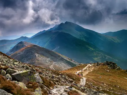
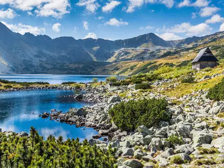
Creux du Van to Noiraigue is a 14 km loop day walk in the Val de Travers, canton of Neuchatel, in the Swiss Jura. Starting and finishing at Noiraigue railway station, it climbs to the rim of the Creux du Van, a huge natural rock amphitheatre, via forest paths and the steep Sentier des 14 Contours. With about 780 m of ascent, rocky sections and exposed rim walking, it suits fit hikers wanting a moderate but demanding Jura mountain day.
Route Overview
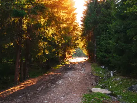
The standard route is a loop from Noiraigue station, reached by direct train from Neuchatel. Most hikers go up via Les Oeillons and the Sentier des 14 Contours, the steep zig-zag climb through forest to the Creux du Van rim. From the top, the route follows the cliff-edge area around Le Soliat and passes close to Ferme-Restaurant Le Soliat before descending towards Fontaine Froide, La Ferme Robert and back to Noiraigue. If you are comparing Jura options, see the related Creux du Van Circular Trail or the ridge-focused Chasseral Ridge Walk.
Glacial Origins and Protected Wildlife
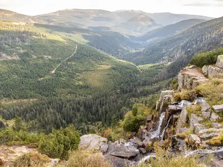
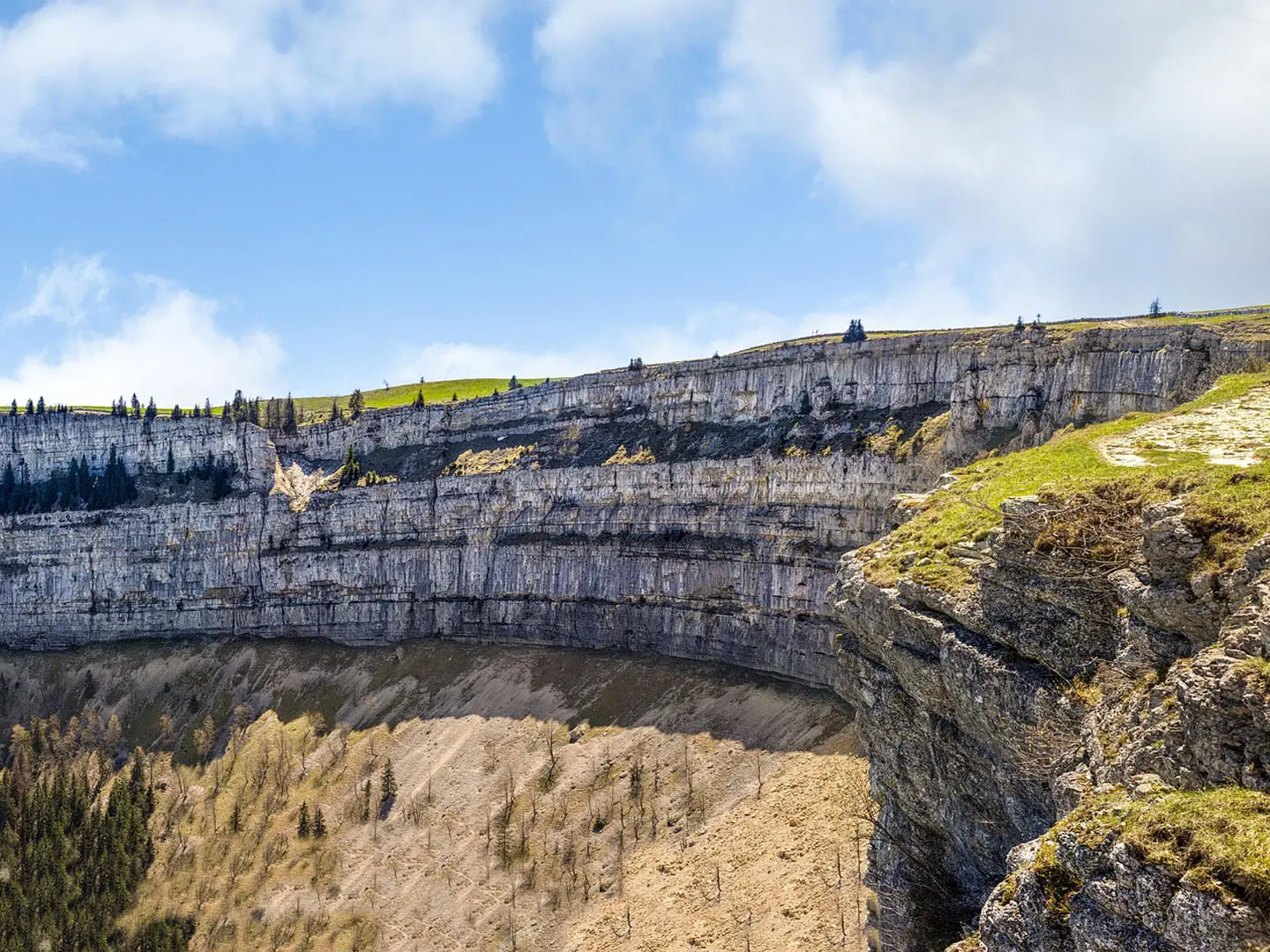
The Creux du Van cirque was shaped over successive ice ages, with glacial action and meltwater cutting into the Val de Travers during the Wurm glaciation. Its limestone cliffs and unusual underground permafrost remain defining features of the landscape today. The area has long been protected as a nature reserve, and alpine ibex were reintroduced in 1965 after being hunted out of the region.
Notable highlights
- Creux du Van amphitheatre: A horseshoe-shaped natural rock cirque about 1,400 m wide, with limestone cliffs around 150 m high. The rim is the scenic focus of the walk.
- Sentier des 14 Contours: The “Trail of the 14 switchbacks” is the hardest section, climbing steeply through forest on rock, roots and loose stone.
- Le Soliat (1,463 m): The summit on the rim, with a cross and panorama point. On a clear day there are views into the amphitheatre, over Lake Neuchatel and towards the Alps.
- Fontaine Froide: A cold spring within or below the cirque, with water at about 4°C year-round, linked to the underground permafrost.
- Alpine ibex and reserve wildlife: Ibex were reintroduced in 1965, and a colony lives near the rim. Chamois, marmots and summer grazing cattle are also part of the landscape.
- La Ferme Robert: A historic Jura farm on the descent route back towards Noiraigue, reflecting the area’s pastoral past.
Challenges to expect
The main challenge is the steep Sentier des 14 Contours, with exposed rock, roots and loose stones that become slippery after rain. The rim can be windy and cold even in summer, and care is needed near cliff edges despite protective fencing or walls along much of the exposed section. Carry water and check seasonal opening before relying on Ferme-Restaurant Le Soliat or Les Oeillons.
HikeList Score
Creux du Van to Noiraigue scored 82/100 on HikeList's trail-quality metrics.
See score breakdownHide breakdown
- Ideal length 55
- Balanced challenge 100
- Scenery & wildness 78
- Varied terrain 100
- Accommodation 75
- Food & support 88
- Path quality 98
- Season flexibility 89
Computed from length, challenge, scenery & wildness, terrain variety, accommodation, food & support, path quality and season flexibility.
Show more data Show less
- Forest
- Pasture
- Cliff Top
- Mountainous
- Dirt
- Forest Tracks
- Stony
- Rocky
- Hotels
- Huts
- Campsites
- Family Friendly
- Pet Friendly
- Restrooms
- Water Sources
- Campsites
- Picnic Areas
In these collections
Photos from hikers
Taken on the trail by people who've reviewed Creux du Van to Noiraigue.
Reviews
How would you rate Creux du Van to Noiraigue?
Tap a star to start your review — you could be the first.