Alta Via 1
How would you rate Alta Via 1?
Tap a star to share your experience and help other hikers.
Alta Via 1: Classic Dolomites Hut-to-Hut Trek
HikeList Score
Alta Via 1 scored 84/100 on HikeList's trail-quality metrics.
See score breakdownHide breakdown
- Ideal length 94
- Balanced challenge 100
- Scenery & wildness 98
- Varied terrain 71
- Accommodation 49
- Food & support 72
- Path quality 98
- Season flexibility 63
Computed from length, challenge, scenery & wildness, terrain variety, accommodation, food & support, path quality and season flexibility.
The Alta Via 1 is a 120 km, 10-day, moderate hut-to-hut trek through the eastern Dolomites in Italy. Walked north to south from Lago di Braies to La Pissa near Belluno, it is the classic and most popular of the Dolomites’ numbered high-level routes. It suits fit hikers with some alpine experience who want a first multi-day Dolomite trek: expect rocky paths, scree, big ascents and descents, rifugio nights, and a waymarked route without mandatory via ferrata.
Route Overview
This is a point-to-point traverse, normally walked north to south. The trail starts at Lago di Braies / Pragser Wildsee in South Tyrol, near Toblach / Dobbiaco, and finishes at La Pissa bus stop in the Cordevole valley below the Schiara group, near Belluno; both ends have public transport. The route crosses Fanes-Senes-Braies, the Tofane, Croda da Lago, Nuvolau, Civetta, Moiazza and Schiara, with key stops around Rifugio Biella, Rifugio Fanes / Lavarella, Rifugio Lagazuoi, Cinque Torri, Passo Giau, Lago Coldai, Rifugio Tissi, Rifugio Vazzoler and Rifugio Bianchet. For a harder Dolomite high route, compare Alta Via 2; for a shorter start-area walk, see Lago di Braies to Prato Piazza.
History of the Alta Via 1
The Alta Via 1 was the first of the Dolomites’ high-level routes, created in the mid-1960s by linking existing CAI mountain paths and rifugi into a continuous north–south traverse. Its central section crosses First World War terrain around Lagazuoi, the Falzarego Pass and Cinque Torri, where Italian and Austro-Hungarian troops fought, tunnelled and built positions in the high mountains. Tunnels, galleries and restored trenches remain visible. Since 2009, the surrounding peaks have formed part of the UNESCO World Heritage Dolomites.
Notable highlights
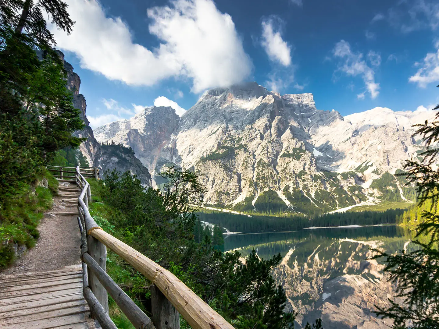
- Lago di Braies (northern trailhead): The emerald alpine lake below Croda del Becco is the route’s instantly recognisable start and one of the Dolomites’ most photographed places.
- Monte Lagazuoi and the WWI tunnels (2,752 m): The standard route’s highest point sits above the Falzarego Pass, with First World War tunnels and broad views from the rifugio terrace.
- Cinque Torri (Five Towers): A compact group of detached rock towers near Rifugio Nuvolau, known for climbing and restored open-air wartime trenches.
- Fanes-Senes-Braies high plateau: An early high-level section of meadows, limestone and karst terrain within a protected nature park associated with Ladin legend.
- Civetta wall and Lago Coldai: The north-west face of Monte Civetta rises above the trail near Lago Coldai and Rifugio Coldai, making this one of the strongest landscape sections.
- Rifugio culture: Nights in mountain refuges, with dormitory bunks and Tyrolean-Italian meals, are central to the Alta Via 1 experience.
Challenges to expect
The Alta Via 1 is moderate, not technical, but it is still an alpine trek. Expect about 6,800 m of total ascent, long descents, rocky paths, scree and loose ground, with some cabled or protected sections and short exposed passages. Weather can change quickly at altitude, and snow may linger outside the main summer season. Huts are busy in July and August, so book well ahead. For another Italian mountain trek with hut logistics, see the Gran Paradiso Trek.
HikeList Score
Alta Via 1 scored 84/100 on HikeList's trail-quality metrics.
See score breakdownHide breakdown
- Ideal length 94
- Balanced challenge 100
- Scenery & wildness 98
- Varied terrain 71
- Accommodation 49
- Food & support 72
- Path quality 98
- Season flexibility 63
Computed from length, challenge, scenery & wildness, terrain variety, accommodation, food & support, path quality and season flexibility.
 Italy
ItalyShow more data Show less
- Mountain
- Alpine
- Rock
- Dirt
- Scree
- Mountain Huts
- Pet Friendly
- Restrooms
- Water Sources
- Campsites
- Shelters
Download Our Full Guide to Alta Via 1 FREE!
Get our comprehensive guide to this hike for free. Save it for later reading or print out at home.
In these collections
Photos from hikers
Taken on the trail by people who've reviewed Alta Via 1.
Alta Via 1: The Complete Guide
 i
Image by rois010
i
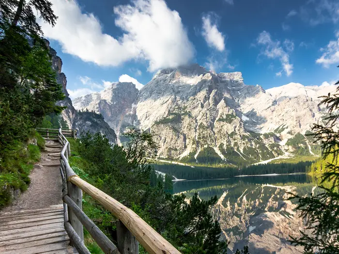
Image by rois010 Alta Via 1 is the classic hut-to-hut crossing of the eastern Dolomites, running north to south from Lago di Braies (Pragser Wildsee / Braies Lake) to La Pissa near Belluno. It suits fit walkers who want a serious alpine journey without mandatory via ferrata, using staffed rifugi rather than a tent.
The route begins abruptly from the lake beneath Croda del Becco (Seekofel), then threads through high limestone, meadow, scree and karst across the Fanes-Senes-Braies plateau. Further south it passes the Lagazuoi area, Cinque Torri, Croda da Lago, Monte Pelmo, Civetta, Moiazza and the quieter Schiara group.
This is not a flat scenic trail with occasional mountains; it is mountain walking almost every day. Expect long ascents and descents, rocky ground, exposed but non-technical sections, short protected passages and weather that can change quickly in summer.
Most walkers take 10–13 days, sleeping in rifugi with mezza pensione and booking well ahead for July and August. The reward is a continuous high-level line through some of the most recognisable Dolomite landscapes, with public transport at both ends.
This guide covers the stages, itinerary choices, accommodation, food, transport, terrain and common planning mistakes.
Stage-by-Stage Guide
Stage distances below are approximate. Hut-to-hut timing varies sharply with snow, thunderstorms, pack weight and how much time is spent on the many high viewpoints, so each day should be planned from a proper map rather than distance alone.
Stage 1: Lago di Braies to Rifugio Biella — approx. 6 km
The route starts at Lago di Braies (Pragser Wildsee / Braies Lake), beneath Croda del Becco (Seekofel), and climbs immediately from the lakeshore into proper Dolomite terrain. Although this is a short stage by distance, it is not a gentle warm-up: the path gains height quickly and sets the tone for a trail where steep ascent, rock and exposed limestone scenery are normal.
The main landmark is Croda del Becco (Seekofel), the pale limestone summit above the opening climb. This first day enters the Fanes-Senes-Braies nature park, so expect a transition from the busy lake setting into a high mountain landscape of rock, meadow and karst.
Food, water and overnight accommodation are at Rifugio Biella. Refill before leaving Lago di Braies and do not assume there will be reliable water away from huts; availability should be checked locally, especially in hot weather.
Public transport access is best at Lago di Braies via Toblach / Dobbiaco or Cortina d’Ampezzo and local bus services. The lakeside road has summer access restrictions, so bus times and access rules should be checked before travelling.
Navigation is straightforward in clear weather on the marked Alta Via 1 line, using blue triangle and CAI red-white waymarks. Early-season snow can linger on high ground, and the opening climb should not be underestimated if arriving late in the day.
Stage 2: Rifugio Biella to Rifugio Fanes / Lavarella — approx. 13 km
This stage continues across the Fanes-Senes-Braies nature park plateau, one of the route’s classic early high-level sections. The walking mixes open meadow, limestone, karst terrain and mountain paths, with the sense of remoteness increasing once away from the hut areas.
The key landscape feature is the Fanes plateau itself, known for its broad upland character and dramatic Dolomite surroundings. In poor visibility, open plateau terrain can feel more committing than it looks on the map, so navigation should not rely only on following footprints.
Rifugio Fanes and Rifugio Lavarella are the standard end-of-stage hut options. Both should be booked ahead in the main season; half board in Dolomite rifugi typically costs around EUR 55–75 per person per night, but current prices should be confirmed before booking.
Food and water are hut-based. Carry enough water for the full day between staffed stops, as limestone and karst ground can make natural water unreliable.
There is no major transport hub at the end of this stage in the route information, so it should be treated as a committed hut-to-hut day. In deteriorating weather, leave early and keep an eye on afternoon thunderstorm development.
Stage 3: Rifugio Fanes to Rifugio Lagazuoi — approx. 12 km
This is a major high-mountain stage leading towards Rifugio Lagazuoi, the highest point reached on the standard Alta Via 1 at 2,752 m. The day involves sustained alpine walking, with rockier ground and a strong sense of height as the route approaches the Lagazuoi area above Passo Falzarego.
Rifugio Lagazuoi is one of the most memorable overnight stops on the trail, with wide Dolomite views from its high position. The area is also known for First World War tunnels, galleries and open-air war museum features, although any optional visits should be planned around weather, time and energy.
Food, water and accommodation are at Rifugio Lagazuoi. Because this hut is prominent and popular, booking well ahead is essential in July and August.
Passo Falzarego gives this stage useful road access near the Lagazuoi area. Any bus or onward transport options from the pass should be checked before travelling, especially if planning to join or leave the route here.
The altitude makes this a stage where weather matters. Snow can persist early in the season, wind and cloud can make the route feel much more serious, and summer thunderstorms are a genuine concern; an early start is sensible.
Stage 4: Rifugio Lagazuoi to Rifugio Nuvolau — approx. 13 km
From Lagazuoi the Alta Via 1 moves through one of its most famous scenic sections, passing the Passo Falzarego area and heading towards Cinque Torri, Averau and Rifugio Nuvolau. The terrain remains rocky and alpine, with sections of rough path, scree and exposed-feeling ground typical of the central Dolomites.
Cinque Torri is the main landmark of the day: a compact cluster of detached rock towers known for climbing and restored wartime trenches. The route then reaches the Nuvolau area, where Rifugio Nuvolau sits in an exceptional summit position at 2,575 m.
Food, water and the overnight stop are at Rifugio Nuvolau. Its exposed, high position is part of the appeal, but also means weather changes can be felt sharply; do not plan to arrive late in unsettled conditions.
Road access is possible around Passo Falzarego, and the Cinque Torri / Averau area is relatively well known and visited compared with quieter southern stages. Any specific transport links should be checked before relying on them.
Navigation is generally helped by waymarks and obvious landmark peaks, but this is not terrain for casual map-reading. In mist, rocky junctions and alternative paths around popular viewpoints can be confusing, so keep checking the Alta Via 1 markers.
Stage 5: Rifugio Nuvolau to Rifugio Città di Fiume — approx. 13 km
This stage leaves the Nuvolau area and crosses towards Croda da Lago, Forcella Giau / Passo Giau and Forcella Ambrizzola before reaching Rifugio Città di Fiume. It is a varied Dolomite day of high pasture, rocky paths and wide views, with repeated changes of aspect rather than easy valley walking.
The highlights are the dramatic spires around Croda da Lago and the views towards Monte Pelmo and the distant Marmolada glacier. The Alta Via 1 does not traverse the Marmolada massif; it is seen from afar rather than crossed.
Passo Giau is an important road pass on or near this stage and can be useful for access or exit planning. Public transport and taxi options at road passes change by season, so this should be checked before travelling.
Food, water and accommodation are at Rifugio Città di Fiume. As with other stages, carry enough water between huts and do not rely on unplanned natural sources.
Navigation needs care around pass and pasture terrain where multiple paths may be present. In early season, lingering snow on shaded high ground can obscure waymarks; in summer, aim to be over exposed high sections before afternoon storms build.
Stage 6: Rifugio Città di Fiume to Rifugio Coldai — approx. 9 km
This shorter stage skirts the area below Monte Pelmo and then heads towards Rifugio Coldai. Although the distance is modest, the ground remains mountainous, with uneven paths and enough ascent and descent to make it a proper walking day.
Monte Pelmo is the dominant landmark, a throne-shaped massif rising to 3,168 m. The route also passes in the wider Passo Staulanza area before continuing towards the Civetta side of the Alta Via 1.
Rifugio Coldai, also known as Rifugio Sonino al Coldai, is the end-of-stage hut. Food, water and the overnight stop are available there in the hut season, but opening dates should be checked before travelling.
Passo Staulanza gives road access in this part of the route. It is a logical point for section-hikers to investigate, but current bus or road-transfer options should be checked in advance.
The stage is a useful chance to avoid rushing, especially if weather has disrupted earlier days. Even on shorter Alta Via 1 stages, afternoon thunderstorms and poor visibility can still create serious navigation and exposure problems.
Stage 7: Rifugio Coldai to Rifugio Vazzoler — approx. 10 km
This is one of the route’s finest landscape stages, passing Lago Coldai beneath the great wall of Monte Civetta. The walking is high, scenic and rocky, with the Civetta massif dominating the day.
Lago Coldai is the key early highlight, followed by prolonged views of Civetta’s vast north-west wall. This is a stage to allow time for photography and breaks, but not at the expense of an early finish if the forecast is unstable.
Rifugio Vazzoler is the end-of-stage hut and the main point for food, water and accommodation. Book ahead, especially in peak summer, as the classic hut chain can fill quickly.
No specific public transport access is supplied for Rifugio Vazzoler, so this should be treated as a mountain hut stage rather than a convenient exit point. If using it as part of a shorter itinerary, access arrangements should be checked before travelling.
Navigation is usually by marked mountain paths, but rocky terrain and side paths demand attention. Loose ground, short protected or cabled passages on the wider route, and changing weather are the main practical concerns rather than technical climbing.
Stage 8: Rifugio Vazzoler to Rifugio Carestiato — approx. 9 km
The route now moves into the Moiazza group, a quieter and wilder-feeling part of the Alta Via 1. The stage is shorter on paper, but the terrain remains rugged, with Dolomite rock walls, uneven paths and steep ground.
The main appeal is the sense of moving away from the busiest central sections into the southern Dolomites. The Moiazza walls give the day a more serious mountain character, even without mandatory via ferrata.
Food, water and accommodation are at Rifugio Carestiato. Hut facilities should be booked in advance and opening dates checked if walking near the edges of the season.
There is no major public transport point stated at the hut itself. Passo Duran lies on the following stage and is the more obvious road-access point in this part of the route.
Navigation should be kept disciplined through rocky and wooded transitions, especially in mist. The southern half of the Alta Via 1 is generally wilder and steeper than the opening days, so fatigue and complacency become real planning issues here.
Stage 9: Rifugio Carestiato to Rifugio Sommariva al Pramperet — approx. 13 km
This stage crosses the Passo Duran area and continues towards Rifugio Sommariva al Pramperet, marking a further shift into the southern Dolomites. Expect a long mountain day with changing terrain, including rocky paths, forest or meadow sections lower down, and rougher ground as the route progresses.
Passo Duran is the principal landmark and road-access point. It can be important for section-hiking, emergency replanning or joining the route, but current transport options should be checked before travelling.
Rifugio Sommariva al Pramperet is the end-of-stage accommodation. Food and water planning should remain hut-based, with enough carried for the full day.
This is not a stage to start late simply because road access appears on the map. The Alta Via 1 becomes more committing in the south, and the approach to the Pramper / Schiara side of the route is wilder than the well-known central highlights.
Navigation remains on waymarked paths, but long days, loose ground and thunderstorms can make decision-making more important than technical difficulty. If weather is deteriorating, use road-access points only where onward transport has genuinely been arranged.
Stage 10: Rifugio Sommariva al Pramperet to Rifugio Pian de Fontana — approx. 6 km
This is a short but serious stage over Forcella de Zita Sud, one of the highest passes actually crossed on foot on the Alta Via 1. Distance is misleading here: the terrain is steeper, wilder and more exposed-feeling than many earlier sections.
The route is now firmly in the remote southern Dolomites, heading towards the Monte Schiara and Dolomiti Bellunesi landscape. Expect rough limestone, scree, steep ascents and descents, and a more committing mountain atmosphere.
Rifugio Pian de Fontana is the end-of-stage hut and the key place for food, water and overnight accommodation. Because there are fewer easy bail-out options in this final mountain section, hut booking and weather checks are especially important.
There is no public transport access at either hut, so this stage should be planned as part of a continuous mountain crossing. Any alternative exit routes should be checked on a proper map before the trip, not improvised in bad weather.
Forcella de Zita Sud can hold snow early in the season, and poor visibility would make the route much more serious. This is one of the stages where a forecast-driven decision matters: if thunderstorms or lingering snow conditions are unfavourable, seek local hut advice before committing.
Stage 11: Rifugio Pian de Fontana to La Pissa, then bus to Belluno — approx. 11 km
The final stage descends from the Rifugio Pian de Fontana area through the Monte Schiara and Dolomiti Bellunesi landscape to La Pissa in the Cordevole valley. It is a long, dramatic limestone descent rather than a gentle finishing stroll.
The key feature is the transition from remote southern Dolomite terrain down towards the valley and Belluno. Paths can be steep, rocky and tiring underfoot, especially after ten days of accumulated fatigue.
There is no hut at La Pissa listed as the overnight goal; most walkers finish at the bus stop and continue to Belluno. Carry enough food and water from Rifugio Pian de Fontana for the descent, and do not assume services before reaching transport.
A bus runs from La Pissa down the Cordevole valley to Belluno, which has a railway station and onward bus and train links, including coach connections towards Venice. The La Pissa to Belluno timetable should be checked before travelling, as missing the intended service can leave an awkward end to the walk.
Navigation remains important until the valley is reached. The descent below the Schiara group is still mountain terrain, and wet limestone, loose ground, fatigue and late-day thunderstorms can make the final stage more hazardous than its downhill profile suggests.
Recommended Itinerary
The most balanced way to walk the Alta Via 1 is as an 11-day hut-to-hut itinerary from Lago di Braies (Pragser Wildsee / Braies Lake) to La Pissa, then by bus into Belluno. This keeps the first climbing day short, avoids over-compressing the rougher southern stages, and fits the common rifugio spacing on the route.
Distances below are approximate. The days are often made hard by ascent, descent, rock, scree, heat and weather rather than distance alone, so do not judge the itinerary by kilometres only.
Standard 11-day itinerary
| Day | From | To | Approx. distance | Why this stage makes sense | Services/accommodation notes |
|---|---|---|---|---|---|
| 1 | Lago di Braies (Pragser Wildsee / Braies Lake) | Rifugio Biella | 6 km | A short but immediate climb from the lakeshore, giving a sensible first day if arriving by public transport and allowing time to settle into hut routine. | Overnight at Rifugio Biella. Check Lago di Braies summer access and bus arrangements before travelling. |
| 2 | Rifugio Biella | Rifugio Fanes / Rifugio Lavarella | 13 km | A full first high-level stage across the Fanes-Senes-Braies nature park plateau without making the opening two days too aggressive. | Book either Rifugio Fanes or Rifugio Lavarella in advance; do not assume space in July-August. |
| 3 | Rifugio Fanes | Rifugio Lagazuoi | 12 km | Takes the route up to its highest overnight point at Rifugio Lagazuoi, above Passo Falzarego, with plenty of mountain ground for a moderate-distance day. | Rifugio Lagazuoi is a high, popular hut. Weather can matter here; check conditions before setting off. |
| 4 | Rifugio Lagazuoi | Rifugio Nuvolau | 13 km | Links the Lagazuoi/Passo Falzarego area with Cinque Torri and the Nuvolau ridge, keeping time for rocky ground and exposed-position walking. | Overnight at Rifugio Nuvolau. This is a sought-after hut, so book early and confirm opening dates. |
| 5 | Rifugio Nuvolau | Rifugio Città di Fiume | 13 km | A logical traverse through the Croda da Lago, Forcella Giau / Passo Giau and Forcella Ambrizzola area towards Monte Pelmo. | Overnight at Rifugio Città di Fiume. Treat Passo Giau as part of the walking day, not as a guaranteed bailout unless current transport is checked. |
| 6 | Rifugio Città di Fiume | Rifugio Coldai | 9 km | A shorter stage that positions the route beneath Monte Civetta and avoids making the approach to Lago Coldai feel rushed. | Overnight at Rifugio Coldai / Rifugio Sonino al Coldai. Passo Staulanza is passed in this part of the route, but accommodation should still be booked around the planned hut stage. |
| 7 | Rifugio Coldai | Rifugio Vazzoler | 10 km | Gives time for the Lago Coldai and Civetta wall section, one of the key landscape days, without forcing a long link across rough Dolomite terrain. | Overnight at Rifugio Vazzoler. Keep an eye on afternoon thunderstorms before committing to exposed ground. |
| 8 | Rifugio Vazzoler | Rifugio Carestiato | 9 km | A shorter but still rugged stage through the quieter Moiazza area, useful before the route starts to feel more remote further south. | Overnight at Rifugio Carestiato. Confirm hut booking and meal arrangements ahead. |
| 9 | Rifugio Carestiato | Rifugio Sommariva al Pramperet | 13 km | A longer southern-stage link from the Passo Duran area towards the wilder Pramper group, where the route becomes steeper and less forgiving. | Overnight at Rifugio Sommariva al Pramperet. Passo Duran is not a substitute for a booked plan unless current transport and services are checked. |
| 10 | Rifugio Sommariva al Pramperet | Rifugio Pian de Fontana | 6 km | Short on paper, but this is an important mountain day over the Forcella de Zita Sud area. It is best not treated as an easy half-day in poor weather. | Overnight at Rifugio Pian de Fontana. Check snow, storm risk and hut status before committing to this section. |
| 11 | Rifugio Pian de Fontana | La Pissa, then bus to Belluno | 11 km | The final stage gives a long descent out of the Monte Schiara / Dolomiti Bellunesi terrain to the Cordevole valley. | Finish at La Pissa and take the bus to Belluno. Check the La Pissa-to-Belluno timetable before relying on it. |
Slower variant: 12-13 days
A 12- or 13-day plan suits walkers taking their first Dolomite hut trek, anyone who wants more weather flexibility, or groups that prefer not to arrive at huts late in the afternoon. The simplest approach is to keep the 11 walking stages above and add one or two rest, weather or short-walking days at key hut areas such as Rifugio Fanes / Rifugio Lavarella, Rifugio Lagazuoi or Rifugio Coldai, subject to hut availability.
Do not add unplanned extra nights casually in peak season. Huts are busy in July-August, and multi-night stays should be booked at the same time as the rest of the itinerary.
Faster variant: 9-10 days
A 10-day Alta Via 1 is possible for fit, efficient walkers with alpine experience, but it is less forgiving. The usual way to compress the route is to combine one of the shorter northern or mid-route stages, for example starting early from Lago di Braies and continuing beyond Rifugio Biella to Rifugio Fanes / Rifugio Lavarella, or linking two of the shorter Civetta/Moiazza stages where hut availability allows.
A 9-day schedule is only suitable for strong parties comfortable with long mountain days, repeated ascent and descent, and less margin for storms or tiredness. The southern stages around Rifugio Sommariva al Pramperet, Forcella de Zita Sud, Rifugio Pian de Fontana and the descent to La Pissa should not be compressed without checking official mapping, hut bookings and current conditions before booking.
Choosing the right pace
For most independent hikers, the 11-day itinerary is the safest default: it fits the standard rifugio chain, keeps daily distances moderate, and leaves the tougher southern terrain in manageable pieces. Faster schedules save time but reduce flexibility; slower schedules cost more in hut nights but give a better buffer for weather, fatigue and transport timing.
Planning the Route
How many days to allow
The cleanest plan for the Alta Via 1 is an 11-stage hut-to-hut itinerary from Lago di Braies (Pragser Wildsee / Braies Lake) to La Pissa, followed by the bus into Belluno. The listed walking days may look modest in kilometres, but they sit on high, rocky Dolomite terrain with repeated ascents and descents, loose ground and some protected sections.
A 10-day schedule is possible for fit, efficient walkers, but it leaves less room for poor weather, late hut starts, tired legs or a fully booked rifugio that forces a different stopping point. Most independent walkers should allow 11–12 walking days, with 13 days giving a more forgiving pace or a useful weather buffer.
The route generally becomes wilder and steeper towards the southern Schiara and Pramper stages, so do not plan only by early-stage effort. A schedule that feels easy around Fanes, Lagazuoi and Nuvolau can feel much tighter by Rifugio Sommariva al Pramperet, Forcella de Zita Sud and Rifugio Pian de Fontana.
Natural stage planning
The Alta Via 1 is dictated by rifugi, not towns. There are staffed mountain huts along the route, but few conventional resupply points, so overnight planning is essentially a chain of hut bookings.
A typical hut sequence is:
| Stage | From | To | Planning note |
|---|---|---|---|
| 1 | Lago di Braies | Rifugio Biella | Short in distance, but the route climbs immediately from the lakeshore. |
| 2 | Rifugio Biella | Rifugio Fanes / Lavarella | Useful early hut choice on the Fanes-Senes-Braies plateau. |
| 3 | Rifugio Fanes | Rifugio Lagazuoi | Leads to the route high point at Rifugio Lagazuoi. |
| 4 | Rifugio Lagazuoi | Rifugio Nuvolau | Crosses the busy central Dolomite area around Passo Falzarego, Cinque Torri and Averau. |
| 5 | Rifugio Nuvolau | Rifugio Città di Fiume | A key linking day towards Croda da Lago, Forcella Giau and Monte Pelmo. |
| 6 | Rifugio Città di Fiume | Rifugio Coldai | Shorter mileage, but still mountain terrain below Pelmo and towards Civetta. |
| 7 | Rifugio Coldai | Rifugio Vazzoler | One of the major Civetta landscape sections. |
| 8 | Rifugio Vazzoler | Rifugio Carestiato | Heads towards the quieter Moiazza group. |
| 9 | Rifugio Carestiato | Rifugio Sommariva al Pramperet | A longer linking stage towards the southern Dolomites. |
| 10 | Rifugio Sommariva al Pramperet | Rifugio Pian de Fontana | Shorter distance, but includes serious mountain ground around Forcella de Zita Sud. |
| 11 | Rifugio Pian de Fontana | La Pissa | Final descent to the bus stop for Belluno. |
Because hut capacity controls the itinerary, book the whole chain before committing to flights or long-distance travel. If one hut is full, shifting a single night can affect several surrounding stages.
Fast, standard or slower schedules
A fast schedule works best only if hut availability lines up cleanly and the walker is already comfortable with long alpine days. The issue is rarely distance alone; it is the combination of rocky footing, cabled sections, steep descents and summer weather.
A standard 11-stage plan is the most practical balance. It follows the natural hut spacing, avoids excessive linking of stages, and keeps the harder southern days within a sensible margin.
A slower plan is often the better choice in July and August, when accommodation pressure is high and afternoon thunderstorms are common. Extra time also makes it easier to wait out a poor forecast rather than being forced over exposed passes in bad conditions.
Shortening, extending and section hiking
The Alta Via 1 can be shortened, but it is not as flexible as a lowland trail with frequent villages. The realistic places to investigate for joining, leaving or breaking the route are the better-known passes and access areas on or near the line, such as Passo Falzarego, Passo Giau, Passo Staulanza and Passo Duran. Local transport or taxi options for these points should be checked before travelling.
Section hiking is practical if planned around hut opening dates and transport first, then walking stages second. Good section plans use the rifugi as fixed overnight anchors and treat any road-pass access as something to verify separately, not something to assume.
Extending the trek usually means building in rest or buffer nights rather than adding unsupported detours. If adding time, place it where it helps the logistics: before the first night at Lago di Braies or Toblach / Dobbiaco, around the central rifugi if hut space allows, or before the final travel day from Belluno.
What to prioritise when planning
Accommodation is the critical item. Huts are busy in July and August and should be booked well ahead. Expect dormitory bunks or small rooms with mezza pensione, and carry a sleeping-bag liner, cash and earplugs.
Food planning is hut-based. Half board covers dinner, bed and breakfast, but do not plan this as a village resupply route. Any packed lunches, snacks and payment arrangements should be checked with each hut before relying on them.
Water planning should be conservative. Carry enough to reach the next reliable hut or service point, especially on hot days, exposed limestone sections and longer southern stages. Availability away from huts should not be assumed.
Navigation still matters. The route is waymarked with the blue triangle and CAI red-white markers, but cloud, lingering snow and fatigue can make route-finding more serious. Carry a proper map or guidebook; the Cicerone Alta Via 1 guide and Tabacco 1:25,000 maps are the standard planning references.
Weather drives daily decisions. Snow can linger on high passes early in the season, and summer thunderstorms are common in the afternoon. Start early, avoid committing to exposed or cabled ground in a deteriorating forecast, and keep enough flexibility to delay a stage if needed.
Transport needs checking at both ends. For the start, plan around public transport to Toblach / Dobbiaco or Cortina d’Ampezzo, then the local bus to Lago di Braies; the lakeside road has summer access restrictions. At the finish, check the La Pissa to Belluno bus times before relying on them.
Permits are not the main issue, but camping rules are. The route crosses protected nature parks where wild camping is not permitted, so the practical plan is to sleep in rifugi every night. Current hut opening dates, booking systems and any local rules should be checked before travelling.
Towns, Villages and Overnight Stops
The Alta Via 1 is primarily a hut-to-hut route, not a village-to-village walk. After leaving Lago di Braies (Pragser Wildsee / Braies Lake), most nights are spent in staffed rifugi, with only limited access to road passes and almost no conventional resupply on the high route.
Plan accommodation before transport and flights. Huts are busy in July and August, many operate only from mid/late June to late September, and opening dates should be checked before travelling. Expect dormitory bunks or small rooms, mezza pensione (half board: dinner, bed and breakfast), a sleeping-bag liner, earplugs and enough cash for hut bills and extras.
Lago di Braies (Pragser Wildsee / Braies Lake)
Lago di Braies is the classic northern trailhead, below Croda del Becco (Seekofel). The route climbs immediately from the lakeshore, so it is sensible to arrive rested rather than treating the first climb as an add-on to a long travel day.
Most walkers reach the area via Toblach / Dobbiaco or Cortina d'Ampezzo, then use a local bus to the lake. The lakeside road has summer access restrictions, so the bus is usually the most reliable approach; current access rules and timetables should be checked before travelling.
Do not rely on the trailhead as a resupply point for the whole route. Start with the cash, liner, snacks and wet-weather kit needed for a high-mountain hut trek.
Rifugio Biella
Rifugio Biella is the usual first overnight stop after the short but steep opening stage from Lago di Braies. It sits high above the start near Croda del Becco (Seekofel), making it a useful first night for easing into the route rather than over-extending on day one.
Accommodation is hut-style: booked bunks or rooms with mezza pensione. There are no village services here, so treat it as a mountain hut rather than a resupply stop.
This is also the first point where late arrival becomes a practical problem. The first day may be short in distance, but the route is already alpine, and hut arrival times matter for dinner and check-in.
Rifugio Fanes / Rifugio Lavarella
Rifugio Fanes and Rifugio Lavarella are the main overnight options on the Fanes-Senes-Braies nature park plateau. They make a natural second stop after crossing the early limestone, meadow and karst terrain of the northern Alta Via 1.
Both should be treated as book-ahead mountain huts. Half board is the normal arrangement, and availability can be tight in peak season because this is one of the most accessible and popular parts of the route.
There are no full village services on this section. Carry any daytime food needed between huts and avoid assuming that shops or cash facilities will be available on the plateau.
Rifugio Lagazuoi and Passo Falzarego
Rifugio Lagazuoi is the highest point reached by the standard Alta Via 1, at 2,752 m, above Passo Falzarego. It is a major overnight stop and one of the most memorable hut locations on the route, with First World War tunnels and galleries nearby.
The hut is a practical place to sleep, eat and reset after the Fanes section, but its height makes weather more significant. Snow patches can linger early in the season and summer thunderstorms can affect high exposed ground, so timings should be conservative.
Passo Falzarego is an important named pass on the route, but onward transport or exit logistics should not be assumed without checking current services before travelling.
Cinque Torri, Averau and Rifugio Nuvolau
The route continues through the Cinque Torri and Averau area to Rifugio Nuvolau, the usual overnight stop for this part of the itinerary. Rifugio Nuvolau sits at 2,575 m and is one of the oldest refuges in the Dolomites, founded in 1883.
This is a popular and exposed place to stay, so booking early is important. Accommodation is again hut-based, with dinner, bed and breakfast rather than village-style choice.
The surrounding area is busy by Dolomite standards because of the Cinque Torri towers and wartime trench sites, but that does not remove the need for a confirmed bed. If a stage is being altered around Averau or Cinque Torri, confirm the exact hut booking and route timings in advance.
Croda da Lago, Passo Giau and Rifugio Città di Fiume
After Rifugio Nuvolau, the Alta Via 1 crosses the Croda da Lago and Passo Giau area via high passes including Forcella Giau and Forcella Ambrizzola. The standard onward overnight stop is Rifugio Città di Fiume, below the north face of Monte Pelmo.
Rifugio Città di Fiume is a useful staging hut because it positions walkers well for the approach toward Passo Staulanza and the Civetta section. Book it as part of the main hut chain rather than relying on turning up.
Passo Giau is a prominent pass on this section, but the route is still not a village walk. Any plan to leave, join or alter the route around the pass should be checked before travelling.
Passo Staulanza
Passo Staulanza is passed between Rifugio Città di Fiume and Rifugio Coldai on the standard route. The brief itinerary treats it as a point on the way rather than a required overnight stop.
It can be relevant for walkers adjusting stages, but current accommodation, food and transport options at the pass should be checked before relying on them. For a straightforward hut-to-hut itinerary, the more important booking is usually the next hut at Rifugio Coldai.
Rifugio Coldai and Lago Coldai
Rifugio Coldai, also known as Rifugio Sonino al Coldai, is the usual overnight stop below Monte Civetta, close to Lago Coldai. This is one of the strongest scenic sections of the route, with the Civetta wall rising above the trail.
The hut provides the standard Alta Via 1 overnight format: booked bunks or rooms with mezza pensione. It is not a shop-resupply stop, so carry enough food for the walking day and any preferred snacks.
Because this section is popular, especially in good summer weather, do not leave the booking late. If the hut is full, the whole stage plan may need adjusting.
Rifugio Vazzoler and the Moiazza group
Rifugio Vazzoler is the next main overnight stop after the Coldai and Civetta section. It sits on the transition towards the Moiazza group, where the route starts to feel quieter and more committed.
This is still a staffed rifugio rather than a village stop. Expect half board, shared sleeping arrangements and limited flexibility if arriving late.
The day into Vazzoler is not long by distance, but Dolomite terrain rarely converts neatly into easy hours. Loose ground, rock and repeated ascent/descent mean accommodation timing should be planned around mountain pace rather than map distance alone.
Rifugio Carestiato and Passo Duran
Rifugio Carestiato is the standard overnight stop after Rifugio Vazzoler, with the route skirting the Moiazza group before reaching the Passo Duran area. It is a key staging point before the longer push towards Rifugio Sommariva al Pramperet.
Book Rifugio Carestiato in the same way as the other AV1 huts, and assume normal hut facilities rather than village amenities. Food is based around the hut meal arrangement, not independent shopping.
Passo Duran may be useful for itinerary changes, but transport, food and accommodation details should be checked before travelling. Do not build an escape plan around it without current information.
Rifugio Sommariva al Pramperet
Rifugio Sommariva al Pramperet is the usual overnight stop before the final high section over Forcella de Zita Sud towards Rifugio Pian de Fontana. By this stage the Alta Via 1 is in its wilder southern half, and the spacing of huts becomes more important.
This is not a place to arrive without a reservation in high season. Half board, cash and basic hut etiquette are the practical essentials.
It is also a good point to reassess weather and fatigue before committing to the next day. The southern stages are steeper and more remote than the early plateau sections.
Rifugio Pian de Fontana and Monte Schiara
Rifugio Pian de Fontana is the final listed overnight hut before the descent towards La Pissa and Belluno. It sits below the Monte Schiara area in the Dolomiti Bellunesi, where the route is more rugged and the descent out of the mountains is long.
Treat this as a critical booking, not an optional stop. If the hut is unavailable, the final stage plan may need substantial revision.
There are no normal town services here. Carry enough food and cash to complete the route to La Pissa, and check the next day's bus connection to Belluno before setting off if timing is tight.
La Pissa
La Pissa is the usual walking finish of the Alta Via 1, in the Cordevole valley near Belluno. Most walkers finish at the bus stop rather than walking all the way into Belluno.
A bus runs from La Pissa down the valley to Belluno, but the timetable should be checked before travelling and again before the final stage if possible. Missing the connection can turn the end of the route into a logistical problem after a hard descent.
La Pissa should be treated as a transport point, not a full-service trail town. Plan food, water and onward travel with Belluno as the practical destination.
Belluno
Belluno is the official southern terminus city for Alta Via 1 logistics, reached by bus from La Pissa. It has a railway station and onward bus/train links, with coach connections towards Venice.
For most walkers, Belluno is the sensible place for a post-trek night, a proper meal, laundry and onward travel. Accommodation and onward transport should still be booked or checked in advance during busy summer periods.
If section-hiking the southern end, Belluno is also the logical transport hub. The exact La Pissa bus times are the key detail to confirm before relying on a same-day train or coach connection.
Getting to the Start
The Alta Via 1 starts at Lago di Braies (Pragser Wildsee / Braies Lake), near Toblach / Dobbiaco in South Tyrol. The trail begins directly from the lakeshore and climbs immediately, so most walkers aim to arrive at the lake early rather than treating the approach as part of a relaxed travel day.
Public transport is the most practical way to reach the start, especially in summer when access to the lakeside road is restricted. Timetables and any reservation rules for the Lago di Braies bus should be checked before travelling.
By train
The most useful railhead for the northern start is Toblach / Dobbiaco. From there, continue by local bus towards Lago di Braies (Pragser Wildsee / Braies Lake).
Cortina d'Ampezzo is another practical approach town for the Alta Via 1 area, reached by bus connections rather than being the direct lakeside railhead. If arriving via Cortina, allow enough time to transfer onwards to the Lago di Braies side before starting the walk.
Do not plan on stepping off a long-distance train and walking immediately unless the local bus connection to the lake is already confirmed. South Tyrol public transport is generally useful for hikers, but mountain-valley services can be seasonal and timetable-dependent.
By bus
Local buses, including SAD / Südtirolmobil services, connect the Toblach / Dobbiaco area with Lago di Braies. In the main hiking season this is usually the most reliable way to reach the trailhead because of summer road-access restrictions near the lake.
The key planning point is timing: the first walking day climbs from Lago di Braies to Rifugio Biella, so a late arrival at the lake can make the opening stage unnecessarily rushed. Check the current Lago di Braies bus timetable, any seat-reservation requirements and the final bus of the day before booking accommodation.
If public transport is limited on the day of arrival, a taxi from Toblach / Dobbiaco or Cortina d'Ampezzo may be possible. Availability and fare should be arranged in advance; this should be checked before travelling.
By car
Driving to Lago di Braies is possible in principle, but it is not the best default plan for a full Alta Via 1 traverse. The route is point-to-point, finishing far to the south at La Pissa near Belluno, so leaving a car at the northern trailhead creates a long retrieval problem at the end.
Summer access restrictions apply on the road to the lake, and parking arrangements can change by season. Do not assume that unrestricted long-stay parking will be available at the lakeshore; this should be checked before travelling.
For most walkers, it is simpler to use public transport to the start and then take the bus from La Pissa into Belluno at the finish. If driving is unavoidable, plan the end-to-start return logistics before committing to hut bookings.
From the nearest airport
There is no airport at the trailhead, so flying in still requires an onward rail-and-bus or coach-and-bus transfer to Toblach / Dobbiaco or Cortina d'Ampezzo, followed by the local connection to Lago di Braies. Choose an arrival airport based on the cleanest onward public transport rather than the shortest map distance.
Venice is a common onward transport direction for this part of northern Italy, and Belluno has bus, rail and coach links for the end of the trek. For the start, check current connections to Toblach / Dobbiaco or Cortina d'Ampezzo before booking flights, especially if arriving late in the day.
Where to stay before starting
The most practical pre-trek bases are Toblach / Dobbiaco, Cortina d'Ampezzo or accommodation near Lago di Braies itself. Staying near the lake gives the earliest start, but availability can be tight in peak season and road/bus access rules still matter.
Toblach / Dobbiaco is a sensible choice if arriving by train and continuing to the lake by morning bus. Cortina d'Ampezzo can also work well for walkers already approaching from the central Dolomites, but it adds another transfer to reach the northern trailhead.
Wherever you stay, build in enough time for a morning transfer and the first climb to Rifugio Biella. Huts on the Alta Via 1 expect booked arrivals, and starting late from Lago di Braies is a poor trade-off on the first day of a multi-day alpine route.
Getting Home from the Finish
The standard Alta Via 1 finish is the La Pissa bus stop in the Cordevole valley, below the final descent from the Schiara group. Most walkers do not walk all the way into Belluno; they finish at La Pissa and take the bus down the valley to Belluno, which is the practical transport hub for leaving the route.
La Pissa-to-Belluno bus times are timetable-dependent and should be checked before travelling, especially if finishing outside the main summer hiking period or late in the day. Treat La Pissa as a pick-up point rather than a place to organise onward travel from scratch.
By train
Belluno is the nearest railway station for the finish. From La Pissa, take the valley bus into Belluno, then continue by train from Belluno station.
Belluno has onward rail links for wider Italian connections. If travelling internationally, or returning towards a major city, plan the whole La Pissa → Belluno → onward train sequence before the final stage rather than assuming that connections will line up on arrival.
If the last hiking day runs long, it is usually safer to stay in Belluno and take onward trains the following morning. The final descent comes after several demanding southern stages, so allow margin for tired legs, weather delays and missed bus connections.
By bus
The key bus connection is from La Pissa down the Cordevole valley to Belluno. This is the normal way to leave the trail from the southern terminus.
Belluno also has onward bus and coach links, including connections towards Venice. Exact routes, seasonal timetables and ticket arrangements change, so check current services before relying on a same-day long-distance connection.
For planning purposes, the critical detail is the final La Pissa departure. If the day from Rifugio Pian de Fontana to La Pissa looks likely to finish late, either start early, pre-arrange onward transport, or plan to overnight in Belluno rather than chaining a tight onward journey.
By car/taxi
Alta Via 1 is a point-to-point walk, so a car left at Lago di Braies (Pragser Wildsee / Braies Lake) is not convenient for the finish at La Pissa. Public transport at both ends is the cleaner option for most independent hikers.
A taxi may be useful if the La Pissa bus timetable does not work, but it should be arranged in advance from Belluno or a local operator. Do not rely on being able to find an unplanned taxi at La Pissa after descending from the mountains.
If being collected by car, agree the pick-up location carefully: the practical finish is La Pissa in the Cordevole valley, not a rifugio and not central Belluno. Mobile reception and road access details should be checked before travelling.
From the nearest airport
For flights after the trek, the usual first step is to reach Belluno from La Pissa, then continue by train, bus or coach towards a major airport city such as Venice. Airport-specific connections, journey times and late-day services should be checked before booking flights.
Avoid booking an evening flight on the same day as the final stage unless there is a very generous buffer. The route finishes after a mountain descent, followed by a valley bus and onward city transport, so delays can compound quickly.
Where to stay at the finish
Belluno is the sensible place to stay at the end of the Alta Via 1. It has the railway station and onward bus links, and it removes pressure from the final descent if the La Pissa bus or onward train connections are limited.
Staying overnight in Belluno is particularly sensible if finishing late in the afternoon, walking in September when services may be less frequent, or connecting to Venice or another major city the next day. Book accommodation ahead in busy summer periods and check the La Pissa-to-Belluno timetable before leaving Rifugio Pian de Fontana.
Which Direction Should You Walk?
The Alta Via 1 is normally walked north to south, from Lago di Braies (Pragser Wildsee / Braies Lake) to La Pissa and onward to Belluno. This is the traditional and most practical direction for most independent hikers, and it is the direction used by the standard hut-to-hut stage sequence.
Walking in reverse is possible, but it changes the feel of the route and makes some logistics less natural. It is best treated as a workaround if hut availability or wider travel plans make it necessary, rather than the default choice.
North to south: the standard direction
Starting at Lago di Braies gives a clear, recognisable trailhead and an immediate climb into the Fanes-Senes-Braies nature park. The first stage to Rifugio Biella is short in distance, which helps most walkers settle into the rhythm of rifugio walking before the longer days begin.
The route then builds through the central Dolomites: Rifugio Fanes / Lavarella, Rifugio Lagazuoi, Passo Falzarego, Cinque Torri, Rifugio Nuvolau, Croda da Lago, Monte Pelmo and Monte Civetta. The scenery does not fade; instead, it becomes progressively quieter and more serious as the route moves south towards the Moiazza, Pramper and Schiara stages.
This direction also makes the psychological shape of the walk work well. The final days feel increasingly remote and committed, before the long descent to La Pissa and the bus into Belluno gives a definite end point with onward transport.
Reverse direction: La Pissa to Lago di Braies
Walking south to north starts with the southern Dolomites and the Schiara / Dolomiti Bellunesi end of the route. That means some of the wilder, steeper and more demanding terrain comes very early, before most walkers have adjusted to the pack, altitude, hut routine and daily ascent/descent.
The reverse direction also turns the classic opening climb from Lago di Braies into a final descent to a very busy lake. This can still be a memorable finish, but it is less straightforward than ending with transport down the Cordevole valley to Belluno.
Reverse itineraries may be useful if accommodation availability forces an unusual sequence, especially in July and August when huts are heavily booked. In that case, check every hut booking carefully and make sure transport to La Pissa and away from Lago di Braies works on the exact dates required. This should be checked before travelling.
Transport and accommodation flow
North to south has the cleanest transport pattern: reach Toblach / Dobbiaco or Cortina d’Ampezzo, take local transport to Lago di Braies, then finish at La Pissa with a bus down to Belluno. Lago di Braies has summer road access restrictions, so using the bus to the start is the reliable approach.
In reverse, the route begins with a bus to La Pissa and ends at Lago di Braies, where onward travel is still tied to local bus services and seasonal access arrangements. That is workable, but less convenient as a finish, particularly if trying to connect to onward trains or buses the same day.
Accommodation is also more intuitive north to south. The standard rifugio sequence and most day-by-day planning flows from Lago di Braies towards Belluno, with the more remote southern huts reached once the trek is already underway. In either direction, huts should be booked well ahead and opening dates checked before committing to flights or trains.
Climbs, weather and route feel
The total effort is substantial whichever way the Alta Via 1 is walked. There is no easy direction that avoids the route’s repeated ascents, descents, scree, rock, cabled/protected sections and high passes.
North to south has the advantage of starting with a short first stage, then allowing the difficulty to build. South to north puts a tougher mountain character near the beginning, which can feel abrupt if arriving straight from travel.
Direction does not remove the main weather issues. Snow can linger on high passes early in the season, and afternoon thunderstorms are common in summer, so early starts and flexible hut-day planning matter more than whether the route is walked northbound or southbound.
Recommendation
Walk the Alta Via 1 north to south, from Lago di Braies to La Pissa / Belluno, unless hut availability or wider travel logistics strongly favour the reverse. It is the traditional direction, fits the standard stage structure, gives the best progression from famous northern scenery into the wilder southern Dolomites, and leaves the simplest finish with transport into Belluno.
Camping and Wild Camping
The Alta Via 1 is planned and normally walked as a hut-to-hut route, not a camping trek. The standard overnight pattern uses staffed rifugi with dormitory bunks or small rooms and mezza pensione, and that is the most practical, legal and low-impact way to complete the trail.
Campsites on or near the route
Do not rely on finding formal campsites directly on the high route. The itinerary stays high for long stretches between rifugi, passes and remote alpine terrain, rather than dropping regularly to valley villages with campsite infrastructure.
If a camping-based itinerary is preferred, legal campsites would need to be researched off-route in valley locations or near road-access points, then linked with public transport or extra descent/ascent. This should be checked before travelling. For most walkers, that adds complexity and usually removes the main advantage of the Alta Via 1: the continuous rifugio-to-rifugio traverse.
Wild camping legality and practical reality
Wild camping is not permitted in the three nature parks crossed by the route. This is especially important because the Alta Via 1 spends significant time in protected Dolomite landscapes, including the Fanes-Senes-Braies nature park plateau in the north and the Dolomiti Bellunesi around the final Schiara stages.
Outside protected areas, rules can vary by municipality, province and land ownership, and permission should not be assumed. This should be checked locally before relying on any bivouac or camping plan.
In practical terms, wild camping is a poor fit for the Alta Via 1. Much of the route is rocky, exposed, high and busy in season, with fragile alpine ground around rifugi, lakes, meadows and passes. The southern stages towards Rifugio Sommariva al Pramperet, Forcella de Zita Sud and Rifugio Pian de Fontana also become wilder and steeper, but that does not make them suitable or legal camping ground.
Carrying a tent
A tent is usually unnecessary weight on this trail. With rifugi every night on the standard itinerary, a sleeping-bag liner, cash and hut essentials are far more useful than camping equipment.
Carrying a shelter as an emergency backup is different from planning to camp. It should not be used to bypass hut bookings or protected-area rules. In summer, afternoon thunderstorms are common, and an exposed tent pitch high in the Dolomites can become unsafe quickly.
Water and cooking considerations
Water planning is normally based around rifugi rather than wild sources. The limestone and karst terrain of the Dolomites means natural water cannot be assumed between huts, and availability can vary in dry weather.
Camp cooking is also awkward on this route. Rifugi provide meals and drinks, while open flames and stove use may be restricted in protected or sensitive areas. Do not light fires; use hut facilities and follow local instructions.
Low-impact rules for any emergency stop
If an unplanned overnight becomes unavoidable, keep the impact minimal: arrive late, leave early, camp away from huts, paths, lakes and grazing areas, and leave no trace of the stop. Pack out all rubbish, avoid disturbing livestock or wildlife, and never contaminate water sources.
The safer and more responsible plan is to book rifugi well ahead, especially for July and August, and to build enough flexibility into the schedule to avoid being forced into an illegal or unsafe overnight.
Food, Water and Resupply
The basic food plan
Alta Via 1 is a hut-to-hut walk, not a village-to-village resupply route. The dependable food points are the staffed rifugi where most walkers book mezza pensione: dinner, bed and breakfast, typically around EUR 55–75 per person per night.
Plan to start with trail snacks already bought before reaching Lago di Braies (Pragser Wildsee / Braies Lake). There are no supermarkets, village shops or petrol-station resupply stops to rely on along the standard high route, and the walking line spends most of its time between huts, passes and high alpine ground.
For each day, carry lunch food and snacks unless the next hut has specifically agreed to provide a packed lunch or you know you will eat at another rifugio en route. Hut catering, packed lunches, payment methods and opening hours vary by hut and season; this should be checked before travelling.
Cash is useful for hut extras, lunches, drinks and small purchases. July and August are busy, so food arrangements are best considered part of the hut booking, not something to solve after arrival.
Water strategy
Use rifugi as the main planned refill points. On arrival, ask hut staff whether the tap water is potable before filling bottles for the next day.
Do not build the day around untreated natural water. The route crosses limestone and karst terrain, especially around the Fanes-Senes-Braies plateau, where water can disappear quickly, and high passes, scree and exposed ridges should be treated as dry unless current local advice says otherwise. Any stream, snowmelt or lake water used in an emergency should be filtered or treated.
Most walkers should leave each hut with 1.5–2.5 litres for a normal stage, increasing this in hot weather, on exposed sections, or where the next reliable refill is the evening hut. The southern stages around the Moiazza, Pramper and Schiara groups feel more remote, so carry a little more rather than assuming there will be a convenient source.
Food and water by section
| Section | Food availability | Water availability | Notes |
|---|---|---|---|
| Lago di Braies → Rifugio Biella | Start with food already bought before the trailhead; food at Rifugio Biella if open and booked. | Arrive at Lago di Braies with bottles full; refill at Rifugio Biella if available. | The route climbs immediately from the lake, so do not delay basic supplies until after starting. |
| Rifugio Biella → Rifugio Fanes / Rifugio Lavarella | Hut food at each end; carry lunch and snacks. | Refill at the huts; do not rely on karst plateau water without treating it. | The Fanes-Senes-Braies plateau is high, open and limestone-based, so water planning matters even when the distance looks modest. |
| Rifugio Fanes / Lavarella → Rifugio Lagazuoi | Hut food at each end; carry a full day’s food. | Refill before leaving; refill again at Rifugio Lagazuoi if available. | Rifugio Lagazuoi is the high point of the route, so cold, wind or thunderstorms can make short stops less appealing. Keep easy-access snacks in the top of the pack. |
| Rifugio Lagazuoi → Rifugio Nuvolau | Hut food at each end; any intermediate food options around road passes or busy areas should not be relied on unless checked in advance. | Fill before leaving Lagazuoi; refill at Nuvolau if available. | Passo Falzarego and the Cinque Torri area are more developed than the wilder southern stages, but opening times and seasonal operation still need checking. |
| Rifugio Nuvolau → Rifugio Città di Fiume | Hut food at each end; carry lunch. | Refill at the huts; treat any natural water. | The crossing around Forcella Giau and Forcella Ambrizzola is exposed high ground, so carry enough water from the morning hut. |
| Rifugio Città di Fiume → Rifugio Coldai | Hut food at each end; carry snacks even though the stage is shorter than some others. | Refill at the huts. Do not assume Lago Coldai is a drinking-water source. | The route skirts Monte Pelmo and then moves towards the Civetta area; keep water topped up before leaving each hut. |
| Rifugio Coldai → Rifugio Vazzoler | Hut food at each end; carry lunch. | Refill at Rifugio Coldai and again at Rifugio Vazzoler if available. | A classic Civetta section, but still a mountain day: water and food should be packed before setting off, not improvised on the route. |
| Rifugio Vazzoler → Rifugio Carestiato | Hut food at each end; carry lunch and spare snacks. | Refill at the huts; natural sources should be treated. | The route heads into the quieter Moiazza group, with fewer fallback options than the northern half. |
| Rifugio Carestiato → Rifugio Sommariva al Pramperet | Hut food at each end; do not rely on services around Passo Duran unless current opening has been checked. | Start with a full water carry; refill at the huts where possible. | This is a longer linking stage into the southern Dolomites, so carry enough food for delays. |
| Rifugio Sommariva al Pramperet → Rifugio Pian de Fontana | Hut food at each end; carry lunch despite the shorter distance. | Refill before leaving and again at Rifugio Pian de Fontana if available. | The route crosses towards Forcella de Zita Sud and more serious southern terrain; poor weather can make progress slower. |
| Rifugio Pian de Fontana → La Pissa → Belluno | Eat breakfast at the hut if booked; carry enough food until Belluno. Do not expect a resupply at La Pissa. | Leave Rifugio Pian de Fontana with enough water for the full descent to La Pissa. | La Pissa is a bus stop in the Cordevole valley, not a resupply centre. Plan food and water around reaching Belluno after the walk. |
Seasonal and closure considerations
The hut network is the food system on Alta Via 1, and huts are generally open only from roughly mid/late June to late September. Outside that window, food and water logistics change completely and the high passes may also be snow-affected.
Sunday closures are less relevant on the trail itself than on a lowland shopping route, because supermarkets and village shops are not part of the standard itinerary. They matter before starting, after finishing in Belluno, or if leaving the route for a valley resupply; opening times should be checked before travelling.
For a normal hut-based itinerary, the safest pattern is simple: breakfast and dinner at the booked rifugio, lunch and snacks carried from the morning, bottles filled before departure, and one spare high-energy food reserve kept for a missed meal, slow stage or weather delay.
Terrain, Conditions and Difficulty in Practice
Alta Via 1 is often described as the most accessible of the classic Dolomite high routes, but that should not be confused with easy walking. It is a sustained alpine hut-to-hut trek: the paths are generally clear and waymarked, there is no mandatory via ferrata, and accommodation removes the need to carry camping gear, but most days still involve long climbs, long descents and rough limestone underfoot.
The route is hardest when several factors combine: loose rock, heat or thunderstorms, tired legs after consecutive hut days, and the steeper southern stages around the Moiazza, Pramper and Schiara groups. Fit hillwalkers with good balance and experience on rocky mountain paths should find it manageable; walkers used only to lowland trails may find the footing and exposure a serious step up.
Path surfaces and underfoot conditions
Expect a constant mix of mountain path, limestone rock, scree, loose gravel, meadow tracks and forest sections. The Alta Via 1 is never a flat valley walk: even the shorter stages can include sharp climbs to a forcella and steep zig-zag descents to the next rifugio.
The early route from Lago di Braies (Pragser Wildsee / Braies Lake) climbs immediately away from the lakeshore into high Dolomite terrain. Around the Fanes-Senes-Braies plateau the walking includes meadow, limestone and karst, where the navigation is helped by waymarking but the ground can still be rough and uneven.
Between Rifugio Lagazuoi, Passo Falzarego, Cinque Torri, Rifugio Nuvolau, Croda da Lago and Passo Giau, the terrain becomes very typically Dolomitic: pale rock, stony paths, broken slopes and exposed-feeling high ground. The views are huge, but the walking asks for concentration rather than speed.
Further south, below Monte Pelmo, Monte Civetta, the Moiazza group and towards the Dolomiti Bellunesi, the route becomes quieter and more serious in feel. The stages towards Rifugio Sommariva al Pramperet, Forcella de Zita Sud, Rifugio Pian de Fontana and the final descent to La Pissa are among the places where fatigue, steep ground and remoteness matter most.
Exposure, cables and technical difficulty
There is no mandatory via ferrata on the standard Alta Via 1. That is one of the reasons it is widely chosen as a first Dolomite hut-to-hut trek.
However, “no via ferrata” does not mean “no exposure”. The route includes short cabled or protected passages, steep traverses, loose descents and narrow mountain paths where a slip would be serious. These sections are usually brief rather than continuous, but they can feel much harder in rain, snow patches, poor visibility or when carrying a heavy pack.
A via ferrata kit is not normally part of the standard route equipment, but walkers must be comfortable using hands for balance on rocky ground and moving calmly on exposed paths. Anyone with a strong fear of heights should treat the route with caution, particularly in the higher and southern sections.
Climbs and descents in practice
The headline difficulty is not a single technical obstacle; it is the accumulation of daily effort. Many days involve around 7 hours of walking with roughly 1,000 m of ascent and descent, and there are few truly easy kilometres.
The climbs are often steep but well defined, using switchbacks to gain passes and hut approaches. Descents can be more punishing than the ascents: loose limestone, gravelly zig-zags and tired legs make trekking poles very useful.
The highest point on the standard route is Rifugio Lagazuoi at 2,752 m. The highest passes crossed on foot are lower, including crossings such as Forcella Giau and Forcella de Zita Sud, but they still sit in genuine high-mountain terrain where weather and snow conditions can change the character of a stage quickly.
Road walking, mud and lowland obstacles
Alta Via 1 is not a route defined by road walking. It links rifugi, passes and mountain paths rather than villages and tarmac lanes, although there are pass areas and access points such as Passo Falzarego, Passo Giau, Passo Staulanza and Passo Duran where roads and transport connections come close to the route.
Mud is not usually the main challenge in the way it can be on lower, wetter long-distance paths. The more typical problems are hard rock, loose scree, dust, gravel, sharp limestone and occasional slippery grass or forest ground after rain.
British-style stiles, enclosed fields and frequent gates are not a major feature of this trek. Lower sections include meadow and pine forest, and some high-pasture areas, but the practical focus should be on mountain footing, weather and hut-to-hut timing rather than farmland navigation.
How the route changes from north to south
| Section | Typical feel | Practical difficulty |
|---|---|---|
| Lago di Braies to Fanes / Lavarella | Immediate climb from the lake, then high plateau terrain with meadow, limestone and karst | A strong opening test; easier navigation than the wilder south, but still high-mountain walking |
| Fanes to Lagazuoi and Nuvolau | Higher, rockier Dolomite terrain around Rifugio Lagazuoi, Passo Falzarego, Cinque Torri and Rifugio Nuvolau | More exposure, rock and weather sensitivity; poor visibility can make progress feel much more serious |
| Nuvolau to Città di Fiume and Coldai | Passes, high pasture, rocky traverses and the approach below Monte Pelmo and Monte Civetta | Sustained walking with major scenery but little flat ground; descents and loose paths take energy |
| Coldai to Vazzoler, Carestiato and Passo Duran | Quieter terrain beneath Monte Civetta and the Moiazza group | Less of a “tourist trail” feel; route-finding and self-sufficiency become more important |
| Pramperet, Forcella de Zita Sud, Pian de Fontana and La Pissa | Wilder southern Dolomites around the Schiara / Dolomiti Bellunesi, then a long descent towards the Cordevole valley | Often the most serious-feeling part of the trek: steep, remote and demanding late in the itinerary |
Seasonal conditions
The normal walking season is late June to late September, matching the period when rifugi are generally open and the higher passes are largely snow-free. Hut opening dates vary and should be checked before travelling.
Early season can still hold snow on high passes and shaded slopes. Even short snow patches can make steep traverses or descents much more serious, especially without appropriate equipment and experience.
July and August bring the busiest huts and the greatest need to book ahead. They also bring common afternoon thunderstorms, so early starts are a practical safety measure rather than just a preference.
September often gives clearer and quieter conditions, but days are shorter and temperatures can drop quickly at altitude. Late-season walkers should be prepared for colder mornings, faster weather changes and fewer daylight hours for long stages.
What makes the Alta Via 1 easier or harder
The route feels easier when huts are booked at sensible intervals, the pack is light, starts are early and the weather is stable. The well-waymarked nature of the trail and the regular rifugi make logistics simpler than on a remote camping trek.
It becomes harder when stages are combined to fit a short itinerary. Linking huts can turn a moderate alpine day into a demanding one, especially where a stage already includes a major pass, a long descent or exposed rocky ground.
Weather is the biggest variable. Rain makes limestone polished and slippery, cloud can reduce the usefulness of visual landmarks, and thunderstorms are a real summer hazard on exposed high ground.
Fitness matters, but footwork matters just as much. The Alta Via 1 rewards walkers who can descend confidently on loose ground, keep moving efficiently over rock and manage several consecutive days of ascent and descent without rushing.
Weather and Best Time to Walk
The practical walking season for the Alta Via 1 is late June to late September, when the rifugi are generally open and the high passes are mostly free of snow. This is a high Dolomite route, reaching Rifugio Lagazuoi at 2,752 m, so conditions can feel alpine even when the valleys are warm.
September is often the best balance: clearer, quieter conditions, less pressure on hut beds and fewer peak-summer thunderstorms. July and August are fully in season, but huts are busiest and early starts matter, both for long walking days and to reduce exposure to afternoon storms.
Month-by-month planning
| Period | What to expect | Practical advice |
|---|---|---|
| Early to mid-June | Too early for many itineraries. Snow can linger on high passes and some rifugi may not yet be open. | Not ideal for the standard hut-to-hut trek. Hut opening dates and pass conditions should be checked before travelling. |
| Late June | Start of the realistic season, but old snow may still affect higher crossings. | Carry traction only if current conditions require it; check with rifugi before committing to stages over high forcelle. |
| July–August | Main season: huts open, long daylight, generally snow-free high ground. Afternoon thunderstorms are common. | Book huts well ahead, start early, and aim to be off exposed passes and cabled sections before storm build-up. |
| September | Often the clearest and quietest month, with cooler mornings and shorter days. | Excellent for experienced walkers who can manage colder starts and plan stages without relying on late finishes. |
| October to spring | Outside the normal trekking season. Huts are generally closed and the route can become snow-covered. | Not realistic as a standard hut-to-hut hike; it becomes a winter mountain undertaking rather than a walking route. |
Weather hazards that affect the route
Snow early in the season is the main reason not to start too soon. Even if lower meadows and forest sections are clear, shaded gullies, high passes and rocky approaches can hold old snow into the early season. This matters on steep, loose or exposed ground, especially where the path crosses scree or short protected sections.
Afternoon thunderstorms are common in summer. The Alta Via 1 has many exposed crossings, including high passes, rocky traverses and ridges around areas such as Lagazuoi, Nuvolau, Forcella Giau and the later southern stages. Plan to leave huts early and avoid being committed to high, exposed ground when storms build.
Cold and wind can be significant even in summer. Overnighting at high rifugi, particularly around Lagazuoi and Nuvolau, means mornings can be cold, and wind can make exposed passes feel severe. A waterproof shell, warm layer, gloves and hat are sensible even in July and August.
Rain, cloud and poor visibility make the Dolomite limestone more awkward. Rock, scree and steep switchbacking descents become slower when wet, and cloud can make waymarking harder to follow across open plateau or karst terrain. Do not treat short stage distances as easy days if the weather is poor.
Accommodation and seasonal closures
The Alta Via 1 depends on staffed rifugi for almost every night. These huts open roughly mid/late June to late September, but exact dates vary by hut and year. Opening dates, booking systems and any weather-related closures should be checked before travelling.
July and August require early hut booking, especially at popular places such as Rifugio Lagazuoi, Rifugio Nuvolau, Rifugio Coldai and other well-known stops along the route. September can be easier to arrange, but later in the month some huts may begin to close, so the full itinerary still needs checking stage by stage.
Winter practicality
The Alta Via 1 is not a winter walking route in the normal sense. Once snow covers the passes, the route crosses avalanche-prone alpine terrain, waymarks may be buried, and most rifugi are not operating as summer huts. Winter travel here belongs to properly equipped mountaineers or ski tourers with current local conditions and avalanche knowledge, not to independent walkers planning the classic hut-to-hut trek.
Safety Notes
The Alta Via 1 is a well-waymarked hut-to-hut route, but it is still a high-mountain trek. Expect long days, repeated climbs and descents, loose limestone, scree, exposed traverses and short cabled or protected sections. The route becomes wilder and steeper towards the southern Schiara and Pramper stages, so do not treat the final days as an easy walk-out.
Emergency help and communication
The emergency number in Italy is 112. Save it before starting, and keep enough battery for navigation and emergency calls.
Mobile reception should not be relied on throughout the route, especially in remote mountain terrain and on the quieter southern stages. Carry offline maps, a paper map or guidebook, and know the next hut, road pass or exit point before leaving each morning.
If walking solo, leave a clear plan with someone off the trail and with hut staff where practical. Hut-to-hut walking gives useful checkpoints, but long gaps between huts still require self-sufficiency if weather, injury or tiredness slows progress.
Weather, thunderstorms and temperature
Afternoon thunderstorms are common in summer. Start early, avoid being on high passes, ridges or exposed cabled sections late in the day, and turn back or wait if thunder is building.
Conditions can change quickly at altitude. Rifugio Lagazuoi is at 2,752 m, and several high forcelle sit well above the valley floors, so wind, cold rain and poor visibility can be serious even in July or August. Carry waterproofs, warm layers, gloves or a hat, and a headtorch even on settled-weather days.
Heat is also a real factor on long limestone and scree sections. Carry enough water, use sun protection, and pace the long ascents and descents rather than relying on distance alone; many stages feel harder than their kilometre count suggests.
Snow, loose ground and protected sections
Snow can linger on high passes early in the season, particularly before the route is fully in summer condition. Late June starts should be planned cautiously, and current conditions should be checked with huts before committing to the next stage.
The Alta Via 1 has no mandatory via ferrata, but it does include short cabled or protected passages and exposed mountain walking. These sections are usually straightforward for fit walkers with alpine experience, but they become more serious when wet, icy, snow-covered or crowded.
Loose rock and scree are common. Keep space between walkers on steep ground, avoid knocking stones down onto people below, and take particular care on long switchbacking descents when fatigue affects footing.
Water, food and hut dependence
This is not a river-fording route, and water-crossing hazards are not a major feature. The bigger safety issue is carrying enough drinking water between huts, especially across open limestone, karst plateau and hot exposed sections.
Do not assume every stream or spring will be available or safe. Fill up at rifugi where possible, and ask hut staff about the next stage if conditions are hot or dry.
The route depends on staffed mountain huts for overnight safety, food and shelter. Huts generally operate only in the summer season, and opening dates can vary; this should be checked before travelling and again if starting near the edge of the season.
Roads, passes and transport points
Road exposure is limited compared with the mountain terrain, but take care at and around road passes such as Passo Falzarego, Passo Giau, Passo Staulanza and Passo Duran, and at the La Pissa bus stop finish. Poor visibility, tired legs and traffic at pass roads are a bad combination.
The finish at La Pissa depends on onward bus transport to Belluno for most walkers. Check the La Pissa-to-Belluno bus times before relying on them, particularly if descending late in the day.
Livestock and shared mountain paths
The route crosses meadows and high pasture as well as rocky alpine ground. Where livestock is present, give animals space, close gates where used, and keep well away from calves or herd dogs.
Many sections are shared with day walkers, hut guests and climbers, especially near Lago di Braies, Rifugio Lagazuoi, Cinque Torri, Rifugio Nuvolau and Lago Coldai. Move carefully on narrow paths, avoid dislodging stones, and do not stop in exposed or rockfall-prone places.
Daily checks before setting off
Before leaving each hut, check:
- the weather forecast, especially thunderstorm timing;
- whether snow, ice or storm damage affects the next pass or cabled section;
- the realistic walking time to the next booked rifugio;
- water availability and how much to carry;
- the next road access or practical exit point;
- that the next hut booking is secure and the hut is open;
- that phone, power bank and offline navigation are working.
If the forecast is poor, shorten the day where possible or wait at a hut rather than forcing a high crossing. On the Alta Via 1, good judgement matters more than sticking rigidly to a schedule.
Gear Recommendations
Alta Via 1 is a hut-to-hut alpine walk, not a camping trek or a technical climbing route. The right kit is light enough for 10–13 consecutive mountain days, but robust enough for rock, scree, steep descents, short protected/cabled passages, summer thunderstorms and cold conditions around high rifugi such as Rifugio Lagazuoi.
Footwear
Choose footwear for rocky Dolomite ground rather than smooth paths. The route includes limestone slabs, scree, loose descents and steep switchbacks, so soles need reliable grip and enough stiffness to edge on uneven rock.
Lightweight hiking boots or sturdy mountain walking shoes are the safest default for most hikers. Trail shoes can work for experienced walkers with strong ankles and a light pack, but they should still have aggressive tread and good protection underfoot.
Waterproof footwear is useful in wet weather and early-season snow patches, but breathability matters in summer heat. Whatever the choice, it should already be broken in before reaching Lago di Braies (Pragser Wildsee).
Waterproofs and Warm Layers
Carry proper waterproofs even in settled summer weather. Afternoon thunderstorms are common in the Dolomites, and several stages cross exposed passes and open limestone terrain where there is little shelter between rifugi.
A waterproof jacket with a hood is essential; waterproof trousers are strongly recommended for multi-day walkers. A pack cover or dry bags will help keep spare layers and hut clothing usable after a wet stage.
Warm layers are also non-negotiable. The route reaches 2,752 m at Rifugio Lagazuoi, and mornings, evenings and stormy days can feel cold even in July and August. A fleece or light insulated jacket, warm hat and gloves are sensible for the high huts and exposed passes.
Navigation
The Alta Via 1 is well waymarked with blue triangle markers and CAI red-white markings, but poor visibility, snow patches and complex rocky terrain can still make navigation demanding. Do not rely on paint marks alone.
Carry an offline map on a phone or GPS device, plus a paper backup. The Cicerone guidebook by Gillian Price includes a 1:25,000 pull-out map booklet, and Tabacco 1:25,000 maps cover the route across several sheets, commonly including 031, 03, 025 and 024.
A compass remains useful in cloud or if electronics fail. Keep the next rifugio, the key forcella or passo, and escape options clear before leaving each hut.
Water and Food Carry
This is a rifugio-based route, so most hikers do not need to carry several days of food. Half board normally covers dinner, bed and breakfast, but lunch and snacks still need planning for each stage.
Carry enough food for a full walking day between huts, especially on the quieter southern stages towards Rifugio Sommariva al Pramperet, Rifugio Pian de Fontana and La Pissa. Do not assume there will be shops or easy resupply on the high route.
Water availability should be planned hut by hut. Limestone and karst terrain can mean unreliable natural water, and streams should not be assumed. Start each stage with enough capacity for several hours of exposed walking, increasing this in hot weather.
Trekking Poles
Trekking poles are highly recommended on Alta Via 1. The route has repeated 1,000 m ascent/descent days, loose scree and long switchbacking descents, where poles reduce strain on knees and improve stability.
They are especially useful on the southern half of the route, where the terrain becomes wilder and steeper towards the Schiara and Pramper stages. Foldable poles are convenient when short cabled or hands-on sections require stowing them.
Hut Kit
For rifugio stays, keep hut gear simple but complete. Bring a sleeping-bag liner, cash and earplugs; these are standard practical essentials for dormitory bunk accommodation.
A small towel, hut clothing and lightweight sandals or hut shoes are useful, but avoid overpacking comfort items. Space in dormitories is limited, and every extra item has to be carried over the passes.
A headtorch is worth carrying for dormitories, early starts and moving around huts after lights-out. A power bank is also sensible, as charging access should not be assumed to be convenient every night.
Camping Gear
Alta Via 1 is not a route to plan around wild camping. The standard itinerary uses staffed mountain rifugi every night, and wild camping is not permitted in the three nature parks crossed by the route.
Carrying a tent, stove and full camping sleep system will add weight without solving the main logistics problem: legal overnight options still need to be planned. Campers should only use legal campsites or permitted accommodation options where available; this should be checked before travelling.
Technical and Safety Equipment
There is no mandatory via ferrata on the standard Alta Via 1, so a harness, lanyards and helmet are not normally required for the classic route. The trail does include short cabled or protected passages, so hikers should be comfortable with exposed non-technical ground.
Do not add via ferrata equipment unless deliberately taking variants that require it. Any such variants should be checked before travelling, including current conditions and whether specialist equipment is necessary.
A compact first-aid kit, blister treatment, emergency blanket and whistle are sensible for a remote alpine trek. Mobile coverage should not be treated as guaranteed in every valley or cirque.
Sun, Heat and Insects
The Dolomites give long days of high-altitude sun, especially across open passes, limestone plateaux and exposed rifugio approaches. Sunglasses, high-factor sun cream and a brimmed cap or sun hat are essential.
Lip balm with sun protection is also useful, as wind and sun exposure build up over a multi-day itinerary. Insect repellent can be useful lower down in meadow and forest sections, though insects are not usually the main gear concern on this route.
Seasonal Extras
In late June and early season, snow can linger on high passes. Add warmer layers and check current trail conditions before setting out; traction devices may be appropriate if snow remains on steep or shaded sections.
In July and August, prioritise storm protection, sun protection and enough water capacity for hot exposed days. Huts are busiest in this period, so a light, organised pack helps in crowded dormitories.
September often brings clearer and quieter conditions, but colder mornings and evenings become more likely. Gloves, hat and a reliable insulating layer become more important, particularly at high huts such as Rifugio Lagazuoi and Rifugio Nuvolau.
Advice by Hiking Style
| Hiking style | Gear priorities |
|---|---|
| Hut-to-hut walkers | Keep the pack light, but do not cut waterproofs, warm layers, navigation, sleeping-bag liner, cash, earplugs or daily snacks. This is the standard and most practical Alta Via 1 setup. |
| Campers | Do not rely on wild camping. The route is built around rifugi, and camping gear should only be carried if legal overnight plans are arranged in advance. This should be checked before travelling. |
| Fast or section hikers | A lighter pack is possible, but footwear, waterproofs, navigation and emergency layers still matter. Long rocky descents and exposed passes make minimalist road-running kit unsuitable for most walkers. |
Budget and Costs
The Alta Via 1 is a hut-to-hut trek, so the main cost is the nightly rifugio bill. Wild camping is not permitted in the three nature parks crossed by the route, and the standard itinerary is built around staffed mountain huts rather than campsites.
All costs are in euros. Hut prices, menus, bus fares and booking systems change from season to season, so current prices should be checked before booking.
Main trail cost: rifugio half board
Most walkers book mezza pensione — dinner, bed and breakfast — in dormitory bunks or small rooms. The typical half-board range is about €55–75 per person per night.
| Itinerary length | Half-board estimate per person |
|---|---|
| 10 nights | €550–750 |
| 11 nights | €605–825 |
| 12 nights | €660–900 |
| 13 nights | €715–975 |
This covers the core accommodation and evening/breakfast meals only. It does not include lunches, snacks, drinks, paid showers where charged, transport, maps, pre- or post-walk hotels, or any emergency transport off the route.
Food and drink extras
Half board reduces the need to carry large amounts of food, but it does not remove all food costs. Budget separately for packed lunches, snacks, hot drinks, soft drinks, beer or wine, and any food bought at passes or huts during the day.
Prices vary by hut and location, especially at high and popular rifugi such as Rifugio Lagazuoi and Rifugio Nuvolau. Carry enough cash for daily extras, and check whether card payment is accepted before relying on it.
Transport costs
Public transport is normally the economical way to handle both ends of the route. To start, most walkers reach Toblach / Dobbiaco or Cortina d’Ampezzo, then take a local bus to Lago di Braies (Pragser Wildsee / Braies Lake). At the finish, a bus runs from La Pissa down the Cordevole valley to Belluno, which has rail and onward bus links.
Exact fares depend on the season, route and ticket type. The Lago di Braies road has summer access restrictions, so the bus timetable and access rules should be checked before travelling. The La Pissa-to-Belluno bus times should also be checked before relying on them for an onward connection.
Taxis may be useful as a fallback if a connection is missed or bad weather forces a retreat, but they should not be treated as the main budget option. In mountain valleys, availability can be limited and costs can rise quickly over longer transfers.
Campsites and camping costs
Camping is not a realistic cost-saving strategy for the standard Alta Via 1. The route is planned around rifugi, and wild camping is not permitted in the three nature parks crossed by the trail.
If trying to reduce costs, the practical options are to choose dormitory bunks, avoid unnecessary extras, take a shorter itinerary only if fitness and hut spacing allow it, and book early before cheaper places fill.
Guided, self-guided and luggage-transfer costs
Independent walkers usually book huts directly and carry their own gear. Self-guided and guided package trips are available through trekking companies, but prices vary widely according to itinerary length, room type, support level and what is included. Current package prices should be checked before booking.
Luggage transfer is not something to assume on the Alta Via 1. The route crosses high rifugi, passes and remote sections where road access is limited or absent, especially towards the southern Schiara and Pramper stages. Pack on the basis that the full overnight kit will be carried each day.
Budget styles
| Style | What it looks like on the Alta Via 1 | Core hut cost estimate |
|---|---|---|
| Budget | Dormitory bunks, half board, limited drinks and extras, public transport at both ends | About €55–75 per night |
| Mid-range | Half board plus regular packed lunches, hut snacks and occasional drinks | Hut cost plus daily extras |
| Comfortable | Small rooms where available, more hut extras, pre/post-walk hotel nights, taxi fallback if needed | Hut cost plus higher extras |
For most independent walkers, the realistic baseline is the half-board hut total plus transport to Lago di Braies and from La Pissa/Belluno, with a separate cash allowance for lunches and drinks. A 10–13 day crossing will usually be far cheaper than a fully guided package, but it still needs to be treated as a mountain-hut trip rather than a low-cost camping trek.
Luggage Transfer, Guided Tours and Support Services
Luggage transfer and bag forwarding
Do not plan the Alta Via 1 around daily luggage transfer. This is a high hut-to-hut route, and many overnight stops are remote rifugi reached only on foot, not road-accessible hotels where a courier can reliably move bags each day.
Most walkers carry their own kit for the full route, keeping weight low by using hut half board rather than camping equipment. A sleeping-bag liner, waterproofs, warm layers, hut cash and essential personal items are normally carried in the rucksack each day.
There are road-accessible points on or near the route, including Passo Falzarego, Passo Staulanza and Passo Duran, so private transfers may be useful for joining, leaving, shortening or recovering from a missed connection. Any taxi or private transfer should be arranged locally and checked before travelling; do not assume luggage can be sent ahead to each rifugio.
Self-guided walking packages
Self-guided packages can be a good fit on the Alta Via 1 because the hardest logistics are not navigation, but hut availability and linking stages sensibly. A typical package may include rifugio reservations, route notes, maps or GPX files, pre-walk information and some emergency or local support contact.
These packages suit walkers who are fit enough for the route but do not want to manage Italian hut bookings themselves, especially in July and August when beds fill early. They can also help with alternative stage plans where the standard rifugi are full.
Check exactly what is included before booking. On this route, “self-guided” does not necessarily mean luggage transfer, and it may not include all public transport to Lago di Braies (Pragser Wildsee / Braies Lake) or from La Pissa to Belluno. Current prices, hut inclusions and cancellation terms should be confirmed when booking.
Guided tours and mountain leaders
Guided Alta Via 1 trips are most useful for walkers who want help with alpine decision-making, weather calls, exposed ground and the more remote southern stages towards Rifugio Sommariva al Pramperet, Rifugio Pian de Fontana and La Pissa. The route has no mandatory via ferrata, but it is still a serious mountain trek with long days, loose rock, scree, steep descents and short cabled or protected sections.
A guided group or private guide can also simplify language and hut logistics, particularly where itineraries need adjusting because of weather, snow lingering on high passes early in the season, or full rifugi. It is not essential for competent, well-prepared hikers who are comfortable navigating waymarked alpine trails and booking huts independently.
Guided places should be booked well ahead for the main summer season. Clarify group size, daily stage lengths, what happens in bad weather, whether any transport is included, and whether the itinerary follows the full Lago di Braies to La Pissa route or finishes earlier.
Taxi transfers, buses and escape logistics
Public transport is the normal way to access both ends of the Alta Via 1. To start, most walkers reach Toblach / Dobbiaco or Cortina d’Ampezzo, then use a local bus to Lago di Braies; summer access restrictions on the lakeside road make the bus the reliable option. At the southern end, a bus runs from La Pissa down the Cordevole valley to Belluno.
Private taxis are mainly useful for missed buses, early exits, returning to a base town, or linking to and from road passes such as Passo Falzarego, Passo Staulanza and Passo Duran. Availability and cost can vary sharply by valley and season, so transfers should be arranged in advance where they are important to the itinerary.
Before setting off, check the current Lago di Braies bus access rules, hut opening dates and the La Pissa-to-Belluno bus timetable. These are the support details most likely to affect the first and last day of the walk.
Shorter Hikes and Best Sections
The Alta Via 1 is straightforward to shorten on paper, but not every rifugio is a convenient public-transport trailhead. The most reliable public-transport access points in the standard route information are Lago di Braies (Pragser Wildsee / Braies Lake) at the north end and La Pissa / Belluno at the south end; many mid-route starts and exits require careful planning around huts, passes and local transport.
For any shortened itinerary, book huts before committing to transport. If a section starts or ends away from Lago di Braies or La Pissa, local buses, road access and transfer options should be checked before travelling.
| Best for | Start → End | Approx. distance | Why choose it | Transport notes |
|---|---|---|---|---|
| Best day walk | Lago di Braies → Rifugio Biella → Lago di Braies | 6 km one-way; about 12 km returning the same way | The classic opening climb from the lake beneath Croda del Becco (Seekofel). A good way to experience the northern Alta Via 1 without committing to hut-to-hut travel. | Lago di Braies is reached by local bus from Toblach / Dobbiaco or Cortina d’Ampezzo. Summer lake-road access restrictions make the bus the dependable option; current timetables and restrictions should be checked before travelling. |
| Best weekend section | Lago di Braies → Rifugio Fanes / Rifugio Lavarella | About 19 km over two standard stages | A compact hut-to-hut introduction: the lake start, Rifugio Biella, and the Fanes-Senes-Braies plateau, with limestone, meadow and karst terrain early in the route. | Access to Lago di Braies is the simplest part. Ending at Fanes / Lavarella means arranging an onward non-AV1 exit or continuing; onward transport should be checked before travelling. |
| Best 3–5 day section | Lago di Braies → Rifugio Città di Fiume | About 57 km over five standard stages | The strongest northern-half sampler: Lago di Braies, the Fanes-Senes-Braies plateau, Rifugio Lagazuoi, Cinque Torri, Rifugio Nuvolau, Croda da Lago / Passo Giau, and the approach beneath Monte Pelmo. | Start transport is good via Lago di Braies. Exiting from the Rifugio Città di Fiume / Passo Staulanza area requires separate planning; local onward transport should be checked before travelling. |
| Best section for scenery | Rifugio Lagazuoi → Rifugio Coldai | About 35 km over three standard stages | A high-impact central section linking the route’s high point at Rifugio Lagazuoi, the First World War landscape around Passo Falzarego, Cinque Torri, Rifugio Nuvolau, Croda da Lago, Monte Pelmo and Lago Coldai below the Civetta wall. | This is a superb hut-to-hut traverse but less simple logistically than starting at Lago di Braies. Access to Lagazuoi and exit from Coldai need arranging around current transport and hut bookings. |
| Best for newer alpine hut hikers | Lago di Braies → Rifugio Biella, or continue to Rifugio Fanes / Lavarella | 6 km one-way to Biella; about 19 km to Fanes / Lavarella | The northern stages give a manageable introduction to waymarked Dolomite hut travel before the route becomes wilder and steeper in the southern Schiara / Pramper stages. It is still mountain terrain, not a beginner’s lowland walk. | Use the Lago di Braies bus access and avoid relying on private car access during summer restrictions. If continuing beyond Biella, make sure the onward exit from Fanes / Lavarella is planned in advance. |
| Best for public transport | Lago di Braies out-and-back to Rifugio Biella | About 12 km return | The cleanest short option because it uses the main northern trailhead rather than a mid-route hut exit. It also avoids having to link two separate mountain transport points. | Bus access to Lago di Braies is the key advantage. Check the Lago di Braies summer access rules and bus timetable before travelling. |
| Best for rifugi and accommodation options | Rifugio Fanes / Lavarella → Rifugio Coldai | About 47 km over four standard stages | A hut-rich central run using established Alta Via 1 overnight points: Fanes / Lavarella, Lagazuoi, Nuvolau, Città di Fiume and Coldai. This suits walkers who want the classic rifugio experience more than village-based accommodation. | This is not a village-to-village walk. Start and finish logistics away from the official trailheads need checking, and hut availability should be secured before transport is booked. |
| Best for camping | Not recommended on the Alta Via 1 | — | The standard way to walk the route is hut-to-hut using staffed rifugi. Wild camping is not permitted in the three nature parks crossed by the route, so a camping-based short version is not a practical plan. | Plan around rifugi instead of campsites, and carry the required sleeping-bag liner for hut stays. |
Highlights and Points of Interest
The Alta Via 1 is strongest as a high-mountain landscape route rather than a village-to-village cultural walk. Most points of interest are lakes, rifugi, passes, rock towers, wartime sites and major Dolomite walls, with very few built-up stops between Lago di Braies (Pragser Wildsee / Braies Lake) and the final bus connection at La Pissa.
North-to-south highlights
| Section | Highlight | Why it matters for planning |
|---|---|---|
| Start | Lago di Braies (Pragser Wildsee / Braies Lake) | The classic northern trailhead: an emerald lake directly beneath Croda del Becco (Seekofel). It is busy and highly photographed, so an early start is useful if you want time at the lakeshore before the immediate climb. |
| Day 1 area | Croda del Becco (Seekofel) | The pale 2,810 m limestone peak dominates the opening ascent into the Fanes-Senes-Braies area. It gives the first clear sense that this is a high Dolomite trek, not a low-level walking trail. |
| Days 1–2 | Fanes-Senes-Braies plateau | One of the finest early landscape sections: high meadow, limestone, karst and protected nature-park terrain. It is a good place to avoid rushing, especially if your first hut booking gives enough daylight after arrival. |
| Day 3 | Rifugio Lagazuoi and the First World War tunnels | At 2,752 m, Rifugio Lagazuoi is the highest point reached on the standard route. The surrounding area above Passo Falzarego is cut with First World War tunnels and galleries, with an open-air war museum and a major panoramic terrace. Allow extra time here if wartime history is a priority; current access details should be checked before travelling. |
| Days 4–5 | Cinque Torri and Rifugio Nuvolau | Cinque Torri is a compact group of detached rock towers, known for climbing and restored open-air wartime trenches. Nearby Rifugio Nuvolau, founded in 1883, is perched on a summit at 2,575 m and is one of the route’s outstanding 360-degree viewpoints. |
| Day 5 | Croda da Lago, Forcella Giau and Forcella Ambrizzola | This section gives a strong mix of rock spires, high pasture and open pass-crossing terrain. Views include Monte Pelmo and the distant Marmolada glacier, though the Alta Via 1 does not traverse the Marmolada massif. |
| Day 5–6 | Monte Pelmo and Passo Staulanza | Monte Pelmo, the throne-shaped 3,168 m massif, is one of the route’s major landmarks. The trail skirts below its north face near Rifugio Città di Fiume and Passo Staulanza; fossilised dinosaur footprints have been found in the area. |
| Days 6–7 | Lago Coldai and Monte Civetta | One of the most memorable landscape combinations on the Alta Via 1: the small alpine Lago Coldai with the vast north-west wall of Monte Civetta rising above the route. This is a natural place to slow down for photography or to build in a less compressed day if hut availability allows. |
| Days 7–9 | Moiazza group and Passo Duran | South of the better-known central Dolomite landmarks, the route becomes quieter and wilder. The rock walls of the Moiazza group and the crossing towards Passo Duran mark the transition into the southern Dolomites. |
| Days 10–11 | Monte Schiara and the Dolomiti Bellunesi | The final mountain group above Rifugio Pian de Fontana feels more remote and serious, with a long limestone descent towards La Pissa and Belluno. It is a dramatic finish, but not a section to underestimate late in the day or in poor weather. |
Where to spend extra time
Rifugio Lagazuoi is the strongest choice for history and wide views. The First World War tunnels, galleries and open-air museum add a genuine cultural layer to the trek, and the rifugio’s height gives one of the broadest panoramas on the route.
Cinque Torri and Rifugio Nuvolau suit walkers who want rock-tower scenery, wartime trenches and a classic high rifugio setting in one area. If schedules are tight, this is one of the places where lingering over a long lunch or a slightly shorter walking day feels worthwhile.
Lago Coldai and the Civetta wall are the obvious choice for landscape photography and a slower alpine day. The lake-and-wall setting is one of the defining images of the route, especially after the more open pass and pasture terrain further north.
The southern Schiara / Dolomiti Bellunesi section is worth respecting rather than rushing. It is less about a single famous viewpoint and more about the cumulative feel of a remote final mountain stage before the descent to La Pissa.
Common Mistakes and Planning Tips
The Alta Via 1 is well marked and hut-supported, but most problems come from treating it as a simple walking holiday rather than a high-mountain traverse. The mistakes below are the ones most likely to affect bookings, safety and day-to-day logistics on this route.
Leaving rifugio bookings too late
July and August beds can fill well ahead, especially at popular huts such as Rifugio Lagazuoi, Rifugio Nuvolau and Rifugio Coldai. The route depends on staffed rifugi; it is not designed around valley hotels each night, and wild camping is not permitted in the three nature parks the route crosses.
Fix: build the itinerary around confirmed hut beds, not the other way round. Book mezza pensione where possible, budget roughly EUR 55-75 per person per night, and check current hut opening dates before committing to flights or trains.
Assuming the 10-day schedule suits everyone
A 10-day Alta Via 1 is realistic for fit walkers, but it gives little room for tired legs, poor weather or slower progress on scree and steep descents. Guidebook itineraries commonly split the route into 11-12 stages, and most walkers take somewhere around 9-13 days.
Fix: choose an 11- or 12-day plan if alpine fitness is uncertain, if travelling early or late season, or if wanting more margin for weather. Avoid making the southern stages too long: the route becomes wilder and steeper towards Forcella de Zita Sud, Rifugio Pian de Fontana and the Schiara descent to La Pissa.
Treating “no mandatory via ferrata” as “easy”
The standard Alta Via 1 does not require a via ferrata, but it is still alpine walking. Expect rock, scree, loose limestone, steep switchbacks and short cabled or protected passages, with many days involving substantial ascent and descent.
Fix: train for repeated 1,000 m ascent/descent days and be comfortable on exposed non-technical ground before starting. Wear footwear suitable for rocky Dolomite terrain, and do not plan this as a first long mountain trek without prior hill or alpine experience.
Ignoring snow and afternoon thunderstorms
The normal season is late June to late September, but snow can linger on higher passes early in the season. In summer, afternoon thunderstorms are common and are a serious concern on exposed passes, ridges and high limestone ground.
Fix: check the mountain forecast daily at huts and start early when storms are possible. If conditions deteriorate, wait, shorten the day or change plan rather than pressing on over exposed ground.
Getting the Lago di Braies start logistics wrong
The classic start is Lago di Braies (Pragser Wildsee / Braies Lake), and the trail climbs immediately from the lakeshore. Summer access restrictions affect the lakeside road, so relying on turning up by car or taxi without checking access can cause a bad start.
Fix: plan public transport to Toblach / Dobbiaco or Cortina d'Ampezzo, then use the local bus to Lago di Braies. Current bus times and summer road access rules should be checked before travelling.
Forgetting that the route finishes at La Pissa, not central Belluno
Most walkers finish the foot journey at the La Pissa bus stop in the Cordevole valley, then continue by bus to Belluno. Planning onward travel as though the trail ends at Belluno railway station can leave too little time at the end of the final descent.
Fix: check the La Pissa-to-Belluno bus timetable before relying on it, especially if connecting to trains, buses or coaches towards Venice. Build in slack after the final mountain descent from the Schiara area.
Assuming there will be shops and villages every day
This is a rifugio-to-rifugio mountain route, not a village-to-village trail. There are road passes and staffed huts, but many overnight stops are high mountain refuges rather than settlements with shops.
Fix: carry enough snacks for each day and arrange packed lunches or food at huts where available. Bring cash, as hut payment arrangements can vary, and do not depend on being able to buy specific items between stages.
Relying only on waymarks or a phone track
The Alta Via 1 is waymarked with the blue triangle and CAI red-white markers, but poor visibility, snow patches, diversions or tiredness can still make navigation less obvious. A phone-only plan is a weak backup in remote high terrain.
Fix: carry proper mapping as well as offline digital navigation. The Cicerone guidebook and 1:25,000 Tabacco maps are standard planning tools for this route; any GPX file should be cross-checked against current hut bookings, maps and local conditions.
Confusing the high point or following the wrong route variant
The route reaches its high point at Rifugio Lagazuoi, 2,752 m, above Passo Falzarego. It does not cross Forcella Marmolada and does not traverse the Marmolada massif, which is seen at a distance rather than walked through on the standard Alta Via 1.
Fix: check that maps, GPX files and itinerary notes follow the Lago di Braies to La Pissa line via the recognised Alta Via 1 huts and passes. Be especially cautious with online route files that add variants or unrelated Dolomite high routes.
Packing like a hotel-based trekker
Rifugi provide dinner, bed and breakfast on a mezza pensione basis, but they are still mountain huts. Dormitories are common, nights can be noisy, and hut rules usually require basic personal items.
Fix: bring a sleeping-bag liner, earplugs and enough cash for hut payments and extras. Keep the pack light, but do not omit warm layers and waterproofs: the route spends many days in exposed high Dolomite terrain.
Not checking seasonal details close to departure
The route is straightforward to organise when huts, buses and weather align, but several key details change by season. Hut opening dates, online booking systems, Lago di Braies access rules and the La Pissa bus timetable can all affect the plan.
Fix: re-check all time-sensitive details in the final days before travelling. The most important checks are hut opening and booking status, the bus to Lago di Braies, and the bus from La Pissa to Belluno.
Final Advice
Alta Via 1 is best suited to fit walkers who already understand long mountain days, hut routines and rough alpine ground, but who do not want a technical via ferrata trek. It is a strong first Dolomites hut-to-hut route for hikers who can manage repeated 1,000 m ascent/descent days, loose limestone, scree, exposed traverses and occasional protected sections without needing constant reassurance.
The single most important planning task is hut booking. The route depends on staffed rifugi, and July-August beds can fill well ahead; book mezza pensione in advance, carry a sleeping-bag liner, and check current hut opening dates before committing to flights or trains. Also check the summer access rules and bus timetable for Lago di Braies (Pragser Wildsee), plus the La Pissa-to-Belluno bus times for the finish.
The reward is the consistency of the terrain: Lago di Braies, the Fanes-Senes-Braies plateau, Rifugio Lagazuoi, Cinque Torri, Nuvolau, Pelmo, Civetta and the quieter southern Dolomites all come in one continuous line. The route becomes wilder and more demanding towards the Schiara and Pramper stages, so avoid treating the final days as a simple walk-out.
A full north-to-south thru-hike gives the best progression, from the famous northern trailhead to the more remote Belluno end. Section hiking is still practical, especially around Passo Falzarego, Passo Giau, Passo Staulanza and Passo Duran, but the route’s character is strongest when walked as a linked hut journey rather than a set of day hikes.
For most walkers, late June to late September is the realistic window, with September often the quieter and clearer choice. Early-season snow on high passes and summer afternoon thunderstorms can materially change the difficulty, so build conservative days, start early, and carry proper navigation rather than relying only on waymarks. The Alta Via 1 is accessible by Dolomites standards, but it is still a serious high-mountain trek.
Starting from the iconic Lago di Braies, this section ascends through coniferous forest and alpine meadows, climbing steadily beneath limestone cliffs. The trail crosses the Forcella Sora Forno pass before descending into the gentle pastures above the Fanes plateau. Panoramic views of dramatic Dolomite peaks are frequent, and the day ends at the welcoming Rifugio Fanes.
From Fanes, the route traverses high alpine basins, with gentle climbs and rolling valleys leading toward more rugged terrain. The ascent becomes more demanding heading up towards Lago di Limo and then over the steep Forcella del Lago. The day’s highlight is the climb to Rifugio Lagazuoi, known for its historic World War I tunnels and breathtaking mountain vistas.
After admiring sunrise views from Lagazuoi, descend through scenic scree slopes and old war relics towards Passo Falzarego. Continue through undulating terrain, passing the Cinque Torri rock formations with their open-air museums. The day ends with an ascent to Rifugio Nuvolau, the oldest refuge in the Dolomites, perched on a panoramic summit.
Departing Rifugio Nuvolau, the path descends through grassy slopes then winds along the southern edges of the Averau and Passo Giau areas. Enjoy spectacular views of Monte Pelmo and the Marmolada glacier in the distance. The route continues on a moderate trail through pine forests and meadows to the comfortable Rifugio Città di Fiume.
Today’s section traces the contours below the mighty Monte Pelmo, famous for its dinosaur footprints. The hike passes through quiet forests and open glades, traversing gentle ridges before arriving at Rifugio Staulanza, nestled beneath the imposing Civetta massif.
Setting out from Staulanza, the trail gradually climbs through dense pine woods and open pastures before leading to the dramatic foothills below Monte Civetta. Expect stunning views of towering cliffs and green valleys as the trail meanders south to Rifugio Vazzoler.
Continuing below the formidable Civetta mountain, this section follows varied terrain, including easy paths, rocky segments, and lush meadows. Skirting the base of the Moiazza group, hikers are treated to scenic overlooks before reaching the friendly Rifugio Carestiato.
Today’s trek continues through remote stretches with fewer crowds, traversing forested ridges and passing above the Val di Zoldo. After a steep ascent and crossing of the rugged Forcella del Camp, the trail drops into Prampèr valley and ends at Rifugio Sommariva al Pramperet.
Leaving Pramperet, the route features remote alpine scenery, often passing through rich wildflower meadows and rocky outcrops. Sections can be steep and rugged as the path winds through Forcella de Zita Sud before reaching Rifugio Pian de Fontana, set in an idyllic valley.
The final day begins with a descent through dramatic limestone formations and lush woodlands into the foothills above Belluno. The trail passes through the Schiara group, with views of the south Dolomites, before making a long descent to the outskirts and finally arriving at the town of Belluno.
Useful Links
Hand-picked external resources for planning and researching the Alta Via 1 — official trail sites, maps and GPX downloads, baggage transfer and local information. Each link opens in a new tab.
Official & reference
- Alpine Path of the Dolomites No. 1 — Dolomiti.it dolomiti.it
The Dolomites tourism portal's dedicated Alta Via 1 page, with a stage-by-stage breakdown from Lago di Braies to Belluno, walking times, the mountain huts and refreshment points along the way, and the Tabacco 1:25,000 map sheets you need.
Maps & GPX
- Tabacco 1:25,000 hiking maps — Tabacco Editrice tabaccoeditrice.it
Publisher of the official 1:25,000 Dolomites topographic maps; the Alta Via 1 is covered across several Tabacco sheets, the standard paper navigation recommended for the full route.
- Alta Via 1 hiking guide and map with rifugios — Moon & Honey Travel moonhoneytravel.com
A thorough independent guide with an overview route map, elevation profile and a rundown of every rifugio, plus practical advice on booking huts and shortening or extending the trek.
Planning & logistics
- Südtirolmobil — South Tyrol public transport suedtirolmobil.info
Timetables and journey planner for South Tyrol's buses and trains, used to reach the northern trailhead at Lago di Braies via Toblach / Dobbiaco — the reliable option given the lake's summer road-access restrictions.
- Dolomiti Bus — Belluno province bus service dolomitibus.it
The bus operator for the Belluno area, covering the Cordevole valley service from the La Pissa finish down into Belluno, which has onward rail and coach connections towards Venice.
Local area & national parks
-
 Alta Via 1 — Wikipedia en.wikipedia.org
Encyclopaedic overview of the classic Dolomites high route: its roughly 125 km line from Pragser Wildsee to Belluno, the blue-triangle waymarking, a typical day of about seven hours and 1,000 m of ascent, and the refuges strung along the trail.
-
 Alta Via 1: a complete planning guide — Cicerone cicerone.co.uk
A detailed free planning article from the guidebook publisher, covering the eleven stages, the Grade 2 (moderate alpine) grading, half-board rifugio costs, the best months to walk and how to reach both ends by public transport.
External links are provided for convenience and are not affiliated with HikeList. Always check official sources for the latest trail conditions before you set out.
How long does the Alta Via 1 take to hike?
The Alta Via 1 runs for about 120 km from Lago di Braies to La Pissa near Belluno, and most walkers complete it in around 10 days. Guidebooks split the route into roughly 11 to 12 rifugio-to-rifugio stages, so allowing 10 to 13 days gives a more comfortable pace with room for weather and rest. A typical day involves close to seven hours of walking.
How hard is the Alta Via 1?
The Alta Via 1 is a moderate but genuine high-mountain trek, graded moderate alpine (Cicerone Grade 2). It involves roughly 6,800 m of total ascent over rock, scree and steep switchback descents, with some short cabled or protected passages, though no mandatory via ferrata. It suits fit walkers with some multi-day mountain experience rather than complete beginners.
Where does the Alta Via 1 start and finish?
The route begins at Lago di Braies (Pragser Wildsee) in South Tyrol, near Toblach / Dobbiaco, and is walked north to south. It finishes at the La Pissa bus stop in the Cordevole valley below the Schiara group, from where a short bus runs down into Belluno. Both ends are reachable by public transport.
Where do you sleep on the Alta Via 1?
Nights are spent in staffed mountain rifugi (huts), which offer dormitory bunks or small rooms on a mezza pensione (half-board) basis of dinner, bed and breakfast. Half board typically costs around €55 to €75 per person per night, so it is worth bringing a sleeping-bag liner and cash. Huts are busy in July and August and should be booked well ahead; wild camping is not permitted in the nature parks the trail crosses.
When is the best time to walk the Alta Via 1?
The season runs from roughly late June to late September, when the mountain huts are open and the high passes are largely clear of snow. July and August are the warmest and busiest months, while September often brings the clearest and quietest conditions. Afternoon thunderstorms are common in summer, so an early start each day is wise.
Is the Alta Via 1 well waymarked?
Yes, the Alta Via 1 is well waymarked throughout with a blue triangle carrying the number 1, alongside the standard CAI red-and-white paint flashes. Junctions and rifugi are signposted, but the ground is alpine, so carrying a map and knowing how to navigate remain sensible. The official Tabacco 1:25,000 sheets are the recommended maps for the route.
Do you need a permit or pay a fee to hike the Alta Via 1?
No permit or fee is required to walk the Alta Via 1 itself. The main costs are half board in the rifugi and the public transport to and from the trailheads. Wild camping is prohibited in the protected nature parks along the way, so overnight stops are made in the huts.
How do you get to the start of the Alta Via 1 by public transport?
Reach Toblach / Dobbiaco or Cortina d'Ampezzo by train or bus, then take a local bus to Lago di Braies; the lakeside road has summer access restrictions, so the bus is the reliable choice. At the finish, a bus links the La Pissa stop with Belluno, which has a railway station and onward connections towards Venice.
Reviews
How would you rate Alta Via 1?
Tap a star to start your review — you could be the first.