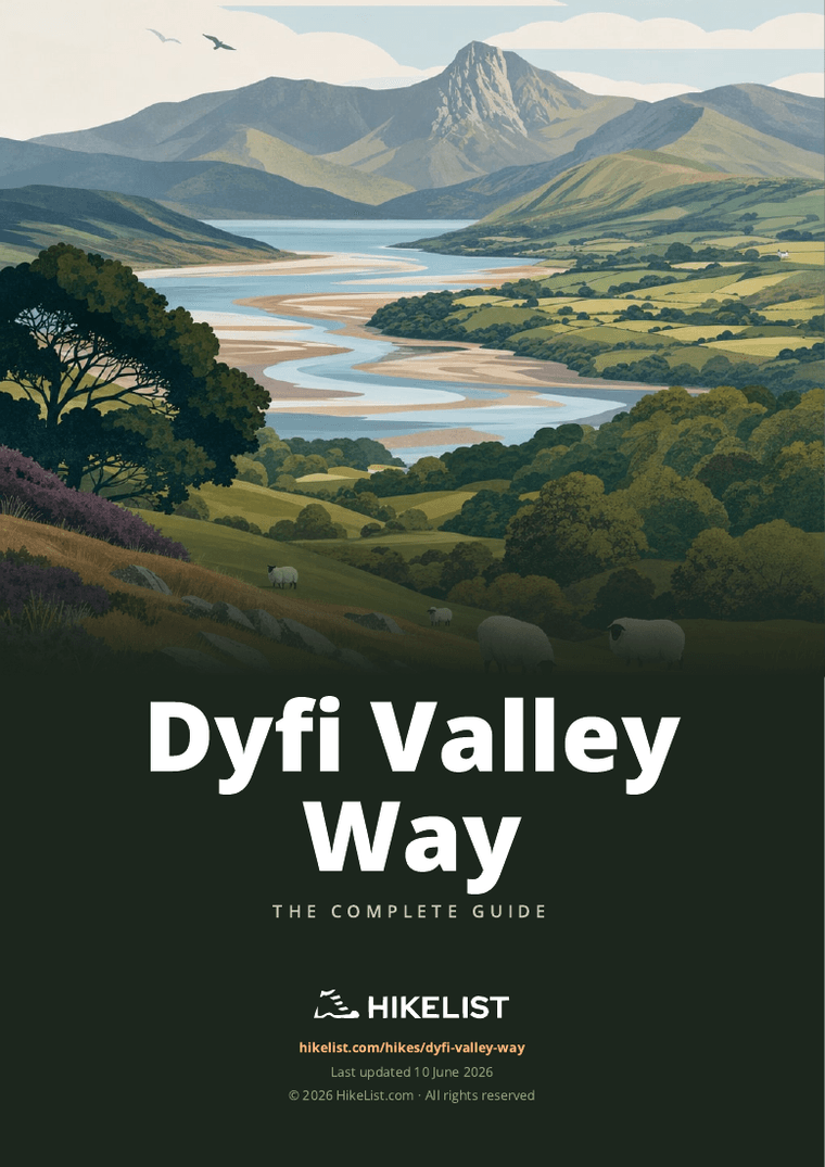
Dyfi Valley Way
How would you rate Dyfi Valley Way?
Tap a star to share your experience and help other hikers.
Dyfi Valley Way: A Complete Hiking Guide
HikeList Score
Dyfi Valley Way scored 91/100 on HikeList's trail-quality metrics.
See score breakdownHide breakdown
- Ideal length 98
- Balanced challenge 84
- Scenery & wildness 91
- Varied terrain 100
- Accommodation 100
- Food & support 74
- Path quality 87
- Season flexibility 89
Computed from length, challenge, scenery & wildness, terrain variety, accommodation, food & support, path quality and season flexibility.
The Dyfi Valley Way is a hard 164 km horseshoe walk in Mid Wales, following the Afon Dyfi from Aberdyfi on Cardigan Bay up to the Aran mountains and back to the estuary at Borth. Allow 6-10 days. It suits experienced walkers who can handle long hilly days, rough forestry, boggy moorland, exposed mountain terrain and partial waymarking. The high point is Aran Fawddwy, 905 m, with about 6,400 m of total ascent across the full route.
Route Overview
The route starts at Aberdyfi, a seaside village on the north shore of the Dyfi estuary in Gwynedd, then works inland via Pennal, the Centre for Alternative Technology near Machynlleth, and the north side of the valley. It reaches the head of the valley around Llanuwchllyn, near Llyn Tegid, before crossing the Aran ridge and descending the south-bank side through places including Llanymawddwy, Dinas Mawddwy, Machynlleth and Borth. Although some listings call it linear because the official start and finish sit on opposite shores of the estuary, it is best planned as a loop or horseshoe. Related Welsh routes include Aber Falls Walk, Anglesey Coastal Path and Beacons Way.
History and Landscape of the Dyfi Valley Way
The Dyfi Valley Way was devised by walker and guidebook author Laurence Main, with the LDWA guide first published in 1996. It was designed to link the Dyfi valley’s cultural and natural landmarks: Machynlleth, where Owain Glyndwr held a Welsh parliament in 1404; the Centre for Alternative Technology; the traditional site of King Arthur’s last battle at Camlan; and the wild upland of the Aran range. The valley also forms the core of the UNESCO-recognised Dyfi Biosphere.
Notable highlights
Aran Fawddwy summit (905 m): The highest point on the Dyfi Valley Way and the highest mountain in Wales south of Snowdon. The climb over the Aran ridge gives the route its most serious mountain section.
Centre for Alternative Technology (CAT): A pioneering eco-centre and visitor attraction in a former slate quarry at Llwyngwern near Machynlleth. The route passes this distinctive landmark on the north side of the valley.
Machynlleth: A historic Mid Wales market town and a practical hub for shops, cafes, transport and accommodation. It is also associated with Owain Glyndwr’s Welsh parliament of 1404.
Site of Camlan: Near Dinas Mawddwy, the Way crosses ground traditionally linked with Camlan, the legendary site of King Arthur’s last battle. It adds a strong heritage element to this upland section.
Dyfi Estuary and Cardigan Bay: The walk begins and ends beside the tidal Dyfi estuary at Aberdyfi and Borth. The nearby Dyfi Biosphere, RSPB Ynys-hir and Cors Fochno/Borth Bog underline the wildlife value of this landscape.
Llanuwchllyn and the Aran approach: This village near Llyn Tegid marks the turning point of the valley horseshoe. It is a key staging area before or after the tougher Aran mountain ground.
Challenges to expect
Expect a demanding long-distance walk rather than a casual valley trail. The Dyfi Valley Way has about 6,400 m of ascent, exposed mountain terrain over the Aran ridge, boggy moorland and rough forestry with stumps, hidden rocks, tussocks and tangled vegetation. Waymarking is only partial, so carry a good map, compass and route guide. Some remote sections have little food or accommodation en route, and the high ground can catch cloud, wind and rain at any time.
HikeList Score
Dyfi Valley Way scored 91/100 on HikeList's trail-quality metrics.
See score breakdownHide breakdown
- Ideal length 98
- Balanced challenge 84
- Scenery & wildness 91
- Varied terrain 100
- Accommodation 100
- Food & support 74
- Path quality 87
- Season flexibility 89
Computed from length, challenge, scenery & wildness, terrain variety, accommodation, food & support, path quality and season flexibility.
Show more data Show less
- Coastal
- Riverside
- Farmland
- Forest
- Moorland
- Mountainous
- Dirt
- Gravel
- Paved
- Rocky
- Boggy
- B&Bs
- Inns
- Hostels
- Campsites
- Pet Friendly
- Campsites
- Water Sources
Download Our Full Guide to Dyfi Valley Way FREE!
Get our comprehensive guide to this hike for free. Save it for later reading or print out at home.
In these collections
Photos from hikers
Taken on the trail by people who've reviewed Dyfi Valley Way.
Dyfi Valley Way: The Complete Guide
 i
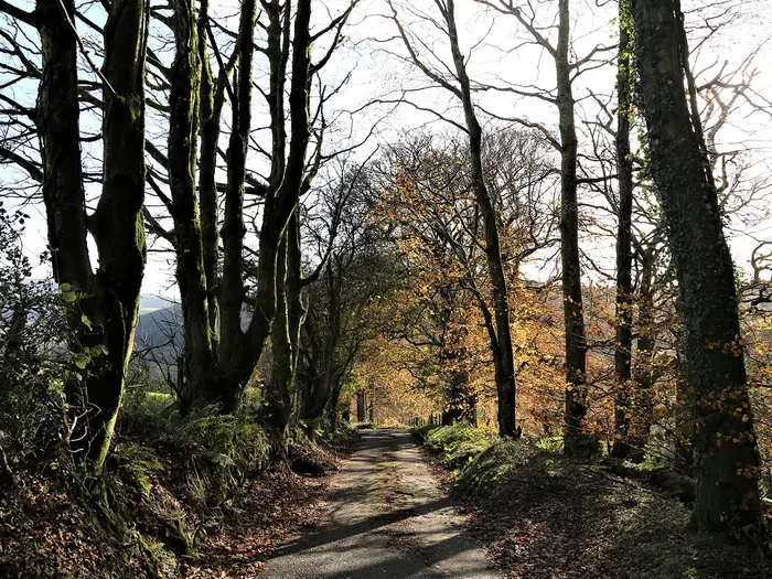
Image by Wendy
i
Image by Wendy The Dyfi Valley Way is a demanding horseshoe through mid-Wales, climbing from Aberdyfi/Aberdovey on Cardigan Bay up the Dyfi valley and returning to the coast at Borth. It links estuary, river, forest, moorland and high mountain ground in a route that suits experienced, self-reliant walkers rather than casual ramblers.
The walk follows the Afon Dyfi (River Dovey) inland through villages, woodland and rough upland forestry before reaching the Aran mountains above Llanuwchllyn. Its high point, Aran Fawddwy at 905 m, is serious Welsh hill country and the hardest section of the route.
The return side brings the route back through Cemmaes, Commins Coch and Machynlleth before dropping towards Tre'r-ddol, Cors Fochno (Borth Bog) and the long beach at Borth. Along the way it passes places with strong mid-Wales character, including Corris, Dinas Mawddwy, Mallwyd and the Centre for Alternative Technology near Llwyngwern.
This is not a continuously waymarked trail and should be planned as a proper mountain and navigation undertaking. Expect wet ground, exposed weather, sparse services between settlements and several days where accommodation, food and transport need arranging before arrival.
This guide covers stages, daily planning, accommodation, food, transport, terrain and the common mistakes to avoid.
Stage-by-Stage Guide
The stages below follow a practical 9-day split using the main valley villages and transport hubs. They are planning stages rather than official sections, and distances may vary depending on accommodation, campsites, diversions and the exact line followed. Because the Dyfi Valley Way is only partly waymarked, each day should be walked with the guidebook, OS mapping and a GPX track rather than by waymarks alone.
Stage 1: Aberdyfi/Aberdovey to Pennal — 14 km
The opening stage leaves Aberdyfi/Aberdovey on the north shore of the Dyfi estuary and begins the inland sweep up the valley. It is a gentler start than the mountain stages later in the route, but it should not be treated as a casual coastal path day: the route is already moving between estuary, lanes, field paths and rising ground.
The main feature is the Afon Dyfi (River Dovey) estuary, with broad views across the tidal water towards the southern shore where the walk will eventually finish at Borth. Aberdyfi/Aberdovey also links with the Meirionnydd Coast Walk, so take care at the start to identify the Dyfi Valley Way line rather than following a coast-route assumption.
Food and water are easiest to organise before leaving Aberdyfi/Aberdovey. Pennal is a small village, so do not assume full resupply at the end of the day; accommodation and evening food should be arranged in advance, or a transfer planned if staying elsewhere.
Aberdyfi/Aberdovey has a Cambrian Coast line station, with Penhelig also nearby on the same branch. Pennal has road access, but public transport should be checked before travelling, especially if using the stage as a day walk.
Navigation is usually less severe here than on the high ground, but the lack of continuous waymarking matters from the outset. Estuary-side paths, lanes and field exits can be easy to misread in poor visibility or fading light, so keep the map to hand rather than relying on occasional signs.
Stage 2: Pennal to Corris via the Centre for Alternative Technology — 16 km
This stage moves away from the lower estuary and into the wooded, slate-quarry landscape around Pantperthog, Llwyngwern and Corris. The Centre for Alternative Technology, set in a former slate quarry near Corris, is the main landmark of the day.
Expect a more enclosed feel than Stage 1, with tracks, woodland paths, lanes and forest sections. Underfoot conditions can be muddy, especially after rain, and the route begins to show the character that makes the Dyfi Valley Way harder than its valley name suggests.
Food and water should be planned before leaving Pennal unless arrangements have been made en route. Corris is one of the better-supported overnight points on the route, but accommodation is still limited compared with major trail towns, so booking ahead is important.
Corris has road access and is among the valley settlements served by local bus links towards Machynlleth and Dinas Mawddwy, but services are sparse and timetables should be checked before travelling. There is no railway station at Corris.
Navigation through wooded and quarry-influenced ground needs attention. Forest tracks can multiply, and a wrong turn may not be obvious immediately; check junctions carefully against the guidebook and mapping.
Stage 3: Corris to Dinas Mawddwy via Aberllefenni and Aberangell — 19 km
Stage 3 is a substantial upland and forest day, linking the slate-quarry country around Corris and Aberllefenni with Aberangell, Mallwyd and Dinas Mawddwy at the foot of the Arans. It is one of the days where the walk feels remote despite passing named villages.
The terrain is varied and often rough: forestry, tracks, lanes, wet ground and sections where old working landscapes have left uneven going. In Dyfi Forest and similar upland woodland, expect mud, tussocks, stumps and hidden stones, especially away from well-made forest roads.
Aberllefenni and Aberangell are the key places passed, with Mallwyd and Dinas Mawddwy forming the end-of-day area. Dinas Mawddwy is a useful stopping point before the high mountain section and is also tied to the folklore of the Red Bandits of Mawddwy and nearby Camlan traditions.
Carry enough food for the full day unless current village services have been checked in advance. Water from natural sources should not be relied on untreated; in wet forestry and moorland country there may be water around, but that is not the same as dependable drinking water.
Dinas Mawddwy has road access and local bus links towards Machynlleth and Corris, but services are limited and should be checked before travel. Accommodation is available in the wider Dinas Mawddwy/Mallwyd area, but beds can be sparse, so this is a stage to book early.
Navigation is a major planning point here. Forest route-finding can be awkward where tracks change, junctions are unsigned or forestry operations alter the feel of the ground. Check before setting out whether any forestry or access diversions apply.
Stage 4: Dinas Mawddwy to Llanymawddwy — 12 km
This is a shorter stage on paper, but it sits in serious terrain and should be treated as positioning for the Aran crossing rather than an easy rest day. The route remains in the Mawddwy side of the valley, with the high ground beginning to dominate the walking.
The day may include lanes, rougher field or hill paths, and wet upland margins. Even on a shorter distance, poor weather can slow progress significantly, especially if the ground is saturated.
The main purpose of ending at Llanymawddwy is to be well placed for the climb towards Aran Fawddwy the next day. Dinas Mawddwy and Mallwyd are the last more obvious service points before this short but important transition, so provisions for Stage 5 should already be sorted.
Food, accommodation and camping arrangements around Llanymawddwy need careful advance planning. Do not assume there will be last-minute beds or evening meals available; this should be checked before travelling.
Public transport is not a dependable safety net for this stage. Road access exists in the valley, but the surrounding hills have little or no public transport, so onward plans should not rely on being able to bail out easily.
Navigation becomes increasingly hill-focused. In mist or low cloud, keep close control of the line and avoid drifting onto unplanned ground before the main mountain day.
Stage 5: Llanymawddwy to Llanuwchllyn over Aran Fawddwy — 18 km
This is the crux stage of the Dyfi Valley Way. It crosses the Aran ridge and reaches Aran Fawddwy, at 905 m the highest point of the route and the highest mountain in Wales south of Yr Wyddfa (Snowdon).
The terrain is exposed, mountainous and potentially serious in poor weather. Expect steep climbing, open ridge walking, boggy approaches, rough ground and very limited shelter. The area is wet by Welsh standards, and low cloud can make navigation difficult even for experienced hill walkers.
Llyn Creiglyn Dyfi, feeding the infant Afon Dyfi, is one of the key landscape features of this high section. Views can be extensive in clear weather, but this stage should never be planned around views alone; safe navigation and weather judgement matter more.
Carry food for the whole day and enough water, or the means to treat water if using upland sources. There should be no assumption of cafés, shops or reliable shelter between Llanymawddwy and Llanuwchllyn.
Llanuwchllyn, near Llyn Tegid (Bala Lake), marks the turning point of the horseshoe. Accommodation exists in and around the village area, but it must be booked ahead because alternatives are limited after a long mountain day.
There is no useful public transport on the ridge itself. Once committed to the high ground, escape options are limited and may involve a long descent to road access, so the stage should only be started in conditions within the party’s ability.
Map and compass skills are essential here. A GPX track is helpful but should not be the only navigation tool; batteries, weather, screen damage and poor signal can all turn a serious hill day into a harder one.
Stage 6: Llanuwchllyn to Cemmaes / Mallwyd — 22 km
After the high point, the route begins the return leg down the wider Dyfi catchment. This is a long stage, and although it leaves the Aran ridge behind, it remains a demanding day with a mix of upland, lanes, tracks and potentially wet ground.
The walking links Llanuwchllyn with the Cemmaes and Mallwyd area, returning towards the Mawddwy side of the valley. It is a day where distance and cumulative fatigue become important: after the Aran crossing, 22 km on mixed terrain can feel much longer than the figure suggests.
Food should be carried from the start unless current services have been checked. Cemmaes and Mallwyd are small settlements, so accommodation and evening meals need arranging before arrival; Dinas Mawddwy may also be part of the practical overnight plan depending on availability.
Public transport in this part of the route is limited. Valley road access is better than on the ridge, but local bus options are sparse and should be checked before travelling.
Navigation remains important because the route is only partly waymarked and may use minor paths, lanes and upland sections rather than one obvious trail corridor. Watch for tiredness-related errors late in the day, especially at junctions and field exits.
Stage 7: Cemmaes / Mallwyd to Machynlleth via Commins Coch — 20 km
Stage 7 continues down the southern return side of the Dyfi Valley Way towards Machynlleth, the main resupply and transport hub of the route. It is another long day, but the finish gives more logistical flexibility than most previous stages.
The route passes through or near Commins Coch before reaching Machynlleth. Expect a mixture of lanes, tracks, farmland, wooded sections and wet ground rather than a simple riverside stroll.
Machynlleth is the key practical highlight of the day. It is the best place on the route for resupply, onward transport planning and resetting gear before the final estuary stages.
Carry enough food from the start for the day, as intermediate services should not be assumed. Once in Machynlleth, food, accommodation and transport options are significantly better than in the smaller valley settlements, though accommodation should still be booked in busy periods.
Machynlleth has a station on the Cambrian line and is the main rail and bus hub for the valley. Local buses link Machynlleth with places including Corris, Dinas Mawddwy and the coast, but current timetables should be checked before building an itinerary around them.
Navigation is generally less committing than the Aran stage, but it still requires care. The route’s partial waymarking means the final approach into town should be followed deliberately, especially where paths, minor roads and settlement edges meet.
Stage 8: Machynlleth to Tre'r-ddol — 17 km
This stage leaves the services of Machynlleth and heads back towards the lower Dyfi estuary, moving from market-town logistics into the wetland and south-side valley landscape. It is an important transition from inland hill country to the final coastal finish.
The terrain is mixed, with paths, tracks, lanes and lowland sections that may be muddy or wet. The wider Dyfi Biosphere setting becomes more apparent as the route approaches the estuary-side wetlands.
The main practical issue is the contrast between Machynlleth and Tre'r-ddol. Machynlleth is the place to buy food, replace supplies and sort transport; Tre'r-ddol is a much smaller overnight point, so accommodation and meals should be arranged before leaving town.
Carry food and water for the stage unless current services along the way have been checked. In lowland wet areas, do not treat visible water as drinkable without proper filtration or treatment.
Machynlleth has rail and bus connections, making it the easiest place to start, pause or leave the walk. Tre'r-ddol has road access, but public transport options should be checked before travelling.
Navigation may involve field paths, lanes and wetland-edge route-finding rather than mountain bearings. Even so, it is easy to lose time if the line is missed in lowland farmland or around minor roads, so keep checking the map through the day.
Stage 9: Tre'r-ddol to Borth — 12 km
The final stage completes the horseshoe to Borth on the south side of the Dyfi estuary. It is shorter than most earlier days, but the ground around Cors Fochno (Borth Bog), the Dyfi Biosphere wetlands and the estuary can still be slow or wet underfoot.
This is the stage where the route reconnects most strongly with the coast. Borth is the finish, a long beach village where the Dyfi Valley Way meets the Wales Coast Path / Ceredigion Coast Path.
Key landscape interest lies in the wetland and estuary setting, including Cors Fochno and nearby nature-reserve country around the Dyfi. Borth is also known for the petrified forest exposed at low tide, although the walking logistics of the Dyfi Valley Way do not depend on tide timing.
Food and water should still be carried from Tre'r-ddol unless current services have been checked. Borth has better end-of-walk facilities than the small villages, but accommodation should be booked ahead if staying after finishing.
Borth has a Cambrian line station, making it a straightforward rail finish compared with the inland stages. Services link through the Cambrian network towards Dovey Junction and Machynlleth, but timetables should be checked before travelling.
Navigation is less mountainous than earlier in the walk, but wetland margins, lanes and route junctions still need attention. Do not relax completely before the finish: the Dyfi Valley Way remains only partly waymarked all the way to Borth.
Recommended Itinerary
The most practical schedule for most walkers is a 9-day traverse from Aberdyfi/Aberdovey to Borth, following the usual horseshoe up the north/east side of the Dyfi valley, over the Arans to Llanuwchllyn, then back down the southern side through Machynlleth. These are indicative walking stages rather than official sections, and overnight plans should be built around available beds, campsites or pre-arranged logistics.
Distances on the Dyfi Valley Way vary between mapping sources, so use these figures for planning only and check official mapping before booking accommodation.
Standard 9-day itinerary
| Day | From | To | Approx. distance | Why this stage makes sense | Services/accommodation notes |
|---|---|---|---|---|---|
| 1 | Aberdyfi/Aberdovey | Pennal | 14 km | A measured opening day from the coast into the Dyfi valley, with enough time for a rail arrival at Aberdyfi or Penhelig if starting the same day. | Aberdyfi/Aberdovey is the stronger service base at the start, with rail access on the Cambrian Coast line. Pennal is a smaller overnight stop, so accommodation availability should be checked before committing to this stage. |
| 2 | Pennal | Corris, via the Centre for Alternative Technology | 16 km | Moves into the wooded north-side terrain and reaches one of the better-known valley villages before the rougher interior stages. | Corris is one of the more practical overnight points on the northern side of the route. Do not rely on finding food or beds without booking ahead. |
| 3 | Corris | Dinas Mawddwy, via Aberllefenni and Aberangell | 19 km | A tougher linking day through slate-quarry and forestry country, placing the route at the foot of the Aran section. | Dinas Mawddwy is an important staging point before the high ground. Carry food through the day, as intermediate facilities are limited. |
| 4 | Dinas Mawddwy | Llanymawddwy | 12 km | A shorter day before the most serious mountain crossing. This creates a sensible approach to the Aran ridge rather than combining too much ascent into one very hard stage. | Llanymawddwy is a small and exposed pre-mountain stop; accommodation options are limited and must be checked well ahead. This is also a useful weather-buffer point before committing to Aran Fawddwy. |
| 5 | Llanymawddwy | Llanuwchllyn, over Aran Fawddwy | 18 km | The key mountain day of the walk, crossing the Aran ridge and the 905 m high point before descending towards the head of the valley near Llyn Tegid. | Treat this as the most serious day of the itinerary. Start early, carry full hill kit, and be prepared to delay if the forecast makes the ridge unsafe. Llanuwchllyn is a logical overnight stop after the crossing, but booking ahead is essential. |
| 6 | Llanuwchllyn | Cemmaes / Mallwyd | 22 km | Begins the return leg down the southern side of the horseshoe and makes useful distance after the turning point at Llanuwchllyn. | This is one of the longer standard days. Overnight choices around Cemmaes / Mallwyd are limited compared with Machynlleth, so confirm the exact stop before fixing the day’s mileage. |
| 7 | Cemmaes / Mallwyd | Machynlleth, via Commins Coch | 20 km | A substantial valley-and-upland stage that reaches the main resupply and transport hub of the whole route. | Machynlleth is the best place on the route for restocking, transport connections and flexible overnight options. It is the obvious place to build in a rest night if the previous stages have been wet or slow. |
| 8 | Machynlleth | Tre'r-ddol | 17 km | Leaves the main hub and works back towards the lower Dyfi estuary, setting up a short final day to Borth. | Tre'r-ddol is a small stop rather than a major service centre. Check accommodation before booking; if nothing is available, adjust the stage using available transport or a pre-arranged transfer. |
| 9 | Tre'r-ddol | Borth | 12 km | A short finishing stage through the estuary-side landscape to the coast and the Cambrian line station at Borth. | Borth has rail access on the Cambrian line and links with the Wales Coast Path / Ceredigion Coast Path. Train times should be checked before travelling, especially if finishing late in the day. |
Slower 10-day option
A 10-day schedule suits walkers who want more margin for the Aran ridge, wet ground and navigation on the partly waymarked sections. The most useful extra time is around the central mountain section, especially Dinas Mawddwy, Llanymawddwy, Aran Fawddwy and Llanuwchllyn.
The simplest slower plan is to keep the 9-day structure but add a buffer night before or after the Aran crossing. This makes it easier to wait out poor weather rather than being forced onto exposed ground in cloud, wind or heavy rain.
Breaking other long days may also be possible, particularly around the Cemmaes / Mallwyd to Machynlleth leg, but intermediate accommodation is not guaranteed. This should be checked before travelling.
Faster 6–7 day option
A 6–7 day itinerary is only realistic for very fit, self-reliant walkers who are comfortable with long days, rough ground and carrying enough food between sparse services. It will usually mean combining some of the standard stages, accepting fewer bail-out options and possibly using camping or pre-arranged logistics.
The Aran Fawddwy crossing should not be treated as a stage to squeeze into an overlong day in poor weather. Even on a fast schedule, this section needs a clear forecast, early start and full navigation plan.
Best itinerary choice
For most independent hikers, the 9-day itinerary is the safest starting point: it follows sensible village hubs, gives the Aran crossing its own day, and reaches Machynlleth at a useful point for resupply and transport. Slower walkers should add a weather or recovery day near the high ground; faster walkers should only compress the route if accommodation, food carrying and navigation are already planned in detail.
Planning the Route
The Dyfi Valley Way is best planned around logistics rather than headline mileage. The walking is slow in places: rough forestry, boggy moorland, wet ground, pathless sections and the Aran ridge all reduce daily pace, especially with a backpack.
Most walkers should allow 7–10 days, with 9 days a sensible planning baseline. Fit backpackers have completed it in around 6 long days, but that leaves little margin for poor weather, route-finding delays or the exposed crossing of Aran Fawddwy.
How many days to allow
A steady 9-day plan works well because it uses the main valley settlements and keeps the hardest mountain day separate. The usual direction is from Aberdyfi/Aberdovey, up the north/east side of the Dyfi valley to Llanuwchllyn, then back down the south side through Machynlleth to Borth.
| Plan | Who it suits | Main drawback |
|---|---|---|
| 6 days | Very fit, self-reliant backpackers comfortable with long rough days | Little spare time for navigation errors, bad weather or slow boggy ground |
| 7–8 days | Strong walkers wanting a tighter schedule | Some days may still be demanding, and accommodation points may not line up neatly |
| 9 days | Most experienced long-distance walkers | Requires advance booking across several small settlements |
| 10+ days | Walkers wanting more weather flexibility or shorter days | Extra nights can be hard to arrange in the sparsest areas |
The route does not have a National Trail-style chain of official stages. Overnight stops are shaped by where accommodation, camping or transport can realistically be found, not by evenly spaced mileage.
Accommodation drives the itinerary
Accommodation is mixed but sparse. Beds and campsites are concentrated around places such as Aberdyfi/Aberdovey, Corris, Dinas Mawddwy, Llanuwchllyn, Machynlleth and Borth, with fewer options on the upland and forest sections.
Book well ahead, particularly around the middle of the walk where the route passes Dinas Mawddwy, Llanymawddwy, the Aran crossing and Llanuwchllyn. A missed booking or full village can force a long extra road transfer or an awkward change to the whole itinerary.
Do not assume that every stage has food, shelter or a shop en route. Carry enough food for the day, and plan evening meals and breakfast around the actual facilities at each overnight stop. Machynlleth is the main resupply and transport hub on the return side of the horseshoe.
Navigation planning is essential
This is only a partly waymarked route. There is no continuous National-Trail-style waymarking, so the walk should be planned with the Laurence Main guidebook, a reliable GPX track and proper OS mapping.
Recommended OS mapping has included Explorer OL18, Explorer OL23, Landranger 135 and OL215, but current sheet numbers should be checked before buying. A phone GPS is useful, but it should not be the only navigation tool: map and compass competence is important, especially in forestry, bog and poor visibility on the high ground.
Treat the Aran section as the key mountain day
The stage from Llanymawddwy to Llanuwchllyn over Aran Fawddwy is the serious mountain section of the route. It reaches the highest ground on the walk and crosses exposed terrain where wind, cloud and rain can make navigation and progress difficult.
Build flexibility around this day if possible. A tightly booked schedule with no spare time can push walkers into crossing the Arans in unsuitable conditions, which is poor planning on this route.
Late spring, summer and early autumn give the best combination of daylight and underfoot conditions. Even then, this is one of the wetter parts of Wales, so waterproofs, warm layers and a realistic bad-weather plan matter more than on a simple valley walk.
Section hiking and shortening the walk
Section hiking is practical at the estuary ends and around the main transport hubs, but less simple in the hills. The Cambrian line serves Aberdyfi/Aberdovey, Penhelig, Borth and Machynlleth, with services meeting at Dovey Junction. Services are roughly two-hourly, but current timetables should be checked before travelling.
Local buses link places such as Machynlleth, Corris, Dinas Mawddwy and the coast, but the mountain and forest sections have no public transport. For section walkers, it is usually easier to plan around valley towns and accept that some upland stages may need a full-day commitment.
There is no neat built-in short version of the Dyfi Valley Way. The simplest way to shorten the walk is to finish or restart at a transport-accessible settlement such as Machynlleth, Corris, Dinas Mawddwy, Aberdyfi/Aberdovey or Borth, depending on the section being walked.
Extensions are easier at the ends. Aberdyfi/Aberdovey links with the Meirionnydd Coast Walk, while Borth links with the Wales Coast Path / Ceredigion Coast Path.
Key checks before setting off
Before booking a final itinerary, check:
- current Cambrian line and local bus timetables;
- accommodation availability in the smaller valley settlements;
- food and water resupply between overnight stops;
- current OS map sheet numbers and GPX reliability;
- forestry operations, access changes or diversions;
- mountain weather for the Aran Fawddwy crossing;
- enough contingency for a delayed or postponed high-level day.
For this route, the most important planning decisions are not permits or sightseeing stops. They are accommodation, transport, food carry, navigation and whether the weather gives a safe window for the high ground.
Towns, Villages and Overnight Stops
Accommodation and services on the Dyfi Valley Way are unevenly spaced. The practical overnight hubs are Aberdyfi/Aberdovey, Corris, Dinas Mawddwy, Llanuwchllyn, Machynlleth and Borth, with smaller villages useful only where accommodation has been arranged in advance.
Do not plan this route on the assumption that every named village has a shop, evening meal or spare bed. Several stages cross forestry, moorland or mountain ground with little or nothing en route, so carry food between confirmed resupply points and check current opening times before travelling.
Aberdyfi/Aberdovey
Aberdyfi/Aberdovey is the usual starting point, on the north shore of the Dyfi estuary. It is one of the easiest places on the route for pre-walk accommodation, with the best choice likely to be before leaving the coast rather than after the first day inland.
The village has its own Cambrian Coast line station, with a second halt at Penhelig. This makes it a practical place to arrive by public transport, especially when linking with Machynlleth, Borth or Dovey Junction.
Use Aberdyfi/Aberdovey to sort last-minute supplies, check weather and make sure the first inland accommodation is secured. Once the route leaves the estuary and heads towards Pennal and the Dyfi Forest side of the valley, services become much less predictable.
Pennal
Pennal is a useful early staging point between Aberdyfi/Aberdovey and Corris, and the 9-day itinerary uses it as the first overnight stop. It also lies close to the return side of the horseshoe between Machynlleth and Tre'r-ddol, so it can be relevant twice when planning variants or shorter sections.
Accommodation and food should be arranged before arrival rather than assumed. Pennal is not the route’s main resupply hub, and walkers should be ready to carry food onward to Corris or back towards Machynlleth depending on direction.
Local bus options in the Dyfi valley and towards the coast may help with section-walking, but timetables are sparse and changeable. This should be checked before travelling.
Pantperthog
Pantperthog sits on the approach towards the Centre for Alternative Technology and Corris, after the route has moved into the wooded, quarry-influenced side of the valley. It is more a passing place than a natural full-service overnight base.
Do not rely on Pantperthog for food, shops or accommodation unless something has been booked or checked in advance. Most walkers will treat Corris as the more practical stop in this part of the route.
Centre for Alternative Technology, Llwyngwern
The Centre for Alternative Technology is passed at Llwyngwern near Corris, set in a former slate quarry. For walkers it is mainly a landmark on the Pennal to Corris stage rather than a normal overnight stop.
Any visitor facilities, opening hours or access arrangements should be checked before travelling. It should not be treated as a guaranteed food or resupply point on a long-distance itinerary.
Corris
Corris is one of the more useful overnight villages on the northern side of the route. It sits after the Pennal stage and before the rougher Dyfi Forest and upland sections towards Aberllefenni, Aberangell and Dinas Mawddwy.
Accommodation in and around Corris is part of the route’s small cluster of viable beds, including the general mix of B&Bs, inns, hostels, bunkhouses and campsites found along the route. Availability is limited compared with larger walking centres, so booking ahead is important.
Local bus services link Corris with Machynlleth and other valley settlements, but there is no useful public transport once committed to the higher forestry and moorland sections. Corris is a sensible place to reassess weather, food and navigation before the more remote middle days.
Aberllefenni
Aberllefenni is passed between Corris and Dinas Mawddwy, in the slate-quarry and forestry landscape on the north-eastern side of the Dyfi valley. It is not one of the main overnight hubs in the route brief.
Treat Aberllefenni as a waypoint rather than a dependable service stop. Food, accommodation and transport options should be checked before travelling if planning to break the stage here.
Aberangell
Aberangell lies on the Corris to Dinas Mawddwy stage and is useful for orientation before the route continues towards the Mawddwy villages. It should not be assumed to provide a full resupply.
Any accommodation or meal plans here need to be arranged in advance. This section includes remote forestry and upland ground, so carry enough food and water margin for the whole day rather than depending on intermediate services.
Mallwyd
Mallwyd sits near Dinas Mawddwy and is relevant both on the northbound approach to the Arans and on the later stage listed as Cemmaes / Mallwyd to Machynlleth. It is a useful planning point at the foot of the mountain section, but beds and meals should still be booked ahead.
Local buses in the wider Machynlleth–Dinas Mawddwy corridor may help with access or bail-out logistics, but services are limited. This should be checked before travelling, especially outside summer or at weekends.
Dinas Mawddwy
Dinas Mawddwy is one of the key inland overnight stops on the Dyfi Valley Way. It sits at the foot of the Arans and is the natural place to prepare for the most serious mountain part of the walk.
The village is included among the route’s main accommodation clusters, but that does not mean there is plentiful capacity. Book well ahead, particularly if trying to keep to a fixed 7–10 day schedule.
Use Dinas Mawddwy for food and weather planning before the Aran section. The onward stages towards Llanymawddwy and Llanuwchllyn leave the easier valley logistics behind, and poor weather on the high ground can make timing and navigation much more serious.
Llanymawddwy
Llanymawddwy is used as an overnight point in the indicative 9-day itinerary before the crossing to Llanuwchllyn over Aran Fawddwy. Its position makes it strategically important, but it should not be treated as a guaranteed service centre.
Accommodation, evening meals and any local transport options must be checked and booked before travelling. If no suitable bed is available, the itinerary may need adjusting around Dinas Mawddwy, Mallwyd or a carefully planned backpacking option.
This is a critical place to make a go/no-go decision for the high ridge. Carry enough food, warm layers and navigation equipment for a long exposed mountain day.
Aran Fawddwy
Aran Fawddwy is the high point of the route, not an overnight stop. There are no village services, accommodation or public transport on the ridge.
The crossing between Llanymawddwy and Llanuwchllyn is the most serious ground on the Dyfi Valley Way, with exposed mountain terrain and navigation that must not depend on waymarks. Plan this day as a self-contained mountain stage with food, water, waterproofs, insulation, map, compass and a realistic bad-weather alternative.
Llanuwchllyn
Llanuwchllyn marks the turning point of the horseshoe near Llyn Tegid (Bala Lake). It is one of the route’s better overnight possibilities and an important place to recover after the Aran crossing.
Accommodation exists in the wider village area, including the route’s general mix of small-scale beds and camping options, but capacity is limited and should be booked in advance. Do not arrive after the mountain day without a confirmed place to stay or a clear onward plan.
Food availability should be checked before travelling. After Llanuwchllyn the route heads back down the southern side of the Dyfi catchment towards Cemmaes, Mallwyd and Machynlleth, with more long rural sections before the main resupply hub.
Cemmaes
Cemmaes is used with Mallwyd as a possible overnight area on the Llanuwchllyn to Machynlleth side of the route. It is a practical staging name rather than a place to assume easy services.
Accommodation and food options should be checked before committing to this stop. If walking a fixed itinerary, make sure the next day into Machynlleth is realistic from the exact bed or campsite booked, not just from the village name on a summary itinerary.
Commins Coch
Commins Coch lies on the approach to Machynlleth from the Cemmaes / Mallwyd side. It is mainly a route waypoint rather than a primary overnight stop.
Do not rely on Commins Coch for resupply or accommodation unless current arrangements have been made in advance. Most walkers will continue to Machynlleth for the route’s strongest transport and food logistics.
Machynlleth
Machynlleth is the main resupply and transport hub on the Dyfi Valley Way. It sits on the southern return side of the route and is the most useful place to reset plans, restock food, replace kit, arrange onward travel or shorten the walk.
The town has a railway station on the Cambrian line, with services connecting towards Borth, Aberdyfi/Aberdovey via Dovey Junction, and the wider rail network. It is also the main bus hub for local services linking the coast, Corris and Dinas Mawddwy areas, though current timetables should be checked before travelling.
Accommodation is more likely here than in the smaller inland villages, but booking ahead is still wise. Machynlleth is also the best place on the route to build in a rest night or contingency night if poor weather has delayed the Aran crossing or forestry stages.
Tre'r-ddol
Tre'r-ddol is the final overnight stop in the indicative 9-day itinerary before Borth. It lies on the lowland approach to the estuary and wetlands after the route has left Machynlleth.
Accommodation and food should be arranged in advance, as this is not identified as one of the route’s main service hubs. If no suitable stop is available, walkers may need to adjust the Machynlleth-to-Borth finish into a longer day or arrange transport.
This section is logistically easier than the Arans, but it still needs planning. Do not assume late-day food or public transport without checking current options.
Borth
Borth is the finish, on the south side of the Dyfi estuary, where the route meets the Wales Coast Path / Ceredigion Coast Path. It is one of the most practical places on the walk for finishing accommodation and onward transport.
Borth has a Cambrian line station, making it straightforward to leave by rail or connect back towards Machynlleth, Dovey Junction and the opposite side of the estuary. Train frequency is roughly two-hourly on the Cambrian services, but current times should be checked before booking onward travel.
As a coastal village, Borth is a sensible place to plan a final night rather than rushing for the last train after a wet or delayed day. Accommodation should still be booked ahead during busy periods.
Getting to the Start
By train
Aberdyfi/Aberdovey is the practical starting point, with its own station on the Cambrian Coast line. There is also a second halt at Penhelig, just along the coast, but most walkers should plan around Aberdyfi/Aberdovey unless their accommodation is nearer Penhelig.
The Cambrian line is the key public transport artery for the whole route. Aberdyfi/Aberdovey and Penhelig are on the Cambrian Coast branch towards Pwllheli, while Borth and Machynlleth are on the Aberystwyth branch; services meet at Dovey Junction. Trains are roughly two-hourly, but current timetables and engineering work should be checked before travelling.
For walkers arriving from elsewhere in the UK, Machynlleth is the main rail hub for the Dyfi valley. A common approach is to travel to Machynlleth, then continue by Cambrian line train via Dovey Junction to Aberdyfi/Aberdovey. Allow enough time for missed connections: the service is useful, but not frequent enough to treat as a turn-up-and-go urban railway.
The finish at Borth also has a station, which makes the end-to-start logistics easier than many upland Welsh walks. If leaving a vehicle near the start, the return from Borth to Aberdyfi/Aberdovey is normally by train via Dovey Junction; this should be checked before committing to parking or accommodation plans.
By bus
Bus travel is possible in the Dyfi valley, but it is less straightforward than the train for reaching Aberdyfi/Aberdovey. Machynlleth is the main bus hub, with local TrawsCymru/Lloyds-style and Bro Ddyfi/Machynlleth services linking Machynlleth, Corris, Dinas Mawddwy and parts of the coast.
For the actual start, the train is usually the cleaner option. If using buses to reach the coast, check the latest timetables carefully and build in a backup plan, especially on Sundays, bank holidays or if arriving late in the day. This should be checked before travelling.
Buses are more useful for section-hiking and for contingency plans around the valley towns than for the remote upland and forest sections. Do not plan on public transport being available from the high ground, Dyfi Forest or the Aran ridge.
By car
Driving to Aberdyfi/Aberdovey is possible, but the route is not a simple out-and-back walk: it starts at Aberdyfi/Aberdovey on the north side of the estuary and finishes at Borth on the south side. That means the car logistics need deciding before the first day.
The simplest car-based plan is to leave the car at one end and use the Cambrian line to connect the two estuary villages via Dovey Junction. Many walkers will find it easier to park at or near their first night’s accommodation and return by train from Borth at the end, but long-stay parking suitability must be checked locally before travelling.
Do not assume that a seafront or village car park allows unattended multi-day parking. Check current parking rules, charges and any overnight restrictions, and ask accommodation providers in Aberdyfi/Aberdovey whether they can advise on legal long-stay options.
Taxis can help with awkward arrivals, missed connections or shortened itineraries, but they should be booked ahead. The useful places to arrange transfers are the valley towns and rail-served settlements such as Machynlleth, Aberdyfi/Aberdovey and Borth; do not rely on finding a taxi at short notice in the smaller villages or near the mountain sections.
From the nearest airport
There is no airport at Aberdyfi/Aberdovey or in the immediate Dyfi valley. The practical approach for anyone flying into the UK is to connect into the rail network and aim for Machynlleth, Dovey Junction or Aberdyfi/Aberdovey by train.
Because airport rail connections, onward train routes and late-evening arrivals vary, this should be checked before travelling. If the flight lands late in the day, it is safer to overnight on the rail approach or in Machynlleth rather than risk missing the final useful connection to the coast.
Where to stay before starting
Aberdyfi/Aberdovey is the best place to stay before starting if you want to step straight onto the route in the morning. Accommodation is available in the village, but beds should be booked ahead, particularly in the main walking and holiday season.
Machynlleth is the main fallback if coastal accommodation is full or if transport connections make a same-day arrival to Aberdyfi/Aberdovey awkward. It is the route’s principal rail and bus hub, and you can take the Cambrian line to Aberdyfi/Aberdovey for the start.
The first stage to Pennal is not the hardest day of the walk, but starting tired after a complicated journey is still a poor choice on a route with sparse services later on. Arrive the night before if possible, buy any last supplies before leaving the coast, and check the next day’s accommodation or camping plan before setting out.
Getting Home from the Finish
By train
Borth is one of the easier places to leave the Dyfi Valley Way because the village has its own station on the Cambrian line. Services are roughly two-hourly, but this is still a rural railway: check the current timetable before committing to a same-day connection, especially on Sundays, bank holidays or after a late finish.
For onward rail travel, trains from Borth use the Aberystwyth branch and connect into the wider Cambrian line through Dovey Junction and Machynlleth. Machynlleth is the main rail hub for the valley and is the best place to aim for if onward travel involves changing trains or combining rail with bus.
If the car or first night’s accommodation is back at the start, the practical rail link is Borth to Dovey Junction, then onto the Cambrian Coast branch for Aberdyfi/Aberdovey or Penhelig. Allow time for the connection: Dovey Junction is useful for changing lines, but it is not a fallback place for food, taxis or accommodation planning.
By bus
Bus options from the finish are more limited than the train. Local TrawsCymru/Lloyds-style services in the Dyfi area link Machynlleth with valley and coastal settlements, but the exact usefulness from Borth depends on the day and time.
For most walkers, the bus is a secondary option rather than the main exit plan. Use it if it fits a local transfer to Machynlleth or nearby accommodation, but do not rely on turning up and finding frequent departures. This should be checked before travelling.
By car/taxi
If parking a vehicle for the end of the walk, Borth is the most convenient finish-point base because it avoids having to cross back over the estuary tired and late in the day. If the vehicle is left at Aberdyfi/Aberdovey, the railway link via Dovey Junction is usually the simplest way back.
Taxis can help with awkward accommodation transfers or a late finish, but they should be booked in advance. Borth is a small coastal village, and it is unwise to assume an available taxi at short notice after completing the final stage.
Machynlleth is the better fallback hub for wider transport and local transfer planning. If there is any doubt about finishing time, arrange the final night or the onward taxi before setting out from Tre'r-ddol.
From the nearest airport
There is no airport at Borth, and the Dyfi Valley Way is best treated as a rail-first route rather than an airport-transfer route. For air travel, plan to connect by rail from Borth via the Cambrian line and Machynlleth to whichever UK airport gives the most practical onward journey.
Airport rail connections, late-evening services and Sunday timetables are all timetable-dependent. This should be checked before booking flights, particularly if trying to leave Wales on the same day as finishing the walk.
Where to stay at the finish
Staying in Borth at the end is often the least stressful option, especially if the final day runs late, the weather slows progress, or the next train connection is poor. Accommodation is available around the finish village, but it should be booked ahead rather than treated as a guaranteed walk-in option.
Borth also works well if continuing onto the Wales Coast Path / Ceredigion Coast Path. If heading home the next morning, an overnight stop gives a much easier rail start and avoids rushing the final 12 km stage from Tre'r-ddol.
Which Direction Should You Walk?
The usual direction for the Dyfi Valley Way is Aberdyfi/Aberdovey to Borth, following the horseshoe up the north/east side of the Dyfi valley, over the Aran ridge to Llanuwchllyn, then back down the south side through Machynlleth to the coast. This is the direction that best matches the standard route description and the practical nine-day stage pattern.
The route can be walked in reverse, but there is little advantage unless accommodation, transport timings or weather make it more convenient. Because the walk is only partly waymarked, direction is less important than having the Laurence Main guidebook, GPX and OS mapping set up for the way you intend to walk.
Standard direction: Aberdyfi/Aberdovey to Borth
This direction gives the route a clear shape. It starts on the north shore of the Dyfi estuary at Aberdyfi/Aberdovey, works inland through Pennal, Corris, Aberllefenni, Aberangell, Mallwyd and Dinas Mawddwy, then reaches the main mountain crossing over Aran Fawddwy before turning back from Llanuwchllyn.
After the high ground, the walk returns down-valley through Cemmaes, Commins Coch and Machynlleth before finishing across the lower estuary landscape at Tre'r-ddol and Borth. For most walkers, this gives the best progression: coast and estuary, then forest and upland, then the Arans, then a long descent in scale back towards the wetlands and beach.
It also places the serious Aran section around the middle of a typical itinerary rather than right at the start or at the very end. By then, legs and routines are usually settled, but there is still enough flexibility to wait out poor weather if accommodation allows.
Reverse direction: Borth to Aberdyfi/Aberdovey
Walking from Borth to Aberdyfi/Aberdovey is perfectly feasible, but it changes the feel of the walk. The opening days are lower and more settled in character, moving from the coast and estuary towards Machynlleth before the route heads deeper into the hill country.
The main mountain section then comes later in the walk, after the return side of the horseshoe has already been completed. That may suit strong walkers who prefer to build towards the Arans, but it can also mean reaching the hardest navigation and exposure when tired or when accommodation choices have already constrained the schedule.
Reverse walkers also need to be more careful with route-finding instructions if using material written around the traditional direction. On a partly waymarked route with forestry, boggy moorland and pathless hill ground, small navigational ambiguities matter.
Transport and accommodation considerations
Transport does not strongly favour either direction. Aberdyfi/Aberdovey, Penhelig, Borth and Machynlleth are all on the Cambrian rail network, with services meeting through Dovey Junction, and Machynlleth is the main rail and bus hub for the valley. Current train and bus times should be checked before travelling, especially if relying on local buses around Corris, Dinas Mawddwy or the coast.
Accommodation may be the bigger deciding factor. Beds and camping options are sparse away from the towns and villages, and the remote upland and forest stages leave little room for improvisation. If the only workable bookings fall into place in the reverse direction, that is a valid reason to walk it that way.
For most itineraries, the standard direction fits the natural accommodation hubs well: Aberdyfi/Aberdovey, Pennal, Corris, Dinas Mawddwy, Llanymawddwy, Llanuwchllyn, Cemmaes or Mallwyd, Machynlleth, Tre'r-ddol and Borth. These are practical stopping points rather than official stages, so the final plan should follow actual availability.
Climbs, weather and the Aran ridge
Neither direction makes the Dyfi Valley Way easy. The route has around 6,422 m of ascent, rough forestry, boggy moorland and exposed mountain ground, and the Aran ridge remains the key seriousness in both directions.
The main directional issue is not whether the climb is easier one way, but whether the Aran day can be walked in safe conditions. In poor visibility, high wind or heavy rain, the exposed ground around Aran Fawddwy demands confident navigation and conservative decision-making. Build enough flexibility into the itinerary to avoid being forced over the ridge in unsuitable weather.
Recommendation
For most hikers, the best direction is Aberdyfi/Aberdovey to Borth. It is the traditional and most practical way to experience the route, gives a strong scenery progression from estuary to mountain and back to coast, and ends cleanly at Borth with a beach finish and rail access.
Walk it in reverse only if accommodation, public transport timings or a specific weather window make that the better plan. In either direction, the key planning priorities are the same: book early, carry enough food for the sparse sections, and treat the Aran crossing as a serious mountain day rather than just another stage of a valley walk.
Accommodation Along the Route
Accommodation is one of the main planning constraints on the Dyfi Valley Way. This is not a walk where you can assume a bed, meal and shop at the end of every stage: the route links a handful of useful valley and coast settlements with long stretches of forestry, moorland and mountain where there may be little or nothing en route.
The strongest bases are Aberdyfi/Aberdovey, Machynlleth and Borth, with further options around Corris, Dinas Mawddwy/Mallwyd and Llanuwchllyn. Smaller places such as Pennal, Aberllefenni, Aberangell, Llanymawddwy, Cemmaes, Commins Coch and Tre'r-ddol need more care, as availability can be limited and may dictate your stage lengths.
Best overnight stops
A practical 9-day itinerary usually needs overnight stops around:
- Aberdyfi/Aberdovey before starting.
- Pennal after the first shorter stage.
- Corris after crossing via Pantperthog and the Centre for Alternative Technology.
- Dinas Mawddwy before the approach to the Arans.
- Llanymawddwy before the Aran Fawddwy crossing.
- Llanuwchllyn after the high mountain stage.
- Cemmaes / Mallwyd on the return leg towards Machynlleth.
- Machynlleth, the best resupply and transport hub on the route.
- Tre'r-ddol before the final stage to Borth.
- Borth at the finish.
These are planning hubs rather than official stage ends. In practice, accommodation availability may force a shorter or longer day, especially around Llanymawddwy, Cemmaes/Mallwyd and Tre'r-ddol.
| Place | Accommodation level | Best for | Notes |
|---|---|---|---|
| Aberdyfi/Aberdovey | Good | Start-night accommodation, rail access, pre-walk supplies | One of the easier places to begin, with a Cambrian Coast line station and a second halt at Penhelig. Book ahead in the main walking season and at weekends. |
| Pennal | Limited | First overnight on a 9-day schedule | Useful for keeping Day 1 manageable, but do not assume late availability. If no bed is available, the opening stage may need redesigning around transport or a longer day. |
| Pantperthog / Centre for Alternative Technology area | Limited | Possible intermediate stop or adjustment point | Passed before Corris on the north side of the valley. Treat as a planning fallback rather than a guaranteed accommodation hub. |
| Corris | Limited | Overnight after the Dyfi Forest/CAT stage | One of the named clusters for accommodation, including hostel/bunkhouse-style options in the wider area. Availability should be checked before fixing stage distances. |
| Aberllefenni | Limited | Possible route-side stop or emergency shortening | Small settlement on the way towards Dinas Mawddwy. Do not rely on it as the main overnight unless accommodation has been arranged in advance. |
| Aberangell | Limited | Possible break between Corris and Dinas Mawddwy | Useful on paper for adjusting the Corris–Dinas Mawddwy section, but services are limited. Check all arrangements before travelling. |
| Mallwyd | Limited | Overnight near Dinas Mawddwy or on the return leg | Practical for stages around the Mawddwy valley and the Cemmaes/Mallwyd return section. Availability is limited, so early booking matters. |
| Dinas Mawddwy | Limited | Key stop before the Aran approach | One of the most important overnight points before the high mountain section. Secure accommodation before committing to the next day’s plan. |
| Llanymawddwy | Limited | Positioning for the Aran Fawddwy crossing | Strategically important but sparse. This is a critical booking: without a bed or camping plan here, the Aran stage logistics become much harder. |
| Aran Fawddwy / Aran ridge | None | Mountain crossing only | No accommodation or services should be expected on the high ground. Carry food, weatherproof kit and navigation equipment. |
| Llanuwchllyn | Limited | Recovery night after the Aran crossing; turning point near Llyn Tegid | A key stop after the hardest mountain day. Book ahead, particularly if walking in the main season. |
| Cemmaes | Limited | Return-leg overnight between Llanuwchllyn and Machynlleth | Often paired with Mallwyd in stage planning. Treat availability as limited and confirm before building an itinerary around it. |
| Commins Coch | Limited | Possible adjustment point before Machynlleth | Passed on the approach to Machynlleth. Useful for route planning, but not a place to rely on without pre-arranged accommodation or transport. |
| Machynlleth | Good | Rest, resupply, transport connections, flexible staging | The strongest mid-route hub, with rail and bus links and better services than the smaller valley villages. A sensible place for a rest or logistics reset. |
| Tre'r-ddol | Limited | Final overnight before Borth | A useful stop for keeping the last day short. Availability should be checked before travel. |
| Borth | Good | Finish-night accommodation, rail departure, Wales Coast Path link | One of the easier places to finish, with a Cambrian line station and coastal accommodation. Book ahead in busy periods. |
Booking strategy
Accommodation should be booked before starting, especially if walking the full route in one continuous journey. The weak points are not the coast or Machynlleth, but the smaller valley and upland-edge settlements where there may be only a small number of suitable beds.
The most important nights to fix early are Llanymawddwy, Llanuwchllyn, Dinas Mawddwy/Mallwyd, Cemmaes/Mallwyd and Tre'r-ddol. These affect the hardest and least flexible parts of the walk, including the Aran Fawddwy crossing and the long return towards Machynlleth.
Late spring, summer and early autumn are the most realistic seasons for the route, which also means greater pressure on accommodation in the coast villages and popular walking areas. Weekend plans need particular care, as a single unavailable night can break the whole itinerary.
Does the route work inn-to-inn?
The Dyfi Valley Way can work as an inn-to-inn or B&B-style walk, but only with careful advance planning. It is not as straightforward as better-served National Trail routes, because several stages pass through rough forestry, moorland or mountain terrain with few services.
Walkers wanting a bed every night should be prepared to adjust the standard 9-day pattern around whatever accommodation is available. This may mean using longer days, shorter days, rest days in Machynlleth, or pre-arranged road transfers to and from accommodation off the line of the route.
Do not assume a regular luggage-transfer network exists for this trail. If walking with baggage support, arrange it directly with accommodation providers, local taxi operators or a private transfer service, and confirm current availability before booking the walk.
Camping and backpacking options
Camping or backpacking can make the route more flexible, particularly on the remote northern and eastern sections and around the Aran crossing. However, campsites and permitted camping options still need to be planned in advance; the high ground and forestry sections should not be treated as places where services will appear when needed.
A camping plan also needs to account for food and fuel resupply. Machynlleth is the main mid-route resupply hub, while smaller settlements may have limited or no useful walker services at the time you arrive. Carry enough food for the remote days and do not plan around uncertain evening meals in the smaller villages.
Using transfers to solve awkward gaps
Pre-arranged transfers can help where accommodation is full or too far off-route, especially around the Mawddwy valley, Llanuwchllyn and the return leg towards Machynlleth. This is often the simplest way to keep daily distances realistic without carrying full camping gear.
Public transport is useful at the estuary ends and at Machynlleth, but it is not a solution for the mountain and forest sections. Local buses serve parts of the valley, yet the remote stages have no practical public transport, so any transfer-dependent itinerary must be arranged before travelling.
Camping and Wild Camping
Camping can make the Dyfi Valley Way much easier to stage, but it is not a route for casual campsite-hopping. The walk has long upland, forestry and moorland sections with little food, shelter or accommodation, so backpackers need to plan overnight stops as carefully as B&B users.
Campsites and organised camping
Formal camping options are most likely around the main valley and estuary settlements rather than on the remote hill sections. Start by looking around Aberdyfi/Aberdovey, Corris, Dinas Mawddwy, Llanuwchllyn, Machynlleth and Borth, where visitor services are more concentrated.
Availability should be checked before travelling, especially in the smaller villages and outside the main summer season. Do not assume that every stage end has a campsite, and do not leave the Aran section dependent on finding an unplanned pitch late in the day.
A practical camping itinerary usually needs one or more of the following:
- shorter or longer walking days to reach a legitimate campsite;
- pre-booked accommodation for the most awkward stage ends;
- a permitted backpacking pitch arranged with a landowner;
- transport from a valley village to accommodation off-route.
Machynlleth is the easiest place on the route to reset supplies and logistics. It is also the main transport hub, so it can be useful if a camping plan needs adjusting because of weather, injury or a missed resupply.
Wild camping legality and permission
In Wales, wild camping is generally not a legal right. On this route, assume that any wild or backpack camping requires landowner permission unless you are using an established, lawful camping place.
That matters on the Dyfi Valley Way because the route crosses a mix of farmland, forestry, open moorland, mountain ground and environmentally sensitive wetlands. A quiet tent on rough ground may feel remote, but it may still be private land, working forestry or protected habitat.
Where rules or ownership are unclear, this should be checked locally. Asking in advance is much better than arriving tired in a village or at a farm after dark and hoping to improvise.
Where camping works best on this route
The Dyfi Valley Way suits experienced backpackers who are comfortable carrying a full camping load over wet, rough and mountainous ground. It is less suitable for hikers who want frequent serviced campsites, easy evening resupply and short escape routes.
Camping is most useful on the more awkward middle stages, where accommodation is sparse and the route moves through Dyfi Forest, the Mawddwy area and the high ground around the Arans. The Corris to Dinas Mawddwy, Dinas Mawddwy to Llanuwchllyn, and Cemmaes/Mallwyd to Machynlleth parts of the walk are the sections where careful overnight planning matters most.
The Aran Fawddwy crossing needs particular caution. It is exposed mountain ground, and a camping plan should not depend on pitching high on the ridge in poor visibility, high wind or heavy rain. A safer plan is to start the mountain day early, carry enough food and water, and have a realistic overnight option before and after the high section.
Water and resupply for campers
Natural water is present in the Dyfi catchment, with rivers, streams and wet upland ground throughout the route, but campers should not treat this as a guaranteed safe supply. Carry a filter, purification method or enough water for the day, especially on the longer upland and forestry stages.
Water taken from streams near farmland, forestry or boggy ground should be treated. In dry spells, small upland trickles may be unreliable; in wet weather, streams can be peaty, fast-running or awkward to reach safely.
Resupply is concentrated in the settlements. Do not rely on buying food between Corris, Dinas Mawddwy, Llanymawddwy, Llanuwchllyn, Cemmaes/Mallwyd and Machynlleth unless current opening times and services have been checked before travelling.
Leave No Trace and sensitive areas
Low-impact camping is essential on this route. The Dyfi valley includes the UNESCO Dyfi Biosphere, and the lower estuary around Cors Fochno (Borth Bog), RSPB Ynys-hir and nearby wetlands is environmentally sensitive.
Camp only where it is lawful and appropriate. Avoid nature reserves, bogs, wetland margins, enclosed fields, stock-grazing areas, forestry operations and any ground where a tent would damage vegetation or disturb wildlife.
Follow the basic rules:
- use campsites or obtain permission where needed;
- arrive late and leave early if using an agreed backpacking pitch;
- keep groups small and discreet;
- pack out all litter, food waste and hygiene products;
- bury human waste only where appropriate, well away from watercourses, paths and grazing areas;
- never wash directly in streams or lakes with soap or detergent;
- leave no sign of the pitch.
Open fires are not appropriate on this route. Use a stove with care, keep it stable, and avoid using it on dry vegetation, peat, forestry brash or exposed windy ground.
Seasonal considerations
Late spring, summer and early autumn give the best chance of long daylight and manageable conditions, but the Dyfi valley and surrounding hills are wet by Welsh standards. Expect saturated ground, boggy approaches, muddy forestry and a heavier pack once camping gear is wet.
In poor weather, camping can become a safety issue rather than just a comfort issue. The Aran ridge, open moorland and rough forestry are poor places to be searching for a pitch in darkness or hill fog, so plan conservative days and keep an indoor fallback where possible.
Food, Water and Resupply
The Dyfi Valley Way needs more food planning than its village-to-village outline suggests. Services are concentrated at the estuary ends and in the larger valley settlements, especially Aberdyfi/Aberdovey, Machynlleth and Borth, with smaller and less predictable provision around places such as Corris, Dinas Mawddwy, Mallwyd and Llanuwchllyn.
Between those places, several stages cross forestry, moorland and mountain ground with little or no opportunity to buy food. Do not plan this walk around casual café stops: carry each day’s lunch, hill snacks and an emergency meal, and check opening hours before relying on any village shop, pub or café.
Resupply strategy
Machynlleth is the key resupply point on the southern return side of the route and the best place to reset food supplies before the final estuary stages. Aberdyfi/Aberdovey and Borth are useful at the start and finish, but should not be treated as substitutes for carrying food through the remoter middle of the walk.
For a 7–10 day itinerary, the practical approach is:
- start from Aberdyfi/Aberdovey with at least two days of food;
- top up wherever services are available in the valley villages, but do not depend on them without checking;
- carry a full day’s food over the Aran Fawddwy stage from Llanymawddwy to Llanuwchllyn;
- make Machynlleth the main resupply before the final two days to Tre'r-ddol and Borth.
Rural opening hours can be short, seasonal and affected by Sundays, bank holidays and staff shortages. Evening meals also need planning: if staying in small villages, check whether food is available at the accommodation or nearby before booking.
Water on the route
Treated tap water is the safest supply and should be filled at accommodation, cafés, pubs or campsites where available. On the remoter stages, especially through Dyfi Forest, the moorland and the Aran ridge, natural water may be present but should not be used untreated.
The route crosses wet country, with riverside sections, boggy ground and upland streams, but livestock, forestry activity and peat-stained runoff make filtration or chemical/UV treatment sensible. In dry spells, high-level streams can be less reliable than the map suggests, so do not leave a settlement assuming the next hillside trickle will be usable.
Most walkers should carry enough water for several hours at a time. Around 1.5–2 litres is a sensible starting load for ordinary cool conditions; carry more in warm weather, on the Aran Fawddwy crossing and on any day where accommodation or service stops are uncertain.
| Section | Food availability | Water availability | Notes |
|---|---|---|---|
| Aberdyfi/Aberdovey to Pennal | Start in a serviced seaside village; limited provision once away from Aberdyfi/Aberdovey. Pennal should be treated as a small-village stop, not a guaranteed resupply. | Fill before leaving Aberdyfi/Aberdovey. Natural water should be treated. | Carry lunch and snacks from the start. Check any Pennal food options before relying on them. |
| Pennal to Corris via Pantperthog and the Centre for Alternative Technology | Food options are limited and may depend on opening hours around the valley settlements and visitor facilities. | Fill at the start and use treated tap water where available en route. Filter/treat any natural water. | Do not assume a mid-stage meal stop will be open. Carry a full day’s food. |
| Corris to Dinas Mawddwy via Aberllefenni and Aberangell | Sparse between settlements, with long upland/forest sections. Dinas Mawddwy is an important overnight and food-planning point. | Carry enough from Corris. Streams and wet ground may be encountered, but water should be treated. | One of the stages where poor planning can leave a long gap without food. Arrange the evening meal before arrival. |
| Dinas Mawddwy to Llanymawddwy | Shorter stage, but still rural and limited. | Fill before leaving Dinas Mawddwy. Natural water should be treated. | Use Dinas Mawddwy to prepare for the Aran stage that follows. Llanymawddwy should not be assumed to provide full resupply. |
| Llanymawddwy to Llanuwchllyn over Aran Fawddwy | No reliable food supply on the mountain section. | Carry a full water load from the start. Upland water may be present but must be treated and may be inconvenient in poor weather. | This is the most serious food-and-water day: carry lunch, high-energy snacks, spare food and enough fluid for a long exposed crossing. |
| Llanuwchllyn to Cemmaes / Mallwyd | Limited village provision; check before relying on food at either end. | Fill at accommodation before leaving. Treat any natural water. | Carry a full day’s food unless confirmed services are available. |
| Cemmaes / Mallwyd to Machynlleth via Commins Coch | Limited until Machynlleth, which is the main resupply hub. | Start full; treat natural sources if used. | Aim to arrive in Machynlleth with enough time to buy food for the final stages. Check shop hours if arriving late or on Sunday. |
| Machynlleth to Tre'r-ddol | Best resupply is at Machynlleth before departure. Food after leaving town is limited and should be checked. | Fill in Machynlleth. Natural water should be treated. | Leave Machynlleth with food for the day and, if necessary, for the final stage to Borth. |
| Tre'r-ddol to Borth | Limited at the start; Borth has end-of-route services. | Fill before leaving Tre'r-ddol. Treat any natural sources. | Shorter final day, but still carry food and water rather than depending on finding an open stop before Borth. |
How much to carry
For most stages, leave the overnight stop with a complete lunch, snacks for the full day and enough food to continue if the planned evening meal is unavailable. On the remoter middle of the route, a lightweight emergency meal is sensible.
For backpackers, food weight is a real consideration because accommodation and resupply are sparse. A practical plan is to carry two days of food at the start, rebuild supplies wherever possible, and leave Machynlleth with enough for the final leg to Borth if Tre'r-ddol services are uncertain.
Water should be topped up whenever a reliable treated supply is available. On hot days, or when crossing the Arans, start with more than the minimum and do not rely on exposed high ground for easy refills.
Terrain, Conditions and Difficulty in Practice
The Dyfi Valley Way is hard because the difficulty is cumulative: long distance, large total ascent, wet upland ground, intermittent waymarking and several remote stages with little shelter or resupply. It is not technically a scrambling route, but it demands competent hillwalking judgement, especially on the Aran crossing above Llanymawddwy and Llanuwchllyn.
Underfoot, the route changes repeatedly. Expect a mix of riverside paths, meadow and farmland, tarmac lanes, forest roads, rough forestry, boggy moorland and exposed mountain ridge. Progress can feel straightforward on tracks and lanes, then slow sharply where the line enters wet forestry, tussocky open ground or poorly defined upland paths.
Surfaces underfoot
| Terrain type | Where it matters | Practical effect |
|---|---|---|
| Estuary, coast and lower valley paths | Around Aberdyfi/Aberdovey, the Afon Dyfi, Machynlleth, Tre'r-ddol and Borth | Generally easier walking, but still affected by mud, wet grass and navigation through fields or lanes. |
| Tarmac lanes and minor roads | Interspersed through valley sections and between settlements | Faster going, useful in bad weather, but tiring underfoot on long days and not a substitute for hill fitness. |
| Forest roads and woodland tracks | Dyfi Forest and the higher wooded sections around Corris, Aberllefenni and Aberangell | Often clear and efficient, though junctions can be confusing without a map, GPX or guidebook. Forestry diversions can occur; this should be checked before travelling. |
| Rough upland forestry | Higher forest and plantation ground | Slower and more awkward, with stumps, tussocks and hidden rocks. Wet conditions make footing less reliable. |
| Boggy moorland | Upland sections away from the valley floor | Slow, energy-sapping ground, especially after rain. Waterproof boots and gaiters are strongly advised. |
| Exposed mountain ridge | The Aran ridge and Aran Fawddwy section | The most serious terrain on the route. Navigation, wind, rain and low cloud can turn this from a long hill day into a demanding mountain crossing. |
The Aran crossing is the key difficulty
The section from Llanymawddwy to Llanuwchllyn over Aran Fawddwy is the crux of the Dyfi Valley Way. It reaches the highest point of the route at 905 m and crosses the most exposed mountain ground on the walk.
In clear, settled conditions it is a strenuous but logical hill day for experienced walkers. In low cloud, strong wind or persistent rain, it becomes a serious navigation and exposure problem, with few escape comforts compared with the lower valley stages. A map, compass, GPX and the route guide should be treated as essential rather than optional.
This is also the stage where a heavy backpack has the greatest effect. The climb, exposed ridge, rougher ground and limited shelter mean conservative timing is sensible, particularly if walking outside high summer or after a wet spell.
Mud, bog and wet-weather reality
The route lies in one of the wetter parts of Wales, and wet ground should be expected even when the weather forecast is not extreme. Boggy moorland, muddy field paths, wet forestry and saturated grass can all slow the pace.
After prolonged rain, the easier-looking upland sections may become more tiring than the map suggests. Tussocks, hidden stones and soft ground increase ankle strain and make accurate pacing difficult. On a multi-day itinerary, this matters because fatigue accumulates before and after the Aran crossing.
Firm summer conditions make the walk much more manageable. Late spring, summer and early autumn also give longer daylight for the bigger stages, which is important where accommodation and food stops are limited.
Waymarking and navigation
The Dyfi Valley Way is only partly waymarked. There is no continuous National-Trail-style waymarking, so the route should not be approached as a simple waymarked path between villages.
Navigation is most demanding where paths fade on open moorland, where forestry tracks multiply, and on the Aran high ground in poor visibility. Even in the lower valley, farmland and lane junctions can cost time if relying only on occasional signs.
Carry the Laurence Main guidebook, OS mapping and a GPX track, and know how to use them without mobile signal. Map-and-compass ability is especially important on the exposed and pathless sections.
Climbs, descents and daily effort
The total ascent is substantial, and the route repeatedly climbs out of the Dyfi valley into forest, hill and moorland before dropping back towards settlements. The challenge is not a single ascent but the repeated height gain over several days.
Shorter daily stages can still feel hard if they include rough ground or sustained climbing. The 12 km stage from Dinas Mawddwy to Llanymawddwy, for example, should not be judged only by distance, as it positions the walk for the mountain crossing. Longer days such as Llanuwchllyn to Cemmaes / Mallwyd and Cemmaes / Mallwyd to Machynlleth require enough pace to cover distance while still handling upland and forest terrain.
Steep or prolonged descents can be as wearing as climbs, especially in wet conditions. Poles are useful for stability on boggy ground, rough forestry and long downhill sections.
Roads, farmland, gates and working land
There is some lane and road walking, mainly linking valley paths, villages and access points. These sections can help with pace and navigation but can be hard on feet during a long backpacking day.
Farmland sections require careful navigation and good countryside practice. Keep to the line of the route, close gates, avoid disturbing stock and expect progress to be slower where the path crosses wet grass, field edges or boundary features.
What makes the route easier or harder
The Dyfi Valley Way is easier in dry, settled weather, with long daylight, a light pack and a 9- or 10-day schedule that reduces pressure on the rougher stages. It is also easier when accommodation, food and transport logistics are fixed in advance, so hill days are not extended by avoidable road walking or diversions.
It becomes significantly harder after heavy rain, in low cloud on the Arans, with a heavy camping load, or on a compressed 6-day itinerary. Sparse services in the mountain and forest sections mean poor planning can turn a hard walking day into a much longer one.
For most walkers, the route is best treated as a demanding hillwalking expedition rather than a valley trail. Fitness matters, but self-sufficiency, navigation and judgement in Welsh mountain weather matter just as much.
Weather and Best Time to Walk
The best window for the Dyfi Valley Way is late spring, summer and early autumn, when the long upland days are more realistic and the boggy ground is usually at its firmest. This is a wet part of Wales, and the route includes exposed mountain ground, rough forestry and open moorland, so good weather should never be assumed even in summer.
The most weather-critical section is the crossing from Llanymawddwy to Llanuwchllyn over Aran Fawddwy. In poor visibility, strong wind or heavy rain, this is serious mountain terrain rather than a waymarked valley path, and navigation by map and compass becomes essential.
Seasonal planning
| Season | Practical implications |
|---|---|
| Late spring | Often the best balance of longer daylight and firmer ground. Still expect wet moorland, cold wind on the Arans and low cloud on the ridge. Accommodation should be booked ahead, especially where options are sparse. |
| Summer | The most forgiving season for daylight and logistics, and usually the easiest time to fit the 7–10 day itinerary around long stages. Heat is rarely the main hazard compared with rain, wind and exposure, but carry enough water on remote upland and forestry sections where services are limited. |
| Early autumn | A good option for experienced walkers if weather remains settled. Shortening days leave less margin on the longer stages, especially Cemmaes / Mallwyd to Machynlleth and the Aran crossing. Wet ground and forestry sections can become slower after sustained rain. |
| Late autumn and winter | Not recommended for most walkers. Short daylight, colder conditions, saturated ground and poor visibility make the route significantly harder, and any snow or ice on the Aran ridge would make the mountain section a serious undertaking requiring appropriate winter skills and equipment. |
Rain, bog and underfoot conditions
Plan for wet feet and slow going. The Dyfi Valley Way crosses riverside meadows, woodland, rough forestry, boggy moorland and pathless hill ground, and many sections become muddy after rain.
The forestry and moorland sections can be awkward underfoot, with tussocks, stumps and hidden rocks. Dry spells make these stages easier, but the route should still be treated as a wet upland walk rather than a fast lowland trail.
Wind, fog and mountain weather
The Aran ridge is exposed and should be given a proper mountain forecast check before committing to the day. Low cloud can make route-finding difficult, and strong wind can make progress slow or unsafe on high ground.
If the forecast is poor, build enough flexibility into the itinerary to delay the Aran day. This is particularly important because accommodation and transport options are limited around the remote middle stages.
Daylight and stage length
The route is commonly walked over 7–10 days, with several stages around 17–22 km and substantial ascent. Long summer daylight gives the best safety margin for navigation errors, slow boggy ground and delays in forestry.
Outside summer, start early and avoid committing to the high or remote stages late in the day. The route is only partly waymarked, so losing light on moorland or in forest makes navigation much harder.
Accommodation and seasonal availability
Beds and campsites are concentrated around places such as Aberdyfi/Aberdovey, Corris, Dinas Mawddwy, Llanuwchllyn, Machynlleth and Borth, with very little between some of the upland stages. In the main walking season, book accommodation well ahead rather than assuming there will be space on arrival.
Some services in small valley settlements may operate seasonally or with limited opening days. This should be checked before travelling, especially if relying on meals, resupply or a campsite at the end of a long stage.
Insects and ticks
Insects are not the main planning issue on this route, but wet woodland, rough grass and moorland mean normal UK tick precautions are sensible. Check skin and clothing after days through forestry, bracken or long vegetation.
Seasonal closures and access issues
There are no route-wide seasonal closures to plan around, but forestry work or access diversions can affect wooded and upland sections. This should be checked before travelling, and an up-to-date map, GPX and the Laurence Main guidebook should be carried rather than relying on waymarks alone.
Safety Notes
The Dyfi Valley Way is a serious hill route, not just a valley walk. Its main safety issues are remoteness, incomplete waymarking, wet ground, forestry navigation and the exposed Aran ridge over Aran Fawddwy.
In an emergency in the UK, call 999 or 112 and ask for Police, then Mountain Rescue if the incident is on the hill. Give a clear location using a grid reference if possible, and do not rely on being able to describe the route by village names alone.
Navigation and mobile signal
The route is only partly waymarked, with no continuous National Trail-style waymarking. Carry OS mapping, the Laurence Main guidebook or equivalent route notes, a GPX track, and a compass; know how to use them without a phone signal.
Mobile coverage should not be treated as dependable on the upland, forest and moorland sections, especially around the Dyfi Forest, the ground between Corris, Dinas Mawddwy and Mallwyd, and the Aran crossing. Keep a power bank dry and accessible, but plan as if the phone may fail.
The Aran ridge
The crossing from Llanymawddwy to Llanuwchllyn over Aran Fawddwy is the most serious part of the walk. It reaches 905 m and involves exposed mountain ground where cloud, wind, rain or cold can turn a normal walking day into a navigation problem.
Do not start this stage late or in marginal weather unless equipped and competent for mountain conditions. If the forecast is poor, use a lower-level rest day, delay the crossing, or rearrange accommodation rather than being forced onto the ridge.
Weather, cold and heat
Mid-Wales is often wet, and the route includes boggy moorland, forestry and open high ground. Waterproofs, warm layers, hat and gloves are sensible even outside winter, particularly for the Arans and long exposed sections.
In warm weather, the risk shifts to dehydration and fatigue. Some stages have little food, shelter or easy resupply, so start with enough water and food for the whole day, plus a reserve if navigation or ground conditions slow progress.
Wet ground, bog and forestry
Expect mud, tussocks, hidden rocks and slow going in rough forestry and moorland. Poles can help with balance, but they are not a substitute for careful foot placement, especially where vegetation hides holes, stumps or stones.
Forestry sections can also be confusing where tracks branch or operations alter the feel of the route. Check for current access or forestry diversions before setting off, and do not enter closed working areas.
Road walking and lanes
The route uses some tarmac lanes as well as paths and tracks. On narrow rural roads, walk facing oncoming traffic where safe, use verges and gateways to step aside, and take extra care on bends, in poor visibility and in wet weather.
A small light or reflective item is useful if a stage runs late. Do not assume drivers expect to meet walkers on quiet lanes.
Livestock and farmland
Several lower sections pass through farmland. Leave gates as found, keep to the line of the right of way, and give cattle, sheep and horses plenty of space.
Dogs should be kept under close control, and on a lead around livestock. During lambing or where cattle are present, avoid getting between animals and their young.
Rivers, estuary and bogland
The route follows the Afon Dyfi (River Dovey) valley and finishes near the Dyfi estuary, Cors Fochno (Borth Bog) and coastal wetlands. Stick to the mapped route and avoid using riverbanks, tidal mud, bog or wetland margins as shortcuts.
After heavy rain, riverside paths and low-lying ground may be wetter, muddier and slower than expected. If a path is flooded or unsafe, turn back and find a lawful alternative rather than forcing a crossing.
Solo walking
Solo hikers should be confident with navigation, bad-weather decision-making and carrying a full day’s food, water and emergency clothing. Leave the day’s plan with someone reliable, including the intended overnight stop and any planned escape point.
Because accommodation and transport are sparse away from the main valley towns, a minor injury or late finish can become a logistical problem. Build in realistic timings rather than planning every day at maximum pace.
Check before setting off each day
Before leaving each morning, check:
- the mountain and local weather forecast, especially before the Aran ridge;
- daylight time versus the length and roughness of the stage;
- that the day’s route is loaded, mapped and backed up on paper;
- food and water, allowing for limited resupply in upland and forest sections;
- accommodation or camping arrangements for the night;
- current public transport options if using Machynlleth, Corris, Dinas Mawddwy, Aberdyfi/Aberdovey or Borth as access points;
- any forestry, access or path diversions;
- phone charge, power bank, torch and emergency kit.
If weather, daylight, injury or navigation starts to deteriorate, make the conservative decision early. On this route, the safest option is often to stop at the next valley village, rearrange the stage, or wait for better conditions rather than pressing into remote ground late in the day.
Gear Recommendations
The Dyfi Valley Way needs proper hill-walking kit, not just lightweight trail gear. The route is only partly waymarked, crosses wet forestry and boggy moorland, and includes the exposed Aran ridge over Aran Fawddwy at 905 m, where poor weather can quickly turn a long walking day into a serious navigation problem.
Footwear
Waterproof walking boots are the safest default for most hikers. Expect mud, wet grass, rough forestry, tussocks, hidden rocks and boggy moorland, with enough ascent and descent to make ankle support useful.
Trail shoes may suit fit fastpackers in firm summer conditions, but they are less forgiving on the rough forest and upland sections. If using lighter footwear, take waterproof socks or a reliable dry-sock strategy, as wet feet are likely over several days.
Gaiters are strongly recommended. They help on boggy ground, wet vegetation and churned forestry tracks, and reduce the amount of grit and debris getting into boots.
Waterproofs and warm layers
This is one of the wetter parts of Wales, and the Aran crossing is exposed mountain ground. Carry a proper waterproof jacket and waterproof trousers every day, even if starting in good weather.
A warm insulating layer should be accessible during the day, not buried at the bottom of the pack. On Aran Fawddwy and the open moorland, wind chill can be significant even outside winter.
A hat and gloves are sensible for the high section in any season. In late spring or early autumn, treat them as standard kit rather than optional extras.
Navigation kit
Navigation is one of the most important gear categories on this route. There is no continuous National-Trail-style waymarking, and some sections involve forest, rough upland and pathless or indistinct ground.
Carry:
| Item | Why it matters on this route |
|---|---|
| Laurence Main’s Dyfi Valley Way guidebook | The route was devised by Laurence Main and the guidebook remains a key route reference. |
| OS maps | Recommended sheets include OS Explorer OL18, OS Explorer OL23 and Landranger 135, with OL215 also cited; confirm current OS sheet numbers before buying. |
| Compass | Essential for the Aran ridge, boggy moorland and poor visibility. |
| GPX track on a phone or GPS device | Very useful on partly waymarked and forested sections, but should not replace map-and-compass skills. |
| Waterproof map case or offline mapping setup | Rain and low cloud are realistic planning assumptions here. |
A phone alone is not enough for this walk. Battery failure, wet screens, poor visibility and navigational uncertainty all become more serious on the remote upland stages.
Water and food carry
Do not plan this route as a café-to-café walk. Towns and villages such as Aberdyfi/Aberdovey, Corris, Dinas Mawddwy, Llanuwchllyn, Machynlleth and Borth provide the main practical resupply points, but several upland and forest stages have little or nothing en route.
Carry enough water capacity for a full day between reliable services, especially on the longer and more remote stages. If relying on natural water, carry a treatment method and do not assume that every stream or source will be convenient, accessible or safe.
Food should include more than lunch. Carry emergency calories for delays, navigational errors or bad weather, particularly for the Llanymawddwy to Llanuwchllyn crossing over Aran Fawddwy and the longer forest/upland days away from valley services.
Trekking poles
Trekking poles are useful rather than essential, but many walkers will benefit from them. They help with the route’s cumulative ascent, steep descents, boggy ground and uneven forestry sections.
Poles are particularly useful when carrying camping gear. They also help with balance where wet vegetation, tussocks and hidden stones make foot placement awkward.
Power and electronics
A power bank is strongly recommended if using GPS navigation, offline maps or a phone camera. Long days, wet weather and cold wind on high ground all reduce the margin for error if a phone battery runs down.
Keep electronics in a dry bag or waterproof pouch. Carry charging cables that match every device, and avoid depending on accommodation access to sockets every night if staying in hostels, bunkhouses or campsites.
If walking inn-to-inn
Staying in B&Bs, inns or hostels reduces pack weight, but it should not reduce the core hill kit. The serious days are still remote, wet and partly unwaymarked.
Inn-to-inn hikers should still carry waterproofs, warm layers, map, compass, GPX, head torch, first-aid kit, emergency food and enough water capacity for a full day. A lightweight pack is useful, but underpacking is a bigger risk than carrying a little extra weight on this route.
Because accommodation is sparse in places, pack assuming that a missed booking or delayed arrival would be a problem. A survival bag or emergency shelter is sensible for the high and remote stages.
If camping or backpacking
Camping can make the logistics easier where accommodation is limited, but the Dyfi Valley Way is a hard route to backpack heavily. Keep the camping system light, weatherproof and stable in wind.
A compact tent or shelter, warm sleeping bag, insulated mat, stove, fuel and reliable dry bags are the key items. Wet ground is likely, so a shelter with dependable pitching and good waterproofing matters more than minimal weight alone.
Carry enough food between the main resupply settlements and plan fuel accordingly. Water treatment is useful if camps are planned away from villages or campsites, but the suitability of any overnight stop and access position should be checked before travelling.
If fastpacking or section hiking
Fast and section hikers can trim weight, but should not treat the route like a fully waymarked lowland trail. The time saved by a light pack can be lost quickly in forest navigation, boggy ground or poor weather on the Arans.
For fast summer attempts, prioritise a compact waterproof shell, emergency insulation, head torch, GPX plus map-and-compass backup, power bank, food for delays and a way to carry enough water for long gaps between services.
Section hikers using buses or trains should still carry full hill kit for the day’s terrain. Public transport is concentrated around the estuary towns and valley hubs, while the mountain and forest sections have no easy bail-out points.
Sun, insects and seasonal extras
Late spring, summer and early autumn give the best chance of firm conditions and long daylight, but sun protection is still needed on open moorland and the Aran ridge. Carry sunglasses, sunscreen and a brimmed cap or equivalent in settled weather.
In warmer months, insect repellent and tick awareness are sensible around wet grass, boggy ground and forestry. Check skin and clothing after long days through vegetation.
Outside the main walking season, the Aran ridge can become a winter mountain route. If snow, ice or severe wind is forecast, the crossing requires appropriate winter equipment and skills, or the stage should be postponed.
Budget and Costs
The Dyfi Valley Way is not an expensive trail in the sense of permits or compulsory services, but it can become costly if accommodation gaps force taxi transfers or last-minute private rooms. The key budget issue is the sparse accommodation and food supply between valley settlements, especially around the upland and forest stages and the Aran crossing.
All figures below are practical planning allowances in GBP, not fixed prices. Check current prices before booking, particularly for rooms, campsites, rail tickets and taxis.
Typical daily budget
| Style | Likely daily spend | What it assumes |
|---|---|---|
| Budget backpacking | £35–£70 per day | Camping where available, occasional hostel or bunkhouse, supermarket/picnic food, very limited taxi use |
| Mid-range | £80–£150 per day | B&Bs, inns or simple private rooms where available, some pub/café meals, occasional bus or short taxi transfer |
| Comfortable | £150–£250+ per day | Private rooms most nights, more meals out, taxis used to bridge accommodation gaps or return from off-route lodging |
For a 9-day walk, most independent walkers should think in terms of roughly 8 nights on the route, plus travel to Aberdyfi/Aberdovey and home from Borth. A low-cost camping trip may still need a contingency fund for weather, transport delays or an unavoidable room on a remote stage.
Accommodation costs
Accommodation is the largest and least predictable cost. Aberdyfi/Aberdovey, Machynlleth and Borth offer the best chances of finding a range of places to stay, while Corris, Dinas Mawddwy, Llanuwchllyn and the smaller valley settlements need earlier booking.
Typical planning allowances are:
| Accommodation type | Planning range |
|---|---|
| Campsite pitch | £10–£25 per person/night |
| Hostel or bunkhouse bed | £25–£45 per person/night |
| B&B, inn or simple private room | £60–£120+ per person/night |
| Single occupancy private room | often higher per person than sharing |
Do not assume there will be a bed exactly at the end of each walking day. Several stages pass through remote forestry, moorland or mountain ground with little or nothing en route, so accommodation may require adjusting the stage plan, carrying camping kit, or arranging a pre-booked transfer.
Wild or backpack camping may reduce costs, but it should not be used as a substitute for planning. The route crosses farmland, forestry, open hill and protected landscapes, and the practicalities of water, shelter, poor weather and responsible access all need to be considered before relying on it.
Food and resupply
Food costs vary sharply depending on how much is bought in towns versus eaten in pubs, cafés or accommodation. A sensible allowance is:
| Food style | Planning range |
|---|---|
| Self-catered breakfast, packed lunch and simple evening food | £15–£30 per day |
| Mixed self-catering and occasional pub/café meals | £25–£50 per day |
| Eating out where possible | £45–£75+ per day |
Machynlleth is the main resupply point on the southern return side of the route. Aberdyfi/Aberdovey, Borth and the larger villages may also be useful, but opening hours and availability should not be assumed, especially on shorter trading days or outside the main season.
Carry enough food for the remote upland and forest sections, particularly around the Aran Fawddwy crossing and the stages where there is little food or shelter between settlements. Budgeting for extra snacks and emergency food is more important here than on a well-serviced National Trail.
Transport to and from the route
The Cambrian line keeps end-to-end transport relatively straightforward. Aberdyfi/Aberdovey and Penhelig serve the start area, Borth serves the finish, and Machynlleth is the main rail and bus hub, with Dovey Junction linking the branches.
Rail fares depend on origin, booking time and ticket type. Check current Transport for Wales fares and timetables before travelling, as services are roughly two-hourly rather than turn-up-and-go.
Local buses can help with access around Machynlleth, Corris, Dinas Mawddwy and the coast, but they are not a complete solution for the mountain and forestry sections. Fares are usually modest compared with taxis, but timetables should be checked before building a stage plan around them.
Taxis and transfers
Taxis can become a significant hidden cost on this route. They are most likely to be needed when accommodation is unavailable at a stage end, when a walker needs to drop into Machynlleth or another valley settlement, or when poor weather makes the Aran section unsafe to continue.
As a planning allowance, a short local transfer may cost tens of pounds, while longer valley transfers can cost substantially more. Pre-booking is strongly advised; do not assume a taxi will be available at short notice in the smaller villages.
Luggage transfer and packages
The Dyfi Valley Way does not have the same developed baggage-transfer infrastructure as better-known National Trails. If luggage transfer is required, it is likely to involve bespoke arrangements with accommodation providers or local taxi firms rather than a standard route-wide service.
Allow a meaningful contingency for this, or plan to carry all overnight kit. Availability and price should be checked before travelling.
Guided or self-guided commercial packages are not something to rely on for this route. Most walkers should expect to arrange the walk independently, using the guidebook, GPX, OS mapping, booked accommodation and public transport where available.
Other costs to allow for
Budget for navigation and route materials. The walk is only partly waymarked, so relying on signage alone is not appropriate; OS mapping, a compass, GPX access and the Laurence Main guidebook are practical necessities rather than optional extras.
The route commonly requires more than one OS map sheet, including coverage around Aberdyfi/Aberdovey, Machynlleth, the Arans and Borth. Current sheet numbers and prices should be checked before buying.
Also allow a small contingency for wet-weather gear replacement, extra food, a rest or delay day, and transport changes. On a hard, wet mid-Wales route with remote ground and sparse services, that buffer is part of the real cost of doing the walk safely.
Luggage Transfer, Guided Tours and Support Services
The Dyfi Valley Way should be planned as a largely self-supported long-distance walk unless specific support has been arranged in advance. It is not a heavily serviced National Trail-style route, and the remoter upland, forest and Aran sections have little accommodation, food supply or transport directly on the line of the walk.
Luggage transfer
Do not assume that daily bag transfer will be available throughout the route. The walk passes through useful bases such as Aberdyfi/Aberdovey, Corris, Dinas Mawddwy, Llanuwchllyn, Machynlleth, Tre'r-ddol and Borth, but several stages cross remote forestry, moorland and mountain ground where road access is limited or indirect.
If walking without camping gear, ask each overnight accommodation whether it can help arrange luggage movement to the next stop. This is most realistic between valley settlements and around Machynlleth, rather than across the high Aran section itself.
For the most remote days, especially Dinas Mawddwy / Llanymawddwy to Llanuwchllyn over Aran Fawddwy, it is safest to plan as if all essential kit, waterproofs, food, water and navigation equipment must be carried. Luggage support should never be used as a reason to reduce mountain safety equipment on this route.
| Support need | Practical approach |
|---|---|
| Full daily baggage transfer | Arrange well ahead, and do not assume route-wide availability. This should be checked before travelling. |
| One-off bag moves between accommodation bases | More plausible around road-linked settlements, especially where accommodation hosts can suggest local options. |
| Aran ridge day support | Carry mountain essentials regardless of any baggage arrangement; there is no substitute for self-sufficiency on the high ground. |
| Backpacking itinerary | Often simpler logistically, but heavier; plan food and fuel carefully around sparse resupply points. |
Self-guided walking holidays
The Dyfi Valley Way is better suited to independent walkers than to standard off-the-shelf walking-holiday packages. Its partial waymarking, rough ground, sparse accommodation and serious mountain section make it a more specialist proposition than popular lowland trails.
A self-guided package, where available, would typically need to be bespoke: accommodation booking, route notes or GPX, luggage arrangements where possible, and taxi support for awkward overnights. Check current details, inclusions and prices directly when booking, as availability can vary sharply by season and by accommodation capacity.
This option suits walkers who are fit and competent navigators but do not want to manage every booking themselves. It does not remove the need for OS maps, the Laurence Main guidebook, a GPX track and the ability to navigate in poor visibility.
Guided walking
There is no need for a guide on the easier valley and estuary sections if you are a competent independent hill walker. However, guided support may be sensible for walkers who are not confident with map-and-compass navigation, remote boggy ground, forestry route-finding or exposed mountain weather.
The most obvious candidate for guided support is the high Aran crossing between Llanymawddwy and Llanuwchllyn, where Aran Fawddwy is the highest point of the route and the most serious mountain terrain on the walk. Poor visibility, high wind or wet ground can make this section significantly harder than the distance alone suggests.
Any guided arrangement should be booked well ahead, with a clear bad-weather plan. Confirm whether the guide provides navigation only, transport support, or a complete day-walk arrangement from an agreed base.
Taxi transfers and public-transport back-up
Taxis can be useful for linking accommodation to the line of the route, shortening a day, or reaching a better overnight base when beds are unavailable in a small village. They are most practical around road-linked valley settlements and the main hub of Machynlleth.
Do not rely on being able to call a taxi at short notice from remote forestry, moorland or mountain sections. Mobile coverage may be unreliable, road access may be indirect, and local vehicles may be limited. Pre-book any essential transfer, especially early starts, evening pick-ups and Sunday or off-season movements.
Public transport is strongest at the estuary ends and at Machynlleth. Aberdyfi/Aberdovey, Penhelig, Borth and Machynlleth are on the Cambrian rail network, with services meeting at Dovey Junction, while local buses link some valley settlements. The mountain and forest sections have no public transport on the route itself, so timetable planning needs to be done around the towns rather than the high ground.
When support is worth paying for
Support services are most useful on this route when they solve a specific logistical problem: a missing accommodation stop, a bag move around the remote middle days, a taxi link back to Machynlleth, or guided navigation over the Arans in uncertain weather.
They are less useful if they create a false sense that the Dyfi Valley Way is a fully supported inn-to-inn trail. Even with luggage transfer or taxi help, this remains a hard, partly waymarked mountain and valley walk requiring fitness, self-reliance and careful daily planning.
Shorter Hikes and Best Sections
The Dyfi Valley Way is awkward to slice neatly because the best scenery sits in remote country, while the strongest public transport is around Aberdyfi/Aberdovey, Machynlleth and Borth. Shorter hikes work best if they are planned around the valley towns rather than arbitrary points on the map.
Distances below follow the practical stage distances used in this guide, not official signed sections. The route is only partly waymarked even on shorter outings, so carry OS mapping, the guidebook or GPX, and allow for slow going on wet forestry and moorland.
| Best for | Section | Approx. distance | Why choose it | Transport notes |
|---|---|---|---|---|
| Best day walk / easiest introduction | Tre'r-ddol to Borth | 12 km | Short final stage with Dyfi estuary and wetland interest, finishing at the coast | Borth has a Cambrian line station; Tre'r-ddol is not a railhead, so check local bus options or arrange a lift/taxi |
| Best weekend section | Machynlleth to Borth via Tre'r-ddol | 29 km over 2 days | Strong logistics, a proper finish at Borth, and a good taste of the lower Dyfi return side | Machynlleth and Borth are both on the Cambrian line; check current train times before booking |
| Best 3-day section | Aberdyfi/Aberdovey to Dinas Mawddwy via Pennal and Corris | 49 km over 3 days | Combines estuary, valley, CAT near Corris, Dyfi Forest and old slate-quarry country before reaching the Aran gateway | Aberdyfi has a station; Corris and Dinas Mawddwy depend on local bus/taxi links via Machynlleth, which should be checked before travelling |
| Best mountain section | Dinas Mawddwy to Llanuwchllyn via Llanymawddwy and Aran Fawddwy | 30 km over 2 days | The highest and most serious part of the route, crossing the Aran ridge and Aran Fawddwy at 905 m | Dinas Mawddwy has local bus links towards Machynlleth; Llanuwchllyn is not a simple railhead, so onward transport needs planning |
| Best for public transport | Machynlleth to Borth | 29 km over 2 days | Starts and finishes at Cambrian line stations and avoids relying on transport in the high hills | Rail services are roughly two-hourly but still need checking; Tre'r-ddol overnight logistics should be booked ahead |
| Best for villages and accommodation | Aberdyfi/Aberdovey to Corris or Dinas Mawddwy | 30–49 km | Uses the denser northern-side village chain: Aberdyfi/Aberdovey, Pennal, Corris and Dinas Mawddwy | Good at the start by rail; onward public transport becomes thinner beyond the coast and Machynlleth hub |
| Best for experienced backpackers / camping logistics | Corris to Llanuwchllyn via Dinas Mawddwy, Llanymawddwy and Aran Fawddwy | 49 km over 3 days | Remote forestry, upland country and the main Aran crossing; a compact but demanding version of the hard core of the trail | Public transport is limited away from Corris and Dinas Mawddwy; food, accommodation and camping options must be planned in advance |
Best Day Walk: Tre'r-ddol to Borth
The final 12 km from Tre'r-ddol to Borth is the most straightforward short sample of the route. It gives a lower-level taste of the Dyfi estuary side of the walk, with Cors Fochno (Borth Bog), Dyfi Biosphere wetlands and the beach finish at Borth nearby.
This is the best option for walkers who want a single day without committing to the Aran ridge or the rougher forest sections. It is still not a waymarked leisure trail in the National Trail sense, so navigation remains necessary.
Borth is the key logistics advantage, with a Cambrian line station at the finish. Tre'r-ddol is not a railhead, so check local bus options before travelling or arrange a taxi/lift from Borth or Machynlleth.
Best Weekend: Machynlleth to Borth
Machynlleth to Borth is the cleanest two-day section for independent walkers using public transport. The distance is about 29 km, usually split as Machynlleth to Tre'r-ddol, then Tre'r-ddol to Borth.
This section works well because Machynlleth is the route’s main transport and resupply hub, while Borth gives a clear coastal finish and a station. It also avoids the most serious mountain ground, making it a practical bad-weather fallback if the Aran ridge is not sensible.
Accommodation around the intermediate stop must be checked and booked ahead. If no suitable bed is available at Tre'r-ddol, the section may need a taxi transfer or a different split.
Best 3-Day Section: Aberdyfi/Aberdovey to Dinas Mawddwy
Aberdyfi/Aberdovey to Dinas Mawddwy is about 49 km over three practical stages: Aberdyfi/Aberdovey to Pennal, Pennal to Corris, then Corris to Dinas Mawddwy. It is the best compact version of the northern half of the walk without taking on the full Aran crossing.
The section includes the estuary start, the approach through Pennal, the Centre for Alternative Technology near Corris, Dyfi Forest and the old slate-quarry landscape around Corris and Aberllefenni. It finishes at Dinas Mawddwy, one of the main gateways to the Arans.
Aberdyfi/Aberdovey has a Cambrian Coast line station, with Penhelig as a second local halt. Corris and Dinas Mawddwy rely on local bus links and/or taxis via Machynlleth, so onward transport should be checked before travelling.
Best Mountain Section: Dinas Mawddwy to Llanuwchllyn
For scenery and seriousness, the standout short section is Dinas Mawddwy to Llanuwchllyn via Llanymawddwy and Aran Fawddwy. It is about 30 km if walked over the two guide stages, with the major mountain day from Llanymawddwy to Llanuwchllyn around 18 km.
This is the high point of the whole Dyfi Valley Way, crossing exposed Aran ground and reaching Aran Fawddwy at 905 m. It is the best choice for experienced hill walkers who want the wildest part of the route, but it is also the least forgiving short option in poor visibility, high wind or winter conditions.
Do not treat this as a casual weekend walk. Accommodation and transport at both ends are limited, and Llanuwchllyn is not a convenient railhead; transfers and overnight stops need to be organised before committing to the route.
Best Section for Beginners
The Dyfi Valley Way is not a beginner route overall. The safest introductory choices are the lower-level end sections, especially Tre'r-ddol to Borth, or Aberdyfi/Aberdovey to Pennal if transport can be arranged at Pennal.
These still require map reading and sensible weather judgement, but they avoid the most exposed Aran ground and the longest remote stretches. Beginners should avoid the Llanymawddwy to Llanuwchllyn mountain crossing unless accompanied by experienced navigators in settled conditions.
Best Section for Public Transport
Machynlleth to Borth is the strongest public-transport section because both ends are on the Cambrian line. Machynlleth is also the main rail and bus hub for the valley, making it easier to reach than the smaller upland villages.
Aberdyfi/Aberdovey to Borth is not a short section, but both trail ends are rail-served via the Cambrian network and Dovey Junction. For any route using Corris, Dinas Mawddwy, Mallwyd or Cemmaes, local bus times should be checked carefully, as services are sparse and the mountain and forest sections have no public transport.
Best Section for Villages and Accommodation
Aberdyfi/Aberdovey to Corris, or onward to Dinas Mawddwy, gives the best run of village-based stages on the northern side. The main useful overnight points on this part of the route are Aberdyfi/Aberdovey, Pennal, Corris and Dinas Mawddwy, with the route also passing Aberllefenni and Aberangell before the Aran gateway.
This is still not a densely serviced trail. Beds, food and transfers should be booked ahead, particularly outside the main holiday season or if walking with a fixed itinerary.
Best Section for Camping and Backpacking
Experienced backpackers wanting the most self-contained short version should look at Corris to Llanuwchllyn, about 49 km over three demanding days via Dinas Mawddwy, Llanymawddwy and Aran Fawddwy. This puts the rougher forestry, remote upland ground and the main mountain crossing into a compact trip.
This section suits walkers who are comfortable carrying extra food and overnight kit, because services are thin and weather can make progress slow. Camping availability, land access, water reliability and any forestry or access diversions should be checked before travelling.
Highlights and Points of Interest
The Dyfi Valley Way is strongest when treated as more than a through-walk. Several places reward extra time, especially where transport, food or accommodation are available: Aberdyfi/Aberdovey, Corris, Dinas Mawddwy and Mallwyd, Llanuwchllyn, Machynlleth and Borth.
Aberdyfi/Aberdovey and the Dyfi estuary
Aberdyfi/Aberdovey gives the route a distinctive coastal start, with the village sitting on the north shore of the Dyfi estuary where the river meets Cardigan Bay. It is also a practical place to arrive early, with a Cambrian Coast line station at Aberdyfi and another halt at Penhelig.
The estuary is not just scenery: the Afon Dyfi (River Dovey) is the spine of the whole walk, and its catchment forms the UNESCO Dyfi Biosphere. The start also links with the Meirionnydd Coast Walk, making Aberdyfi a natural place to add a coastal day if time allows.
Aberdyfi is traditionally associated with the legend of Cantre’r Gwaelod, the lost land beneath Cardigan Bay, and the “bells of Aberdovey”. That local folklore gives the opening stage more character than a simple walk out of a seaside village.
Centre for Alternative Technology and Corris
The Centre for Alternative Technology (CAT) at Llwyngwern, near Corris, is one of the most worthwhile built stops on the northern side of the valley. It is a pioneering eco-education centre and visitor attraction set in a former slate quarry, so it fits naturally with both the landscape and the area’s industrial history.
Corris and nearby Aberllefenni also bring the route into old slate-quarry country. Walkers interested in industrial heritage should allow enough time through this section rather than treating it only as a transit between accommodation stops. CAT opening arrangements should be checked before travelling if a visit is part of the plan.
Dyfi Forest and the upland forestry sections
Dyfi Forest provides some of the route’s longest wooded and forestry walking, especially on the higher ground between the valley villages. It is a major part of the walk’s character, but it is also where navigation and underfoot conditions can become more awkward than the map might suggest.
Expect forest roads, tracks and rougher forestry ground rather than a continuous easy woodland path. Stumps, tussocks, hidden rocks and wet sections can slow progress, so the interest here is as much in the remoteness and working-landscape feel as in conventional sightseeing.
Dinas Mawddwy, Mallwyd and the Mawddwy legends
Dinas Mawddwy and Mallwyd sit at the foot of the Arans and make a strong cultural and practical pause before or after the high mountain section. These old drovers’ and wool villages are among the most atmospheric settlements on the route.
The area is linked with the Gwylliaid Cochion Mawddwy, the “Red Bandits of Mawddwy”, adding a darker local history to the approach to the hills. Near Dinas Mawddwy is ground traditionally associated with Camlan, the legendary site of King Arthur’s last battle.
For walkers with a flexible schedule, this is one of the best areas to avoid rushing. It is also a sensible place to reassess weather and supplies before committing to the Aran crossing.
Aran Fawddwy and the high mountain section
Aran Fawddwy, at 905 m, is the highest point of the Dyfi Valley Way and the highest mountain in Wales south of Yr Wyddfa (Snowdon). This is the route’s outstanding mountain highlight, but it is also the most serious terrain on the walk.
The crossing follows exposed high ground on the Aran ridge above Llyn Creiglyn Dyfi, the lake that feeds the infant Afon Dyfi. In clear weather this is the grandest part of the route; in poor visibility it becomes a navigation challenge where map, compass and mountain judgement matter.
This is not a place to plan a casual scenic detour unless conditions are suitable. If weather is poor, allow extra time or build in flexibility rather than treating the summit day as fixed.
Llanuwchllyn, Llyn Tegid and the turning point
Llanuwchllyn marks the turning point of the horseshoe near Llyn Tegid (Bala Lake). After the seriousness of the Aran section, it is one of the more useful places to pause, restock and reset before beginning the return side down the valley.
The Bala Lake Railway is another local-interest stop near Llanuwchllyn. Timetables and operating dates should be checked before travelling if it is being worked into the itinerary.
Machynlleth
Machynlleth is the main town on the route and the most useful resupply and transport hub. It is also one of the key historic stops: Owain Glyndwr held a Welsh parliament here in 1404.
For most walkers, Machynlleth is the best place to plan a longer stop on the southern return side. It has the strongest transport role on the walk, with rail connections and local bus links, and is the most obvious point for food, repairs, rest or joining/leaving the route.
Cors Fochno, the Dyfi wetlands and Borth
The final approach towards Borth brings the route back into the estuary landscape, with Cors Fochno (Borth Bog), RSPB Ynys-hir and other Dyfi Biosphere wetlands in the wider area. This is the main wildlife and wetland interest on the walk, contrasting strongly with the forestry and mountain stages earlier in the route.
Borth itself makes a memorable finish on the long beach south of the Dyfi estuary. The route meets the Wales Coast Path / Ceredigion Coast Path here, so it is an easy place to extend walking along the coast if time allows.
Borth is also known for its petrified forest, exposed at low tide. Check tide times before planning a visit around it, and allow spare time at the finish if this is a priority.
Common Mistakes and Planning Tips
The Dyfi Valley Way is easy to underestimate because it links estuary villages, lanes and valley settlements. The main planning errors come from treating it like a fully waymarked lowland trail, when it is a hard upland route with long forest and moorland sections, sparse services and a serious crossing of the Aran ridge.
| Common mistake | Better plan |
|---|---|
| Assuming the route is continuously waymarked | Carry OS mapping, the Laurence Main guidebook and a GPX track. Waymarking is only partial, and navigation is especially important in Dyfi Forest, on open moorland and over the Arans. |
| Booking accommodation too late | Secure beds or camping plans before committing to dates, especially around Pennal, Corris, Dinas Mawddwy, Llanymawddwy, Llanuwchllyn, Cemmaes/Mallwyd and Tre'r-ddol. Several stages have little or nothing useful between overnight points. |
| Planning stages only by distance | Factor in ascent, boggy ground, forestry, navigation time and weather. A 12–20 km day can still be slow on this route, particularly around the Aran section and rough upland forestry. |
| Treating Aran Fawddwy as just another hill | Give the Llanymawddwy to Llanuwchllyn stage priority in the schedule. This is exposed mountain ground reaching 905 m, and poor visibility or strong wind can turn it into the most serious day of the walk. |
| Carrying too little food | Do not assume every village has reliable resupply. Stock up at the larger hubs, especially Machynlleth, and carry enough food for remote upland and forest days. Opening times and seasonal availability should be checked before travelling. |
| Relying on public transport to rescue a mountain day | The Cambrian line is useful at Aberdyfi/Aberdovey, Borth and Machynlleth, but the hill and forest sections have no public transport. Plan exit points around valley towns, not remote high ground. |
| Forgetting the finish is across the estuary from the start | Aberdyfi/Aberdovey and Borth are both on rail-served Cambrian line branches, but they are not the same place. Check current train times via Dovey Junction and Machynlleth before fixing travel plans. |
| Using an old route file without checking it | Carry a current GPX track, but do not follow it blindly. Forestry work, access changes and path conditions can alter the best line; any diversions should be checked before travelling. |
| Underestimating wet ground | Expect mud, boggy moorland, wet forestry and rough underfoot conditions. Waterproof boots or shoes with strong grip, gaiters if preferred, and realistic daily timings matter more here than on a dry, engineered path. |
| Leaving the route too late in the year | Late spring, summer and early autumn give the best chance of long daylight and firmer ground. In poor weather the Aran ridge and open moorland become harder to navigate and more committing. |
| Planning without map coverage for the whole horseshoe | The route crosses multiple map areas between Aberdyfi/Aberdovey, the Arans, Llanuwchllyn, Machynlleth and Borth. Confirm current OS sheet numbers before buying, and do not rely on a phone battery as the only map source. |
Tips for a smoother walk
Build the itinerary around accommodation first, then adjust the daily distances. The practical stopping places are dictated by where beds, campsites and transport exist, not by evenly spaced mileage.
Keep the Aran day flexible if possible. A spare half-day or a lower-pressure schedule around Dinas Mawddwy, Llanymawddwy and Llanuwchllyn gives more room to wait out poor mountain weather.
Use Machynlleth as the main logistics reset on the return side of the horseshoe. It is the key rail and bus hub, and the most useful place on the route for resupply and onward transport planning.
Carry more than a day-walk kit, even when not camping. Long stretches have limited shelter, the route is often wet, and navigation may be slow; warm layers, waterproofs, headtorch, power bank and emergency food are sensible for every stage.
Check rail and bus timetables close to departure. Cambrian line services are useful but not turn-up-and-go frequent, and local bus links in the Dyfi valley are sparse compared with lowland walking areas.
Treat all published mileages as approximate. The headline distance used here is 164 km / 102 miles, but other listings give longer figures; detours, accommodation access and navigation choices can easily add distance.
Final Advice
The Dyfi Valley Way is best treated as a serious hill-walking route, not a gentle valley trail. It suits fit, self-reliant walkers who are comfortable with long wet days, rough forestry, boggy moorland, intermittent waymarking and navigation with map, compass, guidebook and GPX.
The key planning issue is not the total distance but the logistics between settlements. Accommodation and food are clustered around places such as Aberdyfi/Aberdovey, Corris, Dinas Mawddwy, Llanuwchllyn, Machynlleth and Borth, while several upland stages have little or nothing en route. Book beds early, carry enough food for the remote sections, and check current public transport, accommodation availability, OS sheet numbers and any forestry or access diversions before travelling.
The Aran Fawddwy crossing is the route’s defining mountain day and should be planned with particular care. In good visibility it is the outstanding high-level section of the walk; in poor weather it becomes a navigation and exposure problem, with few easy escape options. Do not commit to the ridge without a reliable forecast, full waterproofs, warm layers and the ability to navigate away from paths.
For experienced backpackers, the full horseshoe from Aberdyfi/Aberdovey to Borth gives the most satisfying sense of the Dyfi catchment: coast and estuary, forest, river valley, Aran mountains, then the return through Machynlleth to the wetlands and shore. For walkers with limited time, section-hiking around the better-served valley towns is more practical than trying to compress the full route into long days.
The best recommendation is to build in flexibility. A spare day, or at least a plan for shortening around Machynlleth, Dinas Mawddwy or other valley transport points, can turn a difficult wet-weather itinerary into a manageable one. Walked with realistic stages and proper navigation, the Dyfi Valley Way is one of mid-Wales’s most rewarding long-distance routes; underestimated, it can quickly become hard work.
Useful Links
Hand-picked external resources for planning and researching the Dyfi Valley Way — official trail sites, maps and GPX downloads, baggage transfer and local information. Each link opens in a new tab.
Official & reference
-
 Dyfi Valley Way - Wikipedia en.wikipedia.org
Concise overview of the route, its 108-mile (174 km) horseshoe up and down the River Dyfi between Aberdyfi and Borth, the Aran Fawddwy high point and the links to the Meirionnydd Coast Walk and Ceredigion Coast Path.
-
 Dyfi Valley Way - LDWA Long Distance Paths ldwa.org.uk
The Long Distance Walkers Association's authoritative listing for the trail Laurence Main devised, with headline stats (distance, ~6,400 m ascent), start/finish, counties crossed and guidebook details (a GPX download is available to LDWA members).
Maps & GPX
-
 Dyfi Valley Way - Walking Englishman walkingenglishman.com
Detailed route page with free downloadable GPX and Google Earth (KMZ) files, an interactive map, elevation/time statistics and the recommended Ordnance Survey sheets for navigating the walk.
-
 Dyfi Valley Way Walking Route - GPS Routes gps-routes.co.uk
Route description with an Ordnance Survey and OpenStreetMap viewer plus mobile GPS map with live location tracking, handy for following the partly waymarked route on the ground.
Planning & logistics
-
 Machynlleth Station - Transport for Wales tfw.wales
Official rail page for Machynlleth, the main Cambrian Line hub for the valley, with live departures, ticket-office hours and facilities; the line also serves Aberdyfi and Borth at the route's two ends.
Local area & national parks
-
 UNESCO Dyfi Biosphere dyfibiosphere.wales
Official site for the UNESCO Dyfi Biosphere that the walk crosses, covering the river-catchment landscape, nature reserves around the estuary, wildlife and local culture.
-
 Dyfi Valley & Coast - Visit Mid Wales visitmidwales.co.uk
Official tourism guide to the trail's area from Machynlleth out to Aberdyfi and Borth, with attractions, beaches, the Aran mountains and practical transport notes for planning a visit.
External links are provided for convenience and are not affiliated with HikeList. Always check official sources for the latest trail conditions before you set out.
How long is the Dyfi Valley Way and how many days does it take?
The Dyfi Valley Way is a horseshoe of about 164 km (102 miles) that follows the Afon Dyfi up one side of the valley and back down the other; some sources quote up to 108 miles (174 km) depending on how the route is measured. Most walkers allow 6–10 days, and the guidebook's suggested itinerary spreads it over nine. The guide also encourages dividing the way into convenient sections to suit your own plans rather than fixed stages.
How hard is the Dyfi Valley Way?
It is a hard route best suited to experienced walkers: around 6,400 m of total ascent, a serious mountain crossing over Aran Fawddwy, boggy moorland, and rough forestry ground with stumps, hidden rocks and tussocks. Much of it follows seldom-walked paths and the waymarking is only partial, so confident navigation with map and compass is essential. The reward is one of the most beautiful and quietest valleys in Wales.
Where does the Dyfi Valley Way start and finish?
The two ends face each other across the mouth of the Dyfi estuary: Aberdyfi in Gwynedd on the north shore and Borth in Ceredigion on the south. The route is commonly described from Aberdyfi up the north bank to the head of the valley and back down the south bank to Borth, though the guidebook also presents it in the opposite direction. Both ends and Machynlleth in the middle have stations on the Cambrian railway line, which makes the logistics unusually easy for a mountain route.
Is the Dyfi Valley Way waymarked?
Only partly. Where waymarks exist they carry the letters DVW in the shape of a salmon, but long stretches rely on map and compass work rather than signs. Carry the relevant OS Explorer sheets — OL18, OL23, 213 and 215 cover the route — along with a route guide or GPX track.
Does the Dyfi Valley Way climb Aran Fawddwy?
Yes — the strenuous climb to the summit of Aran Fawddwy (905 m / 2,971 ft), the highest mountain in Wales south of Snowdon, is the high point of the Dyfi Valley Way in every sense. It is the route's most serious mountain section, exposed to cloud, wind and rain at any time of year. Near the summit the way passes close to the source of the Afon Dyfi itself before descending towards Llanymawddwy.
Is there a guidebook for the Dyfi Valley Way?
The route was devised by Laurence Main, whose Guide to the Dyfi Valley Way was first published in 1996 with strip maps, transport, accommodation and heritage notes. Route guides have also been sold through local Tourist Information Centres in the valley. GPX files are downloadable from walking websites, and pairing one with the OS Explorer maps is the most reliable way to follow the route today.
Where do you stay on the Dyfi Valley Way?
Accommodation along the Dyfi Valley Way is in B&Bs, inns, hostels and campsites, with Machynlleth — the valley's market town — the best-served base for shops, cafés and transport. The remoter upper-valley and mountain sections have little accommodation or food along the way, so plan and book those days carefully. The route itself is free to walk, following public rights of way and open country.
When is the best time of year to walk the Dyfi Valley Way?
Spring to autumn is the usual season, with the longest daylight for the big days over the Aran ridge. This is a high-rainfall part of Wales: the moorland and forestry sections are boggy at the best of times and wetter still after rain, and the high ground can catch cloud and wind in any month. Pick a settled spell for the Aran Fawddwy crossing and keep a lower-level escape in mind if the weather turns.
Reviews
How would you rate Dyfi Valley Way?
Tap a star to start your review — you could be the first.