GR4
How would you rate GR4?
Tap a star to share your experience and help other hikers.
GR4: Atlantic to Provence Hiking Guide
HikeList Score
GR4 scored 82/100 on HikeList's trail-quality metrics.
See score breakdownHide breakdown
- Ideal length 52
- Balanced challenge 84
- Scenery & wildness 83
- Varied terrain 100
- Accommodation 92
- Food & support 88
- Path quality 98
- Season flexibility 76
Computed from length, challenge, scenery & wildness, terrain variety, accommodation, food & support, path quality and season flexibility.
The GR4 is a hard, waymarked Grande Randonnée crossing southern France from Royan on the Atlantic coast to Grasse in Provence, behind the Côte d’Azur. The full route is about 1,470 km, typically taking 60–75 days, with roughly 35,000 m of cumulative ascent. It suits experienced long-distance hikers who can manage sustained effort, variable accommodation, remote Massif Central sections, hot exposed Provence terrain, and serious rocky ground in places such as Mont Ventoux and the Verdon.
Route Overview
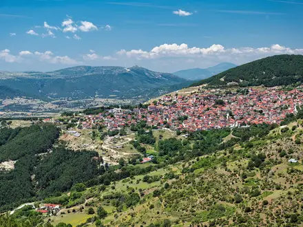
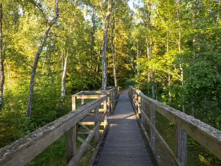
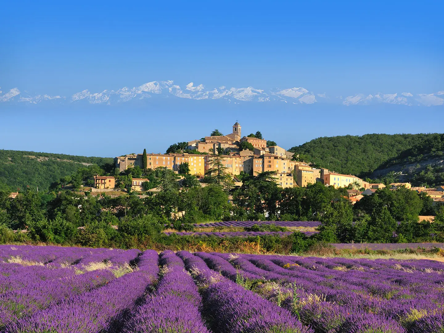
This is a linear, west-to-east thru-hike: Royan in Charente-Maritime to Grasse in the Alpes-Maritimes, not a route “to the Alps”. It crosses the Charentes, Limousin, the volcanic Auvergne/Massif Central, the Ardèche, Gard, Vaucluse, Alpes-de-Haute-Provence and the Riviera hinterland. Expect maritime pine forest and farmland early on, rolling Limousin, beech forest and volcanic uplands around Mont-Dore and the Cantal, then limestone gorges, causses, garrigue and lavender country before Grasse. Waymarking is the standard white-and-red GR balisage maintained by FFRandonnée. As a point-to-point route, plan end-to-end transport and accommodation stages carefully.
GR4 history and waymarking
The GR4 is part of France’s national Grande Randonnée network: long-distance footpaths developed and maintained by the Fédération Française de la Randonnée Pédestre. It is one of the country’s major east-west walking traverses, linking the Atlantic at Royan with Provence at Grasse and connecting many of southern France’s key landscapes. No reliable founding date is documented in the verified sources, so it is best treated as an established GR route rather than tied to a specific opening year.
Notable highlights
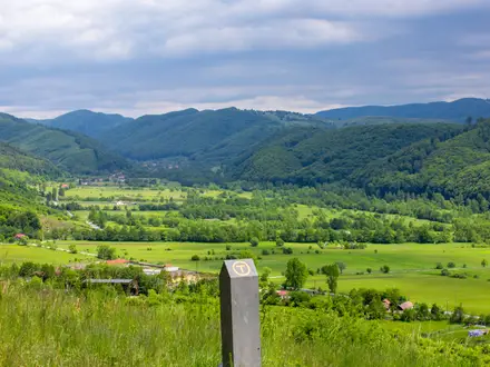
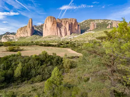
- Massif Central volcanoes (Auvergne): The GR4 climbs through the volcanic uplands around Mont-Dore and the Cantal, with high beech forest, open summits and France’s wild green interior.
- Gorges de l’Ardèche: A limestone karst landscape of cliffs, caves and the meandering Ardèche river, giving the route one of its most dramatic gorge sections.
- Mont Ventoux (around 1,910 m): The highest point on the GR4, known as the “Giant of Provence”, with a bare limestone-scree summit and a treeless, exposed cap.
- Dentelles de Montmirail: Saw-tooth limestone ridges above Provençal vineyards near Mont Ventoux, a distinctive landmark as the route enters classic Provence scenery.
- Gorges du Verdon: A serious, exposed section through one of Europe’s deepest gorges, with turquoise water and cliffs up to around 700 m deep.
- Lac de Sainte-Croix and Grasse: The route passes the turquoise reservoir at the mouth of the Verdon before continuing through lavender plateaux and garrigue to Grasse, France’s historic perfume capital.
Challenges to expect
The difficulty is mainly cumulative: 1,470 km, about 35,000 m of ascent, and two months or more on trail. Accommodation and supplies vary by region, with sparser stretches in remote areas. Summer heat is a major issue in Provence and on treeless Mont Ventoux, while higher Auvergne sections can be cold or snowy outside summer. For shorter French alternatives, compare the Chartreuse Trail GR9 Segment, Cirque de Gavarnie Trails, or the easier Canal du Midi Towpath.
HikeList Score
GR4 scored 82/100 on HikeList's trail-quality metrics.
See score breakdownHide breakdown
- Ideal length 52
- Balanced challenge 84
- Scenery & wildness 83
- Varied terrain 100
- Accommodation 92
- Food & support 88
- Path quality 98
- Season flexibility 76
Computed from length, challenge, scenery & wildness, terrain variety, accommodation, food & support, path quality and season flexibility.
Show more data Show less
- Coastal
- Farmland
- Forest
- Upland
- Volcanic
- Gorge
- Plateau
- Mediterranean
- Footpath
- Forest Track
- Farm Track
- Plateau Path
- Rocky
- Gites
- B&Bs
- Hotels
- Campsites
- Pet Friendly
- Restrooms
- Water Sources
- Campsites
- Shelters
In these collections
Photos from hikers
Taken on the trail by people who've reviewed GR4.
Reviews
How would you rate GR4?
Tap a star to start your review — you could be the first.