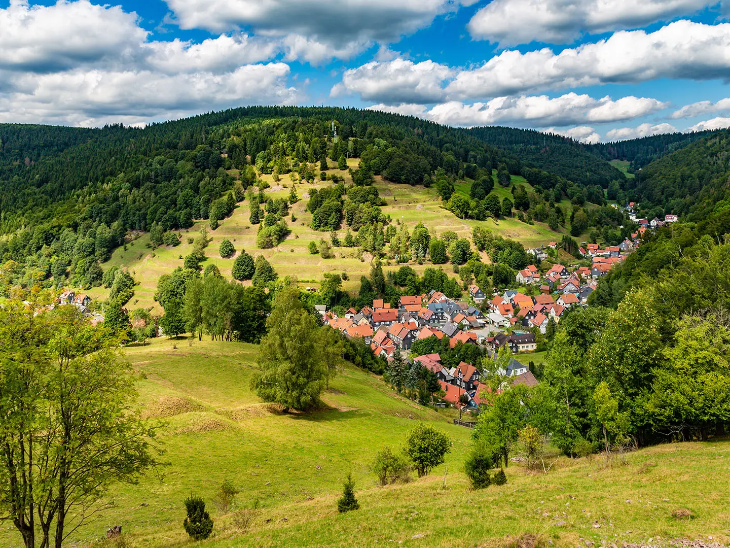
Rennsteig Trail
How would you rate Rennsteig Trail?
Tap a star to share your experience and help other hikers.
Rennsteig Trail: Germany’s Classic Ridge Walk
HikeList Score
Rennsteig Trail scored 94/100 on HikeList's trail-quality metrics.
See score breakdownHide breakdown
- Ideal length 100
- Balanced challenge 100
- Scenery & wildness 98
- Varied terrain 94
- Accommodation 75
- Food & support 88
- Path quality 98
- Season flexibility 89
Computed from length, challenge, scenery & wildness, terrain variety, accommodation, food & support, path quality and season flexibility.
The Rennsteig Trail is a 169.3 km point-to-point hike across Thuringia in Germany, from Hörschel on the Werra to Blankenstein on the Saale. Most walkers take 6-8 days, with 8 stages the standard itinerary. Difficulty is moderate: long forest kilometres, steady ridge walking and a few rougher climbs rather than technical mountain terrain. It suits hikers wanting a well-marked inn-to-inn route with history, woodland, open ridges and straightforward logistics.
Route Overview
The route runs west to east from Eisenach/Hörschel through the Thuringian Forest, the Thuringian Slate Mountains and towards the edge of the Franconian Forest. Key places on or near the trail include Ruhla, Brotterode, Großer Inselsberg, Oberhof, Schmiedefeld am Rennsteig, Neustadt am Rennsteig, Masserberg, Neuhaus am Rennweg, Siegmundsburg, Steinbach am Wald and Brennersgrün before Blankenstein. It follows the watershed between the Weser, Elbe and Rhine river systems, marked near Siegmundsburg by the Dreistromstein. If you like German forest ridge routes, compare it with the Harzer Hexenstieg or the longer Goldsteig.
Rennsteig History and Trail Culture
The Rennsteig is often described as Germany’s oldest long-distance trail and was first documented in 1330 as “Rynnestig”. Its name is linked either to “Rain”, an old word for boundary, or to “renniweg”, a narrow path or bridleway. For centuries it marked borders between Thuringian and Franconian lands and served as a messenger and trade route. Julius von Plänckner mapped it in 1832, August Trinius popularised it in 1889-90, and the traditional greeting is “Gut Runst!”.
Notable highlights
- Großer Inselsberg (916 m): One of the best-known summits in the Thuringian Forest, with a summit viewpoint tower. The nearby Ruhla/Inselsberg section is also the hardest part of the Rennsteig.
- Plänckners Aussicht / Großer Beerberg (973 m): The highest point on the main trail, on the flank of the Großer Beerberg. It is a panoramic viewpoint named after cartographer Julius von Plänckner.
- Dreistromstein near Siegmundsburg: A marker at the meeting point of the Weser, Elbe and Rhine watersheds. It neatly explains why the Rennsteig follows this long dividing ridge.
- Rennsteiggarten Oberhof: Germany’s largest alpine botanical garden sits right on the trail above Oberhof, with close to 4,000 mountain-plant species from around the world spread across roughly seven hectares.
- Wartburg Castle above Eisenach: A UNESCO-listed castle near the western start, closely associated with Martin Luther’s translation of the New Testament. It makes a strong cultural detour before starting at Hörschel.
- Boundary stones: Around 1,300 historic markers line the route, including 13 Dreiherrensteine. They are a constant reminder that the Rennsteig was once a border path.
- Pebble tradition and “Gut Runst!”: Hikers traditionally carry a pebble from the Werra at Hörschel and throw it into the Saale at Blankenstein. The trail’s own greeting gives the walk a distinctive Thuringian identity.
Challenges to expect
Expect distance rather than exposure: the Rennsteig is well waymarked with the white “R” symbol, but it is still a long point-to-point trail with several thousand metres of cumulative climbing. Most surfaces are dirt and gravel forest tracks, with rooty or rocky sections around climbs and descents, especially near Großer Inselsberg. Late spring to early autumn is best; in winter the route becomes a major Nordic ski trail. For another historic border-flavoured German walk, see the Harzer Grenzweg.
HikeList Score
Rennsteig Trail scored 94/100 on HikeList's trail-quality metrics.
See score breakdownHide breakdown
- Ideal length 100
- Balanced challenge 100
- Scenery & wildness 98
- Varied terrain 94
- Accommodation 75
- Food & support 88
- Path quality 98
- Season flexibility 89
Computed from length, challenge, scenery & wildness, terrain variety, accommodation, food & support, path quality and season flexibility.
 Germany
Show more data Show less
- Forest
- Ridge
- Moorland
- Meadows
- Dirt
- Gravel
- Rocky
- Huts
- Hotels
- Campsites
- Family Friendly
- Pet Friendly
- Restrooms
- Water Sources
- Campsites
- Shelters
- Picnic Areas
Download Our Full Guide to Rennsteig Trail FREE!
Get our comprehensive guide to this hike for free. Save it for later reading or print out at home.
In these collections
Photos from hikers
Taken on the trail by people who've reviewed Rennsteig Trail.
Rennsteig Trail: The Complete Guide
 i
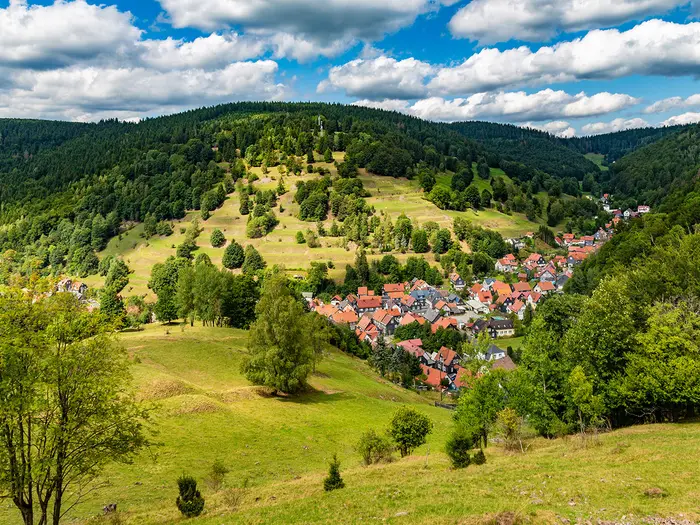
Image by Thomas Dreger
i
Image by Thomas Dreger The Rennsteig is Germany’s oldest long-distance hiking trail: a 169.3 km ridge walk from Hörschel on the Werra to Blankenstein on the Saale, crossing the Thüringer Wald, Thüringer Schiefergebirge and towards the Frankenwald. It is a moderate, well-waymarked route of long forest kilometres, open ridge views, moorland and meadow, with the white “R” underfoot, the “Gut Runst!” greeting, historic boundary stones and the Werra-to-Saale pebble tradition giving it a strong walking culture of its own. It suits inn-to-inn hikers, first-time multi-day walkers who want reliable waymarking, families and faster walkers alike, provided the full distance is treated as a serious multi-day hike rather than a casual forest stroll.
The Rennsteig asks for steady daily mileage, sensible booking ahead and enough self-sufficiency for longer wooded sections, especially around the harder Großer Inselsberg climb and the longer middle stages. This guide covers the 6–8 day planning options, stage logistics, accommodation and luggage transfer, food and resupply, transport at Eisenach/Hörschel, Bahnhof Rennsteig and Blankenstein, terrain and season choices, navigation, and common mistakes such as Sunday closures and food or water gaps.
Stage-by-Stage Guide
Stage distances on the Rennsteig vary slightly depending on the exact overnight stop, whether a town below the ridge is used for accommodation, and which official marker point is treated as the stage end. The notes below follow the classic eight-day west-to-east itinerary from Hörschel to Blankenstein; check the exact distance against your booked accommodation before setting off each morning.
Stage 1: Hörschel to Hohe Sonne — approx. 20 km
The first stage climbs out of the Werra valley and introduces the character of the Rennsteig immediately: steady ridgeward ascent, forest paths, meadows and the white R waymark. Hörschel is the traditional start, where walkers collect a pebble from the Werra to carry across the trail.
Terrain and walking: expect a sustained uphill day rather than difficult ground. The route rises from the river at roughly 196 m towards the wooded heights around Hohe Sonne. Paths are generally well maintained, with mixed forest and meadow walking, but the day can feel tougher than the distance suggests if starting with a full pack.
Landmarks and highlights: the Großer Eichelberg gives an early view towards Wartburg Castle above Eisenach. The route also passes Clausberg, the Vachaer Stein on the old Via Regia trade route, and the historic Wilde Sau stone cross. Hohe Sonne itself is associated with a former ducal hunting lodge.
Food and water: carry enough water from Hörschel or Eisenach; the ridge should not be treated as a reliable water source. Hohe Sonne has an Imbiss/snack stop, with weekend grilling often part of the local set-up, but opening times should be checked before relying on it.
Accommodation: Hohe Sonne has limited accommodation immediately on the ridge. Many walkers use nearby Eisenach, Ruhla, Gerstungen or Mosbach, depending on transport and the exact stage split. Eisenach has the broadest choice at the western end.
Transport and access: Eisenach is the main access hub, with rail services on the Frankfurt–Erfurt–Leipzig corridor. Hörschel is a district of Eisenach, about 5 km from Eisenach Hbf, with taxi and bus access. Hohe Sonne has public transport links back towards Eisenach and Bad Salzungen, but current timetables should be checked before travelling.
Navigation and warnings: navigation is straightforward if the white R is followed from the Werra. The practical issue is not exposure or technical terrain, but the continuous climb and the lack of guaranteed water once away from the valley.
Stage 2: Hohe Sonne to Ebertswiese — approx. 26 km
This is the crux stage of the Rennsteig, crossing the Großer Inselsberg area and giving the route its most mountain-like walking. It is a long and demanding day on the classic itinerary, especially if your accommodation requires a descent to Ruhla or Brotterode-Trusetal.
Terrain and walking: the climb to Großer Inselsberg is the hardest ground of the full trail. Expect steeper gradients, rocky and rooty sections, and slower progress than on the broad forest tracks found elsewhere on the Rennsteig. Sure-footedness is useful, particularly in wet conditions.
Landmarks and highlights: Ruhla lies below the ridge and can be reached by a Rennsteig-Leiter connector trail. Großer Inselsberg, at just over 916 m, is the best-known summit on the route, with a prominent transmitter tower, a former radio tower used as a lookout tower, and extensive views in clear weather. The route continues past the Kleine Inselsberg before reaching the Ebertswiese clearing.
Food and water: food options are better than on some remote ridge stages, but they are still spaced out. Berggasthof Stöhrauch on Großer Inselsberg, the Imbiss Zur Wallfahrt am Rennsteig, and Spießberghaus near Ebertswiese are useful stops, subject to opening times. Carry sufficient water from the start; springs and small sources should not be assumed to be reliable.
Accommodation: Spießberghaus is the key accommodation near Ebertswiese. There is also a youth hostel in the Inselsberg area, and hotels or guesthouses in Ruhla and Brotterode-Trusetal below the ridge. If staying off-route, factor in the connector trail or transfer logistics.
Transport and access: Ruhla and Brotterode-Trusetal are practical access points below the ridge. Public transport details and taxi availability should be checked before travelling, especially if using an off-ridge overnight stop.
Navigation and warnings: the white R waymarking remains clear, but the Inselsberg section is where careful foot placement matters most. In poor weather, the ascent and descent can be slippery under trees and over roots. The longer 25 km-plus versions of this day are genuinely strenuous by Rennsteig standards.
Stage 3: Ebertswiese to Grenzadler (Oberhof) — approx. 17 km
After the Inselsberg stage, this is one of the more forgiving days on the trail. It stays high, crosses forest and meadow terrain, and finishes in the best-serviced part of the Rennsteig around Oberhof and Grenzadler.
Terrain and walking: the walking is easier and more flowing, with mixed forest, open meadows and well-surfaced tracks. Gradients are moderate, making this a useful day for recovery after Stage 2.
Landmarks and highlights: the route passes historic stopping places at Alte Ausspanne and Neue Ausspanne, with open meadow sections such as Weidensuhlswiese and Neuhöfer Wiese. Hoher Schorn has a lookout tower. Oberhof is a major winter sports town, associated with biathlon, bobsleigh and ski jumping. Rennsteiggarten Oberhof, beside the trail area, is Germany’s largest alpine botanical garden and is one of the strongest non-walking highlights on the route.
Food and water: this is the best-serviced stage. Neue Ausspanne has a snack bar, and Oberhof/Grenzadler offer multiple restaurants and shops. Grenzadler has several eating options around the sports complex, including Schanzenbaude, Café Biathlon Inn and Thüringer Hütte. Even so, carry water between stops rather than assuming every hut or inn will be open.
Accommodation: Oberhof has the widest accommodation choice on the Rennsteig, including hotels, guesthouses and holiday apartments. Grenzadler also has useful facilities, including a Rennsteighaus with toilets, showers, lockers and changing rooms.
Transport and access: Oberhof is one of the easiest places to join, leave or split the route, with road and bus access. The RennsteigShuttle is relevant for the next stage at Bahnhof Rennsteig rather than Grenzadler itself; it runs on weekends and holidays between Erfurt, Arnstadt, Ilmenau and Bahnhof Rennsteig. Timetables should be checked before travelling.
Navigation and warnings: navigation is generally simple, and services are close by compared with most stages. The main seasonal issue is winter: this whole region is heavily used for Nordic skiing, and parts of the Rennsteig function as groomed ski trails rather than ordinary hiking paths.
Stage 4: Grenzadler (Oberhof) to Allzunah — approx. 20 km
This stage crosses the high central section of the Thuringian Forest, including the highest point on the main Rennsteig. It is a forest-and-moorland day with important route logistics because Bahnhof Rennsteig provides a useful access or escape point.
Terrain and walking: expect forest tracks, moorland edges and steady high-level walking rather than steep climbing. The route passes through the Vessertal-Thüringer Wald Biosphere Reserve area, where staying on the marked trail is important.
Landmarks and highlights: the trail passes near the Großer Beerberg, the highest mountain in Thuringia, but the actual summit is in a protected moorland nature reserve and is closed to walkers. The main route instead reaches Plänckners Aussicht at 973 m, the highest point on the Rennsteig, named after the cartographer Julius von Plänckner. Schmücke and Bahnhof Rennsteig are important points along the way. The Alte Tränke spring is also noted on this stage.
Food and water: leave Grenzadler/Oberhof with food and water for the day. Services on the ridge are limited, and water should be planned carefully. Alte Tränke is a known spring, but spring flow and drinkability should be checked locally before relying on it.
Accommodation: Allzunah is a small hamlet, so accommodation directly at the stage end is limited. Frauenwald, Schmiedefeld am Rennsteig, Stützerbach and Neustadt am Rennsteig provide more options nearby. Booking ahead is sensible, especially if relying on a small guesthouse.
Transport and access: Bahnhof Rennsteig, at roughly 747 m, is the key transport point on this stage. The RennsteigShuttle operated by Süd-Thüringen-Bahn serves it on weekends and holidays, linking with Ilmenau, Arnstadt and Erfurt. Outside those operating times, taxis from places such as Frauenwald or Schmiedefeld may be needed; this should be checked before travelling.
Navigation and warnings: do not attempt to visit the closed Großer Beerberg summit. Follow the marked trail to Plänckners Aussicht instead. Food and water planning matter more here than route-finding; there are long ridge sections without dependable services.
Stage 5: Allzunah to Friedrichshöhe — approx. 25 km
This is a long central stage, moving from the Thuringian Forest towards the Thuringian Slate Mountains. It has more settlements and cultural interest than some of the remoter stages, but the distance still makes it a full day.
Terrain and walking: the terrain is varied ridge walking, with forest, open areas and steady ups and downs. Gradients are not severe, but the cumulative distance and limited water between villages require proper pacing.
Landmarks and highlights: the midpoint of the Rennsteig comes early in the stage and is traditionally marked as a milestone of the walk. Neustadt am Rennsteig is an important settlement on or near the route and has the Rennsteig Museum, the only museum dedicated to the trail. Stützerbach is associated with Goethe and has the Goethe-Haus museum. Schwalbenhauptwiese is a notable watershed feature where streams rising close together drain towards different river systems. Dreiherrensteine mark former territorial boundaries. Masserberg is a sizeable spa and mountain village, and the Rennsteigwarte observation tower is the only tower directly on the Rennsteig.
Food and water: Neustadt am Rennsteig and Masserberg are the key resupply and meal points. Shops and restaurants should be used when available, as ridge water can be scarce between villages. Carry enough water to bridge the settlement gaps.
Accommodation: Friedrichshöhe has guesthouses, but it is a smaller end point. Masserberg offers a wider range of accommodation and can be a practical alternative stage stop. Book ahead in busy periods and confirm meal arrangements, as rural Gasthöfe may close on certain weekdays.
Transport and access: transport is more limited than around Oberhof or Neuhaus am Rennweg. Taxis from Neustadt am Rennsteig or Masserberg are the most practical fallback. There is no direct rail access on this stage.
Navigation and warnings: the route is not technically difficult, but it is a longer day and the number of nearby settlements can tempt walkers into unplanned detours. Keep an eye on time if visiting the museum, tower or off-ridge services.
Stage 6: Friedrichshöhe to Spechtsbrunn — approx. 23 km
This stage crosses the Thuringian Slate Mountains and includes one of the Rennsteig’s most important watershed landmarks before passing through Neuhaus am Rennweg, the largest town directly on the trail.
Terrain and walking: expect mainly forest tracks and moderate ridge walking with an overall descending tendency. The day is long enough to require steady pacing, but the terrain is generally less demanding than the Inselsberg section.
Landmarks and highlights: Dreistromstein, near Siegmundsburg, comes early and marks the meeting point of the Weser, Elbe and Rhine drainage basins — a key clue to why the Rennsteig follows this long watershed ridge. Siegmundsburg is followed by Neuhaus am Rennweg, an important trail town with services, tourist information and a Rennsteighaus. Beyond Neuhaus, Steinheid has the Sandberg geological formation, linked to older Zechstein and Buntsandstein deposits. Spechtsbrunn has a Baroque church dating from 1746 with notable interior paintings.
Food and water: Neuhaus am Rennweg is the main resupply point and one of the most useful service stops on the entire route. It has shops, supermarkets and several inns or restaurants, including traditional Thuringian options. Steinheid has basic services. Carry water between settlements, as the ridge sections should not be treated as reliably supplied.
Accommodation: Neuhaus am Rennweg has the widest accommodation choice on this stage, including hotels and guesthouses. Spechtsbrunn has guesthouses, with additional options in nearby Piesau, Lichte and Lauscha. If ending the day at Spechtsbrunn, check availability before committing to the stage plan.
Transport and access: Neuhaus am Rennweg is the key access and exit point, with rail services on the Südthüringenbahn towards Sonneberg and onward connections, plus a bus station by the railway station. This makes it one of the easiest places to split the eastern half of the Rennsteig.
Navigation and warnings: navigation remains straightforward on the marked route. The main planning decision is whether to overnight in Neuhaus am Rennweg, with full services and transport, or continue to the quieter stage end at Spechtsbrunn.
Stage 7: Spechtsbrunn to Brennersgrün — approx. 19 km
This stage has mixed forest and border-history interest, but it also contains the most notable road-walking section of the Rennsteig. Treat it as a practical transit day rather than a remote mountain stage.
Terrain and walking: the route descends steadily towards Steinbach am Wald, then climbs again before levelling over meadows and forest towards Brennersgrün. East of Steinbach am Wald there is more than 6 km of road walking, which is the main physical and mental challenge of the day.
Landmarks and highlights: Kalte Küche is a historic mountain pass on an old trade route, with a nature park information centre. Schleifenwiese marks the Thuringia–Bavaria state border and has a commemorative plaque for the reopening of the Rennsteig border crossing on 28 April 1990. Steinbach am Wald is an Upper Franconian village with services and the start of the Schönwappenweg. The Schönwappenweg is known for decorated historic boundary stones, including the Kurfürstenstein from 1515, the oldest boundary stone on the Rennsteig. Brennersgrün is historically significant as the starting point of the first post-reunification Rennsteig hike in 1990.
Food and water: Steinbach am Wald is the key service point. Elsewhere, options are limited, so carry enough food and water from Spechtsbrunn to reach Steinbach, and enough onward to Brennersgrün.
Accommodation: accommodation is more limited than in the central trail towns. Brennersgrün and the Lehesten area, Wurzbach and Steinbach am Wald are the main areas to consider. Booking ahead is strongly recommended.
Transport and access: transport is limited at the stage end. Taxis or private transfers are often the practical option from the Brennersgrün area, with some connections around Lehesten. This should be checked before travelling.
Navigation and warnings: take particular care on the road-walking section east of Steinbach am Wald. Visibility to traffic, fatigue and hard tarmac underfoot are the main concerns. The route is not technically hard, but it is less pleasant underfoot than the forest-track stages.
Stage 8: Brennersgrün to Blankenstein — approx. 20.5 km
The final stage descends towards the Saale valley and finishes at Blankenstein, where the Werra pebble is traditionally thrown into the Saale/Selbitz confluence area at the end of the trail.
Terrain and walking: this is primarily a descending day, with forested and mixed terrain leading down from the higher ridge towards the Saale valley. The walking is not technical, but tired legs from the previous week can make the final descent feel longer than expected.
Landmarks and highlights: the route crosses the former Inner German border area twice. The Grünes Band or Green Band has turned much of the old border strip into a major biotope network, adding natural interest to a historically charged landscape. Small villages on or near the route include Grumbach, Rodacherbrunn and Schlegel. The official terminus is at the Selbitzbrücke in Blankenstein, on the Bavarian–Thuringian border.
Food and water: carry supplies from Brennersgrün, as services are limited before Blankenstein. Most walkers plan to eat in Blankenstein after finishing, but opening times should still be checked if arriving late or out of season.
Accommodation: Blankenstein has guesthouses, while Bad Lobenstein nearby offers a wider choice. If travelling home the same day, leave enough time between finishing at the river and reaching the station.
Transport and access: Blankenstein has a railway station on the Saale valley line, with limited but useful train and bus connections towards Hof in Bavaria and onward rail links. Current timetables should be checked before travelling, especially at weekends and on public holidays.
Navigation and warnings: the final objective is the Selbitzbrücke area at Blankenstein, with the Saale/Selbitz confluence nearby. The main practical warning is resupply: do not assume there will be food or water before Blankenstein. In poor weather, forest descents can be slippery, but the stage has no special technical hazard.
Recommended Itinerary
Stage distances vary slightly between mapping providers and with any off-trail accommodation detours. The itinerary below follows the classic 8-day Rennsteig structure and is the best default for most walkers. Exact hotel-to-hotel distances should be checked before booking, especially where staying off the ridge in Ruhla, Oberhof, Frauenwald or Masserberg.
Standard itinerary: 8 days
This is the most practical inn-to-inn schedule: daily stages are mostly 17–26 km, with the hardest climbing early around Großer Inselsberg and the longest eastern day between Allzunah and Friedrichshöhe.
| Day | From | To | Approx. distance | Why this stage makes sense | Services/accommodation notes |
|---|---|---|---|---|---|
| 1 | Hörschel | Hohe Sonne | ~20 km | A manageable first day: steady uphill from the Werra into the forested ridge, without committing to a very long opening stage. | Hörschel has start-area accommodation including Gasthaus & Pension Tor zum Rennsteig; Ruhla is the nearest useful small town for shops and services. Imbiss-Gaststätte Zur hohen Sonne can be a useful food stop on route. |
| 2 | Hohe Sonne | Ebertswiese | ~25–26 km | The hardest full day for many walkers: it includes the Großer Inselsberg section and the steep 300 m climb from Brotteroder Hütte towards Inselsberg. Doing it on Day 2 means tackling the toughest ground while still fresh. | Accommodation around Ebertswiese includes Spießberghaus, Berggasthof Heuberghaus and Rennsteighaus Neue Ausspanne. Book this stage carefully because options are not as dense as in the larger towns. |
| 3 | Ebertswiese | Grenzadler (Oberhof) | ~17 km | A shorter recovery day after Inselsberg, with easier ridge walking and time to reach Oberhof without pressure. | Grenzadler has an inn on the trail. Oberhof is 2–3 km off-trail downhill and has the widest accommodation choice in the central section, including hotels, guesthouses and sports facilities. Rennsteiggarten Oberhof is on the trail above the town. |
| 4 | Grenzadler (Oberhof) | Allzunah | ~20 km | This is the high-point stage, passing the Großer Beerberg area and Plänckners Aussicht at 973 m, the highest point on the main trail. The distance is moderate, but the day feels more exposed and upland than much of the route. | Allzunah has limited accommodation, so book early. Frauenwald and Neustadt am Rennsteig are the main alternatives nearby; staying off-trail will change the walking distance and should be checked before travelling. |
| 5 | Allzunah | Friedrichshöhe | ~25 km | A longer eastern stage as the route transitions towards the Thuringian Slate Mountains. It works well as a big but steady day after the central high ground. | Friedrichshöhe is close to Masserberg, which has shops and services. Accommodation options in the wider area include Hotel Rennsteig Masserberg, Kurhaus Masserberg and Waldhotel Rennsteighöhe. |
| 6 | Friedrichshöhe | Spechtsbrunn | ~23 km | A substantial but logical ridge stage, with watershed features including Dreistromstein near Siegmundsburg and useful services around Neuhaus am Rennweg. | Neuhaus am Rennweg is the key service hub in the eastern half, with hotels, restaurants and supplies. Spechtsbrunn has limited accommodation, including Gasthaus & Pension Am Rennsteig and Finnhütten holiday houses; book well ahead. |
| 7 | Spechtsbrunn | Brennersgrün | ~19 km | A slightly shorter day before the final approach, crossing into the Franconian Forest area and the Thuringia–Bavaria state line. | Brennersgrün has limited overnight options, including Rennsteighaus Brennersgrün and nearby holiday apartments. Bus line 610 runs from Brennersgrün towards Bad Lobenstein for Deutsche Bahn connections; current times should be checked before travelling. |
| 8 | Brennersgrün | Blankenstein | ~20.5 km | A fitting final stage with a general net descent through the slate hills to the Saale at Blankenstein. | Blankenstein is small, with a Wanderstützpunkt and a station on the Saale valley line via Bad Lobenstein. Many walkers continue by train or transfer to Bad Lobenstein or Saalfeld after finishing. |
Slower variant: 10 days
A slower schedule suits walkers who prefer shorter days, more time in villages, or luggage transfer. It is also useful where accommodation availability forces overnight stops away from the official stage ends. The most sensible approach is to keep the broad west-to-east rhythm, but split the harder early Inselsberg section and the long central/eastern stages.
| Day | From | To | Approx. distance | Why this stage makes sense | Services/accommodation notes |
|---|---|---|---|---|---|
| 1 | Hörschel | Hohe Sonne | ~20 km | Keeps the first day moderate while gaining the ridge from the Werra. | Pre-start accommodation is available in Hörschel and nearby Eisenach-Neuenhof. Ruhla is useful for services near this section. |
| 2 | Hohe Sonne | Ruhla / Brotterode area | Check official mapping before booking | Breaks up the long Inselsberg approach rather than taking the full Hohe Sonne–Ebertswiese stage in one day. | Ruhla has shops and services; accommodation choice and access from the trail should be checked before booking. |
| 3 | Ruhla / Brotterode area | Ebertswiese | Check official mapping before booking | Allows the Großer Inselsberg climb to be handled as a shorter, more focused day. | Ebertswiese-area accommodation includes Spießberghaus, Berggasthof Heuberghaus and Rennsteighaus Neue Ausspanne. |
| 4 | Ebertswiese | Grenzadler / Oberhof | ~17 km | A naturally shorter recovery stage after the western high ground. | Oberhof gives the best accommodation choice in the central Rennsteig, but can fill at weekends and in peak summer. |
| 5 | Oberhof | Frauenwald | ~18 km | Splits the high central section into a comfortable day while still taking in the Großer Beerberg and Plänckners Aussicht area. | Frauenwald has more options than Allzunah, which is limited. Any off-trail descent to accommodation should be checked before booking. |
| 6 | Frauenwald | Masserberg | ~17 km | Shortens the otherwise long Allzunah–Friedrichshöhe section and gives more time in the Thuringian Slate Mountains. | Masserberg is a proper village with shops, services and several accommodation options. |
| 7 | Masserberg | Neuhaus am Rennweg | ~19 km | Uses Neuhaus am Rennweg as a strong service stop before the more limited eastern villages. | Neuhaus am Rennweg has the best concentration of hotels and restaurants in the eastern section. |
| 8 | Neuhaus am Rennweg | Spechtsbrunn | Check official mapping before booking | Keeps the eastern ridge manageable and avoids pushing too far towards Brennersgrün in one day. | Spechtsbrunn accommodation is limited; book early. |
| 9 | Spechtsbrunn | Brennersgrün | ~19 km | A comfortable penultimate day with enough margin for the border-stone and pass sections. | Brennersgrün accommodation is limited; check availability before fixing the previous night. |
| 10 | Brennersgrün | Blankenstein | ~20.5 km | Leaves a full final day for the descent to the Saale and onward transport from Blankenstein. | Blankenstein has limited facilities but has rail access via the Saale valley line. |
Faster variant: 6 days
A 6-day Rennsteig is demanding and suits experienced long-distance walkers, fast hikers and trail runners who are comfortable with repeated 25–30 km days and occasional longer pushes. Accommodation availability becomes the main constraint: exact overnight points should be built around confirmed beds, not just map distances.
The cleanest way to compress the route is to combine shorter official stages rather than starting with an extreme 45 km push from Hörschel to Ebertswiese. The most obvious merger is Day 3 and Day 4 of the standard itinerary, walking Ebertswiese to Allzunah in roughly 37 km. Further compression then depends on where accommodation is available between the official stage ends.
| Faster-planning choice | Practical effect | Who it suits | Cautions |
|---|---|---|---|
| Combine Ebertswiese–Grenzadler and Grenzadler–Allzunah | Turns two moderate days into one long central ridge day of about 37 km. | Strong walkers who can handle a long day after the Inselsberg section. | This passes the Oberhof area; if staying in Oberhof, add the off-trail descent and return climb or arrange transport. |
| Keep Hohe Sonne–Ebertswiese as a separate day | Avoids stacking the hardest Inselsberg climbing onto an overlong opening stage. | Most hikers attempting a fast but realistic schedule. | The day is already around 25–26 km with the steepest sustained climb of the trail. |
| Use Neuhaus am Rennweg as a fast-itinerary service hub | Gives a reliable eastern resupply and accommodation point before the smaller villages. | Walkers carrying minimal food and using hotels or guesthouses. | Spechtsbrunn and Brennersgrün have limited options, so do not assume a late booking will work. |
| Attempt a 4-day completion | Reduces the route to 40+ km days. | Only very fit walkers, ultra-distance hikers or organised challenge attempts. | This is not a normal hiking itinerary and leaves little margin for weather, injury, transport delays or accommodation constraints. |
For most independent walkers, the 8-day itinerary is the best balance of distance, accommodation and recovery. The 10-day version is better for comfort; the 6-day version should be planned only after confirming accommodation and transport at each intended overnight stop.
Planning the Route
How many days to allow
The standard Rennsteig plan is 8 walking days, and that is the best default for most independent hikers. It keeps daily distances mostly in the 17–26 km range, leaves time for food stops and transport logistics, and avoids turning a moderate ridge walk into a forced march.
A 7-day itinerary is possible for fit walkers by combining or lengthening stages where accommodation allows. A 6-day crossing is noticeably sportier and needs longer days, earlier starts and tighter booking. A 4-day crossing means repeated 40+ km days and is best treated as an endurance challenge rather than a normal hiking plan.
| Pace | Who it suits | Planning implications |
|---|---|---|
| 8 days | Most walkers; first-time Rennsteig hikers; inn-to-inn trips | Uses the classic stage structure and fits the main accommodation villages best. |
| 7 days | Fit walkers wanting a slightly faster trip | Requires careful accommodation choices and at least one longer day. |
| 6 days | Strong, experienced long-distance walkers | Less margin for weather, late starts, tired legs or limited food stops. |
| 4 days | Endurance hikers only | Very long days; little time for detours or recovery. |
The route is generally better walked steadily rather than quickly. Much of the Rennsteig is straightforward forest and ridge walking, but the cumulative distance, limited mid-stage resupply and accommodation spacing make over-ambitious schedules uncomfortable. The early section around Großer Inselsberg is the hardest underfoot, so avoid planning the first two days as a warm-up-free sprint.
Using the classic 8-stage structure
The classic itinerary works because the stage ends broadly line up with places where walkers can sleep, eat or transfer off the ridge. It is not only a distance plan; it is an accommodation plan.
| Day | Stage | Approx. distance | Planning note |
|---|---|---|---|
| 1 | Hörschel → Hohe Sonne | 20 km | Start logistics are easiest via Eisenach; collect food and water before leaving the Werra valley. |
| 2 | Hohe Sonne → Ebertswiese | 26 km | Longest and most demanding standard day, with the Großer Inselsberg section. Book this night carefully. |
| 3 | Ebertswiese → Grenzadler / Oberhof | 17 km | Shorter day; Oberhof is one of the strongest service and accommodation bases on the route. |
| 4 | Grenzadler → Allzunah | 20 km | Includes the high-level Beerberg / Plänckners Aussicht area; weather can feel more exposed here. |
| 5 | Allzunah → Friedrichshöhe | 25 km | Longer middle-stage day; check food availability and accommodation in advance. |
| 6 | Friedrichshöhe → Spechtsbrunn | 23 km | Good forward planning matters as villages are smaller and services are less frequent. |
| 7 | Spechtsbrunn → Brennersgrün | 19 km | Accommodation and onward transport options should be fixed before arrival. |
| 8 | Brennersgrün → Blankenstein | 20.5 km | Finish at the Saale; Blankenstein has a station but accommodation choice is limited. |
Stage distances can vary slightly depending on the exact overnight address, the chosen access path and whether the official marker-point stage ends are followed. If booking accommodation away from the exact trail line, factor in the extra approach distance or arrange a transfer with the host.
Accommodation usually dictates the itinerary
The Rennsteig has a strong long-distance walking infrastructure, with hotels, Gasthöfe, Pensionen, mountain inns, huts and campsites across the wider route. The important detail is that choice is uneven. Oberhof is well served, Schmiedefeld am Rennsteig has good provision for a small village, and Neuhaus am Rennweg has accommodation available, but some smaller stage points and ridge villages have limited beds.
Advance booking is strongly recommended in July and August, at weekends, and during the winter ski season. For summer dates, booking 1–3 months ahead is prudent, especially if walking the classic itinerary and needing specific overnight stops. Blankenstein is small, so decide early whether to stay there after finishing or travel out by train the same day.
Official accommodation lists keyed to kilometre markers are published by the Rennsteigverein and the Thuringian Forest tourism board. These are particularly useful when splitting a stage, adjusting the classic itinerary or checking whether a village has realistic inn-to-inn options.
Luggage transfer is common under the German term Wandern ohne Gepäck. Operators such as rennsteigwanderung.de and wandern-in-thueringen.info arrange bag movement between accommodations, typically collecting in the morning and delivering later in the day. Exact coverage, timings, accommodation requirements and prices should be confirmed when booking. Self-guided package companies also offer Rennsteig trips with accommodation and luggage transfer included.
Shortening, extending and adding rest time
Shortening the Rennsteig is straightforward in theory but should be planned around transport, not just distance. Several mid-route areas connect to regional buses, and the central ridge is accessible by rail on RennsteigShuttle operating days, but services are not equally frequent everywhere.
Extending the walk is often easier than compressing it. A slower 9–11 day version can work well for walkers who want shorter days, more time around Oberhof or a less demanding approach to the longer middle stages. Do not assume every short-stage split will have accommodation directly on the trail; check the official accommodation lists before committing.
Oberhof is the most practical place to build in a rest or half-rest day because it is a well-served ski and spa resort with stronger accommodation provision than many ridge villages. Eisenach is also useful before the start if adding time for the Wartburg Castle detour.
Section hiking and transport planning
The Rennsteig is practical to section-hike. Eisenach gives strong rail access near the western start at Hörschel, and Blankenstein has a station on the Saale valley line, with connections towards Saalfeld and onward to larger rail hubs such as Jena, Erfurt and Nuremberg.
For central sections, the RennsteigShuttle is especially useful. It runs on Saturdays, Sundays and public holidays from Erfurt via Arnstadt and Ilmenau to Bahnhof Rennsteig at about 747 m. Tickets include D-Tariff, Hopper-Ticket Thüringen and Thüringen-Ticket options. Timetables and ticket validity should be checked before travelling.
Regional buses serve many mid-route villages and road crossings, including areas along or near the B4 corridor, but frequency can be limited. For section walks, download or print transport options in advance and check current times at bahn.de and the relevant Thuringian transport timetable pages. Do not rely on turning up at a small ridge village and finding a convenient same-day bus without checking.
Food and water planning
Food is available at towns and stage intervals, but not reliably in every small hamlet on the ridge. Some stages may have no useful resupply between breakfast and the next overnight stop. Sunday opening hours can be limited, and small shops or inns may keep seasonal hours.
Carry enough food for the full walking day plus emergency snacks. This is especially important on longer stages, in the eastern half of the trail, and whenever arriving late in a small village.
Water needs more attention than many first-time Rennsteig walkers expect. The trail follows a watershed ridge, so springs and streams are often below the path rather than directly on it. Natural water sources may dry out in summer, and ridge-top water should not be relied on as the main plan. Refill at accommodation, towns and cafés whenever possible, and carry at least 1.5–2 litres capacity.
Navigation and maps
The Rennsteig is well waymarked with the white R symbol, known as Mareile, and navigation is generally straightforward on the broad forest tracks. Where the International Bergwanderweg Eisenach–Budapest overlaps, additional blue waymarkers may also appear.
Even so, carry offline navigation. Mobile signal can be inconsistent in forested sections, and the eastern part of the route is quieter. Download a GPX file before setting off and keep a paper or offline backup. KOMPASS map sheet 118, Der Rennsteig, von Hörschel bis Blankenstein, covers the full route and is a sensible navigation backup.
Weather, season and ground conditions
Late spring to early autumn is the most reliable hiking season, with May to September the usual planning window. July and August bring the busiest accommodation period, so book early. April can still be cold, and conditions around the higher Beerberg and Inselsberg areas should be checked before setting off.
Underfoot, expect mostly dirt and gravel forest tracks, with rooty and rocky sections on climbs and descents, especially around Großer Inselsberg. Summer nettles can be a minor irritation on narrower sections. In winter, much of the Rennsteig functions as a groomed Nordic ski trail; hiking is possible in places but short days, ice, snow, shared ski use and reduced services make it unsuitable for casual long-distance walkers.
Permits, camping and access rules
No permit is required and there is no access fee to walk the Rennsteig.
Campfires are prohibited. Wild camping is legally sensitive in Germany, and Thuringian forest land is typically state or private forest rather than open-access camping ground. Plan to use booked accommodation or established campsites rather than assuming a tent can be pitched anywhere. The route has frequent unmanaged three-sided shelters, useful for breaks and emergency cover, but they should not be treated as a guaranteed legal camping system.
What to fix before departure
- Accommodation — book the key overnight stops first, especially for July, August, weekends and Blankenstein.
- Water strategy — plan refills at towns and accommodation; do not rely on ridge springs.
- Food — check Sunday and seasonal opening hours; carry a full day’s food where needed.
- Transport — confirm trains and buses for Hörschel/Eisenach, Blankenstein and any section-hike exits.
- Maps and GPX — download offline files before entering the forested ridge sections.
- Weather — check conditions for the higher Inselsberg and Beerberg sections, especially outside summer.
Towns, Villages and Overnight Stops
The Rennsteig is well suited to inn-to-inn walking, but accommodation planning matters more than the map sometimes suggests. The route spends long periods on a wooded ridge, so many stage ends are not towns with a full range of services. In several places the best accommodation is a mountain hotel, Gasthof, Pension or walkers’ rest house rather than a village centre.
Use the official Rennsteigverein and rennsteig.de accommodation lists when booking, as they are keyed to route kilometres and are more useful than searching only by town name. Rural Gasthöfe may close on rest days, especially Monday or Tuesday, and opening hours can be shorter outside the main walking and ski seasons. Food and water should not be assumed at ridge car parks or viewpoints.
| Place / area | Practical role for hikers | Key planning note |
|---|---|---|
| Hörschel / Eisenach | Western start and pre-walk base | Hörschel is tiny; Eisenach has the services |
| Hohe Sonne | Classic Day 1 end area | No food or drink at Hohe Sonne itself |
| Ebertswiese | Traditional mountain-stage stop | Do not rely on the Berghotel without checking current status |
| Oberhof / Grenzadler | Main central service hub | Best-equipped mid-route overnight stop |
| Allzunah / Neustadt am Rennsteig / Frauenwald | Quiet ridge villages | Pre-book accommodation and meals |
| Friedrichshöhe / Masserberg | Spa and walkers’ overnight area | Good rest-day potential, but limited direct rail access |
| Neuhaus am Rennweg | Best-equipped eastern high-ridge town | Useful for accommodation, food and regional transport |
| Spechtsbrunn / Steinbach am Wald / Brennersgrün | Small eastern stops | Limited services; booking ahead is essential |
| Blankenstein | Official finish | Small town, adequate for a final night and onward rail travel |
Hörschel and Eisenach
Hörschel is the official western start on the Werra river and is best treated as the trailhead rather than a full-service overnight stop. It is a very small riverside settlement, known for the traditional collection of a Werra pebble before starting the walk.
Most walkers base themselves in Eisenach the night before. Eisenach is close to Hörschel, has mainline rail access on the Frankfurt–Erfurt–Leipzig corridor, and offers the practical pre-walk services that the trailhead itself lacks: hotels, restaurants, supermarkets, banks, pharmacies and tourist information. It is the natural place to buy food, check weather, sort luggage transfer and stay before an early start.
At Hörschel itself, the Pension & Gaststätte Tor zum Rennsteig sits at the start and has a dining room capacity of 80 covers. Availability and opening times should be checked before travelling, particularly if arriving late or outside the main season.
Wartburg Castle above Eisenach is the main cultural detour near the start. It is not needed for logistics, but Eisenach is the only place on the first part of the route with city-level services, so it is worth using properly before heading onto the ridge.
Hohe Sonne
Hohe Sonne is the classic first-stage end area after the climb from Hörschel. It is not a village with shops and evening services. The hiking car park remains, but the former snack bar has been demolished and there is currently no gastronomic facility at Hohe Sonne itself.
This is one of the most important accommodation planning points on the whole route. Do not arrive at Hohe Sonne expecting dinner, breakfast supplies or drinks. If stopping here, accommodation and meals need to be arranged in advance, usually by using nearby accommodation around Eisenach or the Wartburg area, or by arranging transfer to and from the trail.
For a self-supported walker, Hohe Sonne works best as a booked overnight/transfer point rather than an improvised end-of-day destination.
Wolfsburg-Unkeroda
Wolfsburg-Unkeroda sits in the early western section before the route reaches the Inselsberg and Brotterode area. It is a useful name to recognise when planning the first part of the route, but it should not be assumed to offer the same level of walker services as Eisenach, Ruhla, Brotterode-Trusetal or Oberhof.
Treat it as a possible local access or escape point only after checking current accommodation, food and transport options. This should be checked before travelling.
Ruhla
Ruhla is a practical small town below the ridge in the western section near the Großer Inselsberg. It is a useful descent option if accommodation on the ridge is full or if a walker needs proper town services.
Accommodation is available in several forms, including hotels, Pensionen, guesthouses, private rooms, holiday apartments and campsites. Ruhla also has restaurants, snack bars and cafés, making it a more dependable food stop than the isolated ridge points nearby.
The Tourist Information office is at Neuer Markt 1, 99842 Ruhla; telephone +49 36929 89013. The town has a long watchmaking and clockmaking tradition and a Miniature Park, but for hikers its main value is practical: beds, meals and services within reach of the Rennsteig during a harder western section.
Großer Inselsberg and Brotterode-Trusetal
The Großer Inselsberg area is one of the best-known high points of the western Rennsteig and the surrounding walking is among the hardest on the route, with steeper, rougher ground than the long forest-track sections farther east. It is a scenic and memorable section, but not a place to rely on for full resupply unless accommodation or a meal stop has been booked or checked in advance.
Brotterode-Trusetal is the main practical base in this area. The town lies directly on the Rennsteig, and the route runs through it. It has a much better service range than the exposed ridge: bakery, butcher, supermarket, post office, library, ATM and local bus service are all within walking distance.
Accommodation includes Ferienhäuser and Ferienwohnungen, Finnhütten, Pensionen and hotels. This makes Brotterode-Trusetal a good alternative to a more isolated ridge overnight, particularly for walkers who want a proper meal, shopping and a bed before or after the Inselsberg section.
Local attractions include the Trusetaler Wasserfall, a 58 m waterfall with 228 steps, normally open April to October, the Besucherbergwerk Hühn mining museum and the Inselbergbad swimming facility. Tourist Information is at Eisensteinstraße 91, Trusetal; telephone 036840 81578; email [email protected].
Ebertswiese
Ebertswiese is a traditional stage end between the Inselsberg area and Oberhof, set in an isolated mountain-meadow location directly on the Rennsteig. It appears on many classic itineraries and is attractive on paper because it breaks the western half into manageable days.
The key issue is reliability. Berghotel Ebertswiese has been a classic mountain hotel on this section, but its current operating status must be checked before relying on it for a bed, dinner or breakfast. There are no full village services nearby. If accommodation is not available here, the practical alternative is to adjust the stage plan, often by continuing towards Oberhof or arranging a transfer.
Do not plan to arrive at Ebertswiese without a confirmed overnight booking and meal arrangement.
Oberhof and Grenzadler
Oberhof is the main central hub of the Rennsteig and one of the easiest places on the route for accommodation, food, shopping and transport. It is a major winter-sports centre in the Thüringer Wald, and the LOTTO Thüringen Arena am Rennsteig hosts biathlon and cross-country events. For hikers, that sporting infrastructure translates into a strong supply of beds, restaurants and services.
Accommodation options include large hotels such as AHORN Panorama Hotel, Schlossberghotel Oberhof, Berghotel Oberhof, Hotel Sterngrund and Wagners Sporthotel. There are hotel restaurants and local eating options including Thüringer Stube, Bier-Michel and Rennsteig Bar. The town also has supermarkets, pharmacies and sports-equipment services.
Oberhof is an excellent place to do laundry if available at accommodation, replace worn kit, buy food, take a shorter day or build in a rest night. It is also one of the better places to rejoin or leave the route by public transport. Bus connections serve the area, including line 421 running broadly parallel to the trail through this section.
Grenzadler is the Rennsteig stage-end area associated with Oberhof. When booking, check whether accommodation is in Oberhof itself or at/near Grenzadler, as this affects end-of-day walking and meal logistics.
Book ahead at weekends and during the ski season, especially from late November to March. Oberhof can be much busier than the quieter Rennsteig villages on either side.
Schmücke, Plänckners Aussicht and Bahnhof Rennsteig
Schmücke and Plänckners Aussicht are high, remote ridge points rather than settlement stops. Plänckners Aussicht, on the flank of the Großer Beerberg, is the highest point on the main Rennsteig. The area is deeply forested and exposed to mountain weather, so it should be planned as a ridge crossing, not as a place to improvise food or accommodation.
The most useful service point in this area is Bahnhof Rennsteig, the historic station on the Rennsteigbahn at about 747 m. It is a valuable lunch stop, escape point or public-transport access point for the central ridge. The station restaurant serves traditional Thüringer food, including Thüringer Klöße on weekends and holidays, and there is also a Bierhäuserl and outdoor Waggonterrasse.
Opening hours can change, but the station has operated on the following pattern: Monday, Thursday and Friday 11:00–18:00; Saturday and Sunday 10:00–18:00; closed Tuesday and Wednesday. This should be checked before travelling.
The RennsteigShuttle runs to Bahnhof Rennsteig on weekends and holidays via Süd-Thüringen-Bahn, linking Erfurt, Arnstadt, Ilmenau, Stützerbach and Bahnhof Rennsteig. Bus line 202 also serves the station. Address: Rennsteig 3, 98528 Suhl; telephone 036782 701835.
Schmiedefeld am Rennsteig
Schmiedefeld am Rennsteig is a small village directly on the route and is one of the more practical mid-section stops. It is quieter than Oberhof but still offers enough services for walkers who want a proper village overnight rather than a remote ridge hotel.
Accommodation includes hotels, Pensionen and holiday apartments. Services include restaurants and cafés, the Wald-Apotheke pharmacy, a medical practice and sports-equipment hire, including mountain bikes, e-bikes, cross-country ski shoes and ski equipment. A tourist information office is present.
Schmiedefeld is also useful for transport planning. A RennsteigShuttle bus timetable is available from the municipality. Check current bus times before relying on them for stage shortening or onward travel.
Stützerbach
Stützerbach is a small village near Schmiedefeld and close to the Rennsteig. It can be useful as an alternative overnight or access point in the central section, particularly because of its connection with the Rennsteigbahn/RennsteigShuttle to Bahnhof Rennsteig.
Services are modest but include a medical practice and restaurant provision. Tourist information is available locally. As with other small villages on the route, accommodation, meal times and transport should be arranged before arrival rather than left to chance.
Frauenwald
Frauenwald is a quiet village directly on the Rennsteig and works as a useful overnight or service stop in the central-eastern part of the route. It is smaller and calmer than Oberhof, with accommodation and guesthouse options aimed at walkers and winter visitors.
Tourist information is available, and the local services guide on frauenwald.de is useful for checking what is open during the walking period. Sports-equipment hire is available, including e-bikes and ski equipment.
Frauenwald is a good candidate for walkers who prefer a village night on the ridge, but evening meals should still be checked when booking accommodation.
Allzunah
Allzunah is a small ridge settlement used as a stage end on classic itineraries, usually in the area between Frauenwald and Neustadt am Rennsteig. It is not a large service centre, so it should be treated as a pre-booked overnight point rather than a place to arrive and search for options.
Accommodation, dinner, breakfast and any luggage-transfer arrangements should be fixed in advance. Current food and transport options should be checked before travelling.
Neustadt am Rennsteig
Neustadt am Rennsteig is a genuine Rennsteig village on the ridge and is useful for walkers who want to stay directly on or very close to the route. It has developed accommodation and gastronomy services, making it a more reliable option than smaller isolated hamlets.
It is still a quiet forest community rather than a large town. Book ahead, particularly in peak walking periods, and check restaurant opening days before setting a stage plan around it.
Masserberg
Masserberg is a recognised climatic health resort in forested surroundings and is one of the more comfortable overnight options in the eastern-central section. It is particularly suitable for walkers who want a rest night, spa facilities or a less basic stop.
The main accommodation option is Hotel Rennsteig, a 4-star hotel on the Rennsteig with spa facilities including Finnish sauna and organic sauna, plus indoor archery and Thuringian cuisine. Other options in the area include hotels and mountain lodges such as Werraquell-Hütte, which is noted for gastronomy. A tourist information office is present.
The main caution is transport. Masserberg is not directly rail-served; the nearest train station is approximately 23 km away. Public transport depends mainly on buses, and timings should be checked before travelling. It is a sensible place to use luggage transfer or pre-arranged taxi support if the stage plan is tight.
Friedrichshöhe
Friedrichshöhe is a classic walkers’ overnight stop in the Masserberg / Neuhaus am Rennweg area. It is small, but it has accommodation aimed at Rennsteig hikers.
Options include Gasthaus Zum Rennsteig, Pension Arnika, Pension Hirschblick and Pension Zum Rennsteig. Pension Hirschblick has five non-smoking apartments. Because Friedrichshöhe is a small settlement, meals and breakfast should be confirmed when booking rather than assumed.
This is a useful stop for keeping to the classic eight-day rhythm, especially between Allzunah and Spechtsbrunn.
Siegmundsburg and Dreistromstein
Siegmundsburg is a small settlement near the Dreistromstein, the marker where the catchment areas of the Weser, Elbe and Rhine river systems meet. The landmark is one of the symbolic points on the Rennsteig and explains the route’s long watershed character.
Services are limited, so the area is better treated as a point of interest and possible short stop than as a default overnight base. Nearby accommodation is more practically planned through Friedrichshöhe and the surrounding pensions. This should be checked before travelling.
Neuhaus am Rennweg
Neuhaus am Rennweg is the largest and highest-situated town on the Rennsteig, with the centre at about 835 m. It is one of the strongest service stops in the eastern half of the walk and a good place to recover from several days of smaller villages and ridge accommodation.
Accommodation includes hotels such as Hotel & Gasthof Hirsch, Boutique Hotel Schieferhof, Hotel An der alten Porzelline and Rennsteighotel Herrnberger Hof, along with Pensionen, Ferienwohnungen and private rooms. Food options include restaurants, a bakery with fresh bread daily, ice-cream shops, snack stands and pizza delivery. The Thüringer Wald Shop also functions with tourist information and regional products.
Neuhaus has useful transport links. Its central station is the highest-elevation standard-gauge railway station in Central Germany, and the town has regional connections towards the Coburg area. Current timetables should be checked before travelling.
The Rennsteighaus at the Igelshieb railway stop is particularly useful for cyclists and walkers needing facilities: showers, toilets, wash basins, e-bike charging, bicycle boxes and a repair station are available.
Steinheid
Steinheid is a smaller community near Neuhaus am Rennweg. It is not as fully serviced as Neuhaus, but it can be relevant for walkers adjusting stages in the eastern high-ridge section.
Accommodation and food options should be checked directly before relying on Steinheid as an overnight stop. Gasthaus Thomas Münzer is noted in the wider area at Neumannsgrund, but current availability and exact practicality for a Rennsteig stage should be checked before travelling.
Spechtsbrunn
Spechtsbrunn is a recognised stage end on the classic eight-day itinerary and is a small village with limited services. It works best when accommodation is booked in advance and dinner/breakfast arrangements are clear.
Gasthaus & Pension Am Rennsteig is directly on the Rennsteig. It has five single rooms, two double rooms with shared bathrooms, and one twin room with en suite. Facilities include WiFi and flat-screen TV. Typical room prices have been around €40 for a single and €70–80 for a double, with breakfast buffet around €10. Confirm current prices before booking.
Do not treat Spechtsbrunn as a resupply town. It is primarily an overnight stop, with tourist information presence in the area but limited wider services.
Steinbach am Wald
Steinbach am Wald lies in the Frankenwald area approaching the eastern end of the Rennsteig. It is useful for walkers on the penultimate part of the route and marks the area where the trail crosses the former Inner-German border between Thüringen and Bavaria.
The main accommodation option is Hotel-Restaurant Rennsteig, directly on the route, with 38 beds and the Culinarium Atmosphera restaurant serving Mediterranean and Franconian cuisine. Antikhotel Steinbacher Hof is another option in the village.
Wider services are limited compared with Neuhaus or Oberhof, so food and accommodation should be booked and checked ahead.
Brennersgrün
Brennersgrün is a very small settlement near Steinbach am Wald and is used as a stage end on some classic itineraries. It is not a town and has minimal services.
The key facility is Rennsteighaus Alte Schule, a walkers’ rest house with two four-bed rooms, a hikers’ stamp station and WC. The WC charge is €0.50. Breakfast and packed lunch can be added. Current booking arrangements, prices and availability should be checked before travelling.
Brennersgrün is best used as a practical walkers’ halt when pre-arranged, not as a place for spontaneous accommodation or resupply.
Blankenstein
Blankenstein is the official eastern finish on the Saale river. It is a small, quiet town rather than a major commercial centre, but it has enough services for a final night, a meal and onward travel.
Accommodation includes Café & Pension Am Rennsteig, with 15 beds, all-day dining, garden and WiFi, and Gasthof Blankenberg, a family-run guesthouse. Other Pensionen and guesthouses are available locally. As at the start, booking ahead is sensible, especially if finishing on a weekend or arriving late.
Blankenstein has an operational, unstaffed station on the Saale valley line: Blankenstein (Saale), Absangerstr. 1, 07366 Blankenstein (Saale). This makes it a practical finish for walkers using public transport, though current rail times should be checked before committing to same-day onward travel.
Tourist information is available; telephone 036642 29533. The traditional finish is to throw the Werra pebble into the Saale, then stay or eat locally before departure.
Getting to the Start
The Rennsteig starts in Hörschel, a district of Eisenach, on the Werra. Eisenach is the practical gateway: it has mainline rail services, accommodation and onward local transport to Hörschel, which is about 8 km west of the city centre.
The official trailhead is reached through the courtyard of the restaurant Tor zum Rennsteig in Hörschel. Opening information for the restaurant is timetable-sensitive; this should be checked before travelling, especially if planning a very early start or arriving on a Tuesday.
By train
Train is the most convenient way to reach the start. Aim first for Eisenach Hbf, then continue to Hörschel Hp on the local RB6 service.
| Leg | Practical details |
|---|---|
| Long-distance arrival | Eisenach Hbf is on the Frankfurt–Erfurt high-speed corridor and is served by ICE trains. |
| Local train to the start | Hörschel Hp is the local halt for the trailhead, on the RB6 Eisenach/Eisenach West–Bebra line operated by cantus. |
| Frequency | RB6 services run hourly on weekdays and weekends, but current times and stopping patterns should be checked at bahn.de before travelling. |
| Important detail | Hörschel Hp is a request stop / halt, so check the current timetable and be alert on the train. |
| Final approach | A footpath links Hörschel station with the Wanderparkplatz and trailhead area. |
Approximate fastest journey times to Eisenach include:
| From | Typical rail journey to Eisenach |
|---|---|
| Frankfurt (Main) Hbf | about 1 hr 46 min direct by ICE |
| Frankfurt Airport | about 1 hr 51 min direct by ICE, with services roughly every 3 hours |
| Berlin Hbf | about 2 hr 13 min direct by ICE on the fastest services |
| Erfurt Hbf | about 25–30 min by regional train or ICE |
| Leipzig Hbf | around 3 hr, depending on service and changes |
For most walkers, the cleanest plan is to travel to Eisenach the day before, stay overnight, then take the short local connection to Hörschel in the morning. If a connection is missed or arrival is late, a taxi from Eisenach to Hörschel is the simplest fallback; agree the fare or use a metered taxi, and pre-book if travelling late in the evening.
By bus
Buses run from Eisenach towards Hörschel, but they are less frequent than the train and are best treated as a backup rather than the default approach.
| Route | Details |
|---|---|
| Operator | Wartburgmobil, with some supplementary services by Verkehr Hainich OHG |
| Main boarding points | Eisenach Westbahnhof or Georgenstraße |
| Destination | Hörschel |
| Journey time | about 13–18 min |
| Frequency | roughly every 3 hours, with limited supplementary services |
Bus timetables should be checked with Wartburgmobil before travelling, particularly on weekends, public holidays or if planning to start early.
By car
Driving to Hörschel is straightforward, but it is rarely the best option for a full thru-hike because the Rennsteig finishes far away in Blankenstein. Rail logistics are usually easier than leaving a vehicle at the western end and returning to collect it after 6–8 days.
From the west, use the A4 and exit at Eisenach-West, then follow the B84 towards Eisenach/Stedtfeld. At the Stedtfeld junction, turn right and continue towards Hörschel. From the east, the A4 is also the main motorway serving Eisenach; from Berlin the usual approach is via the A9 and A38 before joining the A4, while from the south routes use the A7 or A71 towards the Erfurt/Eisenach area before joining the A4.
There is a Wanderparkplatz at the eastern entrance to Hörschel with 44 paved spaces for cars and motorhomes. Facilities include electric charging stations, bicycle parking, a bicycle repair station, and motorhome electricity, water and disposal points. The parking area is linked by footpath to Hörschel Hp and is close to the trailhead.
The car park is useful for day walks, section hikes and walkers arranging a shuttle. It is listed as free of charge, but current parking rules, any maximum-stay restrictions and charges should be checked before leaving a vehicle for multiple days.
From the nearest airport
The most practical airports are Leipzig/Halle and Frankfurt, depending on flight availability. Frankfurt is often the easiest international gateway because of the direct ICE connection to Eisenach.
| Airport | Onward route | Practical notes |
|---|---|---|
| Leipzig/Halle Airport | Airport train to Leipzig Hbf, then rail to Eisenach | Airport to Leipzig Hbf takes about 14 min, with two departures per hour. Total airport-to-trailhead time is typically about 2–3 hr depending on connections. |
| Frankfurt Airport | Direct ICE from Frankfurt Airport long-distance station to Eisenach | Fastest onward option for many international arrivals: about 1 hr 51 min to Eisenach, with services roughly every 3 hr. Hörschel can usually be reached in under 2 hr 30 min total with a good connection. |
| Erfurt–Weimar Airport | Transfer via Erfurt Hbf, then rail to Eisenach | Close to the route regionally, but with limited international flight options. Services should be checked before booking flights. |
After reaching Eisenach Hbf, continue by local train to Hörschel Hp, by bus if the timing works, or by taxi for late arrivals.
Where to stay before starting
Eisenach is the best base for the night before the hike. It has the main station, a wider choice of accommodation and straightforward onward transport to Hörschel the next morning.
Good practical choices include hotels near Eisenach Hbf for an early start, plus guesthouses and Pensionen in the city centre or near the Wartburg hill area. Examples include City Hotel Eisenach, close to the Hauptbahnhof with breakfast from 06:30, B&B Hotel Eisenach, within walking distance of the station, and pentahotel Eisenach, positioned for both the city and the Rennsteig area.
Staying in Eisenach also makes it easier to visit Wartburg Castle before starting, without adding pressure to the first walking day. Hörschel itself is a small village with limited accommodation, so anyone wanting to sleep right at the start should check availability well ahead using the Rennsteig accommodation lists or normal booking platforms. Current prices should be checked when booking; mid-range guesthouse doubles in Eisenach are often in the region of €50–80 per night, but rates vary by date and demand.
Getting Home from the Finish
The Rennsteig finishes in Blankenstein, a small village in the Rosenthal am Rennsteig municipality on the Saale. The traditional end point is the Saale, where walkers throw in the pebble carried from the Werra at Hörschel. Practical onward travel then depends heavily on the sparse rail service from Blankenstein, so the finish-day timetable matters.
By train
Blankenstein (Saale) station is the nearest station to the finish. It is a small, basic station a short walk from the trail end, village centre and Saale crossing.
The key train is RB 32, operated by Erfurter Bahn on the Elster-Saale-Bahn network. It runs from Blankenstein to Saalfeld (Saale) via places including Bad Lobenstein, Wurzbach and Leutenberg.
| Leg | Typical use | Notes |
|---|---|---|
| Blankenstein (Saale) → Saalfeld (Saale) | Essential first rail leg from the finish | RB 32, roughly 1 hour; only around 4 trains per day, so check bahn.de or DB Navigator before fixing the final day |
| Saalfeld → Jena / Erfurt | Useful for central Germany and onward ICE routes | Jena is about 40 minutes away; Erfurt is about 1h20 from Saalfeld |
| Saalfeld → Nuremberg / Munich | Useful for southern Germany | ICE/IC and regional options; Nuremberg is roughly 1.5–2 hours, Munich roughly 3–4 hours depending on connection |
| Saalfeld → Leipzig / Berlin | Useful for northbound travel | Leipzig is reached by regional or long-distance connections; Berlin is typically around 4–5 hours, often via Leipzig |
| Saalfeld → Frankfurt | Useful for western Germany and Frankfurt Airport | Usually via Erfurt, then ICE; total journey is roughly 3+ hours to Frankfurt city |
Saalfeld (Saale) is the main interchange after the hike. It has both regional and long-distance services, including north–south connections towards Leipzig, Berlin, Nuremberg, Munich, Stuttgart and Karlsruhe, plus regional links towards Jena, Erfurt, Gera, Bamberg and Lichtenfels.
The main planning risk is a late arrival in Blankenstein. With only a handful of RB 32 departures per day, finishing in the afternoon without checking the timetable can leave no realistic train out. If the final stage from Brennersgrün to Blankenstein may finish late, book a night in Blankenstein and travel the next morning.
By bus
Bus options from Blankenstein are more limited than rail, but they can be useful for reaching Hof in Bavaria.
The main direct option is bus line 1559 towards Hof Hbf, with a journey of about 37 minutes. Services are very limited and operate only on Thursday, Saturday and Sunday, so this is not a dependable fallback unless the current timetable fits the finish day. Check bahn.de or the relevant local timetable before relying on it.
A second option is to travel by bus towards Bad Steben and continue by train to Hof-Neuhof, with an overall journey of about 1h30 where connections line up. This is worth considering for walkers heading south or east, but it is still timetable-dependent.
Hof Hauptbahnhof is useful for onward travel to:
| From Hof | Direction | Notes |
|---|---|---|
| Munich | South | RE 2, roughly 2-hourly, about 2 hours to Munich |
| Nuremberg | South-west | RE 30/31 via Bayreuth or Marktredwitz, roughly 2-hourly |
| Bamberg | West | RE 35, roughly 2-hourly |
| Dresden | East | RE 3 via Plauen and Chemnitz, hourly |
| Leipzig | North | Usually with a change, for example via Plauen or Gera |
For Erfurt, central Germany and many Berlin connections, the route via Saalfeld is usually the more direct choice. For Nuremberg, Munich, Franconia or Dresden, Hof can be more convenient if the bus or taxi connection works.
By car/taxi
A taxi from Blankenstein to Hof takes roughly 25 minutes and is likely to cost about €40–55, but the fare should be confirmed locally before booking. Local taxi firms can be found for the Blankenstein and Selbitz area; advance booking is sensible, especially on weekends or for an evening finish.
For walkers who left a car at the start, the practical rail return is:
Blankenstein → Saalfeld → Erfurt → Eisenach, then onward to Hörschel if needed.
This is usually a straightforward train journey, with Eisenach sitting on the main Frankfurt–Erfurt–Leipzig rail corridor. The Saalfeld–Erfurt–Eisenach section is roughly 2–2.5 hours in total, depending on the Blankenstein connection. The weak link is still the first train out of Blankenstein, so plan around the RB 32 timetable rather than assuming frequent services.
From the nearest airport
No major international airport is immediately convenient for Blankenstein. The best airport depends on the direction of onward travel:
| Airport | Practical route from the finish | Notes |
|---|---|---|
| Erfurt–Weimar Airport (ERF) | Blankenstein → Saalfeld → Erfurt, then local onward travel | Closest regional airport, but scheduled flight options are limited |
| Nuremberg Airport (NUE) | Blankenstein → Saalfeld → Nuremberg, then local transport to the airport | Good option for southern Germany; Saalfeld to Nuremberg is roughly 1.5–2 hours |
| Munich Airport (MUC) | Blankenstein/Hof route to Munich, then S-Bahn to the airport | Usually 3+ hours from the Hof side, depending on connections |
| Leipzig/Halle Airport (LEJ) | Blankenstein → Saalfeld → Leipzig, then S-Bahn to the airport | Sensible for northbound itineraries |
| Frankfurt Airport (FRA) | Blankenstein → Saalfeld → Erfurt, then ICE towards Frankfurt | Allow roughly 3.5–4 hours overall, depending on connections |
For international flights, build in a buffer. The sparse Blankenstein service makes same-day long-haul departures risky unless the train timetable and finish time are firmly aligned.
Where to stay at the finish
Staying in Blankenstein is often the safest option, especially if the final stage is likely to finish after mid-afternoon. Accommodation is limited, but the village is set up for Rennsteig finishers and Saale cyclists. Book ahead in summer and at weekends.
Options in and around Blankenstein include:
| Accommodation | Notes |
|---|---|
| Café & Pension Am Rennsteig | Pension with café, directly at the trail end on Rennsteig 3 |
| Gasthof Blankenberg | Family-run Gasthof with 10 guest rooms; quoted room prices are around €52–82, but confirm current rates before booking |
| Gasthaus und Pension Rennsteig | Guesthouse/pension with food and affordable rates |
| Gästezimmer Straubel | Guest rooms on Schulstraße 13 |
| Ferienwohnung Dörk | Holiday apartment on Absangerstraße 26 |
| Ferienwohnung Familie Damme | Holiday apartment on Hauptstraße 18 |
| Ferienwohnung Hubertus | Holiday apartment on Schulstraße 16 |
A useful first stop on arrival is Raststätte “Wanderstützpunkt” at Selbitzplatz 1, which operates as a rest stop and tourist information point. It is open April–October, daily 12:00–18:00; seasonal hours should be checked before relying on it.
Which Direction Should You Walk?
For almost all walkers, the Rennsteig is best walked Hörschel to Blankenstein, west to east. This is the traditional direction, the direction used by the main stage descriptions, and the direction that makes the trail’s best-known ritual — carrying a Werra pebble to the Saale — work properly.
The reverse direction is possible, and experienced walkers do choose it, but it is the less natural choice for a first full Rennsteig crossing.
Standard direction: Hörschel to Blankenstein
Starting at Hörschel, a district of Eisenach, puts you at the traditional western start on the Werra. The route then climbs into the Thuringian Forest, follows the long watershed ridge, passes the high Rennsteig country around Großer Inselsberg, Oberhof, Plänckners Aussicht and Neuhaus am Rennweg, and finishes at Blankenstein on the Saale.
This direction has several practical advantages:
| Factor | Hörschel → Blankenstein | Reverse direction |
|---|---|---|
| Tradition | The classic and most common direction for a full “Runst” | Walkable, but less traditional |
| Waymarking | The white “R” is oriented for west-to-east walking | Still usable, but less natural to follow |
| Transport to start | Eisenach has strong mainline rail access | Blankenstein is reached by regional rail |
| Stage planning | Official and mainstream stage guides are arranged west to east | Requires working the itinerary backwards |
| Symbolic finish | Werra pebble is thrown into the Saale at Blankenstein | The pebble ritual loses its usual meaning |
| Terrain flow | Hardest climbing comes early, then long ridge walking | Long descent to Hörschel comes near the end |
Tradition and the Werra-to-Saale ritual
The strongest reason to walk west to east is cultural rather than athletic. At Hörschel, walkers traditionally collect a pebble from the Werra. At Blankenstein, the pebble is thrown into the Saale to mark completion of the full route.
That simple ritual gives the Rennsteig a clear beginning and end. It also matches how the route is usually presented by the Rennsteigverein, the official portal and mainstream stage guides. The traditional greeting, “Gut Runst!”, belongs most naturally to this full west-to-east crossing.
The Pfingstrunst race alternates direction from year to year, so the reverse is not wrong. For a recreational thru-hike, however, Hörschel to Blankenstein remains the standard choice.
Transport logistics
Transport is another strong argument for starting in the west. Eisenach Hbf sits on the main Frankfurt–Erfurt–Leipzig ICE/IC corridor, making it one of the easiest access points on the whole route. From Eisenach, the start at Hörschel is close by.
Blankenstein also has a station, but it is on the Saale valley regional line. There is no direct train between Blankenstein(Saale) and Eisenach; journeys involve changes, commonly via Saalfeld(Saale) and Neudietendorf, and should be checked before travelling. As a finish, this is manageable: after completing the trail, regional connections from Blankenstein link back towards larger hubs such as Erfurt. As a start, it is less convenient for most walkers arriving from elsewhere in Germany.
The reverse direction can make sense if an easy onward journey from Eisenach at the end is the top priority. For most itineraries, though, it is simpler to arrive by mainline rail at Eisenach and accept the regional rail exit from Blankenstein.
Climbs, descents and underfoot difficulty
The standard direction begins low, at about 196 m by the Werra in Hörschel, and finishes at about 414 m by the Saale in Blankenstein. On paper, this means a modest net gain from west to east, but the real effort comes from the early climb into the ridge country.
The hardest terrain is in the western part of the route around Großer Inselsberg. Walking from Hörschel means meeting this climb on the first part of the trail, while legs are fresh and before fatigue has built up. The western approach to the Inselsberg section is also the more natural way to take the route’s early ascent. After that, the Rennsteig becomes more about sustained ridge walking, forest tracks and rolling high ground than repeated big mountain climbs.
In reverse, the final part of the walk drops down towards Hörschel and the Werra. That can feel easier aerobically at the end of a long trip, but a long descent on tired legs is not automatically easier, especially with a multi-day pack. Reverse walkers also miss the useful psychological pattern of climbing early, gaining the ridge, and then staying high for much of the journey.
Scenery and psychological flow
West to east gives the route a better sense of progression. The walk starts at the Werra, rises into the Thuringian Forest, then spends days following the historic ridge through forest, meadow and high moorland country. Wartburg Castle above Eisenach also works well as an early cultural landmark, setting the tone before the route becomes more remote and ridge-focused.
The finish at Blankenstein is one of the Rennsteig’s strongest moments. Arriving at the Saale and throwing the Werra pebble into the river gives the final day a clear point of completion. In reverse, finishing at Hörschel or Eisenach may be more convenient for facilities and onward travel, but it does not carry the same symbolic weight.
Accommodation and stage flow
Accommodation does not strongly favour one direction: hotels, guesthouses, mountain inns, huts and campsites are spread along the route, and many walkers complete the Rennsteig inn-to-inn. However, the classic 8-stage structure is arranged west to east, with stage ends such as Hohe Sonne, Ebertswiese, Grenzadler, Allzunah, Friedrichshöhe, Spechtsbrunn, Brennersgrün and Blankenstein fitting the standard flow.
Reverse walkers can use the same places, but bookings and daily distances need to be planned carefully in the opposite order. If using baggage transfer, operator arrangements should be checked before booking, especially if walking against the standard stage sequence.
Weather and wind
There is no strong route-specific reason to choose direction based on prevailing wind. The Rennsteig is a ridge walk with long forested sections, open high ground and exposed weather at times, so conditions can matter on any day, particularly around the higher Thuringian Forest sections. Direction should be chosen for tradition, transport and stage logistics; the weather forecast should be checked separately before setting out.
Recommendation
Walk the Rennsteig Hörschel to Blankenstein unless there is a specific transport or scheduling reason to do otherwise. It is the traditional direction, the waymarking and stage guides are built around it, Eisenach is the easiest major access point, the hardest climbing comes early, and the Werra-to-Saale pebble ritual gives the route a proper finish.
Reverse walking is possible and can suit experienced hikers or section walkers, but for a first full Rennsteig, west to east is the clear choice.
Accommodation Along the Route
The Rennsteig works very well as an inn-to-inn walk, but it is not evenly supplied from end to end. The western and central sections around Eisenach, Ruhla, Oberhof, Schmiedefeld am Rennsteig, Neustadt am Rennsteig, Masserberg and Neuhaus am Rennweg have the strongest choice. The eastern stages towards Spechtsbrunn, Steinbach am Wald, Brennersgrün and Blankenstein are much thinner and should be booked first when fixing an itinerary.
Most overnight stops are small Gasthöfe and Pensionen rather than large trail hotels. Expect family-run guesthouses, simple rooms, Thuringian food and practical hiker facilities. Larger hotels and wellness-style accommodation are concentrated in resort towns such as Oberhof, Masserberg and Neuhaus am Rennweg. Self-catering apartments and holiday cabins exist in some areas, but they are less convenient for a one-night stage-by-stage itinerary unless they accept short stays.
Official accommodation lists keyed to Rennsteig kilometre markers are published by the Rennsteigverein and Rennsteig tourism channels; these are the most useful tools when building a day-by-day booking plan.
Accommodation by Place
| Place | Accommodation level (good/limited/none) | Best for | Notes |
|---|---|---|---|
| Hörschel / Eisenach | Good | Pre-walk night, trail gateway | Gasthaus & Pension Tor zum Rennsteig is at the start in Hörschel. Eisenach, about 8 km from Hörschel by road (around 5 km from Eisenach Hbf), has a much wider range of hotels and is the most practical pre-trail base. |
| Ruhla | Good | Stage 1/2 area | Several Pensionen and Gasthöfe sit a short detour off the trail, including Gasthof Hubertushaus Ruhla and Gasthof Rennsteighof. Useful if Hohe Sonne is not a practical overnight stop. |
| Hohe Sonne | None | Day-stage point only | There is currently no overnight accommodation at Hohe Sonne; the former Imbiss has been demolished. Plan to sleep in Eisenach, Ruhla or continue to another booked stop. |
| Brotterode / Ebertswiese area | Limited | Stage 2 end, Inselsberg area | Berghotel Ebertswiese, formerly a key on-trail option, is closed pending a new operator; check its status before relying on it. Ferienhäuser Rennsteighütten near Brotterode provide holiday-cabin accommodation directly on the trail. Ferienpark Ebertswiese may be relevant, but current operation should be checked before booking. |
| Oberhof | Good | Main accommodation hub, rest day, resupply-style stop | The strongest choice on the route, with 20+ properties including large hotels, pensions and a caravan site at the Biathlon Stadium. A good place to build in a rest day or recover from the early climbing. |
| Grenzadler | Limited | Stage 3 finish near Oberhof | Waldgasthof Schanzenbaude provides overnight accommodation near the winter-sports area. The Rennsteighaus at Grenzadler is a rest facility, not sleeping accommodation. Gasthof Thüringer Hütte is primarily a daytime food stop. |
| Schmücke / Schmiedefeld am Rennsteig | Good | Stage 4 overnight | Waldhotel Schmücke is a useful high-level option near Großer Beerberg and Plänckners Aussicht. Schmiedefeld am Rennsteig has Rennsteighotel Grüner Baum and several pensions. |
| Frauenwald / Allzunah | Limited | Stage 4 end | Gasthaus & Pension Waldfrieden in Frauenwald is a practical option in this area. Availability is more limited than in Oberhof or Masserberg, so book ahead. |
| Neustadt am Rennsteig | Good | Stage 4/5 staging point | Hotel Kammweg is a large option with wellness facilities. The Rennsteiginformation office in Neustadt am Rennsteig can help with room booking and luggage-transfer arrangements. |
| Masserberg | Good | Stage 5 overnight | One of the better eastern-central bases, with 15+ properties. Options include Hotel Haus Oberland, Steakhotel Schöne Aussicht and Pension Breitenborn. |
| Neuhaus am Rennweg | Good | Stage 5/6 staging, transport-friendly stop | Multiple hotels and guesthouses, including Marschalls Hotel Am Rennsteig, Hotel Restaurant Oberland, Hotel Hirsch and Boutique Hotel Schieferhof. Some accommodation lies slightly off the trail; check exact access when booking. |
| Friedrichshöhe | Limited | Stage 6 start/end | Gasthaus & Pension Zum Rennsteig is directly on the trail, with a small number of beds. Book early if using Friedrichshöhe as a fixed stage stop. |
| Siegmundsburg / Dreistromstein area | Limited | Mid-stage only | Accommodation is sparse around this section; do not assume a bed without arranging it in advance. |
| Spechtsbrunn | Limited | Stage 6/7 overnight | Gasthaus & Pension Am Rennsteig is directly on the trail and is one of the key eastern overnight stops. Book ahead, especially at weekends. |
| Steinbach am Wald | Limited | Stage 7 overnight alternative | Antikhotel Steinbacher Hof and nearby Pension Alsbachberg are relevant options, but choice is limited. |
| Brennersgrün | Limited | Stage 7/8 overnight | Rennsteighaus Brennersgrün is the only official Rennsteighaus with overnight accommodation. Space is limited, so it should be booked well in advance. |
| Blankenstein | Limited | Finish night | Gasthaus Rennsteig is at the finish. Options at the end of the trail are limited; if arriving late, consider arranging onward travel or staying in Hof, about 12 km away, for wider choice. |
Where to Book First
Book the thin sections before committing to the full itinerary. The most important places to secure are:
- Brotterode / Ebertswiese area, because the closure of Berghotel Ebertswiese removes a formerly important Stage 2 bed option.
- Friedrichshöhe and Spechtsbrunn, where accommodation exists but capacity is small.
- Brennersgrün, because the Rennsteighaus is a useful stop but has limited beds.
- Blankenstein, where finish-line accommodation is much more restricted than in the larger towns.
Oberhof, Masserberg, Neuhaus am Rennweg and Eisenach give more flexibility, but they can still fill quickly in season and on event weekends.
Booking Ahead and Seasonal Pressure
Advance booking is strongly recommended for a continuous multi-day crossing. Late spring to early autumn is the main walking season, and May to October is the period when the best-positioned guesthouses and hotels are most likely to be busy. The annual Rennsteig run in May puts heavy pressure on Oberhof and the surrounding area, so accommodation should be reserved well ahead if dates overlap.
Summer weekends are also busy in Oberhof, Masserberg and Neuhaus am Rennweg. In the eastern half, the problem is less the size of the crowds and more the small number of rooms directly on or close to the trail.
As a broad planning guide, expect simple Pensionen and Gasthöfe from around €34–45 per person, many trail inns around €46–60 per person, and larger hotels in places such as Oberhof and Masserberg from roughly €55–100+. Prices vary by season, board basis and room type, so current rates should be checked before booking.
Rennsteighäuser, Shelters and Campsites
Do not confuse the Rennsteighäuser with mountain huts in the Alpine sense. Most are trail rest facilities with services such as toilets, showers or bike facilities, but only Rennsteighaus Brennersgrün provides overnight accommodation.
There are also more than 70 free Schutzhütten along the route. These are weather shelters, not normal overnight huts with beds or mattresses, and should not be used as the backbone of an accommodation plan.
Camping and caravan options exist in the broader Rennsteig region. The most useful specific trail-planning example is the caravan site at the Biathlon Stadium in Oberhof, with pitches from around €11. Availability, opening dates and rules should be checked before travelling.
Luggage Transfer and Off-Trail Beds
Luggage transfer is widely available on the Rennsteig under the usual German term Wandern ohne Gepäck. This is a practical option for walkers using hotels and guesthouses every night: a day rucksack is carried on the trail while the main bag is moved to the next booked accommodation.
Local arrangements can be made through providers including the Rennsteiginformation in Neustadt am Rennsteig and accommodation-based services such as Elkes Jägerstube in Limbach. Several self-guided walking companies also sell complete Rennsteig packages with accommodation booking and daily luggage transfer.
Luggage transfer does not solve a missing bed at a stage end, but it makes off-trail accommodation easier. Where the best room is 1–3 km away in a village such as Ruhla, or where a larger town hotel is being used instead of a ridge-top inn, arrange access and any pick-up before arrival. Some guesthouses can help with local transfers, but this should be agreed when booking rather than assumed on the day.
Camping and Wild Camping
The Rennsteig can be camped, but it is not a route where walkers should assume they can pitch anywhere along the ridge. The practical camping system is a mix of formal campsites, the Rennsteig’s unusually dense network of shelters, and careful water planning.
For most hikers, the easiest low-cost overnight strategy is not classic tent camping but using the Schutzhütten — the simple wooden hiking shelters placed at frequent intervals along the route. Walkers wanting showers, laundry and a proper pitch will find the best campsite coverage in the western and central sections, especially around Eisenach/Georgenthal, Oberhof and Frauenwald. The eastern stages towards Blankenstein have fewer established campsites directly on or near the trail.
Wild camping rules in Thuringia
Wild camping with a tent or other fixed structure is prohibited in open landscape throughout Thuringia without the landowner’s permission. This applies to the Rennsteig, including the forested ridge sections. Fines are commonly in the €50–€500 range, and can be much higher in protected nature reserves, where penalties can reach €5,000.
The distinction that matters in Germany is between:
- Wildcampen — pitching a tent or fixed shelter. This is not permitted without permission.
- Biwakieren — sleeping without a fixed structure, for example in a bivy bag or sleeping bag under a shelter or under the open sky. This sits in a legal grey area and is often tolerated when done discreetly and responsibly, but it is not the same as having a legal right to camp.
The Rennsteig also passes through protected forest and landscape areas. Do not camp in Naturschutzgebiet sections, and take particular care around the Großer Beerberg area: the actual summit lies in protected moorland and is closed to walkers.
Schutzhütten: the Rennsteig’s shelter network
The most useful option for lightweight campers is the trail’s network of approximately 80 Schutzhütten spread along the 169 km route — roughly one every couple of kilometres on average. These are simple three-sided wooden shelters, usually with benches and a table, and many are large enough for two or three walkers to unroll sleeping mats and bags on the benches or floor.
Overnight stays in these shelters are permitted and they are free to use. They should be treated as shared emergency-style hiking infrastructure, not private campsites: arrive late, leave early, keep noise down, and make space for other walkers if conditions are poor.
Useful named shelters include:
| Shelter | Practical note |
|---|---|
| Schutzhütte Alte Tränke | Well-regarded forest shelter for an overnight stop |
| Schutzhütte Hundskopf | Near Allzunah, useful around the Day 4–5 transition |
| Schutzhütte Dreistromstein | Near Siegmundsburg, on the watershed section |
| Venetianerstein shelter | Noted for its setting |
| Schutzhütte Kamel | Usable for sleeping |
| Gustav-Freitag-Stein | Usable for sleeping |
| Jagdhaus | Meadow setting in the forest |
Shelter conditions are generally basic but serviceable. Expect wooden floors or benches rather than bunks, no booking system, no guaranteed water, and usually no rubbish facilities. Mice can be present, so food should be sealed and kept off the floor where possible.
Pitching a tent beside a shelter is often tolerated in practice when walkers are discreet, arrive late, leave no trace and do not light fires. However, this remains outside the formal permission given for the shelter itself. Anyone wanting a clearly legal tent pitch should use an official campsite or one of the bookable trekking platforms described below.
Official trekking platforms
Thuringia has a small network of official bookable trekking platforms operated via trekking-thueringen.de by Naturfreunde Thüringen. These provide the legal route for hikers who want a sanctioned backcountry-style night outside a campsite.
Key rules and logistics:
- Book online in advance.
- Current pricing is €10 per platform plus €5 per person.
- Arrival is after 18:00 and departure by 09:00.
- Single-night stays only.
- Season: March to October.
- Fire rules still apply.
The current trekking platforms are not explicitly on the Rennsteig main line, so they are best viewed as a legal alternative for adapted itineraries rather than a seamless end-to-end camping system. Locations, availability and rules should be checked before travelling.
Campsites on or near the route
Opening periods, pitch types and prices change, especially outside the main walking season. Confirm current details before booking, and check whether a site accepts small backpacking tents rather than only caravans or motorhomes.
| Area | Campsite / facility | Use for Rennsteig hikers | Key details |
|---|---|---|---|
| Eisenach / Hörschel start | Campingpark Eisenach / Altenberger See, Wilhelmsthal | Useful for the night before starting at Hörschel | Lakeside 10-hectare site with tent pitches and showers |
| Georgenthal / Catterfeld | Campingplatz “Am Schwimmbad” Georgenthal | Western stages, around the Hohe Sonne / early ridge section | From €5 per person; 35 pitches; season 1 March–31 October; sanitary block, washing machine/dryer, access to outdoor pool and snack bar |
| Georgenthal / Catterfeld | Campingplatz Paulfeld | Western stages, Days 1–2 area | Larger family campsite with pitches and bungalows; from €29 per night |
| Friedrichroda / Finsterbergen | Rennsteig-Caravaning Valentinsteich | Inselsberg / Brotterode area, roughly Days 2–3 | Around 3 km from the Rennsteig by footpath; tent meadow, sanitary facilities, WiFi, kiosk/bread service; from €33.20 per night |
| Oberhof / Grenzadler | Caravaning-Stellplatz am Biathlonstadion Oberhof | Very convenient at the Grenzadler stage end | 48 motorhome pitches with electricity; €11 per night; check suitability if carrying a tent |
| Oberhof / Lütschesee | Oberhof Camping Lütschesee | Oberhof area, Days 3–4 | Lakeside site with tent area, showers, drying room, restaurant and holiday homes; adults €9.50, children €5.00, dogs €3.50, electric pitch €14.00; summer operation at minimum, check before arrival |
| Manebach / Stützerbach | Naturcamp Meyersgrund | Accessible from the Stützerbach / Ilmenau side of the route | Year-round; €8.50 per night; sanitary block, bistro, laundry, bungalows and pitches |
| Frauenwald | Naturcamp Lenkgrund | One of the most useful on-route options in the central/eastern half | Directly at the Rennsteig; tent meadow, motorhome/caravan pitches, modern sanitary block, sauna, communal room and digital booking; around €20 per night |
| Floh-Seligenthal | Caravanstellplatz im Schneidmühlengrund | Western-central section, mainly for motorhomes | 8 motorhome pitches; €13.50 per night; modern facilities |
| Großbreitenbach | Wohnmobil Ferienpark Grossbreitenbach | Days 4–5 area east of Ilmenau | Tents, motorhomes, caravans, holiday homes, restaurant and adjacent swimming pool; from €7 per night |
| Harra / Rosenthal am Rennsteig | Campingplatz am Trepplesfelsen | Useful near the Blankenstein finish and Saale valley | Details should be checked locally via Touristinformation Blankenstein |
The official campsite list at rennsteig.de/campingplaetze is the best place to check current site availability before fixing an itinerary.
Best sections for camping
The Rennsteig is most straightforward for campers in three areas:
- Western start and early stages: campsites around Eisenach, Wilhelmsthal, Georgenthal and Catterfeld work well before or during the first two days, though some require dropping south of the ridge.
- Oberhof / Grenzadler: the mid-route area has several formal options and good services, making it the easiest place to combine camping with resupply, showers and drying gear.
- Frauenwald / Stützerbach / Neustadt am Rennsteig area: Naturcamp Lenkgrund is especially useful because it sits directly at the Rennsteig, while Naturcamp Meyersgrund can work with a detour from the Stützerbach side.
The eastern stages from Friedrichshöhe through Spechtsbrunn, Steinbach am Wald and Brennersgrün towards Blankenstein have fewer established tent-camping options directly on the line. Shelter use becomes more relevant here, but water and food planning need to be tighter.
Water for campers
Water is the main camping challenge on the Rennsteig. The route follows the watershed ridge, so it does not regularly drop to streams and valley settlements. Springs exist, but many can run dry in summer, and mapped springs should not be treated as guaranteed.
Practical water strategy:
- Carry 3–4 litres when leaving a town or reliable service point, especially in warm weather.
- Refill at Gasthöfe, shops and services in places such as Oberhof, Neustadt am Rennsteig, Masserberg, Neuhaus am Rennweg and Steinbach am Wald.
- Use the Rennsteighäuser where possible: these dedicated hiker facilities provide water, showers, toilets and phone charging, with some open year-round.
- Carry a water filter if taking water from streams or uncertain springs.
- Do not plan a dry camp unless enough water has already been carried for dinner, breakfast and the next morning’s walking.
Fire rules and cooking
Open fire is prohibited within 100 m of forest throughout Thuringia unless at a designated forest fire site. When ThüringenForst raises the forest fire danger level to 3 or above, fires at designated sites are also prohibited. Fire danger levels are monitored daily from March to October.
For Rennsteig campers, this means:
- Do not rely on campfires for cooking.
- Use a gas or alcohol stove carefully on a stable, non-flammable surface.
- Do not light fires beside shelters unless there is a formal designated fireplace and the current fire danger level allows it.
- Never burn rubbish or leave food waste in fire pits.
Seasonal and safety notes
Late spring to early autumn is the best camping season, but the ridge can still be cold. A sleeping bag rated to around 0°C or below is sensible even for summer trips, particularly if using open-sided shelters. Rain and condensation are also more noticeable when sleeping in Schutzhütten or bivy gear rather than guesthouses.
In winter, much of the route functions as a Nordic ski trail, and camping logistics become significantly harder. Campsite opening, shelter access, water points and transport should all be checked before travelling.
Ticks are a genuine issue in the Thuringian forest and undergrowth, especially from April to October. Use repellent, check skin daily, and carry a tick removal tool.
Leave No Trace on the Rennsteig
Low-impact camping is essential because the trail shelters are popular and the ridge passes through sensitive forest and protected areas.
- Pack out all waste, including food scraps and toilet paper.
- Do not leave rubbish in Schutzhütten; there may be no bins.
- Keep noise low near villages, shelters and private land.
- Do not camp in nature reserves or closed moorland areas.
- Do not damage trees, boundary stones, signs or shelter structures.
- Use a stove rather than a fire.
- Leave shelters cleaner than they were found, and make room for late-arriving walkers in poor weather.
Food, Water and Resupply
The Rennsteig is easier for food than for water. It passes enough tourist villages and small towns for inn-to-inn walkers to eat breakfast and dinner most days, but the ridge itself can feel surprisingly empty: long forest sections have few shops, irregular kiosks and limited natural water. Treat each stage as a full hill day rather than a village-to-village stroll.
Food availability along the route
The strongest resupply points are Oberhof, Schmiedefeld am Rennsteig, Neustadt am Rennsteig and Neuhaus am Rennweg. These are the places to buy proper trail food rather than relying on cafés or Gasthöfe being open at the right time.
Key places to plan around:
- Eisenach / Hörschel: buy supplies in Eisenach before starting. Hörschel is small and should not be relied on for food.
- Brotterode: useful below the ridge on the Großer Inselsberg section, with bakeries including Bäckerei Nahrstedt on Rathausstraße and Bäckerei & Konditorei Weyh on Karl-Liebknecht-Straße.
- Großer Inselsberg: the mountain hut/guesthouse can provide food and drinks, and lunch packets on request. This should be checked before travelling, especially outside the main season.
- Oberhof: one of the best resupply points on the western half of the trail. The tegut... supermarket on Gräfenrodaer Straße is useful for walkers ending or passing through the Oberhof/Grenzadler stage area.
- Schmiedefeld am Rennsteig: has a REWE on Brunnenstraße and Fleischerei Lobig on Nordstraße for cold provisions.
- Neustadt am Rennsteig: a strong mid-route resupply point, with supermarkets including Netto, REWE, Aldi and Penny, plus a smaller Nahkauf-style village supermarket.
- Neuhaus am Rennweg: another important resupply town, with REWE stores including a convenient outlet on Rennsteigstraße.
- Steinbach am Wald: useful late-route food stop, with Hotel Rennsteig and its Bäckerei/café Fiedler, plus Culinarium Atmosphera at the leisure/tourism centre.
- Blankenstein: the Raststätte Wanderstützpunkt at Selbitzplatz is the natural finish-line food stop, open daily in the main season from 1 April to 31 October. Outside that period, do not count on it without checking.
Trail-side food is more irregular. Good examples include Thüringer Hütte at Grenzadler, Waldhotel Schmücke / Ausflugsgaststätte Schmücke near Plänckners Aussicht, Waldgasthof Hubertushaus near Ruhla / Ascherbrück, the kiosk at Hohe Sonne, and Kurti’s snack bar at Ebertswiese Bergsee. These are useful, but they should not replace carrying lunch, especially on longer stages.
Sunday, Monday and seasonal closures
German supermarket rules matter on this trail: supermarkets close on Sundays and public holidays. If a Sunday walking day falls between small villages, stock up on Saturday.
Many rural Gasthöfe and restaurants also have a Ruhetag, commonly Monday. Opening hours can be short, seasonal or weather-dependent, particularly for kiosks, mountain huts and smaller village restaurants. Evening meals and packed lunches should be arranged with accommodation the day before, not assumed on arrival.
Water on the Rennsteig
Water needs more planning than food. The Rennsteig follows a watershed ridge, so streams generally flow away from the path rather than along it. Natural water directly beside the trail is limited, and late-summer dry spells can reduce spring flow.
The safest routine is:
- start each day with 1.5–2 litres as a normal minimum;
- refill at accommodation, cafés, Gasthöfe and open public facilities when available;
- ask for tap water in towns and villages rather than waiting for a stream;
- carry extra on hot days and on the longer central/eastern stages;
- filter or treat natural water if there is any doubt.
Named natural sources include Schmalkaldequelle / Goldborn / Goldbrunnen near the Neue Schmalkalder Hütte, a water source beside the Neue Schmalkalder Hütte, Fehrenbacher Werraquelle near the Masserberg area, and Schwarzaquelle and Nahequelle in the eastern section. These are useful, but they should be treated as supplements, not the basis of the whole water plan. Springs on a forest long-distance trail can be affected by run-off, wildlife and seasonal conditions.
The Bergsee at Ebertswiese is not a tap-water source; it is lake water in a protected nature reserve setting. Do not rely on it for drinking water.
Stage-by-stage food and water planning
| Section | Food availability | Water availability | Notes |
|---|---|---|---|
| Hörschel → Hohe Sonne | Stock up in Eisenach before the start. Hörschel is too small to rely on. Hohe Sonne has kiosk-style food nearby, and Waldgasthof Hubertushaus is in the wider Day 1 area. | Fill before leaving Eisenach/Hörschel. Natural water should not be assumed on the ridge. | Carry lunch from the start. This is the first day, but already has the Rennsteig pattern of forest walking between services. |
| Hohe Sonne → Ebertswiese | Long stage. Food may be available around Hohe Sonne, Großer Inselsberg, Brotterode below the ridge, and Kurti’s snack bar at Ebertswiese. The Berghotel Ebertswiese can be useful but has closing days. | Use reliable refills before starting. Schmalkaldequelle / Goldborn near Neue Schmalkalder Hütte is an important natural source in this part of the route; filter if uncertain. | One of the least forgiving food days because of its length. Carry a proper lunch unless deliberately detouring to Brotterode. |
| Ebertswiese → Grenzadler / Oberhof | Thüringer Hütte at Grenzadler is a strong on-trail stop for hot food, cakes and drinks. Oberhof has the tegut... supermarket for a proper resupply. | Refill at accommodation and at open hospitality stops. Do not assume frequent natural water. | Oberhof is the best place on the western half to reset food supplies. Check supermarket hours before relying on an evening arrival. |
| Grenzadler / Oberhof → Allzunah | Waldhotel Schmücke / Ausflugsgaststätte Schmücke sits near the high-point area. Schmiedefeld am Rennsteig has REWE and Fleischerei Lobig. Frauenwald has a pizzeria and Bergkiosk. | Fill in Oberhof/Grenzadler before leaving. Use businesses in Schmücke, Schmiedefeld or Frauenwald when open. | Good resupply is possible if routed through or near Schmiedefeld. Allzunah itself is small, so avoid arriving with empty food bags. |
| Allzunah → Friedrichshöhe | Neustadt am Rennsteig is the key stop, with multiple supermarkets. Masserberg has hotels/restaurants. Neuhaus am Rennweg is a major resupply option if used on this stage or the next. | Refill in Neustadt am Rennsteig, Masserberg or accommodation. Fehrenbacher Werraquelle is a named source in the wider Masserberg area. | Buy enough in Neustadt or Neuhaus to cover the next less-served section. Friedrichshöhe is small; evening meal arrangements should be checked with accommodation. |
| Friedrichshöhe → Spechtsbrunn | Food may be available in village Gasthöfe around Siegmundsburg/Dreistromstein and at Spechtsbrunn accommodation. Neuhaus am Rennweg is the stronger supermarket resupply if still accessible. | Start full. Use accommodation and village stops for refills. Natural water should not be treated as guaranteed. | Services become less dense east of Neuhaus. Carry lunch and emergency snacks rather than depending on a midday restaurant. |
| Spechtsbrunn → Brennersgrün / Steinbach am Wald | Limited between Spechtsbrunn and Steinbach am Wald. Steinbach has Hotel Rennsteig with Bäckerei/café Fiedler and Culinarium Atmosphera. Brennersgrün is small. | Carry enough water from Spechtsbrunn. Brennersgrün shelter has no water. | Treat this as a carry day. Steinbach am Wald is the practical food target; Brennersgrün should not be treated as a resupply hub. |
| Brennersgrün → Blankenstein | Few intermediate services. Blankenstein has the seasonal Raststätte Wanderstützpunkt from 1 April to 31 October. | Start with enough water for the whole walking day unless a planned stop is known to be open. | The finish has a food stop in season, but fuller services may require onward travel by train to a larger town. Check seasonal opening before counting on a meal at the end. |
What to carry
For most walkers, a sensible Rennsteig carry is:
- 1.5–2 litres of water between towns, more in hot weather;
- breakfast if accommodation does not provide it or if starting before service;
- a packed lunch every day, bought from a supermarket, bakery or requested as a Lunchpaket from the previous night’s inn;
- high-calorie snacks for forest sections where cafés are closed or absent;
- a small water filter or treatment option if using springs.
Local food is hearty and useful for recovery: Thüringer Bratwurst, soups, stews, cakes, Klöße and regional beer are common in Gasthöfe and kiosks. They are welcome bonuses, but the practical rule on the Rennsteig is simple: eat well in towns, leave each morning with lunch, and never postpone water until the next stream.
Terrain, Conditions and Difficulty in Practice
The Rennsteig is moderate in technical terms but serious as a multi-day undertaking. Its difficulty comes from repeated 17–26 km days on firm forest tracks, the sustained ridge elevation and the cumulative fatigue of roughly 170 km, not from scrambling, exposed mountain ground or complex navigation.
The route follows the long watershed ridge across the Thüringer Wald and into the Thüringer Schiefergebirge, usually between about 500 m and 970 m. That makes it less punishing than a valley-to-valley mountain route: ascent is spread across many rises rather than concentrated into a few huge climbs. The trade-off is that you stay high for long periods, so wind, cold rain, lingering snow and mud can matter more than the moderate elevation might suggest.
Path surfaces underfoot
Most of the Rennsteig is on broad forest and ridge tracks rather than narrow mountain path. Expect long kilometres of compacted dirt, gravel and forestry roads, broken by narrower woodland paths, rooty sections, short rocky passages and some asphalt.
| Surface type | Approximate share | What it means in practice |
|---|---|---|
| Dirt road / compacted gravel track | ~75.7 km / 44.7% | The dominant surface. Efficient walking, but hard on feet and joints over long days. Can become rutted and muddy after rain or forestry use. |
| Footpath / narrower trail | ~47 km / 27.8% | More varied walking, especially in western and protected sections. Roots and stones are more common. |
| Forested / wilder trail | ~23.3 km / 13.8% | Can be softer, wetter and less even underfoot, particularly after snowmelt or autumn rain. |
| Asphalt | ~17.3 km / 10.2% | Distributed across the route rather than one single block. Tiring on long-distance days. |
| Surfaced road | ~4.1 km / 2.4% | Mostly short connections and road-side sections, with more noticeable hard-surface walking in the eastern final stages. |
The wide Waldwege are generally straightforward, but they should not be underestimated. Compacted gravel and dirt tracks allow a fast pace, yet they can feel harsh after several 20 km days, especially with a full pack. Trekking poles are useful less for technical balance than for reducing impact on descents and on the longer hard-surface sections.
The harder western terrain: Hohe Sonne, Großer Inselsberg and Ebertswiese
The most demanding ground comes early. The opening stage from Hörschel climbs steadily from the Werra valley towards the ridge, mostly on forest tracks and footpaths. It is not technical, but it is the first real climb of the trail and comes after a low-level start.
The Hohe Sonne to Ebertswiese stage is the hardest day in practice. The climb to and around Großer Inselsberg is the steepest and roughest section of the Rennsteig, with rooty forest path on the ascent and rockier ground near the summit area. The descent is also steep, so this is where tired legs, wet roots and a heavy pack are most noticeable. In poor weather, allow more time here than the distance alone suggests.
After the Inselsberg area, the route passes through the Ebertswiese nature reserve, where the high meadow and moorland character can make ground wetter around the path edges. Stay on the established path in protected areas and avoid cutting corners across soft ground.
Central ridge walking: Oberhof, Großer Beerberg and Allzunah
The central section is usually the easiest walking underfoot. From Ebertswiese towards Grenzadler and Oberhof, forest tracks dominate, with some open ridge and winter-sports terrain around Oberhof. In summer these are generally compacted gravel or grassy tracks; in winter the same corridor becomes part of the ski landscape.
Between Grenzadler and Allzunah the route reaches its highest practical point at Plänckners Aussicht, 973 m, on the flank of Großer Beerberg. The actual Großer Beerberg summit lies in a protected moorland nature reserve and is closed to walkers, so the main trail uses the viewpoint rather than the summit. Around the Beerberg and Oberhof area, raised bog terrain flanks the route. The path itself is usually firm, but the margins can be very soft after rain.
The Schmücke area and the open ski crossings feel more exposed than the deep forest sections. This is not alpine exposure, but in wind, rain or low cloud the high ridge can feel much colder than valley towns such as Eisenach or Blankenstein.
Eastern stages: easier gradients, more road walking
From Allzunah through Friedrichshöhe, Siegmundsburg, Neuhaus am Rennweg and towards Spechtsbrunn, the Rennsteig becomes more consistently rolling. The elevation profile is generally less severe than the Inselsberg section, and much of the walking is on broad forest roads through spruce and beech woodland.
The final stages towards Steinbach am Wald, Brennersgrün and Blankenstein change character again as the route enters the Thüringer Schiefergebirge and the edge of the Frankenwald. Road walking becomes more noticeable here than earlier on the trail. The asphalt is not concentrated into a single continuous stretch, but the last one or two days include longer hard-surface and road-side sections, which many walkers find mentally dull and physically tiring after a week on the ridge.
The final approach to Blankenstein is also a real descent from ridge height to the Saale valley. It is not technically difficult, but the downhill comes when feet and knees are already tired.
Mud, bog and wet ground
Mud is most likely in three situations: after spring snowmelt, after prolonged rain and on forestry tracks affected by vehicle ruts. The broad compacted tracks drain reasonably in dry weather, but shaded conifer sections can hold wet ground for longer, especially on north-facing slopes.
Boggy terrain is a feature around the high moorland areas near Oberhof, Saukopfmoor, the Beerberg flank and Ebertswiese. The Rennsteig normally keeps to a firm line beside or through these sensitive areas, but the edges can be deceptively soft. Waterproof footwear is more useful here than technical mountain boots; gaiters can be worthwhile in spring or after heavy rain.
The Drachenschlucht gorge near Eisenach is a popular detour rather than the standard line of the whole trail. If added, expect a very narrow, wet slot gorge with muddy footing and sections where the path runs within or very close to the stream bed. It is much wetter than the typical Rennsteig forest track.
Rocks, roots and technical difficulty
There is no scrambling on the Rennsteig and no sustained technical mountain terrain. The roughest walking is localised: rooted narrow trails in the western forest sections, rocky ground around Großer Inselsberg, and occasional rocky outcrops or uneven stones along the ridge.
Historic boundary stones are part of the Rennsteig’s character. Many stand beside the path, and some protrude into or close to the walking line. They are not obstacles in a mountaineering sense, but in leaf litter, snow or low light they can catch a toe.
In autumn, leaf-fall can hide roots and stones on narrower woodland paths. In wet conditions those same roots become slippery, particularly on the Inselsberg climb and descent.
Exposure, shelter and weather on the ridge
The route is largely forested, so wind exposure is limited compared with open mountain ridges. The most exposed places are the summit and viewpoint areas, clearings, ski runs and open high ground around Großer Inselsberg, Oberhof, Schmücke and Plänckners Aussicht.
The forest cover makes summer walking cooler and more shaded, but it can also make conditions damp and slow to dry after rain. Shelters, or Schutzhütten, occur regularly along the trail, often every 5–10 km, and are useful for breaks in wet or windy weather. They should not be treated as guaranteed accommodation.
Fields, fences and gates
This is not primarily a pasture, livestock and stile route. The defining terrain is forest, ridge, moorland edge, meadow and forestry track. Walkers should expect road crossings, settlement edges and protected nature areas rather than repeated farm-field navigation. Any temporary forestry diversions, closures or local access notices should be followed on the ground.
Seasonal conditions
| Season | Conditions in practice |
|---|---|
| Spring, April–May | Mud is common after snowmelt, especially in shaded forest and above 700–800 m where snow can linger into April. Compacted old ski snow may be icy. Drachenschlucht is particularly wet and slippery. |
| Summer, June–August | Usually the best underfoot conditions: firm gravel, drier paths and long daylight. Forest shade covers much of the route, though exposed clearings and ski areas can still be hot. Dry spells can make forestry tracks dusty. |
| Autumn, September–October | Good walking conditions early on, with excellent forest colour, but rain increases later in the season. Fallen leaves can hide roots, stones and ruts, making descents more slippery. |
| Winter, November–March | The Rennsteig becomes a major cross-country ski corridor, with groomed ski sections across much of the ridge. Hiking is possible in places but packed snow and ice make microspikes or crampons advisable. Some accommodation closes in winter; this should be checked before travelling. |
What makes the Rennsteig easier or harder
The route is made easier by its consistent waymarking, ridge-following line and lack of technical hazards. There are no major valley crossings every day, and the broad forest tracks allow steady progress in good weather.
It becomes harder when daily distances are compressed into six days or fewer, when spring mud or winter ice slows progress, or when the long hard-surface sections in the east arrive after several days of accumulated fatigue. The single most demanding walking is around Großer Inselsberg; the most wearing walking is often the later road-side and asphalt sections. For most fit walkers, the Rennsteig is manageable with sensible stages, but it still needs to be treated as a full long-distance trail rather than a casual forest walk.
Weather and Best Time to Walk
The Rennsteig is a low-mountain ridge walk, not a high alpine route, but its weather is more demanding than the elevations suggest. Much of the route sits between roughly 500 m and 973 m, with long forest and ridge sections exposed to wind, fog, rain and sudden temperature changes. Conditions at Oberhof, Großer Inselsberg and Plänckners Aussicht can feel markedly colder and wetter than in Eisenach, the Thuringian Basin or the Saale valley.
Best months for walking
The best all-round periods are mid-May to mid-June and September.
- Mid-May to mid-June: good daylight, fresh forest conditions and generally walkable temperatures. Expect some rain and cool nights at ridge height, especially around Oberhof and the higher central sections.
- September: often the strongest choice for an end-to-end walk. The paths are usually firm, the summer accommodation pressure has eased, thunderstorm risk is lower than in July and August, and autumn colour begins in the forest.
- Early October: still viable, especially for experienced walkers, but daylight is shorter, nights are colder and first frosts are possible at altitude.
- July and August: warmest and most popular, with the highest accommodation demand and a real risk of afternoon thunderstorms along the ridge.
- April: possible but unreliable. Snow may linger above 800 m, nights can be near freezing, and saturated ground after snow-melt makes rooty and rocky sections slippery.
- November to March: winter conditions. The route becomes a major cross-country ski corridor where snow permits, and walking it on foot requires winter traction, judgement and shorter-day planning.
Month-by-month planning guide
Approximate conditions below reflect ridge-level areas such as Oberhof and the central Thüringer Wald rather than the lower start and finish points.
| Month | Typical hiking conditions | Practical advice |
|---|---|---|
| January | Snow, ice, short days and frequent cold. The trail is in ski-season mode where conditions allow. | Not recommended as a normal long-distance walk. Use winter kit and avoid damaging prepared ski tracks. |
| February | Continued snow and frost at altitude; cold, often icy surfaces. | Winter walking only, with traction aids and conservative stage lengths. |
| March | Thawing snow, mud and saturated forest tracks; fresh snow still possible higher up. | A poor month for an end-to-end hike unless prepared for mixed winter/spring conditions. |
| April | Highly variable: sun, fog, rain, cold nights and possible snow above 800 m. | Walkable but demanding. Waterproofs, warm layers and flexible plans are essential. |
| May | Greener, warmer and increasingly viable, but still wet at times. | A good month from mid-May onwards. Book ahead around German holiday weekends. |
| June | Longest daylight, warm days, cool ridge nights and increasing thunderstorm risk. | One of the best months if thunderstorms are managed with early starts and weather checks. |
| July | Warmest period, but also one of the wettest; afternoon storms are more likely. | Book accommodation early and avoid committing to exposed summits during stormy afternoons. |
| August | Warm, popular and still storm-prone; vegetation can be high in places. | Good walking conditions, but accommodation pressure remains high. |
| September | Quieter, often drier and more settled; autumn colour begins. | Probably the best single month for the full route. |
| October | Cooler, colourful, with shortening days and possible first frosts. | Still realistic early in the month; carry warmer layers and a headtorch. |
| November | Cold, gloomy, foggy and increasingly wintry; early snow possible on the ridge. | Usually a poor choice for a first Rennsteig crossing. |
| December | Snow and ice likely at ridge level; around 8 hours of daylight near midwinter. | Treat as a winter route, not a standard hiking itinerary. |
Rain, fog and thunderstorms
The ridge crest is significantly wetter than the lower country around it. Annual precipitation on the Thüringer Wald crest is roughly 1,000–1,300 mm, and Oberhof receives around 900 mm or more in a typical year. A waterproof jacket is not optional, even in summer.
Fog and low cloud are common because the ridge acts as a weather barrier. Morning fog can occur in any season and is especially frequent in autumn and winter. This is rarely a navigation problem on the well-waymarked route in normal conditions, but it can make road crossings, exposed ridges and summit areas feel colder and more disorientating. The white Rennsteig waymark remains important in poor visibility.
In June, July and August, thunderstorms can build over the summit areas during the afternoon. This matters most on open or elevated sections such as Großer Inselsberg, the central ridge around Oberhof, and the high point at Plänckners Aussicht near Großer Beerberg. On unstable summer days, start early, avoid lingering on viewpoints, and be ready to shorten or pause a stage if thunder is developing.
Temperature and wind chill
Summer temperatures are usually comfortable for walking, but altitude makes a clear difference. Around 700–900 m, July averages are several degrees cooler than in the valleys, and nights can remain cool even after warm days. Oberhof-level summer days may be warm, but a damp or windy summit can feel much colder.
Wind chill is most noticeable on Großer Inselsberg and around the higher central Thüringer Wald. Carrying a warm layer is sensible even in June, July and August. In spring and autumn, gloves and a hat are not excessive for early starts, foggy mornings or windy viewpoints.
Trail surface by season
Most of the Rennsteig uses dirt and gravel forest tracks, with rooty and rocky sections on climbs and descents, especially around Großer Inselsberg. Seasonal conditions change the difficulty more than the technical terrain does.
| Season | Underfoot conditions | What to plan for |
|---|---|---|
| Spring | Mud, saturated ground and slippery roots after snow-melt. Snow can remain higher up into April. | Waterproof footwear, poles if useful, and slower timings on rougher sections. |
| Summer | Generally firm tracks, but rain and thunderstorms can quickly wet the surface. Vegetation is higher in July and August. | Breathable waterproofs, tick checks, and enough water between services. |
| Autumn | Often firm and pleasant, with fallen leaves hiding roots and stones. | Good grip matters, especially after rain or frost. |
| Winter | Packed snow, ice and groomed ski sections where snow permits. | Microspikes or snowshoes may be needed; avoid assuming summer stage timings are realistic. |
Winter walking: realistic, but not a standard thru-hike
In winter, the Rennsteig is also used as a long-distance Nordic ski trail. The Rennsteig Fernskiwanderweg runs for about 140 km from Ascherbrück to Brennersgrün, overlapping much of the hiking route, and is groomed when snow conditions allow. That makes winter logistics very different from a summer hike.
Walking on foot is possible in winter, but it is best treated as a specialist cold-weather trip rather than a normal inn-to-inn walk. Expect packed snow, ice, short daylight, wind chill and slower progress. Microspikes or snowshoes may be required depending on conditions. Where ski tracks are prepared, walkers should avoid damaging them and should follow local signage and winter-route instructions.
Most accommodation areas have some year-round capacity, and Oberhof has strong winter infrastructure, but smaller guesthouses and mountain Gasthöfe may reduce opening hours outside the main walking season. This should be checked before travelling, especially between November and early April.
Daylight and stage timing
Daylight is generous in high summer, with around 16.5 hours near the June solstice. This gives plenty of margin for the classic 8-stage itinerary and makes longer 6-stage plans more realistic for fit walkers.
By late autumn and winter the calculation changes sharply. Around the December solstice there are only about 8 hours of daylight, and fog, snow or ice can further reduce pace. A headtorch is sensible outside high summer and essential for any short-day itinerary.
Accommodation seasonality
Accommodation demand is highest in July and August, during German school and public holiday periods, and again around the Christmas–New Year ski season. Booking ahead is strongly recommended for these periods, particularly in smaller stage-end areas where choice is limited.
In September and October, beds are usually easier to arrange at shorter notice, though weekends can still be busy in popular places such as Oberhof and the higher Thüringer Wald. In the low season from November to early April, some smaller guesthouses and mountain inns may close or operate reduced hours. Current opening days, meal availability and check-in arrangements should be checked before travelling.
Ticks and insects
Ticks are a real consideration on the Rennsteig because the route passes through dense forest, meadows and undergrowth. Thuringia, especially south-eastern Thuringia, is a known tick-risk area in Germany, and German health authorities recommend tick-borne encephalitis vaccination for forest walkers in risk regions.
Peak tick risk is typically March to November, though milder winters mean ticks can be active outside the traditional season. Long trousers, repellent and daily tick checks are sensible throughout the main walking season, especially after meadow or overgrown forest sections.
Safety Notes
The Rennsteig is a moderate, well-waymarked long-distance trail rather than a technical mountain route. Its main safety issues are distance, weather on the ridge, wet forest paths, road crossings, ticks, sparse water between settlements and occasional isolation in long wooded sections.
Emergency help
- Emergency number: dial 112 anywhere in Germany for ambulance, fire and rescue, including mountain rescue. Police can also be reached on 110.
- The Bergwacht Thüringen provides mountain rescue cover across the Thüringer Wald; access is via the emergency services, not by turning up at a hut.
- There is no permit, registration or formal check-in/check-out system for walking the Rennsteig, so leave your route plan with someone reliable.
- Carry a written or offline copy of your accommodation addresses and phone numbers, especially if walking solo.
Mobile signal and navigation
Mobile coverage can be patchy on the forested ridge. Dense conifer forest, valleys on either side of the route and high isolated ground can all block signal, and data reception can be unreliable even around Oberhof.
Do not rely on live mapping or emergency apps that need mobile data. Before each stage:
- download offline maps and the GPX track;
- ensure the phone is fully charged;
- carry a power bank on multi-day sections;
- keep the route’s white R waymark as the primary navigation aid.
Open wooden shelters occur regularly along the ridge and are useful in bad weather, but they should not be treated as staffed refuges: they have no telephone, no emergency equipment and no guaranteed water.
Terrain hazards
The route has no scrambling, via ferrata, alpine exposure or serious height-related difficulties. The harder ground is mostly ordinary hillwalking terrain made more awkward by rain, roots and distance.
Key places to treat with care:
- Großer Inselsberg area: the steepest and roughest part of the trail, with rooty and rocky paths on climbs and descents. Wet roots are particularly slippery.
- Großer Beerberg / Schmücke / Oberhof plateau: higher moorland and forest tracks can become boggy at the edges after rain.
- Drachenschlucht area near the western end: if using nearby gorge paths around Hörschel/Eisenach, expect narrow rocky ground, mud and wet sections. Sturdy waterproof footwear is sensible.
Ankle-supporting boots or robust trail shoes with good wet-grip soles are recommended. Trekking poles are useful on long descents and in muddy forest sections.
Roads and shared paths
The Rennsteig crosses and sometimes runs close to roads, including the B4 federal road, particularly in the eastern half of the route. Some sections are close enough to traffic that cars are audible for long stretches.
Take particular care:
- at dusk, dawn and in fog;
- when crossing fast roads after quiet forest sections;
- on any road-side stretches approaching or leaving villages;
- around the approach to Schmiedefeld am Rennsteig, where some walkers prefer to avoid the most traffic-exposed section.
Wear a bright or high-visibility layer when road walking or crossing in poor light. Alternative blue-marked Rennsteig diversions can avoid some traffic-exposed sections; check the current Rennsteigverein or rennsteig.de routing before relying on them.
Many forest tracks are also used by cyclists. Stay alert for fast-moving mountain bikes, especially on descents and bends.
Weather, fog and thunderstorms
The Rennsteig stays high for long periods, generally on a ridge between roughly 600 m and 973 m. Conditions can be several degrees colder than the valleys, and weather changes quickly.
- Fog: common on the ridge, especially in spring and autumn mornings. Visibility can drop suddenly, so keep close track of waymarks and junctions.
- Thunderstorms: a real summer hazard on exposed clearings, viewpoints and the moorland plateau around Oberhof and Großer Beerberg. If thunder is heard, leave open ground and descend towards forest edge where possible. Do not shelter beneath an isolated tall tree.
- Cold: nights can be unexpectedly cold at ridge height, even in early summer. Anyone using campsites or basic shelters needs a proper sleeping bag and warm layer.
- Winter: much of the Rennsteig becomes a groomed cross-country ski trail. Winter walking needs full cold-weather kit, snow-aware navigation and advance checks that accommodation and shops are open.
Check a ridge-level forecast before each day, using places such as Oberhof or Schmiedefeld am Rennsteig rather than lower valley towns.
Water and heat
The trail follows a watershed ridge, so reliable natural drinking water is limited between villages. Springs may exist below the ridge but can require side trips and should not be assumed safe to drink untreated.
Plan water carefully, especially on longer stages and in dry summer weather:
- start each day with enough water for the full stage unless a definite refill is planned;
- refill at accommodation, inns or villages where possible;
- filter or purify any natural water unless local drinking-water quality is clearly indicated;
- carry extra capacity in hot weather, as shade does not remove the risk of dehydration on long forest tracks.
Ticks and disease risk
Ticks are a genuine issue in the Thüringer Wald, especially from spring to late autumn and in warm, damp conditions. Long grass, bracken and forest undergrowth along the Rennsteig provide suitable tick habitat.
The Rennsteig corridor passes through Thuringian FSME risk areas. FSME is tick-borne encephalitis, a serious viral infection; vaccination is available and should be discussed with a GP or travel clinic before the trip. Lyme disease, known in German as Borreliose, is also carried by ticks and is not vaccine-preventable.
Practical precautions:
- wear long trousers in grassy or overgrown sections;
- tuck trousers into socks where vegetation is high;
- use an effective insect repellent;
- check the whole body each evening;
- carry tick tweezers and remove ticks promptly without squeezing them.
Solo hiking and remote sections
Although the Rennsteig is a popular trail, the long forest sections between small ridge villages can feel quiet, particularly mid-week, outside peak season or in poor weather. Solo hikers should be self-sufficient between settlements.
Good practice includes:
- telling someone the planned stage and overnight stop each day;
- carrying offline maps and a backup power source;
- knowing the next village or shelter before setting off;
- allowing enough daylight for the full stage;
- avoiding unnecessary late starts on 20–26 km days.
For serious medical issues, the nearest larger medical centres are generally towards Eisenach in the west, Suhl/Zella-Mehlis in the central section, and Hof, Kronach or Kulmbach towards the eastern end. In an emergency, call 112 rather than trying to self-route to a hospital.
Daily safety checklist
Before setting off each morning, check:
- ridge-level weather, including fog, thunderstorms and temperature;
- water carried versus the length of the stage;
- the next village, shelter or realistic exit point;
- phone battery and offline maps;
- accommodation arrival arrangements;
- tick precautions in spring, summer and autumn;
- whether any road-exposed section or diversion is expected that day;
- daylight remaining for the planned distance.
The Rennsteig is straightforward when treated as a long upland forest walk: start early, carry enough water, respect fast-changing ridge weather and do not depend on mobile signal.
Gear Recommendations
The Rennsteig is not a technical mountain route, but it is a long ridge walk through forest, gravel tracks, muddy farm lanes and exposed high ground. Gear should be chosen for repeated 20 km days, changeable Thüringer Wald weather and limited water directly on the ridge.
Footwear
Waterproof, broken-in hiking boots are the safest all-round choice for the Rennsteig. The route is mostly dirt and gravel forest track, but the climb to and descent from Großer Inselsberg includes the roughest, rootiest and rockiest ground on the trail, and spring or autumn mud can be deep and sticky.
Low trail shoes can work in a settled dry summer spell, especially for fit hikers carrying only a daypack, but they leave less margin in wet grass, muddy ruts and colder conditions. Mid-height boots with a robust tread are the better default for most walkers.
Foot care matters because the daily distances are long rather than technically difficult. Pack blister plasters, spare socks and a small tube of foot cream or Hirschtalg. Boots should be well worn in before reaching Hörschel.
Packs: inn-to-inn, self-carrying and camping
| Hiking style | Recommended pack | Practical guidance |
|---|---|---|
| Inn-to-inn with baggage transfer | 18–30 L daypack | Carry waterproofs, warm layer, water, lunch, first aid, navigation and valuables. Main baggage limits vary by operator; this should be checked before booking. |
| Inn-to-inn, self-carrying | 40–50 L trekking pack | Keep total weight low, ideally around 12–14 kg or less, as the Rennsteig is long-distance rather than steep but still accumulates fatigue. |
| Camping | 65–75 L pack | Keep total weight under control, ideally below about 16 kg including water. A rain cover or waterproof liner is essential. |
| Fast or section hiking | 18–25 L daypack | Prioritise light weight, foot care, waterproofs and enough water; 40 km days demand a genuinely efficient kit list. |
Luggage transfer — Wandern ohne Gepäck — makes a major difference on this route. With a 20 L daypack the long forest kilometres are much more comfortable, especially over the classic 8-stage itinerary.
Waterproofs and clothing layers
Do not treat the Rennsteig as a fair-weather forest stroll. The high ridge can be wet, windy and cold even when the valleys are mild.
Pack:
- a genuinely waterproof jacket, not just a shower-resistant softshell;
- rain trousers, especially in spring and autumn or after prolonged rain;
- a moisture-wicking base layer;
- a fleece or synthetic insulated mid-layer;
- a lightweight warm hat and gloves, even in summer;
- long trousers or zip-off trousers for tick protection and wet vegetation;
- a dry set of clothes for evenings in Gasthöfe or accommodation.
A simple layer system is best: base layer, fleece or light insulated jacket, then hardshell. The highest point on the main trail is 973 m at Plänckners Aussicht on the flank of Großer Beerberg, so temperatures can feel noticeably colder than at Hörschel or Blankenstein.
Navigation
The Rennsteig is well waymarked with the white R symbol, nicknamed Mareile, but a backup is still sensible. Long sections of forest track can look similar, and mobile signal may be patchy in deeper wooded areas.
Recommended navigation setup:
- offline GPX route on a phone or GPS device;
- offline mapping app such as komoot, outdooractive or another app with downloaded maps;
- power bank for multi-day use;
- optional paper Thüringer Wald hiking map at 1:50,000 scale;
- headtorch for early starts, late arrivals or poor visibility in forest.
Download maps before leaving accommodation each morning rather than relying on live signal along the ridge.
Water capacity and food carry
Water is one of the easiest things to underestimate on the Rennsteig. The route follows the watershed ridge, so springs and villages are often below the trail and can require side trips downhill and back up again.
Carry at least 1.5–2 litres of water capacity, and refill whenever there is a reliable opportunity in a town, village or Gasthof. In hot weather, electrolyte tablets are useful, particularly on long exposed ridge sections in July and August.
For food, carry at least lunch and high-energy snacks each day. The open-fronted Schutzhütten along the route are useful shelters for breaks, but they are not cafés, shops or staffed huts. Do not plan a day around finding food at a shelter.
Trekking poles
Trekking poles are strongly recommended. They are most useful:
- on the steep climbing and descending around Großer Inselsberg;
- on muddy farm-track and forest-road sections after rain;
- for reducing knee strain over repeated 20 km days;
- for fast hikers attempting longer daily distances;
- for campers using a tarp-style shelter.
They are not essential for every walker, but they add a useful safety and comfort margin on this route.
Camping and shelter gear
The Rennsteig has frequent open-fronted Schutzhütten, roughly at short intervals along the route, and these are valuable for lunch stops or waiting out bad weather. They should not be treated as guaranteed accommodation: they are open-fronted, unheated and not lockable.
Campers should still carry a proper lightweight shelter. Suitable camping gear includes:
- small trekking tent or tarp with poles;
- sleeping mat, even if stopping by a shelter;
- 3-season sleeping bag with comfort around 5°C for spring and autumn;
- lighter summer sleeping bag only in settled warm conditions;
- stove and fuel if cooking independently;
- dry bags for food and spare clothing.
A bear canister is not required in Germany. Standard dry bags or stuff sacks are sufficient for organising food.
Electronics and power
A power bank is worth carrying even on an inn-to-inn itinerary. Navigation, photos and patchy signal can drain a phone quickly, and charging opportunities depend on accommodation rather than the forest sections themselves.
Useful electronics:
- phone with offline maps and GPX;
- 10,000 mAh power bank or similar;
- USB-rechargeable headtorch;
- short charging cable and plug adaptor if needed;
- GPS watch or phone mount for long navigationally repetitive forest tracks.
In winter, keep phones and GPS units warm in an inner pocket, as cold conditions reduce battery performance.
Sun, insects and ticks
Tick protection is essential from spring through autumn, especially May to September. The Thuringian Forest is tick habitat, and Thuringia is a recognised TBE risk area. Lyme disease is also present.
Pack and use:
- DEET or Picaridin insect repellent;
- tick removal tool such as a Zeckenzange;
- long trousers and long sleeves for forest sections;
- daily tick checks after walking;
- sunscreen and sunglasses for open ridge and summit areas.
TBE vaccination is strongly advisable for non-immune hikers visiting the region; medical advice should be taken before travelling.
Seasonal extras
Spring and autumn
Spring and autumn are often the muddiest and wettest seasons. Full waterproofs are essential, and gaiters are useful on churned-up farm-track and forest-road sections. Add a warmer mid-layer, hat and gloves, as the ridge cools quickly after sunset.
Tick precautions still apply in spring and early autumn.
Summer
Summer kit can be lighter, but do not drop waterproofs or warm layers entirely. Thunderstorms, wet forest and cool high-ground mornings are still possible. Prioritise water capacity, sunscreen, sunglasses and full tick protection.
Campers should still carry a sleeping bag warm enough for cold nights at elevation.
Winter
In winter, much of the Rennsteig becomes a groomed Nordic ski trail. Walking the full route in winter is a different undertaking from the standard hiking season and requires proper cold-weather equipment.
Winter additions include:
- insulated waterproof boots;
- microspikes or snowshoes depending on snow depth and conditions;
- warm hat, neckwear and multiple glove layers;
- insulated jacket;
- winter-rated sleeping kit if camping;
- winter gas cartridge if using a stove.
Avalanche terrain is not the main issue here; cold, snow depth, short daylight and difficult progress are the serious considerations.
Small items worth packing
- Lightweight sandals or camp shoes for evenings if luggage transfer is used.
- Drying line or pegs for socks and base layers in accommodation.
- Earplugs for busy mountain inns, especially around popular places such as Oberhof.
- Small first-aid kit with blister treatment.
- Plastic bag or dry bag for wet socks and muddy gear.
- The traditional Werra pebble, collected at Hörschel and carried to the Saale at Blankenstein.
Budget and Costs
The Rennsteig is free to walk: there is no permit, trail fee or access charge. Costs are driven mainly by accommodation style, how often you eat in Gasthöfe, transport to Eisenach/Hörschel and away from Blankenstein, and whether luggage transfer is included.
All prices below are in euros and should be treated as planning ranges. Accommodation, rail fares, tourism taxes and package prices should be checked before booking.
Typical daily costs
| Cost item | Budget approach | Mid-range approach | Comfortable approach |
|---|---|---|---|
| Accommodation | €30–€45 for simple Pension/Gasthof rooms where available; campsites can be around €23–€27 for one person with tent | €45–€75 in Gasthöfe/Pensionen, often with breakfast | €75+ in better inns or hotels, especially around resort towns such as Oberhof |
| Breakfast | Often included; otherwise around €5–€10 | Usually included | Usually included |
| Lunch | €3–€5 for a Bratwurst or simple snack; packed lunch if supplies allow | €8–€15 for a Gasthof lunch | €15+ with drinks or café stops |
| Dinner | €10–€18 for a main course in an inn | €10–€18, plus drinks | €25+ for a fuller meal with drinks |
| Food total per day | €15–€20 | €25–€35 | €35–€50 |
| Tourism tax / Kurtaxe | Usually around €1–€3 per person per night, sometimes included | Usually around €1–€3 per person per night, sometimes included | Usually around €1–€3 per person per night, sometimes included |
Accommodation costs
Simple guesthouses and traditional inns keep the Rennsteig relatively affordable for an inn-to-inn walk. Budget rooms on or near the route commonly sit around €30–€45 per person per night, with some examples in the €34–€40 range around places such as Masserberg, Neuhaus am Rennweg and Spechtsbrunn. Single-night stays can attract a surcharge, and local tourism tax may be added separately.
Mid-range Gasthöfe with breakfast are more often around €50–€75 per person. For example, Friedrichshöhe has inn accommodation with breakfast in this bracket, while Neuhaus am Rennweg and Spechtsbrunn also have mid-range options. Oberhof is the main resort town on the route and can be more expensive, particularly during busy sporting or ski periods.
Camping is possible where a campsite fits the stage plan, but it is less straightforward than simply booking Gasthöfe at the classic overnight stops. Near Oberhof, Camping Lütschesee gives a useful benchmark: roughly €9.50 for an adult, around €14 for a pitch/car element and about €1 tourism tax, making a solo tent night roughly €23–€26. Across the Thüringer Wald, a campsite night around €27 is a reasonable planning figure. Check exact campsite location and whether it works with the day’s walking before relying on it.
Food and drink
Most walkers using Gasthöfe will have breakfast included or available for a small extra charge. Lunch is more variable: some days allow a Gasthof, mountain inn or kiosk stop, while rural ridge sections may require a packed lunch. Larger places such as Eisenach at the start, Oberhof and Neuhaus am Rennweg have more choice for shops and meals.
A practical food budget is:
- Budget: €15–€20 per day, using packed lunches, supermarket supplies where available and one simple hot meal.
- Mid-range: €25–€35 per day, with lunch or snacks out and dinner in the overnight inn.
- Comfortable: €35–€50 per day, allowing for café stops, drinks and fuller dinners.
Transport costs
Eisenach is the main rail gateway for the western start at Hörschel. Advance long-distance fares can be very good value, but flexible tickets cost more.
| Journey | Planning cost |
|---|---|
| Frankfurt (Main) Hbf to Eisenach | From about €12–€18 with advance fares; flexible fares higher |
| Erfurt to Eisenach | About €10–€15 on regional trains |
| Eisenach station to Hörschel | Local bus or taxi; taxi typically around €10–€15 |
| Blankenstein to Hof (Saale) | Short regional train hop; onward fare depends on destination |
| Finish-to-major-city travel | Allow roughly €20–€50+ depending on destination and booking class |
The Deutschland-Ticket, €63/month as of January 2026, can be useful if the Rennsteig is part of a wider German trip using regional trains and local transport. It does not cover long-distance ICE services, so it is not a like-for-like substitute for all approach journeys.
Luggage transfer and packages
The Rennsteig is well set up for Wandern ohne Gepäck — walking without carrying a full bag. Independent walkers can arrange luggage transfer through local providers, but standalone per-stage prices are not always published clearly, so request a quote for the exact itinerary and accommodation list.
Self-guided packages are often the simplest way to include accommodation, breakfast, route notes and luggage transfer in one price.
| Operator / style | Typical price | Usually includes | Usually excludes |
|---|---|---|---|
| Kleins Wanderreisen, 6-day partial tour | From about €630 pp in a shared double; single supplement can take it to about €820 | Accommodation with breakfast, luggage transfer, maps/tour notes, Rennsteig pin, visitor’s tax | Travel to/from the route, dinners, incidentals |
| Kleins Wanderreisen, 9–10 day tours | About €995–€1,110 pp | Accommodation with breakfast, luggage transfer and walking materials | Travel, dinners, incidentals; small-group surcharge may apply |
| Eurohike 8-day Rennsteig tour | From about €809 pp in a shared double | 3-star hotels/guesthouses, breakfast, luggage transfer, one Eisenach–Hörschel train fare, Rennsteig hiking pass, route book | Dinners, most travel to/from route, optional transfers |
| PURES REISEN premium 12-day package | From about €1,520 pp | 11 nights with breakfast, luggage transfer for one bag up to 20 kg, hotel transfers, guidebook/maps | Travel to/from trail, dinners, tourism tax where charged |
Eurohike also lists an optional return transfer towards Eisenach at about €125 per person, with pre-booking required. Current availability, minimum participant numbers and pick-up points should be checked before booking.
Example total budgets for an 8-day walk
These totals assume the classic full crossing over roughly 8 walking days and 7 nights. They are planning figures, not fixed quotes.
| Style | What it looks like | Likely total |
|---|---|---|
| Budget independent | Simple Pension/Gasthof or campsite mix, packed lunches, modest dinners, public transport | About €470–€510 |
| Mid-range self-guided | Gasthöfe/hotels with breakfast, luggage transfer via a package, dinners paid separately | About €960–€1,315 |
| Comfortable / premium | Higher-end package, luggage transfer, return transfer, fuller meal budget | About €1,800–€2,000+ |
Extra costs to allow for
- Maps or guidebook: around €10–€20.
- Rennsteiggarten Oberhof: directly on the route; check current entry price locally before visiting.
- Tourism tax: commonly around €1–€3 per person per night in Thüringer Wald resorts, unless already included.
- Parking: package hotels may charge separately; one operator lists around €7 per day or €70 per week.
- Travel insurance: recommended, especially if booking a package or non-refundable rail fares.
Luggage Transfer, Guided Tours and Support Services
The Rennsteig is one of the easier German long-distance trails to organise with support. The local term to look for is Wandern ohne Gepäck — hiking without luggage — where an operator books your accommodation and moves your main bag between overnight stops while you walk with a day pack.
Luggage transfer: how it works
For most walkers using a booked package, luggage transfer is straightforward:
- leave your main bag at the accommodation reception each morning, typically by 09:00;
- walk the day’s stage with a small pack for waterproofs, food, water, phone and valuables;
- your bag is delivered to the next booked accommodation before you arrive;
- many operators work on a limit of around 20 kg per bag;
- one bag per person is usually included, with extra bags potentially charged separately.
This service is designed for a fixed inn-to-inn itinerary. It is not usually an on-demand courier service for spontaneous accommodation changes, wild alterations to stage ends or last-minute rerouting. If using baggage transfer, book the overnight stops and walking direction first, then check that each stop is covered by the operator.
Luggage transfer is particularly useful on the classic 8-stage itinerary, where several days are around 20–26 km and the ridge walking becomes noticeably harder with a heavy pack. Strong, experienced walkers using lightweight kit may not need it, but for first-time multi-day walkers, families and anyone staying in guesthouses rather than carrying camping gear, it can make the route much more comfortable.
Self-guided walking packages
Self-guided packages are the most common supported way to walk the Rennsteig. These typically include accommodation, breakfast, baggage transfer, route notes or maps, local assistance and sometimes transfers or the Rennsteig-Wanderpass hiking passport. Prices vary by season, room type and group size, so current details should be checked before booking.
| Operator | Best suited to | Typical format and inclusions |
|---|---|---|
| Wandern in Thüringen | Walkers wanting a locally based, full-service Rennsteig package | Based in Ruhla. Offers the full KLASSIK route over 8 days / 7 nights, plus longer RENNER and KENNER options and half-route tours. Packages typically include accommodation in 3-star hotels, pensions and country inns, breakfast, luggage transfer, a custom illustrated hiking guide, train ticket to the trail start, Rennsteig-Wanderpass and service hotline. Indicative full-route prices are around €824–€854 pp in a double room, with single supplement; half-route tours are around €630–€665 pp. Daily arrivals are generally available April–October, but not on Sundays or Mondays. Minimum 2 participants. |
| Kleins Wanderreisen | Walkers comparing several route lengths, including half-Rennsteig options | Offers full-route tours of around 9–10 days, shorter 85 km western or eastern half-route tours, and a longer 12–13 day option with shorter daily stages. Packages include accommodation with breakfast, luggage transfer between hotels, personalised route descriptions, hiking maps, the official Rennsteig pin and transfers. Indicative prices range from about €630–€665 pp for half-route tours to about €995–€1,295 pp for full or longer versions, with single supplements and possible transport surcharges for small groups. Daily arrivals are generally available April–November. |
| Eurohike / Active on Holiday | International walkers wanting an English-bookable self-guided holiday | Offers an 8-day self-guided Rennsteig package from about €809 pp. Includes accommodation in 3-star hotels, guesthouses or pensions with breakfast, daily luggage transfer, transfers as per programme, route descriptions and service hotline. The train fare from Eisenach to Hörschel and the Rennsteig hiking pass are included. Luggage allowance is typically 20 kg per bag. Minimum 2 participants. Season is roughly March–October. |
| PURES REISEN | Walkers who prefer a more comfortable, slower-paced holiday | Focuses on Genusswandern — leisure hiking — with shorter daily stages averaging around 17 km, selected hotels and luggage transport. A good fit if the standard 8-day itinerary feels too demanding. |
For most walkers travelling from outside Germany, a self-guided package removes the main friction points: matching accommodation to stage ends, arranging bag movement and dealing with local transfers. Independent walkers who are comfortable booking German guesthouses directly can still use official accommodation lists from the Rennsteigverein and Thuringian Forest tourism board, then decide whether luggage transfer is worth adding.
Fixed-base and base-camp options
Not every supported Rennsteig trip has to be a point-to-point inn-to-inn walk. Fixed-base formats suit walkers who prefer returning to the same room each evening, travelling lighter and avoiding daily repacking.
- Hotel Berggarten, Brotterode offers multi-day Rennsteig packages of around 3–7 days from a fixed base. This is useful for walkers interested in the western and central sections around Brotterode and Großer Inselsberg without moving accommodation daily.
- Tourismusbüro Lichtenau am Rennsteig offers comfortable packages using two base camps, covering the trail in sections rather than as a continuous hotel-to-hotel progression.
These formats are less pure as a through-hike, but they work well for couples or groups with mixed fitness levels, walkers using a car, or anyone who wants to sample the Rennsteig without committing to the full 169.3 km point-to-point route.
Guided Rennsteig options
The Rennsteig does not require a guide for navigation: the route is well waymarked with the white R symbol, and most experienced walkers can complete it independently with maps or GPX. Guided options are still useful if you want company, cultural context or a fully organised group experience.
Rennsteigverein “Rennsteigrunst”
The Rennsteigverein 1896 e.V. organises traditional guided full-route walks known as the Rennsteigrunst. These cover the whole Rennsteig in around 6 days and are usually held at Pentecost and in autumn. They are led by volunteer guides and proceed in all weathers.
The format is more demanding than the classic 8-stage itinerary, so it suits fit walkers who are comfortable with longer days and a group schedule. The participation fee covers organisational costs, certificates, badges and luggage transport for one piece per participant. Accommodation is arranged at overnight stops, usually with community meals.
The direction traditionally alternates: odd years walk Hörschel to Blankenstein, while even years walk Blankenstein to Hörschel. Registration should be made at least 6 months in advance with the lead coordinator, Susanne Hühner, via [email protected] or 0159-01997030. The traditional greeting on these walks is Gut Runst!
Wikinger Reisen
Wikinger Reisen offers a Rennsteig-based walking holiday from Bad Tabarz, covering selected sections of the Rennsteig along with Wartburg and Eisenach. It is a base-style holiday rather than a full end-to-end through-hike. Indicative prices range from about €725 for a 4-day option to about €1,125 for an 8-day option, with digital route descriptions and maps provided. Current dates, prices and inclusions should be checked before booking.
Biosphärenreservat Thüringer Wald guided nature walks
For walkers interested in local ecology rather than end-to-end logistics, the Biosphärenreservat Thüringer Wald offers short guided nature walks with certified nature and landscape guides. These include sections around the Rennsteig such as Großer Beerberg and Schneekopf, typically lasting around 2–3.5 hours over approximately 7 km. Fees are around €8 pp. These are best treated as add-ons for day visitors or walkers spending extra time near Oberhof, not as support for the full trail.
Taxi transfers and end-to-end return options
A private return transfer from Blankenstein to Eisenach can be booked through Wandern in Thüringen for around €148 pp, with a minimum of 2 people. This should be arranged in advance, with payment details checked when booking.
There is no single regular public hiker shuttle that simply links the end of the trail back to the start. For independent walkers, the practical alternative is to use the rail network from Blankenstein and connect back towards Eisenach; detailed public transport planning belongs in the Getting There and Getting Home sections of the guide.
Who should book support — and who can skip it?
| Walker type | Recommendation |
|---|---|
| First-time multi-day walkers | A self-guided package with accommodation and luggage transfer is the simplest option. It reduces planning risk and avoids carrying a heavy pack over 170 km. |
| Experienced lightweight hikers | Support services are optional. With pre-booked accommodation, maps or GPX, and a manageable pack, the Rennsteig is straightforward to walk independently. |
| Families and mixed-ability groups | Luggage transfer or a fixed-base package is strongly worth considering, especially on the longer 20–26 km stages. |
| Walkers short on time | A 6-day itinerary or the Rennsteigrunst is possible but demanding. For most hikers, shortening the route into western or eastern 85 km sections is more realistic. |
| Section hikers | Half-route packages from operators such as Wandern in Thüringen and Kleins Wanderreisen are practical, especially if transport to and from the mid-route area is arranged in advance. |
| Solo walkers | Independent travel is entirely feasible, but single-room supplements can make package prices higher. Availability should be checked early in busy periods. |
When to book
For summer departures, especially July and August, book self-guided packages and accommodation at least 2–3 months ahead. Popular weekends can fill sooner, particularly in well-known trail towns and ridge locations. Late-season trips in September and October may allow more flexibility, but luggage transfer and accommodation still need to be arranged before the walk starts.
For the Rennsteigverein Rennsteigrunst, allow at least 6 months. For private transfers, book as soon as the finish date and expected arrival time in Blankenstein are fixed.
Shorter Hikes and Best Sections
The Rennsteig works well as a section hike because several useful access points sit on or close to the ridge: Eisenach and Hörschel in the west, Oberhof and Bahnhof Rennsteig in the central section, Neuhaus am Rennweg towards the east, and Blankenstein at the finish.
| Best for | Section | Approx. distance | Why choose it | Transport notes |
|---|---|---|---|---|
| Classic day walk | Hörschel to Hohe Sonne | 14.3 km | Starts with the Werra pebble tradition, forest-and-meadow walking, historic waymarkers and easy access from Eisenach | Eisenach is on the main Frankfurt–Erfurt–Leipzig rail line; buses link Eisenach with Hörschel and Hohe Sonne |
| Easiest quality day | Ebertswiese to Grenzadler / Oberhof | ~17 km | Short, moderate ridge stage with straightforward waymarking and a strong finish at Oberhof | Bus access to Ebertswiese area; Oberhof has bus and regional transport connections |
| Weekend | Ebertswiese to Allzunah via Oberhof | ~37 km | Combines Oberhof, high ridge walking and Plänckners Aussicht, the highest point on the main trail | Use Oberhof/Bahnhof Rennsteig as the main access area; bus connections from Allzunah/Neustadt am Rennsteig should be checked before travelling |
| Best 3–5 day section | Grenzadler / Oberhof to Spechtsbrunn | ~68 km | The central high-level traverse: Plänckners Aussicht, Schmücke, Neustadt am Rennsteig, Masserberg, Dreistromstein and Neuhaus am Rennweg | Travel in via Oberhof; exit via Neuhaus am Rennweg or continue to Spechtsbrunn/Steinbach am Wald for onward links towards Saalfeld |
| Best scenery | Ebertswiese to Allzunah | ~37 km | The most concentrated mix of high ridge, forest, moorland edges, Oberhof and the Großer Beerberg flank | Best planned around Oberhof, Grenzadler and Bahnhof Rennsteig |
| Best eastern finish | Neuhaus am Rennweg to Blankenstein | ~65 km | Quieter eastern ridge, former border landscapes and the traditional Saale finish | Bus access to Neuhaus am Rennweg; Blankenstein has a station on the Saale valley line |
| Supported taster | Friedrichshöhe to Steinbach am Wald via Neuhaus am Rennweg | ~42 km over 2 days | Luggage-free introductory package with daily distances around 20–22 km | Offered by Hotel Am Kleeberg in Neuhaus am Rennweg; current prices and inclusions should be checked before booking |
Best day walk: Hörschel to Hohe Sonne
Start: Hörschel, by the Werra river
Finish: Hohe Sonne
Distance: 14.3 km
This is the best short section for walkers who want the traditional start without committing to the full 169.3 km. It begins at the Werra in Hörschel, where Rennsteig walkers traditionally collect a pebble to carry to the Saale. From there the route climbs through forest and meadow towards Hohe Sonne, with an early view of the Wartburg from Großer Eichelberg and a historic marker at the Vachaer Stein.
Hohe Sonne, at about 434 m, makes a practical finish because it has bus connections towards Eisenach and Bad Salzungen and works as a lunch or café stop. Strong walkers can add a cultural loop towards Wartburg Castle or return to Eisenach via the Drachenschlucht, a narrow gorge walk on wooden walkways. Those additions turn the day into a longer outing and should be planned separately rather than treated as part of the main Rennsteig stage.
Transport: Eisenach is the main rail base, with long-distance and regional trains. Use local bus connections between Eisenach, Hörschel and Hohe Sonne; current timetables should be checked before travelling.
Best beginner section: Ebertswiese to Grenzadler / Oberhof
Start: Ebertswiese
Finish: Grenzadler / Oberhof
Distance: about 17 km
This is the most approachable single stage for first-time Rennsteig walkers. It is shorter than most full stages, follows the white R waymarking, and keeps to typical ridge terrain rather than the steeper, rockier ground around Großer Inselsberg. It still feels like a proper Rennsteig day: forest paths, open high ground and a finish at Oberhof, one of the best-served settlements on the route.
Oberhof is also useful if the weather turns or if a group includes less experienced walkers, because accommodation, food and onward transport are easier here than on many quieter parts of the ridge. The Rennsteiggarten Oberhof, Germany’s largest alpine botanical garden, is right on the trail above the town.
Transport: Ebertswiese can be reached from the surrounding bus network; bus line 851 serves the Neue Ausspanne stop, around 2 km from Ebertswiese, from the Tambach-Dietharz or Schmalkalden side. Oberhof has bus and regional transport links towards Erfurt and wider Thuringia. Timetables should be checked before travelling, especially at weekends and outside the main walking season.
Best weekend section: Ebertswiese to Allzunah via Oberhof
Start: Ebertswiese
Overnight: Oberhof / Grenzadler
Finish: Allzunah or Neustadt am Rennsteig
Distance: about 37 km over 2 days
This is the strongest two-day version of the Rennsteig. Day one follows the manageable Ebertswiese to Grenzadler / Oberhof stage of about 17 km. Day two continues for roughly 20 km from Grenzadler towards Allzunah, passing the high central ridge and Plänckners Aussicht at 973 m, the highest point on the main trail. The actual Großer Beerberg summit is protected and closed to walkers, so Plänckners Aussicht is the practical high point for hikers.
The section gives a concentrated sample of what makes the central Rennsteig distinctive: high forest, open ridge, moorland edges, Oberhof’s walking infrastructure and long views across southern Thuringia. A detour to Schneekopf is possible from this area, but it adds distance and should only be included if time, weather and transport allow.
Transport: Oberhof is the key overnight and access point. Bahnhof Rennsteig, between Allzunah and Schmiedefeld, is served by the RennsteigShuttle from Erfurt via Arnstadt and Ilmenau on Saturdays, Sundays and public holidays. For the finish at Allzunah or Neustadt am Rennsteig, onward bus connections towards Ilmenau or Hildburghausen should be checked before travelling.
Best 3–5 day section: Grenzadler / Oberhof to Spechtsbrunn
Start: Grenzadler / Oberhof
Finish: Spechtsbrunn
Distance: about 68 km, normally 3–4 walking days
For hikers with time for only one multi-day section, the central and central-eastern Rennsteig gives the best balance of scenery, trail identity and logistics. From Grenzadler the trail crosses the high Thuringian Forest around Plänckners Aussicht, Schmücke and the Oberhof area, then continues through or near Schmiedefeld am Rennsteig, Stützerbach, Frauenwald, Allzunah, Neustadt am Rennsteig, Masserberg, Friedrichshöhe, Siegmundsburg, Neuhaus am Rennweg and Steinheid before reaching Spechtsbrunn.
This section includes the trail’s highest point, several of its best-known ridge landscapes, and the Dreistromstein near Siegmundsburg, marking the meeting point of the Weser, Elbe and Rhine watersheds. It is not technically difficult, but the daily distances are still serious, so accommodation should be booked around realistic stage lengths rather than relying on improvisation late in the day.
Transport: Start via Oberhof by bus or regional connections from Erfurt. For a shorter exit, Neuhaus am Rennweg has bus connections, including links towards Saalfeld. Continuing to Spechtsbrunn or Steinbach am Wald gives a more complete central-eastern traverse, but onward transport needs more careful timetable planning.
Best section for scenery: Ebertswiese to Allzunah
Start: Ebertswiese
Finish: Allzunah
Distance: about 37 km
The Ebertswiese–Oberhof–Allzunah stretch is the most scenic compact part of the route. It combines the open feel of the high ridge with dense Thüringer Wald forest, moorland landscapes, the Oberhof area, the Rennsteiggarten, Schmücke and Plänckners Aussicht on the flank of the Großer Beerberg.
This is also the best choice for photographers or walkers who want the highest-level Rennsteig atmosphere without taking on the full trail. Weather matters more here than on lower forest sections: the ridge can be exposed, visibility can close in, and spring or autumn conditions may feel significantly colder than in the valleys.
Transport: Oberhof and Bahnhof Rennsteig are the practical anchors. The RennsteigShuttle runs to Bahnhof Rennsteig from Erfurt via Arnstadt and Ilmenau on Saturdays, Sundays and public holidays. Outside those operating days, use Oberhof and local bus connections instead; this should be checked before travelling.
Best section for public transport
There is no single perfect public-transport section, but three parts of the Rennsteig are notably easier to organise than the rest.
| Section | Approx. distance | Why it works |
|---|---|---|
| Hörschel / Eisenach to Hohe Sonne | 14.3 km | Eisenach has long-distance rail access, and buses connect the start and finish areas |
| Ebertswiese or Grenzadler / Oberhof to Allzunah / Bahnhof Rennsteig | ~20–37 km | Oberhof and Bahnhof Rennsteig provide the strongest central access, especially at weekends and on public holidays |
| Neuhaus am Rennweg to Blankenstein | ~65 km | Neuhaus has bus access towards Saalfeld, and Blankenstein has a railway station on the Saale valley line |
For central section hikes, the RennsteigShuttle is especially useful. It runs from Erfurt through Arnstadt and Ilmenau to Bahnhof Rennsteig at about 747 m on Saturdays, Sundays and public holidays. D-Tarif and Thüringen-Ticket regional tickets are valid on the Ilmenau–Rennsteig section. Because this service pattern is not the same as a daily urban rail service, exact operating days and times should be checked before planning a point-to-point walk around it.
Best section for villages and accommodation
Start: Ebertswiese
Finish: Friedrichshöhe
Distance: about 62 km over 3 days
This is a good choice for walkers who want regular settlements, guesthouses and practical overnight stops rather than the quietest possible ridge experience. The section links the Oberhof area with Schmiedefeld am Rennsteig, Stützerbach, Frauenwald, Allzunah, Neustadt am Rennsteig, Masserberg and Friedrichshöhe. It also keeps the walking on the central high Rennsteig, so the logistics do not come at the cost of scenery.
Many walkers use hotels, Gasthöfe and Pensionen on this part of the route. Official accommodation lists keyed to Rennsteig kilometre markers are published by the Rennsteigverein and the Thuringian Forest tourism board, and these are the right tools for matching each night to a realistic day’s walking.
Transport: Access is easiest via Oberhof or Bahnhof Rennsteig, with onward bus connections from the Masserberg / Friedrichshöhe / Neuhaus am Rennweg area. Exact services should be checked before booking accommodation.
Best eastern section: Neuhaus am Rennweg to Blankenstein
Start: Neuhaus am Rennweg
Finish: Blankenstein
Distance: about 65 km, usually 3–4 days
The eastern Rennsteig is quieter and less resort-like than the Oberhof section, but it gives a strong sense of completion because it ends at Blankenstein on the Saale. It passes through or near Steinheid, Spechtsbrunn, Steinbach am Wald and Brennersgrün before the final descent to the river, where full-route walkers traditionally throw their Werra pebble into the Saale.
This section also crosses landscapes associated with the Thuringia/Bavaria state border and the former inner German border. Around Spechtsbrunn, the Kalte Küche visitor/information centre and the Rennsteig-Imbiss Spechtsbrunn provide useful points on the route.
One practical caveat matters here: around 6.7 km of the eastern section follows the busy Frankenwaldhochstraße. A forest alternative of roughly 8 km avoids this road stretch between Steinbach am Wald and Blankenstein, and is worth considering if road walking is a concern.
Transport: Reach Neuhaus am Rennweg by bus, commonly via Saalfeld connections. Blankenstein has its own station on the Saale valley line, with onward travel via Saalfeld to the wider rail network.
Supported taster option: Friedrichshöhe to Steinbach am Wald
Start: Friedrichshöhe
Finish: Steinbach am Wald
Distance: about 42 km over 2 days
Walkers who want a supported introduction rather than a fully independent section can use the two-stage taster offered by Hotel Am Kleeberg in Neuhaus am Rennweg. The route runs from Friedrichshöhe to Steinbach am Wald via Neuhaus am Rennweg, with daily distances of roughly 20–22 km, luggage-free walking and transfers between the hotel and trailhead included.
The package is aimed at beginners who want the Rennsteig experience without carrying a full multi-day pack. It also crosses the Thuringia–Bavaria state border and includes several viewpoints. Prices have been advertised from €249 per person in a double room, with a minimum of two people; current prices, availability and inclusions should be checked before booking.
Camping and hut-based section hiking
Camping is possible on the Rennsteig where official campsites or permitted overnight options are available, but it is not the easiest way to choose a short section unless the accommodation points are planned first. Guesthouses, mountain inns and hotels are generally the more straightforward option, especially on the central stages around Oberhof, Allzunah, Neustadt am Rennsteig, Masserberg and Neuhaus am Rennweg.
For a camping-based section, use the official Rennsteig accommodation lists and build the itinerary around actual campsite locations rather than assuming every stage end has a camping option. Availability, opening dates and booking requirements should be checked before travelling.
Highlights and Points of Interest
The Rennsteig is at its best when treated as more than a forest mileage route. Its strongest highlights are the cultural detours around Eisenach, the high viewpoints of the central Thüringer Wald, and the historic boundary markers that explain why the path follows this ridge at all.
Where to Spend Extra Time
| Area | Why it is worth slowing down | Practical note |
|---|---|---|
| Hörschel, Eisenach and Hohe Sonne | Start ritual on the Werra, Wartburg Castle, and the Drachenschlucht gorge | Best handled by arriving early, or by adding time before or after the first walking day |
| Großer Inselsberg | Best-known summit on the route, viewpoint tower, and the steepest sustained climb of the Rennsteig | Allow extra time on the western stages rather than treating this as a simple forestry-track day |
| Oberhof, Schmücke and Plänckners Aussicht | Rennsteiggarten Oberhof, winter-sports landmarks, the highest point on the main trail and broad views from the Großer Beerberg flank | A good mid-route place for a shorter day or an overnight with facilities |
| Siegmundsburg and Neuhaus am Rennweg | Dreistromstein watershed marker, heraldic boundary stones and the eastern ridge character | Particularly rewarding for walkers interested in geography and trail history |
| Blankenstein | Formal finish at the Saale/Selbitz, pebble ritual and Rennsteig Wanderpass completion | Facilities are limited; many walkers plan onward travel or an overnight carefully |
Hörschel: the Werra Pebble and “Gut Runst!”
The Rennsteig begins with one of Germany’s best-known walking traditions. At the Rennsteigbeginn in Hörschel, walkers collect a pebble from the Werra and carry it across the full route to Blankenstein. A container of stones is provided at the start, and the traditional act is often paired with briefly dipping a walking stick into the Werra.
At the far end, the stone is thrown or sunk into the Saale, or sometimes into the Selbitz by the bridge near the Rennsteig park. It is a simple ritual, but it gives the walk a clear narrative: river to river, west to east, along the watershed. The traditional greeting on the trail is “Gut Runst!”; “Runst” belongs to Rennsteig tradition and is not a standard German word.
Wartburg Castle and Eisenach Detours
Wartburg Castle is the major cultural sight near the western start. It stands above Eisenach at about 400 m and has been a UNESCO World Heritage Site since 1999. Its importance is not just architectural: Martin Luther translated the New Testament into German here in 1521–22, making it one of the key places in German cultural history.
For Rennsteig walkers, Wartburg is most practical as an arrival-day visit before starting from Hörschel, or as a detour around the first stage near Hohe Sonne. Castle grounds are free to enter, while the interior is by paid entry and guided tour. Typical published opening times are April–October 09:00–17:00 and November–March 09:30–15:30, with grounds open 08:00–20:00. Adult admission is listed at €12, with reduced and child rates available; current hours, tour language and prices should be checked before travelling.
Drachenschlucht: the Dragon Gorge
The Drachenschlucht is a worthwhile natural side trip south of Eisenach, between the city outskirts and Hohe Sonne. The gorge was cut through rock around 250 million years ago and narrows to just 68 cm at its tightest point, with walls up to 10 m high. The path runs directly above the Steinbach brook, with mosses, ferns and plants such as devil’s claw and toothwort growing in the damp gorge environment.
It lies within the nature reserve “Forests with Gorges between Wartburg and Hohe Sonne”. Stage 1 walkers pass close enough that it can be combined with Wartburg and Eisenach if time has been built into the first day. It is a side trip rather than a mandatory part of the Rennsteig, but it is one of the most distinctive natural features near the start.
Boundary Stones and the Old Border Path
The Rennsteig is not just a ridge route; it is an old border path. It was first documented in 1330 as “Rynnestig” in a border charter issued in Schmalkalden, and for centuries it marked political boundaries, including the medieval divide between Franconia and Thuringia.
Around 1,300 historic boundary stones line the route, many from the 18th century. They are easy to miss if walking fast, but they are among the most characteristic features of the Rennsteig. Particularly important are the 13 Dreiherrensteine, or three-lords’ stones, which marked points where three princely territories met. Ten stand immediately on the path; eleven are in Thuringia and two in Bavaria.
The eastern section near Neuhaus am Rennweg is nicknamed the Schönwappenweg — the Beautiful Coat-of-Arms Way — because of its concentration of heraldic boundary stones. The Großer Dreiherrenstein is one of the best-known individual examples on the route.
Großer Inselsberg: the Hardest Climb and a Classic Viewpoint
At 916 m, Großer Inselsberg is one of the defining points of the western Rennsteig. It is the best-known summit in the Thuringian Forest and the approach from the west, in the Ebertswiese/Ruhla direction, gives the route its steepest sustained ascent.
The summit plateau has a 21 m observation and experience tower, the Erlebnisturm, opened in 2015. Published opening hours are daily 10:00–16:00, with entry listed at €2 and children under 100 cm free; current times and fees should be checked before relying on them. On clear days, views can reach as far as the Brocken in the Harz.
There is also a Berghotel and restaurant on the plateau, and road access from Brotterode and Ruhla. For walkers carrying a full pack, this is one of the places where pacing matters: it is a scenic highlight, but also one of the more demanding sections underfoot, with rooty and rocky ground around the climbs and descents.
Ebertswiese and the Spitter Waterfall
The Ebertswiese area, reached around the early western stages, adds a more intimate natural feature to a route often dominated by forest tracks and ridge walking. The nature reserve includes the Spitter waterfall, where water crosses the trail at roughly 700 m elevation.
It is not a long detour-style attraction in the way Wartburg or Oberhof can be, but it is a good place to pause between the tougher western climbing and the central ridge kilometres.
Oberhof and the Rennsteiggarten
Oberhof is the Rennsteig’s major winter-sports town, known for biathlon and Nordic sport. The LOTTO Thüringen ARENA am Rennsteig hosts the annual Biathlon World Cup, drawing large January crowds, while in summer the town functions as a practical hiking hub on the central ridge.
The standout walking-interest site is Rennsteiggarten Oberhof, directly on the trail above the town. It is Germany’s largest alpine botanical garden, covering around seven hectares at 868 m on Pfanntalskopf. The garden contains close to 4,000 mountain-plant species from mountain ranges across the world, with particular emphasis on protected Thuringian flora. It was established in 1970 on former quarry ground, with a bog area added in 1980 and a herb garden in 1993.
Published opening dates are 19 April–30 September daily 10:00–17:00, and 1 October–1 November daily 09:00–17:00. An admission fee is charged; the current price should be checked at oberhof.de before visiting. For hikers, it is best fitted into a shorter day around Oberhof or passed in the morning rather than squeezed into a long mileage stage.
Plänckners Aussicht and the Großer Beerberg
Plänckners Aussicht is the highest point reached by the main Rennsteig, at 973 m on the south flank of the Großer Beerberg. The actual Großer Beerberg summit is higher, at 982.9 m, and is the highest point in Thuringia and the Thuringian Forest, but it lies within a protected moorland nature reserve and is closed to walkers.
The viewpoint is a wooden platform named after Julius von Plänckner, the soldier and cartographer often regarded as the first Rennsteig hiker. A memorial plaque on the platform commemorates him. From here, views extend over Goldlauter-Heidersbach and Suhl, with Domberg, Ring- and Döllberg framing the foreground; in clear conditions the outlook reaches towards the Rhön Mountains and Coburg.
The main trail passes on the south side of the Beerberg, with roughly a kilometre of gravel track to the viewpoint from the main ridge. Nearby Schneekopf, at 978 m, is the second-highest mountain in the Thuringian Forest.
Schmücke and the High Central Ridge
The Schmücke area, around 942 m, is one of the useful high-ridge stopping points near Oberhof and the Beerberg section. It has mountain-inn and café/restaurant options on the ridge, making it a practical place to plan a food stop if opening times suit the walking day.
This central section also shows the Rennsteig at its most typical: high forest, moorland edges, broad tracks and weather that can feel noticeably cooler and more exposed than the lower start and finish villages.
Dreistromstein: the Three-Watershed Marker
Near Siegmundsburg, the Dreistromstein marks the meeting point of three major European river-system watersheds: the Weser, Elbe and Rhine. This is one of the most meaningful geographical points on the whole trail, because it explains the Rennsteig’s line along the high divide.
It is a modest marker rather than a dramatic summit, but it is worth stopping for. For walkers interested in maps, drainage basins and the reason long-distance paths follow certain ridges, this is one of the route’s key landmarks.
Neuhaus am Rennweg and the Eastern Ridge
Neuhaus am Rennweg is a health resort in the Thuringian Forest Nature Park and one of the more significant settlements on the eastern half of the route. Its historic wooden church, consecrated in 1892, is one of the largest wooden churches in Thuringia and is worth a short look if the day’s timing allows.
The surrounding eastern Rennsteig has a different feel from the earlier Thuringian Forest sections. The route begins to shift towards the Thuringian Slate Mountains and Frankenwald, with more open and, in places, wilder-feeling country towards the final days.
Spechtsbrunn, Steinbach am Wald and the Frankenwald Transition
Spechtsbrunn is notable for its position at the meeting point of three nature parks: Thüringer Wald, Frankenwald, and Thüringer Schiefergebirge/Obere Saale. This intersection is a useful way to understand the change in landscape character on the eastern Rennsteig.
Further east, Steinbach am Wald is the only municipality in Bavaria through which the Rennsteig passes. It is a recognised health resort in the Frankenwald Nature Park and marks the route’s brief Bavarian connection before the final approach back towards Blankenstein.
The eastern days are less about single famous viewpoints and more about the accumulated character of the ridge: boundary stones, forest openings, small settlements and the sense of leaving the classic Thüringer Wald behind.
Dichterwald and Local Trail Details
Near the Neuhaus am Rennweg area, the Dichterwald provides one of the Rennsteig’s more unusual local-interest sections, with hand-painted signs featuring famous poets. It is a small-scale feature rather than a major detour, but it adds variety on a trail where long forest kilometres can otherwise blur together.
Small details like this, along with the boundary stones and traditional waymarks, are part of the Rennsteig’s appeal. The trail rewards walkers who keep an eye on posts, stones and signs rather than focusing only on daily distance.
Blankenstein: the Saale Finish
Blankenstein is the traditional end of the Rennsteig, where the carried Werra pebble is thrown or sunk into the Saale, or sometimes into the Selbitz at the bridge near the Rennsteig park. The village is small, but the finish ritual gives it a clear sense of arrival.
Walkers using a Rennsteig Wanderpass can collect stamps along the route and complete it at Blankenstein as a souvenir. Facilities are limited compared with larger towns, so accommodation and onward transport should be planned rather than left to the end of the final walking day.
Common Mistakes and Planning Tips
Leaving accommodation until the walk has started
The Rennsteig is not a route where most walkers should improvise overnight stops day by day. There are plenty of hotels, Gasthöfe, Pensionen, mountain inns and huts across the wider Rennsteig area, but only a minority are directly on the trail. Around 65 of the 300-plus accommodation options listed for the route sit on the trail itself, so a full inn-to-inn itinerary can become awkward if key places are full.
This is most likely to bite on summer weekends, during the Easter holidays, around the annual Rennsteiglauf weekend, and in the ski season around Oberhof and Brotterode.
Fix: book every overnight stop before leaving home, especially on an 8-stage itinerary with fixed stage ends such as Hohe Sonne, Ebertswiese, Grenzadler, Allzunah, Friedrichshöhe, Spechtsbrunn and Brennersgrün. Use the official accommodation lists from the Rennsteigverein and Thuringian Forest tourism board, and check whether a property is actually on the route or requires a transfer or extra walking.
Treating Stage 2 as just another forest day
The Hohe Sonne to Ebertswiese stage is the classic trap. At about 26 km it is one of the longest days on the standard itinerary, and it includes the Großer Inselsberg section, the hardest ground on the whole trail. The climb and the steeper descent from the Inselsberg can feel much tougher than the moderate overall grade of the Rennsteig suggests.
Day 1 from Hörschel to Hohe Sonne can also feel deceptively manageable, which tempts some walkers into starting too fast before the real fatigue arrives.
Fix: keep Stage 2 conservative. Start early, take regular breaks, and avoid turning the first two days into a pace test. For most walkers, the classic 8-day schedule is more sensible than compressing the route into 6 days, especially if carrying a full pack.
Assuming every village has a shop, bakery or open café
Food and drink are available at irregular intervals. Some settlements are small, some services keep limited hours, and long forested sections can pass without a practical resupply point. German shops are also largely closed on Sundays, which can catch out walkers who expect to buy bread, snacks or evening food en route.
Particular care is needed on the more forested stretches between Oberhof and Schmiedefeld, and between Neuhaus am Rennweg and Spechtsbrunn in the eastern Schiefergebirge. Oberhof has stronger services than many trail villages, while smaller places should not be treated as guaranteed resupply stops.
Fix: carry lunch and spare calories before leaving each overnight stop. Stock up in larger service centres such as Oberhof where possible, and check whether a planned resupply day falls on a Sunday. Refreshment stops such as Schmücke are useful, but they are not supermarkets and opening hours should be checked before relying on them.
Underestimating water on the ridge
The Rennsteig follows a long watershed, so water is not always beside the path. Springs and streams often sit below the ridge and may require short detours; in dry summer weather, smaller sources can be unreliable.
Fix: fill up whenever there is a dependable opportunity: accommodation, villages, inns and known reliable springs. Carry enough water for at least half a day between known sources, and carry more in hot, dry summer conditions. Do not assume that a blue line on a map near the ridge will mean easy drinking water at the trail.
Booking baggage transfer too late
Wandern ohne Gepäck is widely available on the Rennsteig, but capacity is not unlimited. Popular weeks, summer weekends and the Rennsteiglauf period can book up, especially when accommodation is also under pressure.
Fix: arrange baggage transfer at the same time as accommodation. Operators such as Eurohike, PURES REISEN, Alpenlandtouristik and dein-rennsteig.de offer Rennsteig packages or luggage services, but current availability, prices and conditions should be checked before booking.
Planning around the RennsteigShuttle without checking the operating days
The RennsteigShuttle is useful for the middle of the route, serving Bahnhof Rennsteig from the Erfurt–Arnstadt–Ilmenau direction. The key detail is that it runs on Saturdays, Sundays and Thuringian public holidays, not as a normal weekday service.
This matters for section hikers, rest-day plans and anyone hoping to bail out around Bahnhof Rennsteig or the Stützerbach area.
Fix: check the current Süd-Thüringen-Bahn timetable before fixing a start, exit or section-hike plan. On weekdays, Ilmenau is the nearest practical rail connection for the middle section; onward local transport should be checked before travelling.
Forgetting that Blankenstein is not a major transport hub
Finishing at Blankenstein is satisfying, but it is not as straightforward for onward travel as starting near Eisenach. Blankenstein is a small Saale-side village with a station on the Saale valley line, and longer journeys normally require multiple changes. The nearest larger transport hub is Hof in Bayern, reached by regional train.
A late finish can make onward connections difficult, especially if returning to Frankfurt, Munich, Berlin or western Germany.
Fix: build the return journey in DB Navigator before committing to the final walking day. Check the last viable connection from Blankenstein, not just the first long-distance train from a larger city. If the final day may run late, staying overnight in or near Blankenstein and travelling the next morning is often the safer plan.
Trying to reach the actual summit of Großer Beerberg
Großer Beerberg is Thuringia’s highest mountain, but the Rennsteig does not go to its actual summit. The summit lies in a protected moorland nature reserve that is closed to walkers. The legal high point on the main trail is Plänckners Aussicht at 973 m, on the flank of the Großer Beerberg.
Fix: stay on the marked Rennsteig and use Plänckners Aussicht as the high-point objective. Do not leave the waymarked trail in the Beerberg area to seek the true summit.
Relying only on the white “R” waymarks
The Rennsteig is generally well waymarked with the white “R” symbol, but forest tracks, junctions and distractions can still lead to missed turns. A wrong track on a ridge route can waste time and energy, especially late in the day or in poor weather.
Older GPX files can also follow outdated alignments or deviations.
Fix: download a current GPX from rennsteig.de or the Rennsteigverein before departure. Keep offline maps on the phone, as mobile signal can be unreliable in parts of the route, including around Oberhof. Apps such as Komoot, OsmAnd and Maps.me can work well if the route and base maps are saved offline. Mark accommodation, huts and planned water points before setting out.
Walking too hard between shelters instead of pacing the day
The Rennsteig has regular Schutzhütten, often spaced at roughly two-kilometre intervals, which makes it easy to create a sensible walking rhythm. Skipping breaks early in the day can turn moderate terrain into a long fatigue problem by Stages 3 and 4.
Fix: use the shelters deliberately: short rests, layers adjusted, food eaten before energy drops, and water checked before the next forest section. This is particularly important on the longer days to Ebertswiese, Friedrichshöhe and Spechtsbrunn.
Treating winter as just a colder hiking season
In winter the Rennsteig becomes a major Nordic ski route. From roughly December to March, many sections are groomed for cross-country skiing. Walking on groomed ski tracks damages the surface and is discouraged, and some sections may be impractical for normal hiking. Snow can also linger or return in shoulder-season conditions, including April.
Fix: for a standard thru-hike, plan for late April to October, with late spring to early autumn the most reliable walking season. If starting early or late in the season, check current Thuringian Forest conditions before travelling and be prepared to alter stages if snow or ski operations affect the ridge.
Final Advice
The Rennsteig is best for hikers who want a well-waymarked, culturally rich forest-and-ridge walk rather than a technical mountain route. The white R waymark makes navigation generally straightforward, the terrain is moderate, and the inn-to-inn style suits walkers who prefer carrying a lighter pack. It also works well for families and dog owners with suitable daily distances. What it will not provide is alpine drama, scrambling or constant open views: much of the reward comes from the rhythm of the Thüringer Wald, the historic boundary stones, and the sense of following an old watershed route across Germany.
Full thru-hike or section hike?
For most walkers, the Rennsteig is at its best as a full west-to-east thru-hike. The classic 8-day itinerary gives the route its proper shape: collecting a pebble from the Werra at Hörschel, crossing the ridge country of the Thuringian Forest and Thuringian Slate Mountains, then throwing the pebble into the Saale at Blankenstein. That small ritual makes the finish feel more meaningful than the final kilometres alone might suggest.
Section hiking is still very practical. Eisenach gives good access to the western start near Hörschel, Blankenstein has rail access at the eastern end, and the weekend/holiday RennsteigShuttle to Bahnhof Rennsteig is useful for reaching the central part of the route. Splitting the trail into two long weekends is a realistic approach for walkers with limited time, though it loses some of the continuous journey that makes the Rennsteig distinctive.
As a rough character guide:
| Section | Best for |
|---|---|
| Hörschel to Großer Inselsberg | The most varied early terrain, the hardest climbing, and the cultural pull of Wartburg Castle near Eisenach |
| Großer Inselsberg to Oberhof and Großer Beerberg | High ridge walking, the best-known summit, Plänckners Aussicht, and the highest ground on the main trail |
| Großer Beerberg to Blankenstein | Quieter, more remote walking with fewer casual visitors and a stronger sense of the old border route |
The main thing to get right
Accommodation planning matters more than route-finding. The Rennsteig has a strong network of hotels, guesthouses, mountain inns and huts, but the popular areas around Großer Inselsberg and Oberhof can be busy in late spring, summer and on long weekends. Book early if following fixed stages, and use the official accommodation lists from rennsteig.de, the Rennsteigverein and the Thuringian Forest tourism board when matching beds to kilometre markers.
If using Wandern ohne Gepäck baggage transfer, arrange it before committing to accommodation. Operators and coverage can change, so current arrangements should be checked before travelling.
Water and food also need a little discipline. The trail follows a watershed, so springs and settlements are not always directly on the ridge. Start each stage with enough water, and be especially careful on quieter eastern sections towards Steinbach am Wald, Brennersgrün and Blankenstein, where services are more limited.
The most rewarding moments
The obvious physical high points are Großer Inselsberg and Plänckners Aussicht on the flank of Großer Beerberg. Inselsberg gives the hardest climbing and the satisfaction of reaching one of the best-known summits in the Thuringian Forest; Plänckners Aussicht is the highest point on the main trail and one of the route’s key panoramic stops.
Just as important are the quieter details: the historic boundary stones, the Dreistromstein near Siegmundsburg, and the gradual shift from busier western stages to the more secluded eastern ridge. The Rennsteiggarten Oberhof is also worth making time for if the season and opening arrangements fit the itinerary.
Final cautions
Do not underestimate the Rennsteig because it is technically moderate. Around 3,000 m of ascent over roughly 170 km is still a serious multi-day walk, and tired legs often make the later stages feel longer than they look on paper.
The finish at Blankenstein is traditional and satisfying, but onward travel needs planning. Train connections from Blankenstein are limited compared with Eisenach; check current timetables via Deutsche Bahn / bahn.de before fixing the final night or onward journey. Connections via Saalfeld or Hof may give more options. Aim to finish with enough daylight and timetable margin rather than relying on a late departure.
Finally, expect the last day to include a less inspiring stretch beside a country road. It is worth knowing in advance, but it should not define the route. The Rennsteig’s strength is the whole crossing: the Werra-to-Saale tradition, the white R through the forest, the old boundary stones, and the steady progress along one of Germany’s classic long-distance trails. Gut Runst!
The journey begins at Hörschel, where hikers traditionally collect a pebble from the Werra River, symbolizing the start of the Rennsteig adventure. This opening stage passes through mixed deciduous and coniferous forest, traversing undulating hills and several historic boundary stones. The section features a mixture of wide forest paths and narrower trails, with scenic views down into surrounding valleys. Ruhla provides a comfortable end to the first day with options for accommodation and refreshment.
Day 2 involves a steady climb through forested ridgelines, with notable highlights including passing beneath the Großer Inselsberg, one of the trail’s highest points. The terrain here features more challenging ascents and occasional rocky stretches, offering panoramic vistas across the Thuringian Forest. Brotterode, a charming small town known for its winter sports heritage, provides rest for the night.
Leaving Brotterode, hikers ascend toward the Dreiherrenstein historical marker and pass through dense forest interspersed with open clearings. This segment is relatively high-altitude, with cool air and occasional mist adding a mystical quality to the surroundings. The route leads into Oberhof, an iconic sports town, with multiple accommodation and dining options.
From Oberhof, the trail continues through the highlands, with gentle ascents and descents across forests of spruce and beech. Highlights include a visit to the Rennsteiggarten botanical garden and scenic stretches along the ridge. This section is renowned for its tranquility and abundant birdlife. The day ends in the village of Neustadt am Rennsteig, offering a peaceful stopover.
Day 5 see hikers following well-marked forest trails, with several gentle climbs and long, rolling sections across the plateau. Along the way, small settlements and old stone markers provide insight into the trail’s boundary history. Arriving in Masserberg, one of the trail’s historically significant towns, hikers can access guesthouses and sample the local cuisine.
The landscape shifts to include more open moorland and scattered woodland, characterized by wide gravel paths and views towards the Franconian Forest. Historic sites and rural villages are scattered along the way, making for easy navigation and ample rest opportunities. Steinbach am Wald serves as a popular staging post before the trail’s final stretch.
The final day offers mostly gentle terrain as the trail descends through the Franconian Forest, with a blend of forest and meadow walking. Highlights include the Dreistromstein watershed marker and the arrival at Blankenstein, where tradition dictates hikers throw their Werra pebble into the Saale River. The endpoint features commemorative markers and a sense of accomplishment after traversing Germany’s most storied ridge trail.
Useful Links
Hand-picked external resources for planning and researching the Rennsteig Trail — official trail sites, maps and GPX downloads, baggage transfer and local information. Each link opens in a new tab.
Official & reference
- Rennsteigverein 1896 e.V. (official trail association) rennsteigverein.de
The association that has waymarked and maintained the Rennsteig since 1896. Has trail history, the white-R route variants and 'Rennsteigperlen', plus downloadable PDF lists of accommodation and inns along the route.
-
 Rennsteig - germany.travel (German National Tourist Board) germany.travel
Official English-language overview from Germany's national tourism authority, covering the 169 km Hörschel-to-Blankenstein route, its six stages, the 'Gut Runst!' tradition and the Wartburg Castle detour.
-
 Rennsteig - Wikipedia en.wikipedia.org
Encyclopedic background on the route, its history from 1330, the watershed it follows between the Weser, Elbe and Rhine, the ~1,300 boundary stones and its place in the E3/E6 European trail network.
Maps & GPX
-
 The Rennsteig - komoot Hiking Collection (8 stages) komoot.com
Free interactive maps breaking the full 170 km trail into 8 stages, each with distance, elevation profile, difficulty and downloadable GPX for offline navigation.
Planning & logistics
-
 Anreise zum Rennsteig (getting there) rennsteig.de
Practical arrival guide for reaching the trailheads at Eisenach/Hörschel, Oberhof and Blankenstein by car (A4/A71/A73) or rail and bus, including the Rennsteig-Shuttle and regional day-ticket options.
-
 RennsteigShuttle - Süd-Thüringen-Bahn sued-thueringen-bahn.de
Official page for the weekend/holiday RennsteigShuttle train from Erfurt via Arnstadt and Ilmenau to Bahnhof Rennsteig (747 m), the easiest car-free way to reach the central ridge, with ticket details.
Local area & national parks
-
 Der Rennsteig im Thüringer Wald (regional tourism) thueringer-wald.com
The Thuringian Forest tourism authority's Rennsteig hub: stage options (8/6/4 days), a downloadable guesthouse list keyed to kilometre markers, an interactive map and local transit/ticket information.
External links are provided for convenience and are not affiliated with HikeList. Always check official sources for the latest trail conditions before you set out.
Reviews
How would you rate Rennsteig Trail?
Tap a star to start your review — you could be the first.