GR2 (Seine River Trail)
How would you rate GR2 (Seine River Trail)?
Tap a star to share your experience and help other hikers.
GR2 (Seine River Trail): Along the Seine from Dijon to Le Havre
HikeList Score
GR2 (Seine River Trail) scored 81/100 on HikeList's trail-quality metrics.
See score breakdownHide breakdown
- Ideal length 52
- Balanced challenge 100
- Scenery & wildness 72
- Varied terrain 83
- Accommodation 100
- Food & support 88
- Path quality 80
- Season flexibility 89
Computed from length, challenge, scenery & wildness, terrain variety, accommodation, food & support, path quality and season flexibility.
The GR2, officially Au fil de la Seine, is an 858 km waymarked GR footpath in France. It runs point-to-point from Dijon to Le Havre, passing the official source of the Seine early on and then tracing the river valley to the English Channel. Plan on 35-40 days. The difficulty is moderate: much of the walking is low-level river, forest, towpath and urban terrain, but the full distance, paved city sections and around 9,500 m of ascent make it a serious thru-hike.
Route Overview
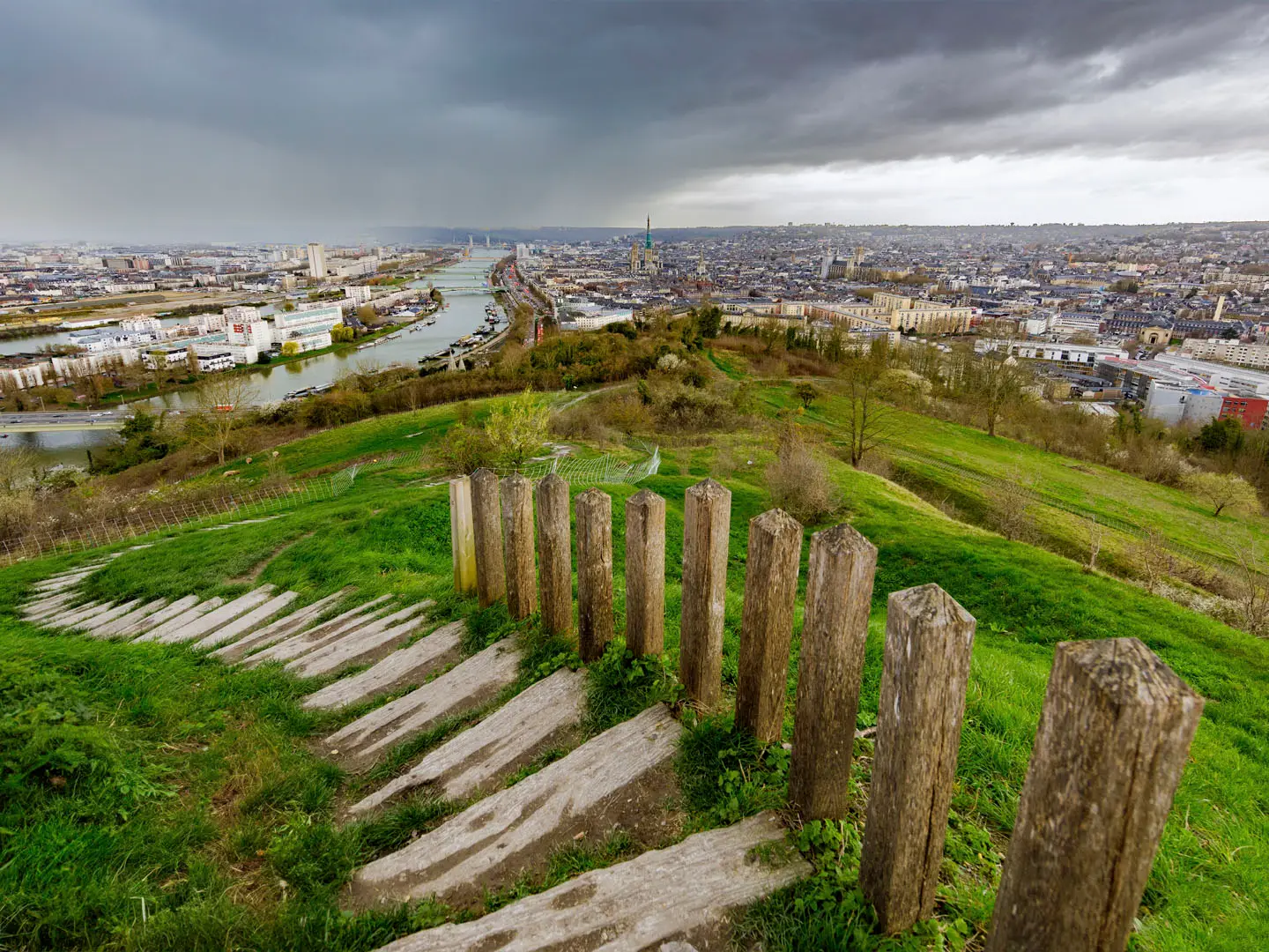
The official eastern terminus is Dijon, not Source-Seine. From Dijon the GR2 climbs north-west through the Côte-d’Or, reaches Source-Seine / Saint-Seine-l’Abbaye, then follows the Seine through Châtillon-sur-Seine, Troyes, Montereau-Fault-Yonne, Melun, Corbeil-Essonnes, Évry-Courcouronnes and central Paris. Downstream it continues via Vétheuil, La Roche-Guyon, Giverny / Vernon, Les Andelys, Rouen, the Seine abbeys around Saint-Martin-de-Boscherville, Jumièges and Saint-Wandrille, then finishes at Le Havre on the estuary. It is a linear, town-to-town route with hotels, guesthouses, hostels and campsites. For shorter French waterway walks, compare the Burgundy Canal Towpath, Berry Canal Walk or Normandy’s D-Day Beaches Circuit.
History of the Seine and the GR2
The Seine has shaped settlement, trade and culture since Celtic and Gallo-Roman times; a sanctuary to the river goddess Sequana stood near its source, and Paris grew from an island settlement on the river. Downstream, abbeys such as Jumièges and Saint-Wandrille and the fortress of Château Gaillard reflect Frankish, Norman and medieval English-Norman power struggles. The modern GR2 was first waymarked in the 1970s, with the Paris crossing and remaining sections added in the 2000s.
Notable highlights
- Source of the Seine, Source-Seine: The official river source in the Côte-d’Or, set in a landscaped park with a grotto and a statue of Sequana. It is an early symbolic waypoint after starting in Dijon.
- Châtillon-sur-Seine and the Vix krater: This Burgundian town on the young Seine has a museum holding the Treasure of Vix, including the ancient bronze Vix krater.
- Paris and the Seine quays: The GR2 crosses the French capital along made-up quays and promenades, passing river landmarks such as Notre-Dame and historic bridges.
- Château Gaillard, Les Andelys: A ruined clifftop fortress above the Seine, begun by Richard the Lionheart and later captured by Philip II of France. The approach gives one of the route’s most dramatic lower-Seine viewpoints.
- La Roche-Guyon: A village wedged between the Seine and chalk cliffs, with a château that layers medieval, Renaissance and wartime history.
- Jumièges Abbey and the Seine abbeys: The Normandy stretch links major abbey sites including Saint-Martin-de-Boscherville, Jumièges and Saint-Wandrille, adding strong historical interest to the lower river walk.
Challenges to expect
The GR2 is not technically hard, but it is long: 858 km over 35-40 days. Expect mixed dirt, gravel and paved surfaces, substantial urban walking through Paris and suburbs, and some steep chalk coteaux on the lower Seine, including Les Andelys and the Côte des Deux-Amants. Riverside paths can be muddy or flooded after heavy rain. Waymarking is standard white-red GR, but city navigation still needs attention. Wild camping is restricted or discouraged.
HikeList Score
GR2 (Seine River Trail) scored 81/100 on HikeList's trail-quality metrics.
See score breakdownHide breakdown
- Ideal length 52
- Balanced challenge 100
- Scenery & wildness 72
- Varied terrain 83
- Accommodation 100
- Food & support 88
- Path quality 80
- Season flexibility 89
Computed from length, challenge, scenery & wildness, terrain variety, accommodation, food & support, path quality and season flexibility.
 France
Show more data Show less
- River Valley
- Forest
- Urban
- Dirt
- Gravel
- Paved
- Hotels
- Campsites
- Hostels
- Guesthouses
- Family Friendly
- Pet Friendly
- Restrooms
- Water Sources
- Campsites
- Picnic Areas
Photos from hikers
Taken on the trail by people who've reviewed GR2 (Seine River Trail).
Reviews
How would you rate GR2 (Seine River Trail)?
Tap a star to start your review — you could be the first.