Burgundy Canal Towpath
How would you rate Burgundy Canal Towpath?
Tap a star to share your experience and help other hikers.
Burgundy Canal Towpath: A Flat Canal Walk Across Burgundy
HikeList Score
Burgundy Canal Towpath scored 74/100 on HikeList's trail-quality metrics.
See score breakdownHide breakdown
- Ideal length 90
- Balanced challenge 50
- Scenery & wildness 59
- Varied terrain 71
- Accommodation 83
- Food & support 88
- Path quality 80
- Season flexibility 89
Computed from length, challenge, scenery & wildness, terrain variety, accommodation, food & support, path quality and season flexibility.
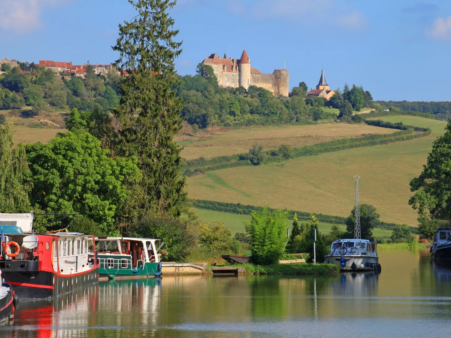
The Burgundy Canal Towpath is a 242 km, easy point-to-point walk along the Canal de Bourgogne in eastern France, usually walked in 12-13 days. It links Migennes on the river Yonne with Saint-Jean-de-Losne on the river Saone, crossing Burgundy through canal villages, farmland, the Ouche valley and Dijon. This is a flat, leisurely waterway route rather than a mountain trail, best for walkers who want simple navigation, regular towns and long, steady days on towpath surfaces.
Route Overview
Most walkers go north-west to south-east from Migennes to Saint-Jean-de-Losne, though the towpath works in either direction. The route passes Saint-Florentin, Tonnerre, Tanlay, Ancy-le-Franc, Montbard, Venarey-les-Laumes / Alesia, Pouilly-en-Auxois, Vandenesse-en-Auxois, the Ouche valley and Dijon before reaching the Saone plain. Train access is available at both ends and at intermediate towns including Montbard and Dijon. Navigation is unusually simple: follow the canal, with one important exception at the Voute de Pouilly tunnel, where walkers go over the hill to Escommes. For similar French routes, compare the Canal du Midi Towpath, Berry Canal Walk and Alsace Vineyard Trail.
History of the Canal de Bourgogne
The Canal de Bourgogne was built to connect the Yonne, Seine and Channel basin with the Saone, Rhone and Mediterranean basin. Authorisation came under Louis XV in 1773, construction began in 1775, and the canal opened to through traffic in 1832 after decades of work. Its summit section includes the Voute de Pouilly tunnel, dug between 1826 and 1832. Commercial freight has now gone, but the 189 locks, lock houses and tree-lined towpath remain as working canal heritage.
Notable highlights
Pouilly-en-Auxois tunnel and canal summit (378 m): The canal reaches its highest point here, with the roughly 3.3 km Voute de Pouilly tunnel cutting through the watershed. There is no through-towpath, so walkers detour over the hill to Escommes.
Chateauneuf-en-Auxois: A fortified hilltop village above the canal near Vandenesse-en-Auxois, ranked among Les Plus Beaux Villages de France. The climb off the towpath gives wide views over the Auxois countryside.
Abbaye de Fontenay: A UNESCO World Heritage Cistercian abbey founded in 1118, reached by a short detour from the canal near Montbard. It is one of the major cultural stops on the route.
Lock houses and locks: Around 189 locks line the canal, many with traditional maisons d'eclusier. Some are still beautifully kept, and others now serve as guesthouses, cafes or small art stops.
Dijon: The historic capital of Burgundy sits roughly two-thirds along the towpath. Its old town, ducal palace, food shops and transport links make it the natural rest and resupply point.
Tanlay and Ancy-le-Franc chateaux: These Renaissance chateaux sit close to the northern, Yonne-side reaches of the canal near Tonnerre. They add an architectural focus to the early stages of the walk.
Challenges to expect
The walking is easy, flat and hard to lose, but the full 242 km still demands consistent days and planning. Surfaces vary from sealed voie verte to gravel and dirt towpath, so unpaved sections can be muddy after rain. Open stretches have limited shade in summer. Services are regular overall, but rural gaps mean accommodation, food and water stops should be checked ahead.
HikeList Score
Burgundy Canal Towpath scored 74/100 on HikeList's trail-quality metrics.
See score breakdownHide breakdown
- Ideal length 90
- Balanced challenge 50
- Scenery & wildness 59
- Varied terrain 71
- Accommodation 83
- Food & support 88
- Path quality 80
- Season flexibility 89
Computed from length, challenge, scenery & wildness, terrain variety, accommodation, food & support, path quality and season flexibility.
 France
Show more data Show less
- Wetlands
- Urban
- Paved
- Gravel
- Dirt
- Hotels
- Hostels
- Campsites
- Wheelchair Accessible
- Stroller Accessible
- Family Friendly
- Pet Friendly
- Restrooms
- Water Sources
- Campsites
- Picnic Areas
In these collections
Photos from hikers
Taken on the trail by people who've reviewed Burgundy Canal Towpath.
Reviews
How would you rate Burgundy Canal Towpath?
Tap a star to start your review — you could be the first.