Mainwanderweg (Main River Trail)
How would you rate Mainwanderweg (Main River Trail)?
Tap a star to share your experience and help other hikers.
Mainwanderweg (Main River Trail): Source-to-Rhine Hiking Guide
HikeList Score
Mainwanderweg (Main River Trail) scored 86/100 on HikeList's trail-quality metrics.
See score breakdownHide breakdown
- Ideal length 72
- Balanced challenge 90
- Scenery & wildness 82
- Varied terrain 94
- Accommodation 100
- Food & support 88
- Path quality 80
- Season flexibility 89
Computed from length, challenge, scenery & wildness, terrain variety, accommodation, food & support, path quality and season flexibility.
The Mainwanderweg is a 540 km waymarked long-distance trail in Germany, following the River Main from the White Main source below the Ochsenkopf in the Fichtelgebirge to Mainz-Kostheim on the Rhine. Allow about 22 days. The walking is mostly moderate: easy riverside paths, vineyard slopes and forest tracks, but with a multi-week distance and some hillier sections in the Fichtelgebirge, Spessart and Odenwald. It suits hikers who want a cultural river thru-hike with towns, wine villages and regular accommodation.
Route Overview
This is a point-to-point trail, marked end-to-end by a blue capital M on a white background. It starts at the Weißmainquelle, the source of the White Main just below the 1,024 m Ochsenkopf, then reaches the Main valley via Bischofsgrün, Bad Berneck and Kulmbach. The route continues through Bad Staffelstein, Bamberg, Volkach, Kitzingen, Würzburg, Lohr am Main, Wertheim, Miltenberg, Aschaffenburg, Seligenstadt and Frankfurt am Main before finishing at Mainz-Kostheim, where the Main enters the Rhine. For other German long-distance options, compare the river-and-limestone scenery of the Altmühltal Panorama Trail or the hillier Goldsteig.
History of the Main-Wanderweg
The Main-Wanderweg was opened in 1972 by Franconian and Bavarian hiking clubs to link the Main’s source to its mouth, using the blue M waymark. The river has long been a trade and cultural corridor through Franconia and the Rhein-Main area. On foot, that history shows in bishops’ cities such as Bamberg and Würzburg, baroque churches associated with Balthasar Neumann, walled wine towns and the long-established settlements of the Main valley.
Notable highlights
- Ochsenkopf and the White Main source: The trail begins at the spring of the Weißer Main (White Main) just below the 1,024 m Ochsenkopf, the second-highest peak of the Fichtelgebirge. The nearby Asenturm viewing tower makes this a strong start before the route drops towards the Main valley.
- Bamberg: A UNESCO World Heritage city with an intact medieval and baroque old town, a hillside cathedral and Rauchbier breweries. It sits astride the Regnitz close to the Main and is one of the cultural anchors of the route.
- Kloster Banz and Vierzehnheiligen: These two landmark baroque churches by Balthasar Neumann face each other across the Main valley above Bad Staffelstein. They are among the most distinctive architectural sights on the upper Main.
- Franconian wine country around Volkach and Kitzingen: The trail passes through the Mainschleife and Mainfranken vineyards, an area known for dry Silvaner and the flat Bocksbeutel bottle. Expect exposed vineyard walking in warm weather.
- Würzburg Residenz: This UNESCO-listed baroque palace of the prince-bishops is known for its grand staircase and Tiepolo ceiling fresco. Würzburg is also overlooked by the hilltop Marienberg Fortress.
- Wertheim and Miltenberg: Wertheim stands where the Tauber joins the Main, below a ruined hilltop castle. Miltenberg is known for timber-framed houses, a medieval market square and a hilltop castle above the Mainviereck.
Challenges to expect
The Mainwanderweg is not technically hard, but 540 km demands steady pacing and recovery. Surfaces vary between asphalt, gravel and dirt, with mostly gentle gradients but short steeper sections in the Fichtelgebirge, Spessart and Odenwald. Vineyard stages can be hot and exposed in high summer, while the Fichtelgebirge start can hold snow into spring. Accommodation is plentiful in towns and wine villages but sparser on the opening upland stages. For tougher upland walking, see the Albsteig or Eifelsteig.
HikeList Score
Mainwanderweg (Main River Trail) scored 86/100 on HikeList's trail-quality metrics.
See score breakdownHide breakdown
- Ideal length 72
- Balanced challenge 90
- Scenery & wildness 82
- Varied terrain 94
- Accommodation 100
- Food & support 88
- Path quality 80
- Season flexibility 89
Computed from length, challenge, scenery & wildness, terrain variety, accommodation, food & support, path quality and season flexibility.
 Germany
Show more data Show less
- River Valley
- Meadows
- Vineyards
- Forest
- Hills
- Paved
- Gravel
- Dirt
- Hotels
- Guesthouses
- Hostels
- Campsites
- Family Friendly
- Pet Friendly
- Restrooms
- Water Sources
- Campsites
- Picnic Areas
Download Our Full Guide to Mainwanderweg (Main River Trail) FREE!
Get our comprehensive guide to this hike for free. Save it for later reading or print out at home.
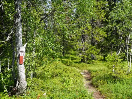
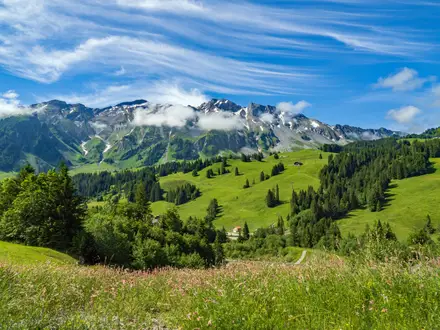
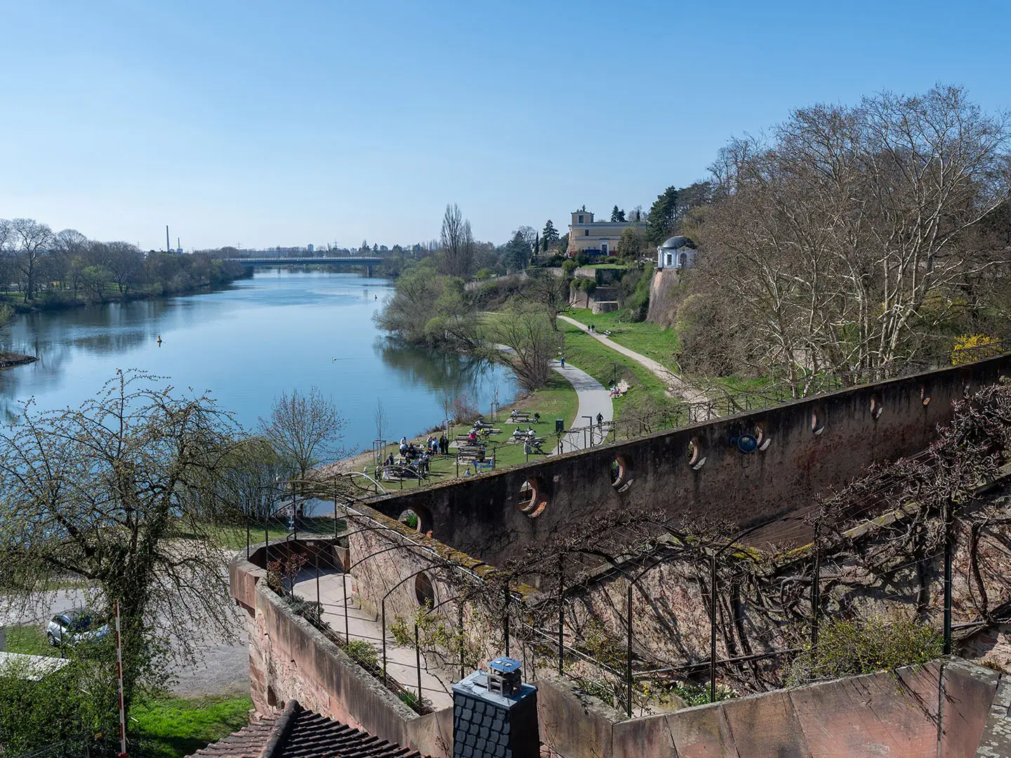
Photos from hikers
Taken on the trail by people who've reviewed Mainwanderweg (Main River Trail).
Mainwanderweg (Main River Trail): The Complete Guide
 i
Image by Claudia Evans
i
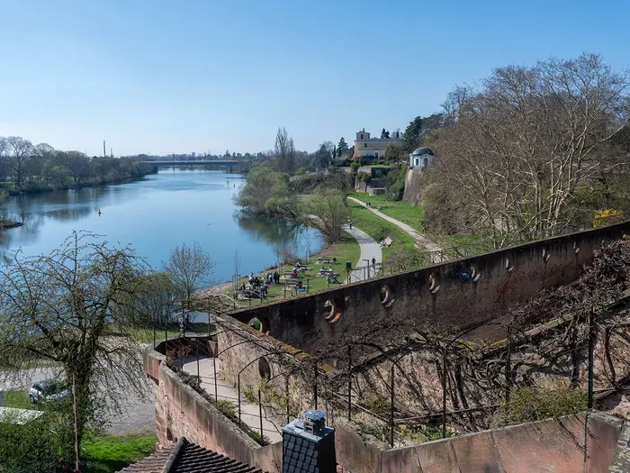
Image by Claudia Evans The Mainwanderweg is a long, civilised source-to-mouth walk following der Main [the Main] from the Weißmainquelle [White Main source] below the Ochsenkopf in the Fichtelgebirge to Mainz-Kostheim, where the river meets the Rhein [Rhine]. It suits walkers who want a real multi-week Fernwanderweg without committing to remote mountain terrain.
The route begins in upland forest, then settles into the rhythm of the Main valley: meadows, orchards, gravel tracks, riverside paths and long stretches through Franconian wine country. Towns such as Kulmbach, Bamberg, Würzburg, Wertheim, Miltenberg, Aschaffenburg and Frankfurt am Main give the walk a strong cultural spine as well as regular services.
This is not a technical trail, and the blue “M” waymarking makes it straightforward to follow in both directions. The appeal is in the continuity: walking from spring to confluence, watching a small upland stream become one of Germany’s great river corridors.
What the trail asks for is time, steady legs and sensible logistics. At 540 km, most walkers should think in terms of 22–25 days, with attention to thinner accommodation in the opening Fichtelgebirge stages, exposed vineyard walking in hot weather and a final lower-Main section that may need splitting more comfortably than a single long day.
This guide covers stages, daily planning, accommodation, food, transport, terrain and the common mistakes to avoid.
Stage-by-Stage Guide
The stages below use the 22-day breakdown for the full 540 km route. There is no single central official itinerary for the Mainwanderweg, so distances should be treated as approximate and checked against the current waymarked blue M route before booking fixed accommodation.
Stage 1: Weißmainquelle / Ochsenkopf to Bad Berneck — approx. 22 km
The opening stage is the most upland-feeling part of the whole Mainwanderweg. It begins at the Weißmainquelle [White Main source] below the Ochsenkopf in the Fichtelgebirge, then works down from forested high ground towards Bad Berneck.
Underfoot, expect forest paths, dirt tracks and some firmer surfaced sections rather than the easy riverside walking that dominates later weeks. This is also the stage most affected by early-season conditions: the Fichtelgebirge can hold snow into spring, and wet forest ground can be slower than the distance suggests.
Bischofsgrün is the key settlement near the start area and is the practical access point for most walkers arriving by public transport, normally by bus from Bayreuth. The Weißmainquelle itself is not a railhead, so the start logistics should be planned carefully and the exact waymarked start point should be checked before travelling.
Food, water and accommodation are thinner here than on the Main valley stages. Carry enough food and drink from the start area, and book Bad Berneck accommodation ahead, especially outside the main holiday season when smaller inns may have limited opening days.
Navigation is generally by the blue M waymark, but do not confuse the route with paths heading for the Ochsenkopf summit: the Mainwanderweg starts at the spring below the mountain, not on the summit itself. A map or offline GPX is useful on this first forested stage where junctions can be less obvious than on the later riverbank sections.
Stage 2: Bad Berneck to Kulmbach — approx. 22 km
This stage continues the transition from the Fichtelgebirge into the upper Main country. The walking becomes less upland and more settled as the route approaches Kulmbach, one of the first major towns on the trail.
Terrain is a mix of minor tracks, paths and surfaced links, with easier gradients than the first day. There may still be short climbs and descents away from the river line, but the overall feel is gentler.
Kulmbach is a substantial end point, known for its brewing heritage and the Plassenburg above the town. It is also near the area where the White Main and Red Main join to form the Main proper, although the trail itself started earlier at the Weißmainquelle.
Food and accommodation are much easier in Kulmbach than on the start stage, and Kulmbach has rail access. Bad Berneck is less connected than Kulmbach, so check onward and return transport before relying on this as a short section.
Navigation is straightforward in principle: follow the blue M rather than assuming the route simply follows the most direct road or river line. The confluence area near Kulmbach can be conceptually confusing because many people associate it with the “start” of the Main, but it is not the start of the Mainwanderweg.
Stage 3: Kulmbach to Altenkunstadt — approx. 24 km
From Kulmbach, the route settles into the upper Main valley. This is a typical town-to-town day, with gentler ground, agricultural surroundings and increasing use of valley tracks and surfaced sections.
The walking is not technically difficult, but the 24 km length makes it a full day if taken at a relaxed pace. Expect a practical mixture of gravel tracks, field-edge paths and asphalt rather than continuous soft footpath.
Kulmbach is the main resupply point at the start of the day. Altenkunstadt is a smaller end point, so accommodation and evening food should be checked before arrival, particularly midweek or outside peak holiday periods.
Public transport is strongest at Kulmbach; options at the end should be checked before building a section hike around this stage. If accommodation is limited in Altenkunstadt, using nearby transport or adjusting the stage length may be necessary.
Navigation is mainly about staying with the waymarked line where tracks, local paths and cycle routes overlap. In the open valley, summer heat can be more of an issue than terrain, so carry enough water between settlements.
Stage 4: Altenkunstadt to Bad Staffelstein — approx. 20 km
This shorter stage brings the route into one of the most distinctive cultural sections of the upper Main. The area around Vierzehnheiligen and Bad Staffelstein is a major highlight, with landmark baroque architecture above the valley.
The terrain remains moderate, with valley walking broken by approaches to higher viewpoints and religious sites. Paths may alternate between paved lanes, gravel tracks and hillside or field paths.
Vierzehnheiligen is the key landmark on or close to this stage, and it is worth allowing time rather than treating the day as only a transit walk. Bad Staffelstein makes a practical overnight halt with a wider choice of services than the smaller villages before it.
Food and water are most reliable at the stage ends and at larger visited places. Do not assume every small village or landmark will have open refreshments at the time of arrival; carry enough for the day and check opening times if depending on a specific stop.
Bad Staffelstein is one of the better-connected towns on this part of the Main valley. Navigation can be slightly more involved around visitor sites and local walking loops, so keep following the blue M rather than other regional signs.
Stage 5: Bad Staffelstein to Bamberg — approx. 25 km
This is a longer but rewarding stage linking the upper Main’s baroque landmarks with Bamberg, one of the major cultural stops of the whole trail. Kloster Banz and the Lichtenfels area lie on or near the line before the route continues towards Bamberg.
Terrain is generally easy to moderate, with a mixture of valley paths, tracks, surfaced ways and occasional hillier approaches where the route rises for views or avoids the immediate riverbank. The distance is the main challenge.
Bamberg is a UNESCO World Heritage city on the Regnitz close to the Main, with a historic old town, cathedral hill and breweries. It is a natural place for a shorter walking day, rest day or planned overnight with more accommodation choice.
Food and accommodation are good at Bamberg, and Lichtenfels and Bamberg both have rail access in this wider section. If staying outside Bamberg’s centre, check how far accommodation lies from the waymarked route, as detours across the city can add time at the end of the day.
Navigation into Bamberg needs attention because urban paths, river channels and local walking routes can make the waymark easy to miss. Use the blue M with a map rather than simply following the most obvious riverside path.
Stage 6: Bamberg to Eltmann — approx. 26 km
Leaving Bamberg, the Mainwanderweg returns to a more open valley character. This is one of the longer standard stages, so an early start is sensible if time is also wanted for Bamberg in the morning.
Expect easy gradients but a fair amount of hard or semi-hard surface, including riverside and cycle-path style walking where the route shares the valley corridor. In hot weather, open sections can feel tiring despite the modest terrain.
Bamberg is the major resupply point at the start. Eltmann is a smaller end point, so accommodation and evening meals should be arranged in advance rather than left to chance.
Rail access is excellent at Bamberg; onward transport from Eltmann should be checked before relying on it for a section break. Road access is generally easier here than in the Fichtelgebirge, but local bus and rail details change and should be checked before travelling.
Navigation is usually uncomplicated, but long valley stages can tempt walkers onto parallel cycle paths or river tracks. Keep checking for the blue M, especially at junctions leaving towns and where the path moves away from the most obvious riverside line.
Stage 7: Eltmann to Gerolzhofen — approx. 24 km
This stage is important to plan carefully because the Mainwanderweg does not simply shadow Schweinfurt on the north-bank urban line. The route in this part uses the Eltmann–Gerolzhofen–Volkach side of the region, with more influence from the Steigerwald side of the Main country.
The walking can feel less purely riverside than the preceding valley stages. Expect a mix of tracks, lanes, field paths and some wooded or gently rolling sections rather than a continuous flat river promenade.
Gerolzhofen is the practical target for the day and marks the approach to the Franconian wine country that becomes more prominent from the next stage onward. Services should be checked before arrival, as this is not the same as finishing in a large rail-served Main valley city.
Carry food and water for the stage rather than assuming frequent riverside cafés or shops. Accommodation in Gerolzhofen should be booked ahead, particularly if walking the full trail on a fixed schedule.
The main navigation warning is not to improvise towards Schweinfurt unless deliberately leaving the waymarked trail. Follow the blue M and verify the exact local line, as the broader Main valley can make alternative routes look plausible on a map.
Stage 8: Gerolzhofen to Volkach — approx. 22 km
This stage leads into Mainfranken, where vineyards, wine villages and more exposed slopes become a defining part of the route. Volkach is one of the classic trail towns and a strong overnight choice.
Terrain remains moderate, but the walking can be hotter and more open than earlier forest or meadow sections. Expect a mix of vineyard tracks, field ways, local lanes and occasional hard surfaces.
The key appeal is the approach to the Volkacher Mainschleife [Volkach Main loop], the near-circular bend of the Main ringed by steep Silvaner vineyards. Volkach itself is a useful place to pause, resupply and plan the next wine-country stage.
Food and accommodation are generally better in wine towns than in the smaller settlements between them, but opening hours can vary. Carry enough water in summer, as vineyard stages can be exposed and shade may be limited.
Navigation through vineyard tracks needs attention because many local paths and farm access roads intersect. The blue M is the route to follow; do not assume that every track contouring above the river rejoins the trail quickly.
Stage 9: Volkach to Kitzingen — approx. 20 km
This is one of the signature Mainfranken stages, centred on the Volkacher Mainschleife and the vineyard landscape around the Main. The distance is moderate, leaving time for viewpoints and town stops.
The route uses a mixture of valley paths, vineyard tracks and surfaced local ways. Gradients are usually modest, but short climbs for vineyard views can feel sharp in heat.
The Vogelsburg above Escherndorf and the Escherndorfer Lump vineyards are the defining highlights of this section. Kitzingen continues the wine-country theme, with walled-town character and good end-of-day services.
Food and water are easiest at Volkach and Kitzingen. Seasonal wine-region businesses may not keep the same hours year-round, so carry enough during the day and check any planned refreshment stops before relying on them.
The main caution is exposure. In high summer, start early, refill whenever possible and avoid underestimating a short stage simply because the gradients are gentle.
Stage 10: Kitzingen to Würzburg — approx. 24 km
This stage continues through Franconian wine country to Würzburg, one of the major cities and cultural high points of the Mainwanderweg. It is a full but manageable day for most fit walkers.
Expect vineyard and valley walking with a practical mixture of asphalt, gravel and local tracks. Surfaces are generally good, but hard ground can become tiring over several consecutive days.
Würzburg is dominated by Festung Marienberg [Marienberg Fortress] and is home to the UNESCO-listed Würzburger Residenz [Würzburg Residence]. It is also one of the best places on the trail for accommodation choice, food, rail connections and a rest day.
Kitzingen and Würzburg both offer strong resupply options. Between them, do not depend on every wine village or seasonal business being open; carry enough water, especially on exposed vineyard sections.
Navigation into Würzburg needs care, as urban approaches often involve a choice of riverside, road and local walking routes. Stay with the blue M and allow extra time for the final kilometres through the city environment.
Stage 11: Würzburg to Retzbach — approx. 18 km
After the intensity of Würzburg, this shorter stage gives a gentler day along the Mainfranken corridor. It is a good opportunity to start late after sightseeing or to use the reduced distance as a recovery stage.
The walking is generally easy, with river-valley gradients and a mix of surfaced paths, tracks and vineyard-side sections. Hard surfaces may still be common, so footwear comfort matters even on shorter days.
Würzburg is the obvious place for breakfast, supplies and transport. Retzbach is a smaller end point, so accommodation and evening food should be checked before committing to finish there.
Public transport is excellent from Würzburg; onward transport at Retzbach should be checked before travelling. If accommodation is unavailable at Retzbach, this is a stage where adjusting the day length may be easier than on the opening upland stages.
Navigation should be uncomplicated, but the route may not always stay tight to the river. Continue to follow the blue M through junctions with local paths and cycling infrastructure.
Stage 12: Retzbach to Karlstadt — approx. 13 km
This is the shortest stage in the itinerary and is best treated as a deliberate easy day. It works well for rest, laundry, sightseeing, or absorbing delays from previous longer stages.
Terrain is straightforward Main valley walking, with gentle gradients and a likely mix of paved and gravel sections. The short distance does not remove the need for water in hot weather, particularly where the path runs through open vineyard or field country.
Karlstadt is a practical and attractive end point with rail access and better services than many smaller villages. It is a sensible place to reset before the route continues towards the Main-Spessart section.
Food and accommodation should be easier in Karlstadt than in Retzbach, but booking ahead is still sensible during busy holiday periods. Carry snacks rather than relying on a mid-stage stop, as the day is short and services between the two ends may be limited.
Navigation is mostly about avoiding complacency. Short stages can still involve local path junctions, so keep the blue M in sight rather than following any riverside option by default.
Stage 13: Karlstadt to Gemünden am Main — approx. 19 km
This stage takes the route further into the Main-Spessart region. The valley begins to feel more enclosed and wooded as the trail approaches Gemünden am Main.
Terrain remains easy to moderate, with river-valley walking mixed with tracks and occasional sections influenced by the surrounding hills. Expect good paths rather than technical ground.
Gemünden am Main is a useful trail town with rail access and makes a logical stop before the Spessart-influenced lower Main stages. Karlstadt and Gemünden both work well for section hikers because transport is stronger than in many smaller places.
Food and water are most reliable at the stage ends. If planning a long lunch stop between towns, check current opening times rather than assuming availability.
Navigation is generally clear, but wooded hill edges and valley alternatives can create choices. Follow the blue M and keep an offline map available if leaving the river for higher ground.
Stage 14: Gemünden am Main to Lohr am Main — approx. 18 km
This is a moderate-distance day through the Main-Spessart landscape, with the Main valley bordered by wooded hills. It is one of the more pleasant rhythm stages after the wine-country towns.
The walking is non-technical, using established paths, tracks and some surfaced sections. Gradients are usually manageable, though the route can rise away from the immediate river where the valley narrows or local terrain requires it.
Lohr am Main is a practical overnight stop with rail access. It is also a good point to check the next two days, as accommodation patterns can vary more in the smaller Main-Spessart towns than in Würzburg or Bamberg.
Resupply is straightforward at Gemünden and Lohr. Carry enough food and drink for the middle of the day, especially outside summer weekends when smaller places may be quiet.
Navigation is mainly a matter of staying with the waymarks through wooded and valley-edge junctions. After rain, forest dirt paths can be muddier than the open vineyard tracks encountered earlier.
Stage 15: Lohr am Main to Marktheidenfeld — approx. 20 km
This stage continues along the wooded Main valley through the Spessart-influenced part of the route. It has a more enclosed, forested feel than the open Mainfranken vineyard stages.
Terrain is still within the easy-to-moderate range, but expect a mix of riverside sections, forest paths, gravel tracks and some asphalt. Short climbs away from the river are possible where the trail uses hillside or woodland routes.
Marktheidenfeld is the day’s end point and should be treated as the main accommodation and food base for the evening. Check accommodation before arrival, especially if walking in peak season or relying on smaller guesthouses.
Lohr is a good place to buy food before starting. Do not assume continuous services during the day, as this part of the trail can feel quieter between towns.
Navigation can be less visually obvious in forest than on open riverbanks. The blue M remains the key guide, and an offline map is useful where forestry tracks and local paths intersect.
Stage 16: Marktheidenfeld to Wertheim — approx. 22 km
This stage leads to Wertheim, one of the major historic towns on the lower Main. The finish at the confluence of the Tauber and the Main below Burg Wertheim is a clear highlight.
The terrain is varied but not difficult: river-valley walking, wooded slopes nearby, gravel or dirt paths, local lanes and some hard-surfaced stretches. The 22 km distance is moderate, but the day can feel longer if there are climbs away from the river.
Wertheim has rail access and a good range of town services, making it a strong overnight or section-break point. Its half-timbered centre and ruined hilltop castle justify arriving with time to spare.
Food and water are most reliable at Marktheidenfeld and Wertheim. Carry lunch and enough water if walking outside the main visitor season, when smaller intermediate services may not be open.
Navigation into Wertheim requires attention where town paths, river corridors and local routes converge. Follow the blue M to avoid drifting onto Tauber-side or local sightseeing routes unintentionally.
Stage 17: Wertheim to Miltenberg — approx. 25 km
This is a longer lower-Main stage between two of the most attractive historic towns on the trail. It is not technically hard, but the distance makes it a proper full day.
The route continues through the Main valley with wooded hills nearby, using a mixture of riverside ways, tracks and surfaced sections. Expect some harder walking surfaces and allow time for regular foot breaks.
Miltenberg is one of the best-preserved timber-framed towns on the Main, with Mildenburg above and a historic Marktplatz in the Churfranken district. It is a rewarding place to overnight rather than rush through.
Both Wertheim and Miltenberg have rail access and accommodation options. Between them, check food stops in advance and carry enough water, particularly in warm weather or if aiming to walk the stage without long breaks.
Navigation is generally logical along the Main corridor, but local alternatives and riverside paths can diverge. Keep checking the blue M, especially when leaving Wertheim and entering Miltenberg.
Stage 18: Miltenberg to Obernburg — approx. 20 km
This stage continues along the lower Main, with a settled valley character and wooded hills still close by. It is a moderate day after the longer Wertheim–Miltenberg stage.
Walking conditions are usually easy, with good paths, gravel tracks and surfaced riverside or local links. Hard surfaces can still be a cumulative issue on a multi-week walk, so this is a sensible stage for managing pace and foot care.
Miltenberg provides the main morning services and is worth using for supplies before leaving. Obernburg is the planned end point; accommodation and evening food should be checked before arrival.
Public transport at Miltenberg is useful for section planning. Transport options at Obernburg should be checked before relying on them, especially for a same-day return journey.
Navigation remains based on the blue M. Built-up areas and riverside cycle infrastructure can make parallel options tempting, so keep an eye on waymarks at junctions and bridges.
Stage 19: Obernburg to Aschaffenburg — approx. 22 km
This stage leads to Aschaffenburg at the gateway to the Spessart and into a more urbanised lower-Main environment. It is a practical day with a strong end point.
Terrain is easy to moderate, but expect more hard-surfaced walking as the route approaches a larger town. The Main valley remains the organising feature, with wooded hills giving way to more settlement near Aschaffenburg.
Aschaffenburg is a major highlight, known for Schloss Johannisburg, the red-sandstone Renaissance palace above the Main. It also has rail access and a good spread of accommodation and food options.
Carry normal day food and water from Obernburg, but resupply at Aschaffenburg is straightforward. If aiming to visit Schloss Johannisburg on arrival, allow extra time rather than planning a late finish.
Navigation becomes more urban towards the end. Watch for the blue M through built-up approaches and do not assume the most direct road line is the waymarked walking route.
Stage 20: Aschaffenburg to Seligenstadt — approx. 18 km
This shorter lower-Main stage moves from Aschaffenburg towards Seligenstadt and is a useful recovery day after several 20 km-plus stages. It is also the point where the route begins to feel increasingly connected to the Rhein-Main area.
Walking is generally straightforward, with gentle gradients and a likely increase in surfaced paths, riverside tracks and settlement-edge walking. The stage is not remote, but hard surfaces can still be tiring.
Aschaffenburg is the main supply point at the start. Seligenstadt has rail access and is a practical overnight halt before the longer approach to Frankfurt.
Accommodation and food are generally easier on the lower Main than in the early Fichtelgebirge stages, and campsites are more abundant in this part of the route. Individual openings should still be checked before travelling.
Navigation is usually simpler than in forested hill country, but the risk is following the wrong riverside or cycling line through built-up areas. Continue to use the blue M as the authority.
Stage 21: Seligenstadt to Frankfurt am Main — approx. 26 km
This is a longer stage into the Rhein-Main metropolis. The character changes from small-town river walking to a more urban and suburban approach to Frankfurt am Main.
Terrain is easy in gradient but often harder underfoot, with more asphalt, riverside promenades, cycle-path sections and built-up-area links. The distance and surface, rather than hills, are the challenge.
Frankfurt am Main is the largest city on the Main and a major transport hub. It has abundant accommodation, food and rail options, making it a logical place to pause before the final stage.
Food and water are much easier to find than on rural stages, but do not rely on constant access directly on the waymarked line. Carry water for long urban stretches, especially in hot weather when exposed paved paths can feel significantly warmer.
Navigation needs particular attention through the urban corridor. The blue M may share space with many local paths, cycle routes and riverfront alternatives, so use a current map and expect more road crossings and urban junctions than earlier on the trail.
Stage 22: Frankfurt am Main to Mainz-Kostheim — approx. 40 km
The final stage follows the lower Main from Frankfurt to Mainz-Kostheim, where the Main flows into the Rhein [Rhine] opposite Mainz. At around 40 km, this is the outlier in the itinerary and should be split by most walkers.
The terrain is not technically difficult, but it is a long day on predominantly low-gradient urban and riverside surfaces. Hard paths, heat reflected from built-up areas and the mental fatigue of navigating a metropolitan corridor can make it tougher than the elevation profile suggests.
Frankfurt and the Mainz-Kostheim / Mainz area both have major rail access, so shortening or splitting the stage is usually more practical than forcing a 40 km finish. The exact split point should be chosen using current maps, accommodation availability and transport times; this should be checked before travelling.
Food, water and services are generally much more available than in rural sections, but the same rule applies: carry enough to walk several hours without depending on a specific café, kiosk or shop. Accommodation at the finish is best planned around Mainz-Kostheim, Wiesbaden or Mainz according to transport and budget.
Navigation is the main practical issue. The official mouth-end is Mainz-Kostheim on the right bank, not simply “somewhere in Mainz”, so follow the blue M and use a map for the final approach to the confluence of the Main and Rhein.
The main warning is distance. Unless already comfortable with 40 km days on hard surfaces, split this stage and finish the Mainwanderweg in better condition rather than turning the final day into an endurance exercise.
Recommended Itinerary
There is no single official day-by-day schedule for the Mainwanderweg, so the most practical plan is to build the walk around town-to-town stages of roughly 18–26 km. The exception is the final Frankfurt am Main to Mainz-Kostheim leg, which is about 40 km and should be split by most walkers.
The itinerary below is a standard 22-stage structure using the main stage towns in order. Treat it as a planning framework rather than a booking list: check current mapping, accommodation availability and local transport before fixing overnight stops.
Standard itinerary: 22 stages, with a strongly recommended split at the end
| Day | From | To | Approx. distance | Why this stage makes sense | Services/accommodation notes |
|---|---|---|---|---|---|
| 1 | Weißmainquelle / Ochsenkopf | Bad Berneck | 22 km | Starts at the Weißmainquelle [White Main source] below the Ochsenkopf and gets the main upland section of the Fichtelgebirge under way early. This is one of the more important stages to plan carefully because the start is the least connected part of the whole route. | Accommodation is thinner in the Fichtelgebirge than later in the Main valley. Reach the start via Bischofsgrün/Ochsenkopf by bus from Bayreuth; current bus times should be checked before travelling. |
| 2 | Bad Berneck | Kulmbach | 22 km | A practical descent towards the Main valley, ending in a substantial Franconian town with better onward transport. Kulmbach also works well as the first major resupply and recovery point after the upland start. | Kulmbach has rail access and a wider choice of town services than the opening stages. Book ahead if arriving at weekends or during local events. |
| 3 | Kulmbach | Altenkunstadt | 24 km | Keeps the daily distance steady as the route settles into the upper Main corridor. The stage is long enough to make progress without forcing an excessive day. | Expect town and village services rather than remote-trail infrastructure. Check accommodation availability in advance, especially if relying on a small guesthouse or Pension. |
| 4 | Altenkunstadt | Bad Staffelstein | 20 km | A slightly easier stage that positions you well for the landmark baroque sights around Vierzehnheiligen and Kloster Banz. Bad Staffelstein is a useful overnight point before the longer walk to Bamberg. | Bad Staffelstein has rail access nearby on the Main corridor and generally better services than smaller villages. Accommodation should still be booked ahead in busy periods. |
| 5 | Bad Staffelstein | Bamberg | 25 km | A rewarding but full day linking the upper Main sights with Bamberg, one of the major cultural stops on the trail. The distance is manageable for fit walkers but worth starting early if time is wanted in Bamberg. | Bamberg has rail access and a broad accommodation base. It is also one of the best places on the route for a rest day or a late-arrival recovery night. |
| 6 | Bamberg | Eltmann | 26 km | One of the longer standard stages, moving out of Bamberg and along the Main-side landscape towards the Steigerwald side of the route. It suits walkers who are comfortable with a full day after a well-served overnight stop. | Services are more regular than in the Fichtelgebirge, but accommodation should still be checked before committing to the day’s endpoint. Consider shortening this stage if leaving Bamberg late. |
| 7 | Eltmann | Gerolzhofen | 24 km | Keeps the route moving through the Mainfranken transition towards the wine country around Volkach. The distance is typical for a three-and-a-half-week thru-hike pace. | This is a stage where advance booking matters more than in the larger rail-served cities. Check current local transport before relying on it as a bail-out option. |
| 8 | Gerolzhofen | Volkach | 22 km | A sensible approach to the Volkacher Mainschleife [Volkach Main loop], one of the signature landscape sections of the whole trail. The distance leaves time for the vineyards and viewpoints around the Main loop. | Volkach is a key wine-town overnight. Accommodation can be in demand during wine-harvest periods and weekends, so booking ahead is sensible. |
| 9 | Volkach | Kitzingen | 20 km | A moderate stage through the Franconian wine country, keeping the walking day shorter after the Mainschleife section. This is a good day to avoid rushing, especially in hot weather on exposed vineyard tracks. | Wine villages and towns usually provide good facilities, but high summer heat and autumn wine events can affect both walking comfort and room availability. |
| 10 | Kitzingen | Würzburg | 24 km | A full but logical stage into Würzburg, one of the major towns on the Mainwanderweg. Ending here gives access to extensive services and major onward transport. | Würzburg has rail access and a wide range of accommodation. It is one of the most practical places for a rest day, laundry, replacement gear or joining/leaving the trail. |
| 11 | Würzburg | Retzbach | 18 km | A shorter stage after Würzburg, useful if time is wanted in the city before leaving. It also starts the gentler Main-valley sequence north-west of Würzburg without forcing a long day. | Retzbach is a smaller overnight than Würzburg, so check accommodation before booking the previous night. Würzburg remains the stronger logistics base. |
| 12 | Retzbach | Karlstadt | 13 km | The shortest standard stage, best treated as an easy recovery day or combined with another stage by faster walkers. It helps balance the itinerary after the longer Bamberg–Eltmann and Kitzingen–Würzburg days. | Karlstadt has rail access and works well as a flexible overnight. This short day can also be useful if weather, heat or previous fatigue has built up. |
| 13 | Karlstadt | Gemünden am Main | 19 km | A comfortable Main-valley day leading to Gemünden am Main, an important junction town on the route. The distance keeps options open if accommodation needs adjusting. | Gemünden am Main has rail access and is a good section-hike start or finish point. Check current accommodation availability before relying on same-day booking. |
| 14 | Gemünden am Main | Lohr am Main | 18 km | A moderate day into the Spessart-influenced lower Main landscape. The shorter distance gives useful flexibility if the route rises away from the immediate river corridor. | Lohr am Main has rail access and town services. This is another practical point for resupply and for breaking the trail into sections. |
| 15 | Lohr am Main | Marktheidenfeld | 20 km | A steady stage between two established Main towns, keeping the itinerary at a sustainable pace. It is a good middle-distance day before the approach to Wertheim. | Marktheidenfeld offers town services and accommodation, but book ahead rather than assuming late availability. |
| 16 | Marktheidenfeld | Wertheim | 22 km | A natural stage to Wertheim, where the Tauber meets the Main below Burg Wertheim. The distance is typical and the destination is one of the strongest overnight stops in this part of the route. | Wertheim has rail access and a good range of visitor services. It is a sensible place for a half-day pause if walking the whole trail continuously. |
| 17 | Wertheim | Miltenberg | 25 km | A longer but rewarding stage through the lower Main corridor towards Churfranken. Miltenberg is a strong endpoint with one of the best-preserved historic centres on the Main. | Miltenberg has rail access and good town facilities. Accommodation can be popular in the main season, so advance booking is recommended. |
| 18 | Miltenberg | Obernburg | 20 km | A moderate day after the longer Wertheim–Miltenberg stage. It keeps the route progressing through the lower Main without overloading consecutive days. | Obernburg provides a practical overnight point. Check current local transport and accommodation before fixing the stage. |
| 19 | Obernburg | Aschaffenburg | 22 km | A logical stage into Aschaffenburg at the gateway to the Spessart, with Schloss Johannisburg as the major landmark. The distance is well within the standard daily range. | Aschaffenburg has rail access and broad urban services. It is one of the best lower-Main places for resupply, rest or a section break. |
| 20 | Aschaffenburg | Seligenstadt | 18 km | A shorter stage that eases the transition towards the Rhein-Main area. It is a useful recovery day before the longer approach to Frankfurt. | Seligenstadt is a practical overnight before entering the Frankfurt area. Accommodation should be checked ahead, particularly at weekends. |
| 21 | Seligenstadt | Frankfurt am Main | 26 km | A long but sensible stage into the Main’s largest city and the best-served transport hub on the trail. Expect a more urban feel as the route enters the Rhein-Main area. | Frankfurt am Main has extensive rail connections and the widest accommodation choice on the route. It is the most convenient place to pause before the final push to Mainz-Kostheim. |
| 22 | Frankfurt am Main | Mainz-Kostheim | 40 km | This is the outlier in the standard breakdown: it reaches the official mouth-end where the Main flows into the Rhein [Rhine], but the distance is too long for many walkers at the end of a multi-week hike. Strong walkers may complete it in one day; most should split it. | Use Frankfurt and the Rhein-Main transport network to divide this into two shorter days. The exact intermediate overnight stop should be chosen from current mapping and accommodation availability before booking. |
Slower variant: 24–26 days
A slower itinerary suits walkers carrying heavier packs, families walking sections, anyone hiking in high summer, and those who want time in Bamberg, Würzburg, Wertheim, Miltenberg, Aschaffenburg or Frankfurt am Main.
The easiest way to slow the route down is not to change the whole schedule, but to split selected longer days:
- Split the 25–26 km days where accommodation allows, especially Bad Staffelstein–Bamberg, Bamberg–Eltmann, Wertheim–Miltenberg and Seligenstadt–Frankfurt am Main.
- Split Frankfurt am Main–Mainz-Kostheim as standard unless 40 km on the final day is genuinely comfortable.
- Add rest or half-rest days in the larger rail-served towns, especially Bamberg, Würzburg, Aschaffenburg and Frankfurt am Main.
- Use the Main-valley railway access to shorten a day if heat, fatigue or accommodation availability makes the planned endpoint awkward.
For a slower plan, exact intermediate stops should be selected with current maps and booking platforms rather than assumed. This should be checked before travelling.
Faster variant: about 19–21 days
A faster itinerary is only sensible for fit walkers already comfortable with repeated 28–35 km days on mixed asphalt, gravel and forest tracks. The Mainwanderweg is not technically hard, but the cumulative distance is the real challenge.
The easiest places to gain time are the shorter middle stages, where rail-served towns make logistics more forgiving:
- Combine Würzburg–Retzbach and Retzbach–Karlstadt into one longer day of about 31 km.
- Combine Karlstadt–Gemünden am Main and Gemünden am Main–Lohr am Main only if a roughly 37 km day is realistic.
- Combine Aschaffenburg–Seligenstadt with surrounding lower-Main stages only if accommodation and transport options line up.
- Keep the opening Fichtelgebirge days conservative; accommodation is thinner and the start has weaker public transport than the Main valley.
The 40 km Frankfurt am Main–Mainz-Kostheim stage should not be used as a routine faster-day benchmark. It is possible for strong long-distance walkers, but for most hikers it is a late-route endurance day rather than good planning.
Planning the Route
How many days to allow
Most walkers should plan the Mainwanderweg as a three-and-a-half-week journey rather than a fast river walk. A practical full-route schedule is usually 22–25 walking days, with daily stages mostly in the 18–26 km range.
There is no single official day-by-day itinerary, so the route is best planned around overnight stops, rail access and the distance each walker is comfortable repeating for several weeks. The final stretch from Frankfurt am Main to Mainz-Kostheim is around 40 km in the sample schedule and should be split by most walkers unless deliberately planning a very long final day.
A faster schedule is possible for strong walkers, but it gives little margin for heat, sightseeing, laundry, rest days or accommodation gaps. A slower schedule suits this trail well: many of the best stops are towns and wine villages where arriving early is more useful than covering extra kilometres.
Building realistic stages
The easiest way to plan the route is to divide it into accommodation-based stages, not to chase equal mileage. The Main valley has frequent towns, but the opening Fichtelgebirge stages are less forgiving, and the first days around Weißmainquelle, Bischofsgrün, Bad Berneck and Kulmbach deserve more attention when booking.
Once the trail reaches the Main valley, stage planning becomes easier. Towns such as Kulmbach, Bad Staffelstein, Bamberg, Volkach, Kitzingen, Würzburg, Karlstadt, Gemünden am Main, Lohr am Main, Wertheim, Miltenberg, Aschaffenburg, Seligenstadt and Frankfurt am Main provide natural break points.
Daily distances should also account for the surface. Long asphalt riverside and cycle-path sections can be fast, but they are hard on feet over repeated days. Vineyard and hill sections in Mainfranken, the Spessart and the Odenwald can feel slower in heat, even when the gradients are not technically difficult.
Suggested planning rhythm
| Part of the route | Planning approach |
|---|---|
| Weißmainquelle / Ochsenkopf to Kulmbach | Book ahead and treat this as the least flexible part of the trail. Access to the start is less direct, accommodation is thinner, and early-spring snow is possible in the Fichtelgebirge. |
| Kulmbach to Bamberg | Plan around established towns and the cultural stops near Vierzehnheiligen, Kloster Banz and Bad Staffelstein. Distances are manageable, but allow time if visiting sights. |
| Bamberg to Würzburg | A good section to walk more slowly through wine country and the Volkacher Mainschleife. Summer heat and exposed vineyard paths matter more here than steepness. |
| Würzburg to Wertheim | Flexible town-to-town walking with several rail-served stops, including Karlstadt, Gemünden am Main and Lohr am Main. Useful for rest days or shorter stages. |
| Wertheim to Aschaffenburg | Plan for wooded hill sections near the lower Main and overnight stops such as Miltenberg and Obernburg. Distances remain moderate, but the route is less purely riverside. |
| Aschaffenburg to Mainz-Kostheim | Very easy to adapt using public transport, but the urban Rhine-Main approach can make accommodation choice more strategic. Split the long Frankfurt–Mainz-Kostheim finish unless deliberately walking a 40 km day. |
Shortening, extending and section hiking
The Mainwanderweg is one of the easier German long-distance trails to walk in sections. Railway lines follow much of the Main valley, with useful stations in places including Kulmbach, Lichtenfels, Bamberg, Würzburg, Karlstadt, Gemünden am Main, Lohr am Main, Wertheim, Miltenberg, Aschaffenburg, Seligenstadt, Frankfurt am Main and Mainz.
This makes it straightforward to walk the trail over several trips, skip a rest day by train, or leave the route during poor weather or injury. The least convenient access remains the start at Weißmainquelle below the Ochsenkopf, which is reached via Bischofsgrün/Ochsenkopf by bus from Bayreuth; current connections should be checked before travelling.
For section hikers, the most practical divisions are usually built around major rail hubs rather than regional trail boundaries. Bamberg, Würzburg, Aschaffenburg, Frankfurt am Main and Mainz are especially useful for starting or ending a trip.
Accommodation planning
Accommodation is mixed, with hotels, Gasthöfe, Pensionen, hostels and campsites along the route. The Main valley and lower Main offer frequent options, including many campsites on the lower river, but availability varies by season and town size.
The first few days need the most care. Around the Fichtelgebirge start, overnight choices are thinner than later in the Main valley, so book the opening stages before committing to travel.
In the wine areas of Mainfranken, weekends, harvest season and local events can affect availability. Booking ahead is sensible in popular towns such as Bamberg, Volkach, Kitzingen, Würzburg, Wertheim and Miltenberg, especially if walking with a tight schedule.
Food, water and daily supplies
This is a town-to-town trail, so food planning is generally easier than on remote mountain routes. The main risk is not scarcity across the route as a whole, but mistiming: small-town shops, bakeries and restaurants may have limited hours, and accommodation meal options should not be assumed.
Carry enough food for the day before leaving each overnight stop, particularly on Sundays, public holidays and longer rural stages. Water can usually be managed by refilling in towns and at accommodation, but exposed vineyard stages in summer require more capacity than the gentle profile might suggest.
Navigation and route variations
The trail is waymarked in both directions with a blue capital “M” on a white background. It can be walked either way, but the classic direction is from the Weißmainquelle to Mainz-Kostheim, following the river system towards the Rhein.
A map or GPX track is still recommended. Different route descriptions give different total distances — commonly around 490 km, 540 km or longer — because of measurement methods, reroutings and local variants. Use current mapping for the exact line being walked, especially where accommodation is booked off a specific daily distance.
Local diversions, forestry work and riverside works can affect a waymarked route. This should be checked before travelling.
Weather and seasonal planning
Late spring to autumn is the most practical window. The Fichtelgebirge start can hold snow into spring, while high summer can be hot and exposed through the vineyards and open Main valley sections.
Autumn is attractive for the Franconian wine country, but it can also increase demand for accommodation in wine villages. In summer, plan earlier starts, longer water carries and realistic breaks, especially between Volkach, Kitzingen and Würzburg.
What matters most
The Mainwanderweg is not a route where technical terrain, permits or wilderness logistics dominate the planning. The key tasks are simpler but still important: secure the first few nights, build repeatable daily distances, check rail and bus connections, and avoid turning the final lower-Main stages into unnecessarily long road-and-riverside slogs.
For most walkers, the best plan is a flexible town-to-town itinerary with a few shorter days in the cultural and wine sections, plus at least one contingency day for weather, transport disruption or tired feet.
Towns, Villages and Overnight Stops
The Mainwanderweg is unusually easy to plan as a town-to-town walk once it reaches the Main valley. Most practical stage ends are established towns or wine villages with accommodation, food and onward transport nearby, while the first Fichtelgebirge stages need more care because services are thinner and the start is less directly connected.
For a full thru-hike, book the opening days and any small wine-village stops ahead, especially in holiday periods and during the autumn wine harvest. Larger towns such as Kulmbach, Bamberg, Würzburg, Wertheim, Miltenberg, Aschaffenburg and Frankfurt am Main are the safest places to build in rest days, shorten stages or recover from bad weather.
Weißmainquelle / Ochsenkopf
The trail begins at the Weißmainquelle [White Main source] below the Ochsenkopf in the Fichtelgebirge. This is a trailhead rather than a natural overnight base, so most walkers should sleep nearby before starting rather than expect facilities at the source itself.
Accommodation and food should be arranged in Bischofsgrün or another nearby settlement before walking to the spring. The start is the least connected point on the whole route; access is by bus from Bayreuth to the Bischofsgrün / Ochsenkopf area, and current bus times should be checked before travelling.
The practical note here is timing. Starting from the source adds an upland forest stage before the easier Main valley walking begins, and the Fichtelgebirge can still hold snow in early spring.
Bischofsgrün
Bischofsgrün is the practical base for reaching the Weißmainquelle and starting the Mainwanderweg. It sits near the Ochsenkopf and is the most useful place to arrange the night before day one.
Accommodation is available in the area, but the brief for this route is clear that the opening upland stages are thinner for beds than the later river towns. Book ahead rather than turning up late in the day.
Food and basic pre-walk supplies should be sorted here or before arrival. Transport is by bus from Bayreuth; rail access is not as convenient as it becomes later along the Main valley.
Bad Berneck
Bad Berneck is the first practical overnight stop on the sample itinerary, reached after the opening stage from the Weißmainquelle / Ochsenkopf. It is useful because it turns the upland start into a manageable first day of about 22 km.
Accommodation should be booked in advance, as this early part of the walk has fewer options than the lower Main. Food is available in town, but walkers arriving outside normal meal times should not rely on finding late-opening services without checking.
Bad Berneck is a sensible place to reassess conditions after the Fichtelgebirge section. If snow, heat or travel delays have affected the start, this is where the route begins to feel more like a settled town-to-town walk.
Kulmbach
Kulmbach is one of the first major service towns on the route and a strong overnight stop after Bad Berneck. It is also near the area where the White Main and Red Main join to form the Main proper, although the trail itself starts earlier at the Weißmainquelle.
For walkers, Kulmbach is a good resupply and recovery point: expect a wider choice of hotels, Gasthöfe and food options than on the opening stages. It is also one of the named rail-served towns on the route, making it a useful place to start, leave or rejoin the trail.
Kulmbach is worth allowing a little time for if the schedule permits, particularly because it is a notable Franconian brewing town below the Plassenburg. It also works well as a first fallback point if the Fichtelgebirge start has been disrupted.
Altenkunstadt
Altenkunstadt is a practical stage stop between Kulmbach and Bad Staffelstein. It breaks the upper Main section into a moderate day of about 24 km from Kulmbach and about 20 km onward to Bad Staffelstein.
Accommodation and evening food should be checked and booked ahead, as it is not one of the larger anchor towns on the route. It is best treated as a functional overnight rather than a place to rely on for extensive services.
Transport links are less clearly defined than in the larger Main valley towns named as rail hubs. This should be checked before travelling, especially if planning to start or finish a section here.
Vierzehnheiligen
Vierzehnheiligen is a major landmark on the upper Main section rather than a default stage-end town. It lies above the Main valley near Bad Staffelstein and is paired scenically and culturally with Kloster Banz on the opposite side of the valley.
Most hikers will visit or pass through as part of the Altenkunstadt to Bad Staffelstein section, then overnight in Bad Staffelstein or another larger service point. Do not assume a full range of walker services immediately at the landmark itself.
The main reason to pause here is the baroque pilgrimage church by Balthasar Neumann. For planning purposes, treat it as a highlight and possible break point, not the safest place to base a full overnight unless accommodation has been booked in advance.
Bad Staffelstein
Bad Staffelstein is an important overnight stop on the upper Main, reached after the Altenkunstadt stage. It sits well for walkers visiting Vierzehnheiligen and Kloster Banz before continuing towards Bamberg.
It is a better services base than the smaller villages around it, with accommodation and food more likely to be available. Even so, bookings are sensible because this is a popular cultural and walking area.
The nearby Main valley rail corridor includes Lichtenfels, which is named among the route’s useful rail-served places. Exact connections from Bad Staffelstein should be checked before travelling.
Kloster Banz
Kloster Banz is another major upper Main landmark close to Bad Staffelstein. Like Vierzehnheiligen, it is best understood as a route highlight rather than the obvious overnight stop for most independent hikers.
Plan food, shopping and accommodation around Bad Staffelstein, Lichtenfels or the next larger town rather than relying on services at the monastery area. This should be checked before travelling if considering an overnight nearby.
The route value of Kloster Banz is the elevated position above the Main valley and its pairing with Vierzehnheiligen. It is worth allowing time in the day’s schedule rather than rushing the section.
Lichtenfels (near)
Lichtenfels is near the route corridor and is one of the named rail-served towns associated with the Main valley. It is useful for transport planning around the Bad Staffelstein / upper Main section.
For walkers, Lichtenfels can function as a rail access point, a bailout option or an alternative overnight if accommodation on the immediate waymarked line is limited. The exact walking link to the blue-M route should be checked before booking off-route accommodation.
Because this part of the route includes several cultural stops, Lichtenfels can also help split or adjust stages without forcing a long day. Check current rail times before relying on it for same-day onward travel.
Bamberg
Bamberg is one of the best overnight and rest-day stops on the whole Mainwanderweg. It comes after the Bad Staffelstein stage and gives a major service base before the route continues west towards Eltmann.
Accommodation, food and shops are abundant compared with the smaller villages, and Bamberg is a named rail-served city on the route. It is an excellent place to restart a section, take a rest day, replace gear or shorten the overall itinerary.
The city is a UNESCO World Heritage site with a cathedral, intact old town and Rauchbier [smoked-beer] breweries, but the practical reason to stop is simple: it offers full services after several smaller-stage towns. Book early at busy times.
Eltmann
Eltmann is a practical overnight stop west of Bamberg, used to break the route before it turns towards the Steigerwald-side section and Gerolzhofen. The sample stage from Bamberg is about 26 km, so it is already a fairly full walking day.
Accommodation and evening meals should be checked before arrival, as Eltmann is not one of the larger rail-hub towns listed for the route. It is suitable as a planned stage end rather than a place to approach casually without a booking.
This is also where planning becomes important for the Schweinfurt-area portion. The waymarked line continues via Eltmann, Gerolzhofen and Volkach rather than treating Schweinfurt itself as the main stage town.
Schweinfurt (area)
Schweinfurt sits in the wider Main corridor and is relevant for services and transport in this part of northern Bavaria. However, the practical stage breakdown for the Mainwanderweg uses Eltmann, Gerolzhofen and Volkach on the route sequence rather than making Schweinfurt a standard overnight stop.
Do not assume the blue-M waymark passes through the city centre without checking the current route line. This should be checked before travelling if planning a section start, finish or accommodation booking around Schweinfurt.
As a larger urban area on the Main, Schweinfurt can be useful for transport and supplies if deliberately built into the plan. The key is to confirm whether doing so adds an off-route link.
Gerolzhofen
Gerolzhofen is the next main practical stage end after Eltmann in the sample itinerary. It is useful because it keeps the Bamberg-to-Volkach portion to manageable days rather than forcing a long carry through smaller settlements.
Accommodation and food should be arranged ahead, particularly outside the main season or if arriving late. Treat Gerolzhofen as a planned overnight rather than a guaranteed walk-in stop.
Transport details are less robust than for the major Main valley rail towns named. This should be checked before travelling, especially for section hikers.
Volkach
Volkach is one of the key overnight stops in the Mainfranken wine country and a highlight of the whole trail. It sits by the Volkacher Mainschleife [Volkach Main loop], the near-circular bend of the Main ringed by steep Silvaner vineyards.
This is a good place to stop rather than hurry through, both for accommodation and for the surrounding vineyard scenery. Wine-region villages can be busy during the autumn harvest period, so beds should be booked ahead.
Food and drink options are part of the appeal here, but walkers should still check opening days and meal times. Volkach also works well as a schedule reset before the route continues to Kitzingen and Würzburg.
Kitzingen
Kitzingen is a practical Mainfranken stage town between Volkach and Würzburg. It is one of the named rail-served towns on the route, making it useful for section starts and exits as well as ordinary overnight planning.
Accommodation and food are generally easier to organise here than in smaller wine villages, though booking ahead remains sensible in high season and during wine events. It is a good place to resupply before the walk into Würzburg.
The surrounding section includes terraced vineyards and exposed summer walking, so plan water and sun protection carefully before leaving town. Kitzingen is a sensible overnight if the Volkach-to-Würzburg distance would otherwise be too long.
Würzburg
Würzburg is a major anchor point on the Mainwanderweg and one of the best places for a rest day. It is a named rail-served city and a strong logistical base roughly around the middle of the trail.
Accommodation, food, shops and transport are all much more extensive than in the smaller towns before and after it. This is an excellent place to replace worn kit, catch up on laundry, meet arriving walkers or leave the trail temporarily.
The Festung Marienberg [Marienberg Fortress] and Würzburger Residenz [Würzburg Residence] make it worth staying longer, but the hiking value is just as important: the following days can be shortened through Retzbach, Karlstadt and Gemünden am Main, so Würzburg is a good place to reorganise the itinerary.
Retzbach
Retzbach is a smaller overnight stop after Würzburg, used in the sample itinerary to create an easy day of about 18 km from the city. It also sets up a short following stage of about 13 km to Karlstadt.
Because it is not one of the major service towns, accommodation and meals should be checked and booked before committing to it as a stage end. If services are limited, nearby alternatives or a longer day may be needed.
Retzbach is useful for walkers who want to reduce daily distance after a rest day in Würzburg. It also helps avoid turning the Würzburg-to-Karlstadt stretch into a single longer stage.
Karlstadt
Karlstadt is a strong Main valley overnight stop and is named as a rail-served town on the route. It works well after Retzbach or as a more substantial base if skipping the short Retzbach stage.
Accommodation, food and supplies are more dependable here than in smaller villages, and the station makes Karlstadt useful for section hikers. It is also a good place to adjust the next stage towards Gemünden am Main.
The sample itinerary gives a short day into Karlstadt, which can be useful for rest, laundry or recovering from heat on exposed vineyard sections. Faster walkers may combine stages, but doing so reduces flexibility.
Gemünden am Main
Gemünden am Main is a key junction-style overnight stop in the Main-Spessart section and one of the named rail-served towns. It sits well between Karlstadt and Lohr am Main, with moderate walking days on either side.
For logistics, Gemünden is one of the better places to pause, resupply or leave the trail temporarily. Accommodation should still be booked ahead, especially if walking in peak season.
This is also where the character of the lower Main begins to shift towards wooded hill country associated with the Spessart. The gradients remain moderate overall, but the route is not simply flat riverside walking throughout.
Lohr am Main
Lohr am Main is another important Main-Spessart overnight stop and a named rail-served town. It lies between Gemünden am Main and Marktheidenfeld, with sample stages of about 18 km into Lohr and about 20 km onward.
Accommodation, restaurants and shops make it a practical service point before the trail continues through more wooded lower-Main country. It is a good place for section hikers because of the rail access.
Lohr is also useful for controlling distance. Walkers who have built up fatigue by this point can keep the next days moderate rather than pushing long stages through the Spessart side of the Main.
Marktheidenfeld
Marktheidenfeld is a practical overnight between Lohr am Main and Wertheim. It breaks the lower-Main approach into sensible daily distances and sits before one of the route’s most attractive town stops at Wertheim.
Accommodation and food are available in the town, but booking ahead is still the safest approach. Transport links are not among the specifically named rail examples, so section hikers should check current options before travelling.
This is a functional and useful stage end rather than a place to gamble on late availability. It also gives a good setup for the following day into Wertheim.
Wertheim
Wertheim is one of the most rewarding overnight stops on the Mainwanderweg and a strong logistics point. It sits at the confluence of the Tauber and the Main, below Burg Wertheim, and is named as a rail-served town on the route.
For walkers, Wertheim offers a good mix of accommodation, food and transport access. It is a sensible place to schedule extra time, particularly if walking the Main-Spessart section in shorter stages.
The town is also a useful psychological marker: by here, the route is well into the lower Main, with Miltenberg, Aschaffenburg and the Rhein-Main area ahead. Book ahead in popular periods, as attractive river towns can fill quickly.
Miltenberg
Miltenberg is a major lower-Main overnight stop and one of the named rail-served towns. It is a practical place to pause between Wertheim and Obernburg, with the sample itinerary using a longer day of about 25 km into Miltenberg followed by about 20 km onward.
Accommodation and food options are an important part of its usefulness, and it is one of the better places on this stretch for a relaxed evening rather than a purely functional stop. The old town, Marktplatz and Mildenburg above the town make it worth allowing time.
Miltenberg is also a good place to revise plans before the route continues through the lower Main towards Aschaffenburg. If the Wertheim-to-Miltenberg day feels too long, look for an intermediate overnight only after checking current accommodation options.
Obernburg
Obernburg is a practical stage stop between Miltenberg and Aschaffenburg. It keeps the lower-Main walking to moderate distances and avoids pushing directly from Miltenberg to Aschaffenburg in one long day.
Accommodation and food should be arranged in advance, as Obernburg is not listed among the main rail-served example towns. It is best treated as a planned overnight rather than an improvised one.
The value of Obernburg is mainly logistical. It sets up a manageable final approach to Aschaffenburg, one of the larger service centres before the trail enters the Rhein-Main urban corridor.
Aschaffenburg
Aschaffenburg is a major overnight, resupply and transport stop on the lower Main. It is named as a rail-served town and sits at the gateway to the Spessart, making it one of the most useful places to enter or leave the route.
Accommodation, food and shops are much more extensive than in the smaller preceding towns. It is a good place to take a rest day, especially before the more urban-feeling final approach via Seligenstadt and Frankfurt am Main.
Schloss Johannisburg above the Main is the main landmark, but hikers will value Aschaffenburg most for its services. If walking the full route, this is a sensible place to confirm the final stages and accommodation near Frankfurt and Mainz-Kostheim.
Seligenstadt
Seligenstadt is a useful overnight between Aschaffenburg and Frankfurt am Main. The sample itinerary gives about 18 km from Aschaffenburg and about 26 km onward to Frankfurt, making it a practical buffer before the city stage.
Accommodation and food should be booked ahead, particularly if arriving at the end of a weekend or holiday period. Transport details are not specifically listed, so check current connections before using Seligenstadt as a section start or finish.
This stop helps avoid making the approach to Frankfurt unnecessarily long. It is also a sensible place to prepare for the change from smaller Main towns into the Rhein-Main metropolitan area.
Frankfurt am Main
Frankfurt am Main is the largest city on the Main and a major overnight and transport hub near the end of the trail. It is one of the named rail-served places and gives the broadest range of accommodation, food and services on the entire route.
For hikers, Frankfurt is the obvious place to split the final lower-Main section, replace gear, take a rest day or connect with long-distance public transport. It is also the best place to avoid being forced into the very long final stage to Mainz-Kostheim.
The sample itinerary lists Frankfurt am Main to Mainz-Kostheim as about 40 km, which is too long for most walkers at the end of a 540 km trail. Plan to split this final leg unless deliberately aiming for a high-mileage last day; the best split point and current accommodation should be checked before travelling.
Mainz-Kostheim
Mainz-Kostheim, a district of Wiesbaden on the right bank, is the official mouth-end of the Mainwanderweg where the Main flows into the Rhein [Rhine] opposite Mainz. It is the finish point rather than the best place to base all final-night logistics.
The wider Mainz / Wiesbaden / Rhein-Main area has major rail access, and Mainz is named as a major hub at the end of the route. Exact local transport between the finish at Mainz-Kostheim and onward rail connections should be checked before travelling.
Accommodation planning at the finish depends on whether the final stage is split. Many walkers will find it more practical to stay in the wider urban area rather than rely on finding the perfect bed immediately beside the confluence.
Getting to the Start
The Mainwanderweg starts at the Weißmainquelle [White Main source] on the flank of the Ochsenkopf in the Fichtelgebirge, near Bischofsgrün. This is the least convenient transport point on the whole trail: once the route drops into the Main valley, rail access becomes much easier, but the source itself requires a final bus, taxi or local transfer.
Do not plan for the trail to start at the Mainzusammenfluss near Kulmbach. The White Main / Red Main confluence comes later on the route; the official source-to-mouth walk begins up at the Weißmainquelle.
By train
The practical rail approach is to travel by Deutsche Bahn to Bayreuth, then continue by bus towards Bischofsgrün / Ochsenkopf. Bayreuth is not on the Mainwanderweg itself, but it is the key rail gateway for reaching the Fichtelgebirge start.
From elsewhere in Germany, plan the rail journey to Bayreuth using current Deutsche Bahn times, then match the onward bus carefully. This should be checked before travelling, especially if arriving late in the day or on a Sunday/public holiday.
Once walking, rail logistics become much simpler: Kulmbach and many later Main-valley stage towns have stations. For the start, however, build the plan around Bayreuth plus the final road transfer into the Fichtelgebirge.
By bus
Buses run from Bayreuth towards Bischofsgrün / Ochsenkopf for access to the start area. Timetables, stop locations and operating days should be checked before travelling.
The key planning point is the last connection from Bayreuth. Missing it can leave a costly taxi as the only practical option, so avoid relying on a tight train-to-bus change when carrying walking kit.
Allow time at the start to reach the actual Weißmainquelle, not just Bischofsgrün. The trail begins at the spring below the Ochsenkopf, and the exact local approach from the bus stop or accommodation should be checked before travelling.
By car
Driving to the Bischofsgrün / Ochsenkopf area is possible in general terms, but it is a poor solution for a full thru-hike unless there is a firm plan to retrieve the vehicle. The finish is far away at Mainz-Kostheim, and the route is a 540 km point-to-point walk.
Long-stay parking at or near the start is not a detail to improvise. Parking rules, availability and any overnight restrictions should be checked before travelling.
For section hikers, a car may be more practical if only walking the opening Fichtelgebirge stages and returning to the same area. For the full route, public transport to Bayreuth and onward bus/taxi access is usually the cleaner logistical choice.
From the nearest airport
No airport sits at the trailhead. International arrivals should choose an airport with convenient onward rail connections into the Deutsche Bahn network, then continue by train to Bayreuth and by bus or taxi towards Bischofsgrün / Ochsenkopf.
The best airport will depend on flight availability, rail connections and arrival time. This should be checked before travelling; late arrivals may require an overnight stop before making the final transfer to the start.
Where to stay before starting
Bischofsgrün is the most logical pre-walk base because it is close to the Ochsenkopf and the Weißmainquelle start area. Staying nearby also avoids trying to combine a long inbound journey with the first 22 km stage to Bad Berneck.
Accommodation is thinner on the opening upland stages in the Fichtelgebirge than later in the Main valley, so book the first night or two ahead. This is particularly important if starting in a busy holiday period, at weekends, or when bus connections make late arrival likely.
A sensible first-day plan is to sleep near the start, reach the Weißmainquelle in the morning, then begin the descent towards Bad Berneck. Confirm the exact access to the spring and the day’s first waymarks before setting off.
Getting Home from the Finish
The Mainwanderweg ends at Mainz-Kostheim, a district of Wiesbaden on the right bank of the Main, where the river meets the Rhein [Rhine] opposite Mainz. This is one of the easiest finish points on the whole trail: Mainz is a major rail hub, Frankfurt am Main is nearby on the route corridor, and the wider Rhein-Main area has strong public transport.
By train
The simplest onward plan is to make for Mainz, the nearest major rail hub to the finish. From there, Deutsche Bahn services connect into the wider German network, including the Main valley corridor used throughout much of the walk.
For section-hikers, Mainz is also a practical place to return up-route by rail. Towns listed along the Mainwanderweg with stations include Frankfurt am Main, Seligenstadt, Aschaffenburg, Miltenberg, Wertheim, Lohr am Main, Gemünden am Main, Karlstadt, Würzburg, Kitzingen, Bamberg, Lichtenfels and Kulmbach, although individual journeys may require changes.
Do not assume a same-evening long-distance connection if finishing late, especially if walking the long final stage from Frankfurt am Main to Mainz-Kostheim. Check Deutsche Bahn times before committing to an onward booking.
By bus
Local buses are the likely way to move between Mainz-Kostheim, Mainz, Wiesbaden-side districts and nearby rail stations, but route numbers, stops and evening frequencies are timetable-dependent. This should be checked before travelling.
If the plan depends on catching a particular train from Mainz after finishing, leave a generous buffer. The final kilometres are urban, but delays from tired legs, wayfinding, food stops or missed local transport can still matter at the end of a 540 km walk.
By car/taxi
A taxi is the most straightforward fallback from the finish if local buses are inconvenient, if accommodation is away from the river, or if finishing after dark. It is also useful for reaching Mainz station with luggage or for transferring to a hotel in Mainz or the Wiesbaden side of the river.
Anyone leaving a car for a section walk should avoid assuming parking at the exact finish. Use a rail-served town such as Mainz or Frankfurt am Main as the transport anchor, then connect locally to or from Mainz-Kostheim. Parking rules and availability should be checked before travelling.
From the nearest airport
For international departures, plan airport access through the Rhein-Main public transport network, using Mainz or Frankfurt am Main as the main rail connection points. Exact airport routing, journey time and late-evening options depend on the current timetable and should be checked before booking flights.
If flying out on the same day, allow more time than looks necessary on paper. The official finish is not an airport or mainline terminal itself, so the journey normally involves at least a local transfer before the longer onward connection.
Where to stay at the finish
Staying overnight at the finish is sensible if completing the full trail, especially after the long Frankfurt am Main to Mainz-Kostheim stage. Mainz is the most practical base because it is a major rail hub with easy onward travel the next morning.
Mainz-Kostheim or the nearby Wiesbaden-side districts may also work well if the priority is to finish, shower and avoid further travel that evening. Book ahead during busy periods and check the exact walking or public-transport link from the trail end to the accommodation before relying on it.
Which Direction Should You Walk?
The Mainwanderweg is best planned source-to-mouth, from the Weißmainquelle [White Main source] below the Ochsenkopf to Mainz-Kostheim, where the Main meets the Rhein [Rhine]. This is the natural direction of the route, follows the river’s story downstream, and gives the cleanest psychological finish at the confluence with the Rhein opposite Mainz.
The trail is waymarked in both directions with the blue M, so walking in reverse is possible. The choice mainly affects transport at the start and finish, the timing of the opening upland stages, and whether the route feels like a gradual downstream journey or a long approach to the source.
Source to mouth: Weißmainquelle to Mainz-Kostheim
This is the recommended direction for most walkers. The awkward access is dealt with at the beginning: the Fichtelgebirge start near Bischofsgrün/Ochsenkopf is the least connected part of the trail and is normally reached by bus from Bayreuth. Once underway, the route descends from the upland start and progressively enters the better-connected Main valley.
Scenically, this direction has the strongest progression. It begins with forest and moorland in the Fichtelgebirge, drops towards Kulmbach and the Main valley, then continues through Franconian towns, vineyards around Mainfranken, wooded sections near the Spessart and Odenwald, and finally into the Rhein-Main area around Frankfurt am Main and Mainz-Kostheim.
It also makes practical sense for ending the walk. Mainz-Kostheim and nearby Mainz sit in a major rail area, so onward travel at the end is far easier than finishing at the Weißmainquelle and needing a bus connection away from the Fichtelgebirge.
The main drawback is that the first few days need more care. Accommodation is thinner on the opening upland stages, so Bischofsgrün, Bad Berneck, Kulmbach and the early Main valley stops should be planned and booked ahead. Snow in the Fichtelgebirge can also affect an early-spring start.
Reverse direction: Mainz-Kostheim to Weißmainquelle
Walking upstream can work well for section-hikers or anyone who wants the simplest possible first-day access. Starting in the Rhein-Main area is logistically easy, with Mainz, Frankfurt am Main and other lower-Main towns offering strong rail links.
The reverse direction gradually leaves the urban lower Main and moves upstream towards the smaller towns, wine country and finally the Fichtelgebirge. That can be appealing if the aim is to finish at the river’s source, but it is a less convenient endpoint: the final transfer away from the Weißmainquelle/Ochsenkopf area requires planning around bus connections via Bischofsgrün and Bayreuth. This should be checked before travelling.
Reverse walkers also save the highest and least-connected terrain for the end. The trail does not summit the Ochsenkopf, but the high point area is reached around the Weißmainquelle at the start/end of the route, and the Fichtelgebirge can still feel like the most exposed logistical section. In early spring, this means any lingering snow risk comes at the end rather than the beginning.
Does direction change the difficulty?
Not significantly. The Mainwanderweg is an easy-to-moderate long-distance trail where the main challenge is the 540 km length rather than steep terrain. Gradients are generally gentle along the Main, with short steeper sections in the Fichtelgebirge and where the route rises into hill country near the lower Main.
Source-to-mouth walking has a slight overall advantage because the route begins high and broadly follows the river downstream. Reverse walkers should expect a more uphill-feeling finish into the Fichtelgebirge, but the difference is not usually decisive for a fit long-distance walker.
Weather and wind do not create a strong directional advantage on this inland route. Seasonal planning matters more: vineyard stages can be hot and exposed in high summer, while the Fichtelgebirge start or finish can be affected by snow in early spring.
| Direction | Best for | Main advantages | Main drawbacks |
|---|---|---|---|
| Weißmainquelle → Mainz-Kostheim | Most thru-hikers | Natural downstream line; easier finish transport; strong scenery progression; awkward Fichtelgebirge logistics handled first | Early accommodation needs booking; early-spring snow risk at the start |
| Mainz-Kostheim → Weißmainquelle | Walkers wanting an easy start or a source finish | Simple access at the start; gradual move from city to upland source | Less convenient finish; Fichtelgebirge logistics and possible snow risk come last |
Recommendation: walk the Mainwanderweg from the Weißmainquelle to Mainz-Kostheim unless there is a specific reason to reverse it. It gives the clearest source-to-mouth narrative, the better transport flow, and the most satisfying finish at the Rhein.
Accommodation Along the Route
The Mainwanderweg works well as an inn-to-inn walk. Most stages end in towns or established wine villages with hotels, Gasthöfe [inns/guesthouses], Pensionen and, in some places, hostels or campsites. It is not a wilderness route, and the Main valley’s rail access makes it relatively easy to shorten stages or move to a better overnight base when beds are tight.
The main exception is the beginning. The Weißmainquelle [White Main source] and Ochsenkopf area are upland and forested, with fewer immediate options than the Main valley, so the first nights around Bischofsgrün, Bad Berneck and the approach to Kulmbach should be planned carefully and booked ahead.
Where accommodation is strongest
The best choice is in the larger stage towns and cities: Kulmbach, Bad Staffelstein, Bamberg, Würzburg, Karlstadt, Gemünden am Main, Lohr am Main, Wertheim, Miltenberg, Aschaffenburg, Frankfurt am Main and Mainz/Mainz-Kostheim. These make the most reliable overnight anchors for walkers who prefer not to gamble on small-village availability.
The wine-country section through Volkach, Kitzingen and the Volkacher Mainschleife [Volkach Main loop] is also practical for inn-to-inn walking, but it can be busy in the main walking season and around wine-harvest periods in autumn. Weekend stays in popular historic towns such as Bamberg, Würzburg, Wertheim and Miltenberg should also be booked early.
Campsites are a realistic option on parts of the route, especially along the lower Main, but opening periods and exact locations vary. This should be checked before travelling, particularly outside summer.
Booking strategy
For a full 22–25 day walk, book at least the first few nights before setting off, then keep several days ahead through the busier tourist sections. In high summer, accommodation pressure can combine with hot, exposed vineyard stages, so shorter days and pre-booked rooms are often more comfortable than searching late in the day.
Smaller stops such as Altenkunstadt, Eltmann, Gerolzhofen, Retzbach and Obernburg may work well as overnight points, but they should not be treated like major accommodation hubs. If a stage end has limited rooms, it is usually sensible to book before committing to that day’s distance.
The final Frankfurt am Main to Mainz-Kostheim stage is around 40 km in the sample itinerary and should be split by most walkers. Accommodation in Frankfurt is abundant, and the wider Rhein-Main area has excellent rail access, so this is one of the easier places to adjust the itinerary without compromising the route.
Using rail, taxis and luggage transfers
Rail access is a major advantage of this trail. Many stage towns are on or close to railway lines, including Kulmbach, Lichtenfels, Bamberg, Schweinfurt, Würzburg, Karlstadt, Gemünden am Main, Lohr am Main, Wertheim, Miltenberg, Aschaffenburg, Seligenstadt, Frankfurt am Main and Mainz. This makes it possible to sleep in a better-served town and return to the trail the next morning where necessary.
A dedicated end-to-end luggage-transfer system should not be assumed. Local taxi transfers, rail hops and individual hotel arrangements may solve awkward gaps, but availability and cost should be checked before travelling.
| Place | Accommodation level | Best for | Notes |
|---|---|---|---|
| Weißmainquelle / Ochsenkopf | None | Trail start only | The source itself is not an overnight base. Most walkers start from nearby access points rather than expecting accommodation at the spring. |
| Bischofsgrün | Limited | Pre-start night or first-stage logistics | Useful for the Fichtelgebirge start, but the opening upland section has thinner accommodation than the Main valley. Book ahead. |
| Bad Berneck | Limited | First night after the source | Practical first-stage stop in the sample itinerary. Book ahead because the early route has fewer alternatives. |
| Kulmbach | Good | Reliable early-route base | Stronger choice after the upland start and a good place to reset logistics before the Main-valley stages. |
| Altenkunstadt | Limited | Shortening the upper Main stages | Viable as a stage stop, but should be booked rather than left to chance. |
| Bad Staffelstein | Good | Upper Main overnight and rest logistics | A stronger base around the Vierzehnheiligen and Kloster Banz section. |
| Bamberg | Good | Rest day, cultural stop, flexible resupply | One of the strongest accommodation hubs on the route. Book early for weekends and busy periods. |
| Eltmann | Limited | Breaking the Bamberg–Steigerwald approach | Useful stage stop, but with less depth than Bamberg or Würzburg. |
| Gerolzhofen | Limited | Connecting into the Mainfranken wine stages | Plan and book ahead, especially if walking a fixed schedule. |
| Volkach | Good | Wine-country overnight | Good base for the Volkacher Mainschleife area. Autumn wine-harvest periods can be busy. |
| Kitzingen | Good | Mainfranken stage stop | Practical accommodation base before Würzburg. |
| Würzburg | Good | Rest day, major resupply, transport flexibility | One of the best places on the trail for choice, services and rail connections. Book ahead at weekends. |
| Retzbach | Limited | Short stage after Würzburg | Useful for reducing daily distance, but not a major hub. Confirm availability before relying on it. |
| Karlstadt | Good | Main valley overnight | Reliable town stop with rail access and a sensible base before Gemünden am Main. |
| Gemünden am Main | Good | Stage break and transport flexibility | Useful Main-Spessart base with rail access. |
| Lohr am Main | Good | Spessart-side stage stop | Stronger overnight option than smaller intermediate places. |
| Marktheidenfeld | Good | Mid-route Main valley stop | Practical inn-to-inn stop between Lohr am Main and Wertheim. |
| Wertheim | Good | Historic town overnight, rest option | Good choice, but popular periods can fill. Book ahead for weekends. |
| Miltenberg | Good | Lower Main overnight | Attractive and practical town stop; book early in peak walking and visitor periods. |
| Obernburg | Limited | Shortening the Miltenberg–Aschaffenburg section | Useful as a stage end, but with less accommodation depth than Aschaffenburg. |
| Aschaffenburg | Good | Major lower-Main base | Strong accommodation and transport option at the gateway to the Rhein-Main area. |
| Seligenstadt | Good | Final lower-Main stage stop | Practical overnight before Frankfurt am Main. |
| Frankfurt am Main | Good | Major city base, itinerary adjustment | Abundant accommodation and transport, useful for splitting or shortening the final approach. |
| Mainz-Kostheim / Mainz | Good | Finish logistics | The official mouth-end is Mainz-Kostheim; Mainz is a major rail hub opposite the Main’s meeting with the Rhein. |
Camping and Wild Camping
Camping is possible on the Mainwanderweg, but it is not the simplest way to walk the whole route. This is primarily a town-to-town river trail with regular villages, wine towns and railway access, so many hikers will find a mixed plan easier: campsites where they fit the stage, and Gasthöfe, Pensionen or hotels where camping options are thin.
The best camping prospects are along the Main valley, especially on the lower Main, where campsites are more abundant. The opening upland stages in the Fichtelgebirge are noticeably thinner for accommodation generally, so do not start the trail assuming there will be a campsite at the end of every day.
Campsites on or near the route
Use campsites as fixed overnight targets rather than improvising late in the day. The practical stage towns on this route — such as Kulmbach, Bad Staffelstein, Bamberg, Würzburg, Karlstadt, Gemünden am Main, Lohr am Main, Wertheim, Miltenberg, Aschaffenburg, Seligenstadt, Frankfurt am Main and Mainz-Kostheim — make it relatively easy to adjust by train if a campsite is full, closed or awkwardly placed off-route.
Seasonal opening matters. Many German campsites operate with reduced periods or limited reception hours outside the main season, and some places are geared more towards caravans and motorhomes than small backpacking tents. This should be checked before travelling, especially in spring, autumn and on public-holiday weekends.
A camping-based itinerary should be built around actual campsite locations, not just the standard 18–26 km walking stages. The final Frankfurt am Main to Mainz-Kostheim stage is long at around 40 km in the sample itinerary and should be split by most walkers; camping logistics here need particular care because the route is passing through the Rhein-Main urban area rather than quiet countryside.
Wild camping
Do not plan the Mainwanderweg around wild camping. The trail crosses a mix of forest, vineyard slopes, agricultural land, river corridors, towns and private property, and walkers should not assume that pitching a tent freely beside the path or river is allowed.
If considering any non-campsite overnight stop, check local rules and obtain permission from the landowner or responsible authority. This is especially important in the Fichtelgebirge forests, the vineyard areas of Mainfranken, and the wooded hill sections around the Spessart and Odenwald, where forestry, nature protection, hunting, farming and fire restrictions may apply.
Bivvying without a tent may be treated differently from camping in some places, but rules vary locally and should not be guessed. If permission is not clear, use an official campsite or indoor accommodation.
Water and facilities
The Mainwanderweg is well supplied by settlements, so water planning is usually easier than on remote mountain routes. Refill in towns, villages, accommodation, cafés or campsites rather than relying on natural water.
Do not treat the River Main as a convenient drinking-water source. It is a major river passing through farmland, towns and industrial areas, and any natural water source should be filtered or treated if used at all.
On hot summer days, carry enough water before the exposed vineyard stages, particularly through Mainfranken around the Volkach, Kitzingen and Würzburg area. Shade can be limited on open vineyard and riverside sections.
Leave No Trace and fire safety
Camp only where it is permitted, arrive late and leave early only if you have explicit permission for a simple overnight stop, and leave no visible trace. Pack out all rubbish, including food scraps, tissues and packaging.
Use toilets in towns, campsites and accommodation whenever possible. If there is no facility, keep well away from paths, watercourses, vineyards, fields and buildings, and bury human waste responsibly where local rules allow.
Do not light fires unless a site or authority explicitly permits it. A stove is the safer option, but it must still be used carefully, particularly in dry summer conditions, forested sections and vineyard landscapes.
Seasonal considerations for campers
Late spring to autumn is the most practical camping season. Early spring can still bring snow or cold conditions around the Fichtelgebirge start below the Ochsenkopf, while high summer can be hot and exposed in the vineyard country.
Autumn is attractive in the Franconian wine region, but it can also be a busy period in wine towns and villages. Campsites and indoor backup accommodation should be booked or checked ahead during weekends and harvest-season events.
Food, Water and Resupply
The Mainwanderweg is generally easy to resupply because it is a town-to-town river trail rather than a wilderness route. Most stage ends are sizeable towns or established wine villages, and the larger places — Kulmbach, Bad Staffelstein, Bamberg, Kitzingen, Würzburg, Karlstadt, Gemünden am Main, Lohr am Main, Wertheim, Miltenberg, Aschaffenburg, Seligenstadt, Frankfurt am Main and Mainz-Kostheim — are the sensible points for buying food for the next day.
Do not assume every small village or hamlet on the route has a shop, and do not plan around a midday restaurant stop unless opening times have been checked. Rural Gasthöfe, cafés and wine-country businesses can keep seasonal or limited hours, especially outside weekends and outside the main walking season.
Practical resupply strategy
For most stages, carry breakfast if your accommodation does not provide it, a packed lunch, snacks and enough water to finish the day without needing to buy anything en route. This is especially important on the opening Fichtelgebirge stages and on hot, exposed vineyard sections in Mainfranken.
A simple routine works well on this trail: buy food in the evening at the stage town, refill water before leaving your accommodation, and treat any café, bakery, Gasthof or supermarket encountered during the day as a bonus rather than a guarantee. In larger towns, resupply should be straightforward; between them, opening hours matter more than map distance.
Sunday and public-holiday planning is important in Germany, as many shops close or run reduced hours. If a stage falls on a Sunday, buy the next day’s lunch and snacks the day before. Restaurant availability may still be good in tourist towns and wine villages, but this should be checked before travelling.
Water
Potable water should come from accommodation, cafés, restaurants or public facilities where drinking water is clearly available. The route follows the Main for long distances, but river water should not be treated as a normal drinking source. If natural water from springs, streams or forest sources is used, it should be filtered, treated or boiled.
In mild weather, most walkers will be comfortable starting a typical 18–26 km stage with around 1.5–2 litres of water, topping up where possible. In high summer, on vineyard stages around Mainfranken and on any long exposed day, carry more. The final Frankfurt am Main to Mainz-Kostheim stage is much longer than the others in the sample itinerary and should usually be split; if walked in one day, water and food planning needs to be more conservative.
Section-by-section food and water notes
| Section | Food availability | Water availability | Notes |
|---|---|---|---|
| Weißmainquelle / Ochsenkopf to Bad Berneck and Kulmbach | More limited at the start, improving at Bad Berneck and Kulmbach | Start with a full day’s water; refill at accommodation or services in towns | The Fichtelgebirge opening is the least convenient part of the route for logistics. Carry lunch and snacks from the start or from Bischofsgrün/Bad Berneck as appropriate. |
| Kulmbach to Bad Staffelstein and Bamberg | Generally good at stage towns and established settlements | Reliable at accommodation and town services | This upper-Main section passes several substantial towns. Still carry lunch rather than relying on a specific midday stop. |
| Bamberg to Eltmann, Gerolzhofen, Volkach, Kitzingen and Würzburg | Good in the main towns and wine villages, but rural opening hours can vary | Refill in towns and accommodation; carry extra in hot weather | Mainfranken vineyard stages can be exposed in summer. Plan around shop closures and seasonal wine-country hours. |
| Würzburg to Retzbach, Karlstadt, Gemünden am Main, Lohr am Main and Marktheidenfeld | Good in the larger Main-valley towns; more variable between them | Frequent planned refill points at stage towns | The shorter stages in this part make resupply easier, but do not assume every village has an open shop. |
| Marktheidenfeld to Wertheim, Miltenberg, Obernburg and Aschaffenburg | Good at the named towns; variable on hill and woodland sections near the lower Main | Refill before leaving each town | Where the trail rises towards the Spessart and Odenwald edges, carry enough food and water to cover quieter stretches between settlements. |
| Aschaffenburg to Seligenstadt, Frankfurt am Main and Mainz-Kostheim | Very good in the larger towns and urban sections | Best supplied by cafés, restaurants, accommodation and public facilities | Logistics become easier towards the Rhein-Main area, but the Frankfurt am Main to Mainz-Kostheim day is long if not split. Carry a full day’s food and water unless services have been planned in advance. |
Terrain, Conditions and Difficulty in Practice
The Mainwanderweg is physically straightforward for most of its length, but it is not effortless. The walking is easy-to-moderate because the route is long, often hard underfoot, and exposed in places, rather than because it contains technical mountain terrain.
There is no scrambling, no alpine ground and no need to carry specialist equipment. The practical difficulty is managing repeated 18–26 km days, with some longer options, on a mixture of paved riverside paths, cycle-path sections, gravel tracks and forest paths.
Underfoot: more hard surface than a mountain trail
Expect a varied but generally good walking surface. Long sections follow the Main valley on asphalt riverside paths, cycle paths and firm gravel tracks, especially through the towns, villages and lower river sections.
This makes navigation and progress easy, but it can be tiring on feet and joints over several weeks. Lightweight trail shoes are usually more appropriate than heavy mountain boots, provided they are comfortable for long days on hard surfaces.
Forest dirt paths are most common at the start in the Fichtelgebirge and where the route rises into wooded hill country around the Steigerwald, Spessart and Odenwald margins. After rain these can be softer and muddier than the valley sections, but the route is still a waymarked Fernwanderweg rather than a rough wilderness traverse.
Climbs, descents and where the route feels hardest
The high point comes immediately at the start around the Ochsenkopf area, where the trail begins at the Weißmainquelle [White Main source] just below the summit area. The first stage from the Fichtelgebirge down towards Bad Berneck is the most upland in character, with forest, moor and more noticeable gradients than much of the rest of the route.
After the early descent to the Main valley, gradients are usually gentle. The river-valley walking is the reason the trail is accessible as a first long German Fernwanderweg for fit walkers.
The route becomes more undulating where it leaves the immediate river edge or climbs through vineyards and wooded hills, particularly through Mainfranken and later towards the Spessart and Odenwald side of the lower Main. These climbs are short compared with alpine or high-mountain trails, but they add effort on hot days and late in a long stage.
The listed cumulative ascent is around 2,100 m, but it should be treated as a broad indication rather than a precise pacing figure. For day-to-day planning, distance, heat, hard surfaces and accommodation spacing matter more than total elevation gain.
Heat, exposure and vineyard stages
The Mainfranken wine country can feel much harder than the map profile suggests. Around Volkach, Kitzingen, Würzburg and the terraced vineyard sections, the route can be open, sun-exposed and warm in summer.
There may be little shade on vineyard slopes and field tracks. Start early in hot weather, carry more water than usual between towns, and avoid treating a short stage as automatically easy if it crosses exposed slopes in the afternoon.
Autumn is one of the best periods for this section, especially around the Franconian wine harvest, but warm days are still possible. Spring and early summer bring more greenery and easier temperatures, though muddy forest paths are more likely after rain.
Snow, mud and seasonal conditions
The Fichtelgebirge start can hold snow into early spring. If beginning at the Weißmainquelle early in the season, check local conditions before travelling and be prepared for colder, wetter ground than in the Main valley below.
In normal late-spring to autumn conditions, the trail does not require winter kit. Waterproof footwear or fast-drying shoes are still useful because forest dirt paths and moor-influenced ground near the start can be wet after rain.
Summer brings the opposite problem: heat reflecting off asphalt, vineyard tracks and riverside surfaces. The lower, open valley stages may be easier technically but can be more draining than the early hills when temperatures are high.
Town, river and urban walking
This is a town-to-town river trail, so the walking regularly passes through or near settlements such as Kulmbach, Bamberg, Würzburg, Wertheim, Miltenberg, Aschaffenburg, Seligenstadt and Frankfurt am Main. Expect paved approaches, urban edges and riverside infrastructure as part of the route.
These sections are logistically helpful because they bring food, accommodation and public transport, but they are not soft underfoot. Consecutive days on asphalt and compacted gravel are a common source of blisters and foot fatigue.
The final stretch from Frankfurt am Main to Mainz-Kostheim is listed as about 40 km in the practical stage breakdown. Most walkers should split it, not because of technical terrain, but because a very long final day on urban and riverside surfaces is a poor trade-off at the end of a three-week walk.
Obstacles, livestock and technical hazards
The Mainwanderweg is not a stile-and-field-boundary route in the British sense, and repeated gates, fences or livestock fields are not a defining difficulty. The route is mainly on marked paths, tracks, forest ways, vineyard paths and riverside infrastructure.
There are no river fords, tidal sections or exposed rocky ridges to plan around. The main hazards are ordinary long-distance walking problems: heat, sore feet, wet forest paths, occasional snow at the Fichtelgebirge start, and fatigue from repeated days rather than any single dangerous obstacle.
What makes it easier — and what makes it harder
| Easier in practice | Harder in practice |
|---|---|
| Waymarked throughout with a blue capital M on a white background | 540 km is a long commitment, even on easy ground |
| Gentle Main-valley gradients for much of the route | Repeated hard-surface walking can be tough on feet |
| Frequent towns and villages for resupply and rest | Accommodation is thinner on the opening Fichtelgebirge stages |
| Excellent rail access along much of the Main valley | The start near Bischofsgrün/Ochsenkopf is less connected |
| No technical mountain terrain | Vineyard and open valley sections can be hot and exposed in summer |
For most hikers, the correct preparation is not technical training but durable pacing: well-tested footwear, blister prevention, sun protection, and realistic stage lengths. Anyone comfortable walking 20–25 km on mixed paths for several consecutive days should find the terrain manageable, provided the early upland section and the hotter exposed wine-country stages are treated with respect.
Weather and Best Time to Walk
The Mainwanderweg is best planned from late spring to autumn, when the Fichtelgebirge start is usually free of winter conditions and the Main valley towns, vineyards and campsites are at their most practical for a multi-week walk. For most walkers, the most comfortable windows are late spring and early autumn: enough daylight for 18–26 km stages, but less heat than high summer.
High summer is entirely realistic, but it changes the walk. The vineyard stages through Mainfranken around Volkach, Kitzingen, Würzburg and the Volkacher Mainschleife can be hot and exposed, with long sections on vineyard tracks, field paths and riverside cycle routes where shade may be limited. Start early, carry more water than usual and avoid assuming every small village has an open shop or café at the time you pass.
Seasonal planning at a glance
| Season | Practical verdict for hikers |
|---|---|
| Early spring | Possible in the Main valley, but the Fichtelgebirge around the Weißmainquelle and Ochsenkopf can still hold snow. The opening stages should be checked carefully before travel. |
| Late spring | One of the best periods: longer days, improving conditions and generally manageable temperatures. Expect mixed surfaces after wet weather, especially on forest dirt paths and gravel tracks. |
| Summer | Good for a full thru-hike, but heat is the main issue. Exposed vineyard and riverside sections can feel much harder than their modest gradients suggest. |
| Autumn | Also one of the best periods, especially through the Franconian wine country during the wine-harvest season. Accommodation in popular wine towns should be booked ahead. |
| Winter | Not recommended for a full continuous walk. Short daylight, colder conditions, possible snow at the Fichtelgebirge start and reduced seasonal services make it better suited to short, rail-accessible sections. |
Heat, storms and exposed walking
The trail is not technically difficult, but weather can make easy kilometres feel slow. In hot weather, the exposed vineyard sections of Mainfranken and the lower, open river-valley paths are the main concern, not altitude.
Plan summer days around the heat: leave early, take shaded breaks where available and avoid stretching already long stages. This matters particularly on the longer days, including any plan to walk Frankfurt am Main to Mainz-Kostheim in one push.
Thunderstorms and heavy showers are a normal summer risk on long Central European walks. On vineyard tracks, open field paths and riverside cycleways there may be little immediate shelter, so check the forecast each morning and avoid being committed to exposed sections during severe weather.
Cold, snow and short daylight
The highest and coldest part of the route is right at the start, around the Weißmainquelle below the Ochsenkopf in the Fichtelgebirge. Early spring conditions there can differ sharply from the lower Main valley, and snow may linger after towns further downstream already feel spring-like.
In winter and early spring, short daylight is a bigger planning issue than the gradients. A 20–25 km day on easy paths is still a full day’s walk when starts are delayed by cold, icy surfaces or public-transport timings.
Rain, mud and underfoot conditions
Underfoot conditions are generally straightforward: asphalt riverside and cycle-path sections, gravel field tracks and forest dirt paths. After sustained rain, the dirt and forest sections are the ones most likely to become slow or slippery, especially in the Fichtelgebirge and wooded hill sections near the Spessart and Odenwald.
Wet weather also makes town-to-town logistics more important. Carry a waterproof layer even in settled months, and keep accommodation contact details handy so late arrivals can be managed without stress.
Accommodation and seasonal services
Accommodation is generally plentiful in the Main valley towns and wine villages, but the opening upland stages in the Fichtelgebirge are thinner and should be planned carefully. In autumn, wine-country towns can be busy during the harvest period, so booking ahead is sensible around places such as Volkach, Kitzingen and Würzburg.
Campsites are more abundant on the lower Main, but opening periods can be seasonal. Campsite availability, local diversions and current accommodation openings should be checked before travelling.
Insects and ticks
The route includes woodland, meadows, orchards, vineyards and riverside vegetation, so ticks are a practical consideration from spring into autumn. Use normal tick precautions: long socks or trousers in grass and woodland margins, repellent if preferred, and a daily tick check after walking.
Mosquitoes and other biting insects can be a nuisance near the river and in warm, still weather, but they are a comfort issue rather than a route-defining hazard. A small repellent is worth carrying in summer.
Safety Notes
Emergency help and bail-out options
The emergency number in Germany is 112 for ambulance and fire services. Mobile coverage is generally more likely in the Main valley towns than in the wooded upland and hill sections, but reception can vary; do not rely on having signal everywhere, especially around the Fichtelgebirge start and in forested Spessart/Odenwald sections.
This is not a remote wilderness trail. Most stages pass through or finish in towns and villages, and the Main valley has frequent rail access from places such as Kulmbach, Bamberg, Würzburg, Gemünden am Main, Miltenberg, Aschaffenburg, Frankfurt am Main and Mainz. The main exception is the start around Weißmainquelle / Ochsenkopf and Bischofsgrün, where transport and accommodation are thinner and should be planned more carefully.
Navigation and daily checks
The Mainwanderweg is waymarked with a blue capital M on a white background, but a 540 km route can still have temporary diversions, missing signs, forestry work or confusing town exits. Carry an offline map or GPX track as a backup, particularly when leaving larger towns and when the route climbs away from the river into woodland.
Before setting off each day, check:
- the weather forecast for the next stage;
- whether the day includes exposed vineyard walking or wooded hill sections;
- food and water availability before leaving town;
- your planned accommodation or campsite opening status;
- public transport options for shortening the day if needed;
- any local route diversions or closures. This should be checked before travelling.
Weather, heat and cold
The route is easiest in late spring, summer and autumn, but conditions vary along its length. The opening Fichtelgebirge section can hold snow into spring, so early-season walkers should treat the first stages as upland walking rather than simple river strolling.
In summer, the Mainfranken vineyard stages around places such as Volkach, Kitzingen and Würzburg can be hot and exposed. Start early, carry more water than usual, wear sun protection and avoid underestimating asphalt and cycle-path sections, which can feel much hotter than shaded forest tracks.
Autumn is a good walking season, but shorter daylight matters on 20–26 km stages. The final Frankfurt am Main to Mainz-Kostheim stage is around 40 km in the sample itinerary and should be split by most walkers to avoid fatigue, especially late in the season.
Road, cycle-path and urban sections
Much of the Mainwanderweg uses good paths, riverside routes, field tracks and forest tracks, but there are also asphalt sections, village streets and shared cycle-path stretches. Stay alert where walkers and cyclists share space, especially along the river and near larger towns.
In urban areas such as Würzburg, Aschaffenburg and Frankfurt am Main, the main hazards are ordinary traffic, junctions, busy riverside paths and navigation through built-up areas. Keep the route map accessible rather than relying only on waymarks in city streets.
River and water safety
The trail follows the River Main for long distances, but it should be treated as a navigation feature, not as a water source. Carry enough drinking water between towns, especially on hot vineyard stages.
Take care on wet riverside paths, quays and grassy banks after rain. Use proper bridges and signed routes rather than trying to shortcut along steep or slippery river edges.
Livestock and rural land
Livestock is not a defining hazard on this route, which is more often a mix of river paths, fields, vineyards, orchards and woodland. If the waymarked line crosses agricultural land, follow local signs, keep dogs under control and avoid entering working vineyard or farm areas unless the marked path clearly does so.
Solo walking
The Mainwanderweg is suitable for solo walkers with normal long-distance hiking judgement: the route is waymarked, settlements are frequent, and public transport access is strong along much of the Main valley. The safety issue is less isolation than cumulative fatigue over several weeks.
Solo hikers should send the day’s planned stage to someone else, keep a charged phone and power bank, and have a realistic bail-out plan. This is particularly important on the first days from Weißmainquelle through Bad Berneck and Kulmbach, and on any longer stage where accommodation or transport options are limited.
Gear Recommendations
The Mainwanderweg is not a technical mountain route, so gear should be chosen for long daily mileage, mixed surfaces and variable lowland weather rather than for alpine difficulty. The main demands are repeated 18–26 km walking days, long asphalt and cycle-path sections, hot exposed vineyard stages in Mainfranken, and cooler upland conditions at the Fichtelgebirge start.
Footwear
Choose footwear with good cushioning and a reliable grip on wet gravel, forest dirt paths and vineyard tracks. Much of the route follows river paths, lanes and firm agricultural tracks, so heavy mountain boots are usually unnecessary unless walking in early spring or carrying a large camping load.
Trail shoes or lightweight walking shoes suit most inn-to-inn walkers. If ankles are prone to fatigue over multi-week distances, lightweight boots can be a better choice, especially for the opening Fichtelgebirge stages and the hillier Spessart and Odenwald sections.
Because there are long hard-surface stretches, footwear should be tested on tarmac before the trip. Blister prevention matters more here than aggressive tread: carry spare socks, blister dressings and foot tape, and avoid starting the trail in new shoes.
Waterproofs and clothing layers
Pack a proper waterproof jacket for the full route, even in summer. The trail is town-to-town, but there are enough exposed riverside, vineyard and field sections that a full day in rain would be uncomfortable without reliable waterproofing.
Waterproof trousers are optional in settled summer weather but useful in spring and autumn, particularly for the forested Fichtelgebirge start and the wooded Spessart/Odenwald sections. A lightweight windproof layer is also valuable on open valley and vineyard stages.
Carry at least one warm mid-layer. The route begins near the Ochsenkopf area in the Fichtelgebirge, and conditions there can be notably cooler than the Main valley; early spring may still involve snow at the start.
Navigation
The Mainwanderweg is waymarked with a blue capital M on a white background and is marked in both directions, but navigation should not rely on waymarks alone. Carry an offline map or downloaded GPX route on a phone, with enough battery capacity to use it all day.
A paper map or printed stage notes are sensible for the opening Fichtelgebirge section and the hillier woodland stretches, where missing a turn can add unwanted distance. Local diversions and path changes should be checked before travelling.
Water and food carry
This is a well-served river-valley route with frequent towns and villages, so there is normally no need to carry several days of food. A typical walking day should still start with enough water and food for the full stage, as opening hours, rest days and seasonal closures can affect cafés, shops and inns.
In high summer, increase water capacity for the exposed vineyard stages around Mainfranken, including the Volkach, Kitzingen and Würzburg area. A capacity of around 1.5–2.5 litres is sensible for most walkers, with the upper end more comfortable in heat.
Carry lunch or substantial snacks rather than assuming a midday stop will always appear at the right point. This is especially important on longer stages, on the opening upland days, and when walking outside the busiest travel season.
Trekking poles
Trekking poles are useful but not essential. They help on the short steeper climbs and descents in the Fichtelgebirge and in the hillier Spessart and Odenwald sections, and can reduce fatigue over three and a half weeks of walking.
On long flat river and cycle-path sections, many walkers will prefer to pack them away. Foldable poles are the most practical option if using public transport frequently or walking shorter sections.
Electronics and power
A phone is valuable for navigation, accommodation contact, rail checks and weather updates. Carry a power bank, particularly if using GPS navigation throughout the day or staying in simple accommodation where charging opportunities may be limited.
For a full thru-hike, pack charging cables and a plug suitable for Germany. Keep navigation available offline, as relying on mobile data alone is poor practice on a long route.
Sun, heat and insect protection
Summer kit should include a sun hat, sunglasses and high-factor sunscreen. Vineyard sections can be hot and exposed, with limited shade compared with the forested uplands and wooded lower-Main hills.
Light, breathable clothing is better than heavy waterproof hiking trousers in high summer. Insect repellent is worth carrying for riverside meadows, campsite evenings and warm, still days along the Main.
Camping gear
Camping is relevant on this route, especially on the lower Main where campsites are more abundant, but it should be planned rather than improvised. Campsites and accommodation openings can vary by season, and this should be checked before travelling.
Campers should keep the shelter system light, as the route involves substantial hard-surface walking and repeated town approaches. A lightweight tent, compact sleeping bag, sleeping mat, head torch and simple cooking setup are enough for most planned campsite itineraries.
The opening upland stages in the Fichtelgebirge have thinner accommodation and service options than the Main valley, so the first days need particular care. Do not assume every stage can be shortened easily with an unplanned camping stop.
Gear by walking style
| Walking style | Best gear approach |
|---|---|
| Inn-to-inn hikers | Lightweight pack, trail shoes or light boots, waterproof jacket, spare warm layer, phone navigation, power bank, snacks and water for each stage. Avoid carrying unnecessary cooking or camping equipment. |
| Campers | Keep the load compact and durable: lightweight shelter, sleep system, waterproof pack liner, head torch, stove if needed, and footwear with enough support for the extra weight. Plan campsites ahead, especially outside the lower Main. |
| Fast or section hikers | Minimal daypack, cushioned footwear for asphalt, reliable offline navigation, waterproof shell, sun protection and enough water for exposed vineyard sections. Public transport access makes light section-walking practical on many parts of the trail. |
Seasonal extras
For spring starts, add warm gloves, a hat and footwear suitable for wet or snowy ground at the Fichtelgebirge start. Early-season conditions near the Weißmainquelle below the Ochsenkopf can be very different from the lower Main valley.
For summer, prioritise sun protection, higher water capacity and breathable clothing. For autumn, add a warmer insulating layer and a head torch, as shorter days leave less margin on the longer stages.
Budget and Costs
The Mainwanderweg is not a permit-based or expedition-style route, so the main costs are accommodation, food and transport. Because it is a 540 km town-to-town walk lasting about 22–25 days, the total budget is driven far more by the number of nights than by specialist trail costs.
Prices vary by season, town size, weekends, wine-harvest demand and how early accommodation is booked. Current prices should be checked before booking, especially in Bamberg, Würzburg, Miltenberg, Aschaffenburg, Frankfurt am Main and Mainz-Kostheim / Mainz.
Main cost drivers
| Cost | What to expect on this route |
|---|---|
| Accommodation | Hotels, Gasthöfe, Pensionen, hostels and campsites are the main options. The opening Fichtelgebirge stages have fewer places to stay, so booking ahead matters there. |
| Food | Regular towns and villages mean this is not a carry-everything route. Budget for bakery / supermarket lunches where available, and Gasthaus or restaurant dinners in stage towns. |
| Transport | Rail access is excellent along much of the Main valley, with stations in or near many stage towns including Kulmbach, Lichtenfels, Bamberg, Würzburg, Gemünden am Main, Wertheim, Miltenberg, Aschaffenburg, Frankfurt am Main and Mainz. The start near the Weißmainquelle is less connected and normally needs a bus approach from Bayreuth to Bischofsgrün / Ochsenkopf. |
| Taxis | Mostly optional, but useful for the start area, accommodation off the exact line, late arrivals, bad-weather shortcuts or splitting the long Frankfurt am Main to Mainz-Kostheim finish. Local availability and fares should be checked before travelling. |
| Camping | Campsites are part of the accommodation mix, with more options on the lower Main than in the opening upland stages. Openings, seasonal dates and pitch prices should be checked before relying on them. |
| Luggage transfer | No single trail-wide luggage-transfer system is part of the route information. Some hotels or regional providers may be able to arrange transfers locally, but this should be checked before travelling. |
| Guided / self-guided packages | There is no single official itinerary for the whole Mainwanderweg. Any package holiday is likely to cover selected sections rather than the entire 540 km; confirm exactly what is included before booking. |
Budget approach
The lowest-cost way to walk the Mainwanderweg is to use campsites where they fit the stages, choose simpler guesthouses or hostels in towns, and buy most breakfasts and lunches from bakeries or supermarkets. This works best on the lower Main, where campsites are more abundant, but is less straightforward in the Fichtelgebirge at the start.
A budget hiker should still reserve the first few nights around the Weißmainquelle, Bischofsgrün, Bad Berneck and Kulmbach area rather than assuming cheap beds will be available on arrival. The route is easy to section by train, so another way to reduce cost is to walk it in shorter blocks and avoid paying for the full three-and-a-half-week trip in one go.
Mid-range approach
Most independent walkers will find the route most practical as a Gasthof / Pension / small-hotel walk, with breakfast included where available and a simple evening meal in the stage town. This suits the Mainwanderweg well because the route passes frequent towns and wine villages rather than remote mountain huts.
For a full thru-hike, multiply the nightly accommodation cost by roughly 22–25 nights, then add daily food and public transport to and from the route. Build in a small reserve for taxis, rest-day accommodation, laundry, entrance fees in cities such as Bamberg or Würzburg, and occasional route changes.
Comfortable approach
A more comfortable budget means choosing central hotels in larger towns, taking rest days in places such as Bamberg, Würzburg, Miltenberg, Aschaffenburg or Frankfurt am Main, and using taxis where accommodation sits away from the waymarked blue “M”. This is the least stressful option if walking with lighter day packs and arranging local luggage moves between selected hotels.
The cost rises sharply if the itinerary includes extra nights in major cities, especially Frankfurt am Main and Mainz. Book these nights early if the finish is fixed, and confirm cancellation terms in case the walking schedule changes.
Transport budgeting
Public transport is one of the route’s strengths, and it can reduce costs because stages can be shortened, skipped or restarted without private transfers. Deutsche Bahn connections along the Main valley make section hiking particularly easy from towns such as Bamberg, Würzburg, Gemünden am Main, Miltenberg, Aschaffenburg, Frankfurt am Main and Mainz.
The exception is the start. Reaching the Weißmainquelle / Ochsenkopf area requires more planning than the rest of the trail, with Bischofsgrün reached by bus from Bayreuth and the exact final approach to the source arranged around current local transport. This should be checked before travelling.
Where not to cut the budget
Do not rely on turning up without accommodation in the opening Fichtelgebirge stages, where the accommodation supply is thinner than along the Main valley. Likewise, avoid planning the final Frankfurt am Main to Mainz-Kostheim stage as a single 40 km day unless that distance is deliberate; splitting it may add a night but is more realistic for most walkers.
Keep enough spare budget for one or two unplanned nights. On a 22–25 day walk, delays from heat in the vineyard sections, spring snow near the Fichtelgebirge start, minor injury or tiredness are more likely than expensive technical problems.
Luggage Transfer, Guided Tours and Support Services
The Mainwanderweg is generally a straightforward independent hike: it is waymarked with a blue M, follows many towns, and has excellent rail access along much of the Main valley. Most walkers do not need a guide or full support package unless they want luggage moved, pre-booked accommodation, or help shortening stages.
Support is easiest to arrange on the middle and lower Main, where towns such as Bamberg, Würzburg, Karlstadt, Gemünden am Main, Lohr am Main, Wertheim, Miltenberg, Aschaffenburg, Frankfurt am Main and Mainz are well connected. The opening Fichtelgebirge stages around the Weißmainquelle, Bischofsgrün, Bad Berneck and Kulmbach need more advance planning because accommodation and transport options are thinner.
Luggage transfer
There is no single official Mainwanderweg itinerary, and dedicated end-to-end baggage transfer should not be assumed. If walking the whole 540 km, arrange luggage movement stage by stage with accommodation providers, local taxi firms or a walking-holiday organiser, and get each transfer agreed in writing before arrival.
For shorter sections, luggage transfer is often most practical when staying in hotels, Gasthöfe or Pensionen in larger stage towns and asking them to coordinate with a local taxi. Do not assume a guesthouse will move bags automatically; many will only help if asked well in advance, and some may not offer the service at all.
If using luggage transfer, keep a daypack with waterproofs, water, food, medication, valuables and anything needed if a bag arrives late. This is especially important on longer days such as Bamberg to Eltmann, Seligenstadt to Frankfurt am Main, and the long Frankfurt am Main to Mainz-Kostheim finish if not split.
Typical baggage-transfer questions to settle before booking:
| Question | Why it matters on the Mainwanderweg |
|---|---|
| Is the service available on the exact stage date? | Smaller inns and taxi firms may not offer daily baggage movement. |
| What is the latest bag drop-off time? | Early starts are useful in hot vineyard sections and on longer stages. |
| Where should the bag be left? | Agree reception, luggage room or named drop-off point. |
| Is there a weight or size limit? | Couriers and taxis may refuse oversized bags. |
| What happens if the next accommodation is closed during the day? | Smaller guesthouses may not have staffed reception all afternoon. |
| What is the cancellation policy? | Useful if stages change because of weather, heat or rail-based rest days. |
Prices vary by distance, provider and whether bags are moved by taxi or as part of an accommodation package. Confirm current prices before booking.
Self-guided walking packages
A self-guided package can be useful for walkers who want accommodation booked, luggage moved and daily route notes supplied, but the full source-to-mouth Mainwanderweg is a long and less standardised product than Germany’s more heavily packaged trails. Shorter regional itineraries are more realistic, especially around Mainfranken, the Volkacher Mainschleife, Würzburg, Main-Spessart, Miltenberg and the lower Main.
A good self-guided package should clearly state:
- which section of the Mainwanderweg is included;
- whether it follows the blue M waymarked route or a modified river/wine-region itinerary;
- daily walking distances and accommodation towns;
- whether luggage transfer is included every walking day;
- how transfers are handled at the Weißmainquelle / Ochsenkopf start, if beginning there;
- what happens if the Frankfurt am Main to Mainz-Kostheim stage is split.
Check the exact route before paying a deposit. Some holidays in the Main valley may be wine-walking or cultural walking breaks rather than the continuous Mainwanderweg.
Guided walking
A guide is not normally required for navigation or mountain safety on this route. The Mainwanderweg is non-technical, mostly close to settlements, and waymarked in both directions.
Guided options make more sense for themed day walks or short breaks: wine landscapes around Volkach and Kitzingen, cultural walking in Würzburg, Bamberg or Miltenberg, or local interpretation in the Spessart and Odenwald sections. Availability, language and dates vary, so this should be checked before travelling.
For international walkers, the main advantage of a guided or hosted trip is logistical rather than technical: accommodation booking, German-language assistance, luggage movement and stage adjustments.
Taxi transfers and shortening stages
Taxis are useful at the start, where the Weißmainquelle / Ochsenkopf area is the least connected part of the trail, and for linking accommodation that is not directly on the waymarked route. They can also help split long days where nearby lodging is full.
In the Main valley, trains are often the simpler support tool. Many stage towns have rail access, including Kulmbach, Lichtenfels, Bamberg, Würzburg, Karlstadt, Gemünden am Main, Lohr am Main, Wertheim, Miltenberg, Aschaffenburg, Seligenstadt, Frankfurt am Main and Mainz. This makes it practical to base yourself for a few nights, walk with a light pack, and return by train rather than moving accommodation every day.
The final Frankfurt am Main to Mainz-Kostheim stage is around 40 km in the sample itinerary and should be split by most walkers. Public transport and urban accommodation make this easier than carrying on to the mouth in one very long day.
When support is worth paying for
Support services are most useful if:
- walking the full route with a heavy bag;
- travelling in peak holiday periods or during the Franconian wine-harvest season;
- starting in the Fichtelgebirge without a car;
- wanting fixed accommodation every night rather than flexible rail-based planning;
- walking shorter days than the standard 18–26 km stage pattern;
- needing help with German-language bookings.
They are less necessary for experienced independent walkers who are comfortable booking accommodation directly and using Deutsche Bahn along the Main valley. The route’s frequent towns and rail access make unsupported section hiking one of the easiest ways to tackle the Mainwanderweg.
Shorter Hikes and Best Sections
The Mainwanderweg is one of Germany’s easier long trails to split because the Main valley is closely shadowed by railway lines. The exception is the Fichtelgebirge start: the Weißmainquelle [White Main source] / Ochsenkopf area is the least convenient access point and is normally reached via Bischofsgrün by bus from Bayreuth.
Distances below use the practical stage breakdown for the trail and should be treated as approximate. Always check current Deutsche Bahn times, local buses and accommodation openings before fixing a section itinerary.
| Best for | Start–end | Approx. distance | Why choose it | Transport notes |
|---|---|---|---|---|
| Best day walk | Volkach to Kitzingen | 20 km | The strongest single-day taste of Mainfranken wine country, with the Volkacher Mainschleife [Volkach Main loop], steep vineyards and wine-town scenery. | Kitzingen has rail access. Volkach access and any return connection should be checked before travelling. |
| Best weekend section | Kulmbach to Bad Staffelstein | 44 km | A compact upper-Main section linking Kulmbach with the approach to Vierzehnheiligen, Kloster Banz and Bad Staffelstein. It gives a good mix of Franconian towns, valley walking and major baroque landmarks. | Kulmbach is on the rail network; Bad Staffelstein sits in the rail-served Main valley. Check exact train times and the intermediate overnight in Altenkunstadt before booking. |
| Best 3–5 day section | Würzburg to Lohr am Main | 68 km | Four manageable days through a highly practical Main valley section: Würzburg, Retzbach, Karlstadt, Gemünden am Main and Lohr am Main. Good for walkers who want culture, riverside walking and straightforward logistics without committing to a full week. | Würzburg, Karlstadt, Gemünden am Main and Lohr am Main are rail-served. Retzbach transport and accommodation should be checked before travelling. |
| Best section for scenery | Weißmainquelle / Ochsenkopf to Kulmbach | 44 km | The most distinctive change in landscape: forested Fichtelgebirge upland around the trail’s source, followed by the descent towards the Main valley and Kulmbach. This is the section to choose if the source-to-river progression matters. | Access to the start is the awkward part: use bus connections via Bischofsgrün from Bayreuth. Accommodation is thinner on the opening upland stages, so book ahead. Kulmbach has rail access. |
| Best for beginners | Würzburg to Karlstadt | 31 km | Two short stages, 18 km then 13 km, with easy Main-valley gradients and strong services at the main towns. This is a sensible first sample of the route for walkers testing distance, footwear or luggage weight. | Würzburg and Karlstadt have rail access. Retzbach sits between them as the natural overnight point; check current transport and beds before committing. |
| Best for public transport | Würzburg to Aschaffenburg | 177 km | The most flexible long section for walkers who may want to shorten, skip or leave the trail. The route passes a chain of rail-linked Main towns including Würzburg, Karlstadt, Gemünden am Main, Lohr am Main, Wertheim, Miltenberg and Aschaffenburg. | Excellent for section-hiking by Deutsche Bahn, though not every overnight village will be equally convenient. Check current train times and any local connections before each stage. |
| Best for villages and accommodation | Bamberg to Würzburg | 116 km | A rich town-to-town stretch through Bamberg, Eltmann, Gerolzhofen, Volkach, Kitzingen and Würzburg, with wine villages and Franconian cultural stops rather than remote walking. This is one of the better choices for walkers who prefer Gasthöfe, Pensionen and hotels over carrying camping gear. | Bamberg, Kitzingen and Würzburg are rail-served anchors. Intermediate public transport varies by town, so check connections before designing shorter subsections. |
| Best for camping | Wertheim to Aschaffenburg | 67 km | A practical lower-Main camping section through Wertheim, Miltenberg, Obernburg and Aschaffenburg. Campsites are more abundant on the lower Main than on the opening upland stages. | Wertheim, Miltenberg and Aschaffenburg have rail access. Campsite seasons, pitch availability and any booking requirements should be checked before travelling. |
Notes on choosing a section
For a first taste of the Mainwanderweg, avoid overcommitting to the 40 km final stage from Frankfurt am Main to Mainz-Kostheim unless deliberately planning a very long day. Most walkers should split that section.
For summer walking, the vineyard stages around Volkach, Kitzingen and Würzburg can be hot and exposed. Start early, carry enough water between villages and do not assume shade on vineyard tracks.
For spring trips, treat the Fichtelgebirge start separately from the river-valley sections. Snow can linger into spring around the Ochsenkopf area, while the Main valley may already be straightforward walking.
Highlights and Points of Interest
The Mainwanderweg is strongest as a cultural river trail: its best days combine easy valley walking with historic towns, baroque landmarks, wine villages and occasional wooded hill sections above the Main. The places below are listed in walking order and are the most useful candidates for longer lunch stops, shorter walking days or an extra night.
Weißmainquelle and the Ochsenkopf area
The route begins at the Weißmainquelle [White Main source] just below the Ochsenkopf, the 1,024 m high point of the Fichtelgebirge area. This is the most upland-feeling part of the whole trail, with forest and moorland before the long descent towards the Main valley.
It is worth allowing unhurried time at the start rather than treating it as a quick trailhead. The opening stages have fewer services than the later river towns, so the practical priority is to combine the visit with a well-planned first day to Bad Berneck.
Kulmbach and the Main confluence area
Kulmbach is one of the first major town stops and a good place to slow the pace after the Fichtelgebirge start. It is a Franconian brewing town below the Plassenburg, one of Germany’s largest Renaissance fortresses.
The area is also important geographically: the trail has already started at the White Main source, but near Kulmbach the Weißer Main [White Main] and Roter Main [Red Main] join to form the Main proper. This makes Kulmbach a natural milestone on the source-to-mouth journey.
Vierzehnheiligen, Kloster Banz and Bad Staffelstein
The Bad Staffelstein area has two of the most distinctive architectural landmarks on the upper Main: Vierzehnheiligen and Kloster Banz. These baroque churches by Balthasar Neumann face each other across the Main valley and are among the finest cultural stops of the early trail.
This is a section where walkers with an interest in architecture should avoid rushing. It also breaks up the transition from smaller upper-Main settlements towards the larger city stage into Bamberg.
Bamberg
Bamberg is one of the clear highlights of the whole Mainwanderweg. The UNESCO World Heritage old town combines medieval and baroque streets, a hillside cathedral and Rauchbier [smoked-beer] breweries, set on the Regnitz close to the Main.
It is one of the best places on the route for an extra night. Doing so also avoids reducing the visit to a late arrival and early departure, which would miss much of the reason Bamberg is a headline stop.
The Steigerwald-side transition: Eltmann, Gerolzhofen and Volkach
After Bamberg, the trail moves through the Main valley and towards the wine country of Mainfranken. The stages through Eltmann and Gerolzhofen are less about a single monument and more about the gradual change into vineyards, orchards and warmer, more open valley walking.
This part can feel exposed in hot summer weather, especially where the route rises through vineyard country. Start early on warm days and avoid assuming the river setting always means shade.
Volkacher Mainschleife and Vogelsburg
The Volkacher Mainschleife [Volkach Main loop] is one of the signature natural features of the route. It is the only place along the Main where the river makes a near-circular loop, bordered by steep Silvaner vineyards including the Escherndorfer Lump.
The classic viewpoint is from the Vogelsburg above Escherndorf. For many walkers this is the most memorable landscape view on the trail, especially in autumn during the Franconian wine harvest period.
Kitzingen and the Mainfranken wine towns
Kitzingen sits in the heart of the Franconian wine country and is a good base for appreciating the walled wine towns and terraced vineyards of Mainfranken. The local identity of this section is strongly tied to dry Silvaner, traditionally sold in the flat Bocksbeutel bottle.
The walking here is generally gentle but can be hot and open in summer. If wine villages are a priority, this is a better area for a shorter-stage approach than for pushing long kilometres.
Würzburg
Würzburg is the major cultural city of the middle Main and deserves more than a brief resupply stop. The skyline is dominated by Festung Marienberg [Marienberg Fortress], while the UNESCO-listed Würzburger Residenz [Würzburg Residence] is one of the great baroque landmarks on the route.
The Residenz is known for its grand staircase beneath Tiepolo’s vast ceiling fresco. Würzburg is also a practical place to pause, with strong transport links and enough interest to justify a rest day.
Karlstadt, Gemünden am Main and the Main-Spessart section
North-west of Würzburg the route continues through a more enclosed Main valley, with Karlstadt, Gemünden am Main and Lohr am Main forming useful overnight points. This is the transition towards the Spessart, where the trail gains a more wooded feel in places.
The interest here is less concentrated in one blockbuster sight and more in the rhythm of river towns, valley walking and hillside woodland. It is a good section for walkers who prefer quieter days between the larger cultural stops.
Wertheim
Wertheim is one of the most attractive town stops on the lower half of the trail. It stands at the confluence of the Tauber and the Main, with half-timbered streets below the ruined hilltop Burg Wertheim.
It is a natural place to spend extra time before the route continues into the Churfranken stretch around Miltenberg. The castle setting also gives the town a clear sense of arrival after the Main-Spessart stages.
Miltenberg
Miltenberg is one of the best-preserved timber-framed old towns on the Main. Its historic Marktplatz, Mildenburg castle and Churfranken setting make it one of the most rewarding overnight stops after Würzburg.
This is a good place to slow down if the lower Main is being walked as a separate section. The town combines strong visual appeal with a convenient position between Wertheim and the Aschaffenburg approach.
Aschaffenburg
Aschaffenburg marks the gateway to the Spessart and is one of the most substantial urban stops before the Rhine-Main area. Its standout landmark is Schloss Johannisburg, a monumental red-sandstone Renaissance palace above the Main.
The city is often described as the “Bavarian Nice”, reflecting its warmer, more urban lower-Main character. It is a sensible place for a rest, resupply or transport break before the final metropolitan stages.
Seligenstadt and the approach to Frankfurt
Seligenstadt provides a smaller historic stop before the route reaches the Rhine-Main metropolis. It is a useful final quieter overnight before the much more urban walking into Frankfurt am Main.
From here the character of the trail changes noticeably. The river remains the organising feature, but the setting becomes increasingly urban and transport-rich.
Frankfurt am Main
Frankfurt am Main is the largest city on the Main and the most metropolitan section of the route. For walkers interested in contrast, it is a striking change after the wine towns, wooded hills and smaller Franconian settlements upstream.
It is also a practical decision point. The final Frankfurt am Main to Mainz-Kostheim stage is long in the itinerary, so many walkers will split it rather than treating Frankfurt only as a through-point.
Mainz-Kostheim and the meeting with the Rhein
The official end of the Mainwanderweg is Mainz-Kostheim, a district of Wiesbaden on the right bank, where the Main flows into the Rhein [Rhine] opposite Mainz. As a finish, it is more about the geographic moment than a remote trail-end atmosphere.
The arrival has strong symbolic value: the route has followed the Main from the Weißmainquelle to its mouth. Mainz and the wider Rhine corridor also make onward travel straightforward after completing the trail.
Best places to allow extra time
| Priority | Best stops | Why they are worth slowing down for |
|---|---|---|
| Architecture and UNESCO sights | Bamberg, Würzburg | Bamberg’s World Heritage old town; Würzburg’s Residenz and Festung Marienberg |
| River landscape and vineyards | Volkacher Mainschleife, Kitzingen, Mainfranken wine villages | The Main’s near-circular loop, steep Silvaner vineyards and classic Franconian wine scenery |
| Timber-framed towns and castles | Wertheim, Miltenberg | Half-timbered old towns, hilltop castle settings and strong lower-Main character |
| Early-route upland scenery | Weißmainquelle, Ochsenkopf area | Forested Fichtelgebirge start and the source of the White Main |
| Final urban contrast | Frankfurt am Main, Mainz-Kostheim | The Main’s largest city followed by the river’s meeting with the Rhein |
Common Mistakes and Planning Tips
| Common mistake | Why it causes problems on the Mainwanderweg | Better plan |
|---|---|---|
| Starting at the Mainzusammenfluss near Kulmbach | The Mainwanderweg does not start where the Weißer Main [White Main] and Roter Main [Red Main] meet near Kulmbach. The route begins higher up at the Weißmainquelle [White Main source] below the Ochsenkopf in the Fichtelgebirge. | Plan access to the Weißmainquelle/Ochsenkopf area, usually via Bischofsgrün by bus from Bayreuth, then walk down towards Bad Berneck and Kulmbach. Confirm the exact waymarked start point at the Weißmainquelle before travelling. |
| Treating Bayreuth as an on-trail town | Bayreuth is useful for access to the Fichtelgebirge start, but it is not on the Mainwanderweg itself. Building a walking stage through Bayreuth will take you off-route. | Use Bayreuth as a transport gateway only, then connect by bus towards Bischofsgrün/Ochsenkopf. Keep the walking itinerary aligned with the blue 'M' waymarks from the Weißmainquelle. |
| Leaving the first nights unbooked | Accommodation is generally good along the Main valley, but the opening upland stages in the Fichtelgebirge are thinner for places to stay. Arriving late without a booking can make the first two days harder than the mileage suggests. | Book the first nights around Bischofsgrün/Bad Berneck/Kulmbach in advance, especially in busy holiday periods or outside the main walking season when opening patterns can vary. |
| Assuming the route is always a flat riverside path | Most of the trail is easy to moderate, but the first stage begins in upland forest below the Ochsenkopf, and later sections rise into wooded hill country around the Spessart and Odenwald. The effort is still manageable, but it is not a completely level river promenade for 540 km. | Keep early stages conservative, especially with a full pack. Expect a mix of riverside paths, field tracks, forest paths, asphalt and vineyard climbs rather than one consistent surface. |
| Planning the final Frankfurt am Main to Mainz-Kostheim stage as a normal day | The practical stage list gives Frankfurt am Main to Mainz-Kostheim as roughly 40 km, which is far longer than the typical 18–26 km days used elsewhere on the route. For most walkers it turns the final day into an unnecessary endurance finish. | Split the final section unless a 40 km road-and-riverside day is genuinely comfortable. Use the strong Rhein-Main transport network to create a shorter final stage. Exact options and current timetables should be checked before travelling. |
| Relying on a single distance figure too literally | The headline distance used here is 540 km, but published figures for the Mainwanderweg vary. Differences reflect measurement method, route changes and whether detours are included. | Build in margin rather than booking every day to the last kilometre. If using GPX, compare it with current blue 'M' waymarking and recent mapping, especially where local reroutes may affect the walked distance. |
| Using only the waymarks | The Mainwanderweg is waymarked in both directions with a blue capital 'M' on a white background, but long routes can have missing, faded or locally confusing marks, particularly through towns and where several paths share the same corridor. | Carry offline mapping or a current GPX as backup, and check the next town or river crossing before leaving each settlement. Do not depend on phone signal alone for navigation. |
| Assuming every village has food, water and open services | The route passes many towns and wine villages, but that does not mean every small place has a shop, bakery, restaurant or open accommodation on the day you arrive. Rural opening hours and seasonal closures can affect resupply. | Check each day’s realistic food stops before setting off. Carry enough water and snacks to cover the full stage, especially on vineyard and hill sections between larger towns such as Volkach, Kitzingen, Würzburg, Karlstadt, Gemünden am Main, Lohr am Main, Wertheim and Miltenberg. |
| Underestimating heat on the vineyard stages | Mainfranken vineyard sections around Volkach, Kitzingen and Würzburg can be hot and exposed in high summer, with reflected heat from paths, walls and terraces. This is a bigger issue than the gradients. | Start early in hot weather, carry more water than usual, and avoid planning the longest days through exposed wine country during the hottest part of the afternoon. Late spring and autumn are often more comfortable walking seasons. |
| Ignoring early-season conditions at the start | The Weißmainquelle sits in the Fichtelgebirge below the Ochsenkopf, where snow can linger into early spring. Conditions at the source can be very different from the Main valley lower down. | For an early-season start, check the local Fichtelgebirge forecast and path conditions before committing to the first stage. Use footwear and clothing suitable for cold, wet or muddy upland tracks. |
| Booking campsites or guesthouses without checking opening dates | The lower Main has abundant campsites and the towns generally have good accommodation, but openings can still be seasonal. Smaller Gasthöfe, Pensionen and campsites may not operate every day or all year. | Confirm opening dates, arrival times and current prices before booking. This matters most outside peak season and in smaller villages where alternatives may be limited. |
| Treating Schweinfurt as a guaranteed on-trail overnight without checking the exact line | The Mainwanderweg passes through the Schweinfurt area, but practical route descriptions commonly use the Eltmann–Gerolzhofen–Volkach line on the Steigerwald side rather than walking directly through Schweinfurt itself. | If planning to overnight in Schweinfurt or use it as a transport break, check the current waymarked line and how to connect without adding unwanted kilometres. This should be checked before travelling. |
| Wearing footwear suited only to soft forest trails | Long asphalt riverside and cycle-path sections are part of the Mainwanderweg, mixed with gravel tracks and forest paths. Over several weeks, hard surfaces can be harder on feet than the gentle gradients imply. | Choose comfortable long-distance footwear already proven on hard surfaces. Pack blister care, rotate socks, and avoid increasing daily mileage too sharply just because the terrain looks easy. |
| Trying to make every day a sightseeing day and a full walking day | Towns such as Bamberg, Würzburg, Wertheim, Miltenberg, Aschaffenburg and Frankfurt am Main are substantial stops, not quick photo points. A full 22–26 km day can leave little time for the historic centres, churches, castles and museums. | Use shorter days into major towns where possible, or add rest/half-days. The route works well as a cultural town-to-town hike, but only if the itinerary leaves time off the trail. |
| Forgetting that the route is easy to leave but still long to complete | Rail access along the Main valley is excellent, with major stops including Kulmbach, Lichtenfels, Bamberg, Würzburg, Gemünden am Main, Wertheim, Miltenberg, Aschaffenburg, Frankfurt am Main and Mainz. This can make the trail feel logistically simple, but 540 km still requires sustained daily walking. | Use the railway advantage deliberately: plan bail-out points, rest days and section breaks. A 22–25 day thru-hike needs recovery time and realistic pacing, not just good transport access. |
Final Advice
The Mainwanderweg is best for walkers who want a long, civilised river journey rather than a remote mountain trek. Its strengths are regular towns, rail access, cultural stops and varied valley walking; its main challenge is sustaining steady daily distances over several weeks, not technical terrain.
The planning priority is accommodation and stage length, especially at the start in the Fichtelgebirge where services are thinner, and at the end where the Frankfurt am Main to Mainz-Kostheim leg is too long for most walkers as a single day. Book the opening stages ahead and split the final approach unless a 40 km urban-river day is genuinely intended.
For many walkers, the most rewarding central section is the Mainfranken stretch through Volkach, Kitzingen, Würzburg, Karlstadt and Gemünden am Main: it combines the classic Main valley, terraced vineyards, historic wine towns and excellent transport links. The lower Main through Wertheim, Miltenberg, Aschaffenburg and Seligenstadt is also well suited to shorter, rail-supported trips.
As a full thru-hike, the route works well for anyone with three to four weeks and a preference for town-to-town walking with frequent resupply. As a section hike, it is even easier to manage: the Main valley rail network allows short blocks, weekend stages and flexible exits with far less logistical pressure than many German Fernwanderwege.
The waymark to follow is the blue capital “M” on a white background, and the start is the Weißmainquelle below the Ochsenkopf, not the Mainzusammenfluss near Kulmbach. Distances for the Mainwanderweg vary between different listings, so treat 540 km as the practical planning figure and check current route diversions, rail times and accommodation openings before committing to fixed bookings.
Reviews
How would you rate Mainwanderweg (Main River Trail)?
Tap a star to start your review — you could be the first.