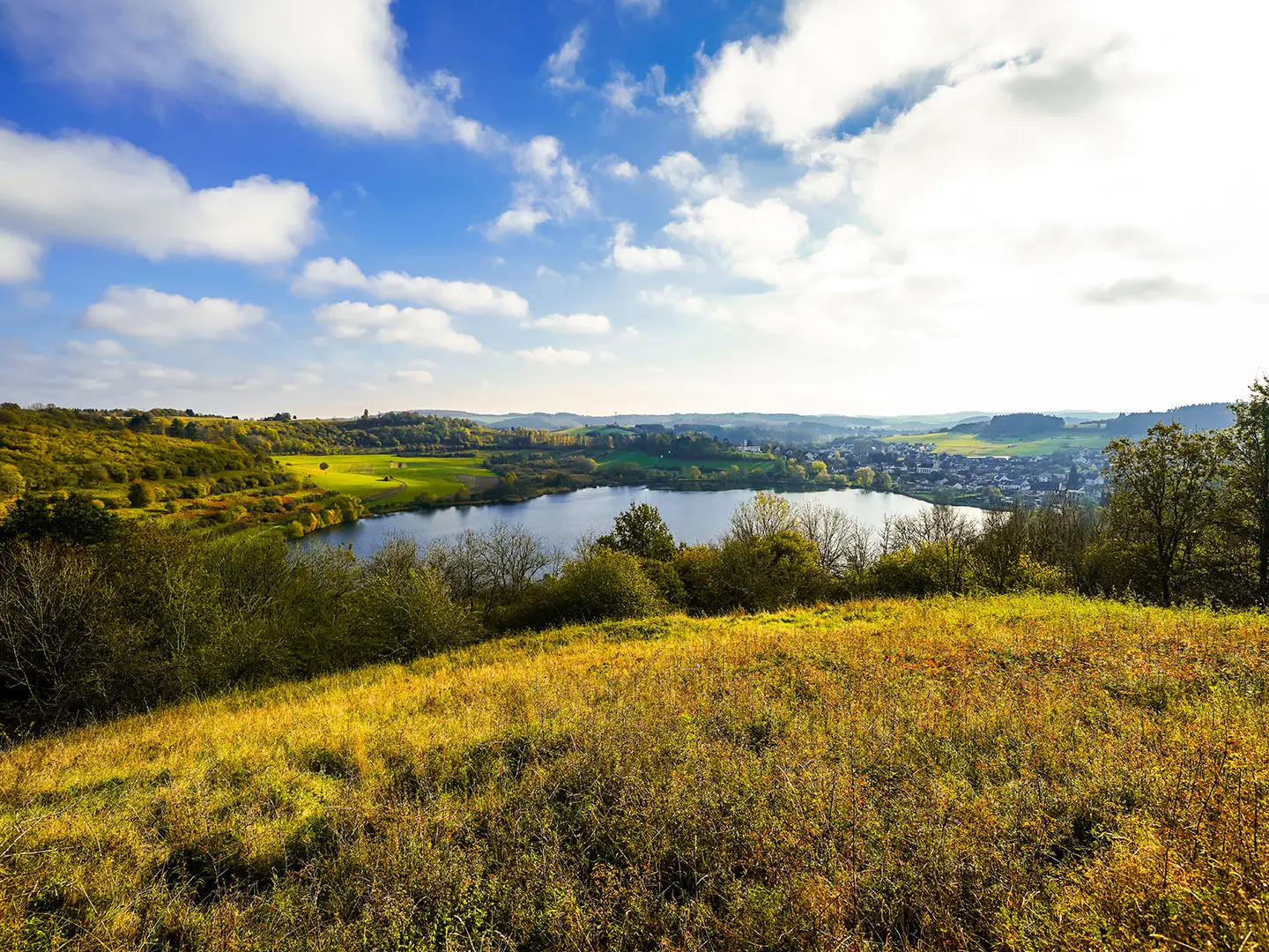
Eifelsteig
How would you rate Eifelsteig?
Tap a star to share your experience and help other hikers.
Eifelsteig: Complete Hiking Guide
HikeList Score
Eifelsteig scored 88/100 on HikeList's trail-quality metrics.
See score breakdownHide breakdown
- Ideal length 85
- Balanced challenge 100
- Scenery & wildness 75
- Varied terrain 100
- Accommodation 83
- Food & support 88
- Path quality 98
- Season flexibility 89
Computed from length, challenge, scenery & wildness, terrain variety, accommodation, food & support, path quality and season flexibility.
The Eifelsteig is a 313 km point-to-point long-distance trail in western Germany, from Aachen-Kornelimünster to Trier. It is normally walked in 15 days and is rated moderate: expect steady climbs and descents, mostly natural paths, but no technical or exposed terrain. The route suits fit walkers who want a well-waymarked German Premium Trail through forest, upland moor, volcanic landscapes, river valleys and red sandstone cliffs.
Route Overview
The Eifelsteig runs south from Aachen-Kornelimünster in North Rhine-Westphalia to Trier in Rhineland-Palatinate, crossing key Eifel places including Monschau, Eifel National Park, the Urft Dam and Rursee, Blankenheim, Gerolstein, Daun, Manderscheid and Biewer. It is divided into 15 daily stages of roughly 15–28 km. As a point-to-point walk, plan start/end logistics around the two termini and overnight stops in the trail towns. If you are comparing German multi-day trails, see also the Goldsteig, Harzer Hexenstieg and Altmühltal Panorama Trail.
History of the Eifelsteig
The Eifelsteig opened in 2009 as a cooperation between the Eifel and Eifel-Ardennes tourism bodies. It was created by linking the best sections from around 1,600 km of regional paths into one signature long-distance route under the motto “Where rock and water accompany you”. The trail connects Aachen with Trier, Germany’s oldest city, founded by the Romans, and is certified as a German Premium Trail by the Deutsches Wanderinstitut.
Notable highlights
- High Fens (Hohes Venn): One of central Europe’s largest upland raised bogs, crossed on boardwalks early in the route. It gives the Eifelsteig a rare moorland character near the German-Belgian border.
- Monschau: A well-preserved medieval half-timbered town in the deep Rur valley. It is one of the classic overnight stops and a strong contrast to the surrounding forest and moor.
- Eifel National Park: North Rhine-Westphalia’s only national park, where forest is being left to rewild. The route also passes the Urft Dam and Rursee in this area.
- Gerolstein Dolomites: Pale dolomite cliffs above Gerolstein, formed from the remains of a roughly 390-million-year-old tropical coral reef. This is one of the most distinctive rocky sections of the walk.
- Volcanic Eifel maars: Circular crater lakes around Daun, formed by ancient volcanic explosions and often called the “Eyes of the Eifel”. They are a clear marker of the route’s volcanic middle section.
- Manderscheid castles: The Oberburg and Niederburg are two facing medieval castle ruins above the Lieser valley. The setting makes this one of the route’s strongest cultural-landscape highlights.
Challenges to expect
The Eifelsteig is not technical, but 313 km and around 6,700 m of total ascent make it a sustained moderate walk. Daily stages of roughly 15–28 km require steady fitness. Expect narrow natural paths, forest tracks, wet upland moor sections, rocky passages and repeated valley climbs. Accommodation is available in towns, but booking ahead is sensible in the main May–October season.
HikeList Score
Eifelsteig scored 88/100 on HikeList's trail-quality metrics.
See score breakdownHide breakdown
- Ideal length 85
- Balanced challenge 100
- Scenery & wildness 75
- Varied terrain 100
- Accommodation 83
- Food & support 88
- Path quality 98
- Season flexibility 89
Computed from length, challenge, scenery & wildness, terrain variety, accommodation, food & support, path quality and season flexibility.
 Germany
Show more data Show less
- Forest
- Meadow
- Upland Moor
- Rocky
- Volcanic
- River Valleys
- Sandstone Cliffs
- Dirt
- Woodland Tracks
- Footpaths
- Heath
- Limited Paved
- Hotels
- Guesthouses
- Holiday Apartments
- Family Friendly
- Pet Friendly
- Restrooms
- Water Sources
- Campsites
- Shelters
- Picnic Areas
Download Our Full Guide to Eifelsteig FREE!
Get our comprehensive guide to this hike for free. Save it for later reading or print out at home.
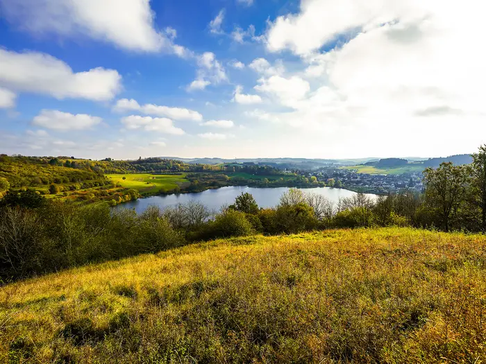
Photos from hikers
Taken on the trail by people who've reviewed Eifelsteig.
Eifelsteig: The Complete Guide
 i
Image by Elly Miller
i
Image by Elly Miller The Eifelsteig is a 313 km waymarked walk across Germany’s Eifel uplands, running south from Aachen-Kornelimünster to the Porta Nigra in Trier. It suits walkers who want a long, varied inn-to-inn route without alpine terrain, but with enough distance, ascent and rough natural path to feel like a proper expedition.
The trail begins in the historic abbey village of Kornelimünster, then heads quickly into woodland, heath and the wet boardwalks of the Hohes Venn (High Fens). Monschau, the Steling viewpoint and the reservoirs of the Nationalpark Eifel give the early days a strong mix of moor, forest and water.
Further south, the route changes character again through Blankenheim, the Gerolsteiner Dolomiten (Gerolstein Dolomites), Daun’s volcanic Maare and the deep Lieser valley around Manderscheid. The final approach brings red Buntsandstein (sandstone) ravines near Kordel before the descent into Trier and its Roman city gate.
This is not a technical mountain route, but it is a sustained 15-day walk with repeated climbs, muddy forest sections, wet bog boardwalks and some narrow or rocky passages. Accommodation is available along the route, but several stage ends are small villages or monasteries, so booking ahead in the main season is a sensible part of the plan.
This guide covers the stages, daily planning, accommodation, food, transport, terrain and common mistakes that matter on the Eifelsteig.
Stage-by-Stage Guide
The Eifelsteig is well waymarked with the stylised E logo, but it should still be treated as a rural long-distance walk rather than a town-to-town promenade. Several stages finish in small villages or monastery settlements where accommodation and evening food can be limited, so book beds ahead and check opening hours before relying on local services.
Stage 1: Aachen-Kornelimünster to Roetgen — 14 km
The route begins in Aachen-Kornelimünster, leaving the historic abbey village from the Korneliusmarkt past the Propsteikirche St. Kornelius before heading into woods on the southern edge of Aachen. This is one of the shorter official stages, making it a sensible first day for settling into the waymarking and the rhythm of the route.
Underfoot, expect woodland paths, tracks and the first taste of the damp upland terrain that defines the northern Eifel. The Hohes Venn (High Fens) area begins to influence the walking early in the route, so boardwalk, boggy ground and wet forest paths can all be part of the day after rain.
Food and water are most reliable at the start and end of the stage; do not assume frequent intermediate options. Roetgen is the overnight stop, with accommodation possible in and around the town, but availability should be checked in advance in the main walking season.
Access to the start is via Aachen Hauptbahnhof and onward city bus to Kornelimünster; current Aachen–Kornelimünster bus times should be checked before travelling. Roetgen has road access and regional public transport options, but onward bus times should also be checked.
Navigation is straightforward in normal conditions if the Eifelsteig waymarks are followed carefully. The main practical warning is wet ground: after rain, waterproof footwear and poles are more useful than the modest stage distance might suggest.
Stage 2: Roetgen to Monschau — 17 km
This is one of the defining early stages of the Eifelsteig, crossing the Hohes Venn (High Fens) and passing the trail’s high point at the Steling (Eifel-Blick) near Monschau-Mützenich. The Steling reaches 658 m and gives broad views east towards the Nationalpark Eifel in clear weather.
The terrain is upland rather than mountainous: moor, heath, forest edges, boardwalk and natural paths. The walking is not technical, but the High Fens can be cold, wet and windswept even when the valleys feel mild.
Services should be treated as limited between Roetgen and Monschau. Carry lunch and enough water from the start, and plan around the fact that weather can slow progress on the boardwalked bog sections.
Monschau is one of the strongest overnight stops on the whole route, with hiker-friendly accommodation in and around the half-timbered old town. It sits deep in the narrow Rur valley, so the end of the stage has a very different feel from the open moorland above.
Public transport in this part of the Eifel is by regional bus rather than mainline rail; current times should be checked before relying on a same-day escape or section-hike connection. Navigation is usually clear, but mist, rain and boardwalk junctions make an offline map sensible on this stage.
Stage 3: Monschau to Einruhr — 24 km
This stage leaves the enclosed valley setting of Monschau and continues south into the forested Eifel, working towards the reservoir country around Einruhr. At 24 km, it is a more sustained walking day than the opening two stages.
The route is typical Eifelsteig terrain: natural woodland paths, tracks, valley-side walking and repeated undulations rather than one single major climb. Expect mud in forested sections after rain, with roots and narrow path sections requiring care.
Food, water and cashpoints should be sorted in Monschau before departure. Einruhr is the stage end on the Obersee, part of the reservoir landscape linked with the Rurstausee/Rursee, but intermediate services should not be assumed.
Accommodation is available in the trail settlement of Einruhr, though booking ahead is sensible because this is a popular walking area and a fixed stage end. Public transport is rural; bus or taxi options should be checked before travelling.
The waymarking remains a strength of the route, but do not treat the day as short simply because the terrain is non-technical. The combination of distance, damp woodland ground and valley climbs makes it a proper full day.
Stage 4: Einruhr to Gemünd — 21 km
This stage continues through the Nationalpark Eifel (Eifel National Park) landscape, with reservoir scenery around the Rurstausee/Rursee and Urftsee among the main draws. It is one of the route’s classic “water and forest” days.
The walking is on natural paths, forest tracks and reservoir-side terrain, with the usual Eifel pattern of climbs in and out of valleys. Conditions are generally moderate, but shaded forest can hold mud and wet leaves long after rain.
Start with enough food and water for the day, as services between stage ends may be sparse. Gemünd is a recognised trail town with hiker-friendly accommodation, making it a practical overnight base after the national park section.
Road access and regional buses serve the wider area, but public transport timings should be checked carefully. If section-hiking, Gemünd is a more practical access point than smaller villages deeper in the route.
Within the national park, stay on the marked route and avoid informal shortcuts. Waymarks are good, but forest tracks can look similar, so an offline map is useful when visibility is poor or if diversions are in place.
Stage 5: Gemünd to Kloster Steinfeld — 18 km
This is a moderate-length stage leading from Gemünd towards Kloster Steinfeld (Steinfeld Abbey), a large former Premonstratensian monastery on a forested ridge. The abbey setting makes this one of the more memorable overnight stops, but also one where logistics need attention.
The route continues through woodland and upland Eifel terrain, with natural paths and tracks rather than technical ground. Expect a quieter feel than in the larger trail towns, especially as the stage approaches the monastery.
Gemünd is the place to organise daytime supplies. At Kloster Steinfeld, accommodation and food arrangements should be checked before travelling, as monastery stage ends and small settlements can have limited capacity.
Public transport for this stage is not as simple as at the trail termini or rail-served towns. If ending or starting here for a section hike, plan around regional buses or a taxi and confirm current connections.
Navigation is uncomplicated if the Eifelsteig waymarks are followed, but the forested approach means it is easy to lose a sense of distance. Carry a map or GPX and do not rely solely on phone signal.
Stage 6: Kloster Steinfeld to Blankenheim — 23 km
Stage 6 links the abbey ridge at Kloster Steinfeld with Blankenheim, a medieval Eifel town below Burg Blankenheim. In the old centre, the Ahrquelle, the source of the river Ahr, rises beneath a house.
The day is longer than the previous stage and continues the Eifelsteig pattern of forest, open upland sections and valley transitions. There is no alpine difficulty, but the cumulative effort builds over successive days.
Leave Kloster Steinfeld with food and water already sorted unless current local provision has been checked. Blankenheim is a better-served overnight stop than the monastery stage ends, with accommodation available in and around the town.
Regional bus and road access are the relevant transport options here; current timetables should be checked before planning a section start or finish. Blankenheim is a sensible place to pause, resupply and reset after the first northern block of stages.
The route is well signed, but pay attention when moving from woodland into town approaches, where waymarks can compete with roads and local paths. Wet forest ground and leaf-covered paths are the main underfoot issues.
Stage 7: Blankenheim to Mirbach — 18 km
This stage leaves Blankenheim and heads through a quieter rural part of the Eifel towards Mirbach. It is shorter than the stages either side of it, but the limited services at the end make planning more important than the distance suggests.
Expect a mix of natural paths, tracks, woodland and open upland walking. The day is typical of the central Eifel: moderate gradients, no technical obstacles, but enough undulation to keep the legs working.
Blankenheim is the logical place to buy food and fill water before setting out. Mirbach is a small village stage end, so accommodation, evening meals and any onward transport should be arranged in advance.
Public transport in this part of the route is rural and may not suit spontaneous changes of plan. Bus or taxi options should be checked before travelling, especially outside peak holiday periods or at weekends.
Navigation should be simple on the marked trail, but this is not a stage to improvise without a confirmed bed. After wet weather, allow extra time for muddy field edges, woodland tracks and slower natural paths.
Stage 8: Mirbach to Hillesheim — 26 km
At roughly 26 km, this is one of the longer official stages and should be treated as a full day. It continues through rural Eifel country from small Mirbach to Hillesheim, one of the named trail towns with hiker-friendly accommodation.
The terrain is not technically hard, but the length and repeated undulations make pacing important. Expect a practical mix of woodland, tracks, open plateau sections and natural paths that can become muddy in poor weather.
Carry enough food and water from the start, as intermediate services cannot be assumed. Hillesheim is the best place to plan the evening meal, resupply and overnight stop.
Transport is by regional rural connections rather than guaranteed frequent services. If using Hillesheim as a section point, current bus or onward travel times should be checked before booking accommodation.
Waymarking is reliable, but a long rural stage leaves little margin for late starts or slow progress. In wet conditions, start early and keep navigation tools accessible rather than buried in the pack.
Stage 9: Hillesheim to Gerolstein — 22 km
This stage moves towards one of the Eifelsteig’s most distinctive rocky landscapes: the Gerolsteiner Dolomiten (Gerolstein Dolomites) above Gerolstein. The pale dolomite cliffs, formed from an ancient tropical coral reef, give the day a sharper and more rugged character than many of the forest stages.
Underfoot, expect natural paths and some rockier passages near the Gerolstein area, along with the usual woodland tracks and undulating terrain. The route remains non-technical, but wet rock, roots and narrow path sections deserve care.
Hillesheim and Gerolstein are the key places for food and water. Do not rely on finding services between them unless current local options have been checked.
Gerolstein is a major practical stop on the route, with accommodation and rail access on the Eifelstrecke Köln–Trier. This makes it one of the better places to start, finish or break a section hike.
Navigation around rocky viewpoints and town approaches can require more attention than a simple forest track. Follow the Eifelsteig waymarks closely and allow time to enjoy the Dolomites without finishing in the dark.
Stage 10: Gerolstein to Daun — 24 km
Stage 10 leaves Gerolstein and heads deeper into the Vulkaneifel (Volcanic Eifel) towards Daun. The landscape begins to shift towards volcanic uplands and the crater-lake country that defines the middle section of the trail.
The walking is a steady mix of forest, open upland, natural paths and valley changes. It is moderate rather than technical, but 24 km of rolling terrain after nine previous stages is still a demanding day.
Gerolstein is the best place to leave fully supplied, particularly because it has rail access and stronger town services. Daun is a recognised trail town with hiker-friendly accommodation and makes a practical overnight stop before the maars stage.
Transport at the start is straightforward by comparison with much of the route because of Gerolstein’s rail station. For Daun, regional bus or taxi connections should be checked before travelling.
Navigation is generally clear on the waymarked route, but forest junctions and rolling plateau sections can feel repetitive. Keep an eye on progress through the day and avoid assuming that the final kilometres into Daun will be quick.
Stage 11: Daun to Manderscheid — 23 km
This is one of the headline stages of the Eifelsteig, passing through the Dauner Maare landscape before reaching Manderscheid. The circular volcanic crater lakes — including the Gemündener Maar, Weinfelder/Totenmaar and Schalkenmehrener Maar — are among the clearest reminders that this is the Volcanic Eifel.
The terrain combines crater-lake scenery, woodland and valley walking, with the route eventually leading towards the deep Lieser valley. Around Manderscheid, the Oberburg and Niederburg castle ruins face each other above the valley, giving a strong cultural finish to the stage.
Food and water should be carried from Daun, with Manderscheid the main service point at the end. Accommodation is available in Manderscheid, but it is a popular and important trail stop, so booking ahead is sensible.
Regional bus or taxi connections are the relevant public transport options; current timetables should be checked before using Manderscheid as a section point. Road access is better than at the monastery stops, but this is still rural Eifel logistics.
The main underfoot cautions are mud, wet roots and potentially slippery natural paths in wooded valley sections. The route is not exposed in a high-mountain sense, but take care around rocky viewpoints, castle approaches and damp descents.
Stage 12: Manderscheid to Kloster Himmerod — 18 km
This stage leaves Manderscheid and continues through wooded valley country towards Kloster Himmerod (Himmerod Abbey) in the Salm valley. It is shorter than the surrounding stages, but the quiet monastery finish requires advance planning.
The walking is on forest paths, tracks and valley-side terrain, with the usual Eifel climbs and descents rather than technical difficulties. After rain, shaded woodland sections can be muddy and slow.
Manderscheid is the best place to buy food and fill water before departure. At Kloster Himmerod, the baroque abbey church is the landmark, but the monastic community has been dissolved and practical visitor services can change; accommodation and meals should be checked before travelling.
Public transport is limited compared with Gerolstein or Trier. If ending the walk here, arrange bus or taxi options in advance rather than assuming an easy same-day connection.
Navigation is normally straightforward on the marked Eifelsteig, but forest junctions and any local diversions can be confusing without an offline map. This is a good stage for a steadier pace after the long Daun–Manderscheid day.
Stage 13: Kloster Himmerod to Bruch — 21 km
Stage 13 continues south from Kloster Himmerod through rural Eifel country towards Bruch. The route remains firmly in wooded valley and upland terrain, with a quieter feel than the better-known volcanic and castle stages.
Expect natural paths, forest tracks and undulating ground. The difficulty is moderate, but the walk can feel remote where services and villages are sparse.
Food and water should be organised before leaving Kloster Himmerod, and only after checking what is actually available there. Bruch is a small stage-end settlement, so accommodation, evening food and any luggage or taxi arrangements should be booked ahead.
Public transport should be planned carefully. Regional buses may be available, but times and routes should be checked before relying on them, particularly for section-hiking.
The waymarking remains a major advantage, but do not let the moderate distance lead to loose planning. Muddy woodland sections, limited services and rural transport are the practical challenges.
Stage 14: Bruch to Kordel — 28 km
At about 28 km, this is the longest official stage and one of the most demanding days logistically. It leads towards the red sandstone country near Kordel, where Buntsandstein (red sandstone) cliffs, caves and the Butzerbachtal/Klausenbachtal ravines give the southern Eifel a markedly different character.
The terrain is more varied and can feel rougher than the pure forest-track stages. Expect natural paths, wooded ravines, rocky ground and potentially slippery sections in damp weather, although the route is still a waymarked hiking trail rather than technical scrambling.
Carry a full day’s food and water from Bruch unless current intermediate services have been checked. Because the distance is long and the ravine terrain can slow progress, an early start is strongly advised.
Accommodation at or near Kordel should be booked in advance, especially if walking the official stages without support. Public transport or taxi options for Kordel should be checked before travelling; do not rely on rural connections without a timetable.
Navigation deserves particular attention in the ravine and sandstone sections, where paths, side trails and viewpoints can complicate progress. Wet rock and roots are the main hazards, so keep speed conservative on descents and in shaded gorges.
Stage 15: Kordel to Trier — 17 km
The final walking stage runs from Kordel into the Moselle (Mosel) valley and finishes in Trier at the Porta Nigra, the great Roman city gate. It is a shorter day than Stage 14, but still includes natural Eifelsteig terrain before the urban finish.
The route continues through the southern red-sandstone landscape before descending towards Germany’s oldest city. Expect a mix of woodland paths, crags and gorges early on, then more built-up and paved sections as the trail approaches Trier.
Carry enough water and snacks from Kordel for the walking section, even though Trier has extensive services at the end. Once in Trier, accommodation, food and onward travel are far easier than on the rural middle stages.
Trier Hauptbahnhof is about a 10-minute walk from the Porta Nigra and is a major rail hub, with connections towards Koblenz, Köln (Cologne), Luxembourg, Saarbrücken and beyond. Current train times should still be checked before booking onward travel.
Navigation can become less obvious in urban approaches, where waymarks share space with streets, signs and visitor routes. Follow the Eifelsteig markers all the way to the Porta Nigra rather than assuming any descent into Trier is the official finish.
Recommended Itinerary
The most practical Eifelsteig itinerary is the official 15-stage walk from Aachen-Kornelimünster to Trier. It matches the waymarked stage towns, keeps most days in the 18–24 km range, and avoids forcing long road transfers in the rural middle of the Eifel.
Distances are approximate. Check official mapping before booking accommodation, especially if altering stage ends or relying on buses or taxis from smaller villages and monastery stops.
Standard 15-day itinerary
| Day | From | To | Approx. distance | Why this stage makes sense | Services/accommodation notes |
|---|---|---|---|---|---|
| 1 | Aachen-Kornelimünster | Roetgen | 14 km | A short first stage that works well after travelling to Aachen and taking the bus out to Kornelimünster. It eases into the wooded northern Eifel before the more exposed Hohes Venn terrain. | Roetgen is an established stage end. Check the current Aachen–Kornelimünster bus connection before travelling and book the first night ahead in season. |
| 2 | Roetgen | Monschau | 17 km | One of the signature early stages, crossing the Hohes Venn (High Fens) and the Steling near Monschau-Mützenich, the high point of the route. The moderate distance leaves time for wet boardwalk, moorland conditions and the descent into Monschau. | Monschau has a stronger choice of hiker accommodation than many rural stage ends. The High Fens can be cold, wet and windswept, so do not plan this as a casual half-day. |
| 3 | Monschau | Einruhr | 24 km | A full but logical day out of the Rur valley towards the Nationalpark Eifel landscape. It keeps the official rhythm and positions you by the Obersee for the reservoir section. | Einruhr is a village stage end, so accommodation should be booked rather than left to arrival. Carry enough food and water for the walking day. |
| 4 | Einruhr | Gemünd | 21 km | This stage continues through the Nationalpark Eifel area, with reservoir and forest walking around the Rurstausee/Rursee and Urftsee zone. The distance is steady without being excessive after the longer Monschau–Einruhr day. | Gemünd is one of the more useful service stops on the northern half of the trail. It is a sensible place to resupply and reset before the abbey stage. |
| 5 | Gemünd | Kloster Steinfeld | 18 km | A shorter day leading to one of the route’s major monastic landmarks. The reduced distance is useful after four consecutive walking days and before the longer stage to Blankenheim. | Beds at or near Kloster Steinfeld are more limited than in larger towns. Reserve early in the May–October season. |
| 6 | Kloster Steinfeld | Blankenheim | 23 km | This links the abbey ridge with Blankenheim, one of the classic Eifel trail towns. It is a proper walking day but still within the normal Eifelsteig stage pattern. | Blankenheim has better trail-town logistics than the smaller rural stops. It is also a practical overnight before the quieter section towards Mirbach. |
| 7 | Blankenheim | Mirbach | 18 km | A moderate-distance rural stage that prevents the Blankenheim–Hillesheim section becoming too long. It keeps the itinerary manageable before one of the longer official days. | Mirbach is a small stage end. Book accommodation well ahead or arrange a transfer to nearby accommodation if required; this should be checked before travelling. |
| 8 | Mirbach | Hillesheim | 26 km | One of the longer days, but it reaches Hillesheim rather than ending in a very small settlement. Keeping this as a single stage avoids complicating the rural middle of the route. | Hillesheim is a useful service stop after a longer day. Start early if conditions are wet underfoot. |
| 9 | Hillesheim | Gerolstein | 22 km | A strong mid-route stage into the Gerolsteiner Dolomiten (Gerolstein Dolomites) area. The distance is moderate and the finish is one of the best-connected towns on the trail. | Gerolstein is a good logistics point, with rail access on the Eifelstrecke Köln–Trier. It is one of the better places for resupply, rest or joining/leaving the route. |
| 10 | Gerolstein | Daun | 24 km | This is a substantial but natural continuation into the Vulkaneifel. It carries the route from the dolomite landscape towards the volcanic crater-lake country around Daun. | Daun is a practical overnight base with more services than the smaller villages. Booking ahead remains sensible in the main walking season. |
| 11 | Daun | Manderscheid | 23 km | A varied Vulkaneifel stage, with the Maare (maars/crater lakes) landscape and the approach to Manderscheid’s castle country. The distance is typical for the central Eifelsteig. | Manderscheid is an established trail stop. It is a good place to allow time for the Oberburg and Niederburg castle setting rather than arriving too late. |
| 12 | Manderscheid | Kloster Himmerod | 18 km | A shorter stage after the Manderscheid section, ending at another major monastic landmark in the wooded Salm valley. It gives some recovery before the final three-stage push south. | Kloster Himmerod is a rural monastery stage end with limited nearby beds. Confirm accommodation before committing to this itinerary. |
| 13 | Kloster Himmerod | Bruch | 21 km | This keeps the official current routing through the southern Eifel rather than using older stage splits. The distance is moderate and sets up the long Bruch–Kordel stage. | Bruch is a small overnight stop. Accommodation or transfer arrangements should be made in advance. |
| 14 | Bruch | Kordel | 28 km | The longest official stage and the key commitment of the southern section. It positions you for the final approach to Trier through the Buntsandstein (red sandstone) country around Kordel. | Start early and carry adequate supplies. Kordel is a smaller stage end than Trier, so check bed availability before booking the surrounding nights. |
| 15 | Kordel | Trier | 17 km | A shorter final day, allowing time for the red-sandstone ravines and the descent into the Moselle valley. The trail finishes at the Porta Nigra in Trier. | Trier has the strongest end-of-walk logistics, with Trier Hauptbahnhof about a 10-minute walk from the Porta Nigra. It is the easiest place to add a final overnight. |
Slower variant: 16–18 days
A slower itinerary suits walkers who want more time in Monschau, the Vulkaneifel, or Trier, or who prefer a buffer for wet weather in the Hohes Venn and forest sections. The simplest slower plan is not to split every stage, but to add rest or half-rest nights at the most useful service towns.
Good places to add time are:
| Extra time | Best place to add it | Why it helps |
|---|---|---|
| 1 night | Monschau | Allows an unhurried start after the High Fens and avoids rushing the historic town before the 24 km stage to Einruhr. |
| 1 night | Gerolstein or Daun | Useful in the middle of the route, with better services than the surrounding rural stage ends and access to the Gerolsteiner Dolomiten or Vulkaneifel landscape. |
| 1 night | Trier | Best for onward transport and for seeing the city after the final walking day rather than leaving immediately. |
Splitting individual stages can work, but intermediate accommodation and public transport are uneven. This should be checked before travelling, especially around monastery and small-village stage ends such as Kloster Steinfeld, Mirbach, Kloster Himmerod and Bruch.
Faster variant: 14 days or fewer
A 14-day itinerary is realistic for fit walkers by combining the first two shorter stages into one long opening day from Aachen-Kornelimünster to Monschau, about 31 km via Roetgen. This removes the Roetgen overnight but makes the first day substantially harder, particularly if starting after travel from Aachen.
Plans faster than 14 days are possible only for strong walkers who are comfortable with repeated long days on undulating forest, moorland and rocky paths. Many potential combinations create days around 40 km or more, so the saving in nights comes at a clear cost in recovery and flexibility.
For a faster schedule, book the constrained rural nights first, then build the rest of the plan around them. Do not assume that every stage end has spare accommodation on arrival, and check current transport options before relying on buses or taxis to solve a missed or shortened day.
Planning the Route
How many days to allow
The official 15-stage plan is the best default for most walkers. The Eifelsteig is not technical, but 15 consecutive days on natural paths, wet boardwalk, forest tracks and repeated valley climbs is enough to make a steady schedule more enjoyable than an over-compressed one.
Fit walkers can shorten the route by combining some of the shorter stages, particularly where the official days are around 14–18 km. That works best if accommodation is available at the new end points; it should not be planned purely from the map, because several stage ends are small villages or monastery locations with limited beds.
A slower plan is also sensible. Extra nights in larger trail towns such as Monschau, Gerolstein or Daun give more flexibility for weather, laundry, local transport and the more scenic middle sections around the Gerolsteiner Dolomiten (Gerolstein Dolomites) and the Vulkaneifel (Volcanic Eifel) maars.
Let accommodation shape the itinerary
The stage structure is strongly influenced by where beds exist. Towns such as Monschau, Gemünd, Blankenheim, Hillesheim, Gerolstein, Daun and Manderscheid are natural overnight bases, while places such as Kloster Steinfeld, Mirbach, Kloster Himmerod and Bruch need more careful booking.
In the main May–October walking season, accommodation should be booked ahead rather than left to chance. This matters most at the smaller stage ends, where a full guesthouse can mean needing a bus or taxi transfer to sleep off-route.
Check that accommodation matches the current official stage split. The present official southern routing runs Manderscheid → Kloster Himmerod → Bruch → Kordel; older material may still use a variant via Eckfeld. This should be checked before travelling.
Pacing the harder days
Do not judge the days by distance alone. A 20–24 km day on the Eifelsteig can feel harder after rain, when the bog, woodland tracks and narrow natural paths are muddy or waterlogged.
The early route across the Hohes Venn (High Fens) can be cold, wet and exposed even when the surrounding valleys feel mild. Later, the repeated river-valley walking along areas such as the Rur, Kyll and Lieser adds steady ascent and descent rather than one single major climb.
The longest official stage is Bruch to Kordel at about 28 km, followed by the final approach to Trier from Kordel. Plan that southern section with enough food, water and daylight, especially if walking outside high summer.
Section hiking
Section hiking is practical, but easiest at the ends and at the better-connected trail towns. Aachen Hauptbahnhof gives access to the start via city bus to Aachen-Kornelimünster, while Trier Hauptbahnhof is close to the Porta Nigra and has onward rail links to Koblenz, Köln, Luxembourg, Saarbrücken and beyond.
Gerolstein is the most useful rail-served intermediate point, sitting on the Eifelstrecke Köln–Trier. Other trail towns are reached by regional buses, but services in the rural middle of the Eifel are not as flexible as the rail links at Aachen, Trier and Gerolstein.
For a short trip, plan sections around transport first and walking distance second. Some moorland, monastery and small-village stage ends may require a bus or taxi connection, and current timetables should be checked before travelling.
Food, water and resupply
The route passes regular towns and villages, but not every stage has reliable mid-walk shopping or café options. Carry lunch, snacks and enough water for the day when leaving each overnight stop, especially on the quieter forest, reservoir and upland sections.
Resupply is easiest in the larger towns, including Monschau, Gemünd, Blankenheim, Hillesheim, Gerolstein, Daun and Manderscheid. At monastery or small-village stage ends, check evening meals, breakfast and packed-lunch options when booking accommodation.
Navigation and maps
The Eifelsteig is a certified Premiumwanderweg and is thoroughly waymarked with the stylised “E” logo. Navigation is therefore straightforward in normal conditions, but a map or GPX track is still useful for forest junctions, town exits and any temporary diversions.
Official stage maps and guidebooks are available, and digital tracks are widely used for planning. Live diversions and current route information should be checked before travelling, particularly after storms or forestry work.
Weather and kit planning
Spring, summer and autumn are the normal walking seasons. Waterproofs and supportive footwear are still essential: the Hohes Venn boardwalks, shaded forest sections and river valleys can stay wet after rain.
This is not an alpine route, so specialist mountain equipment is unnecessary in normal season. The important kit choices are comfortable boots or trail shoes with grip, reliable rain protection, warm layers for exposed upland sections, and a daypack setup that allows food and water to be carried between services.
If using luggage transfer or taxi support, arrange it before the walk rather than assuming it can be organised daily. Rural accommodation, small stage ends and monastery stops need more notice than the larger towns.
Towns, Villages and Overnight Stops
Accommodation on the Eifelsteig is a mix of hotels, Gasthöfe/Pensionen, Ferienwohnungen, some hostels and campsites. The larger trail towns are the safest places for choice, food and resupply; the monastery and village stage ends can be very limited, especially in the May–October walking season.
Book the small-stage-end nights first, then fill in the easier town stops. For any plan relying on buses, taxis, monastery accommodation or a late meal in a village, this should be checked before travelling.
Aachen-Kornelimünster
Aachen-Kornelimünster is the northern trailhead, on the southern edge of Aachen. The Eifelsteig starts in the historic abbey village around Korneliusmarkt and leaves past the Propsteikirche St. Kornelius into the woods.
Most walkers use Aachen as the practical arrival base, then take a city bus to Kornelimünster for the start. Aachen Hauptbahnhof is well connected by regional rail across North Rhine-Westphalia and from Belgium and the Netherlands; bus connections to Kornelimünster include routes such as SB66, 35 and 65, but current timetables should be checked before travelling.
Kornelimünster itself is useful for a relaxed first night if accommodation suits the schedule, but the wider Aachen area gives more choice. If starting early, arrange breakfast, packed food and water before leaving, as stage 1 is a short but rural opening walk to Roetgen.
Roetgen
Roetgen is the first official overnight stop, reached after the short opening stage from Aachen-Kornelimünster. It sits at the northern edge of the Eifel uplands before the route pushes towards the Hohes Venn (High Fens).
It is a sensible first-night stop because the stage into Roetgen is only about 14 km, allowing time for arrival travel to Aachen and the bus transfer to the start. Accommodation is more rural than in Aachen, so beds should be booked rather than assumed.
Use Roetgen to prepare for the wetter, more exposed moorland walking of stage 2. Food and shop availability should be checked against accommodation arrangements, particularly if arriving late.
Monschau-Mützenich and the Steling
Monschau-Mützenich is on the second stage, close to the Steling, the Eifelsteig’s high point at 658 m. This is not usually treated as the main stage-end stop, but it is an important point on the route because the trail reaches its highest ground here before descending towards Monschau.
The area is useful to know for pacing and weather rather than as a default overnight base. The Hohes Venn and Steling section can be cold, wet and windswept even when the lower valleys feel mild, so do not plan this day as a casual town-to-town stroll.
Transport or accommodation options around Mützenich should be checked before building a section-hike around it. For most end-to-end walkers, Monschau is the natural overnight stop.
Monschau
Monschau is one of the strongest overnight stops on the Eifelsteig and the end of stage 2. It lies deep in the narrow Rur valley, after the Hohes Venn and Steling section, and is one of the more memorable town stops on the whole route.
For accommodation, Monschau is a good place to secure a proper bed, dry kit and eat well after the early moorland stages. It has hiker-friendly options, but it is also a popular visitor town, so booking ahead is sensible in the main season.
Monschau is also a practical point for anyone starting with the northern section only. Regional onward travel is likely to involve buses rather than rail, so current connections should be checked before travelling.
Einruhr
Einruhr is the stage 3 overnight stop, reached from Monschau after a longer day of about 24 km. It sits by the Obersee/Rurstausee area on the edge of the Nationalpark Eifel landscape.
This is a useful stop because it breaks the Nationalpark Eifel section naturally: Monschau to Einruhr, then Einruhr to Gemünd. Expect rural logistics rather than a large-town safety net.
Accommodation should be booked in advance, especially at weekends and in holiday periods. Check meal arrangements with the accommodation if arriving late, as relying on spontaneous village dining is risky on rural German walking routes.
Gemünd
Gemünd is the end of stage 4 and one of the better practical stops in the northern half of the route. It comes after the reservoir and Nationalpark Eifel section from Einruhr.
It is a good overnight base for beds, food and resetting before the route continues to Kloster Steinfeld. Compared with the smaller village and monastery stops, Gemünd is a more reliable place to organise laundry, supplies or a shorter recovery evening, though exact services and opening hours should still be checked.
For section hikers, Gemünd is a more useful access point than the isolated forest and reservoir sections around it. Public transport is regional rather than mainline-rail simple, so check current bus connections before travelling.
Kloster Steinfeld
Kloster Steinfeld is the end of stage 5, on a forested ridge after the walk from Gemünd. It is a distinctive monastic stage end rather than a normal town stop.
Beds here are limited compared with the larger towns, so this is one of the nights to book early. Do not assume there will be multiple fallback options within easy walking distance.
Food arrangements are especially important at monastery or rural stage ends. Confirm whether an evening meal and breakfast are available when booking, and carry enough food to cover the gap if timings are uncertain.
Blankenheim
Blankenheim is the stage 6 overnight stop, reached from Kloster Steinfeld. It is a medieval Eifel town below Burg Blankenheim, with the Ahrquelle rising in the old centre.
For walkers, Blankenheim is a useful town stop after the more constrained Kloster Steinfeld night. It is a sensible place to look for accommodation, food and basic resupply before the route heads towards the smaller village stop at Mirbach.
Blankenheim also works as a logical join or exit point for section hiking, though any rail or bus plan needs checking in advance. Do not rely on rural evening transport without confirming times.
Mirbach
Mirbach is the end of stage 7 and one of the smaller official overnight stops. It sits between Blankenheim and Hillesheim, breaking up the transition into the central Eifel.
This is not a place to leave accommodation to chance. Bed numbers are limited in small villages, and nearby alternatives may add transfers or extra walking.
Meal planning matters here. Confirm dinner and breakfast with the accommodation, and carry a backup snack or simple meal if arriving outside normal service times.
Hillesheim
Hillesheim is the end of stage 8 after the longer walk from Mirbach. It is one of the more practical mid-route towns before the Eifelsteig continues to Gerolstein.
As a larger stop than Mirbach, Hillesheim is a good place to recover, eat properly and restock where available. It is also a sensible target if adjusting the itinerary around the longer central stages.
Accommodation should still be booked ahead in season, but Hillesheim generally gives more flexibility than the smallest villages. Public transport options are regional and should be checked before relying on the town as a section endpoint.
Gerolstein
Gerolstein is one of the most important logistics stops on the Eifelsteig. It is the end of stage 9, lies below the Gerolsteiner Dolomiten (Gerolstein Dolomites), and is known for its mineral water.
For accommodation, Gerolstein is one of the stronger choices on the route, with hiker-friendly beds and town services. It is a good place to plan a more comfortable night, resupply, or take a half-day if the previous stages have been wet or tiring.
Gerolstein is also a key transport point because it is served by rail on the Eifelstrecke Köln–Trier. That makes it one of the best places to start, finish or split a section hike without needing a rural bus or taxi for the final link.
Daun
Daun is the end of stage 10 and the practical base for the Vulkaneifel maar country. The route between Gerolstein and Daun moves into the volcanic middle section of the Eifelsteig.
It is a strong overnight stop, especially for walkers wanting a proper town base before continuing to Manderscheid. Accommodation is available, but booking ahead remains sensible in the main walking season.
Daun is also a useful place to manage food and supplies before the following stage through the crater-lake landscape. Transport connections are regional, so check bus times before using it as a section start or finish.
Manderscheid
Manderscheid is the end of stage 11 and one of the best cultural stops on the Eifelsteig. The trail reaches the town after the Vulkaneifel section around Daun, with the Oberburg and Niederburg castle ruins above the Lieser valley forming the main local landmark.
It is a good overnight stop with hiker-friendly accommodation, and it is a natural place to pause before the quieter run towards Kloster Himmerod. Because it is a popular walking destination, book ahead rather than assuming same-day availability.
Check food arrangements and opening days, especially outside high season. Manderscheid also makes sense as a section endpoint, but onward travel is likely to require regional buses or a taxi rather than a simple mainline rail connection.
Kloster Himmerod
Kloster Himmerod is the end of stage 12, reached from Manderscheid. It lies in the wooded Salm valley and is a former Cistercian monastery; the baroque abbey church remains the landmark, although the monastic community has been dissolved.
This is a limited-bed stage end and should be treated as one of the key accommodation bookings on the whole route. Do not assume there will be several alternatives nearby if the monastery-area accommodation is full.
Food and timing need particular care here. Confirm current accommodation, meals and access arrangements before travelling, as monastery and rural facilities can change over time.
Bruch
Bruch is the end of stage 13 on the current official stage split between Kloster Himmerod and Kordel. It is a small village stop before the long penultimate stage.
This is another night to secure early. Accommodation options are likely to be much thinner than in Gerolstein, Daun, Manderscheid or Trier, and a full village can create an awkward planning problem.
Bruch is followed by the longest listed stage, around 28 km to Kordel, so arrange breakfast and carry enough food from the start of the day. Public transport or taxi backup should be checked before relying on it.
Kordel
Kordel is the end of stage 14 and the final overnight stop before Trier. The approach passes through the Buntsandstein (red sandstone) gorges and ravines around the Butzerbachtal/Klausenbachtal area before the route turns towards the Moselle valley.
It is a practical last-stage base because the final walk to Trier is shorter, at about 17 km. Accommodation should still be booked, especially if arriving after the long Bruch–Kordel day.
Kordel is also useful for walkers who want to finish the red-sandstone section separately from the Trier city approach. Transport details should be checked before travelling, particularly for evening arrivals or section-hike departures.
Trier
Trier is the southern trailhead and the finish of the Eifelsteig at the Porta Nigra. It is by far the easiest place on the route for accommodation, food, onward travel and a comfortable final night.
Trier Hauptbahnhof is a major rail hub and is around a 10-minute walk from the Porta Nigra. It has connections towards Koblenz, Köln (Cologne), Luxembourg, Saarbrücken and beyond, making it the simplest end point for international or long-distance onward travel.
For most walkers, Trier is the best place to build in a buffer night after the hike. It removes pressure from the final day, allows for delayed arrivals from Kordel, and makes onward rail travel much easier the following morning.
Getting to the Start
The Eifelsteig starts in Aachen-Kornelimünster, the historic abbey village on the southern edge of Aachen. The waymarked route leaves from the Korneliusmarkt area, passing the Propsteikirche St. Kornelius before heading into woodland.
By train
The main railhead for the start is Aachen Hauptbahnhof. Aachen is well connected by regional rail across North Rhine-Westphalia and has cross-border links from Belgium and the Netherlands, making it the practical gateway for walkers arriving without a car.
From Aachen Hauptbahnhof, continue to Kornelimünster by city bus. Allow enough margin between the train arrival and the first walking day, especially if starting the same afternoon or arriving with luggage.
Rail and bus times can change, particularly at weekends and on public holidays. This should be checked before travelling.
By bus
From Aachen Hauptbahnhof, city buses run out towards Kornelimünster. Lines used for this connection include SB66, 35 and 65, but the exact stop, frequency and best line depend on the current timetable and time of day.
Kornelimünster is part of Aachen’s city transport area rather than a remote trailhead, so access is usually straightforward compared with the rural middle of the Eifelsteig. The key practical issue is timing: arrive early enough to find the Korneliusmarkt start calmly, buy any last supplies in Aachen if needed, and avoid beginning the first stage too late.
This bus connection should be checked before travelling.
By car
Drivers should navigate to Aachen-Kornelimünster, not central Aachen, if being dropped at the trailhead. For a full thru-hike, leaving a car at the start is usually less convenient than using public transport, because the route finishes far away in Trier.
Long-stay parking at or near the start should not be assumed. If driving to Aachen before the walk, arrange parking through accommodation or use a suitable long-stay facility in the city, then take the bus to Kornelimünster. This should be checked before travelling.
For groups, a simple option is to use Kornelimünster as a drop-off point and collect the car later by rail from Trier back towards Aachen. Exact rail routings and journey times should be checked before committing to this plan.
From the nearest airport
No airport transfer is needed directly to the trailhead. The simplest air-to-trail plan is to fly into an airport with good onward rail access to Aachen Hauptbahnhof, then take the local bus to Kornelimünster.
Aachen’s position near Belgium and the Netherlands can make cross-border arrivals practical, but the best airport depends on flight availability and rail connections on the chosen date. This should be checked before travelling.
Avoid planning around a late flight arrival followed by an immediate start on stage 1. Staying in Aachen or Kornelimünster the night before gives more margin if the rail or bus connection is delayed.
Where to stay before starting
The most practical pre-walk base is Aachen, because it has the main railway station, onward city buses and more services than the small start village. This is the better choice if arriving by train, flying in the day before, or needing to buy food, gas or last-minute kit.
Staying in Aachen-Kornelimünster puts you closest to the trailhead and allows a relaxed start from Korneliusmarkt. Accommodation there is more limited than in central Aachen, so book ahead if a village start is preferred.
For the official first stage to Roetgen, the logistics are easiest if you begin in the morning with a full day available. The first two days reach the Hohes Venn (High Fens) area, where weather can be wet and exposed, so it is worth starting with waterproofs accessible rather than buried in luggage.
Getting Home from the Finish
The Eifelsteig ends at the Porta Nigra in central Trier. Trier Hauptbahnhof is the key onward transport point and is about a 10-minute walk from the finish, making this one of the easiest exit points on the whole route.
By train
Trier Hauptbahnhof is a major rail hub with frequent services and onward connections towards Koblenz, Köln (Cologne), Luxembourg, Saarbrücken and beyond. For most walkers, the simplest plan is to walk from the Porta Nigra to the station, then continue by rail the same day or after an overnight stay in Trier.
If returning to the start area, plan the journey from Trier Hbf towards Aachen Hbf, then onward by city bus to Aachen-Kornelimünster if needed. The exact rail routing, changes and the final Aachen bus connection are timetable-dependent and should be checked before travelling.
Allow extra margin if finishing late from Kordel. The final stage is not remote once Trier is reached, but evening onward connections may be less convenient than daytime trains, especially for longer journeys across Germany or into Belgium, the Netherlands or Luxembourg.
By bus
Local buses in Trier can be useful for reaching accommodation away from the station or for short city transfers, but they are usually secondary to rail for leaving the Eifelsteig. Long-distance or regional bus options change over time and should be checked before travelling.
For section hikers leaving from earlier stage ends, public transport is more variable: Gerolstein is rail-served, while smaller places and monastery stage ends may require a regional bus or taxi. From the official finish at Trier, however, the railway is normally the practical first choice.
By car/taxi
A taxi can be useful for a tired finish-day transfer from the Porta Nigra to accommodation, Trier Hbf, or a local car park. It is not usually the logical way to return to Aachen-Kornelimünster or other northern trailheads unless arranged as a private long-distance transfer.
If a vehicle has been left elsewhere on the route, use Trier Hbf as the main departure point and plan the rail or bus return to the closest served town. Rural Eifel connections can involve changes and limited evening services, so this should be checked before travelling.
From the nearest airport
For flights after the hike, plan the airport leg from Trier Hauptbahnhof rather than from the Porta Nigra. Trier has rail links towards Luxembourg, Saarbrücken, Köln and Koblenz, which gives several possible onward airport routes depending on flight choice.
Do not rely on a tight same-day flight after walking the final stage unless the train and airport transfer times work comfortably. Airport rail connections, transfer times and ticket conditions should be checked before travelling.
Where to stay at the finish
Staying overnight in Trier is often the easiest finish strategy, especially after the final walk in from Kordel or before a long onward train journey. It removes pressure from the last day and gives a buffer if weather, fatigue or missed connections slow the finish.
Accommodation in Trier should be booked ahead in the main walking season, particularly if arriving at a weekend or during busy city dates. Choose either the area around the Porta Nigra for the most convenient finish, or near Trier Hauptbahnhof for the easiest early departure the next morning.
Which Direction Should You Walk?
Standard direction: Aachen-Kornelimünster to Trier
The Eifelsteig is normally walked north to south, from Aachen-Kornelimünster to Trier. This is the official 15-stage direction and the simplest choice for following stage descriptions, booking overnight stops in sequence and keeping the walk aligned with the route’s usual planning material.
Transport also works well this way. Aachen Hauptbahnhof is well connected, then a city bus takes you out to Kornelimünster; at the end, Trier gives a strong and convenient finish, with Trier Hauptbahnhof close to the Porta Nigra and rail links towards Koblenz, Köln, Luxembourg and Saarbrücken. Current bus and rail times should be checked before travelling.
The scenery progression is one of the main reasons to walk southbound. The route begins with the Hohes Venn (High Fens), the Steling high point and Monschau, then moves through the Nationalpark Eifel, the Vulkaneifel around Daun, Manderscheid’s castle landscape and finally the Buntsandstein gorges before descending towards Trier. Finishing at the Porta Nigra gives the walk a clear psychological endpoint that the reverse direction cannot quite match.
There is no major technical advantage in either direction. The route is repeatedly up and down, with valley climbs, forest tracks, boardwalked bog and rocky passages spread throughout the trail. Southbound does have a broad sense of finishing lower, at Trier on the Moselle, but the cumulative ascent and descent are substantial enough that this should not be the deciding factor.
Reverse direction: Trier to Aachen-Kornelimünster
Walking northbound is perfectly viable for an independent hiker, but it is less natural logistically. You start easily in Trier, yet the finish at Aachen-Kornelimünster is less convenient and less dramatic, requiring onward bus travel back into Aachen rather than ending beside a major station and landmark.
The reverse direction also changes the emotional rhythm of the hike. You would begin with Trier and the red-sandstone approach, then work north through Kloster Himmerod, Manderscheid, Daun and Gerolstein before saving the Hohes Venn and Monschau for the final days. That can appeal if the High Fens are a personal priority, but it means the walk ends in Kornelimünster rather than with the Porta Nigra.
Accommodation planning is also a little less straightforward in reverse. The same rural constraints apply — especially at monastery and small-village stage ends such as Kloster Steinfeld, Kloster Himmerod, Mirbach and Bruch — but most walkers and route materials use the official southbound stage order. Book ahead in the May–October season whichever direction is chosen.
Weather and exposure
There is no strong reason to choose direction based on prevailing wind from the information available. The practical weather issue is that the Hohes Venn can be cold, wet and windswept, and the boardwalked bog and forest paths can be muddy after rain. In the standard direction this exposed moorland comes early, so carry proper waterproofs from day one rather than treating the first stages as an easy warm-up.
Recommendation
Walk the Eifelsteig from Aachen-Kornelimünster to Trier unless there is a specific transport, accommodation or personal reason to reverse it. The standard direction matches the official stage structure, gives a better landscape progression from bog and forest to volcanic country and red sandstone, and finishes decisively at the Porta Nigra in Trier with excellent onward transport.
Accommodation Along the Route
The Eifelsteig works well as an inn-to-inn walk, with hotels, Gasthöfe, Pensionen, Ferienwohnungen, some hostels and some campsites spread along the 15 official stages. It is not, however, a route where every stage end has a large stock of beds. The larger trail towns are straightforward; the small villages and monastery stage ends need more care.
Book ahead in the main May–October walking season, especially if following the official stage split exactly. This matters most at Kloster Steinfeld, Mirbach, Kloster Himmerod and Bruch, where accommodation is limited compared with places such as Monschau, Gemünd, Hillesheim, Gerolstein, Daun and Manderscheid.
Best overnight bases
The strongest accommodation choice is in the main towns on or close to the official stage line. Monschau, Gemünd, Blankenheim, Hillesheim, Gerolstein, Daun and Manderscheid are the easiest places to build a flexible itinerary around, with a better chance of finding hiker-friendly beds and services.
Aachen and Trier are the obvious pre- and post-walk bases. The trail starts at Aachen-Kornelimünster, on the southern edge of Aachen, so many walkers stay in Aachen and use the city bus connection to the start. Trier has the broadest finish logistics, with the Porta Nigra close to Trier Hauptbahnhof.
Places where beds are limited
The rural middle of the route is the main accommodation constraint. Kloster Steinfeld and Kloster Himmerod are monastery stage ends rather than large trail towns, and Mirbach and Bruch are small villages. These are the places to secure first if walking the official 15-stage itinerary.
If a stage-end bed is unavailable, the practical solution is usually to sleep in a nearby larger settlement and use a bus, taxi or accommodation shuttle to return to the trail. This should be checked before travelling, as rural public transport and transfer availability vary by place and season.
Accommodation table
| Place | Accommodation level | Best for | Notes |
|---|---|---|---|
| Aachen-Kornelimünster / Aachen | Good | Pre-walk night and access to the start | Kornelimünster is the trailhead, but Aachen is the more practical base for wider accommodation and transport. Check the current bus connection to Kornelimünster before travelling. |
| Roetgen | Limited | First overnight on the official stages | A small stage end after the short opening day. Book rather than assume walk-up availability. |
| Monschau | Good | Strong early-route overnight stop | One of the best places on the northern half for hotels, guesthouses and services. Sensible place to pause or shorten early stages. |
| Einruhr | Limited | Overnight between Monschau and Gemünd | A small village on the Obersee/Rursee section. Reserve ahead in season. |
| Gemünd | Good | Nationalpark Eifel base | A stronger accommodation stop after the reservoir and national park stages. Useful if adjusting the first third of the route. |
| Kloster Steinfeld | Limited | Monastery-stage overnight | Beds are more constrained than in a town. Book early, or plan a transfer to/from a nearby base. |
| Blankenheim | Good | Historic town stop and resupply base | A better accommodation and service point after the monastery stage. |
| Mirbach | Limited | Quiet rural overnight | Small-village stage end with limited choice. Secure this night early if following the official itinerary. |
| Hillesheim | Good | Mid-route town stop | One of the more reliable overnight bases between Blankenheim and Gerolstein. |
| Gerolstein | Good | Rail access, services and itinerary flexibility | One of the strongest logistical points on the trail, served by rail on the Eifelstrecke Köln–Trier. Good for joining, leaving or splitting the route. |
| Daun | Good | Vulkaneifel and maar section | A practical town base in the volcanic middle of the Eifelsteig, with better choice than the smaller villages. |
| Manderscheid | Good | Castles, Lieser valley and stage planning | A useful overnight town before the route heads towards Kloster Himmerod. |
| Kloster Himmerod | Limited | Monastery-stage overnight | A rural monastery stop in the Salm valley. Check bed availability before committing to this stage split. |
| Bruch | Limited | Penultimate rural stage end before Kordel | Small village stop; accommodation should be booked well ahead, or replaced with a transfer plan. |
| Kordel | Limited | Final night before Trier | Smaller than Trier but useful for the last walking stage. If accommodation is full, Trier can be used with a transport link. This should be checked before travelling. |
| Trier | Good | Finish, recovery night and onward travel | The easiest finish base, with wide accommodation choice and Trier Hauptbahnhof close to the Porta Nigra. |
Booking strategy
For a full 15-day walk, book the constrained nights first: Kloster Steinfeld, Mirbach, Kloster Himmerod and Bruch. Then fill in the larger towns, where there is normally more flexibility. If walking at weekends or during the May–October season, do not leave the small-stage ends to chance.
Holiday apartments can work well for rest nights or short sections, but they may not suit one-night stays. Hotels, Gasthöfe and Pensionen are usually the most straightforward format for walkers moving on each morning.
Luggage and transfer planning
The Eifelsteig is well suited to comfortable inn-to-inn walking, but a light pack still makes the repeated climbs, muddy forest paths and boardwalked bog sections easier. Luggage transfer may be available through walking packages, accommodation arrangements or local taxis, but it should be arranged before the walk rather than assumed on arrival.
Taxi transfers are also useful when a stage-end bed is unavailable. This is most relevant at the monastery and small-village stops, where sleeping off-route can be easier than forcing a long or awkward stage. Confirm current transfer options before booking a non-trail accommodation base.
Camping and Wild Camping
The Eifelsteig is better suited to inn-to-inn walking than to a fully self-supported camping trip. The route passes hotels, Gasthöfe, Pensionen, holiday apartments, hostels and some campsites, but the camping network is not dense enough to assume there will be a pitch at every official stage end.
If camping, plan the itinerary around specific campsites before booking transport or committing to daily distances. This is especially important around small stage ends and monastery stops such as Kloster Steinfeld, Kloster Himmerod, Mirbach and Bruch, where accommodation choice is limited and camping should not be assumed.
Campsites on or near the route
There are campsites in the wider Eifel region, but not every one sits directly on the Eifelsteig. Expect some nights to require a detour from the waymarked trail, a shorter or longer walking day, or a bus/taxi link to accommodation.
The most practical places to investigate first are the larger trail towns and tourist areas: Monschau, Einruhr, Gemünd, Blankenheim, Hillesheim, Gerolstein, Daun, Manderscheid, Kordel and Trier. The reservoir and maar sections can be popular in season, so pitches should be booked ahead where possible. Availability, opening dates and whether tents are accepted should be checked before travelling.
A camping itinerary may work best as a mixed plan: campsites where they fit naturally, with guesthouse or hostel nights in the thinner rural sections. This avoids being forced into very long days simply to reach the next legal pitch.
Wild camping
Do not plan the Eifelsteig as a wild-camping route. The trail crosses two German federal states, passes through private land, managed forests, the Hohes Venn (High Fens) area, the Nationalpark Eifel (Eifel National Park), reservoir landscapes and other sensitive habitats where overnight camping, leaving paths, fires and disturbance may be restricted or prohibited.
Rules can vary by state, municipality, protected area and landowner. If considering any overnight bivouac outside a designated campsite, permission and current local rules must be checked in advance. Without clear permission, use an official campsite or booked accommodation.
The Hohes Venn in particular is not a place to improvise a camp. The bog landscape is fragile, wet underfoot and crossed on boardwalks for a reason; staying on the marked route is the practical and environmental default.
Water and cooking
Although the Eifelsteig follows or crosses water-rich landscapes — including the Rur, Kyll and Lieser valleys, the Rurstausee/Rursee, Urftsee and the Vulkaneifel maars — natural water should not be treated as a guaranteed drinking supply. Reservoir, lake, bog and stream water may be unsuitable, inaccessible, protected or seasonally low-quality.
Carry enough water between towns and refill from accommodation, cafés, shops or other established services where available. On longer rural stages, start the day with a full supply rather than relying on streams.
Open fires are not appropriate on this route, particularly in forest, moorland and protected areas. Use campsite facilities where provided, follow posted fire-risk notices, and check whether small camping stoves are permitted before using one.
Seasonal considerations
Most walkers tackle the Eifelsteig between spring and autumn, but camping adds more exposure than an inn-to-inn itinerary. The Hohes Venn can be cold, wet and windswept even outside winter, and forest and bog sections can stay muddy after rain.
In the May–October walking season, campsites and town accommodation can be busy, while some rural services may still keep limited hours. Outside the main season, campsite opening dates become a major planning constraint. This should be checked before travelling.
Leave No Trace on the Eifelsteig
Keep camping to designated sites unless explicit permission has been obtained. On trail, stay on marked paths and boardwalks, especially in bog, heath, national park and reservoir areas.
Pack out all rubbish, avoid soap or food waste in streams and lakes, keep noise down near villages and farms, and never damage vegetation to make a pitch. The Eifelsteig’s appeal depends on well-managed forests, fragile wetlands and small rural communities, so low-impact behaviour is essential.
Food, Water and Resupply
The Eifelsteig is best planned as an inn-to-inn walk with daily food top-ups, not as a self-sufficient expedition. Food is easiest in the larger overnight towns — especially Monschau, Gemünd, Blankenheim, Hillesheim, Gerolstein, Daun, Kordel and Trier — and more limited at rural stage ends such as Mirbach, Kloster Steinfeld, Kloster Himmerod and Bruch.
Do not assume every village has an open shop, café, restaurant or petrol-station resupply. Rural opening hours can be short, seasonal and restrictive on Sundays and public holidays, and some places may only serve guests or require advance booking. This should be checked before travelling.
Food planning
For most stages, start the day with breakfast already arranged, a packed lunch or supermarket food, and enough snacks to cover the full distance. This is particularly important on the longer or more rural days: Monschau to Einruhr, Kloster Steinfeld to Blankenheim, Mirbach to Hillesheim, Gerolstein to Daun, Daun to Manderscheid and Bruch to Kordel.
Accommodation is often the simplest resupply point: ask in advance whether evening meals, breakfast and packed lunches are available. This matters most at monastery and small-village stops, where turning up late without a meal plan can be awkward.
Larger towns are the best places to reset food supplies for the next two or three stages. Gerolstein and Daun are especially useful mid-route planning points because they sit in the more settled Vulkaneifel section and break up the long central part of the trail.
Water planning
Carry enough water to complete each stage without relying on streams, reservoirs or bog water. The route passes plenty of water landscapes — the Hohes Venn (High Fens), the Rur valley, Rurstausee/Rursee, Urftsee, the Kyll and Lieser valleys, and the Vulkaneifel maars — but these should not be treated as reliable drinking-water sources without filtration or treatment.
The safest routine is to fill bottles at accommodation before leaving, then refill only from cafés, restaurants, accommodation or other clearly safe taps where available. In hot weather, or on the longer 23–28 km stages, carry a full day’s supply from the start.
The Hohes Venn section can feel especially wet underfoot, but bog and boardwalk country is not a useful water-resupply zone. Treat it as a place to cross with bottles already filled.
Resupply by section
| Section | Food availability | Water availability | Notes |
|---|---|---|---|
| Aachen-Kornelimünster to Roetgen | Start in Aachen-Kornelimünster; plan food before leaving the Aachen area. Roetgen is the overnight stop. | Fill before starting; do not rely on bog or woodland water. | A short first stage, but rural once out of the city edge. Check opening hours before assuming a shop or meal at the end. |
| Roetgen to Monschau | Food is easier at Monschau than on the upland crossing. Carry lunch and snacks from Roetgen. | Fill at Roetgen. Natural water in the Hohes Venn area should be filtered or avoided. | The High Fens and Steling area are exposed and upland; food and drink need to be sorted before setting off. |
| Monschau to Einruhr | Monschau is a key resupply point. Einruhr is a smaller overnight stop, so evening meal and breakfast arrangements should be checked. | Carry enough for the full stage; reservoir and river water should not be used untreated. | A longer day into the Nationalpark Eifel area. Do not depend on intermediate services. |
| Einruhr to Gemünd | Gemünd is one of the more useful service towns on the route. Carry lunch from Einruhr. | Refill before leaving Einruhr; use safe taps or staffed businesses only. | The route runs through reservoir and national-park landscapes where natural water is visible but not automatically drinkable. |
| Gemünd to Kloster Steinfeld | Gemünd is the better place to buy food before this stage. Kloster Steinfeld has limited rural-stage-end logistics. | Fill at Gemünd and ask ahead about water at the overnight stop. | Confirm meals and breakfast at or near Kloster Steinfeld before arrival. |
| Kloster Steinfeld to Blankenheim | Limited resupply at the start unless arranged in advance. Blankenheim is a better place to restock. | Leave Kloster Steinfeld with a full supply. | A 23 km stage: carry lunch rather than relying on finding food en route. |
| Blankenheim to Mirbach | Blankenheim is the practical resupply point. Mirbach is a small village stop with limited assumptions possible. | Fill in Blankenheim and carry enough for the stage. | Check accommodation meals, breakfast and packed-lunch options before staying in Mirbach. |
| Mirbach to Hillesheim | Start with food already arranged. Hillesheim is the next better resupply point. | Carry a full day’s water from Mirbach unless a confirmed refill is planned. | One of the longer stages at about 26 km; do not leave Mirbach short of food or water. |
| Hillesheim to Gerolstein | Food planning is easier at both Hillesheim and Gerolstein than in smaller villages. | Refill before departure; use safe taps or services rather than natural sources. | Gerolstein is an important mid-route stop and a sensible place to replenish snacks and next-day supplies. |
| Gerolstein to Daun | Gerolstein and Daun are both useful service towns, but carry lunch for the walking day. | Fill at Gerolstein; natural water in the Vulkaneifel should be treated if used. | A long stage through the volcanic Eifel landscape; do not assume regular cafés or shops along the way. |
| Daun to Manderscheid | Daun is a good place to restock before continuing. Manderscheid is the overnight stop. | Carry enough from Daun for the full stage. | Another 23 km day; start with snacks and lunch already packed. |
| Manderscheid to Kloster Himmerod | Manderscheid is the practical place to organise food before this rural stage. Kloster Himmerod requires advance meal planning. | Fill at Manderscheid and confirm water access at the overnight stop. | Monastery-stage logistics can be limited; check evening meal, breakfast and packed lunch before booking. |
| Kloster Himmerod to Bruch | Food availability should be treated as limited unless arranged with accommodation. | Leave with a full supply from Kloster Himmerod. | Bruch is a small stage end. Plan the next day’s food before arrival if possible. |
| Bruch to Kordel | Carry a full day of food from Bruch. Kordel is the next better service point before Trier. | Start with a full water supply; this is the longest official stage at about 28 km. | One of the most important stages for self-sufficiency. Do not rely on finding open food stops en route. |
| Kordel to Trier | Kordel is the final overnight stop before the city; Trier has full city services at the finish. | Fill at Kordel; the final stage is shorter but still needs normal day-walk water. | Once in Trier, resupply and onward travel logistics become straightforward again. |
Terrain, Conditions and Difficulty in Practice
The Eifelsteig is not technically difficult in the alpine sense: there is no high-mountain ground, no serious exposure and no scrambling required. Its difficulty comes from the length, the repeated daily ascent and descent, and the changing underfoot conditions across bog, forest, valley paths, rocky uplands and reservoir country.
Treat it as a sustained upland walk rather than a hard mountain trek. A fit walker comfortable with 15 consecutive days of 14–28 km stages should find the route manageable, but tired legs, wet footwear and short accommodation options at rural stage ends can make it feel harder than the headline “moderate” grade suggests.
Path surfaces and road walking
Most of the route is on natural surfaces: forest tracks, woodland paths, dirt trails, heathland paths, narrow valley paths and timber boardwalks. Paved sections exist, especially in and out of towns and villages, but road walking is not the character of the Eifelsteig.
The Premiumwanderweg certification is reflected in the route choice: it generally seeks out footpaths, forest and landscape interest rather than long tarmac links. Even so, expect occasional harder surfaces around places such as Aachen-Kornelimünster, Monschau, Gemünd, Blankenheim, Gerolstein, Daun, Manderscheid, Kordel and Trier.
After rain, the natural surfaces matter more than the distance. Forest tracks can become greasy, low woodland paths can hold water, and bog or heath sections can be slow even where boardwalks keep you off the wettest ground.
Bog, boardwalk and wet ground
The Hohes Venn (High Fens) early in the route is the most distinctive wet-ground section. The trail crosses raised bog and heath on long timber boardwalks near the German–Belgian border, with the high point at the Steling near Monschau-Mützenich coming on stage 2.
This section is not technically hard, but it can be cold, wet and windswept. Boardwalks also demand concentration when damp: take shorter steps, avoid rushing, and assume exposed timber may be slippery after rain or in cold morning conditions.
Bog and forest mud are not limited to the High Fens. The Eifel is a green upland region, and natural paths through woodland and valleys can be muddy or waterlogged after sustained rain, especially where the trail follows shaded ground.
Rocks, cliffs and rougher paths
Rocky walking becomes more noticeable in the middle and southern parts of the trail. Around Gerolstein, the Gerolsteiner Dolomiten (Gerolstein Dolomites) bring pale dolomite cliffs and rougher limestone terrain above the town.
Further south, the approach towards Kordel and Trier includes Buntsandstein (red sandstone) gorges, crags, caves and ravines, including the Butzerbachtal/Klausenbachtal area. These are among the more rugged-feeling parts of the route, but they remain walking terrain rather than technical climbing terrain.
Good footwear matters here. Trail shoes may be enough for experienced walkers in dry conditions, but many hikers will be happier in light boots or supportive waterproof shoes, especially if carrying luggage and walking the full 15 stages.
Climbs, descents and daily effort
The Eifelsteig’s ascent is best understood as cumulative rather than dramatic. The highest point is only 658 m at the Steling, and the finish at Trier sits much lower in the Moselle valley, but the route repeatedly climbs out of wooded valleys and crosses upland ridges and plateaus.
Published ascent totals vary by measurement method, so the exact figure should be treated as approximate. In practice, the effort is spread across many moderate climbs rather than concentrated into one or two major mountain days.
The tougher days are often the longer ones combined with repeated undulations: for example the 24–28 km stages through the Nationalpark Eifel, the Vulkaneifel and the southern Eifel can feel demanding even without high altitude. Stage length, weather and surface condition will affect difficulty more than any single pass or summit.
Forests, valleys, reservoirs and open upland
Much of the trail moves between enclosed forest and more open upland country. The Nationalpark Eifel section around the Rurstausee/Rursee and Urftsee mixes reservoir-side walking with forested climbs and descents, while the later river valleys of the Kyll, Lieser and Salm bring a more enclosed, wooded feel.
Open ground is most significant in the Hohes Venn and on ridge or plateau sections. These areas are more exposed to wind and weather than the valley and forest sections, so a waterproof shell and warm layer are sensible even in the main walking season.
The varied terrain is one of the route’s strengths, but it also prevents the walk from settling into a single rhythm. A day may include firm forest track, narrow dirt path, wet woodland, village paving and a rocky viewpoint approach.
Exposure, obstacles and technical hazards
There is no serious exposed ground on the Eifelsteig. Some viewpoints, cliffs, gorges and rocky passages require ordinary mountain-walking awareness, particularly in wet weather, but the route is designed as a waymarked long-distance hiking trail rather than a technical route.
Livestock fields, stiles, gates and fences are not defining obstacles of this walk from the available route information. Where they occur in rural areas, treat them as normal countryside features: close gates, stay on the waymarked line and avoid entering protected bog or forest restoration areas away from the path.
Navigation is usually straightforward because the route is thoroughly waymarked with the stylised Eifelsteig “E” logo. That does not remove the need for a map, GPX track or offline navigation on long forest stages, especially where bad weather, diversions or fatigue make missed turns more likely.
Seasonal conditions
Spring, summer and autumn are the normal walking seasons. In spring, expect wetter ground, soft forest paths and cool conditions on the High Fens and upland sections.
Summer gives the longest days and the easiest logistics, but the longer stages still require steady pacing and enough water between villages. Forest shade helps, though open moorland, ridge and plateau sections can still feel exposed in hot or stormy weather.
Autumn can be excellent for walking, with cooler temperatures and attractive forest conditions, but shorter daylight and wetter paths make early starts more important on the longer stages. Mud, slippery leaves and damp boardwalks can slow progress noticeably.
Winter is outside the main recommended season for this guide. If attempting sections in winter or during severe weather, current trail conditions, transport and any diversions should be checked before travelling.
What makes the Eifelsteig feel harder than expected
The route’s practical difficulty is cumulative. A single stage may feel moderate, but repeating 15 days with an overnight bag, wet shoes, rural accommodation logistics and several 20 km-plus days changes the character of the walk.
The main difficulty factors are:
- sustained distance over 313 km;
- repeated climbs and descents rather than one major ascent;
- muddy forest and bog-edge paths after rain;
- slippery boardwalks in the Hohes Venn;
- rougher rocky ground around Gerolstein and the Buntsandstein gorges near Kordel;
- long rural stages where shortcuts, shops and transport are not always close at hand;
- weather exposure on open moorland, ridge and plateau sections.
None of these make the Eifelsteig extreme, but they do make it a proper long-distance hike. The safest planning assumption is to allow the full 15 stages unless there is clear fitness, daylight and accommodation flexibility to combine shorter days.
Weather and Best Time to Walk
The Eifelsteig is best planned as a spring, summer or autumn walk. The main hiking and accommodation season runs broadly from May to October, which also fits the route’s rural inn-to-inn logistics: stage-end beds are more likely to be open, but popular places and smaller stops still need booking ahead.
The route is not high-mountain terrain, but it is an upland walk with a lot of forest, bog, reservoir shore and valley paths. Rain matters more than altitude here: the Hohes Venn (High Fens), woodland tracks and natural paths can become muddy or waterlogged, and the boardwalked bog sections can feel cold, wet and exposed in poor weather.
Best months
May to October is the most practical window for a full 15-day through-hike. Daylight is workable, accommodation is in its main operating season, and the terrain is generally manageable without winter planning.
Spring can be a good time if you are prepared for wet ground. Expect bog and forest sections to hold water after rain, especially early on around the Hohes Venn and through shaded woodland.
Summer gives the longest days, useful on longer stages such as Mirbach to Hillesheim, Gerolstein to Daun, and Bruch to Kordel. It is also the period when advance accommodation booking matters most, particularly at smaller villages and monastery stage ends such as Kloster Steinfeld and Kloster Himmerod.
Autumn is often a strong choice for walkers who prefer cooler conditions and quieter trails. Shortening daylight becomes the main planning issue later in the season, so long stages should be started early and any bus or taxi links at rural stage ends should be checked before travelling.
Weather risks by terrain
The Hohes Venn (High Fens) is the most weather-exposed early section. Even though the trail’s high point at the Steling is only 658 m, the moorland can be cold, wet and windswept, and conditions can feel much harsher than in nearby towns such as Roetgen or Monschau.
In the Nationalpark Eifel and the wooded river valleys, prolonged rain makes natural paths and forest tracks slower and messier. Waterproof footwear is more important than heavy mountain boots, but light shoes can be a poor choice after wet weather.
Around the Gerolsteiner Dolomiten, the Vulkaneifel maars and the red-sandstone gorges near Kordel, rocky and narrow natural paths can be slippery when wet. These are not technical alpine sections, but they reward careful footing in rain, leaf litter or low light.
Winter practicality
Winter is not the natural season for a full Eifelsteig through-hike. The route has no alpine or seriously exposed mountain terrain, but short daylight, cold rain, wind on the uplands, muddy forest paths and possible ice or snow on higher sections make a 15-day winter itinerary much less forgiving.
Accommodation and public transport are also more awkward outside the main May–October season, especially at small villages and monastery stage ends. A winter section walk may be realistic for experienced walkers with flexible plans, but current beds, buses, taxis and any live trail diversions should be checked before travelling.
Daylight and stage planning
The official stages range from roughly 14 km to 28 km, so daylight affects the itinerary more than on a short day-hike. In summer, the longer stages are straightforward to schedule; in spring and autumn, start early on the 23–28 km days and avoid leaving moorland, forest or gorge sections until dusk.
This is especially relevant on rural stages where the finish has limited services. If relying on a bus, taxi or a pre-booked bed at places such as Mirbach, Kloster Himmerod or Bruch, build in time for mud, photo stops and navigation through forest junctions even though the waymarking is strong.
What to carry for the weather
Carry proper waterproofs in any season. The Eifelsteig’s difficulty is not technical, but repeated wet days across bog, forest and valley paths can quickly make the walk uncomfortable without a reliable jacket, pack cover or liner, and footwear that copes with mud.
A warm layer is sensible even in the main season, particularly for the Hohes Venn and the Steling area near Monschau-Mützenich. In summer, also carry enough water for longer rural stages where services between trail towns may be limited; this should be checked before travelling for each day’s route.
Safety Notes
The Eifelsteig is not an alpine or technical route, but it is a long upland walk with repeated climbs, natural paths, wet ground and some quiet rural sections. Most incidents are likely to come from fatigue, slips on mud or boardwalks, poor weather, or underestimated stage lengths rather than from serious exposure.
Emergency and communication
In Germany, dial 112 for emergency help. Be ready to give the nearest trail town or landmark, the stage being walked, and that you are on the Eifelsteig.
Mobile signal should not be assumed on every forest, moorland or valley section, especially in the quieter middle of the route. Carry offline mapping or downloaded GPX files, keep enough battery for navigation and calls, and do not rely solely on the waymarks if visibility is poor or a diversion is in place.
Weather and exposure
The Hohes Venn (High Fens) on the early stages can be cold, wet and windswept even when conditions are milder in Aachen, Monschau or the lower valleys. The route also crosses open ridges and plateaux where rain, wind and temperature changes are more noticeable than in the forest.
Carry proper waterproofs and an extra warm layer outside high summer. In hot weather, the longer stages and repeated climbs can still become tiring, particularly where services are limited between villages, so start early and carry enough water for the full day.
Underfoot hazards
Expect mud and waterlogged ground after rain, particularly in bog, heath and forest. Timber boardwalks in the Hohes Venn can be slippery when wet or icy, so take them steadily and avoid stepping off into protected or unstable bog ground.
The route includes narrow natural paths and rocky passages, including sections around the Gerolsteiner Dolomiten (Gerolstein Dolomites) and the Buntsandstein (red sandstone) gorges near Kordel and Trier. These are not technical scrambling terrain, but good footwear matters, especially on wet rock, leaf litter and descending paths.
Water, reservoirs and ravines
The Eifelsteig passes reservoir shores around the Rurstausee/Rursee and Urftsee, volcanic Maare near Daun, and wooded river valleys including the Rur, Kyll and Lieser. Stay on the marked path near steep banks, wet rock and wooded ravines, and take extra care after heavy rain when surfaces are greasy.
Do not assume water from streams, lakes, reservoirs or maars is safe to drink untreated. Carry enough drinking water from accommodation or village services each morning, particularly before rural stages ending at smaller villages or monasteries.
Roads, villages and access points
The Eifelsteig is mostly on natural paths, tracks and woodland trails, with only limited paved sections. Where the route enters or leaves villages, use pavements where available and take care on narrow rural roads, especially in poor visibility or at dusk.
Some stage ends, including monastery and small-village stops such as Kloster Steinfeld, Kloster Himmerod, Mirbach and Bruch, have fewer services and fewer quick escape options than larger towns. If using public transport to shorten or leave a stage, current bus and rail times should be checked before travelling.
Solo hiking
Solo hiking is realistic on the Eifelsteig for competent walkers, but daily distances of roughly 14–28 km make conservative planning important. Tell someone the day’s intended stage and accommodation, especially before quieter forest, moorland or valley sections.
Carry enough food, water, warm clothing and battery power to finish the stage without relying on a café, shop or immediate lift-out. If fatigue builds over successive days, use rail-served or larger towns such as Gerolstein, Daun, Hillesheim, Gemünd or Trier to rest, shorten or reorganise the itinerary where practical.
Check before setting off each day
Before leaving accommodation, check:
- the day’s distance and expected ascent/descent;
- weather for both valleys and higher open ground;
- whether any live trail diversions affect the stage — this should be checked before travelling;
- public transport options if a stage needs to be shortened;
- food and water availability before the next overnight stop;
- phone battery, offline map/GPX and a backup navigation option;
- daylight, especially on the longer stages such as Mirbach to Hillesheim, Gerolstein to Daun and Bruch to Kordel.
The route is well waymarked with the Eifelsteig “E” logo, but waymarking is not a substitute for basic preparation. Treat each stage as a full hill-walking day, not just a countryside stroll between towns.
Gear Recommendations
The Eifelsteig is not a high-mountain route, but it is a long, wet-underfoot upland walk with repeated climbs and descents over 15 stages. Pack for forest mud, slick boardwalks in the Hohes Venn (High Fens), exposed moorland weather, rocky passages around Gerolstein and Kordel, and long rural days between services.
Footwear
Waterproof walking shoes or lightweight boots are the safest default for most walkers. The route uses many natural dirt paths, woodland tracks, heath paths and boardwalks, and bog and forest sections can be muddy or waterlogged after rain.
Choose soles with reliable grip rather than smooth travel shoes. The boardwalks across the Hohes Venn can be slippery when wet, and the rocky sections around the Gerolsteiner Dolomiten (Gerolstein Dolomites), the Lieser valley and the Buntsandstein (red sandstone) gorges near Kordel are easier with a stable, grippy sole.
Full leather boots are not essential for fit walkers carrying a light inn-to-inn pack, but flimsy trainers are a poor choice for a 313 km trail with repeated wet and uneven ground. Gaiters are useful in spring and after prolonged rain, especially through forest and moorland sections.
Waterproofs and warm layers
Carry proper waterproofs every day, not just in poor forecasts. The early stages over the Hohes Venn and Steling near Monschau-Mützenich can feel cold, wet and windswept even though the high point is only 658 m.
A waterproof jacket with a hood is more important than an umbrella on the exposed moor and in windy rain. Waterproof trousers are strongly recommended for spring, autumn and any unsettled spell; summer hikers may still want a light pair for long wet days.
A warm mid-layer is needed outside high summer and still useful in summer for cool mornings, damp forest stops and exposed viewpoints. A hat and light gloves are sensible in spring and autumn, particularly on the High Fens crossing and higher plateau sections.
Navigation
The Eifelsteig is a certified Premiumwanderweg and is thoroughly waymarked with the stylised “E” logo, so navigation is usually straightforward. Do not rely on waymarks alone: fallen trees, forestry work, diversions or poor visibility can still create uncertainty.
Carry an offline digital map or GPX track, plus either the official stage map set, a guidebook or another reliable backup. A phone is adequate for many walkers, but only if the route is saved offline and the battery is protected for a full day.
Live trail diversions should be checked before travelling, especially if walking a section months after planning it.
Water and food carry
The Eifelsteig passes many towns and villages, but the route is rural in the middle and some stage ends are small places such as Mirbach, Kloster Himmerod and Bruch. Do not assume there will be frequent shops or cafés directly on the path.
For most day stages, carry enough water for a full walking day, typically at least 1.5–2 litres in moderate weather and more in hot summer conditions. Refill opportunities should be planned around overnight stops and larger settlements such as Monschau, Gemünd, Blankenheim, Hillesheim, Gerolstein, Daun and Manderscheid.
Carry lunch and emergency snacks unless a specific food stop has been planned. This matters most on longer stages such as Mirbach to Hillesheim, Gerolstein to Daun and Bruch to Kordel, where relying on a spontaneous midday purchase is risky.
Trekking poles
Trekking poles are useful rather than essential. The Eifelsteig has no alpine terrain, but the cumulative ascent and descent is substantial, and poles reduce fatigue over successive 20 km-plus days.
They are particularly helpful on muddy forest descents, repeated valley climbs, and the longer final approach through the red sandstone ravines and crags near Kordel and Trier. Rubber tips are useful on paved village sections and boardwalks.
Power, phone and documents
A small power bank is recommended, especially for hikers using a phone for maps, accommodation details and transport connections. Rural sections and long wet days can drain batteries faster than expected, and not every stop is a convenient place to recharge during the day.
Keep booking details, public transport notes and emergency contacts available offline. This is especially important when finishing at smaller stage ends where a bus or taxi may be needed.
Sun, insects and seasonal protection
Sun protection is still needed despite the amount of forest. Open plateau paths, reservoir sections around the Rurstausee/Rursee and Urftsee, the Vulkaneifel maars near Daun and exposed moorland can all give long periods without shade.
In warm months, carry sunscreen, sunglasses and a sun hat. Insect repellent is useful for damp woodland, reservoir margins and still summer evenings near rivers, lakes and maars.
Gear by hiking style
| Hiking style | Route-specific gear priorities |
|---|---|
| Inn-to-inn hikers | Keep the pack light but do not cut waterproofs, warm layers or spare socks. A 20–35 litre pack is usually enough if accommodation is booked and no camping kit is carried. Pack clothes that dry quickly, because repeated wet forest and moorland days are common. |
| Campers | Camping is not the default logistics style on the Eifelsteig, though some campsites exist along the wider route corridor. Carry a complete shelter, sleep system and stove only if legal overnight stops have been planned in advance; do not assume camping is available at every stage end. This should be checked before travelling. |
| Fast and section hikers | Prioritise light waterproofs, grippy shoes, offline navigation and enough food and water between transport points. Rail-served towns such as Gerolstein make section hiking practical, but some middle stage ends need bus or taxi planning, so carry extra battery and avoid finishing late without onward transport arranged. |
What not to overpack
No alpine hardware is needed: there are no technical climbs, glaciers or seriously exposed mountain traverses. Heavy expedition boots, crampons, helmets and climbing equipment are unnecessary for the normal waymarked route.
The main risk is underpacking for wet, repetitive upland walking. Good waterproofs, grippy footwear, a reliable navigation backup and enough food and water matter far more than specialist mountain gear.
Budget and Costs
The Eifelsteig is best budgeted as a 15-day inn-to-inn walk. There is no single fixed trail cost: the total depends mainly on accommodation style, meal choices, how much public transport or taxi use is needed, and whether luggage transfer or a self-guided package is booked.
Use euros (€) throughout. Current accommodation, transport, taxi and package prices should be checked before booking, especially for the rural middle stages and monastery stops.
Main cost drivers
| Cost item | What to expect on the Eifelsteig | Budget impact |
|---|---|---|
| Accommodation | Hotels, Gasthöfe/Pensionen, holiday apartments, some hostels and campsites | Usually the largest cost, especially in Monschau, Gerolstein, Daun, Manderscheid and Trier |
| Food | Breakfasts at accommodation, packed lunches, cafés/restaurants where available, supermarket supplies in larger towns | Moderate to high, depending on how often you eat out |
| Transport to/from the trail | Aachen Hbf plus bus to Aachen-Kornelimünster; return from Trier Hbf | Generally straightforward, but fares vary by origin and ticket type |
| Intermediate transport | Rail at places such as Gerolstein; regional buses elsewhere | Useful for section hiking, escape days or shortened stages |
| Taxis | Most relevant at small village or monastery stage ends where public transport is limited | Can become expensive if used repeatedly |
| Campsites/hostels | Available in some places, not a complete guaranteed chain for every stage | Can reduce costs, but requires careful stage planning |
| Luggage transfer/packages | Where offered by accommodation or tour operators | Adds convenience, but should be priced before committing |
Accommodation costs
Accommodation is the main budget item. The practical choice is usually between simple Gasthöfe/Pensionen, standard hotels, holiday apartments, occasional hostels and campsites.
The Eifel is rural, and not every stage end has a deep choice of beds. Kloster Steinfeld, Kloster Himmerod, Mirbach and Bruch need particular care because accommodation options are more limited than in larger trail towns such as Monschau, Gemünd, Blankenheim, Hillesheim, Gerolstein, Daun, Manderscheid and Trier.
Booking ahead is sensible in the May–October walking season. This is not just a comfort issue: limited beds can force an expensive taxi transfer or an awkward public-transport link if the planned overnight stop is full.
Food and drink budget
A lower-cost walker should aim to book accommodation with breakfast where possible, buy lunch supplies in larger towns, and avoid relying on restaurants every night. This works best around the better-served overnight stops, but it is less reliable at small villages and monastery stage ends.
A mid-range approach is to take breakfast at the accommodation, carry a packed lunch, and eat a hot evening meal in the stage town where available. This is the simplest pattern for most walkers on the Eifelsteig.
A comfortable budget should allow for restaurant meals, café stops in the better-served towns, and extra food carried for the longer or more remote-feeling stages. Always start each day with enough food and water for the full stage, as services between stage ends are not guaranteed.
Transport costs
The start is reached via Aachen Hauptbahnhof, then by city bus to Aachen-Kornelimünster. The finish at the Porta Nigra is close to Trier Hauptbahnhof, which has onward rail connections towards Koblenz, Köln, Luxembourg, Saarbrücken and beyond.
For section hikers, Gerolstein is the most useful intermediate rail-served town on the route. Other stage ends rely more on regional buses, and some moorland, village and monastery stops may require a taxi if timings do not work.
Rail, bus and taxi fares change, and rural timetables can be limited. Current transport prices and connections should be checked before travelling.
Campsites, hostels and lower-cost options
There are some hostels and campsites along the wider route corridor, but the Eifelsteig should not be assumed to have a campsite at every official stage end. A camping-based itinerary needs more planning than a guesthouse-based itinerary and may require adjusted stages or local transport.
Hostels and campsites can reduce the nightly cost where they fit the route. Availability, opening dates and booking rules should be checked before travelling.
Luggage transfer and packages
The Eifelsteig is well suited to self-guided inn-to-inn walking, and many walkers will simply book accommodation independently and carry their own kit. Where luggage transfer is offered by an accommodation provider or tour operator, it should be treated as an additional daily cost rather than a built-in trail service.
Self-guided packages can simplify booking, luggage logistics and occasional transfers, but they normally cost more than arranging beds and transport independently. Ask exactly what is included: accommodation category, breakfasts, evening meals, luggage movement, taxi links, route notes and any emergency support.
Budget styles
| Style | How it usually looks on this route | Main trade-off |
|---|---|---|
| Budget | Hostels/campsites where possible, simple Pensionen, supermarket lunches, limited taxi use, public transport for access | Requires more planning and less flexibility at small stage ends |
| Mid-range | Gasthöfe/Pensionen or modest hotels, breakfast included where possible, packed lunches, evening meals in trail towns | The most practical balance for a 15-day through-hike |
| Comfortable | Hotels or higher-standard rooms, regular restaurant meals, luggage transfer or package support where available, taxis when useful | Higher cost but less daily logistics stress |
For a full through-hike, budget for the walking days plus any arrival night in Aachen or Kornelimünster and any extra night in Trier. Accommodation availability, rather than trail difficulty, is often what decides the final cost.
Luggage Transfer, Guided Tours and Support Services
The Eifelsteig can be walked as a supported inn-to-inn route, but support should be arranged before the trip rather than improvised each morning. Several stage ends are small rural places or monastery stops — notably Kloster Steinfeld, Mirbach, Kloster Himmerod and Bruch — where accommodation, taxis and baggage options are more limited than in larger towns such as Monschau, Gemünd, Hillesheim, Gerolstein, Daun and Trier.
Luggage transfer
Daily luggage transfer is useful on the Eifelsteig because the route is long, undulating and often wet underfoot, especially across the Hohes Venn (High Fens), forest sections and the Vulkaneifel. Walking with only a daypack makes the 15-stage schedule much more comfortable, particularly on the longer days into Hillesheim, Daun and Kordel.
Do not assume that every guesthouse or hotel automatically offers luggage forwarding. When booking accommodation directly, ask each overnight stop whether it can:
- receive luggage before check-in;
- arrange onward transfer to the next stage end;
- store bags safely if you arrive late;
- contact a local taxi if no formal baggage service is available.
Bags should be clearly labelled with your name, mobile number, next accommodation and walking date. Keep valuables, medication, waterproofs, food, water and any essential documents in your daypack, not in the transferred bag.
Prices and arrangements vary by accommodation, taxi company and package provider. Confirm current costs, baggage limits, pick-up times and delivery times when booking.
Self-guided walking packages
Self-guided Eifelsteig packages are the easiest way to remove the main logistical burden. These normally bundle accommodation reservations, luggage transfer, route information and local contact support, with options for the full Aachen-Kornelimünster to Trier route or selected sections.
This suits walkers who want the independence of walking without a guide but do not want to coordinate 15 separate overnight stops and transfers. It is especially useful in the main May–October season, when popular trail towns and small rural stage ends can book up.
Independent walkers with German language confidence and time to plan can organise the route themselves. In that case, book the thinner stage ends first, then fill in the easier towns around them. Monastery and village stops should not be left until late in the planning process.
Guided options
A guide is not essential for navigation. The Eifelsteig is a waymarked Premiumwanderweg using the stylised “E” waymark, and the terrain is not alpine or technical.
Guided walking is still worth considering for groups, first-time long-distance walkers, or hikers who want interpretation of the Hohes Venn (High Fens), Nationalpark Eifel, Vulkaneifel maars, Gerolsteiner Dolomiten and the cultural sites around Manderscheid and Trier. Guided day walks or group arrangements may be available through local tourism offices, walking providers or accommodation partners. This should be checked before travelling.
Taxis and local transfers
Taxis are a practical back-up on the Eifelsteig. They are most useful for reaching off-trail accommodation, shortening a stage in bad weather, returning to a rail station, or covering gaps where public transport is limited.
Gerolstein is one of the more useful mid-route transport points because it sits on the Eifelstrecke Köln–Trier railway. Aachen and Trier are the obvious start and finish hubs, while some smaller stage ends depend on regional buses or taxis.
Pre-book taxis where possible, especially for monastery and village stops, evening arrivals, Sundays and public holidays. Current local taxi availability, bus times and rail connections should be checked before travelling.
When support is unnecessary
Fit hikers carrying a normal backpack can complete the Eifelsteig independently without baggage transfer, provided accommodation is booked and public-transport fallbacks are understood. The route has regular settlements, no remote wilderness section requiring camping, and no technical terrain that demands specialist guiding.
Support becomes more valuable if walking the full 15-stage route on a fixed schedule, travelling in peak season, carrying injury risk, walking in poor weather, or relying on accommodation away from the exact stage ends.
Shorter Hikes and Best Sections
The Eifelsteig works well as a section hike because the official stages already link recognised overnight stops. The easiest short trips are those that start and finish at stage towns such as Monschau, Gemünd, Hillesheim, Gerolstein, Daun, Manderscheid, Kordel and Trier, rather than trying to cut the trail at minor forest roads or monastery stops.
Distances below use the official stage lengths and should be treated as approximate. Rural buses, taxi availability and any live diversions should be checked before travelling, especially away from Aachen, Gerolstein and Trier.
| Best for | Section | Approx. distance | Why choose it | Transport notes |
|---|---|---|---|---|
| Best day walk | Kordel to Trier | 17 km | Red sandstone gorges and crags near Kordel, then the final descent to the Porta Nigra | Trier Hbf is a major rail hub about 10 minutes on foot from the Porta Nigra. Access to Kordel should be checked before travelling. |
| Best weekend | Aachen-Kornelimünster to Monschau, overnight in Roetgen | 31 km | A compact introduction to the Hohes Venn (High Fens), the Steling high point and the half-timbered town of Monschau | Start via Aachen Hbf and a city bus to Kornelimünster. Onward transport from Monschau should be checked before travelling. |
| Best 3-day section | Gerolstein to Kloster Himmerod, overnight in Daun and Manderscheid | 65 km | The strongest middle-Eifel sequence: Gerolsteiner Dolomiten, Vulkaneifel maars, Manderscheid castles and the wooded Salm valley | Gerolstein is on the Eifelstrecke Köln–Trier. Kloster Himmerod is a rural stage end with limited beds; bus or taxi options should be checked before travelling. |
| Best for scenery and geology | Gerolstein to Manderscheid | 47 km | Pale dolomite cliffs, volcanic crater-lake country around Daun and the twin castle ruins above the Lieser valley | Gerolstein has rail access. Daun and Manderscheid are useful overnight towns, but onward public transport should be checked. |
| Best for beginners | Aachen-Kornelimünster to Roetgen | 14 km | The shortest official stage and a low-commitment way to sample the waymarking, forest paths and upland character | Aachen Hbf has strong rail connections; Kornelimünster is reached by city bus. Transport from Roetgen should be checked before travelling. |
| Best for public transport | Gerolstein to Daun | 24 km | A full Eifelsteig stage with a rail-served start and classic Vulkaneifel scenery | Gerolstein is the key rail access point on the middle route. Daun onward connections should be checked before booking. |
| Best for villages and accommodation | Hillesheim to Daun, overnight in Gerolstein | 46 km | Links three of the better-known trail towns, with more accommodation choice than the monastery and smaller-village stages | Gerolstein gives a practical rail break-point in the middle. Book ahead in the May–October season. |
| Best camping-friendly option to investigate | Hillesheim to Daun, via Gerolstein | 46 km | A short, service-town-based section gives more fallback options if campsite spacing does not work | Campsites exist on the wider route, but spacing is not as straightforward as guesthouse-to-guesthouse walking. Exact campsite locations and bookings should be checked before travelling. |
Best day walk: Kordel to Trier
The final stage is the most satisfying single-day Eifelsteig sample if the aim is a dramatic finish rather than a remote upland crossing. It takes in the Buntsandstein (red sandstone) gorges and crags near Kordel before dropping towards Trier and the Porta Nigra.
This is also a good choice for walkers who want a clear objective at the end of the day. Trier Hbf has frequent rail connections to destinations including Koblenz, Köln, Luxembourg and Saarbrücken, and the station is close to the Porta Nigra. Access to the start at Kordel should be checked before travelling.
Best weekend: Aachen-Kornelimünster to Monschau
This two-stage weekend covers Aachen-Kornelimünster to Roetgen, then Roetgen to Monschau, for about 31 km in total. It is the best short introduction to the northern character of the Eifelsteig: forest, moorland, the Hohes Venn (High Fens), the Steling viewpoint above Monschau-Mützenich and the descent into Monschau.
The start is one of the easier points to reach, using Aachen Hbf and a city bus to Kornelimünster. The Hohes Venn can be cold, wet and windswept even when Aachen feels mild, so waterproofs and warm layers still matter on a short trip. Onward transport from Monschau should be checked before travelling.
Best 3–5 day section: Gerolstein to Kloster Himmerod
For a compact multi-day hike, Gerolstein to Kloster Himmerod gives three full walking days of around 65 km. The standard overnight stops are Daun and Manderscheid, keeping the section aligned with the official stage structure.
This is one of the most rewarding parts of the route for walkers who want the Eifel’s rock-and-water character without committing to all 15 stages. It starts with the Gerolsteiner Dolomiten, continues into the Vulkaneifel maars around Daun, reaches the Oberburg and Niederburg at Manderscheid, then finishes at Kloster Himmerod in the wooded Salm valley.
Gerolstein is the most useful rail-served access point in the middle of the Eifelsteig. Kloster Himmerod is a rural monastery stage end with limited accommodation, so beds and onward bus or taxi arrangements should be checked before travelling.
Best section for villages and easier accommodation planning
Hillesheim to Daun, with an overnight in Gerolstein, is a practical 46 km two-day section for walkers who want named trail towns and less reliance on small monastery stops. Hillesheim, Gerolstein and Daun are all established Eifelsteig stops, and Gerolstein also gives a useful rail connection on the Eifelstrecke Köln–Trier.
This section is still proper hiking, not a town-to-town stroll. Expect natural paths, woodland and upland terrain, with the Gerolstein Dolomites and the approach to the Vulkaneifel providing the main scenic interest. Accommodation should still be booked ahead in the main walking season.
Best section for beginners
Aachen-Kornelimünster to Roetgen is the simplest official-stage taster at about 14 km. It is short enough for a first Eifelsteig day, starts from the Aachen side of the route and follows the same waymarked Premium Trail standards as the rest of the walk.
Beginners should still treat it as an upland walk rather than a casual park path. Forest tracks and boggy ground can be muddy after rain, and the weather becomes more exposed as the route approaches the High Fens. Transport from Roetgen should be checked before travelling.
Camping on short sections
The Eifelsteig is much easier to plan as an inn-to-inn walk than as a continuous camping route. There are some campsites along the wider trail corridor, but stage-end spacing and current availability need careful checking.
For a camping-based section, choose a short itinerary with fallback accommodation in recognised trail towns, such as Hillesheim to Daun via Gerolstein. Do not assume every official stage end has a convenient campsite. Exact campsite locations, booking rules and onward transport should be checked before travelling.
Highlights and Points of Interest
The Eifelsteig is strongest when treated as a sequence of distinct landscapes rather than one continuous forest walk: raised bog in the north, reservoirs and beech forest through the Nationalpark Eifel, limestone and volcanic country in the middle, then red sandstone gorges and Roman Trier at the finish. The places below are the main points worth slowing down for, planning a longer stop around, or protecting from a rushed itinerary.
Hohes Venn (High Fens)
Crossed early on the route around stages 1–2, the Hohes Venn (High Fens) is one of the most distinctive natural sections of the whole Eifelsteig. It is an upland raised bog and heath landscape on the German–Belgian border, with long timber boardwalks carrying the path over wet peat, cotton-grass and open moor.
This is not technically difficult walking, but it can feel exposed compared with the wooded valleys elsewhere on the trail. In poor weather it is often cold, wet and windswept, so it is worth keeping waterproofs and a warm layer accessible rather than buried in the pack.
Steling (Eifel-Blick), 658 m
The Steling above Monschau-Mützenich is the high point of the Eifelsteig and the highest summit in the StädteRegion Aachen. It is crossed on stage 2 and gives a wide easterly view over the Nationalpark Eifel.
For walkers collecting viewpoints, this is the key summit of the route rather than a strenuous mountain objective. The high ground around Monschau-Mützenich is also a good reminder that the Eifelsteig’s difficulty comes from repeated upland undulations and changing surfaces, not alpine exposure.
Monschau
Monschau is the standout historic town of the northern Eifelsteig: a compact, half-timbered medieval town tucked into the narrow Rur valley. It makes one of the most memorable overnight stops on the route, especially because it follows the open moor and forest of the first two stages.
If there is room in the schedule for a slower evening or an extra half-day early in the walk, Monschau is one of the strongest candidates. Accommodation demand can be high in the main walking season, so beds should be booked ahead rather than left to chance.
Nationalpark Eifel, Rurstausee/Rursee and Urftsee
Between Monschau, Einruhr and Gemünd, the trail enters the Nationalpark Eifel, North Rhine-Westphalia’s only national park. The character changes to rewilding beech forest, reservoir shores and deeper valleys, with the Rurstausee/Rursee, Urftsee and the village of Einruhr on the Obersee forming the main landmarks.
This is one of the best sections for walkers who want the “water” side of the Eifelsteig’s rock-and-water character. It is also a section where scenery and logistics line up well, with recognised stage stops at Einruhr and Gemünd.
Kloster Steinfeld
Kloster Steinfeld (Steinfeld Abbey) is a major monastic landmark on a forested ridge and the official end of stage 5. It gives the route a very different feel after the national park stages, shifting from reservoirs and woodland into the historic settlement pattern of the Eifel.
Because monastery and village stage ends can have limited accommodation, this is a place where advance booking matters. Do not assume the same range of beds or evening services as in towns such as Monschau, Gemünd, Gerolstein or Daun.
Blankenheim and the Ahrquelle
Blankenheim is a medieval Eifel town below Burg Blankenheim and is notable for the Ahrquelle, the source of the river Ahr, which rises beneath a house in the old centre. It is one of the more interesting cultural stops in the first half of the route.
For hikers moving quickly through the official stages, Blankenheim is worth leaving time to look around rather than treating it only as a bed stop. It also marks a useful transition before the route continues south towards Mirbach, Hillesheim and the more open middle Eifel.
Gerolsteiner Dolomiten (Gerolstein Dolomites)
The pale dolomite cliffs above Gerolstein are among the most distinctive rocky features on the Eifelsteig. They were formed from a roughly 380–390-million-year-old tropical coral reef, giving this section a very different geological character from the bogs, reservoirs and volcanic maars elsewhere on the trail.
Gerolstein is also known for its mineral water and is one of the more practical trail towns, with rail access on the Eifelstrecke Köln–Trier. That makes it a strong place to start, leave or break the route if walking the Eifelsteig in sections.
Vulkaneifel maars around Daun
The Daun area is the classic Vulkaneifel section of the Eifelsteig. The circular volcanic crater lakes, known as Maare, are often called the “Eyes of the Eifel”; the best-known local examples are the Gemündener Maar, Weinfelder Maar/Totenmaar and Schalkenmehrener Maar.
This is one of the most visually memorable parts of the middle route and a good area to avoid rushing if volcanic landscapes are a priority. Daun is also a practical overnight stop before the route continues towards Manderscheid.
Manderscheid castles and the Lieser valley
Manderscheid is one of the strongest cultural-landscape highlights on the route. The Oberburg and Niederburg are two facing medieval castle ruins above the deep Lieser valley, giving the stage a clear focal point beyond simply covering distance.
For walkers choosing where to add time in the southern half of the trail, Manderscheid is a natural candidate. It combines a recognised stage stop with one of the most dramatic historic settings on the Eifelsteig.
Kloster Himmerod
Kloster Himmerod (Himmerod Abbey) lies in the wooded Salm valley and is the end of stage 12 on the current official stage sequence. Its baroque abbey church is the main landmark, although the monastic community has been dissolved.
As with Kloster Steinfeld, this is a place to plan practically rather than casually. Accommodation and services at monastery or small-village stage ends can be limited, so availability should be checked before committing to a day plan.
Buntsandstein gorges near Kordel
The approach to the Moselle valley brings one of the Eifelsteig’s most dramatic changes of scenery: Buntsandstein, or red sandstone, around Kordel. The Butzerbachtal and Klausenbachtal ravines, with cliffs, caves and narrow wooded passages, make stage 14 one of the strongest late-route sections.
This part of the trail can feel more rugged underfoot than the broad forest tracks found elsewhere, though it remains within normal hillwalking terrain. It is worth allowing enough time for the final stages rather than treating them as an administrative walk-in to Trier.
Trier and the Porta Nigra
The Eifelsteig finishes at the Porta Nigra in Trier, the great 2nd-century Roman city gate and part of the UNESCO World Heritage setting of Germany’s oldest city. It is a fitting end point after the rural and upland character of the preceding stages.
Trier is the obvious place to spend extra time after the walk. Trier Hauptbahnhof is close to the finish area and has onward rail connections towards Koblenz, Köln, Luxembourg, Saarbrücken and beyond, making it far easier for transport than many of the rural intermediate stage ends.
Where extra time is most worthwhile
| Place or section | Best for | Practical note |
|---|---|---|
| Monschau | Historic townscape, Rur valley setting, early-route atmosphere | One of the best overnight stops to avoid rushing; book ahead in season. |
| Nationalpark Eifel around Einruhr and Gemünd | Forest, reservoirs, quieter natural scenery | Good place to appreciate the route’s water-and-woodland character. |
| Gerolstein | Dolomite cliffs, mineral-water town, section-hike logistics | Rail access makes it useful for joining or leaving the trail. |
| Daun and the Vulkaneifel maars | Volcanic crater lakes and open middle-Eifel scenery | Strong candidate for an extra night if the maars are a priority. |
| Manderscheid | Twin castle ruins and the Lieser valley | One of the best cultural-landscape stops on the route. |
| Trier | Roman heritage and straightforward onward transport | The easiest place to add a rest day after finishing at the Porta Nigra. |
Common Mistakes and Planning Tips
Treating the Eifelsteig as an easy woodland walk
The Eifelsteig is not technical and has no alpine terrain, but the mistake is to underestimate the effect of 15 consecutive walking days. The route is repeatedly undulating, with long natural-path sections through forest, moorland, river valleys and rocky passages, and the cumulative ascent is significant even though the high point is only the Steling at 658 m.
Fix: plan it as a proper long-distance trail, not a sightseeing stroll between towns. Keep the official 15-stage structure unless there is a clear fitness margin, and be cautious about combining the longer middle and southern stages, especially the 26 km Mirbach–Hillesheim stage and the 28 km Bruch–Kordel stage.
Leaving accommodation too late in the smaller stage ends
Monschau, Gemünd, Blankenheim, Hillesheim, Gerolstein, Daun and Manderscheid have more hiker-friendly options, but several stage ends are small or rural. Kloster Steinfeld, Mirbach, Kloster Himmerod and Bruch can be much tighter for beds, and the main May–October walking season increases pressure.
Fix: book the constrained nights first, then fill in the larger towns around them. If accommodation is not available at a stage end, check whether a nearby bus or taxi transfer is realistic before committing; rural public transport in the Eifel is not as flexible as the rail connections at the termini.
Assuming every village has food, water and evening meals
The Eifelsteig passes through many villages, monasteries and rural valleys, but not every stop should be treated as a reliable resupply point. Small places may have limited services, and opening hours can be restrictive outside larger towns.
Fix: carry enough food for the walking day and do not depend on a shop appearing at lunchtime. Refill water whenever a reliable opportunity is available at accommodation or in a serviced town, and check evening meal options in advance for monastery and small-village overnights. This should be checked before travelling.
Underestimating the Hohes Venn (High Fens) weather
The early stages across the Hohes Venn and over the Steling can feel much more exposed than their altitude suggests. Boardwalked bog, open moor, wind and rain can make these first two days cold and wet, even when Aachen or Monschau feels mild.
Fix: start with full waterproofs, warm layers and footwear that copes with boggy or waterlogged ground. Do not use the relatively short first two stages as a reason to travel light on bad-weather gear.
Relying only on the waymarks
The Eifelsteig is a well-signed Premiumwanderweg with the stylised “E” logo, but even good waymarking is not a navigation plan. Forest work, storm damage, temporary closures or local diversions can interrupt the expected line.
Fix: carry an offline map or GPX track as a backup, plus enough phone battery for a full day. Check live trail diversions before departure and again during the walk if accommodation hosts or local signage mention changes.
Using outdated stage information or GPX files
Older material may show the southern middle stages via Eckfeld. The current official stage sequence runs Manderscheid → Kloster Himmerod → Bruch → Kordel before the final approach to Trier.
Fix: use current route files and accommodation planning that match the present official stage ends. This matters because monastery and village logistics are more sensitive than in larger towns; a wrong stage split can leave a long transfer problem at the end of the day.
Planning transport as if every stage end were rail-served
Aachen and Trier are straightforward by public transport, and Gerolstein is on the Eifelstrecke Köln–Trier. The middle of the route is more rural, and some stage ends need a regional bus or taxi rather than a train.
Fix: separate the trail into rail-friendly and rural sections when section-hiking. Check the Aachen Hauptbahnhof to Kornelimünster bus connection for the start, use Trier Hauptbahnhof for the finish, and verify buses or taxis for smaller stage ends before booking non-refundable accommodation. Current timetables should be checked before travelling.
Compressing the itinerary too aggressively
Fit walkers can combine shorter days, but the Eifelsteig’s difficulty comes from repetition: wet ground, rocky sections, forest climbs, reservoir paths, the Vulkaneifel and the southern red-sandstone valleys all add fatigue. Cutting several days can turn a comfortable inn-to-inn walk into a forced march.
Fix: if shortening the route, combine only stages with a realistic service plan at the new overnight point. Avoid creating back-to-back very long days around the 24–28 km stages unless carrying a light pack and already used to consecutive long-distance walking.
Treating ascent figures as exact
Published ascent totals for the Eifelsteig vary because different mapping systems smooth elevation differently. The practical point is not the exact number, but that the route involves many repeated climbs and descents over 313 km.
Fix: use stage distance, terrain and daily ascent profile together when judging difficulty. Do not dismiss a day because the high point is modest; the Eifel’s valleys and uplands can make a 20–24 km stage feel harder than its headline distance.
Forgetting that the finish is a city, not a trailhead car park
The route finishes at the Porta Nigra in Trier, with Trier Hauptbahnhof around a short walk away. This is convenient, but it also means the final day is a transition from natural red-sandstone gorges and wooded valleys into an urban finish.
Fix: plan onward travel from Trier Hauptbahnhof, not from an isolated trailhead. If staying in Trier, book accommodation with enough time to enjoy the finish rather than rushing straight from the Porta Nigra to a train.
Final Advice
The Eifelsteig is best suited to reasonably fit walkers who want a well-waymarked, inn-to-inn German long-distance trail with varied upland scenery rather than technical mountain terrain. Its difficulty lies in the accumulated distance, repeated valley climbs, muddy forest paths, wet boardwalked bog and 15 successive walking days, not in exposure or navigation complexity.
The main planning priority is accommodation. Trail towns such as Monschau, Gemünd, Blankenheim, Hillesheim, Gerolstein, Daun and Manderscheid are established overnight stops, but smaller stage ends such as Kloster Steinfeld, Mirbach, Kloster Himmerod and Bruch have fewer beds. Booking ahead is sensible in the May–October walking season, especially if following the official 15-stage schedule.
The most distinctive sections are spread across the route rather than concentrated in one short highlight day. The early crossing of the Hohes Venn (High Fens), Steling and Monschau gives the trail a strong opening; the Gerolsteiner Dolomiten (Gerolstein Dolomites) and Daun maars define the volcanic middle; and the Manderscheid castles, Buntsandstein gorges near Kordel and the Porta Nigra in Trier make the southern finish especially rewarding.
For walkers with two weeks available, the Eifelsteig works very well as a full north-to-south thru-hike from Aachen-Kornelimünster to Trier. It also sections well, particularly because places such as Gerolstein and Trier have rail access, but some intermediate stage ends require regional buses or taxis. Current rail and bus timetables, the Aachen-to-Kornelimünster bus connection and any live trail diversions should be checked before travelling.
Do not underestimate the weather. The Hohes Venn can be cold, wet and windswept even when lower valleys feel mild, and the Eifel’s forest and bog paths can become slow after rain. Waterproofs, sturdy footwear and realistic daily pacing matter more here than specialist technical gear.
The strongest recommendation is to keep the schedule conservative unless already comfortable walking back-to-back 20 km-plus days on undulating terrain. The official 15 stages give enough structure to enjoy the route’s changing landscapes without turning the walk into a forced march.
The Eifelsteig officially starts from the spa city of Aachen. The path quickly leaves the urban sprawl behind, with varied woodland, reservoirs, and rural villages characterizing the first stage. Travelers will pass through Dreilägerbachtalsperre and enjoy the lush Eifel forests before arriving in Roetgen, often considered the northern gateway into the Eifel region.
Today, the trail enters the High Fens, a moorland nature reserve. You will traverse wooden boardwalks over boggy areas and pass through dense conifer forests, descending later through the narrow valley of the Rur to reach the picturesque town of Monschau, famed for its half-timbered houses and historic charm.
From Monschau, the route heads deeper into the Eifel National Park. Forest paths, panoramic ridge walks, and tranquil lakes guide you toward Einruhr, a peaceful village nestled by the Obersee Lake, with plenty of natural beauty along the way.
This section continues through the Eifel National Park, with lovely views of the Rursee and dense woodlands. Varied terrain and gentle climbs will bring you to Gemünd, a popular trail town at the gateway to the park.
Rolling hills and quiet streams take you through the rural Eifel on this stage, with broad views and tranquil forests. The day’s walk ends at the impressive Steinfeld Abbey, a former monastery set on a forested ridge.
Walking through rolling meadows and mixed forest, you will pass small Eifel villages before reaching Blankenheim, a medieval town famous as the source of the River Ahr and for its atmospheric old center.
Expect a mix of farmland, forests, and small villages. You’ll pass scenic viewpoints overlooking the Eifel plateau and finish at Mirbach, known for its distinctive chapel and serene landscape.
This day features the transition into the volcanic Eifel. The route winds past crater lakes, known as maars, and unique geological features, finishing in the historic small town of Hillesheim.
The trail today is highlighted by the striking Gerolstein Dolomites, climbing past distinctive limestone formations. Panoramic vistas and challenging ascents lead you to Gerolstein, a town known for its mineral-rich waters.
Day ten traverses river valleys, past scenic meadows and more volcanic maars. The approach to Daun passes through tranquil forest, and the stage ends in this spa town renowned for its wellness facilities.
Walking through the Lieser valley, today’s stage features deep forests, castle ruins, and wild natural scenery. The highlight is Manderscheid, home to two atmospheric medieval castle ruins overlooking the valley.
You’ll begin with a climb out of Manderscheid before the route undulates through meadows, forests, and tiny Eifel hamlets. This quieter stage delivers a peaceful rural atmosphere as you reach the village of Eckfeld.
Today covers a rural landscape that leads you closer to the Moselle valley region. Forests, old mills, and small river crossings are features of this stage as you make your way toward Kordel, near the caves and rocks of the Butzerbach valley.
The final stage brings you through spectacular ravines, lush woods, and high hills before a descent into the Moselle valley. The Eifelsteig officially concludes at the Roman Porta Nigra in Trier, Germany’s oldest city.
Take a well-earned rest day to explore Trier’s Roman history, vibrant center, and local gastronomy. Visit the Porta Nigra, Roman baths, and many museums, or simply relax and enjoy the atmosphere.
Useful Links
Hand-picked external resources for planning and researching the Eifelsteig — official trail sites, maps and GPX downloads, baggage transfer and local information. Each link opens in a new tab.
Official & reference
- Eifelsteig – official trail site (Eifel Tourismus) eifelsteig.de
The official English-language site for the Eifelsteig, with the full route, planning advice, accommodation and current trail information for the 313 km from Aachen-Kornelimünster to Trier.
-
 Eifelsteig – Wanderbares Deutschland (German Hiking Association) wanderbares-deutschland.de
The Deutscher Wanderverband's certified-trail listing for the Eifelsteig, with route data, stage information and surface breakdown from the national walking portal.
Maps & GPX
- The 15 Eifelsteig stages – official stage guide eifelsteig.de
The authoritative stage-by-stage reference for all 15 Etappen of 14–28 km, including the current Manderscheid–Kloster Himmerod–Bruch–Kordel routing at the southern end, with details for each day.
-
 The 15 stages of the Eifelsteig – komoot collection (maps & GPX) komoot.com
A komoot collection covering every stage with interactive maps, elevation profiles and downloadable GPX tracks for offline navigation.
Local area & national parks
- Eifelsteig – Deutsches Wanderinstitut (Premium Trail certification) wanderinstitut.de
The certification page from the Deutsches Wanderinstitut confirming the Eifelsteig's Premiumwanderweg (Premium Trail) status and the quality criteria behind it.
-
 Eifelsteig – Wikipedia en.wikipedia.org
Encyclopaedic overview of the route: its 2009 opening, the landscapes crossed from the Hohes Venn to the Vulkaneifel and the red sandstone of the south Eifel, and key trail data.
-
 The Eifelsteig – Germany Travel germany.travel
The German National Tourist Board's English overview of the trail's rock-and-water character and headline sights, useful first orientation before detailed planning.
External links are provided for convenience and are not affiliated with HikeList. Always check official sources for the latest trail conditions before you set out.
How long is the Eifelsteig and how many days does it take?
The Eifelsteig is 313 km (194 miles) from Aachen-Kornelimünster to Trier, divided into 15 official day stages of between 14 and 28 km, so most walkers take about 15 days. Fit hikers shave a day or two by combining the shorter stages, and the route also breaks naturally into shorter holidays walked section by section.
How difficult is the Eifelsteig?
It is moderate: a thoroughly waymarked Premium Trail with no alpine, technical or seriously exposed ground, but plenty of climbing in and out of forested valleys — roughly 6,700 m of cumulative ascent over the full route, though published figures vary with the measurement method. The highest point, the Steling above Monschau-Mützenich at 658 m, is modest, so stamina for fifteen successive walking days matters far more than any single climb; boardwalked bog on the Hohes Venn (High Fens) and rocky passages can also be wet and slippery after rain.
Where does the Eifelsteig start and finish?
It runs north to south from Aachen-Kornelimünster, the historic abbey village on the southern edge of Aachen, to the Roman Porta Nigra in Trier, Germany's oldest city. Reach the start via Aachen Hauptbahnhof and a short city bus ride out to Kornelimünster; at the far end, Trier Hauptbahnhof is about ten minutes' walk from the Porta Nigra, with rail connections to Koblenz, Köln, Luxembourg and beyond.
Is the Eifelsteig waymarked?
Yes, the route is signed throughout with the Eifelsteig's stylised 'E' logo, is maintained by the Eifelverein and is certified as a Premiumwanderweg (Premium Trail) by the Deutsches Wanderinstitut, as well as being one of the Top Trails of Germany. Opened in 2009 under the motto 'Wo Fels und Wasser dich begleiten' — where rock and water accompany you — it is easy to follow, though a map or GPX track remains sensible on the remoter moor and forest stretches.
When is the best time of year to walk the Eifelsteig?
The main season runs from May to October, when accommodation and trail services are in full swing — book beds ahead in this window, as some stage ends are small villages with limited rooms. Late spring brings cotton-grass to the Hohes Venn (High Fens) and autumn colours the beech forests, but the upland moor can be cold, wet and windswept even in summer, so carry proper rain gear whatever the month.
Where can you stay along the Eifelsteig?
Trail towns such as Monschau, Gemünd, Blankenheim, Hillesheim, Gerolstein, Daun and Manderscheid offer hotels, guesthouses (Gasthöfe and Pensionen) and holiday apartments, and former monasteries such as Kloster Steinfeld make atmospheric overnight landmarks. The Eifel is rural, though: several stages finish in small villages with only a handful of beds, so book ahead in the May–October season.
Can you walk the Eifelsteig in sections?
Yes, the 15-stage structure makes section walking straightforward, and public transport reaches many stage towns: Gerolstein sits on the Köln–Trier railway through the Eifel, the two termini are well connected via Aachen and Trier, and regional buses serve a good number of the smaller stops. Some moorland and village stage ends still need a bus or taxi transfer, so check current timetables when planning day or weekend sections.
Do you need a permit to walk the Eifelsteig?
No, the Eifelsteig is free to walk and no permit or registration is needed, including through the Nationalpark Eifel (Eifel National Park). Your only costs are accommodation, food and transport, all paid in euros; within the national park, stick to the waymarked route as signed.
Reviews
How would you rate Eifelsteig?
Tap a star to start your review — you could be the first.