Voralpenweg (Pre-Alpine Way, Trail 04)
How would you rate Voralpenweg (Pre-Alpine Way, Trail 04)?
Tap a star to share your experience and help other hikers.
Voralpenweg (Pre-Alpine Way, Trail 04): A practical hiking guide
HikeList Score
Voralpenweg (Pre-Alpine Way, Trail 04) scored 89/100 on HikeList's trail-quality metrics.
See score breakdownHide breakdown
- Ideal length 72
- Balanced challenge 100
- Scenery & wildness 98
- Varied terrain 71
- Accommodation 92
- Food & support 88
- Path quality 98
- Season flexibility 89
Computed from length, challenge, scenery & wildness, terrain variety, accommodation, food & support, path quality and season flexibility.
The Voralpenweg, or Österreichischer Weitwanderweg 04, is a roughly 500 km point-to-point thru-hike across the northern Alpine foothills of Austria. It runs from the Kahlenberg above Vienna to Bad Reichenhall on the German border, taking about 19–25 days. Difficulty is moderate: the route is officially described as family-friendly and stays below 2000 m, but it still needs three weeks of stamina, confident footwork in places, and sensible planning for the higher Salzkammergut sections.
Route Overview
The Austrian route starts on the Kahlenberg in Vienna’s Döbling district, crosses the Leopoldsberg, then splits into northern and southern variants through the Wienerwald before rejoining at Gresten. From there it continues through Waidhofen an der Ybbs, Ternberg, the Ennstal and Steyrtal valleys, then to Traunsee, the Höllengebirge, Attersee, the Schafberg, Wolfgangsee, Fuschlsee, the Gaisberg, Salzburg and Bad Reichenhall. Many walkers treat Salzburg as a natural finish, though the official Austrian line continues to the border. Lake sections pair well with the Attersee Circular Trail; for another Austrian long-distance option, compare the Donausteig (Danube Trail).
History of the Voralpenweg
The Voralpenweg opened to the public in 1978 as Österreichischer Weitwanderweg Nr. 04, part of the Austrian Alpine Association’s network of waymarked long-distance routes. Its purpose is practical as much as scenic: to link Austria’s pre-Alpine landscapes from Vienna across Lower Austria, Upper Austria and Salzburg. It is also a recognised Austrian variant of the European E4 path and connects at Bad Reichenhall with the Bavarian Maximiliansweg towards Bregenz.
Notable highlights
Kahlenberg, Vienna (484 m): The trail begins on this landmark hill above the Danube, with broad views over Vienna. It is also associated with the 1683 relief of the Turkish siege of Vienna.
Wienerwald, or Vienna Woods: The route crosses these wooded, vineyard-fringed hills west of Vienna by two variants. The area is a UNESCO Biosphere Reserve and Vienna’s classic green recreation belt.
Schafberg (1783 m): This Salzkammergut peak above Wolfgangsee is the high point of the Voralpenweg. The route crosses it north to south; the historic Schafbergbahn rack railway is an optional transport link nearby.
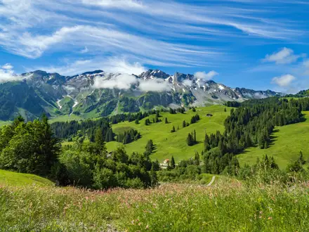
Salzkammergut lakes: Traunsee, Attersee, Wolfgangsee and Fuschlsee give the trail its strongest lake-and-limestone scenery. These sections are also useful for planning rest days and shorter variants.
Gaisberg and Salzburg: The trail climbs the Gaisberg, Salzburg’s viewpoint mountain, before descending towards the city via the Kapuzinerberg and Festungsberg. Salzburg’s old town is UNESCO-listed and a natural stopping point for many walkers.
European E4 connection: Weitwanderweg 04 is an Austrian variant of the E4. Beyond Bad Reichenhall, the line can be continued as the Maximiliansweg towards Bregenz.
Challenges to expect
Expect a long, cumulative effort rather than extreme altitude. The route is moderate, but 500 km over 19–25 days demands fitness and recovery planning. Forest tracks, gravel paths and rocky mountain sections all feature, with sure-footedness needed in places, especially around the Höllengebirge and Schafberg. Late snow can affect higher Salzkammergut sections into early summer. Accommodation is frequent, but book ahead in popular lake and city areas.
HikeList Score
Voralpenweg (Pre-Alpine Way, Trail 04) scored 89/100 on HikeList's trail-quality metrics.
See score breakdownHide breakdown
- Ideal length 72
- Balanced challenge 100
- Scenery & wildness 98
- Varied terrain 71
- Accommodation 92
- Food & support 88
- Path quality 98
- Season flexibility 89
Computed from length, challenge, scenery & wildness, terrain variety, accommodation, food & support, path quality and season flexibility.
 Austria
Show more data Show less
- Mountainous
- Forest
- Dirt
- Gravel
- Rocky
- Hotels
- Huts
- Hostels
- Campsites
- Family Friendly
- Pet Friendly
- Restrooms
- Water Sources
- Campsites
- Shelters
- Picnic Areas
Download Our Full Guide to Voralpenweg (Pre-Alpine Way, Trail 04) FREE!
Get our comprehensive guide to this hike for free. Save it for later reading or print out at home.
Photos from hikers
Taken on the trail by people who've reviewed Voralpenweg (Pre-Alpine Way, Trail 04).
Voralpenweg (Pre-Alpine Way, Trail 04): The Complete Guide
The Voralpenweg is Austria’s long pre-Alpine traverse: a waymarked walk from the Kahlenberg above Vienna to Bad Reichenhall just over the German border. It suits hikers who want a serious multi-week journey with villages, forests, river valleys and lake country rather than exposed high-Alpine terrain.
The route begins in the Wienerwald, crosses the Ybbs, Enns and Steyr valleys, then builds towards the limestone scenery of the Salzkammergut. Traunsee, Attersee, Wolfgangsee and Fuschlsee give the western half its strongest mountain-and-lake character.
Its high point is the Schafberg at 1,783 m, with the Gaisberg above Salzburg and the Höllengebirge adding the route’s most mountain-like days. Salzburg is a natural finish for many walkers, but the official line continues via Großgmain and Bayerisch Gmain to Bad Reichenhall.
This is not a technical trail, but it is still a demanding walk: about 500 km, around 12,000 m of ascent and roughly three weeks on foot. The challenge is consistency, booking sensibly, managing long stages and checking snow or hut openings on the higher Salzkammergut sections.
This guide covers stages, daily planning, accommodation, food, transport, terrain and common mistakes.
Stage-by-Stage Guide
The stages below follow the northern Wienerwald variant via Klosterneuburg, Tulbinger Kogel and Schöpfl. The Voralpenweg also has a southern Wienerwald variant that rejoins near Gresten, so accommodation bookings, GPX files and signposts must match the variant being walked.
Distances are indicative rather than official stage definitions. Several days are long for a moderate trail, and the mountain stages in the Salzkammergut require more care than the early forest and valley walking.
Stage 1: Kahlenberg to Unterkirchbach — about 22 km
The route begins on the Kahlenberg above Vienna, then crosses the neighbouring Leopoldsberg before leaving the city fringe for the wooded and vineyard-edged hills of the Wienerwald. This is a useful settling-in stage: rolling rather than mountainous, but long enough to expose any pack or footwear problems early.
Underfoot, expect a mix of forest paths, tracks and village lanes. The main landmarks are Kahlenberg, Leopoldsberg and Klosterneuburg before the route pushes west towards Unterkirchbach.
Food and drink are easiest to organise at the Vienna end and in settlements along the way, but do not rely on finding supplies at every small hamlet. Start with enough water and lunch for the day, especially if walking outside main opening hours.
Accommodation at or near Unterkirchbach is in the guesthouse/inn style typical of the Wienerwald, but availability should be checked before travelling. The start is straightforward by public transport: Kahlenberg is reached from central Vienna by bus 38A from Heiligenstadt U-Bahn. Public transport from Unterkirchbach is more local in character and should be checked before committing to it as a stage break.
Navigation is generally helped by the red-white-red Österreichischer Weitwanderweg 04 markings, but the city-edge paths and forest junctions require attention. Make sure the route being followed is the northern Wienerwald line, not a connector or local walking circuit.
Stage 2: Unterkirchbach to Schöpfl-Schutzhaus — about 24 km
This stage continues deeper into the Wienerwald and climbs towards the Schöpfl, the highest point of the Vienna Woods at 893 m. It is still pre-Alpine walking rather than mountain terrain, but the day has a more remote feel than the opening stage.
The main places and features are the Tulbinger Kogel area and the approach to Schöpfl. The Matras viewing tower and the Schöpfl-Schutzhaus make the finish one of the more memorable stops on the northern variant.
Paths are mostly forest and hill tracks, with possible muddy sections after rain. The walking is not technical, but the repeated rises and descents can make the stage feel longer than the distance suggests.
Food and water options become less frequent once away from the settlements, so carry a full day’s supplies. The Schöpfl-Schutzhaus is the key accommodation and refreshment point at the end of the stage; opening dates and overnight availability should be checked before travelling, particularly outside summer.
Road access near the end is limited compared with the valley towns, and any public transport escape should be planned in advance. Navigation can be awkward in forest where local marked paths overlap, so keep checking for route-number 04 rather than following any red-white-red marking automatically.
Stage 3: Schöpfl-Schutzhaus to Wilhelmsburg area — about 26 km
From the Schöpfl, the route leaves the highest Wienerwald ground and works west through forest, pasture and lower hill country towards the Wilhelmsburg area. This is a transitional stage: still wooded, but gradually less tied to Vienna’s recreation belt.
The day is mainly on forest and meadow paths, tracks and quiet lanes. Views open intermittently rather than continuously, with the best outlooks usually from clearings and higher ground rather than from the enclosed forest sections.
Food and water should be treated as a planning item rather than assumed en route. Carry enough from the start, and check whether any inns or shops on the line are open on the day being walked.
Wilhelmsburg and its surrounding area offer a more practical overnight base than the upland hut stage before it, with guesthouse-style accommodation more likely in or near settlements. Public transport and road access are better than on the Schöpfl, but exact connections should be checked before travelling.
Navigation is usually straightforward if the 04 markings are followed carefully. The main warning is distance: this is another mid-20 km day after an overnight on the hill, so a late start from the hut can make the finish feel drawn out.
Stage 4: Wilhelmsburg area to Gresten — about 30 km
This is one of the longer stages in the schedule and should be treated as a full day. It carries the route west through Lower Austrian hill and farming country towards Gresten, where the Wienerwald variants are close to their reunion point.
Terrain is mainly rolling countryside: forest tracks, farm tracks, meadow paths and stretches of village lane. There is no technical difficulty, but a 30 km day on mixed surfaces can be tiring, especially in warm weather.
Food and water planning matters here. Settlements exist along this part of the route, but services in smaller places may be limited or closed; start with sufficient water and a packed lunch unless specific stops have been checked.
Gresten is a logical overnight point with village/town services and guesthouse-style accommodation. It also works as a useful place to reset the itinerary before the route turns more decisively towards the Ybbs and the pre-Alpine valleys.
Public transport from Gresten and the Wilhelmsburg area should be checked before relying on it for a start or finish. Navigation is mostly about staying with the correct Voralpenweg line at minor roads, farm tracks and forest junctions.
Stage 5: Gresten to Waidhofen an der Ybbs — about 26 km
This stage leads from Gresten to Waidhofen an der Ybbs, a historic iron-working market town on the River Ybbs. It marks a clear change in the journey, moving away from the Vienna Woods and into the pre-Alpine valley country.
The walking remains moderate, with forest, farmland and track sections rather than high-mountain terrain. Expect a varied day of hill paths and lanes before descending or easing into the Ybbs valley setting around Waidhofen.
Waidhofen an der Ybbs is one of the stronger resupply and accommodation stops on the route. It is a sensible place for a proper overnight, laundry or short recovery stop if the previous long stages have accumulated fatigue.
Food and water should still be carried for the walking day, but the end of the stage has better services than many rural stops. Waidhofen an der Ybbs is one of the stage towns served by rail or Postbus, making it a useful access point for section-hikers.
Navigation should be uncomplicated in broad terms, but take care where the route enters or leaves settlements and where farm tracks intersect. This is also a good point to check onward accommodation, because the next stage is shorter but more rural.
Stage 6: Waidhofen an der Ybbs to Maria Neustift — about 15 km
This is a shorter day by Voralpenweg standards, useful after the longer approach to Waidhofen. The route climbs out of the Ybbs valley country towards Maria Neustift, with a more rural pre-Alpine feel.
The terrain is still moderate: hill paths, forest and farm tracks, with some road or lane walking around settlements. Although the distance is modest, do not underestimate the effort if the route gains height steadily away from the valley.
Food and water are easiest to organise before leaving Waidhofen an der Ybbs. Maria Neustift is a smaller endpoint, so accommodation and evening meals should be booked or checked ahead rather than left to chance.
Waidhofen is a useful public transport access point; onward transport from Maria Neustift is more limited and should be checked before travelling. If using this as a short recovery day, it can also provide time to reorganise supplies before the longer push to Ternberg.
Navigation is mainly about cleanly leaving Waidhofen on the correct 04 line and not being drawn onto local walking routes. In poor weather, forest tracks can be slippery or muddy, but the stage is not technical.
Stage 7: Maria Neustift to Ternberg — about 27 km
The route continues west through the pre-Alpine valleys towards Ternberg. This is a substantial walking day, returning to the longer rhythm of the trail after the shorter Waidhofen–Maria Neustift stage.
Expect rolling terrain with forest paths, gravel tracks, farmland and sections near village lanes. The route is not technically hard, but the cumulative ascent and descent over nearly 30 km make pacing important.
Food and water availability between rural settlements should not be assumed. Carry lunch and enough water from Maria Neustift, especially in hot weather or on Sundays and public holidays when smaller services may be closed.
Ternberg is one of the more practical stage ends, with rail or Postbus access noted for the route. Accommodation is generally in inns, guesthouses or nearby village options; book ahead if walking a fixed itinerary.
Navigation is helped by the standard red-white-red 04 waymarking, but the main risk is missing turns where the route uses minor tracks through agricultural and forested country. Ternberg is also a useful place to join or leave the trail for a shorter section.
Stage 8: Ternberg to Frauenstein — about 27 km
From Ternberg, the Voralpenweg continues through the Enns and Steyr valley landscapes towards Frauenstein. The stage remains in inhabited foothill country, but the hills begin to feel more closely tied to the Northern Alps ahead.
The walking is a mix of tracks, forest paths, meadow sections and lanes. Conditions are usually moderate, although wet forest paths and gravel descents can still be tiring over a full-day distance.
Food and water should be planned before leaving Ternberg. Frauenstein is a smaller endpoint, so check accommodation and meal availability before booking the stage sequence.
Ternberg has useful rail or Postbus access, while transport from Frauenstein should be checked before relying on it. Road access exists in the broader valley area, but this is not a stage where an unplanned late finish should be assumed easy.
Navigation is generally logical, following the 04 markings through a mixture of valleys and wooded ground. Take care at road crossings, village exits and any forest junctions where local paths share the same style of Austrian paint marking.
Stage 9: Frauenstein to Almtal (Habernau) — about 30 km
This is another long stage and one of the more committing valley-and-foothill days before the Salzkammergut. It takes the route towards the Almtal, with Habernau used as the stage endpoint in this schedule.
The terrain is varied but not technical: forest, farmland, tracks and lanes, with the landscape gradually setting up the approach to the limestone lake country. Because the distance is around 30 km, a steady early start is advisable.
Food and water planning is important. Rural services may be sparse between endpoints, so carry enough for the full stage unless definite stops have been identified and checked.
Accommodation in the Almtal/Habernau area should be arranged ahead, as options can be more spread out than in larger towns. If a specific overnight is not available at Habernau, the next practical arrangement may involve local transport or a nearby settlement; this should be checked before travelling.
Public transport in the Almtal area may be useful for section planning, but exact stops and timings should be checked. Navigation requires attention where the route crosses between valleys and where forestry tracks can create multiple similar-looking options.
Stage 10: Almtal (Habernau) to Ebensee — about 28 km
This stage carries the route from the Almtal towards Ebensee on the Traunsee, bringing the Voralpenweg into the Salzkammergut. The scenery becomes more recognisably lake-and-limestone, and the mountain stages ahead begin to dominate the planning.
Underfoot, expect a continued mix of forest paths and tracks, with more sustained hill country than the earlier valley days. The finish at Ebensee is significant because it sits below the Höllengebirge, one of the route’s wilder rocky sections.
Food and water should be carried from the start, even though Ebensee itself is a practical endpoint. Do not rely on casual mid-stage resupply unless current opening times have been checked.
Ebensee has rail or Postbus access and is a strong place to pause, resupply and check weather before entering the Höllengebirge. Accommodation is generally easier to organise here than on the ridge or hut stages ahead, but booking remains sensible in the main walking season.
Navigation is straightforward in principle, but the transition into the Salzkammergut makes it important to check that the next day’s hut booking and route choice are aligned. If weather is deteriorating, Ebensee is the place to make a conservative decision before climbing higher.
Stage 11: Ebensee to Höllengebirge (Hochleckenhaus) — about 21 km
This is one of the key mountain days of the Voralpenweg. From Ebensee, the route climbs into the Höllengebirge, the rugged limestone plateau-ridge between Traunsee and Attersee, and finishes at the Hochleckenhaus.
The terrain is more demanding than the early Wienerwald and valley stages. Expect sustained ascent, rockier paths and a more upland feel, with sure-footedness required in places.
Food and water options are limited once committed to the mountain section. Carry enough for the climb and check the opening dates, meal availability and overnight arrangements at the Hochleckenhaus before travelling.
Accommodation at the end is hut-style rather than town-based. This stage should not be started on the assumption that a bed or meal will be available without a booking or current opening information.
Public transport access is best at Ebensee before the climb. Once on the Höllengebirge section, escape options are more limited and weather matters more; late snow can linger on higher Salzkammergut legs into early summer, so snow clearance should be checked before setting out.
Navigation needs more care than on the lower stages. Follow the 04 markings closely, carry offline mapping or a printed map, and avoid pushing on in poor visibility if the route across rocky upland ground becomes unclear.
Stage 12: Höllengebirge (Hochleckenhaus) to Weißenbach am Attersee — about 11 km
This is a short stage on paper, but it should still be treated as mountain walking. The route leaves the Höllengebirge and descends towards Weißenbach am Attersee, with the Attersee forming the next major landscape marker.
The main task is the descent from rocky limestone terrain to the lakeside/valley setting. Paths may be rougher than the distance suggests, and wet rock or mud can slow progress.
Food and water depend heavily on hut opening and the services at the end. Start with enough water from the Hochleckenhaus and do not assume intermediate supplies.
Weißenbach am Attersee is a useful stage end with access in the Attersee area by Postbus or related public transport links. Accommodation should be booked ahead in the Salzkammergut, particularly in the lake season.
Navigation is generally easier once below the rougher upland ground, but take care leaving the hut and following the correct descent line. If weather has been poor overnight, allow extra time despite the short mileage.
Stage 13: Weißenbach am Attersee to Schafberg — about 15 km
This stage climbs from the Attersee side towards the Schafberg, the highest point of the Voralpenweg at 1,783 m. It is one of the scenic and physical high points of the whole route, with Salzkammergut lake views as the reward for the ascent.
The terrain is steeper and more mountainous than the valley stages, with rocky sections and sustained climbing. Sure-footedness is needed, and conditions can be significantly cooler or more exposed than at lake level.
Food and water should be carried for the full climb. Any refreshment or accommodation on or near the Schafberg depends on seasonal operation and should be checked before travelling.
The historic Schafbergbahn rack railway runs nearby from St. Wolfgang and may be relevant for transport or itinerary planning, but timetables and operating dates should be checked. Accommodation on or around the Schafberg is much more limited than in the lake towns, so booking ahead is essential.
This stage is particularly season-dependent. Late snow can linger into early summer, and the Schafberg should not be treated as a routine lowland hill just because the overall route stays below 2,000 m.
Navigation is important in poor visibility. Follow the 04 markings, keep to the intended line, and avoid relying solely on distant visual landmarks, as cloud can remove the otherwise obvious lake-and-summit orientation.
Stage 14: Schafberg to Hochlackenhof — about 15 km
After the high point, the route descends from the Schafberg area towards the St. Gilgen / Fuschl side of the Salzkammergut. This is a shorter stage, but it includes meaningful descent and should not be dismissed as an easy half-day if conditions are wet.
The stage links the Schafberg and Wolfgangsee landscape with the next section towards Fuschlsee. St. Gilgen and the Wolfgangsee are key nearby landmarks and a major part of this section’s appeal.
Underfoot, expect mountain paths at first, then a gradual return to forest, tracks and settlement-edge walking. Descents from the Schafberg can be hard on knees, especially after the previous day’s climb.
Food and water availability depends on seasonal mountain services and the route taken down from the Schafberg. Carry enough from the start and plan resupply around known lake or village services rather than assuming options on the hillside.
Accommodation at or near Hochlackenhof, St. Gilgen or the broader Fuschl area should be booked ahead in season. St. Gilgen is served by Postbus and is a practical public transport point for section-hikers, but exact connections should be checked before travelling.
Navigation requires care on the descent, particularly where local paths, mountain routes and access tracks intersect. In mist, do not rush the upper section; the route becomes more forgiving once lower down.
Stage 15: Hochlackenhof to Faistenau — about 13 km
This is one of the shorter stages in the schedule and provides a useful breather after the Schafberg and before the Gaisberg approach. The route passes through the Fuschlsee/Fuschl am See area towards Faistenau.
The terrain returns to easier pre-Alpine walking: forest paths, tracks, meadows and lanes rather than rocky mountain ground. The lakes and wooded foothills of the Salzkammergut remain the main setting.
Food and water are easier to plan here than on the high hut stages, but opening times in resort and village areas still vary by season and day of week. Carry basic supplies rather than depending on a single café or inn.
Faistenau is a small but logical overnight stop before the route climbs towards the Gaisberg. Accommodation should be arranged ahead, especially if walking during the busy Salzkammergut season.
Public transport in this area is by regional bus rather than major rail hub, so timings should be checked. Navigation is generally straightforward, but take care where the path uses village lanes and where local walking routes overlap with the long-distance waymarking.
Stage 16: Faistenau to Gaisberg (Zistelalm) — about 18 km
This stage climbs towards the Gaisberg, Salzburg’s viewpoint mountain, and finishes at the Zistelalm area. It is a moderate-length day but includes a clear return to upland walking.
The terrain combines forest paths, tracks and mountain approaches, with the Gaisberg rising to 1,287 m. On a clear day, the stage gives broad views towards Salzburg and the surrounding ranges.
Food and water should be carried from Faistenau, with any service at the Gaisberg/Zistelalm end checked in advance. The endpoint is not a large town, so overnight and meal arrangements should be confirmed before relying on them.
Road access to the Gaisberg area is better than in the Höllengebirge, but public transport details and seasonal services should be checked before travelling. This stage can be affected by weather, especially wind, rain or low cloud near the top.
Navigation is usually manageable with the 04 markings, but the Gaisberg is a popular local walking area, so multiple paths may be present. Stay with the long-distance route rather than following any path that simply appears to head towards the summit or road.
Stage 17: Gaisberg (Zistelalm) to Salzburg — about 12 km
This is a short descent stage from the Gaisberg into Salzburg. Many walkers treat Salzburg as a natural finish, even though the official Voralpenweg continues to Bad Reichenhall.
The walking moves from mountain and forest paths down towards the urban edge and finally into the city. Views over Salzburg are a major highlight, particularly in clear weather from the Gaisberg area.
Food, water and accommodation are much easier to organise in Salzburg than on most of the route. However, the city is busy in peak season, so accommodation should be booked well ahead if the itinerary depends on a specific night there.
Salzburg is a major rail hub and the best public transport reset point in the western part of the walk. It is the obvious place for a rest day, a gear change, or to decide whether to continue the official final stage to Bad Reichenhall.
Navigation changes character on this stage. The descent itself needs normal care, but the approach into the city can involve more junctions, roads and urban path choices than the rural stages; keep following the 04 markings until the intended endpoint is reached.
Stage 18: Salzburg to Bad Reichenhall — about 21 km
The final official stage leaves Salzburg and continues across the border into Bavaria, finishing at Bad Reichenhall. The route passes via Fürstenbrunn, Großgmain and Bayerisch Gmain before reaching the spa town.
Terrain is a mix of settlement-edge walking, tracks, paths and lanes rather than high mountain ground. It is still a proper walking day, and should not be treated as a simple urban transfer.
Food and water are easier to manage than on the hut stages because the route passes through inhabited areas, but carry enough for the day and check opening times if relying on a specific stop. Bad Reichenhall has the broadest range of end-of-route services on this stage.
Accommodation is available in Bad Reichenhall, and the town has its own station with connections via Freilassing/Salzburg. Salzburg is also a major rail hub, so this stage is straightforward to arrange as either the final day of a thru-hike or a separate completion stage.
Navigation requires attention leaving Salzburg and through the border-area settlements, where road crossings and local paths can interrupt the walking rhythm. The official Voralpenweg ends at Bad Reichenhall; any continuation west on the Bavarian Maximiliansweg is a separate onward route, not part of this Austrian trail.
Recommended Itinerary
The itinerary below follows the northern Wienerwald variant via the Schöpfl and uses the 18-stage breakdown. It is a practical fit-walker schedule rather than the only way to walk the Voralpenweg: official stage groupings are commonly closer to 22–24 stages, and many hikers will add rest or split days to make a 19–25 day trip.
Distances are approximate. Check official mapping before booking accommodation, especially where a day ends at a hut, mountain inn or smaller settlement.
Standard itinerary: 18 walking days
| Day | From | To | Approx. distance | Why this stage makes sense | Services/accommodation notes |
|---|---|---|---|---|---|
| 1 | Kahlenberg (Wien) | Unterkirchbach | 22 km | A manageable first day from the Vienna edge into the Wienerwald, starting high above the city rather than with a long urban approach. | Reach Kahlenberg by city bus line 38A from Heiligenstadt U-Bahn. Unterkirchbach is a small overnight stop; accommodation should be checked before travelling. |
| 2 | Unterkirchbach | Schöpfl-Schutzhaus | 24 km | This keeps the route in the Wienerwald and positions the night near the Schöpfl, the high point of the Vienna Woods on the northern variant. | Hut-style accommodation at or near Schöpfl-Schutzhaus should be booked ahead and opening dates checked before travelling. |
| 3 | Schöpfl-Schutzhaus | Wilhelmsburg area | 26 km | A longer descent-and-foothill day that carries the route west out of the higher Wienerwald country towards the pre-Alpine valleys. | Wilhelmsburg area has more settlement options than the preceding hut night, but exact lodging location should be fixed before setting off. |
| 4 | Wilhelmsburg area | Gresten | 30 km | One of the longer days, useful for making progress through rolling farmland, forest and village terrain before the route settles into the Ybbs region. | Plan food and accommodation carefully; 30 km days leave little margin for late starts. Gresten is the key overnight target here. |
| 5 | Gresten | Waidhofen an der Ybbs | 26 km | A good full stage into Waidhofen an der Ybbs, an important trail town and a logical place to resupply, pause or reset the schedule. | Waidhofen an der Ybbs is one of the stronger service points on the route and is served by public transport. It is a sensible place for a shorter day, rest night or section break. |
| 6 | Waidhofen an der Ybbs | Maria Neustift | 15 km | A shorter recovery day after several 25–30 km stages, while still keeping the route moving west. | Maria Neustift is a smaller stop; book accommodation ahead rather than assuming late availability. |
| 7 | Maria Neustift | Ternberg | 27 km | A substantial stage across pre-Alpine valley and forest country, ending in a transport-linked town. | Ternberg is served by rail or bus connections, making it useful for section hikers or schedule changes. |
| 8 | Ternberg | Frauenstein | 27 km | Another full-distance day through the Enns and Steyrtal approach country, keeping the itinerary on track before the longer Almtal stages. | Frauenstein is a smaller overnight point; confirm accommodation before travelling. |
| 9 | Frauenstein | Almtal (Habernau) | 30 km | A long but logical linking stage into the Almtal area, setting up the approach to Ebensee and the Salzkammergut. | Treat this as a committed day. Accommodation in the Almtal/Habernau area should be arranged in advance. |
| 10 | Almtal (Habernau) | Ebensee | 28 km | This stage reaches Ebensee on the Traunsee, a major transition from valley walking into the rockier Salzkammergut section. | Ebensee has rail access and is a strong resupply, rest or bailout point before the Höllengebirge. Book ahead in busy periods. |
| 11 | Ebensee | Höllengebirge (Hochleckenhaus) | 21 km | A shorter distance on paper, but this is a mountain day into the Höllengebirge and should not be treated like a valley walk. | Hut accommodation such as Hochleckenhaus must be booked ahead. Check opening dates, weather and snow conditions before committing to this stage. |
| 12 | Höllengebirge (Hochleckenhaus) | Weißenbach am Attersee | 11 km | A short stage is sensible after the Höllengebirge traverse, with descent to the Attersee rather than forcing a second long mountain day. | Weißenbach am Attersee is a useful lakeside stop. Seasonal demand around the Salzkammergut lakes can be high, so book ahead. |
| 13 | Weißenbach am Attersee | Schafberg | 15 km | A focused ascent day to the Schafberg, the 1,783 m high point of the Voralpenweg. The modest distance allows time for height gain and changing mountain weather. | Schafberg-area lodging and any nearby transport links, including the Schafbergbahn from St. Wolfgang, should be checked before travelling. Snow clearance is a key early-season consideration. |
| 14 | Schafberg | Hochlackenhof | 15 km | This keeps the day short after the route’s highest point and moves the itinerary towards the Wolfgangsee, St. Gilgen and Fuschl area. | Accommodation options are more seasonal in the lake district; reserve ahead, especially in summer. |
| 15 | Hochlackenhof | Faistenau | 13 km | A deliberately easy day through the Salzkammergut approach to Fuschlsee/Faistenau, useful for recovery before the Gaisberg stage. | Faistenau is a practical overnight before Salzburg’s local mountain. Accommodation should still be booked in advance in peak season. |
| 16 | Faistenau | Gaisberg (Zistelalm) | 18 km | This positions the night high on or near the Gaisberg, allowing a short final descent into Salzburg the following day. | Zistelalm/Gaisberg accommodation is limited compared with Salzburg; check availability and opening before relying on it. |
| 17 | Gaisberg (Zistelalm) | Salzburg | 12 km | A short and satisfying descent into Salzburg, giving time for arrival logistics, resupply, onward bookings or an overnight in the city. | Salzburg is a major rail hub and a natural finish for many walkers. Accommodation should be booked well ahead in busy periods. |
| 18 | Salzburg | Bad Reichenhall | 21 km | The official final stage continues beyond Salzburg into Bavaria via Fürstenbrunn, Großgmain and Bayerisch Gmain to Bad Reichenhall. | Bad Reichenhall has a station with connections via Freilassing/Salzburg. Walkers finishing in Salzburg can omit this stage, but the official Voralpenweg continues to Bad Reichenhall. |
Slower variant: 19–25 days
This is the better choice for most walkers carrying full luggage, anyone new to multi-week hiking, and anyone walking in unsettled weather or early/late season. The Voralpenweg is not technically extreme, but repeated 25–30 km days plus around 12,000 m of cumulative ascent make recovery time valuable.
A slower itinerary works best by using more of the official stage structure rather than forcing the condensed 18-day schedule. Split the longest days where accommodation and transport allow, and add rest or contingency nights at the stronger service points.
| Adjustment | Where it helps most | Practical effect |
|---|---|---|
| Add a rest or short day | Waidhofen an der Ybbs | Breaks up the long eastern half and gives a useful public-transport-linked pause after several full days. |
| Split long 30 km stages | Wilhelmsburg area to Gresten; Frauenstein to Almtal (Habernau) | Reduces the risk of late arrivals on rolling valley-and-forest days. Exact stopping points should be checked on official mapping before booking. |
| Add a buffer before the Höllengebirge | Ebensee | Gives time to wait for safe weather and check hut opening dates before entering the rockier Salzkammergut mountain section. |
| Keep Schafberg flexible | Weißenbach am Attersee, Schafberg, St. Gilgen/Wolfgangsee area | Useful if snow, storms or accommodation availability affects the route’s highest point. Check current conditions before travelling. |
| Add a city or logistics night | Salzburg | Sensible before deciding whether to finish in Salzburg or continue the official final stage to Bad Reichenhall. |
Faster variant: 16–17 days
A faster schedule only suits strong long-distance walkers who are comfortable with repeated full days and minimal contingency. It is least suitable in early summer if snow may still affect the Höllengebirge or Schafberg, or in peak season if accommodation has not been secured.
The most realistic way to shorten the walk is to combine some of the later shorter stages, rather than compressing the already-long 26–30 km days in the east. For example, Hochlackenhof to Gaisberg via Faistenau is about 31 km using the stages, and Gaisberg to Bad Reichenhall via Salzburg is about 33 km. These combinations save time but reduce margin for weather, fatigue and accommodation problems.
Most walkers should treat Salzburg as the key decision point. Finishing there creates a shorter trip with excellent onward rail connections, while continuing to Bad Reichenhall completes the official cross-border line.
Planning the Route
How many days to allow
Most walkers should plan the Voralpenweg as a three-week hike rather than trying to force it into a fast itinerary. The route is commonly split into roughly 22–24 official stages, but daily distances vary and several stages are long enough to feel demanding once ascent, heat, weather and accommodation logistics are included.
A fit walker can complete the Austrian route in about 19–21 walking days by combining easier valley sections and accepting some 25–32 km days. A more comfortable plan is 22–25 days, especially if staying in fixed accommodation and booking ahead rather than improvising each afternoon.
The Salzkammergut section deserves particular care in the schedule. The Höllengebirge, Schafberg and Gaisberg stages are not technically extreme, but they involve sustained climbing and descent, rockier ground and more exposure to mountain weather than the earlier valley and forest sections.
Fast thru-hike or slower itinerary?
The Voralpenweg can be walked quickly, but it is usually better planned with some flexibility. The route passes through enough towns, villages and public-transport corridors to make shorter days possible in many places, but not every mountain or rural stage has multiple convenient overnight options.
A faster itinerary works best for walkers who are comfortable with consecutive long days, have accommodation booked in advance and are willing to use rail or Postbus links if a stage has to be adjusted. A slower itinerary is better for most walkers because it gives more margin for weather on the Höllengebirge and Schafberg, busy accommodation around the lakes, and a possible rest stop in Salzburg or one of the Salzkammergut towns.
The route is not a wilderness expedition, so carrying excessive food or camping gear is usually unnecessary for walkers using inns, guesthouses and huts. The real planning challenge is making daily distances line up with places to sleep.
Stage planning and accommodation constraints
Daily stages are naturally dictated by towns, valley settlements, huts and mountain inns. In the Wienerwald and valley sections there are more opportunities to adjust the day, but the higher and more rural legs need firmer planning.
Book ahead for the sparser hut-style stops, especially around the Schöpfl-Schutzhaus, the Höllengebirge and the Schafberg. Opening dates and overnight availability at Schutzhäuser and mountain inns should be checked before travelling, particularly early or late in the season.
Accommodation in the Salzkammergut lake resorts and in Salzburg should also be reserved in advance in peak season. St. Gilgen, Fuschl am See and Salzburg are not remote, but they are popular places to stay and prices and availability can change quickly.
| Route section | Planning implications |
|---|---|
| Kahlenberg to the Wienerwald | Easy access from Vienna, but decide whether using the northern or southern Wienerwald variant before booking early stages. |
| Wienerwald to Gresten | The variants rejoin near Gresten; accommodation choices determine whether long days need to be split. |
| Waidhofen an der Ybbs to the Enns/Steyr valleys | Good section-hiking country, with several practical towns and transport links, but daily distances can still be long. |
| Ebensee, Höllengebirge and Attersee | Treat as mountain-stage planning: check hut opening, snow conditions and weather before committing. |
| Weißenbach am Attersee to Schafberg and St. Gilgen | Shorter distances can still be strenuous because of ascent and descent; accommodation and weather matter more than kilometres. |
| Fuschlsee, Faistenau and Gaisberg to Salzburg | Easier to adjust around settlements and Salzburg, but book city accommodation in season. |
| Salzburg to Bad Reichenhall | Decide whether to finish in Salzburg or continue the official cross-border line via Fürstenbrunn, Großgmain and Bayerisch Gmain. |
Choosing the Wienerwald variant
The route splits in the Wienerwald before rejoining near Gresten. The northern variant runs via Klosterneuburg, Tulbinger Kogel and the Schöpfl, the highest point of the Vienna Woods; the southern variant uses a different line via places including Purkersdorf, Helenental, Hocheck and Lilienfeld.
This choice affects distance, stage towns and accommodation bookings in the first part of the walk. Decide on the variant before reserving nights west of Vienna, and make sure maps, GPX files and accommodation plans all match the same line.
Shortening, extending and finishing options
Salzburg is the most practical shorter finish. It is a major rail hub and many walkers treat it as the natural end of the walk, even though the official Voralpenweg continues to Bad Reichenhall.
Continuing to Bad Reichenhall adds the final cross-border stage through Fürstenbrunn, Großgmain and Bayerisch Gmain. Bad Reichenhall has its own station, with rail connections via Freilassing and Salzburg.
The Voralpenweg can be continued beyond Bad Reichenhall on the Bavarian Maximiliansweg towards Bregenz, but that is a separate onward route and should be planned as a new trip rather than as part of the Austrian Voralpenweg.
Section hiking
Section hiking is very practical on this trail. Vienna and Salzburg are major rail hubs, Bad Reichenhall has rail access, and several stage towns or nearby settlements are served by ÖBB rail or Postbus.
Useful access points for breaking the route include Waidhofen an der Ybbs, Ternberg, Ebensee, Attersee/Weißenbach, St. Gilgen, Salzburg and Bad Reichenhall. This makes the route well suited to week-long blocks such as Vienna and the Wienerwald, the Ybbs–Enns–Steyr valley country, the Salzkammergut lakes, and the Salzburg finish.
Timetables for ÖBB, Postbus and any Salzkammergut lake-boat links should be checked before travelling. Rural buses may not suit every stage start or finish, especially at weekends or outside the main season.
Food, water and resupply
Resupply is generally straightforward because the trail passes through populated valleys, villages, lake resorts and cities. However, some individual stages are long, and the mountain legs should be treated as self-contained walking days.
Carry enough food for the day before leaving each overnight stop, particularly before the Höllengebirge and Schafberg sections. Do not rely on a hut, mountain inn or lakeside service being open unless current opening times have been checked.
Water planning is mostly about timing rather than scarcity. Start each day with enough water for the full stage, then top up only where services are definite; this is especially important on warm summer days and on the higher limestone sections.
Navigation
The Voralpenweg is a waymarked Austrian long-distance route, signed with the standard red-white-red Alpine Association markings and route number 04. It is also an Austrian variant of the European long-distance path E4.
Even so, a map or offline GPX track is strongly recommended. The Wienerwald split, village exits, forestry tracks and variant lines can cause mistakes, and distance figures vary depending on the exact line followed.
Navigation matters most where the route changes character: leaving Vienna into the Wienerwald, crossing between valley systems, moving through the Höllengebirge, and linking the lake and mountain stages around Attersee, Schafberg, Wolfgangsee and Fuschlsee.
Weather and season planning
The lower Wienerwald and valley stages have a longer walking season, but the full route is best planned from late spring to early autumn. The higher Salzkammergut sections, especially the Höllengebirge and Schafberg, should be snow-free before they are built into a fixed itinerary.
Early-season walkers should check snow conditions before committing to the mountain stages. Late-season walkers should check hut opening dates, daylight and weather windows, as the route still climbs above 1,000 m several times and reaches 1,783 m on the Schafberg.
Build at least one spare day into a full thru-hike if possible. It is useful for weather delays in the Salzkammergut, a rest day around the lakes, or accommodation reshuffling before Salzburg.
Permits and practical priorities
Permits are not the main planning issue on the Voralpenweg. The important tasks are choosing the Wienerwald variant, booking accommodation where options are limited, checking hut opening dates, checking snow clearance on the higher stages, and lining up transport for the start, finish and any section breaks.
Before setting off, confirm current accommodation availability, ÖBB and Postbus timetables, Salzkammergut lake-boat schedules if using them, and any live route diversions. These details change more often than the route itself.
Towns, Villages and Overnight Stops
The Voralpenweg is much easier to plan than a remote Alpine traverse because it repeatedly drops into inhabited valleys and lake resorts. The main exceptions are the higher hut-style stops: the Schöpfl, the Höllengebirge and the Schafberg, where opening dates, beds and meal service should be checked before travelling.
Accommodation is usually a mix of hotels, Gasthöfe, guesthouses, Privatzimmer, mountain inns and huts. Book ahead in the Salzkammergut lake towns and Salzburg in season, and do not assume a small village will have late food, a shop or several spare rooms.
Kahlenberg and Leopoldsberg
Kahlenberg is the start point above Vienna, reached from the city by bus line 38A from Heiligenstadt U-Bahn. It is a practical trailhead rather than a necessary overnight stop: most walkers stay in Vienna and travel up to Kahlenberg on the morning they start.
The route crosses neighbouring Leopoldsberg before heading west into the Wienerwald. Carry enough food and water for the first day rather than relying on frequent services immediately after leaving the city edge.
Klosterneuburg
Klosterneuburg sits early on the northern Wienerwald variant after the start from Kahlenberg and Leopoldsberg. It is useful for walkers who want a very short first section or a staged start rather than a full push to Unterkirchbach.
Expect more services than in the smaller Wienerwald villages, with accommodation and places to eat more likely here than on the wooded hill sections. Local transport connections should be checked before travelling if using it as a start, finish or bailout point.
Unterkirchbach
Unterkirchbach is the first listed overnight stop on the northern-variant stage pattern from Kahlenberg. It works well as a practical first night because it breaks the transition from Vienna into the Wienerwald without forcing an overlong opening day.
Accommodation is likely to be small-scale village lodging rather than a large choice of hotels. Book ahead, and check evening meal options, especially outside the main walking season or if arriving late.
Tulbinger Kogel
Tulbinger Kogel is a waypoint in the Wienerwald rather than a major resupply centre. It is useful for orientation on the northern line, but most itineraries will not depend on it as a full-service overnight stop.
If planning to stop on or near this section, accommodation and food availability should be checked before travelling. The better strategy for most walkers is to plan around the established overnight points at Unterkirchbach and the Schöpfl-Schutzhaus.
Schöpfl and Schöpfl-Schutzhaus
The Schöpfl is the highest point of the Vienna Woods and one of the first places where the route feels like a long-distance hill walk rather than a suburban forest route. The Schöpfl-Schutzhaus is the key overnight stop on this section of the northern variant.
Treat this as hut-style accommodation: check opening dates, bed availability and meal service before committing to the stage. There is no reason to expect village-style shopping on the hill, so arrive with the food, snacks and basic supplies needed until the next valley stop.
Wilhelmsburg
Wilhelmsburg, or the Wilhelmsburg area, is the next logical stop after the Schöpfl. It is a useful recovery and resupply point after the longer Wienerwald crossing.
The town-area setting should give more accommodation and food options than the preceding hut stage, but individual opening hours still matter. It is a sensible place to reset supplies before the long stage towards Gresten.
Gresten
Gresten is a significant planning point because the Wienerwald variants rejoin near here. Walkers following the southern variant will have different preceding overnight stops, but Gresten remains an important point at which itineraries converge.
It is a practical overnight stop before the route heads on towards Waidhofen an der Ybbs. Because the approach stages can be long, accommodation should be booked rather than left to chance.
Waidhofen an der Ybbs
Waidhofen an der Ybbs is one of the strongest service stops on the route. It sits on the River Ybbs and is a natural place to pause after the Wienerwald and before the pre-Alpine valley sections.
The town is well suited to an overnight, a shorter day or a rest-and-resupply stop. It is one of the named stage towns with public transport access by rail or Postbus, making it useful for section hikers joining or leaving the Voralpenweg.
Maria Neustift
Maria Neustift is a smaller overnight stop after Waidhofen an der Ybbs. The listed stage into Maria Neustift is shorter than many others on the route, which makes it useful for easing the pace after several longer days.
Do not plan this stop as a major resupply centre unless current services have been checked. Book accommodation ahead and confirm where an evening meal and breakfast will be available.
Ternberg
Ternberg is a useful valley stop after the stage from Maria Neustift. It is one of the stage towns with rail or Postbus access, so it works well for section walking and for itinerary adjustments.
Accommodation, food and basic supplies are more realistic here than in the smaller rural stops on either side. It is a good place to reassess weather, legs and timing before continuing towards Frauenstein and the Almtal.
Frauenstein
Frauenstein is a smaller stop between Ternberg and the Almtal. It is best treated as a booked overnight rather than a place where multiple fallback options can be assumed.
Check accommodation and meal availability before travelling. The following stage towards the Almtal is long, so leaving with enough food and an early start is more important than treating Frauenstein as a leisurely late-morning departure point.
Almtal, Almsee and Habernau area
The Almtal section, including the Habernau and Almsee area, is a scenic but less urban part of the route. It is a practical overnight zone between Frauenstein and Ebensee, but choices can be spread out rather than concentrated in one obvious town centre.
Accommodation should be arranged in advance so that the day ends exactly where a bed is available. Public transport options and any bus timings in this area should be checked before relying on them for a section start, bailout or shortened day.
Ebensee
Ebensee, on Traunsee, is one of the most important stops on the eastern Salzkammergut part of the route. It comes immediately before the Höllengebirge section, so it is the right place to resupply, check weather and confirm hut arrangements.
Ebensee is one of the named trail towns with rail or Postbus access, which makes it a strong access point for a Salzkammergut section hike. It is also a sensible place to take a shorter day before the more rugged limestone walking above the lake.
Höllengebirge and Hochleckenhaus
The Höllengebirge is one of the more serious overnight-planning sections of the Voralpenweg. The route leaves the valley and uses hut-style accommodation such as the Hochleckenhaus, so this stage should not be planned like a normal village-to-village day.
Check the hut opening period, bed availability, meal service and current conditions before travelling. Late snow can affect the higher Salzkammergut legs into early summer, and the rocky limestone terrain makes poor-weather planning more important here than on the lower valley stages.
Weißenbach am Attersee
Weißenbach am Attersee is the natural overnight after the Höllengebirge crossing. It is a useful place to recover from the hut stage and reset before the approach towards the Schafberg.
Accommodation in the Attersee area can be busy in the lake season, so book ahead. The Attersee and Weißenbach area has public transport access by rail or Postbus, making it useful for starting or ending a Salzkammergut section; current timetables should be checked before travelling.
Schafberg
The Schafberg is the high point of the Voralpenweg and a major logistical checkpoint, not just a viewpoint. Accommodation on or near the mountain should be treated as limited, seasonal and weather-dependent.
Check opening dates for Schafberg lodges and current snow or trail conditions before committing to the crossing. The Schafbergbahn rack railway from St. Wolfgang is an optional transport link nearby, but walkers should check its timetable and not rely on it without planning.
St. Gilgen
St. Gilgen sits on the Wolfgangsee below the Schafberg area and is one of the most useful Salzkammergut service stops. It is a good overnight choice for walkers wanting lake-town accommodation after the higher ground.
Expect a better range of beds and food than in the mountain sections, but also stronger seasonal demand. St. Gilgen is one of the named stage towns with public transport access by rail or Postbus, and lake-boat options in the Salzkammergut can also help with rest-day or escape planning; timetables should be checked before travelling.
Hochlackenhof
Hochlackenhof is a smaller rural overnight point between the Wolfgangsee/St. Gilgen area and Faistenau. It is useful for keeping stages moderate through the Fuschl area rather than pushing too far in one day.
This is not a place to leave accommodation to chance. Confirm the exact location of the lodging, meal arrangements and the next day’s route before arrival, as services are likely to be far more limited than in St. Gilgen or Salzburg.
Fuschl am See
Fuschl am See, on Fuschlsee, is a practical alternative or nearby service point in this part of the route. It is a sensible stop for walkers who want lake-town accommodation before continuing towards Faistenau and the Gaisberg.
Because Fuschlsee is a popular Salzkammergut area, accommodation should be booked ahead in season. Public transport and any lake-area connections should be checked before relying on them for section hiking or itinerary changes.
Faistenau
Faistenau is the listed overnight before the climb towards the Gaisberg/Zistelalm stage. It is a useful stop because it positions walkers well for the approach to Salzburg without making the next day too long.
Accommodation and food should be arranged in advance, particularly outside the main holiday period. Treat it as a village stop rather than a guaranteed full resupply centre, and leave with enough food for the climb towards the Gaisberg area.
Gaisberg and Zistelalm
The Gaisberg is Salzburg’s viewpoint mountain and the final substantial height before the descent into the city. Zistelalm is the listed overnight point on the route and is the practical place to break the Faistenau to Salzburg section.
Accommodation here should be checked and booked in advance, especially if walking at weekends or in the main summer season. There are no reasons to rely on broad village services on the mountain, so arrive with snacks and essentials already sorted.
Salzburg
Salzburg is the biggest and easiest logistics stop on the western part of the route. Many walkers use it as a natural finish, even though the official Voralpenweg continues to Bad Reichenhall.
It is the best place on the route for a rest day, full resupply, laundry, replacement gear and flexible transport. Salzburg is a major rail hub, but accommodation can be expensive and busy in peak season, so book ahead rather than arriving without a plan.
Fürstenbrunn, Großgmain and Bayerisch Gmain
Fürstenbrunn, Großgmain and Bayerisch Gmain sit on the final cross-border stage between Salzburg and Bad Reichenhall. They are useful waypoints if the last day needs to be shortened or split.
Do not assume full services at each village without checking current accommodation, food and transport options. This final section is still part of the official route, but it is also the part most easily omitted by walkers who choose to finish in Salzburg.
Bad Reichenhall
Bad Reichenhall is the official western end of the Voralpenweg, just over the Austrian border in Bavaria. It is a practical finish because the town has its own station, with rail connections via Freilassing and Salzburg.
Accommodation and food are easier to arrange here than in the smaller villages on the final stage. It is also the point where walkers continuing west would leave the Austrian Voralpenweg context and look to the separate Bavarian Maximiliansweg continuation.
Getting to the Start
The Voralpenweg starts on the Kahlenberg in Vienna’s Döbling district, above the Danube. For most walkers, the simplest approach is to travel to Vienna, use the city transport network to reach Heiligenstadt, then take bus 38A up to the Kahlenberg.
By train
Vienna is the main rail gateway for the start of the route, with long-distance rail connections from across Austria and neighbouring countries. From elsewhere in Austria, plan to arrive in Vienna the day before starting unless the connection gives enough time to reach the Kahlenberg and still complete the first stage to Unterkirchbach.
The practical public-transport interchange for the trailhead is Heiligenstadt U-Bahn. From there, use city bus 38A to the Kahlenberg. Current ÖBB, Vienna city transport and bus timetables should be checked before travelling, especially for early starts, Sundays and public holidays.
By bus
Bus 38A from Heiligenstadt U-Bahn is the key final link to the Kahlenberg. It is the standard public-transport approach to the trailhead and avoids starting the walk with an unnecessary climb through the city outskirts.
Get off at the Kahlenberg and allow a few minutes to orientate before following the Österreichischer Weitwanderweg 04 red-white-red markings. The route soon crosses the neighbouring Leopoldsberg before heading west into the Wienerwald.
If arriving late in the day, check the last bus times carefully. This should be checked before travelling.
By car
Driving to the start is usually less convenient than using Vienna public transport because the Voralpenweg is a long point-to-point route finishing in Bad Reichenhall, not a circuit. Leaving a car near the start creates a return problem at the end of the hike.
If travelling by car, consider parking in or near Vienna and using public transport to reach Heiligenstadt and bus 38A to the Kahlenberg. Long-stay parking rules, costs and security should be checked before travelling.
A taxi from Vienna or Heiligenstadt can be useful for a very early start, heavy luggage, or if the bus timetable does not fit. Fares and pick-up arrangements should be checked locally before relying on this.
From the nearest airport
For international walkers, Vienna is the relevant arrival city for the start of the trail. From the airport, continue into Vienna, then connect across the city to Heiligenstadt U-Bahn and bus 38A for the Kahlenberg.
Allow enough buffer time if flying in on the same day as starting the walk. The first stage from Kahlenberg to Unterkirchbach is a proper walking day, so a delayed flight or missed connection can quickly turn into a late finish. Airport-to-city transport times and current timetables should be checked before travelling.
Where to stay before starting
Staying in Vienna the night before the hike is the simplest option. Choose accommodation with straightforward morning access to Heiligenstadt U-Bahn, so the transfer to bus 38A is not the weak point of the first day.
Starting directly from the Kahlenberg works well for a clean east-to-west thru-hike, but avoid beginning too late. The first day heads out through the Wienerwald rather than through a dense chain of urban services, so water, food and accommodation for the first night should already be planned before leaving Vienna.
Getting Home from the Finish
By train
Bad Reichenhall has its own railway station, making rail the simplest way to leave the official finish. Services connect through the Bavarian rail network via Freilassing and Salzburg, so most onward journeys will involve changing at one of those hubs.
Salzburg is the key practical interchange: it is a major rail hub and sits close to the final stage of the route. If you need long-distance trains back across Austria, towards Vienna, or onward into Germany, plan the journey around a connection at Salzburg or Freilassing.
If finishing late in the day, do not assume a convenient same-evening long-distance connection. Check current train times before committing to a final walking day into Bad Reichenhall, especially if onward accommodation or flights depend on it.
By bus
For the official finish in Bad Reichenhall, rail is usually the more straightforward onward option. Buses may be useful if you stop short on the final stage around Großgmain, Bayerisch Gmain or the Salzburg side of the border, but exact routes and evening frequencies are timetable-dependent.
Postbus is part of the wider Austrian public transport network used along the Voralpenweg, while local cross-border services around Salzburg and Bavaria should be checked before travelling. This is particularly important on Sundays, public holidays and late in the day.
By car/taxi
The Voralpenweg is a long point-to-point route from Kahlenberg above Vienna to Bad Reichenhall, so leaving a car at the finish only makes sense if you have a specific pick-up plan or are walking a shorter section. Returning by public transport is normally more practical than trying to retrieve a vehicle from the start.
A taxi can be useful for short local transfers at the end of the route, for example between accommodation, the station and nearby villages if you finish after bus services have thinned out. Taxi availability and prices should be checked locally before relying on one, particularly for evening arrivals.
From the nearest airport
For flights, the practical first step is usually to travel by train from Bad Reichenhall towards Salzburg, then continue from there using the appropriate airport connection. Salzburg is the nearest major transport hub named on the route and is also where many walkers choose to finish instead of continuing the official line to Bad Reichenhall.
Airport transfer details, flight times and late-evening connections are not fixed planning assumptions for this hike. This should be checked before travelling, especially if trying to fly out on the same day as the final stage.
Where to stay at the finish
Bad Reichenhall is a spa town just over the German border and is a sensible place to stay after completing the official route. Overnighting there removes the pressure of matching the final walking day to train times and gives more flexibility if the last stage from Salzburg takes longer than expected.
Salzburg is also a practical alternative finish for many walkers, with excellent onward rail connections and a wide accommodation base. It should be booked ahead in peak season, and the same applies if planning a rest night there before walking the final cross-border stage to Bad Reichenhall.
Which Direction Should You Walk?
The standard and most sensible direction for the Voralpenweg is east to west: Kahlenberg above Vienna to Bad Reichenhall. This follows the official point-to-point line of Österreichischer Weitwanderweg 04 and gives the route its natural progression from the Wienerwald into the pre-Alpine valleys, then on to the Salzkammergut lakes, the Schafberg, Salzburg and the Bavarian border.
Walking in reverse is perfectly possible in practical terms, but it is usually less satisfying as a full thru-hike. It puts the strongest mountain-and-lake scenery early, then finishes with the lower wooded and agricultural country approaching Vienna.
East to west: Kahlenberg to Bad Reichenhall
This is the best direction for most walkers. The start is straightforward: reach the Kahlenberg from central Vienna by city bus, with line 38A from Heiligenstadt U-Bahn serving the hill. Starting from a major city also makes it easy to buy fuel, food, maps and any last-minute kit before setting off.
The route then builds gradually. The first section through the Wienerwald and the Ybbs, Enns and Steyr valleys gives several days to settle into long-distance walking before the rockier and higher Salzkammergut stages around the Höllengebirge and Schafberg. That progression matters on a three-week walk with long 25–32 km days and around 12,000 m of total ascent.
Scenically, east to west works especially well. The route begins with wooded hills and village walking, then becomes more mountainous as it approaches Traunsee, Attersee, Wolfgangsee and Fuschlsee. The Schafberg and Gaisberg arrive late enough to feel like major rewards rather than early highlights used up in the first week.
The finish also has better psychology. Salzburg is a natural celebratory endpoint for many walkers, while continuing the official line to Bad Reichenhall gives a clear cross-border finale via Fürstenbrunn, Großgmain and Bayerisch Gmain. Bad Reichenhall has its own station, with rail connections via Freilassing and Salzburg.
Accommodation planning is also slightly easier in this direction. The early Wienerwald and valley stages pass through frequent settlements, while the more constrained hut and lake-resort bookings — Schöpfl-Schutzhaus, the Höllengebirge huts, Schafberg-area lodgings, St. Gilgen, Fuschl and Salzburg — come later in the walk. Opening dates and reservations for these places should still be checked before travelling.
West to east: Bad Reichenhall to Vienna
The reverse direction can work for walkers with a specific transport reason, a section-hiking plan, or a desire to end in Vienna. Bad Reichenhall has a station, and Salzburg nearby is a major rail hub, so reaching the western end is not difficult.
The drawback is that the route front-loads much of the drama. In the first part of a reverse thru-hike, you pass Salzburg, the Gaisberg, Fuschlsee, Wolfgangsee, the Schafberg, Attersee, the Höllengebirge and Traunsee before spending the later stages in the valleys and Wienerwald. For many walkers, that makes the final week feel quieter rather than climactic.
Reverse walkers also meet the higher Salzkammergut logistics early. Hut opening dates, snow clearance on the Höllengebirge and Schafberg legs, and accommodation in the lake resorts need to be sorted before the walk begins, rather than after several days on trail. This is particularly important in late spring or early summer.
There is no major climbing advantage to walking west to east. The Voralpenweg repeatedly crosses rolling foothills, valleys and isolated limestone heights, so the cumulative work is similar either way. Direction does not remove the sustained climbs and descents on the mountain days.
Weather and wind do not give a dependable reason to choose one direction. Seasonal timing is more important: the lower Wienerwald and valley stages have a longer walking window, while the Höllengebirge and Schafberg sections need to be clear of snow.
Recommendation
Walk the Voralpenweg east to west, from Kahlenberg to Bad Reichenhall. It is the standard direction, has the easiest start logistics from Vienna, gives the best scenery progression, lets fitness build before the higher Salzkammergut stages, and ends with the strongest sense of arrival at Salzburg or the official cross-border finish in Bad Reichenhall.
Accommodation Along the Route
The Voralpenweg works well as an inn-to-inn walk. Most nights can be planned around hotels, Gasthöfe, guesthouses and Privatzimmer, with hut-style accommodation on the higher sections. The main planning issue is not a lack of beds across the whole route, but the uneven spread: busy towns and lake resorts have choice, while some rural valley and ridge stages have only a small number of realistic overnight options.
Booking ahead is strongly recommended for the Schöpfl-Schutzhaus, the Höllengebirge huts such as the Hochleckenhaus, any Schafberg overnight, the Salzkammergut lake resorts and Salzburg. Weekend pressure can be noticeable around the Wienerwald, Traunsee, Attersee, Wolfgangsee, Fuschlsee and Salzburg, especially in summer and early autumn.
How to plan overnights
The easiest approach is to book the main stage ends first, then adjust walking days around availability. The route has several long official stages, so some walkers split them using valley accommodation or nearby settlements; others combine easier days where transport and beds make that practical.
The lower Wienerwald and pre-Alpine valley sections are generally the most flexible for inn-to-inn walking. The Höllengebirge, Schafberg and Gaisberg sections need more care because overnight choices are more specific and seasonal opening dates matter.
Where a stage-end village is full, a short transfer to a nearby town or a public-transport bail-out can solve awkward gaps. Taxis and luggage transfer may be possible in some populated areas and lake resorts, but no single route-wide luggage service should be assumed. This should be checked before travelling.
Accommodation types to expect
- Hotels and Gasthöfe: the standard option in towns, valley settlements and lake resorts.
- Privatzimmer and B&Bs: useful in smaller villages where hotel choice is limited.
- Schutzhäuser and Berggasthäuser: important on the Schöpfl, in the Höllengebirge and around the Schafberg/Gaisberg sections.
- Hostels and campsites: present in some towns and resort areas, but not something to rely on for every stage without checking current locations and opening periods.
Mountain huts and upland inns may have shorter seasons than valley accommodation. Opening dates for the Schöpfl-Schutzhaus, Hochleckenhaus, other Höllengebirge huts and Schafberg lodges should be checked before travelling, particularly in May, early June and October.
Key overnight places
| Place | Accommodation level | Best for | Notes |
|---|---|---|---|
| Kahlenberg / Vienna | Good | Pre-walk night, late arrival, easy transport to the start | Vienna has the strongest accommodation choice at the start; reach Kahlenberg by city bus from Heiligenstadt U-Bahn. |
| Unterkirchbach | Limited | First night out of Vienna on the northern Wienerwald line | Book ahead or be ready to use nearby settlements if walking in a busy period. |
| Schöpfl-Schutzhaus | Limited | Classic Wienerwald ridge overnight | Hut-style stop on the northern variant near the Schöpfl; opening dates and beds should be checked before relying on it. |
| Wilhelmsburg area | Limited | Breaking the route before the longer rural stages westwards | Treat this as an area rather than a single guaranteed accommodation hub; book before committing to the stage. |
| Gresten | Limited | Rejoining point area after the Wienerwald variants | A practical stage town, but not a large resort; reserve ahead if arriving at the weekend. |
| Waidhofen an der Ybbs | Good | Restock, recovery night, transport access | One of the stronger overnight bases between the Wienerwald and the higher pre-Alpine country. |
| Maria Neustift | Limited | Rural overnight between Waidhofen an der Ybbs and Ternberg | Check availability carefully, as alternatives may involve transport or changing stage length. |
| Ternberg | Limited | Ennstal / Steyrtal transition stages | Useful stage stop with transport access, but still worth booking ahead. |
| Frauenstein | Limited | Positioning before the long approach towards the Almtal | Rural stage planning is important here; avoid arriving without a reservation. |
| Almtal / Habernau / Almsee area | Limited | Breaking the long approach to Ebensee | Accommodation is more spread out than in a town; confirm exact location against the walking route. |
| Ebensee | Good | Major reset before the Höllengebirge | Stronger choice than the upland huts and a sensible place to restock before the limestone section. |
| Höllengebirge / Hochleckenhaus | Limited | Mountain overnight between Traunsee and Attersee | Essential hut-style planning section; check opening dates, snow conditions and booking requirements. |
| Weißenbach am Attersee | Good | Lake stop after the Höllengebirge | A useful recovery and resupply point on Attersee; book early in lake-resort season. |
| Schafberg | Limited | High-point overnight or short mountain stage planning | Seasonal lodge/hut availability matters; check opening dates and conditions before building the schedule around this night. |
| St. Gilgen / Wolfgangsee | Good | Lake-resort overnight, rest day, shorter-stage planning | One of the best areas for adding comfort or a rest day, but accommodation demand can be high in season. |
| Hochlackenhof | Limited | Rural stop between the Schafberg and Fuschl/Faistenau area | Book before committing to this stage, or plan around nearby resort accommodation if needed. |
| Fuschl am See | Good | Lake stop, rest day, easier logistics | Popular Salzkammergut resort area; advance booking is sensible in summer and at weekends. |
| Faistenau | Limited | Overnight before the Gaisberg stage | Useful village stop, but not a large accommodation hub. |
| Gaisberg / Zistelalm | Limited | Final upland night before Salzburg | Hut/mountain-inn style planning; check current opening and bed availability. |
| Salzburg | Good | Major rest, finish option, transport hub | Many walkers finish here; book ahead in peak season because the city is busy beyond the hiking market. |
| Fürstenbrunn / Großgmain / Bayerisch Gmain | Limited | Splitting the final Salzburg–Bad Reichenhall stage | Useful if not walking the final stage in one day, but exact accommodation and transfer options should be checked before travelling. |
| Bad Reichenhall | Good | Official finish, post-walk night, onward transport | Spa town with rail connections via the Salzburg/Freilassing area; a practical place to end the full official route. |
Where accommodation is most likely to be tight
The most important pinch points are the hut and upland sections: the Schöpfl-Schutzhaus, the Höllengebirge around the Hochleckenhaus, the Schafberg and the Gaisberg/Zistelalm area. These are not places to treat as flexible walk-up accommodation during the main season.
The Salzkammergut resorts also need early booking. Weißenbach am Attersee, St. Gilgen, Fuschl am See and nearby lake settlements can fill for holiday traffic, not just walkers. Salzburg should be booked well ahead if the schedule reaches the city during a busy weekend or summer travel period.
Is camping necessary?
Camping is not necessary for most walkers. The Voralpenweg is better planned as a mixed inn, guesthouse and hut route, using campsites only where they fit the stage plan. Do not assume there will be a convenient campsite at every day’s end; check current locations and opening dates before carrying camping gear for that purpose.
Camping and Wild Camping
Camping is possible on parts of the Voralpenweg, but this is not a classic tent-based wilderness route. The trail is designed around Austrian villages, Gasthöfe, guesthouses, Schutzhäuser and lake-resort accommodation, with campsites available in some areas rather than at every stage end.
A camping approach works best as a hybrid: use established campsites where they fit the stage plan, and book huts or inns for the higher or more awkward sections. A tent can add flexibility in the valleys and Salzkammergut, but it also means carrying extra weight over roughly 12,000 m of ascent.
Where camping fits best
The most realistic places to look for established campsites are the populated valley and lake sections, especially around the Salzkammergut lakes. Traunsee, Attersee, Wolfgangsee and Fuschlsee are lake-resort areas, so camping options are more plausible here than on the wooded ridges or high limestone sections.
Good areas to investigate when planning a camping itinerary include:
| Route section | Camping practicality |
|---|---|
| Wienerwald / Vienna Woods | Less straightforward. The route passes through wooded, lived-in countryside and the Wienerwald is a UNESCO Biosphere Reserve, so plan on formal accommodation such as inns or huts rather than assuming informal camping is acceptable. |
| Ybbs, Enns and Steyr valleys | More practical in principle because the route passes through towns and villages, but campsites should be checked before building a stage plan around them. |
| Ebensee, Traunsee and the approach to the Höllengebirge | One of the better areas to look for formal camping before the wilder mountain section. |
| Attersee, Wolfgangsee and Fuschlsee | The strongest part of the route for campsite planning, with lake-resort infrastructure and more services. Book early in peak summer. |
| Höllengebirge, Schafberg and Gaisberg | Poor choices for camping unless using an established, permitted site. These are better treated as hut, mountain inn or valley-accommodation stages. |
| Salzburg to Bad Reichenhall | Urban and cross-border logistics make formal accommodation more practical than camping. If planning to camp near the end of the route, local rules on both the Austrian and Bavarian sides must be checked before travelling. |
Do not assume a campsite exists at the exact end of each walking day. Several Voralpenweg stages are long, and official or commonly used stage ends often make more sense for guesthouses or huts than for tent pitches.
Wild camping
Wild camping should not be treated as a normal planning method for this route. The Voralpenweg crosses Vienna, Lower Austria, Upper Austria, Salzburg and finishes just inside Bavaria, and local rules can differ between federal states, municipalities, protected areas and private land.
If considering any night outside an official campsite or hut, permission and current local rules must be checked locally before committing. This is especially important in the Wienerwald, on farmland and forest land, around lake resorts, and on the higher Salzkammergut sections such as the Höllengebirge and Schafberg.
Do not pitch beside houses, farms, lake beaches, trailheads, huts, roads or obvious tourist areas without explicit permission. On this route, being close to settlements does not mean camping is allowed; it usually means land ownership, local bylaws and visitor pressure matter more.
Open fires should be avoided unless they are explicitly permitted at an established campsite or managed fire place. Forested sections, dry summer weather, protected landscapes and private land make fires a poor and often prohibited choice. Use a stove only where it is safe and allowed.
Huts versus carrying a tent
For most walkers, the higher sections are better solved with huts or mountain accommodation than with a tent. The Schöpfl-Schutzhaus, Hochleckenhaus in the Höllengebirge area, and accommodation around the Schafberg are the kinds of places that can keep pack weight lower and remove uncertainty over legal pitching.
These places should be booked ahead, particularly in summer and around weekends. Opening dates for Schutzhäuser and mountain inns can vary with season and conditions, so this should be checked before travelling.
A tent makes most sense if the itinerary deliberately links formal campsites in the valleys and lake areas. It is less useful if the route plan already depends on huts, guesthouses and public transport.
Water and camping logistics
Water is generally easier to manage in the valleys, towns and lake areas than on the higher ridges. The route passes many settlements, but there can still be long walking days where the next shop, tap, hut or accommodation stop is not conveniently placed.
Do not rely on drinking directly from lakes, streams or troughs without treatment. Fill up in villages, accommodation, huts and other reliable service points where possible, and carry extra for the Höllengebirge, Schafberg and Gaisberg stages.
Camping near the lakes can be attractive, but lakeside areas are also where visitor pressure, private land and local restrictions are most likely. Use official campsites rather than informal lakeshore pitches.
Seasonal considerations
Camping season planning should match the walking season. The lower Wienerwald and valley sections have a longer practical season, but the Höllengebirge and Schafberg can hold late snow into early summer, and hut or campsite opening dates may not align with a thru-hike outside the main season.
In July and August, the Salzkammergut lake towns and Salzburg can be busy. Campsites and budget accommodation should be booked ahead, especially around St. Gilgen, Fuschl am See and other popular lakeside stops.
In shoulder season, the issue is the opposite: fewer services may be open, evenings are colder, and a camping itinerary can become less flexible. Check campsite opening dates, hut dates, Postbus connections and weather before setting out.
Leave No Trace on the Voralpenweg
Use established campsites wherever possible, keep groups small, and avoid creating new tent spots. Pack out all rubbish, including food scraps, and never leave toilet paper or sanitary waste.
If a legal, permitted overnight spot is arranged on private land, arrive late, leave early and restore the site completely. Keep noise down around farms, villages, huts and lake resorts.
The Voralpenweg stays below 2,000 m and is often close to services, so there is rarely a good reason to risk an illegal or damaging camp. Careful planning around campsites, huts and inns is the more reliable approach.
Food, Water and Resupply
The Voralpenweg is not a wilderness resupply problem. It crosses a long chain of villages, valley towns, lake resorts, mountain inns and huts, so most walkers can eat indoors at least once a day and buy supplies regularly.
The main planning issue is timing. Several official-style stages are long, rural and hilly, and there are higher stretches where food depends on a hut or mountain inn being open. Sunday closures, short rural shop hours and seasonal hut operations matter more than absolute remoteness.
General resupply strategy
Carry enough food for the walking day plus an emergency meal. On the lower Wienerwald, Ybbstal, Ennstal and Steyrtal sections, villages and towns are frequent enough that a heavy multi-day food carry is usually unnecessary, but not every village should be assumed to have an open shop or café when you arrive.
The easiest practical rhythm is:
- Breakfast at accommodation where available.
- Packed lunch bought the evening before or ordered from a Gasthof, hut or guesthouse.
- Dinner at the overnight stop, if it has a Gasthof, hotel restaurant, hut or nearby village facilities.
- Resupply in larger towns such as Waidhofen an der Ybbs, Ternberg, Ebensee, St. Gilgen, Fuschl am See, Salzburg and Bad Reichenhall, rather than relying on small hamlets.
In Austria, rural shops can close early, have limited weekend hours, or close on Sundays and public holidays. Huts and Berggasthäuser may also have rest days outside the busiest summer period. If a stage depends on a specific hut meal, packed lunch or breakfast, this should be checked before travelling.
Where food is easy
Food is simplest in the larger towns, lake resorts and city sections. Waidhofen an der Ybbs, Ternberg, Ebensee, St. Gilgen, Fuschl am See, Salzburg and Bad Reichenhall are the most useful resupply points named on the route, with a much better chance of supermarkets, bakeries, cafés, restaurants and transport-linked services.
The Salzkammergut lake section is also comparatively well served in season because the route passes established resort areas around Traunsee, Attersee, Wolfgangsee and Fuschlsee. This does not remove the need to plan ahead: accommodation and restaurants in popular lake towns can be busy, and opening patterns outside peak season can be patchier.
Salzburg is the obvious full reset point before the official final stage to Bad Reichenhall. It is also a natural place to replace trail food, repair or replace kit, and decide whether to continue to the German finish or end the walk in the city.
Where food is limited
The more awkward food planning comes on the higher and less populated legs: the Wienerwald hut stages around the Schöpfl-Schutzhaus, the Höllengebirge above Ebensee, and the Schafberg section. These are not technical wilderness crossings, but they are places where food availability may depend on hut opening dates, weather, season and whether the overnight place is serving meals.
The long rural days between smaller settlements also need care. Stages such as Wilhelmsburg area to Gresten, Maria Neustift to Ternberg, Ternberg to Frauenstein, Frauenstein to the Almtal area, and Almtal to Ebensee are long enough that turning up hungry and hoping for a café halfway is poor planning. Carry lunch, snacks and enough water before leaving the overnight stop.
If staying at huts such as the Schöpfl-Schutzhaus or Hochleckenhaus, book ahead and ask directly about dinner, breakfast and packed lunch. Hut opening dates and services should be checked before travelling, especially in May, early June and autumn.
Water planning
Tap water is usually the most reliable option: fill bottles at accommodation, huts, restaurants and public facilities where available. On a route that spends much of its time in settled Austrian foothill country, this is generally more dependable than planning around streams.
Natural water is present in the landscape, with the route crossing river valleys, forested hills and lake country, but it should not be treated as automatically drinkable. Agricultural land, grazing, forestry tracks and popular recreation areas can all affect water quality. If using streams or springs, filter or treat the water unless it is explicitly marked and trusted as drinking water.
For most stages, carrying 1.5–2 litres is a sensible starting point in normal conditions. On hot summer days, long climbs, exposed limestone sections, or stages where no guaranteed refill has been arranged, 2–3 litres is safer. The Höllengebirge and Schafberg days deserve particular attention because climbs, rockier ground and seasonal hut dependency can make water mistakes more consequential.
Section-by-section food and water table
| Section | Food availability | Water availability | Notes |
|---|---|---|---|
| Kahlenberg / Leopoldsberg to Unterkirchbach | Good at the Vienna end; becomes more rural as the trail enters the Wienerwald. | Start with full bottles from Vienna/Kahlenberg facilities or accommodation; refill at settlements or accommodation. | Do not rely on every small settlement having an open shop late in the day. |
| Unterkirchbach to Schöpfl-Schutzhaus | Limited to rural stops and hut availability. | Carry enough for the full stage unless refills are arranged. | Check Schöpfl-Schutzhaus opening, meals and any rest days before travelling. |
| Schöpfl-Schutzhaus to Wilhelmsburg area | Moderate but spread out through rural Wienerwald country. | Fill before leaving the hut; refill in settlements or at accommodation. | Carry lunch and snacks rather than depending on a timely café stop. |
| Wilhelmsburg area to Gresten | Limited to moderate; a long rural stage. | Start full and top up when a reliable public or hospitality refill is available. | One of the stages where a packed lunch is the safe default. |
| Gresten to Waidhofen an der Ybbs | Better at both ends, especially Waidhofen an der Ybbs. | Refill at accommodation and town facilities. | Waidhofen an der Ybbs is a useful food resupply point before the pre-Alpine valley stages. |
| Waidhofen an der Ybbs to Maria Neustift | Good at Waidhofen; more limited at the smaller overnight stop. | Fill in Waidhofen; confirm refill options at accommodation. | Shorter than many stages, but shop hours at smaller places still matter. |
| Maria Neustift to Ternberg | Limited en route; better at Ternberg. | Carry enough for a long day and refill where reliably available. | Pack lunch before leaving Maria Neustift. |
| Ternberg to Frauenstein | Moderate at the start; limited through rural sections. | Fill in Ternberg and at accommodation. | Ternberg is a sensible place to buy the next day’s lunch and snacks. |
| Frauenstein to Almtal / Habernau area | Limited; long rural and foothill walking. | Carry generous water unless accommodation has confirmed refill points. | Plan this as a self-sufficient walking day for food. |
| Almtal / Habernau area to Ebensee | Limited until the approach to Ebensee; much better in Ebensee. | Start full; refill at accommodation or reliable hospitality stops. | Ebensee is an important resupply point before the Höllengebirge. |
| Ebensee to Höllengebirge / Hochleckenhaus | Food depends heavily on hut or mountain accommodation. | Fill in Ebensee and check water at the hut. | Check Hochleckenhaus opening, meals and water availability before committing to the stage. |
| Höllengebirge / Hochleckenhaus to Weißenbach am Attersee | Limited on the mountain section; better after descending to Attersee. | Carry enough from the hut; do not assume untreated mountain water is safe. | Shorter in distance, but still a mountain day where hut logistics matter. |
| Weißenbach am Attersee to Schafberg | Food availability depends on seasonal mountain facilities and accommodation. | Fill before leaving Weißenbach; carry enough for the climb and ridge conditions. | Check Schafberg lodging/restaurant opening dates before travelling. |
| Schafberg to Hochlackenhof / St. Gilgen / Fuschl area | Variable: seasonal mountain services, then better near resort areas. | Fill at the overnight point before leaving; refill in settlements or accommodation. | If diverting into St. Gilgen, food options are generally stronger than on the hill itself. |
| Hochlackenhof to Faistenau | Limited to moderate rural availability. | Fill at accommodation and top up at Faistenau. | Shorter stage, but still carry lunch if shop or restaurant hours are uncertain. |
| Faistenau to Gaisberg / Zistelalm | Food depends on rural stops and the Gaisberg/Zistelalm accommodation or hospitality options. | Carry enough for the climb; refill at accommodation or mountain facilities if open. | Check opening and meals at the intended Gaisberg/Zistelalm stop. |
| Gaisberg / Zistelalm to Salzburg | Limited at the start unless mountain facilities are open; excellent in Salzburg. | Fill before leaving; Salzburg provides full services. | Salzburg is the best full resupply and rest point on the route. |
| Salzburg to Bad Reichenhall via Fürstenbrunn, Großgmain and Bayerisch Gmain | Good at Salzburg and Bad Reichenhall; intermediate villages may have limited hours. | Fill in Salzburg; refill in villages or at hospitality stops where available. | A day walk finish, but carry lunch if walking on a Sunday or public holiday. |
Practical food carry
For most walkers, a full food bag for the entire route is unnecessary and inefficient. A practical carry is usually one packed lunch, high-energy snacks, and one spare meal that can be eaten without cooking if accommodation food falls through.
Before leaving larger towns, buy food for the next long rural or mountain day. Waidhofen an der Ybbs, Ternberg, Ebensee, Salzburg and the Salzkammergut resort towns are the places to think ahead, not merely places to buy that evening’s dinner.
Vegetarian, vegan, gluten-free or other specialist diets should be planned more carefully in the smaller villages and huts. Larger towns and Salzburg offer the best chance of broader choice, while huts and rural Gasthöfe may have a shorter menu. Dietary requirements should be raised when booking accommodation, especially where no alternative restaurant is nearby.
Sunday, holiday and seasonal cautions
Sunday and public-holiday closures can affect supermarkets, bakeries and small village shops. Restaurants and Gasthöfe may still operate, but hours are not guaranteed and rest days vary. Buy the next day’s food before Saturday evening when walking through rural sections.
Seasonality matters most on the Schöpfl, Höllengebirge and Schafberg legs. Huts, mountain restaurants and lake-area hospitality can have opening periods that differ from the main walking season, and weather can shorten or delay service on higher ground. Current opening dates, meal service and water availability should be checked before travelling.
Terrain, Conditions and Difficulty in Practice
What the walking is actually like
The Voralpenweg is a long foothills traverse, not a high-Alpine expedition. Most days are on forest paths, meadow tracks, gravel and farm roads, with regular passages through villages, valley settlements and lake resorts.
The easier ground is still tiring because it comes day after day. Around 12,000 m of cumulative ascent over roughly three weeks means the effort is built from repeated climbs and descents rather than one or two major mountain passes.
There is some tarmac and village-lane walking, especially where the route links settlements through the Ybbs, Enns and Steyr valley country and around the Salzkammergut lakes. It is not a remote wilderness trail throughout; the practical rhythm is often forest, farmland, village, climb, descent, repeat.
Main terrain sections
| Section | Terrain in practice | What makes it harder |
|---|---|---|
| Kahlenberg, Leopoldsberg and the Wienerwald | Wooded hills, forest paths, vineyard-fringed slopes, tracks and lanes, with the northern variant crossing the Schöpfl area | Repeated rolling climbs, mud after rain in woodland, and navigation attention where paths and local walking routes intersect |
| Wilhelmsburg, Gresten and Waidhofen an der Ybbs | Lower pre-Alpine country, farmland, forest and river-valley walking | Long stages, mixed surfaces and the cumulative effect of road/track walking on feet |
| Maria Neustift, Ternberg, Frauenstein and the Steyrtal / Ennstal approach | A more rural foothills feel, with forest, meadow and valley connectors | Several 25–30 km stage days can feel harder than the terrain rating suggests |
| Almtal, Ebensee and Traunsee | Transition into the Salzkammergut, with more pronounced climbs and limestone surroundings | The walking becomes more mountainous; weather and accommodation planning matter more |
| Höllengebirge | One of the rockier and wilder parts of the route, with hut-style accommodation such as the Hochleckenhaus | Sure-footedness is needed, and late snow or wet limestone can change an ordinary stage into a much more serious day |
| Attersee, Schafberg and Wolfgangsee | Lakeside approaches followed by the highest ground of the route on the Schafberg, 1,783 m | Sustained ascent/descent, rocky mountain paths and early-season snow risk on the higher sections |
| Fuschlsee, Faistenau, Gaisberg, Salzburg and Bad Reichenhall | Mixed lake, hill, forest and urban-edge walking, including the Gaisberg above Salzburg and the cross-border finish | The Gaisberg is a real climb despite being close to Salzburg; the final stage still needs planning if continuing beyond the city |
Rocky and technical ground
There are no glaciers, no via ferrata sections and no technical climbing on the Voralpenweg. For a fit walker used to long days, the route is broadly moderate.
The caution is that “moderate” does not mean uniformly easy. The Höllengebirge above Ebensee and the Schafberg above the Wolfgangsee are the key places where rocky limestone ground, steeper gradients and mountain weather make the route feel more serious.
Wet rock, leaf-covered forest paths and loose gravel descents can all slow progress. Poles are useful for long descents, particularly on the mountain days and after rain.
Climbs, descents and daily effort
The route stays below 2,000 m, but it repeatedly climbs from valleys and lake basins onto wooded hills, ridges and viewpoints. The Schafberg is the high point at 1,783 m, with other notable high ground including the Feuerkogel area above Ebensee, the Gaisberg above Salzburg and, on the northern Wienerwald variant, the Schöpfl.
Several official stages are long, around 25–32 km. These are often harder in practice than the map profile suggests because they combine distance, ascent, mixed surfaces and time on the feet.
Most walkers should treat the Höllengebirge and Schafberg stages as mountain days rather than simple through-walks between accommodation stops. Start early, carry enough food and water for the full stage, and avoid relying on a late arrival at hut-style accommodation without a booking.
Forest, meadow and farmland conditions
The Wienerwald and many of the lower foothill sections are heavily wooded. After rain, expect damp forest paths, slippery roots, greasy mud and reduced visibility in enclosed woodland.
Meadow and farm tracks can be soft in wet weather and hot in open summer conditions. Where the route passes through working farmland or pasture, follow local signage, keep to the marked line and close any gates where they are present.
This is not a stile-heavy route in the British sense. The practical issue is more likely to be a mix of forest junctions, farm tracks and local path networks, where paying attention to the red-white-red markings and route-number 04 matters.
Road walking and hard surfaces
The Voralpenweg is not a continuous mountain path. It threads populated valleys, lake resorts and city-edge terrain, so some hard-surface walking is unavoidable.
Expect lanes through villages, approach roads into accommodation stops and urban walking around Salzburg if continuing through the city section. Well-cushioned footwear helps, particularly on longer valley days where tarmac, gravel and farm road surfaces add up.
Exposure and weather sensitivity
The route is not defined by exposed scrambling or high ridges. However, the limestone mountain sections in the Salzkammergut need more respect than the lower Wienerwald and valley stages.
Poor visibility, wet rock, lingering snow and sudden mountain weather can make the Höllengebirge and Schafberg slower and more demanding. These higher sections should be checked before travelling, especially in late spring and early summer.
Seasonal changes
The lower Wienerwald and valley sections have a longer walking season and can be feasible outside the main summer window, depending on weather. They are also more forgiving because villages, public transport and lower elevations are frequent.
The full route is best planned from late spring to early autumn, roughly May to October, once the higher Salzkammergut sections are clear of snow. Snow can linger on the Höllengebirge and Schafberg legs into early summer, so hut openings and current conditions should be checked before committing to dates.
In summer, heat on open farmland, lake approaches and road sections can make otherwise straightforward days feel harder. Early starts are sensible on long stages and before major climbs.
In autumn, shorter daylight makes the long 25–32 km stages less forgiving. Forest paths can also be slippery with wet leaves, especially in the Wienerwald and wooded foothill sections.
What makes the route easier
Frequent settlements, accommodation options and public transport make the Voralpenweg easier to break into sections than many long-distance mountain trails. Stage towns such as Waidhofen an der Ybbs, Ternberg, Ebensee, Weißenbach am Attersee, St. Gilgen, Salzburg and Bad Reichenhall give practical bail-out or restart points.
The waymarking is a major advantage: the trail uses the Österreichischer Alpenverein red-white-red field markings and route-number 04. A map or GPX is still advisable, particularly where the Wienerwald variants, local paths and settlement approaches create more route choices.
What makes it harder
The difficulty is cumulative. A single day may feel moderate, but several weeks of 20–30 km stages, repeated ascent and descent, and mixed surfaces require durable fitness.
Accommodation logistics also affect difficulty. The higher and sparser sections around the Schöpfl-Schutzhaus, Höllengebirge and Schafberg are less flexible than the valley towns, and opening dates should be checked before travelling.
The biggest practical mistake is underestimating the Salzkammergut mountain days because the route is described as pre-Alpine. The Voralpenweg is mostly gentle by Austrian mountain standards, but the Höllengebirge and Schafberg still require proper footwear, sure-footedness, weather judgement and enough margin in the day.
Weather and Best Time to Walk
The practical walking season for the full Voralpenweg is late spring to early autumn, broadly May to October. The lower Wienerwald and valley stages can be walkable across a longer season, but the full route depends on the higher Salzkammergut sections — especially the Höllengebirge and the Schafberg — being clear of snow.
For a continuous end-to-end walk, the most dependable window is summer into early autumn. May and October are better treated as shoulder-season options for lower sections unless current conditions, hut openings and transport links have been checked carefully.
Season by season
| Period | Practical verdict for hikers |
|---|---|
| Early spring | Suitable mainly for lower Wienerwald and valley day walks. Higher ground can still hold snow, and a full thru-hike is not a safe assumption. |
| May | Possible for lower and mid-level sections, but the Höllengebirge and Schafberg may still be affected by late snow. Hut opening dates and snow clearance should be checked before travelling. |
| June to September | The main season for a full traverse. Expect the best chance of open huts, clear high sections and workable daylight for the longer 25–32 km stage days, while still planning for rain, storms and sudden changes on the uplands. |
| October | Often a useful early-autumn section-hiking month on lower ground, but daylight is shorter and high sections can become cold, windy or wintry. Accommodation and mountain services may be reduced; this should be checked before travelling. |
| Winter | Not realistic as a normal full-route backpacking season. The low Wienerwald near Vienna may still be used for local walking, but the complete Kahlenberg to Bad Reichenhall route includes mountain and hut-based sections that should not be planned as a standard winter thru-hike. |
Snow and high-ground conditions
Although the Voralpenweg stays below 2,000 m, it is not just a lowland trail. The Schafberg reaches 1,783 m, and the Höllengebirge above Ebensee is one of the rockier, more exposed parts of the route.
Late snow can linger on these higher Salzkammergut legs into early summer. This matters because the trail surface becomes slower and less forgiving where snow, old ice or wet limestone affect footing, and because hut accommodation may not yet be operating on a normal summer pattern.
Before committing to the Ebensee–Höllengebirge–Weißenbach am Attersee–Schafberg section, check current snow conditions and the opening dates of relevant huts and mountain inns. This should be checked before travelling.
Rain, storms and wind
The route crosses forest, farmland, valley tracks, lake country and exposed upland ground, so wet weather affects different sections in different ways. Forest paths and meadow tracks can become muddy, while rocky limestone sections around the Höllengebirge and Schafberg demand more care when wet.
Summer thunderstorms are a serious planning factor on the mountain days. Avoid committing to exposed high ground such as the Höllengebirge, Schafberg or Gaisberg when storms are forecast, and keep enough flexibility to shorten, delay or reroute a stage using nearby valley transport where available.
Wind and low cloud matter most on the higher summits and ridges. The Schafberg and Gaisberg are both major viewpoints, but in poor visibility they can become cold, disorientating and much less rewarding; navigation and timing should take priority over summit views.
Heat and daylight
Summer heat is most noticeable on long valley stages, village lanes and open farmland, especially on the longer official days. Start early on hot days, carry enough water between settlements, and avoid assuming that every small village or hut will have services open when needed.
Daylight is generally workable in the main summer season, which helps with the route’s longer 25–32 km stages. In May and October, shorter days make those same stages less forgiving, particularly if wet ground, snow patches or navigation delays slow progress.
Fog, low cloud and navigation
Fog and low cloud are most relevant in the Salzkammergut and on the approaches to the higher summits. The Voralpenweg is waymarked with red-white-red Austrian Alpine Association markings and route number 04, but poor visibility can still make junctions, rocky sections and hut approaches slower.
Carry offline mapping or a reliable route file as a back-up to the painted waymarks. This is especially important if walking shoulder-season stages when weather windows are shorter and services are less predictable.
Accommodation and seasonal availability
Accommodation is generally frequent because the Voralpenweg passes through populated valleys, lake resorts and Salzburg, but the weather season and the accommodation season are closely linked on the higher sections. Schutzhäuser, mountain inns and huts around the Schöpfl, the Höllengebirge and the Schafberg should be booked ahead and their current opening dates checked.
The Salzkammergut lake towns, including St. Gilgen and Fuschl am See, and Salzburg itself can be busy in peak season. In the best walking months, book key nights early rather than relying on last-minute availability, especially where a long stage leaves few practical alternatives.
Safety Notes
The Voralpenweg is not a technical alpine route: it stays below 2,000 m, has no glaciers and no via ferrata. The main safety issues are the length of the hike, changing weather, long stage distances, route-finding on variants, and the rockier Salzkammergut sections around the Höllengebirge and Schafberg.
Emergency help and mobile signal
Use 112 for emergency help in Austria and Germany. Carry identification, insurance details and the address or name of the next accommodation, especially on hut-to-hut sections.
Mobile coverage should not be relied on everywhere. The route passes many towns and valleys, but reception can be weaker in forest, on limestone uplands and around the more remote Höllengebirge and Schafberg legs. Download offline maps and keep enough battery reserve for navigation and emergency calls.
Weather, snow and exposure
Weather can change quickly on the higher Salzkammergut stages, particularly on the Höllengebirge, Schafberg and Gaisberg. Even though the route is moderate rather than high-alpine, these sections are exposed enough for wind, cold rain, poor visibility and thunderstorms to matter.
Late snow can linger on the Höllengebirge and Schafberg into early summer. Snow clearance on these legs should be checked before travelling, and again locally before setting out if walking in May, June or after fresh cold weather.
In hot weather, the long forest, meadow and valley stages can still be draining, particularly where days run to 25–32 km. Start early, carry enough water for the full stage, and do not assume every hamlet or hut will be open when needed.
Remote and rockier sections
Most of the Voralpenweg is close to villages, roads or public transport, but the Höllengebirge above Ebensee and the Schafberg crossing deserve more careful planning. These are the places where poor weather, missed accommodation, fatigue or navigation errors are most likely to become serious.
Sure-footedness is needed in places on rocky upland paths. Trekking poles can help on long descents, but they are not a substitute for footwear with good grip.
Navigation and route variants
The trail is waymarked with Austrian Alpine Association red-white-red markings and route number 04, but signs and paint marks should not be the only navigation source. Carry a map or offline GPX track, especially in forest, around accommodation detours and where the route splits into the northern and southern Wienerwald variants before rejoining near Gresten.
Distance figures and stage groupings vary depending on variant and measurement method. Avoid planning a day to the last kilometre; allow time for missed turns, hut check-in times, food stops and transport connections.
Road walking and shared paths
The route includes stretches of village lane, farm track and valley road as well as forest and mountain paths. On roads without a pavement, stay visible, walk defensively and take extra care in poor light, rain and at bends.
A small rear light or reflective item is useful for early starts, late finishes and short road sections near villages.
Livestock and farming areas
The Voralpenweg crosses farmland, meadows and pasture country. Give cattle and other livestock a wide berth, keep calm, and never walk between cows and calves.
Dogs should be kept under close control wherever livestock may be present. Gates and electric fences should be left exactly as found.
Lakes and water
The route passes Traunsee, Attersee, Wolfgangsee and Fuschlsee, but the main walking line is not a water-based route. Treat lake swimming as a separate decision, not as part of the day’s hiking plan: cold water, fatigue after a long stage and poor weather can all raise risk.
Do not rely on untreated surface water. Carry enough drinking water between confirmed resupply points, particularly on hot days and on the higher legs where services are sparser.
Solo hiking
Solo hikers can manage this route sensibly because it passes many settlements and has good public transport access, but the long stages still require disciplined planning. Leave the day’s intended finish with someone if possible, and avoid pressing on over the Höllengebirge or Schafberg in deteriorating weather just to keep to schedule.
If walking alone, booking accommodation ahead is especially useful on hut-style sections and in popular Salzkammergut lake towns. It prevents late-day searching when tired and reduces pressure to continue beyond a safe stopping point.
Check before setting off each day
Before leaving accommodation, check:
- the day’s weather forecast, including thunderstorms, wind and visibility on higher ground;
- snow conditions on the Höllengebirge and Schafberg when walking in late spring or early summer;
- hut, Schutzhäuser and mountain-inn opening times, especially Schöpfl-Schutzhaus, Hochleckenhaus and Schafberg accommodation;
- whether food and water are available on the stage or must be carried from the start;
- the next realistic bail-out point by ÖBB rail, Postbus or local transport;
- any live diversions, forestry works or path closures;
- daylight remaining for the planned distance and ascent.
The safest approach is to treat the Voralpenweg as a long endurance hike rather than a difficult technical route: conservative days, reliable navigation, early starts and flexible plans matter more than specialised alpine equipment.
Gear Recommendations
The Voralpenweg is not a technical alpine route, but it is a long point-to-point walk with repeated 25–32 km days, around 12,000 m of ascent and several rockier mountain sections in the Salzkammergut. Gear should be light enough for three weeks, but robust enough for wet forest paths, gravel tracks, village lanes and limestone terrain around the Höllengebirge and Schafberg.
Footwear
Choose footwear for mixed surfaces rather than high-alpine mountaineering. Well-cushioned walking shoes or trail shoes can work for experienced long-distance walkers in summer, especially on the Wienerwald and valley stages, but they need reliable grip on wet forest paths and rocky limestone.
Lightweight hiking boots are the safer all-round choice if carrying a heavier pack, walking early or late in the season, or crossing the Höllengebirge and Schafberg in unsettled weather. Waterproof footwear is useful, but breathability matters too: much of the route is walked over long days on tracks, lanes and lower hills where hot feet can become the bigger problem.
Waterproofs and Warm Layers
Carry proper waterproofs, not just a shower shell. The route stays below 2,000 m, but the exposed Salzkammergut stages, the Höllengebirge, Schafberg and Gaisberg can feel very different from the sheltered valley sections.
A practical clothing system is:
- waterproof jacket with hood;
- waterproof trousers or a rain skirt for sustained wet days;
- warm mid-layer for hut stops and exposed ridges;
- light gloves and a warm hat outside high summer;
- spare dry base layer for hut or guesthouse evenings.
Late spring and early autumn need more insulation than the modest altitude might suggest. Snow can linger on the higher Salzkammergut legs into early summer, so the Höllengebirge and Schafberg conditions should be checked before travelling.
Navigation
The Voralpenweg is waymarked with the Austrian Alpine Association red-white-red markings and route number 04, but navigation still needs attention. The Wienerwald has northern and southern variants, and forest tracks, farm lanes and village approaches can create more junctions than the high mountains.
Carry offline mapping on a phone, a downloaded GPX track for the chosen variant, and enough battery capacity to navigate long days away from plug sockets. A paper map or guidebook is a sensible backup, particularly if walking the whole route rather than a short section.
A small power bank is strongly recommended for thru-hikers. It is useful not only for navigation, but also for checking ÖBB, Postbus and accommodation details when splitting or shortening stages.
Water and Food Carry
The route passes frequent villages, inns and valley settlements, so it is not a wilderness food-carry hike. Even so, several stages are long, and the higher or more remote sections around the Schöpfl-Schutzhaus, Höllengebirge and Schafberg have fewer fallback options.
Carry enough water capacity for a full warm stage between reliable refills, especially in summer and on the limestone sections. Do not assume every hut or mountain inn will be open outside its main season; hut opening dates should be checked before relying on them for water or meals.
Food planning can stay simple for inn-to-inn walkers: breakfast and dinner are usually taken in accommodation, with lunch and snacks bought in towns or villages. On mountain days, carry a proper lunch, high-energy snacks and an emergency reserve in case a planned stop is closed or the day takes longer than expected.
Trekking Poles
Trekking poles are useful on this route. They reduce fatigue over three weeks of repeated climbs and descents, and they are particularly helpful on long downhill sections, wet forest tracks and rougher limestone paths in the Salzkammergut.
They are not essential for strong walkers carrying a small pack, but most thru-hikers will appreciate them by the time the route reaches the Höllengebirge, Schafberg and Gaisberg stages.
For Inn-to-Inn Hikers
Inn-to-inn is the natural style for the Voralpenweg because the route threads populated valleys, lake resorts, huts and guesthouses. A compact pack is a major advantage on the long 25–32 km days.
Prioritise:
- light spare clothing that can be washed and dried overnight;
- hut or guesthouse footwear where appropriate;
- a small towel if using simpler accommodation;
- earplugs for shared rooms in huts or hostels;
- a power bank and charging cable;
- a lightweight pack liner or dry bags.
Booking ahead matters most in the Salzkammergut lake towns and Salzburg in season, and for hut-style stops such as the Schöpfl-Schutzhaus, Hochleckenhaus and Schafberg accommodation. Do not carry camping equipment “just in case” unless the route plan genuinely uses campsites.
For Campers
Camping is possible only as a planned style, not as a vague backup strategy. The Voralpenweg has campsites in the wider accommodation mix, but it also includes resort towns, hut stages and mountain areas where camping options may be limited or unsuitable.
A camper’s kit should stay lightweight: compact tent, warm sleeping system for cool nights, stove only where it is legal and practical to use, and enough food flexibility for stages without convenient shops. Local camping and bivouac rules should be checked before travelling, especially in mountain and lake areas.
Campers should also be realistic about pack weight. The route is moderate technically, but three weeks and around 12,000 m of ascent make unnecessary weight costly.
For Fast and Section Hikers
Fast walkers and section hikers can travel very light because public transport access is good at many stage towns, including Waidhofen an der Ybbs, Ternberg, Ebensee, Attersee/Weißenbach, St. Gilgen, Salzburg and Bad Reichenhall. For single stages or week-long sections, the key is matching gear to the specific terrain rather than packing for the whole route.
For the Wienerwald and valley sections, a small daypack with waterproofs, warm layer, water, food, offline navigation and a power bank is usually enough in settled weather. For the Höllengebirge, Schafberg and Gaisberg sections, add more margin: stronger footwear, extra warmth, proper rain protection and enough food and water for a slower-than-planned mountain day.
Sun, Heat and Insects
Summer heat can be significant on village lanes, open farmland and lake approaches, even though much of the route passes through forest. Carry a sun hat, sunglasses and sunscreen, especially around the Salzkammergut lakes and exposed summits.
Insect repellent is worth packing for warm woodland and lakeside sections. It does not need to dominate the kit list, but it can make evenings and rest stops more comfortable in the Wienerwald and around the lakes.
Seasonal Extras
For May, early June and autumn starts, pack warmer layers and check conditions on the Höllengebirge and Schafberg before committing to those stages. If snow remains on the higher sections, the route should not be treated like a normal summer footpath.
In peak summer, prioritise sun protection, water capacity and breathable clothing. In autumn, shorter daylight makes a reliable headtorch useful, particularly if walking the longer official stages or arriving late into smaller accommodation stops.
Budget and Costs
All costs on the Voralpenweg are in euros (€), including the short final stretch into Bavaria and Bad Reichenhall. Prices vary sharply between simple huts, rural Gasthöfe, Salzkammergut lake resorts and Salzburg, so build a budget from current accommodation quotes rather than relying on a fixed trail-wide tariff. Confirm current prices before booking.
Main cost drivers
Accommodation is the biggest variable. The route uses a mixed accommodation pattern: hotels, Gasthöfe, guesthouses, B&Bs, Alpine huts, mountain inns, hostels and campsites where available. Costs tend to be easier to control through the Wienerwald, Ybbstal, Ennstal and Steyrtal valley sections than in the Salzkammergut lake towns and Salzburg, where demand is stronger in the main walking season.
Food costs depend on whether accommodation includes breakfast and whether you eat evening meals in Gasthöfe, huts and restaurants. The trail passes frequent villages and towns, so most walkers can resupply regularly rather than carrying several days of food, but the higher Höllengebirge and Schafberg legs need more careful planning around hut opening and meal availability.
Transport costs are usually manageable because Vienna, Salzburg and Bad Reichenhall are well connected by rail, and many intermediate stage towns have rail or Postbus access. Optional extras such as lake boats in the Salzkammergut, the Schafbergbahn near St. Wolfgang, taxis, luggage transfers or rest days will add noticeably to the total.
Budget styles
| Style | Best suited to | How to keep costs down |
|---|---|---|
| Budget | Independent walkers using simple rooms, huts, hostels and campsites where practical | Book simple accommodation early, avoid peak weekends in Salzkammergut resorts, buy lunches from shops where available, use ÖBB rail and Postbus rather than taxis |
| Mid-range | Most self-guided thru-hikers | Mix Gasthöfe, guesthouses and huts, take some restaurant meals, allow for occasional shorter stages or a rest night in a town such as Waidhofen an der Ybbs, St. Gilgen, Salzburg or Bad Reichenhall |
| Comfortable | Walkers prioritising private rooms, easier logistics and flexibility | Book hotels or higher-standard guesthouses, use luggage transfer or taxis where available, add rest days around the Salzkammergut lakes or Salzburg, and budget for optional transport such as lake boats or the Schafbergbahn |
Accommodation costs
For a full traverse of roughly three weeks, plan for around 18–24 nights depending on whether you finish at Salzburg or continue to Bad Reichenhall, how stages are split, and whether rest days are added. Accommodation should be booked ahead in the more constrained places: Schöpfl-Schutzhaus, the Höllengebirge huts such as Hochleckenhaus, Schafberg accommodation, Salzkammergut lake resorts including St. Gilgen and Fuschl am See, and Salzburg in peak season.
Campsites can reduce costs on some sections, but this is not a route to budget as a continuous camping trek. The Voralpenweg threads populated valleys, resorts and mountain-hut terrain, so campsite spacing and legal camping options need checking stage by stage before relying on them.
Food and resupply costs
The route is generally kind to food budgets because it passes through regular settlements rather than remote wilderness. Towns such as Waidhofen an der Ybbs, Ternberg, Ebensee, St. Gilgen, Salzburg and Bad Reichenhall are natural places to resupply, eat a proper meal or replace kit.
Carry enough food for the longer valley stages and for the upland sections where services are limited or dependent on hut opening. Hut meals and lake-resort restaurants will usually cost more than supermarket lunches or bakery stops, so mixing the two is the easiest way to control daily spend.
Transport costs
Access to the start is inexpensive by normal Austrian city-transport standards: the Kahlenberg can be reached from central Vienna by city bus line 38A from Heiligenstadt U-Bahn. Vienna and Salzburg are major rail hubs, while Bad Reichenhall has its own station with rail connections via Freilassing and Salzburg.
For section hiking, ÖBB rail and Postbus services make many intermediate access points practical, including Waidhofen an der Ybbs, Ternberg, Ebensee, Attersee/Weißenbach and St. Gilgen. Timetables and fares should be checked before travelling, especially for weekend connections, seasonal bus links and Salzkammergut lake boats.
Taxis, luggage transfer and packages
Taxis are best treated as a contingency budget rather than a daily plan. They can be useful for shortening a stage, reaching accommodation off the line, or escaping bad weather from a road-accessible valley, but availability and cost vary by area and should be checked locally.
Luggage transfer may be possible on some more touristic sections, especially around the Salzkammergut and Salzburg, but it should not be assumed across the whole route. Any baggage service needs to be arranged directly with accommodation providers or a specialist operator before the walk.
The Voralpenweg is straightforward to organise independently because of its waymarking, village accommodation and public transport. If using a self-guided package, check exactly which sections are included, whether the official continuation to Bad Reichenhall is covered, and whether hut nights, Salzburg accommodation and luggage transfer are included in the quoted price.
Luggage Transfer, Guided Tours and Support Services
How much support is realistic on the Voralpenweg
The Voralpenweg is a long, waymarked Austrian Weitwanderweg rather than a single commercial holiday trail with one obvious end-to-end support system. Most independent walkers complete it by booking accommodation stage by stage, carrying their own kit, and using Austria’s rail and bus network for access, rest days and bail-out points.
Support is easiest in the populated valley and lake sections: the Wienerwald, Waidhofen an der Ybbs, Ternberg, Ebensee, the Attersee/Wolfgangsee/Fuschlsee area, Salzburg and Bad Reichenhall. It becomes more awkward on the higher or more hut-based legs, especially around the Schöpfl-Schutzhaus, the Höllengebirge and the Schafberg, where road access and hut opening dates need checking before relying on any baggage or taxi plan.
Luggage transfer
Do not assume there is a continuous door-to-door luggage-transfer service for the full Kahlenberg to Bad Reichenhall route. If walking with luggage support, the practical approach is usually to arrange it locally through accommodation, taxi firms or a walking-holiday operator for selected sections rather than expecting one courier to cover the whole trail.
Luggage transfer suits walkers staying mainly in hotels, Gasthöfe, guesthouses and B&Bs in road-accessible towns. It is less suitable for a purist hut-style itinerary or for stages ending at mountain huts, where bag delivery may be impossible or disproportionately expensive.
Key points to check before booking:
- whether each overnight stop accepts luggage delivery;
- whether the accommodation is road-accessible, not just on foot;
- cut-off times for bag collection and delivery;
- maximum bag weight and labelling requirements;
- whether cross-border delivery to Bad Reichenhall is included if finishing beyond Salzburg;
- what happens on rest days or if a stage is shortened by bus or rail.
If luggage transfer cannot be arranged for the whole route, a hybrid plan works well: send a main bag ahead to larger stops such as Waidhofen an der Ybbs, Ebensee, St. Gilgen, Salzburg or Bad Reichenhall, and carry a normal walking pack between those points. This is often simpler than trying to move a suitcase every day across remote or hut-based stages.
Self-guided walking packages
A self-guided package can be useful if the aim is to walk one manageable section of the Voralpenweg without handling every booking. Packages typically include pre-booked accommodation, route notes or GPX files, luggage transfer where possible, and local support if transport or accommodation problems arise.
Because the full route is about three weeks long and crosses several regions, packaged trips are more likely to make sense for sections such as the Wienerwald, the Salzkammergut lakes, or the Salzburg approach rather than the entire Kahlenberg to Bad Reichenhall traverse. Availability, inclusions and prices vary by operator and season; current details should be checked before booking.
Self-guided support is most worthwhile for walkers who want hotel-style accommodation, lighter day packs and a fixed itinerary. It is less necessary for confident long-distance hikers who are comfortable booking Gasthöfe and huts independently and using ÖBB rail, Postbus and local transport to adjust plans.
Guided options
A fully guided end-to-end Voralpenweg trip should not be assumed. The route is technically moderate, well waymarked and below 2,000 m, so most walkers do not need a guide for navigation or safety in normal summer conditions.
Guided support can still be useful for less experienced groups, family parties, or walkers who want help interpreting weather, transport and accommodation logistics. It is also more relevant on the mountain sections around the Höllengebirge and the Schafberg if conditions are uncertain, snow is lingering, or the group is not used to rocky upland walking.
For any guided arrangement, check exactly what is included: guiding only, accommodation booking, luggage movement, transfers, emergency support and alternative plans in poor weather. Hut opening dates and snow clearance on the higher Salzkammergut legs should be checked before travelling.
Taxi transfers and public-transport back-up
Taxis are best treated as a flexible local tool rather than a full-route support system. They are useful for reaching off-route accommodation, shortening one of the longer 25–32 km days, returning to a rail station, or bypassing a closed or weather-affected higher section.
Public transport is often the more dependable planning backbone. Vienna and Salzburg are major rail hubs, Bad Reichenhall has a station with connections via Freilassing/Salzburg, and stage towns such as Waidhofen an der Ybbs, Ternberg, Ebensee, Attersee/Weißenbach and St. Gilgen are served by rail or Postbus. Timetables should be checked before travelling, especially for weekends, public holidays and lake-region services.
Lake boats in the Salzkammergut can also help with rest days or shorter scenic variants, but they should not be treated as guaranteed daily transport without checking the current timetable.
What to book ahead
Book ahead wherever the route depends on limited accommodation or popular tourist infrastructure. The most important places are the hut-style or mountain stops such as the Schöpfl-Schutzhaus, Hochleckenhaus and Schafberg accommodation, plus the Salzkammergut lake resorts and Salzburg in peak season.
If using luggage support, every overnight stop should be confirmed before committing to the service. A single non-road-accessible hut, closed accommodation, or missed transfer window can break an otherwise neat itinerary.
For a lightly supported thru-hike, the safest pattern is to reserve the sparse mountain and lake stages first, then fill in the easier valley accommodation around them. Transport and taxi alternatives should be checked at the same time, particularly if walking outside the main late-spring to early-autumn season.
Shorter Hikes and Best Sections
The Voralpenweg is unusually easy to divide because it crosses regular valley towns, lake resorts and two major rail hubs. Distances below use the indicative stage distances for the northern Wienerwald variant and should be treated as planning figures rather than exact GPS mileage.
For any short itinerary, check current ÖBB, Postbus and lake-boat timetables before committing to accommodation. Hut opening dates and snow conditions are especially important on the Höllengebirge and Schafberg sections.
| Best for | Section | Approx. distance | Why choose it | Transport notes |
|---|---|---|---|---|
| Best day walk | Salzburg to Bad Reichenhall | 21 km | A practical one-day taste of the official finish, crossing via Fürstenbrunn, Großgmain and Bayerisch Gmain into Bavaria. | Salzburg is a major rail hub; Bad Reichenhall has a station with connections via Freilassing/Salzburg. |
| Best weekend | Ebensee to Weißenbach am Attersee via the Höllengebirge | 32 km over 2 days | The most compact way to experience the route’s wilder limestone terrain, with a hut-style night around the Höllengebirge. | Ebensee has rail access; the Attersee/Weißenbach area is served by rail or Postbus. Hut opening and snow clearance should be checked before travelling. |
| Best 3–5 day section | Ebensee to the St. Gilgen / Hochlackenhof area | 62 km over about 4 days | A strong short thru-hike: Traunsee, the Höllengebirge, Attersee, the Schafberg and the Wolfgangsee area in one continuous section. | Start at Ebensee by rail. St. Gilgen is served by Postbus; onward access from the exact Hochlackenhof finish should be checked before travelling. |
| Best scenery | Weißenbach am Attersee to Faistenau | 43 km over about 3 days | Focuses on the Salzkammergut: Attersee, the Schafberg, Wolfgangsee country and the approach towards Fuschlsee/Faistenau. | Weißenbach/Attersee has rail or Postbus links. Transport from Faistenau should be checked before travelling. |
| Best for beginners | Gaisberg / Zistelalm to Salzburg | 12 km | The shortest listed stage and a low-commitment way to walk a signed section finishing in a city. It still starts high on Salzburg’s viewpoint mountain, so weather matters. | Salzburg is the transport base. Access to Gaisberg or Zistelalm should be checked before travelling. |
| Best for public transport | Salzburg to Bad Reichenhall | 21 km | Simple point-to-point logistics with rail at both ends and no need to return to the start on foot. | Use Salzburg and Bad Reichenhall stations; current cross-border rail connections should be checked before travelling. |
| Best for villages and accommodation | Waidhofen an der Ybbs to Ternberg via Maria Neustift | 42 km over 2 days | A manageable valley-and-village section through the Ybbs/Enns/Steyrtal part of the route, with conventional guesthouse-style logistics rather than high huts. | Waidhofen an der Ybbs and Ternberg are among the stage towns served by rail or Postbus. |
| Best if camping | Salzkammergut lake sections, especially around Traunsee, Attersee, Wolfgangsee and Fuschlsee | Varies; Ebensee to St. Gilgen / Hochlackenhof area is about 62 km | Campsites are more relevant around populated valleys and lake resorts than on the higher mountain legs. Use huts or booked accommodation for the Höllengebirge and Schafberg unless a legal, open campsite fits the route. | Exact campsite locations, opening dates and any local camping restrictions should be checked before travelling. |
Best day walk: Salzburg to Bad Reichenhall
This is the cleanest one-day section for walkers who want a full Voralpenweg stage without committing to rural transfers. The route leaves Salzburg and continues west through Fürstenbrunn, Großgmain and Bayerisch Gmain to Bad Reichenhall, giving a satisfying cross-border finish.
At about 21 km, it is a proper day rather than a casual stroll, but the logistics are straightforward. Salzburg is a major rail hub and Bad Reichenhall has its own station, with connections via Freilassing/Salzburg.
Best weekend: Ebensee to Weißenbach am Attersee
For a two-day itinerary, the Ebensee to Weißenbach am Attersee section gives the biggest change in character in the shortest time. It climbs from the Traunsee side into the Höllengebirge, one of the rockier and more remote parts of the Voralpenweg, before descending towards Attersee.
Plan this as a hut-based weekend, with the Hochleckenhaus area the key overnight zone on the listed stages. This section should not be treated like the lower valley walking: check hut opening dates, weather and snow clearance before travelling.
Best 3–5 day section: Ebensee to the St. Gilgen / Hochlackenhof area
This is the strongest short version of the route for walkers who want the Salzkammergut in a compact block. Over roughly four days it links Ebensee, the Höllengebirge, Weißenbach am Attersee, the Schafberg and the St. Gilgen / Wolfgangsee area.
The section includes the highest point of the Voralpenweg, the Schafberg at 1,783 m, so it is more demanding than the mileage alone suggests. Book mountain and lake-area accommodation ahead in season, and do not rely on early-summer conditions being snow-free without checking locally.
Best for scenery: Weißenbach am Attersee to Faistenau
This three-day option concentrates the lake-and-mountain scenery without requiring the full Ebensee approach. It takes in the Attersee side, the Schafberg, the Wolfgangsee area and the transition towards Fuschlsee and Faistenau.
It is a good choice for walkers who care more about views than completing a long continuous block. Transport is easier at the Weißenbach/Attersee end than at some intermediate rural points, while onward travel from Faistenau should be checked before travelling.
Best for beginners: Gaisberg / Zistelalm to Salzburg
The Gaisberg / Zistelalm to Salzburg stage is the most manageable listed day at about 12 km. It gives a clear taste of the route’s waymarking and pre-Alpine feel while finishing in Salzburg, where accommodation and onward transport are simple.
It is still a mountain-side walk rather than an urban path, so footwear, weather and start access matter. Transport to Gaisberg or Zistelalm should be checked before travelling.
Best for public transport: Salzburg to Bad Reichenhall
For walkers planning a single stage without a car, Salzburg to Bad Reichenhall is the simplest option. Both ends are rail-connected, and the stage also works well as a standalone cross-border day hike.
This is also the obvious choice for anyone who has walked to Salzburg on an earlier trip and wants to return later to complete the official line to Bad Reichenhall.
Best for villages and accommodation: Waidhofen an der Ybbs to Ternberg
Waidhofen an der Ybbs to Ternberg, usually split with a night around Maria Neustift, is a practical two-day section through the pre-Alpine valley country. It suits walkers who prefer Gasthöfe, guesthouses and village stops over mountain huts.
Waidhofen an der Ybbs and Ternberg are useful access points because they are among the route towns served by rail or Postbus. As on the rest of the Voralpenweg, smaller overnight stops should still be booked rather than left to chance.
Camping options
Camping is most realistic on the populated valley and lake-resort parts of the Voralpenweg, particularly around the Salzkammergut lakes. It is not the best strategy for the higher Höllengebirge or Schafberg legs unless the day’s route, legal camping options and opening dates line up exactly.
No wild-camping assumption should be made on this route. Use official campsites where available, and check current opening dates, local rules and whether the campsite is actually convenient for the walking line before travelling.
Highlights and Points of Interest
The Voralpenweg’s main interest builds from east to west: wooded hills out of Vienna, long pre-Alpine river valleys, then the limestone-and-lake scenery of the Salzkammergut before Salzburg and the Bavarian finish. For extra time, the strongest places to linger are usually the Salzkammergut lakes, the Schafberg area, Salzburg, and — if following the northern Wienerwald variant — the Schöpfl.
Kahlenberg and Leopoldsberg
Kahlenberg is more than a convenient start point above Vienna. At 484 m, it gives broad views over the city and sits on a wooded hill associated with the 1683 relief of the Ottoman siege of Vienna.
The route then crosses neighbouring Leopoldsberg before heading west into the Wienerwald. Walkers starting late in the day should treat this opening section as proper hill walking rather than a city stroll, as the trail quickly leaves the urban edge for forested terrain.
Wienerwald / Vienna Woods
The Wienerwald is the route’s first major landscape: wooded, vineyard-fringed hills forming Vienna’s classic green recreation belt. It is also a UNESCO Biosphere Reserve, making it one of the best early sections for walkers who enjoy forest paths, rolling ridges and village-to-village walking rather than high-mountain drama.
The route has northern and southern waymarked variants through this area before rejoining near Gresten. The northern line includes Klosterneuburg, Tulbinger Kogel and Schöpfl; the southern line follows a different sequence of places, so anyone targeting specific highlights should choose the variant deliberately.
Schöpfl and the Matras viewing tower
On the northern Wienerwald variant, Schöpfl is a key high point at 893 m and the highest summit in the Vienna Woods. The Schöpfl-Schutzhaus makes it a logical overnight or meal stop, while the Matras viewing tower gives the section a clear destination rather than just another forested ridge.
Accommodation and hut opening dates should be checked before travelling, especially outside the main summer walking period.
Waidhofen an der Ybbs and the River Ybbs
Waidhofen an der Ybbs is one of the route’s most characterful town stops. It is a historic iron-working market town on the River Ybbs and marks a useful transition from the Wienerwald country into the pre-Alpine valleys.
This is a sensible place to pause for resupply, rest or a staged break in the walk, particularly for hikers dividing the Voralpenweg into week-long sections.
Ennstal, Steyrtal and the pre-Alpine valleys
After Waidhofen, the trail becomes more strongly shaped by valleys, farmland and forest. The Ybbs, Enns and Steyr valley country is less spectacular than the later Salzkammergut, but it is central to the character of the route: long walking days, frequent settlements and steady movement through Austria’s northern foothills.
These stages are good for walkers who value cultural landscape and practical village stops. They are also where the cumulative distance begins to matter, as several stage plans include long 25–32 km days.
Ebensee, Traunsee and the start of the Salzkammergut
Ebensee on the Traunsee is where the route’s scenery changes noticeably. From here the Voralpenweg moves into the limestone Salzkammergut, with lake basins, steeper slopes and more mountainous walking than the earlier foothill stages.
The Traunsee area is a strong candidate for an easier day or rest stop before the climb into the Höllengebirge. Accommodation in popular lake areas should be booked ahead in season.
Höllengebirge and Hochleckenhaus
The Höllengebirge above Ebensee is one of the wilder and rockier parts of the Voralpenweg. This limestone plateau-ridge between Traunsee and Attersee gives the route a more Alpine feel, with sustained climbing, rougher ground and hut-style accommodation such as the Hochleckenhaus.
This is a highlight for strong walkers, but it is also one of the sections where timing matters. Snow can linger into early summer on higher Salzkammergut legs, and hut opening dates should be checked before travelling.
Attersee and Weißenbach am Attersee
The descent towards Weißenbach am Attersee brings the route to another major Salzkammergut lake. Attersee is part of the trail’s most scenic lake sequence, and the shoreline settlements offer useful options for shortening, pausing or reorganising stages.
Public transport and lake-boat timetables in the Salzkammergut can help with flexible section walking, but current services should be checked before relying on them.
Schafberg
The Schafberg is the highest point of the Voralpenweg at 1,783 m and one of its clearest scenic highlights. Rising above the Wolfgangsee, it gives a major panorama over the Salzkammergut lakes and surrounding limestone country.
The historic Schafbergbahn rack railway runs nearby from St. Wolfgang, which can be useful for non-walking companions, bad-weather adjustments or a shorter visit to the summit area. Operating dates and times should be checked before travelling.
St. Gilgen and Wolfgangsee
St. Gilgen sits below the Schafberg on the shore of the Wolfgangsee, one of the route’s most celebrated lake settings. It is a natural place to slow down after the Schafberg crossing, particularly if the weather has been poor on the high section.
Because this is a popular Salzkammergut resort area, accommodation should be arranged early in the main season. It is one of the better places on the route for adding a rest day without feeling detached from the trail.
Fuschlsee, Fuschl am See and Faistenau
Between the Wolfgangsee area and Salzburg, the route passes towards Fuschlsee, Fuschl am See and Faistenau. This section keeps the lake-and-foothill character but begins to lead the walk out of the central Salzkammergut towards the Salzburg approach.
It is a useful area for shorter days after the harder mountain stages, with village stops that make stage splitting more realistic than on the Höllengebirge or Schafberg legs.
Gaisberg and Zistelalm
The Gaisberg, at 1,287 m, is Salzburg’s viewpoint mountain and the last major height before the city. The route climbs it via the Faistenau side and passes the Zistelalm area before descending towards Salzburg.
This is a rewarding final mountain viewpoint for walkers ending in Salzburg, and a strong psychological marker for those continuing the official line to Bad Reichenhall.
Salzburg
Salzburg is the route’s major cultural stop: a UNESCO-listed baroque old town beneath the Festung Hohensalzburg. It is also a practical hub, with rail connections, accommodation, resupply and easy options for ending or restarting the walk.
Many walkers treat Salzburg as a natural finish, even though the official Voralpenweg continues to Bad Reichenhall. Anyone with spare time should consider building in at least one non-walking day here, especially before the final cross-border stage.
Fürstenbrunn, Großgmain, Bayerisch Gmain and Bad Reichenhall
The official final stage leaves Salzburg and crosses into Bavaria via Fürstenbrunn, Großgmain and Bayerisch Gmain. This last day is less about high mountains than about completing the Austrian Weitwanderweg line across the border.
Bad Reichenhall, a spa town in the Berchtesgadener Land, is the formal finish and the point where the Voralpenweg meets the Bavarian Maximiliansweg. For walkers continuing westwards on that separate route, this is the natural place to reset logistics before moving on.
Common Mistakes and Planning Tips
The Voralpenweg is logistically forgiving by long-distance standards, but it still catches out walkers who plan it like a short valley trail. The main risks are stage length, seasonal mountain conditions and accommodation pinch-points in the Salzkammergut and Salzburg.
| Common mistake | Better plan |
|---|---|
| Treating “moderate” as meaning easy | Plan for a sustained three-week walk: about 500 km, roughly 12,000 m of ascent and several 25–32 km days in the official stage structure. Keep early stages conservative until feet, pack weight and daily rhythm are proven. |
| Booking from the wrong route variant | The Wienerwald section has northern and southern variants that rejoin near Gresten. Choose the variant before booking accommodation or downloading GPX files, especially around Klosterneuburg, Tulbinger Kogel and Schöpfl on the northern line. |
| Relying on one exact distance figure | Treat the route length as approximate. Common descriptions use about 500 km, while GPS and stage tallies vary because of the Wienerwald variants and the way the Salzburg–Bad Reichenhall finish is measured. Plan by real daily stages, not by dividing a headline distance by a fixed number of days. |
| Compressing the route into too few days | The route can be walked in around three weeks, but several stages are long: Wilhelmsburg to Gresten, Frauenstein to the Almtal, and Almtal to Ebensee are all demanding walking days in the indicative schedule. Add spare time or split stages if 25–30 km days with ascent are not comfortable. |
| Leaving key accommodation too late | Book ahead for the sparser upland sections and the busy tourist areas: Schöpfl-Schutzhaus, Hochleckenhaus and other Höllengebirge huts, Schafberg accommodation, St. Gilgen, Fuschl am See and Salzburg. Hut opening dates should be checked before travelling. |
| Assuming May conditions are the same everywhere | The lower Wienerwald and valley stages have a longer walking season, but the Höllengebirge and Schafberg can still hold late snow into early summer. Check snow clearance and hut access before committing to the higher Salzkammergut legs. |
| Following only painted waymarks | The trail is waymarked with red-white-red Österreichischer Weitwanderweg 04 markings, but forest tracks, village lanes, variant junctions and urban approaches can still be confusing. Carry an offline map or GPX, and make sure it matches the chosen Wienerwald variant. |
| Treating every village as a guaranteed resupply point | The route passes many settlements, but long days can still leave extended stretches between reliable services. Start each long stage with enough food for the day, especially on the 28–30 km valley stages and the mountain days around Ebensee, the Höllengebirge and the Schafberg. |
| Not deciding whether Salzburg is the finish | Many walkers naturally stop in Salzburg, but the official Voralpenweg continues to Bad Reichenhall via the Gaisberg, Fürstenbrunn, Großgmain and Bayerisch Gmain. Decide this before booking onward travel and accommodation, rather than treating the final cross-border stage as an afterthought. |
| Underestimating finish transport | Salzburg is a major rail hub, while Bad Reichenhall has its own station with connections via Freilassing and Salzburg. If finishing in Bad Reichenhall, check current rail times before booking long-distance connections. |
| Depending on optional transport without checking timetables | ÖBB rail, Postbus services and Salzkammergut lake boats make section hiking practical, and the Schafbergbahn from St. Wolfgang is an optional transport link near the Schafberg. Timetables vary, so rail, bus, lake-boat and mountain-railway times should be checked before travelling. |
| Confusing the Voralpenweg with the onward Maximiliansweg | The Austrian Voralpenweg ends at Bad Reichenhall. The much longer figure of around 870 km includes the Bavarian Maximiliansweg continuation to Bregenz, which is a separate onward route and should not be used for planning this hike unless deliberately continuing west. |
A robust plan is to book the high-demand nights first, then fill in the valley stages around them. Keep at least one flexible day for weather or transport disruption in the Salzkammergut, where the Höllengebirge, Schafberg and lake-resort logistics are less forgiving than the earlier valley walking.
Final Advice
The Voralpenweg is best suited to walkers who want a long Austrian traverse with reliable waymarking, regular villages and varied foothill terrain, rather than a committing high-Alpine route. It is moderate in technical terms, but the length, repeated 25–32 km days on some stage plans and around 12,000 m of ascent mean it still needs proper fitness and disciplined pacing.
The main planning task is not navigation; it is timing and accommodation. Check hut and mountain-inn opening dates before committing to the higher sections around the Schöpfl, Höllengebirge and Schafberg, and book ahead in the Salzkammergut lake resorts and Salzburg during the main walking season. Snow clearance on the Höllengebirge and Schafberg legs should be checked before travelling, especially in late spring and early summer.
For most walkers, the strongest section is the Salzkammergut: Ebensee, the Höllengebirge, Attersee, the Schafberg, St. Gilgen, Fuschlsee and the approach to the Gaisberg. This is where the route feels most distinctly pre-Alpine, with the best mix of limestone terrain, lakes and big views.
As a full thru-hike, the Voralpenweg works well for hikers who can spare about three weeks and enjoy the rhythm of a long east-to-west journey from Vienna to Bavaria. It is also highly practical as a section hike because Vienna, Salzburg, Bad Reichenhall and several intermediate towns have good rail or bus links. The Wienerwald, the valley stages and the Salzkammergut can each be walked as separate trips without compromising the character of the route.
Decide early whether the finish is Salzburg or the official end at Bad Reichenhall. Salzburg is a natural stopping point, but the final cross-border stage via Fürstenbrunn, Großgmain and Bayerisch Gmain completes the Österreichischer Weitwanderweg 04 properly and links the trail to the Bavarian Maximiliansweg.
Treat the quoted distance as approximate. The page figure of about 500 km is the useful planning number, while GPS and stage totals vary depending on the Wienerwald variant and the exact end-point measurement. Build in a little flexibility rather than planning every day to the limit.
Reviews
How would you rate Voralpenweg (Pre-Alpine Way, Trail 04)?
Tap a star to start your review — you could be the first.