Rockenbauer Blue Trail
How would you rate Rockenbauer Blue Trail?
Tap a star to share your experience and help other hikers.
Rockenbauer Blue Trail: Southern Transdanubia on Hungary’s blue network
HikeList Score
Rockenbauer Blue Trail scored 87/100 on HikeList's trail-quality metrics.
See score breakdownHide breakdown
- Ideal length 66
- Balanced challenge 84
- Scenery & wildness 98
- Varied terrain 83
- Accommodation 100
- Food & support 88
- Path quality 98
- Season flexibility 89
Computed from length, challenge, scenery & wildness, terrain variety, accommodation, food & support, path quality and season flexibility.
The Rockenbauer Blue Trail is a 541 km, hard, point-to-point long-distance footpath across south-western Transdanubia in western Hungary. Usually walked in about 25 days, it starts at Irott-ko on the Austrian border and heads through the Orseg, Zala and Somogy hills, the Mecsek near Pecs, and on to Szekszard. It suits experienced walkers who want a long, non-technical but sustained trail with forest paths, gravel tracks, village logistics and quieter rural sections.
Route Overview
The route runs generally west-to-east/south from Irott-ko, the shared western terminus of the National Blue Trail, to Szekszard in Tolna county. Key places include Koszeg, Bozsok, Velem, Egyhazasradoc, Oriszentpeter in the Orseg, Zalalovo, the Kaposvar area, Abaliget, the Mecsek mountains, Zobakpuszta and Moragy. This is a one-way traverse, so plan access to the Irott-ko/Koszeg area and onward travel from Szekszard separately. The trail is waymarked throughout with the horizontal blue-bar blaze. For related Hungarian walking areas, compare the Alföld Blue Trail, Balaton Uplands Trail and Bakony Hills Trail.
History of the Rockenbauer Blue Trail
The trail was created in 1989 by the Hungarian Friends of Nature Federation and named after Pal Rockenbauer, the television film-maker behind the 1980s documentary series Masfelmillio lepes Magyarorszagon (One and a Half Million Steps in Hungary). That series followed the original National Blue Trail and helped make long-distance hiking widely popular in Hungary. The Rockenbauer route extended the blue-trail concept into south-western Transdanubia; together with the National Blue Trail and the Alföld Blue Trail, it forms Hungary’s National Blue Circle.
Notable highlights
- Irott-ko / Geschriebenstein (882 m): The trail begins at its high point on the Austria-Hungary border. The stone lookout tower straddles the frontier, making this a memorable start to the traverse.
- Orseg region: A remote rural landscape of scattered hamlets, hay meadows and old timber szer farmsteads near the Slovenian border. It is one of the quietest and most traditional areas on the route.
- Mecsek mountains: The forested range above Pecs gives the trail its main south-western hill country character. The Rockenbauer route was created in part to bring the blue-trail network through this massif.
- Abaliget cave: A show cave in the western Mecsek, with a stream passage and small subterranean lake on the trail’s course. It is a useful natural landmark as well as a possible side visit.
- Szekszard: The southern terminus sits among the Tolna loess hills. The surrounding area is a known red-wine region, marking a distinctive finish after weeks of forest and hill walking.
Challenges to expect
The walking is not technical, but the scale is serious: 541 km, about 9,530 m of ascent and roughly 25 days on foot. Expect long forest sections, dirt and gravel tracks, some rocky ground near Irott-ko and the Mecsek, and short minor-road links through villages. Resupply is generally village-based but quieter sections need planning. Summer heat can be uncomfortable in southern Transdanubia.
HikeList Score
Rockenbauer Blue Trail scored 87/100 on HikeList's trail-quality metrics.
See score breakdownHide breakdown
- Ideal length 66
- Balanced challenge 84
- Scenery & wildness 98
- Varied terrain 83
- Accommodation 100
- Food & support 88
- Path quality 98
- Season flexibility 89
Computed from length, challenge, scenery & wildness, terrain variety, accommodation, food & support, path quality and season flexibility.
 Hungary
Show more data Show less
- Mountainous
- Forest
- Hills
- Dirt
- Rocky
- Gravel
- Hotels
- Lodges
- Huts
- Campsites
- Hostels
- Family Friendly
- Pet Friendly
- Water Sources
- Campsites
- Shelters
- Picnic Areas
Download Our Full Guide to Rockenbauer Blue Trail FREE!
Get our comprehensive guide to this hike for free. Save it for later reading or print out at home.
Photos from hikers
Taken on the trail by people who've reviewed Rockenbauer Blue Trail.
Rockenbauer Blue Trail: The Complete Guide
 i
Image by Bernadett
i
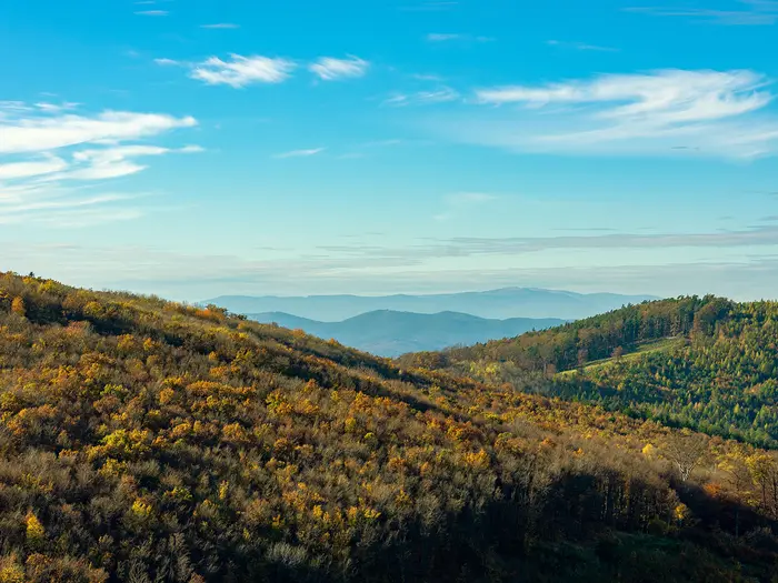
Image by Bernadett The Rockenbauer Blue Trail is Hungary’s long southern blue-blazed traverse: about 542 km from Írott-kő (Geschriebenstein) on the Austria–Hungary border to Szekszárd in the loess wine hills. It suits experienced long-distance walkers who want a sustained, non-technical route through quiet rural Transdanubia rather than a high-mountain or coastal trek.
The trail starts at its high point, beside the stone lookout tower on Írott-kő, then works south-east through the Kőszegi-hegység, Őrség, Göcsej, inner Somogy, the Zselic and the Mecsek. Expect beech woods, scattered farmsteads, hay meadows, sandy forest tracks, limestone gorges and many low-key village links.
Its strongest sections are often the least showy: the traditional hamlets around Őriszentpéter and Szalafő, the wooded Göcsej hills, the lakes and forests around Mesztegnyő, and the Mecsek above Pécs. Abaliget cave, Kisújbánya, Óbánya and the red-wine finish at Szekszárd give the later stages a clear sense of progression.
What the walk asks for is time, organisation and steady legs. The blue-bar waymarking is a major help, but accommodation and resupply are patchier through the Őrség, Göcsej and inner-Somogy stretches, and public transport plans should be checked before travelling.
This guide covers stages, realistic daily planning, accommodation, food, transport, terrain and the common mistakes that make this route harder than it needs to be.
Stage-by-Stage Guide
The 11 stages below are the official Rockenbauer Blue Trail sections, not realistic one-day legs for most walkers. They range from about 32 km to 68 km, so a typical 25-day itinerary splits each official section into shorter village-to-village days. Accommodation and transport should be planned around those shorter breaks, especially through the Őrség, Göcsej and inner-Somogy stretches where services are more spread out.
Stage 1: Írott-kő to Egyházasrádóc — about 50 km
This is the most symbolic start on the whole route: the trail begins at Írott-kő (Geschriebenstein), the 882 m high point on the Austria–Hungary border. From the stone lookout tower the route descends out of the Kőszegi-hegység, passing through the beech-forested western uplands above Velem, Bozsok and the Kőszeg area before moving towards lower, more settled country.
Underfoot, expect the roughest ground near the start. The Írott-kő and Kőszegi-hegység section includes rocky upland paths and forest tracks, then gradually gives way to easier dirt and gravel tracks, village links and farmland. Short minor-road sections are part of the route through settlements.
Key places on or near this stage include Velem, Bozsok, Kőszeg, Szombathely, Ják and Egyházasrádóc. The main highlights are the border-summit start, the forested Kőszegi hills and the transition from western upland terrain into the gentler south-west Transdanubian landscape.
Food and water planning is important from the outset. Kőszeg and the larger settlement areas nearby are the best places to make sure supplies are sorted, but the exact availability of shops, cafés and opening hours in smaller villages should be checked before travelling. Carry enough water for the full walking day, particularly in warm weather.
Egyházasrádóc is a useful section end because it is on or near railway access. Accommodation should still be booked ahead rather than assumed, and if staying elsewhere nearby, check the onward bus or rail connection before fixing the itinerary.
Navigation is generally straightforward on the horizontal blue-bar waymarks, but take care on the descent from the summit area and at village edges where the route changes between paths, tracks and minor roads. In wet weather, the forested upland paths can be slower than the map distance suggests.
Stage 2: Egyházasrádóc to Őriszentpéter — about 66 km
This long official section carries the trail deeper into western rural Hungary, moving from the Egyházasrádóc area towards the Őrség. The landscape becomes quieter and more traditional, with scattered settlements, meadows and wooded country replacing the busier border-town fringe.
The route is non-technical but sustained. Expect a mix of dirt tracks, forest paths, gravel lanes and minor-road links through villages. The distance is the main difficulty; most walkers should divide this section rather than attempt it as a single day.
Kondorfa and Őriszentpéter are the key named places on this stage. The approach to the Őrség is one of the most characteristic parts of the Rockenbauer Blue Trail, with its quiet hamlets, hay meadows and old timber farmstead landscape near the Slovenian border.
Resupply becomes less predictable here. Őriszentpéter is the main planning point, but do not rely on every smaller settlement having open food options. Start each sub-stage with enough food and water to reach the next confirmed service or overnight stop.
Accommodation is more village-based and patchier than in the larger towns. Book ahead for Őrség stages, and confirm whether lodging is directly on the route or requires a short transfer or local bus. Public transport is bus-based away from the main rail points, and current Volánbusz times should be checked before relying on them.
The blue-bar waymarking remains the main navigation aid, but this is a section where complacency can cost time. In open meadows, forest junctions and scattered hamlet layouts, keep a map, GPX track or official route booklet to hand.
Stage 3: Őriszentpéter to Zalalövő — about 55 km
This stage continues through the Őrség before crossing towards Göcsej. It is a quieter, rural section with the route passing through or near Szalafő and then eastwards to Zalalövő.
The terrain is mostly gentle rather than mountainous, but it is rarely fast for a whole day. Forest paths, dirt roads, gravel tracks and village lanes make up much of the walking, with a rolling profile through wooded and pastoral country.
Szalafő is one of the important Őrség settlements on the route, associated with the area’s scattered hamlets and traditional farmstead pattern. Beyond the Őrség, the trail enters the wooded, hilly cottage country of Göcsej on the way to Zalalövő.
Food and water should be planned conservatively. Őriszentpéter and Zalalövő are the obvious start and finish supply points, while smaller places along the way should not be treated as guaranteed resupply unless current opening times are known.
Zalalövő is a practical section end because it has railway access. Accommodation in or near the town should be arranged in advance, especially if walking in peak spring or summer weekends.
Navigation is usually not technically hard, but there are many low-key rural junctions where the correct track can be easy to miss. After rain, dirt roads and forest sections may be muddy, and progress can be slower than on paved village lanes.
Stage 4: Zalalövő to Rádiháza — about 41 km
This is a shorter official section by Rockenbauer standards, but still a substantial walking leg if taken in one go. It continues through the Göcsej landscape: wooded hills, small villages, quiet lanes and rural tracks.
The walking is non-technical and mostly on forest paths, dirt and gravel tracks, with minor-road links around settlements. The stage has less dramatic mountain scenery than the Írott-kő or Mecsek sections, but it is important for understanding the route’s long inland character.
The main named places are Zalalövő at the start and Rádiháza at the end. Between them, expect a quieter countryside stage rather than a service-rich corridor.
Carry food for the day unless a specific intermediate stop has been checked. Water should be topped up before leaving Zalalövő and at confirmed accommodation or services, as smaller rural settlements cannot be relied upon for open shops at the time you pass.
Rádiháza is a small end point compared with the larger rail-linked towns. Accommodation and onward transport should be checked before travelling, and walkers may need to adapt the itinerary around available village lodging or bus connections.
Navigation demands attention at forest and farm-track junctions. There is no technical exposure, but long stretches of similar-looking woodland and gravel roads make it worth checking the route regularly rather than waiting for a problem to become obvious.
Stage 5: Rádiháza to Palin (Nagykanizsa) — about 59 km
This stage runs from rural Göcsej country towards the Nagykanizsa area, with Homokkomárom among the named places on the line of the route. It is a long official section and will usually need splitting into more manageable days.
Terrain remains typical of the central Rockenbauer Blue Trail: forest tracks, dirt roads, gravel ways, farmland and village links. The walking is not technical, but the cumulative distance and repeated low hills make it a demanding multi-day section.
The end at Palin brings the trail close to Nagykanizsa, one of the more useful service and transport areas on the route. This makes the stage a practical point for resupply, laundry, a rest stop or reorganising accommodation after the quieter western sections.
Food and water are easier to plan at the Nagykanizsa/Palin end than in the smaller villages before it. Do not leave Rádiháza or any intermediate overnight stop without enough supplies to reach the next known settlement service.
Accommodation options are generally better around larger towns than in the remote countryside, but specific places and prices should be confirmed before booking. Palin/Nagykanizsa is also one of the route areas with railway access nearby.
Navigation is mostly about staying disciplined through rural junctions, village approaches and minor-road links. Summer heat can be noticeable in this part of southern Transdanubia, especially on open tracks and road sections, so start early and carry adequate water.
Stage 6: Palin (Nagykanizsa) to Zalakomár — about 32 km
This is the shortest official section in the list and a useful chance to reduce the physical load after several long western stages. It leaves the Nagykanizsa/Palin area and heads towards Zalakomár, passing near Zalakaros.
The terrain is gentler than the Kőszegi-hegység and the later Mecsek. Expect a mix of village links, minor roads, dirt tracks, gravel ways and lowland rural walking as the route approaches the inner-Somogy part of the trail.
Zalakaros is near the route and is known for spa hotels, making it a possible comfort stop if it fits the itinerary. Zalakomár is the official section end and should be treated as the next key logistics point.
Food and water planning is simpler than on the most remote stages, but still needs checking. Palin/Nagykanizsa is the strongest start-point for supplies; any reliance on Zalakaros or intermediate services should be planned around current opening hours and the exact route line.
Accommodation may be available in the larger nearby service settlements, including spa-hotel options around Zalakaros, but do not assume availability at short notice. Public transport is part of the wider rail-and-bus network, but current MÁV and Volánbusz times should be checked before building a short-stage transfer around them.
Navigation should be straightforward in clear weather, though the route may feel less distinctive where it uses tracks and village-road links. The main warning is heat rather than difficulty: exposed rural sections can be tiring in summer.
Stage 7: Zalakomár to Kaposmérő — about 63 km
This long official section crosses into inner Somogy, one of the gentler but more logistically important parts of the trail. The route passes Mesztegnyő before continuing towards Kaposmérő, with Kaposvár nearby at the end of the section.
Underfoot, expect sandy pine and oak woods, dirt tracks, gravel roads, small lakeside country and village links. The terrain is less rugged than the Mecsek, but sandy tracks and long forest stretches can make the walking more tiring than the elevation profile suggests.
Mesztegnyő is the key highlight, associated with small lakes and the narrow-gauge forest railway. The section is less about big viewpoints and more about sustained woodland travel through the middle of the route.
Food and water should be planned carefully. Zalakomár, Mesztegnyő and Kaposmérő are the main named planning points, but individual shop and meal options should be checked before travelling. Carry enough to cover long gaps between dependable services.
Kaposmérő is the official end, with Kaposvár nearby and useful for broader services and transport. Kaposvár is also one of the route areas associated with railway access, making this a sensible place to reset the itinerary if needed.
Navigation is generally easy when waymarks are frequent, but forest roads and sandy tracks can create long, repetitive sections. Watch for missed turns at track junctions, and be prepared for slower progress in hot, dry sand or after rain on unpaved tracks.
Stage 8: Kaposmérő to Abaliget vasútállomás — about 68 km
This is the longest official Rockenbauer section and should almost always be split. It leaves the Kaposmérő/Kaposvár area, passes through the rolling Zselic country around Simonfa, and continues towards the western Mecsek and Abaliget vasútállomás.
The Zselic is a forested hill landscape rather than high mountain terrain. Expect long stretches of woodland, rolling tracks, dirt and gravel roads, and village links. The Zselic Star Park dark-sky area near Kardosfa lies close to the route, underlining how rural this section can feel away from Kaposvár.
The character changes gradually as the route approaches the Mecsek. The walking becomes more hill-focused, though the more rocky limestone ground is mainly a feature of the Mecsek stages themselves.
Food and water need deliberate planning because of the section length. Kaposmérő/Kaposvár is the best place to leave fully supplied, and any intermediate overnight split should be chosen only after checking accommodation and food availability.
Abaliget vasútállomás is a particularly useful end point because it gives railway access. Accommodation may be in Abaliget or nearby settlements rather than directly at the station, so check the exact location before committing to a long final day.
Navigation is important in the Zselic, where forest roads and rolling woodland can be disorientating if a waymark is missed. There is no high-level exposure, but the combination of distance, heat and forest-track walking makes this one of the more committing official sections.
Stage 9: Abaliget vasútállomás to Zobákpuszta — about 38 km
This stage brings the trail into the Mecsek, the main southern hill country of the route. Starting from Abaliget vasútállomás, it passes Abaliget and the Abaliget cave area before continuing through the forested limestone landscape above the Pécs region towards Kisújbánya, Óbánya and Zobákpuszta.
Terrain is more varied and hillier than on much of inner Somogy. Expect forest paths, limestone hills, deep wooded valleys and some rocky ground, with gravel and dirt tracks linking the more enclosed sections.
Abaliget cave is one of the major sights of the whole route. It is the largest show cave of the Mecsek, with a long stream passage and important bat colonies. Kisújbánya and Óbánya are also key highlights: small former glassmaking and German-heritage hamlets tucked into the eastern Mecsek valleys.
Food and water should be managed with care. Abaliget and the Pécs area nearby offer better planning options than the rural valleys, but walkers should not rely on being able to buy food in every hamlet. Carry supplies for the full stage or for the full sub-stage if splitting it.
Zobákpuszta is a more rural end point than Abaliget or Pécs. Accommodation and any bus connection should be checked before travelling, and some itineraries may need to use nearby settlements or Pécs for overnight logistics.
Navigation in the Mecsek deserves more attention than on many earlier stages. The forest is denser, the terrain more broken and the path surface rockier in places. After rain, limestone and wooded gorge sections can be slippery, and progress may be slower than on the gentler central tracks.
Stage 10: Zobákpuszta to Mórágy — about 38 km
This section continues east from the Mecsek towards the lower hill country leading to the Szekszárd end of the trail. It passes near Pécsvárad and through the Bátaapáti and Mórágy area.
The walking remains hilly and forested at first, with the Mecsek influence still present, before gradually shifting towards the softer landscapes of the Szekszárdi-dombság approach. Expect forest paths, dirt tracks, gravel roads, village links and some minor-road walking.
Pécsvárad, Bátaapáti and Mórágy are the key named planning points. The stage is less dominated by one single landmark than Stage 9, but it is an important transition from the Mecsek valleys towards the final wine-hill landscape.
Food and water should be planned from confirmed stops only. Zobákpuszta is not a major service hub, so make sure supplies are in place before starting. In warm weather, carry more water than the distance alone might suggest.
Mórágy is the official section end. Accommodation should be arranged ahead, and onward bus or road access should be checked before relying on it. This is not one of the rail-linked section ends named in the route overview.
Navigation is usually manageable with the blue-bar waymarks, but pay attention where forest paths meet village roads and agricultural tracks. The main cautions are fatigue, heat and missed turns rather than technical hazards.
Stage 11: Mórágy to Szekszárd — about 32 km
The final official section is one of the shorter ones, running from Mórágy through Szálka to Szekszárd. It finishes in the loess hills of the Szekszárdi-dombság, where the Rockenbauer Blue Trail meets the start of the Alföldi Kéktúra.
The terrain changes again here. After weeks of forest, gravel tracks and rural hill country, the route enters the vineyard landscape associated with Szekszárd’s red-wine region. Paths and tracks remain non-technical, with village links and rolling loess hills rather than rocky mountain walking.
Szálka is the main intermediate named place, and Szekszárd is the clear logistical and symbolic finish. The final kilometres are distinctive because the route leaves the deep forest character of the Mecsek behind and ends in a more open wine-country setting.
Food and water should still be carried for the day, but the finish at Szekszárd gives better service options than many rural section ends. If planning to celebrate or stay overnight in Szekszárd, book accommodation ahead during busy periods.
Szekszárd has its own railway station, with connections towards Budapest via Sárbogárd or Baja. Current MÁV times should be checked before booking onward travel, especially if finishing late in the day.
Navigation is generally uncomplicated, but do not relax too early: vineyard and minor-road junctions can still cause wrong turns near the end of a long hike. Summer heat can be marked in southern Transdanubia, and the final rolling hills may feel harder than expected after 500 km of walking.
Recommended Itinerary
The Rockenbauer Blue Trail is officially split into 11 long sections, but those sections are too long to use as normal walking days. A practical thru-hike is closer to 25 days, with accommodation arranged in towns, villages and occasional intermediate stops between the official section ends.
The table below is a planning framework rather than a fixed booking list. Where a day divides one of the official sections into shorter legs, the exact daily distance should be checked on official mapping before booking, especially in the Őrség, Göcsej and inner-Somogy stretches where accommodation is patchier.
Standard itinerary — about 25 walking days
This suits experienced long-distance walkers who are comfortable with regular full days, village logistics and some pre-booked rural accommodation. It keeps the hardest official sections from becoming unrealistic single-day pushes.
| Day | From | To | Approx. distance | Why this stage makes sense | Services/accommodation notes |
|---|---|---|---|---|---|
| 1 | Írott-kő (Geschriebenstein) | Velem or Bozsok | Check official mapping before booking | Starts at the trail high point and gives time for the walk-in from the Kőszeg/Velem side before descending from the Kőszegi-hegység. | Overnight before starting is best arranged in the Kőszeg/Velem area. Check current accommodation in Velem or Bozsok before committing to this first split. |
| 2 | Velem or Bozsok | Ják | Check official mapping before booking | Breaks the western approach across the Kőszeg and Szombathely fringe into a manageable second day instead of pushing straight to the official section end. | Kőszeg and Szombathely are nearby service and transport reference points, but the route should be planned as a trail day rather than a city-based walk. Accommodation in or near Ják should be checked before travelling. |
| 3 | Ják | Egyházasrádóc | Part of the 50 km Írott-kő–Egyházasrádóc official section | Reaches the first official section end and a useful transport break after the opening western hills and villages. | Egyházasrádóc has railway access. Verify current MÁV and Volánbusz times before relying on connections. |
| 4 | Egyházasrádóc | Kondorfa | Check official mapping before booking | Begins the long move into the Őrség without trying to cover the full 66 km official section in one push. | This is one of the quieter rural stretches. Accommodation and food options should be arranged ahead. |
| 5 | Kondorfa | Őriszentpéter | Part of the 66 km Egyházasrádóc–Őriszentpéter official section | Brings the route into the heart of the Őrség, a logical place to pause before the Szalafő and Göcsej stages. | Őriszentpéter is one of the more useful overnight bases in this part of the trail. Book ahead in peak walking periods. |
| 6 | Őriszentpéter | Szalafő | Check official mapping before booking | Allows time for the scattered hamlets, meadows and traditional Őrség landscape instead of rushing straight east. | Accommodation is village-based and limited compared with larger towns. Check availability before setting the day length. |
| 7 | Szalafő | Zalalövő | Part of the 55 km Őriszentpéter–Zalalövő official section | Finishes the Őrség/Göcsej transition at a transport-accessible trail town. | Zalalövő has railway access and is a sensible resupply and recovery point. Confirm train times before planning onward travel. |
| 8 | Zalalövő | Planned overnight between Zalalövő and Rádiháza | Check official mapping before booking | The 41 km Zalalövő–Rádiháza official section is long for one standard day, so an intermediate stop makes the itinerary more realistic. | This stop must be planned rather than improvised. Accommodation on this rural Göcsej section is patchy. |
| 9 | Planned overnight between Zalalövő and Rádiháza | Rádiháza | Part of the 41 km Zalalövő–Rádiháza official section | Completes the Göcsej section at a clear official endpoint without forcing a very long day from Zalalövő. | Check the onward accommodation at Rádiháza and the next day’s provisions before leaving Zalalövő. |
| 10 | Rádiháza | Homokkomárom | Check official mapping before booking | Starts the 59 km Rádiháza–Palin section in a controlled way, with a named village objective before Nagykanizsa. | Treat this as a pre-booked rural stage. Do not assume frequent shops or lodging between villages. |
| 11 | Homokkomárom | Planned overnight before Palin | Check official mapping before booking | Avoids making the full Rádiháza–Palin section an excessive two-day push if accommodation allows a better split. | This should be checked before travelling. If no suitable overnight is available, the section may need a different split using local transport. |
| 12 | Planned overnight before Palin | Palin (Nagykanizsa) | Part of the 59 km Rádiháza–Palin official section | Reaches the Nagykanizsa/Palin area, one of the more useful transport and service breaks on the western half of the trail. | The Nagykanizsa/Palin area has railway access. Verify current MÁV and Volánbusz times before relying on it as an entry or exit point. |
| 13 | Palin (Nagykanizsa) | Zalakaros area | Check official mapping before booking | Splits the shorter 32 km Palin–Zalakomár official section and gives a gentler day after the long rural approach. | Zalakaros is known for spa-hotel accommodation near the route area. Check exact access from the trail before booking. |
| 14 | Zalakaros area | Zalakomár | Part of the 32 km Palin–Zalakomár official section | Finishes the transition through the Zalakaros/Zalakomár area without needing to make it a single long day. | Confirm the overnight location and onward food options, as services become more spread out again towards inner Somogy. |
| 15 | Zalakomár | Mesztegnyő | Check official mapping before booking | Starts the 63 km Zalakomár–Kaposmérő official section and enters the gentler woods and lakes of inner Somogy. | Mesztegnyő is a useful named stop in this central section. Accommodation should still be checked ahead. |
| 16 | Mesztegnyő | Planned overnight in inner Somogy | Check official mapping before booking | Keeps the long inner-Somogy crossing manageable before the approach to Kaposmérő and Kaposvár. | This is another section where village-based logistics matter. Book before arrival rather than relying on finding a bed late in the day. |
| 17 | Planned overnight in inner Somogy | Kaposmérő | Part of the 63 km Zalakomár–Kaposmérő official section | Reaches a logical break near Kaposvár before the Zselic hills. | Kaposvár is nearby and is a useful railway and service reference point, but access from the trail should be planned. |
| 18 | Kaposmérő | Simonfa | Check official mapping before booking | Begins the 68 km Kaposmérő–Abaliget vasútállomás official section, the longest official section on the route, without overcommitting. | Accommodation around smaller Zselic settlements should be checked early. This is not a section to leave vague. |
| 19 | Simonfa | Planned overnight before Abaliget | Check official mapping before booking | Breaks the long Zselic-to-Mecsek approach into a realistic middle day. | Confirm both lodging and food before leaving Kaposmérő or Simonfa. Local public transport may help with access, but times must be checked before relying on it. |
| 20 | Planned overnight before Abaliget | Abaliget vasútállomás | Part of the 68 km Kaposmérő–Abaliget vasútállomás official section | Finishes the longest official section at a railway-accessible point on the western side of the Mecsek. | Abaliget station is a major planning advantage for section hikers. Check current rail times before arranging an exit or rest day. |
| 21 | Abaliget vasútállomás | Kisújbánya or Óbánya | Check official mapping before booking | Moves into the Mecsek, the main southern hill section, with the option to pause around the small valley settlements rather than pushing to Zobákpuszta in one day. | Accommodation in Kisújbánya or Óbánya should be checked before booking the stage. Pécs is nearby as a larger service base, but exact access from the route needs planning. |
| 22 | Kisújbánya or Óbánya | Zobákpuszta | Part of the 38 km Abaliget vasútállomás–Zobákpuszta official section | Completes the western and central Mecsek crossing at a clear official section end. | Services are more limited than in Pécs. Confirm overnight arrangements and onward supplies before leaving Abaliget or the Mecsek villages. |
| 23 | Zobákpuszta | Bátaapáti | Check official mapping before booking | Starts the 38 km Zobákpuszta–Mórágy official section and moves east beyond the Mecsek, passing the Pécsvárad area before the Tolna-side hills. | Rural accommodation should be booked ahead. If using Pécsvárad as a nearby service point, check the exact trail access before relying on it. |
| 24 | Bátaapáti | Mórágy | Part of the 38 km Zobákpuszta–Mórágy official section | Positions the final day within reach of Szekszárd while avoiding an overlong finish from Zobákpuszta. | Mórágy is the official penultimate section end. Check accommodation and evening food options before arrival. |
| 25 | Mórágy | Szekszárd | About 32 km | A long but clear final stage through Szálka and the Szekszárdi-dombság to the southern terminus. | Szekszárd has a railway station with onward connections towards Budapest via Sárbogárd or Baja. Verify current MÁV times before booking onward travel. |
Slower variant — about 28–30 days
A slower schedule suits hot summer conditions, heavier packs, walkers using the stamp booklet carefully, or anyone wanting more time in the Őrség, inner Somogy and the Mecsek. It also gives more room to solve accommodation gaps without forcing very long days.
Good places to add time are:
| Where to add time | Why it helps |
|---|---|
| Kőszeg/Velem before the start | The trail begins at Írott-kő, which is reached on foot from the Kőszeg/Velem area. An extra night removes pressure from the first day. |
| Őriszentpéter and Szalafő | The Őrség is one of the quietest and most distinctive parts of the trail, and accommodation is better planned with flexibility. |
| Zalalövő–Rádiháza and Rádiháza–Palin | These rural Göcsej and western-Transdanubian sections are long enough to justify extra intermediate stops if available. |
| Zalakomár–Mesztegnyő–Kaposmérő | Inner Somogy has long wooded and sandy stretches where resupply and lodging need more care. |
| Kaposmérő–Abaliget vasútállomás | This is the longest official section at about 68 km, so a slower walker should strongly consider more than three walking days if accommodation allows. |
| Abaliget, Kisújbánya and Óbánya | The Mecsek is the main southern hill country and contains some of the more interesting terrain on the route. Extra time here is more rewarding than adding it to minor road or gravel-track days. |
| Mórágy–Szekszárd | The final official section is about 32 km. Splitting it via the Szálka area can make the finish less rushed, but accommodation must be checked before travelling. |
Faster variant — about 18–21 days
A faster itinerary is only sensible for very fit walkers carrying light packs and comfortable with repeated long days. It depends heavily on accommodation availability, heat, and the ability to keep moving through quieter rural sections without needing frequent resupply.
The main ways to shorten the standard plan are:
| Faster adjustment | What it means in practice |
|---|---|
| Walk Írott-kő–Egyházasrádóc in two days rather than three | This reduces time at the start but makes the opening Kőszegi-hegység and western approach more demanding. |
| Walk Egyházasrádóc–Őriszentpéter in two days | The official section is about 66 km, so this is a strong-walker option rather than a normal schedule. |
| Keep Palin–Zalakomár as one day | The official section is about 32 km and is one of the more realistic single-section days for fast walkers. |
| Reduce the intermediate stops between Zalakomár, Kaposmérő and Abaliget | This saves time but creates longer days across inner Somogy and the Zselic, where services are more spread out. |
| Walk Abaliget vasútállomás–Zobákpuszta in one day | The official section is about 38 km through the Mecsek, so it should be reserved for walkers already moving well. |
| Keep Mórágy–Szekszárd as one final day | The final section is about 32 km and finishes at a town with rail access, making it a practical but still substantial last day. |
Do not treat the 11 official sections as an 11-day itinerary unless planning an endurance-style traverse. Several official sections are 50–68 km long, and the route’s village-based logistics make a more measured schedule far more reliable for most independent hikers.
Planning the Route
The Rockenbauer Blue Trail is best planned as a chain of village-to-village walking days rather than by following the 11 official sections as daily stages. Those official sections are useful for orientation and stamp-book structure, but several are 50–68 km long, which is well beyond a normal single walking day with a pack.
Most walkers should allow around 25 walking days for the full route, with extra contingency if relying on public transport, booking smaller guesthouses, or walking in hotter summer weather. A faster schedule is possible for very fit hikers, but it gives little margin for long gravel-track days, accommodation gaps, or transport delays in quieter rural areas.
Using the official sections as a planning framework
Use the official sections as large blocks, then split each one around accommodation and transport. This matters especially through the Őrség, Göcsej and inner-Somogy stretches, where services are more scattered and some overnight stops may need booking well ahead.
| Official section | Approx. distance | Planning use |
|---|---|---|
| Írott-kő to Egyházasrádóc | 50 km | Starts from the summit, so allow for the walk-in from Kőszeg or Velem before beginning the trail proper. |
| Egyházasrádóc to Őriszentpéter | 66 km | A long western section where intermediate village planning is essential. |
| Őriszentpéter to Zalalövő | 55 km | Crosses the Őrség/Göcsej area; book accommodation before committing to daily splits. |
| Zalalövő to Rádiháza | 41 km | Shorter as an official section, but still usually split or combined according to lodging. |
| Rádiháza to Palin / Nagykanizsa | 59 km | Plan food and lodging carefully before the larger-service area around Nagykanizsa/Palin. |
| Palin / Nagykanizsa to Zalakomár | 32 km | One of the shorter official sections and a useful resupply/transport block. |
| Zalakomár to Kaposmérő | 63 km | A long inner-Somogy stretch; do not assume services without checking. |
| Kaposmérő to Abaliget vasútállomás | 68 km | The longest official block, leading towards the Mecsek; break it into realistic daily legs. |
| Abaliget vasútállomás to Zobákpuszta | 38 km | A shorter but hillier Mecsek section, with rockier ground and forested limestone terrain. |
| Zobákpuszta to Mórágy | 38 km | Eastern Mecsek into the hills beyond; still worth planning accommodation before arrival. |
| Mórágy to Szekszárd | 32 km | A manageable final block into the Szekszárdi-dombság and Szekszárd. |
How many days to allow
A practical full-trail schedule is roughly 25 days of walking, not 11. That works out as a steady long-distance pace while leaving room to split the longer official sections into village-based days.
Do not plan the route purely by distance. A 20–25 km day with guaranteed accommodation can be easier to manage than a nominally shorter day that ends in a place with no suitable lodging or limited food options. The best itinerary is usually built backwards from confirmed overnight stops.
Rest days are not essential for everyone, but adding at least a little spare time makes the route easier to manage. Good places to build in flexibility are larger-service areas or transport hubs such as Kőszeg/Szombathely at the start, Nagykanizsa/Palin, Kaposvár near Kaposmérő, Pécs near the Mecsek, and Szekszárd at the finish.
Accommodation should drive the daily stages
Accommodation is mixed: panziók, small hotels, turistaházak, hostels and campsites, with spa-hotel options in places such as Zalakaros, Sikonda and Harkány. Availability is not evenly spread along the route, so daily stages often need to bend around where a bed can actually be booked.
The quieter Őrség, Göcsej and inner-Somogy sections need the most care. In these areas, it is unwise to arrive late assuming there will be a spare room, food, or a convenient onward bus. Book ahead where possible and keep phone numbers or booking details accessible offline.
For a continuous thru-hike, arrange the next few nights before leaving a larger town. For section hiking, plan each section around rail and bus access first, then fill in the walking days between those access points.
Section hiking and transport planning
Section hiking is practical because several parts of the route sit on or near rail access. Useful rail-linked points include Egyházasrádóc, Zalalövő, the Nagykanizsa/Palin area, Kaposvár near Kaposmérő, Abaliget vasútállomás, Pécs nearby, and Szekszárd.
The start is less straightforward because the trail begins on Írott-kő (Geschriebenstein), not in a town. Most walkers need to reach the Kőszeg/Velem area, then walk up to the summit before starting the marked route. Kőszeg has a branch-line station reached via Szombathely, the main western rail hub.
The finish at Szekszárd is simpler, with its own railway station and connections towards Budapest via Sárbogárd or Baja. Current MÁV train and Volánbusz times should be checked before relying on any specific connection, especially for rural starts, Sunday travel and end-of-day exits.
Food, water and resupply
Resupply is village-based rather than wilderness-style, but that does not mean it is effortless. The route crosses long stretches of quiet countryside, forest tracks and small settlements where opening hours and food options may be limited.
Carry enough food to bridge at least the current day and the start of the next if the next shop or meal stop is uncertain. This is particularly important in the Őrség, Göcsej and inner-Somogy sections, where accommodation and services are patchier than around larger towns.
Water planning matters most in hot weather and on long forest or gravel-track days. Do not rely on finding regular public water points without checking locally; fill up before leaving villages and carry extra in summer, especially across southern Transdanubia where heat can be marked.
Navigation and route documents
The trail is waymarked with the horizontal blue-bar kék sáv blaze used by Hungary’s Blue Trail network. Even so, a long-distance walker should not rely on paint marks alone for a 542 km route through forests, minor roads and rural tracks.
Carry offline mapping and the official route booklet/stamp logbook if collecting the Rockenbauer Blue Trail stamps. The official 11-section structure and the stamp stations are useful for tracking progress, but they should not dictate the length of each walking day.
Local diversions, forestry work and path changes can affect any long route. Check current route information before travelling and again before starting each major section.
Weather and pacing
Spring, summer and autumn are the normal seasons for the route. Summer brings long daylight but can be hot in southern Transdanubia, so early starts and conservative water carrying are sensible.
Autumn is often attractive for forest walking, but shorter daylight makes the long official sections even less realistic as single-day objectives. Spring and autumn schedules should avoid building in repeated late finishes, particularly where the night’s accommodation is in a small village.
The route is not technical, but it is sustained. Rocky ground around Írott-kő and in the Mecsek, long gravel tracks, forest paths and repeated rolling hills all add up over several weeks. A slightly slower itinerary with secure lodging will usually be more successful than an ambitious schedule that depends on perfect transport, weather and daily pace.
Shortening, extending or linking the trail
For a shorter trip, choose a rail-accessible block rather than trying to cherry-pick isolated highlights without transport. The Mecsek section around Abaliget, Pécs, Kisújbánya, Óbánya and Zobákpuszta is one of the more practical hill-focused choices, while the Őrség and Göcsej give a quieter rural walking experience but require more careful logistics.
The route can also be treated as part of a larger Blue Trail journey. Írott-kő is the shared western terminus of the National Blue Trail, and Szekszárd meets the start of the Alföldi Kéktúra, so experienced walkers can continue into another part of the National Blue Circle if time and fitness allow.
No matter how the route is divided, the main planning priorities are accommodation, rural transport, food availability, water carrying and up-to-date navigation. Those details determine whether the Rockenbauer Blue Trail feels like a well-paced long walk or a series of avoidable logistical problems.
Towns, Villages and Overnight Stops
The Rockenbauer Blue Trail is best planned as a village-to-village walk, not as a hut-to-hut mountain route. The official 11 sections are much too long for most walkers as daily stages, so a realistic itinerary breaks them into shorter legs using the settlements below.
Accommodation is mixed: small hotels, panziók, guesthouses, hikers’ lodges, hostels and campsites appear in the larger towns, while the quieter Őrség, Göcsej and inner-Somogy stretches need more care. Book ahead wherever the next night depends on a small village, and do not assume food will be available in the evening unless this has been checked before travelling.
Írott-kő (Geschriebenstein)
Írott-kő is the western start of the route and its high point, on the Austria–Hungary border above Kőszeg and Velem. The stone lookout tower is a summit start rather than a practical overnight base.
Most walkers sleep lower down and walk up to the summit to begin the trail. Plan food and water before setting off from the Kőszeg/Velem side, as the first logistics are in the surrounding villages and towns rather than at the summit itself.
Velem
Velem is one of the practical approach settlements below Írott-kő and is useful for positioning before the first climb to the border ridge. It can work well as a pre-start overnight stop if suitable accommodation is available.
Facilities should be checked before travelling, especially outside the main walking season. Its main value is logistical: it shortens the access to Írott-kő and avoids starting the trail with a long transfer plus a hill approach on the same morning.
Bozsok
Bozsok sits in the early Kőszegi-hegység part of the route area, close to the western border hills. It is a possible small-settlement stop or resupply point, but should not be treated as a guaranteed full-service base.
Accommodation and food availability need checking in advance. If using Bozsok as an overnight stop, confirm whether dinner and breakfast are available at the accommodation or whether supplies need to be carried from a larger town.
Kőszeg
Kőszeg is the most useful town base for the start, even though the trail itself begins above it at Írott-kő. It has a branch-line railway station and is reached via Szombathely, the main western rail hub.
For most hikers, Kőszeg is the sensible place to organise the first night, buy supplies and start the walk with a clear morning approach to the summit. Accommodation choice should be better here than in the small border villages, but current availability and prices should still be checked before booking.
Szombathely
Szombathely is near the route rather than a walking-stage village, but it is the key rail hub for reaching Kőszeg and the western end of the trail. It is useful if arriving late, connecting across Hungary, or needing a reliable town base before moving to Kőszeg.
It is not usually necessary to build Szombathely into the walking itinerary itself. Its value is transport, onward connections and access to services before entering the quieter western hills and village sections.
Ják
Ják lies on the first broad west-to-east stretch after the Kőszegi-hegység. It is a potential intermediate stop between the start area and Egyházasrádóc, depending on how the first official section is split.
Treat Ják as a small-settlement logistics point rather than a guaranteed service centre. Check accommodation, food and shop opening times before relying on it for an overnight.
Egyházasrádóc
Egyházasrádóc is the first official section end and one of the useful rail-linked points on the western part of the trail. It is a strong candidate for an overnight or for starting/ending a short section hike.
Because the official Írott-kő to Egyházasrádóc section is around 50 km, most walkers will not treat it as a single day unless moving very fast. Egyházasrádóc’s station makes it a practical reset point, but train times should be checked with MÁV before relying on a connection.
Kondorfa
Kondorfa falls in the transition towards the Őrség, one of the quieter and more rural parts of the route. It may be useful for breaking up the long Egyházasrádóc to Őriszentpéter official section.
This is the kind of place where advance planning matters. Confirm accommodation and meals directly, and carry enough food to avoid depending on a shop or pub being open at the right time.
Őriszentpéter
Őriszentpéter is the main service point in the Őrség section and an important overnight stop. It sits in one of the trail’s quietest landscapes of scattered hamlets, meadows and traditional farmstead country.
For hikers, this is a natural place to pause, resupply and plan the next leg through the Őrség and towards Göcsej. Accommodation should be booked ahead in busy periods, as this area is attractive but settlement-based provision is not as dense as on more urban trails.
Szalafő
Szalafő is another key Őrség settlement, known on this route for its traditional hamlet landscape and old timber farmstead setting. It is useful for walkers wanting a shorter day around Őriszentpéter rather than pushing on too far.
Accommodation may be available in village-style lodging, but this should be checked before travelling. Food logistics also need care: confirm meals with the place of stay or carry supplies from Őriszentpéter.
Zalalövő
Zalalövő is the main Göcsej-side rail-linked stop after the Őrség section. It is an official section end and a good practical overnight, especially for walkers dividing the route into public-transport-accessible blocks.
The station makes Zalalövő useful for joining or leaving the trail, but current train times should be checked. It is also a sensible place to resupply before the next quieter rural stretch towards Rádiháza.
Rádiháza
Rádiháza is an official section end between Zalalövő and the Nagykanizsa/Palin area. It is useful mainly as a distance-breaking overnight in a quieter part of the walk.
Do not assume wide accommodation choice here. Book before committing to an itinerary, and check whether evening food is available or whether supplies need to be carried from Zalalövő or another larger stop.
Homokkomárom
Homokkomárom lies on the approach towards the Nagykanizsa area. It can be useful as an intermediate village stop if splitting the long Rádiháza to Palin section.
Facilities should be treated as limited unless confirmed. For planning purposes, it is safer to carry food through this stretch and use pre-booked accommodation rather than depending on spontaneous village services.
Palin (Nagykanizsa)
Palin is the route’s connection to the Nagykanizsa area, one of the more useful service and transport points in the western half of the trail. The official section from Rádiháza ends here, and public transport access is available in the Nagykanizsa/Palin area.
This is a good place to resupply, take a lower-risk overnight and reset the itinerary before continuing towards Zalakaros and Zalakomár. Check local transport details before relying on a specific train or bus connection.
Zalakaros
Zalakaros is near the trail rather than necessarily a precise walking-stage endpoint, but it is a useful accommodation option in this part of the route. It is known for spa hotels, which can make it a comfortable rest or recovery stop.
Using Zalakaros may involve a short off-route plan, so check the exact access before booking. It can be worth considering if accommodation on the line of walk is tight or if a rest night with more services is needed.
Zalakomár
Zalakomár is an official section end after the Palin/Nagykanizsa area and before the long inner-Somogy section towards Kaposmérő. It is a practical overnight point for managing the transition into a quieter central stretch.
Accommodation and food should be checked before travelling. The next official section is long, so most walkers will need to identify and book at least one intermediate stop rather than trying to continue all the way to Kaposmérő in a single day.
Mesztegnyő
Mesztegnyő is one of the important inner-Somogy settlements on the route, in the section of sandy woods, small lakes and forest tracks. It is a logical village stop when breaking up the long Zalakomár to Kaposmérő section.
This is a good place to think carefully about food and water for the following forested kilometres. Accommodation and shop opening times should be checked before travelling, especially if arriving late in the day.
Kaposmérő
Kaposmérő is an official section end west of Kaposvár and an important planning point before the Zselic and the long run towards Abaliget. It is useful as an overnight stop, with Kaposvár nearby for wider services.
For section hikers, the proximity of Kaposvár improves transport options. If staying in Kaposmérő itself, confirm the accommodation and meal arrangements; if using Kaposvár, allow time and transport for the short transfer.
Kaposvár
Kaposvár is near the trail rather than a simple on-route village stop, but it is the main town service point for the Kaposmérő area. It is useful for rail access, resupply, accommodation choice and rest-day logistics.
Walkers planning the Zselic section may find Kaposvár the safest place to reorganise before entering quieter forested hills. Check local bus or taxi arrangements if using it as an off-route overnight from Kaposmérő.
Simonfa
Simonfa lies south of Kaposvár in the Zselic part of the route. It can be useful for breaking up the demanding Kaposmérő to Abaliget vasútállomás official section, which is far too long for most walkers as a single day.
Treat services as limited unless checked. Accommodation should be booked ahead, and food should be carried if there is any doubt about local shops or meals.
Abaliget
Abaliget is a key stop in the western Mecsek and one of the most useful places on the southern hill section. The route passes the Abaliget cave area, one of the trail’s major landmarks.
It is a sensible overnight or short-day stop, especially before or after the more wooded Mecsek walking. Accommodation should be checked in advance, and cave visiting times or local attractions should not be assumed without checking current opening information.
Abaliget vasútállomás
Abaliget vasútállomás is the official section end and an important rail-access point for the western Mecsek. It is useful for joining or leaving the trail without needing to go into Pécs.
This station stop is practical for section hikers, but train times should be verified before relying on it. If overnighting nearby, check whether accommodation is at the station area, in Abaliget itself or elsewhere, and allow for the extra logistics.
Pécs
Pécs sits near the route and is the major city service base for the Mecsek section. It is not simply a village-stage stop, but it is very useful for accommodation, resupply, transport and rest-day planning.
Hikers walking the Mecsek can use Pécs as a reliable backup if smaller settlements are full or inconvenient. Public transport links are better here than in the surrounding hills, but the exact access between the trail and the city should be planned before booking.
Kisújbánya
Kisújbánya is a small former glassmaking and German-heritage hamlet in the eastern Mecsek valleys. It is one of the more atmospheric small stops on the route, but it should be approached as a limited-service village.
Accommodation, meals and any refreshments should be checked before travelling. It can make an excellent short-stage stop if logistics line up, but should not be used as an unplanned fallback late in the day.
Óbánya
Óbánya is another small eastern Mecsek hamlet, close to Kisújbánya in character and scale. It is useful for hikers who want to split the Mecsek section into shorter, more manageable days.
Services are likely to be village-based and limited, so pre-booking is important. Carry food through the Mecsek if the day’s plan depends on small settlements rather than larger towns.
Zobákpuszta
Zobákpuszta is an official section end in the Mecsek area. It is a practical planning point between Abaliget vasútállomás and Mórágy, but not a place to treat casually for last-minute logistics.
Check accommodation and food before fixing it as an overnight. If suitable lodging is not available, the itinerary may need adjusting around nearby larger service points or shorter village stops.
Pécsvárad
Pécsvárad is near the eastern Mecsek part of the route and can be useful as an accommodation or resupply option when moving out of the hill country. It is a practical alternative to relying only on the smaller hamlets.
If using Pécsvárad, check the exact route access and whether a short off-route link is needed. It can be a sensible place to restore supplies before the quieter approach towards Tolna county.
Bátaapáti
Bátaapáti lies on the later section between the Mecsek and the Szekszárdi-dombság. It can be used to split the Zobákpuszta to Mórágy official section.
Treat it as a small rural stop. Accommodation and meals should be confirmed in advance, and walkers should carry enough food to stay flexible if local services are closed.
Mórágy
Mórágy is an official section end and the last major staging point before the final run to Szekszárd. It is a useful overnight stop before entering the loess and vineyard hills of the finish.
Because the final official section to Szekszárd is around 32 km, some fit walkers may complete it in a long day, while others may prefer to break it again if accommodation allows. Confirm lodging and food in Mórágy before committing to the final-stage plan.
Szálka
Szálka sits close to the final approach to Szekszárd and can be useful for shortening the last stage. It is a practical option if the Mórágy to Szekszárd walk would otherwise be too long.
Accommodation and food should be checked before travelling. Szálka is also useful as a psychological marker near the end of the route, giving the final day into Szekszárd more flexibility.
Szekszárd
Szekszárd is the southern terminus of the Rockenbauer Blue Trail and the meeting point with the start of the Alföldi Kéktúra. It is a full town stop and the obvious place to book accommodation at the end of the walk.
The town has its own railway station, with connections towards Budapest via Sárbogárd or Baja. Check current MÁV times before booking onward travel, especially if finishing late in the day or connecting to a long-distance train.
Getting to the Start
The Rockenbauer Blue Trail starts on the summit of Írott-kő (Geschriebenstein), at the stone lookout tower on the Austria–Hungary border above Kőszeg. There is no railway station or road access at the actual start point, so the final approach is a walk-in, most commonly from the Kőszeg/Velem area.
By train
The practical railhead for the start is Kőszeg, which has a branch-line station. Kőszeg is reached via Szombathely, the main western rail hub for this part of Hungary.
For most walkers arriving from elsewhere in Hungary, the simplest plan is:
- Travel by train to Szombathely.
- Change for the branch line to Kőszeg.
- Stay locally, then walk up to Írott-kő (Geschriebenstein) to begin the trail.
Current MÁV train times should be checked before travelling, especially if arriving late in the day or trying to make the summit walk on the same afternoon. Missing the branch-line connection can leave little margin for reaching accommodation or starting the walk-in comfortably.
By bus
Regional buses are useful around the Kőszeg/Velem area and may help position you closer to the foot of the hills before the summit approach. Services are operated through the Hungarian bus network, with timetables that can vary by day and season.
If planning to start from Velem or another village rather than from Kőszeg itself, check current Volánbusz times carefully. This should be checked before travelling.
A common practical approach is to use the train to reach Kőszeg, then arrange the final local movement by bus, accommodation transfer or taxi if needed. Do not rely on an unplanned evening bus connection in the smaller villages without checking the timetable first.
By car
Driving can work well for reaching Kőszeg, Velem or the surrounding start area, but it is less convenient for a full thru-hike because the route finishes far away in Szekszárd. Leaving a car near the start means arranging a long return journey at the end of the walk.
Long-stay parking arrangements in Kőszeg or nearby villages should be checked directly with accommodation or local parking providers before committing to this option. This should be checked before travelling.
Even with a car, the trail’s official start is on Írott-kő (Geschriebenstein) itself, so the first walking task is still the approach to the summit and lookout tower.
From the nearest airport
There is no airport access at the trailhead. If flying in, the realistic plan is to arrive at an airport with onward rail or bus connections into western Hungary, then travel onward to Szombathely and Kőszeg.
Because flight arrivals, cross-city transfers and regional train connections can create long travel days, it is usually safer to sleep in Kőszeg, Velem or Szombathely before starting. Current onward rail and bus times should be checked before booking flights.
Where to stay before starting
Kőszeg is the most practical pre-start base if arriving by train, as it has the branch-line station and is close to the hills below Írott-kő. It gives the simplest logistics for walkers who want a straightforward arrival day before beginning the route.
Velem is a logical alternative for walkers who want to be closer to the walk-in to the summit. Accommodation availability is more limited than in a larger town, so booking ahead is sensible.
Szombathely can work if train connections make a same-day move to Kőszeg awkward, but it adds another transfer before the actual start. It is best treated as an arrival hub rather than the walking start itself.
The main logistical trap is underestimating the start: the first official point is not Kőszeg station but the high point of the whole trail at 882 m on the border ridge. Plan the previous night, the walk-in and the first trail day together rather than treating the summit as a minor detour.
Getting Home from the Finish
By train
Szekszárd has its own railway station, making the finish much simpler than the remote Írott-kő start. Rail is the most straightforward onward option for most walkers, with connections from Szekszárd towards Budapest via Sárbogárd or Baja.
Do not leave the final connection to chance. MÁV timetables should be checked before travelling, especially if finishing late in the afternoon, on a weekend or outside the main season.
If the final walking day into Szekszárd runs long, staying overnight is often the safer plan than trying to force an onward train the same evening. Build in time to reach the station from the trail end, collect any final stamp or logbook admin, eat, and repack before travelling.
By bus
Volánbusz services are the main bus option for regional travel from Szekszárd and can be useful if train times do not suit. Bus timetables are route- and day-dependent, so check current Volánbusz times before relying on a particular departure.
Buses can also be useful for section-hikers finishing at Szekszárd but needing to move back to another town on the route. Connections may require changes, so do not assume a direct return to smaller places in the Mecsek, Zselic, Somogy or Őrség.
By car/taxi
If being collected by car, Szekszárd is a much easier rendezvous point than many earlier rural stage ends. Agree a clear meeting point in town rather than at a vague trail junction, especially if arriving tired after the final loess-hill approach.
Local taxis are best treated as a short-hop solution for reaching accommodation, the railway station or a pre-arranged pick-up point. Availability late in the evening should not be assumed; book ahead where possible, and check current local options before travelling.
From the nearest airport
For international travel, the practical first step is normally to leave Szekszárd by train or bus and connect through a major city such as Budapest. Airport transfers and flight connections are timetable-dependent and should be checked before travelling.
Do not plan a same-day flight after the final stage unless the transport timings are very secure. A delayed finish, missed train or reduced evening service can quickly make that plan fragile.
Where to stay at the finish
Szekszárd is the natural place to stop after completing the Rockenbauer Blue Trail. It is a proper town finish with onward rail access, and staying overnight removes pressure from the final walking day.
Book accommodation in advance if arriving in peak walking season or at weekends. A hotel or panzió in Szekszárd gives time to clean kit, sort onward tickets and leave the trail rested rather than rushing straight from the final kilometres into public transport.
Which Direction Should You Walk?
Standard direction: Írott-kő to Szekszárd
The route is normally presented west to east, starting at Írott-kő (Geschriebenstein) on the Austria–Hungary border and finishing in Szekszárd. This is the cleanest direction for most walkers because it follows the official point-to-point identity of the Rockenbauer Blue Trail and links naturally into the wider Blue Trail network, with Szekszárd marking the meeting point with the Alföldi Kéktúra.
Logistically, this direction front-loads the slightly awkward access. Írott-kő is not a railway-station start: it has to be reached on foot from the Kőszeg/Velem area, with Kőszeg reached via Szombathely. Once that walk-in is done, the finish is straightforward: Szekszárd is a town with its own railway station and onward connections.
The walking also has a satisfying landscape progression. You begin on the highest point of the route, in the rocky, beech-clad Kőszegi-hegység, then move through the quieter Őrség and Göcsej, the sandy woods of inner Somogy, the Zselic, the Mecsek, and finally the loess vineyard hills around Szekszárd.
In height terms, west to east is the easier psychological option. Írott-kő is the high point at 882 m and the trail trends net downhill overall, although the cumulative ascent is still substantial at around 9,530 m. This is not a downhill walk, but it avoids saving the highest summit for the final day.
Reverse direction: Szekszárd to Írott-kő
Walking from Szekszárd to Írott-kő can work, especially for hikers who prefer an easy public-transport start. Szekszárd has a railway station, so the first day can begin from a town rather than with a pre-trail approach to a border summit.
The trade-off is the finish. Ending on Írott-kő is dramatic, but it is not a town finish: after reaching the lookout tower on the border, you still need to descend or walk out towards Kőszeg or Velem for onward transport. Current MÁV train and Volánbusz times should be checked before building a final-day plan around a tight connection.
The reverse direction gives a strong final objective, with the route building towards the highest point of western Hungary. It also puts the Mecsek and the Szekszárdi-dombság early, then carries you west through the long rural middle of the route before the final climb into the Kőszegi-hegység.
Accommodation planning is not automatically easier in reverse. The patchier village-based sections in the Őrség, Göcsej and inner Somogy still need careful booking whichever way you walk. Direction does not remove the need to plan resupply and overnight stops in advance.
Weather and timing
There is no strong direction choice based on prevailing wind. Season and daily heat matter more, especially in summer, when southern Transdanubia can be hot on exposed tracks, farmland links and lower hill sections.
For a full traverse, spring and autumn are generally more comfortable than peak summer. In either direction, build flexibility into the schedule for long forest and gravel-track days, transport connections and the quieter accommodation stretches.
Recommendation
Most hikers should walk the Rockenbauer Blue Trail in the standard direction: Írott-kő to Szekszárd. It follows the natural route presentation, gets the awkward summit access done at the start, trends net downhill overall, and finishes in a proper transport town.
Choose the reverse only if the appeal of finishing on Írott-kő outweighs the less convenient exit logistics. For section-hikers, direction can be decided more pragmatically around railway stations, buses and available accommodation for each block.
Accommodation Along the Route
Accommodation on the Rockenbauer Blue Trail is mainly village-based: small hotels, panziók, turistaházak, hostels and occasional campsites rather than a continuous hut system. It can work well as an inn-to-inn walk, but only if the daily stages are planned around real bed availability rather than the official 11 sections, which are far too long for most walkers as single days.
The strongest bases are the larger towns and spa/resort stops near the route: Kőszeg for the western start, Nagykanizsa/Palin, Kaposvár near Kaposmérő, Pécs near the Mecsek section, and Szekszárd at the finish. Zalakaros is also useful where a spa-hotel style overnight suits the itinerary.
The weaker areas are the quiet rural stretches through the Őrség, Göcsej, inner Somogy, the Zselic and the smaller Mecsek hamlets. In these sections, do not assume that every village has bookable accommodation, food and late arrival options. Rooms should be booked ahead, and current opening should be checked before travelling.
Practical accommodation strategy
Plan the route as a chain of short daily legs using the official section ends only as broad markers. The official section distances run to 32–68 km, so most walkers will need intermediate nights in villages between them.
A realistic plan usually mixes three types of overnight:
- Town nights for recovery, laundry, food shops and transport access — especially Kőszeg, Nagykanizsa, Kaposvár, Pécs and Szekszárd.
- Village guesthouse nights in the Őrség, Göcsej, inner Somogy and Mecsek, where advance booking matters most.
- Transfer nights where accommodation is weak: use a nearby town, railway station, bus link or taxi to avoid forcing an overlong walking day.
Weekend and holiday demand can affect the better-known spa and leisure areas, especially around Zalakaros and the Mecsek/Pécs corridor. In small villages, the issue is often not demand but simply low supply: one closure or fully booked guesthouse can create a long gap.
Accommodation by place
| Place | Accommodation level | Best for | Notes |
|---|---|---|---|
| Írott-kő (Geschriebenstein) | None | Trail start only | The route begins at the summit lookout tower. Plan the previous night in the Kőszeg/Velem area rather than at the summit. |
| Velem / Bozsok / Kőszeg | Good | Pre-start night, walk-in to Írott-kő | Kőszeg is the main practical base for starting the trail; Velem and Bozsok are useful approach villages. Check exact availability before fixing the first walking day. |
| Egyházasrádóc | Limited | Western section break, rail-linked logistics | Useful as an official section end, but accommodation should be arranged in advance. |
| Őriszentpéter / Szalafő | Limited | Őrség overnight, slower village-based itinerary | One of the most important areas to pre-book. The landscape is scattered and rural, so gaps between services can be awkward. |
| Zalalövő | Limited | Göcsej section break, rail access | A practical stopping point, but not a place to rely on without a booking. |
| Rádiháza / Homokkomárom area | Limited | Breaking the long Zala/Göcsej stretch | Treat this as an accommodation-sensitive part of the route. If a direct village overnight is not available, arrange a transfer or adjust the day. |
| Palin / Nagykanizsa | Good | Resupply, rest, transport, stronger accommodation choice | Nagykanizsa is one of the better service centres on the route corridor; Palin is useful for the trail line. |
| Zalakaros | Good | Spa-hotel overnight, rest stop, easier logistics | A good option where the itinerary passes near the spa area. Book ahead in busy periods. |
| Zalakomár | Limited | Section break between Zalakaros area and inner Somogy | Suitable as a planning point, but accommodation should be checked before travelling. |
| Mesztegnyő | Limited | Inner Somogy forests and lakes | Plan carefully through this quieter central section; do not rely on turn-up accommodation. |
| Kaposmérő / Kaposvár | Good | Major resupply, rest, transport access | Kaposmérő is on the route corridor; nearby Kaposvár gives a stronger town-based accommodation and service option. |
| Simonfa / Zselic villages | Limited | Breaking up the Zselic section | Village availability is likely to be the limiting factor. Pre-book and keep a backup transfer plan. |
| Abaliget / Abaliget vasútállomás | Limited | Western Mecsek, Abaliget cave, rail access | Useful for reaching or leaving the Mecsek section. Accommodation is more limited than in Pécs. |
| Pécs | Good | Rest day, city services, Mecsek logistics | The strongest accommodation base near the Mecsek section, with better options for food, transport and recovery. |
| Kisújbánya / Óbánya / Zobákpuszta | Limited | Eastern Mecsek walking | Small hamlet-style stops where advance booking is important. If no suitable bed is available, use Pécs or another nearby base with transport. |
| Pécsvárad / Bátaapáti / Mórágy | Limited | Linking the Mecsek to the final hills | These stops help avoid overlong days towards the Szekszárdi-dombság, but accommodation should be checked and booked ahead. |
| Szálka | Limited | Final approach to Szekszárd | Useful for shaping the last stage, especially if finishing in Szekszárd the following day. |
| Szekszárd | Good | Finish, celebration night, onward rail travel | The best finish-base, with town accommodation and a railway station for onward travel. |
Luggage transfer, taxis and awkward gaps
There is no route-wide luggage-transfer system to assume for the full Rockenbauer Blue Trail. If walking with bags transported, arrange it privately with accommodation providers, local taxis or transfer services for each section. This should be checked before travelling.
Taxis and public transport can make the route much easier where village beds are scarce. The most useful fallback bases are the larger transport towns near the trail corridor: Kőszeg/Szombathely for the start, Nagykanizsa, Kaposvár, Pécs and Szekszárd. Train and bus times should be checked before relying on any connection.
Does it work for inn-to-inn walkers?
Yes, but not as a casual turn-up-and-walk inn trail. The route is suitable for experienced walkers who are happy to book several nights ahead, adjust daily distances and occasionally use a short transfer to close an accommodation gap.
A tent is not essential if the itinerary is well planned, but campsites are not a continuous safety net along the whole route. Where camping is part of the plan, current campsite opening and location should be checked before travelling.
Camping and Wild Camping
Camping can be useful on the Rockenbauer Blue Trail, but it should not be treated as a simple campsite-to-campsite route. Accommodation is generally village-based, with small hotels, panziók, turistaházak, hostels and some campsites in towns, while provision becomes patchier through quieter parts of the Őrség, Göcsej and inner Somogy.
A tent gives flexibility on a 542 km route with long forest and gravel-track days, but it also adds weight on a trail where many nights are more naturally solved by booking village accommodation. The best camping plan is a mixed one: use formal campsites where available, book indoor beds where camping is not practical, and never assume that a legal pitch will appear at the end of a long day.
Formal campsites and planned camping
Formal camping is most realistic around towns and established visitor areas rather than in the small hamlets between them. Larger service points and transport-linked stops are the places to investigate first when planning a tent-based itinerary, especially around Kőszeg/Velem, Őriszentpéter, Zalalövő, Nagykanizsa/Palin, Zalakaros, Kaposvár/Kaposmérő, Abaliget, Pécs and Szekszárd.
Specific campsite opening dates, facilities and prices change seasonally. This should be checked before travelling, especially outside summer or in the quieter rural sections where a listed camping option may not operate year-round.
If a day ends in a small village without an obvious campsite, do not rely on being able to pitch informally. Contact panziók, turistaházak or local hosts ahead of time and ask what is possible; some may be able to advise on legal local options, but this must be arranged rather than assumed.
Wild camping: legality and practical reality
Do not treat the Rockenbauer Blue Trail as a free wild-camping route. The trail crosses a mixture of forest, farmland, villages, vineyard hills and upland areas, and many tempting-looking places will be private land, managed forest or locally restricted.
Wild-camping rules and land-manager permissions must be checked locally before relying on them. If permission cannot be obtained, use formal accommodation or a recognised camping place instead.
The most sensitive approach is to avoid pitching in cultivated fields, hay meadows, vineyards, near houses, beside livestock, at lookout points, around caves, or in busy visitor spots such as the Abaliget cave area. The same applies in the Mecsek, the Zselic and other wooded hill sections, where access for walking does not automatically mean permission to camp.
Where camping helps most
Camping is most useful as a flexibility tool on the quieter western and central parts of the route, where accommodation is more spread out: the Őrség, Göcsej and inner-Somogy stretches need the most advance planning. These areas have long rural days through hamlets, woodland and farmland, so a tent can reduce pressure on exact daily mileage if legal pitches or formal camping options are arranged.
It is less useful if it becomes a daily uncertainty. On a 25-day walk, a failed camping plan can mean extra road-walking, a late bus search, or an unplanned long push to the next settlement.
For many walkers, the most practical pattern is:
- book indoor accommodation for the remoter or uncertain nights;
- use campsites where they fit naturally with the route;
- carry a tent only if the extra weight is justified by a clear plan;
- keep transport-linked towns as fall-back points for rest, resupply and accommodation changes.
Water and resupply when camping
Plan water around villages, accommodation and known services rather than assuming streams, lakes or forest water will be usable. The route crosses sandy woods, farmland and limestone hill country, and water availability can vary sharply by season and location.
Summer heat can be marked in southern Transdanubia, particularly on exposed tracks, farmland links and vineyard hills near the Szekszárdi-dombság. Campers should be prepared to carry enough water for cooking, the evening, the night and the next morning where the next reliable source is uncertain.
Do not rely on lakes or small watercourses for drinking water without proper treatment. If using any untreated source, filter or disinfect it, and avoid taking water from places affected by livestock, settlements or agricultural runoff.
Fire, waste and low-impact camping
Open fires should be avoided unless they are explicitly permitted in a designated place. Dry forest, sandy woodland and hot summer conditions make fire risk a serious issue, and local fire restrictions can change quickly; this should be checked before travelling.
Use a stove where allowed, cook well away from dry grass and leaf litter, and never leave heat sources unattended. In dry periods, even stove use may need extra caution.
Leave No Trace matters on this route because much of its appeal comes from quiet rural landscapes, forest tracks and small villages. Camp discreetly only where allowed, arrive late, leave early, keep noise down, and remove every item of rubbish, including food scraps and toilet paper.
Human waste should be dealt with well away from paths, water, settlements and farmland, and buried only where local rules allow. In villages and near visitor sites, use public or accommodation toilets rather than improvising.
Seasonal points for tent users
Spring and autumn are usually the most comfortable seasons for carrying a tent, with cooler walking conditions and less heat stress. Nights can still be chilly, especially in wooded hill sections and around the higher ground of the Kőszegi-hegység and Mecsek.
Summer gives longer daylight but requires more careful water planning, sun protection and fire awareness. It is also when formal campsites are most likely to be operating, but current opening dates should still be checked before booking a camping-based itinerary.
A camping itinerary is possible on the Rockenbauer Blue Trail, but it needs more planning than simply carrying a tent. Treat campsites and permissions as booked logistics, not assumptions, and keep indoor accommodation options in reserve for the quieter stretches.
Food, Water and Resupply
Food and water logistics on the Rockenbauer Blue Trail are mostly village-based. This is not a hut-to-hut mountain route with regular staffed refuges, and the quieter Őrség, Göcsej, inner-Somogy and Zselic stretches need more planning than the sections near larger towns.
Do not assume every village has a shop, café or reliable evening meal. Rural opening hours can be short, seasonal or affected by Sundays and public holidays, so check food options before each stage and carry a reserve meal where accommodation or onward transport depends on a small settlement.
Food resupply
The easiest resupply points are in or near the larger towns and transport hubs on the route: Kőszeg, Szombathely, Őriszentpéter, Zalalövő, Nagykanizsa/Palin, Zalakaros, Zalakomár, Kaposvár/Kaposmérő, Pécs/Abaliget, Pécsvárad, Mórágy and Szekszárd. Smaller villages may have limited facilities, but availability should be checked before travelling.
For a full traverse, plan to carry enough food for the walking day plus an emergency meal. On the remoter rural sections, especially between Őriszentpéter and Zalalövő, across Göcsej and inner Somogy, and through parts of the Zselic, it is sensible to leave each known resupply point with breakfast, lunch and dinner covered until the next booked accommodation or larger settlement.
If staying in panziók, turistaházak, hostels or hotels, ask in advance whether dinner and breakfast are available. In small places, turning up late and expecting food is a poor plan; pre-booked meals can be the difference between a straightforward evening and a hungry one.
Water
Reliable water planning should be based on settlements, accommodation, cafés, shops and public facilities rather than natural sources. The route crosses forests, farmland, sandy woods, lakes and limestone hills, but natural water should not be treated as automatically drinkable.
If water is taken from streams, springs, lakes or other natural sources, filter or treat it. In summer, heat can be marked in southern Transdanubia, and shaded forest walking can still be humid; start each longer rural leg with full bottles.
A typical carrying plan is 1.5–2.5 litres between known refill points, increasing to around 3 litres or more on hot days, long forest/gravel-track sections, or where the next settlement service is uncertain. Exact needs depend on temperature, pace and whether accommodation can provide a refill before departure.
Section-by-section resupply picture
| Section | Food availability | Water availability | Notes |
|---|---|---|---|
| Írott-kő to Egyházasrádóc | Best planned from the Kőszeg/Velem side before walking up to the start; villages such as Velem, Bozsok and Ják lie on or near the early route, but do not rely on full resupply in every village. | Fill before the climb to Írott-kő and again in settlements/accommodation. Natural hill water should be treated if used. | The trail begins at the summit, so start with food and water already packed; the first official section is long if walked as a single unit. |
| Egyházasrádóc to Őriszentpéter | Limited rural resupply between settlements; Őriszentpéter is the key planned stop in the Őrség. | Refill in villages and at accommodation. Do not assume forest or meadow water is safe untreated. | One of the quieter traditional-farmstead landscapes; carry a full day’s food unless services have been checked. |
| Őriszentpéter to Zalalövő | Food is most reliable at the ends; Szalafő is on the route, but intermediate options should be checked. | Use accommodation and village refills. Carry enough for the full walking leg in warm weather. | Őrség and Göcsej logistics are patchier than the larger-town sections. |
| Zalalövő to Rádiháza | Resupply is mainly settlement-based, with limited certainty between endpoints. | Fill at Zalalövő and at booked overnight stops; treat natural water if used. | A good section to carry an emergency meal, as facilities may be sparse outside the main villages. |
| Rádiháza to Palin (Nagykanizsa) | Nagykanizsa/Palin gives better access to town services; before that, options are more rural and should be checked. | Refill at villages/accommodation; avoid depending on unverified woodland water. | Plan the approach to Nagykanizsa as a resupply opportunity before the next section. |
| Palin (Nagykanizsa) to Zalakomár | Food is easier at the larger settlements and around Zalakaros/Zalakomár, but check exact opening times. | Settlement refills are the practical option. Carry extra in summer heat. | This is one of the shorter official sections, but services can still be affected by rural hours and Sundays. |
| Zalakomár to Kaposmérő | Rural inner-Somogy walking means food should be planned carefully; Mesztegnyő is the main named intermediate settlement. | Refill in settlements and at accommodation; do not rely on lakes or forest water without treatment. | Carry sufficient food until Kaposmérő/Kaposvár unless specific shops or meals have been arranged. |
| Kaposmérő to Abaliget vasútállomás | Kaposmérő/Kaposvár offer better pre-stage resupply; Simonfa and Abaliget are named route points, but intermediate availability should be checked. | Fill before leaving the Kaposvár area and again at accommodation or village stops. | This long Zselic-to-Mecsek section needs deliberate food and water planning if split over several walking days. |
| Abaliget vasútállomás to Zobákpuszta | Abaliget and the Pécs area give access to services, but facilities through the Mecsek valleys are not guaranteed. | Refill at accommodation and settlements; treat any stream or spring water. | The Mecsek has more hill and forest walking, so start with enough water for the full leg between known refills. |
| Zobákpuszta to Mórágy | Food options are village-based through places such as Kisújbánya, Óbánya, the Pécsvárad area and Bátaapáti; check before relying on meals. | Use settlement/accommodation refills; natural limestone-area water should be filtered or treated. | Small hamlets can be quiet outside peak times. Carry lunch and a reserve meal. |
| Mórágy to Szekszárd | Mórágy, Szálka and Szekszárd are the key points; Szekszárd is the secure finish resupply. | Fill before leaving Mórágy and again in settlements. Carry extra in hot weather across the loess hills. | Do not leave the final day short of water simply because the finish is near a town; the Szekszárdi-dombság can be hot and exposed. |
Practical resupply habits
Buy the next day’s walking food as soon as a shop is available, not the following morning. Early starts, Sunday trading and short rural opening hours can make morning shopping unreliable.
Carry lightweight staples that survive heat and long gravel-track days: bread or rolls, hard cheese or cured meat, nuts, dried fruit, biscuits, instant meals and electrolyte tablets. Gas canisters, specialist hiking food and other outdoor supplies should not be assumed in small villages; this should be checked before travelling.
Where accommodation is booked in advance, ask three direct questions: whether dinner is available, whether breakfast can be provided early, and whether bottles can be filled before departure. On this trail, those answers matter more than formal stage labels.
Terrain, Conditions and Difficulty in Practice
The Rockenbauer Blue Trail is hard because it is long, sustained and logistically uneven, not because it is technically difficult. The route stays in low mountains, hills, woods and farmland, with the high point reached immediately at Írott-kő (Geschriebenstein), but the full traverse still adds up to about 9,530 m of ascent over roughly 542 km.
Underfoot, expect a practical mixture of forest paths, dirt tracks, gravel tracks and short minor-road links through villages. The walking is generally non-technical, but a loaded pack, repeated long days, summer heat and quiet rural sections with patchier services make it a serious undertaking.
Surfaces underfoot
Most of the trail is on unsurfaced tracks and woodland paths rather than narrow mountain footpaths. Long gravel and dirt-track sections are efficient in dry weather, but can become tiring over multiple weeks because the surface is hard underfoot and often monotonous.
Rockier ground occurs near Írott-kő and in the Mecsek. These sections need more care in wet weather, especially on descents through forest, but they are still walking terrain rather than scrambling or climbing terrain.
Inner Somogy brings gentler sandy woods and lake country, while the Őrség and Göcsej are more about rolling rural tracks, meadows, scattered settlements and woodland. The final Szekszárdi-dombság section is hillier wine-country terrain, with loess hills rather than mountains.
Short road links are part of the route, mainly in and around villages. They are not the character of the whole trail, but they do affect footwear choice: shoes or boots need to be comfortable on gravel, dirt and tarmac, not just soft forest paths.
Climbs, descents and gradient
The route starts at its highest point, Írott-kő at 882 m, so it trends downhill overall towards Szekszárd. That can be misleading: this is not an easy descending walk, because the trail repeatedly crosses low hills, wooded ridges and rolling country.
The Kőszegi-hegység gives the route an immediate hill-country start, although walkers beginning from Kőszeg or Velem also have to account for the walk-in to the summit. The Mecsek is the main southern hill section, with forested limestone terrain, gorges and more sustained ups and downs around Abaliget, Pécs, Kisújbánya, Óbánya and Zobákpuszta.
The Zselic and Szekszárdi-dombság are lower but still rolling. These later hills can feel harder than their altitude suggests, particularly after two or three weeks on trail.
Mud, sand and wet-weather conditions
Because much of the trail uses forest paths, dirt roads and agricultural tracks, rain can make progress slower. Mud is most likely to be an issue on shaded woodland tracks, field-edge routes and low-lying dirt sections, especially in spring and after prolonged wet weather.
Sandy ground is part of the character in inner Somogy. In dry conditions it can drain well, but loose sand can also be surprisingly tiring over distance, particularly on warm days with a full pack.
The route is not defined by river fords, tides or high exposed mountain passes. Wet-weather difficulty is mainly about slippery woodland ground, mud on unsurfaced tracks and the need to keep moving efficiently between villages.
Exposure, shade and heat
This is a sheltered inland trail for much of its length, with extensive forest in the Kőszegi-hegység, Őrség, Göcsej, inner Somogy, Zselic and Mecsek. There are no high alpine-style exposed ridges, and weather exposure is generally lower than on a mountain route of similar length.
Heat is the bigger practical issue in summer. Southern Transdanubia can be hot, and open farmland, meadow sections, gravel roads and the loess vineyard hills near Szekszárd can feel exposed in the middle of the day.
In hot weather, the difficulty rises sharply if accommodation, shops and water stops are spaced awkwardly for the day’s plan. Start early, carry enough water between settlements, and avoid relying on a single uncertain village service without checking it in advance.
Seasonal difficulty
Spring is often a good walking season, with cooler temperatures and greener countryside, but soft ground and muddy forest tracks can slow progress after rain. Waterproof footwear and patience on unsurfaced sections are useful.
Summer gives long daylight and easier scheduling, but heat can be marked in southern Transdanubia. The hardest summer days are likely to be those combining long gravel or dirt-track mileage with open farmland, limited shade and a long gap between services.
Autumn is well suited to a route with so much woodland and hill country. Days become shorter, however, so the long official sections need careful subdivision into realistic walking days, especially where accommodation is patchier in the Őrség, Göcsej and inner-Somogy stretches.
What makes the trail harder than it looks
The official route is divided into 11 sections, but several are far too long for normal single walking days. A realistic thru-hike of about 25 days depends on breaking those sections into shorter village-to-village legs, and that planning is part of the difficulty.
The walking itself is mostly straightforward, but the repetition is demanding: forest track after forest track, gravel kilometres, rolling climbs, then another village or resupply decision. Navigation is helped by the blue-bar waymarking, but a long-distance walker still needs to manage fatigue, accommodation gaps and transport options.
The quiet rural stretches are the sections to treat with most respect. In the Őrség, Göcsej and inner Somogy, accommodation and services can be patchier than around larger towns such as Nagykanizsa, Kaposvár, Pécs or Szekszárd, so day length may be dictated by logistics rather than terrain.
What makes it easier
There is no technical climbing, no high-altitude terrain and no need for specialist mountain equipment in normal spring-to-autumn conditions. The route is waymarked with the horizontal blue-bar kék sáv blaze, and it regularly passes through or near settlements.
The altitude is modest, and the highest point comes at the start rather than late in the walk. Once the opening Kőszegi-hegység section is behind you, the challenge becomes one of efficient long-distance travel across varied lowland and hill-country terrain.
For experienced walkers, the Rockenbauer Blue Trail is best understood as a sustained endurance and planning hike: physically steady rather than technical, but long enough and rural enough that poor pacing, weak logistics or unsuitable footwear can quickly turn straightforward terrain into a hard trip.
Weather and Best Time to Walk
The Rockenbauer Blue Trail is best planned as a spring or autumn long-distance walk. These seasons usually give the most comfortable balance for a 542 km inland route: enough daylight for steady progress, less risk of exhausting heat, and more pleasant conditions on the long forest and gravel-track sections.
Summer is possible, but heat can be marked in southern Transdanubia. This matters most on exposed farmland, village-road links and the loess vineyard hills towards Szekszárd, where shade and water stops need more deliberate planning than in the forested sections.
Season-by-season considerations
| Season | Practical verdict | What it means on the trail |
|---|---|---|
| Spring | One of the best windows | Good for a full traverse if accommodation is arranged ahead. Expect variable conditions underfoot: forest paths and dirt tracks can be soft or muddy after rain, especially in the Őrség, Göcsej, Zselic and Mecsek. |
| Summer | Walkable but hotter | Start early, carry more water between villages, and avoid assuming every rural settlement has reliable resupply at the time needed. Heat is the main planning issue, particularly in southern Transdanubia and the final Szekszárdi-dombság hills. |
| Autumn | One of the best windows | Often the strongest choice for a multi-week hike: cooler walking conditions and attractive forest sections through the Kőszegi-hegység, Őrség, Zselic and Mecsek. Daylight becomes the limiting factor later in the season, so long daily stages need tighter timing. |
| Winter | Not the normal season for this route | The route is not a high-mountain trail, but winter brings short daylight, cold conditions, potential snow or ice on the higher wooded and rocky sections, and more uncertainty around rural accommodation. A winter traverse should be treated as an out-of-season undertaking. This should be checked before travelling. |
Weather risks that affect planning
The trail’s high point, Írott-kő (Geschriebenstein), is at the very start, but the route still crosses several hill regions rather than staying on lowland roads. The Kőszegi-hegység and Mecsek can feel significantly more exposed in poor weather than the surrounding villages, especially where the path uses rocky or steeper wooded ground.
Rain is most important because of the surfaces. Much of the route follows forest paths, dirt tracks and gravel tracks; after wet weather these can become slow, greasy or rutted. Rocky ground near Írott-kő and in the Mecsek also deserves care when wet.
Fog or low cloud is mainly a navigation and timing issue in the hillier forest sections. The blue-bar waymarking is a major help, but a map or offline navigation should still be carried, particularly on long days through quieter countryside.
Daylight and daily distance
The official 11 sections are too long to treat as normal single walking days for most hikers, with several sections over 50 km. On a realistic 25-day itinerary, shorter daily legs still require consistent progress, so daylight is a real seasonal factor.
Spring and early autumn give enough time for village-to-village walking without routinely finishing in the dark. Later autumn and winter make the same itinerary harder because there is less margin for slow going, bad weather, missed turns or delayed transport connections.
Accommodation and services by season
Accommodation is mixed and generally village-based, but provision is patchier on the quieter Őrség, Göcsej and inner-Somogy stretches. This matters more outside the main walking season, when small guesthouses, hikers’ lodges, campsites or local services may not operate as expected.
Book ahead on the remoter sections regardless of season. For any spring shoulder-season, late-autumn or winter plan, accommodation opening dates and transport times should be checked before travelling.
Practical timing advice
For a full thru-hike, spring or autumn is the most sensible choice. Summer suits hikers who are comfortable with heat management, early starts and carrying extra water, but it is less forgiving on long exposed stretches between villages.
Winter is better suited to short sections by experienced walkers with flexible transport and accommodation plans, rather than to a continuous 542 km traverse.
Safety Notes
Emergency help
Hungary uses the European emergency number 112. Keep the number saved, but do not rely on being able to make a call from every forested or rural section.
If reporting an incident, give the nearest named place, trail section, road crossing, railway station or settlement, and your direction of travel. The route passes many small villages, but some stretches through the Őrség, Göcsej, inner Somogy, the Zselic and the Mecsek are quiet enough that self-sufficiency matters.
Mobile signal and navigation
The RP-DDK is a waymarked trail, following the horizontal blue-bar kék sáv blaze, but waymarks are not a substitute for navigation. Carry an offline map or GPX track, plus enough battery capacity for a long day.
Mobile reception should not be assumed on the quieter forest and rural sections. This is especially important where accommodation, buses or rail connections are limited and missing a turn late in the day can mean a long road walk or a missed transfer.
Before setting off each morning, check:
- the next reliable settlement or accommodation point;
- the day’s exit options by bus or train, where available;
- current MÁV and Volánbusz times if transport is part of the plan;
- any local diversions or forestry notices;
- whether shops, cafés or water points are available on that leg.
Remote and long sections
This is not a technical mountain route, but the scale is the main safety issue. The official sections are long, with several over 50 km, so most walkers should break them into shorter days rather than treating the official section lengths as normal daily targets.
The remoter Őrség, Göcsej and inner-Somogy stretches need particular planning. Accommodation and resupply are patchier here, so book ahead and carry enough food and water to reach the next confirmed stop.
Solo hikers should leave a clear plan with someone else, including the intended overnight stop and any transport connections. A late finish in rural Hungary is harder to solve if the next village has no available room or onward connection.
Weather, heat and exposure
The trail is mostly low hill, forest, farmland and village country, not high alpine terrain. Even so, conditions can change quickly over a 25-day walk, and the exposed farm tracks, hay meadows and loess vineyard hills offer little shade in places.
Summer heat can be marked in southern Transdanubia. Start early on hot days, carry more water than the map distance might suggest, and avoid planning the longest gravel-track or open-field sections for the hottest part of the afternoon.
Spring and autumn are generally better walking seasons, but cool rain, slippery forest paths and shorter daylight can still affect progress. Rocky ground near Írott-kő and in the Mecsek deserves care when wet.
Roads, tracks and villages
Most of the route uses forest paths, dirt tracks and gravel tracks, with short minor-road links through villages. Treat road sections conservatively: walk facing traffic where appropriate, use verges when safe, and make yourself visible in poor light.
Gravel and forestry tracks can also carry local vehicles. Avoid wearing headphones at a volume that blocks approaching traffic, machinery or cyclists.
Farmland and livestock
The route crosses rural farming landscapes as well as forest. Stay on the marked line, close gates where used, and give livestock and working dogs plenty of space.
Do not cut across crops or private farmyards to shorten the route. In scattered hamlet areas such as the Őrség and Göcsej, the path often passes close to homes and working land, so quiet, respectful passage helps avoid problems.
Water and resupply
Do not assume that every village has an open shop, café or public tap at the time you pass through. Opening hours can be limited in small settlements, and this should be checked before travelling.
Natural water from streams, lakes or forest channels should not be used untreated. Carry enough water between confirmed refill points, especially in summer and on the quieter middle sections.
Daily go/no-go checks
Before committing to each day’s walk, make sure the plan still works in real conditions:
- weather forecast and expected heat or storms;
- daylight available for the planned distance;
- confirmed accommodation or a realistic exit option;
- enough food and water to reach the next reliable place;
- offline map/GPX loaded and phone charged;
- transport times checked if using a train or bus at the end of the day;
- footwear and feet in good condition for another long stage.
The Rockenbauer Blue Trail is a sustained, well-waymarked long-distance walk rather than a dangerous technical route. Most safety problems are avoidable with conservative distances, early starts in hot weather, booked accommodation in sparse areas and a clear backup plan for transport or rest.
Gear Recommendations
The Rockenbauer Blue Trail is not a technical mountain route, but it is long, often rural and heavily dependent on village logistics. Gear should prioritise comfort over repeated 20–30 km days, reliable navigation through forest and farmland, and enough capacity for quieter stretches in the Őrség, Göcsej and inner-Somogy sections.
Footwear
Choose footwear for long mixed-surface walking rather than alpine terrain. Most of the route is on forest paths, dirt and gravel tracks, with short minor-road links through villages; rocky ground is most relevant near Írott-kő and in the Mecsek.
Lightweight walking boots or robust trail shoes both suit the route, provided they are comfortable for multi-day use with a loaded pack. Waterproof footwear is useful in spring and autumn, but in summer many hikers will prefer breathable shoes that dry quickly after wet grass, mud or forest tracks.
Carry spare socks and manage hotspots early. The sustained distance is a bigger foot-care challenge than the altitude.
Waterproofs and Layers
A proper waterproof jacket belongs in the pack in all walking seasons. The trail crosses forested hills and rural country where shelter may not be available exactly when weather changes.
A light waterproof overtrouser or rain skirt is worth considering for spring and autumn, especially if walking long sections through wet grass or muddy tracks. In summer, a lighter rain shell may be enough, but do not rely on village stops for weather protection between sections.
Warm layers are still needed despite the modest high point. Írott-kő, the Kőszegi-hegység and the Mecsek can feel cool in poor weather, while mornings and evenings outside high summer can be chilly.
Navigation
The trail is waymarked with the horizontal blue-bar kék sáv blaze, but a long-distance route through forest, farmland and villages should not be treated as waymark-only. Carry offline mapping on a phone or GPS device and know how to follow it when blazes are obscured, missed at junctions or affected by local diversions.
The official route booklet and stamp logbook are useful for hikers collecting the Blue Trail stamps, and also help structure the route around the official sections and stamp points. Local diversions should be checked before starting each section.
A paper map or printed backup is sensible for longer rural stretches, particularly where phone battery, signal or confidence with the route may become an issue.
Water and Food Carry
Plan water around villages rather than assuming frequent natural sources. The route passes many settlements, but the quieter Őrség, Göcsej and inner-Somogy stretches can require more careful planning between services.
A normal daypack setup should include enough capacity for a full walking day between reliable refill points. In summer, southern Transdanubia can be hot, so carry more water than would be needed for the same distance in cooler conditions.
Food carry depends on the day’s village pattern. For most hikers, lunch, snacks and an emergency meal are more relevant than carrying several days of food, but do not start remote sections assuming every small village will have convenient opening hours or full resupply.
Trekking Poles
Trekking poles are optional but useful. They help on long gravel-track days, reduce fatigue over a 25-day itinerary, and add stability on rocky or steeper ground near Írott-kő and in the Mecsek.
They are also helpful if carrying camping gear or a heavier pack. Fast section hikers with light loads may prefer to leave them behind unless they normally use poles.
Power, Phone and Documents
Carry a power bank if relying on phone navigation, accommodation contacts, train and bus times, or digital maps. Long rural days and multi-day sections make battery management important.
Keep essential details available offline: accommodation addresses, booking references, transport options, route files and emergency contacts. Current MÁV train and Volánbusz times should be checked before travelling, especially for section starts and finishes.
Sun and Insect Protection
Sun protection matters, particularly in summer and on exposed farmland, gravel tracks and the loess hills approaching Szekszárd. A hat, sunglasses and sunscreen are practical essentials in warm weather.
Insect repellent is worth carrying in the wooded and lake-dotted sections, including inner Somogy and the forested hills. A small tick-removal tool is a sensible addition for walking through grass, woodland edges and meadows.
Seasonal Extras
| Season | Route-specific gear notes |
|---|---|
| Spring | Waterproof footwear or gaiters can help on muddy tracks and wet grass. Carry a warm mid-layer for cool mornings and hill sections. |
| Summer | Prioritise sun protection, insect repellent and extra water capacity. A breathable clothing system is more useful than heavy insulation. |
| Autumn | Add warmer layers, a reliable headtorch and waterproofs suitable for longer wet days. Shortening daylight makes timing and navigation more important. |
Inn-to-Inn Hikers
Inn-to-inn hikers can keep weight moderate, but should not pack as if walking from hotel to hotel every few kilometres. Accommodation is mixed and village-based, with patchier provision in the quieter Őrség, Göcsej and inner-Somogy sections, so booking ahead is part of the gear strategy: it reduces the need to carry camping equipment.
A 25–35 litre pack is typically enough for walkers using guesthouses, lodges, hostels, hotels or campsites with cabins, depending on season and laundry plans. Prioritise spare socks, a dry sleeping layer, phone power, waterproofs and enough food and water capacity for the day.
Campers
Camping can add flexibility, but only if overnight options have been planned in advance. The briefed accommodation mix includes campsites in towns, while provision is patchier in remoter sections; where camping is intended, legal and practical options should be checked before travelling.
Campers need to account for the cumulative distance rather than the technical terrain. A light, reliable shelter, sleep system, stove setup if needed, and a pack comfortable over repeated long days are more important than expedition-grade mountain equipment.
Water planning becomes more important when camping, especially if stopping away from full services. Do not assume every overnight location will have easy late-day resupply.
Fast and Section Hikers
Fast hikers and section walkers can travel lighter, particularly when using rail and bus access to break the route at places such as Egyházasrádóc, Zalalövő, Nagykanizsa/Palin, Kaposvár, Abaliget station, Pécs nearby and Szekszárd. Even on short trips, carry offline navigation, waterproofs, a warm layer, food, water and a headtorch.
For one-day or weekend sections, a compact 15–25 litre pack is usually enough. The main risk is underestimating rural logistics: train and bus times, village services and accommodation should still be checked before travelling.
Budget and Costs
Hungary uses the Hungarian forint — HUF / Ft — and all trail spending should be budgeted in HUF. Do not assume euro pricing, even though Hungary is in the EU.
There is no single official cost for the Rockenbauer Blue Trail. The main variables are accommodation availability, whether village guesthouses are used every night, how often towns are used for rest days, and how much transport is needed to bridge awkward starts, finishes or resupply gaps.
Current accommodation, transport and food prices should be checked before booking, especially in smaller villages where online information can be limited or seasonal.
Main cost categories
| Cost | What to expect on this route | Planning advice |
|---|---|---|
| Accommodation | Mostly panziók, small hotels, turistaházak, hostels and some campsites, with more choice in towns and spa areas. | Book ahead in the quieter Őrség, Göcsej and inner-Somogy stretches, where accommodation is patchier. |
| Food | Village shops, town supermarkets, cafés and restaurants where available. | Carry food between smaller settlements; do not assume every village has useful evening meals or early opening hours. |
| Transport to the start | Rail and bus-based travel to the Kőszeg/Velem area, usually via Szombathely, then a walk-in to Írott-kő. | Check current MÁV and Volánbusz times before relying on a same-day start. |
| Transport from the finish | Szekszárd has a railway station with onward connections towards Budapest via Sárbogárd/Baja. | Allow time for onward connections rather than planning a tight finish-day departure. |
| Local taxis | Useful for accommodation gaps, late arrivals, illness, or returning to a rail station. | Availability is better around larger towns such as Kőszeg, Szombathely, Nagykanizsa, Kaposvár, Pécs and Szekszárd; agree the fare before travelling. |
| Campsites | Available in some towns and tourist areas, but not a guaranteed nightly option. | Treat camping as a way to reduce costs on selected nights, not as a complete end-to-end strategy unless each stop has been checked. |
| Luggage transfer | Not something to assume as a continuous route-wide service. | If needed, arrange it directly with accommodation providers or taxi operators. This should be checked before travelling. |
| Guidebook / stamp booklet | The official route booklet and stamp logbook is available from Hungarian map shops. | Budget for it if collecting the Blue Trail stamps. |
Budget approach
A low-cost walk means using the cheapest available accommodation, occasional campsites, simple shop food and public transport. This is realistic only with careful planning, because some rural sections do not offer a wide choice of places to sleep.
The biggest risk to a tight budget is being forced into a more expensive room because the only cheap bed in a village is full. The most cost-sensitive sections are likely to be the quieter rural stretches through Őrség, Göcsej and inner Somogy, where flexibility is lower.
For a budget itinerary, plan shorter booking blocks around transport nodes such as Egyházasrádóc, Zalalövő, Nagykanizsa/Palin, Kaposvár/Kaposmérő, Abaliget and Szekszárd. This makes it easier to leave or rejoin the route by train or bus if costs or availability become awkward.
Mid-range approach
A mid-range budget is the most practical style for many independent walkers. It usually means staying in guesthouses or small hotels, eating a mix of supermarket food and simple restaurant meals, and using public transport with the occasional taxi.
This approach gives more room to book comfortable nights in larger towns, especially around Nagykanizsa, Kaposvár, Pécs and Szekszárd. It also reduces the pressure to carry too much food, though some lunches and backup meals are still worth carrying through smaller villages.
For a 25-day traverse, include a contingency allowance for rest days, laundry, missed connections and one or two taxi transfers. The route is long enough that a rigid day-by-day budget can be disrupted by heat, weather, accommodation gaps or fatigue.
Comfortable approach
A comfortable walk uses private rooms where possible, town stays for rest and recovery, regular restaurant meals, and taxis where public transport is inconvenient. Spa-hotel areas such as Zalakaros, Sikonda and Harkány can raise the budget if used for recovery nights.
This style is useful for walkers who want to keep daily logistics simple, but it still requires booking ahead. Comfortable accommodation is not evenly distributed across the full 542 km, and the remoter village sections may still have limited options.
Transport costs
The route is well suited to public transport planning, but timetables matter. The start requires reaching the Kőszeg/Velem area, normally via Szombathely and Kőszeg, then walking up to Írott-kő. The finish at Szekszárd is easier logistically because the town has its own station.
Several section points are on or near rail access, including Egyházasrádóc, Zalalövő, the Nagykanizsa/Palin area, Kaposvár near Kaposmérő, Abaliget station and Pécs nearby. Current MÁV train and Volánbusz bus times should be checked before committing to accommodation or onward tickets.
Where costs can unexpectedly rise
- Remote accommodation gaps: limited beds can force a taxi transfer or a more expensive room.
- Long official sections: the 11 official sections are too long for most daily walking schedules, so real itineraries need intermediate stops.
- Late arrivals: missing the last practical bus or train can mean paying for a taxi or an unplanned town night.
- Food availability: small villages may not provide evening meals or reliable shop hours, so carrying extra food avoids expensive detours.
- Rest days: a 25-day walk should include financial margin for at least some recovery time, especially in hot summer conditions.
Practical budgeting tips
Book the accommodation first for the sparsest sections, then build the food and transport plan around those nights. It is easier to control costs by fixing the hard-to-find beds early than by trying to improvise cheaply at the end of a long walking day.
Keep some cash in HUF for rural guesthouses, small shops, buses, cafés and taxis. Card payments are common in larger towns, but should not be relied on everywhere along quiet village stretches.
For section-hikers, the cheapest structure is usually to start and finish each trip at rail-accessible points rather than paying for long taxi links. Egyházasrádóc, Zalalövő, Nagykanizsa/Palin, Kaposvár/Kaposmérő, Abaliget and Szekszárd are especially useful for this style of planning.
Luggage Transfer, Guided Tours and Support Services
The Rockenbauer Blue Trail is best treated as an independent, village-to-village long-distance walk rather than a packaged inn-to-inn holiday route. Do not assume there will be a dedicated baggage-transfer courier covering the full Írott-kő to Szekszárd traverse. Availability of route-wide luggage transfer should be checked before travelling.
Support is still possible, but it is usually arranged locally: taxis, accommodation owners, public transport links and occasional private transfers between towns. This is most useful on the quieter Őrség, Göcsej and inner-Somogy stretches, where accommodation and onward transport need more planning than in the larger towns.
Luggage transfer
A full end-to-end baggage service is not something to rely on for this route. Walkers wanting luggage moved should contact booked accommodation in advance and ask whether they can arrange or recommend a local taxi transfer to the next overnight stop.
This approach works best when daily stages are short, accommodation is pre-booked and the next stop is clear. It is less suitable for flexible, stamp-by-stamp walking where the overnight destination may change during the day.
When arranging luggage transfer, agree the following before setting off:
- exact pick-up and drop-off addresses, using Hungarian place names;
- collection time and whether reception will be staffed;
- bag size and weight limits;
- payment method in HUF;
- what happens if the day’s walk is changed by weather, heat or tiredness;
- a phone number that will be answered on the day.
The longest official sections are much too long for most walkers as single walking days, so luggage plans should be based on realistic overnight stops rather than the 11 official section endpoints alone. The remoter middle parts of the route are where last-minute baggage arrangements are most likely to be awkward.
Guided and self-guided walking packages
Guided and self-guided packages should be checked directly with Hungarian walking operators or specialist tour companies before making plans. The route is long, rural and logistically uneven, so any package should be examined carefully rather than assumed to work like a mainstream Alpine or Camino-style itinerary.
A useful self-guided package would normally include pre-booked accommodation, route notes or GPX files, luggage movement where available, and emergency contact support. For this trail, it should also make clear how it handles the quieter accommodation gaps in the Őrség, Göcsej and Somogy sections.
Guided walking is most likely to suit walkers who want language support, organised accommodation, and help managing transport between rural trailheads. It is less necessary for experienced long-distance hikers comfortable with waymarked trails, Hungarian village logistics and carrying their own kit.
Before booking any guided or self-guided option, check:
| Question | Why it matters on the Rockenbauer Blue Trail |
|---|---|
| Does the itinerary cover the full Írott-kő to Szekszárd route or only selected sections? | Many walkers may prefer shorter supported sections rather than the full 542 km traverse. |
| Are accommodation stops named before payment? | Provision is patchier in the quieter rural stretches. |
| Is luggage transfer included every walking day? | It may not be available across the whole route. |
| Are transfers included from Kőszeg/Velem to the Írott-kő start area? | The western terminus is reached on foot from the Kőszeg/Velem area. |
| Are rail or bus tickets included? | Public transport is useful but timetables must be checked before travelling. |
| Does the plan allow for heat and shorter days? | Summer heat can be marked in southern Transdanubia. |
| Does the itinerary allow time for the official stamp booklet? | Stamp collection can affect daily pacing and detours within villages. |
Taxi transfers and public transport back-up
Local taxis are the most practical private support option for missed accommodation, shorter walking days or transfers between the trail and nearby transport hubs. They are especially useful around larger towns and access points such as Kőszeg, Szombathely, Nagykanizsa/Palin, Kaposvár, Pécs and Szekszárd.
In smaller villages, taxis should be booked ahead rather than expected on demand. Ask accommodation hosts for local contacts and confirm the fare, pick-up point and payment method before relying on the journey.
Rail and bus links are important back-up throughout the walk. Useful access points include Kőszeg via Szombathely for the start area, Egyházasrádóc, Zalalövő, the Nagykanizsa/Palin area, Kaposvár near Kaposmérő, Abaliget station, Pécs nearby and Szekszárd at the finish. Current MÁV train and Volánbusz times should be checked before travelling.
When support is worth paying for
Support services are most useful if time is limited, accommodation is being booked far in advance, or a heavy pack would make the long gravel-track and forest days less enjoyable. They can also make sense for walkers joining or leaving the trail at railway-linked points rather than walking the full route continuously.
They are usually unnecessary for a self-sufficient hiker carrying a modest pack and using public transport to enter and leave sections. The route is waymarked and non-technical, so the main challenge is not guiding but logistics: accommodation, food, heat management and transport timing.
Shorter Hikes and Best Sections
The official 11 sections of the Rockenbauer Blue Trail are mostly too long to treat as ordinary day walks, with several running well over 50 km. For short trips, it is better to use the railway- and bus-served towns as anchors, then split the blue-blazed route into realistic daily legs using current maps, booked accommodation and up-to-date MÁV and Volánbusz timetables.
| Best for | Suggested section | Approx. distance | Why choose it | Transport notes |
|---|---|---|---|---|
| Best day walk | Írott-kő (Geschriebenstein) to the Velem / Kőszeg area | Variable day walk | The strongest single-day taste of the route: the border summit, the stone lookout tower, rocky upland ground and beech forest in the Kőszegi-hegység. | The summit is reached on foot from the Kőszeg / Velem side. Kőszeg has a branch-line station via Szombathely; the exact walking distance should be checked before travelling. |
| Best weekend section | Mórágy to Szekszárd | About 32 km | A manageable official section with a satisfying finish in the Szekszárdi-dombság loess hills and the red-wine country around Szekszárd. Good for walkers wanting a compact end-to-end section rather than a remote out-and-back. | Szekszárd has a railway station with connections towards Budapest via Sárbogárd or Baja. Access to Mórágy should be checked before travelling. |
| Best 3–5 day section | Abaliget vasútállomás to Szekszárd | About 108 km | The most complete short version of the southern end: western Mecsek, Abaliget cave, the forested limestone hills above Pécs, eastern Mecsek villages such as Kisújbánya and Óbánya, then the rolling Szekszárd finish. | Start at Abaliget vasútállomás; finish at Szekszárd station. Intermediate bus and accommodation options should be checked and booked ahead. |
| Best scenery | Abaliget vasútállomás to Mórágy | About 76 km | This is the strongest scenic concentration on the route: Abaliget cave, wooded Mecsek gorges, limestone hill country and the small valley settlements of the eastern Mecsek. | Abaliget has a station on the route. Onward travel from Mórágy should be checked before committing to fixed train times. |
| Best for beginners | Palin (Nagykanizsa) to Zalakomár | About 32 km | One of the shortest official sections, with bigger service areas nearby and less commitment than the quieter Őrség, Göcsej and inner-Somogy stretches. It is still a real long-distance trail section, not a waymarked park walk. | Palin is in the Nagykanizsa area, which is one of the route’s better rail-access points. Connections at Zalakomár should be checked before travelling. |
| Best for public transport | Kaposmérő to Abaliget vasútállomás | About 68 km | A useful section for walkers wanting rail-based logistics: Kaposvár is near Kaposmérő, and the section ends at Abaliget station. It also crosses the rolling Zselic before reaching the Mecsek. | Plan this as a multi-day section, not a single day. Verify current MÁV and Volánbusz times before relying on any connection. |
| Best for traditional village landscapes | Őriszentpéter to Zalalövő | About 55 km | A good short immersion in the Őrség and Göcsej character of scattered hamlets, hay meadows, timber farmsteads and wooded hills. This is one of the quieter and more distinctive parts of the Rockenbauer route. | Őriszentpéter and Zalalövő are useful section anchors, but accommodation can be patchier here than near larger towns. Book ahead and check bus/train times carefully. |
| Best for accommodation-led planning | Palin (Nagykanizsa) to Zalakomár | About 32 km | Practical for walkers who want a shorter section with town and spa-hotel options nearby, including the Zalakaros area. It is a sensible first test before committing to the more remote middle of the trail. | Check current accommodation availability before booking travel, especially outside the main season. |
| Best for camping-based planning | Palin (Nagykanizsa) to Zalakomár | About 32 km | Campsites are generally a town-based option on this trail rather than something to assume in every village. This shorter section is a practical place to investigate campsite-based logistics because it sits near larger service areas. | Campsite opening dates, rules and locations should be checked before travelling. Do not rely on finding camping at every settlement. |
For most section-hikers, the most rewarding short version is the Mecsek: Abaliget vasútállomás to Mórágy, or the longer continuation to Szekszárd. It gives the route’s best mix of limestone hills, forest, caves, gorges and historic small settlements, with a clearer rail anchor at Abaliget and Szekszárd.
For a first taste with simpler logistics, choose either the Írott-kő high-point walk from the Kőszeg / Velem side or the 32 km Palin to Zalakomár section. The former gives the mountain-start atmosphere; the latter is better for testing the rhythm of the blue-blazed route with accommodation and public transport planning.
The Őrség and Göcsej sections around Őriszentpéter, Szalafő and Zalalövő are among the most characterful parts of the trail, but they are not the easiest last-minute short break. Treat them as book-ahead sections, especially if walking outside the busiest season or relying on village guesthouses.
Highlights and Points of Interest
The Rockenbauer Blue Trail is strongest as a slow, regional traverse: its interest comes from the contrast between border hills, traditional farmstead landscapes, quiet forest country, the limestone Mecsek and the wine-growing hills above Szekszárd. The places below are the most worthwhile points to build extra time around.
| Place or area | Why it matters | Planning note |
|---|---|---|
| Írott-kő (Geschriebenstein) | The trail begins at its high point, 882 m, on the Austria–Hungary border. The stone lookout tower straddles the frontier and gives broad views over the Alpokalja and Burgenland. | Worth starting unhurriedly if the weather is clear; the summit is reached on foot from the Kőszeg/Velem area. |
| Kőszegi-hegység, Velem and Kőszeg | Rocky, beech-forested uplands mark the western start, with Velem below the hills and the historic border town of Kőszeg nearby. | A good area to spend time before the first long eastbound section, especially if travelling in by public transport. |
| Őrség around Őriszentpéter and Szalafő | One of the route’s quietest and most traditional landscapes: scattered hamlets, hay meadows and old timber szer farmsteads close to the Slovenian border. | Accommodation and services can be patchier than in the larger towns, so extra nights should be planned rather than improvised. |
| Göcsej towards Zalalövő | Wooded, hilly cottage country with small villages between the Őrség and the central part of the route. | A subtle, rural section rather than a big landmark area; allow time if quiet village walking is part of the appeal. |
| Inner Somogy and Mesztegnyő | Gentler walking through sandy pine and oak woods, small lakes and the Mesztegnyő narrow-gauge forest railway. | Railway operating days and local visitor arrangements can change. This should be checked before travelling. |
| Zselic south of Kaposvár | Rolling forested hills and one of the route’s key inland woodland sections. The Zselic Star Park dark-sky area near Kardosfa lies close to the route. | Most relevant if staying nearby rather than simply passing through in daylight. |
| Mecsek mountains | The main southern hill country of the trail: forested limestone terrain above Pécs, with deeper wooded gorges and rougher ground than much of the route. | A natural place to slow down, especially around Abaliget and the eastern Mecsek villages. |
| Abaliget cave (Abaligeti-barlang) | The largest show cave of the Mecsek, with a 1,750 m stream passage and bat colonies, lying on the trail’s course in the western Mecsek. | Opening times and visitor conditions should be checked before travelling. |
| Kisújbánya and Óbánya | Small former glassmaking and German-heritage hamlets tucked into the eastern Mecsek valleys. | These are among the most distinctive settlement stops on the second half of the trail. |
| Szekszárdi-dombság and Szekszárd | The finish changes character again, entering loess vineyard hills around Szekszárd, a noted red-wine area associated with Kadarka and Bikavér. | A practical place to add a final night, as Szekszárd has its own railway station for onward travel. |
Best areas for an extra night
For scenery and trail atmosphere, the strongest candidates are the Írott-kő/Kőszeg area, the Őrség around Őriszentpéter and Szalafő, the Mecsek around Abaliget, Kisújbánya and Óbánya, and the finish at Szekszárd.
For a lower-effort rest stop, larger or better-served places on or near the route are usually more practical than the remoter Őrség, Göcsej and inner-Somogy stretches. Spa-hotel options are associated with places such as Zalakaros, Sikonda and Harkány, but exact access from the walking line and current accommodation availability should be checked before travelling.
Common Mistakes and Planning Tips
Treating the 11 official sections as normal day stages
Mistake: The Rockenbauer Blue Trail is officially divided into 11 sections, but those sections are long: roughly 32–68 km each. Planning them as 11 walking days is unrealistic for most hikers carrying overnight kit.
Fix: Build a separate itinerary of shorter daily legs within the official sections. A full traverse is typically closer to about 25 walking days, using villages and towns between the official section ends for accommodation, food and transport links.
Booking the quieter stretches too casually
Mistake: Accommodation is mixed and often village-based, but provision is patchier through the Őrség, Göcsej and inner-Somogy stretches. Turning up late in the day and expecting several options nearby can leave a long extra road walk or an awkward transfer.
Fix: Book the remoter nights ahead, especially around the quieter rural sections between Őriszentpéter, Szalafő, Zalalövő, Rádiháza, Mesztegnyő and Kaposmérő. Keep a note of transport options from section-end towns such as Egyházasrádóc, Zalalövő, Nagykanizsa/Palin, Kaposvár, Abaliget station and Szekszárd.
Assuming every village has reliable food and water options
Mistake: The route passes many villages, but it also crosses long forest, farmland and gravel-track sections where services are spaced out. A place name on the map should not be treated as a guaranteed shop, café or evening meal.
Fix: Carry enough food and water for each full day until the next planned resupply, not merely until the next settlement. Opening hours, meal availability and village shops should be checked before travelling, particularly in the quieter Őrség, Göcsej and Somogy sections.
Underestimating the start logistics at Írott-kő
Mistake: Írott-kő (Geschriebenstein) is the high point and western terminus, but it is not a station or road-end town. The trail begins at the stone lookout tower on the summit above Kőszeg/Velem, so the first day starts with a walk-in before the official traverse begins.
Fix: Plan the approach separately. Kőszeg has a branch-line station reached via Szombathely, and the summit is reached on foot from the Kőszeg/Velem area; allow enough time for that approach rather than treating Írott-kő as a simple transport drop-off.
Thinking “net downhill” means easy
Mistake: The route starts at its high point, Írott-kő at 882 m, and trends downhill overall towards Szekszárd. That can make the hike sound gentler than it is.
Fix: Plan for a sustained long-distance walk: about 542 km and roughly 9,530 m of cumulative ascent. The challenge is repetition — long days on forest paths, dirt and gravel tracks, short road links through villages, and hillier or rockier ground near Írott-kő and in the Mecsek.
Relying only on the blue blazes
Mistake: The horizontal blue-bar waymarks are a major strength of the route, but a 542 km trail through forests, farmland and small villages is still too long to navigate by paint alone. Missed turns, forestry tracks and local diversions can cost time.
Fix: Carry the official route booklet/map material or a reliable offline map, and keep a current GPX track available on a charged phone or GPS device. Local diversions should be checked before setting out, and outdated files should not be followed blindly.
Forgetting the stamp-logistics if completing the official Blue Trail record
Mistake: Hikers walking for official completion can lose time or miss proof-of-passage points by treating stamps as an afterthought. The RP-DDK uses an igazolófüzet logbook and stamp points along the route.
Fix: Buy the official útvonalvázlat és igazolófüzet before starting, then mark the stamp points into the daily plan. Do not leave stamping until the end of the day unless the relevant stamp location and access are clear.
Leaving transport checks until the morning of travel
Mistake: Public transport is workable, but it is not a turn-up-and-go city network. The route depends on MÁV trains, Volánbusz buses and occasional transfers from villages to larger hubs.
Fix: Check current MÁV and Volánbusz times before relying on any connection. This matters at both ends: the start involves Kőszeg/Velem and Szombathely, while Szekszárd has rail connections towards Budapest via Sárbogárd or Baja.
Ignoring heat and exposed lowland sections
Mistake: The Rockenbauer Blue Trail is not a high-mountain route, but summer heat can be marked in southern Transdanubia. Long gravel-track, farmland and village-link sections can feel harder than their elevation profile suggests.
Fix: In hot weather, start early, carry more water than the map distance alone suggests, and avoid building every day around a late-afternoon push. Spring and autumn generally give more forgiving conditions for a full traverse.
Not allowing time for the Mecsek
Mistake: The western and central parts of the trail can encourage a steady rhythm of forests, farms and villages, but the Mecsek brings the main southern hill country. Around Abaliget, Kisújbánya, Óbánya and Zobákpuszta, the walking is more varied and can be slower.
Fix: Do not over-pack the Mecsek days just because the official section distances look shorter than some earlier sections. Allow time for rougher woodland terrain, gorges, the Abaliget cave area and more frequent navigation checks.
Planning no exit points or rest flexibility
Mistake: A 25-day traverse leaves little margin if every night is fixed too tightly and no bail-out points are considered. Fatigue, heat, transport changes or accommodation problems can quickly knock an itinerary out of sequence.
Fix: Use the stronger transport nodes as planning anchors: Kőszeg/Szombathely for the start area, Egyházasrádóc, Zalalövő, Nagykanizsa/Palin, Kaposvár near Kaposmérő, Abaliget station, Pécs nearby and Szekszárd at the finish. Build at least some flexibility around these places rather than treating the entire route as one unbroken booking chain.
Final Advice
The Rockenbauer Blue Trail is best suited to experienced long-distance walkers who enjoy quiet, inland countryside and can manage village-based logistics over several weeks. It is not technically difficult, but the sustained distance, long forest and gravel-track days, summer heat and patchier services in the Őrség, Göcsej and inner-Somogy sections make it a serious undertaking.
The single most important planning task is accommodation and resupply between the larger transport points. Towns and rail-accessible places such as Kőszeg, Zalalövő, Nagykanizsa/Palin, Kaposvár, Abaliget and Szekszárd help break the route, but quieter rural stretches should be booked ahead rather than left to chance. Current MÁV train and Volánbusz times should also be checked before fixing section starts and exits.
The route works well as a full thru-hike if you have around 25 walking days and want a continuous crossing of south-western Hungary. It is equally practical as a section hike because several official section ends are on or near rail links, and the 11 official sections can be split into shorter walking days using villages along the way.
The most rewarding parts are the contrast between landscapes: the border hills around Írott-kő (Geschriebenstein), the traditional scattered settlements of the Őrség and Göcsej, the wooded Zselic, the limestone Mecsek around Abaliget, Kisújbánya and Óbánya, and the loess vineyard hills approaching Szekszárd. Walkers who value solitude, forests and rural detail over big mountain drama will get the most from the trail.
Do not underestimate the route because its highest point comes on the first day. The overall profile trends downhill, but more than 9,500 m of cumulative ascent, repeated long days and limited services in places still demand fitness, navigation discipline and a realistic daily schedule. Carry the official route booklet and stamp logbook if collecting the RP-DDK stamps, keep enough food and water between villages, and check local diversions before setting out.
Reviews
How would you rate Rockenbauer Blue Trail?
Tap a star to start your review — you could be the first.