Goldsteig
How would you rate Goldsteig?
Tap a star to share your experience and help other hikers.
Goldsteig: A Complete Hiking Guide
HikeList Score
Goldsteig scored 84/100 on HikeList's trail-quality metrics.
See score breakdownHide breakdown
- Ideal length 63
- Balanced challenge 84
- Scenery & wildness 98
- Varied terrain 71
- Accommodation 92
- Food & support 88
- Path quality 98
- Season flexibility 89
Computed from length, challenge, scenery & wildness, terrain variety, accommodation, food & support, path quality and season flexibility.
The Goldsteig is a 660 km point-to-point long-distance trail through eastern Bavaria in Germany, crossing the Oberpfälzer Wald and Bayerischer Wald near the Czech border. It takes about 23–30 days and is best treated as a hard hike overall: the northern Bavarian Forest variant climbs the 1,000 m-plus peaks, while the southern variant is gentler. It suits experienced hikers who want sustained forest walking, mountain stages, guesthouse logistics and a choice between a tougher high route or a more moderate alternative.
Route Overview
The Goldsteig starts in Marktredwitz in the Fichtelgebirge / north-east Bavaria and finishes in Passau, the city of three rivers at the confluence of the Danube, Inn and Ilz. The route is single as far as Thanstein, then splits through the Bavarian Forest: the 291 km northern variant crosses the high peaks including Großer Arber, Rachel, Lusen and Dreisessel; the 253 km southern variant is gentler. Both variants rejoin shortly before Passau. The trail is waymarked and point-to-point, so accommodation and end-to-end logistics need planning. For other German long-distance routes, compare the Altmühltal Panorama Trail, Eifelsteig and Elbe Sandstone Mountains Trail.
Goldsteig history: the Golden Path connection
The name Goldsteig refers to the historic Goldener Steig, or Golden Path / Zlatá stezka: a network of medieval pack-animal trade routes carrying salt from the Passau region into salt-poor Bohemia and returning with other goods. The “golden” name reflected the wealth created by the salt trade from the 16th century. The modern Goldsteig hiking trail, opened in 2007, is not the original trade road; it is a recently created long-distance route inspired by that heritage.
Notable highlights
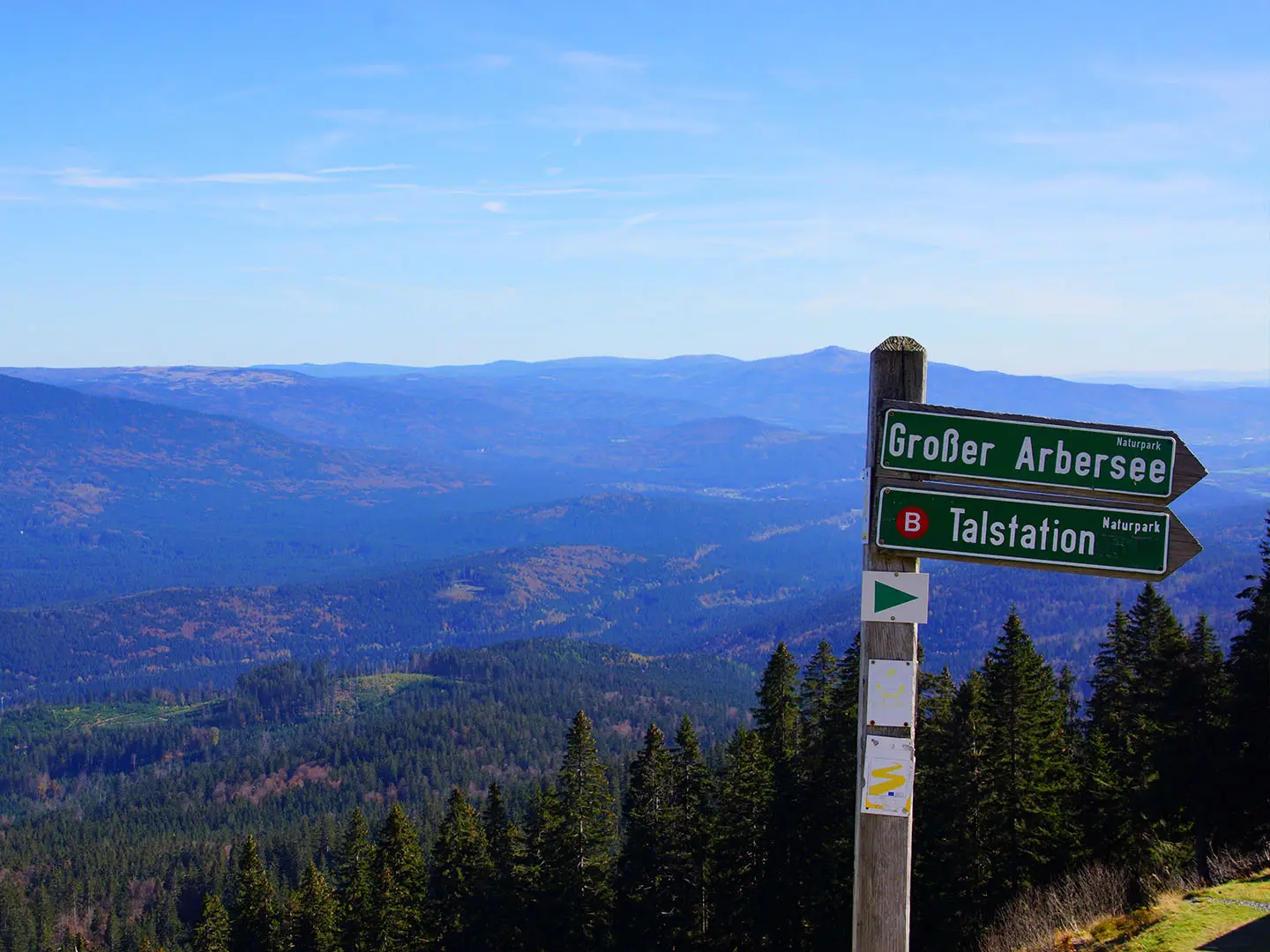
- Großer Arber (1,456 m): The highest point of the Goldsteig and of the Bavarian Forest, reached on the northern route, with a summit lookout and wide views over the Bavarian and Bohemian forests.
- Bavarian Forest National Park: Germany’s oldest national park, founded in 1970. The northern route crosses its core, where natural processes shape old-growth woodland.
- Lusen (1,373 m): A national-park peak known for its Blockmeer, a bare granite “sea of blocks” summit that makes the final approach distinctive underfoot.
- Rachel (1,453 m): The second-highest mountain of the Bavarian Forest, with Rachelsee, a glacial lake below the summit on the northern variant.
- Dreisessel: A granite massif on the tri-border with Austria and the Czech Republic, known for weather-shaped rock formations and broad views.
- Passau: The finish point, with a baroque old town, St Stephen’s Cathedral and the meeting of the Danube, Inn and Ilz rivers.
Challenges to expect
Expect long forest days, repeated climbing and mixed dirt, gravel and rocky paths. The northern variant is the hardest option, with high Bavarian Forest summits and ascents of up to about 1,200 m on some stages; the southern variant is more moderate. May to October is the practical season, but higher peaks can hold spring snow and weather can change quickly. Some remote national-park stages need accommodation and food planned ahead.
HikeList Score
Goldsteig scored 84/100 on HikeList's trail-quality metrics.
See score breakdownHide breakdown
- Ideal length 63
- Balanced challenge 84
- Scenery & wildness 98
- Varied terrain 71
- Accommodation 92
- Food & support 88
- Path quality 98
- Season flexibility 89
Computed from length, challenge, scenery & wildness, terrain variety, accommodation, food & support, path quality and season flexibility.
 Germany
Show more data Show less
- Mountainous
- Forest
- Dirt
- Gravel
- Rocky
- Hotels
- Guesthouses
- Huts
- Campsites
- Family Friendly
- Pet Friendly
- Restrooms
- Water Sources
- Campsites
- Shelters
- Picnic Areas
Photos from hikers
Taken on the trail by people who've reviewed Goldsteig.
Beginning in the town of Marktredwitz, the trail initially follows gentle paths through woodland and open countryside. The route heads south, passing picturesque villages and providing a preview of the forested landscapes to come. The day ends in Friedenfels, a small village known for its castle and scenic ponds.
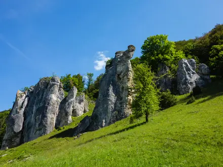
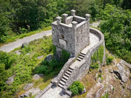
Leaving Friedenfels, the trail traverses tranquil woods and meadowland. Hikers will pass through the historic Waldnaab Valley, noted for its rock formations and bubbling streams. The section concludes in Falkenberg, home to a striking castle perched above the old town.
From Falkenberg, the route heads southeast through peaceful forest tracks and alongside gently rolling hills. The day’s walk is characterized by varied woodland terrain and the occasional open farmland before reaching Bärnau, site of the German Button Museum and medieval village museum.
This section continues through the Upper Palatinate, weaving through thick pine forests and along gentle streams. Pass by small settlements and rural scenery before finishing in Oberviechtach, a market town known for its mining history.
Hiking through forest paths and rural landscapes, this stage features rolling hills and panoramic views. The final destination is Neunburg vorm Wald, a historic town situated on the Schwarzach River with a charming old center.
Today, the walk moves through idyllic countryside and the nature-rich Upper Palatinate landscapes. The route is moderately hilly and passes by small lake areas and forests before reaching Rötz with its medieval castle ruins.
The path ascends gently into the border hills, entering areas marked by both German and Czech influence. Rural trails and wooded slopes predominate, leading hikers into the picturesque town of Waldmünchen, close to the Czech border.
Journeying south, this segment covers undulating hills and forested heights with occasional clearings offering far-reaching views. The day concludes in Furth im Wald, renowned for its traditional Dragon festivities and dramatic backdrop.
This day features a climb into the low mountains, traversing forests and meadows with glimpses of distant summits. The destination, Neukirchen beim Heiligen Blut, is a popular pilgrimage site with historic churches and inviting guesthouses.
Today brings some of the most mountainous terrain so far, with the trail winding through the dense Bavarian Forest. Expect steeper ascents and rewarding lookout points as you approach the resort town of Lam.
A highlight of the Goldsteig, this stage includes the challenging ascent of Großer Arber, the highest peak of the Bavarian Forest. After enjoying summit views, descend gradually through alpine forests to reach Bayerisch Eisenstein on the Czech border.
Heading into the heart of the Bavarian Forest National Park, this section passes through old-growth woodland and along wild streams. The day ends in the remote mountain hamlet of Zwieslerwaldhaus, nestled among forested ridges.
Continue through protected parkland, traversing peaceful forest paths, high plateaus, and striking rock outcrops. The stretch to Finsterau is serene, providing opportunities for wildlife observation and encounters with the area’s unique flora.
With a slightly shorter distance, today’s journey continues within the national park, following forest tracks and crossing small streams. The descent to Mauth offers a chance to enjoy village hospitality and nearby open-air museums.
This segment navigates a less-traveled area near the Czech border. Dense woods dominate the day, interspersed with meadows and small clearings before arriving in the quiet border community of Haidmühle.
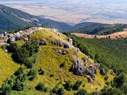
A dramatic day, this route ascends Dreisessel Mountain, famed for its panoramic views and geological features. After taking in the summit, descend toward the rural community of Breitenberg, surrounded by woodland and mountain scenery.
Today’s path heads steadily west, traversing the rolling foothills of the Bavarian Forest. Gentle hillsides and scattered farmsteads characterize the walk to Sonnen, a friendly village on a high plateau with excellent views.
A pleasant hike through mixed woodlands and meadows, this stage offers shorter climbs and sections passing historic sites. The stage ends in Waldkirchen, a lively market town with medieval roots and inviting cafes.
The Goldsteig moves through open countryside, woodland patches, and past peaceful lakes. Hauzenberg awaits at the end of the day, often remembered for its granite quarries and traditional Bavarian atmosphere.
Leaving Hauzenberg, the walk covers gentle hills and passes through quiet countryside. With less elevation, today is a relatively easy day, culminating in Kellberg, a small village offering pastoral scenery and a calm overnight stop.
This section winds through agricultural land, passing farmsteads and sections of light forest before reaching Thyrnau. The day’s route is gentle and offers glimpses of the Danube valley ahead.
On the final full-day stretch, the Goldsteig descends toward Passau. The approach follows a combination of forest tracks and riverside paths, culminating in the vibrant city where the Danube, Inn, and Ilz rivers meet.
Reviews
How would you rate Goldsteig?
Tap a star to start your review — you could be the first.