Hverfjall Crater Loop
How would you rate Hverfjall Crater Loop?
Tap a star to share your experience and help other hikers.
Hverfjall Crater Loop: Lake Mývatn’s Black Ash Rim Hike
HikeList Score
Hverfjall Crater Loop scored 80/100 on HikeList's trail-quality metrics.
See score breakdownHide breakdown
- Ideal length 55
- Balanced challenge 100
- Scenery & wildness 85
- Varied terrain 83
- Accommodation 83
- Food & support 61
- Path quality 98
- Season flexibility 89
Computed from length, challenge, scenery & wildness, terrain variety, accommodation, food & support, path quality and season flexibility.
The Hverfjall Crater Loop is a 4.5 km day hike on the eastern side of Lake Mývatn in northern Iceland, near Reykjahlíð. It climbs steeply up the black ash flank of Hverfjall, also spelled Hverfell, then makes a near-flat circuit of the crater rim before descending the same way. With about 130 m of ascent, loose volcanic gravel and full exposure to wind, it is a moderate short hike suited to walkers who want a striking volcanic viewpoint without a long day.
Route Overview
Start and finish at the trailhead car park at the foot of Hverfjall, reached via Road 848 off the Ring Road. The main north-west path from the northern car park is the easier and most-used approach; a steeper southern path also reaches the rim. From the base, climb the black tephra slope to the crater edge, walk the full rim circuit, then descend by the same flank. The route is best treated as an out-and-back ascent with a loop on top. It combines easily with Dimmuborgir lava field nearby; for another compact volcanic cone walk, compare the Eldborg Crater Loop.
How Hverfjall Was Formed
Hverfjall formed about 2,500 years ago in a single violent phreatomagmatic eruption within the southern Krafla fissure swarm. In this type of steam-driven eruption, rising magma met groundwater and blasted out a ring of tephra. The crater’s near-circular shape was interrupted by a landslide on the southern side during the eruption. Its setting links the hike directly to the wider Krafla volcanic system, one of the key volcanic landscapes around Lake Mývatn.
Notable highlights
- Crater rim circuit (~3 km): The broad, near-level rim loop gives a continuous 360-degree view and a clear look down into the deep crater bowl.
- Lake Mývatn and Skútustaðagígar: The rim looks over the shallow, island-studded lake and its pseudocraters, rootless cones formed by lava interacting with wet ground.
- Dimmuborgir lava field: These dark, castle-like lava formations lie just south of Hverfjall and are easily combined with the hike via a connecting trail.
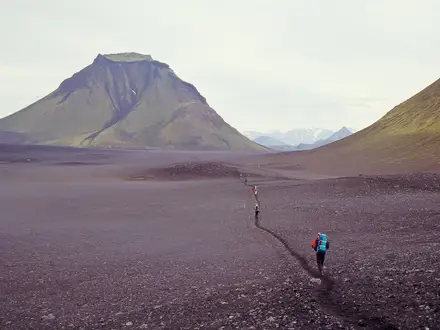
- Black tephra slopes: The ascent crosses loose, near-uniform volcanic ash and gravel, giving the hike its stark, lunar character.
- View to Herðubreið: In clear weather, the flat-topped Herðubreið is visible to the south-east across the highland.
- Krafla volcanic backdrop: The rim looks towards the active Krafla geothermal and volcanic system that Hverfjall belongs to; for a more remote volcanic landscape, see the Askja Trail.
Challenges to expect
The main difficulty is the short, steep climb on loose ash and gravel; the rim is much easier but still uneven in places. The whole route is exposed, with no shade or water, and wind can be strong on the crater edge. In winter or shoulder-season conditions, expect possible snow and ice. Stay strictly on the two marked paths: leaving them is forbidden because the soft volcanic ground is fragile.
HikeList Score
Hverfjall Crater Loop scored 80/100 on HikeList's trail-quality metrics.
See score breakdownHide breakdown
- Ideal length 55
- Balanced challenge 100
- Scenery & wildness 85
- Varied terrain 83
- Accommodation 83
- Food & support 61
- Path quality 98
- Season flexibility 89
Computed from length, challenge, scenery & wildness, terrain variety, accommodation, food & support, path quality and season flexibility.
 Iceland
Show more data Show less
- Mountainous
- Volcanic
- Arctic
- Gravel
- Dirt
- Rocky
- Hotels
- Guesthouses
- Campsites
- Family Friendly
- Restrooms
In these collections
Photos from hikers
Taken on the trail by people who've reviewed Hverfjall Crater Loop.
Reviews
How would you rate Hverfjall Crater Loop?
Tap a star to start your review — you could be the first.