Aber Falls Walk
How would you rate Aber Falls Walk?
Tap a star to share your experience and help other hikers.
Aber Falls Walk: Easy Waterfall Walk in Eryri
HikeList Score
Aber Falls Walk scored 67/100 on HikeList's trail-quality metrics.
See score breakdownHide breakdown
- Ideal length 51
- Balanced challenge 64
- Scenery & wildness 85
- Varied terrain 76
- Accommodation 58
- Food & support 52
- Path quality 98
- Season flexibility 63
Computed from length, challenge, scenery & wildness, terrain variety, accommodation, food & support, path quality and season flexibility.
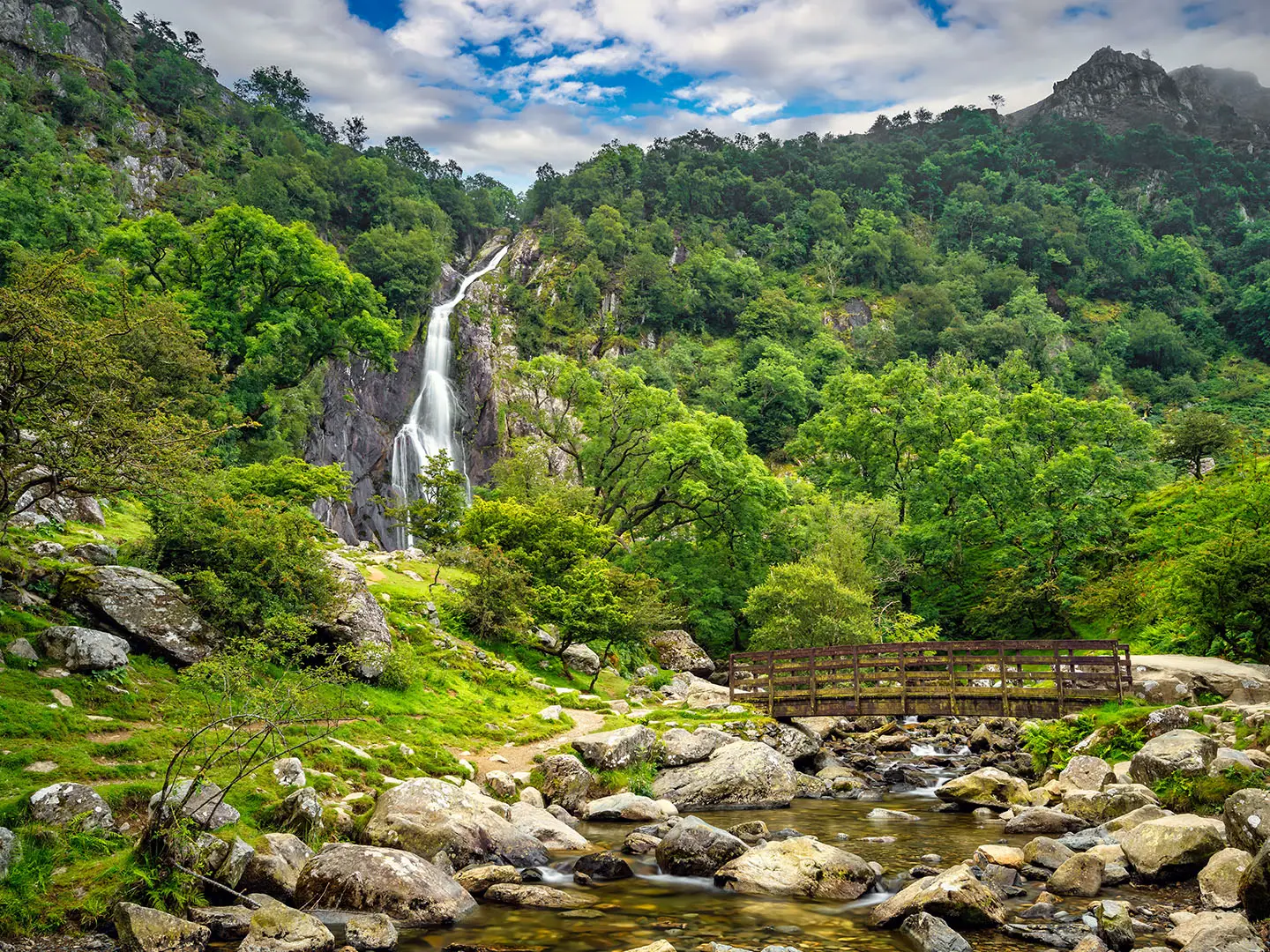
The Aber Falls Walk is an easy 4.5 km out-and-back route near Abergwyngregyn in Gwynedd, North Wales. It follows a wide gravel path through Coedydd Aber National Nature Reserve to Rhaeadr Fawr, a 37 m waterfall beneath the Carneddau. Allow about 1 hour for the walk, or 1.5–2 hours if you want time at the falls. With around 100 m of steady ascent, it suits families and casual walkers looking for a short Eryri waterfall hike.
Route Overview
Start at the Aber Falls car parks near Abergwyngregyn: the lower car park near Bont Newydd or the upper Natural Resources Wales car park. The main route is a there-and-back walk up the valley, following the Afon through Coedydd Aber National Nature Reserve to the foot of Rhaeadr Fawr, then returning the same way. The path is mostly wide compacted stone and gravel, with a gentle continuous climb and rougher sections close to the falls. A longer circular option of about 6.5 km returns on higher ground via the west side of the valley. For a longer Welsh mountain journey, compare it with the Beacons Way; for coastal walking nearby, see the Anglesey Coastal Path.
History of Aber Falls and the Aber Valley
Aber Falls, or Rhaeadr Fawr, has attracted visitors since the Romantic period of the late 18th and 19th centuries. The wider Aber valley has much older human history, with remains of Bronze Age settlement including an excavated roundhouse, standing stones and cairns nearby. Abergwyngregyn is also associated with the medieval Welsh princes of Gwynedd and Llywelyn ap Gruffudd. The current bridges at the falls were erected in 1995, and the area is now managed as Coedydd Aber National Nature Reserve.
Notable highlights
- Rhaeadr Fawr / Aber Falls (37 m): The main waterfall drops over a hard sill of ancient igneous rock into a rocky plunge pool. It is the clear focal point of the walk and is especially forceful after heavy rain.
- Coedydd Aber National Nature Reserve: The lower route passes through oak, hazel and alder woodland. The reserve is noted for lichens and breeding birds including pied flycatcher, wood warbler and redstart.
- Rhaeadr Bach: This smaller waterfall lies a short distance west of the main falls and is reached by a rougher short extension. Its Welsh name means “little waterfall”.
- Carneddau backdrop: The walk sits on the northern foothills of the Carneddau, with the higher circular route giving views towards Anglesey and the Menai Strait. The range is associated with semi-wild Carneddau ponies and upland birds such as ravens and choughs.
- Bronze Age heritage: The valley contains remains of small Bronze Age settlements, including an excavated roundhouse, plus standing stones and cairns nearby.
Challenges to expect
This is an easy walk, but it is not completely flat: expect a steady, continuous climb of about 100 m. The compacted gravel path has loose stones, potholes and uneven sections, especially near the falls, so sturdy footwear helps. It is largely pushchair- and wheelchair-friendly on the lower path but not fully accessible all the way to the waterfall. Parking is very limited, with about 30 spaces total and a pay-and-display fee.
HikeList Score
Aber Falls Walk scored 67/100 on HikeList's trail-quality metrics.
See score breakdownHide breakdown
- Ideal length 51
- Balanced challenge 64
- Scenery & wildness 85
- Varied terrain 76
- Accommodation 58
- Food & support 52
- Path quality 98
- Season flexibility 63
Computed from length, challenge, scenery & wildness, terrain variety, accommodation, food & support, path quality and season flexibility.
 United Kingdom
 Wales
WalesShow more data Show less
- Forest
- Valley
- Mountain Foothills
- Gravel
- Compacted Stone
- Campsites
- Wild camping spots
- Family Friendly
- Pet Friendly
- Restrooms
- Picnic Areas
Photos from hikers
Taken on the trail by people who've reviewed Aber Falls Walk.
Reviews
How would you rate Aber Falls Walk?
Tap a star to start your review — you could be the first.