Ekenäs Archipelago Trail
How would you rate Ekenäs Archipelago Trail?
Tap a star to share your experience and help other hikers.
Ekenäs Archipelago Trail: Boat-Access Island Walks
HikeList Score
Ekenäs Archipelago Trail scored 78/100 on HikeList's trail-quality metrics.
See score breakdownHide breakdown
- Ideal length 55
- Balanced challenge 100
- Scenery & wildness 85
- Varied terrain 83
- Accommodation 67
- Food & support 66
- Path quality 98
- Season flexibility 76
Computed from length, challenge, scenery & wildness, terrain variety, accommodation, food & support, path quality and season flexibility.
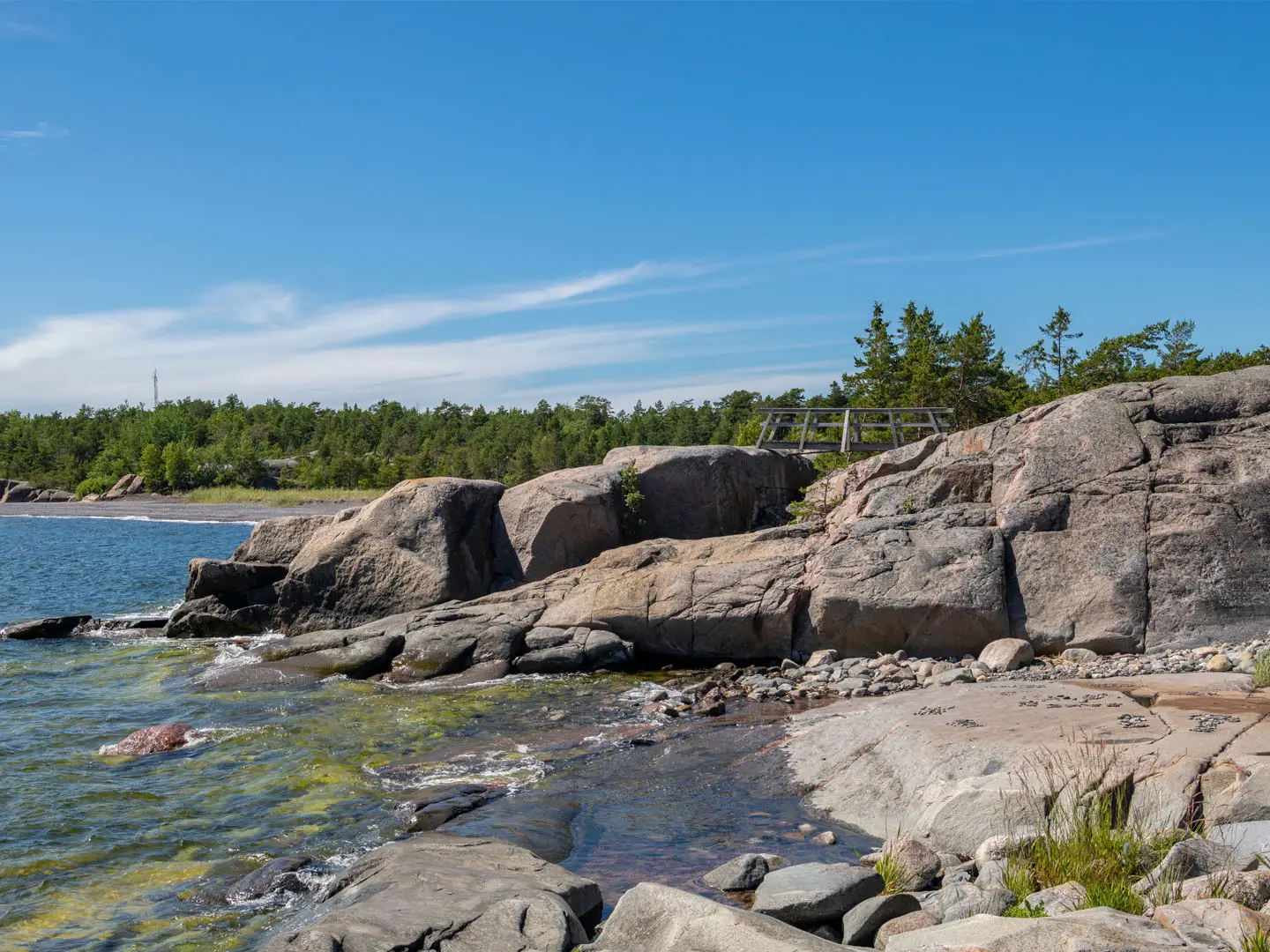
Ekenäs Archipelago Trail is not one continuous 7 km route: it is a set of short island nature trails in Ekenäs Archipelago National Park, off Ekenäs/Tammisaari in Raseborg, Uusimaa, southern Finland. The practical public-transport option is Jussarö, reached by seasonal summer ferry, where the main nature trail is about 4.7 km and takes roughly 2–3 hours. Expect an easy-to-moderate 1-day boat-and-walk trip on rocky coastal paths, forest tracks, granite slabs and occasional boardwalks.
Route Overview
There is no road trailhead, car park or single start/end point inside the park. Access is by private boat, kayak/canoe, chartered water taxi or seasonal ferry/cruise from Ekenäs (Tammisaari) North Harbour, with mainland departures also from Skärlandet/Sommarö. Jussarö is the main visitor island and the only island reached by scheduled summer ferry; its longer loop is about 4.7 km, with shorter options of about 3.3 km and 2.1 km. Other separate island circuits include the Älgö/Rödjan nature trail, Modermagan’s short loop and paths on Fladalandet. For broader island-hiking ideas, compare the Archipelago Trail (Saariston Rengastie) and Archipelago National Park Trail; for another Finnish national park walk, see Nuuksio National Park Trail.
Mining, Maritime Routes and a National Park
The Ekenäs outer archipelago has long been used for fishing, seal hunting and navigation, and lay on medieval trade and sailing routes. Jussarö’s main story is iron mining: ore was worked in the 1830s and 1840s–1860s, then a modern mine operated briefly until 1967. The abandoned settlement and mine buildings later served Finnish military training before the island opened more fully to visitors. Sundharu, southwest of Jussarö, gained Finland’s first unmanned lighthouse in 1922. The national park was established in 1989.
Notable highlights
- Jussarö ghost town and iron mine: The park’s main visitor island has an abandoned mining settlement, old wooden rail tracks and an “iron beach” of mining spoil. The longer nature trail is about 4.7 km, making it the most practical walk for ferry users.
- Rödjan nature information point and Älgö observation tower: Rödjan fishing farm hosts the park’s summer information point. The roughly 2 km trail passes Lake Storträsket and climbs steeply at first to a tower with wide archipelago views.
- Modermagan lagoon harbour: Modermagan has a sheltered, lagoon-like natural harbour known as “Mother’s lap”. Its short nature trail crosses rocky shore and lush slopes, with WWII-era fortification remains.
- Sundharu lighthouse: This islet southwest of Jussarö holds Finland’s first unmanned lighthouse, built in 1922. It is a notable open-sea landmark rather than a walking objective.
- Seabirds and seals: Outer skerries support colonies of great cormorants, ospreys and gulls, with seals also present. Landing on the most important nesting bird islands is forbidden from 1 April to 17 July.
- Boat-and-walk access: Reaching the trails is part of the trip. The park is car-free and reached only by boat, kayak, water taxi or the seasonal ferry to Jussarö.
Challenges to expect
Logistics are the main difficulty: there is no road access, so you must arrange a boat, kayak, water taxi or use the seasonal ferry, and sea weather can disrupt plans. Underfoot, expect roots, uneven rock and exposed granite that becomes slippery when wet. The Älgö trail is steep at the start. Bring drinking water for most islands, insect repellent in summer, and check the 1 April–17 July bird-island landing restrictions.
HikeList Score
Ekenäs Archipelago Trail scored 78/100 on HikeList's trail-quality metrics.
See score breakdownHide breakdown
- Ideal length 55
- Balanced challenge 100
- Scenery & wildness 85
- Varied terrain 83
- Accommodation 67
- Food & support 66
- Path quality 98
- Season flexibility 76
Computed from length, challenge, scenery & wildness, terrain variety, accommodation, food & support, path quality and season flexibility.
 Finland
Show more data Show less
- Coastal
- Forest
- Rocky
- Dirt
- Rocky
- Boardwalk
- Campsites
- Wild Camping Spots
- Cottages
- Family Friendly
- Pet Friendly
- Restrooms
- Campsites
- Shelters
- Picnic Areas
Photos from hikers
Taken on the trail by people who've reviewed Ekenäs Archipelago Trail.
Reviews
How would you rate Ekenäs Archipelago Trail?
Tap a star to start your review — you could be the first.