Valentia Island Trail
How would you rate Valentia Island Trail?
Tap a star to share your experience and help other hikers.
Valentia Island Trail: Bray Head Signal Tower Walk
HikeList Score
Valentia Island Trail scored 79/100 on HikeList's trail-quality metrics.
See score breakdownHide breakdown
- Ideal length 55
- Balanced challenge 100
- Scenery & wildness 78
- Varied terrain 71
- Accommodation 91
- Food & support 68
- Path quality 98
- Season flexibility 89
Computed from length, challenge, scenery & wildness, terrain variety, accommodation, food & support, path quality and season flexibility.
The Valentia Island Trail is best planned as the waymarked Bray Head walk: a 4.5 km out-and-back coastal hike on Valentia Island, County Kerry, Ireland. It is a single-day, moderate route from the island’s southwest tip to the Bray Head Signal Tower, with rough clifftop ground and open Atlantic exposure. It suits hikers looking for a short but rugged Kerry walk with Skellig Islands views, not a multi-day trail.
Route Overview
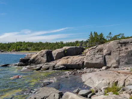
Start and finish at the Bray Head car park at Valentia Island’s southwest tip, reached by road from Portmagee via the Maurice O’Neill Memorial Bridge, or via the seasonal April–October car ferry to Knightstown. The walk climbs a stony/gravel access track, then rougher grassy and rocky ground, to the Bray Head Signal Tower and returns the same way. The former headland loop is now mostly walked as an out-and-back because part of the cliff circuit has eroded or closed. For longer Kerry walking, compare the Dingle Way or Beara Way; for another exposed Irish coastal route, see the Cliffs of Moher Coastal Walk.
Valentia Island’s Atlantic History
Valentia Island has long been a strategic Atlantic outpost. Bray Head’s signal tower dates from the Napoleonic wars, around 1815, and was later reused for naval and coastal watches, including during WWII. In 1866 the island became the European terminus of the first lasting transatlantic telegraph cable to Newfoundland, placing Valentia at the centre of global communications. Fossilised tetrapod footprints about 385 million years old were identified on the island in 1993.
Notable highlights
- Bray Head Signal Tower: A Napoleonic-era watch and signal tower on the cliff-edge high point of the walk. It is the usual turnaround point and the main landmark on the route.
- WWII “EIRE” sign: Large stone letters below the tower marked neutral Irish territory for aircraft during WWII. It is visible on the headland.
- Skellig Islands view: Skellig Michael and Little Skellig rise out of the Atlantic from the Bray Head viewpoint. Skellig Michael is a UNESCO World Heritage Site known for its early-Christian monastery and as a Star Wars filming location.
- Atlantic and Iveragh panoramas: The headland gives wide views over Portmagee, Puffin Island, the Kerry Cliffs and towards the Dingle Peninsula. Watch for seabirds and, in season, dolphins or whales below.
- Geokaun Mountain and Fogher Cliffs: This is a separate paid road or short-walk detour, not part of Bray Head. Geokaun is Valentia’s highest point, while Fogher Cliffs drop to the sea on its north face.
- Tetrapod Trackway: A separate free site on Valentia’s north shore, not on the Bray Head walk. The fossilised footprints were made by an early four-limbed vertebrate about 385 million years ago.
Challenges to expect
Expect a sustained climb on stony track, followed by rough, uneven rocky and grassy ground near exposed cliffs. The headland is open to Atlantic wind, rain and low cloud, so visibility can change quickly; waterproofs and care near edges are essential. Facilities are limited at the trailhead, so carry water and snacks. Dogs are not permitted because of livestock and wildlife.
HikeList Score
Valentia Island Trail scored 79/100 on HikeList's trail-quality metrics.
See score breakdownHide breakdown
- Ideal length 55
- Balanced challenge 100
- Scenery & wildness 78
- Varied terrain 71
- Accommodation 91
- Food & support 68
- Path quality 98
- Season flexibility 89
Computed from length, challenge, scenery & wildness, terrain variety, accommodation, food & support, path quality and season flexibility.
 Ireland
Show more data Show less
- Coastal
- Upland
- Gravel
- Rocky
- Dirt
- Hotels
- Guesthouses
- Hostels
- Family Friendly
- Pet Friendly
- Restrooms
- Picnic Areas
Photos from hikers
Taken on the trail by people who've reviewed Valentia Island Trail.
Reviews
How would you rate Valentia Island Trail?
Tap a star to start your review — you could be the first.