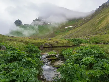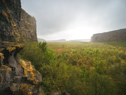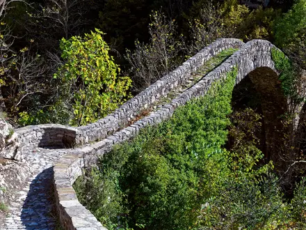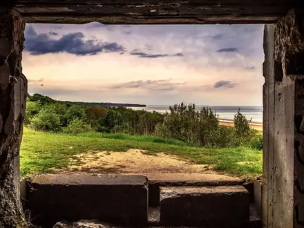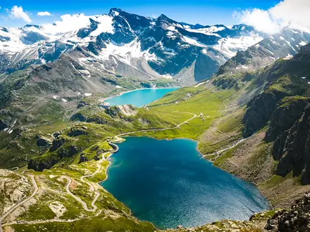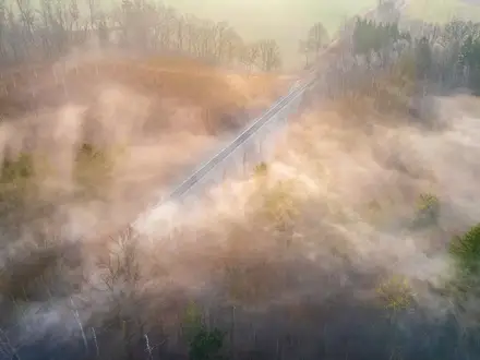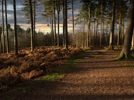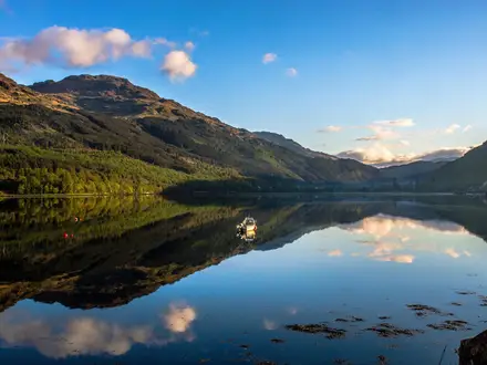
Laugavegur Trail
How would you rate Laugavegur Trail?
Tap a star to share your experience and help other hikers.
Laugavegur Trail: Iceland’s Classic Highlands Trek
HikeList Score
Laugavegur Trail scored 78/100 on HikeList's trail-quality metrics.
See score breakdownHide breakdown
- Ideal length 78
- Balanced challenge 100
- Scenery & wildness 78
- Varied terrain 71
- Accommodation 58
- Food & support 72
- Path quality 98
- Season flexibility 63
Computed from length, challenge, scenery & wildness, terrain variety, accommodation, food & support, path quality and season flexibility.
The Laugavegur Trail is Iceland’s best-known multi-day hike: a 55 km, 4-day, point-to-point trek through the Fjallabak Nature Reserve in the Southern Highlands. It runs from Landmannalaugar to Þórsmörk, crossing rhyolite mountains, obsidian fields, black-sand deserts and glacial rivers. The route is rated moderate and suits hikers comfortable with exposed mountain weather, rocky and snowy ground, and unbridged river crossings. For more Iceland route planning, see our Iceland hiking guide.
Route Overview
Most hikers walk north to south, starting at Landmannalaugar and finishing in Þórsmörk. The route links the hut and campsite locations at Landmannalaugar, Hrafntinnusker, Álftavatn or Hvanngil, Botnar/Emstrur and Þórsmörk. It is a point-to-point hut-to-hut trail, not a loop, so transport planning matters: the practical summer window is late June to early September, when huts are staffed and mountain buses are running. The Laugavegur is often extended south over the Fimmvörðuháls Trail to Skógar; for wilder Icelandic options, compare it with the Hornstrandir Trek or the Askja Trail.
Notable highlights
- Landmannalaugar: The trail begins among rhyolite mountains and geothermal steam in the Fjallabak Nature Reserve. It is one of the most distinctive starts to any hut-to-hut walk in Iceland.
- Hrafntinnusker: This high section is known for obsidian fields and is the route’s highest area at about 1,050 m. Snow and exposure can make it feel more serious than the distance suggests.
- Álftavatn: A lake-side stop on the classic hut sequence. It gives a clear change of scene after the higher, rockier ground near Hrafntinnusker.
- Black-sand deserts and glacier views: The middle and southern sections cross stark volcanic terrain with views towards ice and highland landscapes. Expect open, weather-exposed walking rather than sheltered trail.
- Þórsmörk: The route finishes in a green valley that feels sharply different from the black sand and snow patches earlier on the trail. It is also the usual link point for continuing over Fimmvörðuháls to Skógar.
Challenges to expect
The Laugavegur is well-marked, but not risk-free. Expect exposed Highland weather, rocky and gravel surfaces, possible snow, and unbridged glacial river crossings. Conditions can change quickly, especially near Hrafntinnusker, and the open terrain offers little shelter. Huts must be booked well ahead; campsites are the alternative where permitted at the hut locations.
HikeList Score
Laugavegur Trail scored 78/100 on HikeList's trail-quality metrics.
See score breakdownHide breakdown
- Ideal length 78
- Balanced challenge 100
- Scenery & wildness 78
- Varied terrain 71
- Accommodation 58
- Food & support 72
- Path quality 98
- Season flexibility 63
Computed from length, challenge, scenery & wildness, terrain variety, accommodation, food & support, path quality and season flexibility.
 Iceland
Show more data Show less
- Mountainous
- Arctic
- Rocky
- Gravel
- Snow
- Huts
- Campsites
- Family Friendly
- Restrooms
- Water Sources
- Campsites
- Shelters
Download Our Full Guide to Laugavegur Trail FREE!
Get our comprehensive guide to this hike for free. Save it for later reading or print out at home.
In these collections
Photos from hikers
Taken on the trail by people who've reviewed Laugavegur Trail.
Laugavegur Trail: The Complete Guide
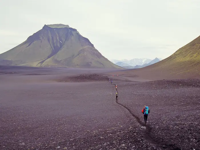 i
Image by pb_pictures
i
Image by pb_pictures The Laugavegur Trail is Iceland’s classic Highland crossing: a 55 km point-to-point walk from Landmannalaugar to Þórsmörk through the volcanic interior of Fjallabaksfriðland. It suits fit, self-reliant hikers who want a hut-to-hut route with wild terrain, clear waymarking and no need for technical climbing.
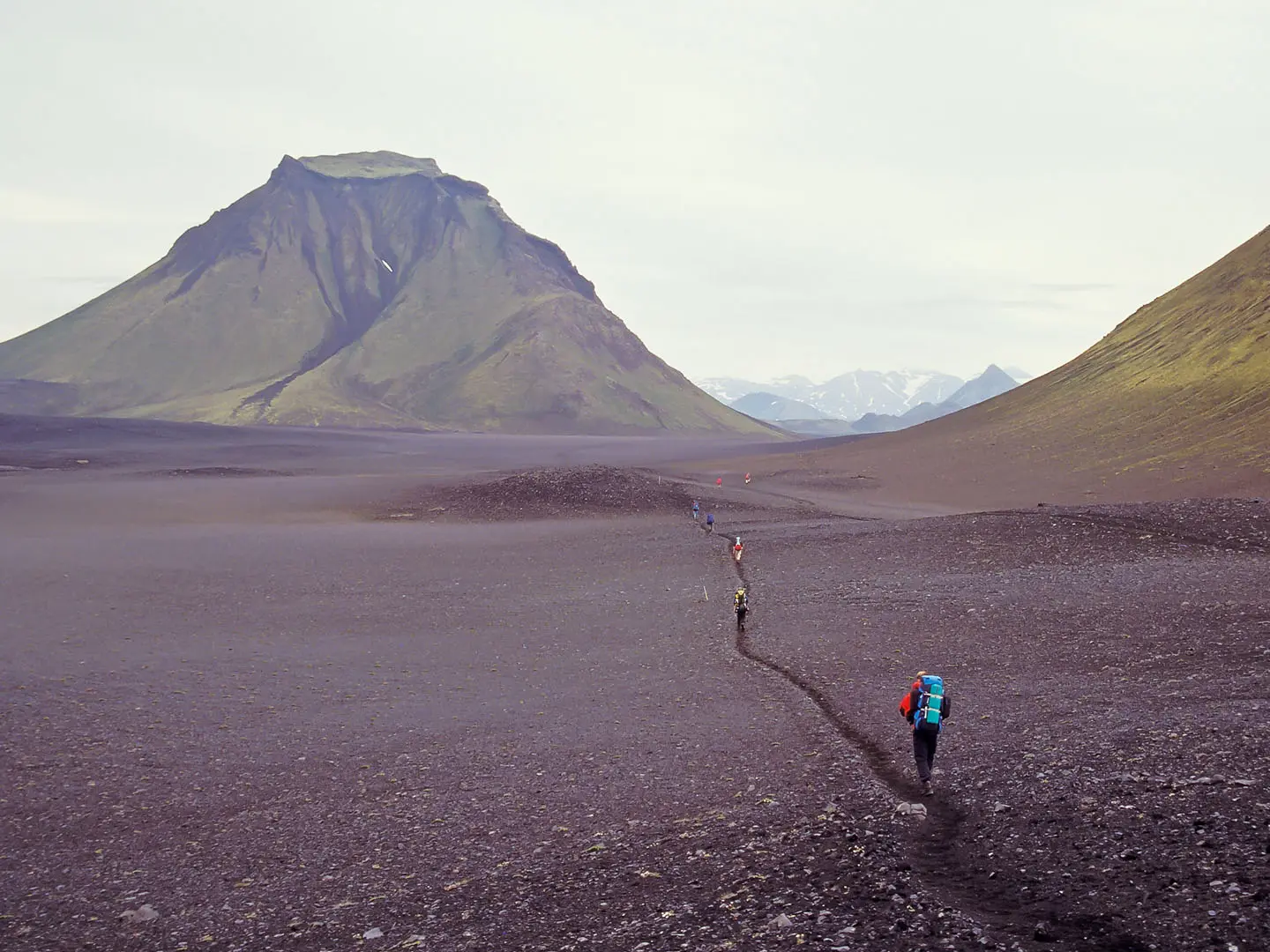
The trail begins among the rhyolite mountains, geothermal steam and black lava around Landmannalaugar, then climbs towards the exposed obsidian plateau of Hrafntinnusker. Snow patches can linger here even in summer, and the weather can turn this short first stage into one of the most serious parts of the route.
Further south, the landscape opens into the green basins around Álftavatn before shifting again into black-sand desert, lava plains and glacial river country around Hvanngil and Emstrur / Botnar. The final approach crosses Þröngá and drops into the birch woods of Þórsmörk, a sheltered valley ringed by glaciers.
This is not a wilderness route to underestimate just because it is popular. There are no shops or villages on the trail, huts and campsites must be booked ahead, all food must be carried, and unbridged glacial river crossings require calm judgement.
This guide covers the stages, day planning, accommodation, food, transport, terrain and common mistakes that matter on the Laugavegur.
Stage-by-Stage Guide
Stage 1: Landmannalaugar to Hrafntinnusker — 12 km
The first stage leaves the geothermal basin of Landmannalaugar and climbs quickly into the most exposed part of the route. It is short on paper, but it gains height from the start and can feel significantly harder in poor visibility, wind or lingering snow.
The route passes through Laugahraun, the black lava field near Landmannalaugar, before moving into colourful rhyolite country around Brennisteinsalda (‘sulphur wave’). Stórihver brings another geothermal section, with steam, hot springs and fumaroles, before the trail continues towards the high obsidian plateau of Hrafntinnusker.
Underfoot, expect a mix of rock, gravel, volcanic ash and possible snowfields, even in summer. This is the highest part of the Laugavegur, reaching the Hrafntinnusker area at around 1,050 m, and it is the stage most associated with Arctic exposure.
There are no shops or resupply points after leaving Landmannalaugar. Carry all food for the stage and onward route; water arrangements at huts and the need to treat or filter natural water should be checked before travelling.
Accommodation at the end is the FÍ hut and adjacent campsite at Hrafntinnusker. Both hut bunks and camping should be booked in advance, especially in the main summer season.
Landmannalaugar is reached by summer highland bus from Reykjavík or by suitable high-clearance 4x4 on F208/F225. Hrafntinnusker is not a practical public-transport access point for most walkers, so treat this as a committed mountain stage once you leave the trailhead.
Navigation is usually straightforward in clear conditions because the Laugavegur is waymarked with posts. In mist, snow or driving rain, the plateau can become serious very quickly; carry proper navigation, keep close track of the markers and do not rely on fair-weather visibility.
The main warning on this stage is weather. Hrafntinnusker is exposed, snow can obscure the path, and the area has a memorial to a hiker who died in a storm here. If conditions are deteriorating at Landmannalaugar, take advice from hut staff before setting out.
Stage 2: Hrafntinnusker to Álftavatn — 12 km
Stage 2 starts high on the Hrafntinnusker plateau and gradually leaves the obsidian and snow-patched uplands behind. The character changes during the day from stark, exposed volcanic ground to the greener lake basin around Álftavatn (‘swan lake’).
The key section is the descent through Jökultungur towards Álftavatn. This is one of the most memorable transitions on the trail, with the view opening towards the lake and surrounding mountains after the more austere terrain of the high plateau.
Path conditions remain rough in places, with gravel, rock and possible remaining snow near the start. The descent can be awkward in bad weather or when the ground is loose, so poles are useful and a steady pace is better than rushing to the lower ground.
There are no villages, shops or food outlets on this stage. Carry the day’s food and the rest of your route supplies; water and hut-specific facilities should be checked before travelling.
The standard overnight is at the FÍ hut and campsite at Álftavatn. Hvanngil is an alternative hut and campsite beyond Álftavatn on the north-to-south route, but using it changes the length of this day and the following day, so book the intended stop rather than assuming flexibility.
There is no railway anywhere in Iceland, and there is no normal public-transport bailout between Hrafntinnusker and Álftavatn. Any vehicle access to Highland huts and tracks is specialised and weather-dependent; this should be checked before travelling.
Navigation is generally post-marked, but poor visibility on the higher ground still matters. Make sure the day’s route is loaded or mapped before leaving Hrafntinnusker, as waiting until the descent to correct a navigation error is too late.
The main concerns are exposure at the start of the day and the descent conditions into Jökultungur. In wet, windy or snowy weather, this stage can feel much more serious than its 12 km distance suggests.
Stage 3: Álftavatn to Emstrur / Botnar — 16 km
This is the longest stage of the classic four-day itinerary and has a more remote, desert-like feel. From the greener basin of Álftavatn the trail passes Hvanngil and moves into black-sand, gravel and lava country on the way to Emstrur / Botnar.
The stage includes the river plains and stark volcanic ground around Hvanngil, with unbridged fords of Bláfjallakvísl and Kaldaklofskvísl on this section of the route. These crossings are a major planning point, not an afterthought.
Underfoot, expect gravel, ash, sand and rough volcanic terrain. The walking is not technical, but the surface can be tiring, particularly in wind when loose sand and grit make progress slower.
There are no shops or resupply options at Álftavatn, Hvanngil or Emstrur. Carry all food needed for the day and the remaining route; check current hut and campsite facilities before travelling, including water arrangements.
Hvanngil provides a hut and campsite part-way through this section and may be used as an alternative overnight depending on your booking and itinerary. The standard four-day schedule continues to the FÍ hut and campsite at Emstrur / Botnar.
Public transport should not be planned around this stage. Although the route passes Highland huts, there are no villages and no ordinary road services for walkers between the main trailheads; any access by vehicle is dependent on Highland conditions and should be checked before travelling.
Navigation remains on a waymarked trail, but the open desert terrain can make distances deceptive. In poor visibility, keep checking that the marker line is being followed, especially where the landscape is broad and featureless.
The river crossings are the key warning. Glacial rivers can rise and become stronger, and crossings should be treated cautiously; cross where directed locally, avoid taking unnecessary risks, and remember that levels are often lower earlier in the cooler part of the day. Check current river conditions before setting out.
Stage 4: Emstrur / Botnar to Þórsmörk — 15 km
The final stage leaves the black volcanic plateau around Emstrur / Botnar and heads towards the greener, more sheltered valley of Þórsmörk (‘Thor’s Wood’). It is a strong contrast to the previous day, finishing among birch woodland rather than open desert.
A major landmark near Emstrur is Markarfljótsgljúfur, the deep canyon associated with this part of the route. As the trail continues south, the landscape gradually softens before the final approach to Þórsmörk, which sits ringed by Eyjafjallajökull, Mýrdalsjökull and Tindfjallajökull.
The walking remains on rock, gravel, ash and rough Highland ground before the terrain becomes more vegetated near Þórsmörk. This is still a mountain stage until the finish; do not treat it as an easy valley walk simply because it ends lower down.
There are no shops or resupply points before Þórsmörk. Carry food for the full day and check current facilities at the Þórsmörk huts and campsites before travelling.
The usual finish is at the huts and campsites in Þórsmörk, most often Langidalur or the neighbouring Básar hut in Goðaland. Make sure the booked accommodation and bus pick-up point match, as Þórsmörk has more than one hut area.
Outbound transport is normally by scheduled summer Highland bus back towards Reykjavík, with operators such as Reykjavík Excursions and Trex serving the area in season. Private vehicle access to Þórsmörk is via F249 and involves fording the Krossá, so it is not suitable for ordinary cars.
The final significant river issue is Þröngá, an unbridged glacial ford before the birch woods of Þórsmörk. Treat it with the same care as earlier crossings and check local conditions before committing.
Navigation is generally straightforward on the marked route, but the end of the trail requires practical attention: know whether the plan is to finish at Langidalur or Básar, and allow enough time for the booked bus. Timetables, F-road status and river conditions should be checked before travelling.
Recommended Itinerary
Standard 4-day hut-to-hut itinerary
This is the classic FÍ sequence and the best plan for most independent walkers. It keeps daily distances moderate while still respecting the exposed nature of the route, especially the high Hrafntinnusker section and the river-crossing days.
Book huts or campsites before arranging transport. There are no villages, shops or resupply points between Landmannalaugar and Þórsmörk, so each overnight needs to be secured and all food carried.
| Day | From | To | Approx. distance | Why this stage makes sense | Services/accommodation notes |
|---|---|---|---|---|---|
| 1 | Landmannalaugar | Hrafntinnusker | 12 km | A short but serious first stage that climbs from the geothermal area through Laugahraun, past Brennisteinsalda and Stórihver, onto the exposed obsidian plateau. Keeping this day short is sensible because weather and lingering snowfields can make progress slower near the high point. | FÍ hut and campsite at Landmannalaugar before starting; FÍ hut and campsite at Hrafntinnusker. Hrafntinnusker is exposed, so late arrival in poor weather is best avoided. |
| 2 | Hrafntinnusker | Álftavatn | 12 km | This stage leaves the high plateau and descends through Jökultungur towards the green lake basin of Álftavatn. It gives a clear change in terrain without overloading the day after the exposed first section. | Hut and campsite at Álftavatn. Hvanngil is an alternative hut option further along the route, but using it changes the stage split and should be planned when booking. |
| 3 | Álftavatn | Emstrur / Botnar | 16 km | The longest standard day, crossing the black-sand and lava-desert terrain through Hvanngil towards Emstrur. This is also a key river-crossing day, including unbridged glacial fords such as Bláfjallakvísl and Kaldaklofskvísl, so allow time and avoid rushing crossings. | Hvanngil hut lies on this section and can be used as an alternative overnight. FÍ hut and campsite at Emstrur / Botnar. No resupply. |
| 4 | Emstrur / Botnar | Þórsmörk, usually Langidalur or Básar | 15 km | A final moderate day past the Markarfljótsgljúfur canyon and across the Þröngá river before entering the birch woodland of Þórsmörk. Finishing here works well with the usual north-to-south transport pattern back towards Reykjavík. | Huts and campsites in Þórsmörk, most commonly around Langidalur or the neighbouring Básar hut in Goðaland. Check which Þórsmörk stop your bus serves before booking accommodation. |
Slower variant
A slower plan suits walkers carrying camping kit, anyone wanting more margin for weather, or groups that prefer not to make the Álftavatn to Emstrur section into one longer day. The main practical split is to use Hvanngil as an extra overnight between Álftavatn and Emstrur.
This does not create more resupply options: it simply spreads the walking and gives more flexibility around river crossings and bad weather. Distances around Hvanngil should be checked against official mapping before booking, as the exact split depends on whether you stay at Álftavatn, Hvanngil or both.
| Day | From | To | Approx. distance | Why this stage makes sense | Services/accommodation notes |
|---|---|---|---|---|---|
| 1 | Landmannalaugar | Hrafntinnusker | 12 km | Keeps the exposed climb to the trail’s high section as a standalone day. | FÍ hut/campsite at both ends. Pre-booking is essential. |
| 2 | Hrafntinnusker | Álftavatn | 12 km | Gives a straightforward descent from the plateau without combining it with the lower desert section. | Hut and campsite at Álftavatn. |
| 3 | Álftavatn | Hvanngil | Short stage; Hvanngil is about 4 km beyond Álftavatn | Useful as a rest, weather-buffer or river-timing day, especially for groups that value a conservative schedule over continuous distance. | Hut/campsite at Hvanngil. This is an accommodation-based split rather than a necessary walking stage. |
| 4 | Hvanngil | Emstrur / Botnar | Check official mapping before booking | Splits the standard Álftavatn to Emstrur day and leaves more time for the black-desert terrain and unbridged river crossings. | FÍ hut/campsite at Emstrur / Botnar. No shops or resupply. |
| 5 | Emstrur / Botnar | Þórsmörk, usually Langidalur or Básar | 15 km | Keeps the final canyon, Þröngá crossing and descent into Þórsmörk as a normal full stage. | Book Þórsmörk accommodation and check the exact bus pick-up point before travel. |
Faster variant
Fit hikers sometimes complete the Laugavegur in 3 days by combining the first two standard stages and walking from Landmannalaugar to Álftavatn in one long day. This is only sensible in stable weather with an early start, because it crosses the exposed Hrafntinnusker plateau and continues all the way down to the lake basin.
| Day | From | To | Approx. distance | Why this stage makes sense | Services/accommodation notes |
|---|---|---|---|---|---|
| 1 | Landmannalaugar | Álftavatn | 24 km | Combines the climb to Hrafntinnusker with the descent through Jökultungur, creating a long but logical high-to-low day. This should not be treated as an easy shortcut in poor visibility, strong wind or heavy snow cover. | Start from Landmannalaugar with a pre-booked bed or pitch at Álftavatn. Hrafntinnusker has hut/camping facilities but would be bypassed as an overnight. |
| 2 | Álftavatn | Emstrur / Botnar | 16 km | Follows the standard long middle stage through Hvanngil and the black deserts, including unbridged glacial river crossings. | Hvanngil is available as an emergency re-plan only if space exists; do not rely on changing hut bookings at short notice. Overnight at Emstrur / Botnar. |
| 3 | Emstrur / Botnar | Þórsmörk, usually Langidalur or Básar | 15 km | A standard final stage into Þórsmörk, still with the Þröngá crossing before the finish. | Book onward transport from Þórsmörk in advance and check current bus timetables before travelling. |
A 2-day crossing is possible for very strong hikers or runners, but it is not the recommended plan for a normal hut-to-hut trek. It leaves little margin for Highland weather, slow snowfields, river conditions or transport delays, and all accommodation and bus connections would need to be checked carefully before committing.
Planning the Route
How many days to allow
Most walkers should plan the Laugavegur over the classic 4-day hut sequence: Landmannalaugar → Hrafntinnusker → Álftavatn → Emstrur / Botnar → Þórsmörk. This spacing fits the established FÍ hut and campsite network and keeps the daily stages manageable in exposed Highland conditions.
Fit hikers can combine stages and complete the route in 3 days, but this leaves less margin for poor weather, slow river crossings, lingering snow near Hrafntinnusker or a delayed bus into the trailhead. Two-day itineraries are mainly for very fast trekkers and runners who are comfortable with long days in remote terrain.
A slower itinerary is often more practical than a faster one. Extra time at Landmannalaugar or Þórsmörk can help absorb transport delays, bad weather or a late start, and gives more flexibility around hut check-in, river levels and onward buses.
Why the stages are fairly fixed
The route is not planned around towns or villages; it is planned around huts and campsites. Once you leave Landmannalaugar, there are no shops, villages or easy resupply points before Þórsmörk, so the overnight stops largely dictate the itinerary.
| Stage | Usual overnight plan | Practical planning note |
|---|---|---|
| Landmannalaugar to Hrafntinnusker | Hrafntinnusker hut/campsite | The highest and most exposed part of the route, with snow patches possible even in summer. Avoid underestimating this first day because the distance is short. |
| Hrafntinnusker to Álftavatn | Álftavatn hut/campsite | A major change in terrain, descending from the obsidian plateau towards the lake basin. Poor visibility can make navigation more serious on the high ground. |
| Álftavatn to Emstrur / Botnar | Emstrur / Botnar hut/campsite | Hvanngil is an alternative hut in this part of the route, but using it changes the spacing of the surrounding days. River fords including Bláfjallakvísl and Kaldaklofskvísl need time and care. |
| Emstrur / Botnar to Þórsmörk | Langidalur or Básar area | The final day includes the Þröngá ford before the birch woods of Þórsmörk. Make sure the booked exit transport matches the hut or campsite area being used. |
Hvanngil is the main variation within the standard route. It sits close to Álftavatn in the overall sequence, so it can be used to adjust hut availability or redistribute distance slightly, but it does not create a completely different route.
Shortening, extending and section hiking
The Laugavegur is not an easy trail to shorten once started. It crosses the Southern Highlands on a point-to-point line, with no railway, no intermediate towns and no regular road access that functions like a normal escape route.
Section hiking is therefore possible in theory but awkward in practice. The practical access points are the trailheads at Landmannalaugar and Þórsmörk, both dependent on summer highland transport or suitable 4x4 access on F-roads. For most walkers, it is simpler and safer to commit to the full hut-to-hut route in one trip.
The standard extension is the separate Fimmvörðuháls trail south from Þórsmörk to Skógar. Treat this as an add-on, not part of the 55 km Laugavegur itinerary, and plan it separately with its own weather, accommodation and transport checks.
Booking accommodation
Accommodation is the first planning constraint. FÍ huts and adjacent campsites are used throughout the route, and both should be booked in advance for the summer season.
Hut bunks are dormitory-style with shared kitchen facilities. Camping keeps costs and pack flexibility different, but it still requires a proper Highland camping setup suitable for wind, cold rain and exposed ground.
There are no hotels on the route and no villages to fall back on between Landmannalaugar and Þórsmörk. Current hut and campsite availability, rules and prices should be checked before booking.
Food, fuel and water planning
Carry food for the full route from the start. There are no shops or resupply points along the trail, and meals should not be planned around buying supplies at huts.
Fuel and stove arrangements need to match the chosen accommodation style and current hut rules. This should be checked before travelling, especially if flying into Iceland and buying fuel locally before taking the highland bus.
Water planning should be done stage by stage rather than casually. Ask hut wardens or check current local advice before setting out each morning, and allow enough capacity for exposed sections where a convenient safe fill point may not be available when needed.
Transport timing
Plan transport before fixing the walking dates. Scheduled summer highland buses run from Reykjavík’s BSÍ terminal with operators such as Reykjavík Excursions and Trex, but services operate only in the short Highland season.
Many walkers bus to Landmannalaugar and return from Þórsmörk. Private access requires a high-clearance 4x4 on rough F-roads, including F208/F225 for Landmannalaugar and the Þórsmörk approach via F249, where the Krossá is a serious river crossing for vehicles.
Bus timetables, F-road opening dates and pick-up points should be checked before travelling. Do not assume that a delayed start, a missed connection or a weather day can be solved easily once in the Highlands.
Weather, navigation and river crossings
The most important safety planning is for weather, not distance. The route is waymarked with posts, but fog, wind, cold rain and snow patches near Hrafntinnusker can make a straightforward path feel much more serious.
Carry navigation that works without phone signal, and know how to use it. A map, compass and offline GPS track are sensible on this route, especially across the high plateau and in poor visibility.
Several rivers are unbridged. Glacial river levels can change, and crossings should be treated as part of the day’s plan rather than an afterthought. Cross with care, ideally when conditions are cooler and levels are lower, and allow time to assess each ford properly.
Registering travel plans with Safetravel is strongly advisable for this route. Before departure, check the weather forecast, current river conditions, hut information and transport status rather than relying on a fixed itinerary regardless of conditions.
Towns, Villages and Overnight Stops
The Laugavegur has no towns or villages on the trail. Overnight planning is built around mountain huts and campsites, mainly run by Ferðafélag Íslands (FÍ), with no shops, pubs, cafés or food resupply between Landmannalaugar and Þórsmörk.
Huts and campsites should be booked before travelling, especially in the short summer season. As a rough recent guide, FÍ hut bunks have been around ISK 13,000–14,000 per night and camping around ISK 2,200–2,500 per night, but current prices and availability must be checked before booking.
| Place | Practical role | Overnight options | Food/resupply | Transport |
|---|---|---|---|---|
| Landmannalaugar | Northern trailhead | FÍ hut and campsite | No trail resupply; carry food | Summer highland bus or 4x4 via F208/F225 |
| Hrafntinnusker | Day 1 high hut | Hut and campsite | No shops | On foot only during the trek |
| Álftavatn | Standard day 2 stop | Hut and campsite | No shops | On foot during the trek |
| Hvanngil | Alternative/extra stop near Álftavatn | Hut and campsite | No shops | On foot during the trek |
| Emstrur / Botnar | Standard day 3 stop | Hut and campsite | No shops | On foot during the trek |
| Þórsmörk – Langidalur / Básar | Southern finish | Huts and campsites | No reliable resupply for the walk; plan to finish self-sufficient | Summer highland bus or 4x4 via F249 |
Landmannalaugar
Landmannalaugar is the northern trailhead and the main place to stay before starting the Laugavegur. It has the FÍ hut and campsite beside the geothermal area, making it the practical staging point for an early start towards Hrafntinnusker.
There are no village facilities here in the normal sense, so food for the whole walk should already be packed. The natural hot-spring bathing pool is the main reason many hikers arrive the day before rather than stepping straight off the bus and onto the trail.
Access is seasonal and depends on the highland F-roads being open. Summer buses run from Reykjavík’s BSÍ terminal with operators such as Reykjavík Excursions and Trex; private vehicles need to be suitable for rough F-roads such as F208/F225. Current bus timetables and F-road conditions should be checked before travelling.
Brennisteinsalda
Brennisteinsalda (‘sulphur wave’) is not an overnight stop but an early landmark on day 1 after leaving Landmannalaugar. It sits in the colourful rhyolite and geothermal terrain that defines the start of the route.
There is no accommodation, food or transport here. Treat it as a navigation and photography landmark, not a place to rely on for any practical support.
Laugahraun
Laugahraun is the lava field crossed shortly after Landmannalaugar. It is part of the first day’s terrain rather than a stopping place.
There are no services or shelter facilities here. In poor weather, the practical point is to keep moving efficiently between the waymarks and avoid treating the early section as a casual day walk.
Stórihver
Stórihver is a geothermal area on the climb towards Hrafntinnusker. It is a useful landmark on day 1, but it has no overnight facilities, shops or transport access.
Stay on the marked route around geothermal ground and do not count on the area for shelter. The weather can deteriorate quickly as the trail gains height towards the Hrafntinnusker plateau.
Hrafntinnusker
Hrafntinnusker is the first standard overnight stop on the classic four-day itinerary, about 12 km from Landmannalaugar. It sits on the exposed high plateau near the route’s high point, around 1,050 m, among obsidian fields and lingering snow patches.
There is a hut and campsite, but this is one of the bleakest places on the trail in bad weather. Campers need equipment that can cope with strong wind, cold and wet ground, even in summer.
There are no shops, cafés or road access for normal trail logistics. Arrive with all food and fuel planned in advance, and do not assume that poor weather on day 1 can be solved by easy evacuation from the hut.
Jökultungur
Jökultungur is the descent between the Hrafntinnusker plateau and Álftavatn. It is not an overnight stop, but it marks a major change in the walk from high, exposed ground into greener lake-basin terrain.
There are no services here. In wet, windy or snowy conditions this section can still feel serious, so it should be treated as part of a mountain day rather than a gentle approach to the next hut.
Álftavatn
Álftavatn (‘swan lake’) is the standard second-night stop on the classic itinerary, about 12 km from Hrafntinnusker. The hut and campsite sit by the lake in a more open basin after the descent from Jökultungur.
This is a good planned overnight for most walkers because it keeps the first two days balanced and avoids pushing too far after the high plateau. There are no shops or village services, so all meals still need to be carried.
Hvanngil lies nearby as an alternative hut stop, roughly 4 km away on the route sequence. Choosing between Álftavatn and Hvanngil depends on booking availability and how the day lengths are being arranged.
Hvanngil
Hvanngil is an alternative or additional overnight stop near Álftavatn, commonly used to adjust the middle of the itinerary. It has hut and campsite facilities, making it useful when Álftavatn is full or when a shorter or longer stage split is preferred.
There are still no shops, cafés or normal village facilities. From a planning perspective, Hvanngil is best treated as another mountain hut stop rather than a settlement.
The surrounding section leads into more remote river plains and black-sand terrain. Check the next day’s river and weather conditions before setting off, especially if continuing towards Emstrur / Botnar.
Bláfjallakvísl / Kaldaklofskvísl
Bláfjallakvísl and Kaldaklofskvísl are river fords on the middle part of the trail, not overnight stops. They are included in planning because they affect timing, footwear and safety.
There is no accommodation, food or transport at the crossings. River levels can vary, and glacial rivers are often lower in the cooler morning; crossings should be taken carefully and never rushed.
Emstrur / Botnar
Emstrur / Botnar is the standard third-night stop, about 16 km from Álftavatn on the classic stage plan. The hut and campsite sit on the edge of the black volcanic plateau, near the Markarfljótsgljúfur canyon area.
It is the practical base before the final day to Þórsmörk. There are no shops or road-based services, so this is still a self-sufficient mountain stop with pre-booked accommodation.
Campers should be prepared for exposed conditions and abrasive volcanic ground. It is also worth keeping the final day’s Þröngá crossing in mind when packing river shoes and arranging an early, unhurried start if conditions warrant it.
Markarfljótsgljúfur
Markarfljótsgljúfur is a deep canyon near the Emstrur / Botnar section. It is a major landscape feature and a worthwhile local objective where conditions and timing allow, but it is not a settlement or service point.
There are no food, accommodation or transport facilities at the canyon itself. Keep to safe viewpoints and do not let a side visit compromise the daylight, weather window or energy needed for the final stage.
Þröngá
Þröngá is the last major unbridged glacial river crossing before Þórsmörk. It is a key practical checkpoint on the final day rather than an overnight stop.
There are no services at the ford. Treat it seriously: assess the crossing, use suitable footwear, and be prepared to wait or reassess if conditions are poor.
Þórsmörk – Langidalur / Básar
Þórsmörk (‘Thor’s Wood’) is the southern finish of the Laugavegur, usually reached at the hut and campsite area around Langidalur or the neighbouring Básar hut in Goðaland. After the black desert and river plains, it is the first place that feels more sheltered, with birch woodland and a clear end-point for the trek.
This is the logical final overnight if bus times do not line up with the walking day, or if continuing on the separate Fimmvörðuháls route towards Skógar. Huts and campsites should still be booked ahead; do not assume last-minute space in peak season.
There is no railway in Iceland. Summer highland buses connect Þórsmörk with Reykjavík, and private access is by high-clearance 4x4 via the F249 approach, which includes the Krossá river fords. Current bus schedules, road access and river conditions should be checked before travelling.
Getting to the Start
By train
There is no railway anywhere in Iceland, so Landmannalaugar cannot be reached by train. Plan the approach around the summer highland bus network, a private high-clearance 4x4, or a booked 4x4 transfer.
By bus
The simplest approach for most hikers is the scheduled summer highland bus from Reykjavík, normally departing from the BSÍ bus terminal and running to Landmannalaugar during the short Laugavegur season. Operators such as Reykjavík Excursions and Trex serve the Highlands in summer, including the Landmannalaugar trailhead.
These buses use the rough highland F-roads to reach the Fjallabak Nature Reserve, so services are seasonal and dependent on road opening. Timetables, departure points, luggage rules and the first/last operating dates should be checked before travelling.
Because the Laugavegur is a point-to-point walk, the common plan is to bus from Reykjavík to Landmannalaugar, walk south, then take a bus out from Þórsmörk back to Reykjavík at the end. Book the outward and return legs together where possible, and allow for the fact that bad weather, river conditions and F-road closures can affect Highland transport.
By car
Landmannalaugar is reached by highland F-roads, including F208/F225. A private approach requires a high-clearance 4x4 suitable for rough Highland roads; this is not a normal low-clearance car access route.
Driving is often less convenient than the bus for this trail because the route does not loop back to Landmannalaugar. Leaving a vehicle at the start means arranging a separate return to collect it after finishing in Þórsmörk, which is logistically awkward.
If driving, check current F-road opening dates, weather and road conditions before committing. Parking arrangements and any long-stay rules at Landmannalaugar should be checked before travelling.
Access to the finish at Þórsmörk is also specialised: the approach via F249 involves fords, including the Krossá. Do not assume a standard hire vehicle can be used for either end of the route; vehicle permissions and insurance conditions should be checked before travelling.
From the nearest airport
There is no rail connection from any airport to the trailhead. The practical approach is to travel first to Reykjavík, then continue from the BSÍ bus terminal by summer highland bus to Landmannalaugar.
If arriving in Iceland close to the start date, build in enough time for food shopping, fuel purchase if driving, hut or campsite check-in logistics, and last-minute weather and transport checks. Highland bus times and F-road status should be checked before travelling.
Where to stay before starting
The most direct pre-start option is Landmannalaugar itself, where the FÍ hut and campsite sit at the northern trailhead beside the geothermal area. This is useful if you want to start walking early the next morning, especially for the exposed first stage to Hrafntinnusker.
The classic FÍ hut sequence often includes a night at Landmannalaugar before day 1. Huts and campsites must be pre-booked, and there are no shops or villages on the route, so arrive with all food and trail supplies already packed.
Staying in Reykjavík the night before is also common if using the morning highland bus. This keeps the pre-trail logistics simple, but it may mean reaching Landmannalaugar later in the day depending on the timetable. This should be checked before travelling.
Getting Home from the Finish
By train
There is no railway in Iceland, so there is no train option from Þórsmörk or from anywhere else on the Laugavegur Trail. Plan to leave the finish by highland bus, private 4x4 transfer, or a pre-arranged vehicle capable of the Þórsmörk access road.
By bus
The normal way to leave the Laugavegur finish is by scheduled summer highland bus from Þórsmörk back to Reykjavík, usually arriving at the BSÍ bus terminal. Operators such as Reykjavík Excursions and Trex run Highland services in the walking season, but timetables are seasonal and limited rather than turn-up-and-go.
Check exactly where your bus collects passengers in Þórsmörk. The Laugavegur commonly finishes at Langidalur or nearby Básar in Goðaland, and the pickup point must match where you are staying or where you intend to finish walking.
Book the return bus before starting the trek, especially if hut or campsite nights are already fixed. Services generally operate only during the short summer season, roughly late June to early/mid September, when the F-roads are open; current timetables, pickup points and operating dates should be checked before travelling.
If your final day from Emstrur / Botnar to Þórsmörk runs late, do not assume there will be another bus. Weather, river crossings and tired legs can all slow the final stage, so a same-day departure needs a realistic margin. If the bus time is tight, staying overnight in Þórsmörk is the safer plan.
By car/taxi
Þórsmörk is not a normal road-access finish. The approach uses F249 and involves glacial river crossings, including the Krossá area, so it requires a suitable high-clearance 4x4 and a driver who understands Icelandic Highland river fords.
Ordinary cars and standard taxis are not appropriate for this access. A private transfer may be possible through Highland-capable operators, but it must be arranged in advance and current access conditions should be checked before travelling.
Self-driving logistics are awkward because the Laugavegur is point-to-point, not a loop. Leaving a vehicle at Þórsmörk only makes sense if the vehicle is suitable for F-road access and the driver is comfortable with the river conditions; otherwise, use the bus system from Reykjavík.
From the nearest airport
There is no airport at Þórsmörk and no direct rail connection anywhere in Iceland. For most international hikers, the practical sequence is: bus out of Þórsmörk to Reykjavík, then continue to the airport from Reykjavík using current airport-transfer arrangements.
Do not book a flight too close to the scheduled Þórsmörk bus arrival. Highland bus timings, F-road conditions and weather can all affect the journey, so allow a buffer night in Reykjavík if missing the flight would be costly.
Where to stay at the finish
Þórsmörk has mountain huts and campsites, including the usual finish areas around Langidalur and Básar. These should be booked in advance, as with the rest of the Laugavegur hut-and-campsite sequence.
Staying overnight at the finish is often the most robust plan if you want time to absorb delays on the Emstrur / Botnar to Þórsmörk stage, dry kit, or avoid rushing for a bus. There are no towns, hotels or shops at the trail finish, so carry food for the final night if you plan to stay.
If continuing south on the separate Fimmvörðuháls route to Skógar, treat that as a separate onward hike rather than transport from the Laugavegur finish. Conditions, accommodation and onward transport for that extension should be planned separately.
Which Direction Should You Walk?
Standard direction: Landmannalaugar to Þórsmörk
The normal and strongly recommended direction is north to south, from Landmannalaugar to Þórsmörk. This is the classic FÍ hut sequence: Landmannalaugar → Hrafntinnusker → Álftavatn → Emstrur / Botnar → Þórsmörk.
It also gives the best natural progression of the route. You start in the geothermal rhyolite mountains of Landmannalaugar, cross the exposed obsidian plateau around Hrafntinnusker, descend through the lake basins around Álftavatn, continue across the black-sand and lava country near Emstrur, and finish in the sheltered birch woods of Þórsmörk.
That finish matters psychologically. After several days of volcanic desert, snow patches, gravel and river crossings, arriving in the green valley of Þórsmörk feels like a clear end-point rather than just another stop on the trail.
Transport and accommodation logistics
For most independent hikers, the standard direction is simpler to organise. Many walkers take a summer highland bus from Reykjavík’s BSÍ terminal to Landmannalaugar, then return from Þórsmörk to Reykjavík after finishing.
The route is not a loop, so transport must be planned at both ends whichever direction you choose. Buses run only in the short summer season, and current timetables, F-road opening dates and hut or campsite availability should be checked before travelling.
Accommodation also flows most naturally north to south because the classic four-day hut itinerary is built around that direction. Reverse bookings are possible in principle, but you still need every hut or campsite night reserved in advance, and the spacing should be checked carefully against your fitness and available beds.
Is the reverse direction worth considering?
Walking south to north, from Þórsmörk to Landmannalaugar, is possible but less common. It starts in the low, wooded valley and works back into the higher, more exposed Highland terrain before descending to Landmannalaugar at the end.
The main drawback is the scenery progression. The standard route builds towards the dramatic contrast of Þórsmörk, while the reverse direction leaves that sheltered finish behind on day one and ends at the bus-accessible geothermal trailhead instead.
The reverse also turns the descent from Hrafntinnusker towards Álftavatn / Jökultungur into a climb. For some walkers this is manageable, but it places a significant uphill section later in the trek, after the body is already carrying several days of fatigue.
Weather, wind and river crossings
There is no direction that makes the Laugavegur safe from weather. The Hrafntinnusker plateau is exposed in either direction, snow patches can linger even in summer, and visibility can deteriorate quickly.
Do not choose direction on the assumption of a helpful prevailing wind unless the current forecast clearly supports it. The practical priority is to check the weather before setting off, carry proper navigation, and be prepared to delay or adjust plans if conditions are poor.
River crossings also need respect in both directions. The Bláfjallakvísl, Kaldaklofskvísl and Þröngá are unbridged glacial fords, and conditions can change; crossing early in the cooler part of the day is often preferable where the itinerary allows.
Recommendation
Walk the Laugavegur from Landmannalaugar to Þórsmörk unless there is a specific booking or transport reason not to. It is the traditional direction, matches the standard hut sequence, usually gives the simplest planning flow, and delivers the strongest scenic and psychological finish in Þórsmörk.
Accommodation Along the Route
Accommodation on the Laugavegur is simple, scarce and must be planned before starting. This is not an inn-to-inn walk: there are no hotels, villages, shops or resupply points between Landmannalaugar and Þórsmörk. The practical choice is between mountain-hut bunks and adjacent campsites at the established overnight stops.
Most huts on the main sequence are run by Ferðafélag Íslands (FÍ / Icelandic Touring Association). Expect dormitory-style bunks and shared kitchen facilities rather than private rooms or catered accommodation. Hut users still need to carry food, a sleeping bag and normal Highland walking kit.
Booking huts and campsites
Huts and campsites should be booked in advance for the summer season. The walking window is short, roughly late June to early/mid September, and the route is one of Iceland’s busiest multi-day hikes, so hut spaces can be tight in the main summer period and around popular departure dates.
Indicative recent costs are around ISK 13,000–14,000 per person per night for an FÍ hut bunk and around ISK 2,200–2,500 per person per night for camping, but current prices should be checked with FÍ before booking. Availability, opening dates and any local rules should also be checked before travelling.
Camping gives more flexibility than hut sleeping, but it does not remove the need to plan carefully. The campsites are still tied to the hut locations, the weather can be severe, and wild alternatives should not be assumed in the Fjallabak Nature Reserve.
Main overnight stops
| Place | Accommodation level | Best for | Notes |
|---|---|---|---|
| Landmannalaugar | Good | Start-night stay before day 1 | FÍ hut and campsite at the northern trailhead beside the geothermal area. Useful if arriving by highland bus the day before walking. |
| Hrafntinnusker | Limited | Standard first night on the classic 4-day itinerary | Hut and campsite on the exposed high plateau near the route’s high point. Weather can be harsh here even in summer, and snow patches may linger. |
| Álftavatn | Limited | Standard second night | Hut and campsite by the lake basin after the descent from Jökultungur. One of the classic FÍ overnight stops. |
| Hvanngil | Limited | Alternative to Álftavatn or a slight adjustment to the middle stages | Hut and campsite on the route corridor, roughly 4 km from Álftavatn. Useful when arranging availability or adjusting stage lengths. |
| Emstrur / Botnar | Limited | Standard third night | Hut and campsite on the black volcanic plateau before the final stage to Þórsmörk. No services beyond the hut/camping setup. |
| Þórsmörk — Langidalur / Básar | Good | Finish-night stay, rest day, or onward Fimmvörðuháls plans | The Laugavegur usually finishes at the huts and campsites in Þórsmörk, most often Langidalur or nearby Básar in Goðaland. This is the best end-point choice on the route, but it is still Highland hut/campsite accommodation, not a hotel village. |
| Between the hut sites | None | Not suitable for overnight planning | There are no villages, hotels, shops or reliable accommodation options between the established hut/campsite stops. Plan each stage around the booked overnight location. |
Choosing between huts and camping
Huts suit walkers who want to avoid carrying a full camping setup, but they are the first places to sell out. A hut booking also gives a clear daily target, which is useful on a route where weather, snowfields and river crossings can slow progress.
Camping is cheaper and keeps bunks out of the equation, but it requires a tent and sleep system capable of exposed Highland conditions. Hrafntinnusker in particular should not be treated like a sheltered lowland campsite.
Whichever option is chosen, carry all food from the start or arrange it as part of a pre-booked supported package. The route has no resupply towns, no shops on the walking stages and no dependable way to correct a missed meal plan once on trail.
Can luggage transfer or taxis solve accommodation gaps?
The Laugavegur should be planned as a self-contained hut-to-hut or campsite-to-campsite trek. There are no towns along the route where taxi transfers can be used to skip awkward accommodation gaps, and the Highland setting means access depends on rough F-roads, seasonal conditions and river crossings.
Specialist supported trips may include logistics such as pre-arranged transport or baggage support, but these should be booked as a complete service rather than assumed independently. This should be checked before travelling.
For independent hikers, the safest assumption is that everything needed between Landmannalaugar and Þórsmörk must be carried. Accommodation planning should therefore start with securing the overnight sequence, then matching transport, food and kit to those bookings.
Camping and Wild Camping
Camping is a normal way to walk the Laugavegur, but it should be planned around the established hut campsites rather than improvised overnight stops. The route runs through the protected Highland landscape of Fjallabaksfriðland (Fjallabak Nature Reserve) and then into Þórsmörk, with no villages, shops or roadside facilities between the trailheads.
The practical approach is simple: book the official campsites in advance, carry all food, and use the same stage structure as hut walkers. Expect basic mountain-campsite conditions rather than lowland campground comforts.
Established campsites on the route
FÍ huts have adjacent campsites at the standard overnight points. These are the places to plan around unless a hut warden or local authority gives different current advice.
| Location | Use on the route | Planning notes |
|---|---|---|
| Landmannalaugar | Start / pre-walk night | Useful if arriving by highland bus the day before starting. Hot-spring area nearby, but camping should remain within the designated campsite. |
| Hrafntinnusker | End of Day 1 | The highest and most exposed overnight on the route, on the obsidian plateau near 1,050 m. A serious bad-weather camp even in summer. |
| Álftavatn | End of Day 2 | Standard second-night stop by the lake basin after the descent from Jökultungur. |
| Hvanngil | Alternative to Álftavatn | A useful alternative hut/campsite in the same general section of the route, around 4 km from Álftavatn. |
| Emstrur / Botnar | End of Day 3 | Standard third-night stop on the black volcanic plateau before the final stage to Þórsmörk. |
| Þórsmörk — Langidalur / Básar | Finish | Campsites and huts at the southern end of the Laugavegur. Often used before taking the bus out or continuing separately towards Fimmvörðuháls. |
Campsites, like huts, should be pre-booked for the summer season. Indicative recent camping fees have been roughly ISK 2,200–2,500 per person per night, but current FÍ rates and booking rules should be checked before travelling.
Does the Laugavegur suit camping?
Yes, provided the tent, sleep system and waterproofs are suitable for exposed Highland weather. The trail is only 55 km, but the camping load matters: there are several river crossings, rough gravel and ash underfoot, lingering snowfields near Hrafntinnusker, and no resupply on route.
A strong three-season mountain tent is the minimum sensible standard; a lightweight fair-weather shelter can become a liability on the Hrafntinnusker plateau or in prolonged wind and rain. Pegging can also be awkward on rocky, sandy or volcanic ground, so bring a setup that can be secured well in poor conditions.
The main advantage of camping is flexibility and lower cost than hut bunks. The main disadvantage is exposure: once the weather turns, a hut walker can dry out and sleep indoors, while a camper must manage wet kit, wind and cold at every overnight stop.
Wild camping
Do not plan the Laugavegur around wild camping. The practical and responsible option is to use the designated campsites at the huts, especially within Fjallabaksfriðland and around the busy trail corridor.
Rules and local restrictions can change, and camping permissions in protected areas should be checked with FÍ, hut wardens or the relevant local authority before relying on anything outside the designated campsites. If a warden instructs hikers to camp in a particular area, follow that instruction.
Even where a remote pitch might look possible, the Laugavegur is not a good route for casual off-site camping. The ground is fragile in places, geothermal areas are unsafe and inappropriate for camping, river plains can be exposed, and the route is popular enough that unmanaged camping would quickly damage the landscape.
Water for campers
Plan to fill water at the huts and campsites where available, and carry enough for each stage. Natural water is present in the landscape, but not every stream or river is a good drinking source: glacial rivers can be silty, geothermal areas should be avoided, and treatment is prudent.
Do not rely on being able to cook or refill at any intermediate building, shop or road point. There are no villages or resupply points on the trail, so food for the whole walk must be carried from the start.
Campcraft and Leave No Trace
Keep tents on the designated camping ground, use existing durable areas, and avoid trampling moss, geothermal crusts or fragile vegetation. Pack out all rubbish, including food scraps, tea bags and sanitary waste.
Use toilets at huts and campsites where provided. Away from facilities, follow local guidance and keep waste well away from watercourses, paths and camping areas.
Open-fire rules should be checked locally; in practice, hikers should expect to cook on a camping stove rather than make fires. Fuel, stove use and cooking arrangements should be planned before leaving Reykjavík or the trailhead, because there are no shops on the route.
Seasonal concerns for camping
The camping season matches the hiking season: roughly late June to early or mid September, when huts are staffed, F-roads are open and highland buses run. Outside that window, the route becomes a winter mountain undertaking rather than a normal backpacking trip.
Snow can remain near Hrafntinnusker even in summer, and storms can arrive quickly. Campers should check the forecast, river conditions and hut/campsite status before setting off, and register plans at safetravel.is.
Food, Water and Resupply
The Laugavegur is a carry-all-food route. There are no villages, supermarkets, petrol stations, cafés, pubs or reliable resupply points between Landmannalaugar and Þórsmörk, and the huts should not be treated as food shops.
Buy and pack provisions before leaving Reykjavík, or before travelling into the Highlands. Once on the trail, the practical food plan is simple: carry every breakfast, lunch, dinner, snack and emergency meal needed for the full crossing, plus extra food for weather delays.
Food planning
FÍ huts have shared kitchens for hut users, so hut-based walkers can plan hot meals without carrying a tent kitchen setup. Campers should still be self-sufficient with their own cooking system unless current hut/campsite rules say otherwise. This should be checked before travelling.
Food should be compact, high-energy and quick to prepare. The route is exposed, cold weather is possible even in summer, and long rests can be uncomfortable in wind or rain, so lunches and snacks should be easy to eat without a full cooking stop.
Carry at least one spare meal or a meaningful emergency food buffer. Delays can happen through poor visibility near Hrafntinnusker, difficult river crossings, bad weather or transport disruption at either end of the route.
Water planning
Water planning is less about distance and more about reliability. The route passes lakes, rivers and streams, including glacial river crossings such as Bláfjallakvísl, Kaldaklofskvísl and Þröngá, but natural water should not automatically be treated as drinkable.
Use hut and campsite water where available, and check current FÍ information before setting out. This should be checked before travelling, especially early or late in the season.
Natural water should be treated, filtered or purified unless it is clearly provided as potable hut water. Avoid collecting from geothermal areas, hot springs, sulphurous streams or visibly silty glacial water where better sources are available.
Start each stage with enough water to walk for several hours in poor conditions, not just in good weather. The black-sand and lava sections around Hvanngil and Emstrur can feel dry and exposed, while cold wind can mask dehydration.
| Section | Food availability | Water availability | Notes |
|---|---|---|---|
| Landmannalaugar | No dependable trail resupply; arrive with food already packed. | Hut/campsite water availability should be checked before travelling. Do not use geothermal water. | Final place to organise kit before starting. The hot-spring area is not a drinking-water source. |
| Landmannalaugar → Hrafntinnusker | No food available on the stage. | Carry enough from the start; natural water near geothermal ground should be avoided unless treated and suitable. | High, exposed first day through geothermal and snow-patched terrain. Do not rely on finding convenient water in poor visibility. |
| Hrafntinnusker → Álftavatn | No food available on the stage. | Hut/campsite water at Hrafntinnusker and Álftavatn should be checked before travelling; treat natural sources if used. | The descent through Jökultungur reaches the lake basin at Álftavatn, but lake or stream water should not be assumed potable. |
| Álftavatn → Emstrur / Botnar via Hvanngil | No shops or meal stops; Hvanngil is a hut/campsite area, not a resupply point. | Carry enough for the day. Natural water includes river systems in this section, but glacial/silty water may need treatment and is not ideal if cleaner sources are available. | This is one of the more exposed resupply-free sections, with black-sand and lava desert and major unbridged river crossings. |
| Emstrur / Botnar → Þórsmörk | No food available until the finish area; do not depend on buying food at Þórsmörk unless current services are known. | Start with sufficient water from Emstrur / Botnar; treat natural water if used. | The final day includes the Þröngá ford before entering the birch woodland of Þórsmörk. Keep food and water accessible until transport is actually reached. |
| Þórsmörk, Langidalur / Básar | Not a guaranteed resupply point; carry food through to departure unless onward services have been checked. | Hut/campsite water availability should be checked before travelling. | Bus delays or weather disruption can extend the day, so avoid finishing with no spare food. |
Practical resupply strategy
For the standard four-day itinerary, pack food by day and keep one emergency ration separate. Waterproofing matters: river crossings, rain and wet pack storage can ruin unprotected meals.
Do not cut food too fine because the route is only 55 km. Highland weather can make a short stage slow, and a missed bus or an extra night at Þórsmörk is easier to manage with spare calories.
Before leaving Reykjavík, check current hut/campsite information, transport timings and any notes on water availability. Once on the Laugavegur, there is no normal mid-route option to restock.
Terrain, Conditions and Difficulty in Practice
The Laugavegur is not technically difficult in the alpine sense: there is no scrambling, and the route is waymarked with posts. In practice, its seriousness comes from the setting — an exposed Highland route with volcanic ground, snow patches, glacial river fords and fast-changing Arctic weather.
This is a mountain trek, not a countryside path. There are no villages, shops or easy road bail-outs between Landmannalaugar and Þórsmörk, and conditions can make a short 12–16 km day feel much harder than the distance suggests.
Underfoot: volcanic, loose and varied
Expect a constant mix of rock, gravel, ash, sand and lava rather than firm, even trail. The early section out of Landmannalaugar crosses geothermal and lava terrain around Laugahraun, Brennisteinsalda and Stórihver before climbing onto the higher Hrafntinnusker plateau.
Near Hrafntinnusker the ground is exposed, often snow-patched, and strewn with obsidian. Lingering snowfields can remain even in summer, so the walking may alternate between rocky trail, wet snow, gravel and soft volcanic material.
South of Hrafntinnusker the route descends through Jökultungur towards Álftavatn, where the terrain changes into greener lake basins. From Álftavatn and Hvanngil towards Emstrur / Botnar, the walking becomes starker again, crossing black-sand plains, lava desert and river flats.
The final stage from Emstrur to Þórsmörk passes near the Markarfljótsgljúfur canyon before reaching the birch woodland and more sheltered ground of Þórsmörk. The contrast is sharp, but the day still includes the important Þröngá river crossing before the finish.
Climbs, descents and exposure
The main sustained climb comes on day 1 from Landmannalaugar, which starts at around 600 m, up towards the Hrafntinnusker area at about 1,050 m. This is the highest and most exposed part of the trail, and it is the section where poor visibility, cold wind and snow underfoot can most affect progress.
The steepest-feeling descent is commonly the drop from the Hrafntinnusker plateau through Jökultungur towards Álftavatn. In wet, snowy or windy conditions this descent needs care, particularly with a full pack.
After Álftavatn the route is less about big climbs and more about sustained, exposed travel across open Highland terrain. Long open sections through Hvanngil, the black deserts and Emstrur can feel tiring in wind, rain or blowing sand.
River crossings are a real part of the difficulty
Several glacial rivers are unbridged. The key crossings include the Bláfjallakvísl / Kaldaklofskvísl area between Álftavatn, Hvanngil and Emstrur, and the Þröngá before Þórsmörk.
These are not optional inconveniences; they are part of the route. Water level, speed and temperature can change with weather and meltwater, and the crossings can be a major factor in whether the trail feels moderate or genuinely demanding.
Crossings are often easier earlier in the day when levels may be lower, but this is not guaranteed. River conditions should be checked before setting out, and walkers need footwear and judgement suitable for cold, fast-moving water.
Stage-by-stage terrain feel
| Stage | Terrain in practice | Main difficulty factors |
|---|---|---|
| Landmannalaugar to Hrafntinnusker | Geothermal ground, lava, rhyolite slopes, gravel, rock and snow-patched high plateau | Longest sustained climb, exposure, possible snow, poor visibility around the high point |
| Hrafntinnusker to Álftavatn | Obsidian plateau, snow patches, then descent through Jökultungur into greener lake basins | Cold exposed start, potentially awkward descent, weather changes |
| Álftavatn to Emstrur / Botnar | Lake-basin terrain, river plains, black sand, lava desert and unbridged glacial fords near Hvanngil | River crossings, loose volcanic surfaces, open windy ground |
| Emstrur / Botnar to Þórsmörk | Black volcanic plateau, canyon country near Markarfljótsgljúfur, Þröngá ford, then birch woodland | Final major river crossing, fatigue, changing from exposed desert into sheltered valley terrain |
Weather and seasonal conditions
The normal hiking season is short: late June to early or mid September, roughly when the huts are staffed, the F-roads are open and mountain buses run. Outside this window the route should be treated as winter mountaineering terrain, not a normal hut-to-hut walk.
Even in summer, the Hrafntinnusker section can hold snow and feel severe in wind, rain or low cloud. The memorial to a hiker who died in a storm near Hrafntinnusker is a reminder that the route’s popularity does not remove its exposure.
Late June and early July can mean more lingering snow, especially high on the plateau. Later summer may bring easier snow conditions, but weather, river levels and wind remain the controlling factors. Current forecasts, river conditions and F-road access should be checked before travelling.
What makes the trail easier — and what makes it harder
The Laugavegur is easier than many mountain treks because it is relatively short, well waymarked, and broken by huts and campsites at logical intervals. The classic 4-day schedule keeps daily distances modest for a reasonably fit hiker.
It becomes harder with a heavy camping pack, bad weather, poor visibility, cold river crossings or lingering snow. Campers also need to carry more equipment and still carry all food, as there are no shops or resupply points along the route.
There is no meaningful road walking, no livestock-field navigation, and no typical British-style stiles, gates or farm boundaries to manage. The challenge is instead open Highland navigation, exposed volcanic terrain, self-sufficiency between huts, and making safe decisions at rivers and in weather.
Weather and Best Time to Walk
The Laugavegur is a summer-only hiking route. The practical walking season is roughly late June to early or mid September, around 25 June to 15 September, when the FÍ huts are staffed, campsites operate, highland buses run and the F-roads to Landmannalaugar and Þórsmörk are open.
Outside that window, the route should be treated as winter mountaineering rather than normal backpacking. Snow, closed F-roads, absent bus services and unstaffed huts make it unsuitable for a standard hut-to-hut or camping itinerary.
Best months
July and August are the main planning months for most hikers. This is when the trail is most likely to fit together logistically: buses are operating, huts and campsites are open, and the marked route is generally in its summer pattern.
That does not mean settled weather. The Laugavegur crosses exposed Highland terrain, with the highest section around Hrafntinnusker at about 1,050 m, and weather can change quickly. Full waterproofs, warm layers, hat, gloves and reliable navigation are essential even on a short four-day itinerary.
| Period | What to expect | Planning advice |
|---|---|---|
| Late June | Start of the usual season, but opening depends on F-road access, hut staffing and remaining snow. Snowfields are more likely near Hrafntinnusker. | Check FÍ hut/campsite status, bus timetables, F-road opening and the weather forecast before travelling. |
| July–August | Core season and the most straightforward time to arrange the trail. Long daylight helps with pacing and delays. | Still plan for wind, rain, fog, cold conditions and snow patches on the high plateau. Book huts or campsites well ahead. |
| Early/mid September | Tail end of the season, with services ending around mid September. Conditions can feel more serious as summer closes. | Check current hut dates, buses and F-road status carefully; do not assume late-season transport or staffing. |
| Outside the summer season | Winter conditions, closed or inaccessible Highland roads, no normal trail services. | Not realistic for ordinary hikers; only for properly equipped winter mountaineering parties. |
Weather risks on the route
The most serious weather exposure is on the high northern half of the trail, especially the climb from Landmannalaugar and the plateau around Hrafntinnusker. This area is open, high and prone to poor visibility; lingering snowfields can remain here even in summer.
Fog or low cloud can make the post markers harder to follow, particularly across snow or dark volcanic ground. Carry a map, compass and/or reliable GPS navigation, and do not rely only on following footsteps.
Wind and cold rain are normal hazards in the Southern Highlands. The route has no villages, shops or road-based escape points between the trailheads, so a poor forecast should be taken seriously before leaving a hut or campsite.
Snow, trail surface and river levels
Underfoot conditions vary from rock and gravel to ash, black sand, lava and snow patches. Early in the season, snow near Hrafntinnusker can slow progress and make the first day feel more serious than its distance suggests.
Several rivers are unbridged, including crossings in the Álftavatn–Hvanngil–Emstrur section and the Þröngá before Þórsmörk. River levels are weather-dependent; heavy rain and meltwater can make fords harder. Cross with care, and where possible aim for cooler morning conditions when glacial rivers are often lower.
Daylight and timing
Summer daylight is a major advantage on the Laugavegur, giving more room for slow snow travel, careful river crossings and weather delays. It should not be used as an excuse for late starts: exposed sections are safer when there is time to wait, turn back or reach the next hut without pressure.
The standard four-day itinerary is sensible for uncertain weather. Faster three-day or two-day plans leave less margin if fog, strong wind, snowfields or river crossings slow the pace.
Accommodation and transport season
Weather planning is tied directly to logistics. FÍ huts and campsites at Landmannalaugar, Hrafntinnusker, Álftavatn, Hvanngil, Emstrur / Botnar and Þórsmörk must be booked, and their staffed season aligns with the short summer walking window.
Highland buses from Reykjavík and road access by F-road are also seasonal. Current bus timetables, F-road opening, FÍ availability, river conditions and the forecast on vedur.is should all be checked before travelling.
Safety Notes
The Laugavegur is well waymarked, but it is still a serious Highland route. The main risks are fast-changing weather, exposure on the Hrafntinnusker plateau, lingering snowfields, loose volcanic ground and unbridged glacial river crossings.
Emergency and communications
The emergency number in Iceland is 112. Registering your route plan with Safetravel before starting is strongly advised, especially for solo hikers and anyone walking outside the busiest midsummer period.
Do not rely on continuous mobile signal in the Southern Highlands. Carry offline mapping, a charged phone, spare power and the ability to navigate between marker posts if visibility drops. Hut wardens can be an important source of local advice during the staffed summer season, but the trail still requires self-reliance between huts.
Weather exposure
Conditions can change quickly, even in summer. The section around Hrafntinnusker, at roughly 1,050 m, is the most exposed part of the route and can hold snow patches well into the walking season. Poor visibility, wind and cold rain can make this short stage much more serious than the distance suggests.
Carry full waterproofs, warm layers, gloves and a hat even if the forecast looks settled. Hypothermia is a realistic risk in wet, windy Highland conditions; heat is usually less of a dominant hazard, but sun, wind and long exposed sections still make sun protection and adequate drinking water sensible.
Check vedur.is and local hut advice before setting off each day. If the forecast is severe, waiting at a hut is often the safer option than trying to push over exposed ground.
River crossings
The Laugavegur has several unbridged glacial river crossings, including around Bláfjallakvísl, Kaldaklofskvísl and Þröngá. These are not technical, but they can be cold, powerful and variable.
Cross with care, unclip pack straps, use trekking poles for balance and avoid crossing alone if other walkers are nearby. River levels are often lower in the cooler morning, so an early start can help on ford-heavy days. If a river looks unsafe, wait or seek advice rather than forcing a crossing.
Geothermal areas and unstable ground
Around Landmannalaugar and Stórihver, geothermal ground, hot springs and fumaroles are part of the route environment. Stay on the marked path and avoid stepping onto crusted or steaming ground, which can be unstable or dangerously hot.
The volcanic terrain also includes rock, gravel, ash, sand and snow patches. Good boots or trail shoes with reliable grip are important, and poles are useful on loose descents such as the drop towards Jökultungur and Álftavatn.
Remoteness and road access
There are no villages, shops or resupply points between Landmannalaugar and Þórsmörk. Once on the trail, retreat options are limited to continuing to the next hut or turning back along the route already walked.
There is no meaningful road-walking hazard on the trail itself, but access roads are a safety consideration. Landmannalaugar is reached by highland F-roads, and the Þórsmörk approach via F249 includes river fords such as the Krossá. Bus timetables, F-road openings and current river conditions should be checked before travelling.
Solo hiking
Solo hikers regularly walk the Laugavegur, but the route is better treated as remote mountain travel than a simple waymarked footpath. Register plans with Safetravel, leave an itinerary with someone reliable, and be conservative with weather and river decisions.
On busy summer dates there may be other walkers on the main stages, but this should not be relied on for safety. Carry enough food, warm clothing and shelter strategy to cope with delays between huts.
Daily checks before leaving a hut
Before setting off each morning, check:
- the latest weather forecast and wind conditions;
- hut warden advice on snowfields, visibility and river levels;
- the next hut or campsite booking and expected walking time;
- whether an early start is needed for river crossings;
- that water, food, waterproofs and warm layers are accessible;
- that phone, GPS or map app and power bank are charged;
- onward transport from Þórsmörk, as buses only run in the summer season.
The safest approach is to keep the schedule flexible enough to wait out bad weather or high rivers. The route is short in distance, but the Highlands decide how straightforward each stage feels on the day.
Gear Recommendations
The Laugavegur is short in distance but serious in kit terms. Pack for exposed Highland weather, cold rain, strong wind, snow patches near Hrafntinnusker, abrasive volcanic ground and unbridged glacial river crossings. There are no shops, villages or resupply points between Landmannalaugar and Þórsmörk, so food, safety gear and spare clothing must be carried from the start.
Footwear and river crossings
Wear footwear that is comfortable over rock, gravel, ash, sand and occasional snow. Lightweight boots or robust trail shoes both work for fit hikers, but the choice should prioritise grip, stability and confidence on loose volcanic ground rather than road-walking comfort.
Several rivers are unbridged, including the Bláfjallakvísl / Kaldaklofskvísl area and the Þröngá before Þórsmörk. Pack separate river-crossing footwear that stays on securely in current; flip-flops are a poor choice. Trekking poles are strongly recommended for balance in fords, on snow patches and on loose descents such as the drop towards Álftavatn.
Expect wet feet at some point. Carry spare socks and keep a dry pair protected for the hut or tent each night.
Waterproofs and warm layers
Full waterproofs are essential: a proper waterproof jacket and waterproof trousers, not just a wind shell. The Hrafntinnusker plateau is the most exposed section and can feel severe even in the summer season.
Pack warm layers that can be worn together: a base layer, insulating mid-layer, warm hat and gloves. A dry insulated layer for stops and evenings is useful, especially for campers and anyone staying at the higher huts.
Avoid packing only for the forecast in Reykjavík. The trail crosses the Southern Highlands, where wind, rain, fog and cold can change the feel of a day quickly.
Navigation and safety kit
The trail is waymarked with posts, but navigation still matters. Fog, snow patches and poor visibility can make the route harder to follow, particularly around Hrafntinnusker and the open volcanic plateaux.
Carry an offline map on a phone or GPS device, plus enough battery capacity to use it over the full route. A paper map and compass are sensible backups. Do not rely on mobile signal or on being able to charge devices at huts; carry a power bank.
A small first-aid kit, blister care, emergency shelter or bivvy bag, head torch and whistle are appropriate for this route. Registering plans at safetravel.is is strongly advised before setting out.
Water and food carry
Carry enough water capacity for long exposed stretches between huts, especially across the black-sand and lava-desert sections between Álftavatn, Hvanngil and Emstrur / Botnar. Exact water availability varies with conditions, so start each day with a sensible reserve rather than depending on the next stream.
Treat natural water if needed. Glacial rivers can be silty and are not always pleasant drinking sources, so plan water around reliable points where possible. Current hut advice and river conditions should be checked before travelling.
All food for the trek must be carried. Hut users still need their own meals and snacks; campers need the same, plus fuel and cooking equipment suitable for exposed conditions. Check current FÍ hut and campsite facilities before packing cooking gear.
Camping gear
Campers need a tent that can handle wind and rain, not a minimal fair-weather shelter. Good pegs, spare guylines and a groundsheet or robust tent floor are useful on gravel, ash and rough campsite surfaces.
A warm sleeping bag and insulated mat are important, as nights can be cold even in summer. Keep sleeping kit dry in waterproof bags or liners inside the rucksack.
Cooking should be planned for wind. Bring enough fuel for the full route, as there is no resupply between Landmannalaugar and Þórsmörk. Current fuel availability before and after the trail should be checked before travelling.
Hut-to-hut hikers
Staying in FÍ huts reduces the weight of shelter, but it does not remove the need for mountain kit. Hut walkers still need waterproofs, warm layers, river shoes, navigation, food and a reliable way to keep essentials dry.
The huts have dormitory bunks and shared kitchens, but current rules on bedding, cooking equipment and what is provided should be checked with FÍ before packing. Carry earplugs, a lightweight towel and hut footwear if desired, but do not let comfort items displace safety layers.
Fast hikers and section hikers
Fit hikers sometimes complete the trail in three days or less, but lighter should not mean under-equipped. The same weather exposure, fords and lack of resupply apply whether the route is walked slowly or quickly.
Fast hikers should be especially strict about navigation, emergency warmth and river-crossing footwear, as longer days increase the chance of finishing tired or crossing rivers later in the day. A compact waterproof layer, warm layer, gloves, hat, head torch, power bank and emergency shelter should remain non-negotiable.
Section hiking is limited by the point-to-point nature of the trail and the lack of normal road access between overnight stops. Transport and any partial itinerary should be arranged around current highland bus operations and hut availability; this should be checked before travelling.
Sun, snow and insects
Bring sunglasses and sun cream. Bright conditions over snow patches near Hrafntinnusker and pale volcanic terrain can be harsh, even when the air is cold.
Insects are not the defining challenge of the Laugavegur, but lightweight repellent or a headnet can be useful around sheltered camps, lake basins and the birch woodland of Þórsmörk if conditions are still.
For early or late summer departures, check current snow and weather conditions before choosing extras such as traction aids. Outside the normal late-June to early/mid-September season, the route becomes a winter mountaineering proposition rather than a standard hut-to-hut trek.
Budget and Costs
The Laugavegur is not a cheap trail, even though the walking distance is short. The main costs are FÍ hut or campsite fees, highland bus transport to Landmannalaugar and back from Þórsmörk, food bought before the trek, and any nights needed in Reykjavík before or after the route.
All costs below are in Icelandic króna (ISK). Hut, campsite and bus prices change between seasons, so current rates should be checked before booking.
Accommodation costs
FÍ mountain huts and adjacent campsites are the key budget decision. There are no hotels, villages or alternative paid accommodation on the route itself.
Indicative 2024–25 FÍ prices are roughly:
| Accommodation style | Indicative cost | What that means on the Laugavegur |
|---|---|---|
| Camping | ISK 2,200–2,500 per person per night | Cheapest option, but requires carrying a tent, sleeping mat and full camping kit. Campsites still need booking. |
| Hut bunk | ISK 13,000–14,000 per person per night | Much more expensive, but avoids carrying a tent and gives access to shared hut facilities. Huts book out early. |
For a typical itinerary, allow for either four or five paid nights depending on bus timings and whether you stay at Landmannalaugar before starting and/or in Þórsmörk after finishing.
| Nights paid | Camping total | Hut total |
|---|---|---|
| 4 nights | ISK 8,800–10,000 | ISK 52,000–56,000 |
| 5 nights | ISK 11,000–12,500 | ISK 65,000–70,000 |
A mixed approach can work well: for example, camping most nights but booking a hut night for the exposed Hrafntinnusker section. That reduces pack weight risk less than a full hut itinerary, but gives a weather buffer at the highest, most exposed overnight stop.
Food and fuel
There are no shops, cafés or resupply points between Landmannalaugar and Þórsmörk. All food for the trek, plus emergency food, must be bought before travelling to the trailhead.
The cheapest approach is to buy supermarket food in Reykjavík and carry simple meals for four days. Freeze-dried meals and specialist hiking food are lighter but more expensive, and stove fuel needs to be planned before boarding the highland bus. Current airline and bus rules for fuel carriage should be checked before travelling.
Hut users still need to carry food. The huts provide shared kitchen facilities, not a catered service to rely on.
Transport to and from the trail
There is no railway in Iceland. Most independent hikers use the scheduled summer highland buses from Reykjavík’s BSÍ terminal to Landmannalaugar, then return from Þórsmörk to Reykjavík with operators such as Reykjavík Excursions or Trex.
Bus fares vary by operator, date and ticket type, so current prices should be checked before booking. Budget for two highland bus legs: Reykjavík to Landmannalaugar, and Þórsmörk to Reykjavík.
Private access requires a high-clearance 4x4 on rough F-roads. Landmannalaugar is reached by F208/F225, while the Þórsmörk approach via F249 involves fords of the Krossá. Standard cars and ordinary taxi-style transfers should not be treated as a reliable budget option for this route.
Taxis, luggage transfer and packages
Local taxis are not a practical way to move between stages on the Laugavegur. The route is a point-to-point Highland trek with no villages, road-based stage exits or resupply stops.
Plan to carry all personal kit and food. No luggage transfer should be assumed for an independent trek unless specifically arranged with an operator; this should be checked before travelling.
Guided or self-guided packages may bundle huts, transport and logistics, but they usually cost substantially more than booking FÍ accommodation and buses independently. Compare exactly what is included: hut nights, Reykjavík transfers, meals, safety equipment and whether Þórsmörk accommodation is included after the final walking day.
Budget approaches
| Approach | Best for | Likely cost pattern |
|---|---|---|
| Budget | Experienced campers carrying full kit | Campsites at roughly ISK 8,800–12,500 for 4–5 nights, plus all food, fuel and highland bus fares. Lowest accommodation cost, highest pack weight. |
| Mid-range | Hikers mixing camping and huts | One or two hut nights for weather comfort, with camping elsewhere. Useful if prioritising Hrafntinnusker or Þórsmörk hut space while keeping costs below a full hut itinerary. |
| Comfortable | Hikers wanting minimum camping kit | Hut bunks throughout at roughly ISK 52,000–70,000 for 4–5 nights, plus food and transport. More comfortable and lighter, but requires early booking and is the most expensive independent option. |
Also allow for Reykjavík accommodation before and after the trek if bus timings do not connect neatly with flights. The Laugavegur season is short, so leaving booking until late can push hikers into more expensive or less convenient arrangements.
Luggage Transfer, Guided Tours and Support Services
Luggage transfer
Do not plan the Laugavegur as a normal luggage-transfer walk. This is not an inn-to-inn route with road-accessed villages each night; it is a remote hut-and-campsite trek through Fjallabaksfriðland, with no shops or resupply points between Landmannalaugar and Þórsmörk.
The practical assumption is that each walker carries their own sleeping kit, clothing, food and river-crossing footwear for the full trail. Hut users can keep weight lower than campers by avoiding a tent and sleeping mat, but food still needs to be carried from the start.
Some organised trips may include vehicle-supported logistics or food drops as part of a guided package, but these should be treated as part of that specific tour rather than a service independent hikers can rely on. Check exactly what is included before booking, especially whether food, hut reservations, emergency support and transport to/from the trailheads are covered.
Self-guided packages
Self-guided Laugavegur packages suit walkers who are comfortable hiking independently but want the difficult admin handled in advance. These trips typically bundle hut or campsite reservations, route notes, and bus transfers from Reykjavík, though inclusions vary by operator and season.
They do not remove the need for mountain judgement. You still need to manage exposed Highland weather, lingering snow near Hrafntinnusker, unbridged glacial river crossings such as Bláfjallakvísl, Kaldaklofskvísl and Þröngá, and day-to-day decisions about whether conditions are safe to continue.
Before booking, check:
| Item | Why it matters |
|---|---|
| Hut or campsite reservations | Spaces are limited in the short summer season and should be secured well ahead. |
| Food arrangements | There are no shops or villages on the route, so clarify whether meals are included or whether all food must be carried. |
| Transport | Confirm highland bus tickets or transfers to Landmannalaugar and back from Þórsmörk. |
| Support level | Understand whether the package is genuinely supported, or simply pre-booked accommodation and notes. |
| Weather disruption policy | Delays, road closures and unsafe river conditions can affect the route. This should be checked before travelling. |
Guided tours
A guided trek is a good option for walkers who are new to Icelandic Highland conditions, travelling solo, or unsure about river crossings and fast-changing Arctic weather. A guide can help with route-finding in poor visibility, group management at fords, and decisions around delaying or shortening a stage when conditions deteriorate.
Guided tours are still physically demanding. The trail is well marked and has no scrambling, but the exposure around Hrafntinnusker, snow patches, rocky ground and repeated river crossings mean it should not be treated as a casual hut walk.
When comparing guided options, check whether the itinerary follows the classic Landmannalaugar → Hrafntinnusker → Álftavatn → Emstrur / Botnar → Þórsmörk sequence, or whether it uses Hvanngil as an alternative overnight stop. Also check whether the tour ends in Þórsmörk or continues over the separate Fimmvörðuháls route to Skógar.
Hut, campsite and official trail support
Ferðafélag Íslands / Icelandic Touring Association (FÍ) operates the main hut network on the Laugavegur, including Landmannalaugar, Hrafntinnusker, Álftavatn, Hvanngil, Emstrur / Botnar and Þórsmörk. Hut bunks and campsites should be booked in advance through FÍ, and current prices should be checked before booking.
The huts provide shelter and shared kitchen facilities, but they are not hotels and should not be treated as resupply points. Independent hikers still need to carry food, appropriate clothing, sleeping arrangements for the booked accommodation type, and a navigation backup.
Registering plans with Safetravel is strongly recommended. ICE-SAR responds to rescues in the Highlands each summer, and registration gives a clear record of your intended route and timing.
Transfers, buses and private transport
Most independent hikers use the summer highland buses to reach Landmannalaugar and leave from Þórsmörk. Services run from Reykjavík’s BSÍ bus terminal with operators such as Reykjavík Excursions and Trex, but they operate only during the short Highland season and depend on F-road access.
Private transfers are possible only with suitable high-clearance 4x4 transport. The approach to Landmannalaugar uses rough F-roads such as F208 or F225, while the Þórsmörk approach via F249 involves fords including the Krossá area; this is not normal taxi terrain.
Book trailhead transport ahead and check current timetables, F-road openings and conditions before travelling. There is no railway in Iceland, and there is no simple fallback public transport once you are committed to the route.
Shorter Hikes and Best Sections
The Laugavegur is not an easy trail to divide into casual half-sections. It is a point-to-point Highland route with huts and campsites, but no villages, shops or normal resupply points between Landmannalaugar and Þórsmörk.
For independent hikers using public transport, the most straightforward options are based at the two trailheads, especially Landmannalaugar. Any plan to start or finish in the middle of the route needs careful transport and accommodation planning, and this should be checked before travelling.
Best options at a glance
| Best for | Start and end | Approximate distance | Why choose it | Transport and logistics |
|---|---|---|---|---|
| Best day walk | Landmannalaugar out-and-back towards Laugahraun, Brennisteinsalda and Stórihver | Variable; the full Landmannalaugar–Hrafntinnusker stage is 12 km one way | Gives the classic rhyolite mountains, lava field and geothermal ground without committing to the full trail | Summer highland bus to Landmannalaugar from Reykjavík BSÍ, or high-clearance 4x4 via F208/F225. Same-day bus timings should be checked before travelling. |
| Best weekend base | Landmannalaugar, staying at the hut or campsite | Variable | The best short taste of the route: hot spring, coloured mountains, Laugahraun and the start of the marked Laugavegur | Hut or campsite must be booked. Buses run only in the summer Highland season; F-road opening dates should be checked. |
| Best short scenic stage | Landmannalaugar to Hrafntinnusker | 12 km one way | The most concentrated volcanic scenery: Brennisteinsalda, Laugahraun, Stórihver, snow patches and the obsidian plateau | Hrafntinnusker has a hut and campsite, but no road-end services. Plan to stay, return, or continue; do not treat it as an easy day-walk turnaround in poor weather. |
| Best 2-day linear section | Landmannalaugar to Álftavatn via Hrafntinnusker | 24 km | Combines the high volcanic plateau with the steep green descent through Jökultungur to Álftavatn | Practical only with hut/campsite bookings and a clear onward plan from Álftavatn. Mid-route exit transport should be checked before travelling. |
| Best 3–5 day option | Full Landmannalaugar to Þórsmörk route | 55 km over 4 days | The route is already a compact hut-to-hut trek; shortening it often creates more logistical difficulty than it saves | This is the cleanest public-transport option: bus to Landmannalaugar and bus out from Þórsmörk in the summer season. |
| Best final section | Emstrur / Botnar to Þórsmörk | 15 km | Markarfljótsgljúfur, black volcanic plateau, the Þröngá ford and the sudden change into birch woodland | Only practical if already on the trail or with arranged logistics. Þórsmörk has summer bus access, but the approach by private vehicle involves the F249 and Krossá fords. |
Best day walk: Landmannalaugar out-and-back
The best single-day taste of the Laugavegur is from Landmannalaugar, following the marked trail south through Laugahraun and towards Brennisteinsalda and Stórihver. This gives the strongest concentration of the route’s geothermal and rhyolite scenery without needing to cross the full Highland interior.
The full stage from Landmannalaugar to Hrafntinnusker is 12 km one way and climbs onto the exposed high plateau, where lingering snow and severe weather can occur even in summer. Day walkers should choose a conservative turnaround unless fully equipped for a long mountain day and confident about the forecast.
Landmannalaugar is served by summer Highland buses from Reykjavík BSÍ, with operators such as Reykjavík Excursions and Trex. Whether a same-day out-and-back is realistic depends on the current timetable, so this should be checked before travelling.
Best weekend: base yourself at Landmannalaugar
For a short trip, Landmannalaugar is more practical than trying to cut a linear weekend section from the middle of the trail. Staying at the FÍ hut or campsite allows a relaxed first look at the northern end of the Laugavegur, including the hot-spring area, black lava and colourful mountains.
This works particularly well for hikers who want Highland scenery without committing to the river crossings and self-reliant logistics of the full route. Hut beds and camping should still be booked in advance, and all food must be carried in.
Best 2-day section: Landmannalaugar to Álftavatn
The strongest two-day linear section is Landmannalaugar to Álftavatn, using Hrafntinnusker as the overnight stop. At 24 km in total, it covers the classic first two stages: the rhyolite and geothermal approach, the exposed obsidian plateau, then the descent through Jökultungur to the lake basin of Álftavatn.
The difficulty is not the walking distance but the exit. Álftavatn is a hut and campsite, not a village or normal trailhead with straightforward public transport, so any plan to finish there needs a clear onward arrangement. For most independent hikers, continuing to Þórsmörk is simpler than trying to leave the route here.
Best 3–5 day section: walk the full Laugavegur
For hikers with three to five days, the best section is the full 55 km route from Landmannalaugar to Þórsmörk. The classic FÍ itinerary takes four walking days, which is already a short, efficient hut-to-hut traverse.
This is also the cleanest option for public transport. Buses can be used into Landmannalaugar and out from Þórsmörk during the summer Highland season, while middle-of-route starts and finishes are much less straightforward.
Best section for scenery
The most dramatic single stage is Landmannalaugar to Hrafntinnusker, 12 km one way. It links the geothermal start, Brennisteinsalda, Laugahraun, Stórihver and the high obsidian plateau around Hrafntinnusker.
The best contrast comes over the next stage, Hrafntinnusker to Álftavatn, also 12 km. This drops from the exposed, snow-patched plateau through Jökultungur into greener lake country, making it one of the most satisfying transitions on the trail.
Best option for beginners
Beginners should start with a Landmannalaugar-based day walk or overnight rather than a mid-route section. It gives a controlled introduction to the trail, with the option to turn around before committing to the higher and more exposed ground near Hrafntinnusker.
The full Laugavegur is often walked as a first multi-day trek by fit hikers, but it is not a casual beginner route. Weather exposure, snow patches near Hrafntinnusker and unbridged glacial river crossings later on the trail require proper kit and judgement.
Best for public transport
The best public-transport plan is the standard north-to-south traverse: bus to Landmannalaugar, walk to Þórsmörk, bus out. This matches the natural shape of the route and avoids complicated mid-route exits.
For a shorter trip by bus, Landmannalaugar is the most useful base. Current highland bus timetables, F-road opening dates and return options should be checked before booking huts or campsites.
Best for accommodation and camping
There are no villages, hotels or shops along the Laugavegur. Accommodation is in FÍ mountain huts with adjacent campsites at Landmannalaugar, Hrafntinnusker, Álftavatn, Hvanngil, Emstrur / Botnar and Þórsmörk.
For a short camping trip, Landmannalaugar is the simplest base. For a true hut-to-hut or campsite-to-campsite experience, the full route works better than an artificial short section, provided every night is booked and all food is carried.
Highlights and Points of Interest
The Laugavegur’s main interest is the rapid change in Highland landscapes: geothermal rhyolite at Landmannalaugar, an exposed obsidian plateau around Hrafntinnusker, lake basins at Álftavatn, black desert and canyon country near Emstrur, then the birch woods of Þórsmörk. If time allows, the best places to build in extra time are Landmannalaugar, Álftavatn / Hvanngil, Emstrur / Botnar and Þórsmörk.
Landmannalaugar
Landmannalaugar is worth arriving at early rather than treating it only as a start point. The area is known for its rainbow-coloured rhyolite mountains, geothermal ground and the natural hot-spring bathing pool beside the FÍ hut and campsite.
This is the most practical place on the route to pause before committing to the exposed first stage. It is also the last point before several days with no shops, villages or easy road access, so any final packing and weather decisions should be made here.
Laugahraun and Brennisteinsalda
Soon after leaving Landmannalaugar, the trail crosses Laugahraun, a black obsidian-and-lava field formed by 15th-century eruptions in the Torfajökull area. The contrast between dark lava, pale steam and coloured hills is one of the defining early scenes of the route.
Brennisteinsalda, meaning “sulphur wave”, is passed early on day 1. It is one of the most distinctive mountains on the trail, with vivid rhyolite colours and sulphur-streaked slopes.
Stórihver geothermal area
Stórihver is a geothermal area of hot springs and fumaroles on the climb towards Hrafntinnusker. It is a natural place to slow down, but the ground here is geothermal terrain rather than a managed urban attraction, so stay on the marked route and avoid stepping near vents or unstable-looking ground.
In poor visibility, this section can feel more serious than the modest distance suggests. The route is waymarked, but mist, steam, snow patches and pale ground can make navigation more demanding.
Hrafntinnusker
Hrafntinnusker is the highest section of the Laugavegur at about 1,050 m. The plateau is strewn with hrafntinna, or obsidian, and lingering snowfields can remain here even in summer.
This is one of the most memorable parts of the route, but also one of the least forgiving. It is exposed to fast-changing Highland weather, and there is a memorial here to a hiker who died in a storm. In clear, settled conditions it rewards extra time; in deteriorating weather it is a place to move efficiently and make conservative decisions.
Nearby ravines contain ice caves, but visiting them should not be treated casually. Conditions around snow and ice features can change, and any side trip should be judged against weather, visibility, daylight and current local advice.
Jökultungur and Álftavatn
The descent through Jökultungur marks a major change in character. The route drops from the high, exposed plateau into greener terrain, with Álftavatn — “swan lake” — lying in a mountain-ringed basin below.
Álftavatn is one of the more attractive overnight areas on the classic itinerary. If the weather is settled, it is a good place to allow time for rest, photography and simply absorbing the transition from the stark plateau to the lake basins.
Hvanngil and the black deserts
South of Álftavatn, the route enters a more remote landscape of river plains, black sand and lava desert around Hvanngil and towards Emstrur. The walking here is not technically difficult, but it feels open, austere and exposed.
This section includes unbridged fords of the Bláfjallakvísl and Kaldaklofskvísl. They are key landmarks as well as practical hazards; river levels and crossing conditions can change, so they should be treated as decision points rather than routine trail features.
Emstrur / Botnar and Markarfljótsgljúfur
The Emstrur / Botnar hut sits on the edge of a black volcanic plateau, close to Markarfljótsgljúfur. This deep canyon is one of the strongest landscape highlights of the southern half of the trail.
The area also gives views towards Mýrdalsjökull glacier, which sits over the Katla volcano. If building flexibility into the itinerary, Emstrur is a good place to avoid rushing, especially if the weather has been poor earlier in the trek.
Þröngá river crossing
Þröngá is the final major unbridged glacial ford before Þórsmörk. It comes late in the route, when the terrain is beginning to change again, but it still deserves the same caution as earlier crossings.
Do not let proximity to the finish reduce care at the river. Crossing conditions should be assessed on arrival, and this should be checked locally before setting out from Emstrur when river levels are a concern.
Þórsmörk
Þórsmörk, or “Thor’s Wood”, is the most dramatic contrast on the route: a sheltered birch-wooded valley after the black desert and river crossings. The trail typically finishes around Langidalur or the neighbouring Básar hut in Goðaland.
The valley is ringed by Eyjafjallajökull, Mýrdalsjökull and Tindfjallajökull, giving it a more enclosed and varied feel than the open Highland stages to the north. It is one of the best places on the Laugavegur to spend an extra night, especially if onward buses or the separate Fimmvörðuháls route to Skógar are being considered.
Common Mistakes and Planning Tips
The Laugavegur is well waymarked and only 55 km, but the planning mistakes tend to be logistical rather than technical. Accommodation, transport, weather windows, food carry and river crossings all need to be treated as part of the route, not as afterthoughts.
| Common mistake | Why it matters on the Laugavegur | Practical fix |
|---|---|---|
| Leaving hut or campsite booking too late | The route uses a fixed hut-and-campsite chain: Landmannalaugar, Hrafntinnusker, Álftavatn, Hvanngil, Emstrur / Botnar and Þórsmörk. There are no villages, hotels or backup accommodation between them. | Book FÍ huts or campsites as soon as plans are firm, especially for the short summer season. Check current availability and prices before committing to flights or buses. |
| Assuming the trail is available outside summer | The normal walking season is roughly late June to early/mid September, when huts are staffed, F-roads are open and mountain buses operate. Outside this window the route becomes a winter mountaineering undertaking. | Plan within the staffed summer season and check F-road opening, hut status and bus timetables before travelling. |
| Underestimating the Hrafntinnusker section | Day 1 climbs onto the highest, most exposed part of the trail at around 1,050 m, with lingering snowfields, volcanic gravel and fast-changing Highland weather. A short stage can still be serious. | Start with full waterproofs, warm layers, gloves and hat accessible, not buried in the pack. Check the forecast on vedur.is and be prepared to delay or adjust if conditions are poor. |
| Treating waymarks as enough navigation | The route is marked with posts, but poor visibility, snow patches near Hrafntinnusker and featureless volcanic ground can make route-finding harder than the map suggests. | Carry offline mapping, a paper map or reliable backup navigation, and know the hut sequence before setting out. Do not depend on mobile signal or clear weather. |
| Not carrying all food | There are no shops or resupply points on the route. Huts provide shelter and shared kitchen facilities, not a village food stop. | Carry all meals and snacks from the start, including contingency food for weather delays. Check hut and campsite facilities before departure so the cooking plan matches the booking. |
| Planning over-ambitious stages to save a day | Fit hikers do complete the route in 3 days, and some move faster, but weather, river levels and snow can make the standard 4-day itinerary the safer plan for most walkers. | Use the classic sequence — Landmannalaugar to Hrafntinnusker, Álftavatn, Emstrur / Botnar and Þórsmörk — unless fitness, daylight, conditions and bookings clearly support a shorter schedule. |
| Mis-booking Álftavatn and Hvanngil | Hvanngil is an alternative hut around the Álftavatn section, not a duplicate name for the same overnight. Booking one rather than the other changes the day’s finish and the next day’s start. | Check the exact hut or campsite name on the booking and match it to the planned stage distances. Do not assume all huts in the same area are interchangeable. |
| Taking river crossings too casually | The Laugavegur includes several unbridged glacial-river fords, including the Bláfjallakvísl / Kaldaklofskvísl area and the Þröngá before Þórsmörk. Levels vary with weather, melt and time of day. | Cross carefully, unbuckle pack straps, use poles if carried, and avoid crossing alone where possible. Earlier, cooler parts of the day are often preferable because river levels can be lower. Current river conditions should be checked before travelling. |
| Forgetting that the finish is remote | Þórsmörk is not a town with normal road access. Buses run seasonally, and private access involves rough Highland roads; the Þórsmörk approach via F249 includes Krossá fords. | Book or plan onward transport before starting the trail. If using buses, check current Reykjavík Excursions or Trex timetables from Þórsmörk to Reykjavík. If using a private vehicle, only a suitable high-clearance 4x4 plan is appropriate; conditions should be checked before travelling. |
| Assuming Landmannalaugar is easy to reach in any vehicle | The northern trailhead is reached by Highland F-roads, including F208/F225. These are not ordinary paved access roads. | Use the scheduled summer highland bus from Reykjavík BSÍ or arrange suitable high-clearance 4x4 transport. Check F-road opening dates and conditions before departure. |
| Relying on the hot spring start to make up for a late arrival | Landmannalaugar is a tempting place to linger, but the first stage to Hrafntinnusker is exposed and should not be rushed late in the day in poor weather. | Build enough time into the arrival day, especially if travelling from Reykjavík by bus. If bathing at Landmannalaugar, do it without compromising the first walking day. |
| Treating Þórsmörk as a single precise finish point | The trail commonly finishes around Langidalur or the neighbouring Básar hut in Goðaland. Accommodation and bus arrangements may not be identical for every Þórsmörk location. | Match the booked hut or campsite to the intended bus stop or pick-up point. This should be checked before travelling. |
| Adding Fimmvörðuháls without allowing for it | Many hikers continue south from Þórsmörk over the separate Fimmvörðuháls trail to Skógar. It is not part of the 55 km Laugavegur and has its own high, exposed mountain terrain. | Treat Fimmvörðuháls as a separate add-on with its own weather check, timing, food, transport and accommodation plan. Do not add it casually at the end of a tight Laugavegur itinerary. |
| Not registering plans | The Icelandic Highlands are remote, and rescue responses are not the same as stepping off a village trail. ICE-SAR handles rescues in this environment each summer. | Register the walking plan with Safetravel at safetravel.is, leave the itinerary with someone reliable, and update plans if hut bookings or transport change. |
Final Advice
The Laugavegur Trail is best suited to reasonably fit hikers who want a hut-to-hut Highland route without technical climbing, but who are still prepared for serious mountain conditions. Its difficulty lies less in distance and more in exposure: fast-changing Arctic weather, snow patches around Hrafntinnusker, loose volcanic ground and unbridged glacial river crossings.
The main planning priority is securing the logistics early. Huts and campsites on the Landmannalaugar–Hrafntinnusker–Álftavatn–Emstrur / Botnar–Þórsmörk sequence must be booked, all food must be carried, and summer bus access from Reykjavík via BSÍ depends on the highland season. Current FÍ availability and prices, Reykjavík Excursions or Trex bus timetables, F-road openings, weather forecasts and river conditions should all be checked before travelling.
The route is most rewarding as a full north-to-south thru-hike. Walking from the geothermal rhyolite mountains of Landmannalaugar over the obsidian plateau, down to Álftavatn, across the black deserts and into the birch woods of Þórsmörk gives the trail its full sense of progression. Section-hiking is possible in principle, but the lack of villages, roads and resupply on the route makes it far less practical than completing the standard hut-to-hut traverse.
Do not treat the short distance as a reason to under-pack. Waterproofs, warm layers, reliable navigation, river-crossing footwear and enough food for the whole route are essential, even in summer. Registering plans at safetravel.is is strongly recommended, and the Hrafntinnusker section deserves particular respect in poor visibility or bad weather.
For hikers with extra time and suitable conditions, the separate Fimmvörðuháls route from Þórsmörk to Skógar is the classic onward extension, but it should be planned as its own mountain stage rather than as part of the 55 km Laugavegur. For most walkers, the best approach is simple: book early, keep the itinerary flexible enough for weather, and take the river crossings and Highland exposure seriously.
Begin the trek at Landmannalaugar, renowned for its vibrant rhyolite mountains and geothermal spots. The route starts with an ascent through lava fields and colorful hills, gradually climbing to the highland plateau. Along the way, hikers pass steaming vents and snow patches as the landscape becomes more barren and exposed. This section ends at Hrafntinnusker hut, located in a dramatic, often windswept setting with expansive views of the surrounding wilderness.
Departing from Hrafntinnusker, the trail continues across exposed highlands with lingering snowfields even in summer. Descend gradually into greener valleys, passing by small canyons, steam vents, and the beautiful Jökultungur area. The route involves some steep descents and river crossings but rewards with views of vast mossy plains. Arrival at Álftavatn provides an idyllic lakeside setting for overnight, surrounded by mountain vistas.
Leaving Álftavatn, the trail follows open plains and crosses several streams, some requiring careful fording. The terrain transforms with black sand deserts and volcanic outcrops appearing as you approach the Emstrur area. Pass the distinct Hvanngil hut and continue over undulating landscape, eventually reaching Botnar hut at Emstrur. This area offers impressive views of nearby glaciers and deep river canyons.
On the final day, the trail descends from the Emstrur plateau toward the green, sheltered valley of Þórsmörk. This section involves navigating a few river crossings, traversing rolling hills, and passing dramatic canyons, such as the Markarfljótsgljúfur. As you approach Þórsmörk, the harsh highlands give way to a lush birch forest with breathtaking vistas of surrounding glaciers and rugged peaks, marking the rewarding end of the journey.
Reviews
How would you rate Laugavegur Trail?
Tap a star to start your review — you could be the first.