Great Glen Way
How would you rate Great Glen Way?
Tap a star to share your experience and help other hikers.
Great Glen Way: Fort William to Inverness on the Great Glen
HikeList Score
Great Glen Way scored 90/100 on HikeList's trail-quality metrics.
See score breakdownHide breakdown
- Ideal length 93
- Balanced challenge 100
- Scenery & wildness 66
- Varied terrain 100
- Accommodation 100
- Food & support 88
- Path quality 92
- Season flexibility 89
Computed from length, challenge, scenery & wildness, terrain variety, accommodation, food & support, path quality and season flexibility.
The Great Glen Way is a waymarked point-to-point trail across Scotland, running ~125 km (78 miles) from Fort William to Inverness through the Great Glen. Most walkers take 5-7 days. It is moderate rather than mountainous: canal towpaths, lochside paths, forest tracks, old roads and some quiet tarmac, with optional high-level variants above Loch Ness. It suits first-time long-distance walkers who want clear waymarking, regular trail villages and big Highland scenery without sustained high-altitude terrain.
Route Overview
The usual direction is south-west to north-east, from Fort William to Inverness, to put the prevailing wind more often behind you. The route follows the Caledonian Canal past Corpach and Banavie, reaches Gairlochy, then continues by Loch Lochy, Laggan Locks, Fort Augustus, Invermoriston, Drumnadrochit, Abriachan and into Inverness. It is a point-to-point walk, so plan onward travel from the finish or a return to your start point. Stages 4, 5 and 6 have high-level and low-level alternatives. For other Scottish routes, compare the coastal Arran Coastal Way, the Ayrshire Coastal Path, or the mountain-focused Beinn Eighe Mountain Trail.
History of the Great Glen Way
The Great Glen Way was officially opened in 2002 and is managed as one of Scotland's Great Trails. It follows the Great Glen Fault, the major geological line that shapes Glen Mor, and shadows Thomas Telford's Caledonian Canal. The canal was completed in 1822 as a coast-to-coast route through the Highlands, using the natural chain of lochs as well as man-made sections. Later high-level alternatives, including around Abriachan, added bigger views and more challenge.
Notable highlights
- Neptune's Staircase: This flight of eight connected locks at Banavie was engineered by Thomas Telford and raises boats about 19 m. The trail passes right beside it near the start.
- Caledonian Canal: The Way follows long, level towpath sections of Telford's coast-to-coast canal. Only about a third is man-made, with Loch Lochy, Loch Oich and Loch Ness doing much of the work.
- Loch Ness: The second half of the route runs high above the western shore of this vast freshwater loch. It is famous for its depth, volume and the Loch Ness Monster legend.
- Fort Augustus: This midway village is a natural overnight stop, where five staircase locks carry the canal down into Loch Ness.
- Urquhart Castle: Near Drumnadrochit, this dramatic ruin sits on a promontory over Loch Ness. The surviving castle dates largely from the 13th century and it played a part in the Wars of Scottish Independence.
- Abriachan Forest: Community-owned woodland above Loch Ness holds the main route's high point at about 375 m, with the newer high route climbing higher.
Challenges to expect
The Great Glen Way is well waymarked and mostly on good surfaces, but do not underestimate the length of the days. The final Drumnadrochit to Inverness stage is about 32 km and is often split. High-level options add ascent, exposure and moorland walking. Summer can bring midges and busier accommodation; winter may mean snow and closed facilities. Expect some quiet road and urban pavement near towns.
HikeList Score
Great Glen Way scored 90/100 on HikeList's trail-quality metrics.
See score breakdownHide breakdown
- Ideal length 93
- Balanced challenge 100
- Scenery & wildness 66
- Varied terrain 100
- Accommodation 100
- Food & support 88
- Path quality 92
- Season flexibility 89
Computed from length, challenge, scenery & wildness, terrain variety, accommodation, food & support, path quality and season flexibility.
 United Kingdom
 Scotland
Show more data Show less
- Canal
- Lochside
- Forest
- Moorland
- Urban
- Towpath
- Lochside Path
- Forest Track
- Forestry Track
- Old Drove Road
- Former Military Road
- Purpose Built Path
- Quiet Road
- Urban Pavement
- B&Bs
- Guesthouses
- Hotels
- Inns
- Hostels
- Campsites
- Wild Camping Spots
- Family Friendly
- Dog Friendly On Leash
- Restrooms
- Established Campsites
- Shelters
- Picnic Areas
- Public Transport Access Points
Download Our Full Guide to Great Glen Way FREE!
Get our comprehensive guide to this hike for free. Save it for later reading or print out at home.
Photos from hikers
Taken on the trail by people who've reviewed Great Glen Way.
Great Glen Way: The Complete Guide
 i
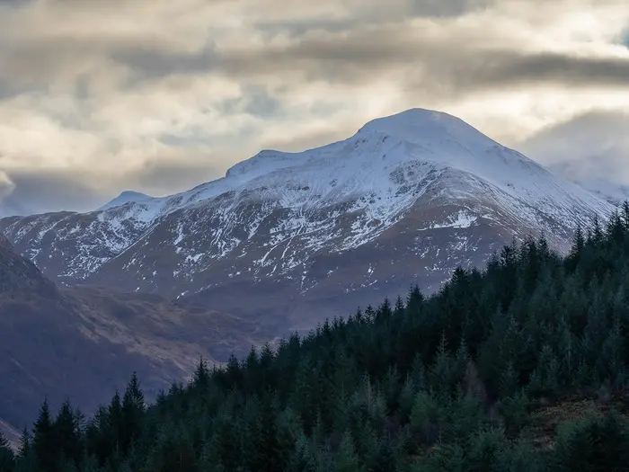
Image by Sonny Vermeer
i
Image by Sonny Vermeer The Great Glen Way is Scotland’s coast-to-coast Highland traverse for walkers who want big scenery without committing to a mountain route. It runs for about 125 km from Fort William to Inverness, linking the west coast, the Caledonian Canal and the long chain of lochs through Glen Mòr.
This is a walk of towpaths, forest tracks, lochside miles and old roads rather than exposed ridges. Neptune’s Staircase, Loch Lochy, Loch Oich, Fort Augustus, Loch Ness and Abriachan Forest give the route its shape, with Inverness Castle marking the finish above the River Ness.
The Way suits reasonably fit first-time long-distance walkers as well as experienced hikers looking for a well-waymarked Highland journey. The standard route stays low by Scottish standards, while the optional High Route above Loch Ness adds more ascent, exposure and rougher-feeling ground.
What it asks for is stamina and planning, not technical skill. Several days are long, accommodation clusters are unevenly spaced, summer beds book out early, and the final Drumnadrochit to Inverness stage is around 32 km unless split.
This guide covers stages, day choices, accommodation, food, transport, terrain and the common planning mistakes to avoid.
Stage-by-Stage Guide
Stage 1: Fort William to Gairlochy — 17 km
The Way starts at the ruins of the Old Fort beside Loch Linnhe and quickly settles into the character of the first half of the route: canal-side walking, level gradients and easy navigation. The early miles pass through or close to Fort William, Caol, Corpach and Banavie before reaching Neptune's Staircase, the eight-lock flight on the Caledonian Canal.
Underfoot, this is mainly firm towpath, urban pavement and quiet linking sections rather than hill path. It is a straightforward first day, but it is still worth starting with water, food and waterproofs to hand, as the weather can change quickly even on these low-level sections.
Food and supplies are easiest in Fort William before setting off. There are settlements on the way out of town, but do not plan this as a continuous serviced corridor; carry what is needed through to Gairlochy unless current opening hours have been checked.
Gairlochy has accommodation options in or near the stage end, but beds are limited compared with Fort William and should be booked well ahead in summer. If using baggage transfer, make sure the provider serves the exact overnight address rather than assuming all properties near the canal are covered.
Fort William is the main transport hub at this end, with a railway station, West Highland Line services, the Caledonian Sleeper from London and regional buses. Gairlochy has road access, but public transport options are much thinner; onward or return travel from there should be checked before travelling.
Navigation is generally simple: follow the thistle waymarks and keep track of canal crossings and urban junctions through the early settlements. The main caution is not difficulty but complacency — the route leaves a built-up start and becomes quieter quickly after Banavie.
Stage 2: Gairlochy to Laggan Locks — 21 km
This stage follows the wooded shore of Loch Lochy, giving the route a more Highland feel after the canal approach. Beyond Gairlochy and Clunes, the Way uses lochside and forest tracks, with long stretches away from large settlements.
The walking is still moderate and non-technical, but the surface can be rougher and muddier than the towpath, especially in wet weather. Expect forest track, occasional old road sections and steady undulations rather than sustained climbing.
Services are sparse on this stage. Start with enough food and water for the full day, particularly if staying at or near Laggan Locks where facilities should not be assumed without checking current arrangements.
Accommodation around Laggan and Laggan Locks is more limited than in the larger trail villages, so this is one of the stages where booking early matters. Some walkers arrange transfers or choose accommodation off the line of the Way, but this needs to be planned before arrival.
Road access exists at points along the glen, and buses using the A82 can be useful for linking stages, but stops and timetables vary by exact location. This should be checked before travelling, especially if ending the day somewhere other than the main trail village.
Navigation is usually clear on the signed route, but forest-track junctions deserve attention. In summer, midges can be a nuisance in sheltered, damp woodland and around still water, so repellent and a headnet can make stops more comfortable.
Stage 3: Laggan Locks to Fort Augustus — 20 km
From Laggan Locks the Way continues through the chain of the Great Glen, following Loch Oich on its eastern side through the Leitirfearn native woodland. Parts of this section use the line of the old Invergarry & Fort Augustus Railway before the route works towards Aberchalder and Fort Augustus.
The terrain is again mostly gentle: woodland path, firm track, former railway alignment and canal-side walking. It is a good stage for steady progress, but wet ground and muddy patches are possible in woodland.
There is an important route-planning choice around Loch Oich. The Invergarry Link gives access to Invergarry on the western side for accommodation and shops, but it is a variant rather than the main eastern-side line; distances, pick-ups and accommodation plans should be checked before committing to it.
Carry food and water from the start unless current facilities at Laggan have been checked. Fort Augustus is a major trail stop with services, food options and accommodation, and it is the natural resupply point before the Loch Ness stages.
At Fort Augustus, the Way reaches the southern end of Loch Ness and passes the village's five-lock staircase on the Caledonian Canal. This is one of the busier places on the route, with boats, visitors and walkers all concentrated around the canal.
Fort Augustus has road access on the A82 corridor, making it one of the more practical places for joining, leaving or splitting the trail. Bus times should still be checked before travelling, particularly outside the main season.
Navigation is generally uncomplicated, but be clear about whether the plan is to stay on the main Way or use the Invergarry Link. Do not rely on phone signal alone for variant choices; carry a map, guidebook or downloaded route.
Stage 4: Fort Augustus to Invermoriston — 15 km
This shorter stage marks the shift from canal-and-lochside walking to the higher forested slopes above Loch Ness. After leaving Fort Augustus, the route follows the north-western side of Loch Ness towards Invermoriston, with more climbing than on the earlier towpath days.
The standard route remains a moderate walk on tracks and constructed path rather than technical hill ground. However, the post-2014 High Route options between Fort Augustus and Drumnadrochit add more ascent, more exposure and a more open moorland feel, so the choice of variant affects how hard the day feels.
Views over Loch Ness are the main reward on this section, especially where the path gains height above the shore. In poor weather, the higher forest and moorland variants can feel much more exposed than the low-level canal stages.
Food and water should be carried from Fort Augustus. Do not rely on finding supplies between the start and Invermoriston unless a specific stop has been checked in advance.
Invermoriston is a recognised trail village with accommodation, but capacity is limited compared with Fort William, Fort Augustus or Inverness. Summer bookings should be made early, and baggage-transfer arrangements should match the exact overnight stop.
The A82 corridor gives Invermoriston road and bus access, making it a practical place to split the Loch Ness section. Current bus times and stopping points should be checked before travelling.
The key navigation issue is the choice between standard and higher variants. Follow waymarks carefully at junctions, and make the decision before leaving Fort Augustus rather than trying to improvise on the hillside.
Stage 5: Invermoriston to Drumnadrochit — 23 km
This is one of the more scenic and more demanding Loch Ness stages, running from Invermoriston towards Drumnadrochit above the quieter north-western shore. The route uses forest tracks, old roads and purpose-built path, with optional higher ground on the High Route.
The walking is not technical, but there is more ascent and descent than on the canal stages. The High Route, including the Grotaig area, gives a wilder feel and broader views but adds exposure and effort, especially in wind, rain or poor visibility.
Alltsigh is one of the key named points along the Loch Ness side of the route. The stage then continues towards Drumnadrochit, the main trail village near Urquhart Castle.
Food and water should be carried from Invermoriston, as there are no reliable continuous services between the main settlements. Drumnadrochit is the next practical resupply and overnight stop.
Drumnadrochit has accommodation and services, but it is also a popular Loch Ness visitor base, so beds can fill quickly in summer. Urquhart Castle is a worthwhile detour from Drumnadrochit, but it is about 1.5 km off the Way down the A82 and should not be treated as being on the trail line.
Public transport is most useful at the stage ends, with the A82 bus corridor serving the glen. Times, stops and luggage policies should be checked before travelling.
Navigation is normally well supported by waymarks, but the variant choices above Loch Ness make this a stage where a map or downloaded GPX is especially useful. In wet weather, expect muddy sections in woodland; in summer, expect midges in sheltered areas.
Stage 6: Drumnadrochit to Inverness — 32 km
The final stage is the longest day in the standard six-day itinerary and is often the main stamina test of the whole Great Glen Way. It leaves Drumnadrochit for the higher ground of Abriachan Forest, then continues via the Blackfold area before descending towards Inverness and the finish at Inverness Castle.
This stage includes the standard route's high point, about 375 m in the Abriachan Forest area. The terrain remains within the moderate character of the Way — forest tracks, old roads, quiet tarmac and urban pavement — but the distance, cumulative ascent and hard surfaces make it a serious final day.
Abriachan Forest is a notable landmark on this section, with community-owned woodland and a forest café and eco-campsite. Opening times, camping arrangements and services should be checked before relying on them.
Carry enough food and water from Drumnadrochit for a long day, especially if walking outside the main season or if current facilities at Abriachan are uncertain. Inverness has the full range of city services at the end.
Accommodation is plentiful in Inverness compared with the smaller trail villages, but advance booking is still sensible in the main walking season. If 32 km is too long, this stage is commonly the one to split, with plans made around available accommodation, transport or pre-arranged transfers.
Drumnadrochit has road and bus access on the A82 corridor, while Inverness is the major transport hub at the finish, with a mainline railway station, airport and onward buses. If using public transport to shorten or split the day, check current bus times before travelling.
Navigation needs care through the forest-track network around Abriachan and on the final approach into Inverness, where rural tracks give way to urban walking. Allow enough daylight for the full distance, and do not underestimate how tiring the last kilometres on pavement can feel after several days on trail.
Recommended Itinerary
Most independent walkers should plan around the six-day itinerary below. It keeps the daily distances manageable until the final approach to Inverness, where the standard stage from Drumnadrochit is long and should not be underestimated.
Standard 6-day itinerary
| Day | From | To | Approx. distance | Why this stage makes sense | Services/accommodation notes |
|---|---|---|---|---|---|
| 1 | Fort William | Gairlochy | 17 km | A gentle opening day along the Caledonian Canal corridor, passing Caol, Corpach, Banavie and Neptune’s Staircase before reaching the quieter canal-side country beyond. | Fort William has the best pre-walk services and transport. Gairlochy has limited accommodation compared with Fort William, so book early. |
| 2 | Gairlochy | Laggan Locks | 21 km | A longer but still moderate stage following the Loch Lochy side of the glen, with forest tracks and lochside walking through and beyond Clunes. | Services are thin between the main settlements. Laggan Locks is a small stopping point, so accommodation and evening food arrangements should be fixed before setting off. |
| 3 | Laggan Locks | Fort Augustus | 20 km | A logical mid-route day along Loch Oich and the Caledonian Canal, using the natural break at Fort Augustus before the route turns towards Loch Ness. | Fort Augustus is one of the most useful resupply and accommodation stops on the Way. The Invergarry Link can help walkers needing services off the main line of the trail; check official mapping before booking around it. |
| 4 | Fort Augustus | Invermoriston | 15 km | The shortest day on the standard itinerary, useful after three steady days and before the harder Loch Ness sections. It also allows time for the High Route option if conditions and fitness suit. | Invermoriston has fewer beds than Fort Augustus or Inverness. Book ahead, especially in summer. |
| 5 | Invermoriston | Drumnadrochit | 23 km | A solid Loch Ness stage, with the choice of standard route or higher-level variants adding more ascent and exposure. Drumnadrochit is the natural overnight stop before the final push to Inverness. | Drumnadrochit has accommodation and is the best base for the off-route detour to Urquhart Castle. The castle is not on the Great Glen Way itself. |
| 6 | Drumnadrochit | Inverness | 32 km | The longest day of the standard itinerary, crossing the Abriachan Forest area before the descent towards Inverness and the finish at Inverness Castle. Start early and treat it as a full hill-walking day for pacing, food and water. | This stage is often the reason walkers choose a slower itinerary. Inverness has the strongest finish-point transport and accommodation options. |
Slower 7-day itinerary
A seven-day plan suits walkers who want shorter days, more time at Fort Augustus and Loch Ness, or less pressure on the final approach to Inverness. The most useful adjustment is to split the 32 km Drumnadrochit–Inverness stage, if accommodation or camping arrangements can be made around Abriachan or Blackfold.
| Day | From | To | Approx. distance | Why this stage makes sense | Services/accommodation notes |
|---|---|---|---|---|---|
| 1 | Fort William | Gairlochy | 17 km | Keeps the easy canal-based start intact. | Book Gairlochy accommodation well ahead. |
| 2 | Gairlochy | Laggan Locks | 21 km | A steady Loch Lochy stage without needing to push on to Fort Augustus. | Limited services; plan food and evening arrangements. |
| 3 | Laggan Locks | Fort Augustus | 20 km | Reaches the main mid-route service village at a comfortable pace. | Good point for resupply and a more relaxed overnight stop. |
| 4 | Fort Augustus | Invermoriston | 15 km | Leaves time for a slower morning, poorer weather, or a higher-level route choice above Loch Ness. | Accommodation should be booked early. |
| 5 | Invermoriston | Drumnadrochit | 23 km | Keeps the Loch Ness section as a self-contained day. | Drumnadrochit is the practical overnight before the final section. |
| 6 | Drumnadrochit | Abriachan / Blackfold area | Check official mapping before booking | Breaks the long final stage and avoids arriving in Inverness tired or late. | Only use this split if accommodation, camping or transfer logistics are firmly arranged. This should be checked before travelling. |
| 7 | Abriachan / Blackfold area | Inverness | Check official mapping before booking | Allows a shorter final walk into Inverness and more flexibility for onward travel. | Inverness has mainline rail, bus links and airport access. |
Faster 5-day itinerary
A five-day schedule is for strong walkers who are comfortable with long back-to-back days and minimal margin for poor weather, tiredness or sightseeing. It is not the best choice for a first long-distance walk, especially if taking the High Route options above Loch Ness.
| Day | From | To | Approx. distance | Why this stage makes sense | Services/accommodation notes |
|---|---|---|---|---|---|
| 1 | Fort William | Gairlochy | 17 km | Keeps the first day straightforward after travel to Fort William. | Fort William is the best place for last-minute supplies before starting. |
| 2 | Gairlochy | Laggan Locks | 21 km | Maintains the standard early split through the quieter canal and Loch Lochy section. | Limited services; carry what is needed for the day. |
| 3 | Laggan Locks | Fort Augustus | 20 km | Reaches the main mid-route village before the demanding final two days. | Fort Augustus is the key resupply point before Loch Ness. |
| 4 | Fort Augustus | Drumnadrochit | 38 km | Combines the Fort Augustus–Invermoriston and Invermoriston–Drumnadrochit stages into one very long Loch Ness day. | Only sensible for fit walkers with an early start. Accommodation in Drumnadrochit should be secured in advance. |
| 5 | Drumnadrochit | Inverness | 32 km | Finishes with the standard long final stage over the Abriachan Forest area to Inverness. | Plan onward travel with enough buffer; this is a long final walking day before reaching the city. |
Planning the Route
Choosing a direction
Most walkers plan the Great Glen Way from Fort William to Inverness. This is the official south-west to north-east direction, starting at the Old Fort beside Loch Linnhe and finishing at Inverness Castle, and it has the practical advantage of usually keeping the prevailing wind behind you.
Walking in reverse is possible, but accommodation and transport plans should still be built around the same limited overnight stops. The route is waymarked, but a map or GPX is still useful for checking variants, diversions and the approach into towns.
How many days to allow
A six-day schedule is the natural fit for most walkers because it matches the main trail villages and avoids forcing too many long stages together. The standard six-stage plan is:
| Stage | From | To | Approx. distance |
|---|---|---|---|
| 1 | Fort William | Gairlochy | 17 km |
| 2 | Gairlochy | Laggan Locks | 21 km |
| 3 | Laggan Locks | Fort Augustus | 20 km |
| 4 | Fort Augustus | Invermoriston | 15 km |
| 5 | Invermoriston | Drumnadrochit | 23 km |
| 6 | Drumnadrochit | Inverness | 32 km |
Five days is realistic for fit walkers, but it usually means at least one demanding combined day. Four days is best treated as a fast schedule for strong walkers who are comfortable with long mileage and minimal margin for weather, sore feet or transport delays.
Seven days is often the more comfortable choice, especially if using the High Route above Loch Ness or wanting to reduce the long final approach to Inverness. Splitting the Drumnadrochit to Inverness stage can make the finish much more manageable, but accommodation or transport around the middle of that section is limited and should be checked before travelling.
Let accommodation shape the itinerary
The Great Glen Way is not difficult to follow, but it is very much dictated by where you can sleep. Fort William, Fort Augustus, Drumnadrochit and Inverness have the clearest service clusters; Gairlochy, Laggan Locks, Invermoriston and the lochside sections have fewer options.
In summer, beds on the smaller stages should be booked well ahead. It is risky to assume that the next village will have space, particularly if the stage ends at a small canal or lochside settlement rather than a larger town.
Camping can add flexibility, and Scotland’s access rights allow responsible wild camping in appropriate places. Campsites and booked accommodation are still the simpler option for many walkers using baggage transfer, and any planned wild-camping itinerary should be matched carefully to food, water and weather.
Fast, steady or slow?
The route rewards a steady pace more than a rushed one. Much of the walking is on canal towpath, forest track, old road and purpose-built path, so the main strain comes from repeated days and the occasional long section rather than technical ground.
A faster itinerary makes sense only if long road-and-track days are already comfortable. The final Drumnadrochit to Inverness stage is the key test on a compressed schedule, and it can feel much longer if the weather is poor or feet are tired.
A slower itinerary gives more room for the Loch Ness sections, the optional High Route, and detours such as Urquhart Castle from Drumnadrochit. Urquhart Castle is not on the Way itself; it lies off-route down the A82 from Drumnadrochit, so allow extra time if adding it.
Variants to decide before booking
Two route choices matter for planning rather than navigation alone.
| Variant | Where it affects the route | Why it matters |
|---|---|---|
| Invergarry Link | Around Loch Oich, giving access to Invergarry off the main line | Useful if you need accommodation or services away from the standard Loch Oich line. Check the impact on your day’s distance and bookings before committing. |
| High Route | Between Fort Augustus and Drumnadrochit, above Loch Ness | Adds ascent, higher forest and moorland, more exposure and a stronger upland feel than the standard low-level route. Best chosen deliberately, not as a last-minute mistake. |
The High Route is the main choice that changes how hard the second half feels. On a poor-weather day, or if walking with a heavy pack, the standard lower route may be the more sensible plan.
Section hiking and shortening the walk
Section hiking is practical because both ends are well connected and buses run along the A82 corridor through the glen. Fort William has rail services including the West Highland Line and the Caledonian Sleeper, while Inverness has mainline rail links, an airport and onward bus connections.
The easiest section breaks are the main trail villages: Fort William, Gairlochy, Laggan Locks, Fort Augustus, Invermoriston, Drumnadrochit and Inverness. Some intermediate points are smaller and have fewer services, so bus times, pick-up points and Sunday or seasonal timetables should be checked before travelling.
Shortening the route mid-walk is usually more realistic from Fort Augustus, Invermoriston or Drumnadrochit than from a remote lochside or forest section. If walking with fixed accommodation, build in a clear contingency plan for what happens if a long day has to be abandoned.
Food, water and daily supplies
Do not plan this as a continuous village-to-village resupply walk with shops everywhere. Supplies are clustered in the larger places, and the canal, lochside and forest sections can be thin for food stops.
Carry enough food and water for the full day before leaving each overnight stop. This is especially important between the smaller settlements and on the Loch Ness stages, where a café or shop should be treated as a bonus unless it has been checked before travelling.
Baggage transfer can make the route much easier, particularly for walkers staying in B&Bs, guesthouses, hotels or hostels. Companies such as Sherpa Van operate on the Great Glen Way, but current arrangements, luggage limits and pick-up requirements should be confirmed before booking.
Navigation and maps
The waymarking is generally straightforward, using the thistle-within-hexagon symbols on blue posts. That makes the Great Glen Way suitable for walkers who do not want complex mountain navigation, but it is still unwise to rely on waymarks alone.
Carry a map, guidebook or offline GPX, especially for the High Route, the Invergarry Link, forest junctions and urban approaches. OS Explorer OL400 and OL416 cover the route, and Harvey publishes a dedicated Great Glen Way map.
Live diversions should be checked on the official Great Glen Way information before travelling. Forestry work, path maintenance or local closures can change the best line on the day.
Weather and seasonal planning
Spring, summer and autumn are the main walking seasons. Summer brings the best chance of long daylight but also midges, busy accommodation and the need to book early.
The route is low-level by Highland standards, but it is still exposed to Highland weather. The High Route above Loch Ness is more committing in wind, rain or poor visibility than the standard canal and forest-track sections.
Winter walking is possible for experienced, well-equipped walkers, but it is not the normal planning window. Snow, short daylight and closed or reduced services can all affect the route, and facilities should be checked before travelling.
The planning priorities that matter most
For this trail, the key planning jobs are accommodation, transport and daily stage length. Navigation is usually manageable, and the walking is not technical, but a poor itinerary can still create difficult days.
Before booking, decide:
- whether to walk the standard route or include the High Route;
- whether to use the Invergarry Link for accommodation or services;
- how to handle the long Drumnadrochit to Inverness stage;
- whether baggage transfer is needed;
- how to reach Fort William and leave Inverness;
- where food and water will be carried between smaller stops.
Once those decisions are made, the Great Glen Way is a straightforward route to organise. The main risk is not getting lost on difficult ground, but underestimating the spacing of accommodation and the cumulative effect of several long Highland days.
Towns, Villages and Overnight Stops
Accommodation is concentrated in a handful of settlements: Fort William, Gairlochy, Fort Augustus, Invermoriston, Drumnadrochit and Inverness. Between these, the Great Glen Way has long canal, lochside and forest stretches where food, beds and public transport are much thinner, so overnight plans should be fixed before setting out in the main season.
The standard 6-day itinerary uses Gairlochy, Laggan Locks, Fort Augustus, Invermoriston and Drumnadrochit as the key intermediate stops. The final Drumnadrochit–Inverness stage is about 32 km, so many walkers look for ways to split it around Abriachan or Blackfold, but availability is limited and must be checked before relying on it.
| Place | Best use for hikers | Practical note |
|---|---|---|
| Fort William | Start town; overnight before the walk | Best-served western end, with rail and bus links |
| Gairlochy | First overnight on a 6-day schedule | Small supply cluster; book ahead |
| Laggan / Laggan Locks | Overnight between Loch Lochy and Loch Oich | Services are limited; plan food carefully |
| Fort Augustus | Mid-route resupply and overnight | One of the strongest service points on the trail |
| Invermoriston | Loch Ness overnight stop | Useful short stage after Fort Augustus |
| Drumnadrochit | Major Loch Ness stop before the final day | Sensible place to pause before the long last stage |
| Abriachan / Blackfold | Possible split before Inverness | Limited options; check availability before building an itinerary around it |
| Inverness | Finish town | Best-served eastern end, with rail, bus and airport links |
Fort William
Fort William is the practical start base for the Great Glen Way. The official start is at the ruins of the Old Fort beside Loch Linnhe, with the waymarked route then leading north-east towards the Caledonian Canal.
It is the strongest place on the route for pre-walk accommodation, last-minute food shopping and transport. Fort William has a railway station, with the West Highland Line from Glasgow and the Caledonian Sleeper from London, and it is also a regional bus hub.
Most walkers stay here the night before starting, especially if arriving by public transport. It is also the best place to sort baggage transfer arrangements, buy any missing kit and begin with a full food supply for the first canal-side stage.
Caol
Caol is passed early on the way out of Fort William, before the route reaches the canal-side settlements around Corpach and Banavie. For most walkers it is part of the first walking day rather than a destination in its own right.
It can be useful if accommodation in central Fort William is full or if a walker wants to shorten the walk out of town slightly. Specific accommodation, food and transport details should be checked before travelling.
Corpach
Corpach sits on the early section between Fort William and Banavie, close to the Caledonian Canal approach. It is still within the wider Fort William start area, so it is mainly relevant as a possible pre-walk or first-night alternative rather than a standard stage end.
The route is still low-level and straightforward here, so there is rarely a walking need to stop. Use Corpach only if accommodation logistics work better than staying in Fort William itself; current food and public transport options should be checked before booking.
Banavie and Neptune’s Staircase
Banavie is the first major trail feature after leaving Fort William, where the Way passes Neptune’s Staircase, Thomas Telford’s flight of eight connected locks on the Caledonian Canal. It is an excellent place for a short break, but not usually an overnight stop on a normal end-to-end itinerary.
Because it lies so close to the start, most walkers continue to Gairlochy on day one. If using Banavie or the Fort William fringe for accommodation, check the exact location against the waymarked route so the first day does not become unnecessarily awkward.
Gairlochy
Gairlochy is the first common overnight stop on the classic 6-day schedule, about 17 km from Fort William. It sits by the Caledonian Canal before the route turns onto the Loch Lochy side of the glen.
Accommodation exists in this part of the route, but the choice is much thinner than in Fort William or Inverness. Book early, especially in summer, and do not assume that late availability will be easy.
Food planning matters here. Gairlochy is a practical stage end, but it is not a large resupply town, so walkers should carry what they need for the evening and the next day unless meals or packed lunches have been arranged with accommodation.
Clunes
Clunes lies beyond Gairlochy on the Loch Lochy section, where the Way follows the wooded eastern/southern side of the loch on forest tracks. It is mainly a through-point on the Gairlochy to Laggan Locks stage.
Do not plan around Clunes as a major service stop unless specific accommodation or support has been arranged. This part of the route is one of the stretches where carrying sufficient food and water for the day is more important than relying on village facilities.
Laggan / Laggan Locks
Laggan Locks is the usual second overnight stop on a 6-day itinerary, about 21 km beyond Gairlochy. It sits at the transition between the Loch Lochy stage and the Loch Oich section.
This is a convenient staging point, but services are limited compared with the larger villages. Accommodation should be booked well ahead, and evening meals or self-catering needs should be clarified directly with the place being used.
The next day to Fort Augustus is manageable for most walkers at about 20 km, but it passes through quieter country beside Loch Oich and the canal. Start with enough food for the day rather than expecting frequent shops or cafés en route.
Loch Oich, Leitirfearn and the Invergarry Link
Between Laggan and Fort Augustus, the Great Glen Way follows the eastern side of Loch Oich through the Leitirfearn native woodland, partly on the line of the old Invergarry & Fort Augustus Railway. This is an attractive walking section, but it is not a major service corridor.
The Invergarry Link provides an official variant towards Invergarry for accommodation and shops off the main line of the Way. Use it only if it fits the day’s mileage and confirmed accommodation plan; the extra logistics should be checked before travelling.
Aberchalder
Aberchalder is passed between Loch Oich and Fort Augustus, after the trail leaves the lochside section and returns towards the canal. It is mainly a route marker rather than a standard overnight stop.
There should be no assumption of walker services here. Treat the Laggan Locks to Fort Augustus leg as a self-contained day and carry what is needed until reaching Fort Augustus.
Fort Augustus
Fort Augustus is one of the most useful stops on the Great Glen Way and a natural mid-route base. The village sits where a flight of five staircase locks carries the Caledonian Canal down into Loch Ness.
It is a strong overnight choice, with a broader range of accommodation and food options than the smaller canal and lochside stops. It is also one of the best places to reset the itinerary, take stock of weather and decide whether to use the Loch Ness High Route on the following stages.
Many walkers stay here after the Laggan Locks stage before walking the shorter Fort Augustus to Invermoriston day of about 15 km. Beds should still be booked ahead in summer, as the village is popular with both walkers and canal visitors.
Invermoriston
Invermoriston is the standard overnight stop after Fort Augustus on a 6-day schedule. The day from Fort Augustus is comparatively short at about 15 km, which makes Invermoriston a useful recovery point before the longer Loch Ness stages.
Accommodation and food options are present but limited, so booking ahead is important. If planning to eat in the village, check opening arrangements before arrival, particularly outside the main walking season.
This is also a key place for route choice on the Loch Ness section. The optional High Route between Fort Augustus and Drumnadrochit adds more ascent, exposure and moorland-style walking, so accommodation timing and daily effort should be planned together.
Alltsigh
Alltsigh lies on the Loch Ness section between Invermoriston and Drumnadrochit. It is relevant because the High Route rejoins the main route near here.
For most walkers, Alltsigh is not an overnight planning anchor. Treat it as part of the day’s route and ensure food, water and weather decisions have been made before committing to the higher option above Loch Ness.
Grotaig
Grotaig is associated with the High Route above Loch Ness. It matters mainly to walkers taking that higher variant rather than staying on the easier low-level line.
Do not count on Grotaig for services unless something has been arranged in advance. The High Route is more exposed and has more ascent, so it should be treated as a walking commitment rather than a way of linking frequent settlements.
Drumnadrochit
Drumnadrochit is the main overnight stop before the final stage to Inverness. The usual stage from Invermoriston is about 23 km, and the following day to Inverness is about 32 km, making Drumnadrochit a key decision point in the itinerary.
Accommodation, food and transport are better here than on the smaller Loch Ness settlements, but summer beds should still be booked well ahead. Citylink and Stagecoach buses run along the A82 through the glen, making Drumnadrochit one of the more practical places for section-walking or adjusting plans.
Urquhart Castle is a worthwhile detour from Drumnadrochit, but it is not on the Great Glen Way itself. It lies about 1.5 km off-route down the A82, so build in extra time and avoid treating it as a quick on-path stop.
Abriachan
Abriachan sits high above Loch Ness on the approach to Inverness, in the area of the standard route’s high point at about 375 m. It is one of the few realistic places that may help split the long Drumnadrochit to Inverness stage.
The area has a forest café/eco-campsite, but availability, opening times and booking requirements should be checked before travelling. It should not be assumed that food or camping will be available on arrival without prior arrangement.
For many walkers, Abriachan is more important as a pacing point than as a full overnight stop. If using it to shorten the final day, confirm exactly where the accommodation or camping sits in relation to the waymarked route.
Blackfold
Blackfold lies on the final approach towards Inverness after the high ground around Abriachan. It can be relevant for walkers trying to break up the 32 km Drumnadrochit to Inverness day.
Services are limited and should not be assumed. Any plan to stop here needs to be based on a confirmed booking or confirmed transport arrangement; otherwise, most walkers continue to Inverness.
Inverness
Inverness is the finish of the Great Glen Way, with the trail ending at Inverness Castle above the River Ness. It is the strongest transport and accommodation hub on the eastern end of the route.
The city has a mainline railway station with direct trains to the Central Belt, Aberdeen and London, plus an airport. Citylink and Stagecoach buses on the A82 also make it practical for onward travel or for returning towards intermediate points along the glen.
Most walkers book a final night in Inverness rather than trying to travel immediately after the long last stage. This is especially sensible if walking from Drumnadrochit in one push, as the final day is the longest standard stage of the route.
Getting to the Start
The Great Glen Way starts in Fort William, with the official start at the ruins of the Old Fort beside Loch Linnhe. Most walkers travel to Fort William the day before starting, then begin the Way north-east out of town along the Caledonian Canal towpath.
By train
Fort William has a railway station and is the most convenient railhead for the start of the walk. The West Highland Line links Fort William with Glasgow, and the Caledonian Sleeper provides an overnight rail option from London.
Allow enough time on arrival to find accommodation, buy food and, if using a baggage-transfer service, make sure bags are ready for the first collection. Train times, sleeper availability and engineering works should be checked before travelling.
By bus
Fort William is a regional bus hub, so bus travel is a practical way to reach the start. Citylink and Stagecoach services also use the A82 corridor along the Great Glen, which is useful for walkers joining, leaving or section-hiking the route.
Bus timetables can change seasonally and may be thinner outside the main tourist season. This should be checked before travelling, especially if arriving late in the day or planning to connect directly into accommodation outside Fort William.
By car
Driving to Fort William is straightforward in planning terms, but the Great Glen Way is a point-to-point walk finishing in Inverness. Leaving a car at the start means arranging a return journey from Inverness to Fort William at the end, or using public transport to reposition before or after the walk.
Long-stay parking arrangements in Fort William should be checked before travelling. Do not assume that accommodation parking can be used for the full duration of the walk unless this has been agreed in advance.
From the nearest airport
Inverness has an airport and is the main airport noted for this route, but it is at the finish end rather than the start. If flying in for a south-west to north-east walk, plan the onward journey to Fort William before booking flights.
Glasgow is also relevant for access because Fort William is on the West Highland Line from Glasgow. Current rail, bus and airport-connection times should be checked before travelling, particularly if relying on same-day connections to reach Fort William.
Where to stay before starting
Fort William is the best place to stay before starting the Great Glen Way. It has the widest choice at the start of the route, including hotels, guesthouses, B&Bs and hostels, and gives easy access to the official start at the Old Fort.
Book ahead in summer, when accommodation on the Great Glen Way can fill quickly. Staying in Fort William also makes the first morning simpler: food supplies, baggage-transfer arrangements and any last transport checks can be dealt with before leaving town.
Getting Home from the Finish
The Great Glen Way finishes at Inverness Castle, in the centre of Inverness. This is one of the easier Scottish long-distance trail finishes to leave from, with rail, coach, bus, taxi and airport options all available from the Highland capital.
The main practical issue is timing. The final stage from Drumnadrochit to Inverness is around 32 km, so many walkers arrive late in the afternoon or evening. If onward travel is time-critical, either start very early from Drumnadrochit, split the final stage, or book a night in Inverness.
By train
The nearest railway station is Inverness, the mainline station for the Highland capital. From here there are direct trains towards the Central Belt, Aberdeen and London.
For most walkers, the train is the simplest onward option if travelling to Edinburgh, Glasgow, Aberdeen or connecting further south. Long-distance services and cheaper advance fares can sell out or become expensive, especially in summer, so book ahead where possible.
If returning to the start at Fort William, do not assume this will be quick by rail. Fort William is served by the West Highland Line from Glasgow, while Inverness sits on different rail corridors, so compare rail and bus options before committing. This should be checked before travelling.
By bus
Citylink and Stagecoach buses run along the A82 through the Great Glen, linking Inverness with settlements on or near the route, including Drumnadrochit, Invermoriston, Fort Augustus and Fort William.
This makes bus travel useful for:
- returning to Fort William after completing the walk;
- leaving the trail early from an intermediate village;
- linking back to accommodation if the final Drumnadrochit–Inverness stage has been split;
- reaching other Highland connections from Inverness.
Timetables vary by day and season, and evening services may be limited. Check current bus times before relying on a same-day connection, especially after the long final stage into Inverness.
By car/taxi
Because the route is point-to-point, parking at one end and finishing at the other needs planning. If a car has been left in Fort William, the usual solution is to travel back from Inverness by bus along the Great Glen or by a pre-arranged taxi/private transfer.
A taxi between Inverness and Fort William is a long journey and likely to be expensive. It is better treated as a planned transfer rather than a fallback after missing the last bus. Confirm availability and current prices before booking.
Taxis are more useful for short local moves at the finish: from Inverness Castle or city-centre accommodation to the railway station, bus departure point or airport. Late arrivals should not rely on finding a taxi instantly without checking availability.
From the nearest airport
Inverness has an airport, making it a practical finish for walkers flying onward or connecting to other parts of the UK. Allow enough time between reaching Inverness Castle and any flight, particularly if walking the full final stage from Drumnadrochit the same day.
Airport transfer arrangements from central Inverness are timetable-dependent. Check current bus, taxi and flight times before travelling, and consider staying overnight if the only suitable flight is early the next morning.
Where to stay at the finish
Inverness is the best-served overnight stop on the route, with hotels, guesthouses, hostels and other accommodation options. Staying in the city after finishing is often the most sensible plan, especially after the 32 km final day.
An overnight stop gives more margin for delayed walking, poor weather, slower progress through Abriachan and any onward transport the following morning. Beds should still be booked ahead in summer, as Inverness is a busy Highland travel hub as well as the end of the Great Glen Way.
Which Direction Should You Walk?
The standard and most common direction is Fort William to Inverness, starting at the Old Fort beside Loch Linnhe and finishing at Inverness Castle. This is also the direction that best matches the usual stage pattern: canal towpath out of Fort William, Loch Lochy and Loch Oich through the middle of the route, then the longer Loch Ness and Abriachan sections before the descent into Inverness.
The Great Glen Way can be walked in reverse, but most independent walkers are better served by the traditional south-west to north-east direction unless accommodation, transport or a personal itinerary makes Inverness the better starting point.
Fort William to Inverness: the standard direction
Walking from Fort William to Inverness gives the cleanest progression. The route begins gently on the Caledonian Canal towpath through Caol, Corpach and Banavie, passing Neptune’s Staircase early, before moving into quieter lochside and forest walking by Loch Lochy, Loch Oich and Loch Ness.
This direction also keeps the prevailing wind more often behind you, which is a useful practical advantage on exposed sections above Loch Ness and on open towpaths. Highland weather is never guaranteed, but the usual west-to-east weather pattern is one reason this direction is traditional.
Transport works well in this direction. Fort William is a practical trailhead, with a railway station on the West Highland Line from Glasgow, the Caledonian Sleeper from London, and regional bus connections. Finishing in Inverness is especially convenient because the city has a mainline railway station, long-distance bus links and an airport, giving more options for onward travel after the walk.
The main drawback is psychological and logistical: the longest standard stage, Drumnadrochit to Inverness at about 32 km, comes at the end. Many walkers split this if accommodation or transport allows, but if walked in one day it is a demanding finish rather than an easy final stroll.
Inverness to Fort William: the reverse direction
Walking from Inverness to Fort William is perfectly possible, but it changes the feel of the route. The conventional stage pattern puts the long Inverness–Drumnadrochit section near the start, followed quickly by the higher ground around Abriachan and the Loch Ness stages.
This can suit strong walkers who want the longest day early, or anyone whose travel plans make Inverness the easier place to reach first. It also gives a satisfying west-coast finish in Fort William, with the Caledonian Canal and Neptune’s Staircase saved for the later part of the walk.
The disadvantages are practical rather than technical. You are more likely to be walking into the prevailing weather, and the scenery progression feels less natural: the route leaves the Highland capital first, then works back through the lochs and canal settlements towards Fort William. Accommodation and baggage-transfer arrangements should also be checked carefully before booking if walking in reverse or using non-standard stages.
Does one direction make the walking easier?
There is no major technical advantage either way. The Great Glen Way is a moderate, low-level trail on towpaths, forest tracks, old roads, purpose-built path and some quiet tarmac, rather than a mountain route with a clearly easier ascent direction.
The bigger issue is how the harder days are placed. In the standard direction, the route builds gradually and saves the longest day for the end. In reverse, the long Inverness–Drumnadrochit leg and the Abriachan area come early, which can be a shock if fitness, footwear or pack weight have not yet settled.
The optional High Route between Fort Augustus and Drumnadrochit adds more ascent, exposure and moorland in either direction. If taking that variant, the weather forecast matters more than the direction.
Recommendation
For most walkers, walk the Great Glen Way from Fort William to Inverness. It is the traditional direction, gives the best scenery progression, usually works better with the prevailing wind, and finishes in the transport hub of Inverness.
Choose the reverse direction only if it clearly suits accommodation availability, transport plans or a deliberate preference to finish on the west coast at Fort William.
Accommodation Along the Route
The Great Glen Way works well as an inn-to-inn walk, but only if accommodation is planned around the actual settlement pattern of the glen. Fort William, Fort Augustus, Drumnadrochit and Inverness have the strongest choice; the canal and lochside sections between them are much thinner, especially around Gairlochy, Laggan Locks and the quieter stretches of Loch Ness.
Book beds well ahead for summer, particularly if walking on a fixed 5–7 day itinerary. Fort William and Inverness are useful for flexible arrival and departure nights, but the smaller villages can fill quickly because walkers, cyclists and general Highland visitors are all competing for the same limited rooms.
Accommodation styles vary from B&Bs, guesthouses, hotels and inns to hostels and campsites. Wild camping is possible in places under Scotland’s access rights, but this should be treated as a low-impact option rather than a substitute for planning every night; the route also passes long managed canal, woodland and village sections where a discreet pitch may not be practical.
| Place | Accommodation level | Best for | Notes |
|---|---|---|---|
| Fort William | Good | Start night, late arrivals, stocking up before the walk | The strongest western-end base, with a wide choice of services before starting from the Old Fort area beside Loch Linnhe. |
| Caol / Corpach / Banavie | Limited | Short first day alternatives, canal-side starts | Useful if adjusting the first stage near the Caledonian Canal and Neptune’s Staircase, but do not assume last-minute availability. |
| Gairlochy | Limited | Standard first overnight on a 6-day itinerary | A small trail stop rather than a large service centre; book early if using the Fort William–Gairlochy stage. |
| Clunes | None / very limited | Passing through | Treat as a route point on the Loch Lochy section, not a reliable overnight base unless arrangements have been made in advance. |
| Laggan / Laggan Locks | Limited | Standard second overnight on a 6-day itinerary | One of the awkward accommodation points on the route. If beds are not available, the stage plan may need adjusting with a transfer or a different overnight stop. |
| Invergarry link area | Limited | Accommodation or services off the main line | The Invergarry Link exists partly to connect walkers with the western side of Loch Oich. Check the practicalities before building an itinerary around it. |
| Fort Augustus | Good | Mid-route rest, resupply, shorter itinerary reset | One of the best overnight stops on the Way, with a useful cluster of services around the canal locks at the southern end of Loch Ness. |
| Invermoriston | Limited | Shorter day after Fort Augustus, staging before Drumnadrochit | A natural overnight stop, but smaller than Fort Augustus or Drumnadrochit. Booking ahead matters. |
| Alltsigh / Grotaig area | None / very limited | Passing through on low or High Route options | Do not rely on accommodation here unless it has been specifically arranged. This is mainly a route section between Invermoriston and Drumnadrochit. |
| Drumnadrochit | Good | Final full overnight before Inverness, Loch Ness services | The main Loch Ness village on the route and the usual stop before the long final stage to Inverness. Also the base for the off-route Urquhart Castle detour. |
| Abriachan | Limited | Splitting the long Drumnadrochit–Inverness stage | Abriachan Forest has a forest café/eco-campsite area, making it relevant for walkers trying to break up the final day. Current availability and opening should be checked before travelling. |
| Blackfold | None / very limited | Passing through near the final approach | Treat as a route point rather than an accommodation hub. |
| Inverness | Good | Finish night, onward travel, recovery day | The strongest eastern-end base, with extensive accommodation and transport connections after finishing at Inverness Castle. |
Best overnight patterns
A common 6-day walking schedule uses Fort William, Gairlochy, Laggan Locks, Fort Augustus, Invermoriston, Drumnadrochit and Inverness. This gives logical stage lengths, but it depends heavily on securing beds in the smaller middle stops.
A 5-day itinerary usually means combining stages or walking longer days. This is easier for strong walkers using luggage transfer, but accommodation still needs to line up with the available villages rather than with ideal mileage.
The final Drumnadrochit–Inverness stage is about 32 km, so it is the main accommodation problem for walkers who prefer moderate daily distances. Splitting it around Abriachan can help, but options are limited and must be checked before travelling.
Booking and seasonal pressure
Summer is the main pressure point. Fort William, Loch Ness villages and Inverness are busy with visitors beyond Great Glen Way walkers, while smaller places such as Gairlochy, Laggan Locks and Invermoriston have far fewer beds.
Weekend starts can also create tight availability because many walkers begin in Fort William and move along similar stage patterns. If the itinerary relies on a specific small stop, book that night before committing to trains, flights or baggage transfer.
Out of the main walking season, accommodation may be easier to find in larger towns but more uncertain in smaller settlements. Seasonal opening, camping availability and food service should be checked before travelling.
Luggage transfer and transfers between stops
The route is well suited to luggage transfer, and companies such as Sherpa Van serve the Great Glen Way. This can make long towpath and forest-track days more manageable, especially on the Loch Ness half and the final approach to Inverness.
Baggage transfer does not remove the need to book accommodation in the right places: bags need a definite overnight address, and small stops may not have many options. Confirm baggage arrangements before booking a fragmented itinerary or using campsites.
Where accommodation gaps are awkward, a transfer to or from a nearby village can sometimes solve the problem, particularly around the thinner canal and lochside sections. Taxi availability, pick-up points and costs should be checked before travelling.
Camping and Wild Camping
The Great Glen Way is a workable camping route, but it needs more planning than the low-level terrain suggests. The trail links several villages with commercial accommodation and some campsite options, while the long canal, loch and forest sections also make responsible wild camping possible under Scotland’s access rights.
Do not assume there will be a campsite exactly where a six-day itinerary ends. Camping provision is clustered around the main stopping places — Fort William, Gairlochy, Fort Augustus, Invermoriston, Drumnadrochit, Abriachan and Inverness — and some sections between them are thin on formal services. Opening dates, pitch availability and prices should be checked before travelling, especially in summer.
Formal campsites and planned camping stops
The most practical camping plan is to use formal sites where they fit the itinerary, then only wild camp where there is a clear, responsible place to stop. Fort William and Inverness are the easiest places to organise the start and finish, while the middle of the route has fewer guaranteed options and needs advance checking.
Abriachan is particularly relevant for campers because the route passes through the community-owned Abriachan Forest area, where there is a forest café/eco-campsite. This sits high above Loch Ness on the final part of the walk before Inverness, and can be useful if splitting the long Drumnadrochit–Inverness stage.
| Section | Camping practicality |
|---|---|
| Fort William to Gairlochy | Best planned as a booked first night if not starting early. The route leaves through Caol, Corpach and Banavie before following the canal, so wild camping needs care around settlements, locks and working canal infrastructure. |
| Gairlochy to Laggan Locks | More rural, with lochside and forest-track walking beyond Clunes. Formal options and any informal stop should be checked locally, as services are limited. |
| Laggan Locks to Fort Augustus | A useful camping stage in principle, with the route passing Loch Oich and Aberchalder before reaching Fort Augustus. Fort Augustus is the main service point, so book ahead if relying on a formal pitch. |
| Fort Augustus to Invermoriston | Shorter in distance, but the Loch Ness-side route is not a place to improvise late in the day. Plan where to stop before leaving Fort Augustus. |
| Invermoriston to Drumnadrochit | A longer forest-and-Loch Ness stage, with the optional High Route adding ascent and exposure. Wild camping may be possible in suitable places, but water, shelter and onward distance need to be planned carefully. |
| Drumnadrochit to Inverness | Long at about 32 km, and commonly split. Abriachan is the key camping-related stop on this section; otherwise plan conservatively rather than assuming an easy pitch near Inverness. |
Wild camping in practice
Scotland’s access rights allow responsible wild camping in many places, but they do not give a right to camp anywhere in any manner. On this route, the main practical limits are settlement edges, private land around houses and farms, commercial forestry, the canal corridor, lock areas, roads and popular lochside stopping points.
A good wild pitch on the Great Glen Way should be small, discreet and well away from buildings, gardens, livestock, roads, locks and busy paths. Arrive late, leave early, keep groups small and avoid staying more than one night in the same place.
The route is often close to water, but that does not remove the need for water planning. Loch, burn and other untreated water should be filtered, treated or boiled, and canal water should not be treated as a convenient drinking source. Carry enough water between villages, especially on the higher Loch Ness sections and if using the High Route.
Leave No Trace and fire rules
Campers need to be particularly careful because the Way passes through working countryside, woodland and managed canal-side land. Pack out all litter, food waste and hygiene products, and leave no sign of the pitch.
Toileting must be done well away from paths, watercourses, lochs, canals and buildings. Use public toilets and campsite facilities whenever available in the trail villages.
Open fires are not appropriate for most Great Glen Way camps. Use a stove, keep it stable, and take extra care in dry woodland, heathery ground and forest areas. Fire risk and local restrictions can change quickly and should be checked locally.
Seasonal camping concerns
Summer brings the biggest pressure on campsites and accommodation, so pitches should be booked early where possible. It is also the main midge season, and camping near still, sheltered water or woodland can be uncomfortable without a head net, repellent and a tent inner that seals properly.
Spring and autumn are often more manageable for camping, but nights can still be cold and wet. Winter camping is possible only for properly equipped walkers, and some facilities may be closed; this should be checked before travelling.
Is it worth camping the Great Glen Way?
Camping suits the Great Glen Way if the aim is flexibility and lower cost, and if carrying a heavier pack over repeated 15–32 km days is realistic. The route is not technically difficult, but long towpath and forest-track days can still become tiring with full camping kit.
For many walkers, the best compromise is a mixed approach: book campsites or indoor accommodation in the main villages, use Abriachan if it fits the final stage, and keep wild camping as a responsible fallback rather than the whole plan.
Food, Water and Resupply
The Great Glen Way is well supplied at the ends and in the larger trail villages, but it is not a route where food appears every few kilometres. Long canal, lochside and forest sections have little or no guaranteed daytime resupply, so most walkers should carry a packed lunch and snacks each day.
Fort William and Inverness are the easiest places to stock up before and after the walk. The most useful mid-route resupply points are Fort Augustus, Invermoriston and Drumnadrochit, with more limited options around smaller stopping places such as Gairlochy and Laggan Locks. Rural opening hours can be short, seasonal and affected by Sunday trading, so shop, café and pub hours should be checked before travelling.
Stage-by-stage resupply
| Section | Food availability | Water availability | Notes |
|---|---|---|---|
| Fort William to Gairlochy | Best stocked at Fort William before setting off. Do not assume reliable food once clear of the early settlements and canal corridor. | Fill bottles before leaving Fort William. The route follows the Caledonian Canal, but canal water should not be treated as a routine drinking source. | Carry lunch unless a definite stop has been checked in advance. Neptune’s Staircase and the canal towpath can feel close to services early on, but the day becomes quieter beyond Banavie. |
| Gairlochy to Laggan Locks | Limited. Arrange food through accommodation or carry it from the previous stop. | Refill before leaving Gairlochy. Natural water may be available near lochs or burns, but it should be filtered, boiled or treated. | This is one of the sections where walkers most often benefit from carrying a full day’s food. |
| Laggan Locks to Fort Augustus | Limited until Fort Augustus. The Invergarry Link can be useful for access to Invergarry’s accommodation and shops, but it is an off-route variant. | Refill at the start if possible. Treat any loch, burn or canal-side water before drinking. | Fort Augustus is a key resupply point and a sensible place to restock before the Loch Ness stages. |
| Fort Augustus to Invermoriston | Food is available at the start and finish, but there is no need to rely on a mid-stage stop unless current options have been checked. | Start with full bottles from Fort Augustus. Natural water should be treated. | A shorter stage by Great Glen Way standards, but still carry lunch, especially if taking the higher variant above Loch Ness. |
| Invermoriston to Drumnadrochit | Food at Invermoriston and Drumnadrochit; limited guaranteed resupply between them. | Fill up before leaving Invermoriston. Treat natural water, particularly on forest and higher route sections. | Carry a full day’s food. The High Route adds ascent and exposure, so do not rely on finding services en route. |
| Drumnadrochit to Inverness | Food at Drumnadrochit and Inverness. Abriachan Forest has a forest café/eco-campsite, but opening times should be checked before relying on it. | Leave Drumnadrochit with enough water for a long day. Refill opportunities may be limited until closer to Inverness. | This is the longest standard stage, around 32 km, and should be treated as a self-sufficient day unless a confirmed stop has been planned. |
How much to carry
For most stages, a sensible minimum is a packed lunch, high-energy snacks and an emergency reserve. On the longer days, especially Invermoriston to Drumnadrochit and Drumnadrochit to Inverness, carry enough food to finish the stage without buying anything en route.
For water, many walkers will be comfortable starting with around 1.5–2 litres in cool conditions, but more is sensible in warm weather, on the High Route, or on the 32 km final stage into Inverness. Refill at accommodation, cafés and pubs where possible, and ask before using private taps.
Natural water is present in the landscape — lochs, burns and the canal are never far from the route — but it should not be assumed to be safe untreated. Use a reliable filter, purification tablets or boiling if taking water from burns or lochs, and avoid stagnant canal water or water close to settlements, livestock, boats and drainage.
Terrain, Conditions and Difficulty in Practice
The Great Glen Way is best understood as a stamina walk rather than a technical hill route. The standard line stays mostly low and uses canal towpath, forest tracks, lochside paths, old roads, former railway line, purpose-built path and some quiet tarmac or urban pavement. There is no scrambling, no high-mountain ground and no routinely rocky terrain that should trouble a competent long-distance walker.
What makes it moderate is the accumulation: several 20 km days, firm surfaces underfoot, thinner services between the main settlements, and a long final stage of about 32 km from Drumnadrochit to Inverness. Walkers carrying full packs will feel the hard towpath and road sections more than the gradient.
Main path surfaces
| Terrain type | Where it matters | Practical effect |
|---|---|---|
| Caledonian Canal towpath | Fort William, Caol, Corpach, Banavie, Gairlochy, Laggan Locks, Aberchalder and Fort Augustus sections | Generally level, straightforward and fast walking, but firm surfaces can be tiring over repeated days. |
| Lochside and forest tracks | Loch Lochy, Loch Oich and Loch Ness | Usually broad and non-technical, with muddier stretches possible after rain. Forest sections can feel enclosed and slower than the canal. |
| Old roads, former military roads and former railway line | Used in places along the glen, including the Loch Oich area | Typically easy navigation and steady gradients, but still hard underfoot in places. |
| Quiet road and urban pavement | Near towns and settlements, especially at the Fort William and Inverness ends | Useful for access but less pleasant on tired feet. Take normal care with traffic where the Way uses or crosses roads. |
| Optional High Route | Between Fort Augustus and Drumnadrochit above Loch Ness | Adds more ascent, higher forest and moorland walking, and greater exposure to wind and weather. Choose it only if conditions and fitness suit. |
Climbs, descents and effort
The flattest walking is on the canal sections, where progress can be quick and navigation simple. These stretches are still physically wearing because the surface is often firm and repetitive, so footwear and pack weight matter.
The Loch Ness half of the route is more demanding. The Way leaves the easiest canal-side terrain and spends more time on forest tracks and higher ground above the loch, with the standard route reaching about 375 m in the Abriachan Forest area. The total ascent on the standard route is around 1,835 m, spread across the full walk rather than concentrated into one mountain day.
The final Drumnadrochit to Inverness stage is the biggest planning issue for many walkers. At about 32 km, it is long even though the terrain is not technical, and it includes the Abriachan area before the descent towards Inverness. Many itineraries are shaped around whether this day is walked in one push or split.
Mud, bog and wet ground
The Great Glen Way is not a boggy wilderness route, but it can be muddy in places, especially on forest tracks and shaded lochside sections after rain. Waterproof footwear is sensible in spring and autumn, and trail shoes or light boots work well for many walkers in drier periods.
The optional High Route is more exposed and includes moorland and higher forest tracks, so it is more affected by poor weather than the low-level line. In rain, wind or low cloud, the standard route will usually be the more conservative choice.
Road walking, livestock and barriers
Road walking is present but not the main character of the route. Expect short urban or settlement approaches and some quiet tarmac, rather than long continuous road marches.
Livestock fields, repeated stiles and complex fence crossings are not a defining feature of this walk. The route is much more about canal infrastructure, forestry, lochside tracks and waymarked paths than field-to-field navigation.
Seasonal conditions
Spring, summer and autumn are the normal walking seasons. Spring and autumn can bring wetter, cooler days and shorter daylight windows, so the longer stages need realistic timing. Summer gives the longest days but also brings midges, especially in still, damp conditions around woodland and water.
Winter is possible for experienced walkers, but it changes the character of the route. Snow can affect higher sections, daylight is short, and some facilities may be closed. This should be checked before travelling.
What makes the route easier
The Way is clearly waymarked with thistle-within-hexagon markers on blue posts, and the line follows an obvious natural corridor through the Great Glen. The regular sequence of Fort William, Gairlochy, Laggan Locks, Fort Augustus, Invermoriston, Drumnadrochit and Inverness also makes stage planning relatively simple compared with more remote Highland routes.
Underfoot, most of the route is suitable for steady, efficient walking. There are no technical passes, no exposed ridges and no sustained high-altitude sections on the standard route.
What makes the route harder
The main difficulty is endurance over multiple days. A walker who is comfortable on a single 20 km day may still struggle once hard surfaces, a loaded pack, wet weather and back-to-back stages are added.
The Loch Ness section and the Abriachan Forest area add more ascent and a more upland feel than the canal stages. The High Route variant increases that challenge further, with more height gain, moorland and exposure.
The Great Glen is also a long, linear corridor, so accommodation and supplies cluster in the main settlements rather than appearing continuously along the trail. Poor pacing can turn a moderate route into a hard one, particularly on the 32 km finish into Inverness.
Weather and Best Time to Walk
The Great Glen Way is primarily a spring, summer and autumn walk. It is a low-level Highland route rather than a mountain traverse, but weather still matters: long exposed canal and lochside sections, forest tracks above Loch Ness and the optional High Route can feel very different in wind, rain or poor visibility.
Most walkers will find the best balance in spring or autumn, when conditions are generally more comfortable for walking and summer midges are less of a nuisance. Summer gives the longest daylight and the greatest choice of open services, but accommodation in Fort William, Fort Augustus, Invermoriston, Drumnadrochit and Inverness should be booked well ahead.
Seasonal planning
| Season | What to expect | Planning notes |
|---|---|---|
| Spring | A good walking season with improving daylight and less insect pressure than summer. Paths may still be wet or muddy in places. | A strong choice for most walkers. Check accommodation availability before fixing stage lengths. |
| Summer | Long daylight and the easiest season for fitting in long stages, including the 32 km Drumnadrochit–Inverness day. Midges can be a real nuisance, especially in still, damp places near woodland and water. | Book beds early. Carry midge repellent and consider a head net if camping or walking in calm conditions. |
| Autumn | Often a practical and quieter walking season, with fewer midges and enough daylight for standard stages earlier in the season. | Later autumn means shorter days, so be cautious with the longer stages and the optional High Route. |
| Winter | Possible snow, closed facilities and short daylight make the route less straightforward. | Realistic only for well-prepared walkers who can manage winter conditions, reduced services and early finishes. This should be checked before travelling. |
Rain, wind and visibility
Waterproofs should be packed in every season. The route is not technically difficult, but wet weather can make forest tracks, lochside paths and muddy sections slower than expected, particularly on the Loch Ness half of the Way.
The usual Fort William to Inverness direction is commonly used partly because it keeps the prevailing wind behind you. That matters on open canal towpaths and higher ground, where a headwind can make otherwise easy kilometres feel much harder.
Poor visibility is less serious here than on a high mountain route because the Way is waymarked and follows clear linear features for much of its length. Even so, map or GPS backup is sensible, especially if taking the High Route between Fort Augustus and Drumnadrochit or crossing the Abriachan Forest area above Loch Ness.
Snow and the High Route
The standard Great Glen Way keeps to mostly low-level towpaths, tracks, old roads and forest paths, with a high point around 375 m near Abriachan. Snow is still possible in winter and can affect higher forestry and moorland sections.
The optional High Route above Loch Ness adds more ascent and exposure than the standard line. In poor weather, high winds, low cloud or winter conditions, the lower route is usually the more conservative choice.
Daylight and stage length
Daylight is a major planning factor outside summer. The final Drumnadrochit to Inverness stage is around 32 km, so it is much easier to manage in the longer days of late spring and summer than in late autumn or winter.
If walking in shorter daylight, consider splitting long stages where accommodation and transport make that possible. Intermediate services are thinner between the main trail villages, so this needs arranging before the trip rather than deciding late in the day.
Midges and summer comfort
Midges are the main seasonal nuisance on the Great Glen Way. They are most relevant in summer and can be worst in still, damp conditions around woodland, lochs and campsites.
Walkers staying indoors may only need repellent, but campers should plan more carefully. A head net, long sleeves and the ability to cook or rest away from still, sheltered spots can make a significant difference.
Safety Notes
The Great Glen Way is a moderate, well waymarked low-level route, but it is still a multi-day Highland walk. The main safety issues are long stages between services, changeable weather, forest and lochside sections with limited easy escape, and the extra exposure on the optional High Route above Loch Ness.
Emergency help and mobile signal
In an emergency in the UK, call 999 or 112 and ask for the appropriate service. If you are injured or lost on the more remote sections, give a clear location using a grid reference, GPS coordinates, nearby waymarks, named settlements or landmarks such as Gairlochy, Laggan Locks, Fort Augustus, Invermoriston, Alltsigh, Drumnadrochit or Abriachan.
Mobile signal should not be relied on throughout the route. Reception can be limited on forested lochside sections and away from the main villages, so carry an offline map, a paper map or guide, and enough battery to navigate without a data connection.
Remote sections and long days
The Way passes through regular settlements, but services are not continuous. The canal and lochside stages between places such as Gairlochy, Laggan Locks, Fort Augustus, Invermoriston and Drumnadrochit can feel committing once accommodation, food and transport options are behind you.
The final stage from Drumnadrochit to Inverness is about 32 km, which is a long day even on good paths. Start early, carry enough food and water, and avoid treating it as an easy finish simply because it ends in a city.
Weather, exposure and temperature
The standard route is not a mountain walk, but Highland weather can change quickly. Carry waterproofs, warm layers and a hat even in settled seasons, especially for the higher forest and moorland sections above Loch Ness and around Abriachan.
The optional High Route between Fort Augustus and Drumnadrochit adds more ascent, higher ground and greater exposure than the standard line. In poor visibility, high wind, winter conditions or if time is tight, the lower route is the safer choice.
Heat can also be a problem on long towpath and track sections, particularly where shade is limited. In warm weather, carry more water than usual, manage pace, and remember that cafés, shops and taps are not guaranteed between villages.
Road walking and traffic
The Great Glen Way includes some quiet tarmac, urban pavement and road-adjacent walking near settlements. Stay alert at road crossings, walk facing oncoming traffic where there is no pavement, and use lights or reflective kit if starting early or finishing late.
Urquhart Castle is a worthwhile detour from Drumnadrochit, but it is not on the Way and involves heading down towards the A82. Treat that detour as a separate road-safety decision, not part of the waymarked trail.
Water, canals and lochs
The route spends long periods close to the Caledonian Canal, locks, Loch Lochy, Loch Oich, Loch Ness and the River Ness. Canal edges, lock areas and lochside rocks or timber can be slippery, especially in rain, frost or darkness.
Do not cut across lock infrastructure or climb barriers for a shortcut. Keep dogs and children under close control near water, and treat all deep water as cold even in summer.
Livestock, forestry and access
This is a working rural and forestry landscape in places. Leave gates as found, keep to the waymarked line where it crosses enclosed ground, and give livestock a wide, calm berth.
Dogs should be under close control, particularly near animals, roads, forestry operations and water. If temporary forestry work, diversion signs or estate instructions are in place, follow the signed diversion rather than trying to force the mapped line.
Solo hiking
Solo walkers regularly complete the Great Glen Way, but the long gaps between settlements make basic precautions important. Share each day’s intended start, finish and route choice with someone reliable, especially if using the High Route or walking the Drumnadrochit to Inverness stage in one push.
If walking alone, avoid depending entirely on phone signal for navigation or rescue. Carry spare power, an offline map, a whistle, a small first-aid kit and enough warm clothing to wait safely if delayed.
Check before setting off each day
Before leaving accommodation or camp, check:
- the day’s weather forecast, including wind, rain and temperature;
- daylight available for the planned stage;
- whether the standard route, High Route or Invergarry Link is the right choice for the conditions;
- current route diversions on the official Great Glen Way information;
- food and water needed until the next settlement;
- phone battery, offline maps and paper map or guide;
- accommodation check-in arrangements and any baggage-transfer timing;
- onward bus or train plans if section-walking or leaving the route.
Most safety problems on the Great Glen Way come from underestimating distance, weather or gaps between services rather than from technical terrain. Plan each stage as a full walking day, not just a waymarked stroll between villages.
Gear Recommendations
The Great Glen Way is not a technical mountain route, so gear should be chosen for long, repeatable days on towpath, forest track, old roads, quiet tarmac and occasional muddy sections rather than for scrambling or high-altitude terrain. The main kit priorities are comfortable footwear, reliable waterproofs, midge protection in summer, and enough food and water for the thinner canal and lochside stretches between villages.
Footwear
Lightweight walking boots or robust trail shoes both work well on the standard route. The surface is generally good, with long level sections along the Caledonian Canal and firmer forest tracks beside Loch Lochy, Loch Oich and Loch Ness, so heavy mountain boots are not essential for most walkers.
Choose footwear that is already broken in and comfortable for consecutive long days. The final Drumnadrochit to Inverness stage is around 32 km, and foot fatigue is more likely to be a problem than technical terrain.
Waterproof footwear is useful in wet weather and on muddy forest sections, but quick-drying trail shoes can also be a sensible choice in spring, summer and early autumn. Gaiters are optional rather than essential; they are most useful after prolonged rain or if taking the higher, more exposed Loch Ness variants.
Waterproofs and warm layers
Carry a proper waterproof jacket throughout the walking season. The route stays relatively low, but it crosses open Highland ground and forested hillsides where weather can change quickly, especially above Loch Ness and around Abriachan.
Waterproof trousers are strongly recommended, not just for heavy rain but also for wind protection on exposed sections. A warm mid-layer, hat and gloves should be packed even in summer, particularly if walking the High Route between Fort Augustus and Drumnadrochit or starting early.
A lightweight insulated layer is useful for lunch stops, waiting for buses, or lingering at accommodation before rooms are ready. Cotton layers are a poor choice for this route in wet Highland weather.
Navigation
The Great Glen Way is well waymarked with thistle-within-hexagon markers on blue posts, and navigation is generally straightforward. Even so, carry independent navigation: signs can be missed in poor weather, forestry areas can feel repetitive, and variants such as the High Route and Invergarry Link need deliberate route choices.
Good options include:
| Navigation item | Why it matters on this route |
|---|---|
| OS Explorer OL400 | Covers the Loch Lochy and Glen Roy area |
| OS Explorer OL416 | Covers Inverness, Loch Ness and Culloden |
| Harvey Great Glen Way map | A dedicated long-distance trail map option |
| GPX route on phone or GPS device | Useful for checking junctions, variants and accommodation detours |
| Printed or offline backup | Important if phone battery or signal fails |
Do not rely on mobile signal alone. Download maps before starting and keep the device dry.
Water and food carry
There are useful service clusters at Fort William, Gairlochy, Fort Augustus, Invermoriston, Drumnadrochit and Inverness, but some canal, lochside and forest stages have limited opportunities to buy food during the day. Carry lunch and high-energy snacks before leaving each overnight stop, especially on the longer Gairlochy to Laggan Locks, Invermoriston to Drumnadrochit, and Drumnadrochit to Inverness stages.
For water, carry enough for a full walking day between reliable refill points. A larger capacity is sensible on warm days, on the 32 km final stage, and if using the higher Loch Ness options where services are less immediate.
A simple bottle system is usually enough for inn-to-inn walkers. Campers and fast hikers may prefer a hydration bladder for easier drinking while moving, but it should be paired with a visible spare bottle so remaining water can be checked easily.
Trekking poles
Trekking poles are optional on the standard Great Glen Way. They are less useful on long, flat canal towpaths but can help with rhythm, knee comfort and stability on forest tracks, muddy sections and the climbs above Loch Ness.
They are more worthwhile for walkers carrying camping gear, anyone with knee issues, and those choosing the High Route between Fort Augustus and Drumnadrochit.
For inn-to-inn walkers
Inn-to-inn walkers can keep kit light, which suits the route well. A daypack should still hold waterproofs, warm layers, food, water, navigation, basic first aid, a headtorch, phone, power bank and midge protection.
If using baggage transfer, keep all essential walking kit with you rather than in the transferred bag. Weather protection, medication, maps, food and water should never be sent ahead.
Casual evening footwear is useful because several days involve long hours on hard surfaces. A small blister kit is also important; repeated towpath and tarmac walking can cause hot spots even where the terrain is easy.
For campers
Campers need a more robust load plan. The route has campsites and some wild-camping options under Scotland’s access rights, but carrying a full camping pack makes the long days and climbs above Loch Ness noticeably harder.
Use a lightweight tent or shelter that can cope with rain and wind, plus a warm sleeping bag and reliable sleeping mat. A stove and food carry may be needed where overnight stops are away from shops or evening meals; this should be planned stage by stage before travelling.
Midge protection matters for campers in summer. Pack a head net, insect repellent, and clothing that covers arms and legs for evenings near water, woodland and sheltered camps.
For fast and section hikers
Fast walkers and section hikers should still pack for Highland weather rather than treating the Great Glen Way as a canal path. The route is moderate overall, but the longer stages and higher forest options leave little margin if weather turns or pace drops.
A compact waterproof system, warm layer, food, water, map/GPS, power bank and headtorch are the essentials. The Drumnadrochit to Inverness stage is the key day to respect: at around 32 km, it needs an early start, enough calories, and footwear that is comfortable on mixed hard and forest surfaces.
If linking stages by bus along the glen, carry an extra warm layer for waiting at stops. Current bus times and stopping points should be checked before travelling.
Power, sun and insect protection
Carry a power bank, especially if using a phone for maps, accommodation details and transport connections. Keep charging cables in a dry bag or sealed pouch.
Sun protection is still needed in the Highlands. Pack sunglasses, sunscreen and a cap or brimmed hat for exposed canal towpaths, open lochside sections and the higher ground above Loch Ness.
Midges can be a serious nuisance in summer, particularly around sheltered woodland, loch edges and campsites. A head net and repellent weigh little and can make evenings and still, damp mornings much more bearable.
Seasonal extras
Spring and autumn walkers should add warmer gloves, a hat, and a more substantial insulating layer. Daylight is shorter outside summer, so a headtorch is essential even for inn-to-inn itineraries.
Winter is a different proposition: facilities may be reduced, weather can be more severe, and snow is possible. The route is low-level compared with Highland mountain trails, but winter plans should be checked carefully before travelling.
Budget and Costs
The Great Glen Way can be walked relatively cheaply by camping and self-catering, but costs rise quickly if you want private rooms in summer. Fort William, Fort Augustus, Drumnadrochit and Inverness have the broadest choice; smaller overnight points such as Gairlochy, Laggan Locks and Invermoriston have thinner accommodation supply, so late booking often means either paying more or arranging transport off-route.
All figures below are indicative planning ranges in GBP. Accommodation, baggage-transfer and transport prices change by season and availability, so check current prices before booking.
Typical total budgets
These broad totals assume a 5–7 day walk, not including major travel to Scotland from elsewhere in the UK or overseas.
| Style | Likely approach | Indicative budget |
|---|---|---|
| Budget | Camping where possible, hostels or simple rooms when needed, supermarket food, minimal taxis, carrying your own pack | £250–£500 |
| Mid-range | B&Bs/guesthouses or modest hotels, pub meals some evenings, packed lunches, occasional baggage transfer or taxi | £650–£1,100 |
| Comfortable | Private rooms throughout, hotels/inns where available, baggage transfer, more meals out, taxi flexibility | £1,100–£1,800+ |
Solo walkers should budget more than two people sharing a twin or double room, especially when using B&Bs and hotels. Summer weekends and school-holiday periods can push Highland accommodation prices up sharply.
Accommodation costs
Camping is the cheapest paid option, with some wild-camping possibilities under Scotland’s access rights. Campsites and simple camping facilities are not evenly spaced, so a camping itinerary still needs planning around Fort William, the canal and lochside sections, Fort Augustus, Drumnadrochit and Inverness.
Hostels, bunkhouses and simple rooms can keep costs down where available, but they are not guaranteed at every stage end. The thinner stages are the ones most likely to force a compromise: either a longer day, a short bus/taxi transfer, or a more expensive bed.
B&Bs, guesthouses, inns and hotels are the most straightforward way to walk the route with a light day pack and reliable overnight stops. Book well ahead in summer, particularly around Fort Augustus, Invermoriston and Drumnadrochit, where demand from Loch Ness visitors overlaps with Great Glen Way walkers.
Food and drink
Food costs depend heavily on how often you eat in pubs, cafés and hotel restaurants. A low-cost walker can self-cater most breakfasts and lunches from shops in the larger settlements, while a mid-range budget should allow for paid breakfasts, packed lunches and several evening meals out.
Do not assume there will be a shop or café exactly where you want one during the canal and lochside stages. Carry enough food for the day, especially between Gairlochy, Laggan Locks, Fort Augustus, Invermoriston and Drumnadrochit.
Transport costs
Both ends of the route are well connected: Fort William has a railway station on the West Highland Line and is a regional bus hub, while Inverness has a mainline railway station, airport and onward bus links. Long-distance travel costs vary too much by booking date, route and ticket type for a reliable fixed figure; compare rail, coach and sleeper options before committing.
Citylink and Stagecoach buses run along the A82 corridor through the Great Glen, which can help with intermediate stage access, missed nights or section-walking. Timetables and fares should be checked before travelling, particularly if using buses to reach accommodation away from the trail.
Taxis and off-route transfers
Taxis are useful as a contingency but should not be treated as a cheap daily solution. They become most relevant if accommodation is full at a stage end, if you split the long Drumnadrochit to Inverness stage, or if you choose to stay off-route around the thinner sections.
Pre-book taxis where possible. Rural Highland availability can be limited in the evening and at busy times, and short-notice journeys may be expensive.
Luggage transfer
Baggage transfer is widely used on the Great Glen Way and can make the long days more manageable, especially for walkers staying in fixed accommodation. Companies such as Sherpa Van operate Great Glen Way baggage services; prices depend on the number of bags, number of stages and current operator tariffs.
Check the baggage-transfer rules before booking accommodation. Some services require bags to be ready by a set morning time and delivered only to recognised accommodation addresses, not informal wild-camping spots.
Guided and self-guided packages
Self-guided walking packages are relevant on this route because the Way is popular, well waymarked and has established accommodation and baggage-transfer logistics. These packages usually cost more than arranging everything independently, but they can simplify booking in peak season by bundling accommodation, luggage transfer and route information.
Fully guided walking is less essential for the Great Glen Way than for remote or technical routes, but it may suit walkers who want a supported group trip. Compare exactly what is included before booking: accommodation standard, meals, baggage transfer, emergency support and transport to or from Fort William and Inverness can vary significantly.
Luggage Transfer, Guided Tours and Support Services
Luggage transfer
Luggage transfer is straightforward on the Great Glen Way and is a sensible upgrade for many walkers. The route has long stages, including the Drumnadrochit to Inverness day, and walking with only a daypack makes the canal towpaths, forest tracks and Loch Ness sections much more comfortable.
Companies such as Sherpa Van offer baggage transfer on the Great Glen Way. Services typically move one main bag between pre-booked accommodation each day, allowing you to carry waterproofs, food, water, navigation, spare layers and personal essentials on the trail.
Book luggage transfer after accommodation is arranged, but well before travelling in the main walking season. Fort William, Fort Augustus, Drumnadrochit and Inverness are easier logistics points; Gairlochy, Laggan Locks and some Loch Ness-side stops have thinner accommodation, so bag-drop arrangements should be checked carefully when booking.
Ask each accommodation provider whether they accept luggage drops and whether bags must be left in a specific place by a set time. Luggage companies usually have bag-weight limits, labelling requirements and cut-off times; current details and prices should be checked before booking.
Luggage transfer is less necessary for experienced backpackers, wild campers or walkers staying in hostels with light kit. It is still worth considering if using B&Bs and hotels, especially on a 5-day schedule or when taking the higher Loch Ness options, where extra ascent makes a heavy pack more tiring.
Self-guided walking holidays
Self-guided packages suit walkers who want the independence of walking alone but do not want to assemble every booking separately. These packages usually combine accommodation, baggage transfer and route information, with the walker covering each stage independently.
They are particularly useful in summer, when beds in the smaller trail settlements can fill early. A package can also simplify awkward stage planning around Gairlochy, Laggan Locks, Invermoriston and Drumnadrochit, where the spacing of accommodation affects how comfortable each day feels.
Check exactly what is included before paying. Important details include whether the package uses the standard low-level route or offers the High Route options above Loch Ness, whether the Invergarry Link is built into the itinerary, how the long Drumnadrochit to Inverness stage is handled, and what support is available if plans change.
Guided options
A guide is not essential for most fit walkers on the Great Glen Way. The route is waymarked, generally low-level and follows clear canal towpaths, forest tracks, old roads and purpose-built paths rather than technical mountain ground.
Guided walking can still be worthwhile for groups, first-time long-distance walkers, or visitors who prefer a leader to manage pacing, navigation decisions and daily logistics. It may also suit walkers who want more structure around the Loch Ness high-level variants, where the route feels more exposed and committing than the canal sections.
If booking a guided trip, check the daily distances, group size, accommodation standard, luggage arrangements and whether transport is provided for any shortened or split stages. Prices and departure dates vary by operator and season, so current details should be checked before booking.
Taxis and local transfers
Taxi transfers can be useful as a safety net rather than a core requirement. They are most relevant if splitting a long stage, reaching off-route accommodation, detouring to places such as Invergarry or Urquhart Castle, or shortening the final approach to Inverness in poor weather or after a late start.
Do not rely on turning up and finding immediate transport in the smaller settlements. Fort William and Inverness have the strongest transport options, while villages along the glen have more limited availability, especially in the evening or in peak season. This should be checked before travelling.
The A82 bus corridor along the glen can also help with intermediate access, but it should not be treated as a guaranteed fallback without checking current timetables. If a walking day depends on a bus or taxi connection, arrange it in advance rather than trying to solve it at the end of the stage.
Shorter Hikes and Best Sections
The Great Glen Way works well as a section hike because many of its main stops sit on or near the A82 corridor between Fort William and Inverness. Citylink and Stagecoach buses run along the glen, and both Fort William and Inverness have railway stations, but services, stops and Sunday timetables should be checked before travelling.
Most shorter itineraries are still point-to-point walks rather than loops. If using accommodation or baggage transfer, book the overnight stops first and then build the walking days around them.
| Best for | Section | Approx distance | Why choose it | Transport notes |
|---|---|---|---|---|
| Best day walk | Fort Augustus to Invermoriston | 15 km | A manageable Loch Ness stage with forest tracks, loch views and a clear village-to-village finish. It gives a proper taste of the second half of the Way without committing to a long day. | Fort Augustus and Invermoriston sit on the A82 bus corridor. Check current bus times before relying on a same-day return. |
| Best weekend section | Fort Augustus to Drumnadrochit via Invermoriston | 38 km over 2 days | This is the strongest short version of the Loch Ness half: Fort Augustus locks, the north-western shore of Loch Ness, forest walking and the option of using the higher variant where conditions and fitness allow. | Fort Augustus, Invermoriston and Drumnadrochit are the logical transport and accommodation points. Buses on the A82 make this one of the more practical weekend sections, but timings should be checked before travelling. |
| Best 3–5 day section | Fort Augustus to Inverness | About 70 km | The best choice if you want the most dramatic half of the route: Loch Ness, Invermoriston, Drumnadrochit, Abriachan Forest and the final approach into Inverness. The Drumnadrochit to Inverness day is about 32 km, so many walkers will want to split it if accommodation or transport can be arranged. | Start at Fort Augustus using A82 bus links and finish in Inverness, which has a mainline railway station, long-distance buses and an airport. Splitting the final stage requires advance planning. |
| Best scenery | Invermoriston to Drumnadrochit | 23 km | A strong single-stage choice for Loch Ness views, woodland and the feel of the higher second half of the trail. Urquhart Castle is a worthwhile off-route detour near Drumnadrochit, about 1.5 km down the A82, but it is not on the Great Glen Way itself. | Both villages are on the A82 corridor. Check bus times carefully, especially if adding the castle detour. |
| Best for beginners | Fort William to Gairlochy | 17 km | A gentle first-stage sample with Fort William, Corpach, Banavie, Neptune’s Staircase and long Caledonian Canal towpath walking. Underfoot conditions are generally straightforward, making it a good introduction to the Way’s waymarking and terrain. | Fort William is the easiest access point, with rail and bus links. Gairlochy has thinner onward logistics than the larger A82 villages, so arrange the return, accommodation or pick-up in advance. |
| Best for public transport | Fort Augustus to Drumnadrochit | 38 km over 2 days | This balances scenery with practical access: two sensible walking days, an overnight in Invermoriston and bus-linked settlements at both ends. | Use the A82 bus corridor for access and exit. Current timetables and suitable stops should be checked before travelling. |
| Best for villages and accommodation | Fort Augustus to Inverness | About 70 km | This section uses the main Loch Ness trail villages — Fort Augustus, Invermoriston and Drumnadrochit — before finishing in the Highland capital. It gives more accommodation options than the thinner canal and loch sections, though beds still book out in summer. | Inverness is the simplest finish for onward travel. Book accommodation before committing to dates, particularly if trying to split the 32 km final stage. |
| Best for camping | Fort William to Fort Augustus | About 58 km over 3 days | A practical lower-level camping section using canal, lochside and forest-track walking through Gairlochy, Laggan Locks and Loch Oich before reaching Fort Augustus. It avoids the long Loch Ness finale and keeps the terrain relatively straightforward. | Campsites and wild-camping options exist on the wider route, but exact stopping places must be planned responsibly under Scotland’s access rights. Do not assume every village has a pitch; this should be checked before travelling. |
Highlights and Points of Interest
The Great Glen Way’s interest comes less from isolated summits and more from the steady sequence of canal engineering, long lochs, forested shores and Highland villages. If time is limited, the places most worth allowing extra time for are Neptune’s Staircase, Fort Augustus, the Loch Ness viewpoints, Urquhart Castle as a short off-route detour, Abriachan Forest and the finish in Inverness.
Fort William, the Old Fort and Loch Linnhe
The official start is at the ruins of the Old Fort beside Loch Linnhe, before the waymarked route heads north-east towards the Caledonian Canal. It is worth arriving with enough time to sort food, luggage transfer and final kit in Fort William, rather than rushing straight onto the towpath.
Neptune’s Staircase, Banavie
Neptune’s Staircase is one of the most memorable early landmarks on the route. This flight of eight connected locks on Thomas Telford’s Caledonian Canal is the longest staircase lock in Britain, raising boats by about 19 m.
The Way passes directly beside the locks at Banavie, so no detour is needed. It is a good early pause point, especially if boats are moving through the lock flight.
The Caledonian Canal
The canal is a defining feature of the walk, especially on the flatter early and middle sections. Completed in 1822, Telford’s coast-to-coast waterway uses the natural chain of lochs through the Great Glen, with only about a third of the route being man-made canal.
For walkers, this means long, level towpath sections with simple navigation and open views along the glen. These stretches are not technically difficult, but they can feel repetitive, so the lock systems and canal settlements provide useful natural breaks.
Loch Lochy and the forest tracks beyond Gairlochy
Loch Lochy is the first of the major lochs encountered after the canal approach. Beyond Gairlochy and Clunes, the route follows the wooded eastern and southern side of the loch on forest tracks.
This is one of the sections where the route begins to feel less like a canal walk and more like a Highland long-distance trail. Services are thinner along these lochside stretches, so food and overnight plans should already be in place before setting off.
Laggan Locks, Loch Oich and Leitirfearn native woodland
Between Laggan and Aberchalder, the Way follows the eastern side of Loch Oich, a smaller and more enclosed loch than Loch Lochy or Loch Ness. The path passes through the Leitirfearn native woodland and partly follows the line of the old Invergarry & Fort Augustus Railway.
This is a quieter section and a useful reminder that the Great Glen Way is not just a Loch Ness walk. Walkers using the Invergarry Link should treat it as a route variant for access to Invergarry rather than as the main line of the Way.
Fort Augustus and the canal locks into Loch Ness
Fort Augustus is the natural midway village and one of the best places on the route to slow down. A flight of five staircase locks carries the Caledonian Canal down into Loch Ness, making the village a busy meeting point for boats, walkers and day visitors.
It is also the practical transition between the easier canal-and-lochside walking of the first half and the more undulating Loch Ness stages. If building in a shorter day or a rest afternoon, Fort Augustus is one of the most logical places to do it.
Loch Ness and the north-western shore
The second half of the route is dominated by Loch Ness, Britain’s largest loch by volume. The Way runs above its quieter north-western shore, using forest tracks rather than hugging the water’s edge throughout.
This gives some of the route’s most dramatic views, especially where the path gains height above the loch. The famous monster legend is part of the area’s identity, but for walkers the real appeal is the scale of the water, the length of the glen and the contrast between forest, moorland and distant hills.
Optional High Route above Loch Ness
Between Fort Augustus and Drumnadrochit, the post-2014 High Route offers a more demanding alternative to the lower route. It adds ascent, exposure and moorland walking, with higher forest and open-ground viewpoints above Loch Ness.
This option suits walkers who want a more strenuous day and better height over the loch, but it should not be treated as an automatic choice in poor weather or when time is tight. Conditions and any current diversions should be checked before travelling.
Invermoriston and Drumnadrochit
Invermoriston and Drumnadrochit are the key Loch Ness-side villages for walkers on the later stages. They are important overnight and resupply points, but they also give structure to what would otherwise be long forest and loch-view days.
Drumnadrochit is especially useful for anyone planning to visit Urquhart Castle. It also comes immediately before the long final stage to Inverness, so many walkers use it as a place to reassess timings, food and onward plans.
Urquhart Castle detour from Drumnadrochit
Urquhart Castle is not on the line of the Great Glen Way, but it is one of the most worthwhile short detours. The 13th-century ruin stands on Strone Point over Loch Ness and was prominent in the Wars of Scottish Independence.
The castle lies about 1.5 km, or roughly a mile, off the trail down the A82 from Drumnadrochit. Anyone adding it to the day should allow extra time and should not assume it is passed automatically on the Way.
Abriachan Forest
Abriachan Forest is a major landmark on the final approach towards Inverness. The standard low-level route reaches its high point in this area at about 375 m, giving a final sense of height before the descent towards the city.
The woodland is community-owned and includes a forest café and eco-campsite. Opening and camping details can change, so this should be checked before travelling if relying on either.
Inverness, the River Ness and Inverness Castle
The Great Glen Way finishes in Inverness at Inverness Castle, above the River Ness. The 19th-century red-sandstone castle gives the route a clear end point in the Highland capital rather than simply fading out at the edge of the city.
It is worth allowing time at the finish for onward travel arrangements, especially after the long Drumnadrochit to Inverness stage. Inverness also makes a practical place to add an overnight stop before taking trains, buses or flights onward.
Common Mistakes and Planning Tips
The Great Glen Way is straightforward by Highland standards, but most problems come from treating it as easier to organise than it is. The walking is generally non-technical; the logistics still need proper planning.
| Common mistake | Practical fix |
|---|---|
| Leaving accommodation too late in summer | Book beds early, especially in the smaller trail stops such as Gairlochy, Laggan Locks, Invermoriston and Drumnadrochit. Fort William, Fort Augustus and Inverness have more choice, but the canal and lochside stages have thinner supply. |
| Assuming every stop has full services | Plan food and supplies around the main trail settlements rather than assuming each overnight point has a shop, pub or café open when needed. Carry enough food for the quieter canal, Loch Lochy, Loch Oich and Loch Ness sections. Opening hours should be checked before travelling. |
| Underestimating the final day from Drumnadrochit to Inverness | The Drumnadrochit–Inverness stage is about 32 km, making it the longest standard day. Fit walkers may manage it comfortably, but many hikers are better splitting it or arranging an early start, especially if carrying a full pack. |
| Treating the High Route as a minor scenic option | The High Route between Fort Augustus and Drumnadrochit adds more ascent, exposure and moorland/forest walking above Loch Ness. Choose it only if the forecast, daylight and fitness level suit; the standard lower route remains the easier option. |
| Accidentally building an itinerary around the wrong variant | Check whether the plan uses the standard route, the High Route, or the Invergarry Link near Loch Oich. The Invergarry Link is useful for accommodation and services in Invergarry, but it is a variant, not simply the main line of the Way. |
| Relying only on waymarks | The Way is well signed with thistle-within-hexagon waymarks, but a map or current GPX is still sensible, especially around variants, forestry tracks, urban approaches and any temporary diversions. OS Explorer OL400 and OL416 cover the route, and Harvey publishes a dedicated Great Glen Way map. |
| Using old route files without checking variants and diversions | Use current route information before setting off, particularly around the post-2014 High Route options and any forestry or canal-side diversions. Live route status should be checked on the official Great Glen Way information before travelling. |
| Forgetting that this is point-to-point | Arrange travel to Fort William and onward travel from Inverness before booking accommodation. Fort William has rail and bus links, while Inverness has rail, bus and airport connections, but exact times and connections should be checked before travelling. |
| Assuming baggage transfer removes all carry needs | Baggage services can make the route easier, but a daypack still needs waterproofs, warm layers, food, water, basic first aid and navigation. Confirm current baggage-transfer arrangements, collection points and accommodation compatibility before booking. |
| Planning road or bus escapes too casually | Citylink and Stagecoach buses run along the A82 through the glen, which can help with section-walking or shortening stages. Timetables, stops and operating days vary, so do not rely on a same-day escape plan without checking current services. |
| Misreading Urquhart Castle as an on-route stop | Urquhart Castle is a worthwhile detour near Drumnadrochit, but it lies about 1.5 km off the Way down the A82. Add time and energy for the out-and-back if visiting, rather than assuming it falls naturally on the walking line. |
| Under-preparing for midges and wet ground | Summer midges can be a real nuisance, especially near woodland, lochs and still evenings. Pack repellent and consider a head net; also expect muddy sections despite the generally good towpaths, forest tracks and old roads. |
| Treating “low-level” as “weatherproof” | The route avoids technical mountain ground, but Highland weather still matters. The higher forest and moorland sections above Loch Ness, particularly on High Route options, need proper waterproofs, warm layers and a realistic check on wind, rain and visibility. |
| Choosing footwear only for easy towpath walking | Long stretches of canal towpath, forest track, quiet tarmac and urban pavement can be hard on feet. Comfortable, broken-in footwear and blister prevention matter more than heavy mountain boots for most walkers, though footwear still needs grip for muddy sections. |
| Starting or finishing in the wrong place for personal mileage estimates | The official start is at the Old Fort in Fort William and the finish is at Inverness Castle. Distances can vary slightly depending on whether accommodation, stations, detours or variants are included, so allow some margin in each day’s plan. |
| Ignoring direction and weather when choosing which way to walk | Most walkers go Fort William to Inverness, which usually gives the prevailing wind from behind and finishes in the larger transport hub of Inverness. Walking the other way is possible, but accommodation and transport plans should be built deliberately around that choice. |
| Leaving winter plans too vague | The Great Glen Way is mainly promoted for spring, summer and autumn. Winter can bring snow, shorter daylight and closed or reduced services, so accommodation, transport, food stops and route conditions need checking carefully before committing. |
Final Advice
The Great Glen Way is best suited to walkers who want a first Scottish long-distance trail with reliable waymarking, manageable terrain and strong public transport at both ends. It is not a mountain route, but it still needs proper long-distance fitness: the cumulative mileage, the exposed-feeling high forest sections above Loch Ness and the long Drumnadrochit–Inverness finish make stamina the key requirement.
The main planning priority is accommodation. Fort William, Fort Augustus, Drumnadrochit and Inverness have the broadest choice, while smaller stops such as Gairlochy, Laggan Locks and Invermoriston have fewer beds and can book out early in summer. If walking in peak season, fix the overnight stops before arranging baggage transfer or transport.
The most rewarding walking comes in the second half, where the route leaves the easier canal-side rhythm and climbs through forest above Loch Ness, especially around Invermoriston, Alltsigh, Drumnadrochit and Abriachan. The optional High Route between Fort Augustus and Drumnadrochit is worth considering in settled weather if extra ascent and more open views are welcome, but the standard route remains the better choice in poor conditions or for a gentler itinerary.
For most walkers, the route works best as a continuous 5–7 day thru-hike from Fort William to Inverness, using the natural progression from canal towpath to lochside forest and then into the Highland capital. It also sections well because buses run along the A82 corridor through the glen, though current timetables should be checked before travelling.
Do not underestimate the final day from Drumnadrochit to Inverness. At about 32 km, it is the stage most likely to catch out tired legs, especially if carrying a full pack or walking in wet weather. Splitting this section, using baggage transfer, or allowing an extra day can turn the end of the walk from a forced march into a strong finish.
Start in Fort William and follow the Caledonian Canal north-east, passing Corpach and Banavie, including Neptune's Staircase, before reaching Gairlochy.
Continue through the Great Glen on low-level paths and tracks, with Loch Lochy shaping much of the stage before Laggan Locks.
Walk via canal and lochside terrain towards Fort Augustus, the midway village where staircase locks drop the canal into Loch Ness.
Leave Fort Augustus for Loch Ness-side walking. This section offers high-level and low-level alternatives, with the higher option adding views and effort.
A key Loch Ness stage with high-level and low-level choices before reaching Drumnadrochit, the trail town near Urquhart Castle.
The longest official stage crosses the Abriachan area, with high and low options, then descends towards the finish in Inverness.
Useful Links
Hand-picked external resources for planning and researching the Great Glen Way — official trail sites, maps and GPX downloads, baggage transfer and local information. Each link opens in a new tab.
Official & reference
-
 Great Glen Way (official website) greatglenway.com
The official Great Glen Way site run by the Highland Council, Scottish Canals and Forestry and Land Scotland, with essential planning info, route details, accommodation listings, services and route updates.
-
 Great Glen Way - Long Distance Walkers Association ldwa.org.uk
Authoritative LDWA listing for the trail with start/end points, length, route variants, an elevation profile, downloadable GPS files and current diversion notes.
-
 Great Glen Way - Wikipedia en.wikipedia.org
Encyclopaedic overview of the 125 km Fort William to Inverness route, its 2002 opening, the Caledonian Canal and Loch Ness sections, and how it links to other Scottish trails.
Maps & GPX
-
 Great Glen Way route, maps & GPX - Walking Englishman walkingenglishman.com
Detailed route description with Google and OpenStreetMap views plus downloadable GPX route and Google Earth KMZ files for navigating the whole trail.
-
 Great Glen Way walking & cycle route (GPX) - GPS-Routes gps-routes.co.uk
Route page with an Ordnance Survey/OpenStreetMap map, elevation profile and a downloadable GPX (and Memory Map) file covering the full Fort William to Inverness route.
Planning & logistics
-
 Great Glen Way baggage transfer - Sherpa Van sherpavan.com
Door-to-door luggage transfer between accommodation along the trail (bags moved up to 20 kg, delivered by 5pm), with an optional accommodation-booking service.
Local area & national parks
-
 Loch Ness & the Great Glen - VisitScotland visitscotland.com
Official tourism guide to the Loch Ness and Great Glen area the trail crosses, covering Urquhart Castle, Fort Augustus, Drumnadrochit, transport options and where to stay and eat.
External links are provided for convenience and are not affiliated with HikeList. Always check official sources for the latest trail conditions before you set out.
Reviews
How would you rate Great Glen Way?
Tap a star to start your review — you could be the first.