GR71 (Picos de Europa Trail)
How would you rate GR71 (Picos de Europa Trail)?
Tap a star to share your experience and help other hikers.
GR71: Saja Reserve Traverse to the Picos de Europa
HikeList Score
GR71 (Picos de Europa Trail) scored 88/100 on HikeList's trail-quality metrics.
See score breakdownHide breakdown
- Ideal length 98
- Balanced challenge 100
- Scenery & wildness 85
- Varied terrain 89
- Accommodation 74
- Food & support 81
- Path quality 84
- Season flexibility 89
Computed from length, challenge, scenery & wildness, terrain variety, accommodation, food & support, path quality and season flexibility.
The GR71 is a 127 km, roughly 8-day point-to-point traverse across western Cantabria from Bárcena de Pie de Concha to Sotres in Asturias. Despite the “Picos de Europa Trail” label, this is mainly the Sendero de la Reserva de Saja through the Saja-Besaya Natural Reserve, only reaching the Picos de Europa at the final stage. Treat it as moderate: the terrain is easy-to-medium, but the route is decommissioned, poorly waymarked and needs confident map-and-GPS navigation.
Route Overview
The route runs broadly east-to-west from Bárcena de Pie de Concha in the Besaya valley to Sotres, via Bárcena Mayor, Saja, Tudanca, Pejanda, Cahecho, Potes and Bejes. It is a village-to-village traverse, not a hut route, with each stage ending in a settlement with lodging and bars. Transport details are not verified here, so plan access and exit separately. For a fully different northern Spain journey, compare the coastal Camino del Norte in Cantabria or the full Camino del Norte. See more routes in Spain.
History of the GR71 and Saja-Besaya Reserve
The Saja-Besaya Natural Reserve was created in 1948 to protect Cantabrian beech and oak forests and their wildlife. The GR71 was later waymarked across the reserve and homologated on 1 January 1994, linking the Besaya valley with the edge of the Picos de Europa. Maintenance has since lapsed: the FCDME now lists the route as deshomologado. Its historic villages, including Bárcena Mayor, Tudanca and Potes, preserve long-standing Cantabrian mountain culture.
Notable highlights
- Bárcena Mayor: A designated historic-artistic ensemble and one of Cantabria’s best-preserved mountain villages, with cobbled lanes and traditional stone-and-wood houses.
- Saja-Besaya Reserve beech forests: The defining landscape of the route, with beechwoods, oak forest and habitat for deer, roe deer, wild boar, chamois, wolves, raptors and rarer Cantabrian species.
- Tudanca: A historic-artistic village in the upper Nansa, associated with the Casona de Tudanca house-museum and the local Tudanca cattle breed.
- Potes: The capital of the Liébana valley and a classic Picos gateway, known for its medieval towers, stone bridges and the nearby monastery of Santo Toribio de Liébana.
- Sotres finale: The final stage reaches Sotres via Bejes, bringing the Saja traverse to the limestone high-mountain setting of the Picos de Europa.
Challenges to expect
The main difficulty is not technical terrain but reliability. The GR71 is decommissioned and described as poorly marked, so do not rely on painted GR waymarks. Carry IGN/SGE 1:50,000 maps and a GPS track. Snow and fog can affect higher sections and the final approach to Sotres outside summer. Resupply and beds are village-based, so check lodging before each stage.
HikeList Score
GR71 (Picos de Europa Trail) scored 88/100 on HikeList's trail-quality metrics.
See score breakdownHide breakdown
- Ideal length 98
- Balanced challenge 100
- Scenery & wildness 85
- Varied terrain 89
- Accommodation 74
- Food & support 81
- Path quality 84
- Season flexibility 89
Computed from length, challenge, scenery & wildness, terrain variety, accommodation, food & support, path quality and season flexibility.
 Spain
SpainShow more data Show less
- Mountainous
- Forest
- Rural
- Dirt
- Paved
- Forest Paths
- Shepherds' Tracks
- Hotels
- Hostels
- Pet Friendly
- Water Sources
- Campsites
- Shelters
Download Our Full Guide to GR71 (Picos de Europa Trail) FREE!
Get our comprehensive guide to this hike for free. Save it for later reading or print out at home.
Photos from hikers
Taken on the trail by people who've reviewed GR71 (Picos de Europa Trail).
GR71 (Picos de Europa Trail): The Complete Guide
 i
Image by Neissl
i
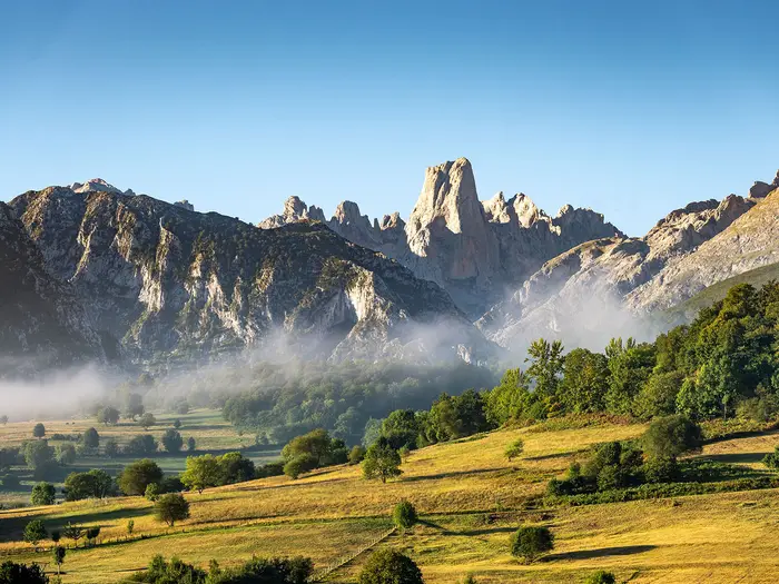
Image by Neissl The GR71 is a quiet east-to-west traverse from Bárcena de Pie de Concha to Sotres, crossing the wooded Saja and Nansa country before reaching the limestone edge of the Picos de Europa. Despite the common “Picos” label, this is first and foremost a Saja Reserve walk: forest, river valleys, summer pastures, shepherds’ tracks and small Cantabrian villages.
Its appeal is the old-fashioned village-to-village rhythm. Each stage ends somewhere with beds and a bar, from Bárcena Mayor and Tudanca to Potes, Bejes and finally high Sotres, but services are small-scale and need planning.
The walking is not technically difficult, with no climbing or exposed mountaineering ground, but it is not a route for beginners relying on paint marks. The GR71 is officially decommissioned, poorly waymarked and often lonely, so confident navigation with maps and a downloaded GPS track is essential.
The hardest day is the Pejanda to Cahecho stage over Collado de las Invernaillas, the route’s high point at roughly 1,570–1,580 m below Peña Sagra. Snow and fog can make the higher passes and the final approach to Sotres serious outside the main walking season.
This guide covers stages, days, accommodation, food, transport, terrain and the common mistakes to avoid.
Stage-by-Stage Guide
The GR71 is best treated as an eight-day village-to-village traverse, not as a waymarked trail that can be followed casually. The red-and-white GR markings are unreliable because the route is decommissioned, so every stage below assumes you are carrying IGN/SGE mapping and a downloaded GPS track, with enough food and water for the day.
Distances vary between official figures and GPS tracks. Use the stage distances below as planning distances, then check your exact track before booking accommodation or arranging transport.
Stage 1: Bárcena de Pie de Concha to Bárcena Mayor — approx. 18 km
The opening stage leaves the Besaya valley at Bárcena de Pie de Concha and heads west into the Saja-Besaya country. Expect a steady transition from valley settlement into quieter forest and upland terrain, with a mix of dirt paths, old tracks, lanes and shaded woodland sections.
This is the first introduction to the character of the route: beech and oak forest, rural Cantabrian valleys and little sense of a busy long-distance trail. The stage finishes in Bárcena Mayor, one of the key highlights of the GR71, with cobbled streets, stone-and-wood houses and a setting on the río Argoza inside the Saja-Besaya Natural Park.
Carry food and water from the start, as intermediate services should not be assumed. Bárcena Mayor has bars and lodging, but beds in small mountain villages are limited and should be booked ahead.
Access to Bárcena de Pie de Concha must be planned separately; Reinosa is the nearest larger town, around 20 km away. Road access exists at both ends, but public transport and taxi options should be checked before travelling.
Navigation matters from day one. Forest tracks, old markings and local path junctions can be confusing, especially in mist or after rain. Do not rely on painted GR flashes to make route decisions.
Stage 2: Bárcena Mayor to Saja — approx. 11 km
This is one of the shorter stages, but it should not be treated as a rest day if visibility is poor or the waymarking is missing. The route continues through the Saja-Besaya landscape, with woodland, pastoral ground and local tracks between small settlements.
The line passes near Los Tojos before reaching Saja. The walking is generally easy-to-medium rather than technical, but the quietness of the area means there may be few other walkers to ask if a junction is unclear.
Do not assume reliable food or drink between Bárcena Mayor and Saja. Start with enough supplies for the day and use the bar and lodging at Saja at the end of the stage.
Saja is a small stage-end village, so accommodation should be reserved in advance. Road access is by local roads, but public transport cannot be assumed; this should be checked before travelling.
The main navigation issue is following the correct minor tracks through wooded and rural terrain. In wet conditions, shaded forest paths can be muddy and slower than the distance suggests.
Stage 3: Saja to Tudanca — approx. 18 km
Stage 3 is a longer traverse from Saja towards the upper Nansa valley and the historic village of Tudanca. The terrain remains typical of the Saja Reserve: forest paths, shepherds’ tracks, lanes, valley sections and open pastoral ground.
Tudanca is the main landmark of the day. It is a Historic-Artistic village associated with the Casona de Tudanca house-museum and the native Tudanca cattle breed, making it one of the most distinctive overnight stops on the route.
Carry a full day’s food and water unless current services have been checked in advance. Streams and rivers in the valleys should not be treated as guaranteed drinking water without proper treatment.
Tudanca has bars and lodging, but capacity is limited compared with Potes later in the route. Book ahead, particularly in summer and at weekends.
Road access is possible at the stage ends, but this is not a route with simple walk-on transport every day. Any bus, taxi or pick-up plan should be arranged and checked before travelling.
Navigation can be awkward where forest tracks and rural lanes intersect. Fog can make the open sections harder to read, and old GR marks should be treated as supporting information only, not as proof of the correct line.
Stage 4: Tudanca to Pejanda — approx. 13 km
This stage links Tudanca with Pejanda via the Nansa country, passing San Mamés on the way. It is shorter than the preceding day, but still involves quiet rural walking rather than a serviced valley stroll.
Expect a mixture of lanes, village approaches, old tracks and pastoral terrain. The walking remains non-technical, though underfoot conditions can vary sharply between paved village sections, muddy track and rougher shepherding paths.
San Mamés is the main intermediate place named on the route, but services there should not be relied upon unless checked in advance. Carry food and water from Tudanca and plan to resupply at the end of the day.
Pejanda has bars and lodging and is an important overnight stop before the hardest stage of the GR71. Because the next day crosses the route’s highest ground, it is sensible to arrive with time to check weather, snow conditions and the next day’s GPS line.
Road access is by local mountain roads. Public transport options, if needed for a section hike or evacuation plan, should be checked before travelling.
Navigation is important on the approaches between villages and tracks. Livestock may be present in the pastoral areas, so pass calmly, give cattle space and keep gates as found.
Stage 5: Pejanda to Cahecho — approx. 20 km
Stage 5 is the toughest day of the GR71 and the one that most deserves an early start. It crosses the highest ground of the route at Collado de las Invernaillas, around 1,570–1,580 m, below Peña Sagra.
The day combines long climbing, open upland country and steep forested descents. This is the stage where the route feels most committing: distances are longer, services are sparse, and navigation errors can cost significant time.
The main high point is Collado de las Invernaillas. This is not in the Picos de Europa; it lies mid-traverse in the Saja/Nansa uplands and is the real mountain crux of the route.
Luriezo lies near the route before Cahecho, but intermediate services should not be assumed. Carry enough food and water from Pejanda for the full day, and avoid depending on untreated upland water unless properly filtered or treated.
Cahecho has bars and lodging, but it is a small village and accommodation should be booked well in advance. This is not a good stage to finish without a confirmed bed.
Road access at Cahecho is by local mountain roads. Public transport cannot be assumed; this should be checked before travelling, especially if using Cahecho as a section-break point.
Navigation is critical on this stage. Snow or lingering patches can affect Collado de las Invernaillas outside summer, and fog can make the high open ground difficult to follow. Steep wooded descents may be slippery after rain, so poles and secure footwear are useful.
Stage 6: Cahecho to Potes — approx. 8 km
This is the shortest stage and leads from the quieter village setting of Cahecho into Potes, the main service hub of the whole route. Many walkers will use this day for recovery, laundry, food shopping and checking onward accommodation.
The walking is easier in scale than the previous day, with a lower overall commitment and more sense of entering the settled Liébana valley. Expect some tracks, lanes and paved village sections rather than remote high-mountain terrain.
Potes is one of the major highlights of the GR71: the capital of Liébana, a classic gateway to the Picos de Europa, and known for the Torre del Infantado and stone bridges over the Deva and Quiviesa. Santo Toribio de Liébana lies about 3 km away for those with spare time and energy.
Food, drink and accommodation are easiest to arrange in Potes, which is the largest service point on the route. Even so, accommodation should still be booked ahead in busy periods.
Potes is also the most practical place for resupply and transport planning. Current public transport, taxi availability and onward logistics should be checked before travelling.
Navigation is generally less severe than on Stage 5, but the route is still decommissioned and should be followed with map and GPS. Watch for short paved or lane sections near settlements and take care with traffic where the route uses roads.
Stage 7: Potes to Bejes — approx. 14 km
Stage 7 leaves the Liébana hub of Potes and heads back into quieter mountain country towards Bejes. The route begins to feel closer to the Picos de Europa, though the full limestone finale comes on the following day.
Expect a mix of rural tracks, lanes, valley walking and upland approaches. The terrain remains non-technical, but this is again a day where services thin out quickly after leaving Potes.
Potes is the place to start with a full food supply and enough water for the day. Do not assume intermediate bars or shops before Bejes unless they have been checked in advance.
Bejes has bars and lodging, but capacity is limited and should be booked ahead. It is the final overnight stop before the crossing into Asturias and the finish at Sotres.
Road access to Bejes is by mountain road. Any transport plan for joining or leaving the route here should be arranged in advance; public transport should not be assumed.
Navigation can be awkward where local tracks and lanes branch away from the intended line. In poor visibility, keep checking the GPS rather than following old waymarks or the most obvious track.
Stage 8: Bejes to Sotres — approx. 17 km
The final stage climbs from Bejes via El Jito de Escarandi to Sotres, crossing from Cantabria into Asturias. This is where the GR71 finally reaches the limestone fringe of the Picos de Europa and delivers its high-mountain finish.
The walking is still not technical climbing, but it is a serious mountain stage in bad weather. Expect open upland ground, mountain tracks and the possibility of fog, wind or lingering snow outside the main summer season.
El Jito de Escarandi is the key feature of the day before the route continues to Sotres. The finish is one of the highest villages in Asturias, with the feel of a true Picos de Europa mountain settlement after a traverse that has been mostly through the Saja Reserve and Liébana country.
Carry food and water from Bejes, as services between Bejes and Sotres should not be assumed. Sotres has bars and lodging, but accommodation is limited and should be reserved before setting out.
Sotres is remote and reached by mountain road via Arenas de Cabrales. Exit transport must be planned separately; taxis, lifts or public transport connections should be checked before travelling.
Navigation is especially important in fog or snow on the approach to Sotres. The old GR71 markings are unreliable, and in poor weather the safest plan is to follow a prepared GPS track backed up by paper mapping and a realistic willingness to wait out bad conditions.
Recommended Itinerary
Distances on the GR71 are approximate: the official route figure is 127 km, while aggregated GPS tracks for the eight stages are closer to about 118 km. Use the figures below for planning, but check mapping and your downloaded GPS track before booking tight transport or accommodation.
Standard 8-day itinerary
This is the most practical schedule because each stage ends in a village with beds and a bar. It also avoids forcing long, poorly waymarked sections into oversized days.
| Day | From | To | Approx. distance | Why this stage makes sense | Services/accommodation notes |
|---|---|---|---|---|---|
| 1 | Bárcena de Pie de Concha | Bárcena Mayor | 18 km | A full first day from the Besaya valley into the Saja-Besaya country. Starting the traverse here gives enough distance to settle into the route without immediately committing to the highest ground. | Bárcena Mayor has lodging and a bar, but beds in small mountain villages are limited. Book ahead, especially in holiday periods. |
| 2 | Bárcena Mayor | Saja | 11 km | A shorter stage after the opening day, useful on a route where navigation cannot be left to waymarks. It keeps the itinerary aligned with the established village-to-village structure. | Saja is a small overnight stop with limited services. Do not assume late food or spare rooms without checking in advance. |
| 3 | Saja | Tudanca | 18 km | A more substantial traverse through the Saja/Nansa country, linking two key valleys. This is a proper walking day rather than a transfer stage, so allow time for navigation checks. | Tudanca is a historic village in the upper Nansa valley with rural accommodation and bar services. Book before arrival. |
| 4 | Tudanca | Pejanda | 13 km | A moderate day that positions you well for the hardest stage over the high ground below Peña Sagra. It is better treated as a set-up day than combined with Stage 5. | Pejanda has village accommodation and bar services, but capacity is limited. Confirm dinner and breakfast arrangements when booking. |
| 5 | Pejanda | Cahecho | 20 km | The key mountain stage of the GR71. It crosses the Collado de las Invernaillas, roughly 1,570–1,580 m, the highest point of the whole route, and includes long climbs and steep forested descents. | Cahecho is a small settlement with limited rural lodging. This is the stage where an early start, reliable GPS track and clear weather matter most. |
| 6 | Cahecho | Potes | 8 km | A deliberately short recovery and resupply day after the high stage. It also brings the route into Potes, the main service hub of the walk. | Potes has the widest choice of accommodation, food and services on the itinerary. It is the best place for an extra night, laundry, resupply or weather buffer. |
| 7 | Potes | Bejes | 14 km | A manageable stage leaving the Liébana hub and moving towards the Picos fringe. Keeping this as a separate day avoids overloading the final approach to Sotres. | Bejes has village lodging and bar services, but beds are limited. Book ahead and check meal availability. |
| 8 | Bejes | Sotres | 17 km | The final stage crosses from Cantabria into Asturias and climbs via El Jito de Escarandi to Sotres. This is where the route finally enters the limestone high-mountain setting associated with the Picos de Europa. | Sotres is remote and reached by mountain road via Arenas de Cabrales. Arrange onward transport before walking the final stage; this should be checked before travelling. |
Slower variant: 9–10 calendar days
A slower schedule is best created by adding buffer nights rather than trying to invent extra stage breaks. The stage structure already uses the practical overnight villages, and some intervening sections should not be assumed to have reliable services.
The most useful slower option is to keep the same eight walking days and add an extra night in Potes before continuing to Bejes and Sotres. This suits walkers who want a rest, need to resupply, or want a weather margin before the final Picos approach.
A second buffer night can be added before the start or after the finish, depending on transport. Access to Bárcena de Pie de Concha and onward travel from Sotres are self-arranged, so current bus, taxi and lodging options should be checked before travelling.
Faster variant: 7 days only for strong, well-organised walkers
A seven-day schedule is possible in principle by combining Cahecho → Potes and Potes → Bejes into one longer Cahecho → Bejes day of about 22 km. This uses the short 8 km Cahecho → Potes stage as the only obvious place to compress the itinerary without combining two major mountain days.
This faster option suits very fit walkers who are already confident with GPS navigation, have accommodation fixed in Bejes, and do not need time in Potes for resupply or recovery. It is a poor choice if weather is unstable, if arriving late from Cahecho, or if relying on waymarks.
A six-day itinerary is not recommended as a default. It would require combining longer stages on a decommissioned and poorly waymarked route, increasing the risk of late finishes, missed meals and navigation errors.
Planning the Route
How many days to allow
Plan the GR71 as an 8-day village-to-village traverse. The stage pattern is not arbitrary: each day finishes in a settlement with lodging and a bar, and the small villages are the natural planning units for the route.
Trying to walk it faster is usually a poor trade-off. The underfoot terrain is not technical, but the route is officially decommissioned and poorly waymarked, so long days leave less margin for navigation errors, fog, heat, or delays on faint shepherds’ tracks.
A slower schedule can work, but only where accommodation and transport allow it. There are no huts or serviced intermediate trail stops to assume between the named stage villages, so adding extra nights normally means arranging a rural stay, taxi transfer, or rest day rather than simply stopping halfway along the trail.
Natural stage structure
The standard itinerary is the practical one for most walkers:
| Stage | Route | Planning notes |
|---|---|---|
| 1 | Bárcena de Pie de Concha → Bárcena Mayor | Start with a full day from the Besaya valley into the Saja-Besaya country. Make sure the first night in Bárcena Mayor is booked before setting off. |
| 2 | Bárcena Mayor → Saja | A shorter day, but still dependent on village accommodation and food at the end. Do not treat it as a casual waymarked stroll. |
| 3 | Saja → Tudanca | A longer crossing into the upper Nansa valley. Carry enough food and water for the walking day. |
| 4 | Tudanca → Pejanda | Moderate in distance, with accommodation again dictating the finish. |
| 5 | Pejanda → Cahecho | The key mountain day: the route reaches Collado de las Invernaillas, roughly 1,570–1,580 m, below Peña Sagra. Give this stage an early start and a good-weather window. |
| 6 | Cahecho → Potes | The shortest stage and the easiest place to build in recovery, laundry, resupply and contingency time. Potes is the main service hub on the route. |
| 7 | Potes → Bejes | The route leaves the Liébana hub and returns to a smaller mountain-village pattern. Book Bejes accommodation ahead. |
| 8 | Bejes → Sotres | The final stage crosses into Asturias via the Picos fringe, climbing towards Sotres. Snow and fog can be a serious issue outside settled summer conditions. |
The short Cahecho → Potes stage is the obvious place to absorb fatigue or poor weather. It is also useful before the final two stages, because Potes has more services than the smaller villages before and after it.
Fast, slow or standard pace?
The standard 8-day pace is the best fit for this trail. It matches the available village stops, keeps the longest mountain stages manageable, and reduces the temptation to press on in poor visibility.
Combining stages is possible only for strong walkers who have checked accommodation, transport and daylight carefully. In practice, the uneven stage lengths make this awkward: Cahecho → Potes is short, but combining it with the following day would create a much longer day and remove the main resupply opportunity.
A rest or buffer day is sensible if walking outside high summer, if relying on public transport, or if accommodation availability forces a non-standard itinerary. The best candidate for that is Potes, because it is the largest service centre on the route.
Shortening, extending and section hiking
The GR71 is not especially easy to shorten on foot. It crosses quiet upland and forest country, and many stage ends are small villages rather than transport hubs.
Section hiking is possible in principle because the route is already divided by settlements. The practical issue is access: Bárcena de Pie de Concha, Sotres and the intermediate villages require self-arranged transport, and current bus or taxi options should be checked before travelling.
Potes is the most logical break point for a split itinerary, as it is the main hub in Liébana and sits before the final approach towards Bejes and Sotres. Any plan to start, finish or pause there should still be built around current transport and lodging availability, not assumed connections.
Extending the walk into the Picos de Europa should be planned as a separate mountain itinerary. The GR71 itself only reaches the Picos fringe at the end; it is primarily a Saja Reserve and Saja-Besaya traverse, not a full Picos high-route.
Accommodation planning
Book the small-village nights before committing to travel dates. The route depends on rural guesthouses, small hostels and hotels rather than mountain huts, and beds can be limited in places such as Saja, Tudanca, Pejanda, Cahecho, Bejes and Sotres.
Do not assume that every village has multiple fall-back options on the day. If one night is unavailable, the whole itinerary may need adjusting because there are few obvious intermediate stops.
Potes is the one place where the logistics are easier. It is the best point for a rest night, resupply, checking weather, replacing minor kit and re-setting the plan before the final two stages.
Food and water
Each stage ends in a village with a bar and lodging, but daytime facilities between stage ends should not be assumed. Carry lunch and snacks for each day before leaving the overnight village, especially on the longer Saja → Tudanca, Pejanda → Cahecho and Bejes → Sotres stages.
Water planning should be conservative. The route passes through river valleys and mountain country, but a safe drinking-water source should not be assumed at the right point in the day; carry enough from the village and treat any untreated natural water before drinking.
Use Potes as the main resupply stop. Smaller villages may cover dinner and breakfast through your accommodation or local bar, but stock and opening hours can vary; this should be checked when booking.
Navigation planning
Navigation is the central planning issue on the GR71. The trail is officially decommissioned, and old red-and-white GR flashes are unreliable.
Carry a downloaded GPS track and offline mapping, and know how to use both without mobile signal. IGN/SGE 1:50,000 mapping is the appropriate paper-map backup for the terrain.
Do not plan the route as if it were a maintained, waymarked GR. Fog, forest junctions, old droving tracks and open upland passes can all make progress slow if the line is unclear.
Weather and seasonal timing
The best planning window is late spring, summer and early autumn, roughly May to October. Outside that, snow and poor visibility can affect the higher crossings, especially Collado de las Invernaillas and the final approach to Sotres.
Fog is a particular concern because the route is poorly marked. If the forecast is marginal, the Pejanda → Cahecho and Bejes → Sotres stages deserve the most caution.
Build the schedule so that a bad-weather delay is possible. On this route, a single missed village booking can create a bigger logistical problem than on a busier, hut-based trail.
Transport and permits
Transport is self-arranged at both ends. Bárcena de Pie de Concha lies in the Besaya valley near the Santander–Reinosa–Palencia corridor, while Sotres is a remote mountain village reached by road via Arenas de Cabrales; current access and exit options should be checked before travelling.
There is no railhead at either end. If using buses, taxis or a lift, plan those connections before fixing accommodation dates, especially for the departure from Sotres.
There is no hut-booking or route-permit system to structure the walk around. The route passes through protected and hunting-reserve landscapes, so any seasonal access notices, forestry work or local restrictions should be checked locally before setting off.
Towns, Villages and Overnight Stops
The GR71 is a village-to-village walk rather than a hut route. The standard eight-stage itinerary finishes each day in a settlement with beds and a bar, but the smaller mountain villages have limited capacity and should be booked ahead, especially in summer, at weekends and during local holiday periods.
Do not rely on finding a shop every day. Potes is the main service hub on the route; elsewhere, plan around bars, pre-booked meals at accommodation and food carried from the previous stop. Current opening days, meal times and transport links should be checked before travelling.
Bárcena de Pie de Concha
Bárcena de Pie de Concha is the eastern trailhead in the Besaya valley, where the GR71 / Sendero de la Reserva de Saja heads west towards the Saja country. It is the practical starting point for Stage 1 to Bárcena Mayor.
This is a place to arrive prepared rather than a major provisioning base. Reinosa, around 20 km away, is the nearest larger town named for the start area, so last-minute food, cash and transport arrangements are best sorted before reaching the village unless current local services have been checked.
Transport to the start is self-arranged. The Besaya valley lies on the Santander–Reinosa–Palencia corridor, but current public-transport options to the trailhead are not detailed here and should be checked before travelling.
Bárcena Mayor
Bárcena Mayor is the first overnight stop, reached after the opening stage from Bárcena de Pie de Concha. It sits on the río Argoza inside the Saja-Besaya Natural Park and is one of the most important villages on the route.
It is a good and logical place to stop: the official itinerary is built around ending Stage 1 here, and the village has lodging and bars. Accommodation is still limited compared with a town, so book in advance rather than arriving without a reservation.
Hikers stop here not only for logistics but because it is one of the best-preserved mountain villages in Cantabria, with cobbled lanes and stone-and-wood houses. It is also the point where the walk begins to feel properly embedded in the Saja Reserve landscape.
Los Tojos
Los Tojos is listed as near the route between Bárcena Mayor and Saja rather than as an official stage end. It may be useful as a local reference point when checking maps, accommodation options or road access in this part of the Saja-Besaya area.
Do not plan around Los Tojos as a guaranteed GR71 overnight unless a specific bed, meal and onward line of walking have been arranged. Current accommodation, food and transport options should be checked before travelling.
Saja
Saja is the second overnight stop, at the end of the short Stage 2 from Bárcena Mayor. It is a small mountain settlement in the Saja Reserve country, making it a practical base before the longer Stage 3 to Tudanca.
The brief for the route identifies Saja as having lodging and a bar, but capacity should be treated as limited. Book ahead and check whether evening meals or breakfast are available where you are staying, as independent food options may be sparse.
This is not a place to assume full services. Carry enough food for the next stage unless current shop and bar opening times have been checked.
Tudanca
Tudanca is the Stage 3 overnight stop after the walk from Saja, and one of the key villages of the upper Nansa valley. It is a natural place to pause before the Stage 4 crossing to Pejanda.
The village has lodging and a bar for walkers on the standard itinerary, but beds should be reserved in advance. As with the other small villages, check meal arrangements directly with accommodation rather than assuming a choice of evening food.
Tudanca is a Historic-Artistic village associated with the Casona de Tudanca house-museum and the Tudanca cattle breed. For hikers, its main value is practical: it breaks the traverse at the right point and gives access to the next section through Nansa and Saja upland country.
San Mamés
San Mamés is listed on the route sequence between Tudanca and Pejanda, but it is not one of the standard GR71 overnight stops in the eight-day itinerary. Treat it as an en-route village or local reference point unless accommodation has been specifically booked there.
It may be useful when checking maps, road access or escape options, but no firm public-transport or service details are available here. This should be checked before travelling.
Pejanda
Pejanda is the overnight stop at the end of Stage 4 from Tudanca and the starting point for the toughest day of the route, Stage 5 to Cahecho. This makes it one of the most important booking points on the GR71.
The next stage crosses the high Saja/Nansa country below Peña Sagra and reaches Collado de las Invernaillas, the highest point of the whole trail at roughly 1,570–1,580 m. For that reason, Pejanda is a place to arrive with food, water planning, a charged GPS device and a clear weather forecast.
Accommodation and a bar are part of the route’s village-stop pattern, but capacity should be assumed to be limited. Check food availability carefully, because an early start is sensible for the Pejanda to Cahecho stage.
Luriezo
Luriezo is listed as near the route before Cahecho. It may be relevant for navigation, accommodation searches or local access, but it is not the standard stage end.
Do not rely on Luriezo for services unless they have been arranged in advance. Current beds, meals and transport links should be checked before travelling.
Cahecho
Cahecho is the overnight stop after the long and demanding Stage 5 from Pejanda. It is a welcome halt after the route’s highest upland crossing and the associated long climbs and steep forested descents.
This is a good place to stop because the following day to Potes is the shortest stage of the standard itinerary. That shorter Stage 6 gives useful flexibility after the hardest day of the traverse, particularly if weather, navigation or fatigue have slowed progress over Collado de las Invernaillas.
Cahecho has lodging and a bar, but it is still a small mountain village. Book ahead, check meal times, and avoid depending on unverified shop options.
Potes
Potes is the main service hub of the GR71 and the most useful resupply and recovery stop on the route. It comes at the end of the short Stage 6 from Cahecho, before the trail turns towards Bejes and the final approach to the Picos de Europa.
This is the best place on the itinerary for a wider choice of accommodation, food and practical services. If any kit, food or booking issue needs fixing mid-walk, Potes is the place to build in time for it.
Potes is the capital of the Liébana valley and a classic Picos gateway, with stone bridges over the Deva and Quiviesa and the Torre del Infantado. Santo Toribio de Liébana lies about 3 km away, which may be relevant if adding time off-route.
Transport options are more plausible here than in the smaller villages, but exact bus, taxi or onward travel details are not specified in this guide section. This should be checked before travelling.
Bejes
Bejes is the Stage 7 overnight stop after the walk from Potes and the last night before the final crossing to Sotres. It is a strategic stop because Stage 8 climbs from Bejes via El Jito de Escarandi into the limestone edge of the Picos de Europa.
Accommodation and a bar are available as part of the standard stage structure, but beds should be booked ahead. Check evening meal and breakfast arrangements, as the final stage is exposed to mountain weather and benefits from an organised early start.
Bejes is not a place to improvise logistics. Make sure the onward route, forecast and any snow or fog risk on the Sotres approach have been checked before leaving.
Sotres
Sotres is the western trailhead and final overnight stop if staying at the end of the walk. It is a high stone village in Asturias on the eastern edge of the Picos de Europa, reached by the final stage from Bejes.
It is a fitting finish but a remote one. The village is reached by mountain road via Arenas de Cabrales, and exit transport must be arranged separately; do not assume easy onward travel without checking current services or booking a taxi/lift in advance.
Sotres has lodging and a bar for the end of the GR71, but availability can be tight in popular mountain periods. Book ahead if staying overnight, and confirm onward transport before starting the final stage from Bejes.
Getting to the Start
By train
Bárcena de Pie de Concha sits in the Besaya valley on the Santander–Reinosa–Palencia transport corridor, but there is no rail access to rely on at the trailhead itself. Reinosa is the nearest larger town, about 20 km from Bárcena de Pie de Concha, and is the most practical place to plan around if arriving by public transport.
Use current rail timetables for the Santander–Reinosa–Palencia corridor, then arrange the final leg to Bárcena de Pie de Concha by local bus, taxi or lift. This should be checked before travelling, especially if aiming to start walking the same day.
By bus
Bus access needs careful checking. The route is self-arranged and no reliable through-service to the start should be assumed without checking current timetables.
The sensible planning pattern is to get to Santander, Reinosa or another town on the Besaya valley corridor, then make a local connection to Bárcena de Pie de Concha. If bus times are sparse or do not line up with accommodation check-in or the first walking day to Bárcena Mayor, budget for a taxi for the last 20 km or so from Reinosa. This should be checked before travelling.
By car
Driving to Bárcena de Pie de Concha is straightforward in principle because the village lies in the Besaya valley, about 20 km from Reinosa. The complication is that the GR71 is a point-to-point traverse ending far away in Sotres, a remote Picos de Europa village reached by mountain road via Arenas de Cabrales.
Leaving a car at the start only works if there is a firm plan to return from Sotres after the hike, which may mean a long taxi transfer, a lift, or a multi-leg public-transport journey. Long-stay parking arrangements in Bárcena de Pie de Concha should be checked before travelling; do not assume there is suitable multi-day parking in the village.
For many walkers, the cleaner option is to arrive at the start by public transport plus taxi, then arrange the exit from Sotres separately at the end of the walk.
From the nearest airport
There is no direct airport-to-trailhead access to plan around. Fly-in hikers should choose an airport with onward transport to the Santander–Reinosa–Palencia corridor, then continue towards Reinosa and arrange the final connection to Bárcena de Pie de Concha.
Allow a buffer day if arriving by air. A delayed flight or missed connection can easily compromise the first stage, and the GR71 is not a route where late starts are ideal: waymarking is unreliable and navigation should be done in good daylight. This should be checked before travelling.
Where to stay before starting
The most practical pre-hike plan is to sleep in or near Bárcena de Pie de Concha the night before starting, if a suitable bed is available. That gives a clean start for Stage 1 to Bárcena Mayor and avoids relying on an early transfer.
If accommodation at the start is unavailable, Reinosa is the nearest larger town, about 20 km away, and makes a logical fallback base before taking a taxi or local connection to Bárcena de Pie de Concha in the morning. Current lodging and transfer options should be checked before booking.
Because the GR71 is officially decommissioned and poorly waymarked, do not treat the first morning as a casual waymarked-trail start. Have the GPS track downloaded, maps ready, and the first stage navigation sorted before leaving the village.
Getting Home from the Finish
Sotres is a remote mountain-road finish, not a transport hub. Plan the exit before starting the GR71, especially if you need to reach a city, airport or rail connection the same day.
By train
There is no rail station at Sotres. The finish should be treated as road-only: the first step is getting out by road from Sotres, via Arenas de Cabrales, before connecting with any onward rail journey.
The nearest practical rail option depends on current road connections and your onward destination. This should be checked before travelling, and rail tickets should not be booked on a tight same-day connection from Sotres unless the road transfer is already arranged.
By bus
Do not assume frequent buses from Sotres. Public-transport plans from the finish are timetable-dependent and should be checked before travelling.
Road access from Sotres is via Arenas de Cabrales, so most bus-based exits will need to be planned around first reaching Arenas de Cabrales, then making onward connections from there. If finishing late in the day, it is safer to stay in Sotres or have a pre-booked taxi rather than relying on an unconfirmed bus.
By car/taxi
A taxi or pre-arranged lift is the most practical way to leave Sotres on a fixed schedule. Arrange it before the final stage from Bejes, with a clear pick-up point and a realistic finish time; the final day is a proper mountain stage, so allow margin for weather, navigation and slow progress.
If using a private car, remember that this is a point-to-point traverse ending far from Bárcena de Pie de Concha. Vehicle shuttles, taxi transfers or recovery of a car from the start need separate planning and current local availability should be checked before travelling.
From the nearest airport
There is no direct airport access from Sotres. Any airport departure should be planned around a road transfer out via Arenas de Cabrales, followed by onward public transport or a longer taxi transfer.
Avoid booking an early or tight flight on the day you finish in Sotres. If a flight connection matters, either finish a day earlier, book a reliable transfer in advance, or stay overnight at the finish and travel the next morning.
Where to stay at the finish
Sotres has beds and a bar, but it is a small high mountain village with limited capacity. Book accommodation ahead, especially in the main walking season and at weekends.
Staying overnight in Sotres is often the simplest option after the final stage from Bejes. It removes the pressure of racing for uncertain onward transport and gives a safer buffer if fog, snow patches outside summer, or difficult navigation slow the crossing into the Picos de Europa fringe.
Which Direction Should You Walk?
The GR71 is best treated as an east-to-west traverse: Bárcena de Pie de Concha → Bárcena Mayor → Saja → Tudanca → Pejanda → Cahecho → Potes → Bejes → Sotres. This is the standard order of the route and the simplest direction to match with the eight-stage structure.
The reverse direction is possible, but it is less natural for planning. The route is officially decommissioned and poorly waymarked, so reverse walkers should not expect reliable red-and-white GR markings to compensate for having stage notes, GPS tracks or village logistics in the opposite order.
East to west: Bárcena de Pie de Concha to Sotres
This is the recommended direction for most walkers. It gives the route its strongest progression: starting in the Besaya valley, crossing the forests and uplands of the Saja-Besaya country, passing through the Liébana area and Potes, then finishing in the limestone mountain setting of the Picos de Europa at Sotres.
It also places the route’s psychological finish in the right place. Sotres is a high, remote mountain village, and reaching it after the climb from Bejes via El Jito de Escarandi feels like a proper end point rather than an opening move.
The main drawback is transport at the finish. Sotres is remote and reached by mountain road via Arenas de Cabrales, so onward travel should be arranged before starting the walk. Public-transport details and taxi availability should be checked before travelling.
Accommodation flow also works well in this direction. Potes, the main service hub of the route, comes late enough to be useful for a reset before the final two stages to Bejes and Sotres, while the smaller villages before and after it still need advance booking because beds are limited.
West to east: Sotres to Bárcena de Pie de Concha
Walking west-to-east can make sense if transport planning is easier when the remote Sotres transfer is dealt with at the beginning rather than at the end. Finishing in the Besaya valley may also be more convenient for some onward journeys, although current services should be checked before travelling.
The trade-off is that the route begins with one of its most dramatic sections and then moves away from the Picos de Europa towards the Saja forests and lower valleys. That is not a problem for the walking itself, but it makes the overall scenery progression feel less satisfying.
Reverse walkers also put the Bejes–Sotres mountain section at the start, when packs are usually heaviest and legs are not yet settled into the rhythm of the route. Later, the high ground around Collado de las Invernaillas still has to be crossed; reversing the route does not avoid the main upland challenge.
Are the climbs easier one way?
There is no clear easy direction. The GR71 crosses the same passes and valleys whichever way it is walked, including the high point at Collado de las Invernaillas on the Pejanda–Cahecho stage and the final high approach to Sotres when walked east-to-west.
East-to-west gives a more natural build-up, with the Picos approach saved for the end. West-to-east may turn some late climbs into descents, but it also makes other steep descents into climbs, including sections around the Saja/Nansa uplands. Choose direction for logistics and route progression, not in the hope of making the trail significantly easier.
Weather and navigation considerations
There is no reliable direction advantage for weather. Fog, snow and poor visibility matter more than wind direction, especially around Collado de las Invernaillas and on the Bejes–Sotres stage.
Because the route is decommissioned and waymarks are unreliable, direction should not be chosen on the assumption that markings will be easier to follow one way. Carry IGN/SGE mapping and a downloaded GPS track, and be prepared to navigate independently in either direction.
Recommendation
Walk the GR71 east to west, from Bárcena de Pie de Concha to Sotres, unless a specific transport plan makes the reverse direction clearly easier. The standard direction fits the official stage order, gives the best landscape progression, places Potes well as a late-route service hub, and finishes with the strongest mountain ending at Sotres.
If walking east-to-west, organise the exit from Sotres before setting off. If walking west-to-east, organise access to Sotres first and be prepared for a demanding opening section.
Accommodation Along the Route
The GR71 works as a village-to-village walk rather than a hut trek. Each official stage ends in a settlement with at least some form of lodging and a bar, but the choice is very uneven: most overnight stops are small mountain villages with limited beds, while Potes is the main service hub.
Book the whole route before setting off, especially in summer, at weekends and around local holiday periods. The smaller stops — Saja, Tudanca, Pejanda, Cahecho, Bejes and Sotres — are not places where a walker should rely on finding a spare room on arrival.
Best overnight pattern
The standard eight-stage itinerary is also the most practical accommodation plan:
| Place | Accommodation level | Best for | Notes |
|---|---|---|---|
| Bárcena de Pie de Concha | Limited | Night before starting, if staying at the trailhead | Small Besaya valley village; lodging availability should be checked before travelling. Reinosa is the nearest larger town, about 20 km away, if a wider pre-walk base is needed. |
| Bárcena Mayor | Limited | End of Stage 1 | Historic mountain village in the Saja-Besaya Natural Park. It is an obvious first overnight stop, so book ahead rather than relying on walk-up rooms. |
| Saja | Limited | End of Stage 2 | Small village stop after a shorter stage. Suitable for keeping the official itinerary intact, but with limited choice. |
| Tudanca | Limited | End of Stage 3 | Key overnight in the upper Nansa valley. Beds should be reserved in advance because there are few alternatives nearby on foot. |
| Pejanda | Limited | End of Stage 4 | Important staging point before the hardest day over Collado de las Invernaillas. Do not leave this booking uncertain. |
| Cahecho | Limited | End of Stage 5 | Small Liébana-side village after the longest and highest stage. Advance booking is strongly advised. |
| Potes | Good | Restocking, rest night, shorter-stage reset | The strongest accommodation and services base on the GR71. Useful if adding a rest day, adjusting the schedule or meeting transport. |
| Bejes | Limited | End of Stage 7 | Mountain village stop before the final crossing to Sotres. Book ahead, particularly outside the main summer walking period when services may vary. |
| Sotres | Limited | Finish night, Picos onward plans | Remote high village reached by mountain road via Arenas de Cabrales. Accommodation exists, but exit transport and beds should be arranged before committing to the final stage. |
Where accommodation is easiest
Potes is the only substantial accommodation hub on the route. It is the natural place to pause, wash kit, restock and recover after the Saja Reserve stages before continuing towards Bejes and Sotres.
Bárcena de Pie de Concha or nearby Reinosa are the practical places to organise the night before the walk. The start has no rail issue within the brief for accommodation planning, but onward access and the first night’s logistics should still be arranged separately.
Where accommodation is tightest
The small mountain villages are the constraint on this walk. Bárcena Mayor, Saja, Tudanca, Pejanda, Cahecho, Bejes and Sotres all suit an inn-to-inn itinerary, but they do not offer the depth of choice found in larger trail towns.
The most important bookings are Pejanda and Cahecho because they sit either side of the toughest stage, including the high ground around Collado de las Invernaillas. If either night is unavailable, the day cannot easily be shortened without arranging road transport.
Does the GR71 suit inn-to-inn walkers?
Yes, provided accommodation is booked in advance and expectations are realistic. This is not a polished hut-to-hut route with staffed mountain refuges at regular intervals; it is a rural village traverse using casas rurales, small hostels, hotels and village bars where available.
Carry enough food for the walking day rather than assuming cafés or shops between overnight stops. Potes is the dependable reset point; elsewhere, services are village-scale and may vary by season and day of the week.
Luggage transfer and taxi options
There is no route-wide luggage-transfer system to rely on for the GR71. Private taxis or pre-arranged lifts may help with awkward accommodation gaps, missed bookings or a forced exit, but these should be organised locally and checked before travelling.
Taxi transfers are most useful around the larger access points and service hubs rather than in the lonelier Saja stages. Do not plan the walk around last-minute transfers from the smaller villages unless they have been arranged in advance.
Camping and Wild Camping
The GR71 is best planned as a village-to-village walk rather than a camping route. Each stage ends in a settlement with lodging and a bar, while the trail itself crosses protected forest, hunting-reserve country, private grazing land and exposed upland passes where informal camping can create legal and practical problems.
No specific campsite on the line of the route is verified for this guide. If camping is essential, check current campsite locations and opening dates before travelling, and do not assume there will be a legal pitch at the end of each stage.
Wild camping: take a conservative approach
Wild-camping rules in Spain vary by autonomous community, municipality, protected area and land ownership. This route passes through Cantabria and finishes in Asturias, crossing the Saja Reserve / Saja-Besaya Natural Park country for most of its length before reaching the edge of the Picos de Europa at Sotres. Local restrictions must be checked before relying on any plan to bivouac or pitch a tent.
The safest planning assumption is: do not wild camp unless explicit local permission has been obtained from the relevant landowner, village authority or protected-area body. This is especially important in forested sections, summer pastures with livestock, hunting-reserve land and the final mountain approach towards Sotres.
Does the GR71 suit camping?
For most hikers, not particularly. The route is already structured around eight village stages — Bárcena Mayor, Saja, Tudanca, Pejanda, Cahecho, Potes, Bejes and Sotres — and beds are the normal way to complete it.
Camping adds weight on a trail where the main challenge is navigation rather than remoteness. The decommissioned waymarking, faint tracks, fog risk and long upland sections make it more sensible to keep packs light and secure accommodation in advance, particularly in the smaller villages where beds are limited.
If you intend to camp
Plan every night before setting off. Do not turn up expecting to pitch behind a village or on open pasture without asking.
Practical options are likely to be limited to:
- using any formal campsite identified independently before travel;
- asking a rural accommodation provider or landowner whether a tent pitch is possible;
- adjusting stages to reach legal camping where available;
- carrying camping gear only as a contingency, not as the primary accommodation plan.
Potes is the main service hub on the route, so it is the most logical place to re-check onward plans, food, fuel and current restrictions. This should be checked before travelling.
Places to avoid pitching
Avoid camping on or near the high passes, including the Collado de las Invernaillas area on the Pejanda to Cahecho stage. It is the highest part of the GR71, exposed to fog and poor weather, and not a sensible place to rely on as an overnight stop.
Also avoid forest interiors, grazing land with cattle, village commons, hunting areas, water sources, and the final approach from Bejes towards Sotres. These are working landscapes and protected mountain environments, not designated backcountry camping zones.
Water and cooking
The route passes through river valleys and villages, and every official stage ends in a settlement where food and drink can usually be planned around bars or lodging. Between villages, do not rely on untreated streams or springs as safe drinking water, particularly in pasture areas used by livestock.
Carry enough water for the full walking day, with extra capacity for the longer and more exposed stages such as Pejanda to Cahecho and Bejes to Sotres. Treat any natural water before drinking.
Open fires should be avoided. In dry periods, forest and mountain fire restrictions may be in force, and stove use may also be restricted locally. Check current rules before travelling and use a stove only where it is permitted and safe.
Leave No Trace on this route
If a legal and permitted camp is arranged, keep impact minimal:
- pitch late and leave early;
- use already-disturbed ground where permission has been granted;
- keep well away from watercourses, livestock and buildings;
- pack out all litter, including food waste and toilet paper;
- bury human waste only where locally acceptable, well away from water and paths;
- never light a fire;
- do not damage stone walls, gates, fences or pasture infrastructure;
- leave gates exactly as found.
The GR71 crosses quiet working mountain country. A low-impact approach is not just good etiquette; it is essential for keeping access relations positive in small villages and protected landscapes.
Food, Water and Resupply
The GR71 is a village-to-village walk, but it is not a route with frequent resupply. Each stage finishes in a settlement with beds and a bar, while Potes is the only larger service hub on the traverse. Outside Potes, plan around small rural villages, limited opening hours and the possibility that a bar or kitchen may not be open when you arrive.
The safest approach is to book accommodation ahead and ask directly about dinner, breakfast and a packed lunch. For most stages, carry lunch and snacks from the start of the day rather than expecting to buy food en route. On the longer and lonelier days — especially Saja to Tudanca, Pejanda to Cahecho and Bejes to Sotres — treat the walking day as self-contained.
Food planning
Do not rely on shops unless they have been checked before travelling. The route passes through small Cantabrian and Asturian mountain villages, and the brief does not support naming any specific village shops, supermarkets or petrol stations on the line of the GR71. Potes is the practical place to reset food supplies before the final two stages.
Rural opening hours can be restrictive, particularly on Sundays, public holidays and outside the main summer season. Bars may open around meal times rather than all day, and accommodation kitchens may require advance notice. This should be checked before travelling.
A sensible food-carrying plan is:
- Daily: breakfast arranged with accommodation where possible, plus carried lunch and snacks.
- Emergency reserve: at least one spare meal or substantial snack, because the route is quiet and poorly waymarked.
- Before leaving Potes: buy enough food for the Potes to Bejes and Bejes to Sotres stages unless meals are confirmed at both stops.
Water planning
Start every stage with full bottles. Potable water points on the trail itself are not specified, so the reliable refill points are accommodation, bars and village taps only where locally marked or offered as drinking water.
The route crosses forest, pasture and upland country where streams or troughs may be encountered, but these should not be treated as safe drinking water without filtration or purification. Livestock is present in the Saja and Nansa uplands, including summer pastures, so untreated surface water is a poor assumption.
For typical conditions, many walkers will want to leave each village with around 2 litres of water, carrying more in hot weather or if moving slowly. On the longer stages and the high ground around Collado de las Invernaillas and the final approach to Sotres, there may be long periods without a dependable refill.
| Section | Food availability | Water availability | Notes |
|---|---|---|---|
| Bárcena de Pie de Concha → Bárcena Mayor | Do not assume meaningful resupply once walking. Arrange food before setting off or carry lunch from the start. | Fill before leaving. Treat any natural water if used. | First stage into the Saja-Besaya country; carry a full day’s supplies. |
| Bárcena Mayor → Saja | Bars and lodging are available at stage villages, but mid-stage food should not be assumed. | Refill at accommodation/bar before departure and again on arrival where available. | Shorter stage, but still plan as a rural mountain walk with limited services. |
| Saja → Tudanca | Food availability between stage villages should be treated as limited. Carry lunch and snacks. | Start with full bottles; potable water on route is not specified. | Longer day through quiet country. Do not depend on villages or bars appearing at convenient times. |
| Tudanca → Pejanda | Arrange breakfast/dinner through accommodation where possible and carry food for the day. | Refill before leaving Tudanca; use only confirmed potable water or filter natural sources. | The route passes through the upper Nansa country, where services are sparse. |
| Pejanda → Cahecho | Very limited on-route resupply should be expected. Carry a full lunch, snacks and an emergency reserve. | Carry enough water for a long, exposed upland stage; natural sources require treatment. | Toughest stage, crossing the high ground around Collado de las Invernaillas below Peña Sagra. Fog or slow navigation can extend the day. |
| Cahecho → Potes | Shorter stage to the main service hub. Carry snacks, but Potes is the best resupply point on the route. | Fill before leaving; refill fully in Potes. | Use Potes to restock for the final two stages and check onward meal arrangements. |
| Potes → Bejes | Buy food in Potes before leaving. Do not rely on resupply before Bejes. | Leave Potes with full bottles. Treat any natural water if used. | Final approach towards the Picos fringe begins; carry lunch even if the distance looks moderate. |
| Bejes → Sotres | Carry food from Bejes or from Potes if Bejes meals/packed lunch are not confirmed. | Start with full bottles; dependable on-route potable water is not specified. | The final stage climbs via El Jito de Escarandi to Sotres. Weather, fog or snow outside summer can make progress slower, so carry extra food and water. |
Terrain, Conditions and Difficulty in Practice
The GR71 is not a technical mountain route, but it is a committing one in practice. The walking is mostly on forest paths, dirt tracks, old shepherding and droving routes, lanes and short paved sections through villages, with no climbing or scrambling required. The difficulty comes from the combination of long quiet stages, repeated climbs and descents, changeable Cantabrian weather and unreliable waymarking on a decommissioned GR.
Treat the route as a self-navigation traverse, not a waymarked holiday trail. Old red-and-white GR marks may still appear, but they are not maintained and should not be used as the primary means of route-finding. A downloaded GPS track plus IGN/SGE mapping is essential, especially in forest, open pasture, fog or snow patches.
Underfoot: forest, tracks, lanes and upland pasture
Much of the route crosses the Saja-Besaya and Saja Reserve country, so expect long wooded sections through beech and oak forest, followed by open pasture and upland passes. Forest paths can be straightforward in dry weather but slower after rain, when leaf litter, mud and steep shaded descents become slippery.
The lower and mid-level walking is generally non-technical: dirt paths, old rural tracks, village lanes and occasional paved approaches into settlements. These sections are easier underfoot than the higher ground, but navigation can still be awkward where tracks split, old waymarks fade or paths enter woodland.
The open upland sections are more exposed to weather. They are not technically difficult, but fog can remove obvious visual references and make a faint shepherds’ track hard to follow. In poor visibility, the route’s decommissioned status matters far more than the gradient.
The final approach towards Sotres brings the route onto the limestone fringe of the Picos de Europa. This is still walking terrain rather than climbing terrain, but it is more mountain-like in feel than much of the Saja traverse, and it should be treated cautiously in snow, fog or wet conditions.
Climbing and descending
The route is often described as moderate, but the effort is greater than the label suggests. The headline ascent figure of around 2,800 m likely understates the accumulated climbing felt across the eight stages; individual stage profiles include substantial gains, with several days involving long climbs and descents rather than simple valley walking.
The hardest day is typically Pejanda to Cahecho. This stage crosses Collado de las Invernaillas, the high point of the whole route at roughly 1,570–1,580 m below Peña Sagra, and includes the biggest sustained upland effort of the traverse. It is also one of the longer stages, so poor visibility or lingering snow can turn a moderate walk into a demanding mountain day.
Bárcena de Pie de Concha to Bárcena Mayor is also a full first day, with a notable amount of ascent before the route settles deeper into the Saja country. Bejes to Sotres is another stage to treat with respect: it climbs into higher mountain terrain via El Jito de Escarandi and finishes in one of the highest villages in Asturias.
Cahecho to Potes is the shortest stage and is likely to feel like the easiest day physically, but it should not be used as a benchmark for the rest of the trail. Most of the route is more remote, more poorly marked and more physically sustained.
Stage-by-stage difficulty notes
| Stage | Practical terrain and difficulty |
|---|---|
| Bárcena de Pie de Concha → Bárcena Mayor | A substantial opening stage from the Besaya valley into Saja-Besaya country. Expect a mix of village exits, tracks, forest and climbing rather than an easy warm-up. |
| Bárcena Mayor → Saja | Shorter distance, but still rural mountain walking through the Saja landscape. Navigation remains important despite the lower mileage. |
| Saja → Tudanca | A longer stage linking valleys and upland country. Expect quiet paths and tracks, with the usual need to manage junctions and faded waymarking. |
| Tudanca → Pejanda | Moderate in distance, moving through Nansa-side mountain villages and rural tracks. Conditions underfoot will depend heavily on recent weather. |
| Pejanda → Cahecho | The toughest stage in practice: longest day, highest pass at Collado de las Invernaillas and sustained ascent/descent below Peña Sagra. Avoid in poor weather unless navigation is confident. |
| Cahecho → Potes | Shortest stage and a useful recovery day into the Liébana hub. Easier logistically, with Potes offering the best services on the route. |
| Potes → Bejes | The route leaves the larger service hub and returns to quieter mountain walking. Expect a more remote feel again after Potes. |
| Bejes → Sotres | A serious final stage into the Picos fringe, climbing via El Jito de Escarandi to Sotres. Snow and fog outside summer can make this much harder than the distance suggests. |
Mud, snow and visibility
The most common condition-related problems are likely to be mud on forest paths, slippery descents after rain, fog on open upland ground and snow on the higher sections outside the main season. This is northern Spain mountain country, not a dry waymarked Camino-style route.
Late spring, summer and early autumn are the realistic walking seasons. Even then, conditions on Collado de las Invernaillas and the Bejes–Sotres stage should be checked before setting out, especially after unsettled weather. Winter and snowy shoulder-season conditions are not suitable for treating this as a normal GR walk.
Fog is a particular issue because the route is poorly marked. In clear weather, many sections are simply pleasant hill and forest walking; in low cloud, the same ground can become slow, uncertain and mentally tiring. Carry enough battery capacity to navigate for a full day without relying on mobile signal.
Livestock and working mountain country
The route passes through summer pastures and traditional livestock country, including areas grazed by Tudanca cattle. Give animals space, keep to established tracks where possible and close any gates encountered. Exact gate, fence and stile arrangements vary on rural routes and should not be assumed in advance.
Dogs, if taken, need close control around livestock and in villages. Any local restrictions should be checked before travelling, particularly because the route crosses protected natural and hunting-reserve landscapes.
What makes it easier — and what makes it harder
The GR71 is easier than many high-mountain treks because it finishes each stage in a village, does not require hut skills and avoids technical climbing. Underfoot, much of it is ordinary walking terrain: paths, tracks, lanes, forest and pasture.
It becomes harder because those same ordinary paths are quiet, poorly signed and sometimes faint. The route is officially decommissioned, so there is no dependable waymarking safety net. A walker who is fit, self-reliant and comfortable navigating in Spanish mountain terrain will find it moderate; a walker expecting continuous GR markings may find it stressful and slow.
Weather and Best Time to Walk
The safest planning window for the GR71 is late spring to early autumn, roughly May to October. Within that, June to September is the most practical period for most walkers: the higher passes are more likely to be clear of snow, village services are more likely to be operating, and there is enough daylight for the longer, more navigationally demanding stages.
This is not a route to treat as a low-level valley walk. The traverse reaches Collado de las Invernaillas at about 1,570–1,580 m on the Pejanda to Cahecho stage, and the final approach from Bejes to Sotres also enters higher mountain country on the edge of the Picos de Europa. Snow, fog and poor visibility are the main weather-related hazards, especially because the GR71 is decommissioned and poorly waymarked.
Best months
| Period | Practical assessment |
|---|---|
| May | Possible in a good year, but residual snow may still affect the higher ground. Fog and wet paths can make navigation harder. Check current snow conditions before committing to the high stages. |
| June | One of the better months: longer daylight and a better chance of clear passes, while avoiding the busiest summer period. Still plan for rain and poor visibility. |
| July–August | Usually the most straightforward period for snow-free walking, but heat can make long climbs tiring, especially on exposed upland sections. Book accommodation ahead in small villages. |
| September | Often a strong choice for experienced walkers: generally still within the viable mountain season, with less pressure on accommodation than high summer. Shorter days mean earlier starts on the longer stages. |
| October | Possible, but increasingly marginal. Shorter daylight, colder mornings, fog and early snow on higher ground can all affect the route. This should be checked before travelling. |
| November–April | Not recommended for a normal thru-hike. Snow and winter conditions can affect the high passes and the Sotres approach, while short daylight and limited services make the route much harder to manage. |
Snow, fog and navigation
The two stages that most need weather caution are Pejanda to Cahecho, which crosses the route’s highest ground below Peña Sagra, and Bejes to Sotres, where the trail climbs towards the limestone fringe of the Picos de Europa. Outside summer, these sections can hold snow or become difficult to follow in fog.
Poor visibility is a particular problem on the GR71 because the former red-and-white GR markings are unreliable. In fog, do not rely on waymarks or vague path traces across open pasture. Carry offline mapping, a downloaded GPS track and paper mapping, and be prepared to wait or retreat if the line ahead is unclear.
Rain, wind and trail surface
Rain is a normal planning consideration in this part of northern Spain. The route uses forest paths, dirt tracks, old shepherds’ ways, lanes and upland pasture, so wet weather can mean muddy woodland sections, slippery descents and slower progress than the stage distance suggests.
Wind exposure is most relevant on the open upland passes and on the final approach to Sotres. Even in the main walking season, pack a waterproof layer and an insulating layer rather than treating the route as a warm-weather stroll.
Heat and daylight
In July and August, heat can be a factor on the longer climbs and on open sections away from the beech and oak forest. Start early on the longer days, especially Pejanda to Cahecho and Bejes to Sotres, and carry enough water between villages.
Daylight is much less forgiving in May and October than in midsummer. Because navigation is the route’s main difficulty, avoid late starts when poor waymarking, fading light and fog could combine into a serious problem.
Accommodation and seasonality
The GR71 is a village-to-village walk, not a hut route, and beds are limited in the smaller settlements. In the main summer period, book ahead because places such as Bárcena Mayor, Saja, Tudanca, Pejanda, Cahecho, Bejes and Sotres have far fewer options than Potes.
Outside the main walking season, some rural accommodation and bars may have reduced opening or close at short notice. This should be checked before travelling, especially if walking in May, October or any winter month.
Is winter realistic?
For most independent walkers, winter is not a realistic season for the full GR71. The combination of snow on higher ground, fog, short daylight, quiet villages, limited services and unreliable waymarking makes the route significantly more serious than its moderate terrain grade suggests.
A winter attempt would require mountain-weather judgement, strong navigation, suitable cold-weather equipment and current local information on snow conditions. For a standard long-distance hike, plan for late spring, summer or early autumn instead.
Safety Notes
The GR71 is not technically difficult, but it is a serious self-reliance route because it is officially decommissioned and poorly waymarked. Treat it as a navigation-led mountain traverse, not as a maintained GR where red-and-white flashes can be followed from village to village.
For emergencies in Spain, call 112. Do not rely on having continuous mobile signal in the Saja-Besaya forests, the upland Saja/Nansa country or on the final approach towards Sotres; carry offline mapping, a downloaded GPS track and enough battery capacity for a full day plus reserve.
Navigation and remoteness
The main safety risk is getting off route in forest, fog or open pasture. Old GR markings may still appear, but they are unreliable and should not be used as the primary navigation method.
Carry IGN/SGE mapping, a GPS track on a phone or GPS device, and a backup power bank. Before leaving each village, check the day’s route, the next reliable escape point and the location of the next accommodation or bar.
The quietest and most committing sections are the middle mountain stages through the Saja and Nansa country, especially around the Pejanda to Cahecho stage over Collado de las Invernaillas. This is the highest point of the route at roughly 1,570–1,580 m and is more exposed to poor visibility and weather than the lower village-to-village walking.
Weather, snow and visibility
Late spring to early autumn is the sensible walking window. Winter and snowy shoulder-season conditions should be avoided on the higher passes and on the final climb towards Sotres.
Fog is a particular hazard because the route is poorly marked. If cloud is down on open upland sections, navigation becomes much slower and a GPS track is essential; be prepared to turn back or wait if the route ahead cannot be followed confidently.
Northern Spain can also change quickly between warm valley conditions and cold, wet upland weather. Pack waterproofs, an insulating layer and sun protection even in summer, and start the longer days early enough to avoid being caught high or in forest in fading light.
Heat, cold and water
The route crosses forest, lanes, valleys and open summer pasture, so exposure varies sharply through the day. In warm weather, carry enough water between villages and do not assume that every stream or fountain is safe to drink without treatment.
Cold is still a realistic risk on the higher ground outside settled summer weather, particularly around Collado de las Invernaillas and the Bejes to Sotres stage. Wet clothing, wind and fog can make these sections feel much colder than the elevation suggests.
Livestock and wildlife
The route passes grazing country, including summer pastures used by Tudanca cattle. Give livestock space, avoid walking between cows and calves, close gates as found and keep food packed away when resting.
The Saja country is also wildlife habitat, including deer, wild boar, chamois, wolves and raptors. Encounters are usually brief and not a planning concern, but walkers should avoid approaching animals or leaving food waste. Because the route crosses a hunting reserve, pay attention to local notices and ask locally about any restrictions or organised hunting activity; this should be checked before travelling, especially outside the main summer walking period.
Roads, lanes and village approaches
Most of the route uses paths, shepherds’ tracks, forest tracks and lanes, with some paved village sections. Where the route uses or crosses roads, walk facing traffic where practical, take extra care on bends and do not assume drivers expect walkers on quiet mountain roads.
The final access and exit points are also remote by road, particularly Sotres. Transport from the finish should be arranged before starting the last stage, rather than relying on finding onward travel on arrival.
Solo hiking
Solo walkers should be confident with map-and-GPS navigation and comfortable spending long periods without seeing other hikers. Leave the day’s intended route and accommodation plan with someone reliable, and check in from villages when signal allows.
A missed turn can cost time quickly on this route, especially in forest or pasture where old tracks multiply. If unsure, stop early, compare map and GPS, and return to the last certain point rather than pressing on across unmarked ground.
Daily checks before setting off
Before each stage, check:
- the weather forecast for valleys and higher ground, not just the nearest town;
- whether fog, snow or storms could affect high sections, especially Pejanda to Cahecho and Bejes to Sotres;
- that the GPS track and offline maps are loaded and working;
- phone and power-bank charge;
- water and food for the whole stage, allowing for limited services between villages;
- accommodation at the next stop, particularly in smaller villages;
- any local notices affecting the Saja-Besaya Natural Park, the Saja hunting reserve or mountain access;
- onward transport plans from Sotres if finishing the route that day.
This is not an alarmist route, but it rewards conservative planning. The walking is moderate; the safety margin comes from good navigation, early starts, realistic weather decisions and not treating the decommissioned GR markings as dependable.
Gear Recommendations
The GR71 is not technically difficult, but it is a poor route for minimalist, waymark-dependent walking. The key gear priorities are navigation, weather protection and enough self-sufficiency for quiet stages through forest, pasture and upland passes.
Footwear
Choose footwear for mixed mountain terrain rather than a smooth camino-style path. The route uses dirt and forest paths, old shepherds’ and droving tracks, lanes, village sections, steep forested descents and open upland ground.
A supportive trail shoe or lightweight boot works for most experienced walkers in settled summer weather. In late spring, early autumn, after wet weather, or if carrying a heavier pack, a boot with a firmer sole and better ankle support is the safer choice, especially for the Pejanda to Cahecho stage over Collado de las Invernaillas and the final approach to Sotres.
Water-resistant footwear is useful in beech and oak forest, long grass and foggy upland conditions. Avoid very soft road-running shoes unless moving fast with a light pack and confident on rough, sometimes indistinct tracks.
Waterproofs and warm layers
Carry a proper waterproof jacket on every stage, even in summer. Fog and poor visibility are a real planning issue on this route, and the higher sections below Peña Sagra and towards Sotres can feel much colder than the valley villages.
Waterproof trousers are strongly recommended outside settled high-summer conditions. They are also useful on wet vegetation and exposed upland sections where there may be little shelter.
Pack a warm mid-layer, hat and gloves for late spring and early autumn. The route reaches roughly 1,570–1,580 m at Collado de las Invernaillas, and snow or cold mist can affect the higher passes and the Sotres approach outside summer.
Navigation kit
Navigation is the most important gear category on the GR71. The route is officially decommissioned and the old red-and-white GR markings are unreliable, so do not treat waymarks as the primary navigation system.
Carry all of the following:
| Item | Why it matters on the GR71 |
|---|---|
| Downloaded GPS track | Essential for poorly marked forest, pasture and upland sections. |
| Offline mapping app | Mobile signal should not be assumed in quiet valleys and reserve country. |
| IGN/SGE 1:50,000 mapping | The route suits walkers who can navigate from Spanish topographic maps, not just follow paint marks. |
| Compass | A simple backup when fog makes open ground confusing. |
| Spare phone battery or power bank | Eight days of GPS use will drain devices quickly if charging opportunities are limited or inconsistent. |
Keep the GPS track available offline before leaving Bárcena de Pie de Concha. A second navigation device, or a paper-map-and-compass backup, is sensible for solo walkers and small groups.
Water and food carry
Each stage ends in a village with beds and a bar, but the route crosses quiet country with limited services between stage ends. Do not rely on finding open shops, bars or food mid-stage, especially in the smaller villages and outside the busiest holiday periods.
Carry enough water for a full day’s walking, with extra capacity for the longer and higher days. The Pejanda to Cahecho stage is the obvious place to be conservative with both water and food, as it is one of the longest stages and includes the route’s highest pass.
Carry lunch and emergency snacks each day. Potes is the main service hub on the route and the best place to reset food, batteries and small supplies before the final stages to Bejes and Sotres.
Do not assume natural water is safe to drink without treatment. If planning to refill away from villages, carry a filter, purification tablets or another reliable treatment method.
Trekking poles
Trekking poles are useful rather than mandatory. They help on long climbs, steep forested descents and rougher shepherds’ tracks, and they reduce strain when carrying an eight-day village-to-village pack.
They are particularly worthwhile for the Pejanda to Cahecho stage and the final Bejes to Sotres stage, where fatigue, ascent and uneven ground combine.
Camping gear
The GR71 is best planned as a village-to-village walk, not a hut or wild-camping route. The verified stage structure ends in settlements such as Bárcena Mayor, Saja, Tudanca, Pejanda, Cahecho, Potes, Bejes and Sotres, where lodging should be booked ahead because beds are limited in the smaller mountain villages.
Camping regulations, legal bivouac options and campsite availability are not established here. This should be checked before travelling. Do not carry a tent as a substitute for booking accommodation unless camping permissions and overnight options have been arranged in advance.
Power, phone and electronics
A power bank is strongly recommended because GPS navigation is central to completing the route safely. Keep maps, GPX files and accommodation details stored offline.
A waterproof phone pouch or dry bag is sensible for wet forest, fog and heavy weather. Carry the charging cables needed for both phone and GPS device, and avoid relying on a single device for all navigation.
Sun, insects and small essentials
Pack sun protection for open pasture and high-pass walking: sunglasses, sun cream and a cap or brimmed hat. Even though much of the route passes through forest and valley country, exposed sections can still be strong in summer.
Insect repellent is useful in wooded and pastoral areas, particularly in warmer months. A small first-aid kit should include blister treatment, any personal medication and enough supplies to manage minor foot problems between villages.
Seasonal extras
For the normal walking season, roughly May to October, pack for rapid changes between warm valleys, damp forest and cool upland passes. Early starts and foggy crossings can be chilly even when the afternoon forecast looks benign.
Avoid winter and shoulder-season snow on the higher sections unless equipped and experienced for those conditions. If snow is lying on Collado de las Invernaillas or the final climb to Sotres, the route becomes a different proposition and should not be treated as a standard moderate trail.
Inn-to-inn hikers
A light but complete mountain day-pack is the right model: waterproofs, warm layer, full-day food and water, navigation backups, power bank and personal essentials. Since each stage ends in accommodation, there is no need to carry camping or cooking equipment when beds are booked.
Keep pack weight low enough for repeated climbs and descents over eight days, but do not strip out safety gear. The navigation challenge makes this a poor route for ultra-light shortcuts such as phone-only mapping, no waterproof trousers in marginal seasons, or no spare power.
Campers
Only plan a camping version if overnight permissions, legal camping rules and practical stopping places have been checked in advance. This should be checked before travelling.
A camping pack will make the forest descents, upland passes and longer stages harder. If carrying tent, stove and sleeping kit, allow for slower days and keep navigation, waterproofs and food capacity at the top of the packing priorities.
Fast and section hikers
Fast walkers and section hikers can use lighter footwear and a smaller pack in settled summer conditions, but the same navigation standard applies. A downloaded GPS track, offline maps, spare power and a bad-weather layer remain essential.
For short sections, choose logistics around the villages in the official stage chain rather than assuming easy bail-outs between them. Transport at the start and finish of sections should be arranged separately and checked before travelling, especially around remote Sotres.
Budget and Costs
The GR71 is a village-to-village walk rather than a hut route, so the main costs are beds, meals in bars or guesthouses, and self-arranged transport at either end. Prices vary by season, village and availability; confirm current prices before booking, especially in the smaller stage villages where beds are limited.
Because the route is officially decommissioned and not operated as a maintained trekking product, do not assume fixed trail tariffs, standard luggage transfer, or a single published package price.
Main cost items
| Cost item | What to budget for |
|---|---|
| Accommodation | Rural guesthouses, casas/turismo rural, small hostels and hotels in stage villages: Bárcena Mayor, Saja, Tudanca, Pejanda, Cahecho, Potes, Bejes and Sotres. Potes has the widest choice; the smaller villages can have very limited capacity. |
| Food | Breakfasts, packed lunches and evening meals from village bars, guesthouses and small local services. Do not rely on frequent shops between stage ends. |
| Transport | Access to Bárcena de Pie de Concha and exit from Sotres must be arranged independently. There is no railhead at either end; Sotres is remote and reached by mountain road via Arenas de Cabrales. Current bus, taxi and connection options should be checked before travelling. |
| Taxis | Useful as a contingency for missed connections, injury, bad weather, or shortening a stage. Taxi costs may be a significant part of the budget because villages are spread through mountain valleys. Confirm local availability and prices before relying on this. |
| Navigation | A downloaded GPS track and proper mapping are essential because the route is poorly waymarked. If using paid mapping apps, printed maps or power-bank upgrades, include these in pre-trip costs. |
| Camping | This is not presented as a campsite-based route. Any plan to camp instead of using village accommodation should be checked carefully before travelling. |
| Luggage transfer | No standard luggage-transfer system should be assumed. If needed, arrange it privately through accommodation providers or local taxis and confirm current prices before booking. |
| Guided or self-guided packages | This is a quiet, self-reliant route rather than a mainstream package trek. Any guided or self-guided offer should be checked directly with the operator, including what is included in the € price. |
Budget approach
A lower-cost plan means keeping the itinerary simple: walk the standard eight stages, use the simplest available rooms or hostel-style accommodation where available, eat mainly in village bars, and avoid taxis except for access and exit. This is still not a true shoestring route, because every stage needs a bed in a small village and there may be little competition on price.
Book the smaller overnight stops early rather than assuming last-minute availability. A cheap room is only useful if it actually exists on the night required.
Mid-range approach
Most walkers should plan on a mid-range rural-guesthouse budget. This gives more flexibility to secure beds in places such as Tudanca, Pejanda, Cahecho, Bejes and Sotres, where accommodation choice is more limited than in Potes.
Allow for paid breakfasts or packed lunches where offered, bar meals in the evening, and a taxi contingency. This is the most realistic budget style for completing the GR71 smoothly without depending on uncertain low-cost options.
Comfortable approach
A more comfortable budget prioritises private rooms, stronger accommodation choices in Potes and Sotres, and pre-arranged transport at one or both ends. It may also include taxi support for difficult logistics, bad-weather rerouting, or luggage movement arranged privately.
This approach is useful if walking outside the busiest summer period, when weather can be less predictable and village services may be more variable. Confirm all € prices, meal availability and transfer arrangements before paying deposits.
Where costs can rise unexpectedly
The biggest extra cost risk is transport. Bárcena de Pie de Concha lies in the Besaya valley, while Sotres is a remote mountain village on the Asturias side; neither end is a simple rail-to-rail trailhead.
Accommodation scarcity is the second risk. If a small stage village is full, changing the itinerary may require a taxi transfer or a longer day, both of which can increase the budget.
Navigation-related delays can also add cost. Because the GR waymarks are unreliable, poor preparation may lead to missed meals, late arrivals, extra taxis or an unplanned night elsewhere. Carry the right maps, GPS track and battery capacity from the start.
Luggage Transfer, Guided Tours and Support Services
Luggage transfer
Do not plan this route on the assumption that a dedicated door-to-door baggage-transfer service exists. The GR71 is a quiet, decommissioned village-to-village traverse, and it does not have the established luggage courier network found on Spain’s busier pilgrimage or coastal routes.
For most independent walkers, the practical choice is to carry a light overnight pack and book accommodation in each stage village. This is the most reliable approach, especially through the smaller settlements of Bárcena Mayor, Saja, Tudanca, Pejanda, Cahecho, Bejes and Sotres, where services are limited.
If walking with heavier luggage, ask each accommodation in advance whether they can help arrange a local taxi transfer to the next overnight stop. This is most plausible on the shorter road-linked sections and around Potes, but it should not be assumed for every stage. This should be checked before travelling.
Where a taxi is used for bags, agree all details clearly before the walking day:
- pickup address and time
- delivery address and contact name
- number and size of bags
- whether the driver can access the accommodation directly
- price, payment method and what happens if plans change
Taxis and private transfers
Taxis are most useful for access, exit and contingency planning rather than as a daily walking support system. The start at Bárcena de Pie de Concha and the finish at Sotres both require separate transport planning, with Sotres particularly remote and reached by mountain road via Arenas de Cabrales.
Potes is the main service hub on the route and the most sensible place to arrange onward help, rest-day logistics or a road transfer if the final stages to Bejes and Sotres need to be adjusted. In the smaller villages, taxis may need to come from outside the settlement, so same-day availability should not be relied on.
Use taxis as a safety margin if weather, snow, fog or navigation problems make continuing unwise. This is especially relevant around the higher Saja/Nansa country and the final approach towards Sotres, where poor visibility can turn a straightforward walking stage into a navigation problem.
Guided and self-guided packages
There is no well-established, route-specific commercial package that should be assumed for the GR71. The route’s decommissioned status and unreliable waymarking make it less suitable for casual self-guided holidays than better-maintained Spanish long-distance trails.
A self-guided arrangement, if available through a local operator, should include more than accommodation booking. At minimum, look for luggage arrangements where possible, current accommodation reservations, taxi planning, emergency contacts and a usable GPS track. The quality of the navigation material matters more here than on a fully waymarked GR.
A guided option may suit walkers who want to experience the Saja-Besaya and Liébana crossing without managing navigation alone. It is also the better choice for groups unfamiliar with Spanish mountain logistics, or for walkers visiting outside the most settled summer period. Availability, dates and prices should be checked directly before booking.
What to book ahead
Accommodation should be booked before starting, particularly in the smaller stage villages where beds are limited. Potes has the broadest choice and is the easiest place to build in flexibility, but the rest of the route is not well suited to turning up without a reservation.
Any non-standard support should also be arranged ahead rather than improvised mid-route. This includes luggage movement, taxi access to Bárcena de Pie de Concha, exit from Sotres, rest-day transfers, and any plan to skip a stage in bad weather.
Because the GR71 is poorly marked, support services do not remove the need for self-reliance. Even with booked rooms or occasional taxi help, walkers should carry offline maps, a downloaded GPS track, sufficient battery capacity and the ability to navigate independently.
Shorter Hikes and Best Sections
The GR71 is easy to divide because the official itinerary already runs village-to-village. The important limitation is that it is not a well-waymarked GR any more: even short sections need a downloaded GPS track, IGN/SGE mapping and enough confidence to navigate without relying on paint marks.
Transport is the other constraint. Bárcena de Pie de Concha has the best start-side position in the Besaya valley corridor, Potes is the main service hub mid-to-late route, and Sotres is remote. Current bus, taxi and accommodation options should be checked before travelling.
| Best for | Start → end | Approx. distance | Why choose it | Transport and logistics notes |
|---|---|---|---|---|
| Best single day for mountain scenery | Bejes → Sotres | 17 km | The strongest one-day taste of the Picos edge, climbing from Bejes via El Jito de Escarandi to Sotres and ending in the limestone high-mountain setting of Asturias. | Both ends are remote. Sotres is reached by mountain road via Arenas de Cabrales, so arrange a lift or taxi in advance; do not assume same-day public transport. |
| Easiest short section | Cahecho → Potes | 8 km | The shortest official stage, ending in Potes, the main service town of the route. A good choice if time is limited or if a gentler day is needed. | Potes is the most practical finish for beds, food and onward arrangements. Access to Cahecho still needs planning; this should be checked before travelling. |
| Best weekend section | Potes → Sotres, via Bejes | 31 km over 2 days | A compact two-day finish: Potes to Bejes, then Bejes to Sotres. It gives the clearest sense of the route’s transition from Liébana into the Picos de Europa fringe. | Start in Potes, overnight in Bejes, finish in remote Sotres. Book the Bejes and Sotres beds before committing, and arrange the exit from Sotres in advance. |
| Best 3-day village-and-forest section | Bárcena de Pie de Concha → Tudanca, via Bárcena Mayor and Saja | 47 km over 3 days | This is the best short version of the Saja character of the trail: Bárcena Mayor, the Saja-Besaya forests, quiet valleys and the Historic-Artistic village of Tudanca. | The start is the most logical access point on the Besaya valley side. Bárcena Mayor, Saja and Tudanca are small places with limited beds, so book ahead and check onward transport from Tudanca. |
| Best 4-day core traverse | Saja → Potes, via Tudanca, Pejanda and Cahecho | 59 km over 4 days | A strong condensed version of the inland GR71, including Tudanca, the Nansa/Saja uplands, Collado de las Invernaillas and the descent towards Liébana. | This includes the toughest stage, Pejanda → Cahecho, and the route high point at about 1,570–1,580 m. Snow and fog can make this section unsuitable outside the main walking season. Transport to Saja and onward from Potes should be arranged in advance. |
| Best section for high-country scenery | Pejanda → Sotres, via Cahecho, Potes and Bejes | 59 km over 4 days | The most mountainous shortened itinerary: the high pass below Peña Sagra, the approach to Liébana, Potes, Bejes and the final climb to Sotres. | This is a demanding short itinerary because it includes the highest and most navigation-sensitive ground. Pejanda access and the Sotres exit both need checking before travelling. |
| Best for villages and accommodation | Bárcena de Pie de Concha → Tudanca | 47 km over 3 days | Links three of the route’s strongest village stops: Bárcena Mayor, Saja and Tudanca, with stage-end bars and lodging each night. | Best suited to walkers who want a booked-bed itinerary rather than camping. Accommodation is limited in the smaller villages; reserve before setting off. |
| Best public-transport candidate | Bárcena de Pie de Concha → Bárcena Mayor | 18 km | The most plausible single-stage option because it starts at the official eastern trailhead in the Besaya valley corridor. It gives a full first-stage walk into one of the route’s headline villages. | Public-transport detail is not fixed here. Check current services to Bárcena de Pie de Concha and arrange either an overnight stay or a pre-booked exit from Bárcena Mayor. |
Best option for beginners
Cahecho → Potes is the most manageable short section on distance alone, at about 8 km, and it finishes in the route’s main service hub. It is the sensible choice for walkers who want a low-commitment sample of the GR71 without taking on a long upland stage.
It is still not a waymarked beginner trail. Because the GR71 is decommissioned and poorly marked, inexperienced walkers should only tackle it with reliable navigation, a downloaded track, suitable weather and a clear plan for reaching Cahecho and leaving Potes.
Camping and bivvying
The GR71 is better planned as a village-to-village walk than as a camping route. The verified stage structure depends on settlements with beds and bars, and there are no specific campsite or permitted wild-camping arrangements to rely on from this route information.
If carrying camping gear, do not build the itinerary around assumed wild pitches. Local rules, landowner permission and any formal camping options should be checked before travelling; for most walkers, booking village accommodation is the safer and simpler plan.
Highlights and Points of Interest
The GR71 is most rewarding as a quiet Cantabrian mountain traverse rather than as a classic Picos de Europa route. Its strongest highlights are the old stone villages, the Saja-Besaya forests, the high pasture country around Peña Sagra, and the final arrival into the limestone edge of the Picos.
Bárcena Mayor and the río Argoza
Bárcena Mayor is one of the key places to slow down on the route. It is one of Cantabria’s oldest and best-preserved mountain villages, with cobbled lanes, stone-and-wood houses and a setting on the río Argoza inside the Saja-Besaya Natural Park.
It is also a Historic-Artistic Ensemble and a member of the Most Beautiful Villages of Spain, so it is worth arriving with enough daylight to look around rather than treating it only as a night stop. Beds are limited, so do not assume extra time here is possible without booking accommodation ahead.
Saja-Besaya Natural Park and the Saja Reserve forests
The defining landscape of the GR71 is the Saja country: beech and oak forest, deep green valleys, shepherds’ tracks and upland grazing areas. This is the largest deciduous woodland area in the Cantabrian range, and it gives the route a wilder, quieter character than many better-known Spanish long-distance trails.
The forests and pastures are habitat for red deer, roe deer, wild boar, chamois, wolves, raptors and rarer Cantabrian species. Wildlife sightings should never be expected on demand, but early starts, quiet walking and avoiding noisy groups give the best chance of seeing animals or birds of prey.
The high summer pastures are also part of the cultural landscape, with native Tudanca cattle grazing in the mountain country. Keep clear of livestock, close gates where required, and avoid approaching calves or animals with dogs.
Tudanca and the upper Nansa valley
Tudanca is one of the most interesting overnight villages on the middle part of the trail. It is a Historic-Artistic village in the upper Nansa valley and is closely associated with the Tudanca cattle breed.
The village is also linked with the Casona de Tudanca house-museum. Opening arrangements can change, so this should be checked before travelling if visiting the museum is an important part of the plan.
Collado de las Invernaillas and the Peña Sagra high country
The Pejanda to Cahecho stage contains the highest point of the GR71: Collado de las Invernaillas, around 1,570–1,580 m, below Peña Sagra. This is the major high-pass highlight of the route and comes on the toughest day, with long climbs and steep forested descents.
This pass is not in the Picos de Europa; it sits in the upland Saja/Nansa country. In poor visibility it is also one of the places where the decommissioned and poorly waymarked nature of the route matters most, so a downloaded GPS track and proper mapping are essential.
Snow and fog can affect this section outside the main summer period. Conditions should be checked before committing to the crossing in late spring, autumn or after unsettled weather.
Cahecho to Potes: entering Liébana
The short Cahecho to Potes stage changes the feel of the route, bringing the walker into the Liébana valley and towards the main service hub of the walk. Potes is the best place on the GR71 for a more comfortable stop, resupply, laundry or a rest afternoon.
Potes is known as a town of towers and bridges, with the Torre del Infantado and stone bridges over the Deva and Quiviesa. It is also a classic gateway settlement for the Picos de Europa, making it the natural place to pause before the final two stages.
Santo Toribio de Liébana
The monastery of Santo Toribio de Liébana lies about 3 km from Potes and holds the Lignum Crucis. It is the most significant cultural side-trip associated with the route.
Allow extra time if adding the monastery to the walking day or rest schedule. Current access, opening times and any transport options should be checked before travelling.
Bejes and the final approach to Sotres
The last stage climbs from Bejes via El Jito de Escarandi to Sotres, finally bringing the traverse into the limestone high-mountain setting of the Picos de Europa. This is the point where the route’s Picos label becomes accurate: most of the preceding trail has been a Saja Reserve and Liébana traverse.
Sotres is one of the highest villages in Asturias and makes a strong finish, with stone village architecture and a remote mountain-road setting. Because it is not a major transport hub, the onward journey from Sotres should be arranged before starting the trek.
Where to spend extra time
| Place | Why linger | Practical note |
|---|---|---|
| Bárcena Mayor | Historic stone village, cobbled lanes, río Argoza setting | Good choice for an unhurried first overnight stop if accommodation is booked ahead |
| Tudanca | Historic-Artistic village, upper Nansa valley, Casona de Tudanca association | Check museum arrangements before relying on a visit |
| Collado de las Invernaillas | Highest point of the route and the strongest upland pass | Do not rush this stage; navigation and weather matter more than sightseeing here |
| Potes | Main service hub, Torre del Infantado, bridges over the Deva and Quiviesa | Best place for resupply, a rest afternoon or an extra night |
| Santo Toribio de Liébana | Important monastery near Potes, associated with the Lignum Crucis | Adds time beyond the core route; check access before travelling |
| Sotres | High Asturian mountain village on the edge of the Picos | A memorable finish, but onward transport needs planning |
Common Mistakes and Planning Tips
Relying on the old GR waymarks
The biggest error on the GR71 is treating it like a maintained, fully waymarked GR route. The FCDME lists the Sendero de la Reserva de Saja as deshomologado — decommissioned — and existing red-and-white marks should be treated as unreliable rather than authoritative.
Fix: carry IGN/SGE 1:50,000 mapping, download an offline GPS track before leaving, and use waymarks only as supporting evidence. A phone-only setup is risky unless maps, track files and battery backup are all sorted in advance.
Underestimating the navigation because the terrain is not technical
The walking is generally on forest paths, lanes, shepherds’ tracks and upland passes, not technical climbing terrain. That can make the route look easier than it is, but the practical difficulty comes from finding the line through quiet forest, pasture and poorly marked sections.
Fix: this route suits experienced walkers who are comfortable navigating without signs. If map-and-GPS navigation is not already familiar, choose a better-marked route or walk with someone competent at route-finding.
Planning around the wrong distance and ascent figures
The official distance is 127 km, but aggregated GPS stage tracks come out closer to about 118 km. More importantly, the commonly quoted ascent figure of around 2,800 m is likely to understate the real cumulative climbing; published stage gains add up to well over 5,000 m.
Fix: plan days as mountain stages, not as a low-level 127 km valley walk. Build in realistic timings for long climbs, forest descents and navigation stops, especially on Pejanda → Cahecho and Bejes → Sotres.
Treating every stage as roughly the same length
The eight stages vary a lot. Cahecho → Potes is short at about 8 km, while Pejanda → Cahecho is about 20 km and crosses the high point at Collado de las Invernaillas, around 1,570–1,580 m.
Fix: plan each day separately rather than averaging the route. The Pejanda → Cahecho stage deserves an early start, good visibility and enough food and water for a full mountain day.
Expecting a Picos de Europa trek from day one
The route name can create the wrong expectation. This is overwhelmingly a Saja Reserve and Saja-Besaya traverse; the limestone edge of the Picos de Europa is only reached at the very end, on the approach from Bejes to Sotres.
Fix: pack and plan for quiet Cantabrian forest, upland pasture, river valleys and lonely passes, not a continuous high-Picos hut trek. The final stage changes character, but most of the route is Saja and Nansa country.
Leaving accommodation too late
This is a village-to-village route, not a hut trail with large-capacity refuges. The small stage villages have limited rural lodging, while Potes is the main service hub.
Fix: book beds ahead in Bárcena Mayor, Saja, Tudanca, Pejanda, Cahecho, Potes, Bejes and Sotres. Confirm dinner, breakfast and arrival times when booking, especially outside the busiest summer period.
Assuming every village has full resupply
Each stage ends in a settlement with beds and a bar, but that does not mean every village can supply a full hiking resupply. Small mountain villages should not be treated like service towns.
Fix: carry lunch, snacks and an emergency meal as a normal part of the plan. Use Potes as the main opportunity to reset supplies, and check food availability at each overnight stop before relying on it.
Not arranging transport at both ends
The GR71 is a point-to-point traverse from Bárcena de Pie de Concha to Sotres. There is no simple rail-at-start, rail-at-finish structure, and Sotres is a remote mountain village reached by road via Arenas de Cabrales.
Fix: arrange access to Bárcena de Pie de Concha and onward travel from Sotres before booking the walk around fixed dates. Current bus, taxi or lift options should be checked before travelling.
Ignoring fog and snow risk on the higher ground
The route is best planned for late spring, summer and early autumn. Snow and fog can make the higher passes and the final approach to Sotres much more serious, particularly around Collado de las Invernaillas and the Bejes → Sotres stage via El Jito de Escarandi.
Fix: check the mountain forecast before committing to exposed or poorly marked days. In fog, allow extra time for navigation; in snow, be prepared to change plans rather than follow an invisible line across upland ground.
Blindly following a single GPX file
Because the route is decommissioned and poorly marked, a GPX track is essential — but it should not be followed uncritically. Different published tracks may not match the official 127 km figure exactly, and minor line differences can matter when signs are absent.
Fix: download the chosen track for offline use, compare it with mapping before the trip, and keep a second source available where possible. If the GPS line and ground conditions disagree, use map judgement rather than chasing a screen.
Trying to improvise extra-long or alternative stages
On a well-serviced trail, combining or splitting stages can be straightforward. On the GR71, the practical rhythm is dictated by villages with beds and bars, and the gaps between confirmed overnight stops matter.
Fix: stick close to the established eight-stage structure unless accommodation and transport for an alternative plan have been arranged in advance. Do not assume there will be an easy bailout, spare room or taxi in the smaller villages without checking first.
Final Advice
The GR71 is best treated as a quiet, self-reliant mountain traverse rather than a fully maintained GR. It suits experienced walkers who are comfortable navigating with IGN/SGE mapping and a downloaded GPS track, and who do not need frequent waymarks, busy trail infrastructure or guaranteed services in every village.
The main planning priority is not the daily distance, but reliability: book village accommodation ahead, check current food and bar options, and arrange both access to Bárcena de Pie de Concha and onward travel from remote Sotres before committing to dates. The route is officially decommissioned and poorly marked, so red-and-white paint should be considered helpful only when it matches the map and GPS line.
The most rewarding part of the walk is the long progression through the Saja-Besaya forests, upland pastures and Nansa/Liébana country, especially the tougher Pejanda to Cahecho stage over Collado de las Invernaillas. The Picos de Europa are the finale rather than the core of the route: this is overwhelmingly a Saja Reserve traverse, finishing with a high approach to Sotres on the limestone edge of the Picos.
As a full thru-hike, the GR71 makes most sense for walkers who enjoy a continuous east-to-west crossing and are happy with the logistics of small rural stops. As a section hike, it is more practical for those with limited time or uncertain weather, with Potes the obvious service hub in the later part of the route.
Late spring to early autumn is the sensible window, with extra caution outside settled summer conditions. Snow or fog on Collado de las Invernaillas and the final approach to Sotres can turn a moderate walking route into a serious navigation problem. If the weather forecast is poor and visibility is likely to be low, delaying or shortening the route is the safer decision.
Start in the Besaya valley and walk to Bárcena Mayor, the first major historic village on the Saja Reserve traverse.
Continue through the rural mountain landscape of the Saja-Besaya Natural Reserve towards Saja.
Cross forested and upland terrain towards Tudanca, a historic-artistic village in the upper Nansa.
Leave Tudanca and continue west through traditional Cantabrian mountain country to Pejanda.
A linking stage through quiet rural terrain, shepherds’ tracks, forest paths and lanes towards Cahecho.
Descend towards Potes, the capital of the Liébana valley and a major gateway to the Picos de Europa.
Leave Potes for Bejes as the route approaches the Picos de Europa after crossing the Saja reserve country.
The final stage reaches Sotres in Asturias, where the GR71 finishes at the edge of the Picos de Europa.
Reviews
How would you rate GR71 (Picos de Europa Trail)?
Tap a star to start your review — you could be the first.