King Ludwig Way (König-Ludwig-Weg)
How would you rate King Ludwig Way (König-Ludwig-Weg)?
Tap a star to share your experience and help other hikers.
King Ludwig Way (König-Ludwig-Weg): Bavaria’s Royal Foothills Walk
HikeList Score
King Ludwig Way (König-Ludwig-Weg) scored 91/100 on HikeList's trail-quality metrics.
See score breakdownHide breakdown
- Ideal length 96
- Balanced challenge 100
- Scenery & wildness 78
- Varied terrain 100
- Accommodation 100
- Food & support 81
- Path quality 84
- Season flexibility 89
Computed from length, challenge, scenery & wildness, terrain variety, accommodation, food & support, path quality and season flexibility.
The King Ludwig Way is a 120.7 km waymarked point-to-point trail in Bavaria, Germany, crossing the Alpine foothills of the Pfaffenwinkel from Lake Starnberg to Füssen. It is typically walked in 6 stages, though 7 days gives a more relaxed pace. Difficulty is moderate: there are no steep alpine climbs, but several 20 km+ days require solid fitness. Expect lakeshores, farmland, forest, moorland, villages, pilgrimage churches and a finish below Neuschwanstein and Hohenschwangau castles.
Route Overview
The route starts at the Votivkapelle in Berg am Starnberger See, near where King Ludwig II drowned in Lake Starnberg, and heads south-west across the Bavarian Voralpenland to Kaiser-Maximilian-Platz in Füssen. Key places include Andechs, Dießen am Ammersee, Wessobrunn, Hohenpeißenberg, Rottenbuch, Steingaden, Wieskirche, Forggensee and Schwangau. It is marked with a blue K and crown on a white sign. As a point-to-point trail, plan separate arrival and departure logistics rather than returning to the trailhead. For other German long-distance options, compare the Altmühltal Panorama Trail, Goldsteig or Albsteig.
King Ludwig II and the Königsweg
Opened in 1977, the King Ludwig Way is named for King Ludwig II of Bavaria, the “Fairytale King”, who ruled from 1864 to 1886 and built Neuschwanstein Castle. The trail begins near the spot where he died in Lake Starnberg and ends below his most famous castle near Füssen. It loosely follows landscapes and pilgrimage routes linked with his life, rather than a single historic road.
Notable highlights
- Andechs Abbey: A Benedictine monastery on the “Holy Mountain” above Lake Ammer. It is a major pilgrimage site and a popular stop for its monastery brewery and beer garden.
- Wieskirche: A UNESCO World Heritage rococo pilgrimage church near Steingaden. For hikers, it is one of the standout cultural stops in the later part of the route.
- Hoher Peißenberg: The trail’s high point, around 978 m on the route, with the summit at 988 m. It has a baroque pilgrimage church, a historic meteorological observatory and wide views towards the Alps.
- Wessobrunn: A former Benedictine monastery associated with the Wessobrunn Prayer, one of the oldest surviving Old High German texts. It is also linked to the Wessobrunn school of baroque stucco artists.
- Ammerschlucht: A wooded gorge section on the River Ammer, sometimes called the “Grand Canyon of Upper Bavaria”. It adds rougher, enclosed terrain to an otherwise well-graded foothills route.
- Neuschwanstein and Hohenschwangau: The castle built by Ludwig II and the older castle where he grew up frame the final approach to Füssen.
Challenges to expect
The walking is moderate rather than alpine, but do not underestimate the distance: several stages exceed 20 km and the full route has about 1,660 m of ascent. Surfaces are generally well graded, with forest tracks, field paths, gravel lanes and quiet asphalt, but gorge sections can feel more enclosed and uneven. Navigation is helped by the blue K and crown waymarking. No wild camping is permitted in Bavaria, so accommodation should be booked in towns and villages.
HikeList Score
King Ludwig Way (König-Ludwig-Weg) scored 91/100 on HikeList's trail-quality metrics.
See score breakdownHide breakdown
- Ideal length 96
- Balanced challenge 100
- Scenery & wildness 78
- Varied terrain 100
- Accommodation 100
- Food & support 81
- Path quality 84
- Season flexibility 89
Computed from length, challenge, scenery & wildness, terrain variety, accommodation, food & support, path quality and season flexibility.
 Germany
Show more data Show less
- Lakeshore
- Farmland
- Forest
- Moor
- Meadow
- Gorge
- Forest Tracks
- Field Paths
- Gravel
- Paved
- Guesthouses
- Inns
- Hotels
- B&Bs
- Family Friendly
- Pet Friendly
- Restrooms
- Water Sources
- Picnic Areas
Download Our Full Guide to King Ludwig Way (König-Ludwig-Weg) FREE!
Get our comprehensive guide to this hike for free. Save it for later reading or print out at home.
Photos from hikers
Taken on the trail by people who've reviewed King Ludwig Way (König-Ludwig-Weg).
King Ludwig Way (König-Ludwig-Weg): The Complete Guide
 i
Image by Chris Redan
i
Image by Chris Redan The König-Ludwig-Weg is a classic Bavarian foothills walk for hikers who want culture, lakes and steady walking rather than alpine exposure. It links the Starnberger See and Ammersee with the Pfaffenwinkel, then finishes in the Allgäu beneath Hohenschwangau and Neuschwanstein before reaching Füssen.
The route begins at the Votivkapelle above the Starnberger See, near the place where King Ludwig II died, and follows blue ‘K’ waymarks south through villages, meadows, woodland and monastery landscapes. Kloster Andechs, Dießen, Wessobrunn, Rottenbuch and the Wieskirche make this as much a pilgrimage-and-church route as a long-distance trail.
There is enough variety to keep the six stages interesting: an Ammersee steamer crossing on the main route, the ancient yew woods at Paterzell, the panorama from Hoher Peißenberg and the stepped passage through the Ammerschlucht. The final approach beside the Lech and Forggensee gives a clear sense of entering the Allgäu before the castle country around Schwangau.
This is a moderate walk, not a mountain trek, but it should not be treated as a gentle stroll. The first and last stages are long, accommodation is thinner in the middle section, and the seasonal boat, inland buses and timed castle tickets all need planning before travel.
This guide covers stages, daily pacing, accommodation, food, transport, terrain and common mistakes.
Stage-by-Stage Guide
The official König-Ludwig-Weg is best treated as six uneven stages rather than six similar walking days. The first and last days are the longest, the middle stages are shorter but include the main climbs and the roughest underfoot section, and Stage 1 depends on the seasonal Ammersee steamer unless the land-route alternative is used.
Stage 1: Berg am Starnberger See to Herrsching am Ammersee, then boat to Dießen am Ammersee — 26 km
The route begins at the Votivkapelle above the Starnberger See, close to the place associated with King Ludwig II’s death in 1886. From there the blue “K” waymarks lead north through the park of Schloss Berg before the stage works away from the Starnberger See towards Starnberg, Maisinger See, Aschering and the Ammersee.
This is a long opening day, but not a technical one. Expect a mixture of parkland, lake-country paths, field and meadow tracks, forest sections, gravel lanes and some quiet asphalt. After wet weather, the lower-lying paths around lakes, meadows and woodland can be muddy, so waterproof footwear is more useful than heavy mountain kit.
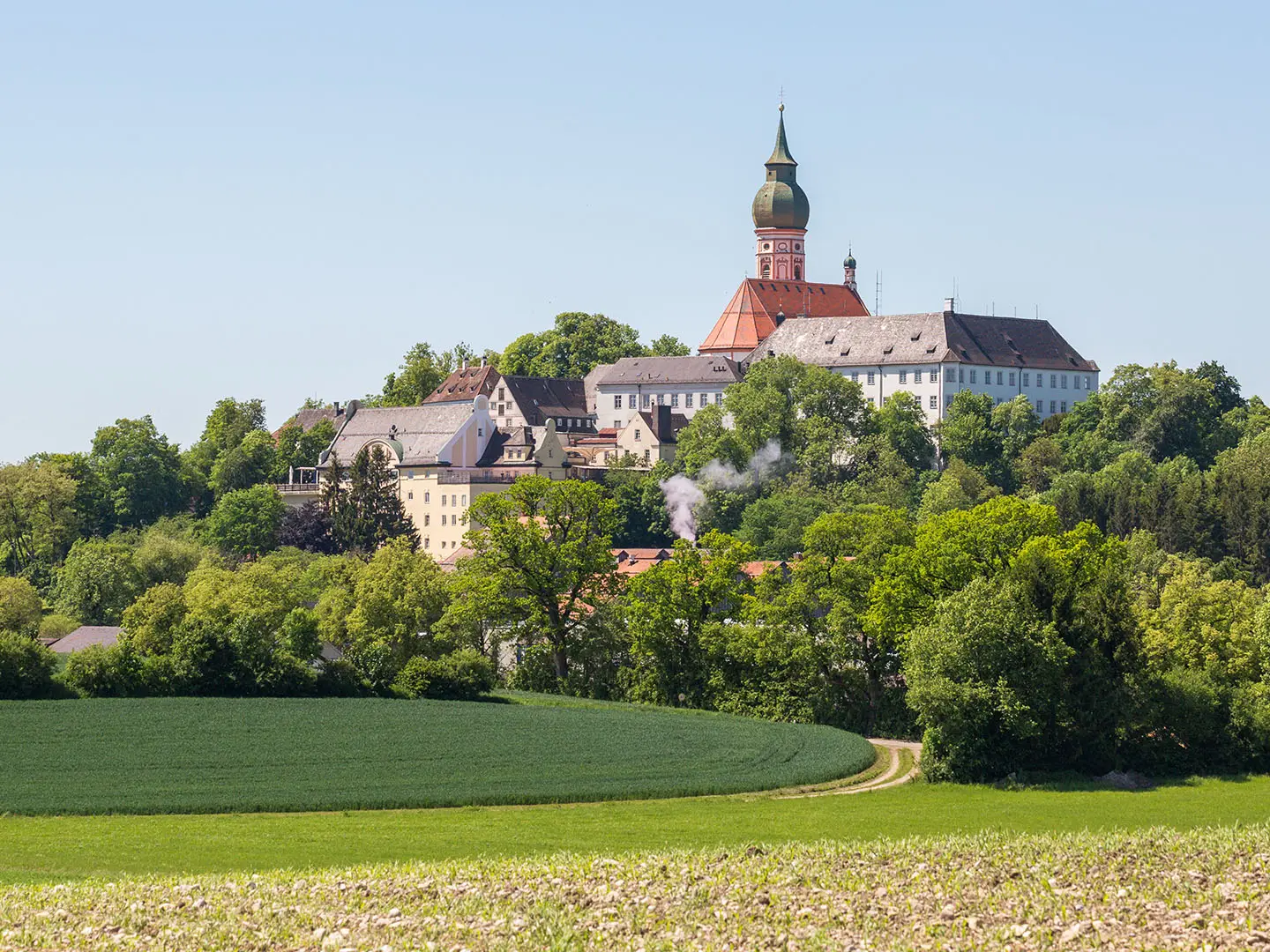
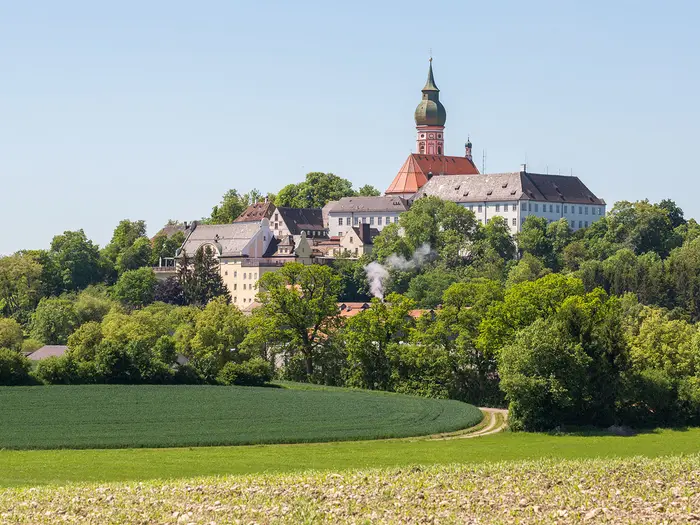
Kloster Andechs is the major landmark of the day, standing on the “Heiliger Berg” above the Ammersee. It is both a pilgrimage site and a practical stopping point, with the monastery brewery and beer garden making it one of the more reliable refreshment stops on the route. The descent towards Herrsching brings the stage to the Ammersee pier for the crossing to Dießen.
The official main route uses the Bayerische Seenschifffahrt steamer from Herrsching am Ammersee to Dießen am Ammersee. This is seasonal, so the current boat timetable must be checked before travelling. Outside the boat season, or if the sailing times do not fit the walking day, use the land-route alternative via Raisting, which adds roughly 19 km of walking around the lake.
Food and drink are most realistically planned around the larger settlements and Kloster Andechs rather than assuming every smaller place will have open services. Carry enough water and snacks to reach Herrsching comfortably, especially if walking on a hot day or outside main visitor hours.
Dießen am Ammersee is the normal overnight stop after the boat crossing. The lakeside towns have a better choice of hotels, guesthouses and B&Bs than the quieter central Pfaffenwinkel stages, but summer weekends can still be busy. If the boat crossing is uncertain, accommodation should be booked with the land-route alternative in mind.
Public transport access is strongest at the start of the route via Starnberg and at the Ammersee towns, but Berg am Starnberger See itself has no railway station. The usual approach is by Munich S-Bahn to Starnberg and then regional bus to Berg. Current bus, rail and boat times should be checked before travelling.
Navigation is generally straightforward on the blue “K” waymarks, but Stage 1 has the greatest logistical trap: arriving in Herrsching after the last suitable boat. The other common issue is underestimating the distance on day one, particularly if starting late after travelling from Munich.
Stage 2: Dießen am Ammersee to Paterzell — 17 km
Stage 2 leaves the Ammersee behind and moves into the quieter Pfaffenwinkel landscape. From Dießen, the route passes the Marienmünster, one of the major rococo church landmarks on the trail, before continuing south-west through rural country towards Wessobrunn and Paterzell.
The walking is moderate and more settled than mountainous: lanes, field paths, woodland tracks and village-to-village paths. It is a good recovery day after the long opening stage, but it still needs a full walking set-up rather than sightseeing shoes, particularly after rain.
Wessobrunn is the key cultural stop between Dießen and Paterzell. The former Benedictine abbey is linked with the Wessobrunn Prayer and the Wessobrunn school of baroque stucco artists, making this one of the most historically important places on the middle part of the route.
The stage also leads towards the Paterzeller Eibenwald area, the protected ancient yew forest that is one of the distinctive natural features of the König-Ludwig-Weg. Paths through woodland can be wet or rooty in places, so allow time rather than treating the shorter distance as automatically easy.
Dießen and Wessobrunn are the main places to plan around for food and drink. Paterzell is a much smaller overnight point, so do not arrive assuming late-opening shops or a wide choice of meals. Carry lunch and enough water for the whole stage unless definite opening times have been checked.
Accommodation in the central Pfaffenwinkel section is thinner than around the lakes and Füssen. Paterzell or nearby options should be booked ahead, especially in the main walking season. If accommodation is unavailable at the exact stage end, transfers or a short public-transport link may be needed; this should be checked before travelling.
Regional buses serve parts of the inland route, but services can be infrequent. Timetables should be checked carefully if joining, leaving or shortening the stage. Road access is generally less complicated than in remote mountain areas, but missed buses can still disrupt the itinerary.
Navigation remains well signed, but there are more quiet rural junctions than obvious lakeside landmarks. Keep an eye on the blue “K” at field edges, village exits and woodland turns.
Stage 3: Paterzell to Hohenpeißenberg — 13 km
Stage 3 is short in distance but important in profile, because it climbs towards the Hoher Peißenberg area. This is the high-point section of the König-Ludwig-Weg, with the route reaching about 978 m and the nearby summit standing at 988 m.
The day begins in quiet countryside and woodland before the walking becomes more sustained on the approach to Hohenpeißenberg. There is no scrambling and no alpine terrain, but the climb is the first point on the route where steady pacing matters more than the kilometre count suggests.
The Hoher Peißenberg is the main highlight. Its baroque pilgrimage church, historic weather observatory and broad views over the Pfaffenwinkel to the Alps make it one of the best viewpoints of the whole trail. In poor weather, however, it can feel much more exposed than the lower meadow and forest stages.
Food and water options should be treated conservatively on this stage. Start with enough supplies from Paterzell or the previous overnight stop, and do not rely on finding something exactly when the climb begins. Hohenpeißenberg is the practical place to plan the evening meal and overnight logistics.
Accommodation in Hohenpeißenberg or nearby should be arranged before the walk, as this is not a large resort area with unlimited spare beds. The shorter distance makes this a useful stage for a later start, laundry, or recovery if the first two days have been tiring, but only if accommodation timing works.
Public transport in this inland section is more limited than at Starnberg, the Ammersee or Füssen. Regional buses and rail branches may help with access, but current timetables should be checked before relying on them.
The main navigation point is to keep following the waymarks through the transition from quiet rural paths to the higher Hoher Peißenberg section. In mist, rain or low cloud, stay disciplined with the marked route and avoid being drawn onto local paths around the summit area.
Stage 4: Hohenpeißenberg to Rottenbuch — 13 km
Stage 4 is another relatively short stage, but it contains one of the most rugged passages of the route: the Ammerschlucht near Peiting. The day links Hohenpeißenberg, Peiting and the wooded gorge of the River Ammer before finishing at Rottenbuch.
The terrain is more varied than the distance suggests. Expect descent from the Hoher Peißenberg area, easier tracks and lanes, and then the enclosed gorge section with steps and footbridges. This is not alpine walking, but it is the stage where sure footing matters most.
The Ammerschlucht is the natural highlight. Sometimes described as the “Grand Canyon of Upper Bavaria”, it gives the König-Ludwig-Weg a wilder feel than the surrounding farmland and monastery-country stages. The gorge can be damp, uneven and slippery, especially after rain.
Peiting is the main intermediate place to plan around for a break before or after the gorge section. Once in the Ammerschlucht, treat it as a walking section rather than a place to look for services. Carry enough water and food to reach Rottenbuch without relying on anything in between.
Rottenbuch is the overnight stop and one of the major cultural points on the route. The former Augustinian abbey and its rococo church Mariä Geburt are the key sights at the end of the stage. Accommodation should be booked ahead, as the middle stages do not have the same depth of choice as the lake towns or Füssen.
Regional public transport is available in the wider area, but inland services can be sparse and should not be improvised at the end of the day. Check current bus or rail options in advance if using Peiting or Rottenbuch as an entry or exit point.
The main warning is the Ammerschlucht underfoot. Use the steps and footbridges carefully, allow extra time in wet conditions, and do not treat the short stage distance as a reason to rush. The enclosed terrain also makes it sensible to have a map or offline route available in addition to the waymarks.
Stage 5: Rottenbuch to Prem — 22 km
Stage 5 is a longer Pfaffenwinkel day, carrying the route from Rottenbuch through Wildsteig, the Wieskirche area, Steingaden and on towards Prem. It combines open rural walking, moorland edges, village sections and quiet lanes, with several important cultural stops.
The terrain is generally moderate, but the distance is significant after several shorter days. Expect a mixture of meadow paths, gravel tracks, forest or moorland sections and some asphalt. In wet weather, the moorland and low-lying tracks can be soft or muddy.
The Wieskirche near Steingaden is the standout landmark. This UNESCO World Heritage rococo pilgrimage church sits in open moorland and is one of the most important sights of the whole König-Ludwig-Weg. Rottenbuch and Steingaden also make this a strong day for church and monastery architecture.
Wildsteig, Wieskirche, Steingaden and Prem provide the main named places on the stage, but services should not be assumed to be evenly spaced or open all day. Carry a proper lunch and enough water, then use open cafés, inns or shops where available. This is especially important if walking outside peak summer or on days with shorter opening hours.
Prem is the official stage end. Accommodation in and around the later Pfaffenwinkel and Lech sections should be arranged before arrival, because options can be more limited than in Füssen or around the lakes. If planning to stop earlier or later than Prem, this should be checked before travelling.
There is also a Trauchgau variant across the last two stages. Anyone using it should decide before leaving Rottenbuch or Prem and follow the chosen route consistently, rather than switching casually between variants during the day.
Public transport in this section is mainly regional and can be infrequent. It is useful as a backup only if the relevant timetable has been checked in advance. Road access is not remote by mountain standards, but the stage still needs to be planned as a full walking day.
Navigation is usually clear on the blue “K”, but pay attention at village exits, lane junctions and around the Wieskirche area, where local visitor paths and roads can distract from the long-distance route.
Stage 6: Prem to Füssen — 25 km
The final stage is one of the longest days on the König-Ludwig-Weg and should not be underestimated because it finishes in a popular tourist area. From Prem the route meets the River Lech near Lechbruck am See, follows the Lech and Forggensee landscape towards the Allgäu, then passes through the Schwangau castle area before reaching Füssen.
The walking remains foothills terrain rather than alpine terrain. Expect river and reservoir-side sections, meadow and forest paths, gravel tracks, village links and some quiet asphalt. The cumulative distance is the main difficulty, especially if time is also allowed for castle sightseeing.
Key places and landmarks include the Lech, Forggensee, Bayerniederhofen, Buching or Halblech, Schwangau, Hohenschwangau, Schloss Hohenschwangau, Schloss Neuschwanstein, Lechfall and the Altstadt of Füssen. The route finishes at Kaiser-Maximilian-Platz in Füssen old town.
The castle area is the scenic climax of the trail, but it is also the busiest part. Schloss Hohenschwangau and Schloss Neuschwanstein use timed-entry visits and can sell out, so castle tickets should be booked before finishing the hike if a visit is planned. Do not build the final walking day around buying tickets on arrival.
Food and water availability improves as the route approaches Schwangau, Hohenschwangau and Füssen, but the early part of the stage should still be treated as a proper walking day. Carry enough water and food from Prem to cover the quieter stretches, then use open services later in the day.
Accommodation is plentiful compared with the middle stages, especially around Füssen and Schwangau, but it fills early in summer and during busy visitor periods. Book the final night well in advance, particularly if combining the walk with castle visits. Some walkers split the long final stage where accommodation and transport allow; this should be checked before travelling.
Füssen has its own railway station, with direct or regional trains to München Hbf taking about two hours. This makes the finish much easier logistically than the rural middle stages. Public transport around the inland villages and castle area should still be checked if shortening the final day.
Navigation is usually straightforward, but the final approach has more visitor traffic, local paths and sightseeing movement than the rest of the trail. Keep following the blue “K” waymarks through Schwangau and Hohenschwangau rather than simply following the crowds. Allow enough time for the Lechfall and the walk into Füssen old town, especially if catching a train the same evening.
Recommended Itinerary
Distances on the König-Ludwig-Weg vary slightly depending on mapping, local detours and whether you take the Ammersee boat or the land route via Raisting. Use the figures below for planning, then check official mapping, boat times and accommodation locations before booking.
Standard 6-day itinerary
This is the official-style itinerary and suits reasonably fit walkers who are comfortable with two long days at either end of the walk. The first and last stages are the ones to plan most carefully: both are around 25–26 km, and Day 1 also depends on the seasonal Ammersee steamer from Herrsching am Ammersee to Dießen am Ammersee.
| Day | From | To | Approx. distance | Why this stage makes sense | Services/accommodation notes |
|---|---|---|---|---|---|
| 1 | Berg am Starnberger See | Herrsching am Ammersee, then boat to Dießen am Ammersee | About 26 km, plus Ammersee boat crossing | This gets the long northern approach done in one day, linking the symbolic start at the Votivkapelle with Kloster Andechs and the Ammersee crossing. It is a full first day, so start early from Berg. | Stay in Dießen am Ammersee if following the main route. The Bayerische Seenschifffahrt boat from Herrsching to Dießen is seasonal; outside the season, use the land route via Raisting. This should be checked before travelling. |
| 2 | Dießen am Ammersee | Paterzell | About 17 km | A shorter day after the long opening stage, moving inland from the Ammersee towards Wessobrunn and the Paterzeller Eibenwald. | Accommodation choice becomes thinner once away from the lake villages. Book Paterzell or nearby options ahead rather than assuming same-day availability. |
| 3 | Paterzell | Hohenpeißenberg | About 13 km | A deliberately short stage before and around the climb to the Hoher Peißenberg area, the high point of the route. This leaves time for the pilgrimage church, weather observatory area and the Alpine panorama if conditions are clear. | Hohenpeißenberg is the logical overnight point for keeping the itinerary balanced. Check opening times and accommodation availability before committing to dates. |
| 4 | Hohenpeißenberg | Rottenbuch | About 13 km | Another short but worthwhile stage, with the route dropping towards Peiting and the Ammerschlucht, then continuing to Kloster Rottenbuch. The gorge section is more rugged than most of the trail, with steps and footbridges. | Rottenbuch is a key overnight stop before the longer push towards Prem. In wet weather, allow extra time through the Ammerschlucht. |
| 5 | Rottenbuch | Prem | About 22 km | This is the main Pfaffenwinkel stage, linking Rottenbuch, Wildsteig, the Wieskirche and Steingaden before reaching Prem near the Lech. It is a culturally rich day but long enough to demand an efficient start. | Services are spread between villages rather than continuous. Carry food and water for gaps between stops, and book accommodation in or around Prem in advance. |
| 6 | Prem | Füssen | About 25 km | A long final stage following the Lech and Forggensee area towards Schwangau, Hohenschwangau, Neuschwanstein and the finish at Kaiser-Maximilian-Platz in Füssen. It is a memorable ending, but not a short victory lap. | Füssen and Schwangau have the best range of accommodation, but they fill early in summer. If visiting Schloss Hohenschwangau or Schloss Neuschwanstein, book timed-entry tickets before the final days of the walk. |
Slower 7-day itinerary
A 7-day schedule is the more comfortable choice if you want shorter walking days, more time for churches and monasteries, or a lower-risk plan around the Ammersee boat. It is especially useful for first-time multi-day walkers, mixed-ability groups, or anyone carrying a full pack.
The simplest approach is to split either the long first stage or the long final stage:
| Day | From | To | Approx. distance | Why this stage makes sense | Services/accommodation notes |
|---|---|---|---|---|---|
| 1 | Berg am Starnberger See | Intermediate overnight before Herrsching am Ammersee | Check official mapping before booking | Breaks the demanding opening stage and gives more time for the Starnberger See approach, Maisinger See and Kloster Andechs area. | Use an established town or village on or close to the marked route. Confirm accommodation and onward route distance before booking. |
| 2 | Intermediate overnight | Dießen am Ammersee, via Herrsching am Ammersee and the Ammersee boat | Check official mapping before booking | Keeps the boat crossing separate from the first-day logistics and reduces pressure if transport to Berg is delayed. | The Herrsching–Dießen steamer is seasonal. If it is not running, the land route via Raisting changes the day and should be planned separately. |
| 3 | Dießen am Ammersee | Paterzell | About 17 km | A moderate inland stage with time for Wessobrunn and the Paterzeller Eibenwald. | Book ahead in the smaller Pfaffenwinkel settlements. |
| 4 | Paterzell | Hohenpeißenberg | About 13 km | Short day to the high-point area, keeping the climb unhurried. | Hohenpeißenberg is the natural overnight stop. |
| 5 | Hohenpeißenberg | Rottenbuch | About 13 km | Allows proper time through the Ammerschlucht and at Kloster Rottenbuch. | After rain, allow extra time in the gorge. |
| 6 | Rottenbuch | Prem | About 22 km | The longer cultural stage via Wildsteig, Wieskirche and Steingaden. | Carry supplies between villages and pre-book the night around Prem. |
| 7 | Prem | Füssen | About 25 km | Keeps the official final stage intact, finishing through Schwangau, the castle area and Füssen. | Book Füssen or Schwangau accommodation early in summer; castle tickets are timed-entry and should be arranged in advance. |
If the final day feels too long, split the Prem–Füssen stage instead, using an overnight in the Buching / Halblech or Schwangau area where available. Exact distances depend on the accommodation chosen, so check official mapping before booking.
Faster 5-day itinerary
A 5-day itinerary is possible for strong walkers, but it removes the recovery built into the two short middle stages. It is best suited to hikers travelling light, using booked accommodation, and already comfortable with repeated 22–26 km days on mixed paths, lanes and forest tracks.
| Day | From | To | Approx. distance | Why this stage makes sense | Services/accommodation notes |
|---|---|---|---|---|---|
| 1 | Berg am Starnberger See | Herrsching am Ammersee, then boat to Dießen am Ammersee | About 26 km, plus Ammersee boat crossing | Keeps the official opening stage intact and avoids creating an awkward first-night split. | Check the seasonal Ammersee boat before committing. If the boat is not operating, the land route via Raisting makes this a different plan. |
| 2 | Dießen am Ammersee | Paterzell | About 17 km | A controlled second day before the longest combined inland section. | Useful day for resupply and recovery before the tougher middle link. |
| 3 | Paterzell | Rottenbuch, via Hohenpeißenberg | About 26 km | Combines the two short official stages into one substantial day over the Hoher Peißenberg area and through the Ammerschlucht towards Rottenbuch. | This is the key test of the faster itinerary. Start early, expect cumulative climbing, and allow extra time if the gorge is wet. |
| 4 | Rottenbuch | Prem | About 22 km | Keeps the Wieskirche and Steingaden stage as a full day rather than rushing it into the finish. | Accommodation around Prem should be booked ahead. |
| 5 | Prem | Füssen | About 25 km | A long but logical final day through the Lech and Forggensee approach, Schwangau, Hohenschwangau and Neuschwanstein to Füssen. | Füssen has rail links back towards München Hbf, but book accommodation if not travelling out immediately. Castle-area accommodation and timed-entry castle tours can sell out in summer. |
For most walkers, the 6-day plan is the best balance of efficiency and enjoyment. Choose 7 days if accommodation availability, boat timing or fitness makes the first and last stages feel too tight.
Planning the Route
How many days to allow
The official König-Ludwig-Weg itinerary is six stages, and that is a realistic plan for fit walkers who are comfortable with consecutive days of 20 km-plus walking. It is not technically difficult, but the first and last stages are long, and the cumulative effect of gravel lanes, forest tracks, quiet asphalt, moorland paths and climbs is what most walkers need to plan around.
A seven-day schedule is often the better choice if the walk is part of a wider Bavaria trip, if castle visits are planned at the end, or if accommodation availability forces a less neat split. The easiest places to build in extra time are around the Starnberger See / Ammersee area at the start and around Schwangau / Füssen at the finish, where there is more visitor infrastructure than in the central Pfaffenwinkel section.
The six official overnight points are useful because the route has been designed around real settlements rather than arbitrary map distances. However, do not assume every village has plenty of beds, food shops or late-opening services. In the middle section, accommodation choice is thinner, so lodging availability may decide the itinerary more than ideal daily mileage.
Six days or seven days?
| Plan | Best for | Main planning implication |
|---|---|---|
| 6 days | Fit walkers who want to follow the official stages closely | Book every night in advance, especially Paterzell / Hohenpeißenberg / Rottenbuch / Prem and the Füssen or Schwangau finish area. |
| 7 days | Walkers who prefer shorter days, want more time for churches, the Ammersee or the castles, or are travelling in summer | Add a night where accommodation is easiest to secure; do not rely on finding an ideal midway stop in the quieter Pfaffenwinkel villages. |
| Section hike | Walkers based in Munich or combining the route with other travel | Practical, but dependent on regional buses and rail branches away from the main towns. Timetables should be checked before travelling. |
Trying to compress the route below six walking days is possible only for strong walkers who are happy with long days and limited time for stops. It works against the nature of the route: the König-Ludwig-Weg is rich in pilgrimage churches, lake stops, the Ammerschlucht and the castle approach, so a rushed schedule removes much of what makes it worth walking.
The Ammersee crossing decision
The main route uses the Bayerische Seenschifffahrt steamer across the Ammersee from Herrsching am Ammersee to Dießen am Ammersee. This is part of the standard route plan, not an optional sightseeing detour, so Stage 1 must be planned around the boat timetable.
The steamer is seasonal. Outside the operating season, or if the day’s timing does not work, use the land-route alternative via Raisting. That changes the logistics of the first two days and may require a different overnight plan, so boat times should be checked before accommodation is finalised.
Do not leave the boat decision until the trail. A missed or non-running crossing can turn an already long opening stage into a transport problem or force an unplanned reroute.
Accommodation planning
Accommodation is the most important practical booking on this route. Bavaria does not permit wild camping, so each night needs a booked bed in a hotel, Gasthof, Pension, B&B or holiday apartment.
Choice is generally better around the lakes and at Füssen / Schwangau. It is more limited through the central Pfaffenwinkel villages, where the official stage ends can have fewer options and may fill on busy dates. Summer and the castle area near Hohenschwangau and Neuschwanstein should be booked early.
If the exact official stage end is full, look first at nearby settlements on the route or at places with usable regional bus access. Inland services can be infrequent, so any off-route overnight arrangement should be checked against current bus times before booking.
Holiday apartments may have minimum-stay rules, especially in popular areas. That can make them less useful for a one-night walking itinerary unless the host clearly accepts single-night bookings.
Food and water
The route passes regular villages, but daily food planning still matters. Carry lunch or emergency food on the quieter central stages rather than relying on every small settlement having an open shop, bakery or Gasthof at the exact time you arrive.
Start each day with enough water for the full morning and refill only where there is a reliable opportunity, such as accommodation or an open café/restaurant. The Hoher Peißenberg climb, the Ammerschlucht section and warm summer days all make carrying more water sensible.
Breakfast times can affect early starts, especially on the longer first and last stages. If an accommodation provider serves breakfast late, arrange this in advance or buy food the evening before where possible.
Navigation and route finding
The König-Ludwig-Weg is waymarked with a blue “K” and crown on a white sign, and route-finding is generally straightforward. Even so, carry an offline map or GPX track, particularly for the moorland and forest sections, village exits and any accommodation detours.
The Ammerschlucht near Peiting is the one section where underfoot conditions need more attention. Steps, footbridges and enclosed wooded paths can be slippery after rain, so allow time rather than treating it as a fast transit section.
The trail is a foothills route, not an alpine crossing. There is no scrambling or exposed mountain terrain, but mud, wet grass, gravel descents and quiet asphalt all influence footwear and pacing.
Transport and section hiking
Munich is the practical transport hub for both ends. For the start, take the Munich S-Bahn to Starnberg and continue by regional bus to Berg am Starnberger See. The trail itself begins at the Votivkapelle above the Starnberger See, then follows the blue “K” waymarks north through the park of Schloss Berg.
Füssen has its own railway station, with direct or regional trains to München Hbf taking about two hours. This makes the finish much easier to manage than many point-to-point walks, especially if accommodation is booked in Füssen after the final stage.
Section hiking is possible because the route passes towns and villages with regional transport links, but it is not a hop-on, hop-off urban trail. RVO regional buses and some rail branches serve the area, yet services away from the main towns can be sparse. Current timetables should be checked before travelling, especially at weekends, on public holidays and outside the main visitor season.
Weather and seasonal timing
Spring, summer and autumn are the normal walking seasons. Snow and alpine hazards are not the defining issue here, but wet weather can still make the route slower, especially in forest, moorland and the Ammerschlucht.
In warm weather, the long open stretches through farmland and meadow can feel more tiring than the map profile suggests. In autumn, shorter daylight matters on the longer stages, particularly if combining walking with long cultural stops or castle visits.
The Ammersee boat is the key seasonal dependency. If walking outside the boat season, plan the Raisting land-route alternative from the outset rather than treating it as a fallback.
Castles, tickets and the final day
The route passes below Schloss Hohenschwangau and Schloss Neuschwanstein before continuing to Füssen. If tours of either castle are part of the plan, treat them as timed-entry visits rather than casual stops at the end of a walking day.
Castle tickets can sell out, particularly in summer and holiday periods, so they should be booked before reaching Schwangau. A relaxed plan is to finish the walk in Füssen and visit the castles with a dedicated time slot before or after the final stage, rather than trying to combine a long Prem–Füssen day with rushed sightseeing.
What matters most to plan in advance
Prioritise the following before setting off:
- Accommodation — essential, because wild camping is not permitted and beds are thinner in the middle stages.
- Ammersee boat timing — the Herrsching–Dießen steamer is seasonal and affects the first-stage plan.
- Castle tickets — book timed-entry visits for Hohenschwangau or Neuschwanstein if they are part of the trip.
- Transport links — check current train, bus and boat timetables, especially for section hiking or off-route overnights.
- Food and water — carry enough for quieter stretches and do not rely on every village service being open.
- Navigation backup — the waymarking is good, but an offline map or GPX is sensible for village exits, forests and weather-affected sections.
Towns, Villages and Overnight Stops
Accommodation on the König-Ludwig-Weg is mostly in hotels, Gasthöfe, Pensionen, B&Bs and Ferienwohnungen rather than campsites. Wild camping is not permitted in Bavaria, so every night needs a booked bed or a deliberate public-transport exit.
The easiest places to book are around the Starnberger See, Ammersee, Schwangau and Füssen. The middle Pfaffenwinkel section has fewer options, especially around the smaller villages, so accommodation and evening meals should be arranged before walking into a stage-end village.
Berg am Starnberger See
Berg is the symbolic start of the route, with the Votivkapelle above the Starnberger See and the first blue “K” waymarks leading through the park of Schloss Berg. It is not the most convenient transport base because Berg has no railway station.
Most walkers access the start via München, taking the S-Bahn S6 to Starnberg and then a regional bus to Berg. If staying before the walk, Berg can work if accommodation is available, but Starnberg is usually the more practical staging point because of its rail connection.
Food and accommodation should be checked before arrival, particularly if starting early. Do not assume full walker services at the chapel area itself.
Starnberg
Starnberg is the practical gateway to the start. It sits on the Starnberger See and is linked to München by the S-Bahn S6, making it useful for an arrival night before transferring to Berg.
It is also a sensible fall-back if accommodation in Berg is limited. From a planning point of view, Starnberg is where transport logistics are easiest at the northern end of the trail.
Walkers starting from the official point at the Votivkapelle still need to reach Berg from Starnberg by regional bus or other local transport. Current bus times should be checked before travelling.
Maisinger See
Maisinger See is an early rural/lakeside landmark between the Starnberger See and the Andechs section. It is more of a daytime waypoint than an obvious overnight base.
Do not rely on it for a full resupply or guaranteed evening meal. Carry what is needed from the start or from a larger settlement.
Aschering
Aschering is a small place on the first stage before the route reaches Kloster Andechs and Herrsching am Ammersee. It is useful as a route marker, but not a main accommodation hub.
If considering a short first day or a split stage, any bed, food or transport options here should be checked before travelling. Most walkers will find the Ammersee towns more practical for overnight logistics.
Kloster Andechs
Kloster Andechs is one of the most important stops on the first stage, set on the Heiliger Berg above the Ammersee. It is a major pilgrimage site and is well known for its monastery brewery and beer garden, making it a natural lunch or rest stop.
For overnight planning, it is better treated as a daytime stop rather than the main stage end. Herrsching am Ammersee and Dießen am Ammersee are more practical because they connect directly with the official Ammersee crossing.
Opening times and food availability should be checked if the day’s plan depends on eating there.
Herrsching am Ammersee
Herrsching is the end of the walking portion of the official first stage. From the pier, the main route uses the seasonal Bayerische Seenschifffahrt steamer across the Ammersee to Dießen am Ammersee.
It can be used as an overnight stop if the boat timing does not fit, if the first stage has taken longer than expected, or if the lake crossing is being saved for the next morning. Accommodation choice around the lakes is generally better than in the middle Pfaffenwinkel section, but summer bookings should still be made ahead.
The boat timetable is a key logistical detail for this route. Outside the operating season, or if the crossing is not running when needed, use the land-route alternative via Raisting instead.
Dießen am Ammersee
Dießen is the official overnight point after the Ammersee crossing and the starting point for the second stage to Paterzell. It is one of the more useful service stops on the route because it sits on the lake and has better accommodation prospects than the smaller inland villages.
It is a good place to buy food for the next day before heading into the quieter Pfaffenwinkel section. The Marienmünster is also one of the major cultural stops on the route, but walkers should prioritise practicalities here: accommodation, breakfast arrangements and food for the next stage.
If the boat from Herrsching is not running, Dießen is reached by following the land alternative round the Ammersee via Raisting. Current boat and local transport times should be checked before travelling.
Raisting
Raisting belongs to the land-route alternative around the Ammersee. It matters most when the seasonal boat between Herrsching and Dießen is not operating, or when a walker deliberately avoids the crossing.
Using the land route adds a significant amount of walking compared with the main boat route, so it may change where an overnight stop makes sense. Any accommodation, food and onward transport in Raisting should be checked before committing to this variant.
Wessobrunn
Wessobrunn lies between Dießen and Paterzell and is a useful stop on the second stage. The former Benedictine abbey and its cultural history make it more than just a pass-through village, but it is still part of the quieter middle section of the trail.
It can be useful for a break or for splitting the Dießen–Paterzell stage if suitable accommodation is available. Do not assume the same range of beds, shops or evening meals as in the lake towns; check before booking the day around it.
Paterzell
Paterzell is the official end of stage 2 and the start for the short stage to Hohenpeißenberg. It is a key overnight stop because the route through this part of the Pfaffenwinkel has fewer large settlements.
Accommodation should be booked well ahead, especially in summer or if walking on fixed dates. It is also important to confirm whether an evening meal and breakfast are available where staying, as small villages may not offer many alternatives.
The nearby Paterzeller Eibenwald is one of the main natural highlights of the route. For logistics, however, treat Paterzell as a booked-bed stop rather than a place to arrive speculatively.
Hohenpeißenberg
Hohenpeißenberg is the official end of stage 3 and sits beneath the Hoher Peißenberg, the high point area of the route. It is a practical overnight stop before the descent and the next stage towards Rottenbuch.
The climb to the Hoher Peißenberg is one of the more sustained efforts on the trail, so this is a sensible place to stop rather than pushing on when tired. Accommodation and food should be arranged ahead because this is still within the thinner middle section.
Regional public transport serves inland communities in this area, but services can be infrequent. Timetables should be checked before relying on Hohenpeißenberg as an exit or joining point.
Peiting
Peiting lies on the route towards the Ammerschlucht and Rottenbuch. It is useful as a practical waypoint in the middle stages and may work as a stopping or exit point if the itinerary needs adjusting.
The Ammerschlucht section involves steps, footbridges and more enclosed, uneven walking than most of the route, so Peiting is a good place to assess time, weather and energy before continuing. Any accommodation, food and onward transport plans should be checked before travelling.
Rottenbuch
Rottenbuch is the official end of stage 4 and a strong overnight choice before the longer stage towards Prem. The former Augustinian abbey and rococo church are major sights, but for hikers the main value is its position as a planned stop after the Ammerschlucht and before the Wieskirche section.
Book accommodation in advance and confirm evening food arrangements. This is not a section where it is wise to arrive late without a reservation.
If using public transport to shorten or leave the route, check current regional bus times carefully. Inland services can be sparse.
Wildsteig
Wildsteig sits between Rottenbuch and the Wieskirche / Steingaden area on the fifth stage. It is useful for walkers who want to break up the official Rottenbuch–Prem day, which is one of the longer stages.
As a smaller village, it should not be assumed to have extensive accommodation, shops or food available at all times. If using Wildsteig as an overnight stop, book the bed and confirm meals before setting out.
Wieskirche and Steingaden
The Wieskirche, near Steingaden, is one of the outstanding cultural stops on the route and a UNESCO World Heritage rococo pilgrimage church. It is a major reason to slow down on the fifth stage, but it should be planned as a visit rather than treated as a guaranteed service point.
Steingaden is the more practical nearby settlement for food, accommodation or transport possibilities, though availability should still be checked. This part of the route crosses moorland and smaller communities, so carry enough food and water to avoid depending on a single café or inn.
Prem
Prem is the official end of stage 5 and the start of the long final stage to Füssen. It is an important overnight stop because it allows walkers to begin the castle approach and the Lech / Forggensee section with a full day available.
Accommodation should be booked ahead, particularly if continuing on a fixed schedule. Confirm food options as well, as the next day is long and should not start without breakfast or carried supplies.
Prem is also where the route is close to the Lech and the Forggensee landscape, marking the transition towards the Allgäu. If using public transport here, current regional timetables should be checked before travelling.
Lechbruck am See
Lechbruck am See is near the route rather than the main official overnight point. It may be useful as an alternative stop or service detour in the Lech / Forggensee area, particularly if the Prem–Füssen stage needs to be split.
Any detour, return to the trail, accommodation and transport plan should be checked carefully before relying on it. Do not assume it fits the official line without adding extra logistics.
Bayerniederhofen
Bayerniederhofen lies on the later approach towards the Allgäu and the castle area. It is mainly a route village rather than a principal stage end.
It may help with splitting the final day if accommodation is available nearby, but this should be arranged in advance. Food and transport options should also be checked before travelling.
Buching / Halblech
Buching and Halblech are useful late-route settlements before Schwangau and Füssen. They are relevant for walkers who want to avoid the full Prem–Füssen stage in one day or who prefer a quieter night before entering the busy castle area.
Accommodation may be possible in this area, but it should be booked ahead and matched carefully to the route. Check whether meals are available and whether any local transport needed for joining or leaving the trail is running.
Schwangau
Schwangau is one of the busiest and most useful overnight areas near the end of the trail. It sits below the royal-castle landscape and is a practical base if the final stage is being split or if castle visits are planned before reaching Füssen.
Accommodation choice is generally better here than in the smaller middle villages, but demand is high in summer and around the castles. Book early and do not leave this area to chance on peak dates.
Schwangau is also where timing becomes important. If visiting Schloss Hohenschwangau or Schloss Neuschwanstein, tickets are timed-entry and can sell out, so castle plans should be arranged before finishing the hike.
Hohenschwangau and Neuschwanstein
Hohenschwangau and Neuschwanstein are the major final-stage landmarks rather than normal hiker service villages. The route passes below the castles before continuing towards Füssen.
This area has heavy visitor pressure, especially in summer. If touring the castles, book timed-entry tickets in advance and allow enough time so the visit does not compromise the walk into Füssen.
For overnight purposes, Schwangau or Füssen are the more practical bases. Use Hohenschwangau primarily as the castle stop on the route.
Füssen
Füssen is the official finish, at Kaiser-Maximilian-Platz in the old town after the approach via the Lechfall and the Lech. It is the best place for a final night, onward travel and recovery after the long last stage.
Accommodation choice is good, but Füssen is a popular Allgäu town and should still be booked ahead in the main walking season. It is also the most convenient place to reset after the trail, with the old town close to the finish.
Füssen has its own railway station, with direct/regional trains to München Hbf taking about two hours. This makes it the simplest exit point on the route.
Getting to the Start
The official start is at the Votivkapelle above the Starnberger See at Berg am Starnberger See, not at Starnberg station. Build in time for the final local transfer from Starnberg to Berg and for reaching the chapel before starting the waymarked route through the park of Schloss Berg.
By train
The nearest useful railway access is Starnberg, reached from Munich by S-Bahn S6. From Starnberg, continue to Berg am Starnberger See by regional bus or taxi.
This is the simplest public-transport approach for most walkers arriving from elsewhere in Germany or abroad, because Munich is the natural hub for the route. Do not assume the train takes you to the trailhead itself: Berg has no railway station.
Check the current S-Bahn and onward bus times before committing to a same-day start, especially if arriving late or walking the long first stage to Herrsching am Ammersee. This should be checked before travelling.
By bus
Regional buses link Starnberg with Berg am Starnberger See, giving access to the start area. Bus numbers and frequencies can change, and services may be less convenient at weekends, on public holidays or outside peak times.
For a smooth start, check the exact stop, timetable and walking route from the bus stop to the Votivkapelle before departure. This should be checked before travelling.
If the bus connection is awkward, a taxi from Starnberg to Berg is the practical fallback. Pre-booking is sensible for early starts, evenings or busy summer periods.
By car
Driving to the start is possible, but it is usually less convenient than using public transport because the King Ludwig Way is a point-to-point walk finishing in Füssen. Leaving a car at Berg means arranging a return journey from Füssen at the end, normally via regional rail back towards Munich and then onward to Starnberg/Berg.
Do not rely on informal long-stay parking near the start. Parking rules, local restrictions and any suitable long-stay options around Berg or Starnberg should be checked before travelling.
For most walkers, the cleaner logistics are to travel to Starnberg by S-Bahn, continue to Berg by bus or taxi, and return from Füssen railway station after finishing.
From the nearest airport
For international arrivals, route via Munich and then use the Munich rail/S-Bahn network to reach Starnberg. From there, continue by regional bus or taxi to Berg am Starnberger See.
Allow enough time between the airport arrival, the Munich transfer, the S-Bahn journey and the final local connection to Berg. If starting the same day, remember that the first walking stage is long and also involves the seasonal Ammersee boat crossing later in the day; current transport and boat times should be checked before travelling.
Where to stay before starting
The most convenient pre-walk bases are Berg am Starnberger See or Starnberg. Berg puts you closest to the Votivkapelle, while Starnberg is usually easier for rail access from Munich and gives a straightforward bus or taxi transfer to the start in the morning.
Accommodation around the lakes is generally a mix of hotels, Gasthöfe, guesthouses, B&Bs and holiday apartments. Book ahead in summer and at weekends, especially if planning an early start and needing to be in Berg the night before.
Staying in Munich can work for late arrivals, but it adds a morning transfer before the first stage. That is manageable only if the S-Bahn, bus or taxi connection to Berg and the onward day plan have been checked in advance.
Getting Home from the Finish
By train
The trail finishes in the old town of Füssen at Kaiser-Maximilian-Platz. Füssen has its own railway station, making it the simplest place to leave the route by public transport.
Regional trains run from Füssen to München Hbf in about two hours. Munich is the main interchange for onward long-distance trains across Germany and for returning towards the start of the trail.
If returning to Berg am Starnberger See, the practical rail route is via München Hbf, then the S-Bahn to Starnberg and a regional bus on to Berg. The start village has no railway station, so do not plan a train-only return to the Votivkapelle.
Train times should be checked before travelling, especially for a Sunday finish, public holidays or a late arrival into Füssen after the long final stage from Prem.
By bus
Local and regional buses serve Füssen and the surrounding castle area, including Schwangau and Hohenschwangau. They are useful if ending the walking day near the castles, staying in Schwangau, or moving between Füssen and the castle area before leaving by train.
Regional bus services in this part of Bavaria can be infrequent, and route numbers and times change. Check the current timetable locally before relying on a bus connection, particularly in the evening or outside the main visitor season.
If the final stage runs late, the safest public-transport plan is to continue into Füssen and use the railway station rather than depending on a late rural bus from an intermediate village.
By car/taxi
Füssen is the natural pick-up point if someone is collecting you at the end of the King Ludwig Way. Agree a meeting point in town rather than at the busy castle area around Hohenschwangau and Neuschwanstein, where traffic and visitor demand can complicate pick-ups.
Taxis are best treated as a back-up for short local transfers around Füssen, Schwangau and Hohenschwangau, or for reaching booked accommodation after a late finish. For longer transfers, including a return towards the start at Berg am Starnberger See, public transport via Munich is usually the more practical plan unless a private transfer has been arranged in advance.
If a taxi is needed late in the day, book ahead rather than assuming one will be immediately available at the finish.
From the nearest airport
For flights after the hike, plan around Munich as the practical transport hub. From Füssen, take the regional train to München Hbf, then connect onwards to the airport using the current Munich airport transport timetable.
Do not book a tight same-day flight after walking the final stage. Prem to Füssen is a long final day, and delays can come from weather, tired legs, time spent around Schwangau and the castles, or a missed train connection. Staying in Füssen and flying the following day is usually the more reliable option.
Where to stay at the finish
Füssen is the best overnight base at the end of the trail because it has the railway station, the old town finish at Kaiser-Maximilian-Platz, and straightforward onward transport the next morning. Schwangau and Hohenschwangau are also logical if the main priority is visiting Schloss Hohenschwangau or Schloss Neuschwanstein after the walk.
Accommodation choice is good around Füssen and Schwangau, but the castle area fills early in summer. Book ahead if finishing in the main season, at weekends, or around public holidays.
An overnight stay is strongly recommended if you want to tour the castles. Visits are timed-entry and can sell out, so castle tickets should be booked before reaching the end of the walk rather than left until arrival.
Which Direction Should You Walk?
Standard direction: Berg am Starnberger See to Füssen
The König-Ludwig-Weg is best walked in its standard southbound direction, from the Votivkapelle at Berg am Starnberger See to Kaiser-Maximilian-Platz in Füssen. This is the direction used by the official six-stage itinerary and it gives the route its natural narrative: from the place associated with King Ludwig II’s death, through the lakes and pilgrimage country of Upper Bavaria, to Hohenschwangau, Neuschwanstein and the old town of Füssen.
Transport also works neatly this way. Berg has no railway station, so reaching the start involves the Munich S-Bahn to Starnberg and then a regional bus to Berg. At the end, Füssen has its own railway station with direct or regional trains back to München Hbf in about two hours, which makes the final travel day simpler.
The scenery builds well southbound. The early stages move through Starnberger See, Kloster Andechs and the Ammersee crossing, before the route enters the Pfaffenwinkel, climbs Hoher Peißenberg, crosses the Ammerschlucht and gradually approaches the Lech, Forggensee and the Allgäu edge. The castle approach through Schwangau, Hohenschwangau and Neuschwanstein is the strongest possible finish.
Reverse direction: Füssen to Berg
Walking northbound is entirely possible, but it is less natural for most hikers. It starts with the biggest scenic and cultural set-piece — Füssen, Neuschwanstein, Hohenschwangau and the lakes around Schwangau — then works back towards the gentler lake-and-foothill country around Berg and Starnberg.
The reverse has one clear transport advantage at the beginning: Füssen is easy to reach by train from Munich. The disadvantage comes at the end, where Berg requires a bus connection rather than a straightforward rail departure. Inland buses and branch-line transport can be infrequent, so any reverse itinerary needs current timetable checks, especially if using public transport to shorten or split stages.
The Ammersee crossing also needs care in either direction. The official main route uses the seasonal Bayerische Seenschifffahrt steamer between Herrsching and Dießen; outside the boat season, or if the timetable does not fit the walking day, the land alternative via Raisting is the practical fallback. This should be checked before travelling.
Are the climbs easier one way?
Direction is not a major difficulty factor on this route. The König-Ludwig-Weg is a foothills walk rather than an alpine traverse, with no scrambling or technical passes, and the sustained efforts are spread across both directions.
The key climbs and rougher sections — notably Hoher Peißenberg and the steps and footbridges through the Ammerschlucht — still have to be dealt with whichever way you walk. The long first and last stages are a bigger planning issue than the direction of ascent, particularly for anyone following the six-day schedule without splitting stages.
Weather and practical flow
There is no strong prevailing-weather reason to choose one direction. Conditions matter most on wet or muddy paths, exposed lake and meadow sections, and in the enclosed Ammerschlucht, where surfaces can feel more committing after rain. Check the local forecast before each stage rather than choosing direction for wind or weather alone.
Accommodation planning is simpler southbound because the published stage structure runs Berg–Herrsching/Dießen–Paterzell–Hohenpeißenberg–Rottenbuch–Prem–Füssen. The middle Pfaffenwinkel section has thinner accommodation choice than the lake towns and Füssen/Schwangau, so whichever direction you choose, nights should be booked ahead in busy periods.
Recommendation
Walk the König-Ludwig-Weg southbound from Berg am Starnberger See to Füssen. It matches the official itinerary, gives the best scenic progression, finishes with the castles and Füssen old town, and leaves you with the easiest onward transport at the end. Reverse only if accommodation availability, public transport timings or a wider travel plan make Füssen the more practical starting point.
Accommodation Along the Route
The König-Ludwig-Weg works well as an inn-to-inn walk. Accommodation is mainly hotels, Gasthöfe, Pensionen, B&Bs and Ferienwohnungen rather than mountain huts, and the route passes regular settlements throughout the Starnberger See, Ammersee, Pfaffenwinkel and Allgäu sections.
The easiest places to secure beds are around the lakes at the start and in the castle area around Schwangau, Hohenschwangau and Füssen. The middle Pfaffenwinkel stages are more constrained: villages such as Paterzell, Hohenpeißenberg, Rottenbuch and Prem have a thinner accommodation base, so the official stage ends should not be treated as places where a last-minute room is guaranteed.
Wild camping is not permitted in Bavaria, so every night needs to be planned around booked accommodation or a transfer to nearby lodgings. In summer, at weekends and during busy holiday periods, booking ahead is strongly recommended, especially near the Ammersee and around Neuschwanstein/Füssen.
Main overnight strategy
Most walkers following the six-stage itinerary stay near the official stage ends: Dießen am Ammersee, Paterzell, Hohenpeißenberg, Rottenbuch, Prem and Füssen. This keeps the walking days close to the published structure, but it leaves little flexibility in the thinner middle section.
The first and last stages are the longest. If preferred, the start can be softened by staying in Berg am Starnberger See, Starnberg or Herrsching am Ammersee before or after the first day, depending on transport and boat timing. The final stage from Prem to Füssen can also be made easier by using accommodation around Buching / Halblech or Schwangau, where available, before continuing to Füssen.
The official main route uses the seasonal Ammersee steamer from Herrsching am Ammersee to Dießen am Ammersee. If staying in Herrsching rather than crossing to Dießen the same day, check the next day’s boat timetable carefully before committing. Outside the boat season, or if the crossing does not fit the plan, the land-route alternative via Raisting changes the accommodation logic for the first part of the walk.
Accommodation by place
| Place | Accommodation level | Best for | Notes |
|---|---|---|---|
| Berg am Starnberger See | Limited | Pre-walk night close to the Votivkapelle start | Useful if starting early from the symbolic trailhead. The village has no railway station, so arrival is usually via Starnberg and regional bus. |
| Starnberg | Good | Practical pre-walk base | A strong choice before the hike because it has rail access from München and is close to Berg am Starnberger See by onward transport. |
| Herrsching am Ammersee | Good | Breaking or finishing the long first walking day | Convenient before the Ammersee boat crossing. If relying on the steamer to Dießen, current sailing times should be checked before booking. |
| Dießen am Ammersee | Good | Official first overnight on the main route | One of the more practical overnight stops on the trail, with better choice than the smaller Pfaffenwinkel villages. Book ahead in busy lake-season periods. |
| Raisting | Limited | Land-route alternative around the Ammersee | Relevant only if avoiding or missing the Herrsching–Dießen boat crossing. Availability should be checked before building the stage plan around it. |
| Wessobrunn | Limited | Shortening the Dießen–Paterzell section | A possible intermediate stop in the Pfaffenwinkel, but not a place to assume plentiful beds. Useful if splitting the middle stages. |
| Paterzell | Limited | Official second overnight | Accommodation is thinner here, so book early or plan a transfer if no room is available. Do not rely on turning up without a reservation. |
| Hohenpeißenberg | Limited | Official third overnight; Hoher Peißenberg stage | A logical stop after the trail’s high-point section. Choice is more limited than around the lakes or at Füssen. |
| Peiting | Limited | Transfer or alternative overnight near the Ammerschlucht section | Can be useful when rearranging the Hohenpeißenberg–Rottenbuch stage, but onward transport or taxi logistics should be checked before travelling. |
| Rottenbuch | Limited | Official fourth overnight | A key overnight on the six-stage itinerary. Book ahead because options in the central section are less numerous. |
| Wildsteig | Limited | Possible break on the Rottenbuch–Prem stage | Useful for walkers wanting to shorten the longer later stage, but accommodation should be arranged in advance. |
| Steingaden / Wieskirche area | Limited | Cultural stop or stage adjustment near the Wieskirche | The Wieskirche is a major highlight, but the surrounding area is not the same as a large accommodation hub. Check availability before planning to stop here. |
| Prem | Limited | Official fifth overnight | Important for the standard itinerary before the long final stage to Füssen. Reserve early, especially if walking in summer. |
| Buching / Halblech | Limited | Splitting the final Prem–Füssen stage | A practical area to consider if the final 25 km stage is too long, subject to accommodation availability. |
| Schwangau / Hohenschwangau | Good | Castle-area overnight before the finish | Stronger choice than the smaller villages, but demand is high because of Schloss Hohenschwangau and Schloss Neuschwanstein. Book early in summer and at weekends. |
| Füssen | Good | Final night and onward travel | The most straightforward end-point base, with a railway station and broad accommodation choice. Still worth booking ahead during peak castle-visiting periods. |
Booking pressure and timing
The highest pressure points are the Ammersee communities and the Füssen/Schwangau castle area. Summer, public holidays and weekends can fill rooms early, and accommodation near Neuschwanstein is used by international visitors as well as walkers.
The middle of the route has the opposite problem: not necessarily heavy demand everywhere, but fewer beds. A full room in Paterzell, Hohenpeißenberg, Rottenbuch or Prem can affect the whole itinerary because the next practical village may be a long walk away.
Ferienwohnungen can be useful for rest days or relaxed itineraries, but some may be less convenient for one-night stays. Check minimum-stay rules, arrival times and whether breakfast is available before booking.
Luggage transfer and awkward gaps
This route is well suited to luggage-supported walking. Self-guided operators such as Alpenlandtouristik offer König-Ludwig-Weg packages with luggage transfer, which can remove the need to carry a full pack and may simplify accommodation planning. Current inclusions, baggage limits and stage options should be checked before booking.
If a preferred stage-end village is full, a taxi or public-transport transfer can sometimes solve the gap by moving to accommodation off the trail and returning the next morning. Do not assume this will be simple in the Pfaffenwinkel: regional buses and branch rail services can be infrequent, so transfer times need checking before relying on them.
For independent walkers, the safest approach is to book the scarce middle-section nights first, then arrange the easier lake and Füssen nights around them. This avoids ending up with good accommodation at both ends but no workable bed in the centre of the walk.
Camping and Wild Camping
The König-Ludwig-Weg is best planned as an inn-to-inn walk, not as a camping trek. The route passes frequent towns and villages, and the normal accommodation pattern is hotels, Gasthöfe, Pensionen, B&Bs and holiday apartments rather than camping stages.
Wild camping is not permitted in Bavaria, so a tent should not be used as a way to avoid booking accommodation. This is especially important on this route because it crosses farmland, moorland, forest, lake margins and protected or sensitive places such as the Paterzeller Eibenwald and the Ammerschlucht.
Campsites and whether camping is practical
There may be campsites in the wider lake and holiday areas around the Starnberger See, Ammersee and Forggensee, but few official campsites sit directly on the daily stage line itself. Anyone planning to camp should build the itinerary around confirmed campsites rather than assuming a tent pitch will be available at the end of each official stage. This should be checked before travelling.
Camping can make the logistics less straightforward than using village accommodation. The official stages finish at places such as Dießen am Ammersee, Paterzell, Hohenpeißenberg, Rottenbuch, Prem and Füssen, and a campsite-based itinerary may require detours, bus links or adjusted stage lengths.
For most walkers, camping is only worth considering if there is a specific confirmed campsite near the intended overnight stop. Otherwise, the extra tent, sleeping kit and cooking equipment add weight without giving the flexibility that wild camping would provide.
Wild camping, private land and protected areas
Do not plan to pitch in fields, woods, meadows, lakeshore areas or beside the Lech, Ammersee, Starnberger See or Forggensee. Much of the route crosses private agricultural land or managed forest, and informal camping is not acceptable.
The Paterzeller Eibenwald, moorland sections and the enclosed Ammerschlucht should be treated as no-camping areas. Stay on the path, avoid trampling vegetation and do not use quiet woodland or gorge sections as overnight spots.
If a genuine emergency forces an unplanned stop, keep the impact as low as possible and leave at first light. This is not a substitute for proper accommodation planning.
Water, cooking and fires
Water planning is simple if staying in accommodation: refill in towns, villages, cafés and guesthouses during the day. Do not rely on untreated water from lakes, the River Ammer, the Lech or small streams unless it is properly treated.
Open fires are not appropriate on this route. Forest, moorland, farmland and dry summer conditions make fire risk a serious issue, and local restrictions can apply. Stove use, if camping at an official site, should follow that site’s rules.
Practical advice for tent users
Book every campsite or pitch in advance, particularly in summer and around the Füssen, Schwangau and castle area. The final approach near Hohenschwangau, Neuschwanstein and Füssen is busy, and accommodation of all kinds can fill early.
Check whether each campsite accepts walkers with small tents, whether late arrival is possible, and whether there are nearby food options. Smaller villages on the middle Pfaffenwinkel stages have thinner services than the lake and castle areas.
If using public transport to bridge gaps between campsites, check current regional bus and train timetables before committing to the itinerary. Inland services can be infrequent, and missed connections can make a campsite plan awkward.
Food, Water and Resupply
The König-Ludwig-Weg is not a wilderness route, but it should still be treated as a village-to-village walk rather than a trail with guaranteed services every few kilometres. Food is easiest around the Starnberger See, Ammersee, Schwangau and Füssen; it becomes thinner through the middle Pfaffenwinkel stages between Dießen, Paterzell, Hohenpeißenberg, Rottenbuch, Wildsteig and Prem.
Most walkers should carry lunch and snacks each day rather than relying on finding an open café at the right time. Rural opening hours can be short, many shops in Bavaria close on Sundays and public holidays, and restaurants or Gasthöfe may have rest days. Check opening times before setting off each morning, especially on the middle stages.
Water planning
Start each day with full bottles from your accommodation. For most stages, 1.5–2 litres is a sensible minimum in normal conditions; carry more in hot weather, on the longer first and last stages, and where you are unsure of opening times.
Refills are most reliable at accommodation, cafés, restaurants, Gasthöfe and visitor facilities when open. Do not plan on untreated water from the Starnberger See, Ammersee, Maisinger See, the River Ammer, moorland channels, the Lech or Forggensee as routine drinking water. If natural water has to be used in an emergency, filter or treat it first.
Food and water by section
| Section | Food availability | Water availability | Notes |
|---|---|---|---|
| Berg am Starnberger See to Herrsching am Ammersee / Dießen am Ammersee | Best supplied around the lakes and towns. Kloster Andechs is a major stop with monastery brewery and beer garden when open. Herrsching and Dießen are the key end-of-stage resupply points. | Refill before leaving Berg or Starnberg, then use cafés, inns or facilities in settlements when open. | This is a long first stage, so do not rely solely on mid-stage food. The official route uses the seasonal Ammersee steamer from Herrsching to Dießen; boat times and any onboard facilities should be checked before travelling. |
| Dießen am Ammersee to Paterzell | Food becomes more limited after leaving the Ammersee area. Wessobrunn is the main named settlement before Paterzell. | Fill bottles in Dießen before leaving. Further refills depend on open services in villages. | Carry lunch unless accommodation or a specific stop has been arranged. This is a shorter stage, but rural closures can still leave a long gap. |
| Paterzell to Hohenpeißenberg | Limited village services. Hohenpeißenberg is the main end-of-stage point. | Start full from Paterzell accommodation. Refill opportunities are not something to assume between villages. | The climb towards the Hoher Peißenberg makes this a stage where water matters even though the distance is modest. Carry enough for several hours. |
| Hohenpeißenberg to Rottenbuch | Peiting and Rottenbuch are the important settlement points on this stage. Do not assume food inside the Ammerschlucht section. | Refill in Hohenpeißenberg before setting off and again in settlements if services are open. | The Ammerschlucht is enclosed and rougher underfoot; carry food and water before entering the gorge section. Natural water from the River Ammer should be treated if used. |
| Rottenbuch to Prem | More limited rural resupply. Wildsteig, Wieskirche / Steingaden and Prem are the key named places, but opening times vary. | Fill at Rottenbuch and use cafés, inns or visitor facilities only where open. | This is one of the longer days. Carry a full lunch, snacks and extra water, particularly if walking on a Sunday, public holiday or outside peak visitor hours. |
| Prem to Füssen | Food choice improves as the route approaches Buching / Halblech, Schwangau, Hohenschwangau, Neuschwanstein and Füssen. The castle area can be busy, but services are geared to visitors. | Start full from Prem. Refill at open cafés, restaurants or accommodation in the larger villages and tourist areas. | This is another long stage. Carry enough to avoid depending on crowded or fully booked castle-area cafés. Füssen has the best end-of-route resupply. |
Practical resupply strategy
Book accommodation with breakfast where possible, then buy or request a packed lunch the evening before if the next stage has uncertain services. This is particularly useful before Dießen to Paterzell, Paterzell to Hohenpeißenberg, Rottenbuch to Prem and Prem to Füssen.
On arrival each afternoon, sort the next day’s food immediately rather than waiting until morning. In small Bavarian villages, a shop, bakery, inn or restaurant may close early, take a weekly rest day or operate reduced hours outside summer. This should be checked before travelling.
The easiest places to make up supplies are the larger lake and tourist centres: Starnberg, Herrsching am Ammersee, Dießen am Ammersee, Schwangau and Füssen. In the quieter Pfaffenwinkel section, the safest approach is to carry one spare meal or substantial emergency snacks in addition to that day’s lunch.
Terrain, Conditions and Difficulty in Practice
The König-Ludwig-Weg is a moderate foothills route rather than an alpine trek. There is no scrambling, no technical climbing and no sustained exposure, but it is still a proper multi-day walk: several stages are long, the surfaces change often, and the total ascent of about 1,660 m builds up over the week.
The main practical difficulty is stamina. The first stage from Berg am Starnberger See to Herrsching am Ammersee is about 26 km before the Ammersee boat crossing to Dießen, and the final stage from Prem to Füssen is about 25 km. These are manageable for fit walkers, but they leave little margin if you start late, stop often or are carrying a heavy pack.
Underfoot: paths, tracks and road sections
Expect a mix of lakeshore paths, meadow and farmland tracks, forest tracks, gravel lanes and quiet asphalt. This is not a narrow mountain-path route for most of its length; much of the walking is on well-graded rural and village surfaces through the Alpine foothills.
The harder surfaces matter more than the gradient on some days. Long stretches on gravel lanes and asphalt can be tiring on feet and knees, especially on the 22–26 km stages, so comfortable, well-broken-in footwear is more important than heavy mountain boots for most walkers.
The route also passes through moorland or wetland-type ground in the Pfaffenwinkel and around the later stages near Wieskirche and Steingaden. These sections are not technically difficult, but they can be wet or muddy after rain.
Climbs, descents and the high point
The climbing is moderate by alpine standards, but there are a few sustained pulls. Hoher Peißenberg is the route’s high point, with the trail reaching about 978 m and the summit standing at 988 m. The climb is one of the clearest fitness tests on the route, especially if tackled after previous long days.
Kloster Andechs also sits on the Heiliger Berg above the Ammersee, so the first stage is not simply a flat lake walk. Later, the walking undulates through the Pfaffenwinkel before the route drops and rises through valleys, villages and wooded ground towards Rottenbuch, Prem and the Allgäu.
Descents are generally straightforward, but wet gravel, forest paths and steps can become slippery. Trekking poles are useful if you prefer extra stability, particularly in wet weather or when carrying luggage.
The Ammerschlucht: the roughest section
The Ammerschlucht near Peiting is the most rugged passage on the König-Ludwig-Weg. The trail enters the wooded gorge of the River Ammer and uses steps and footbridges through enclosed, uneven ground.
This section is not a scramble, but it is more committing than the surrounding farmland and village walking. After rain, expect damp timber, muddy patches and slower progress. Good footwear and a cautious pace are sensible here, and walkers who are comfortable only on smooth tracks should allow extra time.
Stage-by-stage terrain feel
| Stage | Terrain and difficulty in practice |
|---|---|
| Berg am Starnberger See to Herrsching am Ammersee, then boat to Dießen | Long first walking day at about 26 km. Mixed lake, parkland, rural paths and the climb to Kloster Andechs. The official main route then uses the seasonal Ammersee steamer from Herrsching to Dießen; outside the boat season, the land route via Raisting changes the day’s logistics and walking load. This should be checked before travelling. |
| Dießen am Ammersee to Paterzell | Shorter at about 17 km, with a more rural Pfaffenwinkel feel: farmland, lanes, forest and village approaches. Wet ground is possible after rain. |
| Paterzell to Hohenpeißenberg | About 13 km, but not a rest day if conditions are poor or if the climb towards Hoher Peißenberg feels hard. The high-point area is the main ascent feature of the route. |
| Hohenpeißenberg to Rottenbuch | About 13 km, with varied foothill walking and the Ammerschlucht providing the most uneven and enclosed terrain on the trail. Steps, footbridges and wet surfaces can slow the day down. |
| Rottenbuch to Prem | About 22 km, so distance becomes the main challenge again. Expect a mix of rural tracks, quiet lanes, moorland sections and village-to-village walking around Wildsteig, Wieskirche and Steingaden. |
| Prem to Füssen | Long final stage at about 25 km. The route meets the Lech near Prem and continues past the Forggensee area towards Schwangau, Hohenschwangau, Neuschwanstein, Lechfall and Füssen. The terrain remains non-technical, but the length and hard-surface sections can make it feel demanding at the end of the walk. |
Mud, wet ground and seasonal conditions
The best walking seasons are spring, summer and autumn. In dry summer weather, the König-Ludwig-Weg is generally a well-graded, straightforward foothills walk. After rain, the character changes: forest tracks, moorland sections and the Ammerschlucht can become muddy, slippery or slower than expected.
Spring can bring softer ground and wet paths, while autumn can mean shorter daylight and damp leaves on steps and forest sections. Summer gives the longest days but also busier accommodation areas around the lakes, Schwangau and Füssen, which affects how flexible you can be with stage lengths.
This is not normally planned as a winter route. Before walking outside the main spring-to-autumn season, check local path, transport and accommodation conditions.
Livestock, fields, gates and route obstacles
The route crosses farmland and meadow country, but livestock handling, frequent stiles or major fence obstacles are not a defining difficulty of this trail. Normal rural walking etiquette still applies: keep to the marked line, close any gates you use, and give animals space where fields are occupied.
Waymarking is one of the route’s strengths. The blue “K” with a crown on a white sign helps keep navigation straightforward, but a map or offline route file is still sensible in forest, moorland or village-edge sections where paths and lanes can branch.
What makes it feel harder than the rating suggests
The König-Ludwig-Weg is rated moderate because the terrain is not technical, but several real-world factors can raise the effort:
- Long days: the first, fifth and sixth stages are around 22–26 km.
- Cumulative fatigue: the total ascent is about 1,660 m, spread across six days rather than concentrated in one mountain pass.
- Hard surfaces: gravel lanes and quiet asphalt can be tiring over long distances.
- Wet conditions: mud, damp forest tracks and the Ammerschlucht steps can slow progress.
- Logistics: the official Ammersee boat crossing is seasonal, and inland public transport can be infrequent, so missed connections can affect the walking day.
For most reasonably fit walkers, the route is an accessible first multi-day trail. It becomes much more comfortable if the longest stages are split, luggage is kept light, and the Ammerschlucht and Hoher Peißenberg are treated as the key terrain tests rather than as minor details.
Weather and Best Time to Walk
The König-Ludwig-Weg is best treated as a spring to autumn walk. It is not an alpine route, but it crosses open farmland, lakeside paths, forest, moorland and the Hoher Peißenberg, so weather still affects pace, footing and transport choices.
Best walking window
For most hikers, the best time is late spring or early autumn, when temperatures are generally more comfortable for the long first and last stages and accommodation pressure is lower than in the busiest summer periods. Summer is also a good walking season, but expect warmer days, busier lakeside towns and early booking pressure around Füssen, Schwangau, Hohenschwangau and the castle area.
The official main route uses the seasonal Ammersee steamer from Herrsching am Ammersee to Dießen am Ammersee. If walking outside the boat season, or if sailings do not fit the day’s plan, use the land-route alternative via Raisting. Current boat times should be checked before travelling.
| Season | Practical implications for hikers |
|---|---|
| Spring | A good time once paths have dried and daylight is long enough for the 20 km-plus stages. Forest, moorland and the Ammerschlucht can be muddy after rain. |
| Summer | Long daylight helps on the Berg–Herrsching and Prem–Füssen stages, but heat and thunderstorms can make early starts sensible. Accommodation, lake towns and the castle area are busiest. |
| Autumn | Often one of the best periods for walking, with cooler conditions and good visibility possible from Hoher Peißenberg. Shorter daylight means the longer stages need disciplined starts. |
| Winter | Not recommended as the normal thru-hiking season. Snow, ice, short daylight, reduced services and the lack of the Ammersee boat season can complicate the route. |
Rain, mud and trail surfaces
The route is mostly on well-graded paths, forest tracks, gravel lanes and quiet asphalt, but it can become wet and slow after rain. The Moos sections and forested stretches are the places most likely to hold moisture underfoot.
The Ammerschlucht deserves extra care in poor weather. It is the most rugged part of the trail, with steps, footbridges and enclosed woodland terrain beside the River Ammer; after rain, expect slippery surfaces and slower progress.
Heat, storms and exposed sections
This is a foothills route rather than a high alpine trek, so there is no scrambling or exposed ridge walking. Even so, summer heat can make the long stages tiring, especially where the route uses open farmland, lanes and lakeside paths.
Afternoon storms are a normal summer consideration in the Bavarian foothills. On warm days, start early, avoid lingering on exposed open ground if thunder develops, and keep an eye on the forecast before committing to the longer stages.
Hoher Peißenberg is the high point of the route, with the trail reaching about 978 m and the summit standing at 988 m. It is not technical, but it is more open than much of the route, so wind, low cloud or poor visibility can affect the otherwise wide panorama.
Cold, snow and winter practicality
The König-Ludwig-Weg is not designed as a winter long-distance hike. Snow or ice can affect higher and shaded sections, and the steps and footbridges in the Ammerschlucht are a poor place to be dealing with frozen surfaces.
Winter also creates planning problems: shorter daylight is awkward on the 22–26 km stages, the Ammersee boat is seasonal, and accommodation or local transport options may be less convenient. If attempting any section in winter, conditions and services should be checked before travelling.
Accommodation and booking by season
Accommodation is easiest to arrange when booked ahead, especially in summer. Choice is good around the lakes and at Füssen/Schwangau, but thinner through parts of the Pfaffenwinkel, so do not assume every stage village will have last-minute beds.
The castle area around Schwangau, Hohenschwangau, Neuschwanstein and Füssen fills early in the main visitor season. Book the final nights well in advance if walking in summer or around holiday periods.
Insects and ticks
Warm-month walking through meadow, forest edge and woodland brings the usual tick risk for this part of Bavaria. Use repellent if needed, avoid brushing through long vegetation where possible, and check skin and clothing at the end of the day.
Safety Notes
The König-Ludwig-Weg is a moderate foothills walk, not an alpine route. There is no scrambling or technical climbing, but the safety issues are the cumulative distance, changeable weather, wet ground, road and lane sections, and a few places where a slip would matter more than usual.
For emergencies in Germany, call 112. Save accommodation numbers, transport information and any baggage-transfer contact before starting each day, as mobile signal can be less dependable away from towns and villages.
Navigation and remoteness
The route is waymarked with the blue “K” and crown signs, but a paper map or offline GPX is still sensible. Waymarks can be missed at village exits, road crossings, forest junctions and on open farmland where paths and tracks multiply.
This is not a wilderness walk: the route passes frequent settlements and has public transport links in the wider area. However, services are thinner in the middle Pfaffenwinkel stages, especially between Dießen am Ammersee, Wessobrunn, Paterzell, Hohenpeißenberg, Rottenbuch and Prem, so do not rely on being able to shorten the day at short notice without checking timetables.
Weather, heat and cold
The trail is mainly walked in spring, summer and autumn. Conditions can still vary sharply, especially on open farmland, moorland sections and the climb to Hoher Peißenberg, where wind, rain and poor visibility can make a straightforward stage feel much harder.
In hot weather, the long first and last stages are the main concern. Carry enough water between villages, start early, and avoid underestimating exposed asphalt, open meadow and lakeside sections in full sun.
After prolonged rain, expect mud on forest tracks, meadow paths and moorland sections. Waterproof footwear with good grip is more useful here than heavy mountain boots, but smooth-soled travel shoes are a poor choice for wet steps and muddy tracks.
Ammerschlucht gorge
The Ammerschlucht near Peiting is the most rugged part of the route. It is an enclosed wooded gorge with steps, footbridges and uneven ground, and it can be slippery after rain.
Take time here rather than treating it as an ordinary track section. Keep hands free where possible, stow poles securely on steps if they become awkward, and avoid pushing on in poor light if progress has been slower than expected.
Roads, lanes and village approaches
The route includes quiet asphalt, gravel lanes and village approaches as well as paths and forest tracks. Walk facing traffic where there is no pavement, use visible clothing in poor light, and take extra care at junctions where waymarks draw attention away from vehicles.
Traffic is usually a practical hazard rather than a major danger, but tired walkers make poor road decisions late in the day. This matters most on the longer stages into Herrsching am Ammersee and Füssen.
Water and lake safety
The route passes Starnberger See, Ammersee, the River Ammer, the Lech and the Forggensee area. There are no tidal issues and no sea crossings, but lakes, rivers, wet footbridges and steep banks still require care.
Do not enter fast or cold water to cool off, and keep back from river edges where banks are undercut or slippery. On the official main route, the Herrsching to Dießen Ammersee boat crossing is seasonal; if it is not running, use the land route via Raisting or adjust the itinerary. This should be checked before travelling.
Livestock and rural paths
The König-Ludwig-Weg crosses farmland, meadows and rural lanes, so livestock may be present. Give animals space, close gates where required, and do not walk between cows and calves.
Dogs should be kept under close control wherever livestock, wildlife or narrow paths are present. Local signs should always take priority over general assumptions about access.
Solo hiking
Solo walking is realistic on this route for a fit, well-prepared hiker, because the waymarking is good and the trail passes regular towns and villages. The main risk is not isolation, but a long day becoming longer through missed transport, poor weather, a late start or accommodation being some distance from the route.
Solo hikers should leave each day’s plan with accommodation or a contact, carry a charged phone and power bank, and know the next realistic exit point before starting the stage.
Check before setting off each day
Before leaving accommodation, check the day’s route, weather and practical escape options rather than relying on assumptions from the previous evening.
- Weather: rain, thunder risk, heat and wind exposure, especially for Hoher Peißenberg and open moorland or farmland sections.
- Transport: current regional bus and rail times if you may need to shorten the day; services can be infrequent.
- Boat: Ammersee steamer times from Herrsching to Dießen if using the official main route; the service is seasonal.
- Food and water: resupply opportunities are not equally spaced, particularly in the Pfaffenwinkel middle stages.
- Daylight: the 26 km first stage and 25 km final stage leave less margin for late starts.
- Navigation: offline map or GPX loaded, plus enough battery for the full day.
- Footing: after rain, allow extra time for the Ammerschlucht and muddy forest or meadow paths.
Gear Recommendations
The König-Ludwig-Weg is a foothills and village-to-village walk, not an alpine trek. Gear should be light enough for long 20 km-plus days, but robust enough for wet meadow paths, forest tracks, moorland sections and the uneven steps and footbridges of the Ammerschlucht.
Footwear
Lightweight walking boots or sturdy trail shoes are the best fit for most walkers. The route is generally well graded, with lakeside paths, gravel lanes, farmland, forest tracks and quiet asphalt, so heavy mountain boots are usually unnecessary unless ankle support is important.
Choose footwear with good wet-weather grip. Mud and slick wooden surfaces can be an issue after rain, especially in the Moos sections and in the enclosed Ammerschlucht gorge, where steps and footbridges make secure footing more important than speed.
Because the first and last official stages are long, comfort matters more than technical specification. Break footwear in before starting, and carry blister treatment rather than relying on village shops having exactly what is needed.
Waterproofs and Clothing
Carry a proper waterproof jacket on every stage, even in settled weather. The route crosses open farmland, lake country and exposed viewpoints such as the Hoher Peißenberg, where rain and wind can make a moderate day feel much colder.
Waterproof trousers are worth packing in spring and autumn, or if the forecast is unsettled. In high summer, many walkers manage with quick-drying walking trousers or shorts, but a wet final 10 km into a booked overnight stop is still uncomfortable without full rain protection.
A simple layering system is enough: base layer, light fleece or insulated mid-layer, waterproof shell, hat or cap, and gloves outside summer. The trail’s high point is below 1,000 m, but cool conditions are still possible on exposed sections and early starts.
Navigation
The trail is waymarked with the blue K and crown on a white sign, and navigation is generally straightforward. Even so, carry a digital route line or offline map, particularly for junctions through farmland, forest and the approach to smaller villages.
A phone with offline mapping is usually sufficient for competent walkers, backed up by a printed stage map or guide notes. Do not rely on mobile reception alone for route-finding or transport changes, especially in the quieter Pfaffenwinkel stages.
If using the official main route, remember that Stage 1 includes the Ammersee steamer from Herrsching am Ammersee to Dießen am Ammersee. Outside the boat season, or if choosing to stay on foot, the land alternative via Raisting changes the day’s logistics and should be planned before setting out.
Water and Food Carry
A water capacity of around 1.5–2 litres is sensible for most walkers, with more in hot weather or if moving slowly. The route passes through towns and villages, but there are rural stretches where shops and cafés should not be assumed to appear at the right time.
Carry lunch or substantial snacks on the longer stages, especially Berg am Starnberger See to Herrsching am Ammersee and Prem to Füssen. The middle Pfaffenwinkel stages are shorter on paper, but services can be thinner between overnight stops.
Do not plan around monastery, church or tourist-site refreshment without checking opening times. Places such as Kloster Andechs, Wieskirche, Schwangau and Füssen are popular, but actual food availability depends on season, day of week and time of arrival.
Trekking Poles
Trekking poles are optional but useful. They help with the longer days, the sustained climb to Hoher Peißenberg, and the steps and uneven ground through the Ammerschlucht.
They are also helpful after rain, when forest paths, meadow edges and wooden structures can be slippery. Fast walkers using poles should still keep them packed or controlled in busy places such as monastery grounds, lake promenades and the castle area around Hohenschwangau and Neuschwanstein.
Power, Documents and Practical Items
Carry a small power bank if using a phone for maps, accommodation details, train times or castle tickets. Long days, photo use and poor signal can drain batteries faster than expected.
Keep booking details, identity documents, health insurance information and payment cards protected from rain. Cash is also useful in smaller villages and rural inns, where card payment should not be assumed.
A compact first-aid kit should include blister care, pain relief, plasters, any personal medication and basic tick-removal tools. The route includes meadow, forest and lakeside environments where tick precautions are sensible in spring, summer and autumn.
Sun and Insect Protection
Sun protection is important on open farmland, lakeside sections and the approach across the Allgäu towards Füssen. Pack sunglasses, sunscreen and a cap or brimmed hat, particularly from late spring to early autumn.
Insect repellent is useful around lakes, moorland and forest edges, including the Ammersee, moosland sections and the Paterzeller Eibenwald area. Lightweight long sleeves and trousers also help in the evening if staying in rural villages.
Inn-to-Inn Hikers
Most walkers stay in hotels, Gasthöfe, Pensionen, B&Bs or holiday apartments, so a compact 25–35 litre daypack is usually enough if luggage transfer is arranged. Without luggage transfer, keep the pack disciplined: spare walking clothes, evening clothes, wash kit, waterproofs, insulation, food, water and electronics.
Indoor footwear or light sandals are useful for accommodation, but avoid carrying duplicate town clothing. Laundry options should not be assumed in every village, so quick-drying layers are more practical than bulky cotton.
If using baggage transfer through an operator, pack a small day kit that remains with you: waterproofs, warm layer, water, food, medication, documents, phone, power bank and any boat or transport information. Baggage arrangements and limits should be checked before booking.
Campers
Wild camping is not permitted in Bavaria, so this is not a route for informal camping. Anyone planning to camp must use legal campsites or other permitted overnight arrangements, and their availability and location relative to the stages should be checked before travelling.
A camping load will make the long first and last stages harder, and the route’s frequent asphalt, gravel and village walking does not reward carrying heavy mountain-camping equipment. If camping is planned, keep the kit light, book or confirm overnight options in advance, and be prepared to adjust stages around legal places to sleep.
Fast and Section Hikers
Fast walkers and section hikers can travel light, but should not strip the kit down too far. A small running-style pack or light daypack should still hold waterproofs, a warm layer, water, snacks, phone, power bank and basic first aid.
For single-day sections using public transport, check return options before starting, as inland regional buses and rail branches can be infrequent. A missed connection can turn a light section walk into a long wait in wet clothing, so spare warmth and battery power are still worth carrying.
Trail shoes are a good choice for fast hikers in dry conditions, provided they have enough grip for the Ammerschlucht and wet forest tracks. After prolonged rain, more protective footwear is the safer option.
Budget and Costs
The König-Ludwig-Weg is a hotel-and-inn walk rather than a camping route, so accommodation is the main cost. Prices vary sharply between the lake towns, the quieter Pfaffenwinkel villages and the Füssen/Schwangau castle area; summer weekends and holiday periods are the most expensive times to book.
All costs below are planning estimates in euros. Confirm current prices before booking, especially for accommodation, the Ammersee boat, public transport, luggage transfer and castle tickets.
Typical independent-walker budget
A six-day itinerary normally means five overnight stops between the first and last walking days, plus any pre-walk night near Berg am Starnberger See / Starnberg and any final night in Füssen. Solo walkers should expect to pay more per person than two people sharing a double room or apartment.
| Style | Likely spend per person | What it usually means |
|---|---|---|
| Budget independent | €550–€850 | Simple Gasthöfe, Pensionen or B&B-style rooms where available; supermarket/bakery lunches; modest evening meals; public transport; little or no taxi use. |
| Mid-range independent | €850–€1,300 | Better-located hotels or inns, especially around Dießen am Ammersee and Füssen; restaurant dinners most nights; some paid attractions or short taxi transfers if needed. |
| Comfortable independent | €1,300+ | Higher-standard hotels, more flexible room choices, luggage transfer or a self-guided package, castle visits, and taxi use where public transport is awkward. |
These figures exclude long-distance travel to Munich or Germany, travel insurance and major pre- or post-hike sightseeing.
Accommodation costs
Plan around paid accommodation every night: wild camping is not permitted in Bavaria. The route has hotels, Gasthöfe, guesthouses, B&Bs and holiday apartments, but choice is uneven; it is broadest around the lakes and Füssen/Schwangau and thinner in the middle Pfaffenwinkel section.
As a working estimate, allow about €60–€90 per person per night for a budget room or shared arrangement, €90–€140 for a mid-range hotel or inn, and €140+ for more comfortable stays or high-demand dates. Single rooms, last-minute bookings and the castle area near Schwangau and Füssen can push costs higher.
Holiday apartments can be good value for two or more walkers, but may not suit a point-to-point itinerary if minimum stays or cleaning charges apply. Check the full booking terms rather than comparing only the headline nightly rate.
Food and drink
Food costs depend on how often you eat in restaurants. A practical budget is €25–€40 per day for bakery/supermarket lunches and simple evening meals, €40–€70 per day for regular restaurant meals, and more if you add cafés, beer gardens and larger dinners.
Do not assume every stage has frequent food stops throughout the day. The lakeside and larger towns have more choice, while the quieter middle stages require more planning; carry lunch and snacks whenever the next village service is uncertain.
Breakfast may be included with some accommodation, but this varies by property. Check at booking, as paying separately for breakfast each morning can noticeably change the daily budget.
Transport, boat and local transfers
Public transport is usually a manageable part of the budget. The start is reached via München, using the S-Bahn to Starnberg and then a regional bus to Berg am Starnberger See; the finish at Füssen has rail connections back to München Hbf in about two hours.
The official main route uses the seasonal Bayerische Seenschifffahrt boat from Herrsching am Ammersee to Dießen am Ammersee. Budget separately for this crossing and check the current timetable and fare before relying on it; outside the boat season, the land route via Raisting avoids the crossing but changes the walking plan.
Inland buses and rail branches can be infrequent. A missed bus, an off-route accommodation booking or a weather-shortened day can mean paying for a local taxi, particularly in the quieter Pfaffenwinkel section. Ask for an estimated fare before travelling and avoid building a tight itinerary that depends on unconfirmed evening transport.
Luggage transfer and packages
The route can be walked independently with a backpack, but luggage transfer is attractive for walkers who want hotel-to-hotel comfort without carrying a full load. Companies such as Alpenlandtouristik offer self-guided König-Ludwig-Weg packages with luggage transfer.
Package prices depend on date, room type, number of nights and inclusions. Check whether the quoted price includes accommodation category, baggage transfer, route materials, local transport, the Ammersee boat, tourist charges and any castle tickets; these items are not always bundled in the same way.
Campsites and low-cost options
This is not a strong route for a campsite-based budget. Bavaria does not permit wild camping, and the standard König-Ludwig-Weg itinerary is built around towns and villages with paid accommodation rather than formal camping stages.
If attempting a lower-cost camping or campsite-detour version, every overnight stop should be planned in advance. This should be checked before travelling.
Optional attraction costs
Cultural stops are a major part of the route, but paid entries are optional unless you want formal visits. The biggest cost to plan ahead is at Hohenschwangau and Neuschwanstein, where castle tours use timed-entry tickets and can sell out.
Book castle tickets before finishing the walk if they are important to the trip, and check current prices. Also leave a small allowance for church donations, local museum entries, cafés and beer garden stops such as Kloster Andechs.
Luggage Transfer, Guided Tours and Support Services
The König-Ludwig-Weg is straightforward to walk independently, but luggage support can make the long first and last stages much more comfortable. This is especially useful if walking the official six-stage itinerary, where Berg am Starnberger See to Herrsching am Ammersee and Prem to Füssen are both long days.
Luggage transfer and self-guided packages
Companies such as Alpenlandtouristik offer self-guided König-Ludwig-Weg packages. These typically suit walkers who want accommodation booked in advance, route notes or maps, and daily luggage transfer between overnight stops, while still walking without a guide.
A package is the simplest option if you do not want to coordinate bags between smaller places such as Paterzell, Hohenpeißenberg, Rottenbuch or Prem. It is also useful in high season, when accommodation around the lakes, Schwangau and Füssen can fill early.
Prices, included services, baggage limits, start dates and cancellation terms vary by operator and season. Confirm current details before booking, especially whether the itinerary follows the official Ammersee boat route from Herrsching am Ammersee to Dießen am Ammersee or uses a land alternative.
Independent luggage transfer
Independent walkers may be able to arrange luggage movement through accommodation providers or local taxis, but this should not be assumed in the smaller Pfaffenwinkel villages. If booking nights separately, ask each accommodation in advance whether they can receive luggage, store it securely and help arrange onward transfer.
For a self-arranged transfer plan, the key points to settle before arrival are:
| Planning point | Why it matters on this route |
|---|---|
| Exact overnight stops | The official stages use smaller places as well as larger towns, and services are thinner in the middle section. |
| Ammersee crossing | The main route uses the seasonal Bayerische Seenschifffahrt steamer from Herrsching am Ammersee to Dießen am Ammersee; luggage logistics should match the route actually being walked. |
| Delivery times | Some inns and guesthouses may have limited reception hours. |
| Bag limits | Operators and taxis may restrict weight, size or number of bags. Confirm this before booking. |
| Last-stage timing | The final approach through Schwangau, Hohenschwangau and Füssen is busy in summer, so transfers and accommodation check-in should be arranged in advance. |
A light overnight pack is perfectly feasible for fit walkers using hotels, Gasthöfe, guesthouses and B&Bs. There is no need to carry camping equipment, and wild camping is not permitted in Bavaria.
Guided walking options
Most hikers do the König-Ludwig-Weg self-guided. The waymarking is clear, the terrain is non-technical, and the route passes regular settlements, so a guide is not normally necessary for competent independent walkers.
A guided or semi-supported trip may still suit walkers who want everything arranged, prefer group travel, or want additional cultural context at places such as Kloster Andechs, Wessobrunn, Wieskirche, Hohenschwangau and Neuschwanstein. Availability of guided departures varies by season and operator; this should be checked before travelling.
Taxis and bail-out support
Taxis are useful as a back-up for missed buses, bad weather, minor injury or shortening a long stage. Larger service points such as Starnberg, Herrsching am Ammersee, Dießen am Ammersee, Peiting, Schwangau and Füssen are the most practical places to arrange onward travel, while smaller overnight stops may have limited or no immediate taxi availability.
Do not rely on being able to call a taxi at short notice from every village or trailhead. If a stage needs shortening, arrange transport in advance through the accommodation or local tourist information where possible.
Public transport can also help with bail-outs, but inland bus and rail services are more limited than at the start and finish. Current bus, train and boat timetables should be checked before travelling.
Shorter Hikes and Best Sections
The König-Ludwig-Weg works well as a section hike because the official stages pass through regular towns and villages rather than remote mountain huts. The main constraint is transport: Munich is the obvious hub at the start, Füssen has a railway station at the finish, but inland buses and rail branches can be infrequent. Timetables should be checked before travelling, especially at weekends and outside summer.
Best options at a glance
| Best for | Section | Approx distance | Why choose it | Transport notes |
|---|---|---|---|---|
| Best day walk | Paterzell to Hohenpeißenberg | 13 km | A compact taste of the Pfaffenwinkel, with the Paterzeller Eibenwald and the climb to the Hoher Peißenberg panorama. | Inland public transport is limited; use regional buses/rail branches where available and check current times before committing. |
| Best weekend section | Hohenpeißenberg to Prem via Rottenbuch | 35 km over 2 days | Combines the Ammerschlucht, Kloster Rottenbuch, Wildsteig, the Wieskirche and the approach towards the Lech. | Overnight at Rottenbuch works with the official stage split. Buses in this area can be sparse, so plan the start and finish transfers carefully. |
| Best 3–5 day section | Paterzell to Füssen | 73 km over 4 days | The strongest shorter version of the southern half: high point, gorge, rococo churches, Lech/Forggensee and the castle finish. | Finish at Füssen railway station. Getting to Paterzell requires local transport planning; this should be checked before travelling. |
| Best scenery | Prem to Füssen | 25 km | The Lech and Forggensee lead into the Allgäu, then the route passes Schwangau, Hohenschwangau, Neuschwanstein, the lakes near the castles, Lechfall and Füssen old town. | Long for a day walk. Füssen is the easiest end point by train; access to Prem is by regional transport and should be checked in advance. |
| Best for beginners | Paterzell to Hohenpeißenberg, or Hohenpeißenberg to Rottenbuch | 13 km each | Shorter than the first and last official stages, with clear waymarking and no alpine terrain. Still expect ascent, uneven ground and, on the Rottenbuch stage, the Ammerschlucht steps and footbridges. | Suitable only if the transport works on the chosen date. Do not assume frequent buses between smaller villages. |
| Best for public transport | Berg am Starnberger See to Herrsching/Dießen, or Prem to Füssen | 26 km / 25 km | The end sections are easier to link with Munich and Füssen than many middle stages, and both give classic route highlights. | Berg is reached via Munich S-Bahn to Starnberg, then bus to Berg. The main route uses the seasonal Ammersee steamer from Herrsching to Dießen; outside the boat season use the land alternative via Raisting or re-plan. Füssen has trains to München Hbf in about two hours. |
| Best for accommodation choice | Berg to Dießen, or Schwangau/Füssen area | 26 km walking plus boat / variable | The lake towns and the castle/Füssen end have better accommodation choice than the thinner middle Pfaffenwinkel section. | Book early in summer, especially near Schwangau, Hohenschwangau, Neuschwanstein and Füssen. |
Best day walk: Paterzell to Hohenpeißenberg
This 13 km official stage is the neatest single-day sample of the König-Ludwig-Weg. It is short enough for most fit walkers, but still gives a proper sense of the route’s character: quiet Pfaffenwinkel countryside, the protected Paterzeller Eibenwald and the sustained climb to the Hoher Peißenberg.
The Hoher Peißenberg is the high point of the whole trail, with the route reaching about 978 m and the summit standing at 988 m. The baroque pilgrimage church, historic weather observatory and broad view towards the Alps make it more rewarding than its modest distance suggests.
Transport is the main planning issue. Paterzell and Hohenpeißenberg are inland stops on the route, so use current regional bus and rail information rather than assuming a frequent service.
Best weekend section: Hohenpeißenberg to Prem
For a two-day walk, Hohenpeißenberg to Prem gives one of the best concentrations of landscape and cultural interest. The official stage split is Hohenpeißenberg to Rottenbuch, then Rottenbuch to Prem, for about 35 km in total.
The first day includes the descent from the high point area and the route through the Ammerschlucht near Peiting, where the path uses steps and footbridges in the wooded gorge of the River Ammer. The second day continues through Rottenbuch, Wildsteig, the Wieskirche near Steingaden and on towards Prem, where the trail is approaching the Lech country.
This is a stronger weekend than the mileage alone suggests because the gorge is rougher underfoot than the normal farm tracks and lanes. Accommodation at Rottenbuch should be arranged ahead, and transport to Hohenpeißenberg and from Prem should be checked before travelling.
Best 3–5 day section: Paterzell to Füssen
Paterzell to Füssen is the best shortened version for walkers who want the most complete experience without committing to the full 120.7 km. It follows the final four official stages: Paterzell to Hohenpeißenberg, Hohenpeißenberg to Rottenbuch, Rottenbuch to Prem and Prem to Füssen, about 73 km in total.
This section includes the trail’s high point, the Ammerschlucht, Kloster Rottenbuch, the Wieskirche, the Lech and Forggensee, then the castle approach through Schwangau and Hohenschwangau before finishing in Füssen. It feels like a coherent mini-traverse from the Pfaffenwinkel into the Allgäu.
The final day from Prem to Füssen is long at about 25 km, so some walkers may prefer to split it if accommodation and transport allow. Füssen has the simplest onward travel of the whole route, with trains to München Hbf in about two hours.
Best scenery: Prem to Füssen
Prem to Füssen is the strongest scenic day, but it is also one of the longest at about 25 km. The route meets the River Lech near Prem, follows it past the Forggensee reservoir, then enters the castle landscape around Schwangau.
The finish is the most dramatic part of the König-Ludwig-Weg: Schloss Hohenschwangau, Schloss Neuschwanstein, the lakes at Schwangau, Lechfall and the Altstadt of Füssen leading to Kaiser-Maximilian-Platz. Start early if walking it as a day hike, especially if also visiting the castles.
Castle tours at Hohenschwangau and Neuschwanstein use timed entry and can sell out. Tickets should be booked separately in advance; do not rely on being able to add a tour spontaneously at the end of the walk.
Best sections for beginners
Beginners should avoid choosing the first or last official stages as their first experience of the route, as Berg to Herrsching/Dießen is about 26 km before the boat connection and Prem to Füssen is about 25 km. The middle 13 km stages are more forgiving.
Paterzell to Hohenpeißenberg is the best beginner-friendly choice if the climb to Hoher Peißenberg is acceptable. Hohenpeißenberg to Rottenbuch is also short at about 13 km, but the Ammerschlucht section is more uneven and enclosed, with steps and footbridges, so it suits walkers comfortable on rougher ground.
Both are still proper hiking days, not flat strolls. Good footwear is useful after rain, when moorland, woodland and gorge sections can be muddy.
Best sections for public transport
The easiest public-transport logistics are at the two ends of the trail. For the start, travel via Munich S-Bahn to Starnberg, then take a regional bus to Berg am Starnberger See for the Votivkapelle start. For the finish, Füssen has its own railway station with trains to München Hbf in about two hours.
A practical public-transport-based day or overnight section is Berg am Starnberger See to Herrsching am Ammersee, continuing by the seasonal Ammersee steamer to Dießen am Ammersee. This gives the Votivkapelle, Schloss Berg park, Kloster Andechs and the official lake crossing in one section.
The important caveat is the boat. The Bayerische Seenschifffahrt steamer runs seasonally; outside the operating season, or if timings do not work, use the land-route alternative via Raisting or re-plan the section.
Best sections for villages and accommodation
Accommodation choice is strongest around the lakes at the northern end and around Schwangau and Füssen at the southern end. Berg, Starnberg, Herrsching am Ammersee and Dießen am Ammersee are better bases for a comfortable short trip than the thinner middle Pfaffenwinkel villages.
At the southern end, Schwangau, Hohenschwangau and Füssen work well for walkers who want to combine the route with the castles and the old town finish. This area is busy in summer, and accommodation near the castles fills early.
The middle stages are still perfectly walkable as sections, but planning is less flexible. In places such as Paterzell, Hohenpeißenberg, Rottenbuch, Wildsteig, Steingaden and Prem, book accommodation before fixing the walking dates.
Camping and wild camping
Wild camping is not permitted in Bavaria, so the König-Ludwig-Weg should be planned around hotels, Gasthöfe, Pensionen, B&Bs or holiday apartments. Do not assume that a tent will solve accommodation shortages in the smaller villages.
If using campsites, their location, opening season and distance from the trail should be checked before travelling. For most section hikers, booked village accommodation is the practical option.
Highlights and Points of Interest
The König-Ludwig-Weg is as much a cultural route as a walking trail. Its strongest sights are spread across the whole line of the walk, so it is worth planning time carefully rather than saving all spare hours for the castles at the end.
Berg am Starnberger See and the Votivkapelle
The trail begins at the Votivkapelle above the Starnberger See, close to the place where King Ludwig II and his physician died on 13 June 1886. The chapel gives the route its immediate historical context before the blue K waymarks lead north through the park of Schloss Berg.
This is not a place to rush if arriving early in the day. Allow time for the chapel and the lake setting before starting the long first stage towards Herrsching am Ammersee.
Kloster Andechs and the Heiliger Berg
Kloster Andechs is one of the major stops on the first day: a Benedictine monastery on the Heiliger Berg above the Ammersee. It is both a pilgrimage site and a popular stop for its monastery brewery and beer garden.
For walkers splitting the opening stage, this is an obvious place to build in a longer break. The approach and departure also give the first clear sense of the route’s pattern: lake country, farmland, wooded paths and small Bavarian settlements rather than alpine terrain.
Ammersee crossing and Dießen am Ammersee
The official main route uses the Bayerische Seenschifffahrt steamer from Herrsching am Ammersee to Dießen am Ammersee. The crossing is part of the character of the route, but it is seasonal, so current sailing times should be checked before travelling.
If the boat is not running, or if a continuous land walk is preferred, the alternative route continues around the lake via Raisting. This changes the feel and logistics of the first part of the walk, so it should be decided before accommodation is booked.
In Dießen, the key sight is the Marienmünster, a grand rococo former canons’ church. It is one of the standout baroque churches on a route that later passes several more important religious sites.
Wessobrunn and the Pfaffenwinkel churches
The middle of the route crosses the Pfaffenwinkel, a landscape known for its religious and monastic heritage. Wessobrunn is an important cultural stop, linked with the Wessobrunn Prayer, one of the oldest Old High German texts, and with the Wessobrunn school of baroque stucco artists.
This is a good section for walkers interested in church architecture and local history. The walking between villages is generally moderate, but accommodation choices can be thinner than around the lakes or Füssen, so any plan to linger should be matched with early booking.
Paterzeller Eibenwald
Near Paterzell, the route crosses the Paterzeller Eibenwald, a protected ancient yew forest and one of the largest in Germany. It provides a distinct change from the open meadow and farmland sections, with a quieter woodland atmosphere.
It is worth taking this section slowly rather than treating it as a transit stage. After rain, woodland paths on the route can be muddy, so footwear with reliable grip is useful even though the walk is not technical.
Hoher Peißenberg
Hoher Peißenberg is the high point of the König-Ludwig-Weg. The route reaches about 978 m, with the summit standing at 988 m, and the climb is one of the more sustained efforts of the trail.
The reward is one of the best panoramas on the route, looking across the Pfaffenwinkel towards the Alps. The summit area also has a baroque pilgrimage church and a historic weather observatory, making it a natural place for an unhurried break if the weather is clear.
Ammerschlucht near Peiting
The Ammerschlucht, the wooded gorge of the River Ammer near Peiting, is the most rugged natural feature on the walk. It is sometimes called the “Grand Canyon of Upper Bavaria”, and the route passes through it using steps and footbridges.
This section is more enclosed and uneven than the open foothill walking elsewhere. It is not alpine or exposed, but it deserves attention in wet conditions, when steps, timber and shaded ground may be slippery.
Rottenbuch and Kloster Rottenbuch
Rottenbuch is another strong cultural stop, centred on the former Augustinian abbey and its richly decorated rococo church Mariä Geburt. It sits at a useful point in the itinerary between the Ammerschlucht and the later approach towards the Wieskirche.
For walkers interested in the region’s church art, Rottenbuch and Dießen make a natural pair. Both are worth more than a brief photo stop if the day’s timings allow.
Wieskirche near Steingaden
The Wieskirche near Steingaden is one of the defining sights of the later stages. This UNESCO World Heritage rococo pilgrimage church stands in a moorland setting, making the approach feel very different from the town churches earlier on the route.
It is a highlight that can be busy, but it should not be skipped. The section around Wildsteig, Wieskirche and Steingaden is a good place to allow spare time if church interiors and pilgrimage history are a major interest.
The Lech and Forggensee
Near Prem, the route meets the River Lech and then follows it past the Forggensee reservoir towards the Allgäu. This is where the route begins to feel more clearly like an approach to the mountains and the royal castle landscape.
The walking remains a foothills route rather than an alpine one, but the scenery opens up towards the final day. The long Prem to Füssen stage is one of the days where starting early is useful, especially if time is planned for castle-area stops.
Schwangau, Hohenschwangau and Neuschwanstein
The final approach passes Schwangau and Hohenschwangau, with Schloss Hohenschwangau and Schloss Neuschwanstein framing the end of the walk. Hohenschwangau is the older castle associated with Ludwig II’s childhood, while Neuschwanstein is the famous castle built by the “Fairy-tale King”.
Castle tours are timed-entry and can sell out, especially in the main season. Anyone wanting to tour the interiors should book ahead rather than relying on availability after arriving on foot.
The area also includes the Alpsee and Schwansee, which make the final kilometres more than just a road approach to Füssen. If accommodation is available, an extra night in the Schwangau or Füssen area is the easiest way to see the castles without compressing the last walking day.
Lechfall and Füssen Altstadt
Before the finish, the route reaches the Lechfall, where the River Lech drops at the edge of Füssen. It is the final major natural landmark before entering town.
The walk ends at Kaiser-Maximilian-Platz in the Altstadt of Füssen. Füssen is a good place to leave time for the old town, especially for walkers taking the train back towards München after finishing.
Common Mistakes and Planning Tips
Treating a foothills walk as an easy stroll
Mistake: Assuming that because the König-Ludwig-Weg is not an alpine route, the walking will be effortless.
Fix: Plan for a genuine long-distance foothills walk. There is no scrambling or technical climbing, but the route is 120.7 km with about 1,660 m of ascent, and the official first and last stages are long at around 26 km and 25 km. The climb to Hoher Peißenberg and the steps and footbridges through the Ammerschlucht also make the route more tiring than the profile first suggests.
Booking the six official stages without checking whether they suit your pace
Mistake: Following the official six-stage itinerary automatically, then finding the first day to Herrsching am Ammersee and the final day from Prem to Füssen too long.
Fix: Use the official stages as a framework, not a rule. A seven-day schedule gives more time for the long opening and closing sections, and some walkers split those stages where accommodation and transport allow. This should be checked before travelling, especially in the thinner middle Pfaffenwinkel section.
Forgetting that the main route uses the Ammersee steamer
Mistake: Planning Day 1 as if it is entirely on foot from Berg am Starnberger See to Dießen am Ammersee.
Fix: The official main route walks to Herrsching am Ammersee, then crosses the Ammersee by Bayerische Seenschifffahrt steamer to Dießen. The boat runs seasonally, so current sailing times must be checked before booking accommodation. Outside the sailing season, or if the boat does not fit the day’s plan, use the land-route alternative via Raisting, which adds roughly 19 km of walking.
Underestimating the start logistics at Berg am Starnberger See
Mistake: Assuming the trailhead has a railway station or that the start is as simple as arriving in Starnberg.
Fix: Berg am Starnberger See has no railway station. The usual public-transport approach is Munich S-Bahn S6 to Starnberg, then a regional bus to Berg, followed by the walk to the Votivkapelle trail start. Bus times should be checked before travelling, especially for an early start.
Leaving finish transport too vague
Mistake: Reaching Füssen tired at the end of the route without checking onward travel.
Fix: Füssen has its own railway station, with direct/regional trains to München Hbf taking about two hours. Check the current timetable before the final day, particularly if connecting to a flight, long-distance train or accommodation in Munich.
Relying on inland buses as if they run frequently all day
Mistake: Assuming it will be easy to shorten a stage or bail out from any village at any time.
Fix: Regional buses and a few rail branches serve the area, but services between the smaller inland villages can be infrequent. Any plan that depends on buses from places such as Paterzell, Hohenpeißenberg, Rottenbuch, Wildsteig, Steingaden, Prem, Buching or Halblech should be checked before travelling.
Not booking accommodation early enough
Mistake: Leaving overnight stops flexible in summer, especially near the castles at Schwangau, Hohenschwangau and Füssen.
Fix: Book ahead. Accommodation is generally good around the lakes and at Füssen/Schwangau, but thinner in the middle Pfaffenwinkel section, and the castle area fills early in summer. Bavaria does not permit wild camping, so a missed booking cannot simply be solved by camping beside the trail.
Assuming every small village will solve food and drink needs
Mistake: Setting off each morning with no lunch or water plan because the route passes frequent villages.
Fix: Treat larger overnight stops as the main resupply points and carry enough food and water for the day. Do not rely on every smaller settlement having an open shop, café or inn at the exact time you pass. Opening times should be checked locally, and carrying lunch is sensible on the quieter middle stages.
Ignoring mud, rain and the Ammerschlucht
Mistake: Packing as if the whole route is dry gravel lanes and easy meadow walking.
Fix: Expect a mix of lakeside paths, farmland, forest tracks, gravel lanes, quiet asphalt, moorland sections and the rougher Ammerschlucht passage on the River Ammer. After rain, the moorland and woodland sections can be wet or muddy, and the gorge is uneven and enclosed, with steps and footbridges. Footwear with reliable grip is more useful than lightweight town shoes.
Navigating only by the blue ‘K’ waymarks
Mistake: Depending entirely on the waymarks and carrying no independent navigation.
Fix: The route is well waymarked with a blue ‘K’ and crown on a white sign, but a map or offline GPX is still important. This is especially useful where route variants exist, around the Ammersee crossing and land route via Raisting, and on the later approach through the Lech, Forggensee, Schwangau and Füssen area. Use current route information rather than an old GPX that may reflect a different start variant or operator itinerary.
Mixing up route variants and distance figures
Mistake: Worrying that maps and itineraries do not all give exactly the same total distance.
Fix: Treat 120.7 km and about 1,660 m of ascent as the main-route planning figure for Berg am Starnberger See to Füssen. Some sources give around 120–123 km, and some operators quote longer distances because they use different starts or count GPS distance differently. The practical issue is not the headline number, but whether each booked stage matches your walking pace and transport plan.
Leaving Neuschwanstein and Hohenschwangau tickets until arrival
Mistake: Assuming it will be possible to tour Schloss Neuschwanstein or Schloss Hohenschwangau spontaneously at the end of the walk.
Fix: Castle visits use timed-entry tickets and can sell out, particularly in busy periods. If a tour is part of the plan, book it before finishing the route and allow time in the final-day schedule for the approach through Schwangau, Hohenschwangau, the castle area, Lechfall and Füssen.
Planning the final day as only a castle visit
Mistake: Forgetting that the final stage from Prem to Füssen is still a full walking day before any sightseeing.
Fix: Keep the walking and sightseeing plans separate. The route from Prem to Füssen is around 25 km and passes the Lech, Forggensee, Schwangau, Hohenschwangau, Schloss Neuschwanstein, Lechfall and the old town of Füssen before finishing at Kaiser-Maximilian-Platz. If time at the castles matters, consider splitting the final stage or staying an extra night in Füssen or Schwangau.
Packing for camping rather than village-to-village walking
Mistake: Carrying camping gear to keep options open.
Fix: This is a village-to-village walk using hotels, Gasthöfe, Pensionen, B&Bs and holiday apartments. Wild camping is not permitted in Bavaria, and the route is best planned around booked indoor accommodation. A lighter pack will make the long stages and the climb to Hoher Peißenberg easier.
Final Advice
The König-Ludwig-Weg is best suited to walkers who want a well-waymarked Bavarian long-distance route with strong cultural interest, regular villages and no alpine difficulty. It is not a technical mountain walk, but it should not be treated as a casual lakeside stroll: the first and last stages are long, the cumulative ascent is meaningful, and the Ammerschlucht and Hoher Peißenberg add rougher and steeper sections.
The main planning point is accommodation. Book ahead, especially in summer, around Füssen, Schwangau and the castle area, and take the thinner middle section through the Pfaffenwinkel seriously when fixing overnight stops. Wild camping is not permitted in Bavaria, so every stage needs a realistic booked finish.
Transport also needs attention. The start at Berg am Starnberger See is reached via Starnberg and a regional bus, while Füssen has rail links back towards München Hbf. Inland buses and rail branches can be infrequent, and the official Ammersee crossing from Herrsching am Ammersee to Dießen am Ammersee uses the seasonal Bayerische Seenschifffahrt steamer; current boat, bus and train times should be checked before travelling.
For most walkers, the full six-stage thru-hike gives the best sense of progression: from Starnberger See and Kloster Andechs, across the Pfaffenwinkel and its pilgrimage churches, over Hoher Peißenberg, through the Ammerschlucht, then onwards to the Lech, Forggensee and the castle finish at Schwangau and Füssen. A seven-day schedule is a better choice if long road-and-track days or sightseeing stops are likely to slow the pace.
As a section hike, the route also works well because Munich, Starnberg, Herrsching am Ammersee and Füssen give practical access points, with some regional transport in between. However, section walkers should not assume that every village has frequent services; daily escape options should be checked in advance rather than improvised late in the day.
The most rewarding finish comes from allowing enough time for Hohenschwangau, Neuschwanstein, the Lechfall and Füssen old town rather than rushing the final kilometres. Castle visits use timed-entry tickets and can sell out, so book them before the trip if they are part of the plan.
The final recommendation is simple: walk it with light long-distance kit, reliable waterproofs, comfortable shoes for mixed gravel, forest and asphalt, and a schedule that respects the long stages. Done that way, the König-Ludwig-Weg is one of Bavaria’s most accessible and satisfying multi-day foothills walks.
Useful Links
Hand-picked external resources for planning and researching the King Ludwig Way (König-Ludwig-Weg) — official trail sites, maps and GPX downloads, baggage transfer and local information. Each link opens in a new tab.
Official & reference
-
 König-Ludwig-Weg – Wikipedia (German) de.wikipedia.org
The German Wikipedia article on the trail, with its history (opened 1977), the full Berg am Starnberger See–Füssen route, distance and waypoints. The most detailed encyclopaedic reference for background and orientation.
Maps & GPX
-
 König-Ludwig-Weg on komoot komoot.com
Komoot tour for the whole route with an interactive map, surface breakdown, highlights (Kloster Andechs, Ammerschlucht, Schwansee) and downloadable GPX. A good alternative GPS source, especially if you already plan in komoot.
-
 King Ludwig Trail – Walking Englishman (map & GPS files) walkingenglishman.com
An English-language trail page with downloadable GPX and Google Earth files, interactive maps, start coordinates and stage notes. Handy for English-speaking walkers wanting ready-made GPS tracks and a practical overview.
Planning & logistics
-
 Alpenlandtouristik – self-guided König-Ludwig-Weg with luggage transfer alpenlandtouristik.de
A Bavaria-based specialist (operating since 1978) offering the trail as a self-guided package with pre-booked hotels, daily baggage transfer and the Starnberger See/Ammersee boat crossings included. Useful for booking, or simply as a reference for stages and luggage-transfer logistics on this point-to-point route.
Local area & national parks
-
 Füssen im Allgäu – Long-distance hiking trails (official tourism) fuessen.de
Official English-language tourism site for Füssen, the trail's finish town. Lists the König-Ludwig-Weg and provides practical hiker support for the area: luggage transport, hiker parking, the SOS-EU-ALP emergency app and downloadable brochures.
-
 Neuschwanstein & Hohenschwangau – official tickets & visitor info hohenschwangau.de
Official ticketing and visitor site for the two royal castles that crown the final approach near Füssen. Guided tours are timed-entry and sell out, so book here before you finish the walk; also covers Mary's Bridge, the Alpsee and local shuttles.
External links are provided for convenience and are not affiliated with HikeList. Always check official sources for the latest trail conditions before you set out.
Reviews
How would you rate King Ludwig Way (König-Ludwig-Weg)?
Tap a star to start your review — you could be the first.