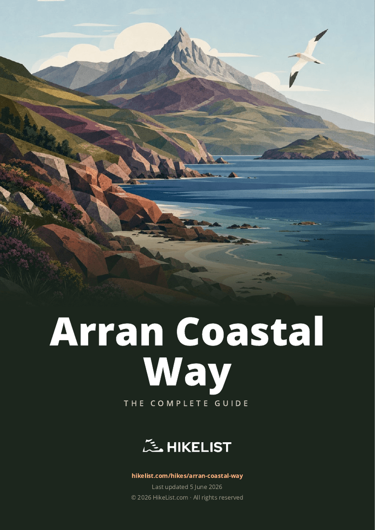
Arran Coastal Way
How would you rate Arran Coastal Way?
Tap a star to share your experience and help other hikers.
Arran Coastal Way: A Complete Hiking Guide
HikeList Score
Arran Coastal Way scored 94/100 on HikeList's trail-quality metrics.
See score breakdownHide breakdown
- Ideal length 100
- Balanced challenge 100
- Scenery & wildness 98
- Varied terrain 100
- Accommodation 83
- Food & support 81
- Path quality 87
- Season flexibility 89
Computed from length, challenge, scenery & wildness, terrain variety, accommodation, food & support, path quality and season flexibility.
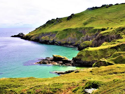
The Arran Coastal Way is a 105 km circular long-distance walk around the Isle of Arran in Scotland, starting and finishing at Brodick ferry terminal. Allow 6-8 days; fit walkers may complete it in 6, while 7-8 days is more typical. It is a moderate route, but not a soft coastal stroll: expect beaches, rocky shore, tidal boulderfields, forest, moorland, quiet road sections and an optional high route over Goatfell’s shoulder.
Route Overview
The route circumnavigates Arran, usually walked anti-clockwise from Brodick. The 8 official stages run Brodick-Sannox/Corrie, Sannox/Corrie-Lochranza, Lochranza-Imachar, Imachar-Blackwaterfoot, Blackwaterfoot-Lagg, Lagg-Whiting Bay, Whiting Bay-Lamlash and Lamlash-Brodick. Key stops include Corrie, Sannox, Lochranza, Pirnmill, Imachar, Blackwaterfoot, Lagg, Kildonan, Whiting Bay and Lamlash. Access is straightforward by CalMac ferry to Brodick from Ardrossan, or to Lochranza from Claonaig. If you like island and coastal routes, compare it with the Ayrshire Coastal Path on the mainland or the longer Anglesey Coastal Path.
History and heritage on the Arran Coastal Way
The Arran Coastal Way has been recognised as one of Scotland’s Great Trails since June 2017, and is waymarked with yellow markers, with red markers for alternative routes. The walk also passes several sites with deeper history: Lochranza Castle is a ruined medieval tower house associated with stories of Robert the Bruce, King’s Cave is tied to the Bruce spider legend, Machrie Moor preserves prehistoric stone circles and cairns, and Holy Isle is linked with a 6th-century hermitage associated with St Molaise.
Notable highlights
- Goatfell (874 m): Arran’s highest point is reached only on the optional high-route variant of Stage 1. The coastal low route avoids it, but the high option gives wide views over the Firth of Clyde towards Kintyre.
- Lochranza Castle: A ruined 13th-16th century L-plan tower house on a spit in Lochranza Bay. It is a memorable landmark as the route reaches the north of the island.
- King’s Cave: A large sandstone sea cave near Blackwaterfoot, now set back from the shore. By legend it is where Robert the Bruce was inspired by a persistent spider.
- Machrie Moor standing stones: Arran’s most important prehistoric site, near Blackwaterfoot. The area includes six stone circles, standing stones and cairns dating from roughly 3500-1500 BCE.
- Glenashdale Falls and Iron Age fort: A short inland excursion above Whiting Bay leads to a waterfall and the remains of an Iron Age hillfort, with the Giants’ Graves nearby.
- Holy Isle: A small island in Lamlash Bay, home to a Buddhist retreat centre and a hermitage associated with St Molaise. It is a clear landmark across the bay on the final stages.
Challenges to expect
The main difficulties are underfoot and tidal rather than altitude. Expect rocky shore, sand, dirt, gravel, paved sections and tidal boulderfields, including areas around the Black Cave shore and the shore to Cordon that may be impassable near high tide. Check tide tables, use road alternatives where needed, and treat the optional Goatfell high route as a mountain day. For another Scottish coastal comparison, see the Berwickshire Coastal Path or the more remote Assynt Coastal Path.
HikeList Score
Arran Coastal Way scored 94/100 on HikeList's trail-quality metrics.
See score breakdownHide breakdown
- Ideal length 100
- Balanced challenge 100
- Scenery & wildness 98
- Varied terrain 100
- Accommodation 83
- Food & support 81
- Path quality 87
- Season flexibility 89
Computed from length, challenge, scenery & wildness, terrain variety, accommodation, food & support, path quality and season flexibility.
Show more data Show less
- Coastal
- Mountainous
- Forest
- Moorland
- Rocky
- Dirt
- Gravel
- Paved
- Sand
- Hotels
- Guesthouses
- Campsites
- Family Friendly
- Pet Friendly
- Restrooms
- Water Sources
- Campsites
Download Our Full Guide to Arran Coastal Way FREE!
Get our comprehensive guide to this hike for free. Save it for later reading or print out at home.
In these collections
Photos from hikers
Taken on the trail by people who've reviewed Arran Coastal Way.
Arran Coastal Way: The Complete Guide
 i
Image by goinyk
i
Image by goinyk The Arran Coastal Way is a 105 km circular walk around the Isle of Arran, starting and finishing at Brodick after arriving by CalMac ferry from Ardrossan. It earns its “Scotland in miniature” tag: beaches, rocky shore, forest tracks, open moorland, quiet road walking and an inscribed UNESCO Global Geopark landscape sit alongside Lochranza Castle, King’s Cave, Machrie Moor, Holy Isle and the wild north coast between Sannox and Lochranza. It suits reasonably fit walkers who want a full island circumnavigation rather than a gentle promenade, with the optional Goatfell high route adding a serious mountain day for experienced hill walkers.
The route asks for steady multi-day fitness, confident footing on rock, sand and boulders, and sensible planning around the tide-dependent shore sections near Bennan Head, Black Cave and Cordon, where waymarked inland or road alternatives exist. This guide covers the stages and itineraries, overnight stops, accommodation and camping, food and water, ferries and island transport, terrain, navigation, weather, gear, support services, shorter sections and the common planning mistakes to avoid.
Stage-by-Stage Guide
Stage 1: Brodick to Sannox — 12 km
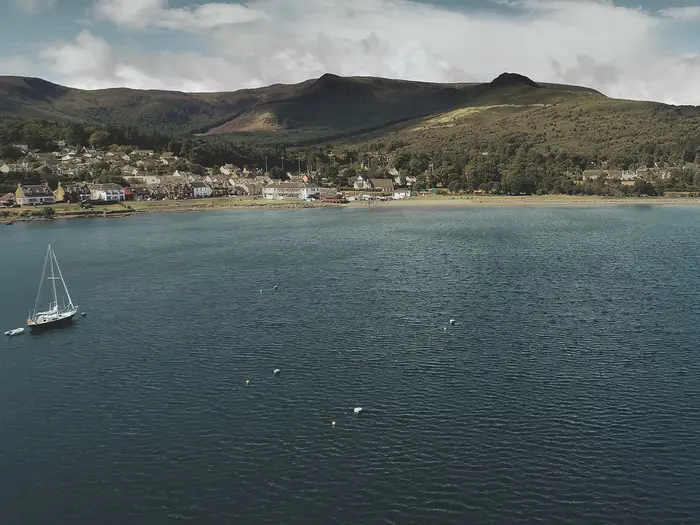
The opening stage is the easiest way to settle into the Arran Coastal Way if the standard low route is taken. It starts at Brodick ferry terminal, where the CalMac ferry from Ardrossan arrives, and immediately gives useful access to full village services: shops, cafés, restaurants, hotels, B&Bs, a bakery, Arran Active Outdoor Shop on the seafront, a taxi rank beside the terminal and the Co-op on Shore Street.
The standard route follows Fisherman's Walk beside Brodick Bay to Cladach, where there is a small cluster of shops, then continues through Merkland Wood on good forest tracks. It passes the old harbour below Brodick Castle before emerging towards the east-coast road through High Corrie and on to Sannox. Underfoot, expect a straightforward mix of footpath, pavement, forest track and quiet road walking. Navigation is generally simple, with the usual yellow gannet waymarkers.
Corrie makes a useful pause before the final road section to Sannox. The village has a hotel with public bar and restaurant, a café and B&Bs, and the coastal road north gives wide sea views and good wildlife-watching potential. Sannox itself has a hotel and bus access back towards Brodick.
There is an important variant on this stage: the optional Goatfell high route. From Cladach it leaves the coast to climb Goatfell, Arran's highest summit at 874 m, before rejoining towards Corrie. This changes the character of the day completely. It becomes a mountain walk of about 15.5 km with roughly 890 m of ascent, over rougher ground and with no Arran Coastal Way waymarkers on National Trust for Scotland land or on Goatfell itself. It needs clear weather, hill-navigation ability and appropriate mountain clothing. In low cloud, high wind or poor visibility, the standard coastal route is the safer and more appropriate Arran Coastal Way option.
Food and drink are available at Brodick and Corrie, with limited services at Sannox. Accommodation is available in Brodick, Corrie and Sannox, but Sannox has fewer choices, so booking ahead is sensible. Island buses serve the A841 corridor through Corrie and Sannox, making this a straightforward stage to shorten or reverse as a day walk.
Stage 2: Sannox to Lochranza — 14.5 km
This is one of the wildest and most memorable stages of the route. Once north of Sannox there are no facilities until Lochranza, and the walking becomes increasingly rugged as the path rounds Arran's exposed north coast. Start with enough food and drink for the whole day.
The stage begins on a broad, well-made gravel path past Sannox Bay, with views across to the Isle of Bute and mainland Ayrshire. The going is initially comfortable, but the terrain changes after the Fallen Rocks, a striking landslide area of huge conglomerate boulders below the cliffs. The path threads through the rocks, passes small caves, then becomes narrower, wetter and rougher in places.
Beyond the ruined Laggan Cottage, the route feels more remote. It reaches the Cock of Arran, a large eroded sandstone boulder on the north coast, before tackling An Scriodan. This is the most demanding part of the stage: a boulderfield where rocks tumble towards the sea and the path climbs above the worst ground before dropping back towards shore level. Minor scrambling and careful foot placement are needed. Although the path has been improved, it remains slow, awkward terrain, especially when wet.
This stage is not primarily a tidal problem, but it is a commitment issue: there is no close road alternative through the roughest north-coast section, and mobile signal may be limited. In poor weather, allow more time than the distance suggests and avoid starting late.
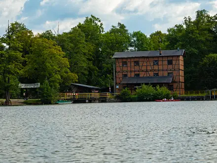
The approach to Lochranza becomes easier, with path and road walking leading into the village and excellent views of Lochranza Castle on its spit. Lochranza has accommodation at the youth hostel, hotel and campsite, plus the distillery café. There is no general shop in Lochranza, so supplies should not be left until arrival. The seasonal CalMac ferry to Claonaig provides an alternative access point from Kintyre, and island buses connect Lochranza with Brodick via the A841.
Stage 3: Lochranza to Imachar — 14.5 km
Stage 3 is varied but logistically awkward because it ends at Imachar, where there are no facilities, no pub, no shop and no accommodation. Walkers finishing the day there need a pre-arranged pick-up, a bus plan using the A841, or an itinerary that continues to accommodation elsewhere.
From Lochranza the route leaves on the old Postie's Path, climbing through birchwoods above the coast road. This is rough and muddy in places but gives fine views back over Loch Ranza and across to Kintyre. It then descends to Catacol, a small hamlet with no shop, pub or accommodation; the Catacol Bay Hotel closed in 2018, so there is no food or drink stop here. The row of estate cottages known as the Twelve Apostles is a notable local feature.
South of Catacol, the character changes sharply. The route follows the A841 coastal road, or its verge, for a long section towards Pirnmill. The road is quiet and scenic, with the sea close by, but it is still tarmac walking and can feel hard on the feet. Pirnmill is the key service point of the day, with B&B accommodation, a shop with post office and a seasonal café or restaurant. It is the sensible place to buy food or drink before the final section.
Near Catacol, a return detour of about 5 km can be made to Coire Fhionn Lochan. It is a worthwhile upland side trip in settled weather, but it adds significant time and should not be treated as part of the standard stage.
The final section before Imachar leaves the road for around 3 km of rugged coast. Expect boulder-hopping, rough shoreline, a faint path in places, small caves and low cliffs. It is awkward rather than technically difficult, but progress can be slow, particularly with a multi-day pack. Navigation is not complicated in clear conditions, but waymarking can feel sparse where the shore itself dictates the line.
Stage 4: Imachar to Blackwaterfoot — 14.5 km
This stage has the longest sustained road-walking section of the Arran Coastal Way, but it is redeemed by two of the route's strongest cultural and geological highlights: Machrie Moor and King's Cave.
From Imachar, the route follows the quiet A841 coast road south for several kilometres. Underfoot it is easy, but the tarmac can become tiring and the walking is less immersive than the rougher coastal stages. The island bus follows this road corridor, so walkers who need to shorten the day can use public transport for part of this section. Machrie Bay Golf Course and Tearoom provides a useful refreshment stop roughly midway.
At the Machrie Water crossing, a signed detour leads inland to Machrie Moor stone circles. This adds about 7 km there and back, but it is one of Arran's most important prehistoric sites, with six stone circles, standing stones and cairns dating from roughly 3500–1500 BCE. Anyone building a slower itinerary around the west side of the island should allow time for it.
The route leaves the road at the Forestry and Land Scotland car park and follows a good woodland and coastal path towards King's Cave. This large sandstone sea cave is associated by legend with Robert the Bruce and the spider, and sits in an impressive cliff setting. From here the path rounds Drumadoon Point, passing below the fort on the basalt headland. Dinosaur footprints can be seen on the rocky shore near this area.
The final approach crosses sandy beach into Blackwaterfoot, the main village on the west coast. Services are good by Arran standards: hotels with public bars and restaurants, a village shop with post office, off-licence, groceries and ATM, a butcher, bakehouse and takeaway. This is a strong resupply stop and a practical place to schedule a shorter or recovery evening. Bus connections run to Brodick.
Stage 5: Blackwaterfoot to Lagg — 12 km
Although short on paper, this is a physically demanding stage because the coast south of Blackwaterfoot is rough, boggy and slow. There are no facilities between Blackwaterfoot and Lagg, so leave with enough food and drink for the day.
The route leaves Blackwaterfoot on a minor road that becomes a sandy track, then narrows beside a stone wall near the coast. Early walking is grassy and keeps just inland from the rockier shore, with a small stream crossed on stepping stones. After Kilpatrick Point the ground becomes more difficult, with boggy patches, boulders and rough coastal path. This is among the hardest underfoot terrain on the whole route.
The stage passes three caves, including the Preaching Cave, a smoke-blackened cave used as a church by Free Church worshippers after the Clearances of 1843. It is an atmospheric landmark, but the surrounding terrain still demands attention. In wet weather, expect slow progress and avoid judging the day by distance alone.
Eventually the route climbs to the road, where the walking becomes easier but remains undulating. Views open south towards Ailsa Craig and across to the Mull of Kintyre. Near the end of the stage the route passes Lagg Distillery, the island's second distillery, with tours, tastings and a café or visitor centre. Current opening times should be checked before relying on it for food.
Lagg has a traditional hotel with bar and restaurant, and there is a bunkhouse near Lagg. The A841 gives road access and possible bus connections. Accommodation options are limited, so this is a stage where advance booking or a pre-arranged transfer is particularly important.
Stage 6: Lagg to Whiting Bay — 16 km
This is the longest stage of the standard eight-day schedule and contains the most serious tidal hazard on the route. It is a superb south-coast day in good conditions, but it should be planned around tide times, not just mileage.
From Lagg the route heads east along the south coast, initially on more straightforward coastal path. The key decision comes around Bennan Head and the Black Cave. The Black Cave is Arran's largest cave, set below dramatic basalt cliffs, but the coastal line here must be avoided within two hours before or after high tide. At high tide the section is impassable. Tide tables should be checked before setting out, and the signed red-waymarked inland diversion should be used when timings are unfavourable.
Even at a suitable tide, the coastal route around Bennan Head is hard work. Expect significant boulder-hopping and terrain that is more demanding than the easier parts of the Arran Coastal Way. This line suits fit walkers in stable conditions; tired parties, heavily loaded walkers or anyone facing poor weather should seriously consider the inland alternative.
After Bennan Head the route continues towards Kildonan, with dramatic igneous dykes running into the sea and regular seal sightings on the rocks. Kildonan has a hotel with bar and restaurant, a small shop and a campsite, and gives views to Pladda Island and, in clear conditions, Ailsa Craig. It is the main service point between Lagg and Whiting Bay.
Further east, the route meets more awkward ground around Dippen Head before conditions ease. At Drimlabarra, an inland escape route follows forestry tracks towards Glenashdale Falls and on through woods to Whiting Bay. This red-waymarked alternative is a practical choice if tides, weather or tired legs make the coastal boulderfields unattractive. Glenashdale Falls are also a worthwhile objective in their own right.
Whiting Bay is one of the best resupply stops on the route, with two grocers, hotels and B&Bs, cafés, restaurant, post office, chemist, newsagent, garage and other village services. It is a sensible overnight stop after this longer and more committing stage.
Stage 7: Whiting Bay to Lamlash — 10 km
Stage 7 is shorter and generally gentler than the previous day, with views of Holy Isle dominating much of the approach to Lamlash. There are two main route choices, both worthwhile depending on conditions and whether Glenashdale Falls has already been visited.
The coastal option goes through Whiting Bay, then rounds Kingscross Point. It passes a Viking burial ground and an Iron Age hill fort near the point, with strong views across to Holy Isle. It then continues through shoreside woodland and along coastal boardwalk towards Lamlash Bay. The boardwalk between Cordon and Kingscross can be very slippery in wet weather and in winter.
The inland option swings towards Glenashdale Falls before continuing through forest to Lamlash. This is a good choice if the falls were missed on Stage 6, or if a less tidal, more sheltered line is preferable.
There is a tidal note on the coastal route near Cordon and Kingscross Point: a small section is not passable for around one hour either side of high tide. Check tide times before leaving Whiting Bay. This is a shorter and less severe timing issue than Bennan Head, but it can still disrupt the day.
Holy Isle is the major visual landmark throughout much of the stage. The island sits in Lamlash Bay and is home to a Buddhist retreat centre, with a hermitage associated with St Molaise.
Lamlash is a strong overnight stop, with a supermarket, hotels, B&Bs, pub, bakery, chemist, post office, garage and medical services. It also has bus connections to Brodick, making this stage easy to use as part of a shorter section walk. Lamlash Bay is a designated No Take Zone marine conservation area, and the shore gives some of the best views of Holy Isle.
Stage 8: Lamlash to Brodick — 8 km
The final stage is the shortest of the circuit, but it is not simply a flat promenade into Brodick. It mixes minor road, coastal footpath, rough shoreline, cart track and field walking, with a choice of routes near Clauchlands Point.
From Lamlash the route follows a minor road around the bay, with further views of Holy Isle, before taking a footpath towards Clauchlands Point. At extreme high tides, parts of the yellow coastal route near Clauchlands Point can be a few inches underwater, although it is normally possible to stay higher on the beach and continue with wet feet. The red alternative via Dun Fionn avoids the wettest shoreline but is not an easier option: it climbs steeply to an Iron Age fort with views, then descends very steeply on a rough path.
Beyond Clauchlands Point the route continues along rough shoreline to Corriegills, where it joins the road. From North Corriegills and through Strathwhillan Farm, cart track and field paths lead back into Brodick. The final kilometres are straightforward, but muddy field sections and rough shore can still slow progress after rain.
Brodick has the full set of end-of-walk services: ferry terminal, toilets, waiting area, Wi-Fi, bus connections, taxi rank, Co-op, cafés, restaurants, hotels and outdoor shop. The route finishes at the Arran Coastal Way obelisk opposite The Douglas Hotel near the ferry terminal. Walk completion certificates are available from The Douglas Hotel reception, and Arran Coastal Way T-shirts are available from Arran Active Outdoor Shop on Brodick seafront.
Recommended Itinerary
Standard itinerary: 8 walking days
This is the best default for most independent walkers. It follows the official 8-stage breakdown, keeps daily distances manageable, and gives more room for slow shore sections, tide timing and accommodation logistics. The distances look modest on paper, but boulders, sand, rocky coast and occasional road walking can make progress slower than a normal lowland trail.
| Day | From | To | Approx. distance | Why this stage makes sense | Services/accommodation notes |
|---|---|---|---|---|---|
| 1 | Brodick | Sannox | 12 km / 7.5 miles | A short first day from the ferry village, allowing time for arrival by CalMac ferry from Ardrossan. The standard coastal route stays low; the Goatfell high route is an optional mountain variant and should only be added by experienced hill walkers in suitable conditions. | Brodick has the island’s main services, including hotels, B&Bs, a supermarket and outdoor kit at Arran Active Outdoor Shop. Corrie, en route, has hotel/hostel accommodation and a pub, making it a useful shorter-stage option. Sannox has limited accommodation; book ahead. |
| 2 | Sannox | Lochranza | 14.5 km / 9 miles | One of the wilder northern stages, passing the Cock of Arran and finishing in Lochranza. There are no facilities between Sannox and Lochranza, so start with enough food and water. | Lochranza has hotel and B&B accommodation plus Lochranza Youth Hostel. It is also the access point for the seasonal CalMac ferry to Claonaig on Kintyre. |
| 3 | Lochranza | Imachar | 14.5 km / 9 miles | A west-coast stage with useful intermediate places at Catacol and Pirnmill before the quieter finish at Imachar. | Catacol has an inn/hotel. Pirnmill has a B&B, seasonal café/restaurant and shop, and is the last practical supply point before Imachar. Imachar itself has no facilities, so overnight plans and food must be arranged in advance. |
| 4 | Imachar | Blackwaterfoot | 14.5 km / 9 miles | A sensible recovery from the sparse Imachar stop, ending at one of the route’s better resupply points. This is also the stage where Machrie Moor can be added as a worthwhile detour if time and energy allow. | Blackwaterfoot has a small supermarket, bakery, hotel and B&Bs. It is a strong place to reset food supplies after the quieter west-coast section. |
| 5 | Blackwaterfoot | Lagg | 12 km / 7.5 miles | A shorter day, useful because the south-west and south-coast walking can be slow underfoot. Tide timing matters around the Black Cave / Bennan Head area; use the waymarked road or inland alternatives when the shore is unsuitable. | Lagg has very limited accommodation, with The Lagg Inn and nearby bunkhouse accommodation. Book early, especially in July and August, and have a backup plan if beds are unavailable. |
| 6 | Lagg | Whiting Bay | 16 km / 10 miles | The longest day on the standard itinerary. It keeps the route moving round the south and south-east coast and finishes in a village with strong services. | Kildonan, between Lagg and Whiting Bay, has a seafront hotel and a campsite, making it a useful alternative overnight if Lagg is full or if a shorter split is needed. Whiting Bay has a good range of B&Bs, hotels, shops, cafés and a Post Office/store. |
| 7 | Whiting Bay | Lamlash | 10 km / 6 miles | A shorter day with scope for the inland excursion to Glenashdale Falls, the Iron Age fort and the Giants’ Graves if conditions and timings suit. The shore to Cordon near Lamlash can be tide-dependent; use the inland alternative when required. | Lamlash is the largest village on Arran and has excellent practical services: supermarket, hospital, doctor, chemist, post office, bakery, pub, garage, hotels with restaurants, B&Bs and cafés. Views of Holy Isle make it a natural final overnight stop. |
| 8 | Lamlash | Brodick | 8 km / 5 miles | A short final stage back to the ferry terminal, useful for matching the walk to an onward CalMac sailing from Brodick to Ardrossan. | Brodick has full village services, accommodation and the ferry terminal. If collecting a completion certificate, The Douglas Hotel is the relevant stop. |
Slower variant: 9–10 days
Choose this if accommodation availability forces shorter days, if the Goatfell high route is being added, or if extra time is wanted for Machrie Moor, Glenashdale Falls or relaxed ferry connections. The most practical slower splits are around the places that already have services, rather than trying to create unsupported wild gaps.
| Day | From | To | Approx. distance | Why this stage makes sense | Services/accommodation notes |
|---|---|---|---|---|---|
| 1 | Brodick | Corrie | Check official mapping before booking | Breaks the opening stage and gives an easy first day after the ferry. | Corrie has hotel/hostel accommodation and a pub. |
| 2 | Corrie | Sannox | Check official mapping before booking | Keeps the north-east coast relaxed and avoids rushing the start of the route. | Sannox accommodation is limited; book before committing to this split. |
| 3 | Sannox | Lochranza | 14.5 km / 9 miles | This stage should usually be kept intact because there are no facilities between Sannox and Lochranza. | Carry the day’s food and water. Lochranza has accommodation and the youth hostel. |
| 4 | Lochranza | Imachar | 14.5 km / 9 miles | Keeps the official west-coast stage intact while still allowing stops at Catacol and Pirnmill. | Use Pirnmill for last supplies before Imachar. Imachar has no facilities. |
| 5 | Imachar | Blackwaterfoot | 14.5 km / 9 miles | A manageable day into a strong resupply village. | Blackwaterfoot has a small supermarket, bakery, hotel and B&Bs. |
| 6 | Blackwaterfoot | Lagg | 12 km / 7.5 miles | Keeps the tide-aware south-west section short enough to avoid forcing poor timing around the Black Cave / Bennan Head area. | Lagg accommodation is very limited; book well ahead. |
| 7 | Lagg | Kildonan | Check official mapping before booking | Splits the longest standard stage and creates a shorter south-coast day. | Kildonan has a small seafront hotel and a campsite. |
| 8 | Kildonan | Whiting Bay | Check official mapping before booking | Completes the south-east coast at an easier pace. | Whiting Bay has a good spread of accommodation, shops and cafés. |
| 9 | Whiting Bay | Lamlash | 10 km / 6 miles | Leaves time for the Glenashdale Falls area or for working around the tide-dependent shore to Cordon. | Lamlash has the best service range outside Brodick. |
| 10 | Lamlash | Brodick | 8 km / 5 miles | A short finish that pairs well with an afternoon ferry. | Brodick has the ferry terminal, supermarket, accommodation and other main-village services. |
Faster variant: 7 walking days
A 7-day schedule suits fit walkers who are comfortable with one longer final day and do not want to linger at every village. It keeps the more awkward accommodation points in the plan but combines the two shortest closing stages.
| Day | From | To | Approx. distance | Why this stage makes sense | Services/accommodation notes |
|---|---|---|---|---|---|
| 1 | Brodick | Sannox | 12 km / 7.5 miles | Standard opening stage from the ferry side of the island. | Brodick is the main supply point; Sannox accommodation is limited. |
| 2 | Sannox | Lochranza | 14.5 km / 9 miles | Keeps the no-facilities northern stage as a single day. | No facilities between Sannox and Lochranza. Lochranza has accommodation and the youth hostel. |
| 3 | Lochranza | Imachar | 14.5 km / 9 miles | Maintains the official west-coast stage without creating an overlong day too early. | Stock up at Pirnmill before Imachar; Imachar has no facilities. |
| 4 | Imachar | Blackwaterfoot | 14.5 km / 9 miles | Reaches a strong resupply point after the sparse Imachar overnight. | Blackwaterfoot has food shops, bakery, hotel and B&Bs. |
| 5 | Blackwaterfoot | Lagg | 12 km / 7.5 miles | Allows time for slow and tide-affected south-west coast walking. | Lagg beds are limited; book early or consider Kildonan/Blackwaterfoot alternatives where practical. |
| 6 | Lagg | Whiting Bay | 16 km / 10 miles | Longest stage of the standard route, but it finishes in a well-served village. | Kildonan provides an intermediate accommodation option. Whiting Bay has shops, cafés, B&Bs and hotels. |
| 7 | Whiting Bay | Brodick via Lamlash | 18 km / 11 miles | Combines the final two official stages into one longer finish, still with Lamlash as a useful services stop on the way. | Lamlash has extensive services before the final leg to Brodick. Check ferry times from Brodick before relying on a same-day departure. |
Very fast option: 6 days or fewer
A 6-day completion is possible for strong, experienced walkers, but it requires combining stages and accepting several long days on terrain that is often slower than the distance suggests. The most demanding combinations are Lochranza to Blackwaterfoot at about 29 km and Blackwaterfoot to Whiting Bay at about 28 km. This is not the best choice for a first visit, for walkers relying on limited village accommodation, or for anyone wanting to add Goatfell, Machrie Moor or Glenashdale Falls without pressure.
If using a compressed itinerary, check current island bus options before travelling, especially around Pirnmill, Imachar, Blackwaterfoot and the south coast. The bus network can be useful for skipping a difficult accommodation gap or shortening a day, but it should not be treated as a substitute for a planned overnight.
Planning the Route
How many days to allow
Most walkers should plan the Arran Coastal Way as a 7- or 8-day walk. The official stage pattern is eight days, and that is the simplest way to match the route to the island’s accommodation villages. A 6-day itinerary is realistic for fit, efficient walkers, but it leaves less margin for slow boulderfields, tide windows, poor weather and limited evening services in smaller places.
The route is rarely improved by rushing. The daily distances look modest on paper, but progress can be slow on rocky shore, sand, forest tracks and tidal sections. A steadier plan also makes it easier to add the optional Goatfell high route, visit Machrie Moor or Glenashdale Falls, or avoid forcing a shore section at the wrong state of tide.
| Itinerary length | Best for | Planning implications |
|---|---|---|
| 6 days | Strong walkers used to long days and rough ground | Longer daily stages; less tide and weather flexibility; accommodation must be aligned carefully |
| 7 days | Most independent walkers wanting a practical pace | A good balance of distance, recovery time and village accommodation |
| 8 days | Walkers wanting the official stage rhythm or more time for side trips | Easiest to fit around villages; better for Goatfell, Machrie Moor or slower tidal sections |
| 9–10 days | Walkers wanting a relaxed holiday pace | Useful if splitting longer southern stages or using buses to create shorter days |
Stage planning and accommodation villages
The stages are strongly shaped by where accommodation and services exist. This is an island route, not a continuous line of villages, and some stretches have no facilities between stage ends. Booking the overnight stops is usually the most important part of planning the walk.
| Stage area | Planning notes |
|---|---|
| Brodick | Best overall service base on the island, with a Co-op supermarket and the widest choice of accommodation. Also the ferry arrival and departure point. |
| Corrie / Sannox | Useful first-night area if following the standard northbound stage pattern. Services are limited compared with Brodick. |
| Sannox to Lochranza | No facilities between the two. Carry food and water for the full section. |
| Lochranza | Key overnight stop in the north, with limited capacity. There is a hotel, B&B accommodation and a SYHA hostel, but beds can fill quickly. |
| Catacol / Pirnmill / Imachar | Pirnmill has a B&B, café and shop, useful part-way through the west-coast stage. Accommodation around Imachar is limited, so this stage often needs early booking or a bus solution. |
| Imachar to Blackwaterfoot | Limited or no facilities between the main stopping points. Plan food and water before leaving. |
| Blackwaterfoot | Important west-coast service village and base for visiting King’s Cave and Machrie Moor. |
| Blackwaterfoot to Lagg | No facilities between the two. This is a section to start with supplies already packed. |
| Lagg | Limited overnight options, including hotel/inn accommodation and a nearby bunkhouse, with opening patterns that may vary. Book early. |
| Kildonan | South-coast hotel stop; useful if splitting or adjusting the southern stages. |
| Whiting Bay | Good service village with shop, B&Bs, hotels and cafés. Useful for resupply and for the Glenashdale Falls side trip. |
| Lamlash | Good final overnight before Brodick, with shop, cafés, B&Bs and hotels. |
For July–August, bank holidays and the main walker season from May to August, accommodation should be booked well in advance. Lochranza, Lagg and the smaller west- and south-coast stops are the most likely to dictate the itinerary. If a village is full, the island bus network can sometimes make it practical to stay in the next or previous village and return to the trail the following morning.
Dinner also needs planning in the smaller villages. Do not assume there will be multiple evening food options at every stop, and book meals ahead where accommodation or local operators recommend it.
Transport and section-hiking flexibility
The loop starts and finishes at Brodick ferry terminal, which makes the overall route simple to access. The usual approach is by CalMac ferry from Ardrossan to Brodick, with trains from Glasgow Central to Ardrossan Harbour connecting with the ferry. The ferry crossing is about 55 minutes, and the train journey from Glasgow Central to Ardrossan Harbour is about an hour. Current ferry and rail times should be checked before travelling, especially if arriving late in the day or connecting directly to the first walking stage.
The island bus network is one of the route’s biggest practical advantages. Stagecoach Arran services, including the 322, 323 and 324, link the main settlements around the island, and Traveline Scotland is useful for journey planning. This makes the Arran Coastal Way much easier to shorten, split or rescue than many Scottish long-distance routes.
Good uses of the buses include:
- staying in one base, such as Brodick, and walking separate stages as day walks;
- busing around a full accommodation village and returning to the missed section later;
- shortening a day if weather, fatigue or tide timing becomes a problem;
- walking the route over several separate visits rather than in one continuous trip;
- avoiding a tide-blocked shore section where a road or bus alternative is more sensible.
Most self-guided packages and baggage services do not include ferry and bus travel, so these usually need to be arranged independently.
Tides: the main timing issue on the route
The whole route is not tide-dependent, but two sections need proper tidal planning:
| Section | Planning rule |
|---|---|
| Black Cave / Bennan Head shore route, south coast | Avoid the coastal shore route for about 2 hours before and after high tide. Use the road or inland alternative if the timing is wrong. If already committed and caught by the tide, wait for the water to drop. |
| Shore to Cordon near Lamlash | Not passable for about 1 hour before and after high tide. A bus alternative exists. |
The Clauchlands Point area can also be affected at high tide, with higher ground providing the practical line through. Check tide times before any stage with a shore option, not just the night before the trip. The important question is whether the relevant shore section can be reached within the safe tidal window, which may affect the day’s start time more than the day’s distance.
Use a current tide table, tide app or local tide information before setting out. This should be checked before travelling.
Navigation and route-finding
The main route is waymarked with yellow gannet marker posts; alternatives use red gannet posts. The waymarking is helpful, but it is not continuous hand-holding. Markers are mainly at junctions and can be miles apart in open or straightforward sections.
Carry a proper map and know how to use it. A Harvey Superwalker or Ordnance Survey map is appropriate, and a guidebook such as the Rucksack Readers guide is useful for stage detail. A GPS app or downloaded GPX track adds confidence, but mobile signal can be variable, so do not rely on live data.
A compass is especially important if adding the Goatfell high route on Stage 1. Goatfell is a mountain day, not part of the standard low-level coastal route, and it adds significant ascent, exposure to weather and navigation responsibility.
Food, water and daily supplies
Plan supplies around the villages rather than assuming services appear during the day. Brodick has the strongest resupply options, while Whiting Bay and Lamlash are also useful service villages. Pirnmill is a useful stop on the west coast, with a café and shop, but several sections have no facilities at all between endpoints.
Carry lunch, snacks and enough water for the full day on these stretches in particular:
- Sannox to Lochranza;
- Pirnmill / Imachar to Blackwaterfoot, depending on the exact overnight stop;
- Blackwaterfoot to Lagg.
Water availability away from villages and accommodation should not be assumed. In warm weather or when tide timing may cause waiting on shore sections, start with extra capacity.
Shortening, extending and variants
The easiest way to shorten the route is to use the island buses to skip a stage or link back to accommodation. This is also the simplest backup if an overnight stop is unavailable or a tide window does not work.
The main extension is the optional Goatfell high route on Stage 1. It reaches Goatfell’s 874 m summit and turns the opening day into a serious hillwalking outing. It should be reserved for experienced hill walkers with suitable weather, clothing, navigation equipment and time. The standard coastal route stays much lower and should be treated as the default itinerary.
Other worthwhile additions include:
- Machrie Moor standing stones near Blackwaterfoot;
- Glenashdale Falls above Whiting Bay;
- a more relaxed 9- or 10-day schedule by splitting the longer or slower southern stages.
What to book first
Prioritise planning in this order:
- Accommodation — the biggest constraint, especially in Lochranza, Lagg and the smaller west- and south-coast stops.
- Ferry travel — CalMac Ardrossan–Brodick sailings should be checked before committing to arrival and departure days. Vehicle spaces need advance booking; foot passengers should still book ahead at busy times.
- Tide windows — especially for the Black Cave / Bennan Head shore route and the shore to Cordon near Lamlash.
- Baggage transfer — Explore Arran offers island-based accommodation booking and baggage transfer; several self-guided operators also include luggage transfer.
- Evening meals — book ahead in smaller villages where options are limited.
No special permit is the main planning issue here. The practical constraints are beds, ferries, tides, food, weather and the ability to navigate confidently when waymarks are sparse.
Towns, Villages and Overnight Stops
The Arran Coastal Way is well served by villages, but services are unevenly spread. Brodick, Blackwaterfoot, Whiting Bay and Lamlash are the easiest places for food and accommodation choice; Sannox, Imachar, Lagg and parts of the south coast need more careful planning.
Stagecoach island buses give useful escape and section-walking options. Route 324 serves the north and west side from Brodick through Corrie, Sannox, Lochranza, Catacol, Pirnmill and Imachar towards Blackwaterfoot. Route 323 serves the south and east side between Brodick, Lamlash, Whiting Bay, Kildonan, Lagg and Blackwaterfoot. Route 322 crosses the island between Brodick and Blackwaterfoot via the String Road. Services broadly connect with CalMac ferries at Brodick, and an Arran DayRider can be useful for hop-on hop-off travel. Timetables change, so check stagecoachbus.com before relying on any bus for an escape, section break or ferry connection.
| Place | Best use for walkers | Food and resupply | Planning note |
|---|---|---|---|
| Brodick | Start/finish base; best first-night stop | Best grocery shop on the island | Buy trail food here before leaving |
| Corrie | Lunch stop or very short overnight | Hotel food only; no proper shop | Do not rely on it for provisions |
| Sannox | Stage 1 overnight | Hotel food only; no shop | No facilities until Lochranza |
| Lochranza | Key north-island overnight | Pub/café options, but no grocery shop | Book early; carry food for the next leg |
| Pirnmill | Important Stage 3 resupply | Small shop and seasonal food | Check opening hours before depending on it |
| Imachar | Bus point only | None | Not a practical overnight stop |
| Blackwaterfoot | Main west-coast overnight | Strongest west-side resupply | Excellent place to restock |
| Lagg | Quiet south-end overnight | Inn only | Must be booked ahead |
| Kildonan | Lunch stop or alternative overnight | Hotel only, seasonal | Check opening dates before planning around it |
| Whiting Bay | Comfortable south-east overnight | Village shop and cafés | Good base for Glenashdale Falls |
| Lamlash | Penultimate overnight | Good food and general shop | Best final-night option before Brodick |
Brodick
Brodick is the start and finish of the loop and the island’s main practical base. The CalMac ferry from Ardrossan arrives here, so it is the natural place to stay before starting, after finishing, or both.
Accommodation choice is broader than anywhere else on the route, with hotels, guesthouses, B&Bs and self-catering. Options include Auchrannie Resort, The Douglas Hotel, Ormidale Hotel and Hunters Guesthouse near the shore and ferry. Summer demand is high, especially around ferry weekends and school holidays, so book well ahead.
For food and supplies, Brodick is the most reliable resupply point on the island. The Co-op on the main street is the best place to buy trail food before leaving. There are also cafés, restaurants, hotel dining, a post office, chemist, bank and tourist information. The Ormidale Hotel is a useful pub stop and is known for local Arran beers and malts. Arran Cheese Shop, Arran Aromatics at Duchess Court and Janies Tea Room are useful if building in time before or after the walk.
Brodick is also the access point for the optional Goatfell high-route variant on Stage 1. If taking that option, start with enough food and water for a much harder day than the standard low-level coastal route. Walkers using a baggage service or staying again in Brodick after the first stage may find it sensible to leave unnecessary kit in town before heading north.
Corrie
Corrie is a small east-coast village about 7 km north of Brodick on the first stage towards Sannox. It is more often a lunch or drinks stop than a standard overnight, but it can work well for a deliberately short first day, slower walkers, families, or anyone starting late after a ferry arrival.
The main walker-friendly service is the Corrie Hotel, a pub-hotel directly on the coast with bar and restaurant. North High Corrie Croft Bunkhouses sit above the village and are more suited to group bookings; there are also self-catering cottages in the area. Food options beyond the hotel are very limited.
Corrie has no proper general shop. The small jewellery shop and The Wee Bookstore are not provision stops, so supplies should be bought in Brodick before departure. Stagecoach route 324 stops in Corrie, making it easy to shorten the first day or return to Brodick if plans change.
Sannox
Sannox is the normal end of Stage 1, roughly 12 km from Brodick on the standard coastal itinerary. It is a small settlement rather than a service hub, but it matters because the next section towards Lochranza enters the wilder north coast around the Cock of Arran.
Accommodation is limited. Sannox Bay Hotel is the main overnight option, with pub and restaurant, and there is some self-catering in the area. Book before building an itinerary around Sannox, as there are no broad fallback options in the village.
There are no shops in Sannox and no further facilities until Lochranza, around 14.5 km away on Stage 2. This is one of the most important food-and-water planning points on the route. Fill bottles before leaving and carry enough food for a slow, rocky coastal day. Stagecoach route 324 serves Sannox, so it is also a useful escape point if the weather, tides or underfoot conditions make continuing unwise.
Lochranza
Lochranza is the key overnight stop at the north end of Arran and the end of Stage 2 from Sannox. It is one of the most useful villages on the route, with accommodation, a pub, the ruined castle, the distillery and the seasonal ferry link to Claonaig on Kintyre.
The Lochranza SYHA Youth Hostel is a major walker stop, with dorms, private rooms, a self-catering kitchen, drying room and lounge. Approximate hostel prices can change, so confirm current rates before booking. Lochranza Country Inn provides pub food and rooms, and there are B&Bs and self-catering cottages. Book early in summer, as capacity is limited for the number of walkers and visitors passing through.
Food options include Lochranza Country Inn, the Isle of Arran Distillery visitor centre and café, and a local sandwich takeaway/deli. The distillery café is seasonal, so do not rely on it without checking. Crucially, Lochranza has no general grocery shop. Carry food for the following day or plan a timed resupply at Pirnmill, about 6 km into Stage 3. Some basics such as water, snacks and bottled beer may be available at the hostel reception, but that is not a substitute for a proper shop.
Stagecoach route 324 serves Lochranza. The seasonal CalMac ferry to Claonaig is useful for Kintyre links or route variation, but its operating dates and times vary by year and should be checked at calmac.co.uk. The castle on its spit in Lochranza Bay is an easy short detour and worth allowing time for.
Catacol
Catacol is a tiny hamlet just south of Lochranza, reached in the opening kilometres of Stage 3. It is now purely a passing point: there is no shop, no pub and no accommodation. The Catacol Bay Hotel closed in 2018 and no longer offers food or beds, so do not plan a meal or an overnight stop here.
The hamlet is known for the Twelve Apostles, a distinctive row of twelve fishermen’s cottages, and makes a natural brief pause after leaving Lochranza. On the Lochranza-to-Imachar leg, treat Lochranza and Pirnmill as the only food, resupply and overnight options. Stagecoach route 324 stops here, giving another option for shortening or joining the west-coast section.
Pirnmill
Pirnmill is the most important service point on Stage 3 between Lochranza and Imachar. It sits on the west coast, roughly halfway through the day, and is the only real food, drink or emergency resupply opportunity on that leg.
The village has a small shop and post office stocking essentials. This is a vital stop if leaving Lochranza without enough food, but opening hours can be limited and seasonal. Do not assume the shop will be open late, early or on Sundays; check before relying on it.
There are B&Bs, limited self-catering and a bunkhouse in the area. Food may be available from a seasonal café or restaurant, and The Lighthouse Restaurant is nearby in the Pirnmill area, but seasonal opening should be checked before building plans around it. A monthly Pop Up Pub event is also associated with the village, but it is not a dependable day-to-day hiker service.
Stagecoach route 324 serves Pirnmill. For most walkers, the best use of Pirnmill is a long break, bottle refill and resupply before continuing south.
Imachar
Imachar is the end point used in the standard Stage 3 itinerary from Lochranza, but it is better understood as a road-end stopping point than a village. There is no pub, no shop, no café and no accommodation.
Because there are no services, Imachar is not a sensible planned overnight unless transport is being used to reach accommodation elsewhere. Some walkers shorten the logistics by stopping earlier at Pirnmill, while others continue through to Blackwaterfoot on a longer combined day. Stagecoach route 324 passes through Imachar, making the bus the key practical option if an escape or transfer is needed.
Blackwaterfoot
Blackwaterfoot is the main village on the west coast and one of the best overnight stops on the whole circuit. It is the end of Stage 4 from Imachar and has the strongest concentration of services between Lochranza and the south-east coast.
Accommodation includes the Kinloch Hotel, a large west-coast hotel with restaurant, bars and leisure facilities, plus Blackwaterfoot Lodge and self-catering cottages. The Kinloch is popular with golfers, tourists and walkers, so early booking is sensible in summer.
Food and resupply are strong here. The village has a well-stocked grocer/post office, butcher, newsagent, bakery and garage/petrol station. Blackwater Bakehouse is a useful stop for fresh bread, and On A Roll takeaway is another practical food option. The Kinloch Hotel serves lunch and dinner and has the only source of cask ale on the west coast of Arran.
Blackwaterfoot is also a good base for side trips. King’s Cave lies on the next stage north of the village area, while Machrie Moor standing stones are one of the island’s major prehistoric sites nearby. Transport is flexible: Stagecoach route 323 links the village with the south-coast settlements and Brodick, while route 322 crosses back to Brodick via the String Road.
Lagg
Lagg is a small hamlet at the south end of Arran and the usual end of Stage 5 from Blackwaterfoot. It is a quiet and attractive overnight, but it has almost no service flexibility.
The key establishment is The Lagg Inn 1791, also referred to as The Lagg Hotel. It provides en-suite rooms, restaurant and bar, and is effectively both the accommodation and dining option in the hamlet. Because there is no shop and no alternative pub or café, booking ahead is essential. An outdoor campsite in the area adds an option for campers, but this should be checked before travelling.
The inn’s wooded burn-side setting makes Lagg a pleasant place to stop after the south-western section. The beach is reached via Lovers’ Lane in around 10 minutes on foot. Stagecoach route 323 passes through Lagg, so there is a bus option if accommodation is unavailable or the day needs to be shortened.
Kildonan
Kildonan lies on Stage 6 between Lagg and Whiting Bay and can work either as a lunch stop or an alternative overnight for walkers who want to push beyond Lagg. It is a small coastal village with open views towards Ailsa Craig, the Mull of Kintyre and Pladda lighthouse offshore.
The main service is the Kildonan Hotel, a 17th-century inn with rooms, bar and restaurant. It is seasonal, so check current opening dates before planning an overnight or meal there. There are self-catering cottages in the area, but no general shop and no wider set of food options.
Stagecoach route 323 stops at Kildonan. If the hotel is open, the village is a useful way to break up the south-coast walking; if it is closed, treat Kildonan as a scenic waypoint rather than a dependable service stop.
Whiting Bay
Whiting Bay is a sizeable south-east coast village and the standard end of Stage 6 from Lagg. It is one of the better-provisioned places on the southern half of the Arran Coastal Way and a comfortable overnight before the shorter onward stage to Lamlash.
Accommodation is broader than in most south-coast villages, with converted Victorian villas used as hotels and guesthouses, B&Bs and self-catering. IvyBank Arran is one example. This is a good village to target if Lagg or Kildonan accommodation is unavailable, though booking ahead is still wise in summer.
Food options include a well-stocked village shop, café or tearoom options and bistro-style food with local seafood. The shop is useful for basics before continuing, but Sunday and seasonal hours should be checked.
Whiting Bay is served by Stagecoach route 323. It is also the best base for the inland excursion to Glenashdale Falls, the Iron Age fort and the nearby Giants’ Graves chambered cairns. If time allows, this works well as an evening walk after arrival or a morning add-on before the short stage to Lamlash.
Lamlash
Lamlash is the largest village on Arran and the usual penultimate overnight, reached after the short Stage 7 from Whiting Bay. It is also a practical fallback if a late finish means missing the final ferry from Brodick the next day.
Accommodation is good for the south-east coast, with Lamlash Bay Hotel, The Pierhead Tavern, B&Bs, self-catering holiday homes and some camping nearby. Food choice is better here than anywhere between Whiting Bay and Brodick, with pubs, hotel dining, cafés and bistros. There is also a good general shop, making Lamlash a useful final resupply point even though only a short walk remains.
The village looks across Lamlash Bay to Holy Isle, a major landmark on the final stages. Stagecoach route 323 gives regular links to Brodick, about 8 km away by road.
The final stage from Lamlash to Brodick includes the shore section to Cordon, which can be tide-dependent. There is a waymarked road alternative if the shore is not passable. Check the tide before leaving Lamlash, particularly if aiming for a specific ferry from Brodick.
Getting to the Start
The Arran Coastal Way starts at Brodick ferry terminal on the Isle of Arran. There is no bridge or tunnel to Arran, so the standard approach is by CalMac ferry from Ardrossan to Brodick, usually paired with the train from Glasgow Central to Ardrossan Harbour. The route is a loop, so the same ferry terminal is also the finish point.
The main public-transport chain is simple: Glasgow Central → Ardrossan Harbour → Brodick. Allow roughly 2 hours from Glasgow city centre when the train and ferry connect cleanly.
By train
The nearest mainland railway station for the normal approach is Ardrossan Harbour, served by ScotRail from Glasgow Central. Use Glasgow Central, not Glasgow Queen Street.
| Leg | Operator | Typical journey time | Notes |
|---|---|---|---|
| Glasgow Central → Ardrossan Harbour | ScotRail | About 51 minutes | Up to around 17 trains per day. Not every train connects with a ferry sailing. |
| Ardrossan Harbour station → ferry terminal | On foot | About 2 minutes | The station is beside the harbour, making the rail-ferry change straightforward. |
| Ardrossan → Brodick | CalMac | About 55 minutes | Main ferry route to the start of the trail. |
CalMac and ScotRail timetables are broadly co-ordinated, but do not assume every train meets a sailing. Build in a margin if arriving for the last ferry of the day, travelling on a Sunday, or connecting from a long-distance train. This should be checked before travelling.
The Ardrossan–Brodick ferry normally runs several times daily, with around 5–6 sailings per day in the main season. The summer timetable runs roughly from late March to mid-October, with reduced winter frequency. Foot passenger fares for Summer 2026 are listed as £5.30 single / £10.60 return for an adult, with pedal cycles carried free. Current fares and sailing times should be checked before booking.
Foot passengers should check in at least 10 minutes before departure. CalMac uses eTickets, scanned from a device, and ferry terminals operate card/digital-wallet payment only rather than cash.
A secondary CalMac route links Claonaig on Kintyre with Lochranza in summer, with the winter service switching to Tarbert (Loch Fyne)–Lochranza. This is useful for walkers approaching from Kintyre or starting a section at Lochranza, but it is not the normal way to reach the official start at Brodick.
By bus
For most walkers, bus travel to Ardrossan is less convenient than the train from Glasgow Central. National and local coach options may get you to the Ayrshire coast, but they are usually slower and less direct for reaching the ferry.
Buses become more useful once on Arran. Stagecoach runs island services from Brodick that can help with section-walking, shortening a day, or leaving the trail early:
| Route | Main places served relevant to the trail |
|---|---|
| 322 | Brodick, Balmichael, Shiskine, Blackwaterfoot |
| 323 / 323A | Brodick, Lamlash, Whiting Bay, Kildonan, Lagg, Corriecravie |
| 324 | Brodick, Corrie, Sannox, Lochranza, Catacol, Pirnmill, Imachar, Dougarie, Machrie, Blackwaterfoot |
These services cover the key Arran Coastal Way villages, but timetables are seasonal and can be limited, especially in the evenings and on Sundays. This should be checked before travelling.
By car
Driving walkers normally have two options:
- Park at Ardrossan and travel as a foot passenger to Brodick. This is the simplest approach for a circular walk, as the route finishes back at Brodick ferry terminal.
- Take a vehicle across on the ferry, which may be useful if staying in fixed accommodation away from the trail, but is not needed for walking the route itself.
Ardrossan is roughly 45 minutes by car from Glasgow and about 2 hours from Edinburgh, depending on traffic. Long-stay parking is available in the harbour area, with 500+ spaces in privately managed short- and long-stay car parks. There is no CalMac-managed car park. Historic daily rates have been around £5 per 24 hours, and third-party booking platforms list some spaces from approximately £1.80–£5 per day, but current long-stay prices should be checked before travelling.
If taking a car on the ferry, advance booking is required. Summer 2026 CalMac fares list a car plus driver at £21.20 single / £42.40 return, and vehicles should check in at least 30 minutes before departure. Vehicle spaces can sell out on summer weekends and around holiday periods, so do not leave this to the day of travel.
From the nearest airport
The most practical airport for many walkers is Glasgow International Airport (GLA), but there is no direct train from the airport to Ardrossan. The usual public-transport route is:
- Bus or shuttle to Paisley Gilmour Street station.
- ScotRail train from Paisley Gilmour Street to Ardrossan Harbour.
- CalMac ferry from Ardrossan to Brodick.
The train leg from Paisley Gilmour Street to Ardrossan Harbour is about 41 minutes, and the overall journey can be around 1 hour 20 minutes if connections work. This should be checked against current ScotRail and Traveline Scotland timetables before travelling.
Glasgow Prestwick Airport (PIK) has its own railway station. The route is Prestwick Airport station → Kilwinning → Ardrossan Harbour, taking roughly 35 minutes to Ardrossan by train. Prestwick is about 26 km from Ardrossan; taxi transfers are available and are commonly around £60–£75, but fares should be confirmed before travelling.
From Edinburgh, the public-transport route is normally by train via Glasgow, changing for Ardrossan Harbour. Allow roughly 2 hours to Ardrossan before the ferry crossing. By car, Edinburgh to Ardrossan is typically 1.5–2 hours, depending on traffic.
Where to stay before starting
The most convenient place to stay before starting is Brodick, because the trail begins at the ferry terminal. This works well if arriving on an afternoon or evening ferry and starting the walk the following morning. Brodick has hotels, guesthouses and B&Bs; accommodation is limited and should be booked ahead for summer and holiday periods.
The Douglas Hotel is directly opposite the ferry terminal and also issues Arran Coastal Way completion certificates, making it a practical landmark for the start and finish.
If arriving late on the mainland, consider staying in Ardrossan and taking an early ferry the next morning. Largs, about 10 miles north of Ardrossan, is another possible overnight base, though it adds an extra transfer before the ferry. Ardrossan has more limited visitor accommodation than Brodick, so book early if using it as a pre-walk stop.
The main logistical risk is the ferry connection. An early sailing gives the best chance of making useful progress on Day 1; a missed or cancelled late sailing can force an unplanned overnight on the mainland. Check CalMac, ScotRail and Stagecoach timetables shortly before travel, especially outside the main April–mid-October walking season.
Getting Home from the Finish
The Arran Coastal Way finishes back at Brodick ferry terminal, so the main journey home is the reverse of the usual arrival route: CalMac ferry from Brodick to Ardrossan, then ScotRail train from Ardrossan Harbour to Glasgow Central. There is no road or rail bridge to Arran; leaving the island always depends on the ferry timetable.
By train
There is no railway on Arran. The nearest rail station for the finish is Ardrossan Harbour, immediately beside the mainland ferry terminal after the Brodick crossing.
| Leg | Details |
|---|---|
| Brodick to Ardrossan | CalMac ferry, around 55 minutes |
| Ferry terminal to station | Ardrossan Harbour station is about 2 minutes’ walk from the ferry terminal |
| Ardrossan Harbour to Glasgow Central | Direct ScotRail train, around 51 minutes |
| Total typical journey | About 1 hr 50 min from Brodick to Glasgow Central, excluding waiting time |
The Brodick–Ardrossan ferry is the key booking to plan around. CalMac runs the route year-round, with around 5 sailings per day in summer. Foot-passenger fares in summer 2026 are £5.30 adult single and £10.60 adult return; child fares are £2.65 single and £5.30 return. Online booking is strongly advised, eTickets are accepted on mobile, and check-in is at least 10 minutes before departure. Some ports do not accept cash, so carry a payment card or use digital payment.
From Ardrossan Harbour, ScotRail runs direct trains to Glasgow Central, with up to 17 trains per day. The first train from Ardrossan Harbour to Glasgow Central is listed as 07:48 and the last as 22:45, but these times are timetable-dependent and should be checked before travelling. Be careful to choose Ardrossan Harbour, not Ardrossan Town or Ardrossan South Beach.
Train and ferry times are broadly co-ordinated, but the last ferry from Brodick is the important constraint. If finishing late in the day, check the CalMac timetable before committing to the final walking stage. Last sailings are typically earlier in winter and somewhat later in summer. Rail & Sail combined tickets are currently unavailable, so buy ferry tickets from CalMac and rail tickets from ScotRail separately unless ticketing arrangements change.
From Glasgow Central, onward rail connections run across Scotland and to major UK cities, including Edinburgh and London.
By bus
Buses are useful if finishing a stage away from Brodick, or if cutting the walk short and needing to get back to the ferry terminal. Arran’s main bus services are run by Stagecoach West Scotland, with routes radiating from Brodick Pier / ferry terminal and generally timed around ferry arrivals and departures.
| Route | Useful for |
|---|---|
| 322 | Brodick to Blackwaterfoot via the String Road (B880) |
| 323 | Brodick, Lamlash, Whiting Bay, Kildonan, Lagg and the south circuit to Blackwaterfoot |
| 324 | Brodick, Corrie, Sannox, Lochranza, Catacol, Pirnmill, Imachar and the north/west circuit to Blackwaterfoot |
This is particularly useful if stopping at Lamlash or Whiting Bay rather than walking the final section into Brodick; Route 323 links both villages with the ferry terminal. Route 324 is the useful northern and western bus for places such as Lochranza, Catacol, Pirnmill and Imachar. Services are limited compared with mainland urban buses, so do not assume a late-evening connection will be available. Timetables should be checked before travelling.
For walkers leaving the route at Lochranza, CalMac also operates the smaller north Arran ferry to Claonaig in summer and Tarbert, Loch Fyne in winter. The crossing is around 30 minutes and summer 2026 foot-passenger fares are £4.00 adult single and £8.00 return. This is mainly useful for walkers heading to Kintyre or those with onward transport arranged there; it is not normally the quickest way back to Glasgow.
By car/taxi
If travelling with a car, the mainland exit is still by ferry: Brodick to Ardrossan with CalMac. Vehicle availability, sailing times and current fares should be checked before travelling, especially in busy holiday periods.
Taxis are available at Brodick Pier around ferry times and can be pre-booked for collection from elsewhere on Arran. This is useful if bad weather, injury or timing forces a finish away from Brodick and a direct transfer to the ferry terminal is needed. Wheelchair-accessible taxis are available on the island, but should be arranged in advance.
From the nearest airport
The most practical airport for most walkers is Glasgow International (GLA). From the finish, take the ferry to Ardrossan, then the train to Glasgow Central. From central Glasgow, the airport is usually reached by airport bus or taxi, taking roughly 30–40 minutes depending on traffic.
Glasgow Prestwick Airport (PIK) can also be convenient for some flights. It has its own rail station; from the Ardrossan side, rail connections run via Kilwinning towards Prestwick Airport. The train journey between Prestwick Airport and Ardrossan is about 25 minutes, subject to connections.
For Edinburgh, travel first to Glasgow Central, then take an onward train. Fast Glasgow–Edinburgh services take about 50 minutes.
Where to stay at the finish
Staying in Brodick at the end of the walk is often the safest option if the final stage timing is uncertain, the last ferry is too tight, or onward travel would make for a long day. Brodick has accommodation within walking distance of the ferry terminal, including guesthouses and hotels around the village and bay.
Options close to the ferry terminal include Carrick Lodge, Strathwhillan House, Belvedere Guest House and Dunvegan House. Some properties offer pick-up by arrangement, but this should be checked when booking. Current prices and availability vary by season; accommodation should be booked ahead in spring, summer and early autumn.
Which Direction Should You Walk?
The Arran Coastal Way is normally walked anti-clockwise from Brodick: north up the east coast to Corrie, Sannox and Lochranza, then down the west coast via Catacol, Pirnmill, Imachar and Blackwaterfoot, before returning along the south and south-east coast through Lagg, Kildonan, Whiting Bay and Lamlash.
The route is waymarked in both directions, so clockwise is perfectly possible for an independent walker. However, anti-clockwise is the standard and more practical choice for most itineraries.
Anti-clockwise vs clockwise
| Factor | Anti-clockwise | Clockwise |
|---|---|---|
| Standard direction | Recommended direction for the route | Valid reverse direction, but less standard |
| Ferry logistics | Starts and finishes at Brodick ferry terminal, same as clockwise | Same ferry logistics at Brodick |
| Baggage transfer | Best fit: the island baggage service is set up for anti-clockwise itineraries | A major drawback if relying on baggage transfer; this should be checked before booking |
| Scenery flow | Gentle east coast start, wild north coast early, west coast mid-route, scenic return through Lamlash Bay and Brodick Bay | Builds towards the north coast and can finish with a bigger-feeling final section |
| Wind | More favourable on the exposed west coast in typical south-westerlies, as you head south rather than north | More likely to put the west coast into a headwind in south-westerly conditions |
| Sea views | Keeps the sea on your right, which is useful and more natural on coastal and road sections | Sea is generally on your left |
| Goatfell option | Optional Goatfell high route can be tackled early, while legs are fresh | Optional Goatfell high route can be saved for the end as a summit finish |
| Tidal sections | No inherent advantage; plan the Black Cave/Bennan Head area and the shore to Cordon around tide times | Same tidal constraints, just reached at different points in the itinerary |
Why anti-clockwise works best
Anti-clockwise gives the route a logical progression. The first day from Brodick to Sannox is a manageable introduction, before the more rugged north coast between Sannox and Lochranza. The west coast then comes in the middle of the walk, where the line south through Catacol, Pirnmill and Imachar is exposed but straightforward to follow. The final stages through Whiting Bay and Lamlash give a satisfying return to Brodick, with Holy Isle and then Goatfell providing clear landmarks as the loop closes.
It also makes sense for the prevailing weather. Arran’s west coast is exposed to winds coming in across Kilbrannan Sound, and south-westerlies are common. Walking anti-clockwise means travelling south along much of that side of the island, reducing the chance of a long, direct headwind on the flatter but exposed road and coast sections.
The biggest practical reason is baggage. Walkers using an island-based baggage transfer should plan around anti-clockwise stages unless the operator explicitly offers otherwise. Current arrangements and prices should be checked before booking, but direction can be a decisive constraint on this route.
When clockwise can make sense
Clockwise is still a workable option if walking independently, carrying all luggage, or building a custom itinerary around accommodation availability. It may appeal if you want the wilder north coast late in the walk rather than near the start, or if you want to save the optional Goatfell high route for the final day.
There is no major climbing advantage either way on the standard low-level coastal route. The harder parts of the Arran Coastal Way are mostly about terrain and timing — rocky shore, boulderfields, quiet road walking and tide-dependent sections — rather than long directional ascents. Goatfell is the exception: anti-clockwise puts it near the start, clockwise puts it near the finish.
Recommendation
Walk the Arran Coastal Way anti-clockwise unless there is a clear reason not to. It is the standard direction, fits the usual baggage-transfer pattern, keeps the sea on your right, is generally better aligned with prevailing winds on the west coast, and gives the route a strong finish through Lamlash Bay and back into Brodick.
Accommodation Along the Route
The Arran Coastal Way works well as an inn-to-inn walk, but accommodation is one of the main constraints on the route. Arran has a small, finite stock of hotels, B&Bs, guesthouses, hostels and campsites, and demand can easily outstrip supply from May to August, on bank holiday weekends and during good-weather holiday periods. This is not a route to start without booked beds unless camping self-sufficiently.
Book the first and last nights in Brodick early, then secure the smaller overnight stops before committing to ferry times. Dinner reservations are also worth making as soon as accommodation is confirmed, especially in Corrie, Lochranza, Lagg, Kildonan and the west coast villages, where evening food options are limited.
Accommodation by place
| Place | Accommodation level | Best for | Notes |
|---|---|---|---|
| Brodick | Good | Start/finish nights, ferry connections, resupply | The strongest accommodation choice on the island, with hotels, guesthouses and B&Bs. The Douglas Hotel and Belvedere Guest House are among the named options. Brodick also has a Co-op supermarket, making it the best place to buy food before starting. Book early for summer weekends and bank holidays. |
| Corrie | Limited | First-night stop or alternative to Sannox | Corrie is a useful east-coast overnight halt. The Corrie Hotel is a well-used route stop with bar and restaurant, but room numbers are limited, so it books quickly. Some itineraries stop here rather than in Sannox. |
| Sannox | Limited | End of the first stage on some schedules | Sannox has very limited accommodation. Do not assume a bed will be available. It is also the last settlement before the remote north-coast section to Lochranza. |
| Sannox to Lochranza north coast | None | Planning gap | There are no facilities or accommodation between Sannox and Lochranza on this section. Carry what is needed for the day and start with accommodation in Lochranza already booked. |
| Lochranza | Good | North-coast overnight, hostel/budget options, rest stop | A key stop after the remote north coast. Lochranza has the SYHA hostel, offering dorms and private rooms, plus kitchen, laundry, drying room, Wi-Fi and cycle storage; current prices should be checked before booking. There are also B&B and hotel options, including Butt Lodge. Some itineraries use Lochranza for two nights if east-coast accommodation is tight. |
| Catacol | None | Passing point only | Catacol has no shop, pub or accommodation; the Catacol Bay Hotel closed in 2018. It is now just a passing point, known for the Twelve Apostles cottages. On the Lochranza-to-Imachar leg, use Lochranza and Pirnmill as the only food and overnight options. |
| Pirnmill | Limited | Mid-stage break, occasional overnight | Pirnmill has a B&B, café and shop. The Lighthouse café is a useful food stop but is closed on Mondays. It is rarely a main overnight stop on standard itineraries. |
| Imachar | Limited | West-coast stage end on some itineraries | Accommodation choice around Imachar is thin. If building an itinerary around an overnight here, secure the booking before arranging the rest of the walk. This should be checked before travelling. |
| Imachar to Blackwaterfoot | Limited | Planning gap | Options are sparse between the west-coast passing villages and Blackwaterfoot. Treat Blackwaterfoot as the main practical overnight base on this side of the island. |
| Blackwaterfoot | Good | West-coast base, two-night stop, King’s Cave and Machrie Moor | One of the better overnight stops away from Brodick. The Kinloch Hotel is a common walking-route hotel, and B&Bs are also available. Blackwaterfoot has a small shop and is often used for two nights to allow time for King’s Cave, Machrie Moor and west-coast exploration. |
| Blackwaterfoot to Lagg | None | Planning gap | There are no facilities en route between Blackwaterfoot and Lagg. Carry food and do not rely on picking up supplies during the stage. |
| Lagg | Limited | South-coast stage end | Lagg is a pinch point. The Lagg Inn is the main accommodation at the village itself, and availability is limited. Nearby bunkhouse options include Kilmory Haven and the Kilmory village hall bunkhouse. Book far ahead; if Lagg is full, itineraries may need to be adjusted. |
| Kildonan | Limited | Alternative south-coast stop, camping option | Kildonan has the Kildonan Hotel on the seafront and a campsite. It can be useful when splitting or adjusting the south-coast stages, but availability is still limited. |
| Whiting Bay | Good | Southeast-coast overnight, services | A practical village stop with B&Bs, hotels, cafés and a shop. Burlington Guest House is one named option. Whiting Bay is also convenient for the Glenashdale Falls and Giants’ Graves excursion. |
| Lamlash | Good | Final overnight before Brodick | A useful last main stop before the short final leg to Brodick, with B&Bs, hotels, cafés and a shop. Named options include the Glenisle Hotel on Shore Road. Lamlash does not have a CalMac ferry to the mainland; mainland travel remains via Brodick. |
Where availability is tightest
The main pinch points are Corrie/Sannox, Lagg and the smaller west- and south-coast stops. Brodick, Blackwaterfoot, Whiting Bay and Lamlash have better choice by Arran standards, but even these can fill quickly in summer.
If an exact village is full, the practical solutions are:
- adjust the daily stages and stay in a stronger accommodation centre;
- use a two-night base, commonly Blackwaterfoot on the west coast;
- use bus connections or a pre-arranged local transfer to return to the route the next morning — this should be checked before travelling;
- book through a self-guided operator that can arrange accommodation and baggage logistics as a package.
Do not leave the Lagg area to chance. Several walking itineraries treat Lagg as the least predictable overnight stop and may substitute Blackwaterfoot or another village if rooms are unavailable.
Luggage transfer and self-guided packages
Luggage transfer is widely used on the Arran Coastal Way and makes the route much easier for inn-to-inn walkers, especially on the rocky, tidal and boulder-strewn shore sections. It does not solve accommodation shortages by itself, but it can make adjusted itineraries more practical.
Explore Arran offers island-based accommodation booking and baggage transfer for the Arran Coastal Way. Other named baggage or walking-holiday operators serving the route include Celtic Trails Walking Holidays, Great British Walks Limited and Arran Coastal Way Baggage Co, with the latter noted for anti-clockwise baggage service. Current operating dates, direction restrictions and baggage limits should be checked before booking.
Self-guided walking companies such as Macs Adventure, Orbis Ways, Alpine Exploratory and Absolute Escapes offer package arrangements using B&Bs, guesthouses and country hotels. Packages usually run in the main walking season, roughly spring to autumn, and commonly include accommodation booking and baggage movement. Macs Adventure itineraries, for example, include baggage transfer with a stated bag allowance; confirm the current limit before booking.
Camping and hostels
Camping gives more flexibility where beds are scarce, but the route still needs planning around campsites, food and weather. Known campsite options include a basic campsite at Glen Rosa in the Brodick area, seasonal campsites at Lochranza and Kildonan, and the south-coast campsite at Kildonan. Wild camping is legal in Scotland when done responsibly under the Scottish Outdoor Access Code, but this does not remove the need to manage tides, food supply, water, weather exposure and impact on small coastal communities.
Lochranza is the main hostel stop, with the SYHA hostel offering both shared and private accommodation. It is a valuable option for walkers trying to keep costs down or for those needing drying and laundry facilities after wet weather.
Camping and Wild Camping
Camping is a realistic way to walk the Arran Coastal Way, but it suits competent backpackers more than first-time wild campers. The route has useful designated campsites at key points, especially Lochranza and Kildonan, and there are good informal wild-camping areas on the quieter north and west coasts. The harder part is carrying a full pack over rocky shore, boulderfields, sand and rough coastal ground, particularly where tide timing can delay progress.
Designated campsites on or near the route
| Place | Usefulness for walkers | Facilities and notes |
|---|---|---|
| Glen Rosa Campsite, Brodick area | Good for the night before starting or after finishing, but it is inland from the coastal route | Basic campsite in Glen Rosa, roughly 2 km west of Brodick. Toilets with cold water only, no showers, dogs welcome, firewood for sale and Rosa Burn nearby. Tent groups of 4 or fewer do not normally need to pre-book. Listed as open all year. Around £5 per person per night by honesty box; current price should be checked before travelling. The lower field can flood in heavy rain, so choose higher ground if the forecast is poor. |
| Lochranza Caravan and Campsite | The most useful campsite on the route, at the end of the Brodick/Sannox to Lochranza northern section | On the Arran Coastal Way at the south end of Lochranza village. Grass tent pitches, hard standings, electric hook-ups for most pitches, heated camping pods, EV charging and a family-run site beside Lochranza Golf Course. Close to Lochranza Castle, the Isle of Arran Distillery and the seasonal CalMac ferry to Claonaig. Book online; bookings open on 1 February each year. Opening dates vary by year and should be checked before travelling. |
| Seal Shore Camping & Touring Site, Kildonan | Useful on the south-east coast during the Lagg to Whiting Bay stage | Campsite at Kildonan with tent and touring pitches, some electric hook-ups, toilet and shower blocks, laundry, shop, covered BBQ area, WiFi, fridge-freezer, TV room and small glamping pods. Adjacent to the Kildonan Hotel, with restaurant and bar. Usually open from mid-March to mid-October; check current dates and availability before relying on it. |
The Auchrannie Resort motorhome pitch in Brodick is for motorhomes and campervans only, so it is not a practical tent-camping option for walkers on foot.
Wild camping: legal position and responsibilities
Wild camping is allowed in Scotland when done responsibly under the Scottish Outdoor Access Code. On the Arran Coastal Way, that means:
- camp lightweight and in small numbers;
- stay no more than 2–3 nights in one place;
- pitch well away from houses, gardens, roads, enclosed fields, crops and livestock;
- avoid historic structures and sensitive sites — do not camp in or beside places such as castles, caves, standing stones or cairns;
- leave no trace, including removing tent pegs, food scraps and all litter;
- bury human waste well away from water, paths and camping areas, or pack it out where burial is not appropriate;
- use a stove as the default cooking method.
There is no route-specific camping permit system for the Arran Coastal Way. Where ground is clearly private, managed or close to buildings — especially around villages and hotels — ask locally before pitching.
Where wild camping works best on the Arran Coastal Way
The best wild-camping sections are generally the north and west coasts, where there is more open ground and fewer houses. The eastern side, especially around Corrie, Sannox, Lamlash and the return towards Brodick, is more constrained by the A841, gardens, village edges and less discreet open ground.
Useful informal areas used by backpackers include:
| Area | Practical notes |
|---|---|
| North Sannox Picnic Spot / North Sannox | One of the most practical early-route wild-camping areas, with flat grass, benches and the North Sannox Burn nearby. It works well after leaving Brodick, especially if not using accommodation in Sannox. Pack out rubbish if bins are full. |
| Sailor’s Grave, near Lochranza | Pebble beach and screened grassy ground near the north-west coast. It is also used by motorhomes, so choose a discreet pitch and avoid blocking access. |
| Catacol Bay | Spacious, flat grassy seaside ground where Glen Catacol meets Kilbrannan Sound. One of the better west-coast camping areas between Lochranza and Pirnmill. |
| Tinkers Campsite / Rubh Arigh Bheirg, north of Thundergay | A known informal pull-off on the west coast with room for several tents. Use it carefully and leave no trace. |
| Dougarie / south of Dougarie | Grass and sand pull-off areas near the road, with views towards Kintyre. More exposed than sheltered sites, so check wind direction before committing. |
| King’s Cave car park area | Flat ground near Blackwaterfoot and the King’s Cave area. As this is a popular and accessible spot, arrive late, keep the pitch unobtrusive and avoid camping at historic features themselves. |
| Silver Sands Beach, near Whiting Bay | Attractive south-east coast option with sand and small grassy areas, but beach camping depends on the tide line. Do not pitch where high tide could reach the tent. |
| South of Corrie | Grassy meadow area by picnic tables, useful as a final-night option before returning to Brodick for an early ferry. The east coast has fewer discreet pitches, so avoid gardens, roadsides and village edges. |
Around Lagg, some land is private and permission should be obtained before pitching. Do not assume that a flat field or hotel-side grass is available for camping.
Water for campers
Water is manageable on the Arran Coastal Way, but it should not be treated casually. Carry enough capacity for long, slow sections, especially on the west coast between Pirnmill, Imachar and Blackwaterfoot, where there is no reliable mains tap in the middle of the stage.
Good natural water points include:
- North Sannox Burn at the North Sannox camping area;
- Glen Catacol at Catacol Bay;
- Rosa Burn at Glen Rosa;
- upland burns away from farmland.
All natural water should be filtered, treated or boiled. Burns running through sheep-grazed lowland, especially around the Lagg area, are more questionable and should not be drunk untreated.
For village water, plan around services in Lochranza, Blackwaterfoot, Kildonan, Whiting Bay and Lamlash. At smaller places, ask politely at cafés, hotels or campsites rather than relying on public taps being available.
Fires, stoves and fuel
Use a camping stove as the normal cooking method. Open fires are a poor choice on much of Arran because of dry grass, peat, woodland, farmland, nearby houses and historic features. Do not light fires during dry or high fire-risk periods, near forests, on peaty ground, on farmland or close to historic sites.
If a fire is permitted at a campsite, follow that site’s rules exactly. Glen Rosa allows campfires and sells firewood, but that does not mean fires are appropriate elsewhere on the route. Where a fire is lit, it must be small, supervised, built only with dead wood and completely removed afterwards.
Midges and weather considerations
Midges are a serious camping nuisance on Arran from June to August. Coastal breezes help, so the windier west coast is often easier than sheltered inland or wooded areas. Glen Rosa and sheltered ground near Lamlash can be particularly bad at dusk and early morning.
Carry a midge head net and effective repellent such as Smidge or DEET in summer. Pitch in breezy, open ground where possible, avoid damp sheltered hollows, and be prepared to cook and pack up quickly if midges are active. May is usually the easiest month for avoiding the worst of them.
Camping strategy for the full route
A practical camping itinerary often combines formal campsites with wild camps rather than relying on one approach throughout. Lochranza campsite is the obvious organised stop in the north, while Kildonan provides a useful serviced option on the south-east coast. Wild camps fit more naturally around North Sannox, Catacol, the west coast and the Blackwaterfoot area.
The tide-dependent sections around Black Cave / Bennan Head and the shore to Cordon near Lamlash do not usually determine where to camp, but they can delay arrival at a planned pitch. Leave enough daylight margin on those days and know the road or inland alternatives before setting off.
Baggage transfer through Explore Arran can be useful for campers who want to reduce pack weight on the rougher coastal stages. This should be arranged in advance, and current availability should be checked before travelling.
Food, Water and Resupply
Arran is a manageable route for food planning, but it is not a walk where every village has a shop. The safe strategy is to do a full food shop in Brodick before setting off, use Blackwaterfoot as the main mid-route resupply, then top up again in Whiting Bay or Lamlash before the final stages. Pubs, hotels and cafes help a lot, but opening hours can be seasonal and shorter on Sundays.
Main resupply points
Brodick is the best place to buy food for the first two to three days. It has two Co-op supermarkets: Shore Street, normally open 6am-10pm daily, and Main Street/Invercloy, normally open 7am-10pm daily. There are also cafes, pubs and restaurants, plus Woodside Farm shop/vending machine near the Co-op for eggs and fresh vegetables. Current opening hours should be checked before travelling.
Lochranza has useful food and drink but no large supermarket. The Lochranza Country Inn serves bar meals and has a fully licensed bar. Stags Pavilion Restaurant is useful for breakfast, lunch, cakes, pastries, preserves and frozen meals, but its stated opening is Thu-Sun 10:00-16:00. The Sandwich Station at the pier is seasonal, normally March-September, and sells hot drinks and sandwiches. The Isle of Arran Distillery just outside the village has a cafe and shop. Campers and self-caterers should still carry enough from Brodick, especially if arriving late.
Pirnmill is the only real resupply point between Lochranza and Blackwaterfoot. Pirnmill Village Stores stocks basic groceries, local produce, wine, beer and newspapers. Sunday opening is limited to 12-4pm, so do not plan a tight west-coast day around a late Sunday shop stop. The Lighthouse Restaurant serves lunches and evening meals but is closed on Mondays.
Blackwaterfoot is the key west-coast resupply. It has a village shop, Blackwater Bakehouse, The Arran Butcher, and the Kinloch Hotel for food and drink. This is the place to stock up before the quieter south-coast stages. Machrie Bay Golf Course and Tearoom near Auchencar can be useful before Blackwaterfoot, but opening should be checked before relying on it.
Whiting Bay has good late-route services, including The Bay Kitchen and Stores for groceries, coffee, pastries, fresh produce and local goods, plus a post office/shop and several cafes and restaurants.
Lamlash is the last major resupply before returning to Brodick. It has a Co-op supermarket on Main Street, normally open 7am-10pm daily, plus cafes, pubs, restaurants and hotels. The Drift Inn and Old Pier Café are among the straightforward food stops near the seafront.
Limited or no-service places
Corrie is useful for an early meal or drink at the Corrie Hotel, and there is a small village shop, but it is not a major resupply point. Sannox has very limited food retail. Catacol has no shop, pub or accommodation; the Catacol Bay Hotel closed in 2018, so do not count on food there. Imachar has no food or drink facilities. Lagg has the Lagg Hotel/Lagg Inn for meals and drinks, and Lagg Distillery nearby for seasonal refreshments, but no shop. Kildonan has very limited services; any pub or hotel opening should be checked locally before depending on it.
Food, water and resupply by section
| Section | Food availability | Water availability | Notes |
|---|---|---|---|
| Brodick to Sannox | Full resupply in Brodick; Corrie Hotel and a small shop around mid-stage; minimal food retail at Sannox | Fill bottles in Brodick; ask at cafes/hotels en route | Stock up properly before leaving Brodick, especially if continuing beyond Sannox the next day |
| Sannox to Lochranza | No intermediate facilities | Carry from Sannox/Brodick; natural burns may be present but should be filtered | Treat this as a self-sufficient stage for food and water |
| Lochranza to Imachar via Catacol and Pirnmill | Lochranza has inns/cafes but no supermarket; Catacol has nothing (no shop, pub or accommodation); Pirnmill has the main shop on this stretch | Refill in Lochranza and Pirnmill where possible; filter any natural water | Lochranza and Pirnmill are the only food and resupply points on this leg; Pirnmill is the critical stop before Blackwaterfoot, so watch Sunday hours and Monday restaurant closure |
| Imachar to Blackwaterfoot | No services at Imachar; possible cafe stop near Auchencar/Machrie Bay; good resupply in Blackwaterfoot | Carry enough from the previous overnight stop; natural sources should be filtered | Do not assume the Auchencar/Machrie Bay cafe will be open without checking |
| Blackwaterfoot to Lagg | Good food shopping and meals in Blackwaterfoot; no intermediate facilities; food at Lagg Hotel/Lagg Inn | Carry from Blackwaterfoot; this is one of the drier sections | Leave Blackwaterfoot with enough food for the day and at least 1.5-2 litres of water |
| Lagg to Whiting Bay via Kildonan | Lagg Hotel/Lagg Inn at the start; very limited services at Kildonan; good services in Whiting Bay | Refill at Lagg if possible; carry enough for long service gaps; filter natural water if used | A longer stage with uncertain intermediate food, so do not rely on Kildonan |
| Whiting Bay to Lamlash | Good food in Whiting Bay and full services in Lamlash | Easy village refills at both ends; natural water unnecessary for most walkers | A straightforward resupply stage, but still carry normal day water |
| Lamlash to Brodick | Full services in Lamlash and Brodick | Fill in Lamlash; Brodick has full facilities at the finish | Only a short final stage, but carry water rather than depending on finding an open cafe en route |
Water planning
Tap water in villages, accommodation, hostels, pubs and cafes is the simplest and safest water source. Ask politely for bottle refills when buying food or drink; walkers commonly use hotels, inns and cafes for this. The Lagg Hotel has been noted as allowing bottle refills, and Lochranza’s food stops are useful for topping up before and after the north-coast section.
Burns and streams occur around the route, especially near Lochranza, the west-coast glens and the forested sections near Whiting Bay and Lamlash. However, many lowland burns pass through sheep-farming ground, so untreated water should be regarded as potentially contaminated. Carry a filter or other treatment method if planning to use natural water.
The south-coast section from Blackwaterfoot to Lagg is the driest part of the route for reliable water. Start that stage with 1.5-2 litres, more in warm weather or if walking slowly over shore sections.
How much to carry
Carry at least 1.5 litres of water on every stage. Increase this to 2 litres for Blackwaterfoot to Lagg and for longer west-coast days when cafe/shop openings are uncertain. In hot weather, or when the tide timing forces a slower schedule over rough shore, carry more.
For food, carry enough for the current day plus an emergency reserve. A practical minimum is one spare meal and high-energy snacks; campers and walkers arriving late in villages should carry more. On Arran, a village may have a hotel but no shop, and a cafe that is useful in summer may be closed, seasonal or operating reduced Sunday hours.
Self-catering walkers should carry a stove unless every overnight stop has confirmed kitchen access. Lochranza has a hostel with self-catering facilities, but this cannot be assumed at every village. Roadside honesty boxes selling items such as eggs, tatties, honey and vegetables may appear near farmsteads, but they are a bonus rather than a dependable resupply plan.
Terrain, Conditions and Difficulty in Practice
The Arran Coastal Way is graded moderate, but that can be misleading if judged only by distance and height gain. The standard route stays mostly low, with around 2,090 m of ascent spread across constant undulations rather than one major climb. The difficulty comes from what is underfoot: rock, shingle, sand, bog, raised beach, boulderfields, forest paths, gravel tracks and stretches of single-track road.
Most walkers should plan for a slower pace than on an inland waymarked trail of similar length. Several kilometres that look short on the map can take time because of clambering, poor footing, tide checks or repeated changes of surface.
Surfaces and walking rhythm
| Terrain type | Where it matters most | Practical effect |
|---|---|---|
| Rocky shore and boulderfields | North coast between Sannox and Lochranza; south coast around Bennan Head, Black Cave and Dippen Head | Slow, tiring walking; occasional use of hands; high ankle-twist risk |
| Boggy and waterlogged path | North coast, especially towards the Cock of Arran; some moorland-style sections | Slower pace, wet feet likely after rain, harder going with a heavy pack |
| Pebbly, shingle and raised beach | West and north coasts; approach into Blackwaterfoot | Uneven footing and slower progress than firm path |
| Sandy beach | Parts of the south coast | Pleasant in places, but soft sand can be tiring over distance |
| Forest and plantation tracks | Around Brodick, parts of the north/east side, and some inland alternatives | Generally easier walking, though still muddy after wet weather |
| Quiet single-track road | Especially Lochranza to Blackwaterfoot on the west coast | Faster underfoot but hard on feet; no footway in places, so traffic awareness is needed |
| Boardwalk and stony shore | Kingscross Point to Cordon area near Lamlash | Boardwalks help, but do not remove the tidal issue entirely |
The hardest terrain sections
Sannox to Lochranza: sustained rough north-coast walking
The north coast is one of the most demanding parts of the route. The section from Sannox to Lochranza is not especially long on paper, but it includes around 7–8 miles of the hardest walking on the trail, with limited easy escape once committed to the coast.
The main obstacles are the rockfall areas:
- The Fallen Rocks, just north of Sannox, are a large historic landslip where huge conglomerate boulders run from the cliffs towards the sea. The path threads through this broken ground and involves slow foot placement and minor scrambling.
- An Scriodan at the far north of Arran is another major rockfall. The route climbs above the worst of the boulderfield, but the path becomes narrow, bouldery and exposed-feeling in places before rocky steps return to the shore.
Between these features, the path alternates between rock, bog and rough ground. Near the Cock of Arran it can become particularly wet and waterlogged. In rain, rock surfaces on this stage become very slippery, especially around An Scriodan. This is not technical climbing, but it is not a casual coastal path either: good balance, grippy footwear and patience matter.
Waymarking is generally good, with yellow gannet posts on the main route, but the terrain itself dictates the pace. Allow considerably more time per kilometre here than on the road or track sections.
Lagg to Whiting Bay: the toughest single day
The south coast stage from Lagg to Whiting Bay is often the hardest day in practice. It includes tidal boulderfields, awkward shore walking, river crossings and the choice between a low coastal route and inland alternatives.
The key problem areas are:
- Bennan Head, where the shore is impassable at high tide.
- The Black Cave area, reached by rocky shore; immediately beyond it, the shore is impassable at high tide and involves awkward boulder clambering even when the tide allows passage.
- Dippen Head, where angular boulderfields are especially rough and become harder as the tide rises.
The low coastal line has little height gain, but it is physically demanding because progress is slow and balance-intensive. The higher alternative on this stage climbs and descends through forest on higher ground and avoids the worst boulder scrambling. Red waymarkers identify the alternative lines around Bennan Head and Dippen Head.
This is the stage where tide planning has the biggest impact on the day. A late start, slow pace or misread tide can force a change of route.
Road walking: easier navigation, harder on feet
Road walking is a significant part of the Arran Coastal Way, especially on the west coast between Lochranza, Catacol, Pirnmill, Imachar and Blackwaterfoot. Much of this follows quiet single-track coastal road without a footway.
The walking is less technically difficult than the boulderfields, but it brings different issues:
- hard tarmac can be tiring over repeated days;
- traffic can appear quickly on narrow bends;
- verges may be limited;
- walking poles may be less useful than on rough path;
- wet or windy conditions can make long exposed road sections feel more wearing.
There are rougher breaks from the road, including the old postman’s path from Lochranza towards Catacol through birch woodland, and the rugged coastal stretch after Pirnmill towards Imachar. Around Whitefarland Point, boulders connected by turf require concentration because holes and uneven gaps can be hidden by vegetation.
Tidal sections and when to avoid the shore
The whole route is not tide-dependent, but a few named sections are. These should be planned using current local tide times before setting out.
| Location | Where on the route | Issue | Alternative |
|---|---|---|---|
| Bennan Head | Stage 6, Lagg to Whiting Bay | Impassable at high tide | Red-waymarked inland alternative |
| Black Cave shore | Stage 6, south of Bennan Head | Impassable at high tide; awkward boulder clambering at any time | Inland alternative |
| Dippen Head | Stage 6 | Rough angular boulderfields, worse at higher tide | Red-waymarked inland alternative |
| Kingscross Point to Cordon | Stages 7/8 near Lamlash | Impassable for about 1 hour either side of high tide; boardwalks do not cover the whole section | Inland Glenashdale Falls route or bus along the coast to Lamlash |
| Clauchlands Point | Final eastern stages | Some sections flood at high tide | Higher beach line usually remains passable |
Boardwalks between Kingscross Point and Cordon improve the going, but they do not make the shore usable at high tide. If timing is poor, use the inland route or public transport rather than trying to force the coastal line.
Climbs, descents and exposure
On the standard low-level route, the ascent is cumulative rather than mountainous. The coastal way repeatedly rises and falls over headlands, raised beaches, forest tracks and minor inland sections, which adds up over several days but rarely feels like a sustained climb.
The important exception is the optional Goatfell high route on Stage 1. This is a red-waymarked alternative, not the standard Arran Coastal Way. It reaches Goatfell at 874 m and is a full mountain day, with steep ground, exposure and roughly 876 m of ascent and descent. It requires hillwalking judgement, sure-footedness and suitable weather. Walkers wanting the standard coastal experience should take the low route from Brodick through Corrie to Sannox.
There are also short exposed-feeling moments on rough coastal ground, particularly where the path narrows around An Scriodan and where boulderfields force slow movement close to the shore. These are not mountaineering terrain, but they are places where tiredness, wet rock or a heavy pack can make the walking feel significantly harder.
Mud, bog and seasonal changes
Underfoot conditions change quickly with weather. After rain, the north coast can become boggy and slippery, and rock surfaces throughout the route become hazardous. Autumn and winter generally make the wet sections worse; spring can still be soft underfoot. Summer usually gives the best chance of drier paths, but slippery rock remains possible year-round.
Practical implications:
- waterproof boots or trail shoes with strong grip are more useful than lightweight road-style footwear;
- gaiters can help on boggy and wet grassy sections;
- poles are helpful on rough shore and bog, but may need to be packed away when hands are needed on boulders;
- daily timings should allow for slow sections rather than assuming a steady path pace;
- tide-dependent stages should not be scheduled too tightly against accommodation or transport cut-offs.
Livestock, gates and minor obstacles
The route passes through farmland areas, especially on the west and south coasts, so livestock should be expected. Keep dogs under close control where animals are present and use gates properly. Stiles, gates and fences occur along the route, but there are no exceptional stile difficulties associated with the trail.
The more serious obstacles are natural ones: wet bog, unstable-looking boulder gaps, slippery rock slabs, soft sand and sections of shore affected by the tide. These are what turn the Arran Coastal Way from a simple coastal loop into a route that needs proper day-by-day planning.
Weather and Best Time to Walk
The Arran Coastal Way is best planned as a spring-to-autumn walk. Arran has a west-coast Scottish maritime climate: rain can arrive in any month, summers are cool rather than hot, winters are generally mild at sea level, and wind is often the factor that most affects walking speed and safety. The practical walking season is also shaped by accommodation and baggage-transfer availability, which generally runs from roughly April to mid-October.
Best months
May, early June and September are the strongest choices for most walkers. They give the best balance of daylight, manageable weather, open services and lower pressure on accommodation than the main summer holiday period.
| Period | Walking conditions | Midges and ticks | Accommodation and services | Planning notes |
|---|---|---|---|---|
| April | Cool, often windy, with lengthening days | Midges low; ticks active | Many services starting to open | A good quieter option. Snow is still possible on Goatfell, though the standard coastal route is unlikely to be affected at sea level. Carry warm layers. |
| May | One of the best months; statistically the driest, though still not dry by west-coast standards | Midges low to moderate; ticks active | Open, with less pressure than summer | Recommended. Long daylight, fewer midges, and generally good conditions for both the coastal route and the optional Goatfell high route in settled weather. |
| Early June | Longest daylight and generally good walking conditions | Midges building but often manageable in wind | Open and becoming busier | Recommended. Long days give useful margin on the rougher north coast and tide-affected south-coast sections. |
| July–August | Warmest period, with cool Scottish summer temperatures but occasional hot spells | Peak midge season; ticks still a consideration | Very busy; book well ahead | Good walking weather when settled, but accommodation and ferries are under most pressure. Manage midges around woodland, campsites and still evenings. |
| September | Cooler, quieter and still practical | Midges reducing; ticks can peak again | Open, generally less pressured | Recommended. Daylight is still adequate, but starts should be earlier on the longer or rougher stages. |
| October | Feasible but colder, windier and with shorter days | Midges fading; ticks still possible | Some smaller places begin closing | Check accommodation carefully before committing. Autumn storms can disrupt ferries and make exposed shore sections slower. |
| November–March | Winter conditions: short daylight, frequent wind and rain, possible frost or ice | No midge issue | Much more restricted; many smaller places closed | Not recommended for a full multi-day traverse. Logistics, daylight and ferry reliability become the main problems. |
Wind is the main weather hazard
Wind matters more on this route than the modest height of the standard coastal way suggests. Arran is exposed to the Firth of Clyde, with prevailing south-westerlies and a windier half of the year from roughly October to March. Average winds are highest in winter and calmer in summer, but strong gusts can affect any season.
The most exposed walking is on the north coast between Sannox and Lochranza around the Cock of Arran, and on the south coast around Bennan Head and the Black Cave. These sections include rocky shore and boulder-hopping where strong wind makes balance, footing and progress noticeably harder. Exposed headlands and high viewpoints can also feel much rougher than sheltered village sections.
The optional Goatfell high route should be treated as a mountain day. In strong wind, poor weather or winter conditions, the standard low-level coastal route is the more sensible option for most walkers.
Rain, wet rock and trail surfaces
Waterproofs are needed in every month. May is statistically the driest month, while December is the wettest, but rain is a year-round feature of the west coast. A dry forecast at the start of a stage is not enough reason to leave waterproofs behind.
Wet conditions have a direct effect on the Arran Coastal Way because several sections are slow underfoot even in good weather:
- rocky shore and boulder sections become slippery after rain;
- the north coast scrambles and boulderfields require more care in wet or windy weather;
- the Bennan Head and Black Cave area is slower and more committing when rock is wet;
- forest and plantation tracks can become muddier in autumn and winter;
- quiet road alternatives may be more attractive in prolonged bad weather.
The tide-dependent sections around the Black Cave / Bennan Head and the shore near Cordon still need separate tide planning, regardless of the weather. Rain and wind do not remove the tidal constraint; they simply make a marginal shoreline choice less appealing. Use the waymarked road or inland alternatives where timing or conditions are unfavourable.
Daylight and stage planning
Daylight is one of the biggest differences between a comfortable walk and a stressful one. Summer gives generous margins, but spring and autumn require more discipline with start times.
| Month / season | Approximate daylight | Practical implication |
|---|---|---|
| April | About 13.5 hours | Usually enough for standard stages, with early starts still useful on rougher ground. |
| May | About 15.5 hours | Excellent for a relaxed pace and tide planning. |
| June | About 17.5 hours | Maximum margin for delays, rough terrain and long breaks. |
| September | About 12.5 hours | Adequate, but start early on the north coast and longer south-coast days. |
| October | About 10 hours | Tighter. Do not leave exposed or boulder-strewn sections until late in the day. |
| December | About 7 hours | Too short for comfortable multi-day planning on this route. |
A 6-day itinerary leaves less room for weather delays, tide timing and slow going over boulders. In September and especially October, a 7–8 day schedule is more forgiving.
Midges and ticks
Midges are relevant on Arran but are usually less oppressive on open, breezy coast than in sheltered inland glens. The season runs broadly from May to October, with July and August the worst months. They thrive in warm, damp, still conditions and are most troublesome around dawn, dusk, woodland, glens and campsites. Wind disperses them quickly, so exposed coastal walking is often much easier than sheltered evening stops.
Useful midge tactics include:
- carrying a proven Scottish midge repellent such as Smidge;
- choosing breezy rest stops where possible;
- avoiding long static breaks at dusk in woodland or sheltered campsites;
- packing a head net if camping in July or August.
Ticks are a spring-to-autumn risk, especially in long grass, bracken and heather. The main exposure is brushing through vegetation, particularly on warmer days when walking in shorts. Check skin after each day, carry a proper tick-removal tool, and treat Lyme disease risk seriously. Tucking trousers into socks and using repellent reduces exposure.
Winter walking
The standard coastal route sits mostly low, and sea-level snow is uncommon on Arran, but winter is still a poor choice for the full Arran Coastal Way. The problem is not only temperature. Short daylight, frequent strong winds, wet or icy rock, restricted accommodation, closed seasonal services and possible ferry disruption all combine to make a multi-day winter circuit impractical.
Goatfell and Arran’s higher ground are a separate winter-mountain proposition, with snow and ice possible even when the villages are clear. The optional high route should not be included in winter plans unless the walker has appropriate winter hill skills, equipment and a suitable forecast.
For most independent walkers, the practical answer is simple: plan the full route between April and mid-October, aim for May, early June or September if dates are flexible, and check current ferry, accommodation and tide information before travelling.
Safety Notes
The Arran Coastal Way is a moderate coastal route, but it is not risk-free. The main safety issues are tide timing on a small number of shore sections, slow boulder terrain, exposed weather, patchy mobile signal, and short stretches of narrow road walking. The standard low-level route is not a mountain route; the optional Goatfell variant is different and should be treated as a proper hill day.
Emergency help
In an emergency in the UK, call 999 or 112.
- For an injured or missing walker inland or on the hill: ask for Police, then Mountain Rescue.
- For someone trapped by the tide, in the sea, or in immediate coastal danger: ask for HM Coastguard.
- Arran Mountain Rescue Team covers walkers and climbers on the island and is called through 999 / Police / Mountain Rescue.
- Arran also has Coastguard and RNLI response, but do not try to contact individual teams directly in an emergency — use 999 or 112.
If trapped by the tide, move to a safe high point above the waterline and call 999 / Coastguard. Do not try to wade through surf, swim around headlands, or scramble over wet boulders while the tide is rising.
Tide-dependent sections
Only a few parts of the Arran Coastal Way are genuinely tide-dependent, but they are important. Check tide times before the relevant stages and use the waymarked alternatives if timing, weather or footing is doubtful.
| Section | Where it affects the route | Main issue | Practical advice |
|---|---|---|---|
| Black Cave / Bennan Head | Stage 6, Lagg to Whiting Bay | Shore south of the Black Cave can be impassable at high tide; immediately after the Black Cave the boulder scrambling is difficult even at a suitable tide | Avoid this section from 2 hours before to 2 hours after high tide. Use the signed red waymarker inland diversion if in doubt. |
| Dippen Head | Stage 6, Lagg to Whiting Bay | Tricky boulder scrambling below Dippen Head can be impassable at high water | Allow extra time and consider the inland high-route alternative. These boulder sections are among the most technically demanding parts of the route. |
| Shore to Cordon | Whiting Bay towards Lamlash | The early shore section to Cordon can be impassable around high tide | Avoid roughly 1 hour before to 1 hour after high tide. Use the inland waymarked route via the Glenashdale Falls forest path, or take the Arran bus along the coast to Lamlash. |
Lamlash tide times are the useful reference for this route, with local adjustments:
| Location | Adjustment from Lamlash tide time |
|---|---|
| Brodick | +25 minutes |
| Corrie | +20 minutes |
| Lochranza | +15 minutes |
| Blackwaterfoot | +25 minutes |
| Kildonan | -5 minutes |
| Whiting Bay | -2 minutes |
Tide tables should be checked before travelling and again before each affected stage. Do not assume yesterday’s tide timing will work for the next section.
Remote and committing sections
The north coast between Sannox and Lochranza is one of the hardest and most committing stretches of the route. It includes beach, grassy path, rocky scrambling over outcrops and headlands, and rougher ground around places such as An Scriodan and the Cock of Arran. Once committed to this section, there is no simple road escape; the practical options are to continue to Lochranza or turn back.
Start this stage with a settled forecast, enough food and water, and enough daylight. Solo walkers should be especially conservative here: leave a route plan with someone, including the intended start and finish points and expected arrival time.
The south coast boulder sections around Bennan Head, the Black Cave and Dippen Head can also be slow and tiring. A distance that looks modest on the map can take much longer than expected when moving over wet rock, seaweed, boulders or rough shore.
Optional Goatfell high route
Goatfell is optional and is not part of the standard low-level coastal way. If added on Stage 1, it turns the day into a mountain outing.
Only attempt Goatfell in clear, settled weather with full hill-walking kit, map-and-compass navigation skills, and enough time to descend safely. The upper route is steep and rocky, the final section to the summit requires care, and wet rock becomes very slippery. In poor visibility, navigation is required. In winter or early spring, conditions can require ice axe and crampons; current hill conditions should be checked before setting off.
If the weather closes in, use the standard low-level coastal route instead. If walking beside the A841 between Cladach and Corrie, treat it as a road-walking section and stay alert to traffic.
Road walking
Several parts of the route use or run close to the A841 and other single-track roads, especially on the west coast between Lochranza, Catacol, Pirnmill, Imachar and Blackwaterfoot. These roads are narrow and winding, with no pavement outside villages.
- Walk facing oncoming traffic.
- Use grass verges where available.
- Step off the carriageway early on blind bends.
- Wear something visible in poor light or rain.
- Do not use headphones where traffic awareness is needed.
The island bus network is a sensible safety option if weather, daylight, tide timing or fatigue makes a road or shore section unattractive.
Mobile signal and navigation
Mobile signal is patchy across Arran. It is generally better in main villages such as Brodick, Lamlash, Whiting Bay and Lochranza, and less reliable on the remote north coast and parts of the south coast below Bennan Head.
Do not rely on a single phone app for navigation. Carry:
- a paper map and compass, and know how to use them;
- downloaded offline mapping or GPX files;
- a charged phone;
- a power bank;
- emergency contact details and accommodation addresses written down or stored offline.
Waymarking is useful, but poor weather, fatigue, diversions or missed posts can still cause problems.
Weather, exposure and temperature
Arran is exposed to fast-changing weather from the Firth of Clyde and the Atlantic. The west coast, the north coast and any high ground can be windy and wet even when Brodick or Lamlash is calm. Low cloud, rain and strong wind are particularly relevant on the Goatfell option and on exposed headlands.
Check a forecast each morning before committing to the day. Brodick and Arran forecasts are useful for the coastal stages; MWIS or another mountain forecast is more appropriate if considering Goatfell. In autumn, strong winds can make exposed coastal sections and open moorland harder than the distance suggests.
Carry waterproofs, a warm layer, hat and gloves even in the main walking season. In warm weather, carry enough water for the full stage, especially on remote or slow shore sections where progress may be slower than planned.
Water, rocks and shore hazards
The main water hazard on this route is the sea combined with tides, wet rock and boulder terrain. Rock platforms, seaweed and rounded boulders can be extremely slippery. Trekking poles may help balance on rough shore, but they are not a substitute for safe tide timing.
Avoid descending onto shore sections if the tide window is marginal. A retreat over wet boulders with the tide rising is much more serious than taking the signed inland alternative at the start.
Livestock, dogs and ticks
The route passes through farmland on lower sections. Keep dogs on a lead near livestock, give animals space, and close gates behind you. Some sections use gates and stiles, so allow time rather than rushing through fields.
Ticks are present on Arran, particularly in bracken, moorland and woodland edges. Check skin and clothing after walking through vegetation and remove ticks promptly with a proper tick remover.
Solo walking
Solo walking is realistic on the Arran Coastal Way, but the remote stages deserve careful planning. The most important precautions are:
- tell someone the day’s route and expected arrival time;
- carry a charged phone and power bank;
- assume there may be no signal on the north coast and some south coast shore sections;
- avoid marginal tide windows;
- use the bus or inland alternatives before fatigue becomes a problem;
- be prepared to turn back on the Sannox to Lochranza section if conditions are poor early in the day.
Daily safety checks before setting off
Before each stage, run through the same short checklist:
- Tides: check tide times before Stage 6 and the Whiting Bay to Lamlash shore section; apply the local time adjustment where relevant.
- Weather: check the day’s forecast, wind strength and visibility; use a mountain forecast if adding Goatfell.
- Route choice: decide in advance whether to use any red-waymarked inland alternatives.
- Daylight: allow for slow boulder terrain, road walking and photo or rest stops.
- Navigation: carry paper map and compass, plus offline mapping.
- Phone and power: start with a charged phone and power bank.
- Food and water: carry enough for delays, especially on Sannox to Lochranza and the south coast shore sections.
- Escape options: know the next village, bus option or accommodation stop before starting.
- Contacts: tell accommodation hosts or a trusted contact where you are heading and when you expect to arrive.
Useful local taxi contacts can be worth saving before starting the route: ARC Taxis Brodick: 07776 082752, Arran Private Hire Lamlash: 01770 600 903, and Corrie Cabs: 07517 356 985. Availability should be checked before relying on a taxi for a time-critical connection or safety escape.
Gear Recommendations
The Arran Coastal Way is low-level for most of its length, but it is not a trainers-and-light-jacket coastal path. The kit choices that matter most are footwear for wet rock and boulderfields, reliable waterproofs, tide information, and enough food and water for the quieter north and west coast stages.
Footwear
Sturdy waterproof walking boots are the safest default for this route. Much of the walking is on rough, uneven ground when it is not on roads: rocky shore, angular boulderfields, wet grass, boggy moorland, forest tracks and sections that become slippery after rain.
Boots are strongly preferable to trail shoes for most walkers because they give better ankle support on:
- the rocky north coast between Sannox and Lochranza
- the south coast boulderfields around Bennan Head and Dippen Head
- wet rock and shore sections affected by tide and sea spray
- boggy or cattle-grazed ground where feet may still get wet even in ankle-high boots
Gaiters are useful in spring and autumn, and after wet weather, for boggy ground and wet vegetation. Carry 2–3 pairs of walking socks; wet feet are common on the rougher coastal sections, and blisters are more likely after a long day on boulders.
Experienced fast hikers can use waterproof trail shoes or lightweight footwear, but the south coast will still be slow, awkward and foot-fatiguing. Lightweight shoes make less sense if carrying a full camping pack.
Waterproofs and layers
A waterproof jacket and waterproof trousers should be treated as essential kit in every season. Arran’s weather can change quickly, and exposed coastal sections can become wet from squalls, wind-driven rain and sea spray even in summer.
Pack clothing so that a cold, wet day can be managed without relying on accommodation drying everything overnight:
- waterproof jacket and trousers
- waterproof rucksack cover or internal dry bags for spare clothes, phone and electronics
- warm mid-layer, such as a fleece or insulated jacket
- hat and gloves, including for summer trips in poor weather
- sun hat and sunscreen for clear summer days, when shade can be limited on open shore and road sections
The optional Goatfell high route on Stage 1 needs full hill-walking clothing rather than ordinary coastal walking kit. Goatfell is an 874 m summit, and conditions can be much colder and windier than on the standard low route.
Navigation and tide information
The main route is waymarked with yellow gannet markers, while alternatives use red gannet markers. Waymarking should not be treated as the only navigation system, especially on the more remote north and south coast sections.
Good navigation options include:
| Item | Why it matters on this route |
|---|---|
| Harvey Superwalker Arran map | Tough, waterproof mapping for the whole island; a practical choice in wet weather. |
| OS Explorer 361: Isle of Arran | Covers the island and is suitable for detailed route-finding. |
| Rucksack Readers guidebook: Arran Coastal Way | Useful as a route companion with maps and stage notes. |
| Offline phone/GPS mapping | Helpful backup, particularly where waymarking is less obvious. Download maps before setting off. |
| Compass | Necessary if taking the optional Goatfell high route; also a sensible backup in poor visibility. |
A tide table is essential kit, not an optional extra. The route has waymarked road or inland alternatives, but tide information lets you decide whether the better shore route is practical.
Key tide-dependent sections are:
- Bennan Head and Dippen Head / south coast: not passable 2 hours either side of high tide; use the waymarked road or inland alternative if timing is wrong.
- Shore section to Cordon near Lamlash: not passable 1 hour either side of high tide; the bus to Lamlash is the alternative.
Tide tables are available from the Arran Coastal Way website, the VisitArran app and at the Arran ferry terminal. This should be checked before travelling.
Water and food carry
Carry at least 1.5–2 litres of water between reliable resupply points. This is particularly important on:
- Sannox to Lochranza, where there is no resupply on the stage
- Lochranza to Imachar, along the remote west coast
- the south coast stages, where rough ground can make progress slower than expected
Natural streams are common on Arran, but water near farmland or with cattle upstream should be filtered or treated. Campers should carry a filter or treatment method rather than assuming every burn is safe to drink from untreated.
Several overnight places on the route are small hamlets rather than service centres. Stock up before longer sections in Brodick, Lochranza and Blackwaterfoot, and carry a day’s emergency food on the north and south coast stages.
Trekking poles
Trekking poles are strongly recommended. They are especially useful for:
- balance on tidal boulderfields and wet rock
- the rougher south coast around Bennan Head and Dippen Head
- boggy moorland and soft ground
- stream crossings after rain
- reducing strain on feet and knees during long, uneven days
Collapsible poles are easiest for inn-to-inn walkers using ferries or buses, as they can be packed away when not needed.
Power and electronics
Mobile signal is variable. It is generally better around Brodick and the main villages, but can be patchy on the remote north coast between Sannox and Lochranza and on parts of the west coast.
Carry a power bank if relying on a phone for maps, accommodation details, ferry information or bus times. Download offline maps before starting, and do not rely on live data coverage for navigation.
Midges, sun and small essentials
Midges are part of summer walking on Arran, especially from June to August in still, humid conditions, woodland, sheltered valleys and campsites. Breezy shore sections are usually better, but calm evenings can be uncomfortable.
Useful extras include:
- midge repellent, such as DEET-based repellent or Smidge
- midge head net, especially for campers between May and September
- sunscreen and sun hat for clear summer days
- blister patches, plasters and basic pain relief
- insect sting treatment for rough vegetation and boggy ground
Inn-to-inn hikers
A 20–30 litre daypack is usually enough if using accommodation and baggage transfer. Heavy camping gear is unnecessary, but the walking still demands proper kit.
Prioritise:
- waterproof boots with good grip
- waterproof jacket and trousers
- warm spare layer
- dry bags or rucksack cover
- navigation, tide table and offline maps
- 1.5–2 litres of water capacity
- lunch and emergency snacks for the quieter stages
- trekking poles
- power bank
Baggage transfer services such as Explore Arran can move heavier bags between overnight stops. Current availability and arrangements should be checked before booking.
Campers and wild campers
Scotland’s access rights allow responsible wild camping, and Arran has open ground suitable for it. Camping kit should be chosen for Scottish coastal weather rather than for sheltered lowland campsites.
Campers should carry:
- wind-resistant tent with good pegs
- sleeping mat
- sleeping bag rated to 0°C or below for spring and autumn; a lighter bag may be suitable in summer
- stove and cooking kit
- water filter or treatment
- midge repellent and head net
- dry bags for clothing and sleeping kit
Gas canisters should not be planned for carriage in hold luggage on the CalMac ferry; buy fuel on Arran instead. Brodick has a Co-op and Arran Active outdoor shop. Availability should be checked before travelling.
Use a stove rather than lighting fires. Do not light fires on the shore or in woodland, and camp discreetly with Leave No Trace principles.
Fast and section hikers
Fast walkers and section hikers can go lighter, but the rough shore dictates the pace more than fitness. Trail runners can work for experienced users, particularly with gaiters, but ankle stability and grip are still important on wet rock and boulders.
A light section-hiking kit should still include:
- waterproof jacket and trousers
- warm layer
- tide table
- offline maps and backup navigation
- power bank
- 1.5–2 litres of water capacity
- emergency food
- poles if tackling the boulderfield sections
The island bus service can help with access to, or exit from, many stages. Current bus times should be checked before relying on them.
Budget and Costs
Arran Coastal Way costs are driven far more by accommodation style than by transport. The ferry fare for foot passengers is modest, but rooms on Arran are seasonal and limited, especially in smaller stage villages. Prices below are in GBP (£) and should be checked with operators before booking.
Typical total budgets
These estimates assume a self-organised 7-night walk, which is the most common planning model for the 6–8 day route. A faster 6-day itinerary can reduce accommodation and food costs; an 8-day itinerary adds another night and day of meals.
| Style | Likely total per person | What this usually means |
|---|---|---|
| Budget / camping / bunkhouse | £300–500 | Foot-passenger ferry, train from Glasgow if needed, camping or hostel/bunkhouse beds, self-catering with occasional pub meals. |
| Mid-range / B&B | £480–770 | Ferry and train, B&B or guesthouse accommodation, breakfasts included, packed lunches and pub meals. Excludes baggage transfer. |
| Mid-range with baggage transfer | £550–875 | As above, plus a planning allowance of about £70–105 for baggage moves over a 7-night itinerary. Current prices should be checked direct. |
| Comfortable / self-guided package | £1,100–1,900 | Package accommodation, daily luggage transfer, route notes or maps, plus travel to Arran and lunches/dinners. Solo travellers are usually at the upper end. |
The optional Goatfell high-route variant does not add an entry fee or transport cost, but it can make the first stage a longer mountain day. Budget for the same number of nights unless deliberately changing the itinerary.
Transport to and from the route
The route starts and finishes at Brodick ferry terminal, so most walkers arrive as foot passengers on the CalMac ferry from Ardrossan to Brodick.
| Item | Typical cost |
|---|---|
| CalMac Ardrossan–Brodick adult single | £5.30 |
| CalMac Ardrossan–Brodick adult return | £10.60 |
| CalMac Ardrossan–Brodick child return | £5.30 |
| Glasgow Central–Ardrossan Harbour train return | From about £11–22 depending on ticket type and booking time |
A combined train-and-ferry ticket may be available; check ScotRail and CalMac before booking. Ferry fares change, so confirm current CalMac prices and sailing times before committing to accommodation.
The smaller CalMac ferry between Claonaig and Lochranza can be useful for wider travel plans, but most end-to-end walkers on this loop will not need it.
Accommodation costs
Accommodation should be booked early for any B&B-based itinerary. Arran’s main walking season is roughly April to mid-October, and some services are more limited outside that period.
| Accommodation type | Typical cost |
|---|---|
| Responsible wild camping | Free |
| Hostel / bunkhouse dorm bed | From about £24 per night |
| Campsite pitch | Example: £40 per night for a tent pitch for 2 adults at Lochranza Caravan and Campsite |
| B&B | About £35–70pp per night |
| Guesthouse room | About £70–120 per room per night |
| Apartment / self-catering style accommodation | Around £105 per night as a broad planning figure |
Useful budget options are limited compared with mainland long-distance routes. Corrie Croft Bunkhouse is one of the few bunkhouse-style options near the route. Lochranza Caravan and Campsite is a practical camping stop on the north side of the island; its 2026 season is listed as 27 March to 25 October. Seal Shore Camping at Kildonan is another south-coast camping option, but current pitch prices should be checked direct before planning around it.
Wild camping can make a low-cost walk possible under Scotland’s access rights, but it must be done responsibly and with care around villages, livestock, enclosed land and fragile coastal ground. It is not a substitute for planning food, water and bad-weather options.
Food and resupply
Food costs depend on how often evening meals are taken in pubs or hotels. As a working estimate:
| Food style | Planning allowance |
|---|---|
| Self-catering, packed lunches and occasional pub meal | £15–25 per day |
| B&B breakfast, bought lunch and pub evening meal | £25–35 per day |
| Typical pub main course | About £12–18 |
B&B breakfasts are usually included in the room price. Many walkers ask accommodation providers about a packed lunch for the next day, especially before quieter stages.
For self-catering, the most useful larger resupply points are the Co-op stores in Brodick and Lamlash, both listed as open daily 7am–10pm. Smaller village shops or post offices in places such as Corrie, Lochranza, Blackwaterfoot and the Kildonan area can be useful, but hours and stock are more limited and may vary on Sundays or outside the main season. Carry a reserve meal or extra snacks rather than assuming every village will have a full resupply option when you arrive.
Baggage transfer, buses and taxis
For walkers not carrying a full pack, Explore Arran provides island-based accommodation booking and baggage transfer for the Arran Coastal Way, usually operating roughly 31 March to 19 October. Current per-bag or per-transfer prices should be checked direct before booking.
As a planning allowance, standalone baggage transfer may add around £10–15 per transfer, or roughly £70–105 over a 7-night itinerary. Self-guided packages usually include daily luggage transfer in the headline price.
Arran’s island bus service can help with shorter sections, rest days or escape routes, but fares and timetables should be checked before travelling. Local taxis may be useful if accommodation is away from the route or if a stage needs to be shortened, but there is no single route-wide fare to budget from; ask for a quote in advance if relying on one.
Self-guided package costs
Several operators sell Arran Coastal Way packages. These are more expensive than arranging the route independently, but they reduce admin and usually solve the two main logistical issues: accommodation availability and baggage transfer.
| Operator / package type | Typical price |
|---|---|
| Let’s Go Walking 7-night package | From £916pp in a shared double/twin; around £1,510pp single with others; around £1,630pp solo |
| Maximum Adventure 7-night package | From about £1,149pp |
| Macs Adventure 8 days / 7 nights | Roughly £1,200–1,400pp; check current GBP pricing |
Package inclusions vary, but can include accommodation, daily luggage transfer, maps, guidebook or route documents and support. Travel to and from Arran, lunches, dinners and personal insurance are commonly excluded. Solo walkers should expect a substantial single supplement, often adding several hundred pounds compared with sharing a room.
Luggage Transfer, Guided Tours and Support Services
The Arran Coastal Way is unusually well supported for a Scottish island trail. You can walk it independently with your own bookings, add baggage transfer only, or buy a self-guided package with accommodation, maps and luggage movement included. Fully accompanied guided walking is not the normal model here; most commercial trips are self-guided, meaning the logistics are arranged but you walk without a guide.
Baggage transfer for independent walkers
For walkers booking their own accommodation, the main island-based baggage option is Explore Arran / Arran Coastal Way Baggage Co. It transfers bags directly between accommodation stops around the island and also offers accommodation booking.
Key points for planning:
| Service | What to know |
|---|---|
| Explore Arran / Arran Coastal Way Baggage Co | Island-based accommodation booking and baggage transfer for the Arran Coastal Way. Bags are moved between overnight stops throughout the walk. |
| Direction | Operates for counter-clockwise walkers only, which matches the common Brodick–Sannox–Lochranza–Blackwaterfoot–Whiting Bay–Lamlash direction. |
| Season | Typically operates from early April to mid-October; for 2026 the stated season is 1 April to 17 October. Dates should be checked before booking. |
| Bag limit | 18 kg per bag. Bags over this limit are not uplifted for health and safety reasons. |
| Indicative price | Around £60 per person per bag for up to 5 stages, then £12 per additional stage; a £30 single supplement may apply. Confirm current prices before booking. |
| Website | explore-arran.co.uk |
Baggage transfer is most useful if you are staying in different villages each night and want to carry only a daypack. It is less necessary if you are using Brodick, Lamlash or another village as a fixed base and using buses to walk sections, or if you are comfortable carrying overnight kit.
Self-guided walking holiday packages
Several companies sell Arran Coastal Way packages. These are typically self-guided: accommodation is booked, luggage is transferred, and you receive route notes, maps or GPS support, but no guide walks with you. This suits walkers who want the independence of hiking at their own pace without having to organise every overnight stop and transfer.
| Operator | Typical package features |
|---|---|
| Absolute Escapes | Accommodation, baggage transfers, guidebook, map, route notes, kit list, information pack and local recommendations. Scotland-based specialist. Tel: 0131 610 1210. |
| Contours Walking Holidays | Hand-picked accommodation, door-to-door luggage transfer, maps, guidebook, tour pack and emergency support. Common options include 6 walking days / 7 nights or 7 walking days / 8 nights. |
| Macs Adventure | Hand-picked accommodation, daily baggage transfers, GPS navigation tools, travel documents and 24/7 support. One 15 kg bag per person is included on relevant packages. Check the UK site for GBP pricing. |
| Easyways Walking Scotland | Self-guided planning with accommodation and baggage transfer bookings. Tel: 01324 714132. |
| Hooked on Walking | Accommodation with breakfast, door-to-door luggage transfers, guidebook, maps and photo route instructions. |
| Celtic Trails Walking Holidays | Guesthouses, farmhouses, inns and B&Bs, breakfast, luggage transfers, route planning, detailed walk pack, dining recommendations and personal transfers between lodging and trailheads where included. Indicative price from £1,165 per person for a 7-night itinerary; check current prices. Season generally March–October. |
| Let’s Go Walking | Self-guided trips from April to 15 October, with accommodation, en-suite where available, daily luggage transfer, route support, itineraries, maps and guidebook. Indicative 7-day / 6-night option from £916 per person sharing and up to £1,630 solo; current prices should be checked when booking. |
| Gemini Walks | Tailored self-guided walking packages and personal service. Tel: 01324 410260. |
| UTracks | Offers Isle of Arran Coastal Way self-guided walking packages. |
Package operators are useful if accommodation availability is tight, if you are travelling during school holidays, or if you prefer a single booking covering lodging, luggage and route information. They are not essential for experienced independent walkers: the route is waymarked, the island has public transport, and baggage-only transfer can be arranged separately.
Guided walking: what to expect
Do not assume that an Arran Coastal Way holiday is guided just because it is sold as a walking holiday. Most listed operators provide self-guided itineraries. You receive the logistical support, but route finding, pacing, tide decisions and daily walking remain your responsibility.
If an accompanied guide is required, ask the operator directly before booking. This is particularly relevant if you want support on the optional Goatfell high route, or if your group is not confident with map reading, mountain weather judgement or the tide-dependent alternatives around the Black Cave / Bennan Head and the shore to Cordon.
Taxis and local transfers
Taxis are useful on Arran for missed buses, shortened stages, bad-weather decisions, injury, or reaching accommodation that is not directly on the trail. Most island taxi firms are small, often with only one or two vehicles, so book ahead rather than relying on immediate availability. Taxis are often present at the pier around ferry arrival times, but that should not be treated as guaranteed for trail logistics.
| Taxi service | Base / details | Contact |
|---|---|---|
| ARC Taxis | Brodick | 07776 082752 |
| Arran Private Hire | Lamlash | 01770 600 903 |
| Corrie Cabs | Corrie | 07517 356 985 |
| Arran Taxi Company | Whiting Bay; 7-seater with wheelchair access, operated by George Lammie | This should be checked before travelling. |
Taxi transfers are especially useful if you are splitting the longer southern and western stages, staying away from the day’s end point, or choosing the inland/road alternatives when tide timing makes the shore sections awkward.
Using buses as support
Stagecoach buses make the Arran Coastal Way much more flexible than many long-distance trails. Services link virtually every village on the route back to Brodick, so you can base yourself in one place, return to accommodation after each day’s walk, or use the bus as a practical escape option.
Useful routes include:
| Route | Main places served |
|---|---|
| 322 | Brodick – Balmichael – Shiskine – Blackwaterfoot |
| 323 | Brodick – Lamlash – Whiting Bay – Kildonan – Lagg – Corriecravie |
| 324 | Brodick – Corrie – Sannox – Lochranza – Catacol – Pirnmill – Imachar – Dougarie – Machrie |
Buses are generally timed around ferry connections, but walkers should check current timetables before building a day around them. Use Traveline Scotland, SPT bus timetables or VisitArran’s getting-around information when planning section walks, rest days or bail-out options.
What to book ahead
Book early for peak-season trips, especially from Easter to the end of August. Accommodation in Brodick, Lochranza, Blackwaterfoot, Whiting Bay and Lamlash can fill quickly, and luggage-transfer or package operators have seasonal capacity.
Prioritise these bookings:
- Accommodation for every night, especially if walking the route as a continuous point-to-point loop.
- Baggage transfer if using Explore Arran, noting the counter-clockwise-only operation and 18 kg bag limit.
- Self-guided packages for July and August, or if requiring solo rooms.
- Taxi transfers where a stage depends on a pre-arranged pick-up or drop-off.
- CalMac Ardrossan–Brodick ferry crossings, particularly if taking a car in peak season.
- Current bus timetables, especially for section-walking from a fixed base.
Certificates and small extras
A completion certificate is available from The Douglas Hotel reception in Brodick for £2, including a metal badge. Arran Coastal Way T-shirts are sold at Arran Active on Brodick seafront. These details can change seasonally, so check locally if either is important to your finish-day plans.
Shorter Hikes and Best Sections
The Arran Coastal Way works well as a section hike because the island bus network links the main villages with Brodick Pier. Stagecoach West Scotland route 324 serves the north and west side via Corrie, Sannox, Lochranza, Catacol, Pirnmill, Imachar and Blackwaterfoot; routes 323/323A serve the south-east via Lamlash and Whiting Bay to Blackwaterfoot; route 322 crosses inland from Brodick to Blackwaterfoot via the String Road. Most services run from Brodick Pier and are timed around ferry arrivals, but bus and ferry timetables should be checked before travelling.
Best single day walk: Sannox to Lochranza
| Detail | Planning notes |
|---|---|
| Start / finish | Sannox to Lochranza |
| Distance | About 14.5 km / 9 miles |
| Best for | The wild north coast, the Cock of Arran, Fallen Rocks and a properly rugged day without committing to the full loop |
| Transport | Bus 324 from Brodick to Sannox; return from Lochranza to Brodick on the same route |
This is the standout one-day section for fit, experienced walkers. The route follows the remote north coast past Fallen Rocks, small caves, boggy moorland and the Cock of Arran headland before finishing at Lochranza, where the ruined castle sits on a spit in the bay.
It is not a casual seaside stroll. Expect rocky and boggy ground in places, slower progress than the distance suggests, and fewer easy exit points than on the east and south coasts. Laggan Cottage makes a useful lunch stop, with views across the Firth of Clyde towards Bute and the Cumbraes.
Best weekend section: Brodick to Lochranza
| Detail | Planning notes |
|---|---|
| Start / finish | Brodick to Lochranza, usually over two days |
| Distance | About 27.5 km using the low route to Sannox, then the Cock of Arran section |
| Best for | A compact two-day version of the Arran Coastal Way with ferry access, villages and the route’s most dramatic northern coastline |
| Transport | Arrive by CalMac ferry to Brodick; return by bus 324 from Lochranza to Brodick for the ferry home. The seasonal CalMac Lochranza–Claonaig ferry can also be useful for onward travel to Kintyre. |
A practical two-day plan is:
| Day | Section | Distance | Notes |
|---|---|---|---|
| 1 | Brodick to Sannox | 12 km / 7.5 miles | Low route via Merkland Wood and the coastal road, passing Corrie. Strong hill walkers can instead take the optional Goatfell high route, which makes this a mountain day and increases the distance to about 15.5 km / 9.5 miles. |
| 2 | Sannox to Lochranza | 14.5 km / 9 miles | The Cock of Arran section, with the wildest coastal walking on the route. |
This is the best short itinerary for walkers who want Arran’s more dramatic side without taking a full week. Brodick has the broadest range of services, Sannox has limited facilities, and Lochranza has accommodation options including hotel, hostel and campsite provision.
Best 3–5 day section: Sannox to Blackwaterfoot
| Detail | Planning notes |
|---|---|
| Start / finish | Sannox to Blackwaterfoot |
| Distance | About 44.5 km over three walking days |
| Best for | A concentrated north-and-west coast traverse with remote shore, Lochranza, the old postman’s route and Machrie Moor nearby |
| Transport | Bus 324 serves Sannox, Lochranza, Imachar and Blackwaterfoot, with connections back to Brodick. Check the current timetable before building a fixed itinerary. |
A strong three-day version follows:
| Day | Section | Distance | Notes |
|---|---|---|---|
| 1 | Sannox to Lochranza | 14.5 km / 9 miles | Cock of Arran, Fallen Rocks and the north coast. |
| 2 | Lochranza to Imachar | 14.5 km / 9 miles | West coast walking on the old postman’s path, via Catacol and with views towards Kintyre; Corrie Fionn Lochan is a possible detour. |
| 3 | Imachar to Blackwaterfoot | 14.5–16 km / 9–10 miles | West-coast walking with Machrie Moor standing stones as the key nearby historic site. |
This section can be stretched to four or five days by starting in Brodick instead, using the Brodick–Sannox stage as the first day. Blackwaterfoot has useful end-of-section facilities, including accommodation, a shop and a pub.
Best section for scenery: Sannox to Lochranza
For pure coastal drama, the Sannox to Lochranza stage is the best choice. It includes the Cock of Arran, Fallen Rocks, caves, boulder-strewn shore, moorland and views across to Bute, the Cumbraes and mainland Ayrshire. The finish at Lochranza adds one of the route’s strongest landmarks: the ruined 13th–16th century tower house in Lochranza Bay.
Use bus 324 for access at both ends. Allow a full day and avoid treating it as a short half-day outing: the terrain is rougher and slower than many coastal paths of similar length.
Best sections for beginners
Brodick to Sannox low route
| Detail | Planning notes |
|---|---|
| Start / finish | Brodick to Sannox |
| Distance | 12 km / 7.5 miles |
| Best for | A first taste of the route with lower, more straightforward walking |
| Transport | Start directly from Brodick ferry terminal; return from Sannox by bus 324. |
Choose the low route, not the Goatfell high route. The low-level line uses footpaths and quiet coastal road, passes Brodick Castle, Merkland Wood and Corrie, and has about 200 m of ascent. It is a sensible introduction before committing to the rougher north coast.
Whiting Bay to Lamlash to Brodick
| Detail | Planning notes |
|---|---|
| Start / finish | Whiting Bay to Brodick via Lamlash |
| Distance | About 17–19 km if stages 7 and 8 are combined |
| Best for | Easier underfoot conditions, good village facilities and reliable bus access |
| Transport | Bus 323 serves Brodick, Lamlash and Whiting Bay. A simple plan is to take the bus to Whiting Bay and walk back towards Brodick. |
This is the most forgiving end of the route for less experienced walkers. The walking is mostly low-level coastal and road-based, with Holy Isle visible from Lamlash Bay. Stage 7 alone, Whiting Bay to Lamlash, is about 9 km / 5.5 miles by the lower coastal route, or about 11 km / 7 miles via the forest option.
Best section for public transport: Whiting Bay, Lamlash and Brodick
The south-east coast is the easiest part of the trail to plan around buses. Whiting Bay, Lamlash and Brodick are all served by route 323, so this section can be walked in either direction with a straightforward bus leg at one end.
Good options include:
| Option | Distance | Why it works |
|---|---|---|
| Whiting Bay to Lamlash | About 9 km / 5.5 miles by the lower coastal route | Short, manageable and easy to link with bus 323. |
| Whiting Bay to Brodick via Lamlash | About 17–19 km | A fuller day with village facilities and a finish at the ferry port. |
| Brodick to Lamlash or Whiting Bay in reverse | Varies by end point | Useful if ferry and bus times make it easier to travel out first and walk back. |
Lamlash is one of the better bases for short walks, with shops, pubs, cafés, B&Bs and views across to Holy Isle.
Best sections for villages and accommodation
The easiest sections for inn-to-inn or village-based walking are the east coast from Brodick towards Lochranza and the south coast around Blackwaterfoot, Lagg, Whiting Bay and Lamlash.
| Area | Why it suits shorter itineraries |
|---|---|
| Brodick to Lochranza | Brodick has the broadest range of services; Corrie has hotel and café provision; Lochranza has hotel, hostel and campsite options. This also links naturally with bus 324. |
| South coast | Blackwaterfoot has accommodation, a pub and a shop; Lagg has hotel/pub provision; Whiting Bay has hotels, guesthouses and cafés; Lamlash has good village facilities. Bus routes 323/323A and 322 help with access. |
The north-coast stages are excellent walking but have fewer accommodation points between Sannox and Lochranza, so they suit walkers who are comfortable with a fixed overnight plan.
Best section for camping: Sannox to Lochranza
The Sannox to Lochranza stage is the strongest camping-oriented section because it has the wildest feel on the route and finishes at Lochranza, where there is a campsite as well as other accommodation. Wild camping is permitted in Scotland under the Land Reform (Scotland) Act 2003 when done responsibly, making the remote north coast suitable for experienced campers who can choose discreet, low-impact pitches and leave no trace.
Natural water sources are present on remote north-coast sections, but the ground is often boggy and water should be filtered or treated. On the south coast, Seal Shore Campsite near Kildonan is another useful camping option for section hikers.
Tide notes for south-coast day walks
Tides matter on specific south-coast sections, not across the whole Arran Coastal Way. Around the Black Cave near Bennan Head on Stage 6, avoid the shore route for about two hours either side of high tide; a road alternative exists. On the shore to Cordon near Lamlash, avoid the coastal line for about one hour either side of high tide; a bus alternative to Lamlash is available. Tide times should be checked before planning south-coast day walks.
Highlights and Points of Interest
The Arran Coastal Way is worth treating as more than a point-to-point mileage exercise. Several of its strongest features sit just off the main line, and the most rewarding itineraries usually leave time for at least one or two short detours, especially around Lochranza, Blackwaterfoot, Whiting Bay and Lamlash.
| Area / stage | Why spend extra time | Practical note |
|---|---|---|
| Brodick to Sannox | Corrie village, fossil dune shoreline, views towards Goatfell, Sannox Beach and Glen Sannox | The optional Goatfell high route is a mountain day, not part of the standard coastal route. |
| Sannox to Lochranza | The Cock of Arran, the wild north coast, basalt dykes, deer and eagle country | One of the rougher, more remote coastal sections; allow time for slow going. |
| Lochranza | Lochranza Castle and Lochranza Distillery | A natural place to linger after Stage 2. Check distillery tour times before relying on a visit. |
| West coast to Blackwaterfoot | Kilbrannan Sound views, Catacol, Pirnmill, Imachar, King’s Cave and Machrie Moor | Machrie Moor needs a detour of about 3 km from the main route. |
| South coast | Bennan Head, the Black Cave, rocky shore, seals and views to Ailsa Craig from Kildonan | The Black Cave / Bennan Head shore is tide-dependent; use the road or inland alternative if needed. |
| Whiting Bay to Lamlash | Glenashdale Falls, the Giants’ Graves, Holy Isle views and Lamlash Bay | Glenashdale Falls and the Giants’ Graves are short inland excursions rather than direct coastal walking. |
Goatfell: the optional mountain highlight
Goatfell, at 874 m, is Arran’s highest summit and the biggest viewpoint associated with the route, but it must be treated correctly: it is reached only by the optional high-route variant on Stage 1. The standard Arran Coastal Way stays low and coastal.
For experienced hill walkers with suitable weather, daylight and equipment, Goatfell adds a very different day to the route. The well-maintained path rises through National Trust for Scotland land above Brodick to the granite massif, with broad views over the Firth of Clyde towards Kintyre, Ailsa Craig and, on clear days, Ireland. It is a proper mountain option, not a casual coastal detour, and should not be added automatically to a multi-day itinerary if conditions are poor.
Corrie, Sannox and the east coast
Corrie is one of the most attractive villages on the early part of the walk: a small whitewashed east-coast settlement with a quiet harbour and good views back towards the hills. The shore here is also geologically important. Its “fossilised” sand dunes are Permian desert sandstone, around 295 million years old, and form one of the clearest examples of Arran’s UNESCO Global Geopark interest beside the walking route.
North of Corrie, Sannox makes a memorable end to the first standard stage. The sandy beach sits below the mountains at the mouth of Glen Sannox, with the craggy granite ridges of Cir Mhòr and Caisteal Abhail forming one of the most dramatic inland backdrops on the whole circuit. For day walkers, Brodick to Sannox also works well as a satisfying shorter section.
The Cock of Arran and the north coast
The north coast between Sannox and Lochranza is one of the wildest and most distinctive parts of the Arran Coastal Way. The Cock of Arran, a dramatic rock formation near the island’s northern tip, marks the character of this section: rocky, exposed, geologically varied and much less settled than the east or south coast.
This is not a fast promenade section. Expect rougher ground, boulder-strewn shore, basalt dykes and a stronger sense of remoteness, with no road immediately beside parts of the coastline. Red deer are often seen in the wider north-coast landscape, and this is also good country for watching for golden eagles and other raptors.
Lochranza Castle and Lochranza Distillery
Lochranza is one of the best overnight stops for walkers who want time for local interest as well as logistics. Lochranza Castle stands on a gravel spit in Lochranza Bay, giving the village one of the most recognisable views on the route. The ruin is an L-plan tower house with origins from the 13th to 16th centuries; it began as a hallhouse associated with the MacSweens and later passed into royal ownership. Robert the Bruce is traditionally linked with Lochranza on his return from Ireland in 1306/7.
The castle is managed by Historic Environment Scotland and is free to explore. Nearby, Lochranza Distillery produces Isle of Arran single malt Scotch whisky and has a visitor centre with tours and tastings. Opening times and tour availability should be checked before travelling, especially outside the main walking season.
The west coast: Kilbrannan Sound, Kintyre views and quiet hamlets
Stages 3 and 4 follow the quieter west side of Arran, looking across Kilbrannan Sound towards the Mull of Kintyre. This side of the island feels more spacious and less busy, passing small settlements including Catacol, Pirnmill and Imachar before the route turns towards Blackwaterfoot.
The seasonal CalMac ferry between Lochranza and Claonaig crosses the narrow sound, and the coastline gives long, open views west in clear weather. Corrie Fionn Lochan, an upland lochan above the west coast, is a worthwhile side excursion from the Lochranza–Imachar part of the route for walkers with spare time and suitable conditions.
Machrie Moor standing stones
Machrie Moor is Arran’s most important prehistoric site and one of the main reasons to build extra time into the Blackwaterfoot section. It lies off the main coastal line near Machrie and Blackwaterfoot, requiring a detour of about 3 km.
The site contains six stone circles, standing stones and burial cairns dating from roughly 3500–1500 BCE, from the Neolithic to the Bronze Age. The circles include both granite boulders and tall red sandstone pillars, some up to 5.5 m high, set in open moorland. The stone circles are aligned with the summer solstice sunrise over a notch in the skyline, and earlier timber circles once stood on the same sites. Machrie Moor is managed by Historic Environment Scotland and is free to visit.
King’s Cave
King’s Cave, north of Blackwaterfoot on the west coast, is a large sandstone sea cave and one of the route’s best historic detours. It is traditionally associated with Robert the Bruce and the story of the spider, although several Scottish locations claim the same legend.
The cave is significant beyond the Bruce story. Its walls include carvings of serpents, deer, horses, crosses and Ogham inscriptions, spanning periods from the Bronze Age to the medieval era. The surrounding area also has evidence of much earlier use, with shelters possibly used from around 10,000–6,000 years ago and Bronze Age settlement circles visible on the approach path.
Bennan Head and the Black Cave
The south coast has some of the most atmospheric walking on the Arran Coastal Way, especially around Bennan Head and the Black Cave. This is a rocky, lightly visited stretch where the shore can feel far removed from the village-to-village rhythm of other stages.
It is also one of the sections where timing matters. The shore around Bennan Head and the Black Cave is genuinely tide-dependent, and walkers should use the road or inland alternatives when the tide makes the coast unsafe or impassable. This is a highlight to enjoy with the right tide window, not a section to force.
Kildonan, seals and Ailsa Craig views
Kildonan is the key wildlife stop on the south coast. Common and grey seals haul out on the rocky dykes, and the surrounding shore is also good otter habitat. On clear days there are views to Ailsa Craig, the distinctive volcanic plug in the outer Firth of Clyde and a major gannet colony.
The gannet waymarkers used on the Arran Coastal Way reflect how visible these seabirds can be around the island. South-coast walking also gives good chances for general birdwatching, particularly when conditions are calm and visibility is good offshore.
Glenashdale Falls and the Giants’ Graves
Above Whiting Bay, a short inland excursion leads to Glenashdale Falls and the Giants’ Graves. Glenashdale Falls is a 45 m double cascade and one of Arran’s strongest natural features away from the immediate coast.
The Giants’ Graves are two Neolithic Clyde-type chambered long cairns on the hillside above Whiting Bay, dating from around 4500–5500 BCE. Excavations in 1902 found pottery sherds, flint knives, arrowheads and cremated bone. The site is also a fine viewpoint over Whiting Bay and Holy Isle, making it one of the most worthwhile short diversions in the later stages of the route.
Holy Isle and Lamlash Bay
Holy Isle dominates the view from Lamlash and the final stages back towards Brodick. The route does not visit the island, but it is one of the most constant landmarks on this side of Arran.
The island has been a sacred site since the 6th century, associated with the hermitage and cave of St Molaise, Arran’s local patron saint. A 13th-century monastery followed, and since 1992 the island has been owned by the Samye Ling Tibetan Buddhist community. It now includes the Centre for World Peace and Health, retreat programmes, and a nature-reserve character with Eriskay ponies, Saanen goats and Soay sheep. Seasonal day trips run from Lamlash; this should be checked before travelling.
Lamlash Bay also has a modern conservation story. Since 2008 it has included Scotland’s first designated No Take Zone, protecting the seabed by prohibiting the taking of fish and shellfish. The sheltered bay makes a fitting final coastal landmark before the return to Brodick.
Wildlife to watch for
Arran supports all of Scotland’s “Big Five”: golden eagle, red deer, otter, seal and red squirrel. Wildlife sightings are never guaranteed, but the coastal circuit gives good opportunities across several habitats.
| Wildlife | Where to look on the route |
|---|---|
| Red deer | Hills, glens and the wilder north-coast sections. |
| Golden eagles and buzzards | North and west sections, especially around upland ground. |
| Seals | Kildonan is the standout place, with common and grey seals on the rocky dykes. |
| Otters | South-coast sections, particularly around Kildonan and quieter rocky shore. |
| Gannets | Offshore, especially with views towards Ailsa Craig from the south coast. |
| Basking sharks | Possible off the west and south coasts in late spring and summer. |
| Dolphins and porpoises | Possible around the island’s coastline in calm conditions. |
Common Mistakes and Planning Tips
The Arran Coastal Way is straightforward to arrange when treated as an island route with limited beds, variable services and several slow shore sections. Most problems come from planning it like a simple low-level coastal path.
1. Leaving accommodation too late
Arran has limited accommodation in the smaller trail villages, and the route does not always pass through places with multiple fallback options. Brodick, Lochranza and Lamlash have the widest choice, but Sannox, Imachar, Lagg and Kildonan are much tighter. Lagg is a particular pinch-point: when the hotel or inn accommodation is full, walkers may need to use the bus back to Blackwaterfoot or restructure the stage.
July and August are peak season, and popular bank holiday weekends can leave the whole island heavily booked. Self-guided operators such as Explore Arran and Macs Adventure also reserve accommodation blocks, reducing availability for independent walkers.
Fix: book beds as soon as dates are known. For July and August, booking months ahead is sensible. Reserve dinner at the same time, especially in smaller villages where the pub or hotel restaurant may be the only practical evening meal option.
2. Ignoring the tide-dependent sections
The whole route is not tidal, but two official shore sections need proper timing:
| Section | Where it affects the route | Planning note |
|---|---|---|
| Black Cave / Bennan Head | Stage 6, Lagg to Whiting Bay | Avoid 2 hours either side of high tide. Use Lamlash high water times minus 5 minutes. |
| Shore section to Cordon near Lamlash | Stage 7/8 area near Lamlash | Avoid 1 hour before and after high tide. |
The Dippen Head boulders on Stage 6 are also slow and awkward, and become harder going as the tide rises. Red-waymarked road or inland alternatives are signed and are valid route choices, but they need to be part of the plan rather than an emergency improvisation.
Fix: check tide times the night before each relevant stage. Time the day so the shore is reached well outside the problem window, or decide in advance to take the red-waymarked alternative. Tide information for the Isle of Arran should be checked before travelling and again locally before the stage.
3. Treating the ferry as an afterthought
The main access route is the CalMac ferry from Ardrossan to Brodick. Foot passengers can often walk on, but peak summer sailings, bank holiday queues and disrupted connections can still cause delays. Anyone taking a car must book ahead; vehicle spaces can sell out well in advance in summer.
The rail connection is to Ardrossan Harbour, not Ardrossan South Beach or Ardrossan Town. Trains from Glasgow Central connect with the ferry, but summer Friday services can be busy. The smaller Claonaig to Lochranza ferry is useful for joining or leaving the north of the island, but it is seasonal and less frequent.
Fix: book CalMac tickets online before travel, especially on summer weekends. If travelling by train, check that the ticket and timetable are for Ardrossan Harbour. Do not rely on the Claonaig to Lochranza ferry as an exit plan without checking the current timetable.
4. Assuming every village has food or a shop
A place name on the map does not mean there will be a shop, café or evening meal. This matters most on the quieter north, west and south sections.
Useful resupply or meal stops include Brodick, Corrie, Sannox, Lochranza, Pirnmill, Blackwaterfoot, Lagg, Kildonan, Whiting Bay and Lamlash, but services vary by season and opening day. Brodick has the most reliable early resupply, including a supermarket; Lamlash is also a strong final-stage food stop.
The following stretches need particular care:
- Sannox to Lochranza: remote north coast, with no reliable facilities between the villages.
- Catacol and Imachar: do not plan on shops.
- Pirnmill through Imachar: limited mid-route options.
- Blackwaterfoot to Lagg: south-coast stage with no mid-stage shop.
- Sundays and shoulder season: cafés and small shops may be closed or operating reduced hours.
Fix: stock up in Brodick before starting, then use every realistic resupply opportunity at Pirnmill, Blackwaterfoot, Whiting Bay and Lamlash. Carry lunch and emergency food for every stage. Ask accommodation hosts about packed lunches the night before rather than assuming food can be bought en route.
5. Underestimating how slow the rough shore can be
The headline distance of 105 km can make the Arran Coastal Way look easier than it is. Boulderfields, shingle, tidal rock and unpathed shore walking slow the pace dramatically. The north coast between Sannox and Lochranza and the south coast around Bennan Head and Dippen Head are the sections most likely to disrupt optimistic schedules.
Six-day itineraries are possible for fit walkers, but they leave little margin if a rough shore section takes longer than expected or if tides force a road alternative. Late finishes can also mean missing dinner service in small villages.
Fix: treat 7–8 days as the standard plan unless pace over rough ground is known to be strong. On six-day schedules, do not add extra mileage to rough-shore days and build in enough time for boulderfields, navigation stops and tide timing.
6. Relying only on waymarks
The route is waymarked, but it is not marked continuously. Yellow gannet posts mark the main route and red gannet posts mark alternatives, including tidal or inland options. Posts are generally placed at junctions and turns, not at regular short intervals.
On shore sections, the route may simply follow the coast with no clear worn path. On moorland, road and track sections, waymarks can be widely spaced, missing or damaged.
Fix: carry a reliable offline navigation setup. Download a GPX track before leaving, and carry suitable OS mapping; OS Landranger 69 covers most of the island. Do not keep walking on the assumption that the next post will appear soon.
7. Planning stages without checking dinner times
Several overnight stops are small villages with one main pub or hotel restaurant. Kitchens may stop serving by 8–9 pm, and tables can be fully booked. A slow tidal section, late ferry arrival or over-long day can easily turn into a missed hot meal.
Fix: ask accommodation providers about dinner when booking the room. Reserve a table where possible. If a late arrival is likely, arrange food in advance or carry a proper backup meal rather than relying on finding somewhere open.
8. Forgetting that many services are seasonal
Arran’s walking-season infrastructure is strongest from roughly April to mid-October. Accommodation, baggage transfer, cafés, pubs and attractions such as the distillery café at Lochranza may have reduced hours or closures in early spring and late autumn. Kildonan’s hotel and campsite are seasonal, and the campsite closes outside the main season.
Fix: directly confirm accommodation, baggage transfer, dinner reservations and opening hours when finalising the itinerary. Check the CalMac timetable for the exact travel dates, as winter services are less frequent.
9. Confusing the standard coastal route with Goatfell
Goatfell is often associated with the Arran Coastal Way, but it is not part of the standard low-level loop. It is an optional high-route variant on Stage 1. The standard coastal route stays low; Goatfell reaches 874 m and should be treated as a mountain day.
Starting late, carrying light coastal kit or assuming Goatfell is simply part of the waymarked coast route creates avoidable risk. The ascent adds significant time and effort and requires proper footwear, navigation and mountain clothing.
Fix: decide before travelling whether Goatfell is part of the itinerary. If it is, plan it as a separate objective or as a deliberately short Stage 1, with an early start, OS mapping, summit clothing and enough daylight. If conditions are poor, stay on the low coastal route.
10. Not using the island bus network as part of the plan
The Arran bus network is more than a last-resort escape option. Stagecoach routes 322, 323 and 324 serve the main villages and connect with ferry arrivals at Brodick. Services are less frequent on Sundays, but they can be very useful for section walking, shortening a stage, reaching accommodation in another village, or returning to Brodick if plans change.
This is especially useful when accommodation is unavailable at Lagg, Imachar or another small stop, or when tide timing makes a planned stage awkward.
Fix: download the Stagecoach Ayrshire & Arran timetables before starting. Note the bus times from each overnight village and keep enough flexibility in the itinerary to use the bus deliberately rather than only in an emergency.
Final Advice
Who the Arran Coastal Way suits
The Arran Coastal Way is best for walkers with reasonable fitness, some experience of consecutive walking days and a willingness to deal with awkward coastal ground. It suits non-campers as well as campers, because the main villages around the island have guesthouses, B&Bs, hotels and other serviced options, but it should not be treated as an easy promenade-style coastal path.
It is a strong choice for walkers who want a complete Scottish island route: rocky north coast, quiet beaches, forest tracks, moorland, historic sites, wildlife and a proper sense of progression around Arran. It is less suitable for anyone expecting consistently smooth paths, anyone with very limited fitness, or anyone unwilling to plan around tides on the few affected shore sections.
If bringing a dog, accommodation needs particular attention. Many places restrict pets, so this should be checked before travelling.
The main thing to plan carefully
Accommodation is the key booking pressure. Beds on Arran are limited, and smaller stops such as Sannox have fewer options than Brodick, Lamlash, Whiting Bay or Blackwaterfoot. Book well ahead for July and August, and do not assume a flexible day-by-day approach will work in peak season.
Ferries are the other fixed point. The main access is the CalMac Ardrossan–Brodick ferry, with the seasonal Claonaig–Lochranza service useful for some itineraries. Timetables change seasonally and weather can affect sailings, so ferry times should be checked before booking onward travel.
Tides only affect specific parts of the route, but they matter there. The Black Cave / Bennan Head area should be avoided within 2 hours either side of high tide, and the shore near Cordon / Lamlash within 1 hour either side of high tide. Both have waymarked road or inland alternatives, but tide times should still be checked before setting out.
The most rewarding sections
The north coast between Sannox and Lochranza is the standout walking section for many hikers: rough, rocky, quieter and more committing than the gentler parts of the loop. It gives the route much of its character.
The south coast is the other section not to rush. The tidal boulderfields, Black Cave and Kildonan area are slow underfoot but memorable in good conditions and at the right state of tide. Away from the coast, Machrie Moor and Glenashdale Falls are among the most worthwhile short detours if time and energy allow.
The Goatfell high-route variant on Stage 1 is a separate mountain option, not part of the standard low-level coastal route. It should only be added in suitable weather by walkers equipped and experienced for a hill day.
Full loop or section hiking?
The full circuit is the most satisfying way to walk the Arran Coastal Way. Moving from Brodick around the north, west, south and east of the island gives a coherent journey and shows how varied Arran is over a relatively compact distance.
Section hiking is also genuinely practical. The island bus service circles Arran, so it is possible to base yourself in one village and walk selected stages, return to Brodick between days, or shorten the route if weather, tides or tired legs intervene. This makes the trail unusually flexible for mixed-fitness groups or walkers with limited time.
Final recommendation
Allow enough days. The biggest mistake is trying to make the 105 km feel like a fast low-level coastal walk. Sand, rock, boulders, tide windows and short road sections all affect pace, and the route is more enjoyable when there is time for detours, wildlife and weather delays.
For most walkers, late spring to early autumn is the sensible season, with September often a good balance of daylight, quieter accommodation and easing midges. July and August bring longer days and more services, but also heavier demand for beds. The route is not a good winter proposition for most independent walkers, as services are seasonal and conditions are less forgiving.
At the end, completion certificates are available from The Douglas Hotel in Brodick — a small but fitting way to mark a full circuit of Arran.
Start at Brodick ferry terminal. Choose either the coastal low route or the optional high-route variant over Goatfell’s shoulder before continuing towards Corrie or Sannox.
Continue north along Arran’s coast to Lochranza, with a finish near Lochranza Bay and its ruined castle.
Leave Lochranza and follow the west side of the island towards Imachar, using a mix of coastal walking and quieter sections.
Continue south on the west coast to Blackwaterfoot, with access to nearby heritage sites including King’s Cave and Machrie Moor.
Walk from Blackwaterfoot towards Lagg, continuing around the southern part of Arran.
Follow the south-east coast towards Whiting Bay. Plan carefully around tidal sections, including the Black Cave shore.
Continue north-west to Lamlash, with possible inland interest above Whiting Bay at Glenashdale Falls and the Iron Age fort. The shore to Cordon can be affected by high tide.
Complete the circuit from Lamlash back to Brodick ferry terminal, with Holy Isle visible across Lamlash Bay.
Useful Links
Hand-picked external resources for planning and researching the Arran Coastal Way — official trail sites, maps and GPX downloads, baggage transfer and local information. Each link opens in a new tab.
Official & reference
-
 Arran Coastal Way – Official Website coastalway.co.uk
The official site for the trail, with the 8-stage route broken into north and south sections, waymarking notes (yellow main route, red alternatives), escape routes, responsible-access guidance and a useful-links page. The best first stop for planning.
-
 Arran Coastal Way – Wikipedia en.wikipedia.org
Encyclopaedic overview of the 107 km circular trail: its history (opened 2003, designated one of Scotland's Great Trails in 2017), waymarking, and the Arran Access Trust that maintains it.
Maps & GPX
-
 Arran Coastal Way – Walking Englishman (map, GPS files & stats) walkingenglishman.com
A downloadable GPX route file plus a Google Earth KMZ, an embedded map and full statistics (distance, elevation gain, suggested days), with recommended OS Explorer maps for the trail.
-
 Arran Coastal Way – GPS Routes (map & GPX) gps-routes.co.uk
Interactive Ordnance Survey and OpenStreetMap views plus a free downloadable GPX file for the full circuit, useful for loading the route onto a GPS device or phone.
-
 Arran Coastal Way – LDWA Long Distance Paths ldwa.org.uk
The Long Distance Walkers Association record for the trail: accurate measured distance and ascent, downloadable GPX/route files, recommended OS and Harvey maps, plus accommodation and baggage-handling pointers.
Planning & logistics
-
 Ardrossan to Brodick Ferry – Caledonian MacBrayne (CalMac) calmac.co.uk
Official ferry operator page for the main crossing to Arran, with timetables, fares and online booking. This is the standard way to reach Brodick, the start and finish of the loop.
Local area & national parks
- VisitArran – Isle of Arran Tourism visitarran.com
The island's official destination site, with accommodation, dining, travel and tide/weather information, plus background on Arran (a UNESCO Global Geopark) and its towns and attractions along the route.
External links are provided for convenience and are not affiliated with HikeList. Always check official sources for the latest trail conditions before you set out.
How long does the Arran Coastal Way take?
Most walkers complete the Arran Coastal Way in 6–8 days, covering the roughly 105 km (65-mile) circuit of the Isle of Arran in its 8 official stages. Fit hikers can finish in 6 days, while 7–8 gives a more comfortable pace with time for detours to sights such as Machrie Moor or Glenashdale Falls. The trail also splits neatly into shorter sections, so it works as a series of day walks if a full circuit is too much in one go.
How hard is the Arran Coastal Way?
The Arran Coastal Way is a moderate route, but it is tougher than its modest length and roughly 2,000 m of total ascent suggest. The walking is mostly low-level — the only real height comes on the optional Goatfell variant — yet several shoreline stretches cross rough rock, shingle and tidal boulderfields, and the boulder-hopping on the south coast should not be underestimated. Red-waymarked inland alternatives bypass the hardest ground, so the route can be tailored to the weather and your confidence.
Where does the Arran Coastal Way start and how do you get there?
The Arran Coastal Way starts and finishes at Brodick, where a start/finish monument stands on the seafront near the ferry terminal, and it is normally walked anti-clockwise round the island. Arran is reached by CalMac ferry to Brodick from the Ayrshire coast — the crossing from Ardrossan takes about an hour, and some sailings run from Troon. In summer a smaller ferry also links Claonaig on the Kintyre peninsula with Lochranza, useful for joining the route in the north of the island.
Do you need to check tides on the Arran Coastal Way?
Yes — tides are the biggest planning factor on the Arran Coastal Way. The shore at Black Cave beneath Bennan Head is impassable at high tide, Dippen Head can be awkward near high water, and the shore approaching Cordon by Lamlash can also be cut off. Check tide times before each coastal stage and use the signed red-waymarked diversions or the inland forest-track alternatives when the sea is in.
Is the Arran Coastal Way waymarked?
The Arran Coastal Way is fully waymarked with marker posts carrying the trail's gannet emblem: yellow waymarkers show the main route and red waymarkers show the alternative and diversion routes. The route is signed for walking in either direction, but markers sit mainly at turns and junctions, which can be well apart on the longer shoreline sections. Carrying a map or a GPX track on your phone is therefore sensible.
Do you have to climb Goatfell on the Arran Coastal Way?
No — Goatfell (874 m), Arran's highest point, is an optional high-route variant of the first stage between Brodick and Sannox, and the main coastal route via Merkland Wood avoids it entirely. The summit option is a proper mountain day with wide views over the Firth of Clyde, straightforward in good conditions for walkers with hill experience. If the weather is poor, the low-level coastal option is the sensible choice.
Can you wild camp on the Arran Coastal Way?
Yes. Wild camping is permitted in Scotland under the Scottish Outdoor Access Code, provided you camp responsibly, well away from buildings, roads and enclosed fields, and leave no trace. There are also campsites at several points around the island, while villages on the route such as Brodick, Corrie, Lochranza, Blackwaterfoot, Whiting Bay and Lamlash offer hotels and guesthouses for those who prefer a bed each night.
When is the best time of year to walk the Arran Coastal Way?
Spring to autumn is the usual window for the Arran Coastal Way, with most walkers going between April and October. May and June generally bring the driest, brightest conditions and long daylight, while September and October are quieter, with autumn colour on the wooded stages. In winter, short daylight, rough west-coast weather and leaner ferry timetables make the tidal shoreline stages a much more serious undertaking.
Reviews
How would you rate Arran Coastal Way?
Tap a star to start your review — you could be the first.