GR653 (Arles Camino)
How would you rate GR653 (Arles Camino)?
Tap a star to share your experience and help other hikers.
GR653 (Arles Camino): France’s Southern Camino
HikeList Score
GR653 (Arles Camino) scored 80/100 on HikeList's trail-quality metrics.
See score breakdownHide breakdown
- Ideal length 52
- Balanced challenge 84
- Scenery & wildness 69
- Varied terrain 100
- Accommodation 100
- Food & support 88
- Path quality 84
- Season flexibility 89
Computed from length, challenge, scenery & wildness, terrain variety, accommodation, food & support, path quality and season flexibility.
The GR653, also called the Voie d’Arles or Via Tolosana, is an 800 km point-to-point Camino route across southern France, from Arles to the Col du Somport on the Franco-Spanish border. Allow 30–35 days. The full thru-hike is hard because of its length, 13,500 m of ascent and Pyrenean finish, though most individual stages are non-technical. It suits experienced long-distance walkers who want a quieter French Camino with pilgrim infrastructure, historic towns and a high mountain border crossing.
Route Overview
The route starts in Arles, heads west via Saint-Gilles, Montpellier, Saint-Guilhem-le-Désert, Lodève, Castres and Castelnaudary, then crosses Toulouse before continuing through Gascony towards Pau, Oloron-Sainte-Marie and the Col du Somport. It is a linear walk, marked as GR653 with red-and-white FFRandonnée blazes, so plan point-to-point logistics rather than a loop. From the Col du Somport the Camino continues into Spain as the Camino Aragonés towards Jaca and Puente la Reina. The GR653 includes a towpath section on the Canal du Midi; for a shorter canal-focused walk, see the Canal du Midi Towpath.
History of the Via Tolosana
The GR653 follows a historic Santiago de Compostela corridor that developed from old Roman roads and was established as a pilgrim route by the 12th century. It was described in the Codex Calixtinus attributed to Aimery Picaud, funnelling pilgrims from Italy, the Alpilles and Provence towards Compostela. It also served travel in the opposite direction towards Rome via the Via Francigena. Saint-Gilles, Saint-Guilhem-le-Désert and Saint-Sernin in Toulouse are included in the UNESCO “Routes of Santiago de Compostela in France” listing.
Notable highlights
- Arles: The start of the route, known for Roman monuments including its amphitheatre and theatre. It was a historic gathering point for pilgrims coming from Provence and Italy.
- Abbey of Saint-Gilles: A Romanesque abbey church with a richly carved 12th-century west façade. It is part of the UNESCO Santiago routes listing and gives the route its Via Aegidiana name.
- Saint-Guilhem-le-Désert: A medieval village around the Abbey of Gellone in the Hérault gorge. It is one of the Plus Beaux Villages de France and a UNESCO-listed Camino site.
- Canal du Midi: The GR653 follows the 17th-century, plane-tree-lined canal towpath into Toulouse. This gives a flatter, shaded change of pace on a UNESCO World Heritage waterway.
- Basilica of Saint-Sernin, Toulouse: A major Romanesque pilgrim church in the “pink city” and roughly the halfway point of the route. Toulouse is the source of the Via Tolosana name.
- Col du Somport: The 1,632 m Pyrenean pass that ends the French section. From here the way continues into Spain as the Camino Aragonés.
Challenges to expect
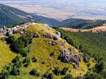
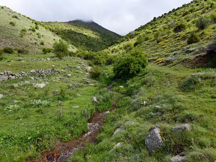
The main challenge is endurance: 800 km, 30–35 walking days and about 13,500 m of ascent. Terrain varies from hot Mediterranean plains, vineyards and garrigue to forested Haut-Languedoc massifs, rolling Gascony and the Pyrenean climb to the Col du Somport. Spring and autumn are best for the exposed eastern half; the Somport crossing is generally a June–October objective. Facilities can be spaced out on quieter middle and Gascon sections. For other French mountain options, compare the Cirque de Gavarnie Trails or the Chartreuse Trail (GR9 Segment).
HikeList Score
GR653 (Arles Camino) scored 80/100 on HikeList's trail-quality metrics.
See score breakdownHide breakdown
- Ideal length 52
- Balanced challenge 84
- Scenery & wildness 69
- Varied terrain 100
- Accommodation 100
- Food & support 88
- Path quality 84
- Season flexibility 89
Computed from length, challenge, scenery & wildness, terrain variety, accommodation, food & support, path quality and season flexibility.
 France
Show more data Show less
- Hilly
- Forest
- Mountainous
- Urban
- Dirt
- Gravel
- Rocky
- Paved
- Hostels
- Guesthouses
- Hotels
- Campsites
- Family Friendly
- Pet Friendly
- Restrooms
- Water Sources
- Campsites
- Shelters
Articles related to this hike
In these collections
Photos from hikers
Taken on the trail by people who've reviewed GR653 (Arles Camino).
Reviews
How would you rate GR653 (Arles Camino)?
Tap a star to start your review — you could be the first.