Kom-Emine Trail (Balkan Traverse)
How would you rate Kom-Emine Trail (Balkan Traverse)?
Tap a star to share your experience and help other hikers.
Kom-Emine Trail: Bulgaria’s Balkan Traverse Guide
HikeList Score
Kom-Emine Trail (Balkan Traverse) scored 79/100 on HikeList's trail-quality metrics.
See score breakdownHide breakdown
- Ideal length 72
- Balanced challenge 84
- Scenery & wildness 98
- Varied terrain 83
- Accommodation 58
- Food & support 65
- Path quality 98
- Season flexibility 63
Computed from length, challenge, scenery & wildness, terrain variety, accommodation, food & support, path quality and season flexibility.
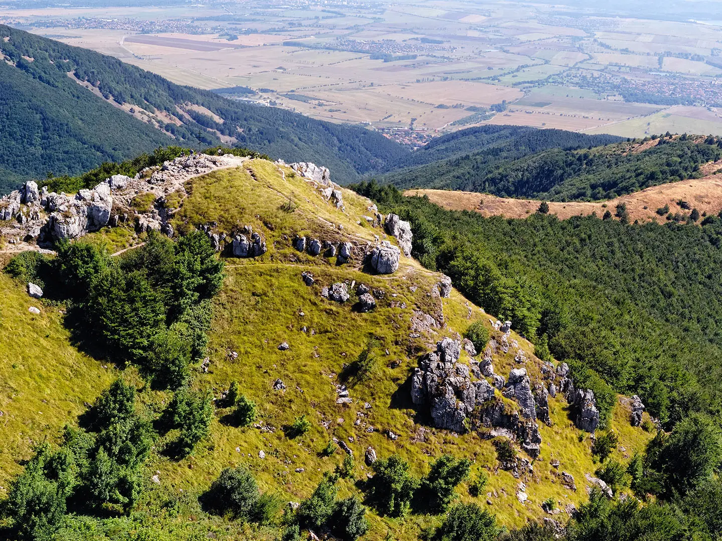
The Kom-Emine Trail is Bulgaria’s classic long-distance thru-hike: a roughly 650 km west-to-east traverse of the Stara Planina, or Balkan Mountains. It runs from Mount Kom near the Serbian border to Cape Emine on the Black Sea, taking about 22 days for a typical fit hiker. Expect a hard, committing route with around 18,500 m of ascent, long ridge days, basic huts, patchy waymarking and one exposed chain-secured section near Botev Peak.
Route Overview
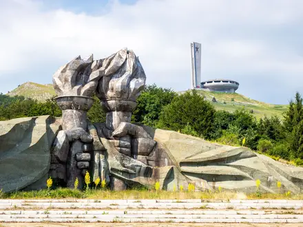
This is a point-to-point mountain traverse, usually walked west to east from Mount Kom (2,016 m), above Berkovitsa, to Cape Emine on the Black Sea coast. The route follows the red / white-red-white E3 waymarks along the main Balkan ridge, passing the Iskar Gorge and Lakatnik, Murgash Peak, Central Balkan National Park, Botev Peak, Shipka Pass, the Buzludzha area, Kotel and the lower eastern Stara Planina. Many hikers continue about 10 km beyond Cape Emine to Elenite or Sveti Vlas. For shorter related objectives, see the Cherni Vrah Summit Trail, Central Balkan Ridge Trail and Buzludzha Monument Trail.
History of the Kom-Emine Trail
The first recorded traverse was completed in 1933 by the Bulgarian geographer Pavel Deliradev. The first organised mass through-hike followed in 1953, and the first winter ski crossing in 1961. Kom-Emine later became the Bulgarian section and eastern end of the E3 European long-distance path, which links the Atlantic coast to the Black Sea. The route also passes Shipka Pass and the Buzludzha monument area, connecting the walk with Bulgaria’s national-liberation history and Communist-era legacy.
Notable highlights
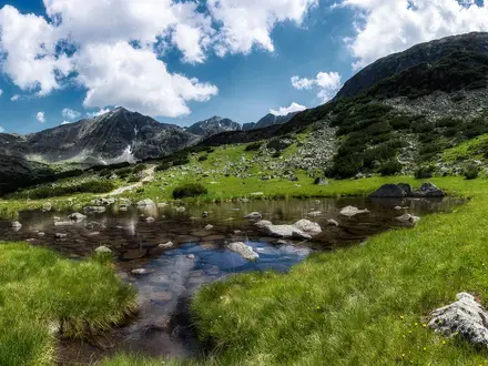
- Mount Kom & the western Stara Planina (2,016 m): The start summit near the Serbian border gives the first clear sense of the long Balkan ridge running east across Bulgaria.
- Iskar Gorge & Lakatnik: Early in the traverse the trail drops through the dramatic Iskar Gorge, passing the limestone cliffs and caves around Lakatnik before climbing back onto the main ridge.
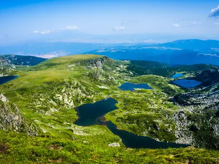
- Central Balkan National Park & Botev Peak (2,376 m): The high alpine middle section stays above 2,000 m and climbs Botev Peak, the highest summit in the Balkan Mountains, via the chain-secured ridge from Dobrila hut.
- Shipka Pass & Buzludzha: Shipka Pass is tied to the Russo-Turkish War battles of 1877–78, while nearby Buzludzha is a derelict Communist-era congress hall with a distinctive flying-saucer shape.
- Cape Emine: The lighthouse headland on the Black Sea is the symbolic finish of both the Kom-Emine Trail and the E3 route across Europe.
Challenges to expect
Plan for 8–12+ hour walking days, big cumulative ascent, exposed weather and limited resupply, especially in the drier eastern section. The chained ridge between Dobrila hut and Botev Peak is the main exposed passage. Waymarking can be patchy in the west and east, signage is mostly in Cyrillic but usually also in Latin script, and huts are basic or full in season. Carry GPS mapping, cash, ample water capacity and camping gear for nights between huts.
HikeList Score
Kom-Emine Trail (Balkan Traverse) scored 79/100 on HikeList's trail-quality metrics.
See score breakdownHide breakdown
- Ideal length 72
- Balanced challenge 84
- Scenery & wildness 98
- Varied terrain 83
- Accommodation 58
- Food & support 65
- Path quality 98
- Season flexibility 63
Computed from length, challenge, scenery & wildness, terrain variety, accommodation, food & support, path quality and season flexibility.
 Bulgaria
Show more data Show less
- Mountainous
- Forest
- Coastal
- Dirt
- Rocky
- Grass
- Huts
- Wild Camping Spots
- Pet Friendly
- Water Sources
- Campsites
- Shelters
In these collections
Photos from hikers
Taken on the trail by people who've reviewed Kom-Emine Trail (Balkan Traverse).
Begin your journey at Komski Hut, ascending Kom Peak (2,016m) to officially start the traverse. Enjoy expansive views, then follow the red-blazed ridge path eastward through open meadows and forest patches towards Petrohan Pass. This section includes the first major descent and passes several water sources and minor shelters.
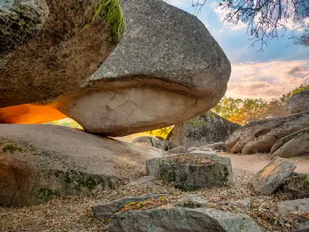
Continue east, traversing a mix of forested slopes and open ridges. The trail undulates past spectacular limestone formations and into Vrachanski Balkan Nature Park, where abundant wildlife can be spotted. Overnight at Proboinitsa Hut or set up camp nearby.
Follow the undulating path along ridge lines, traversing karst terrain and rocky outcrops. Enter denser forest sectors as you approach the area around Parshevitsa Hut, where accommodation is available. This section includes a moderate climb and a few technical sections.
Descend from mountain ridges towards the Iskar Gorge, enjoying excellent views of the river valley. The path winds through forest and meadow, with the descent requiring careful footing. Finish the day at Lakatnik, an area known for dramatic cliffs and caves.
After a short stretch along the Iskar River, climb back onto the high ridges east of Lakatnik. The trail alternates between dense forest and panoramic clearings, leading over a series of smaller peaks before reaching Leskova Hut for the night.
Traverse lush woodlands and cross several minor summits, with sections of open ridges offering views far to the north and south. Pass old shepherd shelters and wildflower meadows before reaching the isolated Trastenaya Hut.
Head east along forested ridges with occasional viewpoints overlooking the surrounding valleys. The trail includes both gentle and steeper ascents, culminating at Chavdar Hut, a popular resting location for long-distance hikers.
Continue through alternating shady forest and sunny grasslands as you move further into the heart of the Stara Planina. Frequent ups and downs lead you to Momina Polyana Hut, nestled in a sheltered basin amid pine woods.
The route rises above treeline, crossing breathtaking alpine terrain. Expect some rocky footing and longer stretches without water. Pass near Vezhen Peak (2,198m) before descending to Vezhen Hut, an essential staging point for the next part of the traverse.
Enjoy panoramic vistas as you travel above the treeline, crossing grasslands and rocky slopes. This stage passes several notable summits and takes you into the heart of the Central Balkan National Park, finishing at Dermenka Hut.
Traverse the high plateau, with segments of exposed ridgeline. The path is dramatic but demanding, offering wide-reaching mountain views. End at Dobrila Hut, known for spectacular sunsets and one of the highest overnight spots on the trail.
Follow the edge of the main ridge, requiring careful navigation through some rocky passages. The trail skirts above deep valleys and wildflower-strewn slopes before a final descent to Levski Hut, nestled in a tranquil valley.
Begin with a climb back to the high ridges, passing subalpine meadows and rushing streams. Traverse toward the base of Botev Peak, with the possibility to detour to see the impressive Raysko Praskalo waterfall before reaching Rai Hut for the night.
Ascend to Botev Peak, the highest point on the Balkan range. The steep, exposed climb is one of the hardest sections of the trail. After enjoying the sweeping views, descend carefully to Pleven Hut for a well-earned rest.
Departing from forested slopes, rejoin the main ridge and traverse high above the valleys for much of the day. This section is remote, with sweeping panoramas and very limited shelter until you arrive at Mazalat Hut.
Continue along undulating ridges, passing through wildflower meadows and crossing occasional rocky patches. The Uzana area is known as the geographic center of Bulgaria, and Uzana Hut provides comfort for the night.
The trail heads east on open mountain ridges, descending gradually toward the history-rich Shipka Pass. Visit the Shipka Monument and learn about the region’s importance in Bulgaria’s liberation history before ending your day near the pass.
Walk through pine and beech woods, then ascend towards the remarkable Buzludzha monument, an iconic relic of socialist-era architecture. The trail continues on undulating ridges to Yavorov Hut for overnight rest.
Continue east across a mix of forest and pastures, enjoying easier gradients but remote stretches without infrastructure. Arrive at Vratnik Pass, a historical gateway marking the transition toward eastern Stara Planina.
Descend into regions renowned for traditional music and folklore. Walk through rolling countryside and forested hills toward the town of Kotel, which features historical architecture and is a good place to restock supplies.
The trail meanders through bucolic scenery, connecting the cultural towns of Kotel and Zheravna. Both villages are protected for their preserved traditional Bulgarian architecture and vibrant rural history. Accommodation can be found in either town.
Climb back onto the main ridge, passing through pine forests, clearings, and traditional sheep pastures. This stage is remote, with few facilities, ending at or near Vurbitsa Pass where basic shelter is available.
Traverse little-visited ridge sections known for their tranquility and wildlife. The hike is isolated, with a mix of overgrown paths and wide-open spaces. Overnight at the grassy Varbishka Polyana area, used by local shepherds.
Descend through dry grasslands and scattered oak woods as the mountains begin to taper off toward the Black Sea. Arrive in Kozichino, a small village offering insight into rural life and an opportunity for overnight accommodation.
The final stage contains undulating hills and soon brings glimpses of the Black Sea to the east. Walk along open plateaus and descend to the dramatic cliffs of Cape Emine. The trail finishes at the lighthouse, marking the official end of this epic traverse.
Reviews
How would you rate Kom-Emine Trail (Balkan Traverse)?
Tap a star to start your review — you could be the first.