GR34 (Sentier des Douaniers)
How would you rate GR34 (Sentier des Douaniers)?
Tap a star to share your experience and help other hikers.
GR34 (Sentier des Douaniers): A Brittany Coast Hiking Guide
HikeList Score
GR34 (Sentier des Douaniers) scored 81/100 on HikeList's trail-quality metrics.
See score breakdownHide breakdown
- Ideal length 52
- Balanced challenge 90
- Scenery & wildness 66
- Varied terrain 100
- Accommodation 100
- Food & support 88
- Path quality 98
- Season flexibility 100
Computed from length, challenge, scenery & wildness, terrain variety, accommodation, food & support, path quality and season flexibility.
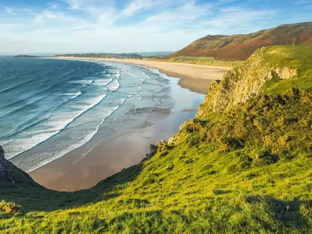
The GR34, or Sentier des Douaniers, is a moderate long-distance coastal trail in Brittany, France, running over 2,000 km from Mont-Saint-Michel to Saint-Nazaire. A full thru-hike takes around 80 days at a steady pace, though most hikers walk it in sections. It suits walkers who want continuous sea views, waymarked navigation and regular villages, but who are ready for repeated short climbs, rocky headlands, beaches, estuaries and the sheer scale of a full coastal traverse.
Route Overview
The GR34 is a point-to-point route from Mont-Saint-Michel in Manche to Saint-Nazaire in Loire-Atlantique, near the Pont de Saint-Nazaire. It follows almost the whole Breton coastline via Cancale, Saint-Malo, Dinard, Cap Frehel, Saint-Brieuc, Paimpol, the Pink Granite Coast, Morlaix, Roscoff, Brest, the Crozon peninsula, Douarnenez, Pointe du Raz, Concarneau, Lorient, Vannes and La Roche-Bernard. The route crosses six departments: Manche, Ille-et-Vilaine, Cotes-d'Armor, Finistere, Morbihan and Loire-Atlantique. For shorter French coastal options, compare the D-Day Beaches Circuit or the Bordeaux to Arcachon Trail.
From customs patrol path to long-distance GR
The Sentier des Douaniers began in 1791 after the French Revolution as a coastal patrol path for customs officers, who walked in pairs to combat smuggling and help shipwrecked sailors. Its hiking story began much later: the first section opened in 1968 near Lannion, initiated by Emile Orain, and full waymarking was completed around 2008. In 2018 the GR34 recorded about 9 million users, and its Finistere section was voted Best French GR of 2017.
Notable highlights
Mont-Saint-Michel: The trail’s north-eastern gateway is the UNESCO-listed abbey-island rising from tidal salt marshes, one of France’s most recognisable landmarks.
Cote de Granit Rose (Perros-Guirec to Ploumanac'h): The Pink Granite Coast is the GR34’s signature stretch, with weathered pink-granite boulders and views towards the Sept-Iles bird sanctuary.
Cap Frehel: A major headland on the Emerald Coast, with cliffs around 70 m high, a lighthouse and seabird colonies; in clear weather the views extend along the coast.
Falaises de Plouha: These are the highest sea cliffs in Brittany at 104 m, north of Saint-Quay-Portrieux, and one of the route’s most dramatic cliff-top sections.
Pointe du Raz: A Grand Site de France at the western tip of the Cap Sizun peninsula, where granite cliffs around 70 m high give wide Atlantic views.
Crozon peninsula: Craggy headlands and turquoise coves define this Finistere section; from Cap de la Chevre the sea view spans from the Bay of Douarnenez to Pointe du Raz.
Challenges to expect
The GR34 is not a mountain trail, but a full thru-hike is demanding because of its length. Expect repeated steep climbs and descents on cliff paths, with some sections accumulating serious ascent despite low altitude. Underfoot is mostly dirt, grass, sand and rock across heathland, dunes, headlands, marshes and estuaries. Some low-lying sections can be submerged at high tide. Navigation is helped by standard red-and-white GR waymarks throughout.
HikeList Score
GR34 (Sentier des Douaniers) scored 81/100 on HikeList's trail-quality metrics.
See score breakdownHide breakdown
- Ideal length 52
- Balanced challenge 90
- Scenery & wildness 66
- Varied terrain 100
- Accommodation 100
- Food & support 88
- Path quality 98
- Season flexibility 100
Computed from length, challenge, scenery & wildness, terrain variety, accommodation, food & support, path quality and season flexibility.
Show more data Show less
- Coastal
- Cliff Top
- Heathland
- Dunes
- Estuaries
- Dirt
- Grass
- Rock
- Sand
- Campsites
- Guesthouses
- Hostels
- Hotels
- Wild Camping Spots
- Family Friendly
- Pet Friendly
- Restrooms
- Water Sources
- Campsites
- Picnic Areas
In these collections
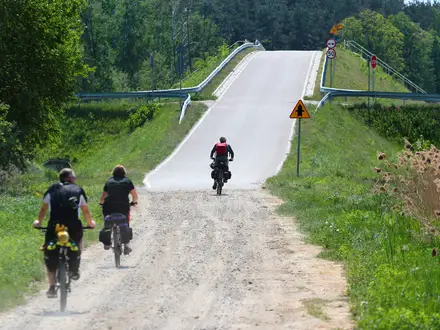
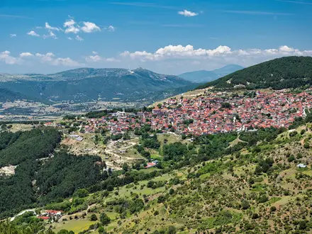
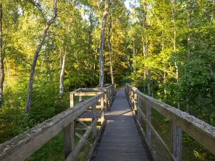
Photos from hikers
Taken on the trail by people who've reviewed GR34 (Sentier des Douaniers).
Begin at the iconic Mont Saint-Michel, following tidal paths across salt marshes and sandy flats to reach the coastal village of Cherrueix. This relatively flat section provides expansive views of the bay and the mont rising in the distance.
Travel along grassy dikes and sandy trails, passing oyster farms and salt marshes. Arrive in the charming town of Cancale, renowned for its seafood and panoramic bay views.
The route follows rocky coastline, forested paths, and small beaches, passing Pointe du Grouin before arriving at the historic walled city of Saint-Malo. This segment offers both rugged scenery and urban exploration.
Cross the Rance estuary via ferry or bridge, then follow tree-lined coastal promenades and dramatic headlands leading to the elegant seaside resort of Dinard.
Continue through a succession of intimate bays, beaches, and headlands, walking past classic Breton villas before arriving at Saint-Briac-sur-Mer, noted for its charming atmosphere.
This short stretch hugs the jagged shoreline, offering continual ocean views and tranquil spots to rest before entering Saint-Lunaire, a popular summer destination.
Traverse headlands and sandy stretches, including Pointe du Décollé and the long beaches that define this section. Reach the lively seaside town of Saint-Cast-le-Guildo.
Follow spectacular cliffside paths through heathland and windblown fields, with Cap Fréhel’s lighthouse and remarkable pink and grey cliffs emerging ahead.
Descend from the cliffs of Cap Fréhel to golden beaches and dune areas. The trail becomes easier as it approaches Sables-d’Or-les-Pins, a well-known seaside destination.
Transition between cliff paths and scenic bays, moving through small villages and resort towns on the way to Pléneuf-Val-André, famous for its boating history.
A longer segment along varied coastline, blending dramatic cliffs with gentle beaches and passing the picturesque port of Binic, ideal for seafood lovers.
Enjoy a mixture of wooded paths and expansive sea views, passing through historic fishing villages and approaching the port town of Paimpol, gateway to the Île de Bréhat.
Follow secluded estuaries and rivers as the GR34 turns inland from the coast momentarily, traversing peaceful countryside before arriving at the medieval town of Tréguier.
Return to coastal scenery, entering the Pink Granite Coast. This renowned stretch features unusual rose-tinted rock formations and dramatic ocean vistas as you head to Perros-Guirec.
Follow well-marked trails past pink granite boulders and picturesque bays, passing Ploumanac’h and the Seven Islands nature reserve en route to the charming town of Trébeurden.
Move inland, following river paths into the heart of Lannion. This shorter day offers a transition from coastal to riverside walking, with opportunities to enjoy local markets and architecture.
A diverse section that leads you back to sea cliffs, sandy coves, and peaceful estuaries, eventually bringing you to the welcoming seaside town of Locquirec.
Travel along rugged coastline, past windswept beaches and dramatic rock formations to the quiet cluster of villages around Plougasnou.
Skirt the eastern edge of Morlaix Bay and small estuaries, before heading inland to the bustling market town of Morlaix, marked by its impressive viaduct.
Return toward the coastline, meandering through lush countryside, tidal rivers, and marshland areas before reaching the seaside resort of Carantec.
Enjoy an exhilarating walk along coastal promontories, with views of nearby islands and the open Channel, before reaching the ferry port of Roscoff.
Traverse dunes, sandy beaches, and rocky stretches characteristic of northern Finistère, through small ports and bordered fields on this quieter coastal section.
A scenic march along Finistère’s wild coastline, dotted with jagged rocks, white sandy beaches, and the picturesque lighthouse at Pontusval before arriving at Brignogan-Plages.
Continue through the 'Pays Pagan', a coastline famous for wild landscapes, immense granite boulders and charming hamlets, arriving in Kerlouan.
Follow paths flanked by sand dunes and heather, with regular glimpses of the sea and far-off lighthouses. Reach the coastal village of Plougerneau.
Navigate through estuarine terrain and marshlands, crossing scenic bridges and causeways before arriving in Lannilis, a hub for oyster cultivation.
This circuit features the winding Aber Wrac’h estuary, with rich birdlife and extensive wetlands, looping back to Plouguerneau through tidal inlets.
Head toward the western tip of Brittany, passing dramatic cliffs, sandy coves, and small fishing ports. Arrive at Le Conquet, one of the westernmost villages in continental France.
Walk through wild coastal heathland, passing lighthouses and WWII fortifications before heading inland to the urban center of Brest, famed for its naval history.
Cross the Pont de l’Iroise into Plougastel-Daoulas, a peninsula renowned for strawberry fields and quiet coastal tracks, with gentle elevation changes.
Follow estuary edges and tranquil woodland paths, with sweeping river vistas and a finish in the characterful small town of Le Faou.
Begin your exploration of the Crozon Peninsula, traversing wild uplands and wooded coastal slopes, leading to the town of Crozon.
This section highlights the dramatic southern cliffs and hidden beaches of the Crozon Peninsula, ending at the welcoming seaside village of Morgat.
A stunning journey along some of Brittany’s highest sea cliffs, offering expansive views of the Atlantic before descending into Camaret-sur-Mer.
Walk the wild headlands of Cap de la Chèvre and traverse remote stretches before arriving in the lively port of Douarnenez, renowned for traditional fishing.
The path takes you along jagged shores and sandy coves, passing cliffs and lighthouses on the way to the windswept Pointe du Raz, a highlight of the entire trail.
Follow winding cliff-top trails around Cap Sizun, eventually descending to the fishing port of Audierne, with its lively riverfront and bustling harbor.
Walk endless beaches and dunes past the Pointe de la Torche, renowned for windsurfing, before reaching the iconic Eckmühl lighthouse at Penmarc’h.
This easy segment follows quiet coastline and small harbors, passing oyster beds and picturesque coves en route to the fishing community of Loctudy.
Head inland across flat terrain, following estuaries and marshland to the heritage town of Pont-l’Abbé, known for its castle and vibrant markets.
Return toward the sea, traversing fertile fields and gentle dunes to the major fishing port of Le Guilvinec, a hub for Brittany’s seafood industry.
A scenic journey along a mosaic of beaches, estuaries, and pine forests, leading to the famous walled port of Concarneau with its celebrated Ville Close.
Leave the coast temporarily to follow the Aven River inland, passing through woodlands and small farms to reach the artist’s town of Pont-Aven.
Travel through wooded river valleys and rocky coves before returning to the Atlantic coastline at the quiet village of Moëlan-sur-Mer.
Venture through a bucolic landscape of tidal rias, pinewoods, and sandy bays, finishing in the historic hamlet of Clohars-Carnoët.
Emerge onto wide, windswept beaches and marshy headlands, walking past dunes and river estuaries before arriving at Guidel-Plages.
Skirt the Blavet River and cross natural reserves before entering the urban area of Lorient, a city rich in maritime history and World War II heritage.
Exit Lorient via harbors and waterfront promenades, then enjoy a relaxing stretch along sandy bays to the beach town of Larmor-Plage.
Follow low cliffs dotted with small chapels, fortifications, and sandy inlets, passing by several beautiful coves on the way to Ploemeur.
Cover a wild, remote stretch of coastline bordered by dunes and marshes before culminating in Gâvres, a small fishing community.
Continue through sandy spits and tidal lagoons, with open views of the Atlantic. The village of Étel is known for its impressive ria and fishing traditions.
Follow the narrow, exposed Quiberon Peninsula southward, traversing beaches, cliffs, and ancient megalithic sites to reach the vibrant resort town of Quiberon.
Pass the wild Côte Sauvage cliffs before entering historic Carnac, home to world-famous stone alignments and scenic sandy shores.
Stroll through woodlands, marshland, and lively marinas before reaching La Trinité-sur-Mer, famous for its sailing scene.
Short and pleasant day by salt marshes and oyster beds to Plouharnel, gateway to the Quiberon Peninsula and ancient archaeological sites.
Walk sandy isthmuses and quiet coves, passing Neolithic ruins as you near the charming resort village of Saint-Pierre-Quiberon.
Depart from the peninsula, trekking across fields and ancient causeways to Auray, a picturesque medieval riverside town.
Travel south through forest corridors, crossing river inlets to Locmariaquer, famous for large megaliths and panoramic views over the Gulf of Morbihan.
Follow a network of tide-influenced trails skirting the Gulf of Morbihan, passing oyster beds and ancient chapels on the way to the fortified town of Vannes.
Explore protected wetlands with rich birdlife and salt marshes, navigating winding paths to the scenic harbor of Séné.
Skirt the tip of the Rhuys Peninsula, passing historical sites, ancient dolmens, and scenic beaches en route to the seaside town of Arzon.
Meander along dramatic coastal cliffs on the Atlantic side, passing sandy coves and wild heaths to the abbey village of Saint-Gildas-de-Rhuys.
Travel farmland tracks and wide beaches, with views of distant islands and maritime pines, before finishing at the market town of Sarzeau.
A quiet, short segment through oyster beds and salt marshes along sheltered shoreline, concluding at Le Tour-du-Parc.
Journey inland a short way through quiet rural landscapes and small hamlets before reaching the town of Muzillac.
Return to dramatic coastal walking with red cliffs and vast estuaries, passing by the famous Mine d’Or beach before closing the day in Pénestin.
Cross long stretches of sandy shoreline and lively harbor areas, finishing the day at La Turballe, a center of Brittany’s fishing industry.
Walk the wild granite headlands and tidal salt pans of the Guérande peninsula, with a finish in the fortified port town of Le Croisic.
Circle the salt marshes of Guérande, then continue on to the grand beaches and seaside promenade of La Baule-Escoublac, one of France’s most famous resorts.
Travel a classic French Riviera-style stretch of wide strand and elegant villas to reach the lively vacation town of Pornichet.
Your final day takes you along the Atlantic promenade to Saint-Nazaire, passing coastal parks, WWII bunkers, and industrial heritage sites before arriving at the GR34’s southern terminus.
Cross the Loire estuary, continuing on to the pine forests and sweeping sands of Saint-Brévin-les-Pins. This day marks the symbolic entrance to southern Brittany.
Walk beautiful pine forests and beachfront trails, passing contemporary sculptures and quiet residential areas en route to the Mindin district.
This section drifts inland along the southern banks of the Loire, traversing marshland and historical canal towns before finishing in Paimboeuf.
Traverse the former industrial areas of the Loire estuary, moving through nature reserves and green spaces to the rural commune of Frossay.
Walk riverside levees and old lock paths through peaceful countryside, arriving at Le Migron at the intersection of waterways and meadows.
Continue along the southern edge of the Loire estuary, through tranquil orchards and countryside to the village of Saint-Viaud.
A peaceful walk through farmlands and nature areas leads to Corsept, a classic small commune of southern Brittany, famed for its festivals.
Wander rural lanes and groves, crossing nature preserves and small rivers before reaching your penultimate stop at Saint-Père-en-Retz.
The final day leads through scenic wetlands and across expansive maritime plains, concluding your GR34 adventure in the historic town of Bourgneuf-en-Retz.
Reviews
How would you rate GR34 (Sentier des Douaniers)?
Tap a star to start your review — you could be the first.