Ruta de Don Quijote
How would you rate Ruta de Don Quijote?
Tap a star to share your experience and help other hikers.
Ruta de Don Quijote: La Mancha Windmills and Plains
HikeList Score
Ruta de Don Quijote scored 85/100 on HikeList's trail-quality metrics.
See score breakdownHide breakdown
- Ideal length 94
- Balanced challenge 90
- Scenery & wildness 64
- Varied terrain 87
- Accommodation 92
- Food & support 88
- Path quality 98
- Season flexibility 76
Computed from length, challenge, scenery & wildness, terrain variety, accommodation, food & support, path quality and season flexibility.
The Ruta de Don Quijote is a 2,500 km official waymarked ecotourism network across Castilla-La Mancha in Spain, not a single end-to-end trail. It crosses the central Spanish plains through Toledo, Ciudad Real, Cuenca, Albacete and Guadalajara, linking places associated with Cervantes’ Don Quixote. Difficulty is easy to moderate: the ground is mostly flat, but stages can be long, exposed and hot. Most walkers choose one section or a week-long themed segment rather than attempting the full network.
Route Overview
There is no single start or finish. The route is divided into 10 tramos of varying length, from the 28 km Esquivias-Carranque section to the 501 km Toledo-San Clemente section, and crosses 148 municipalities. It follows historic drovers’ roads, old country tracks, riverbanks and disused railway lines through open Meseta landscapes, vineyards, olive groves, cereal fields, wetlands and windmill country. Key walking targets include Toledo, Consuegra, Campo de Criptana, Alcázar de San Juan, El Toboso, Almagro, Ruidera Lakes Nature Reserve, Sigüenza and Atienza. For a more linear Spanish thru-hike, compare the Camino Francés or the Camino del Norte.
Cervantes, Don Quixote and the 2005 Route
The Castilla-La Mancha government inaugurated the Ruta de Don Quijote in 2005 for the IV Centenary of the first part of Miguel de Cervantes’ Don Quixote, published in 1605. The route links landscapes and towns associated with the novel rather than tracing a precise literary itinerary, because scholars dispute the book’s exact geography. It was recognised as a European Cultural Itinerary by the Council of Europe, but that designation was later withdrawn around 2011-2012.
Notable highlights
- Consuegra windmills: Twelve restored 16th-century windmills stand along the Cerro Calderico ridge beside a medieval castle. Each mill bears the name of a character from the novel, making this one of the clearest visual links to Don Quixote’s “giants”.
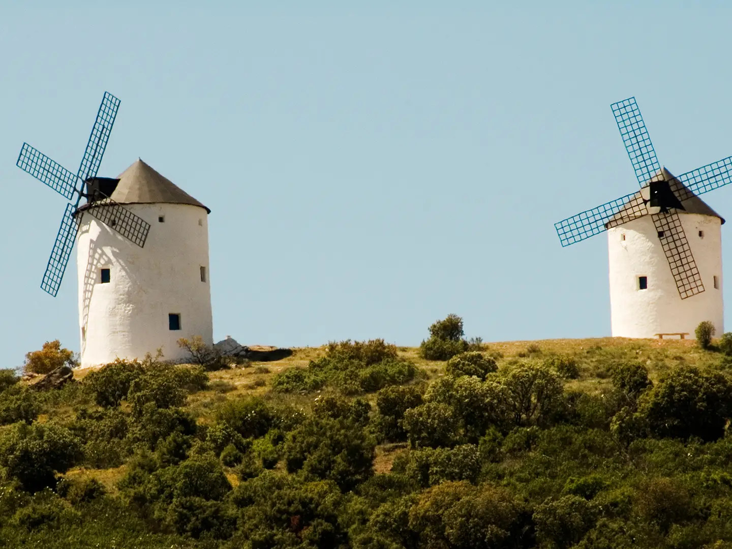
- Campo de Criptana windmills: Ten windmills stand on the Sierra de los Molinos above whitewashed streets. Several retain working machinery and the site is often cited as the windmill landscape Cervantes had in mind.
- El Toboso: The village is associated with Dulcinea, Don Quixote’s idealised love. The Casa-Museo de Dulcinea is a restored 16th-century manor house showing well-off La Mancha domestic life from Cervantes’ period.
- Ruidera Lakes Nature Reserve: A chain of around fifteen interconnected turquoise lagoons and waterfalls gives the route a rare green, watery section. It is also linked in the novel to the Cave of Montesinos.
- Toledo: This UNESCO World Heritage city is a historic starting point for several sections. Its medieval streets above the River Tagus layer Christian, Muslim and Jewish heritage.
- Almagro: A noble town known for its arcaded Plaza Mayor and the Corral de Comedias, a rare surviving 17th-century open-air theatre from the Spanish Golden Age.
Challenges to expect
The main challenge is not altitude but exposure. The route crosses mostly flat, open plains with long stretches of compacted earth and gravel, often with little shade. Summer heat is severe, especially in July and August, when highs around 35 C and occasional temperatures over 40 C are reported. Because this is a network, not a fixed itinerary, plan your chosen tramo carefully and split long walking stages where needed.
HikeList Score
Ruta de Don Quijote scored 85/100 on HikeList's trail-quality metrics.
See score breakdownHide breakdown
- Ideal length 94
- Balanced challenge 90
- Scenery & wildness 64
- Varied terrain 87
- Accommodation 92
- Food & support 88
- Path quality 98
- Season flexibility 76
Computed from length, challenge, scenery & wildness, terrain variety, accommodation, food & support, path quality and season flexibility.
 Spain
SpainShow more data Show less
- Open Plains
- Gentle Undulations
- Riverbanks
- Wetlands
- Vineyards
- Olive Groves
- Cereal Fields
- Compacted Earth
- Gravel
- Hotels
- Hostales
- Casas Rurales
- B&Bs
- Family Friendly
- Pet Friendly
- Restrooms
- Water Sources
- Campsites
- Picnic Areas
Download Our Full Guide to Ruta de Don Quijote FREE!
Get our comprehensive guide to this hike for free. Save it for later reading or print out at home.
Photos from hikers
Taken on the trail by people who've reviewed Ruta de Don Quijote.
Ruta de Don Quijote: The Complete Guide
 i
Image by KERO
i
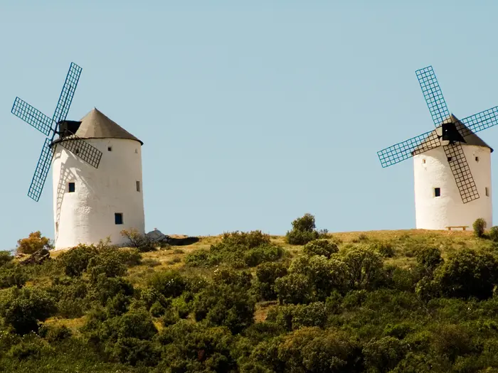
Image by KERO The Ruta de Don Quijote is best treated as a vast menu of walks, not a single end-to-end trail. Its waymarked tramos cross the open Meseta of Castilla-La Mancha through Toledo, Ciudad Real, Cuenca, Albacete and Guadalajara, linking windmill ridges, old drovers’ roads, vineyards, wetlands and towns tied to Cervantes’ novel.
Most walkers choose a section: a weekend around Consuegra or Campo de Criptana, a cultural stretch through El Toboso and Belmonte, or several days around the green Lagunas de Ruidera. Toledo is the natural jumping-off point for many itineraries, but the network has no fixed start or finish.
Underfoot, expect compacted earth, gravel tracks, riverbanks and quiet rural ways rather than mountain paths. The reward is space, history and big La Mancha horizons, with highlights such as the Molinos de Consuegra, the Sierra de los Molinos, Almagro, Sigüenza and Atienza.
The walking is easy to moderate in technical terms, but the logistics matter. Stages published for horse riders and cyclists often need splitting on foot, and the exposed plains demand early starts, careful water planning and avoidance of high summer heat.
This guide covers choosing tramos, breaking stages into walking days, accommodation, food, transport, terrain and the common mistakes to avoid.
Stage-by-Stage Guide
Treat the “stages” below as the ten official tramos of the Ruta de Don Quijote, not as single walking days. The published etapas were laid out with horse riders and cyclists in mind, so walkers should normally split them into shorter days around available towns, accommodation and transport.
Before committing to any tramo, check current waymarking and GPX data, especially on quieter rural sections. This is a large, ageing network across open country, and navigation should not rely on signs alone.
Stage 1: Toledo to San Clemente
Distance / format: approx. 501 km, published as 10 etapas. This is the longest tramo and the one most walkers use as the main introduction to the route, because it starts from Toledo and runs through some of the best-known Don Quixote landscapes of La Mancha.
The walking is mainly across the open Meseta on compacted earth, gravel farm tracks, historic vías pecuarias and quiet rural approaches between towns. Expect long, flat or gently undulating days rather than mountain terrain; the difficulty comes from heat, distance, hard surfaces and limited shade.
Key places associated with this part of the network include Toledo, Consuegra, Alcázar de San Juan, Campo de Criptana, El Toboso, Belmonte and San Clemente. The strongest highlights are the windmill ridges at Cerro Calderico above Consuegra and the Sierra de los Molinos / Cerro de la Paz above Campo de Criptana, plus El Toboso’s Museo Casa de Dulcinea and Belmonte’s 15th-century castle.
Food, water and overnight stops need planning around towns rather than the countryside between them. Toledo, Consuegra and Alcázar de San Juan have better services than smaller places, but long exposed sections between settlements can have few reliable water points, so carry more than usual and refill whenever possible.
Accommodation is in the usual mix of hoteles, hostales, pensiones and casas rurales, with the strongest choice in larger towns. San Clemente is a named tramo endpoint, but accommodation and onward transport should be booked or checked before arrival rather than assumed on a long walking schedule.
Transport is easiest at the Toledo end and around Alcázar de San Juan, which is a major rail junction. Smaller towns and villages on the tramo may depend on regional buses, taxis or road access; this should be checked before travelling, especially if splitting the tramo into short walking days.
Navigation is generally straightforward where waymarks and broad tracks coincide, but the network is not a continuous single-line trail in the way a national trail is. Carry offline mapping or GPX, watch for junctions where cycling, riding and walking variants diverge, and do not assume every published etapa is suitable as one walking day.
The main warning is exposure. In spring and autumn this is often pleasant walking; in high summer, the shadeless Meseta can be severe, with July and August heat commonly around 35 °C and sometimes higher.
Stage 2: San Clemente to Villanueva de los Infantes
Distance / format: approx. 267 km, published as 6 etapas. This tramo links the Cuenca side of the network with one of the most rewarding watery sections of the Ruta de Don Quijote.
Underfoot, expect more of the route’s typical compacted tracks, gravel lanes and open agricultural country, with a notable change of feel around the Lagunas de Ruidera. The lagoons, waterfalls and river landscape along the Río Guadiana provide rare shade, colour and water scenery compared with the drier La Mancha plains.
Important places and landmarks on or associated with this part of the network include Argamasilla de Alba, Ruidera / Ossa de Montiel, the Lagunas de Ruidera Nature Reserve, the Cueva de Montesinos and Villanueva de los Infantes. The Ruidera area is one of the best sections for walkers who want natural landscape as well as literary associations.
Food and water are more dependable in towns and visitor areas than on the open approaches. Do not treat the presence of lagoons as drinking-water availability; carry water between settlements and use cafés, shops or accommodation where available.
Accommodation is mixed. Around Ruidera / Ossa de Montiel there are accommodation options associated with the lakes area, including campsites near the Lagunas de Ruidera, while towns provide casas rurales, hostales and small hotels. Villanueva de los Infantes is the endpoint and should be used as an overnight anchor if the tramo is being split.
Public transport to the smaller settlements around El Toboso, Ruidera / Ossa de Montiel and similar rural places can be limited compared with rail towns. Many walkers will find a hire car, taxi transfer or carefully timed regional bus useful; timetables should be checked before travelling.
Navigation around the lakes and rural tracks needs attention because this is not a single valley path with one obvious line throughout. Use current mapping, and be prepared to adjust day lengths so that accommodation, food and transport line up.
Seasonal heat still matters on this tramo, even where the Ruidera section feels greener. Start early on exposed days and avoid planning the longest open stages in the afternoon.
Stage 3: Villanueva de los Infantes to Almagro
Distance / format: approx. 238 km, published as 5 etapas. This tramo continues across the La Mancha and Ciudad Real landscapes towards one of the route’s strongest historic town stops.
The terrain is mostly easy underfoot but physically wearing over long distances: agricultural tracks, broad gravel roads, open fields, vineyards and olive groves. There is no technical walking, but shade can be scarce and the line can feel remote between settlements.
The main named places associated with this part of the network include Villanueva de los Infantes, Valdepeñas, Ciudad Real and Almagro. Almagro is the standout cultural finish, with its arcaded Plaza Mayor and the Corral de Comedias, a rare surviving 17th-century open-air theatre.
Food and water planning should be conservative. Larger towns such as Ciudad Real and Almagro have much better services, while intermediate rural stretches may require carrying a full day’s food and water.
Accommodation is most straightforward in Ciudad Real and Almagro, with hoteles, hostales and pensiones. Smaller overnight stops may have fewer beds, so reservations matter if splitting the official etapas into walker-friendly days.
Transport is comparatively better around Ciudad Real, which sits on the Madrid–Sevilla high-speed rail line, and around larger towns. Rural starts and finishes between them may still require bus, taxi or road access; this should be checked before travelling.
Navigation is generally on broad, non-technical routes, but the monotony of the plains makes it easy to miss a junction if walking on autopilot. Carry offline maps and check the line at track intersections, especially where agricultural tracks look similar.
The key warning is the combination of heat, distance and hard surfaces. Foot care matters on long gravel days, and summer walking should be avoided unless stages are very short and started at first light.
Stage 4: Alcudia – Campo de Calatrava
Distance / format: approx. 307 km, published as 8 etapas. This is a longer southern tramo through the Ciudad Real side of the network, with fewer headline landmarks in the route information than the windmill and Ruidera sections.
Expect practical, rural walking: broad country tracks, vías pecuarias, gravel surfaces and open terrain. The route remains easy to moderate in technical terms, but the official etapas are too long for many walkers unless split.
The tramo’s value is in linking the wider Don Quixote network across the Alcudia and Campo de Calatrava areas rather than in one single must-see monument. Plan this section as a sequence of service-to-service walking days, not as a wilderness route.
Food and water availability should be treated as variable. Stock up whenever passing a town or village, and do not assume there will be fountains, shops or cafés on the next rural stretch.
Accommodation will depend heavily on the chosen subdivision of the tramo. Use towns, casas rurales, hostales and road-access points to build realistic walking days; this should be checked before travelling.
Public transport is not a single joined-up corridor here. Regional buses, road access and taxis may be needed to connect starts, finishes and rest days, especially if walking only part of the tramo.
Navigation requires more care than the simple terrain suggests because the network uses a mix of drove roads, country tracks and variants for different users. Current GPX mapping is strongly recommended, and waymark condition should be checked before relying on signs alone.
The main hazards are exposure, heat and overlong day planning. There is no high-altitude difficulty, but a flat 35 km day on shadeless gravel can be harder than it looks on paper.
Stage 5: Albacete to Bienservida
Distance / format: approx. 179 km, published as 4 etapas. This tramo links Albacete with Bienservida and is shorter than many others, but the published etapas still need reviewing for walkers.
The walking is mostly on the route’s typical rural surfaces: compacted earth, gravel tracks and agricultural approaches. The terrain is not technical, and there is no need for mountain equipment, but long open sections can still be demanding in warm weather.
Albacete is the practical anchor for the start, with better services than the smaller endpoint. Bienservida is a named tramo endpoint, so onward accommodation and transport should be arranged in advance rather than left to chance.
Food and water should be planned town by town. Carry enough for the full walking day, particularly if the day’s route crosses open countryside with few settlements or no obvious services.
Accommodation is likely to be easiest at the Albacete end and in established towns along a chosen subdivision. Casas rurales and small hostales may be useful in smaller places, but availability can be limited; book ahead.
Transport access is strongest at Albacete compared with the smaller rural endpoint. For Bienservida and intermediate stops, regional bus, taxi or a pre-arranged lift may be necessary; this should be checked before travelling.
Navigation is normally low-risk underfoot but still needs proper mapping. Do not rely on the fact that the route is waymarked as a substitute for checking junctions, especially where farm tracks meet in open country.
The main planning warning is not to underestimate a “shorter” tramo. Four published etapas over 179 km can still mean very long walking days unless split.
Stage 6: La Roda to Villamanrique
Distance / format: approx. 334 km, published as 8 etapas. This is one of the longer linking tramos across the broader La Mancha network.
Expect broad, exposed walking on compacted earth, gravel farm tracks and quiet rural lines rather than dramatic relief. The challenge is logistical: spacing accommodation, food and transport so that each day is realistic on foot.
This section is less defined by major listed highlights than the windmill, Toledo, Ruidera or Guadalajara tramos. It is best suited to walkers deliberately connecting larger parts of the network, cyclists, horse riders, or hikers comfortable with practical rural route-finding.
Food and water availability should be assumed to be limited between settlements. Carry a full day’s supply and build the itinerary around known towns or booked accommodation.
Accommodation planning is essential. Use casas rurales, hostales and small-town stays where available, but do not assume every published etapa endpoint has walker-friendly services without checking.
Public transport may not line up neatly with walking stages. This tramo is likely to require careful bus planning, taxi support, road access or a car-based section strategy; this should be checked before travelling.
Navigation should be treated as a core task. The landscape can be visually open and repetitive, so use current mapping or GPX and check waymarks at every significant junction.
Heat and exposure are the main warnings. Avoid high summer, start early in warm weather and protect feet from long days on hard gravel surfaces.
Stage 7: Campo de Criptana to La Solana
Distance / format: approx. 129 km, published as 3 etapas. This is one of the more compact tramos and works well for walkers wanting a shorter La Mancha section focused on the windmill country.
The tramo begins at Campo de Criptana, one of the iconic Don Quixote locations, where ten tower windmills stand on the Sierra de los Molinos and Cerro de la Paz above the town. From there, expect typical open-plain walking through agricultural country on gravel and earth tracks.
The main highlight is the windmill skyline at Campo de Criptana, including the mills Sardinero, Burleta and Infanto, which retain original machinery. The finish at La Solana gives a clear endpoint for a short section-walk.
Food and water are most reliable in the towns. Between them, carry enough for the day and do not depend on shade or fountains along the route.
Accommodation should be arranged around Campo de Criptana, La Solana and any chosen intermediate stops. Because the official three etapas are likely to be long for many walkers, splitting the tramo may require careful booking.
Transport is easier at better-connected La Mancha towns than in small rural stops, but this is not a continuous rail-corridor walk. Check bus and train options before travelling, and consider taxi support if making shorter walking days.
Navigation is generally on non-technical tracks, but the network may share lines with cycling and horse-riding routes. Follow the correct walking variant where marked and carry offline mapping.
The warning here is classic Meseta exposure: wind, sun, hard surfaces and long straight sections. Spring and autumn are the sensible seasons.
Stage 8: Almagro to Mascaraque
Distance / format: approx. 364 km, published as 8 etapas. This long tramo links Almagro northwards towards Mascaraque in Toledo province.
Starting from Almagro gives a strong cultural opening, with the Plaza Mayor and Corral de Comedias. Beyond the town, the walking returns to the network’s main pattern of rural tracks, agricultural land, open plains and, where the route enters the Montes de Toledo sector, more undulating country than the flattest La Mancha tramos.
This is a substantial linking section rather than a short themed walk. It suits walkers who want to connect Ciudad Real and Toledo parts of the network, but it needs more planning than the shorter windmill or Esquivias–Carranque tramos.
Food and water planning is important because distances between useful services can be long. Refill in every town and carry enough for exposed stages with no shade.
Accommodation is strongest at the Almagro end and in larger towns, but may be thinner on rural legs. Build the itinerary around booked overnights rather than simply following the published etapas.
Transport options vary along the tramo. Almagro is one of the better-known service towns on the network, while Mascaraque and intermediate rural points may require regional buses, taxi access or a road-based pick-up; this should be checked before travelling.
Navigation should combine waymarks with current GPX or offline mapping. Long linking tramos are where small waymarking gaps become more consequential, especially if walking alone or outside the main season.
Warnings are mainly exposure, long distances and possible fatigue from repeated hard-surface days. There is no technical mountain ground, but the route should still be treated as a serious multi-day walk.
Stage 9: Esquivias to Carranque
Distance / format: approx. 28 km, published as 1 etapa. This is the shortest tramo in the network and the most practical option for a single long day or a short overnight section.
The terrain should be expected to follow the Ruta de Don Quijote pattern: easy-to-moderate walking on rural tracks, compacted earth and gravel rather than technical paths. Although the distance is modest compared with other tramos, 28 km is still a full walking day for many people.
The tramo links Esquivias and Carranque, both named endpoints in the network. It is useful for walkers who want a manageable sample of the route without committing to a week-long section.
Food and water should be arranged before setting out. Do not assume there will be reliable services between the two endpoints; carry enough for the whole day unless current local information says otherwise.
Accommodation may be needed before or after the walk rather than mid-stage. Check options in and around Esquivias and Carranque before booking transport, especially if not using a car.
Public transport and road access are likely to be simpler than on remote long tramos because this is a short section, but exact bus and onward connections should still be checked before travelling.
Navigation is less complex than on multi-day tramos, but a single missed junction can still add unwanted distance. Carry the current route line offline and check waymarks at track intersections.
The main warning is heat exposure. A 28 km day on open ground can become unpleasant quickly in summer, so start early and carry sufficient water.
Stage 10: Hoz del Río Dulce to Atienza
Distance / format: approx. 88 km, published as 3 etapas. This northern tramo is the Guadalajara highlands section and has a different feel from the lower La Mancha plains.
The walking remains non-technical, but the country around Sigüenza and Atienza is higher and rockier than much of the network. The route reaches the network’s best-supported high point figure of about 1,221 m at Alto del Mojonazo, although most of the Ruta de Don Quijote lies far lower on the 600–800 m Meseta.
The main highlights are the medieval towns of Sigüenza and Atienza. Sigüenza has its cathedral and castle, while Atienza is a hilltop town close to the route’s higher ground.
Food and water should still be planned carefully. Higher country does not mean more reliable services, and walkers should carry enough for each day between towns.
Accommodation should be arranged around Sigüenza, Atienza and any chosen intermediate overnight points. Because this tramo is only three published etapas, it may suit a long weekend or short trip if transport and beds line up.
Transport is not the same as the Madrid-linked La Mancha hubs such as Toledo, Ciudad Real, Alcázar de San Juan or Puertollano. Check current public transport to the start, Sigüenza, Atienza and any intermediate stops before travelling.
Navigation deserves close attention because this is a more upland-feeling section with fewer broad visual cues than the flat plains. Use current mapping or GPX and do not rely solely on waymarks.
The main warnings are exposure to sun and wind, cooler conditions outside summer because of the higher ground, and the usual issue of long official etapas. It is not a technical mountain route, but it is the tramo where weather and navigation can feel more serious than on the central plain.
Recommended Itinerary
The Ruta de Don Quijote is best planned by tramo, not as a single end-to-end hike. The official etapas were sized for horse riders and cyclists, so most walkers should split each published etapa into two walking days, then choose overnight stops from the current mapping and accommodation available.
The table below gives a practical standard walking plan using the published tramo lengths. The day numbering is a planning framework only: this is a network, not one continuous line, and transfers may be needed between separate tramos.
Standard itinerary: walking the full network in sections
| Day | From | To | Approx. distance | Why this stage makes sense | Services/accommodation notes |
|---|---|---|---|---|---|
| 1–20 | Toledo | San Clemente | ~501 km total | The longest and most obvious starting section, with Toledo as the strongest transport and accommodation anchor. Split the 10 published etapas into roughly 20 walking days. | Toledo has the best services at the start. Overnight planning must be built around towns and casas rurales on the current route; check official mapping before booking. |
| 21–32 | San Clemente | Villanueva de los Infantes | ~267 km total | A substantial continuation across the La Mancha plains, best treated as 12 walking days rather than the 6 published etapas. | Accommodation is thinner between towns than in the larger centres. Carry water and do not assume shops or bars between overnight stops. |
| 33–42 | Villanueva de los Infantes | Almagro | ~238 km total | A 10-day walking block if each of the 5 published etapas is split. Almagro makes a strong finish, with good cultural interest and town services. | Plan accommodation before committing to each split point. Almagro has a better range of services than smaller intermediate settlements. |
| 43–58 | Alcudia | Campo de Calatrava | ~307 km total | A longer interior block: 8 published etapas become about 16 walking days on foot. This is a section for walkers comfortable with exposed, open-country days. | Do not rely on spontaneous accommodation on the Meseta. Water, shade and services should be checked before travelling. |
| 59–66 | Albacete | Bienservida | ~179 km total | A shorter official tramo: 4 published etapas become about 8 walking days. Albacete is a practical urban starting point. | Albacete has strong services; provision towards smaller endpoints is likely to be more limited. Regional bus or taxi options should be checked before travelling. |
| 67–82 | La Roda | Villamanrique | ~334 km total | Another long plains section, best managed as about 16 walking days from the 8 published etapas. | Book around confirmed town stops. This is not a section to improvise in summer heat. |
| 83–88 | Campo de Criptana | La Solana | ~129 km total | A compact La Mancha option: 3 published etapas become around 6 walking days. Campo de Criptana is one of the key windmill towns on the network. | Good candidate for a first shorter trip, but daily distances and overnight points still need checking against official mapping before booking. |
| 89–104 | Almagro | Mascaraque | ~364 km total | A long 8-etapa tramo, more realistic as about 16 walking days. Almagro is a practical and attractive start point. | Start with confirmed accommodation reservations and work outwards. Smaller places near the end of the section may have limited lodging. |
| 105–106 | Esquivias | Carranque | ~28 km total | The shortest published tramo. Strong walkers may treat it as a long day in cool weather, but the safer walking plan is to split it into two. | Mid-stage accommodation or transfer arrangements should be checked before travelling. This is a good weekend-style section if logistics line up. |
| 107–112 | Hoz del Río Dulce | Atienza | ~88 km total | A northern, higher-country section in Guadalajara, split from 3 published etapas into about 6 walking days. It gives a different feel from the flatter La Mancha plains. | Atienza and nearby larger towns are the logical service anchors, but local transport and accommodation should be checked before travelling. |
Slower variant
The slower version suits families, hot-weather shoulder-season trips, walkers carrying heavier packs, and anyone wanting time for the windmills, literary sites and historic towns. Instead of automatically splitting each official etapa into two, add extra short days wherever accommodation allows.
Useful places for rest or low-mileage days include Toledo, Consuegra, Alcázar de San Juan, Campo de Criptana, El Toboso, Lagunas de Ruidera, Ciudad Real, Almagro, Sigüenza and Atienza, depending on the tramo chosen. Campsites are available near the Lagunas de Ruidera, while most other overnights rely on hoteles, hostales, pensiones and casas rurales.
Faster variant
A faster walking plan is only sensible in spring or autumn, with early starts and reliable water planning. Fit walkers may combine some split days where the distance, heat and accommodation pattern allow, but the published etapas should not be assumed to be comfortable walking days.
For a short fast trip, Esquivias–Carranque is the simplest option on paper at ~28 km total. For a longer but still contained section, Campo de Criptana–La Solana at ~129 km or Hoz del Río Dulce–Atienza at ~88 km are more manageable than committing to one of the 300 km-plus tramos.
Planning the Route
Start by choosing a tramo, not a “whole trail”
Plan the Ruta de Don Quijote as a network of sections rather than a continuous end-to-end walk. There is no fixed start or finish, and most walkers will get far more from choosing one tramo, or a themed cluster of towns, than trying to force the full network into a single itinerary.
Toledo is the usual practical jumping-off point because it anchors the longest tramo, Toledo–San Clemente, and has strong transport links from Madrid. Other useful bases include Ciudad Real, Almagro, Alcázar de San Juan and, for the northern Guadalajara section, Sigüenza or Atienza.
How many days to allow
The published etapas were designed with horse riders and cyclists in mind, so walkers should normally split them. As a practical rule, allow around twice the published number of etapas if walking on foot, then add time for transfers, rest days or visits to towns such as Toledo, Almagro, El Toboso or Campo de Criptana.
A typical week is best spent on a 5–8 day segment rather than trying to “complete” a named tramo. The shorter tramos can be covered in a long weekend or short week; the longest ones need a full multi-week plan if walked continuously.
| Tramo | Published section | Approx. length | Published etapas | Practical walking approach |
|---|---|---|---|---|
| 1 | Toledo – San Clemente | 501 km | 10 | A long expedition section; plan as roughly three weeks on foot once stages are split and logistics are added. |
| 2 | San Clemente – Villanueva de los Infantes | 267 km | 6 | Better treated as a multi-day section walk, not six walking days. |
| 3 | Villanueva de los Infantes – Almagro | 238 km | 5 | A substantial point-to-point section between historic towns; split published etapas. |
| 4 | Alcudia – Campo de Calatrava | 307 km | 8 | Needs careful overnight planning across a longer inland section. |
| 5 | Albacete – Bienservida | 179 km | 4 | A shorter tramo, still likely to need more than four walking days. |
| 6 | La Roda – Villamanrique | 334 km | 8 | A longer section requiring transport and accommodation planning at both ends. |
| 7 | Campo de Criptana – La Solana | 129 km | 3 | A good candidate for a short themed windmill-and-La Mancha section if split sensibly. |
| 8 | Almagro – Mascaraque | 364 km | 8 | A long cross-country tramo; plan around towns rather than the published etapa count. |
| 9 | Esquivias – Carranque | 28 km | 1 | The easiest tramo to fit into a single day or relaxed overnight. |
| 10 | Hoz del Río Dulce – Atienza | 88 km | 3 | A compact northern section, but with higher, rockier Guadalajara terrain than the La Mancha plain. |
Let towns dictate the walking days
Accommodation and services are the main constraints. Larger towns such as Toledo, Ciudad Real, Almagro, Consuegra and Alcázar de San Juan have better provision, while smaller places may have limited beds, food supplies and onward transport.
Build the itinerary from overnight stops first, then adjust the walking days to fit. On the Meseta, a stage that looks straightforward on paper can become slow and tiring in heat, especially where there is little shade and few reliable water points.
Do not assume every published etapa ends in a place that suits a walker’s daily distance. If a section is too long, arrange a taxi, use a town base with day walks, or split the tramo into separate trips rather than carrying on into an overlong exposed day.
Walk slowly enough to make the route work
This route rewards a slower pace. The interest is in the linked towns, windmill ridges, wetlands, castles and Cervantes associations, not in covering daily mileage as quickly as possible.
A fast schedule is also poorly matched to the conditions. Long gravel and earth tracks across cereal fields, vineyards and olive groves can be easy underfoot but draining in sun and wind, and there may be long gaps between shade, shops and water.
For spring and autumn, an early start still makes sense. In high summer, the Meseta can be severely hot, with July and August highs around 35 °C and sometimes over 40 °C, so summer walking should generally be avoided.
Shortening, extending and section-hiking
The network format makes shortening and extending straightforward in principle. You can walk one tramo, combine nearby literary sites, or base in a town and use taxis or a hire car to reach selected start points.
Section-hiking is the most practical way to experience the Ruta de Don Quijote. A first trip might focus on the windmill country around Consuegra, Alcázar de San Juan, Campo de Criptana and El Toboso, or on the greener Lagunas de Ruidera area around Ruidera and Ossa de Montiel.
Longer return trips can then link the cultural towns: Toledo, Belmonte, Argamasilla de Alba, Villanueva de los Infantes, Ciudad Real, Almagro, Sigüenza and Atienza. Because transport is not a single joined-up corridor, each section needs its own arrival and departure plan.
Transport planning matters more than on a linear trail
Madrid is the usual international gateway, with onward rail or bus into Castilla-La Mancha. Toledo, Ciudad Real, Alcázar de San Juan and Puertollano sit on Madrid rail lines, and Alcázar de San Juan is a major rail junction.
Smaller places such as El Toboso, Ossa de Montiel, Ruidera and Belmonte rely more on regional buses or road access. Bus and train times to smaller villages should be checked before travelling, especially if a missed connection would leave a long taxi transfer.
For many walkers, the simplest method is to base in a service town for several nights and use local taxis or a hire car for one-way day sections. This reduces pack weight and avoids forcing the route around scarce accommodation.
Accommodation, food and water
Book accommodation around towns, not theoretical stage ends. Expect a mix of hoteles, hostales, casas rurales, B&Bs and pensiones, with campsites near the Lagunas de Ruidera.
Food planning should be conservative. Larger towns have good services, but long plain stages may pass few shops or cafés, so carry lunch and emergency snacks whenever the next settlement is uncertain.
Water is the critical daily item. Much of the route is open, dry and shadeless, with few reliable water points between settlements, so start with more than would be carried on a cooler, hillier route and refill whenever possible.
Navigation and waymarking
The Ruta de Don Quijote is waymarked, but it is an ageing 2,500 km network rather than a single heavily walked trail. Do not rely on signs alone.
Download current GIS/GPX information from Datos Abiertos Castilla-La Mancha before setting out, and carry offline mapping on a phone or GPS. This is particularly important on open farm tracks and vía pecuaria sections where parallel tracks can look similar.
If walking remote or lightly used tramos, check the intended line against current accommodation, water and transport options before committing to a day. This should be checked before travelling.
What to prioritise when planning
The main planning risks are not technical terrain or altitude. They are heat, exposure, long distances between services, uncertain village transport and overlong official etapas.
Before booking, settle these points in order:
- Chosen tramo or theme — windmills, Lagunas de Ruidera, Toledo–La Mancha towns, or the Guadalajara highlands.
- Overnight stops — confirm beds in each town before fixing walking days.
- Stage length — split published etapas for walking rather than following the horse/bicycle schedule.
- Water and food — identify resupply towns and carry enough for exposed sections.
- Transport — check rail, bus, taxi or hire-car options at both ends of each section.
- Season and daily timing — prefer spring or autumn, start early, and avoid high-summer heat.
- Navigation — carry offline maps and current GPX/GIS data rather than relying only on waymarks.
Towns, Villages and Overnight Stops
The Ruta de Don Quijote is best planned around overnight towns rather than around the published etapas. The official stages were laid out with horse riders and cyclists in mind, so walkers should expect to split long days and use towns, taxis or local transfers to make practical walking sections.
Accommodation is strongest in the larger towns and cities, especially Toledo, Ciudad Real, Almagro, Consuegra and Alcázar de San Juan. In smaller villages, assume fewer rooms, shorter shop hours and less frequent public transport; book ahead and carry enough food and water to reach the next reliable service point.
Toledo
Toledo is the main practical anchor for the network and the usual jumping-off point for walkers choosing the long Toledo–San Clemente tramo. It sits above the Río Tajo (River Tagus) and has the strongest combination of accommodation, food, shops and onward transport of any likely starting base.
It is a good overnight stop before and after a section, particularly if arriving from Madrid. Toledo sits on Madrid rail links, making it one of the simplest access points for walkers without a car.
Use Toledo to buy supplies, sort maps or GPX files, and avoid starting the exposed Meseta sections underprepared. Accommodation choice is broad by route standards, but advance booking is sensible in busy periods.
Esquivias
Esquivias is a named endpoint of the short Esquivias–Carranque tramo, the network’s one-stage 28 km section. It is useful for walkers wanting a compact introduction to the route rather than a multi-day commitment.
Accommodation and food options should be checked before building an overnight plan around the village. If services do not line up with your walking day, Toledo or another larger base may be easier for sleeping and resupply.
Transport to smaller places on the network is not part of a single continuous corridor. Check regional buses, taxi availability and return options before travelling.
Consuegra
Consuegra is one of the more useful overnight stops on the La Mancha plain, with better provision than many smaller settlements. It is also a strong place to pause because the Molinos de Consuegra line the Cerro Calderico ridge beside the castle of La Muela.
Accommodation availability is relatively good for this route, with hotels, hostales and casas rurales typically being the relevant styles. Food and basic resupply are more dependable here than in the open countryside between towns.
Consuegra is a sensible staging point if you want to walk a windmill-focused section without committing to the full network. Public transport should still be checked before travelling, as services across the route are mixed and not arranged as one continuous hiking corridor.
Alcázar de San Juan
Alcázar de San Juan is one of the best logistical bases in the central part of the network. It is a rail-junction town on Madrid rail lines and sits between several of the windmill and literary places associated with La Mancha.
For walkers, its main value is practical: better accommodation choice, food, shops and transport than the smaller villages. It works well as a base for out-and-back days, taxi-supported sections or connecting between tramos.
The town has its own windmills and is close enough in route-planning terms to be considered a hub for the windmill villages. Use it to reset supplies before moving into thinner-service stages.
Campo de Criptana
Campo de Criptana is a key stop for walkers following the windmill theme. The Molinos de Campo de Criptana stand on the Sierra de los Molinos and Cerro de la Paz above the town, making it one of the most recognisable places on the route.
It is also the named start of the Campo de Criptana–La Solana tramo. That makes it a logical overnight before beginning this three-etapa section, especially if splitting the official stages into shorter walking days.
Accommodation and food should be planned in advance rather than assumed on arrival. Transport links are less straightforward than the major rail towns, so check regional bus or taxi options before fixing a schedule.
El Toboso
El Toboso is the village associated with Dulcinea and is a natural stop for walkers following the literary line of the route. The Museo Casa de Dulcinea is the main local reason to pause rather than simply pass through.
As a smaller village, El Toboso is not a place to leave logistics to chance. Accommodation, evening meals, shop hours and onward buses should all be checked before travelling.
It can work well as an overnight on a themed section, but many walkers may find it easier to use a larger nearby town as a base and reach El Toboso by regional bus, taxi or hire car. Carry water when walking into or out of the village, as the surrounding Meseta stages are exposed and can be shadeless.
Belmonte
Belmonte is an important Cuenca-side stop on the network, dominated by the 15th-century Castillo de Belmonte. It is most useful for walkers building a cultural section through the eastern part of La Mancha.
Services are likely to be more limited than in the bigger towns, so accommodation and meals should be arranged ahead. Belmonte is one of the smaller places where regional buses or a car are often needed for practical access.
Treat Belmonte as a planned overnight rather than a fallback. If walking long stages on either side, confirm where water, food and the next bed will be before leaving town.
Argamasilla de Alba
Argamasilla de Alba is a useful literary stop, traditionally linked with the unnamed “lugar de la Mancha” in Don Quixote. The Cueva de Medrano is the main local point of interest for walkers following the Cervantes theme.
It can serve as an overnight on a longer La Mancha section, but exact accommodation choice and food availability should be checked before travelling. Do not assume late-opening shops or frequent transport in smaller towns on the plain.
The surrounding walking is typical of the route: open, flat to gently undulating, and exposed. Leave with enough water for the next stage, particularly outside the cooler months.
Ruidera / Ossa de Montiel (Lagunas de Ruidera)
Ruidera and Ossa de Montiel are the practical bases for the Lagunas de Ruidera stretch, one of the few green, watery sections of the network. The lakes run along the Río Guadiana, and this is where the route feels most different from the dry Meseta stages.
This area has campsites near the Lagunas de Ruidera, adding an option not widely available across much of the network. Hotels, casas rurales and other small-scale accommodation may also be relevant, but availability and seasonal opening should be checked before booking a walking itinerary.
Transport is less simple than in the rail-linked towns. Smaller places such as Ruidera and Ossa de Montiel rely on regional buses or a car, so walkers without their own vehicle should confirm connections and taxi options before travelling.
The Cueva de Montesinos, near the Laguna de San Pedro, is the main literary side stop. Build in time for it only if transport and walking distances work; do not stretch a hot-stage itinerary just to fit it in.
Villanueva de los Infantes
Villanueva de los Infantes is a major named endpoint in the network: the San Clemente–Villanueva de los Infantes tramo finishes here, and the Villanueva de los Infantes–Almagro tramo begins here. That makes it a natural changeover point between sections.
It is a good overnight stop when linking tramos, resting, or shortening the official etapas into walkable days. Accommodation and food should still be booked or checked ahead, especially if arriving outside the main visitor season.
Because it functions as a route junction rather than a simple pass-through village, it is a sensible place to reassess water, food and onward transport. Check buses or taxis before depending on public transport for a stage exit.
Valdepeñas
Valdepeñas is one of the larger service towns listed on the network and can be useful as a practical overnight or resupply point. It is particularly relevant for walkers piecing together the Ciudad Real and La Mancha sections rather than following one continuous line.
Accommodation, food and shops are likely to be more dependable here than in the smaller villages, but current options should still be checked before travelling. Use it as a planned stop if the surrounding stages are too long to walk comfortably in one day.
Transport should be checked against the exact section being walked. The Ruta de Don Quijote does not follow a single rail or bus corridor, so a town may be useful for services without being simple to connect from every tramo.
Ciudad Real
Ciudad Real is one of the strongest logistics bases on the route. It sits on the Madrid–Sevilla high-speed rail line, making it a practical access point for walkers arriving from Madrid or connecting between sections.
Accommodation, food, shops and onward services are generally more useful here than in the villages of the Meseta. It is a good place for a rest night, resupply, laundry and reorganising transport before continuing.
Ciudad Real is especially helpful for walkers using taxis, hire cars or regional transport to reach nearby tramo start points. As always on this network, check exact bus and train times before committing to a walking day.
Almagro
Almagro is both a strong overnight town and an important route junction. The Villanueva de los Infantes–Almagro tramo ends here, while the Almagro–Mascaraque tramo starts here.
Accommodation provision is good by Ruta de Don Quijote standards, and the town has enough food and visitor services to make it a comfortable stop. It is a sensible place for a rest night if walking several days across the plains.
The arcaded Plaza Mayor and the Corral de Comedias are the main reasons to allow extra time here. Do not rush through if the next stage is long; Almagro is one of the better places to break the journey properly.
Tomelloso
Tomelloso is a practical service town within the wider La Mancha network. It can be useful for accommodation, food and resupply when constructing a section around the central plains.
Because the route is a network, Tomelloso should be treated as a staging option rather than an automatic stop on every itinerary. Confirm exactly how it fits the tramo being walked and how you will reach the next overnight place.
Transport and accommodation should be checked before travelling. If using Tomelloso as a base, taxis or a hire car may make nearby stage starts and finishes easier than relying only on public transport.
La Solana
La Solana is the named endpoint of the Campo de Criptana–La Solana tramo. It is therefore a natural overnight at the end of a windmill-and-plains section.
It can work well as a finish point for a short multi-day walk, provided onward transport has been checked. Do not assume frequent departures to every nearby route town.
Accommodation, meals and resupply should be arranged in advance if arriving late in the day. The country around La Solana is exposed, so start early in warm weather and leave the previous stop with enough water.
San Clemente
San Clemente is a major endpoint in the network: the long Toledo–San Clemente tramo finishes here, and the San Clemente–Villanueva de los Infantes tramo starts here. It is a logical place to stop, rest and change plans between sections.
For walkers attempting part of the 501 km Toledo–San Clemente tramo, San Clemente is a substantial target rather than just another village. Accommodation and food should still be booked ahead, particularly if your arrival depends on splitting long official etapas.
Transport should be checked before travelling, especially if using San Clemente as a finish point. Build in flexibility in case bus times do not match the end of a walking day.
Albacete
Albacete is the named start of the Albacete–Bienservida tramo and one of the larger urban anchors in the south-eastern part of the network. It is a practical place to begin or reset a section before heading towards smaller settlements.
As a city, it is the right place to sort accommodation, food, transport and last-minute supplies before moving onto thinner-service stages. Exact onward bus or rail arrangements should still be checked before travelling.
Albacete is also useful for walkers who prefer to base in a larger place and use taxis, regional transport or a hire car to reach tramo start points. That approach can be more realistic than trying to make every small settlement work as an overnight.
Bienservida
Bienservida is the endpoint of the Albacete–Bienservida tramo. It is a practical finish for that section, but it should be treated as a small-endpoint stop where logistics need checking in advance.
Accommodation, evening meals, shops and onward transport should not be assumed. This should be checked before travelling.
If finishing here, arrange the exit plan before starting the tramo from Albacete. A taxi or pre-arranged lift may be more practical than relying on same-day public transport.
Sigüenza
Sigüenza is one of the key northern anchors of the Ruta de Don Quijote in Guadalajara. It sits in the higher, more medieval-feeling part of the network, with its cathedral and castle making it a worthwhile overnight rather than a quick stop.
For walkers, Sigüenza is useful because the surrounding country is hillier and rockier than most of the La Mancha plain. It is a good place to sleep before or after tackling the northern stages towards Atienza.
Accommodation and food should be planned ahead, particularly outside busier periods. Transport options need checking against the exact start point, as the northern tramo does not share the simple logistics of a single end-to-end trail.
Atienza
Atienza is the endpoint of the Hoz del Río Dulce–Atienza tramo and one of the most important overnight points in the northern part of the network. It lies close to the route’s higher ground in the Guadalajara highlands.
The town is a logical finish for a three-etapa northern section, but walkers should plan it carefully. Accommodation, meals and onward transport should be checked before travelling, as this is not one of the major rail-linked hubs named for the route.
Allow enough time and flexibility at the end of the section. If public transport does not match the walking schedule, arrange a taxi, transfer or overnight before committing to the final stage.
Getting to the Start
The Ruta de Don Quijote has no single trailhead. Choose the tramo first, then plan transport to that tramo’s named endpoint or to a larger nearby base town such as Toledo, Ciudad Real, Almagro, Consuegra, Alcázar de San Juan or Albacete.
Toledo is the usual jumping-off point because it anchors the long Toledo–San Clemente tramo and has the strongest visitor infrastructure. Smaller route villages can be awkward without a car, especially where a stage ends away from a rail corridor.
By train
Train is the simplest way to reach the bigger towns on or near the network. Toledo, Ciudad Real, Alcázar de San Juan and Puertollano sit on Madrid rail lines, making them the most practical rail-based access points for many walkers.
Ciudad Real is on the Madrid–Sevilla high-speed line, so it is a strong option for tramos in the central and southern part of the network. Alcázar de San Juan is a major rail junction and works well for the windmill area around Campo de Criptana and nearby La Mancha towns.
Rail is less useful for smaller places such as El Toboso, Ossa de Montiel/Ruidera and Belmonte, where onward travel normally depends on regional buses, taxis or a car. Train and onward bus/taxi timings should be matched before booking accommodation. This should be checked before travelling.
By bus
Regional buses link many towns and villages across Castilla-La Mancha, but the Ruta de Don Quijote is not served by one continuous transport corridor. Buses are most useful for filling gaps between rail towns and smaller tramo endpoints.
Expect services to be thinner in rural areas and less convenient at weekends or outside school/work travel times. Places such as El Toboso, Ossa de Montiel/Ruidera and Belmonte should be treated as bus-or-car access points rather than reliable turn-up-and-go destinations. This should be checked before travelling.
For one-way walking days, a practical pattern is to sleep in a larger town and arrange a bus or taxi to the start, or walk back towards the base. Pre-booking taxis is sensible where the route crosses open Meseta country with few services between villages.
By car
A hire car is often the easiest way to section-walk this network, especially if the target tramo starts or finishes away from Toledo, Ciudad Real, Alcázar de San Juan or Albacete. Many walkers base in one town for several nights and use a car or local taxi to reach individual stage starts.
Driving also helps where the published etapas are too long for walkers and need splitting. The route’s stages were laid out with horse riders and cyclists in mind, so walking itineraries often require extra transfers to intermediate villages or accommodation.
Parking and long-stay parking vary by town, and no single trailhead car park applies to the whole route. If leaving a car for more than a day, ask the accommodation locally or use established town parking rather than isolated rural track ends. This should be checked before travelling.
From the nearest airport
For most international walkers, the practical gateway is Madrid’s Adolfo Suárez Madrid-Barajas Airport. From Madrid, continue by train or bus to the chosen starting town, most commonly Toledo for the Toledo–San Clemente tramo.
Madrid also works for Ciudad Real, Alcázar de San Juan and Puertollano via the main rail network. For smaller starts such as El Toboso, Belmonte or the Ruidera/Ossa de Montiel area, allow extra time for a regional bus, taxi transfer or hire car collection.
Where to stay before starting
Toledo is the best all-round pre-walk base if starting the longest and most commonly used tramo. It has a wide choice of hoteles, hostales and other accommodation, and gives time to organise food, water capacity and onward stage logistics before leaving the city.
For the windmill sections, Alcázar de San Juan, Consuegra and Campo de Criptana are practical bases depending on the chosen tramo. For central and southern sections, Ciudad Real, Almagro and Valdepeñas offer stronger services than the smaller villages between them.
In the Lagunas de Ruidera area, accommodation is more seasonal and includes options around Ruidera and Ossa de Montiel, with campsites near the lagoons. Availability should be checked ahead, particularly in holiday periods.
For the Guadalajara highlands and the northern tramo towards Atienza, plan accommodation and transfers carefully, as this part of the network is more detached from the main La Mancha rail hubs. This should be checked before travelling.
Getting Home from the Finish
The Ruta de Don Quijote has no single finish, so onward travel depends entirely on where a chosen tramo or themed section ends. Build the exit plan before booking accommodation: some finish towns are well connected, while smaller La Mancha villages may have limited regional buses and few late-day onward options.
For most walkers, the safest plan is to finish in or transfer to a larger transport town such as Toledo, Ciudad Real, Alcázar de San Juan, Albacete or Puertollano. If finishing at a smaller endpoint such as San Clemente, Villanueva de los Infantes, Bienservida, La Solana, Mascaraque, Carranque or Atienza, check the last bus or taxi options before committing to the final walking day.
By train
Train travel is the easiest onward option where the route connects with larger towns. Toledo, Ciudad Real, Alcázar de San Juan and Puertollano sit on Madrid rail lines; Alcázar de San Juan is a major rail junction, and Ciudad Real is on the Madrid–Sevilla high-speed line.
This does not mean every tramo endpoint has a useful station. The network is spread across five provinces rather than following one continuous rail corridor, so a final transfer by bus, taxi or car may be needed to reach a rail-served town.
Good train-based exit points to consider when designing a section include:
| Practical rail hub | Why it matters |
|---|---|
| Toledo | Common anchor for the network and useful for returning towards Madrid. |
| Ciudad Real | Strong onward rail option, including the Madrid–Sevilla high-speed line. |
| Alcázar de San Juan | Major junction on the plains and useful for sections around the windmill towns. |
| Puertollano | On Madrid rail lines and useful for southern Castilla-La Mancha itineraries. |
| Albacete | A practical larger-town base or exit point for the Albacete side of the network. |
Train times, ticket rules and station access should be checked before travelling, especially if the final walking day ends in a village rather than at the station town itself.
By bus
Regional buses are important on this route, particularly for smaller places that are not convenient by train. Villages and small towns such as El Toboso, Ossa de Montiel/Ruidera and Belmonte rely on regional buses or private transfers rather than frequent rail links.
Bus services can be infrequent, especially outside larger towns and at weekends or late in the day. Do not assume there will be an evening departure after a long walking stage; check current timetables before travelling and allow time for delays, heat-shortened walking days or route-finding on quieter tramos.
For a one-way section, it is often easier to finish at a larger town and use buses at the start, rather than depend on a sparse service at the end of the hike. Where a smaller finish is unavoidable, book accommodation at the finish or arrange a taxi transfer in advance.
By car/taxi
A hire car or taxi is often the most practical way to leave a rural finish point. This is especially useful on tramos where the official etapas were designed for horse and bicycle and may not align neatly with walkable day stages or public transport.
Many walkers base themselves in a larger town and use taxis to reach or leave tramo start and finish points. This works well around towns with better services, but taxi availability in smaller villages should not be left to chance.
If finishing late in the day, pre-book the taxi before setting out. Mobile reception, heat, long exposed tracks and uncertain bus times can make an improvised exit awkward on the Meseta.
From the nearest airport
Madrid Adolfo Suárez Madrid-Barajas is the main practical airport for international arrivals and departures. From most finish areas, the usual strategy is to reach Madrid by rail or bus via a larger regional town such as Toledo, Ciudad Real, Alcázar de San Juan, Puertollano or Albacete.
Because the Ruta de Don Quijote is a network rather than a point-to-point trail, there is no single “nearest airport” for every finish. Madrid is generally the most useful gateway, but the transfer time from a rural finish can vary significantly by tramo and by day of week.
If flying home the same day, finish in a transport town rather than a small village. For rural endpoints, staying overnight and travelling the next morning is usually the lower-risk plan.
Where to stay at the finish
Accommodation is generally easier in larger towns such as Toledo, Ciudad Real, Almagro, Consuegra and Alcázar de San Juan, where hoteles, hostales, pensiones and casas rurales are more readily found. Smaller finish towns and villages may have fewer rooms, so book ahead if the final stage ends away from a main hub.
Staying overnight at the finish is sensible when bus or train times are uncertain, when the final stage is long, or when walking in warm conditions that may force an early start and slower afternoon pace. It also avoids relying on the last regional bus after a demanding day across open, shadeless terrain.
For section-hikers, a practical finish plan is: walk into the chosen endpoint, stay locally if needed, then transfer the next morning to the nearest larger rail or bus hub. This should be checked before travelling for the specific tramo and date.
Which Direction Should You Walk?
There is no single correct direction for the Ruta de Don Quijote because it is a 10-tramo network, not a continuous end-to-end trail. The published tramo names give a natural planning direction — for example Toledo–San Clemente, San Clemente–Villanueva de los Infantes, Campo de Criptana–La Solana and Hoz del Río Dulce–Atienza — but walkers regularly choose whichever direction best fits transport, accommodation and the sights they want to link.
The most natural direction
For a first section, the most common and practical choice is to start from Toledo and follow part of the long Toledo–San Clemente tramo eastwards into La Mancha. Toledo is the main anchor of the network, a major visitor city, and a straightforward jumping-off point from Madrid compared with many smaller villages on the route.
This direction also gives a clear cultural progression: Toledo, then the plains and windmill country around places such as Consuegra, Alcázar de San Juan, Campo de Criptana and El Toboso, depending on the section chosen. It suits walkers who want the route to unfold from a major historic city into the open Meseta landscapes associated with Don Quixote.
When walking in reverse makes sense
Reverse direction can be the better choice if it simplifies the end of the trip. On a linear section, finishing in a larger transport town such as Toledo, Ciudad Real, Alcázar de San Juan or another well-connected base is often easier than ending in a smaller village where bus services may be limited.
This is especially relevant if walking shorter themed sections rather than a full tramo. If the chosen endpoint is El Toboso, Belmonte, Ruidera / Ossa de Montiel or another smaller place, onward transport should be checked before travelling. In some cases it may be simpler to travel out by taxi or regional bus at the start, then walk back towards a stronger transport hub.
Terrain and weather do not favour one direction strongly
Direction makes little difference to the physical difficulty on most of the network. The Ruta de Don Quijote is mainly flat or gently undulating across the La Mancha Meseta, with the main challenge being distance, heat, exposure and water planning rather than sustained climbing.
The higher ground around Sigüenza and Atienza on Tramo 10 is the main exception, but even there the route is not a technical mountain walk. There is no route-wide advantage in choosing one direction for easier climbs.
Weather is a bigger planning factor than direction. The open Meseta has long, shadeless stages, so in spring and autumn the direction can be chosen for logistics; in hot weather, early starts, water capacity and stage length matter far more than whether the sun is ahead or behind.
Accommodation flow
Accommodation planning should drive the direction more than tradition. The published etapas were designed for horse riders and cyclists, so walkers often need to split them into shorter walking days and overnight in towns, villages, casas rurales, hostales or pensiones where available.
Before committing to a direction, check that each night’s stop has accommodation and that the final day has a realistic way out. Reversing a section is sensible if it gives a better final overnight, avoids a weak transport connection, or allows a more comfortable split of a long exposed stage.
Recommendation
For a first Ruta de Don Quijote walk, start in Toledo and walk east or south-east into La Mancha if choosing the classic cultural approach. For practical section-hiking, however, choose direction tramo by tramo: start or finish in the strongest transport town, split the long etapas for walking, and do not hesitate to walk in reverse where buses, trains or accommodation make that the cleaner plan.
Accommodation Along the Route
Accommodation planning on the Ruta de Don Quijote is less about following a fixed inn-to-inn trail and more about designing a workable section around towns. The network’s published etapas were laid out with horses and bicycles in mind, so walkers should expect to split long stages and build overnights around settlements rather than rely on accommodation appearing at regular walking intervals.
The strongest choices are in the larger towns: Toledo, Ciudad Real, Almagro, Consuegra and Alcázar de San Juan. Across the rest of La Mancha, accommodation is typically a mix of hoteles, hostales, casas rurales, B&Bs and pensiones, with thinner provision in smaller villages and across the open Meseta.
Best overnight bases
Toledo is the most practical anchor for walkers starting the long Toledo–San Clemente tramo, especially if using public transport from Madrid. Alcázar de San Juan is useful for windmill-focused sections around Consuegra, Campo de Criptana and El Toboso, and also works well as a transport hub.
Ciudad Real and Almagro are strong bases for central sections, with better choice than the smaller plain towns around them. Around the Lagunas de Ruidera, accommodation is more seasonal in character, with campsites near the lakes as well as rural options around Ruidera and Ossa de Montiel.
In the north, Sigüenza and Atienza are the key overnight names for the Guadalajara highlands tramo. Provision should be checked carefully here, as the terrain is more remote by Ruta de Don Quijote standards and the section is not part of a continuous accommodation corridor.
| Place | Accommodation level | Best for | Notes |
|---|---|---|---|
| Toledo | Good | Starting or basing the Toledo–San Clemente tramo | Strongest practical jumping-off point for the network, with the widest choice before entering long Meseta stages. |
| Consuegra | Good | Windmill sections and Cerro Calderico | Useful overnight stop on La Mancha itineraries; book ahead at busy weekends. |
| Alcázar de San Juan | Good | Transport-based section walking | One of the most useful bases for walkers linking windmill towns and using rail or regional transport. |
| Ciudad Real | Good | Central La Mancha stages and resupply | A sensible base where smaller nearby overnight options are awkward or full. |
| Almagro | Good | Tramos around Campo de Calatrava and cultural overnights | Good choice compared with nearby smaller settlements; useful for breaking longer central sections. |
| Campo de Criptana | Limited | Molinos de Campo de Criptana and short themed walks | Suitable for an overnight, but do not assume large-town choice. |
| El Toboso | Limited | Dulcinea/Cervantes-themed sections | Plan ahead, especially if relying on a single overnight here between longer stages. |
| Belmonte | Limited | Cuenca-side sections and Castillo de Belmonte | Works as a planned stop, but availability should be checked before building a walking day around it. |
| Argamasilla de Alba, Tomelloso, Valdepeñas and La Solana | Limited | Splitting long La Mancha stages | Useful intermediate towns, but spacing and availability need checking stage by stage. |
| Ruidera / Ossa de Montiel and Lagunas de Ruidera | Limited | Lakes, Cueva de Montesinos and a greener route section | Campsites are available near the Lagunas de Ruidera; other rural accommodation should be booked ahead. |
| Villanueva de los Infantes and San Clemente | Limited | Tramo endpoints and section starts/finishes | Important route towns, but overnight plans should be fixed before committing to adjacent walking days. |
| Bienservida | Limited | End of the Albacete–Bienservida tramo | Treat as a planned endpoint rather than a flexible accommodation hub. |
| Sigüenza and Atienza | Limited | Tramo 10 and the Guadalajara highlands | Best northern bases, but check current availability and transport before travelling. |
| Esquivias, Carranque and Mascaraque | Limited | Shorter connector sections | Suitable for short tramos and day-walk logistics; accommodation and onward transport should be checked before travelling. |
| Open Meseta between towns | None | Not an overnight target | Do not plan to find accommodation, reliable water or services between settlements on exposed farm tracks and vías pecuarias. |
Booking ahead and awkward gaps
Booking ahead is strongly recommended if walking in spring or autumn, particularly for weekends and Spanish holiday periods. This matters most in smaller towns, where a single closed or full property can leave a long taxi transfer as the only practical solution.
High summer is poor walking season on the Meseta because of heat and exposure, but accommodation around popular places such as the Lagunas de Ruidera may still be in demand from non-walking visitors. If travelling then, start early, carry extra water and confirm beds before setting out each day.
Taxi transfers are often the simplest way to solve awkward gaps: walk from a base town, then return by taxi or pre-arranged lift rather than forcing an overlong walking stage. Many walkers also use a hire car to reach tramo start points and to make shorter day sections possible from Toledo, Alcázar de San Juan, Ciudad Real or Almagro.
Do not assume a route-wide luggage-transfer system. For a light inn-to-inn trip, the safer approach is to carry a small overnight pack, base in larger towns where possible, and use taxis only where the spacing between accommodation makes a walking day impractical.
Does it work as an inn-to-inn walk?
Yes, but only if treated as a planned section walk rather than a continuous thru-hike. The best inn-to-inn itineraries are short themed segments between established towns, with the horse-and-bike etapas split into walker-sized days.
It is least suitable for walkers who want guaranteed daily accommodation at regular intervals. The Ruta de Don Quijote rewards careful stage planning: choose the tramo first, identify the overnight towns, then adjust each walking day around actual beds, water and transport rather than the published etapa length.
Camping and Wild Camping
Camping is not the default accommodation style on the Ruta de Don Quijote. This is a town-to-town cultural network across La Mancha, and most walkers should plan around hoteles, hostales, casas rurales and pensiones in the linked towns rather than relying on a tent.
The main exception is the Lagunas de Ruidera area, where campsites are available near the lagoons around Ruidera and Ossa de Montiel. This is the most practical part of the network for walkers who specifically want to include camping, but opening dates, pitch availability and booking requirements should be checked before travelling.
Does the Route Suit Camping?
Only partly. The route crosses long stretches of open Meseta on compacted earth and gravel tracks, through cereal fields, vineyards, olive groves and exposed country with little natural shade. Carrying camping kit adds weight on stages where water already needs careful planning.
The published etapas were sized for horse and bicycle, so walkers often need to split them. A tent can look tempting for this reason, but it does not remove the main constraints: legal pitch locations, private agricultural land, lack of reliable water points and summer heat.
For most hikers, the better approach is to choose a tramo, split the walking days sensibly, and book accommodation in towns such as Toledo, Consuegra, Alcázar de San Juan, Campo de Criptana, El Toboso, Belmonte, Argamasilla de Alba, Ruidera / Ossa de Montiel, Villanueva de los Infantes, Ciudad Real, Almagro, Sigüenza or Atienza as appropriate to the section.
Wild Camping and Local Rules
Do not assume wild camping is permitted. Rules can vary by municipality, land status and protected area, and much of the route crosses working agricultural land or sensitive natural areas. This should be checked locally before travelling, especially if planning to camp away from an established campsite.
If permission has not been obtained, avoid pitching in cultivated fields, vineyards, olive groves, near livestock infrastructure, beside lagoons or wetlands, on windmill ridges, near monuments, or close to villages and roads. In protected areas such as Lagunas de Ruidera Nature Reserve, use official accommodation or designated camping facilities only, and check the current park rules.
Local ayuntamientos, accommodation owners and campsite operators are the most practical points of contact for current restrictions. If a section has no clear legal camping option, plan a town-based overnight instead.
Best Area for Camping
| Area | Camping suitability | Practical notes |
|---|---|---|
| Lagunas de Ruidera / Ossa de Montiel | Best | Campsites are available near the lagoons. This is also a protected natural area, so use official sites and check current rules. |
| Open La Mancha Meseta sections | Poor | Long, exposed agricultural stages with little shade and few reliable water points. Town accommodation is usually the safer plan. |
| Windmill towns and cultural stops | Poor | Places such as Consuegra and Campo de Criptana are better handled with local accommodation; do not camp on ridges, heritage sites or near monuments. |
| Guadalajara highlands around Sigüenza and Atienza | Unclear | Higher and more remote in character than the plains, but legal camping options are not specified. This should be checked before travelling. |
Water and Heat
Water is the limiting factor for any camping plan. The route has long, flat, shadeless stages and few reliable water points between settlements, so do not plan to camp between towns unless there is a known legal pitch and a dependable water source.
In spring and autumn, water carrying still needs planning. In high summer, camping becomes much less sensible: July and August heat on the Meseta can be severe, with exposed tracks, little shade and temperatures that may exceed 40 °C. If walking then, start early, shorten stages and prioritise accommodation with reliable water and cooling options.
Fire, Stoves and Low-Impact Practice
Open fires are inappropriate on this route and may be restricted or prohibited, particularly in dry weather and in natural areas. Stove use should also be checked where restrictions apply; when in doubt, avoid cooking outdoors and use town services instead.
Where camping is legal and permitted, keep the impact minimal: pitch late, leave early, keep well away from water margins and cultivated land, pack out all waste, use toilets where available, and never wash directly in lagoons, streams or irrigation channels. The route passes through working landscapes as well as protected habitats, so a discreet, permission-based approach is essential.
Food, Water and Resupply
Food and water planning on the Ruta de Don Quijote depends entirely on the tramo you choose. This is a wide rural network across La Mancha and neighbouring highlands, not a continuous trail with regular hiker infrastructure, so each day should be planned from settlement to settlement.
The main risk is not technical terrain but exposure: long, flat, shadeless tracks across cereal fields, vineyards, olive groves and open Meseta, with few reliable water points between towns. In spring and autumn this is manageable with sensible carrying capacity; in July and August, heat can reach around 35°C and sometimes exceed 40°C, making water logistics a serious safety issue.
Food resupply
The best places to stock up are the larger towns and transport hubs, including Toledo, Ciudad Real, Almagro, Consuegra, Alcázar de San Juan and Albacete. These are the sensible points for buying several meals’ worth of food before heading into thinner rural sections.
Smaller places such as El Toboso, Belmonte, Argamasilla de Alba, Ruidera / Ossa de Montiel, Villanueva de los Infantes, La Solana, Bienservida and Atienza may have basic food options, but opening hours can be limited. Do not assume a village bar, shop or restaurant will be open when you arrive, especially on Sundays, public holidays, during the afternoon, or outside the main visitor season. This should be checked before travelling.
For most walking days, carry lunch and emergency snacks from the previous overnight stop. If starting early to avoid heat, buy breakfast supplies the evening before rather than relying on a café being open at dawn.
Petrol stations should not be treated as a resupply strategy unless they are specifically mapped on your chosen day’s route. The network uses rural tracks, vías pecuarias, riverbanks and old lines rather than following a road corridor with frequent roadside services.
Water
Leave every town or overnight stop with enough water for the full stage, plus a reserve. On the open Meseta this often means carrying several litres, particularly if the day is long, exposed or warm.
Reliable water is most likely to come from accommodation, bars, cafés and shops in towns and villages. Public fountains or taps may exist in some settlements, but they should be treated as a bonus unless clearly marked as drinking water. This should be checked before travelling.
Natural water should not be relied on. The route passes riverbanks, wetlands, salt-lake areas and the Lagunas de Ruidera, but these are not a substitute for carrying drinking water. If water from a natural source has to be used in an emergency, it should be filtered and treated, and even then availability and quality cannot be assumed.
The Lagunas de Ruidera section is visually the wettest part of the network, but it does not remove the need for normal water planning. Carry drinking water from Ruidera / Ossa de Montiel or your accommodation, and do not plan to drink directly from the lagoons or streams.
Practical carrying strategy
Because the official etapas were sized for horse riders and cyclists, walkers should split long stages where possible. Shorter walking days make food and water much easier to manage and reduce the need to carry excessive weight across exposed ground.
A practical approach is to carry:
- Water for the whole day from the start point, with extra in warm weather.
- Lunch, snacks and an emergency food reserve.
- Breakfast supplies if leaving before cafés or shops are likely to open.
- Electrolytes or salty snacks for hot, exposed Meseta days.
- A filter or treatment method as backup, not as the main water plan.
Resupply overview by route type
| Section | Food availability | Water availability | Notes |
|---|---|---|---|
| Major towns and tramo anchors such as Toledo, Ciudad Real, Almagro, Consuegra, Alcázar de San Juan and Albacete | Best resupply points; plan main food shopping here | Best places to fill bottles via accommodation, cafés, bars and town services | Stock up before rural stages. These are the safest places to buy food for the next day or two. |
| Smaller literary and windmill towns such as Campo de Criptana, El Toboso, Belmonte and Argamasilla de Alba | Some food options may be available, but hours can be limited | Refill in town where possible; do not assume water between settlements | Check opening times before relying on shops, bars or restaurants, especially on Sundays and holidays. |
| Open La Mancha Meseta stages between towns | Very limited to none once away from settlements | Few reliable water points; carry all water from the start | The most important food-and-water planning issue on the route. Start early and avoid high summer. |
| Lagunas de Ruidera / Ossa de Montiel area | More visitor-focused than the empty plain, with accommodation and campsites nearby | Carry drinking water; do not rely on lagoons or natural water | The landscape is greener and wetter, but natural water still needs treatment and should not be the main plan. |
| Long rural tramos such as San Clemente–Villanueva de los Infantes, Albacete–Bienservida and La Roda–Villamanrique | Plan resupply around the named towns and villages on your chosen itinerary | Assume long dry gaps unless your day plan proves otherwise | Split the published etapas for walking and confirm village services before setting off. |
| Guadalajara highlands around Sigüenza and Atienza, including Tramo 10 | Use Sigüenza and Atienza as key service points | Carry sufficient water between settlements | Higher and rockier than much of La Mancha, but still rural; do not expect frequent facilities on the trail itself. |
Terrain, Conditions and Difficulty in Practice
What the walking is really like
The Ruta de Don Quijote is physically easier underfoot than most mountain long-distance routes, but harder logistically than the word “easy” suggests. Most walking is on compacted earth, gravel farm tracks, historic vías pecuarias, old country roads, riverbank paths and some disused railway alignments rather than narrow mountain footpaths.
The main difficulty is not technical terrain. It is the combination of long distances, exposure, limited shade and the need to split stages that were originally sized for cyclists and horse riders. On foot, many published etapas are too long for a normal walking day and should be broken around accommodation, transport or taxi access.
Surfaces underfoot
Expect firm, dry tracks across cereal fields, vineyards and olive groves for much of La Mancha. These surfaces are generally straightforward for walking shoes or lightweight boots, though long gravel sections can be tiring on the feet over repeated days.
There is little in the way of scrambling, steep rocky ground or high-altitude walking. The rockier and more upland-feeling terrain is mainly in the Guadalajara highlands around Sigüenza and Atienza, and in the low relief of the Montes de Toledo, rather than across the central La Mancha plain.
Riverbank and wetland sections add variety, especially around the Lagunas de Ruidera and salt-lake areas such as Laguna Larga de Villacañas and Laguna de Manjavacas. These are still not technically difficult, but surfaces can be more variable than the open farm tracks, especially after rain. Local conditions should be checked before committing to a long day through wetland or river-edge terrain.
Climbs, descents and relief
Most of the network lies on the broad Meseta at roughly 600–800 m, with gentle undulations rather than sustained climbs. For many walkers, the lack of ascent is a help; for others, the sameness of long flat days can become tiring because there are few natural pauses, viewpoints or shaded breaks.
The highest ground is in Tramo 10, between Hoz del Río Dulce and Atienza, where the route reaches the Guadalajara highlands near the Alto del Mojonazo, around 1,221 m. This is still modest by mountain standards, but it is where the route feels least like the open La Mancha plain.
The windmill ridges at places such as Cerro Calderico above Consuegra and the Sierra de los Molinos at Campo de Criptana involve short climbs rather than major hillwalking. They are exposed to wind and sun, with little shelter once on the ridgeline.
Exposure, shade and water
Exposure is the defining condition of the route. Large parts of the network cross open agricultural country with very little natural shade, few reliable water points between settlements and long views across the plain.
In practice, this means water planning matters more than footwear choice. Start early, carry more water than would be normal on a shaded European trail, and do not rely on finding fountains, cafés or shops between villages unless they have been checked in advance.
High summer should be avoided. July and August can bring highs around 35°C and sometimes over 40°C, which turns otherwise easy gravel tracks into serious heat-exposure walking. Spring and autumn are the most practical seasons for covering longer stages on foot.
Mud, bog and bad-weather conditions
This is not a boggy route in the British upland sense. The dominant surface is dry earth and gravel, and the main weather problem is heat rather than persistent wet ground.
After rain, compacted farm tracks can become sticky or rutted, and low-lying wetland or riverbank sections may be slower. The Lagunas de Ruidera and salt-lake landscapes should be treated as places where ground conditions can change locally, rather than assumed to be dry all year.
Road walking, tracks and shared use
The route is designed as a multi-use ecotourism network for walkers, cyclists and horse riders, so many sections follow broad tracks rather than foot-only paths. This usually makes navigation and walking technically simple, but it also means less of a remote trail feel.
Expect agricultural access tracks and approaches into towns and villages to form part of the walking day. Farm vehicles, cyclists and horse riders may share the same corridors, especially on vía pecuaria sections and near settlements.
Precise proportions of road, track and footpath vary by tramo. This should be checked before travelling, particularly if choosing a section for family walking or trying to avoid hard surfaces.
Gates, fences and livestock
The route uses traditional drove roads and rural tracks, so livestock and agricultural boundaries may be encountered, but it is not a stile-heavy countryside route in the British sense. Gates, fences and access arrangements vary by municipality and tramo.
Do not assume every boundary or side track will be obvious on the ground. Keep to the waymarked route or a current GPX line, close any gates found closed, and avoid entering cropped fields even where parallel tracks look tempting.
Navigation and waymarking in practice
The Ruta de Don Quijote is waymarked, but it is a large, ageing network rather than a single intensively maintained national trail. Waymarking quality can vary between tramos and municipalities, especially on long, open sections where tracks cross agricultural land.
Carry offline mapping and a current GPX for the chosen tramo. Current waymarking and route files should be checked before travelling, especially if walking a less popular section away from Toledo, Consuegra, Campo de Criptana, Lagunas de Ruidera or the larger towns.
How the terrain changes by area
| Area / landscape | What to expect in practice |
|---|---|
| Open La Mancha Meseta | Long, flat or gently rolling days on compacted earth and gravel tracks through cereal fields, vineyards and olive groves; very exposed and often shadeless. |
| Windmill ridges at Consuegra and Campo de Criptana | Shorter climbs to exposed ridgelines; firm surfaces, big views, little shelter from sun or wind. |
| Riverbanks and Lagunas de Ruidera | Greener, more varied walking near water along the Río Guadiana and the lagoons; ground conditions can be more changeable after rain. |
| Salt-lake wetland areas | Flat, open terrain around wetlands such as Laguna Larga de Villacañas and Laguna de Manjavacas; check local conditions after wet weather. |
| Montes de Toledo | More undulating than the central plain, but still low-level rather than technical mountain terrain. |
| Guadalajara highlands near Sigüenza and Atienza | The highest and rockier part of the network, including the route’s high ground near the Alto del Mojonazo; more relief than the La Mancha sections but still non-technical. |
What makes it feel harder than the grade
The route’s easy-to-moderate rating is accurate for terrain, but it can understate the effort of walking full days across exposed country. Long straight tracks, heat, limited shade and long gaps between services are the factors that most often make a stage harder than expected.
The published etapas should not be treated as ready-made walking days. Because they were sized for horse and bicycle travel, walkers should split them where practical and build itineraries around real accommodation, water, transport and escape options.
Weather and Best Time to Walk
Best season
Spring and autumn are the best windows for walking the Ruta de Don Quijote. The route is mostly low, open Meseta on compacted earth and gravel tracks, so the main weather issue is not altitude but exposure: long distances, little shade and few reliable water points between towns.
For most walkers, the most practical months are the milder parts of spring and autumn, when daytime heat is less punishing and there is enough daylight to split the long published etapas into realistic walking stages. The route is a network rather than a single thru-hike, so choose dates for the specific tramo: the open La Mancha plains, the Lagunas de Ruidera area and the higher Guadalajara country around Sigüenza and Atienza will not feel the same in shoulder-season weather.
Summer: possible, but best avoided
High summer is the worst time to walk the exposed Meseta sections. July and August commonly bring highs around 35°C, and temperatures can exceed 40°C. On long, shadeless tracks between places such as Consuegra, Alcázar de San Juan, Campo de Criptana, El Toboso, Belmonte, Tomelloso and La Solana, this can turn an otherwise easy-to-moderate route into a serious heat-management exercise.
If walking in hot weather, start very early, reduce daily distance, carry more water than usual and plan every stage around known towns or villages. Do not rely on finding shade or water on agricultural tracks. The official etapas were designed with horses and bicycles in mind, so walkers should be ready to split them, especially in heat.
Winter: realistic in places, but less convenient
Winter walking is realistic on many of the lower, flatter sections because the route has no technical or high-altitude mountain ground. The trade-off is shorter daylight, colder starts, fewer hours for long stages and less margin if accommodation or transport connections are limited.
The higher northern part of the network in Guadalajara, including the country around Sigüenza, Atienza and the route’s high ground near Alto del Mojonazo, needs more caution in winter. Cold, wind and occasional wintry conditions are more plausible there than on the La Mancha plain. Current local forecasts should be checked before committing to those stages.
Rain, wind and trail surface
Most of the route uses compacted earth, gravel farm roads, vías pecuarias, riverbanks and disused railway lines. In dry weather these are straightforward underfoot, but they can feel harsh and tiring over long distances, especially where there is no shade.
After rain, expect slower going on earth tracks and field-edge paths. The route is not known for technical hazards, but wet ground can make long stages more tiring, and there may be little shelter on the open plain. Wind is also worth taking seriously: this is windmill country for a reason, and exposed ridges and open agricultural land can make progress feel harder.
Daylight and stage planning
Daylight matters because many published etapas are too long for most walkers on foot. In spring and autumn there is usually enough usable day to walk a sensible split stage, take breaks and still reach accommodation before dark. In winter, shorter days make the same distances more committing.
Avoid planning around the published tramo stages without checking their length. A 30–50 km horse or bicycle etapa may need turning into two walking days, particularly in hot weather or where services are sparse.
Accommodation and seasonal practicalities
There is no single route-wide walking season or known seasonal closure for the Ruta de Don Quijote. Larger towns such as Toledo, Ciudad Real, Almagro, Consuegra and Alcázar de San Juan have better accommodation choice, while smaller villages and rural stretches need more careful booking.
Casas rurales, hostales and campsites near the Lagunas de Ruidera may have seasonal patterns or limited availability. This should be checked before travelling, especially if walking outside the main spring and autumn periods or relying on a specific overnight stop.
Insects and other seasonal annoyances
Insects are not the main planning constraint on this route; heat, water, exposure and stage length are more important. Around wetlands such as Laguna Larga de Villacañas, Laguna de Manjavacas and the Lagunas de Ruidera, expect more insect activity than on the dry plains, particularly in warm conditions.
Carry sun protection in every season, not just summer. On the Meseta, cool air can still coincide with strong sun, and many stages offer little natural shade.
Safety Notes
The Ruta de Don Quijote is not technically difficult, but its safety issues are practical: heat, exposure, long distances between services and the need to plan each chosen tramo properly. Treat it as a section-walked network, not as a continuous way with guaranteed daily facilities.
Emergency help and communications
The emergency number in Spain is 112. Save it before setting off, and carry the address or location of your accommodation so it can be given clearly if needed.
Mobile signal should not be assumed on every rural section, especially away from towns and in the higher Guadalajara country around Sigüenza and Atienza. Download maps and GPX files for offline use, carry a power bank, and tell your accommodation or a contact which section you are walking that day.
Heat, sun and exposure
The main hazard is the open La Mancha Meseta: long, flat, shadeless tracks through cereal fields, vineyards, olive groves and exposed country. In July and August, daytime highs can reach around 35°C and sometimes exceed 40°C, making long walking stages unsafe for many hikers.
Spring and autumn are the sensible seasons. Even then, start early, cover exposed skin, use a hat and high-factor sunscreen, and avoid planning the longest distances in the hottest part of the afternoon.
The published etapas were designed for horse and bicycle as well as walkers, so on-foot stages should often be split. Do not rely on the official etapa length alone when deciding whether a day is safe to walk.
Water and food between towns
There are few reliable water points on some long plain stages. Carry more water than would normally be needed for a low-level walk, especially between smaller villages such as El Toboso, Belmonte, Ruidera / Ossa de Montiel and other rural tramo points where services can be thin.
Do not assume that every village has an open shop, bar or fountain at the time you pass through. Check opening times, carry food for the day, and refill whenever there is a dependable opportunity.
Around riverbanks, salt-lake wetlands and the Lagunas de Ruidera, do not treat natural water as drinkable without proper purification. Keep to marked paths around wetland margins and lagoons, where ground can be sensitive and access may be managed locally.
Navigation and waymarking
The route is waymarked, but it is a large network opened in 2005 and some sections may be less consistently maintained than others. Before setting off, check the current route line and GPX data for the specific tramo you plan to walk. This should be checked before travelling.
Carry a backup map or offline navigation rather than relying only on signs. This is especially important where the route follows farm tracks, vías pecuarias, old country ways or disused railway alignments that can branch across open land.
Roads, tracks and other users
Most of the route uses compacted earth and gravel tracks, drove roads, riverbanks and old railway lines, but approaches to towns and linking sections may involve minor roads or roadside walking. Use high-visibility clothing or a bright pack cover where traffic is present, and take extra care in poor light.
Expect to share the network with cyclists, horse riders, farm vehicles and occasional livestock activity. Give horses and animals space, close gates where used, and avoid startling animals on narrow tracks.
Cold, wind and higher ground
Most of the network sits on the lower La Mancha plain, but the northern tramo towards Sigüenza and Atienza reaches higher, rockier Guadalajara country near the route’s high ground. At around 1,221 m, conditions can be noticeably cooler and more exposed than on the plains.
In spring and autumn, pack a windproof layer and a warm layer even if the day starts hot. Long open sections can feel exposed in strong wind or after a sharp temperature drop.
Solo hiking
Solo walking is feasible, but the network format makes self-management important. Choose realistic daily distances, avoid committing to overlong official etapas on foot, and have a clear exit plan if heat, fatigue or lack of water becomes a problem.
Where buses are limited, especially around smaller villages, do not assume an easy same-day escape. Check onward transport, taxi availability and accommodation before starting each section.
Daily safety checklist
Before leaving each morning, check:
- The exact tramo and route line for the day, including any unclear junctions.
- Weather, temperature and expected heat in the afternoon.
- Water carried, refill points and whether shops or bars are likely to be open.
- Distance to the next confirmed accommodation or transport point.
- Battery level, offline maps and power bank.
- Road sections or exposed crossings near towns.
- Whether the day’s official etapa needs to be split for walking pace and conditions.
The safest approach is conservative planning: shorter walking days, early starts and confirmed services beat a long exposed push across the Meseta.
Gear Recommendations
Gear for the Ruta de Don Quijote should be chosen for long, exposed days on compacted earth and gravel rather than for mountain difficulty. The route is mostly low, dry and open, with little shade and few reliable water points between towns, so sun protection, water capacity and navigation matter more than technical equipment.
Footwear
Lightweight walking shoes or trail shoes are usually the best choice for the La Mancha Meseta: breathable, comfortable over hard tracks, and suitable for repeated road-edge and farm-track walking. Light boots may suit walkers carrying heavier loads, tackling the rockier Guadalajara highlands around Sigüenza and Atienza, or walking in wetter shoulder-season conditions.
The surface is mainly compacted earth, gravel farm roads, vías pecuarias, riverbanks and disused railway lines, so very stiff mountain boots are usually unnecessary. Dust, grit and small stones can be persistent; low gaiters are useful if walking long dry stages in trail shoes.
Water and heat management
Water capacity is one of the most important gear decisions on this route. Many stages cross open cereal fields, vineyards and olive groves with little natural shade, and the official etapas were sized for horse and bicycle rather than walkers, so on-foot days often need to be split.
Carry enough water to cover a full exposed stage between towns, not just the next visible village on the map. In spring and autumn, 2–3 litres will suit many walkers for a normal day; in hotter weather or on longer plain stages, greater capacity is sensible. High summer should be avoided: July and August can bring severe heat, with temperatures around 35°C and sometimes over 40°C.
Use bottles or a bladder that make it easy to monitor intake. Electrolyte tablets or rehydration salts are worth carrying for hot, dry days, especially when walking away from larger service towns such as Toledo, Ciudad Real, Almagro, Consuegra or Alcázar de San Juan.
Sun protection
The Meseta is shadeless for long stretches, so sun gear is essential rather than optional. Pack a wide-brimmed hat or cap with neck cover, high-protection sunscreen, sunglasses and a light long-sleeved shirt.
A trekking umbrella can be useful for walkers who tolerate carrying one, particularly on flat exposed tracks where there is no tree cover. It is less useful in windmill areas and open ridges if conditions are gusty.
Waterproofs and warm layers
The route is not high-altitude or technical, but spring and autumn still require a proper weather shell. A lightweight waterproof jacket is usually enough for inn-to-inn walking; add waterproof trousers if the forecast is unsettled or if walking multi-day sections where there is little flexibility to sit out rain.
Pack a warm layer for early starts, cool evenings and the higher northern ground around Sigüenza, Atienza and the Alto del Mojonazo area. A fleece or light insulated jacket is normally more useful than heavy mountain clothing, but exposed plains can feel cold outside the main heat of the day.
Navigation
Although the Ruta de Don Quijote is a waymarked ecotourism network, it is not a single continuous trail with one obvious line. It has ten tramos, side choices and stages designed for multiple users, so navigation needs more care than on a straightforward point-to-point path.
Carry offline mapping and the GPX for the exact tramo being walked. Waymarking and route data should be checked before travelling, especially on less-used sections of the network. A phone is usually sufficient for many walkers, but a paper backup or second device is sensible on long, open stages where wrong turns can add significant distance.
Food carry
Do not assume frequent shops or cafés between overnight towns. Larger places such as Toledo, Ciudad Real, Almagro, Consuegra, Alcázar de San Juan and Albacete have better provision, but smaller villages can have limited opening hours and services may be sparse on long plain stages.
Carry lunch and snacks for the full day, plus an emergency reserve. This is especially important when splitting the longer published etapas into walker-sized days, as the most practical break point may not have reliable food options.
Trekking poles
Trekking poles are optional rather than essential. They can help maintain rhythm on long flat gravel roads, reduce fatigue over repeated hard-surface days, and add stability on loose tracks or the rougher highland sections near Sigüenza and Atienza.
On short cultural sections or town-based day walks, many walkers will not need them. For longer multi-day tramos, lightweight collapsible poles are a sensible comfort item.
Power and electronics
A power bank is strongly recommended if using a phone for maps, GPX navigation, accommodation bookings and transport checks. Long exposed days, bright screens and offline navigation can drain batteries quickly.
Carry charging cables that suit all devices, and keep the phone shaded where possible in hot weather. A small headtorch is useful for early starts, particularly when walking before the heat builds.
Insect protection
Insects are not the defining challenge of the route, but repellent is worth packing for wetland and water-side sections, especially around the Lagunas de Ruidera, the Río Guadiana and salt-lake areas such as Laguna Larga de Villacañas and Laguna de Manjavacas.
A lightweight long-sleeved shirt helps with both insects and sun exposure, making it more useful than a single-purpose item.
For inn-to-inn hikers
Most walkers should pack light and plan around hoteles, hostales, casas rurales, B&Bs and pensiones in the towns. A 25–35 litre pack is usually enough for a spring or autumn section if accommodation is booked and laundry is planned.
Prioritise comfortable footwear, water capacity, sun protection, a light waterproof, one warm layer and reliable navigation. Avoid carrying camping equipment unless it is genuinely part of the plan; the extra weight is noticeable on long, flat, hard-surfaced days.
For campers
Camping is not the default style for the Ruta de Don Quijote. Accommodation is normally town-based, and campsites are specifically relevant around the Lagunas de Ruidera area.
If camping, use established campsites where available and plan food, water and transport carefully. Rules and practical options for camping outside established sites should be checked before travelling. A lightweight shelter, warm-season sleeping system, sun-resistant water storage and a compact stove are more appropriate than heavy mountain-camping kit.
For fast or section hikers
Fast walkers and day-section hikers can travel very light, but should not cut water, navigation or sun protection. The main risk is underestimating the exposure and distance between reliable services, especially when linking villages across the open Meseta.
A small running vest or daypack should still hold water, food for the full section, offline maps, a power bank, hat, sunscreen, lightweight shell and a warm layer in spring or autumn. For taxi- or hire-car-supported sections, keep spare water and dry clothing at the end point where practical.
Budget and Costs
Costs on the Ruta de Don Quijote are best planned per chosen tramo or short section, not for the whole 2,500 km network. The route does not function like a single thru-hike with continuous walker services, so the main budget variables are accommodation availability, taxi use, meal options in smaller towns, and how many long etapas need splitting.
No reliable fixed price set is available for the whole network. Accommodation, taxi fares, bus links and museum entry should be checked before travelling, especially in smaller places such as El Toboso, Ossa de Montiel/Ruidera and Belmonte.
Main cost drivers
| Cost area | What to expect | Planning advice |
|---|---|---|
| Accommodation | Hoteles, hostales, pensiones, B&Bs and casas rurales in towns; campsites near the Lagunas de Ruidera | Book around the towns your chosen tramo links. Availability is much better in larger bases such as Toledo, Ciudad Real, Almagro, Consuegra and Alcázar de San Juan. |
| Food and drink | Town meals and shop supplies where available; limited options between settlements on exposed Meseta stages | Budget for carrying lunch, snacks and extra water on long stages. Do not rely on frequent cafés or fountains between towns. |
| Transport to the route | Madrid-Barajas is the usual international gateway; rail and bus access is strongest to larger towns | Toledo, Ciudad Real, Alcázar de San Juan and Puertollano are more practical public-transport hubs than many rural endpoints. |
| Local transfers | Taxis or a hire car may be needed for scattered tramo starts, stage splitting or returning to a base town | This can become the largest variable cost on short trips. Agree taxi fares in advance where possible. |
| Campsites | Relevant mainly around the Lagunas de Ruidera | Useful for reducing accommodation costs on that section, but campsite opening periods and current prices should be checked before booking. |
| Luggage transfer | Do not assume a regular baggage-transfer system across the network | If walking without carrying luggage, arrange transfers directly through accommodation, taxis or a specialist operator. This should be checked before travelling. |
| Cultural visits | Windmills, castles, museums, caves and historic sites may add entry costs | Allow a small extra budget if visiting places such as Museo Casa de Dulcinea, Castillo de Belmonte, Cueva de Montesinos or the Corral de Comedias. Current prices and opening days should be checked before travelling. |
Budget approach
A lower-cost trip works best by choosing a tramo with good public transport at both ends, staying in hostales or pensiones, eating simple town meals, and avoiding daily taxi transfers. Toledo, Ciudad Real, Almagro and Alcázar de San Juan are the most practical bases for this style because they have stronger transport and accommodation provision than smaller villages.
This approach still needs a contingency for water, food and occasional transfers. The published etapas were sized for horse and bicycle, so walkers may need to split stages; that can add an extra night or taxi even on an otherwise simple itinerary.
Mid-range approach
A mid-range budget usually means staying in a mix of hoteles, casas rurales and better hostales, using restaurants in the evening, and paying for taxis where a stage start or finish is awkward by bus. This is often the most realistic way to walk 5–8 days of the network without being forced into overlong days.
For many walkers, the best-value plan is to base in one town for several nights and use a hire car or occasional taxi to reach nearby start points. This avoids repeatedly moving luggage, but it does require careful planning so taxi or car logistics do not outweigh the savings.
Comfortable approach
A more comfortable trip uses larger towns as overnight bases, private transfers to and from stage ends, pre-booked casas rurales or hotels, and a looser schedule that allows time for the main Cervantes sites. This is the easiest way to include places such as Consuegra, Campo de Criptana, El Toboso, Almagro, Lagunas de Ruidera, Sigüenza and Atienza without forcing every day into a point-to-point walking stage.
If using a guided or self-guided package, compare what is included: accommodation grade, luggage movement, stage transfers, meals, route notes, emergency support and entry fees. Package prices vary by itinerary and season, so current prices should be checked before booking.
Practical budgeting tips
- Build the budget around your selected tramo, not the full network.
- Check accommodation before committing to walking stages; some long plain sections have thin overnight provision.
- Keep a taxi contingency for stage splitting, heat-shortened days or poor bus connections.
- Carry enough cash or payment flexibility for smaller villages where services may be limited.
- In July and August, severe heat can force earlier starts, shorter walking days and extra transfers; spring and autumn are easier to budget for because walking days are more predictable.
- Confirm current bus and train times before booking accommodation, especially for smaller settlements away from the main Madrid rail lines.
Luggage Transfer, Guided Tours and Support Services
The Ruta de Don Quijote is not set up like a single long-distance trail with a standard baggage-transfer chain. It is a wide ecotourism network across five provinces, so support needs to be arranged tramo by tramo, usually through accommodation, local taxis, hire cars or a bespoke walking-holiday operator.
Do not assume there will be a daily luggage courier between small villages such as El Toboso, Ossa de Montiel/Ruidera or Belmonte. Larger bases such as Toledo, Ciudad Real, Almagro, Alcázar de San Juan and Albacete give far more flexibility for taxis, public transport and hotel logistics.
Luggage transfer
There is no route-wide, named luggage-transfer service supported by the route information. Walkers wanting to move bags between overnight stops should treat this as a local arrangement, not a guaranteed trail facility.
The most practical options are:
| Option | How it works | Best for |
|---|---|---|
| Local taxi transfer | Arrange a taxi to move luggage between two booked accommodations, or to return you to a base town at the end of the day | Short sections, hot-weather walking, walkers using one town as a base |
| Accommodation-arranged transfer | Ask hoteles, hostales or casas rurales whether they can help arrange a bag move or local taxi | Rural stages where public transport is thin |
| Hire car support | Base in a larger town and use a car to reach start and finish points, sometimes with a taxi shuttle | Themed trips around Consuegra, Campo de Criptana, El Toboso, Lagunas de Ruidera or Almagro |
| Carrying your own kit | Keep the route simple and avoid dependency on local transfers | Fit walkers doing shorter tramos or one-night sections |
Book accommodation first, then ask about luggage movement. A bag transfer is much easier to arrange between towns with regular services than between isolated rural stops on the Meseta.
Agree the collection point, delivery address, timing and fare in advance. Current prices and taxi availability should be checked before travelling, especially outside larger towns and during weekends or holidays.
Self-guided walking packages
Self-guided packages can suit walkers who want hotels, route notes and transfers arranged in advance, but the Ruta de Don Quijote is usually sold and walked as selected cultural sections rather than as a complete 2,500 km itinerary. Expect packages, where available, to focus on manageable clusters such as the windmill country around Consuegra, Alcázar de San Juan and Campo de Criptana, the literary villages around El Toboso and Argamasilla de Alba, or the Lagunas de Ruidera area.
A useful self-guided package should include:
- pre-booked accommodation in towns or villages on the chosen tramo;
- clear daily distances adapted for walking, not just the longer horse-and-bicycle etapas;
- luggage movement or taxi support where required;
- GPX files or reliable navigation notes;
- advice on water, shade and early starts for exposed Meseta stages;
- emergency contact arrangements in Spanish.
Check carefully that any itinerary splits the official etapas into realistic walking days. The published stages were designed for horse riders and cyclists, so a walking holiday that simply follows those etapas may be too long, especially in warm weather.
Guided tours
Guided options are most useful if the focus is cultural interpretation rather than difficult navigation. The route links Cervantes sites, windmills, castles, historic towns and wetlands, so a guide can add value around places such as Toledo, Consuegra, Campo de Criptana, El Toboso, Almagro, Belmonte, Lagunas de Ruidera, Sigüenza and Atienza.
For the walking itself, a full-time guide is usually unnecessary for experienced independent hikers on the easier tramos, provided stages are kept sensible and transport is planned. The main challenges are distance, heat, exposure and logistics, not technical terrain.
Guided arrangements are worth considering for:
- groups wanting vehicle support between scattered villages;
- walkers with limited Spanish who need help coordinating taxis and rural accommodation;
- mixed-ability groups where some people may want to skip a stage;
- cultural trips where guided visits are as important as the walking;
- summer-adjacent trips, when early starts and vehicle backup become more important.
Taxi transfers and base-town logistics
Taxis are often the most flexible support option on this route. Many walkers base themselves in a town and use taxis, buses, trains or a hire car to reach the start of a day walk, rather than moving accommodation every night.
Good base towns include Toledo, Ciudad Real, Almagro, Alcázar de San Juan and Albacete, all of which offer stronger transport and accommodation options than smaller villages. Alcázar de San Juan is particularly useful as a rail junction on the plains, while Ciudad Real sits on the Madrid–Sevilla high-speed line.
Smaller places such as El Toboso, Ossa de Montiel/Ruidera and Belmonte rely more heavily on regional buses or private transfers. Timetables and taxi availability should be checked before travelling.
For taxi-supported walking, plan each day around three questions:
- Where can the taxi legally and practically collect you? Use a town, village, roadhead or recognised accommodation, not an vague point on a farm track.
- Is there mobile reception at the finish? Do not rely on calling from an exposed rural section at the last minute.
- What is the fallback? Heat, fatigue or a closed bar can change the day quickly on long, shadeless stages.
When support is unnecessary
Support services are not essential for every section. If you are walking a short tramo, staying in larger towns, carrying a light overnight kit and travelling in spring or autumn, independent planning is usually straightforward.
Support becomes more valuable when stages are long, accommodation is sparse, temperatures are high or the chosen route crosses smaller villages with limited public transport. On the Ruta de Don Quijote, paying for an occasional taxi can be more useful than booking a fully supported holiday.
Shorter Hikes and Best Sections
The Ruta de Don Quijote is best treated as a menu of sections rather than a trail to complete in one push. The most practical shorter hikes are either complete named tramos with published distances, or base-based walks around the strongest places on the network.
For walking, be cautious with the published etapas: many were laid out for horse riders and cyclists, so on-foot stages often need splitting. For any shorter town-to-town slice not listed below with a fixed distance, download current GPX from Datos Abiertos Castilla-La Mancha and check local transport before booking.
Best short options at a glance
| Best for | Start → End | Approx. distance | Why choose it | Transport notes |
|---|---|---|---|---|
| Best single-day named tramo / fit beginners | Esquivias → Carranque | 28 km | The shortest complete named tramo on the network and the only one-stage section. It is still a long day on foot, so start early and carry water. | Endpoint public transport should not be assumed to line up neatly. This should be checked before travelling; a taxi or car shuttle may be simpler. |
| Best weekend experience | Consuegra and Campo de Criptana, done as base-based windmill walks rather than one continuous line | Variable; no single published weekend distance | The strongest short-hit version of the route: Molinos de Consuegra on Cerro Calderico, then the Molinos de Campo de Criptana on Sierra de los Molinos and Cerro de la Paz. This suits walkers who want the Don Quixote landscape without committing to a long linear stage. | Alcázar de San Juan is the useful rail hub for this part of La Mancha. Consuegra and smaller connections need regional bus, taxi or car planning; this should be checked before travelling. |
| Best 3–5 day walking section | Hoz del Río Dulce → Atienza | 88 km | The most manageable multi-day named tramo and the best choice for walkers wanting a complete section with more relief than the La Mancha plain. It reaches the higher Guadalajara country near Sigüenza and Atienza. | Do not treat this as a mainline rail corridor. Check access to the start, onward travel from Atienza and any taxi links before travelling. |
| Best classic La Mancha plains and windmill section | Campo de Criptana → La Solana | 129 km | A compact way to focus on the windmill country and open Meseta. The official three etapas are too long for most walkers as daily stages, so split the route into shorter walking days. | Alcázar de San Juan is the main rail hub in this area. Transport from smaller towns, including La Solana, should be checked before travelling. |
| Best scenery and camping potential | Ruidera / Ossa de Montiel around the Lagunas de Ruidera | The nature reserve is about 28 km long; walking distance depends on the chosen route | The greenest, wettest and most distinctive landscape on the network, following the lagoon country of the Río Guadiana. It also gives access to the Cueva de Montesinos area. | Ruidera and Ossa de Montiel rely on regional buses or car access. Campsites exist near the Lagunas de Ruidera, but current opening dates and availability should be checked before booking. |
| Best for villages and accommodation | Toledo → San Clemente, used selectively rather than in full | 501 km for the full tramo | The longest tramo links many of the best-known cultural stops: Toledo, Consuegra, Alcázar de San Juan, Campo de Criptana, El Toboso and Belmonte. It is too long for a short holiday in full, but excellent for cherry-picking a 5–8 day slice. | Toledo and Alcázar de San Juan are the strongest rail anchors. Accommodation is better in larger towns; smaller villages need advance booking and transport checks. |
| Best public-transport strategy | Base in Toledo, Ciudad Real, Alcázar de San Juan or Puertollano and walk selected nearby sections | Variable | The network is not a single joined-up transport corridor, so base-based walking is often easier than trying to link remote endpoints every day. This works especially well for walkers with limited time. | These towns sit on Madrid rail lines. For smaller places such as El Toboso, Ruidera / Ossa de Montiel and Belmonte, use regional buses, taxis or a hire car; this should be checked before travelling. |
Best day walk: Esquivias to Carranque
Esquivias to Carranque is the cleanest one-day option because it is a complete named tramo of about 28 km. That makes it long rather than easy, but it avoids the uncertainty of cutting an unofficial slice out of a much larger tramo.
It is best for fit walkers who want a defined start and finish. In warm weather, treat it as an early-start walk across exposed country, with water carried from the start rather than relying on intermediate services.
Best 3–5 day section: Hoz del Río Dulce to Atienza
The 88 km Hoz del Río Dulce to Atienza tramo is the best short multi-day option on the network. It is compact enough to plan as a single trip, but more varied than the long flat La Mancha stages, with the higher Guadalajara landscape around Sigüenza and Atienza.
The published version has three etapas, but walkers may prefer to split it into four or five days. Accommodation and onward transport should be arranged before setting out, especially around smaller endpoints.
Best classic Don Quixote section: Campo de Criptana to La Solana
For the most recognisable La Mancha imagery, Campo de Criptana to La Solana is the obvious themed section. It starts at one of the route’s key windmill towns, where the Molinos de Campo de Criptana stand above the whitewashed settlement.
At about 129 km, this is not a casual weekend walk. The official three etapas are better understood as cycling or riding stages; most walkers should divide the distance into shorter days and plan overnights carefully.
Best for scenery and camping: Lagunas de Ruidera
The Lagunas de Ruidera area is the best choice if scenery matters more than completing a named tramo. The chain of lagoons and waterfalls along the Río Guadiana is the rare green, watery stretch on a route otherwise dominated by open Meseta, cereal fields, vineyards and olive groves.
It is also the only part of the route where camping is specifically practical, with campsites near the Lagunas de Ruidera. Elsewhere, plan around hoteles, hostales, casas rurales and pensiones unless a current campsite or other legal overnight option has been booked in advance.
Best for public transport: use rail towns as bases
Public transport works best when the Ruta de Don Quijote is approached as a base-and-section trip. Toledo, Ciudad Real, Alcázar de San Juan and Puertollano are the strongest rail-linked bases, while smaller places often depend on regional buses or taxis.
This matters because the network does not follow one continuous transport corridor. A neat linear itinerary may look simple on the map but fail in practice if the day’s endpoint has limited onward transport; check times before committing to accommodation.
Highlights and Points of Interest
The Ruta de Don Quijote is best treated as a menu of cultural and landscape highlights rather than a single line to be ticked off end-to-end. If time is limited, the most rewarding sections for walkers are usually the windmill country around Consuegra, Alcázar de San Juan and Campo de Criptana; the literary villages of El Toboso and Argamasilla de Alba; the Lagunas de Ruidera; and the northern medieval towns around Sigüenza and Atienza.
Toledo and the Río Tajo
Toledo is the strongest place to start if you want a substantial, well-connected introduction to the route. The city sits above the Río Tajo (River Tagus) and is a UNESCO World Heritage site, with Christian, Muslim and Jewish heritage layered through the old town.
It is also the anchor of the longest tramo, Toledo–San Clemente, so it works well for walkers who want to begin with good transport, accommodation and services before heading out onto the more exposed La Mancha plains. Allow extra time here if the trip combines walking with history, museums and urban sightseeing.
Consuegra: Cerro Calderico and the Molinos de Consuegra
Consuegra is one of the classic Ruta de Don Quijote stops. Twelve restored windmills stand along the Cerro Calderico ridge beside the castle of La Muela, creating one of the route’s best-known viewpoints over the surrounding Meseta.
The windmill group is a declared Bien de Interés Cultural. The Sancho mill still contains complete 16th-century machinery, making this a particularly worthwhile stop for anyone interested in the practical history behind the La Mancha windmills, not just the view.
Campo de Criptana: Sierra de los Molinos and Cerro de la Paz
Campo de Criptana is another essential windmill stop, with ten tower windmills above the whitewashed town on the Sierra de los Molinos and Cerro de la Paz. Three of them — Sardinero, Burleta and Infanto — retain original machinery.
This site is often associated with the windmills Cervantes turned into Don Quixote’s “giants” in chapter VIII of the novel. For walkers building a shorter themed itinerary, Campo de Criptana combines well with Alcázar de San Juan and El Toboso.
Alcázar de San Juan
Alcázar de San Juan is a useful plains hub as well as a point of interest in its own right. It has its own windmills and is claimed by some as Cervantes’ birthplace.
For practical planning, its role as a rail-junction town makes it one of the easier bases for exploring the windmill villages by section walks, local transport, taxi or hire car. It is a sensible place to pause, resupply and reset an itinerary before moving deeper into the network.
El Toboso and the Museo Casa de Dulcinea
El Toboso is the village of Dulcinea, Don Quixote’s idealised love, and one of the clearest literary stops on the route. The Museo Casa de Dulcinea is a restored 16th-century Manchego manor house, furnished to show well-off rural domestic life from Cervantes’ era.
It is a good place to spend extra time if the route is being planned around the novel rather than simply the landscape. Public transport to smaller villages such as El Toboso should be checked before travelling.
Belmonte and Castillo de Belmonte
Belmonte is dominated by the 15th-century Castillo de Belmonte, one of the best-preserved castles in the region. It makes a strong cultural stop on the Cuenca side of the network, especially for walkers linking the La Mancha plains with the eastern tramos.
Accommodation and onward transport in smaller towns should be planned in advance. This should be checked before travelling.
Argamasilla de Alba and the Cueva de Medrano
Argamasilla de Alba is traditionally held to be the unnamed “lugar de la Mancha” where Cervantes set Don Quixote. The key stop is the Cueva de Medrano, where Cervantes is said to have been imprisoned.
This is one of the better places to pause if the main purpose of the walk is to connect the landscape with the novel’s origin stories. It also pairs naturally with the nearby Ruidera area for a mixed cultural-and-natural section.
Lagunas de Ruidera and the Río Guadiana
The Lagunas de Ruidera are the route’s major natural contrast to the dry, open Meseta. This Parque Natural forms a chain of about fifteen turquoise interconnected lagoons and waterfalls along the Río Guadiana, stretching for roughly 28 km across the Ruidera and Ossa de Montiel area.
For walkers, this is one of the best places on the network to slow down rather than simply pass through. It offers water, greenery and campsites near the lakes, but accommodation and transport around Ruidera and Ossa de Montiel should still be planned carefully and checked before travelling.
Cueva de Montesinos
Near the Laguna de San Pedro in the Ruidera lakes, the Cueva de Montesinos is another direct link with Don Quixote. It is the setting of the knight’s dream-descent in chapters XXII–XXIII of the second part of the novel.
It is worth adding to a Ruidera-based itinerary if the aim is to combine the route’s literary landmarks with its strongest natural section. Check current access arrangements before building a day around it.
Almagro: Plaza Mayor and Corral de Comedias
Almagro is one of the most attractive historic towns on the network. Its arcaded, green-framed Plaza Mayor is the main focal point, and the Corral de Comedias is a rare surviving 17th-century open-air Golden Age theatre still in use.
This is a good overnight or rest stop for walkers who want a town with character rather than just a logistical halt. It also sits on named tramos linking towards Villanueva de los Infantes, Mascaraque and the Campo de Calatrava area.
Sigüenza, Atienza and the Guadalajara highlands
The northern end of the network feels different from the broad La Mancha plain. Around Sigüenza and Atienza the route enters higher, rockier Guadalajara country, with the network’s highest ground near Alto del Mojonazo at about 1,221 m.
Sigüenza brings cathedral and castle interest, while Atienza is a hilltop medieval town close to the route’s high ground. This area is best suited to walkers who want more relief, cooler-feeling upland character and medieval towns rather than the classic windmill-and-vineyard imagery of central La Mancha.
Quick pick: where to spend extra time
| If you want… | Best stops to prioritise |
|---|---|
| Classic Don Quijote windmill views | Consuegra, Campo de Criptana, Alcázar de San Juan |
| Strongest literary connections | El Toboso, Argamasilla de Alba, Cueva de Montesinos |
| Water, greenery and a change from the Meseta | Lagunas de Ruidera and the Río Guadiana |
| Historic towns with substantial sightseeing | Toledo, Almagro, Sigüenza, Atienza |
| Castles and medieval architecture | Toledo, Belmonte, Sigüenza, Atienza |
| Easier logistics for a short section | Toledo, Alcázar de San Juan, Ciudad Real, Almagro |
Common Mistakes and Planning Tips
The Ruta de Don Quijote is straightforward underfoot, but it is easy to plan badly because it behaves more like a regional walking network than a single long-distance trail. The main risks are over-long stages, poor water planning, weak transport links and relying on route information that may not match current ground conditions.
| Common mistake | Better planning approach |
|---|---|
| Treating the route as a single end-to-end thru-hike | Choose a specific tramo or themed section first. The network has no fixed start or finish, and the full ~2,500 km is normally section-walked over many weeks or repeat trips. |
| Assuming the published etapas are walking days | Split the official etapas where needed. The regional government notes that on-foot stages should be divided because the etapas were sized for horse riders and cyclists. |
| Planning a “10-day Ruta de Don Quijote” | Ten refers to the number of tramos, not a realistic duration for the full network. Even the longest tramo, Toledo–San Clemente, is around 501 km and published as 10 etapas before splitting for walkers. |
| Underestimating the Meseta | Flat does not mean easy. Long compacted-earth and gravel tracks across La Mancha can be shadeless, exposed and mentally wearing, especially between towns. |
| Walking in high summer | Plan for spring or autumn where possible. July and August can bring severe heat on the open plain, with highs around 35 °C and sometimes over 40 °C; early starts and shorter days become essential. |
| Carrying too little water | Start each day with enough water for a long exposed stage, not just the distance to the next place on the map. Reliable water points are limited on some plain sections, and villages should not be treated as guaranteed resupply unless services have been checked. |
| Assuming every settlement has accommodation | Build the itinerary around towns with known accommodation options such as Toledo, Ciudad Real, Almagro, Consuegra and Alcázar de San Juan, then check smaller places individually. Provision is thinner between the larger towns, especially on long rural stages. |
| Leaving transport until the end | Work out the return journey before committing to a tramo. Toledo, Ciudad Real, Alcázar de San Juan and Puertollano are useful rail-linked hubs, but smaller places such as El Toboso, Ruidera/Ossa de Montiel and Belmonte may require regional buses, taxis or a hire car. This should be checked before travelling. |
| Relying only on waymarks | Carry offline mapping and current GPX/GIS data as well as following signs on the ground. The network opened in 2005, and waymarking can be uneven on older or less-used sections. |
| Using outdated digital tracks without checking them | Download current route data from the official Castilla-La Mancha open-data/GIS resources where available, then compare it with accommodation and transport plans. Do not assume an old GPX line still gives the best practical walking itinerary. |
| Booking a remote overnight without an exit plan | Before reserving accommodation in a smaller village, check how to get there, how to leave, and whether food is available nearby. A taxi or car transfer may be the most practical solution for some tramo start points and finishes. |
| Chasing every highlight in one trip | Group places logically. A windmill-focused trip might use Consuegra, Campo de Criptana, Alcázar de San Juan and El Toboso; a greener section might centre on Lagunas de Ruidera and Ossa de Montiel; the higher northern country sits around Sigüenza and Atienza. |
| Overpacking for mountain conditions while underpacking for heat | This is not a technical high-altitude route, although the network reaches around 1,221 m near Alto del Mojonazo in Guadalajara. Prioritise sun protection, water capacity, breathable clothing and footwear suited to long gravel and farm-track walking. |
| Treating the ascent figure as a key planning metric | There is no official cumulative-ascent figure for the whole network. Daily distance, exposure, heat, water and accommodation spacing matter more than total climb on most tramos. |
A good Ruta de Don Quijote plan starts with the chosen tramo, then works backwards from accommodation, water and transport. Once those are realistic, the walking itself is usually uncomplicated: broad tracks, low technical difficulty and plenty of cultural reasons to slow the itinerary down.
Final Advice
The Ruta de Don Quijote is best treated as a flexible cultural walking network, not as a classic end-to-end thru-hike. It suits walkers who want La Mancha towns, windmills, vineyards, literary sites and big open Meseta landscapes, with walking that is generally non-technical but logistically demanding.
The key planning task is choosing a realistic tramo and then shortening the published etapas for walking. Many stages were laid out with cyclists and horse riders in mind, so on-foot itineraries need careful overnight planning around towns such as Toledo, Consuegra, Alcázar de San Juan, El Toboso, Almagro, Ruidera / Ossa de Montiel, Sigüenza and Atienza.
For most walkers, a 5–8 day themed section will be far more rewarding than trying to force the whole network into a continuous journey. Strong options include a windmill-and-Cervantes section around Consuegra, Campo de Criptana, Alcázar de San Juan and El Toboso, or a greener contrast through the Lagunas de Ruidera and nearby Don Quixote sites.
The main hazard is not altitude or technical ground, but exposure. The La Mancha Meseta is often flat, open and shadeless, with long stretches on compacted earth and gravel tracks and few reliable water points between settlements. Spring and autumn are the sensible seasons; high summer should be avoided, especially when temperatures rise towards or above 40°C.
Before committing to dates, check current waymarking or GPX data, accommodation availability, and bus or train links for the smaller villages. Public transport works well for some hubs, but many sections are easier with taxis, a hire car, or a town-based walking plan.
Choose the section carefully, start early, carry more water than seems necessary, and build the itinerary around real services rather than the published stage divisions. Done that way, the Ruta de Don Quijote is one of Spain’s most distinctive long-distance walking experiences: broad, historic, sun-exposed and unmistakably Manchego.
Reviews
How would you rate Ruta de Don Quijote?
Tap a star to start your review — you could be the first.