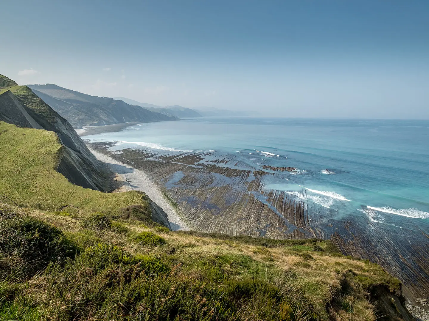
Camino del Norte
How would you rate Camino del Norte?
Tap a star to share your experience and help other hikers.
Camino del Norte: A Coastal Camino Across Northern Spain
HikeList Score
Camino del Norte scored 79/100 on HikeList's trail-quality metrics.
See score breakdownHide breakdown
- Ideal length 52
- Balanced challenge 84
- Scenery & wildness 85
- Varied terrain 89
- Accommodation 83
- Food & support 88
- Path quality 84
- Season flexibility 89
Computed from length, challenge, scenery & wildness, terrain variety, accommodation, food & support, path quality and season flexibility.
The Camino del Norte is an 825 km point-to-point pilgrimage route across northern Spain, from Irun on the French-Spanish border to Santiago de Compostela in Galicia. Typically walked in about 34 days, it is a hard Camino: coastal climbs, descents, wet Atlantic weather and mixed surfaces make it more demanding than its resort-town stages suggest. It suits experienced long-distance walkers who want Green Spain’s coast, Basque cities, Cantabrian towns, Asturian cliffs and the final pilgrim approach into Santiago.
Route Overview
The route starts in Irun, crosses the Basque Country via San Sebastian and Bilbao, continues through Cantabria via Santander, Santillana del Mar and Comillas, then follows the Asturian coast through Llanes, Gijon and Aviles. From Ribadeo it enters Galicia, turns inland through Mondonedo and reaches Arzua, where it merges with the Camino Francés for the final stretch to Santiago de Compostela. It is a point-to-point walk with pilgrim albergues, guesthouses and hotels in many towns. If you only want the Cantabrian section, see the Camino del Norte Cantabria Segment.
History of the Camino del Norte
The Camino del Norte is one of the oldest pilgrimage routes to Santiago, used from around the 9th–10th centuries when southern Meseta routes were unsafe during the Reconquista. Royal and coastal patronage helped create pilgrim hospitals, bridges and monasteries along the way. It predates, and was later partly eclipsed by, the inland Camino Francés. In 2015 it was inscribed on the UNESCO World Heritage List as part of the extended “Routes of Santiago de Compostela: Camino Francés and Routes of Northern Spain”.
Notable highlights
- San Sebastian (Donostia): An elegant Belle Epoque resort city wrapped around La Concha bay. For hikers it is a memorable early stop, with pintxos bars and strong Basque food culture.
- Bilbao Guggenheim: Frank Gehry’s titanium-clad Guggenheim Museum opened in 1997 beside the river. It is the signature landmark of Bilbao and a major cultural break on the route.
- Santillana del Mar: A beautifully preserved medieval town nicknamed “the town of three lies” because it is neither holy, flat, nor by the sea. It also sits near the prehistoric Altamira cave paintings.
- Comillas: A Cantabrian seaside town known for El Capricho, an early colourful villa designed by Antoni Gaudi. It is one of the route’s most distinctive architectural stops.
- Asturian coast and Gijon: The Asturian section brings cliffs, wild beaches and cider culture. Gijon is a large coastal city with Roman heritage and a long seafront.
- Ribadeo and Galicia: At Ribadeo the route crosses the Eo estuary near Playa de las Catedrales, then turns inland through Mondonedo towards Santiago.
Challenges to expect
Expect repeated daily climbing and descending rather than one high mountain pass. Many stages involve 600–1,000 m of cumulative ascent, with coastal footpaths, clifftops, beaches, forest, farmland, asphalt roads and cobbled streets. The Atlantic coast is wet, and many albergues close in winter. August and early September are busiest. For another demanding northern Camino comparison, see the Camino Primitivo.
HikeList Score
Camino del Norte scored 79/100 on HikeList's trail-quality metrics.
See score breakdownHide breakdown
- Ideal length 52
- Balanced challenge 84
- Scenery & wildness 85
- Varied terrain 89
- Accommodation 83
- Food & support 88
- Path quality 84
- Season flexibility 89
Computed from length, challenge, scenery & wildness, terrain variety, accommodation, food & support, path quality and season flexibility.
 Spain
SpainShow more data Show less
- Coastal
- Forest
- Farmland
- Footpaths
- Sand
- Paved
- Cobbled
- Albergues
- Guesthouses
- Hotels
- Family Friendly
- Pet Friendly
- Restrooms
- Water Sources
- Campsites
- Shelters
Download Our Full Guide to Camino del Norte FREE!
Get our comprehensive guide to this hike for free. Save it for later reading or print out at home.
Articles related to this hike
In these collections
Photos from hikers
Taken on the trail by people who've reviewed Camino del Norte.
Camino del Norte: The Complete Guide
 i
Image by Christina
i
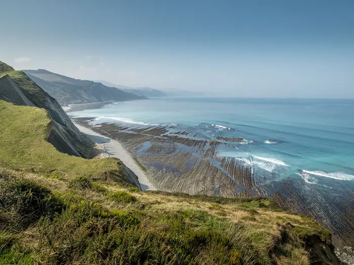
Image by Christina The Camino del Norte is the long Atlantic Camino: a roughly 817–825 km pilgrimage from Irún on the French border to Santiago de Compostela, following Spain’s green northern coast before turning inland through Galicia. It suits walkers who want coast, cities and quieter pilgrim stages, but still expect a serious five-week undertaking.
From País Vasco through Cantabria and Asturias, the route links places such as Donostia / San Sebastián, Bilbao, Santander, Gijón (Xixón), Avilés and Ribadeo with fishing towns, rural lanes, clifftop paths and rolling hills. After Ribadeo it leaves the sea, crosses inland Galicia through Mondoñedo, Vilalba and Sobrado dos Monxes, then joins the Camino Francés near Arzúa for the final approach to the Praza do Obradoiro.
This is not the easiest Camino. There is no single high pass, but the repeated climbs and descents, long asphalt stretches, Atlantic rain and widely spaced beds make the Norte harder to improvise than the busier Camino Francés.
It rewards steady walkers who plan their stages, carry sensible wet-weather kit and keep enough flexibility for variants, closed albergues and long days. A pilgrim credencial is essential for albergues and for claiming the Compostela, with Vilalba the usual start for those walking only the final 100 km.
This guide covers stages, days, accommodation, food, transport, terrain and the common mistakes to avoid.
Stage-by-Stage Guide
Stage 1: Irún to Donostia / San Sebastián — 26 km
The opening stage starts at Irún on the Bidasoa river and immediately sets the tone for the Basque section: hilly, green and more strenuous than many first-time Camino walkers expect. The route is waymarked with yellow arrows and scallop-shell markers, but this is not a flat coastal promenade; expect repeated climbing and descending on lanes, tracks, town streets and coastal paths.
Donostia / San Sebastián is the main landmark and a major service point at the end of the day, with the Bahía de la Concha making this one of the most memorable arrivals on the Norte. Food and water are straightforward at the start and finish, but carry enough for the full walking day rather than relying on frequent services between.
Accommodation options are broader in Donostia / San Sebastián than in smaller Camino stops, with pilgrim albergues, pensiones and hotels typically available in the city. It also has strong public transport connections, making it a practical point to join, leave or pause the route.
Navigation on the main Camino is generally good, but urban exits and coastal alternatives always require attention. In wet Atlantic weather, paths can be muddy and exposed coastal sections windy, so keep waterproofs accessible from the first day.
Stage 2: Donostia / San Sebastián to Zarautz — 22 km
This stage continues west from the Basque resort city into a coastal walking day with a mix of town streets, lanes, tracks and hillier sections above the sea. The day is shorter than Stage 1, but the Basque Country remains one of the most physically demanding parts of the Camino del Norte because height is gained and lost repeatedly.
Zarautz is the key end-point, known for its long surf beach. Food, water and overnight options are good at both Donostia / San Sebastián and Zarautz, but do not assume that every rural or clifftop stretch has services.
Zarautz has road access and regional transport links should be checked before travelling if using it as a start or finish point. Accommodation usually includes pilgrim and private options, though summer demand and winter closures can affect availability.
Waymarking is usually reliable on the main line. Coastal variants can be less consistently signed, so a GPX track or Camino app is useful, particularly where paths, lanes and urban streets intersect.
Stage 3: Zarautz to Deba — 22 km
This is a classic Basque coastal stage, leaving Zarautz and passing the historic fishing port of Getaria before continuing towards Deba. Expect a varied surface mix: seafront and town walking, rural lanes, tracks, short steep climbs and descents, and stretches of asphalt.
Getaria is one of the main highlights, associated with Juan Sebastián Elcano and Cristóbal Balenciaga. It is also the logical place to plan a food or water stop, but opening hours and seasonal availability should be checked before travelling.
Deba is a recognised Camino stop with accommodation at or near the end of the stage, including pilgrim-style lodging and private options. Road and public transport access in coastal towns is generally better than on the inland stretches, but exact services should be checked before committing to a split itinerary.
Navigation can be fiddly where coastal paths, roads and local streets overlap. Wet conditions make paved descents slippery and unpaved sections muddy, so this stage rewards steady pacing rather than rushing.
Stage 4: Deba to Markina-Xemein — 25 km
The route turns more inland here and remains firmly Basque in character: green hills, farmed valleys, forest tracks, lanes and a demanding profile. This is one of the stages where the Norte’s reputation for effort becomes clear, despite the absence of a single high mountain pass.
Services are more limited than in the larger coastal towns, so leave Deba with enough food and water for a substantial rural day. Markina-Xemein is the end-of-stage service point and should be used for resupply and overnight recovery.
Accommodation at Markina-Xemein should be planned rather than left too late, particularly outside the main season when some albergues close. Public transport and onward road access from smaller inland towns should be checked before travelling.
Waymarking on the main route is normally clear, but the terrain is less urban and more enclosed than the earlier coastal stages. After rain, forest tracks and farm lanes can be muddy, and long asphalt stretches can be tiring on feet.
Stage 5: Markina-Xemein to Gernika (Guernica) — 24 km
This stage continues through rolling Basque countryside, with a mix of rural lanes, tracks, woodland and small settlements before reaching Gernika (Guernica). The walking is not technically difficult, but the cumulative ascent and descent can make the day feel harder than its distance suggests.
Gernika is a major cultural stop on the Camino del Norte, known for the Casa de Juntas, the historic Tree of Gernika and its association with the 1937 bombing immortalised by Picasso. It is the best place on this stage for food, supplies and accommodation.
Expect pilgrim and private lodging options in or around Gernika, but book or plan ahead in busy periods. Public transport access is better here than in smaller villages, making it a practical place for a rest night or itinerary adjustment.
Navigation into and out of towns requires attention because Camino arrows can be missed among local signs. Wet weather is common in this part of northern Spain, so muddy tracks and slick paved sections are normal concerns.
Stage 6: Gernika (Guernica) to Lezama — 21 km
This is a transitional stage between rural Basque country and the approach to Bilbao. The walking remains undulating, with lanes, tracks, wooded sections and an increasing amount of built-up or road-influenced walking as Lezama is approached.
Food and water are reliable at Gernika and should be available at Lezama, but intermediate services should not be assumed. Carry enough for the day, especially if walking outside the busiest months.
Lezama is a common staging point before the short approach into Bilbao. Accommodation and onward transport options are more limited than in Bilbao itself, so this is a stage where booking ahead is sensible.
The main navigation issue is staying alert during the transition from countryside to urban fringe. Road walking and asphalt increase towards the Bilbao area, so foot care becomes important after several hilly Basque days.
Stage 7: Lezama to Bilbao — 11 km
This is a short stage in distance, but it should not be treated as a throwaway morning because the approach to Bilbao involves hills and urban navigation. It is a useful recovery day after the demanding first week and gives time to deal with laundry, repairs and resupply in a major city.
Bilbao is the principal landmark, though the traditional waymarked Camino climbs over the hills and does not pass directly by the Museo Guggenheim. Walkers wanting to visit the Guggenheim should plan the detour within the city rather than assuming it lies on the waymarked line.
Food, water, pharmacies, outdoor supplies, accommodation and transport are all strongest in Bilbao. It is one of the best places on the entire Norte to take a rest day or reorganise onward bookings.
Navigation through the city fringe can be less intuitive than rural walking because arrows compete with road signs, streets and junctions. Keep an eye on the waymarks and use a GPX/app if taking any Bilbao or river-side variant.
Stage 8: Bilbao to Portugalete — 19 km
This stage moves through the Bilbao metropolitan area towards Portugalete and the estuary. It is more urban and asphalt-heavy than the earlier rural Basque days, so the challenge is less about wild terrain and more about hard surfaces, junctions and staying on the intended route.
Portugalete is associated with the Puente de Vizcaya, the UNESCO-listed iron transporter bridge of 1893. The river/Getxo variant brings walkers closer to the modern Bilbao riverside and the Vizcaya Bridge area, but variants can be less well signed than the main Camino.
Food, water and accommodation are generally easier to manage on this urban stage than on rural ones. Bilbao and Portugalete both give access to wider transport options, useful for section hikers.
The main warning is navigation: city walking can be tiring and arrows can be easy to miss. Expect traffic, crossings, pavements and long hard-surface sections rather than remote trail walking.
Stage 9: Portugalete to Castro-Urdiales — 27 km
Leaving Portugalete, the route heads west towards Cantabria, with a long day that blends urban edge, coastal influence, lanes, tracks and asphalt. The distance is substantial, and the repeated hard surfaces can make this stage feel longer than the profile alone suggests.
Castro-Urdiales is the end-of-stage service town and the first major Cantabrian stop on this itinerary. Food and water should be planned from the start, with enough carried to cover gaps between built-up areas.
Accommodation is usually available at or near Castro-Urdiales through pilgrim and private options, but summer demand can tighten availability along the coast. Road and public transport access should be checked before travelling if using this stage as a section break.
Navigation is generally straightforward on the main waymarked Camino, but urban exits and road-adjacent sections need care. Watch for tiredness on asphalt, especially if walking in warm July or August conditions.
Stage 10: Castro-Urdiales to Laredo — 26 km
This is another long Cantabrian coastal stage, moving through a mix of town streets, rural lanes, rolling green country and sections of coast-influenced walking. The Norte is still undulating here, though generally less sharply hilly than the Basque opening.
Laredo is a significant coastal town and a useful overnight stop with food, water and accommodation options. Carry enough during the day because services between the larger towns can vary with season and opening hours.
Accommodation at Laredo should be arranged in advance in busy periods, especially in summer. Public transport along the Cantabrian coast is generally more practical than in the inland sections, but exact services should be checked before travelling.
Road walking and asphalt remain a feature of the Norte in Cantabria. In rain, muddy rural tracks and slippery paved surfaces are the main practical concerns.
Stage 11: Laredo to Güemes — 29 km
This is a long and logistically important stage because it involves the Laredo–Santoña marshes area and the crossing towards Santoña. The route choice here can affect distance and timing, so the current ferry or inland detour situation should be checked before travelling.
Santoña and the marshes are the main landmarks of the day, with the route then continuing towards Güemes. Food and water are available at the larger coastal towns, but carry enough for the full stage because the day is long and services may not line up conveniently with the walking rhythm.
Güemes is a recognised Camino stop, but accommodation should be planned because it is not a large city. If relying on public transport or road access here, this should be checked before travelling.
Navigation around estuaries, marshes, roads and variants needs more attention than on a simple linear rural stage. Allow extra time if the ferry is not operating or if an inland detour is required.
Stage 12: Güemes to Santander — 12 km
This short stage brings the route into Santander, one of the major cities of the Camino del Norte. It is a practical recovery day after the longer Cantabrian stages and allows time for resupply, accommodation admin and transport connections.
Terrain becomes more urban on the approach to Santander, with lanes, roads, pavements and city streets replacing more open coastal walking. Food and water are straightforward at Santander, but check what is available at Güemes before setting off.
Santander has broad accommodation options and is one of the best-connected points on the route for buses, trains and onward travel. It is a sensible place for a rest day or for joining/leaving the Camino.
Navigation through the city approach can be busier and less relaxed than countryside walking. Stay alert for yellow arrows at junctions and use a GPX/app if the urban waymarking is unclear.
Stage 13: Santander to Santillana del Mar — 37 km
This is one of the longest stages in the HikeList itinerary and should be treated seriously. Expect a demanding day of mixed urban exit, roads, lanes, rolling countryside and asphalt, with fatigue likely to be a bigger issue than technical difficulty.
Santillana del Mar is the highlight at the end: a preserved medieval Cantabrian town, near the Altamira cave-painting site. Food and water should be stocked before leaving Santander, and walkers should not rely on frequent services across the full 37 km without checking current options.
Accommodation in Santillana del Mar is available through pilgrim and private lodging, but advance planning is strongly advised because the town is a popular stop. If 37 km is too much, intermediate stopping options should be checked before travelling rather than assumed.
Navigation out of Santander and across built-up margins requires attention. The warnings for this stage are distance, asphalt, potential heat in summer and rain-softened tracks in unsettled weather.
Stage 14: Santillana del Mar to Comillas — 22 km
This is a more moderate Cantabrian stage after the long walk from Santander. The route continues through rolling coastal countryside, lanes, tracks and stretches of road before reaching Comillas.
Comillas is one of the architectural highlights of the Norte, known for El Capricho de Gaudí. Santillana del Mar and Comillas both provide food, water and overnight options, though services between them should be checked if planning a slower day.
Accommodation at Comillas includes pilgrim-style and private lodging in a seaside town setting. Transport and road access should be checked before travelling if using Comillas as a section endpoint.
Waymarking on the main route is usually adequate, but variants and town exits can be less obvious. Expect some asphalt and be prepared for wet, muddy sections after Atlantic rain.
Stage 15: Comillas to Colombres — 29 km
This long stage continues west through Cantabria towards the Asturian border area. The walking mixes coastal influence, rural lanes, farmland, green hills and road sections, with San Vicente de la Barquera an important on-route highlight.
San Vicente de la Barquera is a memorable stop, set on a sea inlet with bridges and a hilltop church, with the Picos de Europa inland as a backdrop in clear weather. Use the larger towns for food and water, and carry enough between them because the day is nearly 30 km.
Colombres is the overnight target and should be planned in advance, particularly outside the main season or during busy summer weeks. Road access is available in general terms, but public transport details should be checked before travelling.
Navigation is mostly standard Camino waymarking, but pay attention where the route crosses towns, roads and coastal-side paths. Long hard-surface sections can aggravate foot problems at this point in the journey.
Stage 16: Colombres to Llanes — 23 km
This stage enters the Asturian coast, where the Camino alternates between coastal paths, green countryside, lanes, small settlements and asphalt. It is moderate in distance but still includes the rolling character that defines the Norte.
Llanes is the main landmark and overnight point, known for its medieval core and the painted Cubos de la Memoria. Food and water are best planned around Colombres and Llanes, with intermediate availability checked before relying on it.
Accommodation in Llanes is usually a mix of pilgrim and private options, though the Asturian coast is busy in summer. Llanes is also a practical section-hiking point, but current bus or train details should be checked before travelling.
Waymarks are generally good on the main line, but coastal alternatives and local paths can introduce ambiguity. Wind on exposed clifftops and mud after rain are the main practical warnings.
Stage 17: Llanes to Ribadesella — 30 km
This is a long Asturian coastal stage, with a varied day of lanes, tracks, clifftop and coastal walking, settlements and road sections. The distance makes it a full walking day even when gradients are not extreme.
The Asturian coast is the highlight, including clifftop beaches and the bufones, or blowholes, where route choice and conditions allow. Ribadesella, at the mouth of the Sella river and near the Tito Bustillo caves, is the end-of-day service centre.
Food and water are available in the larger towns, but the stage length means carrying a reliable supply is sensible. Accommodation in Ribadesella should be planned ahead in high season, when coastal demand rises.
Navigation can be less simple on coastal variants than on the main waymarked route. Exposed sections can be windy, and wet weather can make tracks slippery or muddy.
Stage 18: Ribadesella to Colunga — 20 km
This shorter stage continues through Asturias on a mix of coastal and inland-feeling terrain: lanes, green hills, farmland, tracks and sections of asphalt. It offers a useful reduction in distance after the 30 km approach to Ribadesella.
Ribadesella is the best place to stock up at the start, while Colunga provides the end-of-stage services and accommodation base. Intermediate food and water should be checked before travelling if planning a slow or late start.
Colunga is a smaller overnight stop than Ribadesella, so accommodation planning matters more. Public transport or road access should be checked before treating it as a guaranteed join/leave point.
The main navigation concerns are junctions between rural lanes and local tracks. Rain, mud and hard-surface fatigue remain the realistic hazards rather than any technical mountain difficulty.
Stage 19: Colunga to Villaviciosa — 18 km
This is a relatively short Asturian stage, useful for recovery and for managing cumulative fatigue. The route continues through rolling green countryside, lanes, tracks and road sections rather than high mountain terrain.
Villaviciosa is the key service point and an important junction area on the Norte, with the route continuing west afterwards towards Gijón (Xixón). Food and water should be easy to manage at the start and finish, but check intermediate options before relying on them.
Accommodation in Villaviciosa should be arranged in line with season and expected pilgrim numbers. Road access is useful in general terms, but public transport details should be checked before travelling.
Waymarking on the main route should be followed carefully because junctions and route choices can affect the onward line. Wet conditions can make rural surfaces muddy, while asphalt remains tiring underfoot.
Stage 20: Villaviciosa to Gijón (Xixón) — 30 km
This is a significant Asturian stage, both for its distance and for the climbing before the approach to Gijón (Xixón). The route includes the Alto de la Cruz and Monte Areo area, one of the named higher sections of the Camino del Norte, though it is still a rolling route rather than a single mountain pass.
Expect a demanding mix of rural lanes, tracks, climbs, descents, road walking and urban approach. Gijón (Xixón), Asturias’ largest coastal city, rewards the effort with strong services, a long seafront and the Cimavilla headland.
Food and water should be stocked before leaving Villaviciosa, with enough carried for a long day. Gijón (Xixón) has extensive accommodation, resupply and transport options, making it a strong rest-day or section-break location.
Navigation around high ground, road sections and the city approach needs attention. The warning here is cumulative: distance, ascent, asphalt and weather can combine to make this one of the tougher Asturian days.
Stage 21: Gijón (Xixón) to Avilés — 25 km
This stage links two major Asturian cities and is more urban and infrastructure-influenced than the wilder coastal sections. Expect pavements, road walking, lanes and built-up margins, with hard surfaces forming a significant part of the day.
Gijón (Xixón) and Avilés both offer strong food, water, pharmacy, accommodation and transport options. For section hikers, this is one of the easier stages to organise because both ends are significant cities with bus and rail links.
Accommodation at Avilés is normally easier to arrange than in smaller villages, though booking ahead remains wise in peak season. Use the city to resupply before the longer, quieter stages to the west.
Navigation through urban and suburban areas requires concentration. The main physical warning is foot fatigue from asphalt rather than exposure or technical terrain.
Stage 22: Avilés to Soto de Luiña — 34 km
This is a long stage west of Avilés, moving back into a more rural and coastal-influenced rhythm after the city-to-city walking. The distance is demanding, and the combination of lanes, tracks, road sections and undulating ground should not be underestimated.
Food and water need planning from Avilés, as services become less dense than around the larger Asturian cities. Soto de Luiña is the overnight target and should be checked for accommodation availability before committing to the full stage.
Accommodation at or near Soto de Luiña is more limited than in Gijón (Xixón) or Avilés, so advance planning is sensible. Public transport and road access for this smaller stop should be checked before travelling.
Waymarking on the main Camino is the safest choice, particularly where alternatives appear. After rain, rural tracks can be muddy, and the long distance makes late arrival a risk if starting slowly.
Stage 23: Soto de Luiña to Cadavedo — 20 km
This shorter Asturian stage is a welcome reduction after the long day from Avilés. Terrain remains mixed, with lanes, tracks, green countryside, coastal influence and some asphalt.
Food and water should be arranged at Soto de Luiña before departure, with Cadavedo used as the end-of-day resupply and rest point. Do not rely on every small place between the two having open services.
Accommodation in Cadavedo should be checked and, where possible, arranged ahead. It is a smaller Camino stop, so flexibility is more limited than in the larger coastal towns.
Navigation is usually manageable on the main waymarked route, but coastal or local variants can be weaker. Wet weather, mud and road walking remain the practical issues.
Stage 24: Cadavedo to Luarca — 16 km
This is one of the shorter days on the itinerary and can be used to recover, deal with laundry or slow the pace before the longer stages ahead. The walking continues through western Asturias with a mix of lanes, rural tracks, coastal approaches and asphalt.
Luarca is the principal end-of-stage town and a useful service point. Food and water are easier to manage on a 16 km stage, but start with enough for the walk because opening hours can still affect smaller places.
Accommodation in Luarca is generally more practical than in small rural stops, with pilgrim and private options expected at or near the town. Public transport or road access should still be checked before using it as a firm section endpoint.
Navigation is not usually complex on the main route, but pay attention on town approaches and road crossings. In poor weather, short stages can still become slow if tracks are muddy or exposed coastal sections are windy.
Stage 25: Luarca to A Caridad / La Caridad — 29 km
This is a long western Asturian stage with rolling countryside, lanes, road sections, tracks and coastal influence. By this point, cumulative fatigue is a serious planning factor, so treat 29 km as a full day even without major altitude.
Food and water should be stocked in Luarca, and walkers should carry enough to cover the stage comfortably. A Caridad / La Caridad is the end-of-stage service point and should be used for accommodation, evening meal and onward planning.
Accommodation at A Caridad / La Caridad should be checked in advance, especially outside the main Camino season. Public transport and road access for this smaller endpoint should be checked before travelling.
The main warnings are distance, asphalt and wet-weather mud. Navigation on the main yellow-arrow route should be manageable, but do not drift onto poorly signed alternatives without a map or GPX.
Stage 26: A Caridad / La Caridad to Ribadeo — 23 km
This stage reaches the Ría del Eo and crosses from Asturias into Galicia at Ribadeo. It is an important psychological milestone: after many coastal stages, the Camino soon turns inland for the final Galician approach.
Ribadeo is the clear highlight and service centre, with the Eo estuary and the nearby Praia das Catedrais rock arches among the best-known features of the area. Food and water are available at the start and finish, but intermediate services should be checked before relying on them.
Accommodation in Ribadeo is a good opportunity to reset before the inland Galician stages. Road and transport links are generally more useful here than in the small inland stops ahead, but exact services should be checked before travelling.
Navigation around the estuary approach and town streets requires attention. The warning is not technical difficulty, but the shift from coastal walking into a quieter inland rhythm after Ribadeo.
Stage 27: Ribadeo to Lourenzá — 29 km
From Ribadeo the Camino turns inland into Galicia, leaving the immediate Cantabrian coast behind. Expect greener inland walking on lanes, tracks, farmland and rolling hills, with the Atlantic weather still capable of bringing rain and mud.
This is a long stage, so stock up properly in Ribadeo before setting off. Lourenzá is the end-of-day service and accommodation point; intermediate food and water should be checked before travelling.
Accommodation in Lourenzá is more limited than in the large coastal cities, so planning ahead is important. Public transport or road access should not be assumed without checking current options.
Waymarking on the main Camino is generally good, but the quieter Galician countryside can make missed junctions more consequential. Wet lanes and muddy tracks are the main conditions to prepare for.
Stage 28: Lourenzá to Mondoñedo — 14 km
This is a short but meaningful inland Galician stage, finishing in Mondoñedo. Although the distance is modest, the route has left the coast and the walking now feels more rural and enclosed, with lanes, tracks and rolling terrain.
Mondoñedo is a major highlight of the inland Norte, known for its Gothic cathedral and former episcopal importance. Food and water are straightforward at the start and finish, but check intermediate services if setting off without supplies.
Accommodation in Mondoñedo should be available through pilgrim or private options, but winter closures can affect albergues. Its shorter distance makes it a useful place for a slower day or recovery night.
Navigation is usually simple if the yellow arrows are followed carefully. Rain can still make surfaces muddy, and short stages should not lead to complacency with weather or daylight.
Stage 29: Mondoñedo to Abadín — 16 km
This stage continues through inland Galicia and includes higher rolling ground before the route drops gradually towards the Vilalba area on subsequent stages. It is not a high-pass day, but the terrain can still feel strenuous because of the repeated gradients.
Food and water should be arranged in Mondoñedo before departure. Abadín is the end-of-stage stop, and services there should be checked before travelling, particularly outside the main season.
Accommodation at or near Abadín is more limited than in larger towns, so do not rely on turning up late without a plan. Public transport and road access should also be checked before using Abadín as a section break.
Navigation is generally on the main Camino line, but rural junctions and quiet lanes require attention. Mud, rain and wind on more open inland ground are the likely challenges.
Stage 30: Abadín to Vilalba — 20 km
This Galician stage continues through rural inland terrain, with lanes, tracks, farmland and gentler rolling country than the early Basque stages. It is a moderate-distance day and a useful point in the route because Vilalba is the usual start for walkers completing the final 100 km requirement for the Compostela.
Food and water should be carried from Abadín, with Vilalba providing the main end-of-stage services. Because Vilalba is a recognised last-100 km start, accommodation demand can increase compared with quieter preceding stages.
Vilalba has pilgrim and private lodging options, but booking or checking availability is sensible in busy periods. Public transport and road access should be checked before travelling if starting the Camino here.
Waymarking becomes increasingly important as more pilgrims may join from Vilalba onwards. Keep the credencial stamped regularly from here if walking for the Compostela.
Stage 31: Vilalba to Baamonde — 19 km
This is a moderate inland Galician stage through lanes, tracks, farmland and small settlements. The walking is generally gentler than the coast-and-hill sections earlier in the Camino, but wet weather can still make the day slow and muddy.
Vilalba is the best place to stock up before leaving. Baamonde is the end-of-stage stop, with food, water and accommodation availability to be checked before travelling if relying on specific services.
Accommodation at Baamonde is likely more limited than in Vilalba, so plan the night in advance. Public transport and road access for smaller Galician stops should not be assumed without checking current timetables.
Navigation on the main route is normally reliable, but stay alert at rural junctions. From this point onward, maintaining credencial stamps matters for Compostela eligibility.
Stage 32: Baamonde to Miraz — 15 km
This is a short Galician stage and can work as a recovery day before the longer approach to Sobrado dos Monxes. Terrain is rural and rolling, with lanes, tracks and quiet countryside rather than coastal exposure.
Food and water should be planned carefully because the distance is short but the route is quieter. Miraz is a small end-of-stage stop, so accommodation and meal options should be checked before travelling.
Do not arrive at Miraz assuming the same depth of services found in cities such as Bilbao, Santander or Gijón (Xixón). If accommodation is unavailable, alternative staging should be arranged before setting out.
Navigation is generally by yellow arrows on the main Camino. Mud after rain and limited services are the main practical warnings.
Stage 33: Miraz to Sobrado dos Monxes — 25 km
This stage continues through rural Galicia to Sobrado dos Monxes, a major Camino landmark. The walking is a full day again, with lanes, tracks, open countryside and rolling inland ground.
Sobrado dos Monxes is known for the Cistercian Monasterio de Santa María, which still offers pilgrim lodging. Food and water should be carried from Miraz, and any intermediate services should be checked before travelling.
Accommodation at Sobrado dos Monxes is central to planning this stage, especially if intending to stay at or near the monastery. Availability and current arrangements should be checked before travelling, particularly outside the main season.
Navigation is usually straightforward on the main route, but the rural setting leaves less room for casual detours. Rain, mud and a 25 km distance make an early start sensible.
Stage 34: Sobrado dos Monxes to Santiago de Compostela via Arzúa — 41 km
The final stage in the HikeList itinerary is very long at 41 km and should be treated as a major walking day, not simply a ceremonial finish. The route goes via Arzúa, where the Camino del Norte joins the Camino Francés for the final approach to Santiago de Compostela.
From Arzúa onwards, the route becomes busier and more service-rich as it shares the final kilometres with the French Way. O Pedrouzo lies on the run-in before Santiago, and the finish is at the Praza do Obradoiro before the Catedral de Santiago.
Food, water and accommodation are more available after joining the Camino Francés, but the long distance still requires proper pacing and supplies. Many walkers will prefer to split this final section if accommodation and time allow; this should be checked before travelling.
Santiago de Compostela has the strongest finish-line logistics, including accommodation, a railway and bus station, and Santiago de Compostela Airport (SCQ) for onward travel. Navigation is generally well marked, but the increase in pilgrim traffic and urban walking into Santiago can make the final kilometres slower than expected.
The main warnings are distance, fatigue, asphalt and the temptation to rush the finish. Keep the credencial accessible for final stamps and allow enough time at the Pilgrim Office if seeking the Compostela.
Recommended Itinerary
Standard 34-day itinerary
This is a fit, full-route schedule for walkers who are comfortable with repeated 20–30 km days and occasional stages above 30 km. It follows the HikeList 34-day structure, but several days are demanding enough to justify splitting if time and accommodation allow — especially Santander to Santillana del Mar, Avilés to Soto de Luiña, and Sobrado dos Monxes to Santiago de Compostela.
Albergue availability on the Camino del Norte is thinner than on the Camino Francés, and many places close in winter. Accommodation and any estuary-crossing arrangements should be checked before travelling, particularly on long days where there are fewer easy bail-out options.
| Day | From | To | Approx. distance | Why this stage makes sense | Services/accommodation notes |
|---|---|---|---|---|---|
| 1 | Irún | Donostia / San Sebastián | 26 km | A full first day that gets the route properly under way along the hilly Basque opening section. Expect this to feel harder than the distance suggests. | Donostia / San Sebastián is a major city with broad accommodation and food options; book ahead in busy periods. |
| 2 | Donostia / San Sebastián | Zarautz | 22 km | A shorter but still active coastal stage after the tough first day. It keeps the early itinerary sustainable without losing momentum. | Zarautz has pilgrim and tourist accommodation, with more pressure in summer. |
| 3 | Zarautz | Deba | 22 km | A manageable day through the Basque coastal sequence, with Getaria as a useful on-route place before continuing west. | Deba is a recognised stage stop; check albergue opening dates outside the main season. |
| 4 | Deba | Markina-Xemein | 25 km | One of the more serious early inland Basque days, with more climbing and a less coastal feel. Keeping it to a standard stage avoids overloading the first week. | Markina-Xemein has pilgrim accommodation and town services, but beds are fewer than in the coastal cities. |
| 5 | Markina-Xemein | Gernika (Guernica) | 24 km | A solid mid-length stage that continues through rolling Basque terrain and finishes in a historically important town. | Gernika (Guernica) has accommodation and services; book if arriving late or in peak season. |
| 6 | Gernika (Guernica) | Lezama | 21 km | A practical positioning day before Bilbao, avoiding a very long push into the city. It gives an easier run-in for the following morning. | Lezama is a smaller stop, so confirm current pilgrim-bed availability before relying on it. |
| 7 | Lezama | Bilbao | 11 km | A deliberately short day into Bilbao, useful for recovery, resupply and any city logistics. | Bilbao has the widest choice of accommodation on this part of the route; prices and availability vary sharply by season and events. |
| 8 | Bilbao | Portugalete | 19 km | A manageable urban and estuary-side transition out of Bilbao towards the western side of the metropolitan area. | Portugalete has services and accommodation; this is a sensible overnight before the longer Cantabrian stages begin. |
| 9 | Portugalete | Castro-Urdiales | 27 km | A longer day that carries the route west from the Bilbao estuary towards Cantabria. The distance is significant but fits the spacing of the main stage towns. | Castro-Urdiales is a substantial coastal town with accommodation options; summer demand can be high. |
| 10 | Castro-Urdiales | Laredo | 26 km | Another long but logical coastal stage, keeping the itinerary moving across eastern Cantabria. | Laredo has good town services and a range of accommodation; check seasonal pilgrim options before booking. |
| 11 | Laredo | Güemes | 29 km | A demanding day involving the Santoña marshes/estuary area and a longer carry to a quieter inland stop. Start early and have a clear plan for the crossing or detour. | The Santoña/Laredo estuary ferry versus inland detour can affect the day; this should be checked before travelling. Güemes is a smaller pilgrim stop. |
| 12 | Güemes | Santander | 12 km | A short recovery stage into a major Cantabrian city after several long days. It also gives useful time for laundry, resupply and transport connections. | Santander has extensive accommodation, food and transport services. Book ahead in the high season. |
| 13 | Santander | Santillana del Mar | 37 km | One of the hardest distance days in this schedule. It works only for strong walkers who are happy with a long road-and-country transition after leaving the city. | Consider splitting this stage if accommodation spacing allows; check official mapping before booking. Santillana del Mar has pilgrim and visitor accommodation. |
| 14 | Santillana del Mar | Comillas | 22 km | A more moderate stage after the long day from Santander, finishing in a well-known Cantabrian route town. | Comillas has accommodation and services, but summer tourist demand can reduce flexibility. |
| 15 | Comillas | Colombres | 29 km | A long but classic Cantabrian day, passing the San Vicente de la Barquera area before continuing towards Asturias. | San Vicente de la Barquera can be used to shorten the day if planning a slower itinerary. Colombres has fewer beds than the larger towns. |
| 16 | Colombres | Llanes | 23 km | A balanced first Asturian stage, long enough to make progress without forcing another 30 km day. | Llanes is a useful service town with accommodation; reserve ahead in summer. |
| 17 | Llanes | Ribadesella | 30 km | A long Asturian coastal stage where the terrain and tarmac can make the day feel sustained. It suits walkers already conditioned by the first two weeks. | Ribadesella has accommodation and food options; arrival times matter in busy months. |
| 18 | Ribadesella | Colunga | 20 km | A deliberately easier day after the long Llanes to Ribadesella stage. It keeps the Asturian section from becoming an unbroken sequence of high-mileage days. | Colunga is a smaller overnight stop; check current albergue and private-room availability. |
| 19 | Colunga | Villaviciosa | 18 km | A short positioning stage before the harder approach to Gijón (Xixón). Useful for rest, resupply and an early start the next day. | Villaviciosa has town services and accommodation; confirm pilgrim-bed availability outside the main season. |
| 20 | Villaviciosa | Gijón (Xixón) | 30 km | A tough day with notable climbing, including the Alto de la Cruz / Monte Areo area before reaching Asturias’ largest coastal city. | Gijón (Xixón) has extensive accommodation and services; it is a good place for repairs, resupply and a proper rest evening. |
| 21 | Gijón (Xixón) | Avilés | 25 km | A solid city-to-city stage that keeps the western Asturian coast within reach. Expect more hard surfaces than remote mountain walking. | Avilés is a major stop with broad services and transport links. |
| 22 | Avilés | Soto de Luiña | 34 km | One of the longest days on the standard itinerary. It is best treated as a serious endurance stage rather than a routine Camino day. | Soto de Luiña is much smaller than Avilés; accommodation should be checked before committing to this distance. |
| 23 | Soto de Luiña | Cadavedo | 20 km | A more forgiving stage after the long day from Avilés, keeping progress steady along western Asturias. | Cadavedo is a smaller stop, so do not assume late-arrival bed availability. |
| 24 | Cadavedo | Luarca | 16 km | A short day into Luarca, useful for recovery before the next longer push west. | Luarca has town services and accommodation, making it a practical reset point. |
| 25 | Luarca | A Caridad / La Caridad | 29 km | A long western Asturian stage that continues towards the Galician border. The distance is significant, so an early start is sensible. | A Caridad / La Caridad is a smaller stage town; check current accommodation before relying on walk-up availability. |
| 26 | A Caridad / La Caridad | Ribadeo | 23 km | A moderate day to the Ría del Eo, where the route crosses from Asturias into Galicia. This is a natural psychological and logistical milestone. | Ribadeo has accommodation and services; it is a good place to prepare for the inland Galician section. |
| 27 | Ribadeo | Lourenzá | 29 km | The route turns inland from the coast, with a longer Galician stage and more rural feel. Expect a different rhythm from the seaside sections. | Lourenzá has pilgrim accommodation and basic town services; check opening dates in winter. |
| 28 | Lourenzá | Mondoñedo | 14 km | A short stage into one of the key inland Galician towns. It helps absorb the effort of the transition away from the coast. | Mondoñedo has accommodation and services; this is a sensible place not to rush through. |
| 29 | Mondoñedo | Abadín | 16 km | A short but useful upland Galician stage, keeping the final week controlled rather than forcing long back-to-back days. | Abadín is a smaller stop; confirm available beds before travelling in quieter months. |
| 30 | Abadín | Vilalba | 20 km | A moderate stage to the usual last-100 km starting area for pilgrims seeking the Compostela. | Vilalba has services and accommodation; ensure the credencial is being stamped properly from here if walking the final qualifying distance. |
| 31 | Vilalba | Baamonde | 19 km | A steady Galician day that keeps the run-in to Santiago measured. It is short enough to allow a slower morning or extra recovery. | Baamonde is a recognised pilgrim stop, but accommodation should still be checked in winter. |
| 32 | Baamonde | Miraz | 15 km | A short stage before a more substantial day to Sobrado dos Monxes. It is useful for managing fatigue late in the route. | Miraz is a small stop; pre-check beds and food options rather than assuming full services. |
| 33 | Miraz | Sobrado dos Monxes | 25 km | A solid penultimate Galician stage, finishing at one of the most important monastery stops on the Norte. | Sobrado dos Monxes has pilgrim lodging at the Monasterio de Santa María, but current arrangements should be checked before travelling. |
| 34 | Sobrado dos Monxes | Santiago de Compostela, via Arzúa | 41 km | A very long final day that joins the Camino Francés near Arzúa and continues to the Praza do Obradoiro. It is efficient, but only strong walkers should plan to finish this way. | Arzúa and O Pedrouzo are the obvious places to split this final approach. If walking the full 41 km, book Santiago accommodation in advance and start early. |
Slower variant: 36–42 walking days
A slower itinerary suits walkers carrying full packs, anyone new to multi-week Camino walking, and those who want more time in the coastal towns. It is also the safer choice in wet weather, when repeated climbs, mud and tarmac take more effort than the map distance suggests.
The most useful way to slow the route is to split the longest days rather than adding random rest days. Priority candidates are Santander to Santillana del Mar, Avilés to Soto de Luiña, Luarca to A Caridad / La Caridad, Ribadeo to Lourenzá, and the final Sobrado dos Monxes to Santiago de Compostela stage.
Known places on or near the route that can help shape a slower plan include Getaria, Santoña, San Vicente de la Barquera, Arzúa and O Pedrouzo. Exact split distances and current bed availability should be checked against up-to-date mapping before booking.
Faster variant: 30–32 walking days
A faster itinerary is only sensible for experienced long-distance walkers who are already comfortable with 30 km days on hard surfaces. The Camino del Norte is not a flat coastal stroll; compressing the schedule means accepting repeated long days with cumulative climbing, wet-weather delays and less flexibility around accommodation.
The easiest places to save time are around the shorter stages into or out of cities, and in Galicia where several standard stages are below 20 km. For example, strong walkers may choose to combine some shorter days around Lezama, Bilbao and Portugalete, or later around Lourenzá, Mondoñedo, Abadín, Baamonde and Miraz.
Do not rely on a faster schedule without checking accommodation spacing first. The Norte has fewer pilgrim beds than the Camino Francés, and a missed booking on a compressed itinerary can turn a hard day into an impractical one.
Planning the Route
The Camino del Norte is best planned as a five-week walk rather than a route to rush. Most walkers should allow about 32–35 walking days from Irún to Santiago de Compostela, with the HikeList itinerary using 34 days. Adding one or two spare days is sensible if accommodation availability, wet weather, foot problems or transport timings force a change.
The route is not difficult because of one major pass; it is difficult because the effort repeats day after day. The Basque opening is especially hilly, and later sections still include regular climbs, descents and long stretches of tarmac. A fast schedule can become punishing, particularly in wet Atlantic weather when paths are muddy and road walking is harder on the feet.
Choosing a realistic daily schedule
Daily stages are shaped mainly by towns and pilgrim accommodation. The Norte is quieter than the Camino Francés, and beds are generally spaced further apart, so it is less forgiving of vague planning. In spring, summer and autumn there is usually a workable chain of public and private albergues, pensiones, guesthouses and hotels, but some stages still need booking or checking ahead.
A few days in the standard itinerary are long enough to deserve special attention:
| Section | HikeList stage distance | Planning note |
|---|---|---|
| Santander to Santillana del Mar | ~37 km | A long road-and-settlement day for many walkers; check whether it can be split before committing to it. |
| Avilés to Soto de Luiña | ~34 km | Another big day where accommodation planning matters. |
| Sobrado dos Monxes to Santiago de Compostela, via Arzúa | ~41 km | Too long for many walkers as a single final day; splitting after the route joins the Camino Francés near Arzúa, or continuing via O Pedrouzo, is usually more manageable. |
Shorter days are also built into the route, such as Lezama to Bilbao, Güemes to Santander, Lourenzá to Mondoñedo and Mondoñedo to Abadín. These are useful for recovery, laundry, food shopping and catching up on admin, but they should not be relied on as rest days if the surrounding stages are already at the edge of comfort.
Walking quickly or slowly
A strong walker can complete the Norte in around 32 days, but that leaves little slack. A 34–35 day plan is more balanced, especially for anyone carrying a full pack and using pilgrim accommodation. The better approach is usually to protect the first week from Irún through Donostia / San Sebastián, Zarautz, Deba, Markina-Xemein and Gernika (Guernica), where the climbing starts immediately and the body is still adapting.
Walking more slowly also helps with accommodation. Arriving earlier in smaller towns gives more options, especially when albergue capacity is limited or when winter closures reduce the available beds. In the busiest summer period, private accommodation in popular coastal towns can also book up quickly.
Shortening, extending and section hiking
The Camino del Norte is practical to section-hike. Rail and bus links serve the main coastal cities and towns on or near the line, including Donostia / San Sebastián, Bilbao, Santander, Gijón (Xixón) and Avilés. Irún and Hendaye are strong access points at the eastern end, and Santiago de Compostela has an airport, railway station and bus station for onward travel.
For a shorter pilgrimage that still qualifies for the Compostela, Vilalba is the usual starting point for the final 100 km-plus section to Santiago. The rule is that walkers must complete at least the final 100 km on foot, with stamps in the credencial, to apply for the Compostela in Santiago. Cyclists must complete the final 200 km.
It is also possible to divide the route by region: País Vasco from Irún to Bilbao, Cantabria through Santander, Asturias through Gijón and Avilés to Ribadeo, and the inland Galician finish from Ribadeo to Santiago. Exact start and finish points should be chosen around transport and accommodation, not just map distance.
Variants and route choices
The main Camino del Norte is waymarked with yellow arrows and scallop-shell markers, but some coastal and inland variants are less consistently signed. A GPX track or reliable Camino app is strongly recommended, particularly when leaving the main line or following coastal alternatives.
Bilbao needs particular attention. The traditional waymarked route climbs over the hills and does not pass directly by the Guggenheim Museum; a river/Getxo variant via the Puente de Vizcaya at Portugalete brings walkers closer to modern Bilbao and the estuary. Choose this section deliberately rather than assuming all versions of the Camino follow the same city route.
The Laredo and Santoña area also needs a pre-walk check because the estuary crossing can depend on the ferry or an inland detour. This should be checked before travelling, especially outside the main walking season.
Accommodation planning
Accommodation is the main constraint on the Norte. Public and private pilgrim albergues, pensiones, guesthouses and hotels are available in many towns, but the network is thinner than on the Camino Francés. Winter is a particular issue, with many albergues closed.
Carry a pilgrim credencial from the start if using albergues or aiming for the Compostela. It must be stamped along the way, and it is also the document that identifies you as a pilgrim at many pilgrim lodgings. Current opening dates, booking rules and prices should be checked before travelling.
For peak summer, booking private rooms ahead in popular coastal towns can reduce stress. For a more flexible albergue-based walk, plan each evening around the next two or three stages rather than only the following day, so long stages and possible closures are visible before they become a problem.
Food, water and daily logistics
This is not a wilderness route, but it is still a long-distance walk with some demanding gaps between reliable services. The safest habit is to leave each town with water and food for the next stage rather than assuming every village will have an open bar or shop. This matters most on long days, in bad weather, and outside the busier season.
Larger places such as Donostia / San Sebastián, Bilbao, Santander, Gijón (Xixón), Avilés and Ribadeo are useful points for replacing gear, reorganising transport and resetting the schedule. Smaller overnight stops are better treated as places to sleep and eat, not as guaranteed full-service resupply points.
Weather and timing
April–June and September–October are the most practical seasons for most walkers: milder temperatures, less pressure than high summer and generally better accommodation availability than winter. July and August are warmer and busier, particularly through coastal towns. Winter is wet and requires much more accommodation checking.
Rain gear is part of route planning, not an optional extra. The Atlantic climate makes wet paths, muddy tracks, exposed clifftops and slippery tarmac likely at times. Allowing schedule flexibility is often more useful than trying to force the same daily distance in all conditions.
Navigation and paperwork
On the main route, waymarking is generally good, but it should not be the only navigation method. Carry an offline map, GPX track or Camino app, especially for variants, city exits and days with poor visibility or heavy rain.
There is no separate route permit mentioned for the Camino del Norte, but the credencial matters if staying in pilgrim albergues or applying for the Compostela. Keep it accessible during the day, protect it from rain, and make sure stamps are collected consistently, particularly from Vilalba onwards if walking the final qualifying section.
Towns, Villages and Overnight Stops
Accommodation on the Camino del Norte is a mix of public and private pilgrim albergues, pensiones, guesthouses and hotels, with better choice in the larger towns and cities. It is not as densely supplied as the Camino Francés, and beds are spaced further apart in places, so overnight planning matters more than on Spain’s busiest Camino.
Many albergues close in winter and some smaller stops have limited food options. Carry the credencial for pilgrim accommodation and stamps, and check current openings before committing to a stage plan, especially outside the main April–October walking season.
Irún
Irún is the starting town on the Bidasoa river at the French border, opposite Hendaia/Hendaye. It is a practical place to arrive the day before walking, collect last supplies, organise the credencial if needed and start early for the long first stage to Donostia / San Sebastián.
Accommodation choice is better here than in many smaller Camino towns, with pilgrim and private options. Transport access is one of Irún’s strengths: rail connections serve Irún and Hendaye, with onward links from Madrid, Barcelona and Paris, and long-distance buses also serve the area; nearby airports include San Sebastián and Biarritz.
Donostia / San Sebastián
Donostia / San Sebastián is reached at the end of the first stage and is one of the major service stops of the Basque section. It is a very good overnight stop, particularly for walkers who want a straightforward resupply, a wide choice of food and accommodation, and an easier reset after the demanding opening day.
Expect far more choice here than in the rural stages that follow. The city is also useful for transport, with coastal rail and bus links, making it a sensible join, exit or rest point if section-walking.
Zarautz
Zarautz is the usual second-night stop on the HikeList itinerary, after the coastal stage from Donostia / San Sebastián. It is a practical overnight town with food and accommodation options, and it works well before the onward stage towards Deba.
Its long beach and larger-town services make it easier to manage laundry, food and basic resupply than in smaller settlements. Current accommodation openings should still be checked in advance, particularly outside summer.
Getaria
Getaria sits between Zarautz and Deba and is passed on the coastal walk west. It is not used as a stage end in the HikeList 34-day schedule, but it can be a useful intermediate stop for food, a break or an adjusted shorter day.
As a historic fishing port and on-route town, it is worth allowing time rather than treating it only as a pass-through. If planning to overnight here instead of Zarautz or Deba, accommodation availability should be checked before travelling.
Deba
Deba is the stage end after Zarautz and a key place to pause before the inland and hillier walk to Markina-Xemein. It is a good overnight stop because the next stage is long enough to reward an early, organised start.
Use Deba to eat properly, buy food for the following day and check the weather, as the route soon leaves the easier coastal-town rhythm. Accommodation is normally part of the Camino infrastructure here, but current albergue availability should be checked.
Markina-Xemein
Markina-Xemein is the main overnight stop between Deba and Gernika (Guernica). It is a practical inland Basque stage town after one of the more demanding early sections, so arriving with accommodation already identified is sensible.
Food and basic services should be handled in town rather than left until the next morning. Transport options away from the route are less central here than in the coastal cities; this should be checked before travelling.
Gernika (Guernica)
Gernika (Guernica) is a significant Basque town and a good overnight stop after the stage from Markina-Xemein. It has more interest and services than many smaller villages, making it a useful place for food, supplies and a more settled evening.
Walkers often stop here for the Casa de Juntas and the historic Tree of Gernika, as well as its role in Basque history. It is also a practical place to reassess the following approach towards Lezama and Bilbao.
Lezama
Lezama is the short-stage stop before Bilbao in the HikeList itinerary. It is useful because it allows a gentle final approach into Bilbao the next day rather than combining the hills and city entry into a much longer day.
Accommodation and food should be planned rather than assumed, as Lezama is not a major city stop. It is best used by walkers who want to arrive in Bilbao early enough to sort laundry, rest or handle transport.
Bilbao
Bilbao is one of the major urban stops on the Camino del Norte and a strong rest, resupply or section-break point. Accommodation, food and transport choice are among the best on the route, and it is well placed for buses, trains and airport access via the wider region.
A useful route note: the Guggenheim and modern riverfront Bilbao are near the Camino, but not necessarily on the traditional waymarked line, which climbs over the hills and can bypass the museum area. Walkers who want to see the Guggenheim or take the river/Getxo variant towards the Vizcaya Bridge should plan that deliberately rather than assuming the yellow arrows pass the door.
Portugalete
Portugalete is the overnight stop after Bilbao in the HikeList schedule and sits by the Bilbao estuary. It is especially useful for walkers taking the route out past the UNESCO-listed Puente de Vizcaya, the 1893 transporter bridge.
As an urban stop, it is a good place for food and accommodation before the longer stage to Castro-Urdiales. Transport links around the Bilbao area are better than in rural sections, but any specific onward journey should be checked before travelling.
Castro-Urdiales
Castro-Urdiales is the first listed overnight after leaving País Vasco for Cantabria on the HikeList itinerary. It is a practical coastal town stop after the long stage from Portugalete and before another substantial day to Laredo.
Use it for food, accommodation and general resupply rather than pushing on late. As with other coastal towns, summer demand can affect availability, while winter albergue openings should be checked.
Laredo
Laredo is a key Cantabrian overnight town and the usual stop before the stage towards Güemes via the Santoña marshes crossing. It is a sensible place to check the next day’s route choice, because the Laredo/Santoña estuary crossing and any inland alternative can affect timing.
Accommodation and food options are more dependable here than in smaller stops, but current albergue opening and the estuary crossing arrangements should be checked before travelling. Do not leave the ferry or detour decision until the last minute in poor weather or out of season.
Santoña
Santoña lies on the marshes crossing section between Laredo and Güemes rather than being a HikeList overnight stage end. It is a useful intermediate place for food or a route pause, depending on the crossing used that day.
Because this part of the route can depend on the estuary crossing versus an inland detour, Santoña should be treated as a logistics point as much as a sightseeing stop. Current crossing arrangements should be checked before travelling.
Güemes
Güemes is the overnight stop between Laredo and Santander in the HikeList itinerary. It breaks up the Cantabrian coast before a short approach into the regional capital the following day.
It is a smaller overnight stop than Santander, so beds and evening food should be checked ahead. Its main practical value is positioning: stopping here allows an easier morning into Santander with time to handle city services.
Santander
Santander is a major Cantabrian city and one of the best places on the route for transport, food, accommodation and resupply. The HikeList itinerary uses it as an overnight stop before the very long stage to Santillana del Mar.
This is a sensible place for a rest half-day, repairs, laundry or schedule changes. Frequent buses and trains link Santander with other coastal cities, making it a strong access point for section-hikers.
Santillana del Mar
Santillana del Mar is a major overnight stop after the long stage from Santander. It is a preserved medieval town and a practical base before the shorter onward walk to Comillas.
The town is near the Altamira cave-painting site, so accommodation demand can come from visitors as well as pilgrims. Booking or checking beds is sensible in busy periods.
Comillas
Comillas is the stage end after Santillana del Mar and one of the more useful Cantabrian coastal stops. It offers a good overnight position before the longer stage towards Colombres.
Walkers often allow time for El Capricho de Gaudí, but the main hiking value is practical: food, accommodation and the chance to prepare for the next day. Check current albergue and private-room availability if travelling in winter or peak summer.
San Vicente de la Barquera
San Vicente de la Barquera sits between Comillas and Colombres and is one of the most worthwhile intermediate towns on this section. The HikeList itinerary does not end a day here, but it can be used to shorten or rebalance stages.
It is a coastal fishing town on a sea inlet, with bridges, a hilltop church and views inland towards the Picos de Europa. If using it as an overnight alternative, accommodation availability and onward stage distances should be checked before travelling.
Colombres
Colombres is the stage end after Comillas in the HikeList itinerary and marks the approach into Asturias. It is a useful overnight stop before the walk to Llanes.
Services are more limited than in the larger coastal towns, so food and accommodation should be arranged with care. It works best as a functional stop for keeping the Camino rhythm rather than as a major resupply hub.
Llanes
Llanes is a strong Asturian coastal overnight stop and a good place for food, accommodation and a more substantial break. It sits after Colombres and before the longer stage to Ribadesella.
The medieval core and painted Cubos de la Memoria make it one of the more rewarding town stops, but its practical value is equally important. It is a good place to check weather before the exposed coastal sections and to resupply before moving west.
Ribadesella
Ribadesella is the stage end after Llanes and sits at the mouth of the Sella river. It is a good overnight stop, especially after the long approach from Llanes.
Accommodation and food are normally easier here than in smaller villages, but availability can vary by season. The nearby Tito Bustillo caves are a notable local attraction, though walkers should prioritise bed, food and the next day’s shorter stage to Colunga.
Colunga
Colunga is the overnight stop between Ribadesella and Villaviciosa. It gives a shorter day after the demanding Llanes–Ribadesella stage and helps avoid arriving tired into Villaviciosa.
As a smaller town stop, it is best to check accommodation and evening food before relying on it. It is useful for maintaining a steady schedule through the Asturian coast.
Villaviciosa
Villaviciosa is the stage end before the route towards Gijón (Xixón). It is an important planning stop because the next day is one of the longer Asturian stages in the HikeList itinerary.
Use Villaviciosa for resupply, food and checking the next day’s route and weather. Accommodation should be checked in advance outside the main season.
Gijón (Xixón)
Gijón (Xixón) is Asturias’ largest coastal city and one of the main service hubs on the Camino del Norte. It is a very good overnight, rest or section-break point, with broad accommodation and food options.
The route reaches the city after the Alto de la Cruz / Monte Areo area, so it is a natural place to recover after repeated climbing and descending. Frequent coastal buses and trains link Gijón with other cities, making it useful for joining or leaving the route.
Avilés
Avilés is the next major city stop after Gijón (Xixón) and another important logistics point. It has the accommodation and food depth expected of an urban stage end, and it is well placed before the long stage to Soto de Luiña.
Frequent buses and trains connect Avilés with other coastal cities, so it also works for section-hikers. Use it to prepare carefully for the following day, which is one of the longer stages in the HikeList schedule.
Soto de Luiña
Soto de Luiña is the overnight stop after the long stage from Avilés. It is a practical rural-stage endpoint rather than a major city stop, so bed and food planning is important.
The following day to Cadavedo is shorter, making Soto de Luiña a useful recovery point if accommodation is secured. Check current albergue openings before travelling, especially outside the main season.
Cadavedo
Cadavedo is the stage end between Soto de Luiña and Luarca. It is a smaller overnight stop that helps break the western Asturian coast into manageable days.
Because services are not on the scale of Gijón, Avilés or Luarca, carry enough food to be comfortable if cafés or shops are limited. Accommodation should be checked before relying on a same-day arrival.
Luarca
Luarca is the overnight stop after Cadavedo and a useful coastal town before the longer stage to A Caridad / La Caridad. It is a sensible place for a proper meal, resupply and accommodation after the shorter previous day.
The next stage is longer, so leaving Luarca organised matters. Current accommodation and food opening times should be checked if walking outside the main season.
A Caridad / La Caridad
A Caridad / La Caridad is the final Asturian overnight in the HikeList schedule before crossing to Ribadeo in Galicia. It is a practical stop for positioning rather than a major service hub.
Use it to prepare for the transition into Galicia and the route over the Eo estuary. Accommodation and evening food should be checked before travelling.
Ribadeo
Ribadeo is the first Galician overnight stop and a key transition point where the Camino crosses from Asturias over the Ría del Eo estuary. It is one of the most important practical stops on the western part of the route.
The town is useful for food, accommodation and resupply before the Camino turns inland towards Lourenzá and Mondoñedo. The celebrated Praia das Catedrais is nearby, but walkers should avoid compromising the next day’s start unless extra time has been planned.
Lourenzá
Lourenzá is the overnight stop after Ribadeo and the first inland Galician stage end on the HikeList itinerary. It is useful because the route has now left the coast and the rhythm becomes quieter and more rural.
Accommodation and food should be checked in advance, especially in winter. The following day to Mondoñedo is shorter, so Lourenzá can also help reset pace after the longer Ribadeo stage.
Mondoñedo
Mondoñedo is a short stage from Lourenzá and one of the most worthwhile inland Galician towns on the Norte. It is a good overnight stop, particularly for walkers who want time to see the Gothic cathedral and still keep the final week under control.
The town is also a practical place to prepare for the onward climb and inland walking towards Abadín. Accommodation is part of the Camino pattern here, but current openings should be checked.
Abadín
Abadín is the stage end between Mondoñedo and Vilalba. It is a functional inland stop that keeps the approach to Vilalba manageable.
Expect fewer choices than in larger towns, so accommodation and food should be organised ahead. It is best used as a steady overnight rather than a flexible transport hub; onward transport should be checked before travelling.
Vilalba
Vilalba is a key planning town because it is the usual last-100 km starting point for walkers seeking the Compostela, at roughly 116 km from Santiago. It is a good overnight stop and a useful place to start if walking only the qualifying final section.
Accommodation and food options are important here because more pilgrims may join for the final distance. Make sure the credencial is stamped from this point onwards if the Compostela certificate is the aim.
Baamonde
Baamonde is the overnight stop after Vilalba in the HikeList itinerary. It is a useful short-to-medium stage endpoint before the quieter stretch to Miraz.
Food and accommodation should be checked, as services thin out compared with the larger towns. Carry enough supplies for flexibility on the next day’s shorter rural stage.
Miraz
Miraz is a small rural stop between Baamonde and Sobrado dos Monxes. It is useful for breaking the final Galician inland section, but it should not be treated like a large service town.
Accommodation availability and food arrangements should be checked before travelling. If beds are limited, plan an alternative before leaving Baamonde rather than trying to solve it late in the day.
Sobrado dos Monxes
Sobrado dos Monxes is one of the most important final-stage stops before the route reaches the Camino Francés near Arzúa. The Monasterio de Santa María is a major landmark and still offers pilgrim lodging.
It is a strong overnight stop, but the onward distance in the HikeList itinerary is long if continuing all the way to Santiago via Arzúa. Many walkers will want to consider splitting the final approach rather than treating Sobrado dos Monxes to Santiago as a normal day.
Arzúa
Arzúa is where the Camino del Norte joins the Camino Francés for the final approach to Santiago. It is a major route junction and a logical place to stop if the Sobrado dos Monxes to Santiago day is too long.
After Arzúa, expect a busier Camino atmosphere as Norte walkers merge with pilgrims on the French Way. Accommodation should still be checked, especially in peak periods, because demand is shared across routes.
O Pedrouzo
O Pedrouzo is on the final run-in between Arzúa and Santiago de Compostela and is a practical last-night option. It is useful for walkers who prefer a shorter final day into Praza do Obradoiro rather than arriving in Santiago exhausted.
As a final-stage stop on the shared Camino corridor, it can be busy. Accommodation availability should be checked before travelling, particularly in the main pilgrimage season.
Santiago de Compostela
Santiago de Compostela is the finish of the Camino del Norte, with the route ending at Praza do Obradoiro before the Catedral de Santiago. It is the place to complete Compostela formalities if the qualifying distance has been walked with a stamped credencial.
Accommodation choice is broad, but demand can be high because multiple Camino routes finish here. Santiago has its own airport, plus railway and bus stations for onward travel, so it is the easiest place on the route to arrange departure or extra nights.
Getting to the Start
The Camino del Norte starts in Irún, in Gipuzkoa, País Vasco (Basque Country), on the Bidasoa river at the French border opposite Hendaia / Hendaye. The pilgrim route leaves from the town and is waymarked with yellow arrows and scallop-shell markers.
Aim to arrive the day before walking. The first stage to Donostia / San Sebastián is around 26 km and the Basque opening is hilly, so a rushed same-day arrival makes for a poor start.
By train
Irún has its own railway station and is the most straightforward railhead for the start of the Camino del Norte. Trains run to Irún on the Spanish side, with connections from major cities including Madrid and Barcelona.
Hendaia / Hendaye, just across the Bidasoa river in France, is also a practical arrival point, especially for rail travel from Paris and the French network. If booking from outside Spain, check both Irún and Hendaye as destination options, as fares and journey times can differ.
Cross-border rail journeys may involve more than one operator, including Renfe and SNCF. Timetables, ticketing and transfer arrangements between Hendaye and Irún should be checked before travelling.
By bus
Long-distance buses are another practical way to reach Irún. Operators serving the wider route corridor include ALSA and FlixBus, with connections linking northern Spanish cities.
Bus times can vary by season and day of week, especially for early or late arrivals. This should be checked before travelling, and it is sensible to avoid an arrival that leaves no margin for finding accommodation or collecting any last supplies.
By car
Driving to Irún is possible, but it is usually the least convenient option for a full Camino del Norte. This is a point-to-point walk finishing in Santiago de Compostela, roughly five weeks and more than 800 km away, so leaving a car at the start creates an awkward return journey.
If someone is dropping you off, Irún works well as a start-point town. For anyone considering long-stay parking in or near Irún, availability, rules and security should be checked before travelling; no assumption should be made that pilgrim-specific long-stay parking will be available.
From the nearest airport
The nearest relevant airports for reaching the start are San Sebastián, Biarritz in France, Bilbao and Santander. San Sebastián and Biarritz are the closest options geographically, while Bilbao often works well for international flight choice and onward surface transport.
From any airport, the practical plan is to continue by bus, train or taxi to Irún, depending on arrival time and connections. Exact airport-to-Irún links change, so current timetables should be checked before travelling.
A taxi can be useful for the final short transfer if arriving late, if staying away from the station, or if crossing from Hendaye with tired legs and luggage. Agree the fare or check the meter arrangement before setting off.
Where to stay before starting
Stay in Irún if possible. It keeps the first morning simple: breakfast, final packing, then straight onto the yellow-arrowed route towards Donostia / San Sebastián.
Hendaye can also work for walkers arriving from France, but allow time in the morning to get across to Irún before beginning the Camino proper. Do not underestimate the first day just because it starts in town; it is a full walking stage.
Accommodation in Irún and along the Camino del Norte includes pilgrim albergues, private albergues, pensiones and hotels, but availability varies by season. Many albergues close in winter, so openings should be checked before travelling, especially outside the main spring-to-autumn walking season.
Carry or arrange a pilgrim credential before relying on pilgrim albergues. It will be stamped along the way and is also needed for the Compostela certificate in Santiago de Compostela.
Getting Home from the Finish
The Camino del Norte finishes in central Santiago de Compostela, at the Praza do Obradoiro in front of the Catedral de Santiago. Santiago is one of the easiest Camino finish points to leave from: the city has its own railway station, bus station and airport, so onward travel is normally straightforward if it is planned around current timetables.
If arriving late in the day, it is usually better to stay in Santiago rather than commit to an onward connection the same evening. The final approach can be slow, especially if walking in from Sobrado dos Monxes via Arzúa on a long final stage, and transport departures are timetable-dependent.
By train
Santiago de Compostela has a railway station for onward travel. Use this for longer-distance rail connections after finishing, especially if continuing elsewhere in Spain rather than flying.
Book or check train times before committing to a final walking day. Services, seat availability and journey times vary by date, and this should be checked before travelling.
A practical plan is to finish the walk, stay one night in Santiago, and take a train the following morning. This avoids having to rush the final kilometres, collect belongings from accommodation and reach the station under time pressure.
By bus
Santiago de Compostela also has a bus station for onward travel. Buses are useful where rail times are inconvenient or where the onward destination is better served by coach.
Timetables should be checked before travelling, particularly for evening departures, Sundays, public holidays and travel outside the main season. Do not assume a late bus will be available after completing the final stage.
If section-hiking or returning to an earlier point on the Camino del Norte, expect to plan the journey carefully. The route has crossed País Vasco, Cantabria, Asturias and Galicia, and returning to coastal towns such as Gijón (Xixón), Avilés, Ribadeo, Bilbao or Santander may involve multiple connections rather than a simple direct trip.
By car/taxi
A taxi is the simplest short-hop option within Santiago, especially between the Praza do Obradoiro, accommodation, the railway station, the bus station and the airport. It is also useful if finishing tired, in bad weather or with luggage forwarded to accommodation.
Long-distance taxis from Santiago are possible in principle but are likely to be expensive compared with train, bus or airport transport. Prices should be agreed or checked before travel.
For walkers being collected by car, arrange a meeting point away from the busiest streets around the cathedral area. Central Santiago can be congested, and access close to the Praza do Obradoiro may not be convenient for vehicles.
From the nearest airport
The nearest airport is Santiago de Compostela Airport (SCQ). This is the most convenient airport for leaving the Camino del Norte after reaching Santiago, and it removes the need to backtrack to the north coast.
Allow enough time between finishing and flying. The final day may run longer than expected, and you still need time to reach accommodation or the airport, organise kit and deal with any post-walk plans in the city.
For most walkers, flying the day after arrival is the safer option. Same-day flights are only sensible if the final walking stage is short, the departure is late, and airport transport has been checked in advance.
Where to stay at the finish
Staying overnight in Santiago is strongly recommended. It gives a buffer for delays on the final stage, avoids rushed onward travel, and makes the end of a five-week walk far easier logistically.
Santiago has pilgrim accommodation, guesthouses and hotels, but demand can be high because several Camino routes finish in the city. Book ahead if arriving in the busier months, at weekends, or if a private room is preferred after the trail.
If taking an early train, bus or flight, choose accommodation with practical access to the relevant station or airport transport rather than staying only for atmosphere near the cathedral. If arriving late, confirm check-in arrangements before booking.
Which Direction Should You Walk?
Standard direction: Irún to Santiago de Compostela
The Camino del Norte is overwhelmingly planned and waymarked westwards from Irún to Santiago de Compostela. This is the traditional pilgrim direction, following the yellow arrows and scallop-shell markers towards Galicia before joining the Camino Francés near Arzúa for the final approach to the Praza do Obradoiro.
For most walkers, this direction makes the logistics simpler. Irún is straightforward to reach by rail or bus, with useful airport access via San Sebastián, Bilbao, Santander or Biarritz, while Santiago de Compostela is a natural end point with its own airport, railway station and bus station.
Accommodation also flows more naturally westbound. Albergues, guidebooks, stage plans and pilgrim services are generally organised around walkers moving towards Santiago, and the standard towns fall into a workable sequence from Irún, Donostia / San Sebastián, Bilbao, Santander, Gijón (Xixón), Ribadeo, Vilalba and on to Santiago.
The main practical advantage is wayfinding. The main Camino del Norte is marked for pilgrims heading to Santiago; walking with the arrows is simpler, especially where urban exits, rural lanes and coastal or inland variants can become confusing.
Reverse direction: Santiago to Irún
Walking eastwards is possible in principle, but it is a specialist choice rather than the normal way to tackle the Norte. The biggest drawback is navigation: the arrows are not intended for reverse walking, and some variants are already less well signed even in the standard direction. A reliable GPX/app becomes much more important.
The psychological shape of the walk is also very different. Instead of finishing at the Catedral de Santiago, a reverse walk starts in Santiago and ends at the French border in Irún. That removes the usual pilgrim climax and, importantly, does not meet the normal Compostela requirement unless the qualifying final 100 km are walked into Santiago separately.
Reverse logistics are not impossible, as both Santiago and Irún have good onward connections. However, accommodation planning may feel less intuitive because most published stage patterns and pilgrim movement run the other way.
Does one direction make the walking easier?
Not by much. The Camino del Norte has no single major pass where direction clearly changes the character of the route. Its difficulty comes from repeated daily climbing and descending, long stages, tarmac and Atlantic weather.
Westbound walkers meet the hilliest opening in the Basque Country early, including steep, rolling terrain between Irún, Donostia / San Sebastián, Deba, Markina-Xemein and Gernika (Guernica). That can be a hard start, but it also means the final Galician run-in is generally gentler and more psychologically straightforward.
Eastbound walkers reverse that pattern, beginning with Galicia and the busier joined section from the Camino Francés, then reaching the rougher Basque stages near the end. For most long-distance walkers, saving the tougher Basque terrain until the body is tired is not an advantage.
Weather, wind and scenery progression
The Norte is an Atlantic route, so rain, mud and wind on exposed coastal sections should be expected in either direction. There is no reliable planning advantage in choosing the route for a tailwind; conditions can change quickly along the Cantabrian coast.
Scenically, the standard direction works well. It begins at the French border, moves through the Basque coast and cities, continues across Cantabria and Asturias, then turns inland through Galicia before the final pilgrim approach to Santiago. The reverse direction gives the coast as a later reward, but loses the strong sense of moving towards a recognised destination.
Recommendation
Walk the Camino del Norte in the standard direction: Irún to Santiago de Compostela. It follows the waymarking, matches the accommodation and stage flow, gives the clearest transport pattern, satisfies the Compostela direction if the final 100 km are completed into Santiago, and preserves the full psychological pull of finishing at the cathedral.
Accommodation Along the Route
Accommodation on the Camino del Norte is varied, but less dense than on the Camino Francés. Most recognised stage towns have some mix of public or private pilgrim albergues, pensiones, guesthouses and hotels, but beds are spaced further apart and some smaller stops can leave little room for improvisation.
A pilgrim credencial is important if using albergues and collecting stamps for the Compostela. Municipal albergues are usually the cheapest option, private albergues and pensiones cost more, and hotels are most useful in the larger coastal towns and cities. Current prices and opening dates should be checked before booking.
Where accommodation is strongest
The best choice is in the larger towns and cities: Irún, Donostia / San Sebastián, Bilbao, Santander, Gijón (Xixón), Avilés, Ribadeo, Vilalba, Arzúa, O Pedrouzo and Santiago de Compostela. These are the easiest places to add rest nights, find private rooms, deal with laundry and resupply, or recover from bad weather.
Coastal tourist towns such as Zarautz, Laredo, Comillas, Llanes, Ribadesella and Luarca also tend to work well for walkers who prefer guesthouses or hotels. In summer, however, these places can be busy for reasons unrelated to the Camino, so private rooms should not be left until late in the day.
Where planning matters most
The Norte is quieter than the Francés, so smaller stage ends need more care. Places such as Lezama, Güemes, Soto de Luiña, Cadavedo, Abadín, Baamonde, Miraz and Sobrado dos Monxes should be treated as limited-bed stops unless current listings show plenty of availability.
The long stages in the HikeList itinerary also deserve attention. Santander to Santillana del Mar, Avilés to Soto de Luiña, and the final Sobrado dos Monxes to Santiago de Compostela day are all demanding on paper; accommodation planning is part of making those days realistic. The final approach can be broken around Arzúa and O Pedrouzo after the Norte joins the Camino Francés.
Winter is the most awkward season for accommodation. Many albergues close outside the main walking season, and a stage that works easily in May or September may require a different overnight stop in winter. This should be checked before travelling.
Booking ahead
For albergue-only pilgrims, booking is less uniform than on a hotel-based trip: some albergues may not take reservations, while private albergues and pensiones often do. The practical approach is to check the next one or two nights as you go, and to book ahead for weekends, July–August, popular coastal towns and city nights.
Inn-to-inn walkers should book more deliberately. The route works well with private accommodation in many coastal sections and in the main cities, but it is less straightforward in small inland or rural stops. A flexible itinerary, occasional shorter days and a willingness to adjust stages are useful.
Luggage transfer and taxi options
Luggage transfer and taxi support can make the Norte more manageable for walkers who want private accommodation or need help with long asphalt-heavy days. They are most practical around the larger towns and coastal cities where transport links are stronger.
They should not be assumed at every small village, on every variant, or in winter. If a stage relies on a transfer, arrange it before committing to that overnight plan. This should be checked before travelling.
| Place | Accommodation level (good/limited/none) | Best for | Notes |
|---|---|---|---|
| Irún | Good | Start night | Sensible place to arrive early, organise the credencial and avoid starting tired. |
| Donostia / San Sebastián | Good | City stop, first major overnight | Strong choice, but book ahead for weekends and summer. |
| Zarautz | Good | Coastal overnight | Useful after the first Basque stages; private rooms may be in demand in summer. |
| Deba | Good | Basque stage end | Common overnight before the inland hillier section towards Markina-Xemein. |
| Markina-Xemein | Good | Inland Basque stop | Important stage town after a harder walking day from Deba. |
| Gernika (Guernica) | Good | Basque town stop | Good place to reset before the approach towards Bilbao. |
| Lezama | Limited | Short final approach to Bilbao | Treat as a smaller stop; check beds before relying on it. |
| Bilbao | Good | Rest day, resupply, private rooms | One of the strongest accommodation points on the route. |
| Portugalete | Good | Bilbao estuary stop | Useful overnight after Bilbao and before the Cantabria-facing stages. |
| Castro-Urdiales | Good | Coastal town overnight | Book ahead in busy holiday periods. |
| Laredo | Good | Cantabrian coastal stop | Stronger than many smaller villages, but summer demand can be high. |
| Güemes | Limited | Pilgrim-stage stop before Santander | Check opening and availability before committing to the stage. |
| Santander | Good | Rest day, resupply, transport links | One of the easiest places for hotels, guesthouses and logistics. |
| Santillana del Mar | Good | Overnight after a long stage | Popular town; book private rooms ahead in peak periods. |
| Comillas | Good | Coastal town stop | Works well for walkers using pensions or hotels, but summer pressure applies. |
| Colombres | Limited | Smaller stage end | Check current bed options before travel. |
| Llanes | Good | Asturian coastal stop | Useful for private accommodation and services. |
| Ribadesella | Good | Coastal town overnight | Popular stop; book ahead in summer and at weekends. |
| Colunga | Limited | Shorter Asturian stage end | Treat as a smaller accommodation point. |
| Villaviciosa | Good | Asturian town stop | Useful before the route towards Gijón (Xixón). |
| Gijón (Xixón) | Good | Rest day, city accommodation | Strong hotel and service base on the Asturian coast. |
| Avilés | Good | City stop, resupply | Good place to prepare for the long stage towards Soto de Luiña. |
| Soto de Luiña | Limited | End of a long Asturian stage | Check beds before setting out from Avilés. |
| Cadavedo | Limited | Smaller coastal stop | Useful for breaking the western Asturian coast, but do not assume plentiful beds. |
| Luarca | Good | Coastal town overnight | One of the more useful stops in western Asturias. |
| A Caridad / La Caridad | Limited | Stage end before Ribadeo | Check availability, especially outside the main season. |
| Ribadeo | Good | Galicia entry point, resupply | Stronger accommodation choice before the route turns inland. |
| Lourenzá | Limited | Inland Galician stop | Plan ahead, particularly in winter. |
| Mondoñedo | Good | Historic inland town stop | Useful place to stay before the higher inland Galician stages. |
| Abadín | Limited | Rural stage end | Check beds before relying on it. |
| Vilalba | Good | Last-100 km start, resupply | Common starting point for walkers completing the final 100 km to Santiago. |
| Baamonde | Limited | Short stage stop | Plan ahead; options are less dense than on the Francés. |
| Miraz | Limited | Rural Galician overnight | Check opening and bed availability before arrival. |
| Sobrado dos Monxes | Limited | Monastery stop, final approach planning | The monastery offers pilgrim lodging, but availability and opening should be checked. |
| Arzúa | Good | Joining the Camino Francés, breaking the final approach | Expect a busier Camino atmosphere from here towards Santiago. |
| O Pedrouzo | Good | Final-night option before Santiago | Practical stop if not walking Sobrado dos Monxes to Santiago in one long day. |
| Santiago de Compostela | Good | Finish night, recovery, onward travel | Book ahead for weekends, holidays and peak Camino periods. |
| Between main stage towns and on variants | None | Not an overnight strategy | Do not assume accommodation between recognised stops; variants may have weaker services and should be checked before travelling. |
Camping and Wild Camping
Camping is not the normal way to walk the Camino del Norte. The route is built around pilgrim albergues, pensiones, guesthouses and hotels, and carrying a tent adds weight on a trail that already has repeated climbs, long tarmac stretches and wet Atlantic weather.
That said, a lightweight camping set-up can work for experienced walkers who are prepared to plan carefully and use formal campsites where available. It is a poor strategy to assume that a tent will solve accommodation gaps at short notice, especially in bad weather or where legal camping options are limited.
Formal campsites
Formal campsites are the only camping option that can be recommended without local permission. On the Camino del Norte, these are most likely to be useful on the coastal part of the route through País Vasco, Cantabria and Asturias, where the Camino passes or approaches seaside towns such as Zarautz, Laredo, Santander, Comillas, Llanes, Ribadesella, Gijón (Xixón), Luarca and Ribadeo.
Do not assume a campsite sits directly on the waymarked Camino or is open year-round. Many coastal camping businesses are seasonal, may be outside the town centre, and may involve extra road walking or a short transfer. This should be checked before travelling, especially outside the main spring-to-autumn walking season.
The inland Galician section after Ribadeo is generally less suited to a camping-based plan. Once the route turns inland through Lourenzá, Mondoñedo, Abadín, Vilalba, Baamonde, Miraz and Sobrado dos Monxes, it is usually more practical to plan around pilgrim albergues and other indoor accommodation.
Wild camping and bivvying
Wild camping should not be treated as a standard option on this route. The Camino del Norte crosses four Spanish regions — País Vasco, Cantabria, Asturias and Galicia — and camping rules can vary by municipality, protected area and land ownership. Local restrictions must be checked before pitching anywhere.
In practical terms, much of the route is unsuitable for discreet legal camping anyway. The Camino frequently uses farmland, lanes, clifftop paths, town edges, beaches, forest tracks and settled valleys, with private land and local access rules to consider. Camping on beaches, dunes, marshes, signed natural areas, cultivated land or close to houses should be avoided unless there is explicit permission.
The Santoña marshes area, exposed clifftops, coastal paths and any signed protected landscapes require particular care. Stay on the marked route, respect local signs and do not pitch in sensitive habitats.
Fires, stoves and weather
Do not light open fires. Northern Spain’s Atlantic coast is wet for much of the year, but dry spells and local fire rules still matter, and open flames are not appropriate on private land, forest edges, clifftops or near villages.
If carrying a stove, use it only where it is lawful and safe, and never in dry grass, scrub, woodland litter or exposed windy places. In many cases, eating in towns or using accommodation kitchens is simpler and safer.
Weather is a major reason not to rely heavily on camping. Rain, mud and wind are common on the Camino del Norte, and exposed coastal ground can be uncomfortable or unsafe in poor conditions. A tent also needs space to dry; repeated wet nights can make the walk harder than the distance suggests.
Water and resupply when camping
The route passes through towns and villages regularly, so water is normally managed from settlements rather than from streams. Fill bottles in towns, accommodation, cafés or other reliable public sources where available, particularly before the longer stages such as Santander to Santillana del Mar, Avilés to Soto de Luiña, Laredo to Güemes, and the final long run into Santiago de Compostela via Arzúa.
Do not rely on untreated natural water. The Camino crosses farmland, coast, towns and estuaries, and water quality cannot be assumed. If using any non-tap source in an emergency, treat or filter it.
When camping makes sense
Camping is most realistic as an occasional back-up or as part of a pre-planned campsite itinerary on the coastal half of the route. It suits walkers who are happy to accept extra weight, check openings in advance and adjust stages to reach legal campsites.
It is less useful for anyone walking fast, travelling in winter, relying on municipal albergues, or trying to keep pack weight low. For most pilgrims, the better plan is to carry a sleeping liner for albergues, keep accommodation flexible, and reserve indoor beds where stages are long or services are spaced further apart.
Leave No Trace on the Camino del Norte
If camping legally with permission or at a formal campsite, keep the impact minimal:
- Pitch only where camping is clearly permitted.
- Never damage walls, crops, dunes, woodland or fences.
- Keep well away from homes, livestock and working farms.
- Pack out all rubbish, including food waste and toilet paper.
- Use toilets in towns, cafés, campsites and albergues wherever possible.
- Avoid loud noise and bright lights near villages or other walkers.
- Leave beaches, clifftops, woodland and marshland exactly as found.
The safest rule is simple: if permission or legality is uncertain, do not pitch. Use an albergue, pensión, hotel or a formal campsite instead.
Food, Water and Resupply
The Camino del Norte is not a wilderness route, but it is less continuously serviced than the Camino Francés. Food is generally straightforward in the coastal towns and cities, while some hilly, rural and inland stages need a more deliberate approach: buy food the evening before, start with breakfast supplies, and do not assume that every small village will have an open shop or café.
The easiest resupply points are the larger towns and cities on the route, including Irún, Donostia / San Sebastián, Bilbao, Santander, Gijón (Xixón), Avilés, Ribadeo, Vilalba, Arzúa and Santiago de Compostela. Coastal towns such as Zarautz, Deba, Castro-Urdiales, Laredo, Santillana del Mar, Comillas, San Vicente de la Barquera, Llanes, Ribadesella and Luarca also make practical places to restock before the next stage.
Food planning
Most walkers can manage with daily resupply rather than carrying several days of food. A sensible routine is to carry lunch, snacks and an emergency extra meal, then eat breakfast and dinner in towns where bars, cafés, restaurants or accommodation meals are available.
Early starts need particular care. Spanish cafés and shops may not be open when pilgrims leave at dawn, especially in smaller places, so breakfast food and coffee alternatives should be bought the previous evening if needed.
Sunday and public-holiday closures can affect village shops and smaller supermarkets. Larger towns are safer resupply points, but opening hours still vary by season and locality; this should be checked before travelling if a stage depends on a specific shop being open.
Longer stages where carrying a full day’s food is prudent include Santander to Santillana del Mar, Avilés to Soto de Luiña, Luarca to A Caridad / La Caridad, Ribadeo to Lourenzá, Miraz to Sobrado dos Monxes, and the long final push from Sobrado dos Monxes towards Santiago de Compostela via Arzúa. These are not necessarily foodless days, but they are long enough that relying on a mid-stage meal is poor planning.
Water
Water is usually obtained from accommodation, cafés, bars and public facilities in towns and villages. Refill whenever leaving a settlement, particularly before hilly or rural stretches where services may be spaced out.
For most stages, carrying around 1.5–2 litres is a practical starting point in mild conditions. In hot weather, on exposed tarmac, or on longer stages over 25–30 km, carry more and top up whenever possible.
Do not rely on untreated streams, springs or agricultural run-off as drinking water. The route passes through farmland, villages and wet Atlantic terrain, so any natural water used away from recognised drinking taps should be filtered or treated.
Resupply by section
| Section | Food availability | Water availability | Notes |
|---|---|---|---|
| Irún to Bilbao | Good in major towns and coastal stops, especially Donostia / San Sebastián, Zarautz, Deba, Gernika (Guernica) and Bilbao. More care is needed on hillier Basque stages such as Deba to Markina-Xemein. | Refill in towns, albergues and cafés. Carry enough before leaving each settlement. | The opening week is physically demanding, so do not under-fuel. Buy lunch before rural or hilly stages rather than waiting for a village stop. |
| Bilbao to Santander | Good in Bilbao, Portugalete, Castro-Urdiales, Laredo and Santander, with smaller stops between. | Generally manageable through towns and services, but refill before longer road and coastal sections. | Check food before the Laredo/Santoña/Güemes area, especially if walking outside peak season or using variants. |
| Santander to Villaviciosa | Good at the stage towns, including Santillana del Mar, Comillas, San Vicente de la Barquera, Colombres, Llanes, Ribadesella, Colunga and Villaviciosa. | Refill at accommodation and hospitality stops. Carry more for the long Santander to Santillana del Mar stage. | Santander to Santillana del Mar is one of the longest days in the itinerary, so start with breakfast, lunch and snacks already packed. |
| Villaviciosa to Ribadeo | Good in Gijón (Xixón), Avilés, Luarca and Ribadeo; more limited between smaller Asturian stops such as Soto de Luiña and Cadavedo. | Refill in towns and overnight stops. Do not depend on natural water without treatment. | Avilés to Soto de Luiña and Luarca to A Caridad / La Caridad are long enough to justify a full day’s food. |
| Ribadeo to Vilalba | Food becomes more dependent on inland towns such as Lourenzá, Mondoñedo, Abadín and Vilalba. | Refill at towns and accommodation; carry enough before rural Galician stretches. | After Ribadeo the route turns inland, so the steady coastal-town rhythm changes. Plan around the named stage towns rather than assuming frequent shops. |
| Vilalba to Santiago de Compostela | Services improve again after joining the Camino Francés near Arzúa, but the Vilalba–Baamonde–Miraz–Sobrado dos Monxes run-in still needs planning. | Refill in towns, albergues and bars. Carry extra water on the Miraz to Sobrado dos Monxes stage. | Miraz to Sobrado dos Monxes is a key carry-your-lunch day. The final stretch via Arzúa is long on the 34-day itinerary, but Arzúa and O Pedrouzo provide stronger resupply options before Santiago. |
Terrain, Conditions and Difficulty in Practice
The Camino del Norte is hard because of repetition rather than altitude. There is no single major mountain pass, but the route climbs and drops day after day through coastal hills, river valleys, inland ridges and town approaches. Many stages involve several hundred metres of cumulative ascent, and the fatigue builds quickly when this is combined with long distances and hard surfaces.
The route is not technically difficult in a mountaineering sense. The main challenges are sustained mileage, steep short climbs, wet Atlantic conditions, slippery surfaces after rain, exposed coastal sections and a significant amount of tarmac.
Surfaces underfoot
Expect a constantly mixed surface rather than a continuous footpath. A normal day can include coastal paths, forest tracks, farm lanes, cobbled town streets, pavements, minor roads and occasional beach or sandy sections.
Asphalt is one of the defining difficulties of the Norte. Long road and pavement sections are common around larger towns and coastal settlements, especially on approaches to and exits from places such as Donostia / San Sebastián, Bilbao, Santander, Gijón (Xixón) and Avilés. Lightweight footwear may feel comfortable early on, but many walkers find that repeated hard-surface impact is tougher on feet, shins and knees than the hills themselves.
After rain, the non-road sections can become muddy and slow. Forest tracks and rural paths are the most likely places to hold water, while cobbles and smooth stone in older towns can become slick. Waterproof footwear is useful, but fast-drying shoes can also work if paired with good foot care; the key is being prepared for repeated wet days rather than one isolated storm.
Climbs and descents
The Basque Country gives the route its hardest opening. From Irún through Donostia / San Sebastián, Zarautz, Deba, Markina-Xemein and Gernika (Guernica), the walking is repeatedly up and down, with steep coastal and inland hills coming before most walkers have settled into Camino fitness.
Cantabria and Asturias remain undulating rather than flat. The route alternates between coast, rolling farmland, inland lanes and clifftop or near-coastal walking, with notable accumulated effort on longer stages such as Santander to Santillana del Mar, Villaviciosa to Gijón (Xixón), Avilés to Soto de Luiña and Luarca to A Caridad / La Caridad.
The high ground is modest in absolute terms, but it should not be underestimated. Named rises include Alto de la Cruz, around 436 m, and Monte Areo, over 400 m, near Gijón (Xixón), while the inland Galician section before and after Mondoñedo involves more climbing away from the coast. The listed high-point figure should be treated as approximate undulating high ground, not a single pass to be crossed and finished with.
Regional terrain character
| Section | What it feels like in practice |
|---|---|
| Irún to Bilbao | The toughest early terrain: steep Basque hills, frequent climbs and descents, mixed town streets, lanes, tracks and coastal sections. Fitness and pacing matter from day one. |
| Bilbao to Santander | More urban and coastal influence, with road walking, estuary and town approaches, and rolling sections between Cantabrian settlements. Hard surfaces can be as tiring as the hills. |
| Santander to Ribadeo | A varied middle section through Cantabria and Asturias: beaches, clifftops, rural lanes, farmland, forest tracks and coastal towns. Exposed stretches can be windy, and wet weather often changes the feel of the day. |
| Ribadeo to Santiago de Compostela | The route turns inland into Galicia. The walking generally becomes gentler than the Basque opening, but there are still climbs, long rural stretches and wet-weather mud before joining the Camino Francés near Arzúa. |
Coast, exposure and weather
This is an Atlantic route, so conditions can change quickly. Rain is common, and exposed clifftop or near-coastal paths can be windy even when the temperature is mild. In poor weather, the difficulty rises less because of technical danger and more because navigation, footing, morale and clothing management become harder over a full day.
Spring and autumn are often the most practical walking seasons, with milder temperatures and less peak-season pressure. July and August are warmer and busier, and long asphalt sections can feel more punishing in heat. Winter brings wetter conditions, shorter daylight and more limited albergue availability, so it is a much more demanding time to walk the full route.
Mud, sand and rural sections
Mud is most likely after sustained rain on forest tracks, farm access routes and rural paths. These sections are not usually technically complex, but they slow the pace and increase the risk of blisters if feet stay wet for several days.
Beach and sand sections occur in places along the coastal route. They are usually short compared with the full day’s walking, but soft sand can be tiring with a loaded pack. Where alternatives or variants exist, signage can be weaker than on the main Camino line, so a GPX track or reliable Camino app is sensible.
Farmland and green rolling hills are a regular part of the route, especially away from the larger towns. Stiles and fences are not the main difficulty on this Camino; the more important practical issue is the constant switching between lanes, tracks, rural paths and built-up areas.
Road walking and traffic awareness
Road walking is unavoidable on the Camino del Norte. Much of it is on quiet rural lanes or pavements through towns, but there are also longer connecting sections where the route uses asphalt because the coast, farmland and settlements leave few continuous off-road options.
This affects planning in two ways. First, daily distance can feel harder than the map suggests because hard surfaces increase impact fatigue. Second, footwear and pack weight matter: overloaded packs and stiff boots can become a problem on repeated pavement days.
Variants and waymarking
The main route is waymarked with yellow arrows and scallop-shell markers, but coastal and inland variants can be less consistently signed. Variants may be attractive in good weather, but they can also add uncertainty in poor visibility, after diversions, or where local path conditions have changed.
Carry an offline map, GPX track or Camino navigation app rather than relying only on painted arrows. Live coastal-path diversions and the Santoña/Laredo estuary crossing should be checked before travelling, as local routing can affect the day’s distance and walking surface.
What makes it easier or harder than expected
The Norte often feels harder than its modest high point suggests. The difficulty comes from cumulative ascent, long stages, repeated tarmac, wet weather and the need to keep walking for around five weeks.
It becomes easier with conservative early pacing, especially through the Basque Country, and with realistic daily distances rather than treating every stage as fixed. It becomes harder with a heavy pack, poor rain gear, insufficient foot care, or an itinerary that leaves no margin for bad weather or fatigue.
Weather and Best Time to Walk
The best windows for the Camino del Norte are April–June and September–October. These months usually give the best balance of mild walking temperatures, manageable accommodation demand and enough daylight for long stages, with typical mild conditions around 20°C.
This is still Atlantic northern Spain, not a reliably dry summer trail. Rain, mud and wind should be expected in any walking season, especially on exposed clifftop sections and in the greener inland hills of Galicia.
Seasonal conditions
| Season | What to expect | Planning notes |
|---|---|---|
| Spring: April–June | One of the best periods: mild temperatures, green countryside and fewer walkers than peak summer. Rain remains likely. | Good for a full five-week crossing, but carry proper waterproofs and allow for wet shoes, muddy tracks and slippery lanes. |
| Summer: July–August | Warmest and busiest period. Coastal towns and pilgrim accommodation see more demand. | Book ahead in popular towns where possible, especially on longer stages with fewer realistic stopping points. Start early on hot days and carry enough water between services. |
| Autumn: September–October | Another strong walking window, with milder temperatures than high summer and generally less pressure on beds. Rain becomes a more important planning factor as the season advances. | A good choice for experienced walkers who want quieter stages, but shorter days later in the season make early starts more important. |
| Winter: November–March | Wet, quieter and more logistically difficult. Many albergues close in winter. | A full winter Camino del Norte is realistic only for well-prepared long-distance walkers who are comfortable booking private accommodation and adapting stages. This should be checked before travelling. |
Rain, mud and wind
Rain is one of the defining practical challenges of the Norte. The route crosses País Vasco, Cantabria, Asturias and Galicia, all on the wetter Atlantic side of Spain, and the path frequently uses forest tracks, farmland, rural lanes and coastal paths where conditions can deteriorate quickly after rain.
Expect mud on unsealed sections and wet asphalt on road-heavy days. Footwear with reliable grip matters more here than on drier Caminos, especially on the repeated climbs and descents of the Basque opening stages and the rolling coastal terrain farther west.
Exposed clifftop paths can be windy. In poor weather, avoid treating coastal variants as automatic choices: the main waymarked route, local diversions and safer inland options may be preferable. Live path conditions and diversions should be checked before travelling.
Heat and sun
July and August are the warmest months. The Norte is moderated by the Cantabrian coast, but long tarmac sections can still feel hot, particularly on exposed road walking and through urban approaches such as the larger coastal cities.
On warm days, start early, keep water topped up in towns and avoid assuming there will be frequent services between every village. Several stages are long, including days of around 29–37 km in the HikeList itinerary, so heat management is part of stage planning rather than an afterthought.
Cold, snow and winter viability
The Camino del Norte has no single high mountain pass, and its listed high ground is modest compared with alpine routes. Cold and snow are not the main defining hazards; persistent rain, short daylight, closed albergues and empty services are usually the bigger winter problems.
Winter walkers should plan shorter days, book accommodation in advance and be prepared to use pensiones or hotels where pilgrim albergues are closed. Do not rely on summer-stage spacing in winter, particularly away from the larger coastal cities.
Daylight and stage timing
The full route is commonly walked over about five weeks, so daylight changes matter if starting in spring or autumn. Long stages such as Santander to Santillana del Mar, Avilés to Soto de Luiña, and the final long run from Sobrado dos Monxes towards Santiago de Compostela are easier to manage with an early start and a clear accommodation plan.
In October and through winter, shorter daylight makes late departures risky, especially on wet rural tracks or less familiar variants. Carry a headtorch even if the intention is to finish every day in daylight.
Accommodation by season
Accommodation is simplest in the main walking seasons, especially from spring to early autumn. July and August bring the opposite problem: more beds are open, but demand is higher in coastal towns and popular pilgrim stops.
Winter is the most difficult season for lodging. Many albergues close, and private accommodation may be needed to keep stages workable. Current openings should be checked before travelling, particularly if walking outside April–October.
Safety Notes
The Camino del Norte is not an alpine route, but it is a long, hard coastal Camino with repeated climbs, wet Atlantic weather, exposed clifftops, long road sections and some quieter rural stretches. Most safety issues come from fatigue, poor weather, navigation on variants and underestimating the cumulative effort over five weeks.
Emergency help and communication
The emergency number in Spain is 112. It works for police, ambulance, fire and mountain/coastal rescue emergencies.
Mobile coverage is generally better around towns and coastal cities such as Donostia / San Sebastián, Bilbao, Santander, Gijón (Xixón), Avilés and Santiago de Compostela, but do not rely on having signal everywhere. Rural inland stretches, forest tracks, clifftop sections and quieter Galician stages can have patchier reception.
Carry a charged phone, a power bank and an offline map or GPX track. The main Camino is usually waymarked with yellow arrows and scallop-shell markers, but coastal and inland variants can be less clearly signed.
Weather and exposure
The Norte follows Spain’s Atlantic coast for much of its length, so rain, wind and sudden changes in visibility are normal planning factors. Muddy tracks, slippery stone, wet pavements and exposed clifftops are all realistic hazards after rain.
A lightweight waterproof, warm layer and dry storage for phone, documents and sleeping clothes are worth carrying even in settled months. In winter, conditions are wetter and many albergues close, so both shelter and accommodation should be checked before setting off.
July and August can be warm, especially on tarmac and inland climbs. Start early on hot days, carry more water than usual and avoid pushing long asphalt stages through the hottest part of the afternoon.
Road walking and tarmac fatigue
Long stretches of asphalt are one of the main physical risks on the Camino del Norte. Expect town streets, rural lanes and road-side walking as well as footpaths and tracks.
Use pavements where available, take extra care on bends and narrow lanes, and make yourself visible in poor light or rain. Trekking poles can help on descents and muddy paths, but keep them controlled near traffic and in busy towns.
Foot care is a safety issue on this route. Repeated tarmac walking over 30 km days can quickly turn minor blisters, shin pain or knee soreness into a trip-ending problem. Treat hot spots early, keep socks dry where possible and consider shortening or splitting the longest stages.
Long stages, fatigue and quieter sections
Several stages are long enough to become safety concerns if started late or walked in poor weather, including Santander to Santillana del Mar, Avilés to Soto de Luiña and the long final run from Sobrado dos Monxes towards Santiago de Compostela via Arzúa. These days need realistic timing, food, water and daylight planning.
The Norte is quieter than the Camino Francés, and beds are spaced further apart in places. Do not assume there will always be an open albergue, café or shop exactly when needed, especially outside the main season.
If walking solo, share the day’s destination with someone, avoid unnecessary late finishes and keep enough battery for calls and navigation. Solo walking is common on the Camino, but the quieter stretches reward conservative decisions.
Clifftops, beaches and water crossings
Coastal paths and clifftop sections can be windy and slippery, especially after rain. Stay on the marked path, keep back from cliff edges and avoid informal shortcuts around eroded or closed sections.
The route also includes beaches, sand, estuaries and marshland areas, including the Santoña/Laredo area and the later crossing towards Ribadeo and the Ría del Eo. Use official bridges, signed routes and recognised transport links rather than improvising water crossings.
The Santoña/Laredo estuary ferry and any inland alternative should be checked before travelling, as seasonal operation, timings and diversions can affect the stage plan.
Livestock, dogs and rural tracks
The route crosses farmland and rural lanes, particularly away from the larger towns. Give livestock space, close gates where required and do not feed or approach animals.
If confronted by farm dogs, keep moving calmly, avoid running and use poles only as a barrier rather than as a threat. Most encounters are uneventful, but tired walkers can make poor decisions late in the day.
Daily safety checks before setting off
Before leaving each morning, check:
- The weather forecast, especially wind and heavy rain on exposed coastal sections.
- The distance, ascent and likely walking time for the day’s stage.
- Whether the chosen albergue or accommodation is open.
- Food and water availability before long rural stretches.
- Whether a coastal or inland variant is well signed enough for the conditions.
- Battery level, offline maps and GPX access.
- Any live diversions, path closures or ferry changes. This should be checked before travelling.
The safest approach on the Camino del Norte is steady pacing: start early, protect the feet, avoid unnecessary road-risk in poor visibility and be prepared to shorten a stage when weather, fatigue or accommodation availability makes that the sensible option.
Gear Recommendations
The Camino del Norte is not a high-altitude trek, but it is hard on kit: repeated climbs and descents, long road sections, wet Atlantic weather, muddy tracks, beach and sand, cobbled towns and exposed clifftops. Pack for five weeks of daily walking rather than for a mountain expedition.
Footwear
Choose footwear for cushioning, grip and wet-weather resilience. The Norte has frequent asphalt and cobbles, so very stiff mountain boots can become tiring; many walkers will be better served by well-cushioned trail shoes or lightweight walking shoes with a reliable tread.
Waterproof footwear can help in spring, autumn and winter, when mud and rain are likely, but it can also dry slowly after a soaking. Breathable shoes with quick-drying socks are often more comfortable in warmer months. Whatever the choice, it must be fully broken in before Irún: the early Basque stages are hilly, and blisters early on can compromise the whole route.
Carry spare walking socks and blister treatment. The combination of long days, road walking and damp conditions makes foot care one of the most important parts of the kit system.
Waterproofs and Warm Layers
A proper waterproof jacket is essential on the Camino del Norte, even in the main walking seasons. The route follows the wet Atlantic side of Spain, and exposed coastal sections can be windy as well as rainy.
A waterproof pack cover is useful, but dry bags or waterproof liners inside the rucksack are more reliable for protecting a sleeping liner, spare clothes, documents and electronics. A poncho can work on quieter tracks, but it is less practical in strong clifftop wind.
Bring a light fleece or insulated layer for cool mornings, damp evenings and breezy coastal sections. April–June and September–October are generally mild, but conditions can change quickly; July–August is warmer, yet rain protection should still be packed.
Navigation and Electronics
The main Camino del Norte is waymarked with yellow arrows and scallop-shell markers, but some coastal and inland variants are less consistently signed. Carry an offline mapping app or GPX track, especially when leaving the main line or walking in poor visibility.
A power bank is strongly recommended. Long stages, phone navigation, accommodation bookings and translation use can drain a phone before the next overnight stop. Keep the phone, charger and credential in a waterproof pouch or dry bag.
Water and Food Carry
A water capacity of around two litres is sensible for most walkers, with more flexibility in hot weather or on longer rural stages. The route passes many towns and villages, but services are not evenly spaced and some days are long.
Carry snacks and a simple lunch rather than assuming a café will appear at the right time. This matters particularly on longer stages such as Santander to Santillana del Mar, Avilés to Soto de Luiña, and the quieter inland Galician sections after Ribadeo.
Trekking Poles
Trekking poles are useful on this route, not because of one major pass, but because of the cumulative strain of repeated climbs and descents. They help on muddy tracks, steep lanes and the rolling hills of the Basque Country, Cantabria, Asturias and inland Galicia.
Use rubber tips on long asphalt and cobbled sections to reduce noise, improve grip and slow pole-tip wear.
Sleeping and Albergue Kit
For albergue-based walkers, keep overnight kit simple and light. A sleeping liner, compact towel, earplugs and a small headtorch are more useful than bulky camping equipment.
A pilgrim credential should be carried securely and kept dry, as it is used for stamps along the route and is needed for pilgrim accommodation and the Compostela requirements in Santiago de Compostela.
Camping Gear
Camping gear is not necessary for a standard Camino del Norte itinerary. Public and private albergues, pensiones, guesthouses and hotels are available in most towns, although beds are spaced further apart than on the Camino Francés and many albergues close in winter.
Anyone planning to camp should keep the shelter system very light and should not assume wild camping is permitted or practical. Campsite availability, local rules and seasonal openings should be checked before travelling.
Sun and Seasonal Protection
Sun protection still matters on this Atlantic route. Pack a cap or brimmed hat, sunglasses and sunscreen for beaches, open clifftops, exposed lanes and long asphalt approaches to towns.
In July and August, heat reflected from roads and town streets can make the day feel harder than the elevation profile suggests. In winter, the priority shifts to dependable waterproofs, warmer layers and checking accommodation openings before setting off.
Recommended Set-ups by Walking Style
| Walking style | Best gear approach |
|---|---|
| Albergue / inn-to-inn hikers | Lightweight rucksack, cushioned footwear, waterproof jacket, dry bags, sleeping liner, compact towel, power bank, basic first-aid and blister kit. Avoid carrying camping gear unless there is a clear reason. |
| Campers | Add only a very light shelter, mat and sleeping system. Do not rely on camping to solve accommodation gaps without checking current legal and practical options before travelling. |
| Fast or section hikers | Use a smaller pack and minimal overnight kit, but do not drop waterproofs, navigation or foot-care supplies. Road cushioning and a power bank remain important even on shorter sections. |
The best pack for the Camino del Norte is light, weatherproof and disciplined. Extra weight is punished by the route’s repeated climbs, descents and long road sections far more than by any single high pass.
Budget and Costs
Spain uses the euro (€). Costs on the Camino del Norte vary sharply by season, town and accommodation type, so treat any budget as a framework rather than a fixed quote. Current prices should be checked before booking, especially for summer, weekends in coastal towns and winter periods when many albergues close.
Main cost drivers
Accommodation is the biggest variable. The lowest-cost approach is to use public or municipal pilgrim albergues where available; these are typically only a few euros per night, but beds are limited and more spaced out on the Norte than on the Camino Francés.
Private albergues, pensiones, guesthouses and hotels cost more, but they may be necessary where public beds are full, closed for the season or poorly placed for the day’s stage. This matters on the Camino del Norte because some stages need advance planning rather than simply walking until the next large pilgrim town.
Food costs depend on how often you self-cater. Larger places such as Donostia / San Sebastián, Bilbao, Santander, Gijón (Xixón), Avilés and Santiago de Compostela give more choice, while smaller villages can mean fewer shops and less flexibility.
Budget styles
| Style | Accommodation | Food | Best suited to |
|---|---|---|---|
| Budget pilgrim | Public/municipal albergues where open; occasional private albergue when needed | Supermarkets, bakeries, simple café meals | Walkers with flexible expectations who are happy with dormitories and basic facilities |
| Mid-range | Mix of private albergues, pensiones and some guesthouse rooms | Café breakfasts, picnic lunches, regular evening meals | Most independent walkers wanting more reliability and occasional privacy |
| Comfortable | Guesthouses, hotels and pre-booked rooms in key towns | Restaurants more often; fewer self-catered meals | Walkers who want guaranteed beds, private rooms and less day-to-day uncertainty |
For the full Irún to Santiago de Compostela route, budget for roughly five weeks on the trail, plus arrival and departure travel. Add extra money for rest days or short stages in cities such as Bilbao, Santander or Gijón (Xixón), where accommodation choices are broader but can also be more expensive.
Accommodation planning costs
The cheapest beds are pilgrim albergue beds, but the Norte is quieter and less densely served than the Francés. Do not assume there will always be another albergue a short distance ahead, particularly outside the main season.
In winter, many albergues close. That can push walkers into private rooms or force longer stages, so winter budgets need a larger contingency even if daily demand is lower.
The final approach after Arzúa joins the Camino Francés, where pilgrim infrastructure is denser. Demand is also higher there, especially in peak season, so booking ahead can be worth the extra cost if arrival time is uncertain.
Food and drink
A low-cost food budget is realistic if you use shops for breakfast, lunch and snacks, then eat one simple meal in the evening. This works best in larger towns and villages with regular services.
On longer or more rural stages, carry enough food for the day rather than relying on cafés being open at the right time. This is especially important on the harder days with long distances, repeated climbing and wet Atlantic weather, when an unplanned stop can become expensive or impractical.
Transport to and from the route
Irún can be reached by rail via Irún or Hendaye, with wider connections from Madrid, Barcelona and Paris, and by long-distance bus operators such as ALSA and FlixBus. Nearby airports include San Sebastián, Bilbao, Santander and Biarritz.
From Santiago de Compostela, onward travel is straightforward by airport, railway station or bus station. Fares vary by season, booking time and route, so compare rail, bus and flight options before fixing the walking dates.
Local transport, taxis and bail-out costs
The coastal cities on the route — including Donostia / San Sebastián, Bilbao, Santander, Gijón (Xixón) and Avilés — are linked by frequent buses and trains. This makes section-hiking, skipping an injured day or reaching accommodation off-stage more practical than on remoter trails.
Taxis can be useful where accommodation is full or a stage has become too long, but they should be treated as a contingency cost rather than a routine plan. Availability and prices vary locally; this should be checked before travelling.
Luggage transfer and package options
Luggage transfer can reduce the strain of the Norte’s repeated climbs, asphalt sections and wet-weather walking, but it adds a daily cost and may not be equally convenient on every stage or variant. Availability should be checked stage by stage before relying on it.
Companies such as CaminoWays and S-Cape Travel offer arranged Camino del Norte trips. These are generally a comfortable option rather than a budget option, with accommodation logistics handled in advance, but current package prices should be checked directly before booking.
Camping
Camping is not the standard budgeting model for the Camino del Norte. Most walkers plan around albergues, pensiones and hotels rather than carrying camping equipment for the full route.
If using campsites, check locations, opening dates and prices in advance. Do not assume a campsite will fall conveniently at the end of each stage, particularly away from the main coastal holiday areas or outside summer.
Practical contingency
Build in spare money for at least a few unexpected private-room nights. This is particularly sensible in July–August, in winter when albergues may be closed, and on stages where bed spacing is awkward.
Also allow for laundry, blister supplies, replacement waterproofing or footwear items, museum or church visits, and occasional transport if weather, injury or fatigue makes a stage unsafe. The Camino del Norte is not a high-permit or specialist-equipment route, but its length makes small unplanned costs add up.
Luggage Transfer, Guided Tours and Support Services
Luggage transfer on the Camino del Norte
Luggage transfer can be useful on the Camino del Norte, especially for walkers booking private rooms rather than relying entirely on pilgrim albergues. The route is long, wet and hilly, with frequent tarmac and repeated climbs, so carrying a lighter daypack can make a real difference on harder stages such as the Basque opening, the long Cantabrian and Asturian days, and the inland Galician stretch after Ribadeo.
Availability is generally better in established Camino towns and on popular sections, but it is less something to assume than on the busier Camino Francés. If using baggage transport, book accommodation that is willing to receive bags, keep each stage fixed, and check whether the service covers smaller overnight stops such as Güemes, Soto de Luiña, Cadavedo, A Caridad / La Caridad, Miraz and Sobrado dos Monxes.
Most luggage-transfer arrangements work best when every night is pre-booked. This is a poor fit for a fully flexible albergue-to-albergue Camino, because transported luggage normally needs a definite delivery address and public albergues may not be set up for unattended bag drops. This should be checked before travelling.
Current prices vary by operator, distance, season and bag size, so confirm current prices before booking. In July and August, and on the final 100 km from Vilalba to Santiago de Compostela, arrange transfers ahead rather than assuming same-day availability.
Self-guided walking packages
Self-guided packages are the most practical organised-support option for many Camino del Norte walkers. Companies such as CaminoWays and S-Cape Travel offer Camino del Norte services, typically built around pre-booked accommodation, route notes or app-based navigation, luggage transfer and local assistance.
This style suits walkers who want the independence of walking without a guide but do not want to manage every lodging and bag move across five weeks. It is particularly useful on the Norte because accommodation is more spread out than on the Camino Francés, many albergues close in winter, and some coastal or inland variants are less well signed.
A full Irún to Santiago de Compostela package is a major commitment in both time and cost. Many walkers use organised support for selected sections instead: the Basque Country from Irún to Bilbao, a coastal stretch through Cantabria or Asturias, or the final qualifying Compostela section from Vilalba to Santiago de Compostela.
Before booking, check exactly what is included: accommodation grade, luggage-transfer limits, emergency contact arrangements, rest days, route variants, airport or station transfers, and whether the itinerary follows the traditional waymarked route or a coastal alternative.
Guided tours
Fully guided Camino del Norte trips are less central to the experience than self-guided packages, because the route is well waymarked on the main line with yellow arrows and scallop-shell markers. A guide may still be worthwhile for walkers who prefer a fixed group, want cultural interpretation, or are nervous about logistics in Basque, Cantabrian, Asturian and Galician towns.
Guided options are most realistic on shorter sections rather than the whole 817–825 km route. The final section from Vilalba is the most obvious choice for walkers whose priority is earning the Compostela while keeping daily logistics simple.
Check group size, walking pace, daily distances, luggage arrangements and what happens if weather, injury or fatigue forces a shorter day. The Camino del Norte has several long stages, including days of around 30 km or more in the standard itinerary, so a guided trip should still match the ability of the slowest walker in the party.
Taxi transfers and local support
Taxis are useful as a safety net on the Camino del Norte rather than as a core planning method. They can help with an injury, a missed accommodation booking, a very long stage, or a weather-hit coastal section where continuing on foot would be unwise.
The best places to rely on transport backup are the larger towns and cities on or near the route, including Donostia / San Sebastián, Bilbao, Santander, Gijón (Xixón), Avilés and Santiago de Compostela. Smaller villages may have limited taxi availability, especially early or late in the day, on Sundays, or outside the main walking season. This should be checked before travelling.
Frequent buses and trains link the major coastal cities on the route, so public transport can also be used for planned rest days, skipping an urban approach, or leaving and rejoining the Camino in sections. Do not assume that transport is convenient from every rural overnight stop.
When support is unnecessary
Experienced pilgrims carrying a light pack and staying mainly in albergues can walk the Camino del Norte without paid support. The main route is waymarked, the towns are frequent enough for a traditional Camino approach, and the pilgrim infrastructure is established, even if it is quieter and more spaced out than on the Camino Francés.
Support becomes more worthwhile if walking in winter or shoulder season, travelling with limited time, wanting private rooms, carrying camera or work equipment, managing an injury, or starting with limited long-distance walking experience. It is also sensible for walkers who want a fixed itinerary through the busier summer months, when accommodation pressure can be higher in popular coastal towns.
Whatever support is used, keep the pilgrim credential accessible in the daypack rather than in transferred luggage. It is needed for stamps along the way and for claiming the Compostela in Santiago de Compostela after walking at least the final 100 km.
Shorter Hikes and Best Sections
The Camino del Norte works well as a section hike because many of its strongest stretches sit between sizeable coastal towns. The main caution is that the easier-to-reach transport hubs are not always the prettiest section endpoints, so allow time for local transfers and check current bus or train times before committing to a tight schedule.
Best short options at a glance
| Best for | Start → end | Approx. distance | Time needed | Why choose it | Transport notes |
|---|---|---|---|---|---|
| Best day walk | Zarautz → Deba | ~22 km | 1 day | A compact Basque coastal stage passing Getaria, with surf beach, fishing-port atmosphere and constant Atlantic views. | Zarautz and Deba are smaller coastal towns, so local return transport should be checked before travelling. |
| Best weekend | Irún → Zarautz, via Donostia / San Sebastián | ~48 km | 2 days | Starts at the French border, reaches Donostia / San Sebastián on day one, then continues along the Basque coast. Strong choice if the aim is to sample the Norte from its official start. | Irún has rail and bus access, and Donostia / San Sebastián is a major route city. Onward travel from Zarautz should be checked before travelling. |
| Best 3–5 day section | Bilbao → Santander | ~113 km | 5 days | A practical city-to-city section with Portugalete, the UNESCO-listed Puente de Vizcaya, Castro-Urdiales, Laredo, Güemes and the approach to Santander. | Bilbao and Santander are among the best-connected cities on the route, with bus and train links. Check the Santoña/Laredo estuary option before walking this section, as ferry and inland-detour arrangements can affect the day. |
| Best for coastal scenery | Comillas → Ribadesella | ~82 km | 3 days | Links some of the strongest Cantabrian and Asturian coastal walking: Comillas, San Vicente de la Barquera, Colombres, Llanes and Ribadesella. Expect a mix of clifftops, beaches, lanes and rolling green country. | Use larger route hubs such as Santander or Gijón (Xixón) for mainline access, then plan local transfers carefully. This should be checked before travelling. |
| Best for beginners / Compostela walkers | Vilalba → Santiago de Compostela | ~116 km | 5–6 days for most walkers | The usual last-100 km start for walkers who want the Compostela, with gentler inland Galician terrain than the Basque opening and the route joining the Camino Francés near Arzúa. | Santiago de Compostela has an airport, railway station and bus station. Access to Vilalba should be checked before travelling. |
| Best for towns and accommodation choice | Santillana del Mar → Llanes | ~74 km | 3 days | A rewarding run of historic and coastal stops: Santillana del Mar, Comillas, San Vicente de la Barquera, Colombres and Llanes. Good for walkers who want regular settlements rather than a remote feel. | Beds are available in towns along the Norte, but the route is quieter than the Camino Francés and albergues can close in winter. Book or check openings in advance. |
Best day walk: Zarautz to Deba
For a single day that still feels distinctly like the Camino del Norte, Zarautz to Deba is the strongest choice. It is short enough to complete without a full pilgrim schedule but long enough to include coast, hills, town streets and the historic fishing port of Getaria.
The day is still not a casual seaside stroll. The Norte repeatedly climbs and drops, and even moderate stages can feel demanding if wet weather, tarmac and a loaded pack are involved.
Best weekend: Irún to Zarautz
Irún to Zarautz is the most logical two-day introduction because it starts at the official border town on the Bidasoa river and reaches Donostia / San Sebastián on the first stage. It then continues west to Zarautz, giving a quick but genuine sample of the hilliest opening part of the Camino del Norte.
This is not the easiest weekend on the route. Walkers choosing it should be ready for Basque climbing, changeable Atlantic weather and two proper long-distance days rather than a gentle city break.
Best 3–5 day section: Bilbao to Santander
Bilbao to Santander is one of the most practical short Caminos on the Norte because it links two major transport cities. It also gives a varied cross-section of the route: urban walking, the Bilbao estuary, Portugalete and the Puente de Vizcaya, then the Cantabrian coast through Castro-Urdiales, Laredo and Güemes before reaching Santander.
This section suits walkers who want straightforward access without committing to the full five weeks. The Laredo/Santoña estuary arrangement should be checked before travelling, as ferry availability or the inland alternative can change the shape of the day.
Best section for scenery: Comillas to Ribadesella
Comillas to Ribadesella is a strong choice for walkers prioritising coast and landscape over big-city logistics. The route passes Comillas, San Vicente de la Barquera, Colombres and Llanes before finishing at Ribadesella at the mouth of the Sella river.
Expect the classic Norte mixture: beaches, clifftop sections, green inland lanes, fishing towns and road walking. Some coastal and inland variants are less consistently signed than the main line, so carrying a GPX track or Camino app is sensible.
Best section for beginners: Vilalba to Santiago de Compostela
Vilalba is the usual start for walkers completing the final 100 km requirement for the Compostela. The distance to Santiago is about 116 km, and the route is inland and generally gentler than the steep Basque opening.
This is the best shorter option for less experienced Camino walkers because it has a clear goal, a manageable timeframe and the security of finishing in Santiago de Compostela. It is still a multi-day walk, and the final approach joins the busier Camino Francés near Arzúa.
Best section for public transport
For pure access, choose a section that begins and ends in one of the main coastal cities: Donostia / San Sebastián, Bilbao, Santander, Gijón (Xixón) or Avilés. Bilbao to Santander is the cleanest 3–5 day option because both endpoints are named route transport hubs.
Shorter sections ending in smaller towns can be excellent on foot but may require local buses, taxis or an overnight stop to make the logistics work. Timetables should be checked before travelling, especially outside summer.
Best section for villages and accommodation
Santillana del Mar to Llanes gives a particularly good run of characterful overnight stops. Santillana del Mar, Comillas, San Vicente de la Barquera, Colombres and Llanes all make the section feel more like a chain of places than a long transfer between cities.
Accommodation on the Camino del Norte is mixed: public and private pilgrim albergues, pensiones, guesthouses and hotels. Beds are more spaced out than on the Camino Francés, and many albergues close in winter, so do not assume every stage can be improvised year-round.
Camping on shorter sections
Camping is not the natural planning model for the Camino del Norte. The route is built around pilgrim albergues, guesthouses and hotels in towns and villages, and the brief does not provide reliable campsite-by-campsite information.
If camping is part of the plan, use established campsites and check current rules, locations and opening dates before travelling. Do not base a short Norte section on assumed wild-camping options.
Highlights and Points of Interest
The Camino del Norte is strongest where coast, historic towns and pilgrim heritage overlap. The places below are the most useful candidates for a slower day, a rest day or an overnight stop with time to look around.
País Vasco: Basque coast, Gernika and Bilbao
Donostia / San Sebastián is the first major reward after leaving Irún. The city curves around the scallop-shaped Bahía de la Concha, and it is one of the best places on the whole route to build in extra time for food, seafront walking and a proper urban pause before the harder Basque hill stages continue west.
Zarautz and Getaria make one of the classic coastal sections of the early Norte. Zarautz brings a long surf beach, while Getaria is a historic Basque fishing port associated with Juan Sebastián Elcano and Cristóbal Balenciaga. This is a good stretch to slow down if the weather is clear, as the route is still close to the Cantabrian Sea.
Gernika (Guernica) is one of the route’s most important historic stops. The town is known internationally for the 1937 bombing immortalised by Picasso’s painting, and it is also home to the Casa de Juntas and the historic Tree of Gernika. It is worth allowing time here rather than treating it only as a bed stop.
Bilbao needs a little planning because the traditional waymarked Camino does not simply pass the Guggenheim. The Museo Guggenheim Bilbao, Frank Gehry’s titanium-clad museum opened in 1997, is a major near-route landmark; walkers who want to visit it should plan the city approach and exit carefully, especially if choosing a river/Getxo variant rather than the hillier traditional line.
Puente de Vizcaya, Portugalete is one of the most distinctive engineered landmarks on the Norte. The UNESCO-listed iron transporter bridge dates from 1893 and is crossed when leaving the Bilbao estuary area.
Cantabria: medieval towns, architecture and sea inlets
Castro-Urdiales, Laredo, Santoña and Güemes mark the transition into Cantabria’s mix of coast, estuary and lowland walking. The Santoña marshes crossing is a notable change of landscape after the Basque hills; any seasonal ferry or inland-detour logistics around this area should be checked before travelling.
Santander is a natural place to pause because it is one of the main coastal cities on the route and has good onward transport links. It can also work as a practical reset point for laundry, replacement kit or rest before the long inland-and-coastal stages that follow.
Santillana del Mar is one of the most attractive historic towns on the Camino del Norte. Its preserved medieval streets make it a strong overnight choice, and it lies near the prehistoric Altamira cave-painting site. Visitor arrangements for Altamira should be checked before travelling.
Comillas is worth extra time for architecture. The key stop is El Capricho de Gaudí, an early, brightly tiled villa by Antoni Gaudí and one of the most distinctive buildings encountered on the route.
San Vicente de la Barquera is a memorable Cantabrian coastal town, set on a sea inlet with bridges, a hilltop church and views inland towards the Picos de Europa. It is one of the better places to appreciate how the Norte balances sea-level walking with mountain horizons.
Asturias: cliffs, cider country and coastal cities
Llanes is a strong base for enjoying the Asturian coast. The town has a medieval core and the painted Cubos de la Memoria, and the surrounding coastline includes clifftop beaches and the bufones — blowholes where sea conditions can make the coast feel particularly dramatic.
Ribadesella sits at the mouth of the Sella river and is another place where an extra half-day can be well spent. The nearby prehistoric Tito Bustillo caves add archaeological interest to a stage that is otherwise remembered for sea, river and coastal walking. Opening arrangements should be checked before travelling.
Villaviciosa to Gijón (Xixón) is one of the more physically notable parts of the Asturian section, with the route reaching the Alto de la Cruz / Monte Areo area before descending towards Asturias’ largest coastal city. Gijón itself has Roman heritage on the Cimavilla headland and a long seafront, making it a practical and interesting rest stop.
Avilés, Soto de Luiña, Cadavedo and Luarca continue the western Asturian run, where the Norte alternates between coastal settlement, rural lanes and rolling green country. This section is less about one single monument and more about the rhythm of Atlantic Spain: sea air, villages, cider-country culture and repeated short climbs.
Galicia: estuary crossing, inland towns and monastic heritage
Ribadeo and the Ría del Eo mark a major psychological shift. The route crosses from Asturias into Galicia over the Eo estuary before turning inland, leaving the most continuous coastal walking behind. The celebrated Praia das Catedrais rock arches are near Ribadeo, but any detour should be planned separately from the main walking day.
Mondoñedo is one of the quiet highlights of the Galician interior. The town has a Gothic cathedral and was a former episcopal see, and it makes a rewarding contrast to the earlier seaside towns after the climb away from the coast.
Vilalba is practically significant as well as being on the inland Galician route: it is the usual start point for walkers completing the final 100 km requirement for the Compostela, at roughly 116 km from Santiago. Expect the pilgrim traffic to feel a little more purposeful from here onward.
Sobrado dos Monxes is one of the great pilgrim landmarks of the final approach. The Cistercian Monasterio de Santa María still offers pilgrim lodging, making it both a historic stop and a meaningful overnight before the route runs towards Arzúa.
Arzúa to Santiago de Compostela brings the Norte onto the Camino Francés for the final approach. The atmosphere changes as routes merge and numbers increase, ending at the Praza do Obradoiro before the Catedral de Santiago.
Highlights most worth building extra time around
| Place | Why allow extra time |
|---|---|
| Donostia / San Sebastián | La Concha bay, Basque food culture and a major early city stop |
| Gernika (Guernica) | Basque history, Casa de Juntas and the Tree of Gernika |
| Bilbao / Portugalete | Guggenheim near-route, big-city services and the Puente de Vizcaya |
| Santillana del Mar | Preserved medieval town and nearby Altamira cave-painting site |
| Comillas | El Capricho de Gaudí and Cantabrian seaside setting |
| San Vicente de la Barquera | Sea inlet, bridges, hilltop church and Picos de Europa backdrop |
| Llanes and Ribadesella | Asturian coast, blowholes, beaches, river mouth and cave heritage |
| Gijón (Xixón) | Roman heritage, seafront and a useful larger-city pause |
| Ribadeo | Ría del Eo crossing, entry into Galicia and nearby Praia das Catedrais |
| Mondoñedo | Gothic cathedral and quieter inland Galician character |
| Sobrado dos Monxes | Cistercian monastery and pilgrim lodging before the final run-in |
Common Mistakes and Planning Tips
Planning it like the Camino Francés
Mistake: assuming the Camino del Norte has the same density of beds, services and easy stage options as the Camino Francés.
Fix: plan accommodation before committing to each stage, especially outside summer and on quieter inland sections. Public and private pilgrim albergues, pensiones and hotels exist in most towns, but beds are spaced further apart than on the Francés and many albergues close in winter. Opening dates and booking rules should be checked before travelling.
Underestimating the first week from Irún
Mistake: treating the opening Basque stages as a gentle coastal warm-up.
Fix: arrive fit enough for repeated steep climbs and descents from day one. Irún to Donostia / San Sebastián, Zarautz to Deba, Deba to Markina-Xemein and the stages through Gernika (Guernica) and Lezama are demanding despite modest altitudes. The Norte has no single major pass, but the work comes from constant cumulative ascent rather than one obvious climb.
Focusing on the high point instead of cumulative effort
Mistake: judging difficulty from the approximate high point and assuming the route is low-level and easy.
Fix: plan around daily climbing, descending, hard surfaces and fatigue. Many stages involve 300–800 m of cumulative ascent, and the full route gains height repeatedly over rolling coastal and inland terrain. The listed high point is only an approximate figure, not a named pass that defines the route.
Accepting every standard stage without checking the distance
Mistake: following a 32–35 day schedule mechanically, even when a day is too long for the walker’s pace, pack weight or weather.
Fix: identify the long days before booking. On the HikeList 34-day itinerary, demanding distance days include Laredo to Güemes at about 29 km, Santander to Santillana del Mar at about 37 km, Comillas to Colombres at about 29 km, Llanes to Ribadesella at about 30 km, Villaviciosa to Gijón (Xixón) at about 30 km, Avilés to Soto de Luiña at about 34 km, Luarca to A Caridad / La Caridad at about 29 km, Ribadeo to Lourenzá at about 29 km, and Sobrado dos Monxes to Santiago de Compostela via Arzúa at about 41 km. Add nights or split stages where accommodation is available; this should be checked before travelling.
Leaving accommodation too late in busy or closed-down periods
Mistake: assuming a bed will always be available on arrival.
Fix: be more proactive than on busier Caminos with denser infrastructure. July and August are the busiest months, while winter brings wet weather and many albergue closures. In smaller places, book or call ahead where possible, and carry enough flexibility to stop earlier or continue if a hostel is full or closed.
Relying only on yellow arrows
Mistake: expecting every variant and urban exit to be as clearly marked as the main Camino line.
Fix: follow the yellow arrows and scallop-shell markers, but carry an up-to-date GPX track or reliable Camino app. Waymarking is generally good on the main route, but some coastal and inland variants are less well signed. This matters particularly around cities, route splits and optional coastal alternatives.
Using an outdated route file
Mistake: downloading a GPX track months in advance and never checking it again.
Fix: update navigation shortly before departure and pay attention to local diversions on the ground. Coastal paths, roadworks and urban approaches can change, and live coastal-path diversions should be checked before travel. If a signposted diversion conflicts with an old track, follow the safe local marking rather than forcing the file.
Assuming the route always stays beside the sea
Mistake: expecting continuous beach and clifftop walking all the way to Galicia.
Fix: plan mentally and practically for a mixed route. The Norte includes clifftop paths, beaches and coastal towns, but also forest tracks, farmland, cobbled streets, quiet lanes and long stretches of asphalt. After Ribadeo and the Ría del Eo, the route turns inland through Galicia towards Mondoñedo, Vilalba, Baamonde, Miraz and Sobrado dos Monxes before joining the Camino Francés near Arzúa.
Not preparing for wet Atlantic weather
Mistake: packing for a warm Spanish holiday rather than a wet Atlantic walking route.
Fix: carry proper waterproofs, quick-drying layers and footwear that can cope with mud, rain and repeated road walking. Spring and autumn are often the best seasons, but rain remains likely. Exposed clifftop sections can also be windy, so a reliable shell is more useful than extra casual clothing.
Forgetting how much tarmac there is
Mistake: choosing footwear only for soft trails and mountain paths.
Fix: expect regular asphalt, cobbled town streets and hard rural lanes, then choose shoes or boots that are comfortable for long road mileage. Blisters and impact fatigue are common consequences of underestimating the hard surfaces. Test footwear on consecutive long days before starting in Irún.
Assuming every village has food and supplies
Mistake: leaving town with no food because the next place on the map looks close.
Fix: check the next day’s services before setting off and carry enough food and water for the full stage if needed. The route passes many towns, but quieter stretches and smaller villages cannot be treated as guaranteed resupply points. This is especially important on long days and outside the main season.
Not checking the Santoña / Laredo estuary crossing
Mistake: planning the Cantabrian section as if the estuary option will always fit the day.
Fix: check the current Santoña / Laredo ferry arrangements before travelling and know the inland detour if it is not usable. This is one of the few route-specific logistics that can affect both distance and timing on the day.
Expecting the traditional route to pass the Guggenheim
Mistake: assuming the waymarked Camino through Bilbao naturally goes past the Museo Guggenheim.
Fix: choose the correct Bilbao option for the goal of the day. The traditional waymarked route climbs over the hills and does not pass modern Bilbao’s riverfront sights. Walkers who want to go closer to the Guggenheim need to plan the river/Getxo variant via the Puente de Vizcaya at Portugalete.
Ignoring the Compostela rules until Galicia
Mistake: collecting stamps casually, or starting too near Santiago to qualify.
Fix: carry a pilgrim credential from the start if using albergues or seeking the Compostela. To earn the Compostela in Santiago, walkers must complete at least the final 100 km on foot; Vilalba, about 116 km from Santiago, is the usual Camino del Norte start point for the last-100 km requirement. Get the credential stamped along the way.
Leaving the final approach too compressed
Mistake: treating the last day from Sobrado dos Monxes to Santiago de Compostela via Arzúa as a normal short finish.
Fix: note that the HikeList itinerary gives this as about 41 km, and it also joins the busier Camino Francés near Arzúa for the final approach. Many walkers will prefer to break the run-in and arrive in Santiago with time to reach the Praza do Obradoiro without rushing. Any extra stopping point should be checked before booking.
Booking transport without allowing for walking uncertainty
Mistake: fixing an onward flight or train too tightly after the planned arrival in Santiago.
Fix: leave a buffer for weather, injury, full accommodation, route variants and rest days. Santiago de Compostela has its own airport, railway station and bus station, so onward travel is straightforward, but the walking schedule over roughly five weeks is not guaranteed to run exactly to plan. A flexible ticket or an extra night in Santiago reduces pressure in the final week.
Final Advice
The Camino del Norte is best suited to experienced long-distance walkers who want a quieter, coastal Camino and are comfortable with repeated climbing, wet Atlantic weather, long tarmac sections and less predictable bed spacing than on the Camino Francés. It is not the easiest first Camino: the challenge is not altitude, but the accumulation of daily ascent, hard surfaces and multi-week fatigue.
The main planning priority is accommodation. Public and private albergues, pensiones and hotels are available through the route, but services are more spread out than on the Francés and many albergues close in winter. Book ahead where stages are long, where arrival points are small, and during July–August; outside the main season, check current openings before travelling.
Navigation is usually straightforward on the main line, with yellow arrows and scallop-shell markers, but coastal and inland variants can be less consistently signed. Carrying a GPX track or reliable Camino app is sensible, especially where diversions, bad weather or variant choices affect the day. The Santoña/Laredo estuary crossing and any live coastal-path diversions should be checked before travelling.
The route is most rewarding when treated as more than a way to reach Santiago. The Basque opening, the Cantabrian towns, the Asturian coast and the inland Galician approach each feel distinct, and the final join with the Camino Francés near Arzúa gives a clear change of pace before Santiago de Compostela.
As a full thru-hike, the Norte needs roughly five weeks and rewards walkers who can settle into a steady rhythm. As a section hike, it works well because the coastal cities — including Donostia / San Sebastián, Bilbao, Santander, Gijón (Xixón) and Avilés — have useful transport links, making it realistic to walk one region at a time.
For the Compostela, make sure the pilgrim credencial is stamped along the way and remember the final-distance rule: walkers must complete at least the last 100 km to Santiago, with Vilalba the usual Norte starting point for that requirement. For the full route, the better recommendation is simple: keep the pack light, protect feet from wet tarmac mileage, build rest or short days into the schedule, and do not underestimate the first week out of Irún.
Begin the Camino del Norte by leaving Irún and quickly ascending into the lush foothills of the Basque coast. The path traverses woodland, cliff-edge trails, and small villages before dropping steeply toward the beautiful crescent beach and cityscape of San Sebastián.
Leave San Sebastián following the coastline west, with excellent views of the Bay of Biscay. The route brings you through undulating terrain, past beaches and hamlets, before arriving in the fishing and surfing town of Zarautz.
Walk along coastal footpaths and rural farmland, with beautiful sea views throughout. Pass through Getaria, known for its seafood and historic port, and continue through rolling hills until reaching the riverside town of Deba.
Depart Deba and head inland across scenic countryside. The day includes some of the route’s more substantial hills, forested stretches, and quiet rural landscapes before arriving at the historic town of Markina-Xemein.
Travel through hilly forests and hamlets en route to Gernika, a town of great historical significance. Expect steady climbs and descents through tranquil Basque land, passing monasteries and ancient churches.
Head through countryside and green hills, gradually approaching more populated areas as you walk toward Lezama. The landscape alternates between woodlands and open pastures, offering peaceful walking.
A comparatively short day with a final approach into the bustling and modern city of Bilbao. Walk through villages and urban neighborhoods, finishing in the heart of Basque culture and cuisine.
Leave central Bilbao on a mixture of urban and riverside paths, passing through suburbs and green parks. Follow the Nervión River north until you reach Portugalete, famed for its UNESCO-listed transporter bridge.
Continue along the coast, leaving the Basque Country for Cantabria. Traverse rural roads, cliffs, and beaches, finally arriving at the pretty seaside town of Castro Urdiales.
Pass through coastal villages, sandy bays, and headlands along Cantabria’s northern shoreline. Finish the day in Laredo, known for its vast beach and historic old town.
After crossing the Santoña marshes (by ferry or foot), the path winds through coastal farmlands and valleys before reaching the tiny pilgrim hub of Güemes.
Easy walking through green meadows and small villages brings you to the city of Santander, capital of Cantabria. A ferry crossing or city approach introduces you to its grand bay.
Leave the city to traverse rolling countryside dotted with traditional Cantabrian villages. End in the picturesque, time-capsule town of Santillana del Mar, famed for its medieval streets.
This stage features gentle terrain through rural roads and fields, passing by lush landscapes and beaches before arriving in Comillas, renowned for its Modernist buildings and coastal beauty.
Continue on undulating terrain along the coasts and countryside of Cantabria. The route ends as you cross into Asturias at the village of Colombres.
Hike through small Asturian villages and past dramatic blowholes and fields, finishing in the lively coastal town of Llanes, with its medieval core and fine beaches.
A scenic walk weaving through fishing hamlets, rolling hills, and beach platforms. The day ends at the riverfront town of Ribadesella, celebrated for prehistoric caves and a lively waterfront.
Gradually ascend through green meadows and farmland, passing rural villages and coastal panoramas before reaching Colunga, a quiet market town at the foot of the Sierra del Sueve.
Meander through the apple orchards typical of cider country, with gentle climbs over pleasant hills until you reach the historic town of Villaviciosa, famed for its sidrerías.
This varied stage includes a significant ascent to Alto de la Cruz and a descent toward the urban sprawl of Gijón. Enter the city along green parks and coast, finishing in Asturias' largest city.
Leave the coast temporarily to traverse urban and industrial zones, crossing through rolling hills and outer suburbs before reaching the historic center of Avilés.
Rejoin tranquil sections of coastline and country lanes, passing by scenic valleys and isolated hamlets. The day finishes in the peaceful village of Soto de Luiña.
Experience more rural, lightly forested terrain and rolling farmland, with glimpses of the sea from hilltops. Cadavedo, a small coastal town, provides a welcoming stop.
Walk through pretty hillside villages and along panoramic cliffside paths, finishing in the fishing port of Luarca, known for its white houses and dramatic harbor.
Proceed along quiet roads and rural pathways, with an easygoing stage that takes you past beaches and productive farmland to the small town of La Caridad.
Cross from Asturias into Galicia along rolling farmland and pueblo villages. Reach Ribadeo at the estuary’s edge, marking your entrance into the final province.
Entering Galicia, follow country roads and quiet paths as the route heads inland through fields and forests toward the serene village of Lourenzá.
Climb uphill through shaded woodland to reach Mondoñedo, famed for its Gothic cathedral and tranquil town square—ideal for rest and reflection.
Depart Mondoñedo with a long gradual ascent into forested hills, then descend into open Galician countryside toward the village of Abadín.
Travel over easy terrain along country lanes and paths, passing rural farmlands and hamlets before finishing in Vilalba, a market town with a medieval tower.
The stage continues on tranquil rural roads through the Galician heartland, finishing in Baamonde, another friendly village well-accustomed to pilgrims.
Continue across farmlands, sleepy hamlets and woods on a gentle terrain. Arrive in the small settlement of Miraz, a peaceful stop with basic pilgrim facilities.
This stage includes gentle ascents and descents through forested Galician countryside, ending at the imposing Sobrado Monastery—a historic site offering overnight stays.
Your final day leads through the green, undulating countryside of inland Galicia. Join the main Camino Francés near Arzúa and walk the busy, expectant path with other pilgrims until reaching the iconic cathedral square of Santiago de Compostela.
Useful Links
Hand-picked external resources for planning and researching the Camino del Norte — official trail sites, maps and GPX downloads, baggage transfer and local information. Each link opens in a new tab.
Official & reference
- The Northern Way — Camino de Santiago official Galician portal caminodesantiago.gal
The Xunta de Galicia's official Camino site covers the final Galician section from Ribadeo through Mondoñedo, Vilalba and Sobrado dos Monxes to Arzúa, with public albergue listings and notes on the yellow-arrow and scallop-shell waymarking.
- Pilgrim's Office, Santiago — the Compostela and credencial rules (official) oficinadelperegrino.com
Official requirements for the Compostela certificate: walk at least the final 100 km (or cycle 200 km) with a credencial stamped at the start and end of each stage. Read before deciding where to start — Vilalba is the usual last-100 km point on the Norte.
Maps & GPX
-
 Camino del Norte — Gronze stage planner gronze.com
The stage-by-stage planning reference most pilgrims rely on: maps, elevation profiles, distances and constantly updated albergue listings for every stage from Irún to Santiago. In Spanish, but simple to navigate.
Planning & logistics
- Renfe — Spanish railways (getting to Irún and along the coast) renfe.com
Official rail operator for reaching the start at Irún (connections from Madrid, Barcelona and the French border at Hendaye) and for joining or leaving the route at coastal cities such as San Sebastián, Bilbao, Santander and Gijón.
Local area & national parks
- Camino del Norte route overview — American Pilgrims on the Camino americanpilgrims.org
A clear English-language overview from the long-established pilgrim association: character of the route, terrain, planning pointers and how the Norte compares with the other Caminos.
- Routes of Santiago de Compostela: Camino Francés and Routes of Northern Spain — UNESCO whc.unesco.org
The official World Heritage listing that has included the Northern (Coastal) Way since the 2015 extension, alongside the Camino Francés, Primitivo, Interior and Liébana routes. Background on why the route's bridges, hospitals and monasteries matter.
-
 Northern Way — Wikipedia en.wikipedia.org
Encyclopedic background on the Camino del Norte: its early-medieval origins when inland routes were unsafe, the coastal towns it threads together, and how it relates to the wider Camino network.
External links are provided for convenience and are not affiliated with HikeList. Always check official sources for the latest trail conditions before you set out.
How long does the Camino del Norte take to walk?
The Camino del Norte runs about 825 km from Irún on the French border to Santiago de Compostela and takes most walkers around 34 days — roughly five weeks. The route joins the Camino Francés near Arzúa for the final approach into Santiago. Pilgrims short on time often walk just the last stretch from Vilalba, about 116 km out, in under a week.
How hard is the Camino del Norte?
It is rated hard, and is widely considered more demanding than the Camino Francés. There is no single mountain pass — the high point is only about 570 m — but the coastal terrain climbs and descends relentlessly, and many stages carry several hundred metres of cumulative ascent on a mix of clifftop paths, beaches, farm tracks and long stretches of tarmac. Wet Atlantic weather adds to the effort, so it suits experienced long-distance walkers.
Do you need a credencial, and how do you earn the Compostela on the Camino del Norte?
Yes — a credencial (pilgrim passport) stamped along the way is required to stay in pilgrim albergues and to claim the Compostela in Santiago, with stamps collected at the start and end of each stage. The certificate requires walking at least the final 100 km, or cycling the last 200 km. On the Norte, Vilalba at about 116 km from Santiago is the usual starting point for the last-100 km walk.
Where do you stay on the Camino del Norte?
Accommodation is a mix of public and private albergues, pensiones, guesthouses and hotels in the towns along the way. The Norte is much quieter than the Francés and beds are spaced further apart, so some stages need planning ahead, especially in August; many albergues also close in winter. Municipal albergue bunks cost from a few euros to around €10–15, with private albergues and pensiones more.
When is the best time of year to walk the Camino del Norte?
April to June and September to October are the best windows: mild temperatures, open albergues and quieter paths. August and early September are the busiest weeks on the route, and inland stages can be warm. Winter walking is possible but Green Spain's coast is very wet, days are short and many albergues shut.
Is the Camino del Norte better than the Camino Francés?
It depends on the pilgrim: the Camino del Norte offers Green Spain's coastline, Basque and Asturian food culture and far fewer crowds, at the price of harder daily climbing and sparser pilgrim infrastructure. The Camino Francés is flatter, busier and easier to organise, which makes it the classic first Camino. Both are UNESCO-listed — the Norte was added in 2015 — and the two routes merge near Arzúa for the final stretch to Santiago.
Does the Camino del Norte go past the Guggenheim in Bilbao?
Not exactly — the traditional waymarked route climbs over the hills and bypasses modern Bilbao, so the Guggenheim is near the route rather than on it. A river-side variant towards Getxo and the UNESCO-listed Vizcaya transporter bridge at Portugalete brings walkers much closer. Since the itinerary overnights in Bilbao anyway, most pilgrims simply visit the museum on a short detour or rest day.
Is the Camino del Norte well waymarked?
The main line is well marked with the Camino's yellow arrows and scallop-shell markers — in Galicia including ceramic shell plaques and distance posts — but some coastal and inland variants are less clearly signed, so a guidebook, app or GPX track is worth carrying. Note the estuary at Santoña: from Laredo it is crossed by a short boat hop or walked around, so check the seasonal service locally.
Reviews
How would you rate Camino del Norte?
Tap a star to start your review — you could be the first.