Alpujarras Trail
How would you rate Alpujarras Trail?
Tap a star to share your experience and help other hikers.
Alpujarras Trail: GR-7 Village Walk in Andalucía
HikeList Score
Alpujarras Trail scored 87/100 on HikeList's trail-quality metrics.
See score breakdownHide breakdown
- Ideal length 74
- Balanced challenge 100
- Scenery & wildness 98
- Varied terrain 71
- Accommodation 92
- Food & support 74
- Path quality 98
- Season flexibility 76
Computed from length, challenge, scenery & wildness, terrain variety, accommodation, food & support, path quality and season flexibility.
The Alpujarras Trail is a 50 km point-to-point walk in Spain, following the western GR-7 through Las Alpujarras on the southern slopes of the Sierra Nevada, Andalucía. Most hikers walk Lanjarón to Trevélez in 3–4 days. It is a moderate village-to-village route: no technical sections, but repeated steep climbs and descents through gorges make it tiring. It suits hikers who want mountain scenery, whitewashed pueblos, reliable village lodging and old mule-track walking without carrying camping kit.
Route Overview
The usual line runs west to east from Lanjarón to Trevélez, though it can be walked either way. It follows the GR-7, Spain’s section of the European E4, linking Cañar, Soportújar, Pampaneira, Bubión, Pitres, Pórtugos and Busquístar before finishing in Trevélez. The scenic centre is the Poqueira Gorge, where Pampaneira, Bubión and Capileira sit in tiers below the high Sierra Nevada. This is a point-to-point inn-to-inn walk; transport details are not specified in the verified brief. For other Spanish long-distance routes, compare the Camino Francés, the coastal Camí de Ronda or the inland GR1 Historic Trail.
Moorish Alpujarras and the GR-7
Las Alpujarras became a refuge for Muslim communities after the fall of Granada in 1492. Forced conversions created the Morisco population, and tensions led to the Rebellion of the Alpujarras in 1568–1571, led by Aben Humeya and suppressed by forces under Don John of Austria. The region’s Moorish legacy remains visible in acequia irrigation channels, terraces, flat-roofed architecture and village layouts. The GR-7 is modern: Spain’s first GR, part of the European E4, linking older mule tracks across the mountains.
Notable highlights
- Pampaneira, Bubión and Capileira: Three tiered whitewashed villages in the Poqueira Gorge, known for flat-roofed Alpujarran houses, covered passages and craft shops. This is the scenic and architectural heart of the walk.
- Trevélez (~1,476 m): The finish and the highest village in mainland Spain, set beneath Mulhacén. It is also known for air-cured jamón produced in the dry mountain air.
- Lanjarón: The usual starting point, a spa and spring-water town with mineral springs, a balneario, a ruined Moorish castle and an annual water festival.
- Moorish acequias and terraces: The path crosses hillsides shaped by open irrigation channels and narrow farming terraces, a lasting legacy of Al-Andalus agriculture.
- Sierra Nevada backdrop: The route stays on the southern slopes of the range, with views towards Mulhacén and Alcazaba north of Trevélez; those peaks are not on the standard walking route.
Challenges to expect
Expect a moderate trail made harder by repetition: steep climbs and descents in and out of deep ravines, rocky or loose mule tracks, and short lane sections near villages. Waymarking is generally good on popular western stretches but can be sporadic, so carry a map or GPS. Spring and autumn are best; summer heat can be draining, while winter snow may affect higher ground.
HikeList Score
Alpujarras Trail scored 87/100 on HikeList's trail-quality metrics.
See score breakdownHide breakdown
- Ideal length 74
- Balanced challenge 100
- Scenery & wildness 98
- Varied terrain 71
- Accommodation 92
- Food & support 74
- Path quality 98
- Season flexibility 76
Computed from length, challenge, scenery & wildness, terrain variety, accommodation, food & support, path quality and season flexibility.
 Spain
SpainShow more data Show less
- Mountainous
- Forest
- Dirt
- Rocky
- Gravel
- Hotels
- Hostels
- Campsites
- Wild Camping Spots
- Pet Friendly
- Water Sources
- Campsites
Download Our Full Guide to Alpujarras Trail FREE!
Get our comprehensive guide to this hike for free. Save it for later reading or print out at home.

In these collections
Photos from hikers
Taken on the trail by people who've reviewed Alpujarras Trail.
Alpujarras Trail: The Complete Guide
 i
Image by fjgalcaraz
i
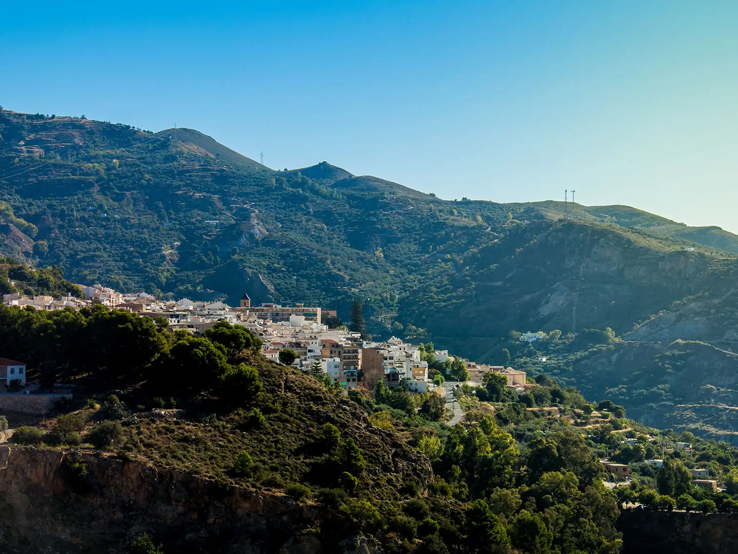
Image by fjgalcaraz The Alpujarras Trail is a compact but satisfying village-to-village walk across the southern slopes of the Sierra Nevada. In around 50 km it links Lanjarón with Trevélez on the GR-7, threading through whitewashed pueblos, terraced hillsides and deep barrancos.
This is an excellent choice for walkers who want mountain scenery without carrying camping kit. Small hotels, hostales, guesthouses and casas rurales make it a practical inn-to-inn route, while Granada provides the main access point by bus.
The Poqueira Gorge is the scenic heart of the walk, with Pampaneira, Bubión and nearby Capileira stacked beneath the high Sierra. Further east, the route passes Pitres, Pórtugos and Busquístar before finishing at Trevélez, one of Spain’s best-known high mountain villages and famous for jamón de Trevélez.
The walking is moderate rather than technical, but it is not effortless. Expect repeated steep climbs and descents on rocky mule tracks, heat in summer, possible winter snow higher up, and the need to check bus times and village accommodation before committing to dates.
This guide covers the stages, how many days to allow, where to stay and eat, transport, terrain, season choice and the common planning mistakes to avoid.
Stage-by-Stage Guide
The notes below follow the common four-stage Lanjarón to Trevélez split. Distances are approximate: different guides and GPS tracks can vary slightly, especially where walkers add village detours or follow temporary diversions.
Stage 1: Lanjarón to Soportújar via Cáñar — approx. 16 km
This is a proper mountain-village opening day rather than a gentle approach. The GR-7 / E4 leaves Lanjarón eastwards towards Cáñar, trading the busier spa-town setting for terraced hillsides, old mule tracks and the first of the route’s repeated ravine crossings.
The walking is not technical, but it is already physically demanding. Expect rocky and sometimes loose underfoot conditions on old stone and dirt paths, with short surfaced sections close to villages. The main effort comes from the constant climb-and-drop pattern rather than any single difficult obstacle.
Cáñar is the key intermediate village and a useful place to break the stage mentally. Beyond it, the route continues through typical Alpujarran terrain shaped by acequias, terraces and woodland before reaching Soportújar.
Food and water planning is straightforward but should not be casual. Start from Lanjarón with enough for the full day, then use village services in Cáñar and Soportújar where available; opening hours in small villages can be limited, especially outside main visitor periods. Do not rely on finding anything between villages.
Soportújar has village accommodation, but capacity is limited compared with larger towns. Book ahead in spring and autumn, and make sure an evening meal or food option is arranged if arriving late.
Lanjarón is the main access point for the start of the trail, reached by ALSA bus from Granada. Road access exists at the villages, but onward public transport from smaller settlements is limited; this should be checked before travelling.
Navigation is generally helped by GR red-and-white waymarks on this western section, but a map or GPS track is still important. The main navigation risk is missing a path leaving or entering a village, where streets, lanes and farm tracks can make the waymarks less obvious.
The key warning on this stage is heat. Much of the effort comes early in the walk, and summer temperatures can make the climbs out of ravines far harder than the distance suggests.
Stage 2: Soportújar to Bubión via Pampaneira — approx. 9 km
This shorter stage brings the route into the Poqueira Gorge, one of the most distinctive parts of the Alpujarras Trail. The distance is modest, but the terrain remains steep, with the path repeatedly working across hillside, terrace and village approaches rather than following easy valley-floor walking.
Pampaneira is the main place passed en route and is one of the classic Poqueira pueblos blancos, known for flat-roofed houses, tinaos and craft and weaving shops. From Pampaneira, the through-route climbs to Bubión, with big views into the Barranco de Poqueira and up towards the high Sierra Nevada slopes.
Capileira sits above Bubión at the head of the Poqueira spur and is a worthwhile detour for walkers with time and energy. It is not part of the direct Lanjarón to Trevélez through-line used in this stage split, so allow extra time if including it.
Food and water are village-based on this day. Pampaneira and Bubión are the practical places to look for supplies, drinks and meals, but opening times should still be checked locally. Carry enough water for the climb between villages, particularly in hot weather.
Bubión has small-scale accommodation and makes a logical overnight stop in the gorge. As throughout the route, rooms are limited and should be booked ahead rather than left to arrival.
The Poqueira villages have road access and are served by buses, but timetables are limited and should be checked before building an itinerary around them. This is one of the easier parts of the walk from which to shorten, pause or rejoin the route, provided transport times work.
Navigation is usually clear through this popular western section, but pay attention at village exits where lanes, steps, footpaths and road sections can be confusing. If adding the Capileira spur, verify current path conditions before committing to the detour; a landslide diversion has affected the direct Capileira–Bubión path and this should be checked before travelling.
The main hazards are steep stone paths, loose surfaces on descents and heat exposure. There is no scrambling, but tired legs can make the short, sharp village climbs feel harder than the mileage suggests.
Stage 3: Bubión to Busquístar via Pitres and Pórtugos — approx. 11 km
This stage leaves the heart of the Poqueira villages and heads east through the Taha district, linking smaller settlements by old caminos, terraces and wooded slopes. It is a varied day, with less of the concentrated village bustle of the Poqueira Gorge and more quiet hillside walking between settlements.
Pitres and Pórtugos are the main villages passed before Busquístar. The Fuente Agria iron-rich spring and the hamlets of Mecina and Fondales lie close by, but any side visit adds time and should be planned rather than assumed as part of the direct stage.
Terrain remains typical Alpujarran: rocky mule tracks, dirt and gravel paths, short surfaced approaches near villages and frequent changes of gradient. The route works across cultivated and wooded hillsides, with acequias and terraces still a regular feature.
Food and water should again be planned around villages. Pitres, Pórtugos and Busquístar are the places to look for services, but carry enough between them and do not assume all facilities will be open when passing through.
Busquístar is a compact whitewashed village above the Trevélez river gorge and has village lodging, but options are limited. Booking ahead matters here, especially if walking during the main spring or autumn seasons.
Road access exists at the villages, but public transport east of the Poqueira area is limited. Any plan to leave or join the trail at Pitres, Pórtugos or Busquístar should be checked before travelling.
Navigation deserves more attention from this stage onwards. Waymarking is generally good on the popular western villages, but can be more sporadic east of the Poqueira; carry an offline map or GPS track and check each village exit carefully.
The descent towards Busquístar through fruit smallholdings is a notable section and can be tough on loose or uneven ground. In wet conditions, old stone and dirt paths may be slippery; in summer, the same slopes can be hot and exposed.
Stage 4: Busquístar to Trevélez — approx. 14 km
The final stage is one of the more serious walking days on the standard route, with a longer distance and the accumulated fatigue of previous climbs and descents. It takes the GR-7 towards the Trevélez river gorge and finishes high in Trevélez at around 1,476 m, the high point of the standard Lanjarón to Trevélez line.
The walking remains non-technical, but the terrain is demanding: rocky and sometimes loose paths, steep ravine sides and old mule tracks with little flat ground. Expect a slow mountain pace rather than road-walking speed.
The main reward is the high-Sierra setting. Mulhacén and Alcazaba lie to the north above the route, giving the final approach a much more mountainous feel, although the standard Alpujarras Trail does not climb those peaks.
There are no major intermediate villages listed on the standard Busquístar to Trevélez stage, so treat this as a self-contained walking day. Leave Busquístar with enough food and water to reach Trevélez, allowing extra for heat or slow progress on rough ground.
Trevélez has village accommodation and is a natural place to finish the walk, but rooms should still be booked in advance. The village is also known for jamón de Trevélez, produced in the dry mountain air, so it is a good place to plan an unhurried final evening rather than a rushed bus connection.
For onward travel, ALSA buses run westwards towards Granada, but services are infrequent and may involve a change at Órgiva or Pampaneira. Check current timetables carefully before fixing flights, train tickets or same-day onward plans.
Navigation should not be treated casually on this final day. East of the Poqueira, carry a map or GPS and do not rely solely on seeing the next GR mark, especially where tracks divide or the route crosses terraced ground.
Seasonal conditions matter more here because Trevélez is the highest village on the standard route. Summer heat can still be draining on the approaches, while winter can bring snow to higher ground and lingering snow on upper sections; this should be checked before travelling.
Recommended Itinerary
The most balanced plan for the standard Lanjarón to Trevélez walk is four days. It keeps each stage within village-to-village lodging range while allowing time for the steep ravine descents, hot afternoons and slow going on rocky mule tracks.
Distances are approximate and vary slightly by mapping source and any local diversions. Check official mapping before booking if adding Capileira or altering overnight stops.
Standard 4-day itinerary
| Day | From | To | Approx. distance | Why this stage makes sense | Services/accommodation notes |
|---|---|---|---|---|---|
| 1 | Lanjarón | Soportújar | 16 km | A full opening day that gets the route properly into the western Alpujarras, leaving Lanjarón on the GR-7 / E4 and passing Cáñar before finishing in a smaller village. Expect the day to feel harder than the distance suggests because of the first sustained climbs and descents. | Lanjarón has the best start-of-walk services. Cáñar and Soportújar have limited village facilities and small-scale lodging, so book ahead rather than relying on arrival. |
| 2 | Soportújar | Bubión | 9 km | A shorter stage into the Poqueira area, giving time to enjoy Pampaneira and the climb to Bubión without rushing. This is a good day to absorb the architecture of the pueblos blancos rather than treating the villages as quick stops. | Pampaneira and Bubión are useful overnight villages with accommodation and walker services, but rooms can still be limited in spring and autumn. Capileira is a worthwhile Poqueira spur rather than strictly necessary for the through-route. |
| 3 | Bubión | Busquístar | 11 km | This stage carries the route east out of the Poqueira villages through Pitres and Pórtugos towards the Trevélez gorge. The distance is moderate, but the repeated ups and downs across terraces, woodland and barrancos keep it physical. | Pitres and Pórtugos are useful intermediate villages for food, drink or a shorter overnight if preferred. Busquístar is a compact overnight stop before the final approach to Trevélez. |
| 4 | Busquístar | Trevélez | 14 km | A strong final day to one of the highest villages in Spain, with the route finishing at about 1,476 m beneath the high Sierra Nevada. Leave enough time for the climb into Trevélez and for onward bus logistics. | Trevélez has accommodation and food options, but onward ALSA buses towards Granada are infrequent and may involve a change at Órgiva or Pampaneira. Timetables should be checked before travelling. |
Slower variant
A slower itinerary suits walkers who want shorter walking days, more time in the Poqueira villages, or a buffer for hot weather. The simplest approach is to add an extra night in the Poqueira area — Pampaneira, Bubión or Capileira — rather than trying to force every stage into equal distances.
| Day | From | To | Approx. distance | Why this stage makes sense | Services/accommodation notes |
|---|---|---|---|---|---|
| 1 | Lanjarón | Soportújar | 16 km | Still a substantial first day, but it reaches a logical overnight point after Cáñar. | Book Soportújar lodging ahead; village choice is limited. |
| 2 | Soportújar | Pampaneira or Bubión | 8–9 km | Keeps the day short and allows unhurried time in the Poqueira Gorge. | Pampaneira and Bubión are practical overnight stops. If adding Capileira, check current path conditions and mapping before travelling. |
| 3 | Poqueira village day / short move within Poqueira | Bubión or Capileira | Check official mapping before booking | Best for walkers who want time for the Poqueira villages rather than a continuous end-to-end push. Capileira is a scenic spur, not a required through-route stop. | Accommodation is more available than in smaller hamlets but still should be booked ahead in popular seasons. |
| 4 | Bubión | Busquístar | 11 km | Rejoins the main eastbound rhythm through Pitres and Pórtugos to Busquístar. | Pitres and Pórtugos can also be used to shorten or reshape this stage. |
| 5 | Busquístar | Trevélez | 14 km | Leaves the final climb and arrival into Trevélez as a standalone day. | Check Trevélez accommodation and the return bus before committing to dates. |
Faster 3-day variant
A 3-day itinerary is feasible for fit walkers travelling light, but it compresses the route into longer mountain days. It is not the best choice in high summer heat or for anyone wanting time in the Poqueira villages.
| Day | From | To | Approx. distance | Why this stage makes sense | Services/accommodation notes |
|---|---|---|---|---|---|
| 1 | Lanjarón | Soportújar | 16 km | A direct first stage to a logical overnight village beyond Cáñar. | Book ahead; there is less accommodation flexibility than in the Poqueira villages. |
| 2 | Soportújar | Busquístar | 20 km | Combines the standard second and third days, passing Pampaneira, Bubión, Pitres and Pórtugos. This is the hardest scheduling day because the cumulative ascent and descent are more important than the headline distance. | Start early and do not assume every village shop or bar will fit your timing. Carry enough food and water between villages. |
| 3 | Busquístar | Trevélez | 14 km | A final day into Trevélez with enough distance to feel substantial but not as long as the previous day. | Plan the finish around the limited ALSA bus timetable, or book a night in Trevélez. |
For most independent walkers, the 4-day itinerary is the safest default: it keeps the walking enjoyable, gives the Poqueira villages proper time, and avoids making transport or accommodation too fragile.
Planning the Route
How many days to allow
Most walkers should plan the standard Lanjarón to Trevélez route over 4 days. The daily distances are not long on paper, but the walking is made slower by repeated descents into barrancos, steep climbs out again, rocky mule tracks and exposed heat in warm weather.
A 3-day itinerary is realistic for fit walkers who are comfortable with longer mountain days and do not want much time in the villages. It is a poorer choice in hot conditions, when early starts and longer rest stops become more important.
A slower 5-day plan can work well if you want time in the Poqueira villages, especially Pampaneira, Bubión and the short spur to Capileira. This is also the better approach if arriving late into Lanjarón or if relying on infrequent buses at either end.
Natural stage planning
The route is naturally planned around the villages. Accommodation is available regularly, but rooms are limited, so the stages should be built around confirmed beds rather than treated as flexible mountain camping days.
| Stage | Usual overnight | Planning notes |
|---|---|---|
| Lanjarón to Soportújar, via Cáñar | 16 km | A full first day with a steady move east from the western trailhead. Avoid starting too late in hot weather. |
| Soportújar to Bubión, via Pampaneira | 9 km | Shorter on distance, but useful for enjoying the Poqueira Gorge and the villages. Build in extra time if visiting Capileira. |
| Bubión to Busquístar, via Pitres and Pórtugos | 11 km | A practical middle stage through the Taha district, with several villages but still plenty of ascent and descent. |
| Busquístar to Trevélez | 14 km | The final committed stage into Trevélez, finishing at the highest point of the standard route. Start with enough food and water for the full leg. |
The gap between lodging villages is never more than about 14 km, which makes this a very manageable inn-to-inn walk. The important point is that “short” days in the Alpujarras still involve rough underfoot conditions and repeated height loss and gain.
Walking fast or slow
This route is better walked at a measured pace unless fitness is strong and conditions are cool. The terrain rarely becomes technical, but the old stone paths, loose descents and ravine crossings can punish rushed walking, especially with a multi-day pack.
The 4-day version gives enough time to reach villages in daylight, buy supplies, and manage the heat with early starts. The 3-day version is mainly for walkers treating the route as a physical traverse rather than a village-based walk.
Shortening, extending and variants
Shortening the walk is possible because several villages have road access and buses serve Lanjarón, Órgiva and the Poqueira villages. Public transport is infrequent, so any shortened itinerary should be planned around current ALSA timetables rather than assumed on the day.
The most natural shorter objective is to finish in the Poqueira area rather than continuing to Trevélez. Pampaneira, Bubión and Capileira make the easiest scenic break point, although Capileira is a spur from the standard through-line rather than a necessary point on the Lanjarón to Trevélez traverse.
Extending is straightforward in route terms: the GR-7 continues east beyond Trevélez towards Cádiar, Yegen and Laroles. The full Lanjarón to Laroles western-Alpujarras traverse is around 119 km and usually needs 7–8 days, with accommodation and return transport replanned accordingly.
A reported landslide affected the direct Capileira–Bubión path in 2024, with walkers using a road detour. This should be checked before travelling, especially if adding Capileira to the Poqueira section.
Section hiking
Section hiking is practical, but it is bus-led rather than rail-led. There is no railway in Las Alpujarras, so Granada is the main gateway, with ALSA buses used to reach Lanjarón and return from Trevélez.
Trevélez buses westwards to Granada can be infrequent and may involve a change at Órgiva or Pampaneira. For section walkers, transport timing is often the limiting factor, not the walking distance.
If walking only one or two stages, choose start and finish villages with confirmed bus options and allow spare time for missed connections. This should be checked before travelling.
What to book and organise first
Accommodation should be arranged before transport is finalised. The route uses small hotels, hostales, guesthouses, casas rurales and pensiones, and rooms are limited in the villages, particularly in spring and autumn.
Camping kit is not normally needed for the standard walk. The route works best as an inn-to-inn itinerary, with a lighter pack and overnight stops in villages.
Transport should be the next priority. Check current ALSA times for Granada to Lanjarón and Trevélez back towards Granada, including possible changes at Órgiva or Pampaneira.
Food, water and daily supplies
Village spacing makes resupply easier than on a remote mountain route, but do not assume every shop, bar or café will be open exactly when needed. Buy food for the next stage before leaving the overnight village, especially before Busquístar to Trevélez.
Carry enough water for the full day in warm weather. The route passes acequias and spring-fed landscapes, but irrigation channels should not be treated as a planned drinking-water source unless water is properly treated.
Navigation and weather planning
Follow the GR-7 red-and-white waymarks, but carry a map or GPS track as well. Waymarking is generally good on the popular western village sections, but can be more sporadic east of the Poqueira.
Weather affects planning more than altitude alone suggests. Late April to June and September to October are the most comfortable periods; high summer heat makes early starts important, while winter can bring snow to higher sections.
No technical equipment is needed for the standard route in normal conditions. If snow is present, if a diversion is active, or if continuing beyond Trevélez, plans should be reassessed before committing to the next stage.
Towns, Villages and Overnight Stops
This is a village-to-village route, so overnight planning is usually built around small hotels, hostales, guesthouses, casas rurales and pensiones rather than camping. Every village on the standard Lanjarón to Trevélez line has at least one or two places to stay, but capacity is limited and spring and autumn bookings should be made ahead.
Food planning is straightforward but should not be left entirely to chance. Expect village bars, cafés and small local shops to vary in opening hours, especially outside the main walking seasons; if arriving late, ask accommodation in advance about evening meals, breakfast and packed lunches.
There is no railway in Las Alpujarras. Lanjarón and Trevélez are bus-based trailheads, with ALSA services linking the area with Granada; services are infrequent and may involve a change at Órgiva or Pampaneira, so current timetables should be checked before travelling.
Lanjarón
Lanjarón is the usual western trailhead and the most practical place to spend the night before starting. The GR-7 / E4 waymarks lead east out of town towards Cáñar, so staying here avoids a rushed first morning after travelling from Granada.
As a spa and spring-water town, Lanjarón has a broader range of services than the smaller villages further along the route. It is the best place at the start of the walk to deal with last-minute supplies, water, cash and any kit gaps before committing to the smaller pueblos blancos.
Accommodation is more plentiful here than in the mid-route villages, with small hotels and guest accommodation. It is also the main gateway into this western part of Las Alpujarras, with ALSA bus access from Granada; onward bus times should still be checked carefully, particularly if connecting from Granada railway station or airport.
Useful local notes: the ruined Castillo de Lanjarón and the town’s mineral-spring heritage make it worth arriving early, but for hikers the main value is logistical. Start the first walking day with water already sorted, as the route immediately becomes a mountain village walk rather than a serviced valley path.
Cáñar
Cáñar sits between Lanjarón and Soportújar, roughly 7.9 km from Lanjarón on the first stage. Many walkers pass through rather than stay, but it is a useful option if the opening day needs to be shortened.
Accommodation is limited but the route’s village-lodging pattern means there should be at least a small choice in or around the village. Availability should be checked before relying on Cáñar as an overnight stop.
Food and drink options should be treated as local-village provision rather than guaranteed all-day services. If planning to stop here overnight, confirm meals, breakfast and any packed-lunch arrangements with the accommodation.
Transport links are less useful than at Lanjarón or the Poqueira villages. Any bus access or taxi arrangement should be checked before travelling.
Soportújar
Soportújar is the standard first overnight stop on the four-day Lanjarón to Trevélez itinerary, reached after the long opening stage via Cáñar. It works well because it breaks the route before the Poqueira Gorge villages and keeps the following day relatively short.
Accommodation is small-scale, so booking ahead matters. This is not a place to assume there will be several spare rooms on arrival in the main walking seasons.
Food provision is village-based. Check evening-meal options before arrival, especially if walking late or outside the busiest months, and arrange breakfast or picnic food in advance if needed.
For transport, do not plan around frequent services unless timetables have been checked. Lanjarón and the Poqueira villages are more useful access points for most walkers.
Pampaneira
Pampaneira is the first of the classic Poqueira Gorge villages on the standard line, reached from Soportújar before the short climb onwards to Bubión. It is a practical and attractive place to pause, resupply lightly, or shorten the day by staying before climbing higher.
Accommodation is available, but as with the rest of the route it is mostly small inns, guesthouses and rural houses rather than large hotels. It can be a good alternative to Bubión if rooms are full or if the day from Soportújar has felt hard in heat.
The Poqueira villages are among the better-served places on the trail for cafés, bars, craft shops and visitor facilities. Even so, opening hours should not be assumed, particularly outside spring and autumn weekends.
Buses serve the Poqueira villages, making Pampaneira one of the more useful access or exit points on the route. Current ALSA times should be checked before building an itinerary around this.
Bubión
Bubión is the standard second overnight stop on the four-day itinerary, sitting above Pampaneira in the Poqueira Gorge. It is directly useful for walkers because it keeps the next stage to Busquístar manageable while still giving time in the architectural heart of Las Alpujarras.
Accommodation is available in small-scale village properties, but booking ahead is sensible. Bubión is popular because it sits on the through-route and gives easy access to the wider Poqueira area.
Food and drink are usually easier to manage here than in the smallest villages, but hikers should still check evening meals and breakfast times with accommodation. If the next day starts early, arrange food the previous evening rather than depending on early shop opening.
A practical route note: the direct Capileira–Bubión path has been affected by a reported 2024 landslide diversion. If adding Capileira or using paths between the Poqueira villages, live route conditions should be checked before travelling.
Capileira
Capileira sits higher up the Poqueira spur and is a worthwhile detour rather than a mandatory village on the standard Lanjarón to Trevélez through-line. The usual GR-7 line continues via Pampaneira and Bubión towards Pitres, so adding Capileira means deliberately building in extra time or adjusting the day.
It is a good overnight stop for walkers who want more time in the Poqueira Gorge, or for anyone turning the route into a slower village-based itinerary. Accommodation and visitor services are well suited to walkers, but rooms should still be booked ahead in the main seasons.
Food options are generally more practical here than in the smallest hamlets, though precise opening times vary. Confirm meals and supplies locally, particularly if using Capileira as a base for any walking beyond the standard GR-7 route.
Buses serve the Poqueira villages, making Capileira a useful point for joining, leaving or shortening the route. Check current ALSA timetables before relying on a same-day connection.
Pitres
Pitres lies east of Bubión, after the route leaves the Poqueira area and enters the smaller villages of the Taha district. It is a useful intermediate stop or lunch point on the Bubión to Busquístar stage.
Accommodation exists but is limited, making Pitres better treated as a planned overnight rather than a fallback. It can be useful for walkers spreading the route over more days, especially if the repeated ravine climbs and descents are proving tiring.
Food and basic services should be checked locally. The nearby Taha villages and hamlets are attractive but small, so do not assume continuous shop or café availability through the day.
Transport is not as central here as at the main trailheads or Poqueira access villages. Any bus or taxi plan should be checked before travelling.
Pórtugos
Pórtugos sits between Pitres and Busquístar, making it more of a short-stage stop than a standard overnight on the four-day itinerary. It is useful if accommodation patterns or fitness levels make a shorter day preferable.
The village has limited small-scale accommodation, so book before committing to it as a night stop. Because Pórtugos is only a short distance from Busquístar, many walkers continue, but staying here can make sense on a slower inn-to-inn schedule.
Food and drink should be treated as village provision with variable hours. Confirm in advance whether dinner, breakfast and picnic supplies are available through the accommodation or nearby businesses.
The Fuente Agria iron-rich spring lies close by, and Mecina and Fondales are also nearby hamlets in the wider Taha area. These are useful local points of interest, but detours should be fitted around daylight and the next day’s walking rather than added casually.
Busquístar
Busquístar is the standard third overnight stop before the final stage to Trevélez. It is a compact whitewashed village above the Trevélez river gorge, reached after the route works through fruit smallholdings and steep terrain.
For most walkers, Busquístar is the right place to stop before tackling the longest remaining section to Trevélez. Accommodation is limited and should be booked ahead, particularly because there are fewer easy alternatives at this point in the route.
Check evening food and breakfast arrangements before arrival. The final day to Trevélez is around 14 km and includes more mountain terrain, so start with water and food rather than assuming an early shop stop.
Transport should not be relied on without checking current services. If using Busquístar as a start, finish or escape point, confirm bus or taxi logistics before travelling.
Trevélez
Trevélez is the standard finish of the Lanjarón to Trevélez route and the highest point of this itinerary at about 1,476 m. It is often called one of the highest villages in mainland Spain and sits beneath the high Sierra Nevada, with Mulhacén and Alcazaba above but off the standard walking route.
It is a good place to stay at the end rather than rushing for an onward bus. The final stage from Busquístar is around 14 km, and bus services westwards towards Granada are infrequent and can involve a change at Órgiva or Pampaneira.
Accommodation is available, but booking ahead remains sensible. Trevélez is well known for jamón de Trevélez, and food options are a practical reason to stop overnight after finishing the walk.
For onward travel, check ALSA timetables carefully before fixing flights or trains from Granada, Málaga or Almería. Allow extra time for the mountain bus journey and possible connections rather than planning a tight same-day departure.
Getting to the Start
The Alpujarras Trail usually starts in Lanjarón, on the south-western edge of the Sierra Nevada in Granada province. There is no railway in Las Alpujarras, so most walkers reach the trailhead by combining long-distance travel to Granada with an onward ALSA bus or taxi to Lanjarón.
By train
The nearest practical railway gateway is Granada railway station. From there, continue to Lanjarón by bus from Granada or by pre-booked taxi.
Do not plan on taking a train into Las Alpujarras itself: the mountain villages on this route, including Lanjarón, Cáñar, Soportújar, Pampaneira, Bubión, Busquístar and Trevélez, are bus-based. Rail arrivals should allow enough time to cross Granada and connect with the onward bus. This should be checked before travelling.
By bus
ALSA buses run from Granada to Lanjarón, making this the normal public-transport approach to the start. Buses in Las Alpujarras are limited compared with city services, so the key planning point is timing: check the current ALSA timetable before booking flights, trains or the first night’s accommodation.
Lanjarón is a sensible place to start because it is one of the main gateways into Las Alpujarras. From town, the GR-7 / E4 waymarks lead east towards Cáñar and Soportújar.
If arriving late in Granada, it may be easier to stay in Granada overnight and take a morning bus to Lanjarón, or travel to Lanjarón the day before walking. The first standard stage to Soportújar is around 16 km and includes climbing and descending on mountain paths, so starting too late is not ideal.
By car
Driving to Lanjarón is possible, but this is a point-to-point walk finishing in Trevélez, not a circular route. Leaving a car at the start means arranging a return from Trevélez to Lanjarón or Granada at the end, which may involve infrequent buses and possibly a change at Órgiva or Pampaneira.
Long-stay parking arrangements in Lanjarón should be agreed with accommodation or checked locally before leaving a vehicle for several days. This should be checked before travelling.
For groups, a pre-booked taxi can be useful either from Granada to Lanjarón or for end-of-walk logistics, especially if bus times do not fit. Agree the route and fare in advance, as distances in the Alpujarras can take longer than they look on a map.
From the nearest airport
Granada Airport is the nearest airport normally used for this walk. From Granada, continue to Lanjarón by ALSA bus or taxi.
Málaga and Almería airports are also common long-distance gateways for Andalucía, but they add an extra transfer before reaching Granada or Las Alpujarras. Build in enough time for onward connections, particularly if trying to reach Lanjarón the same day. Current bus and rail connections should be checked before travelling.
Where to stay before starting
The most convenient pre-walk base is Lanjarón itself. It has village accommodation and lets you start the GR-7 on foot the next morning without relying on an early transfer.
Booking ahead is advisable, especially in spring and autumn, when the Alpujarras are popular with walkers. If arriving in Andalucía late in the day, Granada is the safer overnight base, with the onward bus to Lanjarón taken the following morning.
Getting Home from the Finish
By train
There is no railway in Las Alpujarras, so Trevélez is not a rail finish. The practical rail connection is via Granada, which has the main railway station for onward travel after leaving the mountains.
Plan the Trevélez–Granada leg by bus or taxi first, then book any long-distance train from Granada with enough margin. Bus timings from Trevélez are limited and timetable-dependent, so avoid tight same-day rail connections unless the current schedule clearly supports them.
By bus
ALSA buses run west from Trevélez towards Granada, but services are infrequent and may involve a change at Órgiva or Pampaneira. Check the current ALSA timetable carefully before fixing accommodation, flights or trains.
For most walkers, the safest plan is to finish the walking day in Trevélez, stay overnight, then take a morning or midday bus out. If arriving late in the day, do not assume there will still be a useful bus connection to Granada.
If continuing further east on the GR-7 towards Cádiar, Yegen or Laroles, treat Trevélez as a resupply and overnight stop rather than a transport exit. Eastbound transport options should be checked separately before committing to a longer traverse.
By car/taxi
Trevélez is road-accessible, so a pre-arranged taxi or private transfer can be a practical fallback if bus times do not work. This is especially useful for groups, late finishes, or walkers needing to reach Granada the same day.
If a car has been left at Lanjarón, factor in the point-to-point nature of the walk. Returning to the start by public transport may require a connection, while a taxi or transfer between Trevélez and Lanjarón should be arranged in advance and priced before relying on it.
Taxi availability in small Alpujarran villages can be limited, particularly outside normal daytime hours. This should be checked before travelling.
From the nearest airport
Granada is the usual onward gateway after finishing in Trevélez, with Granada airport nearby and the city’s railway station for longer-distance connections. Málaga and Almería airports are also used for trips to Las Alpujarras, but they require onward surface travel from the mountains.
Do not plan a flight on the same day as finishing unless there is a confirmed early transport connection from Trevélez and plenty of contingency time. The final village is high in the mountains, bus services are limited, and delays to a walking finish are easy to underestimate after the steep Busquístar–Trevélez stage.
Where to stay at the finish
Staying overnight in Trevélez is usually the most sensible end to the route. It removes pressure from the final 14 km stage from Busquístar and gives a wider choice of onward bus or transfer options the following day.
Trevélez has small-scale village accommodation such as hostales, guesthouses, casas rurales and pensiones, but rooms are limited. Book ahead in the main spring and autumn walking seasons, and also in busy summer periods.
An overnight stop also gives time to sort onward travel calmly, buy food, and recover before descending to Granada or continuing east on the GR-7.
Which Direction Should You Walk?
The standard and most logical direction for the Alpujarras Trail is west to east, from Lanjarón to Trevélez. This is the usual line for the 3–4 day route and follows the GR-7 / E4 eastwards through Cáñar, Soportújar, the Poqueira villages, Pitres, Pórtugos and Busquístar before finishing high at Trevélez.
The route can be walked in reverse, but there are few practical advantages unless accommodation or bus times make it necessary.
Lanjarón to Trevélez: the standard direction
Walking from Lanjarón to Trevélez gives the route a clear sense of progression. You start from the western gateway town of Lanjarón, move gradually deeper into Las Alpujarras, pass the Poqueira Gorge villages around Pampaneira and Bubión, then finish at Trevélez, the high point of the standard route at around 1,476 m.
This direction also makes the finish feel satisfying. Trevélez is one of the highest villages in Spain, set beneath the high Sierra Nevada, and it works well as a natural endpoint rather than just another overnight stop.
Transport is generally simpler this way for most walkers. Lanjarón is reached by ALSA bus from Granada, while the return from Trevélez also uses ALSA buses westwards towards Granada, with infrequent services and possible changes at Órgiva or Pampaneira. Current timetables should be checked carefully before booking fixed onward travel.
The walking is not “easy” in this direction. Because the trail repeatedly drops into and climbs out of barrancos, the eastbound route involves plenty of ascent as well as steep descents. The overall feel, however, is of travelling up into the higher Alpujarras, which suits the landscape and the psychology of the route.
Trevélez to Lanjarón: the reverse direction
Walking Trevélez to Lanjarón gives more overall height loss, because Trevélez is the highest point of the standard line. That may sound easier, but the Alpujarras terrain reduces the benefit: the route still crosses deep ravines, and long rocky descents on old mule tracks can be hard on knees and feet.
The reverse direction also puts the most awkward transport at the start. Reaching Trevélez by bus from Granada can involve limited services and a change, so a missed connection may affect the first night’s accommodation. This should be checked before travelling.
Scenically, the reverse still works, but the route loses some of its natural build-up. Instead of finishing in the high village beneath Mulhacén, you descend towards Lanjarón, which is practical but less distinctive as a final objective.
Direction comparison
| Direction | Best for | Main drawback |
|---|---|---|
| Lanjarón → Trevélez | Standard route, simpler start from Granada, strong high-village finish, good sense of progression | More of a rising journey overall, with sustained climbs between ravines |
| Trevélez → Lanjarón | Walkers who prefer to finish nearer the western gateway, or whose accommodation works better in reverse | More awkward start logistics and a less satisfying finish |
Weather and exposure
There is no strong route-specific reason to choose a direction based on prevailing wind. Heat is the bigger practical issue in summer, and it affects both directions. Early starts, enough water between villages and sun protection matter more than whether the route is walked eastbound or westbound.
In winter, snow may linger on higher ground, so the Trevélez end of the route deserves particular attention whichever way the walk is planned.
Recommendation
For most independent hikers, walk the Alpujarras Trail from Lanjarón to Trevélez. It is the standard direction, starts from the easier western gateway, follows the most natural scenic progression through the villages, and ends with the strongest mountain-village finish. Reverse the route only if bus times, accommodation availability or a longer GR-7 itinerary make it clearly more convenient.
Accommodation Along the Route
The Alpujarras Trail works very well as an inn-to-inn walk. The route passes through a regular chain of pueblos blancos with small hotels, hostales, guesthouses, casas rurales and pensiones, so camping kit is not needed for the standard Lanjarón to Trevélez itinerary.
Rooms are small-scale rather than resort-style, and capacity can be tight in the more popular villages. Book ahead in spring and autumn, and be especially careful with Fridays, Saturdays, public holidays and local festival periods. Current availability and prices should be checked before travelling; village lodging is often roughly from €40+ per night, but rates vary by season and room type.
Best overnight pattern
The most straightforward 4-day accommodation pattern is:
- Lanjarón — pre-walk night, useful for arriving by bus from Granada and starting early.
- Soportújar — practical end to the longer first day from Lanjarón via Cáñar.
- Bubión — strong Poqueira Gorge base, with Pampaneira below and Capileira as a worthwhile spur above.
- Busquístar — logical final overnight before the 14 km stage to Trevélez.
- Trevélez — finish night, sensible because onward buses are infrequent and should not be assumed to connect conveniently with the walking day.
A 3-day version is possible for fit walkers, but it leaves less flexibility for heat, long climbs out of barrancos and time in the Poqueira villages. A slower itinerary can split stages using Cáñar, Pampaneira, Pitres or Pórtugos, provided rooms are available.
Accommodation by village
| Place | Accommodation level | Best for | Notes |
|---|---|---|---|
| Lanjarón | Good | Pre-walk night, late arrival from Granada, stocking up before starting | The usual western trailhead and a practical place to sleep before Day 1. Booking ahead is still sensible in busy periods. |
| Cáñar | Limited | Shortening the first day or creating an easier start | A small intermediate village between Lanjarón and Soportújar. Do not rely on turning up without a reservation. |
| Soportújar | Limited | Standard first overnight on a 4-day itinerary | A useful staging point after the longer Lanjarón–Soportújar day. Book ahead because capacity is not large. |
| Pampaneira | Good | Poqueira Gorge stop, shorter day, village facilities | A good alternative to Bubión if breaking the route lower in the gorge. It also works well for walkers wanting more time in the Poqueira villages. |
| Bubión | Good | Standard second overnight, central Poqueira base | A natural overnight stop on the classic 4-day schedule. It gives access to the Poqueira villages without adding much complexity. |
| Capileira | Good | Extra night in the scenic Poqueira area | Capileira is on a short northern spur rather than the strict through-line. It is worthwhile if the itinerary allows, but factor in the detour. |
| Pitres | Limited | Splitting the Bubión–Busquístar section | Useful for a shorter day across the Taha district. Check availability before building an itinerary around it. |
| Pórtugos | Limited | Shorter stages, flexible resupply/rest stop | Close to Pitres and before Busquístar. Suitable for a slower schedule, but room choice is not extensive. |
| Busquístar | Limited | Standard third overnight before Trevélez | The logical place to stop before the final 14 km stage. Reserve in advance, as fallback options nearby are limited. |
| Trevélez | Good | Finish night, onward travel buffer, extra mountain time | Staying after finishing is practical because buses back towards Granada are infrequent and may involve a change. |
Booking strategy
For most independent walkers, the safest approach is to book every night before starting. This matters most in Soportújar and Busquístar, where the standard itinerary depends on smaller villages with limited room stock.
Lanjarón, the Poqueira villages and Trevélez usually give more choice, but they are also more popular. Spring and autumn are prime walking seasons, so availability can disappear at weekends even when midweek rooms remain.
If a planned overnight is full, the easiest solution is usually to adjust the stage rather than expect a last-minute transfer. For example, staying in Pampaneira instead of Bubión, or Pitres/Pórtugos instead of Busquístar, can work if the daily distances and climbing still suit the group.
Luggage transfer, taxis and camping
This route is designed for village accommodation, not wild camping. Campsites and informal camping possibilities exist in the wider area, but they are not the normal or most efficient way to walk the Lanjarón to Trevélez line.
Independent luggage transfer should not be assumed between every village. Some accommodations or local taxi operators may be able to help with bags or short transfers, but this should be arranged in advance and checked before travelling.
Taxi transfers can also help if a preferred village is full, but they add cost and depend on local availability. A better plan is to secure rooms early and keep daily stages within comfortable limits, especially in hot weather.
Camping and Wild Camping
The Alpujarras Trail is best treated as an inn-to-inn walk, not a camping route. Every standard stage finishes in a village with small-scale accommodation, and the gap between lodging villages is never more than about 14 km, so carrying a tent is usually unnecessary weight on a route with repeated steep climbs and descents.
Some campsites and informal camping possibilities exist in the wider Alpujarras, but specific campsite availability on or near the Lanjarón–Trevélez line should be checked before travelling. Do not build an itinerary around camping unless current sites, opening dates and access from the GR-7 have been checked directly.
Is wild camping allowed?
Do not assume wild camping is permitted. Rules can vary by municipality, land ownership, protected-area boundary and season, and they should be checked locally before relying on a wild camp.
In practical terms, this is also not ideal wild-camping terrain. Much of the route crosses terraced farmland, old mule tracks, woodland, ravines and village approaches, with private land, acequias and steep or rocky ground limiting discreet, low-impact pitch options.
If permission is not clear, stay in village accommodation or use an official campsite where available. Wild camping should never be used as a way to avoid booking rooms in small villages during busy spring and autumn periods.
Practical camping suitability by route section
| Section | Camping practicality |
|---|---|
| Lanjarón to Soportújar | Long enough to feel the weight of camping kit, but still a normal village-to-village day. Terraces, paths and village approaches make informal camping a poor default plan. |
| Soportújar to Bubión / Poqueira area | Shorter walking day with accommodation in the Poqueira villages. This is one of the least compelling places to camp because village lodging is convenient and the landscape is heavily settled and terraced. |
| Bubión to Busquístar via Pitres and Pórtugos | Multiple villages and short inter-village distances make camping unnecessary. Woodland and terraces may look tempting, but land ownership and local rules still need checking. |
| Busquístar to Trevélez | The longest standard final stage, with steep gorge terrain and a high finish at Trevélez. Carrying camping kit adds effort without solving a real logistics problem if accommodation is booked ahead. |
Water and stove use
Plan water around villages and accommodation rather than around camping spots. The route crosses acequias and passes through irrigated hillsides, but irrigation channels are working agricultural water systems and should not be treated as dependable drinking-water sources.
In hot weather, carry more water than the map distance suggests: the climbs out of the barrancos are exposed and slow. Natural springs and fountains may exist locally, but drinkability and seasonal flow should be checked before relying on them.
Open fires are inappropriate on this route. Summer heat, dry vegetation and woodland sections make fire risk a serious concern, and local fire restrictions can change; plan on using no fire at all, and check current rules before using any stove outside formal accommodation or campsite facilities.
Leave No Trace expectations
If camping is legal and locally permitted, keep the impact extremely low: arrive late, leave early, use an already durable surface, and avoid terraces, cultivated plots, acequias, animal enclosures and village-edge land. Pack out all rubbish, including food scraps and toilet paper.
Do not wash, cook or toilet near acequias or water sources. These channels are part of the Alpujarras’ irrigation system and should be kept clean and undisturbed.
For most walkers, the best camping decision on the Alpujarras Trail is to leave the tent at home, book the small village hotels or guesthouses ahead, and carry a lighter pack for the steep rocky mule tracks.
Food, Water and Resupply
The Alpujarras Trail is an inn-to-inn village walk, so resupply is far easier than on a remote mountain route. The practical rule is simple: eat and refill in the pueblos blancos, and do not rely on finding anything between them.
There are no long wilderness sections on the standard Lanjarón to Trevélez line, but the path repeatedly drops into and climbs out of barrancos on hot, exposed or rocky ground. Carry enough food and water to be self-sufficient between villages, especially on the longer Lanjarón–Soportújar and Busquístar–Trevélez stages.
Food availability
Plan around village bars, restaurants, accommodation meals and small local shops where available, rather than large supermarkets. Lanjarón is the best place to start with snacks and walking food; Trevélez has end-of-route food options and is known for jamón de Trevélez.
Opening hours in rural Andalucía can be irregular, with afternoon closures, reduced Sunday trading and seasonal variation. Do not assume that a shop or bar will be open when passing through a small village at lunchtime. This should be checked before travelling, particularly outside the main spring and autumn walking seasons.
For most walkers, the safest system is to carry:
- breakfast supplies if your accommodation does not provide an early breakfast;
- a packed lunch or picnic food for each walking day;
- high-energy snacks for steep climbs and hot sections;
- one spare meal or substantial backup snack in case a village bar or shop is closed.
Water availability
Refill from accommodation and village facilities before leaving each morning. Lanjarón is a spring-water town, but elsewhere the reliable planning assumption is still to fill bottles in villages rather than depend on water found on the hillside.
The route crosses acequias and passes cultivated terraces, but these irrigation channels should not be treated as drinking-water sources. Natural water, springs and channels may be seasonal, shared with agriculture or livestock, and should be filtered or treated if used in an emergency.
In normal spring or autumn conditions, most walkers should start each stage with at least 1.5–2 litres of water. In summer heat, on the 16 km Lanjarón–Soportújar stage and the 14 km Busquístar–Trevélez stage, carrying more is sensible. Refill whenever there is a dependable opportunity in a village rather than waiting for the next one.
| Section | Food availability | Water availability | Notes |
|---|---|---|---|
| Lanjarón → Soportújar, via Cáñar | Start with food from Lanjarón. Cáñar and Soportújar are the only listed villages on this stage, so carry lunch rather than relying on a perfectly timed stop. | Fill in Lanjarón before leaving; refill in villages where possible. | Longest standard day at about 16 km, with steep ravine terrain. Do not leave Lanjarón short of food or water. |
| Soportújar → Bubión, via Pampaneira | Shorter stage with Pampaneira before Bubión. Food is easiest when services are open in the villages, but carry snacks and lunch as backup. | Refill before leaving Soportújar and again in Pampaneira or Bubión if needed. | Pampaneira and Bubión sit in the Poqueira Gorge area; Capileira is a worthwhile nearby detour rather than the through-route itself. |
| Bubión → Busquístar, via Pitres and Pórtugos | Pitres and Pórtugos give intermediate village points, but rural hours still matter. Carry a packed lunch unless eating arrangements are certain. | Fill in Bubión; top up in Pitres or Pórtugos where available. | The Fuente Agria iron-rich spring lies close to Pórtugos, but ordinary drinking-water planning should still be based on villages and accommodation. |
| Busquístar → Trevélez | No listed village resupply between Busquístar and Trevélez on the standard stage. Carry the day’s food from Busquístar. | Fill fully in Busquístar before starting. Refill only if a dependable source is available; otherwise expect to carry through to Trevélez. | Around 14 km and finishing at the high point of the standard route. Treat this as a self-contained day, especially in hot weather. |
Terrain, Conditions and Difficulty in Practice
The Alpujarras Trail is moderate because it is physically repetitive rather than technically difficult. There is no scrambling, glacier terrain or high-alpine pass crossing on the standard Lanjarón to Trevélez route, but the walking is rarely flat: the GR-7 repeatedly drops into barrancos and climbs out again on old mule tracks.
Expect a mixture of stone-paved caminos, dirt and gravel paths, rocky mule tracks and short surfaced lane sections around villages. The hardest footing is usually on steep descents, where loose stones and worn track surfaces can make poles useful, especially with a multi-day pack.
What the ground is like
Much of the route follows historic village-to-village tracks across terraced hillsides, chestnut and pine woodland, and small cultivated areas. Around Lanjarón, Cáñar, Soportújar, Pampaneira, Bubión, Pitres, Pórtugos, Busquístar and Trevélez, expect short stretches of lanes, cobbled village streets and junctions where the walking line briefly becomes less obvious.
The open acequias are a distinctive part of the terrain. They are not normally an obstacle in themselves, but they mean the path often runs through irrigated terraces and narrow hillside margins where care is needed not to step into channels or eroded edges.
This is not a boggy route in the British upland sense. The more relevant underfoot problems are loose rock, dust, rough stone paving and slippery surfaces after rain, particularly on shaded woodland sections and steep mule-track descents.
Climbs, descents and cumulative effort
The route gains roughly 2,100 m over about 50 km, which is a meaningful amount for a short inn-to-inn walk. The ascent is not concentrated into one single mountain climb; it comes in repeated bursts as the path crosses the grain of the southern Sierra Nevada slopes.
That pattern makes the days feel harder than the distances suggest. A 9–14 km stage can still be tiring where it includes a hot climb out of a ravine, a loose descent, then another pull up to the next pueblo blanco.
Trevélez, at about 1,476 m, is the high point of the standard route. The trail does not climb Mulhacén or Alcazaba, which lie to the north and are not part of the Lanjarón to Trevélez line.
Exposure and technical difficulty
There is no technical scrambling ground on the standard route, and the trail is suitable for fit walkers with normal mountain-walking skills. The challenge is sure-footedness rather than hands-on climbing.
Airy exposure is not the main issue, but some hillside paths above ravines and terraces require attention, particularly where the track is narrow, loose or eroded. Walkers uncomfortable on steep-sided terrain should take descents steadily and avoid rushing to make village arrival times.
Road walking and diversions
Road walking is limited mainly to village approaches, short surfaced lanes and practical links between track sections. It is not a road-based itinerary, but the route passes through lived-in villages, so expect occasional tarmac and built-up sections rather than continuous wilderness path.
If adding the Poqueira spur to Capileira, check the current state of the Capileira–Bubión path before relying on it. A landslide diversion has been reported on that link, and a road detour may be required; this should be checked before travelling.
Navigation in practice
The route follows GR-7 red-and-white waymarks, and waymarking is generally good on the popular western village sections. Even so, carry a map or GPS track, because village exits, terraces, irrigation channels and path junctions can make the line less obvious on the ground.
Navigation tends to be most demanding when leaving settlements and where several farm tracks or mule paths meet. Do not rely on waymarks alone if walking late in the day, in poor visibility or when taking detours to places such as Capileira.
Seasonal conditions
Late April to June and September to October usually give the best balance of daylight, temperature and walking conditions. These periods still require sun protection and enough water between villages, but they avoid the worst of the summer heat.
High summer can make the route significantly harder. The climbs out of barrancos and exposed hillside traverses are more taxing in heat, and early starts become important if walking in July or August.
Winter changes the character of the route. The standard line stays below the high Sierra Nevada summits, but snow may linger on higher sections and cold conditions can affect the approach to Trevélez; winter walkers should check conditions before setting out.
What makes it easier — and what makes it harder
The route is made easier by regular villages, short stage options and the absence of camping requirements. Accommodation in the pueblos blancos allows walkers to keep pack weight moderate, which matters on the steep descents.
The route is made harder by the combination of heat, loose footing and repeated ascent. Fitness matters more than technical ability: walkers who are comfortable with consecutive days of rocky hill paths, steady climbing and careful descending should find the trail manageable, while those judging it only by the daily kilometre figures may underestimate it.
Livestock fields, stiles and fence crossings are not the defining difficulty here. The practical focus should be on footwear with good grip, trekking poles if useful on descents, sun and water management, and carrying reliable navigation for the GR-7 village-to-village line.
Weather and Best Time to Walk
Best months
The best walking windows are late April to June and September to October. These months give the best balance of comfortable temperatures, usable daylight and village services, with spring wildflowers or autumn colour on the terraced hillsides and woodland.
Spring and autumn are also the most sensible times for the route’s repeated climbs and descents through barrancos. The Alpujarras Trail is not technically difficult, but heat makes the rocky mule tracks feel much harder, especially on the longer Lanjarón–Soportújar and Busquístar–Trevélez days.
Rooms in the pueblos blancos are limited, so the best walking months are also the months when accommodation should be booked ahead. Do not rely on finding last-minute beds in small villages such as Soportújar, Busquístar or Trevélez.
Summer
High summer is possible, but it is the least comfortable season for most walkers. The route sits on the southern slopes of the Sierra Nevada, and exposed climbs on stony tracks can become punishing in heat.
If walking in summer, start early, carry more water than usual, and avoid treating the short village-to-village distances as easy half-days. Shade is intermittent, and the accumulated ascent and descent can be draining even where the map distance looks modest.
Summer is also busier in the better-known villages, particularly around the Poqueira Gorge and the Pampaneira–Bubión–Capileira area. Accommodation should be arranged in advance.
Winter
Winter is realistic only for walkers prepared for mountain weather and short daylight. The standard route does not climb onto the high Sierra Nevada summits, but it still reaches Trevélez at around 1,476 m, and snow may linger on higher sections in winter.
Cold, wet or icy conditions make the steep stone-paved and loose descents more serious. A winter itinerary should allow spare time, conservative stage lengths and a willingness to use road or village-based alternatives if conditions deteriorate. Current path conditions should be checked before travelling.
Winter is not the best season for a first multi-day walk in the Alpujarras. It can be done in settled conditions, but the margin for delay is much smaller than in spring or autumn.
Rain, storms and trail surface
The main weather-related trail issue is footing. The route uses old mule tracks, dirt and gravel paths, stone-paved sections and short lanes; after rain, the steep descents into and out of barrancos can be slippery, loose and slow.
Cloud or poor visibility can also make navigation less straightforward, especially where waymarking is less consistent away from the most popular western villages. Carry a map or GPS track rather than relying only on GR-7 red-and-white flashes.
Because the trail crosses open hillsides and ravines, do not ignore forecasts for storms, strong wind or prolonged rain. There is usually a village within a manageable distance, but there are few reasons to push on in poor conditions when the route is designed as an inn-to-inn walk.
Daylight and pacing
In spring and autumn there is generally enough daylight for the standard 3–4 day itinerary, provided starts are not too late. In winter, shorter days make the longer stages less forgiving, especially the rougher approaches and descents around the gorges.
The distance figures can be misleading: a 9–14 km day may still involve a significant climb, a steep descent, or both. In hot weather or on wet ground, plan by ascent, surface and daylight rather than by kilometres alone.
Insects and seasonal closures
Insects are not a defining planning issue on this route. Normal warm-weather precautions are sufficient: avoid leaving skin exposed unnecessarily in long grass or woodland, and check for ticks after walking.
There is no routine seasonal closure for the standard Lanjarón to Trevélez village route, but local path diversions can occur after landslides or maintenance work. Any current diversion, including around the Poqueira villages, should be checked before travelling.
Safety Notes
Emergency help and communication
Spain uses 112 for emergency services. Save it before starting, and carry the address or name of that night’s village accommodation so a location can be given clearly if help is needed.
Do not rely on continuous mobile signal throughout the route. The Alpujarras Trail repeatedly drops into deep barrancos, woodland and terraced hillsides, where reception can be patchy. Carry an offline map or GPS track, keep a battery reserve, and make sure someone knows the day’s intended village stop.
Terrain hazards
The route is non-technical, but the main safety issue is the repeated steep climbing and descending on old mule tracks, rocky paths and loose ground. Descents into the Poqueira and Trevélez gorges can be tiring on knees and ankles, especially with a full pack.
Use footwear with reliable grip, take poles if normally used, and avoid rushing the rocky downhill sections. After heavy rain, stone-paved tracks and shaded paths can become slippery.
Open acequias cross and follow parts of the hillsides. Treat them as working irrigation channels rather than footpaths: step over them carefully, avoid eroding their banks, and do not assume the water is safe to drink unless it is specifically marked as potable.
Heat, cold and seasonal exposure
The best walking conditions are normally in late April–June and September–October. In high summer, heat is the main hazard, particularly on exposed climbs between villages. Start early, carry enough water for the whole stage, and avoid committing to the longest sections in the hottest part of the day.
Winter is a different proposition. Snow may linger on higher sections, and Trevélez sits at around 1,476 m. If walking outside the main seasons, check the mountain weather forecast, carry warm layers, and be prepared to change plans if snow or ice affects the route.
The high Sierra Nevada summits, including Mulhacén and Alcazaba, are not on the standard Lanjarón to Trevélez route. Any separate ascent into the high mountains requires separate mountain planning and should not be treated as a simple extension of this village walk.
Navigation and diversions
GR-7 red-and-white waymarking is generally good on the popular western villages, but it should not be the only navigation tool. Waymarking can be more sporadic east of the Poqueira, so carry a map or GPS track and check junctions carefully before dropping into the next ravine.
A landslide diversion has affected the direct Capileira–Bubión path. This should be checked before travelling, especially if adding the Capileira spur or relying on a specific line through the Poqueira villages.
Roads, villages and escape options
There are short surfaced lane sections near villages, so walk facing traffic where there is no pavement and take care on bends. The route is mainly a footpath and old track walk, not a road walk, but traffic awareness still matters around settlements.
The trail is village-based and the gap between lodging villages is never more than about 14 km, which gives useful safety margins compared with a remote mountain traverse. However, buses in Las Alpujarras are infrequent and there is no railway, so do not assume an easy same-day exit if plans change. ALSA timetables and any required changes at places such as Órgiva or Pampaneira should be checked before relying on them.
Solo walking
Solo walking is reasonable for a fit, well-prepared hiker because the route links villages and avoids technical ground. The main solo risks are heat, a fall on loose descents, missed waymarks, and being caught late between villages.
Set off with enough daylight for the full stage, keep accommodation expecting an arrival, and avoid pushing on when tired. The Busquístar to Trevélez stage is around 14 km and finishes with the route’s high-point village, so it deserves a steady start and conservative pacing.
Daily safety checklist
Before leaving each morning, check:
- the day’s weather, including heat, storms, snow or ice depending on season;
- the exact route line and any diversions, especially around the Poqueira villages;
- that offline mapping, phone battery and backup power are ready;
- that enough water and food are carried for the full stage, not just to the next café;
- that the night’s accommodation is booked and knows the expected arrival window;
- that bus options are understood if ending or shortening the walk that day.
The Alpujarras Trail is a moderate, well-established village-to-village hike, but its safety depends on respecting the terrain: steep ravines, loose paths, strong sun and seasonal snow can all make a short distance feel much harder than it looks on the map.
Gear Recommendations
The Alpujarras Trail is best packed as a light inn-to-inn mountain walk: village accommodation removes the need for a tent, stove and sleeping system, but the terrain still demands proper hiking kit. The main gear pressures are steep rocky descents, hot exposed climbs, changeable mountain weather and the need to navigate confidently between small pueblos blancos.
Footwear
Wear proper walking shoes or lightweight boots with a grippy sole. The old mule tracks, stone-paved caminos, loose gravel descents and rocky barranco crossings are hard on soft trainers, especially over consecutive days.
Ankle support is a personal choice, but sole stiffness and traction matter more than high-cut boots. If walking in spring or autumn, expect a mix of dry dusty trail, woodland sections and potentially damp or rough ground in shaded ravines.
Clothing and weather protection
Pack for both southern Spanish sun and mountain conditions. Even though the standard route does not climb onto the high Sierra Nevada summits, it finishes at Trevélez at around 1,476 m and winter can bring snow to higher ground.
A sensible clothing system is:
- breathable hiking shirt or top for hot climbs
- light fleece or active insulation layer
- waterproof jacket
- wind-resistant outer layer if your waterproof is not comfortable to walk in all day
- spare dry layer for evenings in higher villages
- hat, sunglasses and high-factor sun cream
Waterproof trousers are useful in unsettled spring, autumn or winter weather, but many walkers will prioritise a light emergency pair rather than heavy mountain overtrousers. In high summer, heat management is often more important than rain protection, but a waterproof shell should still be carried.
Navigation
The route follows the GR-7 / E4 with red-and-white GR waymarks, and waymarking is generally good on the popular western village sections. Do not rely on waymarks alone: carry an offline map or GPS route, plus enough phone battery to use it throughout the day.
Navigation matters most where paths leave villages, cross terraces and split around acequias and old farm tracks. Waymarking can be more sporadic east of the Poqueira, so the later stages should not be treated as a simple village stroll.
A reported Capileira–Bubión landslide diversion has affected local route options. This should be checked before travelling, especially if adding the Poqueira spur to Capileira.
Water and food carry
The trail passes through villages regularly, and the gap between lodging villages is never more than about 14 km. That makes the route straightforward for food and water compared with a remote mountain traverse, but services are not continuous once you leave a village.
Carry enough water for long, hot climbs between settlements. In cooler spring and autumn conditions, many walkers will be comfortable starting with around 2 litres; in summer, carry more and refill whenever there is a reliable opportunity. Do not assume every acequia is a drinking-water source.
Food carry can stay light if accommodation and meals are booked in villages, but pack lunch or substantial snacks each day. Small villages may have limited opening hours, and relying on buying food exactly when needed is a poor plan on a point-to-point route.
Trekking poles
Trekking poles are strongly recommended. The Alpujarras Trail is not technical, but the repeated climbs and descents in and out of deep ravines are tiring, and poles reduce strain on knees during loose, steep descents.
They are particularly useful on the longer Busquístar to Trevélez stage and anywhere the path drops on gravel, broken stone or old paved mule track.
Power and electronics
A phone with offline mapping is one of the most useful items on this route. Carry a small power bank, especially if using GPS tracking, taking photos or navigating with the screen on for long periods.
Inn-to-inn walkers can usually recharge overnight, but a power bank gives a safety margin if a long day, route diversion or transport delay drains the battery. Keep maps available offline before leaving Granada or Lanjarón.
Camping gear
For most hikers, camping gear is unnecessary and only adds weight on steep terrain. The standard Lanjarón to Trevélez route is designed as a village-to-village walk using small hotels, hostales, guesthouses, casas rurales and pensiones.
Campers should not assume that carrying a tent makes logistics easier. Campsites and possible wild-camping spots exist in the wider area, but the route planning is built around villages, and local camping rules, access, water and current site availability should be checked before travelling.
If camping, keep the setup light. The extra load will be felt on every ravine descent and climb.
Sun, heat and seasonal extras
Sun protection is essential from spring through autumn. Carry sunglasses, a brimmed hat or cap, high-factor sun cream and clothing that covers well without overheating.
Insect protection is a minor but sensible addition in warm months, especially around woodland, terraces and irrigation channels. A small repellent is enough for most walkers.
Seasonal adjustments:
| Season | Gear priorities |
|---|---|
| Late April–June | Sun protection, light waterproof, warm layer for higher villages, good grip for mixed spring conditions |
| July–August | Maximum heat management: extra water capacity, sun hat, sunglasses, breathable clothing, early starts where possible |
| September–October | Sun protection plus a warmer layer for cooler mornings and evenings; light waterproof still needed |
| Winter | Warmer layers, waterproofs, gloves/hat and footwear suitable for cold, rough ground; snow may linger on higher sections |
Packing by hiker style
| Hiker style | Recommended approach |
|---|---|
| Inn-to-inn walkers | Keep the pack light: walking clothes, waterproof, warm layer, water, snacks, navigation, power bank and minimal overnight kit. No camping equipment is needed. |
| Campers | Only carry camping gear if the camping plan is already clear. Check current rules and practical sites before travelling, and keep the load as light as possible. |
| Fast or section hikers | A smaller day pack works well, but do not strip out essentials. Carry navigation, water, sun protection, waterproof layer, warm layer and enough food for the full section. |
Budget and Costs
The Alpujarras Trail is usually a modest-cost inn-to-inn walk rather than an expedition-style route. The main cost is village accommodation; transport is by ALSA bus rather than train, and no camping kit is needed for the standard Lanjarón to Trevélez itinerary.
Prices in Las Alpujarras vary by season, room type and how early you book. Spring and autumn are popular walking periods, so current rates should be checked before booking.
Accommodation
Village lodging is the biggest fixed cost. Small hotels, hostales, guesthouses, casas rurales and pensiones are the normal overnight options, with village accommodation roughly from €40+ per night.
For the standard 3–4 day walk, accommodation costs typically start at:
| Itinerary length | Lodging nights | Minimum lodging budget to allow |
|---|---|---|
| 3-day crossing | 2–3 nights | From about €80–€120+ |
| 4-day crossing | 3–4 nights | From about €120–€160+ |
These figures are a starting point only. Some places price by room rather than per person, and private rooms cost more than shared or simple pension-style accommodation. Book ahead in Lanjarón, Soportújar, Bubión, Busquístar and Trevélez if walking in spring or autumn, as rooms in the smaller villages are limited.
Food and drink
Food costs depend heavily on whether you rely on simple village meals or eat in restaurants each evening. Budget walkers should plan to buy breakfast items and trail food where available, then pay for one main meal at the overnight village.
Do not assume every small village will have all-day food options or a large shop. Carry enough snacks and water between villages, especially on the longer Lanjarón–Soportújar and Busquístar–Trevélez stages. Current meal prices should be checked locally or with your accommodation before travelling.
Transport costs
There is no railway in Las Alpujarras. Most walkers use ALSA buses from Granada to Lanjarón, then return from Trevélez towards Granada, sometimes with a change at Órgiva or Pampaneira.
Bus fares are normally a small part of the overall trip cost compared with lodging, but services are infrequent and timetables change. Check current ALSA fares and times before booking accommodation, particularly for the Trevélez return leg.
If a missed or unsuitable bus forces a taxi transfer, costs can rise quickly because villages are spread along mountain roads. Taxi prices are not fixed here in advance; confirm the fare before travelling.
Camping, luggage transfer and packages
The standard Alpujarras Trail is best budgeted as an inn-to-inn walk. Campsites and possible wild-camping spots exist in the wider area, but camping is not the usual way to complete this route and should not be relied on as the main budget strategy without checking current options and rules before travelling.
Luggage transfer and self-guided or guided walking packages may be available through walking companies in Las Alpujarras. These are convenient but usually cost more than arranging your own rooms, buses and meals. Check current package prices before booking.
Budget styles
| Style | Best suited to | Likely approach |
|---|---|---|
| Budget | Independent walkers keeping costs down | Simple village lodging from about €40+ per night, bus travel, basic meals and self-carried luggage |
| Mid-range | Most inn-to-inn walkers | Pre-booked private rooms, evening meals in villages, ALSA buses to and from Granada |
| Comfortable | Walkers wanting easier logistics | Better rooms where available, possible luggage transfer or package support, taxis if bus times do not fit |
As a practical baseline, allow at least the accommodation minimums above, then add food, bus fares and a contingency for taxis or route changes. The most common budgeting mistake is not the daily walking cost, but assuming that limited village accommodation or infrequent buses can be arranged cheaply at the last minute.
Luggage Transfer, Guided Tours and Support Services
The Alpujarras Trail is straightforward to organise independently, but support services can make the walk easier if you want to avoid carrying an overnight pack, are travelling in high season, or prefer someone else to handle village accommodation and transfers. This is not a route with a large, standardised baggage-transfer network like the Camino de Santiago, so any luggage movement should be arranged before setting off.
Luggage transfer
Do not assume that baggage transfer will be available on the day between Lanjarón, Soportújar, Bubión, Busquístar and Trevélez. The most reliable approach is to book it as part of a self-guided walking package, or to arrange private transfers through local taxis or accommodation hosts in advance. This should be checked before travelling.
Luggage transfer is most useful on this route because the walking is tiring rather than technical: steep rocky descents into barrancos, hot conditions in summer, and repeated climbs out of ravines all feel harder with a full pack. It is especially worthwhile for walkers with knee issues, anyone walking in warm weather, or those extending beyond Trevélez towards Cádiar, Yegen or Laroles.
For many independent hikers, luggage transfer is not essential. The route is designed as an inn-to-inn village walk, no camping kit is needed, and the gap between lodging villages is never more than about 14 km on the standard Lanjarón to Trevélez line. A compact overnight pack is usually enough if accommodation is booked ahead.
When arranging baggage movement, clarify:
- the exact overnight village and accommodation name for each stage;
- whether Capileira is included, as it is a worthwhile Poqueira spur rather than the strict through-line;
- bag size or weight limits;
- collection and delivery times;
- what happens if a path diversion or bus delay changes the plan;
- whether Trevélez finish-day storage or onward transfer is included.
Prices vary by operator, season and group size, so current costs should be confirmed when booking.
Self-guided walking packages
Companies such as Walking Alpujarras offer GR-7 walking-tour packages in Las Alpujarras. These normally suit hikers who want the independence of walking without a guide, but with accommodation, route information and local logistics arranged in advance. Check exactly what is included before booking, particularly baggage transfer, airport or Granada transfers, meals, emergency support and any route changes.
A self-guided package is a good fit if you are travelling without Spanish, walking in spring or autumn when rooms can be limited, or prefer not to manage infrequent ALSA bus connections at the start and finish. It can also be useful if extending the walk beyond Trevélez on the longer western-Alpujarras GR-7 traverse.
Independent walkers who are comfortable booking small hotels, hostales, guesthouses or casas rurales can also organise the route directly. The key is to reserve rooms early, especially in the main walking seasons, and to check current bus times for Lanjarón and Trevélez before fixing accommodation dates.
Guided walking options
Guided trips are not necessary for navigation on the standard Lanjarón to Trevélez route in normal conditions, as the GR-7 is waymarked with red-and-white flashes and the walk links settled villages. They are still useful for groups, less experienced mountain walkers, and anyone who wants help with pacing, route choices, local context and Spanish-language logistics.
A guide may be particularly valuable if walking outside the ideal late April–June and September–October seasons. Summer heat and winter snow on higher ground can change how the route feels, even though the standard trail does not go onto the high Sierra Nevada summits. Current diversions, including the reported Capileira–Bubión landslide-related route change, should also be checked before travelling.
Before booking a guided option, confirm whether the itinerary follows the standard Lanjarón to Trevélez line, includes the Poqueira villages, or continues east on the GR-7 towards Laroles. Also check whether luggage movement, accommodation, meals and return transport from Trevélez are included.
Taxi transfers and local support
There is no railway in Las Alpujarras. Access is bus-based, with ALSA services from Granada to Lanjarón and return services from Trevélez westwards towards Granada, sometimes involving a change at Órgiva or Pampaneira. Services are infrequent, so timetables should be checked carefully before booking flights, trains or accommodation.
Taxis or private transfers can be useful for missed bus connections, shortening a stage, reaching accommodation slightly away from the GR-7, or returning from Trevélez without waiting for the next bus. They should be booked ahead where possible, as the villages are small and availability cannot be assumed at short notice. This should be checked before travelling.
For a supported but still independent walk, the most practical combination is usually pre-booked village accommodation, a light overnight pack, and a taxi contact or walking-holiday operator as backup rather than full daily vehicle support.
Shorter Hikes and Best Sections
Distances below use the village-to-village GR-7 sections and exclude optional wandering around villages or the Capileira spur. Bus services in Las Alpujarras are limited and there is no railway, so all public-transport plans should be checked against current ALSA timetables before booking accommodation.
| Best for | Start → end | Approx distance | Why choose it | Transport notes |
|---|---|---|---|---|
| Best short day walk | Pampaneira → Bubión → Pampaneira | ~3 km return | The easiest way to sample the Poqueira Gorge villages without committing to a full stage. It gives the classic whitewashed architecture, steep stone lanes and terraced hillside setting in a compact walk. | ALSA buses serve the Poqueira villages, but services are infrequent. Check times carefully, especially if returning to Granada the same day. |
| Best scenic day stage | Soportújar → Pampaneira → Bubión | ~9 km | A strong short stage into the Poqueira area, ending among the most distinctive villages on the route. It is a good choice if scenery and village architecture matter more than covering distance. | Pampaneira and Bubión are in the bus-served Poqueira area. Public transport for Soportújar should be checked before travelling, or use this as part of an inn-to-inn itinerary. |
| Best full-day mountain finish | Busquístar → Trevélez | ~14 km | The final stage feels wilder and more committing, with the route working towards the high finishing village of Trevélez above the Trevélez river gorge. It is the best single stage for walkers who want a proper full day rather than a short village hop. | Trevélez has ALSA buses westwards towards Granada, sometimes involving a change at Órgiva or Pampaneira. Reaching Busquístar independently by public transport should be checked before travelling. |
| Best weekend section | Pampaneira → Bubión → Pitres → Pórtugos → Busquístar | ~12.5 km | A compact two-day section linking the Poqueira villages with the Taha district, woodland, terraces and smaller pueblos blancos. It works well if split with an overnight in Bubión, Pitres, Pórtugos or Busquístar, depending on availability. | Start access is strongest in the Poqueira villages. Onward transport from Busquístar is less straightforward from the information available; check current options or plan a pre-arranged road transfer. |
| Best 3–5 day section | Lanjarón → Trevélez | ~50 km | This is the standard western Alpujarras traverse and the obvious choice if time allows three or four walking days. It includes the spa-town start, Cáñar, Soportújar, the Poqueira Gorge, Pitres, Pórtugos, Busquístar and the high finish at Trevélez. | Lanjarón is reached by ALSA bus from Granada. From Trevélez, return westwards by ALSA bus, with infrequent services and possible changes at Órgiva or Pampaneira. |
| Best for beginners | Pampaneira → Bubión, with optional time in the Poqueira villages | ~1.5 km one way | This is the gentlest practical taste of the route: short, village-based and easy to abandon if heat, footwear or fitness become an issue. It still uses the steep Alpujarran terrain, so it is not a flat stroll. | Use the Poqueira bus links and build the day around the timetable. If adding Capileira, treat it as a separate uphill detour rather than part of the standard through-line. |
| Best for public transport | Lanjarón → Soportújar → Pampaneira/Bubión | ~24–25 km | This two-day option uses the strongest known access points: Lanjarón at the western trailhead and the bus-served Poqueira villages at the finish. It also covers the early GR-7 villages without needing to reach the more awkward eastern end. | ALSA buses link Granada with Lanjarón and also serve the Poqueira villages. Check whether the timings allow a practical same-day arrival and departure. |
| Best for villages and accommodation | Pampaneira → Bubión → Pitres → Pórtugos → Busquístar | ~12.5 km | This is the densest section for village stops, with several possible overnight points and short distances between them. It suits walkers who want flexibility, cafés or guesthouses rather than long isolated stages. | Rooms are limited in the small villages, especially in spring and autumn, so book ahead rather than relying on walking in. Transport at the Busquístar end should be checked before committing to it as a finish. |
| Camping-focused option | Not a strong fit for this route | n/a | The Alpujarras Trail is fundamentally an inn-to-inn village walk. Some campsites and wild-camping spots exist in the wider area, but the practical short-section strategy is to use village lodging rather than carry camping kit. | Camping rules, exact sites and current availability should be checked before travelling. |
Capileira is one of the most worthwhile additions in the Poqueira Gorge, but it sits on a short northern spur rather than on the standard GR-7 through-line from Pampaneira to Bubión and onwards to Pitres. If adding it, allow extra time and verify the current state of the Capileira–Bubión path, as a landslide diversion has been reported.
Highlights and Points of Interest
The Alpujarras Trail is strongest as a village-to-village cultural walk, with the mountain scenery building steadily as the route moves east. The most rewarding extra time is usually spent in Lanjarón at the start, around the Poqueira villages, and in Trevélez at the finish.
Lanjarón
Lanjarón is the natural place to arrive early rather than stepping straight onto the trail. It is a spa and spring-water town known for its medicinal mineral springs, balneario and ruined Moorish castle, the Castillo de Lanjarón.
It is also the main western gateway into Las Alpujarras, so it works well for last supplies, checking bus arrangements and easing into the heat and ascent before the first walking day. The town’s annual water festival is a local point of interest if dates happen to coincide.
Moorish terraces, acequias and mule tracks
One of the defining features of the route is the repeated crossing of terraced hillsides shaped by Moorish irrigation systems. Open acequias carry water across the slopes, while narrow farming terraces and old stone-paved mule and donkey tracks show how the hillsides have been worked for centuries.
These are not isolated sights but a constant part of the walk. Allow time on the climbs and descents to notice the construction of the paths, the channels, and the way villages sit above cultivated ravines rather than on broad valley floors.
Poqueira Gorge and the three Poqueira villages
The Barranco de Poqueira is the scenic and architectural centrepiece of the standard route. Pampaneira, Bubión and Capileira rise in tiers below the high Sierra Nevada, giving the clearest concentration of classic Alpujarran village architecture on the walk.
Pampaneira and Bubión sit on the through-route, while Capileira is a worthwhile spur at the head of the Poqueira valley rather than a necessary part of the direct Lanjarón to Trevélez line. If time is limited, this is the best area to slow down, stay an extra night, or plan a shorter walking day.
Look for flat-roofed whitewashed houses, cylindrical chimneys, covered passages known as tinaos, and craft and weaving shops. The views across the gorge and up towards the high Sierra are among the most memorable on the trail.
Capileira detour
Capileira deserves separate consideration because it is often treated as part of the classic Poqueira experience, even though the standard GR-7 through-walk continues via Pampaneira and Bubión towards Pitres. It sits higher up the Poqueira spur and gives a stronger sense of the valley’s full scale.
Walkers adding Capileira should allow extra time rather than treating it as an incidental stop. Any current path diversions between Capileira and Bubión should be checked before travelling.
Pitres, Pórtugos and the Taha villages
East of the Poqueira, the route becomes quieter and more rural through the Taha district. Pitres and Pórtugos are small villages set among woodland and terraces, making this section feel less like a headline viewpoint and more like lived-in Alpujarras countryside.
The iron-rich Fuente Agria spring lies close to Pórtugos, and the hamlets of Mecina and Fondales are also nearby. These are useful options for walkers who want a more local, less crowded stop than the Poqueira villages, provided timing and accommodation work with the day’s stage.
Busquístar and the Trevélez river gorge
Busquístar is a compact whitewashed village above the Trevélez river gorge. The approach involves a steep descent through fruit smallholdings, so it stands out less as a single viewpoint than as a strong transition into the final, higher-feeling section of the walk.
It is also a practical overnight point before the long final leg to Trevélez. The gorge terrain here is a reminder that the route’s difficulty comes from repeated ravine crossings rather than technical mountain ground.
Trevélez
Trevélez is the high point and standard finish of the route at around 1,476 m. It is often called the highest village in mainland Spain, although that claim is contested, and it has a distinctly high-mountain setting beneath Mulhacén.
The village is famous for jamón de Trevélez, air-cured in the dry mountain air. It is worth allowing time here after the final stage rather than planning an immediate onward bus, especially because public transport from Trevélez is infrequent and onward travel should be checked carefully.
Sierra Nevada backdrop
Throughout the walk, the northern skyline is dominated by the southern slopes of the Sierra Nevada. Mulhacén and Alcazaba provide the dramatic high-Sierra backdrop, but they are not on the standard Alpujarras Trail route.
The contrast is part of the trail’s appeal: walkers stay on village paths, terraces, woodland tracks and gorge crossings while the major summits remain above the route to the north. The clearest impressions of this backdrop come around the Poqueira valley and on the higher eastern approach to Trevélez.
Common Mistakes and Planning Tips
| Common mistake | Why it causes problems on the Alpujarras Trail | Practical fix |
|---|---|---|
| Leaving accommodation until the last minute | The route is an inn-to-inn village walk, but the villages are small and rooms are limited. This matters most in spring and autumn, when walking conditions are best. | Book Lanjarón, Soportújar, Bubión or the Poqueira villages, Busquístar and Trevélez before committing to travel dates. Village lodging is typically small-scale — hotels, hostales, casas rurales and pensiones — so do not assume there will be late availability. |
| Underestimating the finish transport from Trevélez | There is no railway in Las Alpujarras, and buses are infrequent. Returning west towards Granada can involve a change at Órgiva or Pampaneira. | Check current ALSA timetables before booking flights, trains or a final night in Granada. Build slack into the final day rather than relying on a tight connection out of Trevélez. |
| Treating the mileage as easy because the route is only about 50 km | The difficulty is not technical, but the route repeatedly drops into and climbs out of barrancos on rocky mule tracks. A 14–16 km day can feel much harder than the number suggests. | Plan stages around ascent, descent and heat, not just distance. The Busquístar to Trevélez stage is a good example: it is not long on paper, but it is still a serious mountain-village walking day. |
| Assuming the GR-7 goes over the high Sierra Nevada summits | Mulhacén and Alcazaba dominate the skyline north of the route, but they are not on the standard Lanjarón to Trevélez line. The high point of the standard route is Trevélez itself, at about 1,476 m. | Keep the Alpujarras Trail plan separate from any high-Sierra summit ambitions. Adding Mulhacén or other high routes changes the terrain, altitude, weather exposure and logistics completely. |
| Relying only on red-and-white waymarks | Waymarking is generally good on the popular western village sections, but it can be more sporadic east of the Poqueira. Village exits, terrace paths and mule-track junctions are the places where mistakes are most likely. | Carry an offline map and GPS track as well as following GR-7 flashes. Check the next village and the day’s main barranco crossings before leaving each village, so a missed turn is noticed quickly. |
| Using an old GPX or guidebook without checking diversions | Paths through the Poqueira villages and older mule routes can be affected by closures or diversions. The Capileira–Bubión path has been affected by a 2024 landslide closure, with a road detour used instead. | Check current local route information before walking this section, especially if including the Capileira spur. This should be checked before travelling. |
| Treating Capileira as automatically on the through-route | Capileira is one of the classic Poqueira villages and a worthwhile scenic detour, but the standard GR-7 line continues through Pampaneira and Bubión towards Pitres. | Decide in advance whether Capileira is part of the day or an optional side trip. If accommodation is booked there, allow for the extra climb and descent rather than assuming it is on the direct line. |
| Depending on acequias or streams for drinking water | The route crosses open irrigation channels and terraced farmland, but acequias are working water channels, not reliable drinking-water sources. Summer heat increases the risk of running short between villages. | Start each day with enough water for the full stage, especially in June, September and high summer. Refill from accommodation, bars or clearly potable village sources rather than from irrigation channels. |
| Assuming every village service will be open when needed | The trail passes through many villages, but they are small and opening hours can be limited or seasonal. A village with lodging is not automatically a guaranteed food stop at the exact time a walker arrives. | Carry a simple lunch and emergency snacks each day. Buy supplies when services are open rather than postponing until the next village. Evening meals and breakfasts should be discussed with accommodation when booking. |
| Planning summer stages too late in the day | The southern slopes of the Sierra Nevada can be very hot in summer, and the route has long climbs with limited shade on some exposed hillside sections. | In hot weather, start early, avoid the hardest climbs in the middle of the day and carry more water than would be needed in spring or autumn. Late April–June and September–October are the most comfortable walking windows. |
| Ignoring winter conditions because the route stays below the high peaks | The standard trail is not a high-summit route, but Trevélez is still around 1,476 m and snow can linger on higher sections in winter. Rocky descents are also less forgiving in poor weather. | Check the mountain forecast before setting out and pack for cold, wet and possibly snowy conditions if walking in winter. If conditions are poor, shorten stages or use village-based alternatives rather than forcing the itinerary. |
| Carrying camping kit for a route designed around villages | Camping is not the normal way to walk this section. The strength of the route is the regular chain of pueblos blancos, with lodging gaps of no more than about 14 km. | Travel light and use village accommodation unless there is a specific reason to camp. A lighter pack makes the steep barranco descents and loose mule tracks noticeably easier. |
Final Advice
The Alpujarras Trail is best suited to walkers who want a village-to-village mountain route without carrying camping kit. It is a good first multi-day hike for reasonably fit walkers, but it should not be treated as easy: the repeated climbs and descents into barrancos, loose old mule tracks and summer heat make the short daily distances more tiring than they look.
The main planning priority is logistics. Book village accommodation ahead, especially in spring and autumn, and check current ALSA bus times before fixing travel days. There is no railway in Las Alpujarras, services are infrequent, and the return from Trevélez to Granada can involve a change at Órgiva or Pampaneira.
The most rewarding section is around the Poqueira Gorge, where Pampaneira, Bubión and the worthwhile spur to Capileira give the strongest mix of landscape, architecture and classic Alpujarran village walking. Trevélez also makes a satisfying finish, not because the route reaches the high Sierra summits, but because it ends high on the southern slopes beneath Mulhacén with a clear sense of arrival.
For most walkers, the Lanjarón to Trevélez route works best as a full 3–4 day inn-to-inn walk. Section hiking is still practical because the villages are close together, but transport is limited, so day-walk plans should be built around actual bus times rather than assumed connections.
Carry reliable navigation as well as following the GR-7 red-and-white waymarks, particularly east of the Poqueira where waymarking can be less consistent. Before travelling, check any live diversions, including the reported Capileira–Bubión landslide diversion, and adjust the route if necessary.
The best overall approach is to keep the pack light, start early in warm weather, allow time for steep descents as well as climbs, and avoid rushing the village stops. Late April to June and September to October give the strongest balance of conditions, services and walking comfort; high summer and winter both demand more caution.
Start in the spa town of Lanjarón and follow the GR-7 east through Cañar to Soportújar on old mule and village paths.
Continue into the Poqueira Gorge, reaching Pampaneira before the short climb to Bubión among the best-known whitewashed villages of the Alpujarras.
Walk east through Bubión, Pitres and Pórtugos to Busquístar, crossing terraced hillsides, woodland and quiet village approaches.
Finish with the longest standard stage to Trevélez, the high point of the route at about 1,476 m beneath the Sierra Nevada peaks.
Useful Links
Hand-picked external resources for planning and researching the Alpujarras Trail — official trail sites, maps and GPX downloads, baggage transfer and local information. Each link opens in a new tab.
Official & reference
- Sierra Nevada National Park — official visitor guide (MITECO) miteco.gob.es
The Spanish government's official visitor guide to the Sierra Nevada, whose southern slopes the trail follows through Las Alpujarras, with park regulations, itineraries, wildlife and safety guidance for walkers.
-
 Trekking the GR7 in Andalucía — Cicerone guidebook cicerone.co.uk
The standard English-language guidebook to the GR7/E4 across Andalucía by Guy Hunter-Watts, with the day-by-day Alpujarras stages from Lanjarón through the Poqueira villages to Trevélez, plus maps, profiles and accommodation notes.
Maps & GPX
- Sendero E-4 / GR-7 por la Alpujarra — Andaltura andaltura.com
A detailed Spanish route resource covering the GR-7 through the Alpujarra stage by stage, with village-to-village descriptions, distances and downloadable GPS tracks for the Lanjarón–Trevélez section.
-
 Lanjarón to Trevélez, five days in the Alpujarra — Komoot komoot.com
A ready-made Komoot collection of the exact Lanjarón-to-Trevélez line broken into daily stages, with interactive maps, elevation profiles and GPX export to follow the walk on a phone or GPS.
Planning & logistics
- Getting around the Alpujarras — Trek Sierra Nevada treksierranevada.com
A local specialist's practical guide to reaching and moving around the Alpujarras, covering the Alsa buses from Granada that serve Lanjarón, the Poqueira villages and Trevélez, plus taxi and car options for reaching the trailheads.
Local area & national parks
-
 Alpujarras — Wikipedia en.wikipedia.org
Encyclopaedic overview of Las Alpujarras: its Moorish and Morisco history, terraced acequia farming, the flat-roofed white villages of the Poqueira Gorge, and Trevélez as the highest village in mainland Spain.
External links are provided for convenience and are not affiliated with HikeList. Always check official sources for the latest trail conditions before you set out.
How long is the Alpujarras Trail?
The Alpujarras Trail is a 50 km point-to-point walk that follows the western GR-7 through Las Alpujarras, on the southern slopes of the Sierra Nevada. Most hikers cover it in 3–4 days from Lanjarón to Trevélez, with around 2,100 m of ascent and a similar amount of descent as the path drops into and climbs out of successive gorges.
How hard is the Alpujarras Trail?
It is a moderate route with no technical sections, but it is made tiring by repetition: steep climbs and descents in and out of deep ravines on rocky or loose old mule tracks, with short lane sections near the villages. A reasonable level of hillwalking fitness is needed, though there is no scrambling or exposure. Carrying only a daypack, with lodging waiting in each village, keeps the effort manageable.
Where does the Alpujarras Trail start and finish?
The Alpujarras Trail usually runs west to east, starting in the spa town of Lanjarón and finishing in Trevélez, the highest village in mainland Spain at about 1,476 m beneath the Sierra Nevada peaks. It can be walked in either direction, but the west-to-east line from Lanjarón is the most common.
Which villages does the Alpujarras Trail pass through?
Between Lanjarón and Trevélez the GR-7 links a string of whitewashed pueblos: Cañar, Soportújar, Pampaneira, Bubión, Pitres, Pórtugos and Busquístar. The scenic heart is the Poqueira Gorge, where Pampaneira, Bubión and neighbouring Capileira sit in tiers below the high mountains, showing the flat-roofed Alpujarran houses and covered passages typical of the region.
Where can you stay on the Alpujarras Trail?
The Alpujarras Trail is an inn-to-inn walk, with hotels, hostales and small guesthouses in every village along the way. Villages with lodging are never more than about 14 km apart, so most people walk between them each day without carrying camping equipment. Booking ahead is sensible in spring and autumn, when the pueblos are busiest.
When is the best time to walk the Alpujarras Trail?
Spring and autumn are the best seasons, roughly March to mid-June and September to late October, when the days are warm rather than fierce. Summer heat regularly climbs into the high thirties and makes the exposed climbs draining, while winter can bring snow to the higher ground around Trevélez.
Is the Alpujarras Trail waymarked?
The route follows the GR-7, Spain's first long-distance footpath and part of the European E4, so it carries the standard red-and-white GR waymarks. Signing is generally clear on the popular western stretches between Lanjarón and the Poqueira villages, but it can be sporadic elsewhere, so a map or GPS track is worth carrying.
Do you need a permit or fee to walk the Alpujarras Trail?
No permit or fee is required to walk the Alpujarras Trail; the GR-7 is an open public footpath through the villages and countryside of Las Alpujarras. Much of the route runs across the southern slopes of the Sierra Nevada natural park, so normal upland care and Leave No Trace practice apply.
Reviews
How would you rate Alpujarras Trail?
Tap a star to start your review — you could be the first.