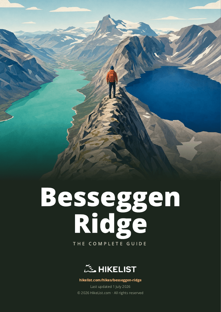
Besseggen Ridge
How would you rate Besseggen Ridge?
Tap a star to share your experience and help other hikers.
Besseggen Ridge: Norway’s Classic Jotunheimen Day Hike
HikeList Score
Besseggen Ridge scored 72/100 on HikeList's trail-quality metrics.
See score breakdownHide breakdown
- Ideal length 55
- Balanced challenge 74
- Scenery & wildness 85
- Varied terrain 83
- Accommodation 49
- Food & support 72
- Path quality 98
- Season flexibility 76
Computed from length, challenge, scenery & wildness, terrain variety, accommodation, food & support, path quality and season flexibility.
Besseggen Ridge is a hard, waymarked 13.6 km point-to-point day hike in Jotunheimen National Park, eastern Norway. The route links the DNT lodges at Memurubu and Gjendesheim, usually using the Lake Gjende boat to walk one-way back to Gjendesheim. Expect 6–8 hours, about 1,100 m of ascent, rocky alpine terrain and a steep, exposed scramble on the ridge. It suits fit, experienced hikers with a head for heights.
Route Overview
The standard route starts at Gjendesheim, takes the scheduled Gjendebåten passenger boat across Lake Gjende to Memurubu, then walks back over Besseggen to Gjendesheim. From Memurubu the path climbs steeply to the ridge, crosses Bandet between green Lake Gjende and higher blue Bessvatnet, passes below Besshø/Besshøe, then continues to Veslfjellet at 1,743 m before descending to Gjendesheim. Walking Memurubu to Gjendesheim puts the steep scramble on the ascent; the reverse direction is possible but less common. For other Norwegian mountain objectives, compare the Galdhøpiggen Summit Trail, Glittertind Ascent and the longer Hardangervidda Traverse.
Besseggen, Peer Gynt and Jotunheimen
Besseggen has been walked for generations and is strongly tied to Norwegian culture through Henrik Ibsen’s 1867 verse drama Peer Gynt. In the play, Peer boasts of riding a wild reindeer buck along the knife-edge ridge, then known as Gjendineggen. The route lies within Jotunheimen National Park, established in 1980, and today is supported by DNT lodges and the seasonal Lake Gjende boat service.
Notable highlights
- Besseggen ridge and Bandet: The signature section is a steep, narrow, hands-on scramble over the slim land bridge between Lake Gjende and Bessvatnet. No technical climbing gear is needed, but the exposure is real.
- Lake Gjende: This long emerald-green lake lies far below the ridge at about 984 m. Its colour comes from glacial rock flour carried in by meltwater.
- Bessvatnet (Bessvatn): The deep-blue lake sits roughly 400 m higher than Gjende on the other side of Bandet. The side-by-side colour contrast is the classic Besseggen view.
- Veslfjellet (1,743 m): The highest point of the walk gives wide views across the Jotunheimen massif, Norway’s highest mountain range and home to Galdhøpiggen and Glittertind.
- Peer Gynt connection: The ridge appears in Ibsen’s Peer Gynt, a literary link that helped turn Besseggen into one of Norway’s best-known mountain walks.
Challenges to expect
Besseggen is a strenuous mountain day, not a casual lakeside walk. Expect sustained ascent, rough rock, boulder fields, bare slabs and a narrow exposed ridge where you may need to use your hands. Weather can change quickly above the tree line, and snow or ice makes the ridge dangerous outside the normal season. There is no accommodation or resupply on the ridge itself.
HikeList Score
Besseggen Ridge scored 72/100 on HikeList's trail-quality metrics.
See score breakdownHide breakdown
- Ideal length 55
- Balanced challenge 74
- Scenery & wildness 85
- Varied terrain 83
- Accommodation 49
- Food & support 72
- Path quality 98
- Season flexibility 76
Computed from length, challenge, scenery & wildness, terrain variety, accommodation, food & support, path quality and season flexibility.
 Norway
Show more data Show less
- Mountainous
- Alpine
- Exposed Ridge
- Rocky
- Boulders
- Gravel
- Huts
- Pet Friendly
- Restrooms
- Water Sources
- Campsites
- Shelters
Download Our Full Guide to Besseggen Ridge FREE!
Get our comprehensive guide to this hike for free. Save it for later reading or print out at home.
In these collections
Photos from hikers
Taken on the trail by people who've reviewed Besseggen Ridge.
Besseggen Ridge: The Complete Guide
Besseggen is a demanding one-day mountain traverse in Jotunheimen nasjonalpark (Jotunheimen National Park), linking Memurubu with Gjendesheim above Gjende (Lake Gjende). It suits fit, experienced hillwalkers who want a serious alpine day rather than a casual lakeside walk.
The day normally begins with the Gjendebåten (Gjende boat) from Gjendesheim to Memurubu, then a steep climb away from the lakeshore. Higher up, the route reaches Bandet ("the Strip"), where green Gjende lies far below on one side and the deeper-blue Bessvatnet (Bessvatn) sits around 400 m higher on the other.
The signature section is the Besseggen edge: a steep, narrow, exposed scramble on rock with real drops and hands-on movement, but no technical climbing gear required. Beyond it, the route continues over bare high ground to the cairn on Veslfjellet at 1,743 m before descending broadly back to Gjendesheim.
This is a hard day of about 14 km with roughly 1,100 m of ascent, rough ground, boulder fields and slabs that become slippery when wet. There is no shelter, accommodation or resupply on the ridge, and the walk should not be attempted in snow, ice, strong wind, thunder or poor visibility.
This guide covers route stages, day timing, accommodation, food, transport, terrain and common mistakes.
Stage-by-Stage Guide
Stage 1: Memurubu to Gjendesheim over Besseggen and Veslfjellet
This is the full Besseggen day: about 14 km from Memurubu back to Gjendesheim, normally after taking Gjendebåten (the Gjende boat) west along Gjende (Lake Gjende). Allow 6–8 hours of walking including breaks, with around 1,100 m of ascent and sustained rough ground throughout.
The walking starts at Memurubu, the DNT lodge on the north shore of Gjende. There is no road access here, so the stage logistics depend on the boat from Gjendesheim; book the boat ahead in peak season and check current sailing times before travelling. Missing the planned boat can compromise the whole day.
From Memurubu the route climbs steeply away from the lake. This first section is a real mountain ascent rather than a gentle warm-up, gaining height quickly over rough, rocky ground above the tree line. In wet weather the rock and bare slabs can be slippery, and progress is slower than the distance suggests.
The path is waymarked with DNT red “T” paint marks, but this is still high alpine terrain. In clear weather the line is generally straightforward; in fog or low cloud, the broad rocky areas and exposed ridge demand proper navigation with map, compass and/or GPS. Do not treat the popularity of the route as a substitute for route-finding ability.
The first major landmark is Bandet (“the Strip”), the narrow land bridge between Gjende and Bessvatnet (Bessvatn). This is the classic viewpoint where the contrast between the two lakes is clearest: Gjende lies far below at about 984 m with its milky green glacial colour, while Bessvatnet sits roughly 400 m higher at about 1,374 m and appears deep blue.
Beyond Bandet the route reaches the Besseggen edge, the defining section of the walk. This is a steep, narrow and exposed scramble on rock, with hands needed in places, but no technical climbing equipment required in normal summer conditions. The drop towards Gjende is serious, and anyone uncomfortable with exposure should think carefully before committing to this route.
The Besseggen edge is not a place to be in snow, ice, high wind, thunder or poor visibility. Wet rock also makes the scrambling more awkward, particularly where polished slabs and boulders have to be crossed. If the forecast is unsettled or the ridge is still holding snow, choose another day.
After the exposed ridge, the route continues across rocky high ground below Besshø (Besshøe) and on towards Veslfjellet. The walking remains demanding, with boulder fields, bare slabs and open mountain terrain, but the most exposed scrambling is behind you once the Besseggen edge has been completed.
Veslfjellet, at 1,743 m, is the highest point of the stage and is marked by a large stone cairn. In clear weather this is one of the best viewpoints on the route, with wide views across Jotunheimen nasjonalpark (Jotunheimen National Park) and the surrounding high mountains. It is also a good point to assess time, weather and energy before the final descent.
From Veslfjellet the route descends broadly towards Gjendesheim at the eastern end of Gjende. The ground remains rocky and can feel tiring late in the day, especially after the scramble and the long ascent. Keep enough concentration and daylight for this final section; most slips on mountain days happen when the harder climbing feels finished.
There is no accommodation, shelter, shop or resupply between Memurubu and Gjendesheim. Carry all food, drink and spare clothing needed for a full mountain day, including warm layers even in summer. Do not rely on being able to obtain anything once you leave Memurubu until the route finishes at Gjendesheim.
Accommodation at the end is at Gjendesheim DNT lodge, which is also the main base for the route, the boat quay and a public transport stop. Memurubu DNT lodge is the start-side accommodation option if staying at the western end before walking. Opening dates, meal arrangements and bed availability at both lodges should be checked before travelling.
Gjendesheim is the practical transport hub for the walk. It can be reached by car or by seasonal public transport, including the Valdresekspressen coach from Oslo in summer and a train-to-Otta plus local bus option via Vågå. Timetables change seasonally, so bus and train connections should be checked before travelling.
For drivers, short-term parking at Gjendeosen is limited to about two hours, so it is not suitable for the full hike. Longer-stay parking is at Reinsvangen, about 1.7 km away, while lodge guests at Gjendesheim have separate parking arrangements. Current parking rules and any shuttle arrangements should be checked before travel.
Key stage warnings are exposure, weather and underestimating the terrain. Besseggen is famous and busy, but it is still a hard alpine mountain walk with a steep hands-on ridge, long ascent, rough descent and no escape services on the ridge itself. Start early, carry full mountain kit, and do not set off if snow, ice, strong wind, thunder or fog is forecast on the ridge.
Recommended Itinerary
Besseggen is a one-day mountain traverse, not a hut-to-hut route. The key planning choice is whether to sleep at Gjendesheim, sleep at Memurubu, or attempt the walk as a same-day arrival and departure.
There is no accommodation, shelter or resupply between Memurubu and Gjendesheim. Once you leave Memurubu, the day must be completed over the ridge unless conditions force an early retreat.
Standard itinerary: Gjendesheim base, boat to Memurubu, walk back
This is the normal and most efficient way to walk Besseggen: stay at or near Gjendesheim, take Gjendebåten (the Gjende boat) west along Gjende (Lake Gjende) to Memurubu, then walk back east over Bandet, the Besseggen edge and Veslfjellet.
| Day | From | To | Approx. distance | Why this stage makes sense | Services/accommodation notes |
|---|---|---|---|---|---|
| Day 1 | Gjendesheim by boat to Memurubu, then on foot from Memurubu | Gjendesheim over Besseggen and Veslfjellet | About 14 km | This puts the boat journey at the start of the day and avoids needing to meet a boat after a long, weather-dependent mountain walk. The route follows the usual direction: Memurubu → steep climb → Bandet (‘the Strip’) → Besseggen edge → below Besshø (Besshøe) → Veslfjellet → Gjendesheim. | DNT staffed lodges are at Gjendesheim and Memurubu only. There is no shelter, food or accommodation on the ridge. Book the Gjende boat in advance in peak season, and check current boat times before committing to the day. |
This standard plan suits most fit, experienced hillwalkers who want the cleanest logistics. It also gives the best margin for a slow descent, as the finish is back at the road end, car park area and Gjendesheim lodge rather than at a boat quay that still requires onward travel.
Slower variant: stay at Memurubu before walking
This option does not split the hike itself, but it makes the walking day less rushed. It suits hikers who want to remove same-morning transport pressure, start the climb from Memurubu fresh, or build in more flexibility around weather.
| Day | From | To | Approx. distance | Why this stage makes sense | Services/accommodation notes |
|---|---|---|---|---|---|
| Day 1 | Gjendesheim | Memurubu by Gjendebåten | Boat transfer; no ridge walking | Positions you at the start of the route the evening before, so the Besseggen day can begin directly from Memurubu. | Memurubu is a DNT staffed lodge on the north shore of Gjende, reached only by boat or on foot. Boat dates, times, fares and lodge availability should be checked before travelling. |
| Day 2 | Memurubu | Gjendesheim over Besseggen and Veslfjellet | About 14 km | Gives a full day for the demanding ridge crossing without first needing to travel from elsewhere to Gjendesheim and catch the morning boat. | No services after leaving Memurubu until Gjendesheim. Carry all food, water, clothing and emergency kit needed for a 6–8 hour alpine day. |
This is the better choice if accommodation at Memurubu is available and the aim is to reduce logistical stress rather than reduce the difficulty. The exposed Besseggen edge, the ascent to Veslfjellet and the descent to Gjendesheim all still have to be completed in one day.
Faster variant: same-day arrival, boat and hike
A same-day plan is possible only if transport, boat times, daylight and weather all line up. It suits strong, efficient hikers who are already comfortable with long mountain days and who can keep a reliable pace over rough ground.
| Day | From | To | Approx. distance | Why this stage makes sense | Services/accommodation notes |
|---|---|---|---|---|---|
| Day 1 | Gjendesheim by boat to Memurubu, then on foot from Memurubu | Gjendesheim over Besseggen and Veslfjellet | About 14 km | Compresses the route into a single travel-and-hike day, using the normal walking direction from Memurubu back to Gjendesheim. | This depends on current bus or car-arrival timings, Gjende boat departures, parking arrangements and lodge/transport options after the walk. This should be checked before travelling. |
The faster variant leaves less margin for delays, poor visibility, wet rock or slower-than-expected progress on the scramble. It should not be used as a way to force the ridge into marginal conditions; snow, ice, strong wind, thunder or fog make Besseggen unsafe.
Planning the Route
Plan it as a single mountain day
Besseggen is not a hut-to-hut route with flexible stages. It is normally planned as one long mountain day: take Gjendebåten (the Gjende boat) from Gjendesheim to Memurubu, then walk back over Besseggen and Veslfjellet to Gjendesheim.
Most walkers should allow the whole day, not just the quoted walking time. The route commonly takes 6–8 hours including breaks, but boat timing, weather, queues on the exposed scramble and a slower-than-expected descent can all add pressure if the day is planned too tightly.
It is better treated as a steady, early-start hike rather than something to squeeze into a travel day. The exposed Besseggen edge, boulder fields and bare rock slabs are not places to rush, especially if the rock is damp or there are many walkers on the ridge.
The boat dictates the day
The key planning decision is the outward boat from Gjendesheim to Memurubu. Once that is booked, the rest of the route is straightforward in shape: Memurubu → Bandet (’the Strip’) → Besseggen edge → below Besshø (Besshøe) → Veslfjellet → Gjendesheim.
Advance booking of Gjendebåten is strongly advised in peak season, particularly July and early August. The boat runs seasonally, roughly from mid-June to mid-October, but exact dates, sailing times and fares should be checked before travelling.
A single Gjendesheim–Memurubu boat ticket has recently been in the region of NOK 200–250. Current fares should be checked before booking.
Where to stay before the hike
The practical bases are the DNT staffed lodges at Gjendesheim and Memurubu. Gjendesheim is the main road-end and boat-quay base; Memurubu sits on the north shore of Gjende and is reached by boat or on foot.
Staying at Gjendesheim the night before works well for walkers who want to take the morning boat and finish at their accommodation or parked car. Staying at Memurubu can also give an early start on foot, but it depends on reaching Memurubu by boat the previous day and on lodge availability.
There is no accommodation, shelter or resupply on the ridge between Memurubu and Gjendesheim. DNT lodge opening dates and booking availability should be checked before travelling.
Shortening, extending and section hiking
Besseggen has very little practical scope for shortening once committed to the ridge. There are no intermediate villages, road crossings, staffed huts or resupply points between Memurubu and Gjendesheim.
Section hiking is therefore not really relevant. This is a single point-to-point mountain route, with the boat providing the access leg rather than a multi-day trail that can be split into stages.
Extending the trip is possible only by building a wider Jotunheimen itinerary around the DNT lodges and local transport, but that is separate from the Besseggen day itself. For the ridge, the planning focus should remain on completing the Memurubu-to-Gjendesheim route in safe conditions.
Key planning priorities
| Planning point | What matters on Besseggen |
|---|---|
| Transport | Get to Gjendesheim by car or public transport, then book Gjendebåten to Memurubu. Check Valdresekspressen, Otta connecting-bus options and current parking arrangements before travelling. |
| Accommodation | Book Gjendesheim or Memurubu if staying locally. There is nowhere to stay or shelter on the ridge. |
| Food and water | Carry food and enough water for the full day. Do not plan on buying anything between Memurubu and Gjendesheim. |
| Weather | Do not go in snow, ice, high wind, thunder or fog. The exposed edge and bare rock become serious in poor conditions. |
| Navigation | The route is waymarked with DNT red “T” marks, but visibility can change quickly in high alpine terrain. Carry a reliable map/navigation method rather than relying only on following other walkers. |
| Timing | Leave enough daylight and avoid planning onward travel too tightly after the hike. The descent from Veslfjellet to Gjendesheim still takes time after the famous ridge section is over. |
Weather and season planning
The usual hiking season follows the Gjende boat season, roughly mid-June to mid-October. Snow can linger into mid-June, and the ridge is not suitable with snow or ice on the route.
Weather is the main go/no-go factor. The Besseggen edge is steep, narrow and exposed, with a major drop towards Gjende, so strong wind, thunder, fog or icy rock should be treated as reasons to postpone rather than push on.
Because the route is entirely above the tree line, there is little shelter from wind or weather once underway. A forecast that looks marginal at Gjendesheim can feel much more serious on the ridge and on Veslfjellet at 1,743 m.
Towns, Villages and Overnight Stops
Besseggen is not a town-to-town trail. The route is a high mountain day walk between two DNT staffed lodges, with no villages, shops, shelter or resupply once you leave Memurubu. Overnight planning is therefore simple but important: most walkers base themselves at Gjendesheim or Memurubu, then carry everything needed for the full ridge day.
| Place | Role on the route | Overnight use | Food / supplies | Transport |
|---|---|---|---|---|
| Gjendesheim | Main base, boat quay and finish | Yes — DNT staffed lodge | Do not rely on ridge resupply; check lodge arrangements when booking | Road access, buses in season, parking nearby, Gjendebåten boat |
| Memurubu | Walking start after boat from Gjendesheim | Yes — DNT staffed lodge | No shops on the ridge; start with all food and water needed | Reached by Gjendebåten or on foot |
| Bandet, Besseggen, Veslfjellet | High mountain route features | No | None | On foot only |
Gjendesheim (Gjendeosen)
Gjendesheim is the key logistics point for Besseggen. It sits at Gjendeosen, the eastern end of Gjende (Lake Gjende), where the walk normally finishes and where the Gjendebåten boat leaves for Memurubu.
This is the best base for most walkers because it combines accommodation, the boat quay, road access and onward transport in one place. Staying here the night before makes it easier to catch the morning boat and start the ridge without a long same-day approach.
Accommodation is at the DNT staffed lodge at Gjendesheim. Opening dates, room availability and booking conditions should be checked before travelling, especially in the main summer season.
Gjendesheim is also the practical place to deal with parking and public transport. Short-term parking at Gjendeosen is limited to about two hours, longer-stay parking is at Reinsvangen about 1.7 km away, and free parking is available for lodge guests at Gjendesheim. Current parking arrangements should be checked before travelling.
In summer, the Valdresekspressen coach runs from Oslo to Gjendesheim, roughly from mid-June to early October. Another approach is by train to Otta, then a local connecting bus to Gjendesheim via Vågå. Timetables should be checked before travelling, as the route depends on seasonal services.
There is no resupply after leaving for Memurubu and the ridge. Pack food, water, waterproofs, warm layers and any emergency items before boarding the boat.
Memurubu
Memurubu is the normal walking start for Besseggen when the route is done in the usual west-to-east direction. It stands on the north shore of Gjende and is reached from Gjendesheim by the scheduled Gjendebåten passenger boat.
The DNT staffed lodge at Memurubu makes it a useful overnight stop for walkers who want to start directly from the trailhead in the morning. This can reduce pressure on boat timing, but it changes the logistics: you still need to reach Memurubu by boat or on foot before the walking day.
There is no road access for ordinary route logistics here. The practical link is the seasonal Gjende boat, which also connects Gjendesheim, Memurubu and Gjendebu. Advance booking is strongly advised in July and early August, and current boat dates, times and fares should be checked before travelling.
Memurubu is the last place before the climb where plans can be adjusted sensibly. If the forecast has worsened, or if snow, ice, high wind, thunder or fog are likely on the ridge, the Besseggen crossing should not be started.
Bandet ("the Strip")
Bandet is not a settlement or stopover, but it is a key decision point on the route. It is the narrow land bridge between green Gjende below and blue Bessvatnet (Bessvatn) higher up, before the exposed Besseggen edge.
There is no accommodation, food, shelter or transport here. Treat it as a mountain rest and assessment point only, not as a place to rely on for facilities.
This is a sensible place to pause, eat and put on an extra layer before committing to the steeper exposed ground ahead. In poor visibility, strong wind or deteriorating weather, continuing onto the edge becomes much more serious.
Besseggen edge
The Besseggen edge is the exposed scramble section and has no facilities of any kind. It is a steep, narrow and hands-on part of the route, with a major drop towards Gjende and rough rock underfoot.
Do not treat this as a place for a long stop or group regrouping unless there is safe space to stand clear of other walkers. The route is popular, and slower movement on the scramble can create pressure from other hikers.
There is no escape accommodation, shelter or resupply on this section. Once committed in suitable conditions, the practical aim is to move steadily and carefully over the ridge towards the ground below Besshø and Veslfjellet.
Below Besshø (Besshøe)
The route passes below Besshø (Besshøe) after the Besseggen edge on the way towards Veslfjellet. This is still open, high mountain terrain rather than a service point.
There is no accommodation, food, shop, café, shelter or public transport here. Navigation remains important in poor visibility, and the ground can be slow across rock, slabs and boulder fields.
For overnight planning, this section simply reinforces the need to carry enough food, water and warm clothing for the whole day. The next practical base is still Gjendesheim at the end of the walk.
Veslfjellet
Veslfjellet is the high point of the walk at 1,743 m, marked by a large stone cairn. It is a summit on the route, not an overnight stop.
There are no facilities on Veslfjellet. It can be an exposed place in wind and cold, so stops should be managed with conditions in mind rather than treated as a fixed lunch point.
From here the route continues down towards Gjendesheim. Although the main scramble is behind you, the day is not finished: the descent is still on rough alpine ground and tired walkers should allow enough time and energy to complete it safely.
Gjendesheim finish
The walk ends back at Gjendesheim, making it the natural place to stay after the hike if onward travel is awkward or if bus connections do not line up with the finish time. It also avoids the need to drive or travel after a demanding mountain day.
If staying after the walk, book the DNT lodge in advance and check current opening dates. If leaving the same day, allow for the normal 6–8 hours of walking, possible delays on the ridge, and the final transfer from any longer-stay parking at Reinsvangen if using a car.
Getting to the Start
The walking start is Memurubu, but the practical access point is Gjendesheim at Gjendeosen, the eastern end of Gjende (Lake Gjende). From Gjendesheim, take the scheduled Gjendebåten passenger boat to Memurubu, then walk back over Besseggen to finish at Gjendesheim.
The boat is seasonal, broadly tied to the summer hiking season from around mid-June to mid-October. Exact sailing dates, times, fares and availability should be checked before travelling, and advance booking is strongly advised in July and early August. A single Gjendesheim–Memurubu boat ticket is typically in the region of 200–250 NOK, but current prices should be confirmed before booking.
By train
The nearest practical rail approach is to take the train to Otta, then continue by local connecting bus to Gjendesheim via Vågå. This is a mountain-area connection rather than a frequent city service, so the train, bus and boat times need to be planned together.
Do not assume that arriving at Otta on the day gives enough time to reach Gjendesheim, take the boat to Memurubu and complete the ridge safely. For most walkers using public transport, staying at Gjendesheim or Memurubu the night before is the more reliable plan. Timetables and seasonal operation should be checked before travelling.
By bus
From Oslo, the Valdresekspressen / Valdres Express coach runs to Gjendesheim in summer, roughly from mid-June to early October. This is the simplest public-transport approach when the route is operating, as the bus brings you directly to the road end and boat quay area at Gjendesheim.
The key connection is the onward boat from Gjendesheim to Memurubu. If arriving by coach on the same day, check that there is a suitable Gjendebåten sailing and enough daylight for a demanding 6–8 hour mountain walk. In many cases, it is better to travel to Gjendesheim the day before and start with a booked morning boat.
Local bus links via Otta and Vågå are another option, but services can be limited and seasonal. This should be checked before travelling.
Taxi use should be treated as a backup rather than the main plan. Availability in this mountain area may be limited, and any long transfer should be arranged in advance with the fare agreed beforehand.
By car
Drive to Gjendesheim / Gjendeosen, park, then take the Gjendebåten across Gjende to Memurubu. The route then returns on foot to Gjendesheim, so there is no need to retrieve a vehicle from a different trailhead.
Parking arrangements are important. There is free short-term parking of about 2 hours at Gjendeosen, which is not suitable for the full Besseggen hike. Longer-stay parking is at Reinsvangen, about 1.7 km away, while guests staying at Gjendesheim have free parking at the lodge.
Parking rules, capacity and any transfer arrangements between Reinsvangen and the quay should be checked before travelling, especially in peak season. Allow extra time before the boat departure; missing the boat can disrupt the whole day.
From the nearest airport
There is no airport at Gjendesheim or Memurubu. Fly-in plans normally require onward surface travel by coach, train-and-bus or hire car to Gjendesheim, followed by the Gjendebåten to Memurubu.
For international arrivals, Oslo is the most relevant major-city gateway mentioned for this route because the Valdresekspressen runs from Oslo to Gjendesheim in summer. If using flights, leave enough time between arrival, onward transport and lodge or boat bookings. Airport-to-city, coach, train, bus and boat connections should all be checked before travelling.
Where to stay before starting
The two practical pre-hike bases are the staffed DNT lodges at Gjendesheim and Memurubu. Both require advance planning, and opening dates and booking availability should be checked before travelling.
Gjendesheim is the main base for most walkers. It sits at the road end and boat quay, with bus access and parking nearby, so you can stay overnight, take the boat to Memurubu in the morning, then walk back to your accommodation, vehicle or onward bus stop.
Memurubu is on the north shore of Gjende and is reached only by boat or on foot. Staying there allows you to begin walking directly from the start point in the morning, but you must first get there by Gjendebåten and you will finish the hike back at Gjendesheim.
There is no accommodation, shelter or resupply on the ridge between Memurubu and Gjendesheim. Once you leave Memurubu, you are committed to a full alpine mountain day unless conditions force a retreat early on.
Getting Home from the Finish
The walk finishes at Gjendesheim, beside the boat quay at Gjendeosen at the eastern end of Gjende (Lake Gjende). This is also the normal access point for the morning Gjendebåten (Gjende boat), so most transport plans are arranged as a return to the same road-end base.
Do not assume there will be easy onward transport after a slow or weather-delayed crossing of the ridge. Besseggen is a 6–8 hour mountain day for most walkers, and onward buses, boat services and lodge arrangements are seasonal and timetable-dependent.
By train
The rail option is via Otta, with a local connecting bus between Otta and Gjendesheim via Vågå. This is the relevant rail connection for walkers leaving the finish without a car.
Connections should be planned before setting out, especially if trying to leave the area the same day as the hike. If the final descent to Gjendesheim takes longer than expected, it may be safer to stay overnight at the finish rather than rely on a late connection. This should be checked before travelling.
By bus
In summer, the Valdresekspressen (Valdres Express) coach runs between Oslo and Gjendesheim, with the season roughly mid-June to early October. This is the most direct public-transport option for returning towards Oslo from the finish.
There is also the Otta connection by local bus, linking Gjendesheim with the railway at Otta via Vågå. Timetables are seasonal and should be checked before travelling, particularly outside July and early August or if finishing late in the day.
By car/taxi
For walkers who drove to the route, the finish at Gjendesheim is convenient because the hike ends back at the road end where transport is based. Short-term parking at Gjendeosen is limited to about 2 hours, so it is not suitable for the full Besseggen day.
Longer-stay parking is at Reinsvangen, about 1.7 km from Gjendeosen. Gjendesheim lodge guests have free parking at Gjendesheim. Current parking arrangements at Gjendeosen, Reinsvangen and Gjendesheim should be checked before travelling.
Taxi availability should not be relied on without arranging it in advance. Gjendesheim is a mountain road-end location, not a town with frequent on-demand taxi services.
From the nearest airport
No airport is directly useful for the finish at Gjendesheim without a road or public-transport connection. Plan the journey out first by coach towards Oslo, or by bus to Otta for the railway, then continue to any onward flight connection from there.
Because the hike, buses and the Gjende boat season all depend on summer mountain schedules, same-day flight connections after walking Besseggen are risky unless there is a generous time buffer. This should be checked before travelling.
Where to stay at the finish
Gjendesheim DNT lodge is the practical overnight option at the finish. Staying there after the hike is often the simplest plan if public transport has finished for the day, if weather has slowed the crossing, or if onward travel would require tight connections.
Memurubu is the other DNT lodge associated with the route, but it is on the north shore of Gjende and is reached by boat or on foot, so it is not the convenient place to stay after finishing at Gjendesheim. DNT lodge opening dates and bookings should be checked before travelling.
Which Direction Should You Walk?
Standard direction: Memurubu to Gjendesheim
Besseggen is normally walked west-to-east: take Gjendebåten (the Gjende boat) from Gjendesheim to Memurubu, then walk back over Bandet, the Besseggen edge, Veslfjellet and down to Gjendesheim.
This is the most practical direction for most hikers. The boat is taken at the start of the day, when timings are controllable, and the walk finishes back at the road end, car park area, bus stop and DNT lodge at Gjendesheim. There is no pressure to catch a boat after a hard mountain day, although boat times should still be checked before travelling and booked ahead in peak season.
The standard direction also puts the exposed Besseggen edge mostly uphill. For many walkers, scrambling up steep rock is more secure and less intimidating than downclimbing it, especially where the ridge is narrow and the drop towards Gjende is obvious.
Scenically, this direction works well. The day begins with the boat journey along Gjende, climbs away from Memurubu, reaches the classic lake-colour contrast at Bandet between green Gjende and blue Bessvatnet, then builds towards the exposed ridge and the high point on Veslfjellet before the final descent to Gjendesheim.
Reverse direction: Gjendesheim to Memurubu
Walking from Gjendesheim to Memurubu is possible as a route direction, but it is less convenient for most independent hikers. It means starting with the broad climb towards Veslfjellet, then crossing the high ground before descending the Besseggen edge and continuing down to Memurubu.
The main drawback is the exposed section. In reverse, the steepest and most famous part of Besseggen is tackled downhill, which can feel more awkward and committing than climbing it. Wet rock, tired legs or nervousness with exposure all make this direction less forgiving.
Transport is also less tidy. Finishing at Memurubu means either staying there or catching Gjendebåten back to Gjendesheim, so the day becomes dependent on the boat timetable after the walk. Exact sailing times, season dates and booking requirements should be checked before travelling.
Direction comparison
| Factor | Memurubu → Gjendesheim | Gjendesheim → Memurubu |
|---|---|---|
| Normal choice | Traditional and most common direction | Less common |
| Transport | Boat first, walk back to road, buses, parking and Gjendesheim | Walk first, then need boat or accommodation at Memurubu |
| Exposed scramble | Generally uphill on the Besseggen edge | Generally downhill on the Besseggen edge |
| Finish | Ends at Gjendesheim, the main access point | Ends at Memurubu, reached only by boat or on foot |
| Best suited to | Most hikers, especially first-timers | Strong, confident hikers with firm onward logistics |
Weather does not give either direction a reliable planning advantage. In snow, ice, strong wind, thunder or fog, the ridge should not be attempted in either direction.
Recommendation
Walk Besseggen in the standard direction: Gjendesheim by boat to Memurubu, then Memurubu → Bandet → Besseggen → Veslfjellet → Gjendesheim on foot. It gives the cleanest transport logistics, puts the exposed scrambling in the better uphill direction, and finishes at the main lodge, quay, parking and bus access point.
Accommodation Along the Route
Besseggen is not an inn-to-inn hike in the usual multi-day sense. It is a demanding one-day mountain crossing with staffed DNT lodges at the two practical ends: Gjendesheim at Gjendeosen and Memurubu on the north shore of Gjende (Lake Gjende). Between Memurubu and Gjendesheim there is no accommodation, shelter or resupply on the ridge.
Most walkers base themselves at Gjendesheim, take the morning Gjendebåten (the Gjende boat) to Memurubu, then walk back over Besseggen and Veslfjellet to finish where they started. Staying at Memurubu the night before is also possible, but it requires reaching the lodge by boat or on foot, so the boat timetable becomes part of the accommodation plan.
| Place | Accommodation level | Best for | Notes |
|---|---|---|---|
| Gjendesheim | Good | Main base before or after the hike | DNT staffed lodge at the road end, boat quay and normal finish point. Best logistics if arriving by car, coach or connecting bus and taking the boat to Memurubu in the morning. DNT opening dates and booking should be checked before travelling. |
| Memurubu | Limited | Starting fresh from the walk start | DNT staffed lodge on the north shore of Gjende. Useful if staying at the western end before tackling the ridge, but it is reached only by boat or on foot, so arrival depends on Gjendebåten services. DNT opening dates, room availability and boat times should be checked before travelling. |
| Bandet (‘the Strip’) | None | Not an overnight stop | This is a terrain feature between Gjende and Bessvatnet, not a settlement or hut location. No shelter, beds, food or resupply. |
| Besseggen edge / ridge | None | Day hiking only | No accommodation or safe fall-back facilities on the exposed ridge. Do not start unless the weather and conditions allow the full crossing. |
| Veslfjellet | None | High point only | Cairn-marked summit area on the return towards Gjendesheim. No shelter, services or overnight option. |
Where to stay before the hike
For the simplest plan, stay at Gjendesheim the night before. This puts you at the boat quay for the outward crossing to Memurubu and at the finish point when the walk is complete, avoiding any need to travel again after a hard 6–8 hour mountain day.
Memurubu works well for hikers who want to wake up directly at the start of the walk. The trade-off is access: Memurubu is not a roadhead base, so the previous day’s boat crossing must line up with lodge check-in and the seasonal boat timetable.
Booking pressure and seasonality
Accommodation should be booked ahead, especially in the main summer season, at weekends and during settled-weather periods when Besseggen is at its busiest. The route attracts very high numbers of walkers, and both bed space and boat departures can become limiting factors.
The practical walking season is tied closely to summer mountain conditions and the seasonal Gjende boat, roughly mid-June to mid-October. Snow can linger into mid-June, and DNT lodge opening dates do not remove the need to check ridge conditions before committing to the walk.
Luggage, taxis and awkward transfers
There is no accommodation gap to solve on the ridge itself: the route is normally completed in a single day. Heavy overnight luggage should not be carried over Besseggen unless it is genuinely necessary, as the day includes steep ascent, rough rock, boulder fields and exposed scrambling.
Taxi transfers are not a solution for Memurubu, because the lodge is reached by boat or on foot rather than by road. The key transfer is the Gjendebåten crossing from Gjendesheim to Memurubu; book this in advance in peak periods and check current sailing times before travelling.
Does it work as an inn-to-inn walk?
Only in a very limited sense. You can sleep at Memurubu, cross Besseggen, and sleep at Gjendesheim, but there are no intermediate huts and no alternative overnight stops along the ridge. For most independent hikers, the most efficient arrangement is one or two nights at Gjendesheim, with the Besseggen crossing done as a self-contained mountain day.
Weather and Best Time to Walk
Besseggen is a high, exposed alpine route and the weather decision matters more here than on many day walks. The route is entirely above the tree line, reaches Veslfjellet at 1,743 m, and includes the steep, narrow Besseggen edge where wind, wet rock, fog, snow or ice can turn a hard hike into a serious hazard.
The practical walking season is normally tied to the Gjendebåten (the Gjende boat), which runs seasonally between Gjendesheim and Memurubu, roughly from mid-June to mid-October. Exact boat dates, first departures, last sailings and DNT lodge opening dates at Gjendesheim and Memurubu should be checked before travelling.
Best months
The most reliable period for most hikers is the main summer season, once the ridge is clear of snow and the Gjende boat is running regularly. July and early August are popular, so boat tickets and lodge beds should be booked ahead.
Early autumn can be excellent in settled weather, with fewer people than peak summer, but the margin for error is smaller. Days are shorter, conditions can feel colder at height, and any deterioration in visibility or wind is more consequential on the exposed ridge.
| Period | Practical assessment |
|---|---|
| Mid-June | Possible only if the route is free of snow and ice. Snow can linger into mid-June, so ridge conditions must be checked carefully. |
| July to early August | Main season and usually the simplest time for transport, boat access and lodge logistics. Also the busiest period, especially on fine-weather days. |
| Late August to September | Often a good choice for experienced hikers in settled weather, but colder, shorter days make early starts and careful forecasts more important. |
| Early to mid-October | Only for competent hikers in suitable conditions and while the boat/lodges are still operating. Snow, ice, wind and short daylight can quickly make the route unsuitable. |
| Winter and spring | Not a realistic normal hiking objective. The Besseggen edge should not be attempted in snow or ice as a standard walking route. |
Weather hazards that should stop the walk
Do not start Besseggen in snow, ice, strong wind, thunder or fog. The route is waymarked with DNT red “T” marks, but waymarking does not remove the need for clear visibility and safe footing on the exposed sections.
Rain is also a serious factor. Much of the route crosses rock, boulders and bare slabs, and these become slippery when wet. Wet conditions are especially unwelcome on the scramble over the Besseggen edge and on the long descent from Veslfjellet towards Gjendesheim.
High wind is a particular concern because the ridge is open and the exposed edge has real drops. If the forecast suggests strong winds at ridge height, choose another day rather than relying on being able to “push through”.
Fog or low cloud removes the main visual references between Gjende, Bessvatnet, Bandet and the ridge. It also makes it harder to judge the line through boulders and slabs, and increases the risk of straying from the safest route on the exposed ground.
Thunderstorms are a clear no-go. There is no shelter or resupply on the ridge between Memurubu and Gjendesheim, and much of the route is high, bare and exposed.
Daylight and timing
The walk typically takes 6–8 hours including breaks, though times vary with fitness, queues on the scramble, weather and underfoot conditions. In summer the long daylight gives a useful buffer, but the day still depends on the boat crossing from Gjendesheim to Memurubu and on having enough time to complete the ridge safely.
In autumn, shorter daylight makes timing more critical. Use an early boat where possible, carry a head torch, and avoid starting if the forecast leaves any doubt about visibility, wind or precipitation later in the day.
Trail surface by season
When dry and snow-free, the route is still rough: steep climbing from Memurubu, rocky ridge walking, boulder fields, bare rock slabs, the exposed Besseggen scramble, then a broad descent from Veslfjellet. Good boots or robust mountain footwear with dependable grip are important.
After rain, the rock and slabs can be slick. After fresh snow, freeze-thaw or lingering old snow, the route is not suitable as a normal summer hike, particularly on the Besseggen edge.
Accommodation and transport seasonality
Weather planning is inseparable from logistics on this route. Most walkers stay at Gjendesheim or Memurubu and use the Gjendebåten from Gjendesheim to Memurubu before walking back over the ridge.
The boat runs seasonally, and DNT lodge availability also varies by season. Check Gjendebåten times and fares, book ahead in peak season, and verify DNT lodge opening dates before committing to travel dates.
Insects and other seasonal nuisances
Insects are not a major planning factor for this high, exposed ridge compared with weather, footing and timing. The main seasonal risks are snow and ice early or late in the season, wet rock after rain, strong wind, fog and storms.
Safety Notes
Besseggen is a serious alpine mountain day, despite its popularity. The route is short enough to complete in a day, but it is high, exposed, rocky and fully above the tree line, with no shelter, accommodation or resupply between Memurubu and Gjendesheim.
Emergency help and communication
For emergency assistance in Norway, use the local emergency services; 112 is the European emergency number. Check current Norwegian emergency contact guidance before travelling, and make sure all party members know what to do if someone is injured on the ridge.
Do not rely on mobile signal being available throughout the walk. Carry an offline map, a charged phone, spare power, and enough clothing and food to wait safely if progress is delayed by injury, poor visibility or bad weather.
Weather and conditions
Besseggen should only be attempted in settled summer or autumn conditions. Snow, ice, high wind, thunder and fog make the ridge dangerous, especially on the exposed Besseggen edge and the bare rock slabs.
Conditions can be much colder and windier on the ridge and Veslfjellet than at Gjendesheim or Memurubu. Pack warm layers, waterproofs, hat and gloves even on a clear morning, and avoid starting if the forecast is marginal.
Snow can linger into mid-June, and the walking season is closely tied to the Gjendebåten (Gjende boat) operating period. Current weather, snow and ridge conditions should be checked before travelling and again before setting off.
Exposure and scrambling on Besseggen edge
The Besseggen edge is the key safety point on this hike. It is steep, narrow and exposed, with hands-on scrambling over rock and a very large drop towards Gjende (Lake Gjende).
No technical climbing equipment is normally required, but a good head for heights is essential. Anyone uncomfortable with exposure, steep rock or using hands for balance should not treat this as a casual hiking route.
Wet rock, loose boulders and bare slabs increase the risk of slips. Wear proper hiking boots or mountain shoes with good grip, keep both hands free on the scrambling sections, and avoid rushing if the route is busy.
Fitness, timing and daylight
Allow a full mountain day. Most walkers take about 6–8 hours including breaks, and delays are common if the ridge is crowded, the weather changes or the group moves slowly over boulders and slabs.
Start early enough to finish comfortably in daylight and do not underestimate the total ascent of about 1,100 m. The climb from Memurubu is steep, and the day remains physically demanding until the final descent to Gjendesheim.
Navigation
The route is waymarked with DNT red “T” paint marks, but waymarking is not a substitute for navigation skills. Fog or low cloud can make the broad high ground around Veslfjellet disorientating.
Carry a map or reliable offline navigation, and know the walking order: Memurubu → Bandet (“the Strip”) → Besseggen edge → below Besshø → Veslfjellet → Gjendesheim. In poor visibility, reassess before committing to the exposed ridge.
Water, food and shelter
There is no resupply, staffed hut or shelter on the ridge between Memurubu and Gjendesheim. Carry all food, water and emergency layers for the full day.
The walk passes between Gjende and Bessvatnet, but this is not a lakeside route for most of the day and water access should not be assumed once committed to the high ground. Carry enough from the start.
Solo hiking
Solo hikers need a conservative margin. Tell someone at Gjendesheim, Memurubu or at home what route is planned and when arrival is expected, and check in after finishing.
Solo walkers should be especially cautious about setting off in poor forecasts, as an injury on the boulder fields or exposed scramble could leave a long wait for help in cold, open terrain.
Other route hazards
Road walking is not a significant hazard on the main Besseggen route, which is a mountain path between Memurubu and Gjendesheim. The main risks are weather, exposure, slippery rock, fatigue and poor visibility.
Livestock is not a defining safety issue for this route. Standard mountain courtesy still applies: give any animals space, keep dogs under control if taken, and check boat, lodge and trail suitability before travelling.
Before setting off
Check the following on the day or the evening before:
- Weather forecast for Jotunheimen and the ridge area.
- Snow, ice, wind, thunder and fog risk — do not go if any of these make the ridge unsafe.
- Gjendebåten times and booking, especially in peak season.
- That every walker has suitable footwear, warm layers, waterproofs, food, water and navigation.
- That the group is fit enough for a hard 6–8 hour alpine day with about 1,100 m of ascent.
- That someone knows the plan and expected finish time at Gjendesheim.
Gear Recommendations
Besseggen is a single, hard mountain day rather than a hut-to-hut trek. Pack for 6–8 hours above the tree line, with no shelter, accommodation or resupply between Memurubu and Gjendesheim.
Footwear
Wear proper mountain footwear with a reliable sole for wet rock, bare slabs and boulder fields. The route includes a steep climb from Memurubu, the exposed Besseggen edge and a long rocky descent from Veslfjellet, so light town trainers are a poor choice.
Stiff walking shoes can work for experienced hikers in settled summer conditions, but many walkers will be better served by lightweight boots with good edging and support. Whatever is worn, it needs to feel secure when scrambling with hands on rock.
Clothing and weather protection
Carry full waterproofs even on a clear morning. The route reaches 1,743 m at Veslfjellet and stays in exposed alpine terrain for much of the day, so wind, rain and rapid temperature changes matter more than the modest 14 km distance suggests.
A practical clothing system is:
- wicking base layer
- warm fleece or light insulated layer
- waterproof jacket and waterproof trousers
- warm hat or buff
- gloves, especially outside high summer
- spare dry layer in a waterproof bag
Do not start the ridge in snow, ice, high wind, thunder or fog. Extra clothing is not a substitute for safe conditions on the exposed edge.
Navigation and safety kit
The path is waymarked with DNT red “T” paint marks, but visibility can close in quickly in Jotunheimen nasjonalpark (Jotunheimen National Park). Carry a map or offline route map, plus a charged phone; a small power bank is sensible if using the phone for navigation, photos and transport information.
A headtorch is worth carrying even on a day hike. Most parties will expect to finish in daylight, but delays on the scramble, bad weather or a missed early start can make the final descent to Gjendesheim longer than planned.
Also carry a basic first-aid kit and an emergency layer or survival bag. There is no shelter on the ridge itself.
Water and food
Carry enough water for the full day from Memurubu to Gjendesheim. There is no resupply on the ridge, and the combination of 1,100 m of ascent, bare rock and exposure can make the day more demanding than the distance implies.
Pack lunch plus regular high-energy snacks that can be eaten during short stops. Do not rely on reaching Gjendesheim quickly after the high point; the descent from Veslfjellet is still part of a long mountain day.
Trekking poles
Trekking poles are useful on the climb from Memurubu and the broad descent towards Gjendesheim, especially for reducing strain on knees over rough ground. They should be collapsible, because the Besseggen edge itself requires hands-on movement and poles need to be stowed securely before the exposed scrambling section.
Camping and overnight gear
Camping gear is not needed for the normal Besseggen day. The practical bases are the staffed DNT lodges at Gjendesheim and Memurubu, and most walkers should avoid carrying a heavy overnight pack across the exposed ridge.
If camping elsewhere before or after the hike, reduce the carried load for the ridge day wherever possible. A large pack makes the scramble less balanced and more tiring, particularly in wind.
Gear for lodge-based hikers
For hikers staying at Gjendesheim or Memurubu, a compact daypack is ideal. Carry only the mountain-day essentials: waterproofs, warm layers, food, water, navigation, first aid, phone, power bank and small emergency kit.
Non-essential overnight items should stay at the lodge or in the car where practical. Lodge opening dates and bookings should be checked before travelling.
Gear for fast hikers and section hikers
Fast hikers should still carry proper mountain kit. Besseggen is popular, waymarked and only about 14 km, but the exposure, ascent and rocky terrain make it unsuitable for a stripped-down road-running setup in poor weather.
For a light-but-safe approach, prioritise a waterproof shell, warm layer, gloves or hat, enough water, food, offline navigation, phone, power bank and emergency layer. Speed should come from fitness and efficient packing, not from leaving safety equipment behind.
Sun, cold and seasonal extras
The route is entirely above the tree line, so take sun protection in settled weather: sunglasses, sunscreen and a cap or brimmed hat. Insects are not the defining issue on the ridge, but repellent can be useful around the lakeshore or lodges in warmer periods.
For early summer and autumn, add warmer gloves, a more substantial insulating layer and a hat. Snow can linger into mid-June, and any snow or ice on the ridge is a reason to change plans rather than simply add traction gear and continue.
Budget and Costs
Besseggen is a single-day mountain walk, but it is not a zero-cost day if walked in the normal direction. The main budget items are the Gjendebåten (Gjende boat) from Gjendesheim to Memurubu, getting to Gjendesheim, food for a full mountain day, and any overnight stay at Gjendesheim or Memurubu.
All costs should be planned in NOK. Current boat fares, lodge prices, bus fares and parking arrangements should be checked before booking.
Main cost items
| Cost item | What to budget for |
|---|---|
| Gjende boat: Gjendesheim to Memurubu | A single ticket is typically in the region of 200–250 NOK. Advance booking is strongly advised in July and early August. Check current fares and sailing times before travelling. |
| Accommodation | The practical bases are the DNT staffed lodges at Gjendesheim and Memurubu. Prices vary by room type, meal plan, DNT membership and season, so check directly with DNT before booking. |
| Food | There is no shelter, shop or resupply on the ridge. Budget for a full day of packed food, snacks and drinks, either brought with you or bought at/through the lodge where available. Lodge meals and packed lunches will cost more than carrying food from a supermarket before reaching Gjendesheim. |
| Transport to Gjendesheim | If travelling by public transport, budget for the Valdresekspressen coach from Oslo in summer or train to Otta plus local bus via Vågå. Timetables and fares change seasonally and should be checked before travelling. |
| Parking | Free short-term parking of about 2 hours is available at Gjendeosen, which is not enough for the hike. Longer-stay parking is at Reinsvangen, about 1.7 km away, while lodge guests at Gjendesheim have free parking. Current arrangements should be checked before travelling. |
| Luggage transfer | Not normally relevant. This is a one-day hike with no accommodation or resupply on the ridge, and most walkers leave luggage at their lodge or vehicle and carry only a day pack. |
Budget approach
The cheapest realistic way to walk Besseggen is to arrive at Gjendesheim without using a lodge, take the morning boat to Memurubu, carry all food for the day and finish back at Gjendesheim. In that case, the fixed local cost is mainly the Gjende boat ticket, plus whatever is needed for transport or parking.
This approach only works well if the public transport timings, weather window and boat departure fit the same day. It leaves little margin if the weather is poor, so it is often less practical than it first appears.
Mid-range approach
Most independent walkers should budget for at least one night at Gjendesheim or Memurubu. Staying locally makes it much easier to take an early boat, start fresh and avoid building a long journey into the same day as a hard 6–8 hour mountain walk.
A mid-range budget usually includes a lodge bed, breakfast or packed food, the Gjende boat ticket, and transport or parking. Exact lodge and meal prices vary, so check current DNT rates before booking.
Comfortable approach
A more comfortable plan is to stay at a DNT lodge before and after the hike, with lodge meals and a packed lunch arranged where available. This reduces pressure around transport connections and gives more flexibility if weather or ridge conditions force a delay.
This is the most expensive self-guided option, but it is also the most resilient for a route where snow, ice, high wind, thunder or fog can make the ridge unsafe.
Costs that are easy to underestimate
The main hidden cost is not the path itself, but the logistics around it. A missed boat, full sailing, unsuitable weather day or late public-transport connection can mean paying for an extra lodge night or changing onward travel.
Do not budget on the assumption that Besseggen can always be squeezed into a single arrival-and-departure day. In peak season, book the Gjendebåten in advance and leave enough financial margin for weather-related changes.
Luggage Transfer, Guided Tours and Support Services
Luggage transfer
Besseggen is a one-day mountain route, so luggage transfer is usually unnecessary. Most walkers base themselves at Gjendesheim, take Gjendebåten (the Gjende boat) to Memurubu, then walk back to Gjendesheim the same day.
There is no accommodation, shelter or resupply on the ridge, and no practical courier-style luggage-transfer service to rely on between Memurubu and Gjendesheim. Carry only a mountain day pack on the walk, but include waterproofs, warm layers, food, water and emergency items; the route is too exposed to treat as a lightweight sightseeing walk.
If staying at Gjendesheim before or after the hike, ask the lodge directly about storing non-walking luggage while on the ridge. If staying at Memurubu and wanting luggage moved separately, contact Memurubu and Gjendebåten before booking plans around it. This should be checked before travelling.
Guided and self-guided options
Fit, experienced hillwalkers with good mountain judgement commonly walk Besseggen independently. The route is waymarked with DNT red “T” paint marks, but the challenge is not navigation alone: the exposed Besseggen edge, rough rock, boulder fields, weather changes and long ascent make this a demanding alpine day.
A guided day can be worthwhile if you are unsure about the scramble, exposure, mountain weather or pacing. It can also suit solo travellers who would prefer group support on a serious ridge walk. Book ahead in the main summer season, especially in July and early August, and make sure any guided plan is conditional on safe weather and ridge conditions.
Self-guided walking-holiday arrangements are less essential here than on a multi-day trail, because the route is a single day with two obvious bases: Gjendesheim and Memurubu. Where a package is useful, it is mainly for bundling accommodation, the Gjende boat, onward transport and route information rather than for complex daily logistics.
Boat, transport and local support to book ahead
The key support service for Besseggen is Gjendebåten, the scheduled passenger boat on Gjende (Lake Gjende). The normal plan is to park or arrive by bus at Gjendesheim, take the boat to Memurubu, and walk back over Besseggen and Veslfjellet to Gjendesheim.
A single Gjendesheim–Memurubu boat ticket is typically in the region of NOK 200–250, but current fares, sailing dates and times should be checked when booking. Advance booking is strongly advised in peak season.
Public transport access can be arranged by the Valdresekspressen coach from Oslo to Gjendesheim in summer, or by train to Otta with a local connecting bus via Vågå. Timetables are seasonal and should be checked before travelling.
Taxi transfers may be useful for reaching Gjendesheim from nearby settlements or transport connections, but they do not replace the Gjende boat for the usual Besseggen start at Memurubu, which is reached by boat or on foot. Local taxi availability, fares and pre-booking requirements should be checked before travelling.
| Support option | When it helps | What to arrange in advance |
|---|---|---|
| Gjendebåten boat | Essential for the normal one-way walk from Memurubu back to Gjendesheim | Sailing date, departure time, ticket, weather contingency |
| DNT lodges at Gjendesheim or Memurubu | Useful for starting early and avoiding a rushed travel day | Opening dates, bed booking, meals, luggage storage possibilities |
| Guided day | Useful if exposure, scrambling or mountain conditions are a concern | Guide availability, group size, cancellation policy, weather decision process |
| Self-guided package | Useful if you want accommodation and transport bundled | Inclusions, boat ticket, bus connections, lodge bookings |
| Taxi/local transfer | Useful for access to Gjendesheim where buses do not fit your schedule | Availability, fare, pickup point and time |
Whatever support is booked, the ridge itself remains a committing mountain walk. Do not start in snow, ice, strong wind, thunder or fog, and be prepared to change plans if conditions are unsuitable.
Shorter Hikes and Best Sections
Besseggen is not a long-distance trail with natural half-day stages. It is a hard one-day mountain traverse, and the practical choice is usually either to do the full Memurubu–Gjendesheim route in good conditions or choose a different, easier walk from the Gjendesheim area.
There is no accommodation, shelter or resupply on the ridge itself, and there are no convenient intermediate escape points between Memurubu and Gjendesheim. Shortening the day generally means turning back before committing to the exposed Besseggen edge, not dropping off the ridge elsewhere.
| Option | Start → end | Approx. distance | Best for | Transport notes |
|---|---|---|---|---|
| Full Besseggen traverse | Memurubu → Gjendesheim | About 14 km | The classic route, including Bandet, the Besseggen edge, Veslfjellet and the descent to Gjendesheim | Take Gjendebåten from Gjendesheim to Memurubu, then walk back to Gjendesheim. Boat times and tickets should be checked before travelling. |
| Scenic partial walk from Memurubu | Memurubu → towards Bandet, then return to Memurubu | Variable; depends on turnaround point | Strong walkers who want a taste of the route without committing to the exposed ridge | Requires boat access to and from Memurubu. Return boat availability must be checked before setting out. |
| High-point out-and-back from Gjendesheim | Gjendesheim → towards Veslfjellet, then return to Gjendesheim | Variable; depends on turnaround point | Fit walkers wanting a shorter mountain outing from the road end without using the boat | Starts and finishes at Gjendesheim, where cars are parked and buses call. Weather and underfoot conditions still matter. |
| Weekend version | Gjendesheim or Memurubu base, full traverse on the main walking day | Walking day about 14 km | A less rushed plan, with lodge accommodation before and/or after the hike | Book DNT lodges and the Gjende boat in advance, especially in peak season. |
Best day walk: the full Memurubu to Gjendesheim traverse
For most hikers, the best “section” is still the complete Besseggen day: Memurubu to Gjendesheim over Bandet, the Besseggen edge and Veslfjellet. It is about 14 km with roughly 1,100 m of ascent and typically takes 6–8 hours including breaks.
This is the only option that gives the full sequence of the route: the boat crossing on Gjende, the colour contrast between green Gjende and blue Bessvatnet, the exposed scramble, the cairn-marked high point of Veslfjellet and the final descent to Gjendesheim. It also fits the transport pattern best, because the boat provides the outward leg and the walk finishes back at the road end.
Best shorter scenic option: Memurubu towards Bandet and back
If the aim is to see some of the route without committing to the whole traverse, the most logical shorter plan is to start at Memurubu, climb towards Bandet ('the Strip') and turn back before the exposed Besseggen edge. This gives a taste of the high alpine terrain and the lake setting, but it should not be treated as an easy walk: the climb from Memurubu is steep and the ground is rocky.
The distance depends entirely on the turnaround point, so it must be planned around fitness, weather and the return boat from Memurubu. Do not continue onto the edge unless the whole party is capable of completing the full mountain day to Gjendesheim.
Best non-boat option: Gjendesheim towards Veslfjellet and back
Walkers staying at or arriving in Gjendesheim can make an out-and-back hike up the broad eastern side of the route towards Veslfjellet. This avoids relying on the Gjende boat and keeps the start and finish at the same road-accessible point.
It does not give the classic Bandet view or the Besseggen edge experience unless you continue much farther into the full route, but it can still provide a demanding above-the-tree-line mountain walk in the same terrain. The distance is variable and should be set by the turnaround time, weather and available daylight.
Best weekend plan
The best weekend version is not a separate shorter section, but a slower logistics plan: stay at Gjendesheim or Memurubu, do the full Besseggen traverse on the main day, and avoid trying to combine long travel, the boat crossing and the hike into an over-tight schedule.
A common practical structure is to reach Gjendesheim, take the Gjendebåten to Memurubu for the start, then walk back to Gjendesheim. Lodge opening dates, bed availability, boat times and fares should be checked before booking travel.
Best 3–5 day section
There is no meaningful 3–5 day section of Besseggen itself. The route is a single-day traverse between Memurubu and Gjendesheim, with DNT staffed lodges only at the two ends and no intermediate accommodation on the ridge.
Longer hut-to-hut itineraries in Jotunheimen are outside this route section and should be planned separately through DNT and current local route information.
Best for scenery
For scenery, the key section is Bandet and the Besseggen edge, where the path runs between green Gjende far below and the higher blue Bessvatnet. This is the signature view of the route and the reason many walkers come to Besseggen.
In practical terms, it is best experienced as part of the full Memurubu to Gjendesheim traverse. Turning it into a short walk is difficult because the scenic middle of the route sits high above both lodges and is reached only after a strenuous approach.
Best for beginners
Besseggen is not a good beginner objective, even as a shortened route. The terrain is high, rocky and exposed, and the Besseggen edge requires confidence with steep hands-on scrambling and a head for heights.
Beginners should choose an easier marked walk from the Gjendesheim area or get local advice from DNT before committing to any mountain route. This should be checked before travelling.
Best for public transport
The full traverse is also the best option for public transport. Buses call at Gjendesheim in the summer season, and the Gjende boat links Gjendesheim with Memurubu for the normal start of the walk.
The critical point is timing: the bus, boat and walking day must fit together, with enough margin for a demanding 6–8 hour mountain hike. Valdresekspressen, Otta connecting buses and Gjendebåten schedules should all be checked before travelling.
Best for accommodation
Gjendesheim is the most convenient base because it is at the road end, boat quay and finish of the walk. Memurubu is useful if you want to stay at the walking start, but it is reached by boat or on foot only.
There are no lodges, huts, shelters or resupply points on the ridge between Memurubu and Gjendesheim. Carry all food, water, spare clothing and weather protection needed for the whole day.
Camping
No specific camping arrangement is needed to complete Besseggen, and camping is not the simplest way to plan the route. The practical supported options are the DNT lodges at Gjendesheim and Memurubu.
If considering camping elsewhere in the area, current local rules, protected-area guidance and weather exposure should be checked before travelling. Do not plan to camp on the ridge as a way to split the traverse.
Highlights and Points of Interest
Besseggen is a compact route, so the main points of interest come in a clear walking order between Memurubu and Gjendesheim. There are no villages, cafés, shelters or resupply points on the ridge itself; the memorable stops are the lakes, the exposed crest, and the high mountain viewpoints.
| Point of interest | What makes it worth your time | Practical note |
|---|---|---|
| Gjendebåten (the Gjende boat) | The day starts with the passenger-boat crossing along Gjende (Lake Gjende) from Gjendesheim to Memurubu, giving an early look at the glacial valley and the ground you will walk above later. | Book ahead in peak season and treat the boat as part of the hiking plan, not an optional extra. Missing the sailing can disrupt the whole day. |
| Memurubu | The normal start of the walk, beside Gjende on the north shore. It is one of the two DNT staffed lodges relevant to the route. | Useful as an overnight base if you want an early start from the lakeshore, but once you leave Memurubu there is no accommodation or resupply until Gjendesheim. |
| The climb out of Memurubu | The route gains height quickly into open, treeless mountain terrain, with broadening views over Gjende as the lake drops away behind. | Start steadily here; the day still includes the exposed ridge, boulder fields and the climb towards Veslfjellet. |
| Bandet ('the Strip') | The classic Besseggen viewpoint: a narrow land bridge between emerald-green Gjende and deep-blue Bessvatnet (Bessvatn). Gjende lies at about 984 m, while Bessvatnet is roughly 400 m higher at about 1,374 m. | This is one of the best places to pause for photos and food before the exposed section. In poor visibility, the famous lake-colour contrast may be largely lost. |
| Besseggen edge | The signature section of the route: a steep, narrow, exposed hands-on scramble along the ridge crest, with a serious drop towards Gjende. No technical climbing gear is normally used, but the exposure is real. | Do not linger on awkward or narrow sections, especially when the route is busy. Keep stops to safe stances and avoid the edge entirely in snow, ice, strong wind, thunder or fog. |
| Bessvatnet | The higher blue lake beside the ridge, reputedly one of Norway’s clearest lakes, provides the sharp colour contrast with the glacial green water of Gjende. | The best appreciation of Bessvatnet is from Bandet and the higher ground around the ridge rather than by leaving the marked route. |
| Gjende | The long glacial lake below the ridge is known for its milky emerald colour, caused by glacial rock flour carried in by meltwater. Its scale becomes most obvious from the higher parts of the route. | The drop towards Gjende from the narrow ridge is substantial, so viewpoints should be chosen carefully rather than from exposed edges. |
| Below Besshø (Besshøe) | The route passes through high, open Jotunheimen terrain below Besshø, with extensive mountain views when the weather is clear. | Stay with the DNT red ‘T’ waymarks unless a separate mountain objective has been planned. Besseggen is already a demanding full day. |
| Veslfjellet | The high point of the walk, marked by a large stone cairn at 1,743 m, with wide views across the Jotunheimen massif, Norway’s highest mountain range and home to Galdhøpiggen and Glittertind. | This is the best broad summit viewpoint on the route. Allow time here in settled weather, but remember the final descent to Gjendesheim still takes effort. |
| Descent to Gjendesheim | A broad final descent leads back towards Gjendesheim and Gjendeosen, closing the one-way circuit made possible by the boat. | Fatigue often shows here after the scramble and the high point, so poles can be useful if normally carried. |
Cultural note: Besseggen and Peer Gynt
Besseggen has a place in Norwegian literary culture through Henrik Ibsen’s 1867 verse drama Peer Gynt. In the play, Peer boasts of riding a wild reindeer buck along the crest, which Ibsen refers to as “Gjendineggen”, an old name associated with Besseggen.
This is a cultural footnote rather than a separate site to visit on the walk, but it adds context to why the ridge is so well known in Norway. The terrain itself explains the drama: narrow rock, steep drops and the two contrasting lakes far below.
Common Mistakes and Planning Tips
Besseggen is logistically simple compared with a multi-day trek, but the common errors are serious: missing the boat, starting too late, underestimating the scramble, or treating a high alpine ridge as a tourist path. Plan the day as a demanding mountain route with no services between Memurubu and Gjendesheim.
Transport and timing mistakes
| Common mistake | Better plan |
|---|---|
| Assuming the walk starts where the car or bus drops you. | The normal start is Memurubu, reached from Gjendesheim by Gjendebåten (the Gjende boat). Book the outward boat in advance in peak season and check the current sailing dates, times and fares before travelling. |
| Leaving the boat booking until arrival. | The route is one of Norway’s most popular mountain day walks, and July and early August can be busy. Secure the Gjendesheim–Memurubu boat early enough that the walking day still has a comfortable time margin. |
| Planning a late start because the route is only about 14 km. | The distance hides the effort: around 1,100 m of ascent, rough rock, boulder fields and the exposed Besseggen edge make this a 6–8 hour mountain day for most walkers. Choose an early enough boat and leave spare time for delays, rests and the descent to Gjendesheim. |
| Assuming parking is all at the quay. | Free short-term parking at Gjendeosen is limited to about 2 hours, which is not enough for Besseggen. Use the longer-stay parking at Reinsvangen, about 1.7 km away, or the appropriate lodge parking if staying at Gjendesheim. Current parking arrangements should be checked before travelling. |
| Building a public-transport itinerary with tight evening connections. | If travelling without a car, check the Valdresekspressen summer coach to Gjendesheim or the train-to-Otta plus local bus option carefully. Services are seasonal and timetables can make a late finish awkward. This should be checked before travelling. |
Route and terrain mistakes
| Common mistake | Better plan |
|---|---|
| Treating Besseggen as a famous viewpoint walk rather than a hard mountain route. | Prepare for a strenuous alpine day entirely above the tree line, with sustained ascent, bare slabs, loose rock and boulder fields. Fitness matters as much as distance. |
| Underestimating the Besseggen edge. | The edge is a steep, narrow, exposed hands-on scramble with a major drop towards Gjende (Lake Gjende). No climbing gear is needed, but a head for heights is essential. Anyone unsure about exposure should choose another route rather than relying on confidence appearing on the day. |
| Walking the route in poor conditions because accommodation or transport is already booked. | Do not go onto the ridge in snow, ice, strong wind, thunder or fog. Wet rock is also significantly more slippery. Weather and ridge conditions should be checked before travelling and again locally before setting off. |
| Relying only on the red DNT T marks. | The route is waymarked, but fog or snow patches can make navigation difficult and the terrain is not forgiving. Carry a map, a charged phone with offline mapping, and enough navigation skill to identify the key sequence: Memurubu, Bandet, Besseggen, Veslfjellet and Gjendesheim. |
| Wearing light casual footwear. | Use footwear with reliable grip on wet rock, slabs and boulders. The final descent from Veslfjellet to Gjendesheim is broad, but it still comes after a long, rocky day when tired feet and knees are more vulnerable. |
Food, water and facilities mistakes
| Common mistake | Better plan |
|---|---|
| Expecting shops, cafés or huts on the ridge. | There is no accommodation, shelter or resupply between Memurubu and Gjendesheim. Carry all food, drink and emergency layers needed for the full day. |
| Assuming the DNT lodges solve all logistics without booking. | Gjendesheim and Memurubu are the practical bases at either end, not intermediate shelters on the ridge. Check DNT opening dates and book beds or meals in advance, especially in the main summer season. |
| Starting with too little warm or waterproof clothing because the day begins by the lake. | The route climbs to Veslfjellet at 1,743 m and stays exposed above the tree line for much of the day. Pack windproof and waterproof layers, warm clothing, gloves or a hat if conditions warrant, and avoid setting off dressed only for the valley. |
Direction and commitment mistakes
| Common mistake | Better plan |
|---|---|
| Reversing the route without understanding the logistics. | The standard plan is to take the boat first from Gjendesheim to Memurubu, then walk back over Besseggen and Veslfjellet to Gjendesheim. This avoids needing to catch a boat at the end of a variable mountain day. |
| Pressing on when the weather deteriorates before the edge. | The most exposed section comes after the approach from Memurubu and Bandet. If cloud, wind, ice or thunder makes the ridge unsafe, turn back before committing to the scramble. |
| Bringing a dog because the route looks like a popular day hike. | The exposed scramble is a poor fit for many dogs, and boat or DNT rules and charges can apply. Check Gjendebåten and DNT requirements before travelling, and do not assume a dog can safely complete the Besseggen edge. |
Final Advice
Besseggen is best suited to fit, experienced hillwalkers who are comfortable on steep rock, boulder fields and exposed hands-on scrambling. Its fame should not soften the judgement: this is a demanding alpine mountain day, not a casual walk above Gjende.
The main planning task is synchronising the practical chain at Gjendesheim: transport or parking, the Gjendebåten (Gjende boat) to Memurubu, lodge accommodation if needed, and a weather window good enough for the ridge. Boat times, fares, parking arrangements, bus timetables and DNT lodge opening dates should all be checked before travelling, especially outside the busiest summer weeks.
The most rewarding section is the traverse from Bandet (‘the Strip’) over the Besseggen edge, where Gjende lies far below on one side and Bessvatnet sits higher on the other. This is also the section that demands the clearest conditions and the best judgement; snow, ice, strong wind, thunder or fog are all reasons not to commit to the ridge.
Treat the route as the classic one-way day hike: boat from Gjendesheim to Memurubu, then walk back over Besseggen and Veslfjellet to Gjendesheim. It is not a meaningful section-hike objective, and there is no accommodation, shelter or resupply between Memurubu and Gjendesheim once on the mountain.
Start early, carry proper mountain clothing and food, and allow enough time for a 6–8 hour day without rushing the exposed ground. In settled summer conditions Besseggen is one of Norway’s great mountain walks; in poor conditions it becomes a serious place to be, and turning back or waiting for another day is the right decision.
The day opens with the Gjendebåten passenger boat from Gjendesheim up Gjende (Lake Gjende) to Memurubu, from where the path climbs steeply above the lake for the first hour. The route crosses Bandet ('the Strip'), the slim land bridge between the emerald-green Gjende at about 984 m and the deep-blue Bessvatnet at about 1,374 m, then tackles the Besseggen edge itself — a steep, narrow, hands-on scramble with real exposure but no need for climbing gear. From the crest the trail continues over cairn-marked Veslfjellet at 1,743 m, the high point, before a long, broad descent over rock and boulder fields back to Gjendesheim at Gjendeosen. Book an early boat departure in advance and carry the day's food and water, as there is no shelter or resupply between Memurubu and Gjendesheim.
Useful Links
Hand-picked external resources for planning and researching the Besseggen Ridge — official trail sites, maps and GPX downloads, baggage transfer and local information. Each link opens in a new tab.
Official & reference
- Hiking the Besseggen ridge — Visit Norway (official) visitnorway.com
The Norwegian tourist board's official guide to Besseggen, covering the route, difficulty, boat logistics and safety advice for the country's most famous mountain day hike.
- Guide to the Besseggen Ridge — Nasjonalparkriket (official park region) nasjonalparkriket.no
The national park region's detailed Besseggen guide: route description, 6-9 hour timings, season (tied to the Gjende boat), parking at Gjendeosen and safety essentials.
Maps & GPX
- Klassikeren over Besseggen — UT.no route with map (DNT trip planner) ut.no
The classic Memurubu-Gjendesheim crossing on UT.no, the Norwegian Trekking Association's trip planner, with an interactive map, elevation profile and 13.7 km route data (in Norwegian).
Planning & logistics
- Gjendebåten — official Gjende boat tickets and timetable (gjende.no) gjende.no
The official boat operator's Besseggen page, with timetables, advance booking (essential in peak season), NOK fares, luggage transport and the Reinsvangen parking shuttle. The boat leg from Gjendesheim to Memurubu is how the standard walk begins.
- Gjendesheim — DNT staffed lodge at the eastern trailhead gjendesheim.dnt.no
The DNT lodge beside the boat quay at Gjendeosen, the usual base the night before the hike. Booking, opening dates and practical information for the start and finish point.
- Memurubu — mountain lodge at the walking start memurubu.no
The privately run lodge on the north shore of Gjende where the walking begins, with around 160 beds, seasonal opening dates and booking. Staying here allows an early start on the ridge without catching the first boat.
Local area & national parks
-
 Besseggen — Wikipedia en.wikipedia.org
Encyclopaedic background on the ridge: its geography between Gjende and Bessvatnet, the Veslfjellet high point, visitor numbers and the Peer Gynt literary connection.
External links are provided for convenience and are not affiliated with HikeList. Always check official sources for the latest trail conditions before you set out.
How long does the Besseggen Ridge hike take?
The Besseggen Ridge walk from Memurubu to Gjendesheim is about 13.6 km and takes most hikers 6 to 8 hours including breaks, with published estimates ranging from about 5 to 9 hours. Add the Gjendebåten boat crossing from Gjendesheim to Memurubu at the start of the day, so an early departure is worth booking. It is a full mountain day rather than a short walk, with around 1,100 m of ascent along the way.
How hard is Besseggen and do you have to scramble?
Besseggen is graded hard: a strenuous alpine day over rough rock, boulder fields and bare slabs, entirely above the tree line. The famous Besseggen edge is a steep, narrow, hands-on scramble with a drop of some 400 m towards Gjende (Lake Gjende), so a head for heights is essential, though no ropes or climbing equipment are needed in summer conditions. The ridge becomes dangerous in snow, ice, high winds or poor visibility and is best left alone outside settled weather.
Which direction should you walk the Besseggen Ridge?
Most hikers take the morning Gjendebåten boat from Gjendesheim to Memurubu and walk back east over the ridge to Gjendesheim. Walking this way puts the steep, exposed scramble on the ascent, which is easier and feels safer than climbing down it. The reverse direction is possible, but descending the Besseggen edge is a real challenge for anyone uneasy with heights.
Do you need to book the Gjende boat, and how much does it cost?
Yes — tickets for the Gjendebåten should be booked in advance at gjende.no, and the popular early departures from Gjendesheim to Memurubu fill quickly in July and August. A one-way adult ticket from Gjendesheim to Memurubu costs NOK 260, children under 15 travel half price and under-5s go free, with up to seven departures a day in high season. The boat also transports luggage between the lodges for NOK 100 per piece if you want to send a heavy pack ahead.
When is the best time of year to hike Besseggen?
The season runs through summer and early autumn while the Gjendebåten is sailing — in 2026 the boat operates from 6 June to 19 September, with exact dates varying by year. Snow often lingers on the ridge into mid-June, and July to early September brings the most settled conditions and the biggest crowds. Outside the boat season the route is a serious, potentially dangerous undertaking and is not recommended.
How is the Besseggen route waymarked?
The route is a marked DNT summer trail, waymarked with the Norwegian Trekking Association's red 'T' paint marks and cairns, with the high point on Veslfjellet marked by a large stone cairn. It is Norway's most-hiked mountain trail, with tens of thousands of walkers each year, so the path is well trodden and busy in season. Waymarks can still disappear quickly in mist or late snow, so carry a map or GPS track as backup.
Where do you stay when hiking Besseggen?
The two bases are the lodges at either end of the walk: Gjendesheim, the DNT staffed lodge beside the boat quay at Gjendeosen, and Memurubu, a privately run mountain lodge with around 160 beds on the north shore of Gjende. Many walkers sleep at one of them the night before to catch an early boat, and both get busy in high season, so booking ahead is strongly advised. There is no accommodation, shelter or resupply on the ridge itself between the two lodges.
Where do you park for Besseggen and can you get there by public transport?
Parking at the Gjendeosen quay is free for a maximum of two hours only; long-stay parking is at Reinsvangen, about 1.7 km away, with a shuttle bus to the quay timed to start 30 minutes before the first boat — pay for parking and the shuttle online in advance. Without a car, the summer Valdresekspressen coach runs from Oslo to Gjendesheim, or take the train to Otta and a local connecting bus. Services are seasonal, so check current timetables before travelling.
Reviews
How would you rate Besseggen Ridge?
Tap a star to start your review — you could be the first.