Aurlandsdalen Valley Trail
How would you rate Aurlandsdalen Valley Trail?
Tap a star to share your experience and help other hikers.
Aurlandsdalen Valley Trail: Norway’s Gorge Classic
HikeList Score
Aurlandsdalen Valley Trail scored 84/100 on HikeList's trail-quality metrics.
See score breakdownHide breakdown
- Ideal length 55
- Balanced challenge 100
- Scenery & wildness 98
- Varied terrain 83
- Accommodation 83
- Food & support 81
- Path quality 98
- Season flexibility 76
Computed from length, challenge, scenery & wildness, terrain variety, accommodation, food & support, path quality and season flexibility.
The Aurlandsdalen Valley Trail is a point-to-point hike in Aurland municipality, Vestland, western Norway, south of the Sognefjord. The classic route runs 20 km from Østerbø Fjellstove to Vassbygdi and takes about 6–7 hours in one day. It is moderate, but demanding in places: expect rocky path, steep slippery descents, river crossings and about 1,100 m of descent. It suits fit hikers who want a dramatic Norwegian valley walk rather than a high alpine ridge. For contrast, compare Besseggen Ridge or the longer Hardangervidda Traverse.
Route Overview
The classic Aurlandsdalen route is walked downhill from east to west: start at Østerbø Fjellstove at roughly 820 m and finish at Vassbygdi bus stop / car park at about 94 m. The waymarked path passes Nesbøgalden, Nesbø farm, Sinjarheim, Almen, Teigen and Vetlahelvete before dropping through the lower Aurlandselvi gorges to Vassbygdi. It is not a loop, so plan transport: there is a bus connection between Vassbygdi and Aurland/Flåm, and you pay separately for transport and lodging. The longer Finse–Vassbygdi traverse continues through the upper valley via Geiterygghytta and Steinbergdalshytta over 3–4 days.
Aurlandsdalen History: Trade Route, Farms and Hydropower
Aurlandsdalen is one of the oldest and most important routes between eastern and western Norway, used since prehistoric times for cattle drives and trade between Aurland and the Hol district. The valley once held up to ten farms and homesteads dating back to medieval times. Norwegian painter Johannes Flintoe walked and painted the valley in 1819. Hydroelectric development in the 1970s, following a 1969 parliamentary decision, regulated the river and silenced many of the great waterfalls.
Notable highlights
- Sinjarheim farm (restored mountain farm): Perched on metre-high stone foundations, Sinjarheim was inhabited since before the Black Death. It was the last farm in the valley to be permanently abandoned, in 1922, and remained in summer use until 1964.
- Vetlahelvete (glacial pothole): The largest giant’s kettle in Aurlandsdalen is a rounded rock cavity scoured by gravel-laden meltwater during and after the ice age. It is now water-filled, with a small opening in its “ceiling”.
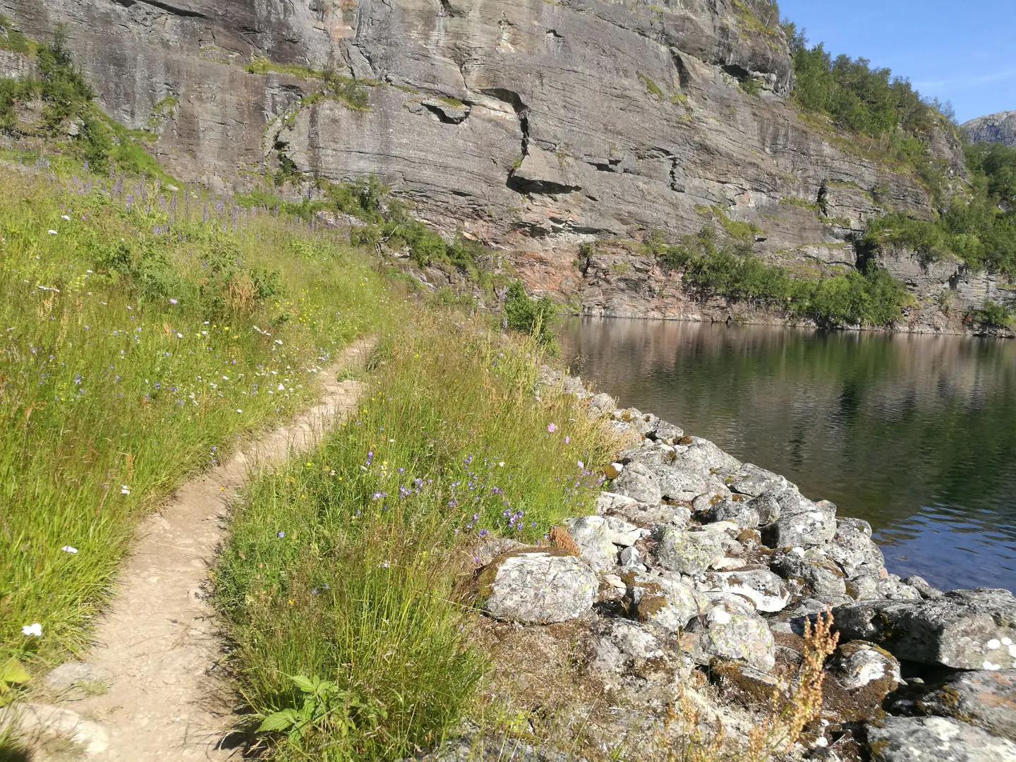
- Nesbøgalden (cliff-cut path): This dramatic section is blasted into the cliff face high above the gorge. It replaced the precarious old ladders once used by hikers and farmers.
- Aurlandselvi gorges (lower valley): The river cuts deep, steep-walled gorges through the lower valley, giving Aurlandsdalen its “Norway’s Grand Canyon” nickname.
- Old farms (Nesbø, Almen and Teigen): Abandoned hill farms line the route and show how people once lived and worked in this steep mountain valley.
- Wildflowers (rich valley flora): Around 500 flowering-plant species have been recorded in the valley, making the walk especially rewarding in the main summer season.
Challenges to expect
Do not treat Aurlandsdalen as an easy valley stroll. The route mixes broad gravel tracks with narrow rocky trail, slippery descents, rock-slab sections near the end and river crossings that may use chains or cables when water is high. Navigation is straightforward on red Norwegian Trekking Association “T” waymarks, but late snow, wet rock and high river levels can raise the difficulty. For a summit-focused Norwegian day, see Gaustatoppen Summit Trail.
HikeList Score
Aurlandsdalen Valley Trail scored 84/100 on HikeList's trail-quality metrics.
See score breakdownHide breakdown
- Ideal length 55
- Balanced challenge 100
- Scenery & wildness 98
- Varied terrain 83
- Accommodation 83
- Food & support 81
- Path quality 98
- Season flexibility 76
Computed from length, challenge, scenery & wildness, terrain variety, accommodation, food & support, path quality and season flexibility.
 Norway
Show more data Show less
- Mountainous
- Valley
- Gorge
- Rocky
- Gravel
- Rock Slabs
- Huts
- Lodges
- Hotels
- Pet Friendly
- Water Sources
- Campsites
- Shelters
Photos from hikers
Taken on the trail by people who've reviewed Aurlandsdalen Valley Trail.
Reviews
How would you rate Aurlandsdalen Valley Trail?
Tap a star to start your review — you could be the first.