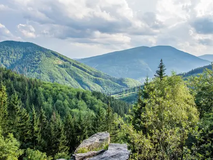
Mount Asama Trail
How would you rate Mount Asama Trail?
Tap a star to share your experience and help other hikers.
Mount Asama Trail: Day Hike to Mt. Maekake
HikeList Score
Mount Asama Trail scored 78/100 on HikeList's trail-quality metrics.
See score breakdownHide breakdown
- Ideal length 55
- Balanced challenge 74
- Scenery & wildness 88
- Varied terrain 100
- Accommodation 74
- Food & support 75
- Path quality 98
- Season flexibility 89
Computed from length, challenge, scenery & wildness, terrain variety, accommodation, food & support, path quality and season flexibility.
The Mount Asama Trail is a hard 13.5 km out-and-back day hike on the Nagano–Gunma border in central Honshu, Japan. Starting at Asama Sanso / Tengu Onsen, it climbs about 1,114 m to Mt. Maekake, the highest point hikers are permitted to reach. The active summit crater of Mt. Asama, Honshu’s most active volcano, is permanently off-limits, so this route suits fit hikers who want a serious volcanic mountain day with strict safety checks before departure.
Route Overview
Start and finish at Asama Sanso mountain lodge / Tengu Onsen, reached from Komoro. The route climbs through forest past Ichi-no-torii, with an optional Fudo-taki waterfall detour, then continues via Ni-no-torii and Kamoshika-daira towards Kazankan, the volcano observation hut and shelter about two hours in. Above this, the trail becomes open, loose and exposed, crossing scoria, ash and gravel towards emergency shelters near the rim. The turnaround is Mt. Maekake at 2,524 m, with views towards the closed crater. For a longer central Honshu mountain trip, compare the Kamikochi to Mount Yari Trail; for a very different Japanese walking journey, see the Kumano Kodo Nakahechi Route.
Mt. Asama: Eruptions and the Tenmei Disaster
Mt. Asama is one of Japan’s 100 Famous Mountains, but its history is dominated by volcanic hazard. The 1783 Tenmei eruption was a major three-month Plinian event; its climactic phase produced pumice falls and pyroclastic flows, created the Onioshidashi lava field, and killed an estimated 1,500+ people. Kanbara village was buried and became known as “Japan’s Pompeii”. Ash from the eruption also contributed to the Tenmei famine during the Edo period.
Notable highlights
- Active volcano up close: Mt. Asama is Honshu’s most active volcano and is closely monitored by the Japan Meteorological Agency. Steam and gas often vent from the summit crater, which is why hikers stop at Mt. Maekake rather than the true top.
- Mt. Maekake (2,524 m): This is the legal turnaround point and the highest place hikers are permitted to reach. It gives crater-rim views without entering the permanently closed summit area.
- Kazankan volcano observation hut: Reached roughly two hours from the trailhead, this shelter marks the transition towards more open volcanic ground. It is a useful reference point before the exposed upper mountain.
- Onioshidashi lava field: Formed by the 1783 Tenmei eruption on Asama’s northern slope, this frozen black lava landscape is a notable nearby geo-tourism site.
- Tengu Onsen: The iron-rich hot spring at Asama Sanso sits right by the trailhead, making it a practical post-hike stop after the long descent.
Challenges to expect
Expect a sustained 1,114 m climb, loose volcanic ash and cinder underfoot, and little shelter on the upper cone. Weather can change quickly near the crater rim, and the route is subject to closure under JMA eruption warning levels. Level 1 allows access to Maekake; Level 2 restricts entry within 2 km; Level 3 creates a 4 km exclusion zone. Check the current alert before setting out.
HikeList Score
Mount Asama Trail scored 78/100 on HikeList's trail-quality metrics.
See score breakdownHide breakdown
- Ideal length 55
- Balanced challenge 74
- Scenery & wildness 88
- Varied terrain 100
- Accommodation 74
- Food & support 75
- Path quality 98
- Season flexibility 89
Computed from length, challenge, scenery & wildness, terrain variety, accommodation, food & support, path quality and season flexibility.
 Japan
JapanShow more data Show less
- Volcanic
- Mountainous
- Forest
- Exposed
- Dirt
- Rocky
- Ash
- Gravel
- Cinder
- Lodges
- Hotels
- Pet Friendly
- Restrooms
- Campsites
- Shelters
In these collections
Photos from hikers
Taken on the trail by people who've reviewed Mount Asama Trail.
Reviews
How would you rate Mount Asama Trail?
Tap a star to start your review — you could be the first.