Dovrefjell-Sunndalsfjella Trail
How would you rate Dovrefjell-Sunndalsfjella Trail?
Tap a star to share your experience and help other hikers.
Dovrefjell-Sunndalsfjella Trail: Hut-to-Hut Across Norway’s High Fells
HikeList Score
Dovrefjell-Sunndalsfjella Trail scored 82/100 on HikeList's trail-quality metrics.
See score breakdownHide breakdown
- Ideal length 93
- Balanced challenge 80
- Scenery & wildness 98
- Varied terrain 83
- Accommodation 58
- Food & support 65
- Path quality 98
- Season flexibility 63
Computed from length, challenge, scenery & wildness, terrain variety, accommodation, food & support, path quality and season flexibility.
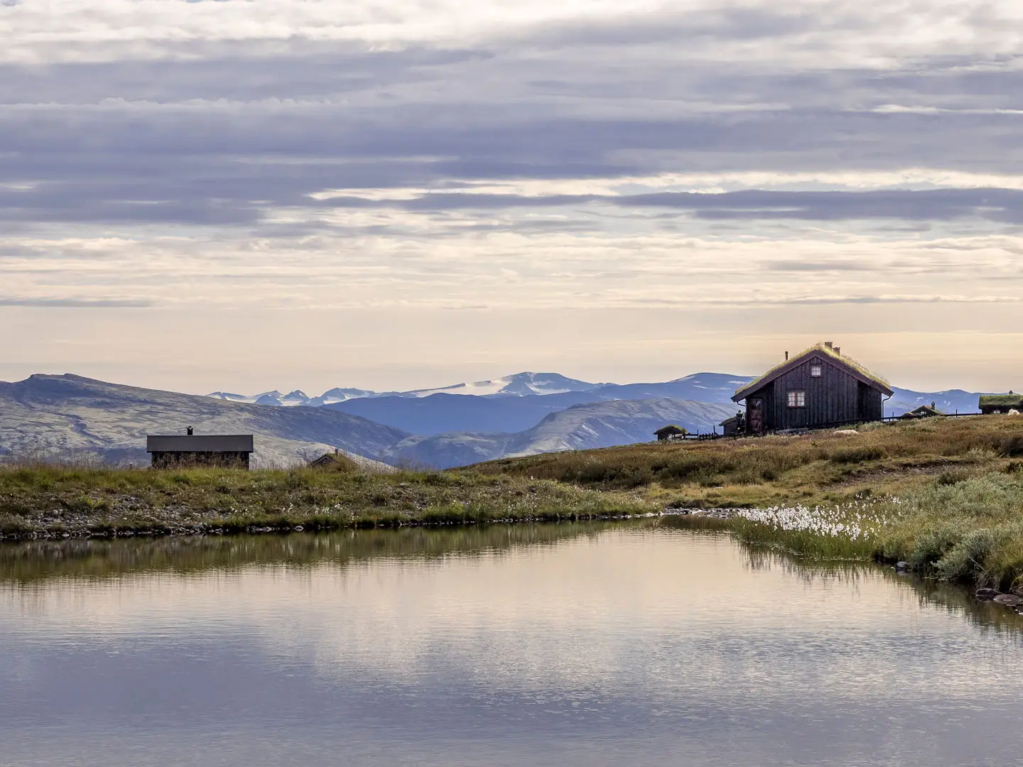
The Dovrefjell-Sunndalsfjella Trail is best understood as an approximately 80 km, 6-day, hard hut-to-hut traverse across Dovrefjell-Sunndalsfjella National Park in central Norway, not a single official signed trail. It follows the DNT network of red-T-marked and cairned summer routes between mountain cabins, usually from Kongsvold to Gjora via Reinheim, Snohetta, Amotdalshytta and Gammelseter. It suits experienced hikers comfortable with exposed plateau, rocky ground, river crossings, self-service huts and fast-changing Arctic-alpine weather.
Route Overview
The classic point-to-point line starts at Kongsvold / Kongsvoll Fjeldstue, beside the E6 and Kongsvoll station on the Oslo–Trondheim railway, and heads through Stroplsjodalen to Reinheim. From there, hikers continue over or past Snohetta (2,286 m), the park’s high point, towards Amotdalshytta, then on to Gammelseter and down to Gjora in Sunndalen. Hjerkinn is the main access hub, with a summer shuttle to Snoheim for Snohetta variants. For another Norwegian plateau journey, compare the Hardangervidda Traverse; for Jotunheimen summit hikes, see the Galdhopiggen Summit Trail and Glittertind Ascent.
Dovrefjell: Old Crossings, National Symbolism and DNT Cabins
Dovrefjell has long been a crossing between Oslo and Trondheim, used by travellers, kings and pilgrims bound for Nidaros; the St Olav Ways still cross the region. Snohetta was first climbed in 1798 and was once thought to be Norway’s highest mountain before Jotunheimen was properly mapped. In 1814, Norway’s constitutional oath pledged unity “until Dovre falls”. The modern protected area was enlarged in 2002 as Dovrefjell-Sunndalsfjella National Park, with DNT cabins making today’s traverse practical.
Notable highlights
- Snohetta (2,286 m): The roof of Dovrefjell and the highest mountain in Norway outside Jotunheimen. The ascent is strenuous but non-technical, with rock and scree near the summit.
- Muskoxen of Dovrefjell: Dovrefjell is the only place in Norway with wild muskoxen. They are a major draw on the open fells, but hikers should keep a very wide distance.
- Wild reindeer and Arctic fox: The park protects one of Europe’s last genuinely wild mountain reindeer herds and a reintroduced Arctic fox population, alongside wolverine, golden eagle and gyrfalcon.
- Reinheim mountain lodge: A DNT self-service cabin in Stroplsjodalen and a natural base for Snohetta, with marked routes to Kongsvoll, Snoheim and Amotdalshytta.
- Snoheim lodge and Hjerkinn shuttle: Snoheim sits below Snohetta and is reached in summer by shuttle bus from Hjerkinn, making it a popular base for the summit.
- Dovre’s national symbolism: The Dovre mountains are tied to Norwegian identity through the 1814 oath “til Dovre faller” and the Peer Gynt legend of the Mountain King.
Challenges to expect
Expect long mountain days, including stages over 20 km, with no facilities between DNT cabins. The route crosses exposed treeless plateau, rocky and boggy paths, scree near Snohetta, and occasional unbridged streams. Weather can change quickly, and outside summer the area becomes a serious snow-and-ice environment. Navigation is on DNT red-T marks and cairns, but map skills remain important. For a shorter but exposed Norwegian ridge day, compare Besseggen Ridge.
HikeList Score
Dovrefjell-Sunndalsfjella Trail scored 82/100 on HikeList's trail-quality metrics.
See score breakdownHide breakdown
- Ideal length 93
- Balanced challenge 80
- Scenery & wildness 98
- Varied terrain 83
- Accommodation 58
- Food & support 65
- Path quality 98
- Season flexibility 63
Computed from length, challenge, scenery & wildness, terrain variety, accommodation, food & support, path quality and season flexibility.
 Norway
Show more data Show less
- Mountain
- Plateau
- Valley
- Rock
- Dirt
- Gravel
- Huts
- Wild Camping Spots
- Pet Friendly
- Water Sources
- Campsites
- Shelters
Photos from hikers
Taken on the trail by people who've reviewed Dovrefjell-Sunndalsfjella Trail.
Reviews
How would you rate Dovrefjell-Sunndalsfjella Trail?
Tap a star to start your review — you could be the first.