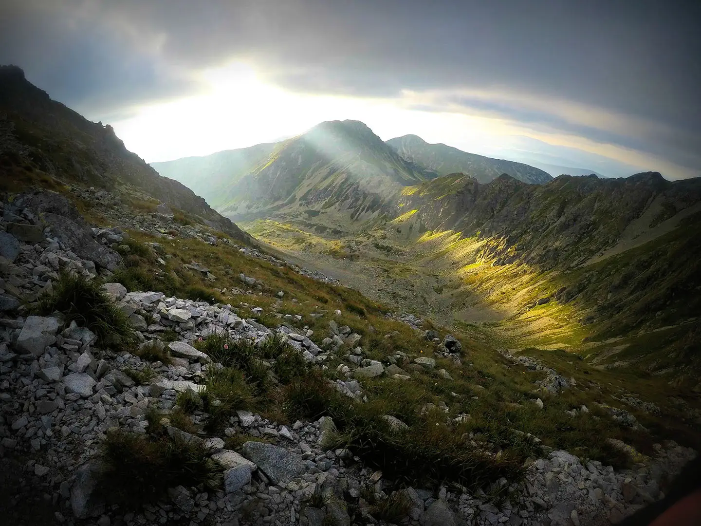
Baníkov Summit Trail
How would you rate Baníkov Summit Trail?
Tap a star to share your experience and help other hikers.
Baníkov Summit Trail: Roháče Ridge Day Hike
HikeList Score
Baníkov Summit Trail scored 73/100 on HikeList's trail-quality metrics.
See score breakdownHide breakdown
- Ideal length 55
- Balanced challenge 74
- Scenery & wildness 98
- Varied terrain 83
- Accommodation 49
- Food & support 65
- Path quality 98
- Season flexibility 76
Computed from length, challenge, scenery & wildness, terrain variety, accommodation, food & support, path quality and season flexibility.
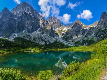
The Baníkov Summit Trail is a hard 11.5 km out-and-back day hike in the Western Tatras (Západné Tatry), inside Tatra National Park in Slovakia. It climbs from Žiarska dolina via Žiarska chata to Baníkov, the highest point of the Western Tatras’ main ridge and the Roháče subgroup at 2,178 m. Expect around 1,200 m of ascent, rocky upper terrain, scree, exposure and fixed chains. It suits fit, sure-footed hikers with a head for heights.
Route Overview
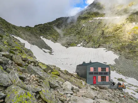
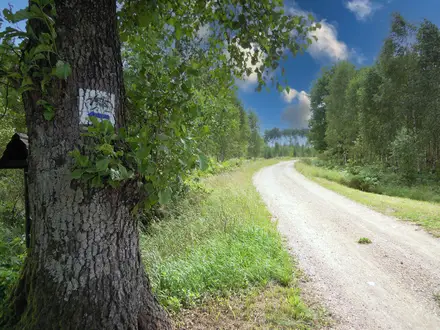
Start in Žiarska dolina and follow the approach towards Žiarska chata, the key hut and staging point at about 1,300 m. From there the route continues towards the Žiarske sedlo / saddle area and Baníkovské sedlo before the final rocky crest to Baníkov. The listed trail is an out-and-back: return by the same line to the Žiarska valley trailhead. Allow a long single day; the direct ascent from Žiarska chata is about 2.5 hours, with the full valley round trip typically around 6–8 hours depending on start point and pace. Parking fees apply at the Žiarska dolina car park.
Name and mining history
Baníkov’s name comes from baník, the Slovak word for “miner”; the Polish name is Banówka. Around the 18th century, the slopes were prospected for iron ore, but the attempts found nothing of value. That short mining episode is the main historical thread attached to the mountain, and it gives useful context to the name without changing the character of the walk: this is now a protected high-Tatra ridge route within Tatra National Park.
Notable highlights
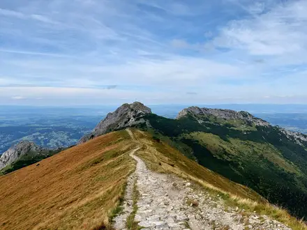
- Baníkov summit (2,178 m): The narrow top gives a near-360° view across the Orava, Liptov and Tatra landscapes, with steep drops on several sides.
- Chain-secured upper ridge: The final crest has airy rock steps, notches and smooth slabs. Fixed chains protect the trickiest passages, but the ground remains exposed.
- Žiarska chata: This mountain hut at about 1,300 m is the classic rest and refuelling point before the steeper climb towards the ridge.
- Highest point of the main ridge: Baníkov is the highest point on the main ridge of the Western Tatras and the highest summit of the Roháče group, though not the overall highest summit of the Western Tatras.
- Roháče ridge setting: Nearby summits such as Hrubá kopa, Tri kopy and Príslop lie on the longer ridge loop, which is a harder variant rather than the listed out-and-back.
Challenges to expect
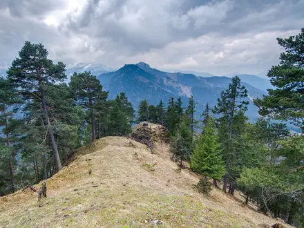
This is a demanding alpine day, not a casual hut walk. Expect around 1,200 m of ascent, forest and dwarf-pine lower sections, then scree, rocky steps and an exposed granite crest. Fixed chains help on the hardest passages, but poor weather can make the ridge serious. For other Slovak summit objectives, compare the Kriváň Summit Trail or the Ďumbier Summit Trail; for a longer traverse, see the Low Tatras Ridge Trail.
HikeList Score
Baníkov Summit Trail scored 73/100 on HikeList's trail-quality metrics.
See score breakdownHide breakdown
- Ideal length 55
- Balanced challenge 74
- Scenery & wildness 98
- Varied terrain 83
- Accommodation 49
- Food & support 65
- Path quality 98
- Season flexibility 76
Computed from length, challenge, scenery & wildness, terrain variety, accommodation, food & support, path quality and season flexibility.
 Slovakia
Show more data Show less
- Mountainous
- Forest
- Alpine
- Dirt
- Rocky
- Scree
- Huts
- Pet Friendly
- Water Sources
- Campsites
- Shelters
In these collections
Photos from hikers
Taken on the trail by people who've reviewed Baníkov Summit Trail.
Reviews
How would you rate Baníkov Summit Trail?
Tap a star to start your review — you could be the first.