Low Tatras Ridge Trail
How would you rate Low Tatras Ridge Trail?
Tap a star to share your experience and help other hikers.
Low Tatras Ridge Trail: Slovakia’s High Ridge Traverse
HikeList Score
Low Tatras Ridge Trail scored 77/100 on HikeList's trail-quality metrics.
See score breakdownHide breakdown
- Ideal length 81
- Balanced challenge 80
- Scenery & wildness 78
- Varied terrain 94
- Accommodation 58
- Food & support 65
- Path quality 98
- Season flexibility 63
Computed from length, challenge, scenery & wildness, terrain variety, accommodation, food & support, path quality and season flexibility.
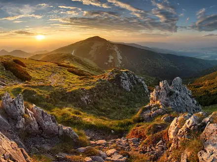
The Low Tatras Ridge Trail is a roughly 95 km point-to-point traverse of the Nízke Tatry in central Slovakia, usually walked in 4–5 hard days. It follows the red-marked main ridge through Low Tatras National Park, sharing the route with the Cesta hrdinov SNP and European long-distance path E8. Expect long exposed days, about 5,500 m of ascent, hut and shelter nights, and sustained mountain terrain above the treeline. It suits fit hikers with multi-day mountain experience.
Route Overview
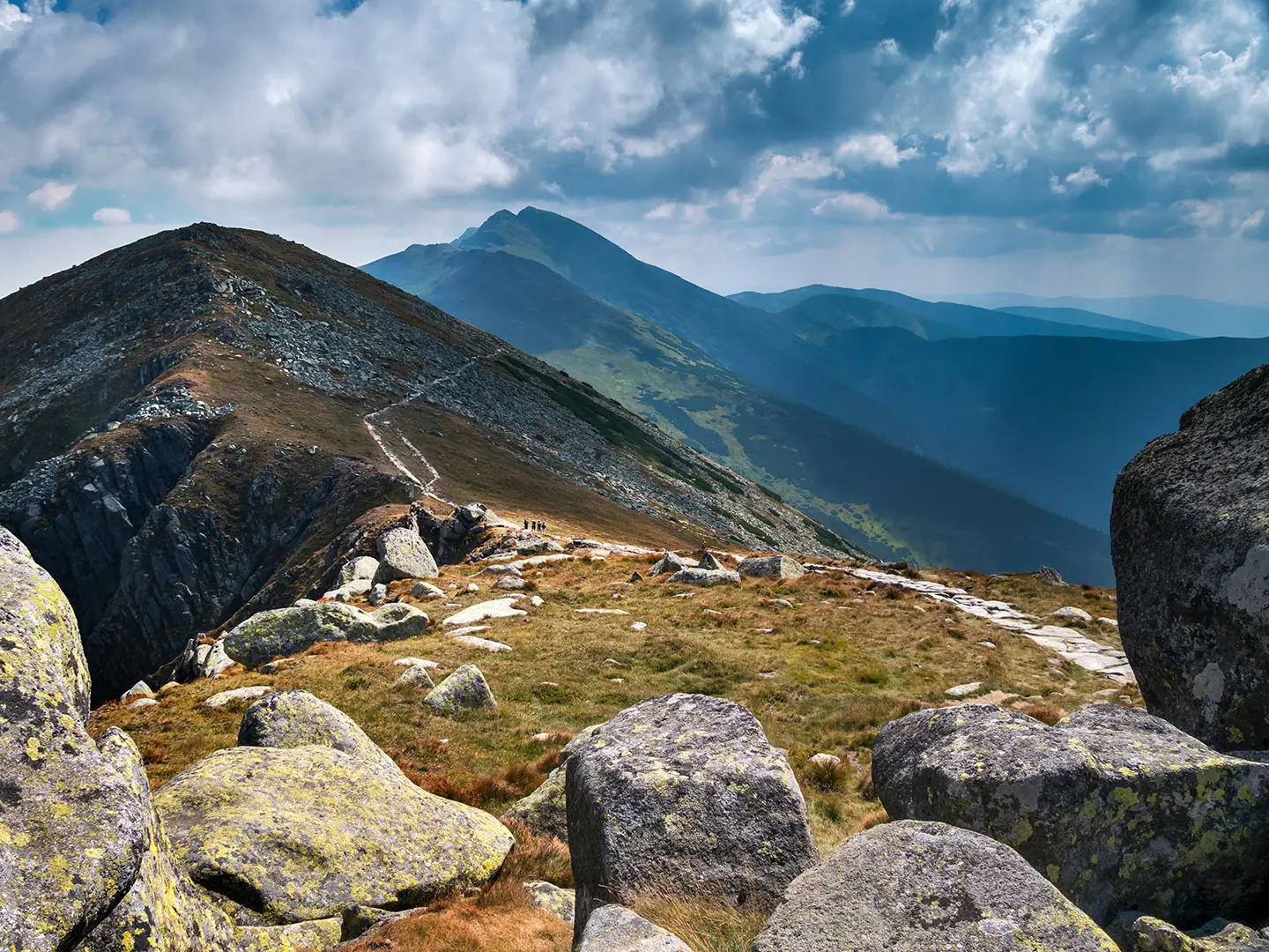
The traverse runs between Telgárt in the east and Donovaly in the west, and can be walked either way. From Donovaly the ridge passes Kečka, Kozí chrbát, Hiadeľské sedlo, Veľká Chochuľa, Ďurková, Chabenec, Dereše, Chopok, Ďumbier, Chata gen. M. R. Štefánika, Čertovica, Andrejcová and Kráľova hoľa before descending to Telgárt. The route is point-to-point, so plan your onward travel before starting. Čertovica pass has road access and accommodation, while Chopok can be reached by the paid cable car from Jasná. For the full Slovak red trail, see the Cesta Hrdinov SNP; for a shorter objective on the same massif, compare the Ďumbier Summit Trail.
Cesta hrdinov SNP and the protected Low Tatras
The ridge is followed by the Cesta hrdinov SNP, a 772 km red-marked long-distance trail inaugurated in 1956 from Dukla Pass to Devín Castle. It commemorates the 1944 Slovak National Uprising and also forms part of the European E8 path. The route crosses Low Tatras National Park, protected in 1978. The Ďumbier massif also has a mining past, with medieval workings for gold, iron and antimony.
Notable highlights
Ďumbier (2,043 m): The highest summit of the Low Tatras and the high point of the traverse, roughly midway along the ridge. From here hikers get wide views across the Hron valley, Liptov and towards the High Tatras.
Chopok (2,024 m) and the Jasná saddle: The range’s third-highest peak and the most accessible point on the ridge, thanks to the cable car from Jasná on the north side. It is a practical place to join or leave the route.
Kráľova hoľa (1,946 m): A rounded eastern summit above Telgárt, marked by a tall transmitter mast. It is well known in Slovak folk tradition and forms a dramatic end or start to the traverse.
Čertovica pass (~1,232 m): The highest paved mountain pass in Slovakia and the main break in the ridge. Its road access and accommodation make it the key resupply, rest or bail-out point.
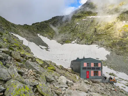
Chata generála M. R. Štefánika: A classic staffed high mountain hut below Ďumbier at about 1,740 m. It is one of the most important overnight stops on the central ridge.
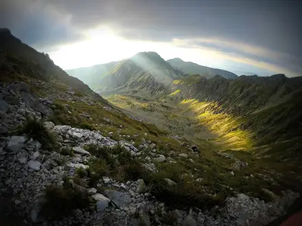
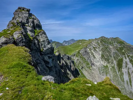
Open hoľa ridge walking: Much of the route stays above the treeline on broad grassy summits, with rockier sections around Ďumbier and Chopok. The reward is long, continuous skyline walking with few major interruptions.
Challenges to expect
This is a hard mountain traverse, not a casual hut walk. Daily stages can be long, with sustained ascent, exposed grassy ridges, rocky sections near Ďumbier and Chopok, and few shelters between huts. Weather can change very quickly, with storms a serious risk on the open ridge. Water is limited away from huts and known springs, so carry enough between reliable refill points.
HikeList Score
Low Tatras Ridge Trail scored 77/100 on HikeList's trail-quality metrics.
See score breakdownHide breakdown
- Ideal length 81
- Balanced challenge 80
- Scenery & wildness 78
- Varied terrain 94
- Accommodation 58
- Food & support 65
- Path quality 98
- Season flexibility 63
Computed from length, challenge, scenery & wildness, terrain variety, accommodation, food & support, path quality and season flexibility.
Show more data Show less
- Mountain
- Alpine Meadow
- Rocky Ridge
- Forest
- Dirt
- Rock
- Grass
- Mountain Huts
- Shelters
- Pet Friendly
- Water Sources
- Campsites
- Shelters
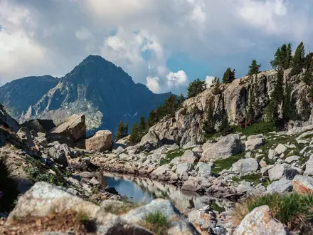
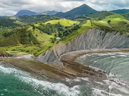
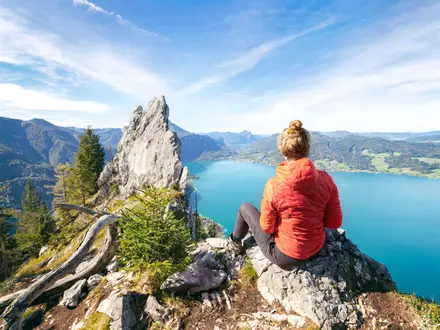
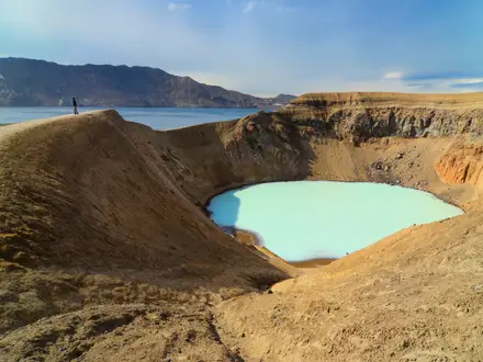
Photos from hikers
Taken on the trail by people who've reviewed Low Tatras Ridge Trail.
Reviews
How would you rate Low Tatras Ridge Trail?
Tap a star to start your review — you could be the first.