Lac Blanc Circuit
How would you rate Lac Blanc Circuit?
Tap a star to share your experience and help other hikers.
Lac Blanc Circuit: Chamonix’s Classic Alpine Lake Loop
HikeList Score
Lac Blanc Circuit scored 72/100 on HikeList's trail-quality metrics.
See score breakdownHide breakdown
- Ideal length 55
- Balanced challenge 74
- Scenery & wildness 98
- Varied terrain 64
- Accommodation 49
- Food & support 65
- Path quality 98
- Season flexibility 76
Computed from length, challenge, scenery & wildness, terrain variety, accommodation, food & support, path quality and season flexibility.
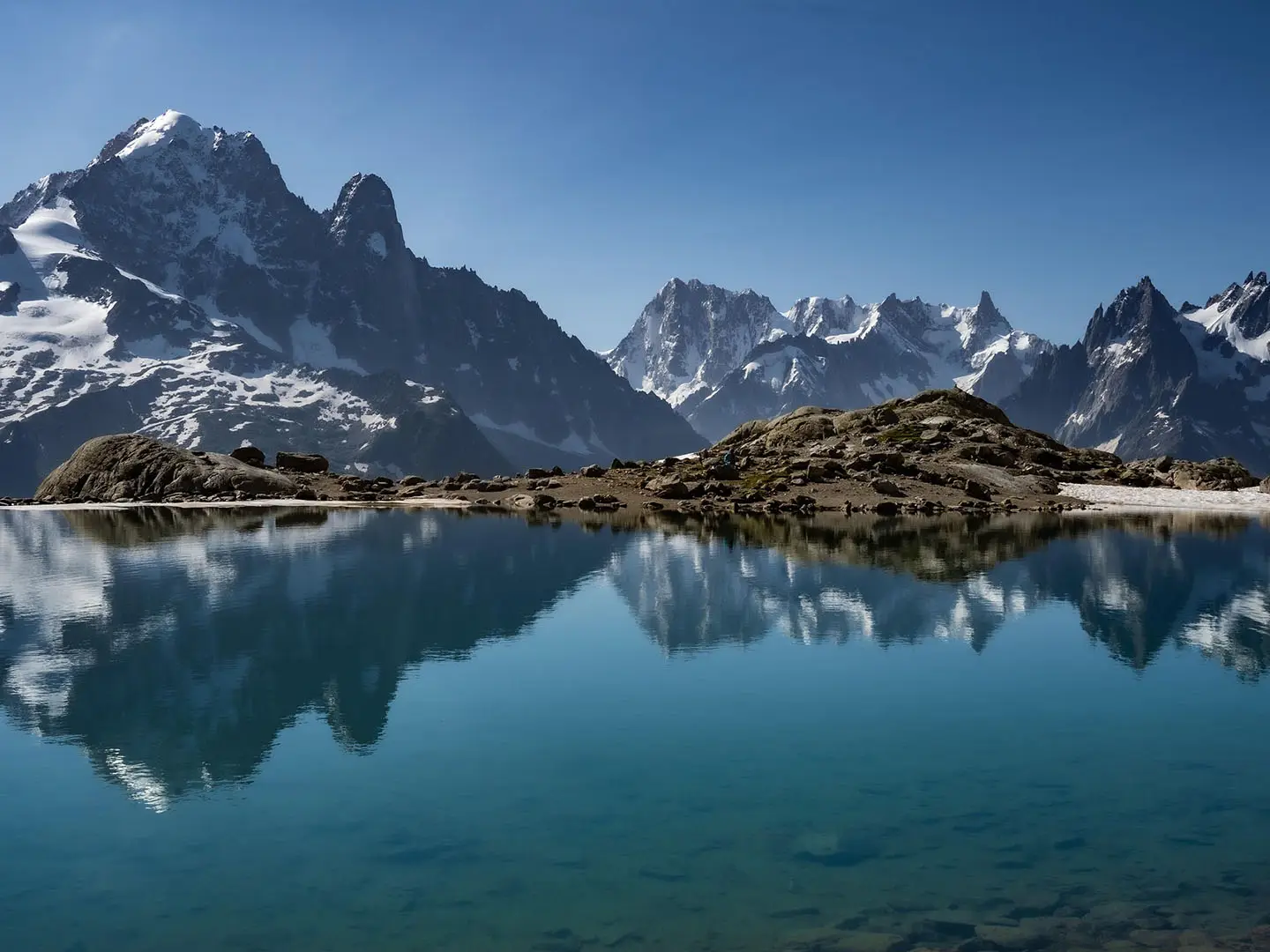
The Lac Blanc Circuit is a 12 km hard alpine day hike in the Aiguilles Rouges National Nature Reserve above Chamonix-Mont-Blanc, Haute-Savoie, France. Usually walked as a loop from Tré-le-Champ or Col des Montets, it climbs about 1,000 m to Lac Blanc at 2,352 m, with rocky paths, fixed ladders, the Lacs des Chéserys and Mont Blanc massif views. It suits fit, sure-footed hikers comfortable with exposure; the La Flégère lift variant is shorter and easier.
Route Overview
The standard circuit starts at the Tré-le-Champ car park, or nearby Col des Montets, between Argentière and Vallorcine. The usual line climbs past the fixed ladders below the Aiguillette d’Argentière to the Lacs des Chéserys, then reaches Lac Blanc and the Refuge du Lac Blanc before returning along the Grand Balcon Sud. It is a loop, though out-and-back options exist. Lift-assisted walkers can start from the top of the La Flégère gondola above Les Praz de Chamonix. For other French mountain walking ideas, compare the Cirque de Gavarnie Trails or the longer Chartreuse Trail (GR9 Segment).
Lac Blanc, the Refuge and the Aiguilles Rouges Reserve
Lac Blanc became a walkers’ destination in the early 20th century as Chamonix grew as a mountaineering centre. In 1939, local guide and carpenter Louis Mouchet opened a refreshment shelter at the lake. A storm in November 1943 killed a Jeunesse et Montagne group there. The original refuge was destroyed by an avalanche in January 1986 and rebuilt nearby in 1991. The Aiguilles Rouges National Nature Reserve was created by ministerial decree on 23 August 1974; the lake is now also a highlight of the final Tour du Mont Blanc stage.
Notable highlights
- Lac Blanc (2,352 m): The glacial lake that gives the hike its name, with two basins and direct views across to the Mont Blanc massif.
- Refuge du Lac Blanc: A staffed stone-and-timber hut beside the lake, serving drinks, meals and beds; booking is essential for overnight stays.
- Ladders below the Aiguillette d’Argentière: Fixed metal ladders, rungs and railings take the Tré-le-Champ ascent through steep rock. They are secure but exposed.
- Lacs des Chéserys: Smaller alpine tarns on the approach, often used as a foreground for views towards the Aiguille Verte, Les Drus and Mont Blanc.
- Mont Blanc massif panorama: The balcony path looks across the valley to Mont Blanc, the Aiguille du Midi, the Mer de Glace, the Aiguille Verte and Les Drus.
- Aiguilles Rouges National Nature Reserve: A protected alpine reserve where ibex, chamois and marmots are regularly seen among the high-mountain flora.
Challenges to expect
Expect a hard day: about 1,000 m of ascent, rocky alpine paths, scree, slabs, wooden steps, metal handrails and exposed fixed ladders. Snow can linger near Lac Blanc into June, and the safe season is snow-dependent. Facilities are limited to the Refuge du Lac Blanc, so carry food and water. Dogs are banned, and swimming or boating is prohibited in Lac Blanc and the Lacs des Chéserys. For gentler terrain, see the Ballons des Vosges Park Trails.
HikeList Score
Lac Blanc Circuit scored 72/100 on HikeList's trail-quality metrics.
See score breakdownHide breakdown
- Ideal length 55
- Balanced challenge 74
- Scenery & wildness 98
- Varied terrain 64
- Accommodation 49
- Food & support 65
- Path quality 98
- Season flexibility 76
Computed from length, challenge, scenery & wildness, terrain variety, accommodation, food & support, path quality and season flexibility.
 France
Show more data Show less
- Mountainous
- Forest
- Dirt
- Rocky
- Huts
- Restrooms
- Water Sources
- Shelters
In these collections
Photos from hikers
Taken on the trail by people who've reviewed Lac Blanc Circuit.
Reviews
How would you rate Lac Blanc Circuit?
Tap a star to start your review — you could be the first.