Tatranská Magistrála (Tatra Highway)
How would you rate Tatranská Magistrála (Tatra Highway)?
Tap a star to share your experience and help other hikers.
Tatranská Magistrála: Slovak Tatras Hut-to-Hut Traverse
HikeList Score
Tatranská Magistrála (Tatra Highway) scored 83/100 on HikeList's trail-quality metrics.
See score breakdownHide breakdown
- Ideal length 78
- Balanced challenge 80
- Scenery & wildness 98
- Varied terrain 83
- Accommodation 66
- Food & support 81
- Path quality 98
- Season flexibility 76
Computed from length, challenge, scenery & wildness, terrain variety, accommodation, food & support, path quality and season flexibility.
The Tatranská Magistrála, or Tatra Highway, is the classic long-distance hike across the Slovak Tatras: a red-waymarked, point-to-point traverse of the southern Western and High Tatras. The full route is about 72 km, usually walked in 4 days, with roughly 3,400 m of ascent and a hard difficulty rating. It suits fit hikers who want a hut-to-hut mountain route in Slovakia, with rocky traverses, tarns, forests and big High Tatras views, but without roped or via-ferrata sections on the main line.
Route Overview
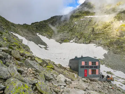
The trail runs west to east from the Tokáriny junction above Jalovecká dolina, near Jalovec and Liptovský Mikuláš, to Veľké Biele pleso below Kopské sedlo. Many hikers shorten the western approach and start at Podbanské or Tri Studničky, both noted for public transport access. From there the red-marked route passes Štrbské Pleso, Popradské pleso, Sliezsky dom, Hrebienok and Starý Smokovec, then continues via Zamkovského chata, Rainerova chata, Skalnaté pleso, Veľká Svišťovka and Chata pri Zelenom plese. It is a linear traverse, not a loop. If you want other Slovak mountain objectives, compare the Kriváň Summit Trail or the longer Low Tatras Ridge Trail.
History of the Tatranská Magistrála
The idea of a continuous Tatra trunk trail was first published by Hugo Jeltsch in 1903 in the yearbook of the Hungarian Carpathian Association. Petr Karel revived the plan in 1923, proposing to link existing paths into one route. The Club of Czechoslovak Tourists built the unified trail between 1931 and 1937, using its own funds and a state subsidy. The route has changed over time, most notably when the Belianske Tatry ridge was closed for conservation in 1978, shortening the trail by about 19 km.
Notable highlights
- Štrbské Pleso: A glacial lake at about 1,346 m and Slovakia’s best-known mountain resort. It is a major waypoint and trailhead on the southern High Tatras section.
- Popradské pleso: A tarn ringed by peaks, with a lakeside chalet just below the magistrála. It is a useful rest stop on the western High Tatras stretch.
- Studený potok waterfalls and Hrebienok: The route passes close to the cascades of Studený potok near Hrebienok, the upper station of the Starý Smokovec funicular. Bilíkova, Zamkovského and Rainerova chalets are all in this area.
- Skalnaté pleso and Veľká Svišťovka: Skalnaté pleso sits beneath Lomnický štít and is linked by cable car from Tatranská Lomnica. The trail then crosses Veľká Svišťovka, around 2,038 m and the practical high point of the traverse.
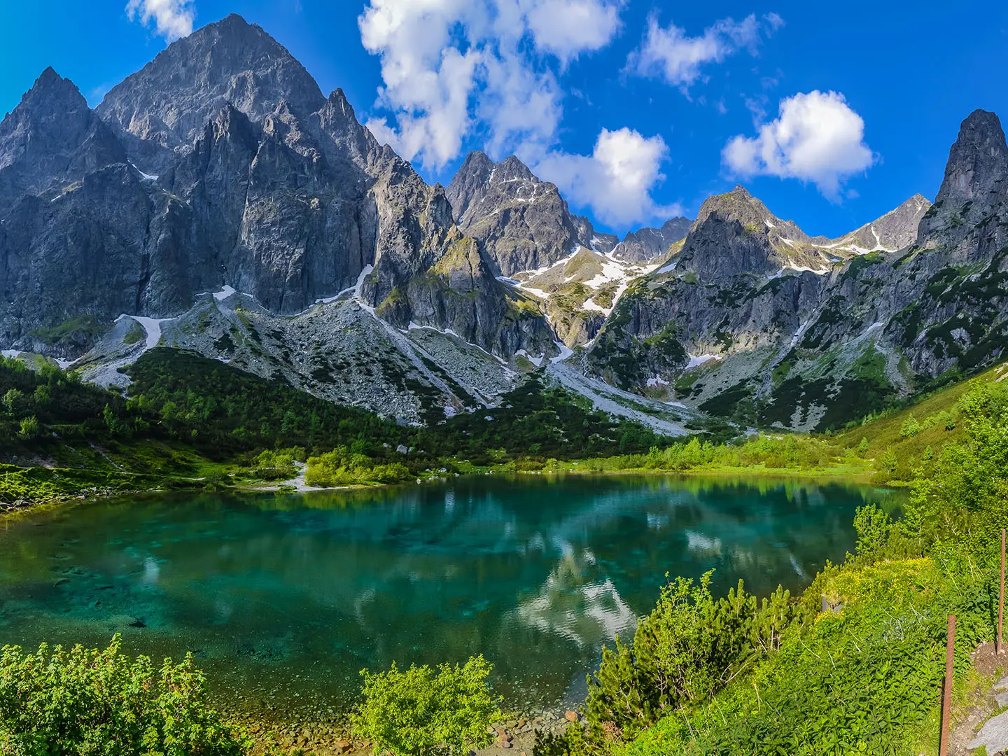
- Zelené pleso: An emerald tarn below Jastrabia veža and Kolový štít, with Chata pri Zelenom plese on the eastern section.
- Veľké Biele pleso: The Great White Tarn below Kopské sedlo, and the traditional eastern terminus of the Tatranská Magistrála.
Challenges to expect
Expect long mountain days on stone-paved traverses, rocky boulder-field sections and exposed eastern slopes where surefootedness matters. The route is well waymarked with red tourist marks and Slovak signposts, but weather can make navigation and footing harder above the treeline. Wild camping and open fires are banned in TANAP, so plan hut or resort nights. For tougher summit days nearby, see the Baníkov Summit Trail or Ďumbier Summit Trail.
HikeList Score
Tatranská Magistrála (Tatra Highway) scored 83/100 on HikeList's trail-quality metrics.
See score breakdownHide breakdown
- Ideal length 78
- Balanced challenge 80
- Scenery & wildness 98
- Varied terrain 83
- Accommodation 66
- Food & support 81
- Path quality 98
- Season flexibility 76
Computed from length, challenge, scenery & wildness, terrain variety, accommodation, food & support, path quality and season flexibility.
 Slovakia
Show more data Show less
- Mountain
- Alpine
- Forest
- Rocky
- Dirt
- Gravel
- Huts
- Hotels
- Family Friendly
- Pet Friendly
- Restrooms
- Water Sources
- Shelters
In these collections
Photos from hikers
Taken on the trail by people who've reviewed Tatranská Magistrála (Tatra Highway).
Begin your trek at Podbanské, following well-marked forest trails that gradually ascend through the western Tatras. This section offers a gentle introduction to the terrain, winding beneath spruce trees and across mountain streams before reaching the well-known lakeside resort of Štrbské Pleso. The route is mostly sheltered by forest canopy, with occasional clearings giving early glimpses of the high peaks ahead. Štrbské Pleso’s amenities, including lodges and restaurants, make it an ideal endpoint for the first day.
From Štrbské Pleso, the trail heads east and quickly climbs toward Popradské Pleso, another scenic mountain lake. From here, you’ll tackle the climb up a series of switchbacks to Sedlo pod Ostrvou, the highest point of the Magistrála, offering breathtaking views of the Tatras. Descend into the Velická Valley on rocky paths, passing alpine tarns, wildflower meadows, and potential wildlife sightings before arriving at the mountain hotel of Sliezsky Dom on the shores of Velické Pleso.
Departing Sliezsky Dom, you skirt the upper mountain valleys along undulating rocky terrain. The trail passes several photogenic waterfalls, including the renowned Studenovodské vodopády, before leading on to the forest-fringed rest stop of Hrebienok. Continue past Zamkovského Chata, a traditional mountain hut, and traverse open mountainside paths that occasionally dip into forest before reaching the exposed slopes of Skalnaté Pleso, known for its observatory and panoramic views.
The final section continues east from Skalnaté Pleso along rolling alpine trails. You will enjoy sweeping vistas and pass through high meadows and forested stretches before reaching Veľké Biele Pleso, a peaceful mountain tarn. From here, you may descend toward Tatranská Kotlina or press onward through mountain forests and meadows to the village of Ždiar, marking the end of the Tatranská Magistrála.
Reviews
How would you rate Tatranská Magistrála (Tatra Highway)?
Tap a star to start your review — you could be the first.