Demänovská Valley Circuit
How would you rate Demänovská Valley Circuit?
Tap a star to share your experience and help other hikers.
Demänovská Valley Circuit: Low Tatras Ridge Day Hike
HikeList Score
Demänovská Valley Circuit scored 77/100 on HikeList's trail-quality metrics.
See score breakdownHide breakdown
- Ideal length 55
- Balanced challenge 80
- Scenery & wildness 85
- Varied terrain 83
- Accommodation 66
- Food & support 88
- Path quality 98
- Season flexibility 76
Computed from length, challenge, scenery & wildness, terrain variety, accommodation, food & support, path quality and season flexibility.
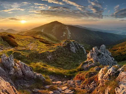
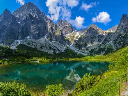
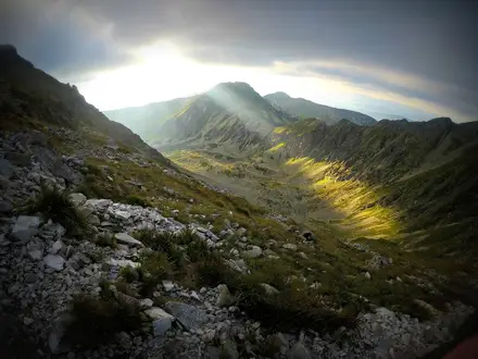
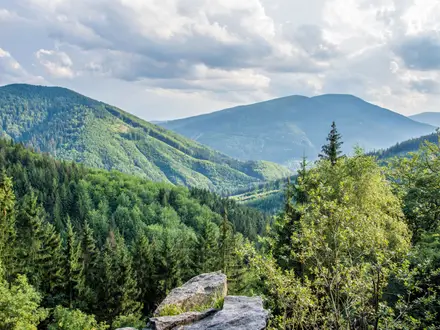
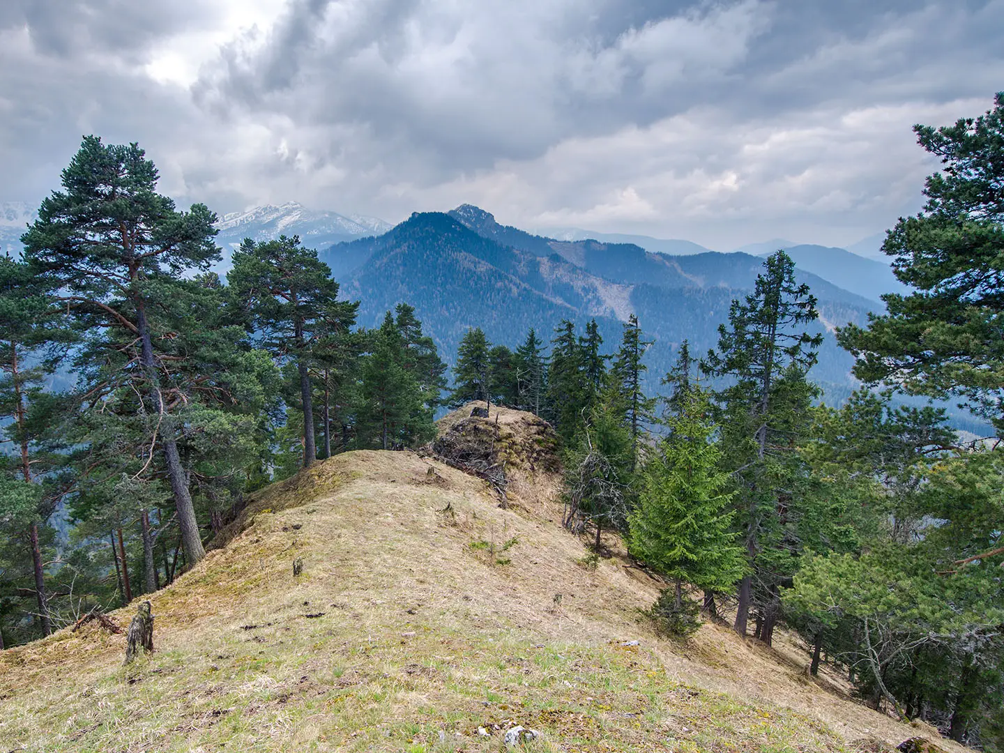
The Demänovská Valley Circuit is a 15 km, one-day loop in Demänovská dolina, near Jasná in Slovakia’s Low Tatras National Park. It climbs from the forested valley onto the exposed Dereše–Chopok ridge and returns on waymarked KST trails. With roughly 1,000 m of ascent, rocky ridge terrain and fast-changing mountain weather, this is a hard day hike for fit, sure-footed walkers. For more Slovak hiking ideas, see our Slovakia hiking guide.
Route Overview
Most valley-side versions start and finish at car parks in Demänovská dolina, typically around Jasná/Záhradky or the Demänovská caves. The loop climbs out of the valley on yellow, blue or green connecting trails, then joins the red-waymarked Low Tatras ridge around Dereše, Chopok and Lúková before descending back towards the valley. Expect forest tracks low down, dwarf-pine belts higher up, then open alpine ridge walking with views across the Nízke Tatry. Jasná chairlifts can shorten the climb, but they are paid attractions and should not be relied on as part of the walking route. The ridge section overlaps the line of the Low Tatras Ridge Trail and the historic Cesta Hrdinov SNP.
Demänovská Valley history
Demänovská dolina has been settled since prehistoric times, and ore was mined here around the turn of the 18th–19th centuries. Its wider fame grew through the Demänovská cave system, especially after the Demänovská Cave of Liberty was discovered in 1921 and the access road was built. Tourism accelerated when the first chairlift to Chopok opened in 1936, making the valley the main northern gateway to the Low Tatras. The ridge crossed by the circuit is also followed by the Cesta hrdinov SNP, the long red route along the Slovak mountain spine.
Notable highlights
- Chopok (2,024 m): The signature summit above Jasná and a major Low Tatras viewpoint. A chairlift reaches near the top, so expect more people here than on quieter ridge sections.
- Dereše (2,003 m): The rounded ridge peak most shorter loops crest, just south-west of Chopok. It gives broad views over Demänovská dolina and the surrounding Nízke Tatry.
- Ďumbier (2,043 m): The highest peak of the Low Tatras, reached only on longer variants beyond the standard valley circuit. If that is your aim, compare this route with the Ďumbier Summit Trail.
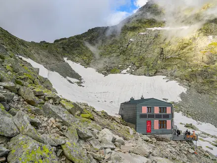
- Demänovská Cave of Liberty: A major show cave in the lower valley, known for sinter formations, underground lakes and the Demänovka river system. It is a paid attraction, separate from the hike.
- Demänovská Ice Cave: Another well-known show cave in the same cave system, with permanent ice formations. It sits near the lower valley trailheads.
- Jasná resort and Demänovská dolina: Jasná is the main resort hub below Chopok, while the 15 km valley is the busiest in the Low Tatras. Its lifts, car parks and waymarked trails make this high ridge accessible as a long day walk.
Challenges to expect
The main difficulty is the sustained climb from the valley to the Dereše–Chopok ridge, with around 1,000 m of ascent in a single day. The upper route is open, rocky and exposed, with strong wind possible around Chopok. Snow can linger outside the main summer–autumn window. Waymarking is good, but several loop variants exist, so carry a map or offline GPX and check which descent you are taking.
HikeList Score
Demänovská Valley Circuit scored 77/100 on HikeList's trail-quality metrics.
See score breakdownHide breakdown
- Ideal length 55
- Balanced challenge 80
- Scenery & wildness 85
- Varied terrain 83
- Accommodation 66
- Food & support 88
- Path quality 98
- Season flexibility 76
Computed from length, challenge, scenery & wildness, terrain variety, accommodation, food & support, path quality and season flexibility.
Show more data Show less
- Mountain
- Forest
- Alpine Ridge
- Dirt
- Rock
- Gravel
- Hotels
- Mountain Huts
- Family Friendly
- Pet Friendly
- Restrooms
- Water Sources
- Campsites
- Shelters
- Picnic Areas
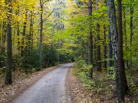
Photos from hikers
Taken on the trail by people who've reviewed Demänovská Valley Circuit.
Reviews
How would you rate Demänovská Valley Circuit?
Tap a star to start your review — you could be the first.