Saltergate Circuit
How would you rate Saltergate Circuit?
Tap a star to share your experience and help other hikers.
Saltergate Circuit: Hole of Horcum Circular Walk
HikeList Score
Saltergate Circuit scored 75/100 on HikeList's trail-quality metrics.
See score breakdownHide breakdown
- Ideal length 55
- Balanced challenge 100
- Scenery & wildness 98
- Varied terrain 83
- Accommodation 45
- Food & support 45
- Path quality 98
- Season flexibility 89
Computed from length, challenge, scenery & wildness, terrain variety, accommodation, food & support, path quality and season flexibility.
The Saltergate Circuit is an 11.5 km moderate loop in the North York Moors National Park, North Yorkshire, England. The route is better known as the Hole of Horcum Circular or Levisham Moor & Hole of Horcum walk; “Saltergate Circuit” is not an official trail name. It suits hikers wanting a half-day moorland walk with big views, archaeological interest and a few short steep pulls, starting from the Saltergate car park on the A169 between Pickering and Whitby.
Route Overview
Start and finish at the North York Moors National Park pay-and-display car park at Saltergate, beside the A169 on Saltergate Brow. The loop drops from the moor rim, crosses Levisham Moor on established paths and the Tabular Hills Walk, passes Dundale Pond and can be extended by a short detour to Skelton Tower. It then reaches Levisham village before descending by Levisham Beck into the valley and crossing the floor of the Hole of Horcum via Low Horcum and Horcum Slack. A short climb returns to Saltergate. For longer linear walking in the region, compare The Cinder Track, The Wainwright Coast to Coast and Minster Way.
History and Landscape
This walk crosses one of the North York Moors’ richest archaeological landscapes. Levisham Moor carries traces of long human use, including Bronze Age round barrows, Iron Age boundary dykes and field systems, and a medieval monastic sheep farm at Dundale. The Hole of Horcum has a giant Wade legend attached to it, but its real formation is spring-sapping erosion. “Saltergate” recalls the old salt packhorse route across the moors, while Skelton Tower is a ruined shooting lodge built by a local rector above Newtondale.
Notable highlights
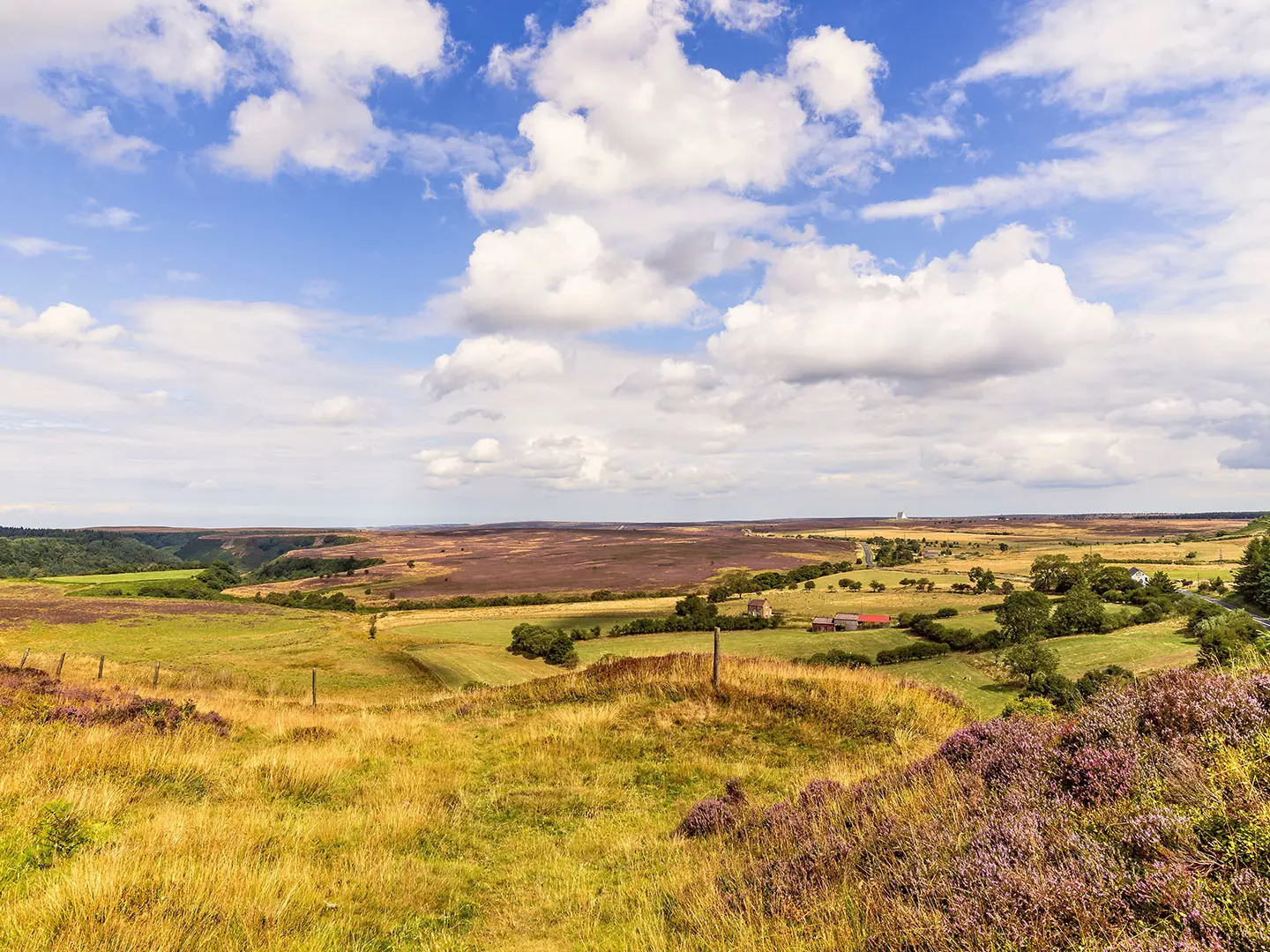
- Hole of Horcum (natural amphitheatre): The centrepiece of the walk, about 400 ft / 120 m deep and roughly three-quarters of a mile / 1.2 km across. Its wide grassy bowl was formed by spring-sapping erosion, not the local giant legend.
- Levisham Moor (ancient moorland): Around two miles of open heather moorland, with Bronze Age round barrows, Iron Age boundary dykes and Dundale Rigg. In late summer the heather is a major draw.
- Skelton Tower (optional detour): A ruined folly and former shooting lodge on the edge of the moor, built around 1830 by the Reverend Robert Skelton. It looks over Newtondale and the North Yorkshire Moors Railway.
- Dundale Pond (moorland landmark): A small pond near the head of Dundale Griff, linked to a medieval monastic sheep farm. It is also a useful navigation point where moor paths meet.
- Levisham village (refreshment stop): A quiet stone-built village with a green and a pub, reached on the lower part of the loop.
- Saltergate Brow (start and viewpoint): The car park starts high on the moor rim, giving an immediate view over the Hole of Horcum before the route descends.
Challenges to expect
Expect no technical ground, but the route is still moderate. The main effort is the descent into the Hole of Horcum and the short climb back to Saltergate, plus exposed moorland walking on Levisham Moor. Paths can be boggy and wet after rain, especially on the floor and sloping sections of the Hole. Waymarking exists at key junctions, but mist or fog can make the open moor harder to navigate. There are no toilets, water or facilities on the route.
HikeList Score
Saltergate Circuit scored 75/100 on HikeList's trail-quality metrics.
See score breakdownHide breakdown
- Ideal length 55
- Balanced challenge 100
- Scenery & wildness 98
- Varied terrain 83
- Accommodation 45
- Food & support 45
- Path quality 98
- Season flexibility 89
Computed from length, challenge, scenery & wildness, terrain variety, accommodation, food & support, path quality and season flexibility.
 United Kingdom
 England
Show more data Show less
- Moorland
- Forest
- River Valley
- Dirt
- Rocky
- Grass
- Accommodation Not Required
- Family Friendly
- Pet Friendly
- Picnic Areas
Photos from hikers
Taken on the trail by people who've reviewed Saltergate Circuit.
Reviews
How would you rate Saltergate Circuit?
Tap a star to start your review — you could be the first.