Bâlea Lake to Bâlea Waterfall
How would you rate Bâlea Lake to Bâlea Waterfall?
Tap a star to share your experience and help other hikers.
Bâlea Lake to Bâlea Waterfall: Făgăraș Descent Guide
HikeList Score
Bâlea Lake to Bâlea Waterfall scored 77/100 on HikeList's trail-quality metrics.
See score breakdownHide breakdown
- Ideal length 55
- Balanced challenge 94
- Scenery & wildness 98
- Varied terrain 83
- Accommodation 49
- Food & support 72
- Path quality 98
- Season flexibility 76
Computed from length, challenge, scenery & wildness, terrain variety, accommodation, food & support, path quality and season flexibility.
Bâlea Lake to Bâlea Waterfall is a 4.5 km point-to-point descent in Romania’s Făgăraș Mountains, dropping about 800 m from Lacul Bâlea to Cascada Bâlea. Allow 2 to 3 hours one way. The listing is Moderate: the upper section is open alpine ground, but the lower forest path is steep, rocky and uneven. It suits fit day hikers who want a short Transfăgărășan mountain walk with an easy cable-car return. For wider trip planning, see our Romania hiking guide.
Route Overview
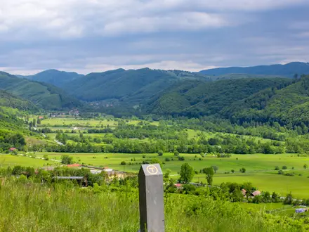
Start at Bâlea Lake, a glacial cirque lake beside the Transfăgărășan (DN7C) at 2,034 m. The main descent follows blue-triangle waymarks on a white background down the Bâlea valley towards Bâlea Waterfall and the Bâlea Cascadă chalet/cable-car lower station at about 1,234 m. Terrain changes from alpine grassland and rock to a forest road along the Bâlea stream, then a narrow, boulder-strewn woodland path near the lower cascades. This is a one-way descent; many hikers return uphill by the Bâlea cable car. An alternative scenic descent uses red-cross then blue markings via the Doamnei valley. If comparing Romanian day walks, also see the Babele to Sphinx Rock Trail or the Curmătura Hut Loop.
Bâlea Lake, the Transfăgărășan and Cable-Car Access
Bâlea Lake is a glacial cirque lake formed as Ice-Age glaciers retreated from the Făgăraș Mountains. The area became far easier to reach after the Transfăgărășan road, DN7C, was built between 1970 and 1974 under Nicolae Ceaușescu. Today, the Bâlea cable car links the lake with the Bâlea Cascadă chalet, giving walkers a practical way to descend on foot and return uphill, and keeping the lake accessible outside the road’s warmer-month opening period.
Notable highlights
Bâlea Lake, Lacul Bâlea (2,034 m): The walk starts beside a glacial cirque lake ringed by 2,000 m-plus Făgăraș peaks. It is the highest point of the route, so the day begins in open alpine terrain.
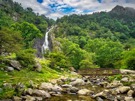
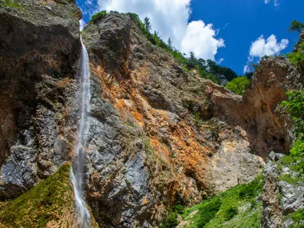
Bâlea Waterfall, Cascada Bâlea (about 1,234 m): Widely cited as the largest waterfall in the Făgăraș Mountains, it drops around 60 m before breaking into smaller cascades. The trail ends near the waterfall chalet and cable-car station.
Transfăgărășan views: The descent runs near the switchbacks of the Transfăgărășan, DN7C, one of Europe’s best-known mountain roads. It gives clear views of the road threading through the Bâlea valley.
Bâlea cable car: The telecabina runs between the lake and the waterfall chalet. It is useful for hikers who want to walk down and ride back up rather than climb the 800 m ascent in reverse.
Bâlea stream and forest section: The lower route follows the Bâlea stream through woodland with small cascades. This is also where the path becomes steep, narrow and strewn with large stones.
Challenges to expect
Do not underestimate the descent. Although some Romanian tourism sources call it easy, the lower forest section is steep, rocky and very uneven, with large boulders underfoot. The route starts high at 2,034 m, so conditions can change quickly. In winter the trail is considered dangerous or closed because of avalanche risk. The upper Transfăgărășan road and walking route are typically usable only in the warmer months.
HikeList Score
Bâlea Lake to Bâlea Waterfall scored 77/100 on HikeList's trail-quality metrics.
See score breakdownHide breakdown
- Ideal length 55
- Balanced challenge 94
- Scenery & wildness 98
- Varied terrain 83
- Accommodation 49
- Food & support 72
- Path quality 98
- Season flexibility 76
Computed from length, challenge, scenery & wildness, terrain variety, accommodation, food & support, path quality and season flexibility.
 Romania
Show more data Show less
- Mountainous
- Alpine
- Forest
- Rocky
- Dirt
- Gravel
- Huts
- Family Friendly
- Pet Friendly
- Restrooms
- Water Sources
- Campsites
- Shelters
Photos from hikers
Taken on the trail by people who've reviewed Bâlea Lake to Bâlea Waterfall.
Reviews
How would you rate Bâlea Lake to Bâlea Waterfall?
Tap a star to start your review — you could be the first.