Moldoveanu Peak Trail
How would you rate Moldoveanu Peak Trail?
Tap a star to share your experience and help other hikers.
Moldoveanu Peak Trail: Romania’s Highest Summit Hike
HikeList Score
Moldoveanu Peak Trail scored 76/100 on HikeList's trail-quality metrics.
See score breakdownHide breakdown
- Ideal length 55
- Balanced challenge 80
- Scenery & wildness 98
- Varied terrain 83
- Accommodation 58
- Food & support 65
- Path quality 98
- Season flexibility 76
Computed from length, challenge, scenery & wildness, terrain variety, accommodation, food & support, path quality and season flexibility.
The Moldoveanu Peak Trail is a 22 km, 1-day hard out-and-back to Vârful Moldoveanu, Romania’s highest mountain at 2,544 m. The route climbs from the Victoria / Valea Rea side of the Făgăraș Mountains in the Southern Carpathians, reaching high alpine terrain, loose rock and an exposed summit ridge. It suits fit, experienced hikers who can handle a long day, around 1,100 m of ascent, fast-changing mountain weather and a pre-dawn start. See more routes in Romania if you are planning a wider Carpathian trip.
Route Overview
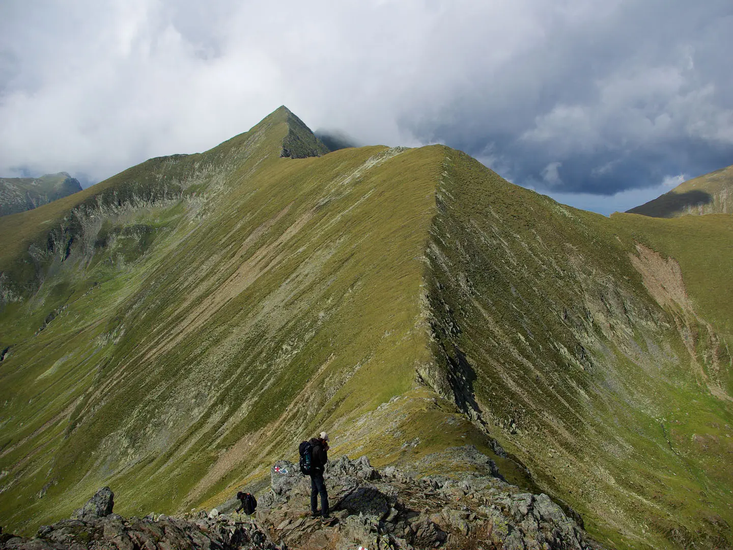
This route is the popular Valea Rea / Victoria day-ascent, not the longer Bâlea Lac ridge traverse. Most hikers approach from Victoria and use the upper trailhead at Stâna lui Burnei where accessible, then follow red-triangle markings up Valea Rea past the waterfall area and Iezerul Triunghiular to Portița Viștei. From the saddle, the route joins the main Făgăraș ridge on red-stripe markings, crosses Viștea Mare Peak and continues along the short rocky crest to Moldoveanu Peak. Return the same way. For nearby Făgăraș hiking, compare the Bâlea Lake to Bâlea Waterfall walk or the broader Carpathian Ridge Trail.
Moldoveanu Peak: Shepherds, Maps and Alpine Clubs
Moldoveanu was long known to local shepherds, whose summer sheepfolds, or stâne, still mark the valleys around the Făgăraș Mountains. The peak appeared on 19th-century Austro-Hungarian topographic maps made under the Habsburg Empire and was later confirmed as Romania’s highest summit. Hiking and mountaineering interest grew through the 20th century with Romanian alpine clubs, especially after the Second World War. In December 2019, the star XO-1 in Corona Borealis was officially named “Moldoveanu” after the mountain.
Notable highlights
- Moldoveanu Peak summit (2,544 m): The highest point in Romania and the main objective of the hike, with wide views along the Făgăraș ridge and across the Southern Carpathians.
- Viștea Mare and the summit ridge (2,527 m): Viștea Mare comes just before Moldoveanu. The short rocky crest between the two is exposed and forms the most committing section of the route.
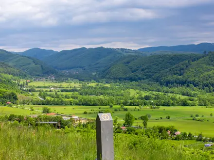
- Valea Rea, “the Bad Valley”: A rough glacial valley with grass, dirt, rock and scree underfoot. The route passes a waterfall area and the small glacial lake Iezerul Triunghiular.
- Portița Viștei saddle (~2,310 m): The key notch where the Valea Rea path meets the main Făgăraș ridge and the waymarking changes from red triangle to red stripe.
- Făgăraș Mountains setting: This is Romania’s highest and most alpine mountain range, with remote ridges, cirques and high lakes. For a different Romanian high-mountain landscape, see the Bucegi Plateau Circuit.
Challenges to expect
Expect a long, strenuous mountain day: around 1,100 m of ascent, high altitude, loose rock, scree and short exposed scrambling on the Viștea Mare–Moldoveanu ridge. Weather in the Făgăraș Mountains can change quickly, and mountain-rescue cover is sparse. Navigation is waymarked, but you still need mountain competence, especially in mist. For another exposed Romanian objective, compare the Caraiman Cross Trail.
HikeList Score
Moldoveanu Peak Trail scored 76/100 on HikeList's trail-quality metrics.
See score breakdownHide breakdown
- Ideal length 55
- Balanced challenge 80
- Scenery & wildness 98
- Varied terrain 83
- Accommodation 58
- Food & support 65
- Path quality 98
- Season flexibility 76
Computed from length, challenge, scenery & wildness, terrain variety, accommodation, food & support, path quality and season flexibility.
 Romania
Show more data Show less
- Mountain
- Alpine
- Ridge
- Dirt
- Rock
- Scree
- Mountain Huts
- Wild Camping
- Pet Friendly
- Water Sources
- Campsites
- Shelters
Photos from hikers
Taken on the trail by people who've reviewed Moldoveanu Peak Trail.
Reviews
How would you rate Moldoveanu Peak Trail?
Tap a star to start your review — you could be the first.