Alföld Blue Trail
How would you rate Alföld Blue Trail?
Tap a star to share your experience and help other hikers.
Alföld Blue Trail: Hungary’s Great Plain Thru-Hike
HikeList Score
Alföld Blue Trail scored 74/100 on HikeList's trail-quality metrics.
See score breakdownHide breakdown
- Ideal length 52
- Balanced challenge 50
- Scenery & wildness 78
- Varied terrain 100
- Accommodation 84
- Food & support 88
- Path quality 92
- Season flexibility 76
Computed from length, challenge, scenery & wildness, terrain variety, accommodation, food & support, path quality and season flexibility.
The Alföld Blue Trail, or Alföldi Kéktúra (AK), is an 870 km waymarked point-to-point trail across the Great Hungarian Plain in Hungary. It runs from Szekszárd to Sátoraljaújhely and takes about 33 days at a steady pace. The difficulty is easy underfoot: almost flat lowland with around 900 m of cumulative ascent over the full route. It suits hikers who want a long, quiet, culturally rich thru-hike more than a mountain challenge.
Route Overview
The AK is conventionally walked south-west to north-east, starting in Szekszárd, the endpoint of the South-Transdanubian Blue Trail, and finishing in Sátoraljaújhely, where the National Blue Trail can be reached. It is organised into 13 official sections, AK-01 to AK-13, tied to public-transport hubs. Key places include Baja, Hajós, Mindszent, Szarvas, Dévaványa, Vésztő, Berettyóújfalu, Létavértes, Nyírbátor and Kisvárda. Expect farm tracks, dyke-top paths, river embankments and quiet rural roads rather than mountains. Parts of the eastern route overlap the European Long-Distance Trail E4; for a shorter puszta-focused trip, compare the Hortobágy National Park Trail.
History of the Alföldi Kéktúra
The Alföldi Kéktúra is the youngest of Hungary’s three National Blue Circle routes. It was launched in 1996 to extend the blue-marked hiking tradition across the lowlands of the Great Hungarian Plain, and was fully developed and waymarked by around 2000. Together with the National Blue Trail and the Rockenbauer Pál South-Transdanubian Blue Trail, it forms part of the continuous Országos Kékkör circuit around Hungary. Since spring 2020, the AK has been organised into 13 near-equal official sections.
Notable highlights
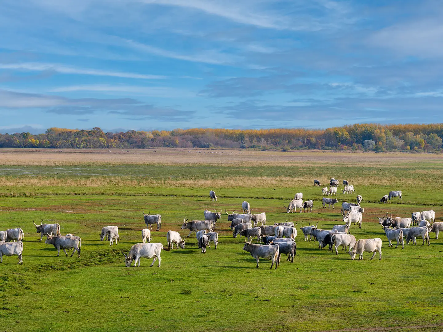
Great Hungarian Plain puszta: The defining landscape of the AK: open salt-steppe grasslands, huge skies and traditional pastoral country. Around the Réhely puszta visitor area, the route passes habitat associated with the great bustard, Europe’s heaviest flying bird.
Hajós wine cellars: Hajós is known for its historic wine-cellar village, with hundreds of cellars forming a distinctive “cellar town”. It is one of the most memorable cultural stops on the Bácska section.
Kiskunság National Park country: The route crosses the Danube–Tisza interfluve, associated with Kiskunság National Park. Hikers pass landscapes of sand dunes, alkaline lakes and puszta grassland.
Szarvas: This 18th-century town was founded by Slovak settlers and is linked with Sámuel Tessedik’s practical agricultural school. It is also known today for the Szarvas Arboretum.
Vésztő-Mágor: The Vésztő-Mágor historical memorial park preserves a prehistoric settlement mound and archaeological remains on the eastern plain.
Sátoraljaújhely finish: The trail leaves the open plain for the Zemplén foothill town of Sátoraljaújhely, where hikers can connect with the National Blue Trail. Nearby north-eastern Hungary also links naturally with routes such as the Aggtelek National Park Trail.
Challenges to expect
The walking is technically easy, but the full AK is a serious long-distance commitment. The main difficulties are length, heat and exposure on open agricultural and puszta sections, limited shade, and planning water or resupply between settlements. Deep winter can be exposed and muddy. Navigation follows the blue stripe waymarks, but hikers should still carry maps or GPX, especially on field margins, dyke-top trails and quiet rural-road sections.
HikeList Score
Alföld Blue Trail scored 74/100 on HikeList's trail-quality metrics.
See score breakdownHide breakdown
- Ideal length 52
- Balanced challenge 50
- Scenery & wildness 78
- Varied terrain 100
- Accommodation 84
- Food & support 88
- Path quality 92
- Season flexibility 76
Computed from length, challenge, scenery & wildness, terrain variety, accommodation, food & support, path quality and season flexibility.
 Hungary
Show more data Show less
- Lowland
- Grassland
- Agricultural
- Wetland
- Forest
- River
- Farm Tracks
- Forest Paths
- River Embankments
- Field Margins
- Dyke Top Trails
- Quiet Rural Roads
- Guesthouses
- Hikers' Lodges
- Small Hotels
- Village Pensions
- Private Rooms
- Bivouac Shelters
- Family Friendly
- Pet Friendly
- Water Sources
- Campsites
- Shelters
- Picnic Areas
Photos from hikers
Taken on the trail by people who've reviewed Alföld Blue Trail.
Reviews
How would you rate Alföld Blue Trail?
Tap a star to start your review — you could be the first.