North Sea Trail
How would you rate North Sea Trail?
Tap a star to share your experience and help other hikers.
North Sea Trail: Dutch Coastal Path Guide
HikeList Score
North Sea Trail scored 74/100 on HikeList's trail-quality metrics.
See score breakdownHide breakdown
- Ideal length 52
- Balanced challenge 50
- Scenery & wildness 71
- Varied terrain 100
- Accommodation 92
- Food & support 88
- Path quality 87
- Season flexibility 89
Computed from length, challenge, scenery & wildness, terrain variety, accommodation, food & support, path quality and season flexibility.
The North Sea Trail in the Netherlands is the Dutch section of the transnational North Sea Trail, walked on the ground as the Nederlands Kustpad / Dutch Coastal Path, LAW 5 and E9. It runs about 725 km from Sluis on the Belgian border to Bad Nieuweschans on the German border, usually taking around 37 days. The walking is technically easy and flat, but the total distance, soft sand, dikes and coastal wind make it best for steady long-distance hikers.
Route Overview
This is a point-to-point coastal thru-hike, normally walked south to north from Sluis in Zeeland to Bad Nieuweschans in Groningen. Hook of Holland is not the start: it is roughly the midpoint, where the Deltapad meets the Hollands Kustpad. The route is signed both ways with white-over-red LAW waymarks, with E9 marking near the Belgian border. The four named sections are Deltapad, Hollands Kustpad, Friese Kustpad and Wad- en Wierdenpad, linking Delta Works barriers, dunes, beaches, polders, Wadden dikes and old villages. For a shorter coastal section, see the Dutch Coastal Path (Hollands Kustpad); for inland Friesland, compare the Friese Woudenpad, and for the wider north-east near the Groningen finish, the Drenthepad.
History of the North Sea Trail
The North Sea Trail began as an EU Interreg project in the early 2000s, aiming to connect coastal walking routes around the North Sea. In the Netherlands, the walk follows a landscape shaped by centuries of land reclamation and flood defence: medieval terps and sea walls, the post-1953 Delta Works, and sections of Zeeland coast once fortified as part of the WWII Atlantic Wall. Since 2013, the Deltapad, Hollands Kustpad, Friese Kustpad and Wad- en Wierdenpad have been combined as the Nederlands Kustpad, LAW 5.
Notable highlights
Delta Works: The early Deltapad stages follow the vast system of dams, sluices and storm-surge barriers built in Zeeland and South Holland after the 1953 North Sea flood.
Brielle (Den Briel): A star-shaped fortified town on Voorne, with ramparts and moats that make it one of the most distinctive historic stops on the route.
Coastal dunes and beaches: Long dune ridges and wide sandy beaches define much of the South and North Holland walking, and also form part of the Netherlands’ natural sea defence.
Spring bulb fields: Behind the Holland dunes, the trail passes flower-bulb districts where tulips and other blooms are a major spring highlight in April and May.
Afsluitdijk: The route reaches or crosses this 32 km barrier dam between North Holland and Friesland, a major work of Dutch water engineering closing off the former Zuiderzee.
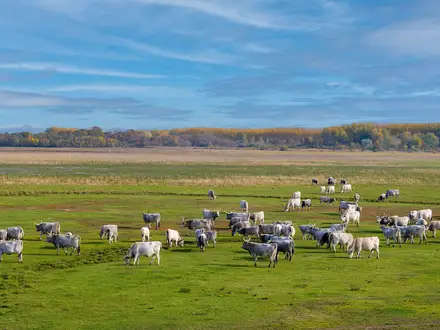
Wadden Sea coast: The Frisian and Groningen sections skirt the UNESCO-listed Wadden Sea, known for intertidal sand and mud flats, birdlife and coastal villages such as Pieterburen.
Challenges to expect
The route is flat and technically easy, with negligible ascent, but it is not effortless. Expect long exposed dike sections, persistent coastal wind and tiring soft-sand beach walking. Accommodation is straightforward in many coastal towns but thins out in Friesland and Groningen, so book ahead on those sections. Navigation is easy thanks to the white-over-red LAW waymarks; on this trail it is stamina and the weather, not altitude, that decide your day.
HikeList Score
North Sea Trail scored 74/100 on HikeList's trail-quality metrics.
See score breakdownHide breakdown
- Ideal length 52
- Balanced challenge 50
- Scenery & wildness 71
- Varied terrain 100
- Accommodation 92
- Food & support 88
- Path quality 87
- Season flexibility 89
Computed from length, challenge, scenery & wildness, terrain variety, accommodation, food & support, path quality and season flexibility.
 Netherlands
Show more data Show less
- Coastal
- Dunes
- Beach
- Polders
- Farmland
- Forest
- Sand
- Dirt
- Gravel
- Paved
- Boardwalk
- Hotels
- Campsites
- Hostels
- Wild Camping Spots
- Family Friendly
- Pet Friendly
- Restrooms
- Water Sources
- Campsites
- Picnic Areas
Photos from hikers
Taken on the trail by people who've reviewed North Sea Trail.
Reviews
How would you rate North Sea Trail?
Tap a star to start your review — you could be the first.