Bakony Hills Trail
How would you rate Bakony Hills Trail?
Tap a star to share your experience and help other hikers.
Bakony Hills Trail: A Practical Hiking Guide
HikeList Score
Bakony Hills Trail scored 87/100 on HikeList's trail-quality metrics.
See score breakdownHide breakdown
- Ideal length 70
- Balanced challenge 100
- Scenery & wildness 98
- Varied terrain 71
- Accommodation 84
- Food & support 88
- Path quality 98
- Season flexibility 89
Computed from length, challenge, scenery & wildness, terrain variety, accommodation, food & support, path quality and season flexibility.
The Bakony Hills Trail is an around 70 km, 3-day moderate traverse through the Bakony Mountains of western Hungary. It is not a single official waymarked trail: this itinerary uses Hungary’s marked path network, mainly the National Blue Trail (Országos Kéktúra / OKT), which is also part of the European Long-Distance Trail E4. Expect forested hills, limestone gorges, gravel and dirt tracks, a climb to Kőris-hegy, and village-based overnights. It suits confident walkers who want a short Hungarian thru-hike without alpine terrain.
Route Overview
This is best treated as a point-to-point walk, commonly from Zirc to the Csesznek area via the High Bakony, though it can be walked in either direction. Zirc has rail and bus links and makes a practical cultural start; the line then uses real waymarked sections towards Borzavár, Porva / Porva-Csesznek, Bakonybél, Kőris-hegy, the Cuha Valley and Csesznek. Navigation is by Hungarian coloured trail marks, including the OKT’s blue horizontal stripe where the route follows it. Many walkers also use Zirc or Bakonybél for shorter loops. For a nearby western-Hungary alternative, compare the Balaton Uplands Trail or the volcanic Badacsony Volcano Trail.
Bakony history and the National Blue Trail
The Bakony is the largest and oldest range of the Hungarian Transdanubian Mountains and has been settled since prehistory. In the Middle Ages its forests guarded frontier and trade routes, leaving hilltop castles such as Csesznek, while monastic communities grew at Bakonybél and Zirc. The woods later became associated with betyárs, Hungary’s romanticised outlaws. Modern long-distance walking here is tied to the National Blue Trail, first waymarked in 1938 and now part of the European E4 route.
Notable highlights
- Zirc Abbey (Cistercian): Founded in 1182, Zirc is the main cultural anchor of the walk. The Baroque church, historic Monument Library and arboretum make it worth time before or after hiking.
- Kőris-hegy (709 m): The highest point of the Bakony and the main sustained climb. A wooden lookout tower tops the forested summit.
- Cuha Valley: A rocky gorge followed by the Cuha stream and a scenic railway between Porva-Csesznek and Zirc. It is one of the most popular walking sections in the High Bakony.
- Ördög-árok (Devil’s Ditch): A narrow limestone gorge near Bakonybél with rock steps, mossy walls and a mostly dry streambed. A staircase bypasses the crux, with a short “mini via ferrata” option for confident hikers.
- Bakonybél and Saint Maurice Monastery: A Benedictine monastery village founded in 1018 and a useful base in the High Bakony. It has good rest facilities for multi-day walkers.
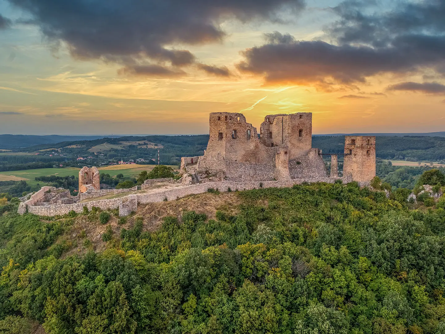
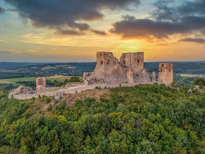
- Csesznek Castle: A ruined hilltop fortress built around 1263 after the Mongol invasion. Its cliff-top position gives the route a memorable northern finish.
Challenges to expect
The walking is moderate rather than technical, but do not underestimate the hills: the route has around 1,200 m of ascent, including Kőris-hegy. Gorges such as Ördög-árok can be rocky, stepped and slippery. Navigation needs attention because “Bakony Hills Trail” is a descriptive route, not one official signposted line. Summer forests can be humid with mosquitoes; winter can be cold, snowy or muddy. Plan accommodation and food around Zirc, Bakonybél and nearby villages.
HikeList Score
Bakony Hills Trail scored 87/100 on HikeList's trail-quality metrics.
See score breakdownHide breakdown
- Ideal length 70
- Balanced challenge 100
- Scenery & wildness 98
- Varied terrain 71
- Accommodation 84
- Food & support 88
- Path quality 98
- Season flexibility 89
Computed from length, challenge, scenery & wildness, terrain variety, accommodation, food & support, path quality and season flexibility.
 Hungary
Show more data Show less
- Mountainous
- Forest
- Dirt
- Rocky
- Gravel
- Hotels
- Huts
- Campsites
- Wild Camping Spots
- Family Friendly
- Pet Friendly
- Water Sources
- Campsites
- Shelters
- Picnic Areas
Download Our Full Guide to Bakony Hills Trail FREE!
Get our comprehensive guide to this hike for free. Save it for later reading or print out at home.
Photos from hikers
Taken on the trail by people who've reviewed Bakony Hills Trail.
Bakony Hills Trail: The Complete Guide
 i
Image by tamas
i
Image by tamas The Bakony Hills Trail is a short, village-based thru-hike through Hungary’s High Bakony, linking Zirc with Csesznek in around three days. It suits confident walkers who want forested hills, karst gorges and a manageable point-to-point journey without alpine terrain.
The route begins in Zirc, the Cistercian abbey town often treated as the cultural gateway to the Bakony, then works through beech woods and small settlements towards Bakonybél. From there the walking becomes more rugged, with Ördög-árok / Devil’s Ditch and the long climb to Kőris-hegy, the highest summit in the Bakony at 709 m.
The northern leg brings a change of character in the Cuha-völgy, where the stream, railway, rock towers and gorge paths make one of the most memorable sections of the route. The finish at Csesznek is well chosen: a village beneath a ruined cliff-top castle, with Porva-Csesznek station giving a practical rail link back towards Zirc and Győr.
This is not a single official waymarked trail, and that matters for planning. The itinerary combines the National Blue Trail / Országos Kéktúra with other Hungarian coloured trails, so good map reading, current GPX or app navigation, and attention to waymarks are part of the walk.
This guide covers the stages, daily planning, accommodation, food, transport, terrain and common mistakes to avoid.
Stage-by-Stage Guide
The stage distances below are practical planning estimates for a composite route, not an official end-to-end waymarked trail. Use the coloured Hungarian trail marks on the ground, but plan from a current Bakony hiking map or GPS app before setting off, especially where the route leaves the National Blue Trail / Országos Kéktúra (OKT).
Stage 1: Zirc to Bakonybél — approx. 22 km
This opening day leaves the Cistercian abbey town of Zirc and moves quickly into the wooded High Bakony. It is a village-to-village hill stage rather than a dramatic ridge walk, with the route commonly using the marked path network through the Borzavár and Porva area before reaching Bakonybél.
Allow time in Zirc before starting if the abbey, Monument Library or arboretum are part of the plan. Once on the trail, the day is mostly about settling into Bakony terrain: forest tracks, dirt paths, limestone and dolomite hills, and long stretches through beech woods.
Underfoot, expect a mix of gravel forest roads and narrower woodland paths. The walking is not technical, but mud can slow progress after rain and the forest can feel humid in high summer.
Bakonybél is the natural overnight halt. The village is also one of the cultural anchors of the route, with the Saint Maurice / Szent Mauríciusz Monastery founded in 1018, and it has the most useful mid-route services.
Food and water planning is straightforward at the ends but less certain between them. Start with enough food and water from Zirc to reach Bakonybél, and do not rely on Borzavár or Porva for supplies unless this has been checked before travelling.
Accommodation should be booked ahead in Bakonybél, especially in summer and at weekends. Options are village-based rather than plentiful: guesthouses, panzió-style lodging, tourist accommodation and camping may be possible, but beds are sparse compared with larger hiking regions.
Zirc is one of the easiest access points on the whole route, with both MÁV rail and Volánbusz coach links. Bakonybél is reached by bus from Zirc, which also makes this stage workable as a long day walk if transport times fit; current MÁV and Volánbusz timetables should be checked before travelling.
Navigation is the main planning issue. There is no “Bakony Hills Trail” waymark to follow, so use the coloured trail marks and check each junction against the map. Where the route uses the OKT, look for the blue horizontal stripe, but do not assume every onward mark belongs to the same route.
Ördög-árok / Devil’s Ditch lies near Bakonybél and is often planned with the Bakonybél section of the walk. If included late in the day, allow extra time: the gorge has rock steps, mossy limestone walls and a mostly dry streambed, with a staircase bypass around the awkward crux and a short mini via ferrata for confident hikers. It can be slippery after rain and should not be treated as a quick add-on in fading light.
Stage 2: Bakonybél to Kőris-hegy / Porva area — approx. 24 km
This is the key hill day of the route and the stage that gives the Bakony Hills Trail its mountain character. From Bakonybél, the route climbs through forest towards Kőris-hegy, the highest summit in the Bakony at 709 m.
The ascent is sustained rather than technical. Expect long forest sections on dirt paths and tracks, with mud possible after wet weather and fewer obvious escape points than on the village-to-village first day.
Kőris-hegy is the main landmark. The summit is forested and topped by the three-storey Vajda Péter-kilátó, the lookout tower that gives the best views of the route: across the Bakonyalja, towards the Balaton Uplands, and on clear days as far as Pannonhalma Abbey.
This stage is also where navigation discipline matters most. The OKT crosses Kőris-hegy, so the blue horizontal stripe is important here, but the wider three-day itinerary is not simply an OKT walk from start to finish. Check the onward line carefully if continuing towards the Porva, Vinye or Cuha-völgy area for the overnight.
Carry a full day’s food and water from Bakonybél. There should not be an assumption of reliable resupply on the forest climb or around the summit, and any accommodation or service near the Porva area should be checked before travelling.
The end-point for this stage depends heavily on where beds are available. Accommodation is sparse between the main hubs, so this is the stage where booking ahead is most important; some walkers may need to adjust the split to reach a confirmed bed around Porva, Vinye or the wider Cuha-valley approach.
Public transport is simple at the start because Bakonybél has bus access from Zirc. Transport at the end of the stage depends on the exact overnight point and should be checked before travelling.
Warnings are practical rather than alpine. The climb is long, forest navigation can be repetitive, and a late start from Bakonybél can turn the descent or onward continuation into a rushed finish. In wet conditions, allow extra time for muddy tracks and slippery limestone or dolomite sections.
Stage 3: Porva / Cuha valley to Csesznek — approx. 24 km
The final day links the Porva or Cuha-valley area with the northern finish at Csesznek. It is the most varied stage underfoot, combining wooded tracks with the rocky karst scenery of Cuha-völgy and a castle finish above the village.
Cuha-völgy is one of the High Bakony’s most popular walking sections. The route follows the Cuha stream corridor and the scenic Győr–Veszprém railway, with rock towers, railway viaducts and tunnels, a boardwalk nature trail and sections where iron climbing aids appear on the rockier lines.
Progress can be slower than the distance suggests. Rocks, steps, wet patches and gorge terrain all take more concentration than a forest road, especially after rain when stone and timber surfaces can be slippery.
Vinye and Porva-Csesznek are key planning points on this stage. Porva-Csesznek railway station sits on the Cuha-valley line and gives useful rail access back towards Zirc and Győr, making it an important bailout or finish-adjustment point if the day is running late.
The route then continues towards Csesznek, where the ruined cliff-top castle gives the walk its dramatic final landmark. Csesznek Castle began after the 1241–42 Mongol invasion and stands above the village on a limestone cliff; opening times vary and the castle is closed in winter, so this should be checked before travelling.
Food and water should be planned conservatively. Carry enough to get from the overnight start to Csesznek, and treat any services around Vinye or Csesznek as something to check in advance rather than a guarantee on the day.
Accommodation is available around Csesznek and Vinye, but it is not a large accommodation corridor. Book the final night ahead if staying locally, particularly at weekends or in summer.
For transport, the most useful rail link is Porva-Csesznek station on the scenic Cuha-valley railway. If finishing in Csesznek village rather than at the station, onward transport arrangements should be checked before travelling.
Navigation on this stage is especially important because the OKT does not run through the Cuha valley to Csesznek. Follow the correct coloured trail marks for the Cuha and Csesznek leg, and avoid assuming the blue stripe will lead to the finish.
Take care in the gorge sections and on any iron-aided or via-ferrata-style variants. The main walk is moderate rather than technical, but wet rock, polished steps and narrow rocky passages can make the Cuha valley feel more demanding than a normal woodland stage.
Recommended Itinerary
Standard 3-day itinerary
This is the most practical way to walk the Bakony Hills Trail as a short thru-hike. It uses the natural service hubs of Zirc, Bakonybél and the Porva/Cuha valley/Csesznek finish area, while keeping each day within the route’s stated stage distances.
Distances are approximate because this is a composite route using Hungary’s coloured marked trail network rather than one official waymarked line. Check current mapping before booking accommodation, especially for the exact route between Kőris-hegy, the Porva area, the Cuha-völgy and Csesznek.
| Day | From | To | Approx. distance | Why this stage makes sense | Services/accommodation notes |
|---|---|---|---|---|---|
| 1 | Zirc | Bakonybél | 22 km | A good first day from the main transport start into the High Bakony. It gives time to leave Zirc, pass through the forested hill country around Borzavár and Porva, and reach Bakonybél, the key mid-route village. | Zirc is the best place to arrive by MÁV train or Volánbusz coach. Bakonybél is the natural first overnight stop, with village services, food and beds. Book ahead, particularly in summer and at weekends. |
| 2 | Bakonybél | Kőris-hegy / Porva area | 24 km | This is the main hill day, with the sustained climb to Kőris-hegy, the highest point of the Bakony at 709 m. The stage also gives time for Ördög-árok near Bakonybél, where rocky and stepped ground can slow progress after rain. | Accommodation is sparse away from the village hubs. The exact overnight point around Kőris-hegy or the Porva area must be planned against current maps and available beds. Do not assume a walk-in bed will be available. |
| 3 | Porva / Cuha valley | Csesznek | 24 km | The final day links the Porva/Cuha area with the Cuha-völgy and finishes beneath Csesznek Castle. It is not just an easy exit stage: the Cuha valley has rocky sections, streamside walking and iron aids that need care in wet conditions. | Porva-Csesznek railway station gives a useful rail link on the Győr–Veszprém line. Csesznek and the Vinye area are the main places to look for end-of-walk accommodation. Check MÁV timetables before relying on the train. |
Slower variant
A slower plan suits walkers who want more time in Zirc, Bakonybél, Ördög-árok, Kőris-hegy and the Cuha-völgy, or anyone walking with children on selected sections. The simplest slower approach is to add a night before starting in Zirc and/or an extra night in Bakonybél, rather than trying to force an overnight in the forested middle of the route.
A 4-day walking version may be possible by splitting the Porva/Cuha valley/Csesznek end of the route, especially if accommodation can be arranged around Vinye or Csesznek. This should be checked before travelling, as beds are not evenly spaced and the route is not an official single trail with fixed stage infrastructure.
| Variant | How to adjust it | Who it suits | Key planning note |
|---|---|---|---|
| Extra night in Zirc | Arrive the day before walking and start Day 1 fresh. | Walkers arriving by train or bus, and anyone wanting time for Zirc Abbey and the arboretum before setting off. | Best option if transport arrival times make a same-day start awkward. |
| Extra night in Bakonybél | Keep the standard walking stages but pause in Bakonybél. | Walkers wanting an easier pace around the monastery, Ördög-árok and the High Bakony village setting. | Bakonybél is the strongest mid-route base, so this is the most practical rest-day choice. |
| Split the northern leg | Break the Porva / Cuha valley to Csesznek section if accommodation or transport allows. | Walkers who want more time in the Cuha-völgy or prefer shorter rocky-gorge days. | Check official mapping, bed availability and MÁV/Volánbusz connections before booking. |
Faster variant
A 2-day itinerary is possible only for very fit, efficient walkers carrying light packs and confident with Hungarian trail marks. It is not the recommended plan for most hikers because it leaves little margin for the Kőris-hegy climb, Ördög-árok, the Cuha-völgy, bad weather or navigation errors.
| Day | From | To | Approx. distance | Why this stage makes sense | Services/accommodation notes |
|---|---|---|---|---|---|
| 1 | Zirc | Bakonybél | 22 km | Keeps the first day manageable and uses Bakonybél as the clear overnight hub. | Book Bakonybél accommodation in advance. Starting from Zirc early is still sensible. |
| 2 | Bakonybél | Csesznek | About 48 km | Combines the Kőris-hegy day with the Porva/Cuha valley/Csesznek finish, creating one very long hill-and-gorge stage. | Only suitable with an early start, reliable navigation and a clear exit plan from Csesznek or Porva-Csesznek station. Check train and bus times before committing. |
For most independent hikers, the 3-day itinerary is the best balance: short enough to feel like a compact thru-hike, but with enough time to handle the Bakony’s forest climbs, rocky gorges and non-official route connections without rushing.
Planning the Route
The Bakony Hills Trail needs more route planning than its length suggests, because it is not one official, continuously branded waymarked trail. Treat it as a planned itinerary across Hungary’s coloured waymark network: mainly the National Blue Trail (Országos Kéktúra / OKT, blue horizontal stripe) around the Zirc–Bakonybél–Kőris-hegy core, then other marked paths for the Cuha-völgy and Csesznek finish.
Most walkers should plan on three walking days. The hills are moderate rather than severe, but the pace is set by forest climbs, rocky gorge paths, wet or muddy ground after rain, and the need to keep checking coloured marks at junctions.
Choosing a schedule
The natural overnight pattern is village-based. Zirc, Bakonybél and the Csesznek/Vinye area are the key practical hubs, with accommodation much thinner in the forested sections between them.
| Plan | Best for | Practical notes |
|---|---|---|
| 3 days | Fit, confident walkers wanting a compact thru-hike | The standard plan: Zirc to Bakonybél, then over the High Bakony/Kőris-hegy area, then through the Cuha-völgy towards Csesznek. Book beds ahead and start early enough for navigation delays. |
| 4 days | Walkers wanting more time for Zirc, Bakonybél, Kőris-hegy or the gorges | A slower plan gives more margin for poor weather, slippery gorge sections and sightseeing, but depends on finding suitable accommodation in or near the mid-route villages. This should be checked before travelling. |
| Weekend sections | Day walkers or those using public transport | Zirc, Bakonybél, Porva-Csesznek and Csesznek make logical access points, though bus and train times must be checked carefully. |
Walking it faster than three days is possible only for strong hikers who are comfortable with long forest days and confident navigation. It is usually a poor trade-off: the route’s interest is in the gorges, summit, villages and railway valley, not in covering distance quickly.
How the stages are dictated
Daily stages are shaped less by mileage than by services. Bakonybél is the key mid-route base, with food, shops and beds, and is the obvious place to break the walk.
The second night needs the most care. Depending on the exact line chosen and availability, walkers generally need to plan around the Kőris-hegy / Porva / Vinye / Csesznek side of the route rather than assuming there will be frequent accommodation on the path. Book before fixing transport.
The final day through or near the Cuha-völgy should not be treated as a simple valley stroll in bad weather. Rock, steps, iron aids and slippery surfaces can slow progress, especially after rain.
Shortening, extending and section hiking
This is a practical route to section-hike because Zirc has train and coach access, Bakonybél is reached by bus from Zirc, and Porva-Csesznek station gives a rail link on the Győr–Veszprém line. Current MÁV and Volánbusz timetables should be checked before relying on any connection.
The easiest short versions are based around the strongest transport and service points: Zirc, Bakonybél, the Kőris-hegy area, the Cuha-völgy and Csesznek. Exact start and finish points should be matched to a current Bakony hiking map or GPS route, because the named Bakony Hills Trail is a composite itinerary rather than a single signed line.
Extending the walk is also straightforward in principle, as the High Bakony has a wider network of coloured marked trails and the OKT continues beyond this itinerary. Do not assume the OKT itself goes to Csesznek: the Csesznek and Cuha-völgy leg uses other marked trails.
What to plan before booking
Navigation is the main planning task. Carry a current Bakony hiking map, such as a Cartographia map, or a reliable GPS app such as Termeszetjaro or Outdooractive. Know the Hungarian colour-mark system before setting out, and check carefully where the route leaves the OKT for the northern Cuha/Csesznek section.
Accommodation should be booked ahead. Beds are concentrated in Zirc, Bakonybél and around Csesznek/Vinye, with sparse options between hubs. Summer weekends can be busy, especially around the popular Cuha-völgy and Csesznek area.
Food planning should be village-led. Bakonybél is the key mid-route resupply point, while the forest sections should be treated as carry-what-you-need terrain. Opening hours and meal options in smaller villages can vary; this should be checked before travelling.
Water should not be left to chance. The route passes streams and karst valleys, but that does not make untreated water a reliable plan. Carry enough between villages and refill at known accommodation, shops or services where possible.
Transport needs checking close to departure. Zirc is reached by MÁV train and Volánbusz coach, while the finish can be linked back by rail from Porva-Csesznek on the scenic Cuha-valley line towards Zirc and Győr. Timetables can determine whether the final day needs an early start.
Weather affects the gorges more than the summits. The High Bakony has no alpine terrain, but rain can make Ördög-árok and the Cuha-völgy awkward underfoot. In high summer, the wooded hills can be humid, so allow realistic time rather than planning stages only by distance.
Access checks are simple but worthwhile. Csesznek Castle is closed in winter, and gorge or iron-aided sections may require extra caution depending on conditions. Current opening times and local conditions should be checked before travelling.
Towns, Villages and Overnight Stops
Accommodation on this route is village-based rather than evenly spread along the path. The practical overnight hubs are Zirc, Bakonybél and the Csesznek / Vinye area; beds are sparse between them, so book ahead, especially in summer and at weekends.
Small hotels, guesthouses (panzió), tourist huts (turistaház) and campsites are the relevant accommodation styles in the High Bakony. Wild-camping and simple forest shelter options may exist, but they should not be treated as the main plan for a three-day crossing unless you have checked current local rules, water access and your exact route.
Zirc
Zirc is the normal starting base and the easiest place to organise the beginning of the walk. It has both a MÁV railway station on the Győr–Veszprém line and a Volánbusz coach station at Rákóczi tér, with bus links from Veszprém and services from Győr.
It is a sensible place to stay the night before starting if arriving from elsewhere in Hungary. Accommodation is among the more reliable on-route options, with village and town lodging in the form of small hotels or guesthouses; book rather than assuming same-day availability.
Zirc is also the last straightforward place before the hills to sort food, water and route logistics. Exact shop, café and restaurant opening times should be checked before travelling, particularly if starting early, arriving late or walking outside the main summer season.
The town is worth allowing time for if your schedule permits. The Cistercian abbey, Monument Library and arboretum sit close to the cultural start of the route, but do not let sightseeing compress the first walking day to Bakonybél unless accommodation and daylight are secure.
Borzavár
Borzavár sits between Zirc and the higher Bakony country. For most thru-hikers it is a route village rather than a planned overnight stop.
Do not rely on Borzavár as a major resupply or accommodation hub without checking ahead. If using it to shorten a stage, confirm food, beds and any transport options before building the itinerary around it.
Its main value is practical pacing: it breaks up the transition from Zirc into the quieter forested sections. Carry enough food and water from Zirc for the day rather than assuming services will be open en route.
Porva
Porva is another small settlement on the High Bakony side of the route and can be useful in planning the second half of the walk. It is associated with the Porva area used in the standard stage split after Bakonybél and Kőris-hegy.
Accommodation and food options should be checked before travelling. This is not one of the route’s main service hubs, so it is safer to treat Porva as a possible staging point only if a specific bed has been booked.
Porva also matters because of its position near the northern route options towards the Cuha valley. Navigation needs attention here: the overall Bakony Hills itinerary is a composite of Hungarian coloured marked trails, not one continuous named waymarked route.
Bakonybél
Bakonybél is the key mid-route overnight stop and the most important village base on the walk. It sits deep in the High Bakony and naturally divides the route after the first day from Zirc.
This is the place where most walkers should plan to sleep on a three-day itinerary. Accommodation includes village-style options such as guesthouses and similar small lodgings, and it should be booked in advance during busy periods.
Bakonybél has the most useful mid-route services, including food and shops. Opening times can still be limited compared with larger towns, so buy what is needed for the next stage before evening closures or rest days become a problem.
Transport-wise, Bakonybél is reached by bus from Zirc. That makes it a practical bail-out or section-hiking point, but current Volánbusz times should be checked before relying on it.
The village is also the base for the Saint Maurice (Szent Mauríciusz) Monastery and nearby Ördög-árok / Devil’s Ditch. If planning to explore the gorge as part of the route, allow time for slow going on rocky or slippery ground and do not treat the next day as a fast road-style distance.
Kőris-hegy
Kőris-hegy is the high point of the route, not an overnight village. The summit reaches 709 m and is topped by the Vajda Péter-kilátó lookout tower.
There should be no assumption of food, water or accommodation on the summit. Treat it as a sustained hill section between serviced places and carry what is needed from Bakonybél or the previous overnight stop.
Weather and underfoot conditions matter more here than the altitude suggests. The climb is forested and non-technical, but mud, humidity and poor visibility can slow progress, especially when linking onwards towards the Porva area or the Cuha valley.
Vinye
Vinye is one of the practical bases around the Cuha valley and the Csesznek end of the walk. The wider Csesznek / Vinye area has accommodation options, including small guesthouse-style lodging and campsites, but availability is not as dense as in a larger town.
It can work well as a final-night base if the last stage is being shortened or if you want more time in the Cuha-völgy. Book ahead and check where the accommodation sits in relation to the walking route, as small settlements and valley locations can add awkward extra distance at the end of the day.
Food and drink options should be checked before travelling. The Cuha valley is popular for day walks, but popularity does not guarantee evening meals, late-opening shops or year-round service.
Cuha-völgy (Cuha valley)
Cuha-völgy is a walking corridor rather than a conventional overnight stop. It is one of the most scenic and popular sections of the route, with the Cuha stream, rocky gorge scenery, railway engineering and marked walking paths.
Do not plan on the gorge itself as a resupply point. Carry enough food and water for the section, and allow extra time for rocky ground, wet conditions or short detours around the valley features.
The railway through the valley is a major logistical advantage. The Győr–Veszprém line links back towards Zirc and Győr, but current MÁV timetables should be checked before using it as a firm exit plan.
Porva-Csesznek
Porva-Csesznek is important because of its railway station on the scenic Cuha-valley line. For many walkers it is the key rail access point near the finish and a useful option for cutting the final day short.
Treat it primarily as a transport point, not as a full-service village stop. Food, accommodation and onward connections should be checked before travelling if the plan depends on waiting there or ending the walk there.
The station gives flexibility: it can support a shorter Cuha valley day, a return towards Zirc, or travel onwards towards Győr. Train times are essential here, as missing a service can create a long wait in a rural area.
Csesznek
Csesznek is the usual finish village, set below the ruined cliff-top Csesznek Castle. It is a strong end point scenically, but accommodation should still be arranged in advance rather than left to arrival day.
The Csesznek / Vinye area has some of the route’s end-of-walk lodging options, including guesthouse-style accommodation and campsites. If staying after the walk, check whether the chosen bed is in Csesznek itself, nearer Vinye, or positioned for the Porva-Csesznek railway station.
Food and evening meal options should be checked before travelling, especially outside the main visitor season. If arriving late from the Cuha valley, carry a backup meal or snack rather than assuming everything will still be open.
Csesznek Castle is a worthwhile finish landmark, but it is closed in the winter months and opening arrangements can change. This should be checked before travelling if visiting the castle is part of the plan.
Getting to the Start
The usual start is Zirc, in Veszprém county. It is a practical trailhead because it has both a MÁV railway station and a Volánbusz coach station, and the marked paths lead out from the town into the High Bakony.
Do not look for signs saying “Bakony Hills Trail” at the station or in town. This is a composite walking itinerary using Hungary’s coloured trail-marking system, mainly the National Blue Trail / Országos Kéktúra where it applies, plus other marked paths later in the route.
By train
Zirc is on the Győr–Veszprém railway line, operated by MÁV. This is the same scenic line that later serves the Cuha valley and the finish-side rail access at Porva-Csesznek.
For most walkers, the simplest rail approach is to reach either Veszprém or Győr, then continue by train to Zirc. Current MÁV services, connection times and ticketing arrangements should be checked before travelling.
The railway is also useful for planning the end of the hike. The finish at Csesznek has rail access via Porva-Csesznek station, giving a return route back towards Zirc and Győr without needing to retrieve a car immediately.
By bus
Zirc is also served by Volánbusz, with the coach station at Rákóczi tér. There are frequent buses from Veszprém and services from Győr.
Bus is often the more flexible option if train times do not line up with accommodation check-in or an early start. It is also relevant for local logistics, as Bakonybél is reached by bus from Zirc.
Volánbusz timetables can change by season, weekday and school-day pattern. This should be checked before travelling, especially if arriving on a Sunday, public holiday or late in the day.
By car
Driving to Zirc is possible, but this is a point-to-point walk ending at Csesznek, not a loop. Anyone arriving by car needs a plan for getting back to the vehicle from the finish.
The cleanest car-based approach is usually to leave the car where accommodation or parking arrangements are agreed in advance, then use train or bus connections to reposition. Long-stay parking in Zirc or around the finish should be arranged directly with accommodation providers or local parking operators; this should be checked before travelling.
Do not assume that rural taxi availability will be immediate in the High Bakony, particularly in the evening or at weekends. If a taxi or accommodation transfer is needed between Zirc, Bakonybél, Porva-Csesznek, Vinye or Csesznek, book it ahead rather than trying to arrange it after finishing a stage.
From the nearest airport
There is no airport at Zirc or in the immediate trail area. International arrivals will need to connect onward by rail, coach or road via a larger Hungarian transport hub, then continue to Veszprém, Győr or directly to Zirc where possible.
Airport-to-Zirc journey times and connections vary too much to rely on without checking current schedules. This should be checked before travelling, allowing enough buffer for onward train or Volánbusz connections into the Bakony.
Where to stay before starting
Zirc is the most practical place to stay the night before starting. It has village/town services, access by both train and bus, and enough cultural interest around the Cistercian abbey and arboretum to justify arriving early rather than stepping straight off transport onto the trail.
Accommodation on this route is village-based, with small hotels, guesthouses and similar options concentrated in places such as Zirc, Bakonybél and around Csesznek/Vinye. Beds can be sparse between hubs, so book ahead in Zirc if starting at the weekend or in the main walking season.
Before leaving Zirc, make sure offline mapping or a paper Bakony hiking map is ready. The onward route does not follow a single dedicated “Bakony Hills Trail” waymark, so navigation starts as soon as the walk leaves town.
Getting Home from the Finish
By train
The most useful public-transport exit is Porva-Csesznek railway station, on the scenic Győr–Veszprém line through the Cuha valley. This gives the finish a rail link back towards Zirc and onwards towards Győr or Veszprém, depending on your onward plans.
If you are ending at Csesznek village or at Csesznek Castle, allow time to get from the village/castle area to the station rather than assuming the train is immediately at the finish line. The route already passes through the Porva-Csesznek area before reaching Csesznek, so some walkers may choose to treat the station as the practical transport finish if timing is tight.
Train times on this rural line are timetable-dependent. Check current MÁV services before committing to a same-day connection, especially if finishing late, walking in poor weather, or relying on an onward train from Győr, Veszprém or Zirc.
By bus
Bus travel is possible in the wider Bakony area, but the most straightforward finish logistics for this route are by rail from Porva-Csesznek. Do not assume that a convenient bus will be available from Csesznek at the exact time you finish.
Check current Volánbusz timetables before travelling if planning to leave by bus or combine bus and train. This is particularly important at weekends, on public holidays, and outside the main summer walking period.
By car/taxi
For private pick-up, Csesznek is the natural road-access finish, while Porva-Csesznek station is the practical rail-access point. If a driver is meeting you, agree the exact pick-up point in advance: the village, the castle area and the railway station are not interchangeable for timing.
Taxi availability should not be assumed on arrival. If a taxi or accommodation transfer is needed, arrange it before starting the final day, particularly if finishing in the evening or after a long stage through the Cuha valley.
From the nearest airport
This is not an airport-to-trailhead route; the sensible exit is first by train or bus to a larger transport hub such as Győr, Veszprém or Zirc, then onward by national connections. Airport transfers and long-distance connections should be planned around the current MÁV and Volánbusz timetables.
If flying out the same day, leave a generous margin. Rural train and bus services, the walk from the final trail point to transport, and onward city connections all introduce timing risk. This should be checked before travelling.
Where to stay at the finish
Accommodation is available around Csesznek and Vinye, but beds are not as concentrated as in larger towns. Book ahead, especially in summer and at weekends.
Staying locally is the safest option if the final day runs long, the Cuha valley is slippery after rain, or train times from Porva-Csesznek do not line up with onward travel. It also avoids rushing the visit to Csesznek Castle, noting that the castle is closed in the winter months and opening times should be checked before travel.
Which Direction Should You Walk?
There is no official direction for the Bakony Hills Trail, because this is not a single waymarked trail. It is a composite route using the National Blue Trail / Országos Kéktúra (OKT) and other coloured Hungarian marked paths, so direction is a planning choice rather than a rule.
For most walkers, Zirc to Csesznek is the better direction. It gives the cleanest start, the most satisfying finish, and a practical accommodation rhythm through Bakonybél and the Cuha valley area.
Standard direction: Zirc to Csesznek
Starting in Zirc is the most natural option. It is the usual cultural start, with the Cistercian abbey, arboretum and town services before the route heads into the High Bakony, and it has both MÁV rail and Volánbusz coach access.
This direction also gives the route a strong sense of progression. The walk builds from Zirc’s town setting into forest, reaches the Bakonybél area, tackles the main high-ground section around Kőris-hegy, then finishes through the dramatic Cuha-völgy and below Csesznek Castle.
The finish at Csesznek has more psychological impact than using it as a starting point. Ending beneath the ruined cliff-top castle feels like a clear destination, especially after the enclosed forest and gorge walking of the previous stages.
Transport also works well this way. Zirc is straightforward to reach by train or bus, while the finish can be linked back via Porva-Csesznek railway station on the scenic Cuha-valley line towards Zirc and Győr. Current MÁV and Volánbusz timetables should be checked before travelling.
Reverse direction: Csesznek to Zirc
Walking from Csesznek to Zirc is possible and may suit anyone with accommodation or onward travel arranged in Zirc. It also means finishing in a larger service town rather than a smaller village area.
The reverse direction is less elegant as a journey. Csesznek Castle becomes an opening landmark rather than a finale, and the cultural finish at Zirc is useful but less dramatic than arriving under the castle after crossing the Bakony hills.
The climbing is not transformed by reversing the route. The walk still has around 1,200 m of cumulative ascent, and Kőris-hegy remains the main height objective. In the standard direction, the long pull to the high point comes after the natural overnight base of Bakonybél, which is a sensible place to be rested and resupplied before the biggest hill section.
Accommodation and stage flow
The standard direction fits the most obvious village-based sequence: Zirc → Bakonybél → Porva / Cuha valley area → Csesznek. Beds are sparse between the main hubs, so the direction should ultimately follow where accommodation is available.
In summer and at weekends, book Zirc, Bakonybél and the Csesznek / Vinye area ahead. If the only suitable beds are available in the reverse order, walking backwards is a perfectly reasonable solution.
Weather considerations
There is no strong direction-based weather advantage on this inland, mostly forested hill route. Wind exposure is not a major planning factor compared with rain, mud and slippery limestone in Ördög-árok and the Cuha valley.
After wet weather, the gorge sections and rocky steps deserve extra care whichever way you walk. Conditions in the gorges and on any iron or via-ferrata-style aids should be checked before setting out.
Recommendation
Walk Zirc to Csesznek unless accommodation or transport forces the reverse. It has the best start logistics, the most natural stage rhythm, a well-placed build-up to Kőris-hegy, and the strongest finish at Csesznek Castle.
Accommodation Along the Route
Accommodation on the Bakony Hills Trail is village-based rather than hut-to-hut. The most reliable overnight stops are Zirc, Bakonybél and the Csesznek/Vinye area, with a mix of small hotels, panzió-style guesthouses, tourist huts and campsites.
Beds are sparse between these hubs, so the accommodation plan should be fixed before the walking itinerary. This matters most around the second night, where the route passes Kőris-hegy and the Porva/Cuha-völgy area rather than a large service town.
Best overnight pattern
For most walkers, the simplest plan is:
- Before Day 1: Zirc — useful if arriving by MÁV train or Volánbusz coach and wanting an early start.
- Night 1: Bakonybél — the natural mid-route base, with shops, food and beds.
- Night 2: Porva, Vinye or the Csesznek area — the key booking challenge; secure this before committing to the day-stage split.
- After finishing: Csesznek or onward by rail from Porva-Csesznek — depending on train times and whether visiting Csesznek Castle.
Bakonybél is the strongest mid-route overnight choice. It sits well for the Zirc–Bakonybél first day and gives access to the Kőris-hegy climb and Ördög-árok / Devil’s Ditch section.
The second overnight is less straightforward. Kőris-hegy itself is a forested summit and not an accommodation base, so walkers need to descend to a village or arrange a transfer if the chosen bed is off the walking line.
Accommodation by place
| Place | Accommodation level (good/limited/none) | Best for | Notes |
|---|---|---|---|
| Zirc | Good | Start night; late arrival by train or coach | One of the best places to stay before setting off. Useful for food, transport and visiting the abbey area before the walk. |
| Borzavár | Limited | Contingency stop | Not a main overnight hub for this itinerary. Do not rely on spare beds without booking. |
| Porva | Limited | Possible second-night area | Can help break the route after the Kőris-hegy section, but availability should be arranged before travel. |
| Bakonybél | Good | Main mid-route overnight | The most practical centre of the walk, with shops, food and beds. Book ahead in summer and at weekends. |
| Kőris-hegy | None | Summit only | No village accommodation on the summit. Plan to continue to an overnight base after the climb. |
| Vinye | Limited | Cuha-völgy access; possible overnight near the final leg | Useful for walkers shaping the route around the Cuha valley, but capacity is limited. Book ahead. |
| Cuha-völgy / Porva-Csesznek railway station | None | Transport access, not an overnight base | Treat this primarily as a railway access point on the Győr–Veszprém line. Accommodation nearby should not be assumed. |
| Csesznek | Limited | Finish night; castle visit | A practical finish base beneath Csesznek Castle, but smaller than Zirc or Bakonybél. Reserve in advance. |
Booking advice
Advance booking is strongly recommended, especially in summer, on Hungarian holiday weekends and for Friday or Saturday nights. The route is short, but the villages are small; a single full guesthouse can make the next stage awkward.
Book the second night first, then shape the walking days around it. If no suitable bed is available around Porva, Vinye or Csesznek, consider adjusting the stage split or arranging a local taxi transfer. Taxi availability and prices should be checked before travelling.
There is no reason to assume a route-wide luggage-transfer system. Inn-to-inn walking is possible, but any bag transfer needs to be arranged privately with accommodation providers or a local taxi; this should be checked before travelling.
Camping and shelters
Camping and basic shelter options exist in parts of the Bakony, but this route is best planned around village accommodation rather than improvised forest overnights. Wild-camping rules, permitted sites and current local restrictions should be checked before travelling.
A lightweight emergency layer is still sensible, as long forest sections and limited beds can leave little margin if accommodation, weather or transport plans change.
Camping and Wild Camping
Camping is possible on the Bakony Hills Trail, but this is primarily a short, village-based walk. For most hikers, the most reliable plan is to use accommodation in Zirc, Bakonybél and around Csesznek or Vinye, then carry only day food and wet-weather gear rather than full camping equipment.
If camping, plan around established sites or accommodation that accepts tents. Do not rely on finding a legal wild pitch each night, especially because the route passes through popular gorges, managed forest, private land and village approaches where camping may be restricted.
Campsites and tent-friendly bases
The main camping and low-cost accommodation options are concentrated around the same hubs as the beds: Zirc, Bakonybél and the Csesznek/Vinye area. Exact campsite openings, tent acceptance, booking requirements and prices change by season, so this should be checked before travelling.
| Area | Use for camping logistics | Practical notes |
|---|---|---|
| Zirc | Start-night camping or a pre-walk base | Best used before setting off rather than as an on-trail camp, because the walk quickly leaves town for forest tracks and smaller settlements. |
| Bakonybél | The most useful mid-route camping base | The natural overnight point on a 3-day itinerary, with village services, food and accommodation options. Book ahead in summer and at weekends. |
| Porva / Cuha-völgy / Vinye area | Useful for splitting the final leg | Services are more limited than in the main villages, so confirm availability before committing to a tent-based stage plan. |
| Csesznek area | Finish-night option | Useful if arriving late after the Cuha valley and Csesznek Castle section, but availability should be checked before travel. |
Wild camping: legality and practical reality
Wild camping should be treated with caution on this route. There is some practical shelter potential in the forest, but that does not mean camping is automatically legal or appropriate. Local rules, land ownership and any forest or protected-area restrictions must be checked before relying on a wild camp.
Do not pitch in Ördög-árok, Cuha-völgy, near the iron-aid sections, on paths, at lookout points, beside monuments, or close to village edges. These are narrow, popular or sensitive places where camping would obstruct other users and may damage the setting.
If a legal bivouac or wild pitch is available locally, keep it discreet and minimal: arrive late, leave early, use an already durable surface, and leave no trace. Never cut vegetation, move stones to build a pitch, dig drainage channels or leave food waste.
Does the route suit camping?
Camping only makes sense if you particularly want a self-supported style. The route is around 70 km over 3 days, so carrying a tent, sleeping kit and extra food adds weight on the climb to Kőris-hegy and through the rocky gorge sections.
A light camping setup is more manageable than a full heavy pack. The stepped and slippery sections in Ördög-árok and the rocky Cuha valley are awkward with bulky luggage, especially after rain.
For most walkers, the best compromise is to book village accommodation and keep the pack light. Campers should still have a backup plan in Bakonybél or around Vinye/Csesznek in case a campsite is closed, full or not accepting tents.
Water and food when camping
Do not assume that streams are safe drinking water. The Cuha stream and smaller watercourses are useful landscape features, not guaranteed potable sources; carry enough water from villages and treat any natural water if used.
Bakonybél is the key resupply point in the middle of the route, with shops, food and beds. Between the main villages, services are sparse, so campers should leave each settlement with enough water and food for the next stage.
In hot, humid summer conditions, water demand can rise quickly in the forest. After rain, the same sections can become muddy and slippery, slowing progress and extending the time between reliable services.
Fire, waste and seasonal cautions
Open fires should not be assumed to be allowed. Forest fire restrictions can apply seasonally, and any current fire rules must be checked locally before lighting a stove or fire. In practice, a small camping stove used safely is far more appropriate than any open flame.
Pack out all rubbish, including food scraps, tissues and biodegradable waste. The Bakony’s gorges and forest tracks are popular walking areas, and careless camping has an immediate impact on other hikers.
In summer and at weekends, book any official camping or tent-friendly accommodation in advance. In wet weather, avoid low, enclosed or rocky pitches where water may collect, and do not camp in the gorge beds.
Food, Water and Resupply
This is a village-based route, not a wilderness trek, but resupply is uneven. Treat Zirc and Bakonybél as the main practical food points, and do not assume that every smaller village or railway stop will have usable opening hours when you arrive.
Bakonybél is the key mid-route base, with shops, food and accommodation. Between the main settlements the route spends long periods in forest, on hill tracks and in gorges, so each walking day should start with lunch, snacks and enough water to finish the stage if nothing is open en route.
Practical resupply strategy
Start from Zirc with the first day’s food already sorted. Zirc is the logical place to arrive prepared, especially if travelling in by MÁV train or Volánbusz coach and setting off soon after arrival. Current shop opening times should be checked before travelling.
Bakonybél is the best place to restock for the second half of the walk. It is the natural mid-route base and the one settlement on the route specifically worth planning around for shops, food and beds.
For the final approach through the Porva / Cuha-völgy / Porva-Csesznek / Csesznek side of the route, carry food in advance rather than relying on finding something at the right time. Accommodation exists around Csesznek and Vinye, but food availability and opening hours should be checked before booking and before setting out.
Water
The safest plan is to refill from accommodation and village services, then carry enough for the next stage. Do not rely on finding treated drinking water in the forest sections or at minor trail junctions.
Natural water is present in places, most notably around the Cuha valley, while Ördög-árok is described as having a mostly dry streambed. Any stream or spring water should be filtered or treated before drinking, and availability can vary with season and recent weather.
In warm, humid summer conditions, start each day with a generous water carry. For most walkers, 1.5–2 litres is a sensible minimum for a normal stage, with more needed in hot weather, if walking slowly, or if accommodation and refill points are uncertain.
Rural opening times
Rural Hungarian shops and food outlets can keep shorter hours than city services, and Sunday or holiday opening can be limited. This matters most if arriving late in Bakonybél, finishing near Csesznek, or travelling at weekends.
Do not plan a tight resupply around a single unverified shop, café or restaurant. Opening times should be checked before travelling, and a spare meal or substantial emergency snacks should be carried.
| Section | Food availability | Water availability | Notes |
|---|---|---|---|
| Zirc to Bakonybél | Start with food from Zirc or bought before arrival. Bakonybél has shops and food at the end of the stage. | Refill before leaving Zirc and again in Bakonybél. Do not rely on forest water. | Carry lunch and snacks for the full day. Check Zirc and Bakonybél opening times if starting early, arriving late or walking on Sunday. |
| Bakonybél to Kőris-hegy / Porva area | Bakonybél is the key resupply point before this hill stage. No reliable food point is specified on the climb to Kőris-hegy. | Fill up in Bakonybél. Natural sources should not be assumed; filter or treat any untreated water. | This is the main sustained climb of the route, so carry enough food and water before leaving the village. |
| Porva / Cuha-völgy to Csesznek | Food should be carried from the previous overnight or arranged with accommodation. Services around Vinye and Csesznek should be checked in advance. | The Cuha valley has the Cuha stream, but stream water should be filtered or treated. Carry enough drinking water from the start of the day. | The railway at Porva-Csesznek helps with transport, but it should not be treated as a guaranteed resupply point. Check food options near the finish before committing to late arrivals. |
Terrain, Conditions and Difficulty in Practice
The Bakony Hills Trail is moderate because the ground is mostly non-technical, but it is not a soft lowland walk. The route crosses forested limestone and dolomite hills, with long stretches on dirt and gravel forest tracks, narrower woodland paths, stepped gorge sections and a sustained climb to Kőris-hegy, the 709 m high point of the Bakony.
The underfoot difficulty changes sharply after rain. Forest tracks can become muddy, limestone steps and gorge rocks can be slippery, and shaded woodland sections may stay damp long after open ground has dried. In high summer, the challenge is less the altitude and more the humid, enclosed feel of the beech woods and gorges.
Path surfaces and footing
Most of the walking is on marked forest paths and forestry tracks rather than engineered trail. Expect a mixture of compacted dirt, loose gravel, leaf-covered woodland paths and rougher rocky ground in the gorges.
The limestone and dolomite sections are the places to slow down. Ördög-árok near Bakonybél has rock steps, mossy walls and a mostly dry streambed, with a staircase bypass around the crux. The Cuha-völgy section is rockier and busier, with the Cuha stream, rock towers, boardwalk nature-trail sections and iron aids in places.
Good footwear matters more than heavy mountain equipment. Lightweight walking boots or grippy trail shoes are suitable in dry conditions, but smooth-soled shoes are a poor choice for wet rock, muddy forest tracks and stepped gorge terrain.
Climbs and descents
The total ascent is around 1,200 m over the three-day itinerary, so the climbing is cumulative rather than severe. There is no alpine terrain and no scrambling required on the main walking line, but the hills are enough to affect daily pace, especially with a full pack.
The main physical effort is the pull to Kőris-hegy. It is a sustained forest climb rather than a sharp exposed ascent, and the summit itself is wooded, with the Vajda Péter-kilátó lookout tower providing the views.
Descents through woodland and gorge terrain can be slower than the map suggests. Wet leaves, polished rock and mud are the usual reasons walkers lose time, particularly around Ördög-árok and Cuha-völgy.
Gorges, rock and exposure
There is little sustained exposure on the standard walking route. The difficulty comes from confined rocky ground, steps, damp surfaces and short sections where hands may be useful for balance.
Ördög-árok includes an optional short “mini via ferrata”, but this is not necessary for completing the hike. Treat it as a separate equipped section, not as part of the normal walking requirement; conditions and suitability should be checked before relying on it.
Cuha-völgy also has rock features and iron climbing aids in the area. These add interest, but they also demand care in wet weather and should not be underestimated by tired walkers at the end of a long day.
Navigation difficulty
Navigation is one of the main practical challenges. This is not a single official waymarked trail; it is a composite itinerary using Hungary’s coloured marked trail network, including the National Blue Trail / Országos Kéktúra on the core Bakony section and other coloured trails for the Cuha-völgy and Csesznek leg.
Do not expect signs saying “Bakony Hills Trail”. Follow the correct coloured waymarks at junctions, and carry a current Bakony hiking map or a reliable GPS app such as Termeszetjaro or Outdooractive. The forest track network can make wrong turns easy, particularly where several marked and unmarked tracks meet.
Road walking, fields and barriers
Road walking is not a defining feature of this route. There will be village approaches and departures around places such as Zirc, Bakonybél, Vinye and Csesznek, but the character of the hike is overwhelmingly forest, hill and gorge rather than tarmac.
Livestock fields, stiles and fenced pasture are not a major part of the difficulty here. The practical obstacles are more likely to be forest junctions, muddy tracks, rocky gorge footing and changes between different coloured trail markings.
Seasonal conditions
Spring, summer and autumn are the natural seasons for this hike. Spring brings greener woodland and potentially muddy tracks; summer can be hot and humid in the enclosed forest and gorge sections; autumn is often good walking weather, but fallen leaves can hide rocks, roots and mud.
After heavy rain, allow extra time for Ördög-árok and Cuha-völgy. Even if stream levels are not the issue, wet limestone, mossy steps and damp boardwalks can make normally straightforward sections slow and slippery.
Winter is outside the main recommended season for this route. Csesznek Castle is closed in the winter months, and gorge or forest conditions should be checked before travelling if planning an out-of-season walk.
How hard is it in practice?
For a confident hill walker, the Bakony Hills Trail is a manageable three-day hike rather than a technical mountain route. The distances are moderate, the highest point is 709 m, and there is no need for alpine equipment on the standard line.
It becomes harder if accommodation forces longer days, if the weather turns wet, or if navigation between coloured trail systems is treated casually. The best preparation is simple: book village overnights early, start each day with a clear route loaded or mapped, and keep time in hand for the gorge sections.
Weather and Best Time to Walk
The practical walking season for the Bakony Hills Trail is spring, summer and autumn. The route is not alpine, but the combination of forest tracks, limestone gorges and the climb to Kőris-hegy means conditions underfoot matter more than the modest altitude.
The best choices are usually the shoulder seasons: spring for cooler forest walking and autumn for settled hiking conditions without high-summer humidity. Summer is fully walkable, but the High Bakony can feel humid in the woods, and accommodation in Zirc, Bakonybél and around Csesznek/Vinye should be booked ahead, especially at weekends.
Seasonal conditions
| Season | What to expect | Planning notes |
|---|---|---|
| Spring | Good walking temperatures, but forest tracks and gorge paths can be muddy after rain. | Take footwear with reliable grip. Ördög-árok and the Cuha valley need extra care when wet. |
| Summer | Long daylight and straightforward logistics, but humid conditions in the forest can make the climbs feel harder. | Carry enough water between villages and book beds ahead in the main hubs. Start earlier on hot days. |
| Autumn | Often a strong choice for this route, with cooler walking than summer. | Daylight becomes the main constraint for 22–24 km stages, so start promptly and avoid leaving the gorge sections late in the day. |
| Winter | Not the intended season for this itinerary. Csesznek Castle is closed in the winter months, and cold, wet or icy conditions would make the rocky gorges and steps less forgiving. | Treat it as a specialist off-season walk only, with current trail, transport and accommodation checks before committing. |
Rain, mud and slippery ground
Rain affects this route quickly because several of its best sections are rocky or enclosed. The stepped limestone of Ördög-árok / Devil’s Ditch, the rocky Cuha-völgy (Cuha valley) paths and the forest tracks around the High Bakony can all become slippery after wet weather.
The route has no technical alpine ground, but wet rock, mud and steep forest sections can slow the 3-day schedule. If heavy rain is forecast, allow more time, avoid rushing the gorge sections and consider whether the optional iron-aided or mini via ferrata-style sections are sensible on the day.
Heat and water planning
High summer is walkable, but the brief high point of Kőris-hegy at 709 m should not be mistaken for cool mountain terrain. The long beech woods can be humid, and the sustained climb to the summit will feel harder in heat.
Plan water around the village hubs rather than assuming easy resupply in the forest. Zirc, Bakonybél and the Csesznek/Vinye area are the main practical bases; services are sparser between them.
Daylight and stage timing
The standard 3-day split uses stages of roughly 22–24 km, so daylight is generous in summer but more limiting in autumn and early spring. This matters most on days that include navigation changes between coloured Hungarian trail marks, the Kőris-hegy climb, or the slower rocky sections of Ördög-árok and the Cuha valley.
Because this is a composite route rather than one single waymarked trail, avoid relying on “just one more hour” at the end of the day. A headtorch is sensible in the shoulder seasons, but the better plan is to start early enough to finish the more technical ground in daylight.
Accommodation and seasonal closures
Accommodation is village-based and concentrated in Zirc, Bakonybél and around Csesznek/Vinye. Beds are sparse between hubs, so book ahead in summer and at weekends rather than assuming there will be space on arrival.
Csesznek Castle is closed in winter, so check opening times if the castle visit is part of the plan. MÁV train times, Volánbusz services, gorge conditions and any iron-aided route access should also be checked before travelling, especially outside the main spring-to-autumn walking season.
Safety Notes
Emergency help and communication
Hungary uses the European emergency number 112. If calling for help, give the nearest named place or feature using the Hungarian names on maps and signs, such as Bakonybél, Kőris-hegy, Ördög-árok, Cuha-völgy, Porva-Csesznek or Csesznek.
Do not rely on continuous mobile signal in the beech forests, gorges and higher wooded sections. Download offline mapping before leaving Zirc or Bakonybél, carry a power bank, and make sure someone knows the day’s intended finish if walking alone.
Navigation is the main safety issue
This is not one continuous official waymarked trail. The route combines the National Blue Trail / Országos Kéktúra with other Hungarian coloured marked paths, so a wrong turn can put you on a different marked route rather than obviously “off trail”.
Carry a current Bakony hiking map or reliable GPS app, and check the colour of the waymark at junctions rather than simply following the most trodden path. This matters especially on the connecting legs towards the Cuha valley and Csesznek, where the route is not the OKT itself.
Gorges, rock steps and iron aids
The two places needing most care underfoot are Ördög-árok near Bakonybél and the Cuha valley. Both can be rocky, stepped and slippery, particularly after rain, with mud, polished stone and damp limestone making falls more likely than the overall “moderate” grade suggests.
In Ördög-árok, use the staircase bypass if the gorge crux looks wet, awkward or beyond the group’s ability. The short “mini via ferrata” and iron climbing aids are not necessary for completing the walk; avoid them unless properly equipped and confident on that type of terrain.
Weather, heat and storms
The High Bakony is not alpine, but weather still affects safety. After heavy rain, the forest tracks can become muddy and the gorge sections more slippery; in hot summer weather the wooded valleys can feel humid and slow.
Start early in warm conditions, carry enough water between villages, and avoid committing to narrow rocky sections during thunderstorms or immediately after intense rain. In spring and autumn, take an extra warm layer, as shaded forest and the climb to Kőris-hegy can feel much cooler than the villages.
Water and food between villages
Plan water and food around the main settlement stops, especially Zirc, Bakonybél, Vinye, Porva-Csesznek and Csesznek. Do not assume that streams in the gorges are safe drinking water; any natural water should be treated, and carrying enough from the villages is the simpler option.
Because accommodation and services are sparse between hubs, running late can become a practical safety issue. Know the distance to the next village, and have a realistic fallback if using buses or trains to shorten a stage.
Roads, villages and rail exits
The route is mostly on forest tracks and marked footpaths, but village approaches and linking sections may involve short stretches on lanes or road edges. Walk facing traffic where there is no pavement, stay visible in dull weather, and take particular care at the start and end of the day when tiredness affects judgement.
The railway at Porva-Csesznek and services from Zirc, Bakonybél and the Cuha-valley line can be useful exit options, but timetables should be checked before relying on them. Verify current MÁV and Volánbusz times each day if transport is part of the safety plan.
Solo hiking
Solo walkers should be comfortable navigating by coloured waymarks and map, not just following an app line. Keep enough battery to finish the day, carry a small first-aid kit, and avoid optional scrambling or iron-aided sections when alone.
Tell accommodation or a contact where the day is intended to finish. This is particularly sensible on the longer forested stretches around Bakonybél, Kőris-hegy and the Cuha valley, where help may not be immediately nearby.
Check before setting off each day
- The exact route line and required coloured waymarks for the day.
- Weather forecast, especially rain, heat and thunderstorms.
- Water and food needed to reach the next village or overnight stop.
- Accommodation booking and arrival time.
- MÁV train or Volánbusz times if using an exit or transfer.
- Gorge and iron-aid conditions for Ördög-árok and Cuha-völgy.
- Phone charge, offline maps, torch and emergency contact details.
Gear Recommendations
The Bakony Hills Trail does not need alpine equipment, but it does reward walkers who pack for forest navigation, wet limestone and long village-to-village stretches. The key choices are secure footwear, reliable navigation and enough food and water between Zirc, Bakonybél, Vinye/Porva-Csesznek and Csesznek.
Footwear
Choose footwear with good grip on mud, wet rock and stepped gorge paths. Lightweight hiking boots or robust trail shoes are both suitable for confident walkers, but slick-soled trainers are a poor choice for Ördög-árok and the Cuha valley after rain.
Ankle support is useful if carrying overnight kit, especially on the longer pull towards Kőris-hegy and on uneven limestone or dolomite tracks. In dry summer conditions, breathable trail shoes can work well, but expect humid forest sections and patches of mud after rain.
Waterproofs and warm layers
Carry a proper waterproof jacket even on a short three-day itinerary. The route spends much of its time in forested hills, where wet vegetation, mud and cooling wind after a shower can make conditions feel colder than the altitude suggests.
A light insulating layer is sensible for spring and autumn, and for rest stops on Kőris-hegy. The summit is only 709 m, but the route still involves a sustained climb and long shaded sections where sweat can chill quickly once you stop.
Navigation kit
Navigation is one of the most important gear considerations on this route. This is a composite itinerary using Hungary’s coloured marked trail network, not a single signed “Bakony Hills Trail”, so do not rely on following one dedicated waymark from Zirc to Csesznek.
Carry a current Bakony hiking map, such as a regional hiking map, and/or a GPS app with the route downloaded for offline use. The National Blue Trail / Országos Kéktúra uses the blue horizontal stripe, but the Cuha-völgy and Csesznek leg uses other coloured marked trails, so the ability to identify junctions matters.
A phone alone is vulnerable to flat batteries, poor signal and wet weather. Pack a power bank and keep the map or route file available offline.
Water and food
Plan to carry enough water for each day’s walking rather than relying on streams in the gorges or forest. A capacity of around 2 litres is sensible for most walkers, with more in hot, humid summer weather.
Food planning should be village-based. Zirc, Bakonybél and the Csesznek/Vinye area are the practical places to organise meals and supplies, while the forested sections between them should be treated as self-sufficient walking days.
Carry lunch and high-energy snacks each day. This is especially important on the Kőris-hegy day and through the Cuha valley, where the terrain and navigation can slow progress even though the overall distances are moderate.
Trekking poles
Trekking poles are useful but not essential. They help on the long climb to Kőris-hegy, on muddy forest tracks and on slippery descents through gorge terrain.
Poles can be awkward where hands are needed for rock steps, railings, iron aids or the optional mini via ferrata in Ördög-árok. Use them where they help, but be ready to stow them securely.
Gorge and iron-aid sections
Ördög-árok and the Cuha valley are the sections where gear choice matters most. Grippy footwear, free hands and a cautious pace are more useful than heavy technical equipment on the normal walking line.
The standard route does not require via ferrata equipment if using the walking options and bypasses. Anyone intending to use the optional mini via ferrata or iron climbing aids should check current conditions and any equipment requirements before travelling.
For inn-to-inn hikers
Inn-to-inn walkers can keep packs light, as the route is only three days and overnights are normally arranged in Zirc, Bakonybél and around Csesznek or Vinye. A 25–35 litre daypack is usually enough for waterproofs, layers, food, water, navigation, first aid and overnight essentials.
Do not overpack just because the route is a thru-hike. The main risk is not remoteness in an alpine sense, but being underprepared for wet underfoot conditions, a navigation error or a longer-than-expected day between village services.
For campers
Campers need to carry a full lightweight sleep system and should plan carefully, as beds and camping options are sparse between the main hubs. Campsites and shelter possibilities are concentrated around settlements rather than evenly spaced through the forest.
Keep camping kit compact and weather-resistant. A wet tent, heavy sleeping bag and excess food weight will make the 1,200 m of cumulative ascent feel much harder than the headline distance suggests.
Wild-camping rules, local restrictions and suitable overnight locations should be checked before travelling. Do not assume that every forest shelter or clearing is available for overnight use.
For fast or section hikers
Fast walkers and section hikers can travel very light, especially on day sections around Zirc, Bakonybél, the Cuha valley and Csesznek. Even so, carry waterproofs, a warm layer, water, snacks, a headtorch and offline navigation.
The railway access at Zirc and Porva-Csesznek makes shorter outings practical, but missed connections can turn a quick day into a long wait. MÁV and Volánbusz times should be checked before setting out.
Seasonal extras
In spring and autumn, prioritise waterproofs, a warmer mid-layer and a headtorch with spare power, as daylight and temperatures can be less forgiving. Mud is more likely after rain, especially on forest tracks and in shaded gorge sections.
In summer, add sun protection, insect repellent and extra water capacity. Much of the route is wooded, but humidity can be high and the climbs still take effort.
Csesznek Castle is closed in the winter months, and this route is best treated as a spring, summer or autumn hike. Winter-specific equipment is not the normal planning basis for this itinerary.
Budget and Costs
Hungary uses the forint — HUF / Ft — so accommodation, transport, food and attraction costs should be checked and paid in HUF rather than assuming euro pricing. Exact prices change by season and by village, so confirm current prices before booking.
For this short 3-day route, the biggest cost difference is accommodation style. A low-cost trip uses campsites or simple tourist-hut-style beds where available; a mid-range trip uses guesthouses or panzió rooms in Zirc, Bakonybél and around Csesznek/Vinye; a more comfortable trip adds private rooms, meals out and taxi backup where public transport timing is awkward.
Main costs to plan for
| Cost item | What to budget for | Planning notes |
|---|---|---|
| Accommodation | Usually the largest cost | Beds are concentrated in Zirc, Bakonybél and around Csesznek/Vinye, with sparse options between hubs. Book ahead, especially in summer and at weekends. |
| Campsites | Lower-cost where available | Campsites exist around the main hubs, but availability and seasonality should be checked before travelling. |
| Food | Moderate if self-catering; higher with meals out | Carry lunches and snacks for the forest sections. Bakonybél has shops and food, but services are not continuous along the route. |
| Train and bus | Usually a manageable part of the budget | Zirc has MÁV rail and Volánbusz coach links; Porva-Csesznek station gives a rail exit from the finish area. Check current MÁV and Volánbusz fares and timetables before relying on them. |
| Local taxis | Useful contingency cost | Worth keeping HUF spare for missed buses, late finishes or bad-weather shortcuts. Arrange fares in advance where possible. |
| Attractions | Optional extra | Zirc Abbey and arboretum, the Saint Maurice Monastery in Bakonybél and Csesznek Castle may add entrance costs. Csesznek Castle is closed in winter; opening times and prices should be checked before travelling. |
| Luggage transfer | Do not assume it exists as a standard trail service | This is a composite route rather than a single packaged waymarked trail. Any bag movement is likely to need private arrangement through accommodation or local taxi providers. |
| Guided or self-guided packages | Not essential for most walkers | Confident independent hikers can plan this with maps, accommodation bookings and public transport. If using a guide or custom package, agree exactly what is included: accommodation, transfers, luggage, meals and navigation support. |
Budget approaches
Lowest-cost approach: use campsites or the simplest tourist-hut/guesthouse beds where available, travel by MÁV train and Volánbusz bus, and buy food from village shops before the longer forest sections. This needs the most flexibility, because cheap beds and camping places are not spread evenly along the route.
Mid-range approach: book guesthouses or panzió accommodation in the main overnight hubs, eat some meals in villages, and keep public transport as the main access and exit method. This is the most practical balance for many walkers, as it reduces uncertainty without needing private transfers.
Comfortable approach: book private rooms or small hotels where possible, add meals out, and budget for taxi backup if a train or bus connection is inconvenient. This is useful if arriving late in Zirc, finishing late near Csesznek, or walking outside the busiest summer period when services may be less convenient.
Booking and cash practicalities
Reserve accommodation before setting off rather than relying on walk-up availability. The route passes long forested sections and small settlements, so a missing bed in Bakonybél or around the Porva/Cuha valley area can create a real logistics problem.
Carry a bank card plus enough HUF cash for small payments, cafés, local transport gaps and taxi contingencies. Card acceptance should not be assumed in every small accommodation, campsite or rural service point.
Build a small contingency into the budget for weather or navigation delays. The route uses Hungarian coloured trail marks rather than one dedicated “Bakony Hills Trail” waymark, and a wrong turn, slippery gorge section or missed connection can quickly turn into an extra transport or accommodation cost.
Luggage Transfer, Guided Tours and Support Services
Luggage transfer
Do not assume there is a dedicated baggage-transfer network for the Bakony Hills Trail. This is a short, composite itinerary using Hungarian coloured waymarked paths rather than a single official branded trail, so services that exist on larger European long-distance routes should not be expected here.
For most walkers, the simplest plan is to carry a light overnight pack for the three days. Accommodation is village-based, with the most practical overnight hubs at Zirc, Bakonybél and around Porva, Vinye, Csesznek or the Cuha valley area, but beds are sparse between those hubs, so book accommodation first and then plan the walking stages around those bookings.
If luggage transfer is important, arrange it directly with accommodation providers or a local taxi before committing to the trip. Give the exact Hungarian place names — Zirc, Bakonybél, Porva, Vinye, Porva-Csesznek and Csesznek — and make clear whether the drop-off is at a village address, a railway station or a guesthouse outside the centre. This should be checked before travelling.
Private transfers and taxis
Private transfers can be useful on this route, especially if accommodation is not available exactly at the end of a planned walking day. They may also help if the final night is booked around Csesznek or Vinye rather than directly on the day’s line.
Taxi arrangements should be made in advance rather than left until arrival at a small village or railway station. The key transfers to consider are:
| Transfer need | Practical use |
|---|---|
| Zirc to Bakonybél | Useful for non-walking companions, late arrivals, or shortening the first day |
| Bakonybél to nearby accommodation | Useful if the overnight stay is outside the village centre |
| Porva / Vinye / Cuha valley area to booked lodging | Useful where beds are not directly on the walking line |
| Csesznek to Porva-Csesznek station | Useful if finishing at the castle or village but returning by rail |
Current taxi availability, waiting times and fares should be checked before travelling. Small-village transfers may need to be booked by phone and may not be available at short notice.
Self-guided packages
A self-guided walking-holiday package can make sense for hikers who want accommodation pre-booked and daily route notes prepared, but this route is not a standard single-line trail with one official signpost system. Any package should be checked carefully to ensure it follows the intended Zirc–Bakonybél–Kőris-hegy–Cuha-völgy–Csesznek line, rather than only the National Blue Trail section through the Bakony.
A useful self-guided arrangement would normally include accommodation reservations, stage-by-stage route notes or GPX files, emergency contact details and, if available, luggage movement between overnight stops. Before booking, check exactly what is included, whether luggage is transferred every day, and how the route deals with the non-OKT sections towards Cuha-völgy and Csesznek.
Guided walking
A guide is not essential for fit, map-confident hikers, but it can be worthwhile for groups, families, walkers unfamiliar with Hungarian trail markings, or anyone who wants local interpretation around Zirc Abbey, Bakonybél, Kőris-hegy, Cuha-völgy and Csesznek Castle.
The main practical value of a guide is navigation. The route combines the National Blue Trail / Országos Kéktúra with other coloured marked trails, and there is no single “Bakony Hills Trail” waymark to follow from start to finish. A guided day in the more complex sections can reduce the risk of taking the wrong marked path at junctions.
Guided availability, languages, group sizes and prices vary and should be checked before booking. If using a guide for only part of the walk, the most useful sections are the Bakonybél–Kőris-hegy stage and the Cuha-völgy / Csesznek approach, where navigation and terrain require more attention.
Public transport as support
Public transport is a practical back-up, but it should not be treated as an on-demand rescue service. Zirc has MÁV rail and Volánbusz connections, Bakonybél is reached by bus from Zirc, and Porva-Csesznek station gives rail access on the Győr–Veszprém line for the finish area.
Use public transport for planned shortcuts, delayed starts or bad-weather changes, and check current MÁV and Volánbusz timetables before relying on them. This is particularly important on weekends, holidays and if planning to connect the finish at Csesznek with the railway at Porva-Csesznek.
Shorter Hikes and Best Sections
The Bakony Hills Trail works well as a set of linked day and weekend walks because its main hubs — Zirc, Bakonybél, Vinye, Porva-Csesznek and Csesznek — sit close to rail or bus access. The main caution is navigation: this is not one continuously signed official trail, so every shorter version still needs a current Bakony hiking map or GPS route using the Hungarian coloured waymark network.
Quick picks
| Best for | Start and end | Approx. distance | Why choose it | Transport and logistics |
|---|---|---|---|---|
| Best day walk | Porva / Cuha-völgy to Csesznek | Up to about 24 km if walking the full final-day section | The most concentrated mix of gorge scenery, railway atmosphere and a strong finish at Csesznek Castle | The Porva-Csesznek railway station is on the scenic Győr–Veszprém line. Check MÁV times before committing to the start or finish. |
| Best weekend section | Bakonybél to Csesznek via Kőris-hegy and the Cuha valley | About 48 km over 2 days | Takes in the main hill climb, the highest point of the Bakony, the Vajda Péter-kilátó and the Cuha-völgy/Csesznek finale | Reach Bakonybél by bus from Zirc. Finish using Porva-Csesznek station for rail connections back towards Zirc or Győr. Accommodation around the Porva/Vinye/Cuha-valley area should be booked ahead. |
| Best 3–5 day version | Zirc to Csesznek | Around 70 km | The full line, taken at the standard 3-day pace or spread over 4 days for shorter daily distances | Use Zirc for arrival by MÁV train or Volánbusz coach, and the Porva-Csesznek railway for the return. Extra splits depend on available beds and should be checked before travelling. |
| Best scenery | Bakonybél to Kőris-hegy / Porva area | About 24 km | The strongest mountain day: Ördög-árok, sustained forest climbing, Kőris-hegy at 709 m and the Vajda Péter lookout tower | Bakonybél has bus access from Zirc. The onward finish needs careful planning because accommodation and transport are thinner away from the main hubs. |
| Best for newer long-distance walkers | Zirc to Bakonybél | About 22 km | A manageable first stage between two useful bases, with cultural stops at Zirc and Bakonybél and no need to commit to the full route | Zirc has train and coach access. Bakonybél is reached by bus from Zirc, so this can be made into a one-way day or an overnight taster. |
| Best for public transport | Zirc to Bakonybél, or the Cuha-völgy / Porva-Csesznek section | About 22 km for Zirc–Bakonybél; variable for a Cuha-valley rail walk | These sections make the best use of the route’s practical access points rather than requiring a car shuttle | Verify current MÁV and Volánbusz timetables before relying on same-day connections, especially at weekends. |
| Best for villages and accommodation | Zirc – Bakonybél – Csesznek/Vinye | Around 70 km if walked as the full route | This follows the strongest accommodation pattern on the route, using the main settlement hubs rather than isolated forest stops | Beds are sparse between hubs. Book Zirc, Bakonybél and the Csesznek/Vinye area ahead, particularly in summer and at weekends. |
| Best for camping | Village-based camping version of the full route | Around 70 km, split by available campsites | Campsites are concentrated around the same hubs as guesthouses, so camping works best when planned village to village | Wild-camping and shelter options exist in the forests but should not be treated as guaranteed. Rules, campsite openings and water availability should be checked before travelling. |
Best day walk: Cuha-völgy and Csesznek
For a single day, the Cuha-völgy/Csesznek end of the route gives the most immediate reward. The valley has the rocky karst gorge, Cuha stream, railway viaducts and tunnels, boardwalk nature trail, rock towers and iron climbing aids that make this part of the High Bakony especially popular.
The full final-day line from the Porva / Cuha-valley side to Csesznek is about 24 km, so it is a proper hill-walking day rather than a casual stroll. Shorter out-and-back options in the Cuha valley are possible using the railway access, but the exact distance should be set from a current map and train timetable.
Csesznek Castle gives the route a clear objective if continuing beyond the gorge. Check castle opening before planning the day around a visit, as it is closed in the winter months.
Best weekend: Bakonybél to Csesznek
The strongest two-day version starts in Bakonybél and finishes at Csesznek. It keeps the best mountain and gorge terrain while avoiding the easier cultural approach from Zirc.
The first day is the Bakonybél to Kőris-hegy / Porva-area stage, about 24 km, with the climb to Kőris-hegy and the Vajda Péter-kilátó. The second day continues through the Cuha-valley side of the route to Csesznek, again about 24 km.
This is the best option for fit walkers with only a weekend, but it needs accommodation planning. Beds are limited away from the main hubs, so do not assume a convenient overnight will be available without booking.
Best 3–5 day option: the full line at an easier pace
For 3–5 days, the best section is simply the full Zirc to Csesznek route. At around 70 km, it is already a short thru-hike, but spreading it over 4 days can make the gorge sections, abbey visits and Kőris-hegy climb less rushed.
The practical issue is not distance but where to sleep. Zirc, Bakonybél and the Csesznek/Vinye area are the key hubs; any extra split between them depends on current guesthouse, tourist-hut or campsite availability.
Best beginner-friendly choice: Zirc to Bakonybél
The Zirc to Bakonybél stage is the best taster for walkers who want one substantial day without committing to the rougher gorge-and-summit finish. It is about 22 km, so it still suits reasonably fit walkers rather than complete beginners.
This section also has the simplest logistics. Zirc has both rail and coach access, while Bakonybél is connected by bus from Zirc, making it practical as an overnight introduction or a one-way day if the timetable works.
Camping and short sections
Camping is possible to plan around the route, but it is not the easiest reason to choose the Bakony Hills Trail. Campsites are concentrated around Zirc, Bakonybél and the Csesznek/Vinye area, while the forested middle sections have fewer formal services.
If camping, plan around known settlement hubs rather than expecting frequent official sites along the path. Wild-camping rules, shelter use and campsite openings should be checked before travelling.
Highlights and Points of Interest
Zirc Abbey and Arboretum
Zirc is worth allowing time for before setting off, rather than treating it only as a transport point. The Cistercian Abbey of Zirc was founded in 1182 by King Béla III with monks from Clairvaux, and its rebuilt Baroque church dates from 1732–52.
The abbey complex also includes the Monument Library and a 20-hectare arboretum, described as the highest-lying tree collection in Hungary. If arriving by train or coach on the first morning, build in enough time to visit before following the waymarks out into the High Bakony.
Bakonybél and Saint Maurice Monastery
Bakonybél is the natural place to slow down mid-route. It is a quiet High Bakony village with shops, food and accommodation, making it more than just a stage end.
The key cultural stop is the Saint Maurice Monastery, a Benedictine abbey founded in 1018 by King St Stephen I. Walkers using Bakonybél as an overnight base should leave some daylight for the village and monastery before or after the approach to the surrounding forest trails.
Ördög-árok / Devil’s Ditch
Ördög-árok is one of the most distinctive natural features near Bakonybél: a narrow limestone gorge with rock steps, mossy walls and a mostly dry streambed. It is a short, memorable contrast to the broader beech-forest walking elsewhere on the route.
The gorge is not technically alpine, but it does need care. A staircase bypasses the crux, and there is also a short “mini via ferrata” option for confident hikers; conditions and access should be checked before travelling, especially after wet weather.
Kőris-hegy and Vajda Péter-kilátó
Kőris-hegy is the highest point of the Bakony and the main high-level objective of the walk. The climb is a sustained forest ascent rather than an exposed mountain section, but it is the point where the route feels most like a proper hill day.
The summit is crowned by the three-storey Vajda Péter-kilátó lookout tower, built in 1920 and rebuilt in 1962. From the tower there are far-reaching views over the Bakonyalja, the Balaton Uplands and, on clear days, as far as Pannonhalma abbey.
Cuha-völgy / Cuha Valley
Cuha-völgy is one of the most rewarding sections to take slowly. The route follows a rocky karst gorge shaped by the Cuha stream, with rock towers, a boardwalk nature trail and iron climbing aids in places.
The valley is also followed by the scenic Győr–Veszprém railway, with viaducts and tunnels adding to the character of the gorge. Underfoot conditions can be muddy or slippery after rain, so it is a section for steady progress rather than rushing for the finish.
Porva-Csesznek and the railway finish option
Porva-Csesznek railway station is a useful landmark in its own right because it links the northern end of the walk back towards Zirc and Győr on the Cuha-valley line. This makes the final day more flexible if weather, daylight or onward transport become limiting factors.
Train times should be checked before relying on this option. The station also marks the transition between the enclosed gorge walking and the final approach towards Csesznek.
Csesznek Castle
Csesznek Castle gives the route its most dramatic finish. The ruined hilltop fortress stands on a cliff above Csesznek village and was begun after the 1241–42 Mongol invasion, later associated with the Csák, Garai and Esterházy families.
It is the best final viewpoint and the most obvious place to spend extra time before leaving the route. The castle is closed in the winter months, and current opening arrangements should be checked before travelling.
Where to Spend Extra Time
| Place | Why linger | Practical note |
|---|---|---|
| Zirc | Abbey, Baroque church, Monument Library and arboretum | Best visited before starting the first walking day |
| Bakonybél | Monastery, village services and a natural mid-route base | A good overnight stop with food and beds |
| Ördög-árok | Short limestone gorge with steps, rock walls and optional mini via ferrata | Take care after rain; check conditions before relying on the via-ferrata option |
| Kőris-hegy | Highest summit of the Bakony and the main lookout | Worth timing for clear weather if possible |
| Cuha-völgy | Gorge scenery, stream, railway viaducts, tunnels and rock features | Do not rush this section; surfaces can be slippery |
| Csesznek | Castle ruins and cliff-top views | Check seasonal opening before planning a visit |
Common Mistakes and Planning Tips
Assuming there is a single signed “Bakony Hills Trail”
The most common mistake is treating this as one official waymarked trail. It is not: the route is a composite itinerary using Hungary’s coloured marked trail network, mainly the National Blue Trail / Országos Kéktúra (OKT) on the Bakony core, then other coloured trails for the Cuha-völgy and Csesznek leg.
Fix: plan the line on a current Bakony hiking map or a reliable GPS app before travelling. Follow the actual coloured marks on the ground, especially the blue horizontal stripe where the route uses the OKT, rather than looking for “Bakony Hills Trail” signs.
Expecting the OKT to take you all the way to Csesznek
The OKT is central to this walk, but it does not itself run through the Cuha valley to Csesznek. After Zirc, the OKT continues east towards Bodajk, while this itinerary uses connecting marked trails to reach Vinye, Cuha-völgy, Porva-Csesznek and Csesznek.
Fix: mark the changeovers between the OKT and the connecting trails in advance. This matters most on the northern leg, where blindly following the blue stripe would not deliver the intended finish at Csesznek.
Underestimating the route because it is “only” around 70 km
The distance is short for a thru-hike, but the Bakony’s hills set the pace. The route includes about 1,200 m of cumulative ascent, the sustained climb to Kőris-hegy, and slower ground in Ördög-árok and the Cuha valley.
Fix: plan stages as hill-walking days, not flat-distance days. The standard three-day split is realistic for fit walkers, but allow extra time for navigation, muddy forest tracks after rain, and careful movement through rocky or stepped gorge sections.
Booking accommodation too late
Beds are concentrated in Zirc, Bakonybél and around Csesznek/Vinye, with sparser options between these hubs. Turning up without a booking is a poor strategy, especially in summer and at weekends.
Fix: reserve village accommodation before fixing transport. Bakonybél is the natural mid-route base, so it is particularly important to secure a bed there if walking the route over three days.
Assuming every village will have food and supplies when needed
Zirc and Bakonybél are the key service points, and Bakonybél has shops, food and beds. Smaller places on the route should not be treated as guaranteed resupply stops unless current opening times have been checked.
Fix: leave Zirc and Bakonybél with enough food and water for the next stage. Shop and restaurant opening hours, especially in smaller villages, should be checked before travelling.
Leaving the finish transport vague
Csesznek is a village finish beneath the castle, while the rail link is at Porva-Csesznek station on the Cuha-valley line. Trains on the Győr–Veszprém line are a useful part of the route logistics, but they still need to be planned.
Fix: check MÁV train times and Volánbusz connections before booking the trip. Do not rely on simply arriving in Csesznek and working out the return journey on the spot.
Not checking bus and train times before committing to start and end times
Zirc is served by MÁV train and Volánbusz coach, with buses from Veszprém and services from Győr. Bakonybél is reached by bus from Zirc, which can be useful for section-walkers or contingency planning.
Fix: verify current MÁV and Volánbusz timetables before relying on them. Build in enough margin for a missed connection at the end of the walk, particularly if travelling onwards the same evening.
Treating the gorge sections as ordinary forest paths
Ördög-árok and the Cuha valley are highlights, but they are not fast, smooth walking. Expect rock steps, damp or muddy surfaces after rain, and sections where care is needed around iron aids or the optional short “mini via ferrata” in Ördög-árok.
Fix: wear footwear with reliable grip and keep hands free where the ground is awkward. Do not use the optional via-ferrata-style section unless the party is confident and conditions are suitable; the staircase bypass exists for a reason.
Relying only on a downloaded GPX track
A GPX line is useful, but this route is stitched together from several marked trails rather than maintained as one official route. Old files can also be misleading if they send walkers along the wrong coloured trail at a junction.
Fix: carry a current map as well as digital navigation, and check the colour of the waymark at decision points. This is especially important near the OKT sections and on the Cuha-völgy/Csesznek connection.
Planning the Kőris-hegy day too tightly
Kőris-hegy is only 709 m, but it is the highest summit in the Bakony and involves the route’s main sustained climb. The forested summit and Vajda Péter-kilátó are worth time, but the ascent can still absorb more of the day than expected.
Fix: start the Kőris-hegy stage early enough to avoid rushing the descent and onward navigation. In hot, humid summer weather, carry enough water and allow for slower climbing through the forest.
Assuming attractions are always open
Zirc Abbey, the arboretum, Saint Maurice Monastery in Bakonybél and Csesznek Castle can add a lot to the walk, but opening times are separate from trail logistics. Csesznek Castle is closed in the winter months.
Fix: check opening times before building a walking day around a visit. If an attraction is essential to the trip, schedule it with a time buffer rather than leaving it until the end of a long stage.
Treating the route as a family stroll throughout
Day sections around Zirc and Bakonybél can suit families, but the full multi-day route needs competent navigation and steady hill fitness. The gorges, longer forest stages and sparse accommodation make it less forgiving than a short circular walk.
Fix: for mixed-ability groups, use Zirc, Bakonybél, Vinye or Porva-Csesznek as bases for shorter sections. Only commit to the full point-to-point route if everyone is comfortable with map reading, changing trail colours and walking full hill days.
Final Advice
The Bakony Hills Trail works best for reasonably fit, self-reliant walkers who want a short Hungarian hill traverse with forest, gorges and village overnights rather than a high-mountain expedition. The walking is moderate, but it still demands proper hill-walking habits: early starts, wet-weather footwear, a map or GPS track, and enough flexibility for transport and accommodation changes.
The single most important planning point is navigation. This is not one official waymarked trail; it is a composite route using the Hungarian coloured trail network, including the National Blue Trail / Országos Kéktúra on the core Bakony section and other marked paths towards Cuha-völgy and Csesznek. Do not set off expecting continuous “Bakony Hills Trail” signs.
For most hikers, the strongest version is the full 3-day traverse from Zirc to Csesznek, with Bakonybél as the key overnight base and Kőris-hegy as the main hill objective. That gives the route a satisfying shape: abbey town, deep Bakony forest, summit lookout, rocky Cuha valley and the castle finish above Csesznek.
It also sections well. Families and less experienced walkers are likely to get more from shorter days around Zirc, Bakonybél, Ördög-árok or the Cuha valley than from trying to force the full route into a tight schedule. The train link at Zirc and Porva-Csesznek helps, but MÁV and Volánbusz times should be checked before travelling.
Book village accommodation ahead, especially in summer and at weekends, because beds are concentrated in Zirc, Bakonybél and around Csesznek or Vinye rather than evenly spaced along the trail. Check Csesznek Castle opening times if visiting the castle matters to the trip, as it is closed in the winter months.
The most memorable walking is likely to be the contrast between the quiet forest climb to Kőris-hegy and the more rugged gorge terrain of Ördög-árok and Cuha-völgy. Treat those rocky sections with care after rain, and avoid being tempted onto iron or via-ferrata-style aids unless conditions and ability are suitable.
With realistic daily stages, confirmed beds, current transport times and a reliable navigation setup, this is one of the most rewarding short hill walks in western Hungary: compact, varied and logistically manageable, but not a route to approach casually without a map.
Useful Links
Hand-picked external resources for planning and researching the Bakony Hills Trail — official trail sites, maps and GPX downloads, baggage transfer and local information. Each link opens in a new tab.
Official & reference
-
 Országos Kéktúra section OKT-08: Városlőd–Zirc — kektura.hu (official) kektura.hu
The National Blue Trail's official page for its 38.8 km High Bakony section via Németbánya, Bakonybél, Kőris-hegy and Borzavár to Zirc — the waymarked line this itinerary mainly borrows. Includes the route map, elevation profile and stamping points.
- Walking routes around Zirc — Zirc tourism office (official) turizmus.zirc.hu
The town tourism site's collection of marked day routes that make up much of this walk, including Bakonybél–Kőris-hegy–Zirc, Porva–Borzavár–Zirc and Vinye–Porva-Csesznek–Zirc, each with distances and waymark colours. In Hungarian, but the route listings are easy to follow.
-
 Magas-Bakony Protected Landscape Area — Balaton Uplands National Park Directorate (official) bfnp.hu
The park authority's page for the 8,754-hectare protected landscape the route crosses, protected since 1991 and 84% forest. Useful for conservation context, caves and gorges of the High Bakony, and responsible-visiting guidance.
Maps & GPX
- Cuha gorge walk — Természetjáró tour with map and GPX termeszetjaro.hu
A documented tour of the Cuha gorge on the Hungarian Hikers' Association's Természetjáró platform, with interactive map, elevation profile and GPX download. Handy for planning the rocky valley section between Zirc, Porva-Csesznek and Vinye.
Planning & logistics
- MÁV Hungarian Railways — English site mavcsoport.hu
Timetables and tickets for the scenic Győr–Veszprém railway that threads the Cuha valley, with halts at Zirc, Porva-Csesznek and Vinye. Useful for reaching the start, shortening a stage or returning from the finish.
- Menetrendek.hu — national journey planner menetrendek.hu
Hungary's door-to-door public transport planner covering both trains and Volánbusz buses. The simplest way to check connections to Zirc and Bakonybél and bus times from the Csesznek area after the walk.
Local area & national parks
-
 Bakony — Wikipedia en.wikipedia.org
English-language background on the Bakony range: geography, geology and history of the largest block of the Transdanubian Mountains. Good context for the forests, karst gorges and hilltop castles seen along the route.
External links are provided for convenience and are not affiliated with HikeList. Always check official sources for the latest trail conditions before you set out.
How long is the Bakony Hills Trail?
The Bakony Hills Trail is around 70 km and is normally walked in three days, point to point from Zirc towards the Csesznek area across the High Bakony. That works out at roughly 20–25 km a day between village bases. The railway halts at Porva-Csesznek and Vinye in the Cuha valley make it easy to shorten a stage or break the walk into day trips.
Is the Bakony Hills Trail an official waymarked route?
No. The name describes an itinerary pieced together from Hungary's dense marked-path network rather than one signposted trail. Much of it follows the National Blue Trail (Országos Kéktúra), whose 38.8 km OKT-08 section crosses the High Bakony via Bakonybél, Kőris-hegy and Borzavár to Zirc, while local red- and yellow-marked paths link Zirc, the Cuha gorge and Csesznek. Navigation is by coloured blazes, so carry a map or a mapping app.
How hard is the Bakony Hills Trail?
The Bakony Hills Trail is moderate, with about 1,200 m of total ascent and no alpine terrain — the highest point is Kőris-hegy at 709 m, the top of the whole Bakony. The gorge sections, such as Ördög-árok and the Cuha valley, are rocky and stepped and can be slippery after rain. Daily distances of 20 km or more still call for reasonable fitness and proper footwear.
Where does the Bakony Hills Trail start and how do you get there?
The usual start is Zirc, reached by train on the scenic Győr–Veszprém line that runs through the Cuha valley, or by bus from Veszprém. The walk finishes in the Csesznek area, where buses serve the villages and the Porva-Csesznek railway halt connects back to Zirc or on towards Győr. The route works in either direction, and Zirc or Bakonybél also suit shorter loop walks.
Where can you stay on the Bakony Hills Trail?
Accommodation is village-based rather than hut-to-hut: Zirc and Bakonybél have hotels, guesthouses and campsites, with further options around Porva, Szépalma and Csesznek. Book ahead in summer and at weekends, as the villages are small. Much of the walk crosses the Magas-Bakony Protected Landscape Area, so camp at established sites rather than wild pitches within the reserve.
When is the best time of year to walk the Bakony Hills Trail?
Spring to autumn is the main season for the Bakony Hills Trail. Late spring brings fresh beech forest, while summer is warm and humid with mosquitoes under the trees, and autumn offers the best colour in the woods. Winter can be cold, snowy or muddy, and the gorges are much more pleasant — and safer — in dry conditions.
What are the highlights of the Bakony Hills Trail?
The route strings together the Cistercian abbey town of Zirc, founded in 1182, the lookout tower on 709 m Kőris-hegy, and the Cuha gorge with its rock walls and mountain railway. Near Bakonybél lie the Benedictine monastery of Saint Maurice, founded in 1018, and the narrow limestone gorge of Ördög-árok, which has a staircase bypass and a short via-ferrata-style option. The finish is crowned by Csesznek's ruined 13th-century hilltop castle.
Do you need a permit or pay any fees to hike the Bakony Hills Trail?
No permit is needed and the marked paths are free to walk. Expect modest entrance charges in forint for sights such as Zirc Abbey's library and Csesznek Castle, and overall costs are low by western European standards. Dogs are welcome on the trails; keep them on a lead through villages and in the protected forest areas.
Reviews
How would you rate Bakony Hills Trail?
Tap a star to start your review — you could be the first.