Thames Path
How would you rate Thames Path?
Tap a star to share your experience and help other hikers.
Thames Path: Source-to-London River Walk
HikeList Score
Thames Path scored 80/100 on HikeList's trail-quality metrics.
See score breakdownHide breakdown
- Ideal length 87
- Balanced challenge 50
- Scenery & wildness 69
- Varied terrain 94
- Accommodation 100
- Food & support 94
- Path quality 80
- Season flexibility 89
Computed from length, challenge, scenery & wildness, terrain variety, accommodation, food & support, path quality and season flexibility.
The Thames Path is an easy, waymarked National Trail in southern England, following the River Thames for about 296 km from Thames Head near Kemble to the Thames Barrier in south-east London. Most walkers take around 14 days at a steady pace. It suits first-time long-distance hikers, river walkers and anyone wanting frequent towns, gentle terrain and flexible accommodation rather than mountain conditions. Expect a mix of rural Cotswold meadows, towpaths, historic towns and paved London riverfront.
Route Overview
This point-to-point trail is usually walked downstream from Thames Head / Trewsbury Mead near Kemble, helped by the guidebook direction and prevailing south-westerly winds. The route passes Cricklade, Lechlade-on-Thames, Oxford, Abingdon-on-Thames, Wallingford, Goring and Streatley, Reading, Henley-on-Thames, Marlow, Windsor and Eton, Runnymede, Hampton Court, Richmond, Putney, central London, Greenwich and the Thames Barrier. Towns are frequent, so accommodation and resupply planning is straightforward compared with remote trails. At Goring Gap the Thames Path crosses The Ridgeway; for a hillier Cotswold walk, compare the Cotswold Way. In London, shorter urban walking can pair well with the Jubilee Walkway.
Thames Path history
The Thames has long been a route for trade, transport and power, with horse-drawn barges once using riverside towpaths through the canal era and Industrial Revolution. A continuous riverside path was proposed in 1948, but decades of rights-of-way negotiation and new links were needed before the Thames Path opened as a National Trail in 1996. The walk connects rural river origins, historic towns such as Oxford, Abingdon, Wallingford and Windsor, royal sites and the modern engineering of the Thames Barrier.
Notable highlights
- The source at Thames Head: The trail starts in Trewsbury Mead near Kemble, where the infant Thames rises. The channel can be dry near the source except after heavy rain, so the river gradually appears as you head downstream.
- Oxford: The path threads through the historic university city, passing meadows, college boathouses and the confluence with the River Cherwell. Here the Thames is locally known as the Isis.
- Goring Gap: A scenic chalk gap where the Thames cuts between the Chiltern Hills and the Berkshire Downs. It is also where the Thames Path meets The Ridgeway at Goring and Streatley.
- Windsor Castle: Seen across the river at Windsor, this royal residence is a major landmark on the middle Thames. The route also links Windsor with Eton on the opposite bank.
- Runnymede: This riverside water-meadow is where King John sealed Magna Carta in 1215. The path passes memorials connected with the charter’s constitutional legacy.
- Central London riverfront and Thames Barrier: The final urban section passes Westminster, the South Bank, Tower Bridge and Greenwich before reaching the Thames Barrier, the official end of the trail.
Challenges to expect
The Thames Path is easy underfoot and mostly flat, but the full distance is still a two-week walk. Rural upper-river sections use soft footpaths, towpaths and water-meadow grass that can become muddy after rain, and winter flooding can affect riverside meadows. London sections are paved and busy rather than wild. Navigation is generally helped by waymarking, but plan accommodation ahead in popular towns and allow for shorter daylight outside the main season.
HikeList Score
Thames Path scored 80/100 on HikeList's trail-quality metrics.
See score breakdownHide breakdown
- Ideal length 87
- Balanced challenge 50
- Scenery & wildness 69
- Varied terrain 94
- Accommodation 100
- Food & support 94
- Path quality 80
- Season flexibility 89
Computed from length, challenge, scenery & wildness, terrain variety, accommodation, food & support, path quality and season flexibility.
 United Kingdom
 England
Show more data Show less
- Riverside
- Grassland
- Wetlands
- Urban
- Dirt
- Gravel
- Paved
- Hotels
- Guesthouses
- Hostels
- Campsites
- Family Friendly
- Dog Friendly On Leash
- Restrooms
- Potable Water Sources
- Picnic Areas
- Visitor Center
- Food Vendors
- Public Transport Access Points
Download Our Full Guide to Thames Path FREE!
Get our comprehensive guide to this hike for free. Save it for later reading or print out at home.
In these collections
Photos from hikers
Taken on the trail by people who've reviewed Thames Path.
Thames Path: The Complete Guide
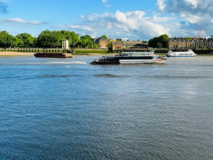 i
Image by Mohammed Karim
i
Image by Mohammed Karim The Thames Path is England’s great low-level river walk: 298 km / 185 miles from the spring-fed meadows near Kemble to the Thames Barrier at Woolwich. It suits independent walkers who want a proper long-distance journey without mountain terrain, with frequent towns, strong transport links and a river to follow almost every step of the way.
The route starts quietly at Thames Head, where the channel is often dry, then gathers itself through Cricklade, Lechlade-on-Thames, Oxford, Abingdon-on-Thames and the Goring Gap. Further downstream it becomes broader, busier and more urban, passing Henley-on-Thames, Windsor and Eton, Hampton Court, Richmond, central London, Greenwich and Woolwich.
This is an easy trail underfoot in good conditions, but not a trivial one. Two weeks of steady walking, muddy upper-river paths after rain, seasonal flooding of water-meadows and long hard-surfaced London miles all need sensible planning.
Its biggest strength is flexibility. Rail access at Kemble, Oxford, Reading, Henley, Windsor and Eton, Staines, Richmond, Putney and Woolwich makes the Thames Path unusually easy to walk end-to-end, in weekends or as single day sections.
This guide covers stages, daily planning, accommodation, food, transport, terrain and the common mistakes to avoid.
Stage-by-Stage Guide
The stage split below follows the 14-day itinerary used in this guide. Distances are approximate, and the Thames Path is easy to shorten or lengthen because many towns have public transport and accommodation. On the rural upper river, seasonal flooding and mud can change the practical difficulty of a stage; current path closures and river conditions should be checked before travelling.
Stage 1: Thames Head to Cricklade — 15 km
The walk begins at Thames Head, the official National Trail source near Trewsbury Mead, about 1.5 km / 1 mile north of Kemble. The source stone sits in a meadow and the early river channel is often dry except after heavy rain, so this first day can feel more like a Cotswold field walk than a riverside towpath.
Underfoot, expect grassy field paths, water-meadows and soft ground rather than a firm engineered trail. After wet weather this is one of the muddiest parts of the whole Thames Path, and winter flooding can make the meadows awkward or temporarily impassable.
The route passes near Ewen before reaching Cricklade, the first significant overnight stop. Do not plan this stage around frequent refreshment stops: carry food and water from the start, especially if arriving at Kemble by train and walking straight out to the source.
Kemble station is the practical access point for the start, with the National Trail beginning a short walk north at Thames Head. Cricklade has accommodation, but the upper river has the thinnest choice on the trail, so book early rather than assuming a room will be available on arrival. Public transport onward from Cricklade should be checked before travelling.
Navigation is straightforward once on the National Trail, but the first task is simply getting from Kemble to the source and then picking up the waymarked route. In poor weather, waterproof footwear is more useful here than on the later paved London stages.
Stage 2: Cricklade to Lechlade-on-Thames — 17 km
This is a quiet upper-Thames stage through low-lying meadows and riverside countryside. The river becomes more evident downstream, but the feel remains rural, with long sections where the path is soft, grassy and exposed to wet ground.
Castle Eaton is the main named place passed between the stage endpoints. Services between Cricklade and Lechlade-on-Thames should not be relied on without checking opening times, so start the day with enough food and water.
Lechlade-on-Thames is an important milestone because it sits near the head of navigation. St John’s Lock and the statue of Old Father Thames mark the point where the river begins to feel more like the navigable Thames familiar farther downstream.
Accommodation is available in Lechlade-on-Thames, but this is still part of the upper river where beds are less plentiful than they are from Oxford onwards. Road access is reasonable at both ends, while any bus or taxi arrangements should be checked before travelling.
The main warning is seasonal ground condition. In settled summer weather this is an easy riverside walk; after prolonged rain, the water-meadows can be slow and muddy.
Stage 3: Lechlade-on-Thames to Newbridge — 22 km
This is one of the more rural and rewarding upper-river days, linking the head of navigation with a long run of meadow, towpath and small riverside settlements. It is longer than the first two stages and has fewer obvious bail-out points, so it needs a little more planning.
Soon after Lechlade-on-Thames the route is associated with St John’s Lock and Old Father Thames, then continues downstream towards Kelmscott and Radcot. Kelmscott Manor, the country home of William Morris, lies just off the towpath and is one of the key cultural highlights of the upper Thames.
The walking remains mostly flat, but do not mistake flat for effortless in wet conditions. Mud, wet grass and flood-prone meadows can make progress slower than the distance suggests.
Food and water should be carried for the day unless specific stops have been checked in advance. Newbridge is a useful stage endpoint, but accommodation at or near the finish is more limited than in larger Thames towns; book ahead and be prepared to arrange a transfer if necessary. This should be checked before travelling.
Navigation is generally simple because the path follows the river corridor, but pay attention at bridges, locks and field boundaries where the waymarked line may not always stay exactly beside the water.
Stage 4: Newbridge to Oxford — 23 km
This stage continues through the rural upper Thames before gradually entering Oxford. It is a good example of how the trail changes: quiet meadow and towpath walking early on, then a more urban, historic riverside approach into one of the major cities on the route.
Bablock Hythe is the principal named place before Oxford. The final approach brings the path into the university city, where the Thames is traditionally called the Isis, passing the setting of Christ Church Meadow, college boathouses and the confluence with the River Cherwell.
The terrain is still easy and low-level, but the first part of the day can be muddy after rain. Once in Oxford, surfaces become firmer and the path is busier, with more pedestrians, cyclists and city activity.
Carry food and water for the rural section, then expect far better services on arrival in Oxford. Oxford is one of the easiest overnight stops on the whole trail, with plentiful accommodation and excellent rail access.
Navigation becomes more important in the city than it is in the open countryside. Follow the National Trail waymarks carefully through parks, bridges and riverside paths rather than simply assuming the nearest path beside the water is always the route.
Stage 5: Oxford to Abingdon-on-Thames — 15 km
This is a shorter and more forgiving day, useful after the longer upper-river stages. The route leaves Oxford along the riverside, passing Iffley and continuing through gentler countryside towards Abingdon-on-Thames.
The walking is mostly towpath, meadow and riverside path, with little physical difficulty. In dry weather it is one of the easier stages; after rain, soft sections can still be muddy, especially away from the city.
Abingdon-on-Thames is a strong overnight stop and a notable historic town, with medieval abbey grounds and the County Hall close to the river. Food and drink are easiest to plan around Oxford at the start and Abingdon at the end; any intermediate stops should be checked before relying on them.
Oxford has excellent rail access for anyone section-walking this stage. Public transport onward from Abingdon-on-Thames should be checked before travelling, especially if not staying overnight.
Navigation is normally uncomplicated, but there are enough urban fringes, bridges and river branches to make the waymarks worth following closely. Flooding of low riverside ground remains the main practical concern outside summer.
Stage 6: Abingdon-on-Thames to Wallingford — 24 km
This is a longer rural day through a chain of Thames villages and small settlements. The stage passes Culham, Clifton Hampden, Dorchester-on-Thames and Shillingford before reaching Wallingford.
The route remains flat and low-level, following field paths, riverside tracks and towpath-like sections. It is not technically difficult, but 24 km on soft or muddy ground can feel tiring, particularly if the water-meadows are wet.
Dorchester-on-Thames and the other settlements give the day structure, but do not assume regular food and water all along the route. Start with enough supplies and treat any village services as useful extras unless opening times have been checked.
Wallingford is the natural overnight stop and has accommodation options, though booking ahead is still sensible. Road access exists at the named settlements, but public transport arrangements for starting, ending or shortening the stage should be checked before travelling.
Navigation is mainly a matter of staying alert at river bends, bridges and village approaches. In wet periods, check for flood-related diversions before setting out.
Stage 7: Wallingford to Reading — 23 km
This is one of the classic middle-Thames stages, combining quiet riverside walking with the scenic Goring Gap before finishing in the larger urban centre of Reading. The day passes Moulsford, Goring and Streatley, Pangbourne and then Reading.
The highlight is the Goring Gap, where the Thames cuts between the Chiltern Hills and the Berkshire Downs. At Goring and Streatley the Thames Path crosses The Ridgeway National Trail, making this an important long-distance walking junction.
Terrain is still easy, but more varied than the upper river: field paths and towpaths give way to firmer riverside approaches as Reading nears. Mud can still be an issue on rural stretches, while the final urban miles are busier and harder underfoot.
Food and water planning is easier than on the upper river because the stage passes several named settlements, but carrying basic supplies is still sensible. Reading has plentiful accommodation and excellent rail access, making it one of the best places on the route to pause, resupply or join the trail for a section.
Navigation through Goring and Streatley and into Reading needs more attention than open towpath walking. Follow the acorn waymarks at bridges, road crossings and urban riverside paths.
Stage 8: Reading to Henley-on-Thames — 15 km
This is a shorter stage from Reading to Henley-on-Thames, giving a gentler day after the previous 23 km walk. The route leaves Reading’s urban riverfront and continues downstream via Sonning towards Henley.
The stage mixes paved or firmer town-edge paths with more traditional riverside walking. It is mostly straightforward underfoot, though wet weather can still affect softer stretches away from the built-up areas.
Sonning is the main named place between the endpoints. Henley-on-Thames is the highlight of the day: an elegant riverside town associated with the Henley Royal Regatta, held on the straight reach of river beside the path each summer since 1839.
Food and water are easy to organise at Reading and Henley-on-Thames, with intermediate options best checked in advance. Henley has accommodation, but availability can tighten around major summer events, so book early if walking in the regatta season.
Reading and Henley-on-Thames both have rail access, making this a practical section-walk. Navigation is generally simple, but the busier riverside through Reading and Henley means the National Trail waymarks should be followed rather than just walking whichever promenade looks closest to the river.
Stage 9: Henley-on-Thames to Marlow — 14 km
This is one of the shorter stages in the 14-day schedule and is a good opportunity for a slower morning or an early finish. The path continues along the middle Thames from Henley-on-Thames towards Marlow, passing Hurley.
The terrain is easy riverside walking: towpaths, field edges and village approaches, with minimal ascent. In normal conditions it is a straightforward day, though muddy sections can persist after rain.
Henley provides a strong start point for food and water, while Marlow is the main place to plan around at the end. Any stop in Hurley or along the way should be checked before relying on it.
Marlow has accommodation and makes a useful overnight stop before the longer walk to Windsor and Eton. Henley-on-Thames has rail access; public transport from Marlow should be checked before travelling.
The main practical issue is not difficulty but complacency. Short, flat stages are easy to underestimate, so keep an eye on waymarks at settlements and bridges where local paths may branch away from the National Trail.
Stage 10: Marlow to Windsor and Eton — 24 km
This is a longer and more built-up middle-Thames stage, linking Marlow with Windsor and Eton via Bourne End, Cookham and Maidenhead. The day has more settlement, more hard surface and more frequent services than the upper river stages.
The walking remains flat and river-led, but the character shifts between towpath, riverside green space, town approaches and developed riverfront. After several days of soft paths, the firmer surfaces can be welcome, though they may also be tiring over 24 km.
Cookham and Maidenhead break up the day before the route reaches Windsor and Eton. The key highlight is the view of Windsor Castle across the river, along with the historic setting of Eton.
Food and water are easier to manage on this stage because the route passes several sizeable places. Accommodation is available at Windsor and Eton, but it is a popular visitor area, so booking ahead is sensible.
Windsor and Eton has rail access, making this a good place to join or leave the trail. Navigation needs attention through the more developed riverside sections, where paths, promenades and bridge approaches can be busy.
Stage 11: Windsor and Eton to Staines-upon-Thames — 16 km
This is a moderate-length stage with major historic interest. The route leaves Windsor and Eton, passes Datchet, then continues to Runnymede before reaching Staines-upon-Thames.
Runnymede is the central landmark of the day: the riverside water-meadow where King John sealed Magna Carta in 1215, with memorials commemorating its constitutional legacy. The walking itself remains low-level and straightforward, moving between meadow, riverside path and town-edge sections.
Food and water planning is relatively easy compared with the upper river, especially at Windsor and Eton and Staines-upon-Thames. Datchet and Runnymede help break up the stage, but any specific refreshment stop should be checked before relying on it.
Staines-upon-Thames has accommodation and rail access, and Windsor and Eton is also well connected. This makes the stage practical for section-walkers as well as end-to-end walkers.
The main warning is seasonal wet ground around riverside meadows. In dry conditions this is an easy day; after high rainfall, check for flooding or diversions before setting out.
Stage 12: Staines-upon-Thames to Kingston / Hampton Court — 22 km
This stage moves into the outer London fringe while still keeping a strong riverside feel. From Staines-upon-Thames the route continues via Chertsey towards Hampton Court and Kingston upon Thames.
Hampton Court Palace is the main highlight: the great Tudor and baroque royal palace associated with Henry VIII, set beside the river with its famous maze and gardens. The approach also marks a noticeable transition from rural Thames to increasingly suburban Thames.
Underfoot, expect a mix of towpath, riverside path and firmer suburban surfaces. The walking is easy, but 22 km can still be tiring if much of the day is on harder ground.
Food and water are easier to find than on earlier rural stages, though carrying water remains sensible. Kingston upon Thames and the Hampton Court area offer accommodation options, with London-fringe prices and availability best checked before booking the stage split.
Staines-upon-Thames has rail access. Public transport around Kingston and Hampton Court is generally practical for London section-walking, but exact services and stations should be checked before travelling.
Navigation becomes more urban, with more bridges, riverside developments and local paths. Follow the National Trail waymarks carefully rather than assuming the most obvious riverside pavement is always the official line.
Stage 13: Kingston / Hampton Court to Putney — 23 km
This stage takes the Thames Path deeper into London, passing Richmond and Kew before reaching Putney. The river remains the constant guide, but the feel changes significantly: busier paths, more hard surface, more bridges and more people.
Richmond and Kew are the main landmarks and make this one of the more attractive London approaches. The walking is still flat, but the day can feel harder than the profile suggests because paved paths and promenades are less forgiving on feet than grass and towpath.
Food and water are readily available in this part of London, so there is less need to carry a full day’s supplies. Carry water anyway, especially in warm weather, because long urban stages can be surprisingly dehydrating.
Accommodation is abundant across London, and Putney is a practical overnight stop or transport break. Richmond and Putney both have rail or London transport access, making this stage easy to walk as a day section.
From the tidal lower Thames onwards, tide times and any riverside restrictions should be checked before travelling. Navigation is mostly simple, but through London there may be choices of bank in places; decide the intended line in advance and keep checking the waymarks at bridges and busy junctions.
Stage 14: Putney to Thames Barrier, Woolwich — 30 km
The final stage is the longest in this 14-day schedule and is almost entirely urban. It follows the Thames through central London and down to the Thames Barrier at Woolwich, with a sequence of landmarks that makes the distance memorable but also physically tiring on hard surfaces.
The route passes Battersea, Westminster and central London, continues under or near the great central bridges including Tower Bridge, then heads on through Greenwich towards the finish. Greenwich is a major highlight, with the Maritime Greenwich World Heritage Site, the Cutty Sark, the Old Royal Naval College and the Royal Observatory on the Prime Meridian close to the river corridor.
The finish at the Thames Barrier is distinctive and unmistakable, with its steel-hooded piers spanning the river at Woolwich. The official National Trail ends at the Thames Barrier and continues the short distance to the Woolwich foot tunnel; the Thames Path Extension to Crayford Ness and longer England Coast Path links beyond are separate add-ons, not part of the 185-mile core route.
This stage is easy in terms of gradient but demanding in distance and surface. Expect extensive paving, busy promenades, traffic noise near road crossings and crowds around central London landmarks. An early start is sensible if walking the whole 30 km in one day.
Food, water and toilets are far easier to plan than on the rural stages because the route passes through central London. Accommodation is abundant across London but can be expensive, so book ahead if staying near the finish.
Putney has public transport access, central London has numerous options, and Woolwich is served by the Elizabeth line, DLR and National Rail. This makes it easy to shorten the day, split it into two London sections or bail out if feet are suffering from the hard surfaces.
Navigation through central London needs attention because the river can be walked on either bank in places and the most scenic line is not always the official waymarked one. Check tide times, current riverside closures and any temporary diversions before relying on a specific bank, especially on the tidal lower river.
Recommended Itinerary
The 14-day schedule below is the most straightforward through-walk: long enough to cover the 298 km / 185 miles efficiently, but still realistic for most fit walkers because the route is flat and well waymarked. The main planning issue is not ascent, but where the longer rural stages and the hard-surfaced London miles fall.
Book the upper-river nights early, especially between the source and Oxford. Later in the walk, rail access and accommodation become much more flexible, although London beds are usually expensive.
Standard 14-day itinerary
| Day | From | To | Approx. distance | Why this stage makes sense | Services/accommodation notes |
|---|---|---|---|---|---|
| 1 | Thames Head (source) | Cricklade | 15 km | A sensible first day after reaching Kemble and walking to the source at Trewsbury Mead. It leaves time to locate the source stone and settle into the upper-river paths, where the channel may be dry near the start. | Kemble station is the practical access point for the start. Cricklade is the first main overnight stop; book ahead because upper-river accommodation is thinner. |
| 2 | Cricklade | Lechlade-on-Thames | 17 km | Another moderate day through the quiet upper Thames, keeping the opening stages manageable before the longer rural days begin. | Lechlade-on-Thames is a useful overnight town. Accommodation should still be booked in advance in this upper section. |
| 3 | Lechlade-on-Thames | Newbridge | 22 km | This is the first longer stage, following the upper navigable river past places such as Kelmscott and Radcot. It keeps progress steady without pushing all the way to Oxford. | Newbridge is a practical staging point but has less choice than the larger towns later on. Secure accommodation before committing to this stage. |
| 4 | Newbridge | Oxford | 23 km | A long but flat approach into Oxford, with the reward of reaching one of the best-served towns on the whole trail. | Oxford has extensive accommodation, food options and rail links. It is a good place to recover, resupply or adjust the itinerary. |
| 5 | Oxford | Abingdon-on-Thames | 15 km | A shorter day after Oxford, following the river out past Iffley and giving time either for a slower start or some time in Abingdon. | Abingdon-on-Thames has town services and accommodation. This is one of the easier days to keep relaxed. |
| 6 | Abingdon-on-Thames | Wallingford | 24 km | A longer rural stage linking a chain of Thames-side settlements including Culham, Clifton Hampden, Dorchester-on-Thames and Shillingford. The flat terrain makes the distance manageable. | Wallingford is the main overnight target. If shortening this stage, check official mapping and accommodation availability before booking. |
| 7 | Wallingford | Reading | 23 km | This stage takes in the Goring Gap and then continues via Pangbourne towards Reading, balancing scenery with a strong transport and accommodation finish. | Goring and Streatley and Pangbourne are useful intermediate places. Reading has plentiful accommodation and excellent rail links. |
| 8 | Reading | Henley-on-Thames | 15 km | A shorter stage after two longer days, passing Sonning and finishing in one of the most attractive riverside towns on the route. | Henley-on-Thames has accommodation, but availability can tighten around major summer river events such as Henley Royal Regatta. Check dates before booking. |
| 9 | Henley-on-Thames | Marlow | 14 km | The shortest day on this schedule, useful for recovery before the longer push to Windsor. It also leaves time for a more relaxed morning in Henley or Marlow. | Marlow is a practical overnight stop with town services. This is a good buffer day if feet are sore or weather has slowed progress. |
| 10 | Marlow | Windsor and Eton | 24 km | A longer but well-supported day through the middle Thames corridor, passing Bourne End, Cookham and Maidenhead before reaching Windsor and Eton. | Windsor and Eton offer a wide choice of accommodation and transport, but book early in busy periods. |
| 11 | Windsor and Eton | Staines-upon-Thames | 16 km | A moderate stage that allows time for Windsor, Eton and the riverside at Runnymede without creating a long walking day. | Staines-upon-Thames is a practical overnight stop with rail access. This is a useful point to adjust the schedule before entering the London approaches. |
| 12 | Staines-upon-Thames | Kingston / Hampton Court | 22 km | A steady suburban-riverside stage via Chertsey and Hampton Court, with the route becoming increasingly urban but still easy underfoot. | Decide in advance whether to overnight around Hampton Court or Kingston upon Thames. Accommodation availability and prices should be checked before booking. |
| 13 | Kingston / Hampton Court | Putney | 23 km | This stage carries the walk through the western London river corridor, including Richmond and Kew, while stopping before the longest and most urban final day. | Richmond and Putney have strong public transport links. London accommodation is plentiful but often expensive. |
| 14 | Putney | Thames Barrier, Woolwich | 30 km | The final day is the longest in this standard itinerary and is mostly hard-surfaced urban walking. It passes central London, Tower Bridge and Greenwich before the finish at the Thames Barrier. | Check tide times for the tidal lower river and decide your bank through central London before setting out. Woolwich is served by the Elizabeth line, DLR and National Rail. Many walkers split this day. |
Slower variant: 15–16 days
A slower itinerary suits walkers who want more time in Oxford, Henley, Windsor or London, families walking shorter days, or anyone tackling the trail in winter when upper-river mud and flooding can slow progress.
The easiest extra day is to split the final 30 km from Putney to Woolwich, usually by stopping in central London or Greenwich. Exact distances depend on the side of the river chosen through London, so check official mapping before booking.
For a 16-day walk, also shorten one of the 22–24 km stages. The most logical candidates are Abingdon-on-Thames to Wallingford, Wallingford to Reading, or Marlow to Windsor and Eton, using intermediate places such as Dorchester-on-Thames, Shillingford, Goring and Streatley, Pangbourne or Maidenhead where accommodation works. This should be checked before travelling, as smaller places may have limited beds.
Faster variant: 12–13 days
A faster schedule is realistic only for walkers comfortable with repeated long, flat days and some hard-surface fatigue, especially near London. The route is not technically hard, but the lack of climbing should not disguise the cumulative mileage.
For 13 days, the cleanest compression is to combine Reading to Henley-on-Thames and Henley-on-Thames to Marlow into one longer Reading to Marlow day of about 29 km. This keeps accommodation simple while removing one of the shortest days.
For 12 days, a second compression is possible by combining Thames Head to Cricklade and Cricklade to Lechlade-on-Thames into a long opening day of about 32 km. This only makes sense with an early start from Kemble, light luggage and accommodation already booked in Lechlade-on-Thames.
Going faster than this is usually less practical than it looks on paper. The upper river has fewer accommodation options, and the final London miles are hard underfoot even though navigation and transport are easy.
Planning the Route
How many days to allow
A practical end-to-end schedule is around 14 days, averaging roughly 24 km / 15 miles per day. That suits fit walkers who are comfortable with consecutive full days, but the Thames Path is often more enjoyable over 15–16 days, especially if you want time in Oxford, Henley-on-Thames, Windsor, Greenwich or central London.
The route is easy underfoot in terms of gradient, but it should not be treated as effortless. Long flat days can be hard on feet and joints, and the later urban stages include a lot of hard-surfaced riverfront and pavement. A slightly slower schedule is often the better choice unless the priority is simply to complete the trail efficiently.
The sample 14-day split works well as a direct itinerary, but the final Putney to Thames Barrier day is long at around 30 km. Walkers wanting a gentler finish can shorten this by using London accommodation and transport to divide the capital section more finely.
Stage planning and natural stopping points
Daily stages are mainly dictated by riverside towns, accommodation and transport rather than terrain. The upper Thames has fewer large settlements, so the early days need more care; from Oxford downstream, towns and rail options become increasingly frequent.
A typical progression is:
| Section | Planning character |
|---|---|
| Thames Head to Oxford | Rural, quieter and more accommodation-sensitive. Book ahead, expect field paths, grass and possible mud or flooding after wet weather. |
| Oxford to Reading | Easier to organise, with established towns such as Abingdon-on-Thames, Wallingford, Goring and Streatley, Pangbourne and Reading. |
| Reading to Windsor and Eton | Well-served river towns, including Henley-on-Thames, Marlow, Maidenhead and Windsor and Eton. Accommodation is generally more flexible, but busy periods still need advance booking. |
| Windsor and Eton to Putney | Increasingly urban, with frequent transport links and many ways to adjust daily distance. |
| Putney to Woolwich | London walking on hard surfaces with excellent transport, but route choice, tide checks and fatigue management matter more than accommodation logistics. |
Above Oxford, the thinnest accommodation choice is the main constraint. Cricklade, Lechlade-on-Thames, Newbridge and nearby stopping points should be planned before fixing the rest of the itinerary. Downstream, it is usually easier to adapt stages around towns and stations.
Walking quickly or slowly
A fast end-to-end walk is possible because the route has negligible climbing and is well waymarked. The limiting factor is not altitude but repeated mileage, hard surfaces, wet ground in the upper water-meadows and the cumulative effect of two weeks beside the river.
A slower schedule is better if the walk is part holiday and part trail. Oxford, Abingdon-on-Thames, Henley-on-Thames, Windsor and Eton, Hampton Court, Greenwich and central London all reward extra time, and short days also help when weather or flooding affects the upper river.
For most independent walkers, the best plan is to keep the rural upper stages fixed around booked beds, then allow more flexibility from Oxford onwards. London in particular is easy to split into shorter stages because transport and accommodation are abundant, though often expensive.
Shortening, extending and section hiking
The Thames Path is one of the easiest National Trails to walk in sections. Kemble station gives access near the source, and major places such as Oxford, Reading, Henley-on-Thames, Windsor and Eton, Staines-upon-Thames, Richmond, Putney and Woolwich all have strong rail, Underground, Overground, DLR or Elizabeth line links as appropriate.
This makes bail-outs and rest days unusually simple. If weather, foot pain or flooding interrupts the walk, it is normally practical to leave the trail and return later without redesigning the whole route.
The official National Trail finishes at the Thames Barrier and continues to the Woolwich foot tunnel. The waymarked Thames Path Extension to Crayford Ness and the England Coast Path link onward towards the Isle of Grain are separate add-ons, not part of the core 185-mile Thames Path. Add them only if the aim is a longer source-to-sea journey rather than the standard National Trail.
What to plan before booking
Accommodation is the first priority. Book the early nights between the source and Oxford before relying on a fixed itinerary, then arrange the rest around preferred daily distances. London beds are plentiful but can be costly, so late booking there may affect budget rather than availability.
Transport is the second major advantage of this route. End-to-end walkers can start from Kemble, a short walk from the source area at Thames Head / Trewsbury Mead, and finish at Woolwich, which is served by Elizabeth line, DLR and National Rail services. Section walkers can build the route around rail access in the larger towns.
Food and water planning is straightforward compared with remote trails, but the upper river still has quieter stretches. Carry enough water and food for each day rather than assuming constant riverside services, particularly between the smaller settlements before Oxford.
Navigation is usually simple thanks to National Trail acorn waymarks and the river as a constant reference. Still carry reliable mapping or a GPS route, especially for field crossings, temporary diversions, urban riverfront choices and places where the path changes bank.
Weather planning matters most for wet ground rather than exposure. The upper Thames water-meadows can become muddy or flood-prone in winter and after heavy rain, and temporary closures or diversions should be checked before travelling. In London and on the tidal lower river, check tide times where required and decide in advance which bank to use through central London.
No complex mountain logistics are involved: there are no major climbs, high passes or remote resupply problems. The success of a Thames Path itinerary depends instead on sensible stage lengths, early accommodation booking above Oxford, current flood and tide checks, and using the excellent transport network to keep the walk flexible.
Towns, Villages and Overnight Stops
Accommodation is one of the Thames Path’s strengths, but it is not evenly spread. The upper river between Thames Head and Oxford has the thinnest choice, so the first few nights need the most careful booking; from Oxford downstream, towns are frequent and the route becomes much easier to split flexibly.
Hotels, guesthouses, B&Bs, inns, a few hostels and campsites are all possible along the trail, but campsites are not continuous and should not be assumed at the end of every stage. In smaller villages, food may mean a pub rather than a full choice of shops, and opening days can matter. This should be checked before travelling.
Thames Head and Kemble
The National Trail starts at Thames Head, at Trewsbury Mead near Kemble. The source is marked by a stone in a meadow about 1.5 km / 1 mile north of Kemble village, and the river channel here is often dry except after heavy rain.
Kemble is the practical access point for the start, with a station on the London Paddington–Cheltenham line. Most walkers will not treat Thames Head itself as an overnight stop; it is a rural start point rather than a serviced trail village.
If arriving the day before, accommodation and food should be arranged around Kemble or the surrounding area rather than relying on anything at the source. Availability should be checked before travelling, especially if starting on a weekend or during holiday periods.
Cricklade
Cricklade is the first natural overnight stop after the source, reached at the end of the common first stage from Thames Head. It is one of the key upper-river towns and is a sensible place to break the walk before the route continues towards Lechlade-on-Thames.
This is still part of the thinner accommodation section of the trail, so book ahead rather than arriving without a room. Expect more useful services here than in the smaller settlements between the source and Lechlade, but check current food and shop opening times before relying on them.
Cricklade is also a practical reset point after the first day, when paths across water-meadows can be muddy after rain. If conditions on the upper river are poor, it is worth checking current route information before setting out again.
Lechlade-on-Thames
Lechlade-on-Thames is one of the most important early stops and a strong overnight choice after Cricklade. It sits near the head of navigation, with St John’s Lock and the Old Father Thames statue marking the point where the navigable river becomes a defining feature of the walk.
Accommodation is generally more useful here than in the smaller villages immediately before and after it, but it should still be booked early because the upper Thames has fewer beds than the middle and lower river. Food and pub options are more dependable than on the rural reaches, though current opening times should still be checked.
Lechlade is a good place to buy supplies before the quieter stretch towards Kelmscott, Radcot and Newbridge. Do not assume regular shops or all-day food in the smaller places along the next section.
Newbridge
Newbridge is a common overnight halt between Lechlade-on-Thames and Oxford. It breaks a long rural section that passes places such as Kelmscott, Radcot and Bablock Hythe, where services are more limited and less predictable.
This is one of the stops that needs the most attention when booking the Thames Path. Accommodation can be thinner than in the larger towns, and walkers should have a confirmed bed or a clear onward plan before committing to this stage.
Food arrangements also need checking. In this part of the trail, carrying enough snacks or lunch to cover the day is sensible rather than depending on a convenient café or shop appearing at the right time.
Oxford
Oxford is the first major city on the Thames Path and one of the easiest places on the whole trail for accommodation, food and transport. The path reaches the city after the rural approach from Newbridge and passes through the historic riverside area around Christ Church Meadow and the college boathouses.
This is an excellent overnight stop, especially for anyone wanting a shorter day afterwards to Abingdon-on-Thames. Hotels, guesthouses and other accommodation styles are much more plentiful here than on the upper river, though prices and availability will vary with university terms, events and holidays.
Oxford has rail access and is one of the best points for starting, ending or pausing a section walk. It is also the obvious place to replace gear, restock properly and deal with any wet or muddy kit after the upper-river meadows.
Abingdon-on-Thames
Abingdon-on-Thames is a natural overnight stop after Oxford, with a relatively short stage between the two. The town sits directly on the river and is one of the more useful service points before the route continues towards Wallingford.
Accommodation and food options are stronger here than in the smaller villages either side, making it a practical place to stop rather than pushing on. It is also a good town for resupplying before the longer Abingdon-to-Wallingford day.
Between Oxford and Abingdon the path passes Iffley, and beyond Abingdon it passes smaller places including Culham, Clifton Hampden, Dorchester-on-Thames and Shillingford. These can be useful for breaks, but should not be treated as guaranteed overnight or resupply points without checking ahead.
Wallingford
Wallingford is a key overnight stop on the middle Thames and a sensible end to the longer stage from Abingdon-on-Thames. It gives access to town services before the route continues towards Moulsford, the Goring Gap and Reading.
For walkers following a steady two-week schedule, Wallingford is one of the better places to pause, restock and recover. Accommodation should still be booked in advance, but the town is a more dependable base than the smaller riverside settlements nearby.
The next stage is varied and includes smaller places where services may not line up conveniently with walking hours. Carrying lunch or at least reliable snacks is still sensible, even though the trail is becoming less remote than the upper river.
Goring and Streatley
Goring and Streatley sit at the Goring Gap, where the Thames cuts between the Chiltern Hills and the Berkshire Downs. This is one of the most useful intermediate stops between Wallingford and Reading, as well as a scenic highlight.
The villages make a good overnight alternative if splitting the Wallingford-to-Reading section into shorter days. They are also significant because the Thames Path crosses The Ridgeway National Trail here, which can make the area busier with walkers.
Accommodation and food should be booked or checked ahead, particularly at weekends. If staying here, it creates a shorter onward walk to Reading and avoids turning the middle-river stages into a sequence of long days.
Reading
Reading is a major practical hub on the Thames Path and a strong overnight stop. It is reached after Wallingford via Moulsford, Goring and Streatley, and Pangbourne, and it marks the transition into a more urban, better-served part of the route.
Accommodation choices are much wider here than on the upper and middle rural sections. Food, shops and transport are also much easier, making Reading a useful place for laundry, gear replacement, restocking or joining/leaving the trail.
Reading has rail access and is one of the best locations for section-walk logistics. It is also a good place to review onward accommodation, because the popular riverside towns downstream, especially Henley-on-Thames, Marlow and Windsor, can be busy in peak periods.
Henley-on-Thames
Henley-on-Thames is a classic overnight stop after Reading, with the trail approaching via Sonning and the riverside reaches used for the Henley Royal Regatta. It is one of the most attractive and popular towns on the Thames Path, which also means accommodation should be booked early.
Food and town services are generally more useful here than in the villages immediately before and after it. Henley has rail access, making it a good point for section walkers or anyone needing to adjust plans.
The next stage to Marlow is relatively short on the standard schedule, so Henley is a good place to recover from previous longer days. If local events are taking place, prices and availability can change sharply; confirm current accommodation before booking a fixed itinerary.
Marlow
Marlow is a strong overnight stop between Henley-on-Thames and Windsor and Eton. The usual stage from Henley is comparatively short, making Marlow a useful place to arrive with time to rest, eat properly and prepare for the longer day that follows.
Accommodation and food options are more dependable than in smaller riverside places such as Hurley, Bourne End and Cookham, though those places may still be useful for breaks depending on opening times. Current services should be checked before travelling.
The following section towards Windsor and Eton passes Maidenhead and is one of the longer standard days. Starting it from a confirmed Marlow overnight stop keeps the schedule straightforward.
Windsor and Eton
Windsor and Eton are among the most useful overnight stops on the lower Thames. The route links the two sides of the river with Windsor Castle visible from the trail, and the towns offer a much broader range of accommodation and food than the smaller places upstream.
This is a good point for walkers who want a reliable bed, a full resupply and strong transport options. Windsor and Eton have rail access, making them suitable for section starts and finishes as well as a main through-walk stop.
Because Windsor is a major visitor destination, accommodation should be booked ahead and prices can be higher than in less visited towns. If walking a fixed schedule, do not leave this night to chance.
Staines-upon-Thames
Staines-upon-Thames is the next practical overnight stop after Windsor and Eton, following a stage that passes Datchet and Runnymede. It is a useful service town before the route continues towards Chertsey, Hampton Court and Kingston upon Thames.
Accommodation and food are generally easier to arrange here than in the smaller riverside places nearby. Staines-upon-Thames has rail access, so it also works well for section walkers or as a bail-out point.
Runnymede is an important historic stop on the way, but it is better treated as a place to visit during the walking day rather than the main overnight base. Check onward route conditions and any tidal or riverside path notes before continuing towards the London fringe.
Hampton Court and Kingston upon Thames
Hampton Court and Kingston upon Thames form a practical pair of overnight options on the approach to London. The standard schedule often ends this stage at Kingston or Hampton Court after walking from Staines-upon-Thames via Chertsey.
Hampton Court is useful for walkers who want to stop beside one of the major riverside landmarks, while Kingston upon Thames gives a more urban base with broader services. Accommodation and food are much easier here than on the rural upper Thames, but prices and availability should still be checked before fixing dates.
This is also where the character of the walk changes decisively. Expect more hard surfaces, more people and more urban riverside walking from here downstream.
Richmond, Kew and Putney
Richmond, Kew and Putney are the main practical stopping points through west and south-west London. The route from Kingston or Hampton Court to Putney is a long urban-riverside day on the standard schedule, but it can easily be split because transport access is frequent.
Richmond and Putney have rail or Underground/Overground access, making them excellent section-walking bases. Accommodation is plentiful compared with the rural trail, but London prices are often high.
Food and shops are not a problem in this section, so the main planning issue is distance and underfoot fatigue rather than resupply. The long paved miles can be harder on feet than the flat profile suggests.
Central London, Greenwich and Woolwich
From Putney downstream, the Thames Path passes Battersea, Westminster and central London, Tower Bridge and Greenwich before finishing at the Thames Barrier at Woolwich. This final section is heavily serviced, but it is also the longest standard day if walked in one push from Putney.
Many walkers split the London section rather than treating Putney to Woolwich as a single day. Accommodation is abundant across London, but it is often expensive, so booking early and choosing a base close to the river or good transport can make the final stages easier.
Through central London the river can be walked on either bank in places, so decide the preferred side before setting out for the day. The tidal lower river and some sections require tide-time checks, and current route information should be checked before travelling.
Greenwich is a useful final overnight or break point before the run-in to the Thames Barrier, with major landmarks close to the path. Woolwich is the practical finish area: the official National Trail ends at the Thames Barrier and continues to the Woolwich foot tunnel, and Woolwich is served by the Elizabeth line, DLR and National Rail.
Getting to the Start
By train
Kemble is the key railhead for the start of the Thames Path. Kemble station is on the London Paddington–Cheltenham line, making the source unusually straightforward to reach for a rural National Trail start.
From Kemble, the National Trail begins at Thames Head / Trewsbury Mead, where a stone marks the official source of the Thames in a meadow about 1.5 km / 1 mile north of Kemble village. Allow time to walk from the station or village to the source before beginning the first stage towards Cricklade.
Train times, engineering works and whether a change is needed should be checked before travelling, especially for Sunday starts or early-morning departures.
By bus
Bus access to the immediate start is less useful than the train. The source is in open countryside near Kemble, not in a town centre, so most walkers should plan around arriving by rail at Kemble rather than relying on a bus to the trailhead.
Local bus options in the Kemble, Cricklade and upper Thames area may be limited and timetable-dependent. This should be checked before travelling.
By car
Driving to the source is possible in general terms, but it is awkward for a point-to-point walk unless someone is dropping you off. The route finishes far away at Woolwich in south-east London, so leaving a car near the start creates a significant end-of-walk retrieval problem.
There is no need to drive for most itineraries because Kemble station is close to the start and the Thames Path has excellent rail access throughout. If a lift or taxi is used, arrange it to Kemble or to the nearest practical road access for Thames Head, then walk to the source marker.
Do not assume long-stay parking is available at or near the source. Parking arrangements, restrictions and any station parking at Kemble should be checked before travelling.
From the nearest airport
For walkers arriving by air, the simplest approach is usually to travel into London and use trains from London Paddington to Kemble. This keeps the start logistics simple and avoids needing a hire car for a linear trail.
Airport-to-rail connections, transfer times across London and late-evening train options vary, so build in margin if starting the walk the same day. This should be checked before travelling.
Where to stay before starting
The most convenient pre-start base is Kemble or accommodation close enough to reach Thames Head early the next morning. The first walking day is typically from the source to Cricklade, so Cricklade can also work if a taxi or lift back to the source is arranged before starting.
Accommodation is thinnest on the upper river between the source and Oxford, so the first few nights should be booked ahead rather than left to chance. This is especially important if walking in peak season or if your first day depends on a late train arrival at Kemble.
Getting Home from the Finish
The official Thames Path finishes at the Thames Barrier in Woolwich, with the National Trail continuing the short distance to the Woolwich foot tunnel. This is one of the easiest long-distance trail finishes in Britain for onward travel: Woolwich is part of the London transport network and is served by the Elizabeth line, DLR and National Rail.
By train
Woolwich is the practical rail hub for leaving the finish. From there, use the Elizabeth line, DLR or National Rail for onward travel across London and connections to the wider rail network.
For most walkers, the simplest plan is to finish at the Thames Barrier, continue to Woolwich, then take rail transport into central London or onwards to a mainline station. Exact routes, late-evening services and engineering work are timetable-dependent and should be checked before travelling.
If returning to the start area, rail travel back towards Kemble will normally involve crossing London and then using the London Paddington–Cheltenham line. Build in extra time if carrying a full pack, especially at busy periods.
By bus
Woolwich has London bus connections, but bus route numbers, stops and evening frequencies should be checked before travelling. For most end-to-end walkers, rail from Woolwich will be faster and simpler than relying on buses for the main onward journey.
Buses can still be useful for short local hops: for example, reaching nearby accommodation, connecting from the Thames Barrier area to Woolwich, or avoiding an extra urban walk at the end of a long final stage.
By car/taxi
Finishing by car is less convenient than using public transport. The Thames Barrier is in south-east London, so parking, congestion, and meeting a lift can be awkward compared with rural trailheads.
A taxi or private-hire vehicle is practical for local transfers, especially if finishing late, in poor weather, or with heavy luggage. Arrange a clear pick-up point in advance rather than assuming a driver can meet you directly at the barrier.
If leaving a car anywhere near the finish, check current parking rules before committing. London parking restrictions and charges can change, and long-stay options may not suit a two-week walk.
From the nearest airport
Airport connections from the finish depend on which London airport is being used. The practical approach is to travel from Woolwich by Elizabeth line, DLR or National Rail into the London transport network, then connect onwards to the chosen airport.
Allow generous time between finishing the walk and a flight. The final day into Woolwich is often a long paved urban stage, and delays can come from tired legs, navigation through busy riverside areas, or timetable disruption. Same-day flights are possible but should not be planned tightly.
Where to stay at the finish
London has abundant accommodation, but it is often expensive. Staying near Woolwich, Greenwich or elsewhere in London can make sense if you finish late, want an unhurried meal and shower, or need an early onward train or flight the next morning.
Greenwich is passed shortly before the finish and is a practical area to consider if you prefer to stop just short, visit the Maritime Greenwich area, or split the final London miles. Otherwise, Woolwich works well as a functional finish point because onward rail options are close at hand.
Book ahead if finishing at a weekend, during major London events, or in peak holiday periods. Prices and availability vary sharply across the capital, so confirm current rates before booking.
Which Direction Should You Walk?
Standard direction: Thames Head to Woolwich
The normal and most satisfying direction is downstream, from Thames Head near Kemble to the Thames Barrier at Woolwich. This follows the way the National Trail is usually described: source to tidal London, with the river gradually growing from a dry or seasonal channel in the Cotswold water-meadows into a navigable river, then a major urban waterway.
This direction also gives the strongest sense of progression. The early days are quiet and rural, passing Cricklade, Lechlade-on-Thames and Newbridge before reaching Oxford; the middle section builds through Abingdon-on-Thames, Wallingford, Reading, Henley-on-Thames, Marlow and Windsor and Eton; the final stages become increasingly urban through Richmond, Putney, central London, Greenwich and Woolwich.
The finish at the Thames Barrier is a clear psychological endpoint. It feels more conclusive than finishing in a meadow near Kemble, especially after the long sequence of London bridges, landmarks and tidal riverfront.
Reverse direction: Woolwich to Thames Head
Walking upstream is entirely possible. Waymarking, mapping and transport access make the route workable in either direction, and the Thames Path has no serious climbs to worry about.
The main disadvantage is the loss of narrative momentum. Starting at the Thames Barrier and walking away from London means the route becomes quieter and more rural as it goes on, but the final miles end at Thames Head, where the channel is often dry except after heavy rain. Some walkers will enjoy that quiet ending; most will find the downstream journey more natural.
Reverse walking can make sense for London-based section walkers who want to begin with easy rail, Underground, Overground, DLR or Elizabeth line access and work gradually west. It can also suit anyone with fixed accommodation already available in the upper Thames towns at the end of the trip.
Transport and accommodation logistics
Transport is excellent in both directions. Kemble station gives access near the source, while Woolwich is served by the Elizabeth line, DLR and National Rail. Major intermediate points such as Oxford, Reading, Henley, Windsor and Eton, Staines-upon-Thames, Richmond and Putney make section walking straightforward either way.
Accommodation is the bigger practical issue. The upper river between Thames Head and Oxford has the thinnest choice, so walking downstream means dealing with the most constrained bookings at the start of the trip. That is usually a good thing: once those early nights are fixed, later stages have more frequent towns and generally more flexibility.
In reverse, the accommodation bottleneck comes near the end, when tired legs and accumulated delays are more likely. If walking upstream, book the upper-river nights early and avoid relying on last-minute availability around the final stages.
Does direction affect difficulty?
Not in any meaningful way. The Thames Path is almost flat, with negligible ascent, and the high point is effectively at the source. Downstream walking technically loses height all the way to sea level, but the gradient is so gentle that it makes little practical difference underfoot.
Weather and wind are not usually a deciding factor for this trail. The more important seasonal issues are mud and flooding on the rural upper river after wet weather, and tide-time checks for the tidal lower river and a few affected sections. These apply whichever direction you walk.
Recommendation
Walk the Thames Path downstream, from Thames Head near Kemble to the Thames Barrier at Woolwich. It is the traditional, most intuitive direction, gives the best source-to-city progression, handles the accommodation flow sensibly, and ends with the strongest finish. Reverse direction is mainly worth choosing for section-walking convenience or specific accommodation plans.
Accommodation Along the Route
The Thames Path is one of the easier National Trails to organise as an inn-to-inn walk. Most stages finish in or near established riverside towns, and the route has a wide mix of hotels, guesthouses, B&Bs, inns, a few hostels and campsites.
The main accommodation pinch-point is the upper river between Thames Head and Oxford. Places such as Cricklade, Lechlade-on-Thames and Newbridge are natural overnight stops, but choice is thinner than farther downstream, so these early nights should be booked first. Once the trail reaches Oxford, Reading, Windsor and London, availability becomes much broader, though city prices and weekend demand can be high.
Best overnight bases
For a continuous 14-day walk, the practical overnight stops are the stage towns: Cricklade, Lechlade-on-Thames, Newbridge, Oxford, Abingdon-on-Thames, Wallingford, Reading, Henley-on-Thames, Marlow, Windsor and Eton, Staines-upon-Thames, Kingston / Hampton Court, Putney and Woolwich or central/east London after the finish.
Oxford, Reading, Windsor and Eton, and London are the strongest bases if flexibility matters. They have the broadest range of accommodation and good rail links, which makes them useful for rest days, late arrivals, bag-free day walks or rejoining the trail after a break.
The smaller river settlements are more atmospheric but less forgiving. Where a stage ends at a small place such as Newbridge, availability should be treated as limited unless accommodation has already been secured.
| Place | Accommodation level | Best for | Notes |
|---|---|---|---|
| Kemble / Thames Head area | Limited | Night before starting | The trail begins at Thames Head near Kemble, with the source about 1.5 km / 1 mile north of Kemble village. Accommodation close to the actual start is limited, so arrange the first night carefully. |
| Cricklade | Limited | First overnight stop | A logical end to the first short stage from the source. Book ahead, especially if walking a fixed itinerary. |
| Lechlade-on-Thames | Limited | Upper-river staging | A key stop on the early trail and useful before the longer rural stages towards Newbridge and Oxford. Choice is thinner than downstream. |
| Newbridge | Limited | Breaking the Lechlade–Oxford section | A practical overnight point, but not a large town. Secure accommodation before relying on it as a stage end. |
| Oxford | Good | Rest day, resupply, flexible staging | One of the strongest accommodation hubs on the route, with extensive transport links and plenty of services. Useful after the thinner upper-river section. |
| Abingdon-on-Thames | Good | Standard overnight stop | A natural stage town after Oxford, with a more manageable riverside-town feel than the city. |
| Wallingford | Good | Mid-route overnight stop | A practical stop between Abingdon and Reading, and a good base before the Goring and Streatley / Pangbourne stretch. |
| Goring and Streatley / Pangbourne | Limited to good | Alternative staging | Useful if shortening or reshaping the Wallingford–Reading stage. Accommodation availability should be checked before building an itinerary around these stops. |
| Reading | Good | Major resupply, transport, flexible overnight | One of the biggest service centres on the Thames Path. A strong choice for walkers wanting rail access, shops and a wide bed choice. |
| Henley-on-Thames | Good | Classic riverside overnight | A popular and attractive stop. Demand can be high around major river events and summer weekends, so book ahead. |
| Marlow | Good | Short-stage overnight | A natural stop after Henley-on-Thames and before the longer push towards Windsor and Eton. |
| Maidenhead | Good | Alternative staging | Useful for splitting the Marlow–Windsor and Eton section if a shorter day is preferred. |
| Windsor and Eton | Good | Major overnight, sightseeing, transport | Strong accommodation choice, but tourist demand can make advance booking sensible. |
| Staines-upon-Thames | Good | Practical suburban stop | A useful overnight between Windsor and the Hampton Court / Kingston area, with good onward transport options. |
| Hampton Court / Kingston upon Thames | Good | London-edge staging | Both areas work well before the longer riverside stretch towards Putney. Accommodation choice increases as the route enters Greater London. |
| Richmond / Kew | Good | Alternative London staging | Useful if splitting the Kingston / Hampton Court to Putney section or planning a shorter final approach through London. |
| Putney | Good | Final-stage base | A practical base before the long final day to the Thames Barrier at Woolwich. London accommodation is plentiful but often expensive. |
| Central London / Greenwich / Woolwich | Good | Finish, onward travel, section walking | The final miles have abundant accommodation options across London. Staying near Woolwich, Greenwich or a well-connected central area can simplify departure after finishing. |
Booking strategy
Book the upper-river nights first: Kemble / Thames Head area, Cricklade, Lechlade-on-Thames and Newbridge. These are the least flexible parts of the route because the settlements are smaller and alternatives may involve leaving the river.
After Oxford, it is usually easier to adjust the itinerary because towns are larger and rail access is frequent. Even so, fixed-date walkers should still book ahead in popular places such as Henley-on-Thames, Windsor and Eton, and London.
Summer weekends, bank holidays and major local events can tighten availability in the best-known Thames towns. Henley-on-Thames is especially associated with the Henley Royal Regatta, and Windsor and central London attract heavy visitor demand throughout the warmer months. Current availability and event dates should be checked before booking non-refundable travel.
Camping, hostels and budget options
The Thames Path is not a wild upland trail, and most walkers use roofed accommodation. Campsites and hostels exist in some areas, but they are not evenly spaced enough to assume a simple campsite-to-campsite itinerary without planning each night in advance.
Budget walkers should pay particular attention to the upper river and London. The upper river has fewer total beds, while London has many beds but can be costly. Rail access can help reduce costs by allowing some sections to be walked from a cheaper base off the immediate riverside.
Using taxis, rail and luggage transfer
The excellent rail coverage is one of the Thames Path’s biggest accommodation advantages. If a preferred overnight stop is full, many walkers can finish at the planned point, travel by train to a nearby town with more rooms, and return the next morning. This works especially well from Oxford downstream, where rail and Underground / Overground access becomes increasingly frequent.
Taxi transfers can also solve awkward gaps on the upper river, particularly where a small village or riverside stop has limited accommodation. Availability, fares and late-evening service should be checked before travelling, especially if arriving after a long walking day.
Luggage transfer can suit inn-to-inn walkers on this route, but it should be arranged around confirmed accommodation rather than assumed at every stop. Check whether each overnight place accepts bag drops and whether the service covers the upper-river stages before booking.
Camping and Wild Camping
How practical is camping on the Thames Path?
Camping is possible on the Thames Path, but it is not the simplest way to walk the whole trail. The route passes frequent towns and villages, and conventional accommodation is generally much easier to arrange than a continuous chain of campsites.
There are only a few campsites compared with the number of inns, B&Bs, hotels and rail-linked towns. Anyone planning a camping itinerary should build the schedule around known bookable sites rather than assuming a pitch will be available near the end of each stage. This should be checked before travelling.
The most practical camping sections are the more rural upper and middle reaches, especially before the route becomes increasingly urban towards Reading, Windsor, Richmond, Putney and central London. The lower Thames is much less suited to camping: it is built-up, busy, paved in places, and accommodation or public transport is usually the more realistic option.
Wild camping legality and reality
Wild camping in England generally requires the landowner’s permission. The Thames Path crosses a mixture of private riverside land, water-meadows, towpaths, managed public spaces and urban riverfront, so it should not be treated as a route where walkers can pitch discreetly anywhere.
In practice, wild camping is a poor fit for much of this trail. The riverside corridor is visible, well used, often close to houses, farms, roads or towns, and in London and other urban sections there is no realistic scope for lawful informal camping without explicit permission.
Do not pitch in water-meadows, on riverbanks, in parks, beside moorings, on embankments or near access points unless permission has been granted. Local signs and landowner instructions take priority, and unclear rules should be checked locally before relying on them.
Best sections for a camping-based itinerary
The upper river between Thames Head, Cricklade, Lechlade-on-Thames, Newbridge and Oxford is the quietest part of the trail and the section where a camping plan is most plausible. It is also the area with the thinnest general accommodation choice, so booking ahead matters whether using campsites or indoor beds.
The middle Thames through Abingdon-on-Thames, Wallingford, Goring and Streatley, Reading, Henley-on-Thames and Marlow gives more frequent towns and resupply points, but campsites still need to be planned deliberately. From Windsor and Eton downstream, the route becomes progressively less camping-friendly and far more suited to hotels, guesthouses, hostels where available, or day-walking by rail.
Water, food and facilities
Do not treat the Thames as a drinking-water source. Carry enough water between towns and refill from proper taps, accommodation, cafés, pubs or shops where available.
Resupply is rarely a major problem on this trail because towns and villages appear regularly. The main issue for campers is not food access but the spacing of legal overnight pitches, particularly if trying to keep daily distances short.
Seasonal and ground conditions
The rural upper Thames can be muddy after rain and is prone to seasonal flooding across the water-meadows. This matters more for campers than for walkers using indoor accommodation, because low riverside ground can become wet, unsuitable or closed.
Avoid camping on low ground close to the river, even where permission has been granted, if heavy rain or flooding is forecast. On the tidal lower river, use established accommodation rather than trying to camp near the foreshore or embankments.
Fire, waste and Leave No Trace
Open fires are not appropriate on this route. Much of the path runs through farmed, managed or urban land, and fire risk, damage to grass, disturbance and smoke all make fires unsuitable even where a pitch has been arranged.
Use a stove only where the campsite or landowner allows it, pack out all rubbish, and leave no food waste or toilet waste beside the river. Keep noise low, avoid blocking paths or access points, and never damage bankside vegetation to make a pitch.
Weather and Best Time to Walk
Best season
The Thames Path is best planned for spring, summer or early autumn, when daylight is long enough for relaxed river stages and the upper-river paths are less likely to be waterlogged. The route is low-level throughout, so weather is more about mud, flooding, heat on exposed towpaths, and hard-surface fatigue than mountain conditions.
For most walkers, the most comfortable window is late spring to early autumn. Spring gives fresher conditions and softer light, summer gives the longest days and the easiest logistics, and early autumn can be a good balance of settled walking and fewer crowds.
Seasonal conditions on the trail
| Season | What to expect | Planning implications |
|---|---|---|
| Spring | Often a good walking season, but the rural upper Thames can still be muddy after wet weather. | Waterproof footwear is useful between Thames Head, Cricklade, Lechlade-on-Thames and Oxford. Check for flood-related diversions before travelling. |
| Summer | Long daylight and generally the easiest season for a full end-to-end walk. Riverside towns, London sections and popular places such as Henley-on-Thames and Windsor can be busy. | Book accommodation ahead, especially above Oxford where choice is thinnest. Carry enough water on hot towpath stretches and expect busy paved riverfronts in London. |
| Autumn | A strong option, especially early autumn, with cooler walking conditions. Rain can make field paths and water-meadows slippery or muddy. | Build in flexibility for slower going on the rural upper river. Later autumn means shorter days, so stage lengths need more discipline. |
| Winter | Possible, but the least reliable season. The main issues are mud, wet grass, short daylight and seasonal flooding of water-meadows, especially on the upper river. | Realistic for day sections or a flexible itinerary, but less ideal for a continuous two-week walk. Check current path conditions and diversions before travelling. |
Rain, flooding and mud
The key weather risk on the Thames Path is not exposure or altitude; it is water underfoot. The upper river from the source near Kemble through Cricklade, Lechlade-on-Thames and towards Oxford uses grassy water-meadows, field paths and old towpaths that can become muddy after rain.
Seasonal flooding can affect low-lying riverside sections. This is most relevant in winter and after prolonged wet weather, when short diversions may be needed and progress can be slower than the flat profile suggests. Current flood and diversion information should be checked before travelling.
Heat, sun and exposed towpaths
In warm weather, the Thames Path can feel hotter than expected because many miles are flat, open and reflective beside the river. There is negligible climbing, but long summer days on towpaths and paved embankments can still be tiring.
A sun hat, sunscreen and regular water stops are sensible in summer. The later urban miles through Richmond, Kew, Putney, central London, Greenwich and Woolwich are easy to navigate but include long hard-surfaced stretches, so heat and foot fatigue can matter more than terrain.
Cold, snow, wind and fog
Snow is not a normal planning constraint for this route, but cold rain, frost and poor visibility can make winter sections unpleasant. Fog can reduce visibility along the river and around open meadows, so navigation should not rely only on seeing the next landmark.
Wind is usually more of a comfort issue than a safety issue, although exposed riverbanks and embankments can feel raw in poor weather. Waterproofs and warm layers are still needed outside high summer, even though the route is low-level.
Daylight and stage planning
The standard two-week itinerary includes several stages around 22–24 km, with a longer final day from Putney to the Thames Barrier at Woolwich. These are straightforward in summer daylight, but they need earlier starts in late autumn and winter.
Short daylight matters most where mud or flooding slows progress on the rural upper Thames. In London, the route is easier to shorten because rail, Underground, Overground, DLR and Elizabeth line access is frequent, including at Woolwich.
Accommodation and busy periods
Accommodation is generally plentiful along the Thames Path, but the upper river between the source and Oxford has the thinnest choice. In the main walking season, book the first few nights ahead, especially around Kemble, Cricklade, Lechlade-on-Thames, Newbridge and Oxford.
Summer weekends and popular riverside towns can be busy. Henley-on-Thames is especially affected around its summer regatta period, and Windsor, Oxford and London have year-round demand. London has abundant accommodation, but prices are often high, so booking early is still worthwhile.
Tides and lower-river checks
The lower Thames is tidal, and a few sections require tide-time checks. This is not a weather issue in the mountain sense, but it is part of safe and practical timing on the final approach through London and towards Woolwich.
Check tide times, current diversions and any seasonal access notes before relying on a fixed schedule, particularly for the tidal lower river and any planned alternative-bank walking through central London.
Safety Notes
The Thames Path is a low-level, well-waymarked National Trail, but it is still a 298 km riverside walk with flooding, mud, tide and urban-use hazards in places. Treat it as an easy long-distance route rather than a risk-free promenade.
Emergency help
In an emergency in the UK, call 999 or 112 and ask for the relevant service. Give the nearest town, bridge, lock, road crossing or railway station if possible; on a riverside route these landmarks are often the clearest way to describe your location.
Mobile coverage is generally more forgiving than on remote upland trails because the route passes frequent towns and London suburbs, but do not rely on a phone alone. Carry an offline map or guide, keep the phone charged, and make sure someone knows the day’s start and finish if walking solo.
Flooding, mud and river conditions
The main safety issue on the upper Thames is seasonal flooding of water-meadows, especially in winter or after prolonged rain. The rural sections between Thames Head, Cricklade, Lechlade-on-Thames, Newbridge and Oxford can become very muddy, slow or temporarily awkward underfoot.
Do not try to force a flooded field path beside the river. Use official diversions where signed, and check current National Trail updates before setting off in wet periods. This should be checked before travelling.
Near the source at Thames Head / Trewsbury Mead the channel is often dry, but after heavy rain the upper river and surrounding meadows can change quickly. Waterproof footwear and trekking poles can be useful on these early soft-ground stages.
Tides and the lower Thames
The lower Thames through London is tidal, and the brief for this route specifically calls for tide-time checks on the tidal lower river and a few sections. Check tide times before committing to the relevant riverside stretches, particularly on the final approach through central London, Greenwich and towards Woolwich.
Stay back from wet steps, slipways, chains, walls and exposed edges beside the tidal river. The safest line is the signed walking route, not informal shortcuts close to the water.
Road crossings, towns and busy riverfronts
The Thames Path is not a mountain trail, but it passes through busy places including Reading, Windsor and Eton, Richmond, Putney, central London, Greenwich and Woolwich. Expect road crossings, shared promenades, commuters, tourists and other path users.
In London especially, the hard-surfaced miles can be tiring in a different way from rural walking. Allow realistic time, stay alert at crossings and do not assume the riverside path will be quiet or fast-moving.
Weather exposure, heat and cold
The open water-meadows above Oxford can feel exposed in wind, rain or strong sun, with limited shelter between villages on some stretches. In hot weather, the flat terrain can encourage long, fast days, but paved sections through towns and London reflect heat and can be hard on feet.
Carry water, sun protection and waterproof layers even though the route is low-level. In colder months, mud, flooding and short daylight are bigger problems than altitude or snow.
Livestock and field walking
Some rural sections use field paths and water-meadows. Where livestock are present, keep dogs under close control, give animals space and do not get between cows and calves.
Close gates where required and avoid lingering in fields if animals become unsettled. If a signed route through a field is flooded or blocked, use an official diversion rather than making a new line across farmland.
Solo hiking and bail-out options
The Thames Path is one of the easier National Trails to walk solo because rail and Underground/Overground access is frequent, especially from Oxford downstream and through London. Kemble, Oxford, Reading, Henley, Windsor and Eton, Staines, Richmond, Putney and Woolwich all make practical access or exit points within the route planning described for this trail.
Even so, the early stages above Oxford have thinner accommodation and fewer immediate services than the lower river. Carry enough food, water and warm clothing for the full day, and avoid starting late if flooding or mud may slow progress.
Check before setting off each day
Before each stage, check:
- Weather forecast for rain, wind, heat and daylight hours.
- Flooding or path closures, especially on the upper river and water-meadows above Oxford.
- Tide times for the tidal lower Thames and any sections where tide checks are needed.
- Official diversions on the National Trail route.
- Transport options for the day’s finish or bail-out point.
- Accommodation or onward travel, particularly on the thinner upper-river stages.
- Phone battery and offline navigation, with key towns, bridges or stations noted as reference points.
Gear Recommendations
The Thames Path is not a technical trail, so kit should be chosen for long, low-level mileage rather than mountain conditions. The main gear challenges are muddy upper-river paths after rain, occasional flooded water-meadows, exposed riverside weather, and hard paved miles through Reading, Windsor and London.
Footwear
Lightweight walking shoes or trail shoes are the best default for most of the route in spring, summer and early autumn. The path is mostly flat, with little need for stiff boots, and softer footwear is kinder on the long paved sections into and through London.
Waterproof walking boots are worth considering for the upper Thames between Thames Head, Cricklade, Lechlade-on-Thames and Oxford in wet periods, when grassy field paths and towpaths can become muddy or waterlogged. If walking after sustained rain, prioritise grip and waterproofing over speed.
Blister prevention matters more than ankle support on this trail. Use well-tested socks, carry spare dry socks, and expect hot spots on the longer hard-surface days, especially from Windsor and Eton onwards.
Waterproofs and layers
Carry a proper waterproof jacket even in settled weather. The route stays close to the river for long stretches, and shelter can be limited across rural water-meadows and open towpaths.
Waterproof trousers are useful in wet spring or autumn conditions and on the upper river after rain, where wet grass can soak legs quickly. In summer, many walkers will manage with quick-drying trousers or shorts, but a lightweight waterproof layer is still sensible for a two-week itinerary.
A warm mid-layer is enough for most conditions, but do not treat the Thames Path as an urban stroll for its whole length. The early stages around Thames Head, Cricklade, Lechlade-on-Thames and Newbridge can feel exposed and quiet, particularly in wind or persistent rain.
Navigation
The Thames Path is well waymarked with National Trail acorn signs, and navigation is generally straightforward. Even so, carry a map, guidebook or reliable offline mapping, especially for the source approach near Thames Head, rural field sections above Oxford, and route choices through central London where the river can be walked on either bank.
A phone is useful for maps, rail links, accommodation details, tide checks on the lower river, and checking current diversions or flooding information. Download maps before each stage and carry a power bank if relying on a phone for navigation.
Water and food carry
Resupply is easy compared with most long-distance trails, but do not assume constant services on the upper river. Between Thames Head, Cricklade, Lechlade-on-Thames, Newbridge and Oxford, carry enough food and water for the full walking day, particularly if accommodation or pub stops are off-route or seasonal.
From Oxford downstream, towns and villages become more frequent, with larger service centres including Abingdon-on-Thames, Wallingford, Reading, Henley-on-Thames, Marlow, Windsor and Eton, Staines-upon-Thames, Kingston upon Thames and London. Even here, start each day with water rather than relying on finding a convenient stop exactly when needed.
Trekking poles
Trekking poles are optional. They are useful on muddy upper-river paths, for balance across slippery grass, and for reducing fatigue over repeated long days.
They are less useful on the long paved sections through towns and London, where they can be awkward in busy areas. Collapsible poles are the most practical choice if carrying them for only part of the route.
Camping and overnight kit
Most Thames Path walkers use inns, B&Bs, guesthouses or hotels, and this keeps pack weight low. A light daypack or small overnight pack is enough for inn-to-inn walkers, provided waterproofs, layers, water, snacks, navigation and basic first aid are carried each day.
Campers need to plan more carefully. Campsites exist but are not continuous along the trail, and the upper river has the thinnest accommodation choice overall, so overnight stops should be arranged before committing to a camping itinerary. This should be checked before travelling.
If camping, keep the load light: the terrain is easy, but 298 km of flat walking with a heavy pack can still cause foot and knee problems. Prioritise a compact shelter, warm sleep system appropriate to the season, and dry bags for clothing on wet upper-river stages.
Power, phone and urban-stage kit
A power bank is strongly recommended if using a phone for navigation, accommodation details, transport checks and tide information. This is especially useful for section hikers who may be linking the trail with trains or Underground/Overground services on the same day.
For the London stages, comfortable footwear and battery life matter more than hill kit. The final miles include long hard surfaces and busy riverside promenades, so a light pack, cushioned shoes and easy-access navigation are more useful than heavy outdoor equipment.
Sun, insects and seasonal extras
Sun protection is important on open towpaths and water-meadows, particularly in summer when shade can be intermittent. Carry a hat, sunglasses and sunscreen.
Insect repellent is useful in warm weather near the river, especially on still evenings and around grassy sections of the upper and middle Thames. A small tick-removal tool is a sensible addition for walkers spending long days through grass and meadow margins.
In spring and autumn, add warmer gloves or a hat for cool starts and exposed riverside wind. After heavy rain, gaiters or waterproof socks can make the muddy upper stages more comfortable, though they are not essential for the drier, paved lower route.
Fast and section hikers
Fast walkers and day-section hikers can travel very light because rail access is excellent along much of the trail. The minimum practical kit is still waterproof protection, an insulating layer, water, food for the day, offline navigation, a power bank and a small first-aid kit.
Do not strip the pack too far on the rural early stages simply because the route is easy. Thames Head to Oxford has fewer immediate bail-out options than the London and lower-river sections, and flooding or mud can slow progress more than the elevation profile suggests.
Budget and Costs
The Thames Path is one of the easier National Trails to budget for because there are frequent towns, rail links and food stops. It is not a wilderness route, but it does pass through expensive parts of southern England, with London, Windsor and Henley-on-Thames generally pushing costs up.
There is no trail permit or access fee for walking the route. The main costs are accommodation, meals, rail travel, occasional taxis and any optional luggage transfer or walking-holiday package.
Typical daily budgets
Use these as planning allowances only; prices vary heavily by season, day of week and how far ahead accommodation is booked. Confirm current prices before booking.
| Style | Likely spend per person per day | What it usually means |
|---|---|---|
| Budget | £55–£90 | Campsites or the cheapest rooms where available, supermarket breakfasts/lunches, simple evening meals, minimal taxis |
| Mid-range | £110–£170 | B&Bs, inns or modest hotels, pub meals, occasional rail/taxi use, some paid attractions |
| Comfortable | £180–£300+ | Better hotels, private rooms throughout, restaurant meals, taxis to off-route accommodation, luggage transfer |
For a 14-day end-to-end walk, a realistic total planning range is therefore roughly £770–£1,260 for a tight budget, £1,540–£2,380 for a mid-range trip, and £2,520+ for a comfortable itinerary, before long-distance travel to and from the route and major sightseeing costs.
Accommodation costs
Accommodation is the biggest variable. The route has a good mix of hotels, guesthouses, B&Bs, inns, a few hostels and some campsites, but the choice is not even along the whole river.
The upper river between Thames Head, Cricklade, Lechlade-on-Thames, Newbridge and Oxford has the thinnest choice, so early booking matters most there. Later sections through Oxford, Reading, Henley-on-Thames, Marlow, Windsor and London have more beds, but popular towns can be expensive, especially at weekends and during major events.
As a broad planning guide:
| Accommodation type | Typical planning allowance |
|---|---|
| Campsite pitch | £15–£35 per person or small tent, where available |
| Hostel bed or very basic budget room | £30–£60 per person |
| B&B / inn / modest hotel | £70–£130 per person, depending on room sharing |
| Better hotel, especially Windsor or London | £130–£220+ per person |
Camping can reduce costs, but campsites are not continuous along the trail and should not be assumed at every stage end. A camping itinerary may need shorter or longer days, off-route detours or occasional paid rooms.
Food and drink
Food is easy to manage compared with more remote trails. Most stage towns have shops, cafés, pubs or restaurants, and the frequent rail-linked towns make resupply straightforward.
A frugal walker using supermarkets for breakfast and lunch and eating a simple evening meal can plan on around £20–£35 per day. A more typical B&B-and-pub style budget is £35–£60 per day. Restaurant meals, riverside pubs and London prices can take this higher.
Carry food for the upper-river stretches where villages are smaller and services are more spread out. On the urban and London sections, food is rarely a logistical problem, but it is easy to overspend.
Transport to and from the trail
The start is near Kemble, which has a station on the London Paddington–Cheltenham line, with the source at Thames Head about 1.5 km / 1 mile north of Kemble village. The finish at Woolwich is well served by the Elizabeth line, DLR and National Rail.
Rail is usually the simplest way to access both ends and to section-walk the route. Oxford, Reading, Henley, Windsor and Eton, Staines, Richmond, Putney and central London all provide useful rail or Underground/Overground access points.
Rail fares in England vary widely by time of day, ticket type and booking date. Advance tickets and off-peak travel can be much cheaper than buying flexible peak-time tickets on the day; check current fares before travelling.
Local taxis and off-route accommodation
Taxis are most relevant on the upper river, where accommodation is thinner and a bed may be away from the path. They can also be useful if flooding, mud or fatigue forces a shorter day.
Do not build an itinerary that depends on finding a taxi instantly in the smaller villages. Book ahead where possible, especially around Thames Head, Cricklade, Lechlade-on-Thames, Newbridge and the rural approach to Oxford. Taxi costs should be checked locally before relying on them.
Luggage transfer and packages
Luggage transfer is useful on a two-week Thames Path walk, particularly for walkers staying in B&Bs and inns rather than camping. Pricing depends on the operator, the number of bags, the number of moves and whether accommodation is on or off the route, so obtain current quotes before booking.
Self-guided walking packages are also relevant on the Thames Path because the route has regular accommodation and strong transport links. These usually bundle accommodation planning, route notes and luggage movement, but cost more than arranging the walk independently.
Guided trips are less necessary for this route than for remote or mountainous trails. The path is waymarked, low-level and well served by towns and transport, so most walkers can keep costs down by booking accommodation and rail independently.
Luggage Transfer, Guided Tours and Support Services
The Thames Path is one of the easier National Trails to organise independently, but support services can still make an end-to-end walk much more comfortable. The route is long rather than technically difficult, and carrying a full pack for around two weeks is often the hardest part for walkers who otherwise find the terrain straightforward.
Because the trail passes frequent towns and has excellent rail access, support is optional rather than essential. It becomes most useful on the quieter upper river between Thames Head, Cricklade, Lechlade-on-Thames, Newbridge and Oxford, where accommodation choice is thinner and daily logistics take more planning.
Luggage transfer
Luggage transfer is well suited to walkers completing the Thames Path in one continuous journey and staying in booked accommodation each night. A courier-style service normally moves one main bag from one overnight stop to the next, leaving you to walk with a daypack containing waterproofs, food, water, valuables and any essentials needed before check-in.
No specific luggage-transfer operator is listed here, so availability, coverage and prices should be checked before booking. Ask whether the service covers the full route from the Kemble / Thames Head area to Woolwich, or only the more popular central sections. Some providers may be more comfortable serving the Cotswolds-to-Oxford stages than the London finish, while others may expect clear hotel or B&B addresses rather than campsites or informal drop points.
For luggage transfer, book accommodation first or at least have a fixed night-by-night itinerary. The operator will usually need:
- the exact accommodation name and address for each night;
- the booking name used at each property;
- a mobile number for the walker;
- the number, size and weight of bags;
- any access notes for smaller inns, B&Bs or rural properties.
Do not rely on luggage transfer to solve an overambitious itinerary. The final Putney to Thames Barrier day is long, and rural upper-river sections can be slowed by mud or seasonal flooding. A realistic schedule is still the main support system on this trail.
Self-guided walking packages
Self-guided walking-holiday packages are a practical option for anyone who wants the route planned but does not need a guide on the path. These packages typically arrange accommodation, daily stage notes or route information, luggage transfer and sometimes taxi links where overnight accommodation is away from the river.
They suit overseas visitors, first-time long-distance walkers and anyone walking the full 298 km / 185 miles in one trip. They can also be useful on the upper river, where places to stay are less plentiful than in Oxford, Reading, Windsor or London.
Before paying a deposit, check exactly what is included. Key points are whether the package starts at Thames Head near Kemble, whether it finishes at the official Thames Barrier / Woolwich end point, how rest days are handled, and what happens if flooding or a temporary diversion affects the upper river.
Current prices, luggage limits, single-room supplements and cancellation terms vary by company and season, so confirm current details when booking.
Guided walks
A fully guided Thames Path trip is not necessary for most competent walkers. The route is waymarked as a National Trail, follows a low-level river corridor and passes frequent settlements, so navigation and safety demands are modest compared with hill or mountain routes.
Guided options may still suit walkers who want interpretation of the river, towns and London landmarks, or groups that prefer a fixed itinerary with someone else managing the day. Short guided day walks are likely to be more relevant around Oxford, Windsor, Richmond, central London and Greenwich than across the whole end-to-end trail. This should be checked before travelling.
Taxi transfers and rail support
Taxi transfers can be useful where accommodation is away from the river, especially on the upper stages between the source and Oxford. If staying outside the trail towns, arrange the lift in advance rather than assuming a taxi will be available at the end of the walking day.
Rail support is one of the Thames Path’s biggest advantages. Kemble gives access near the source, and major places on or near the route include Oxford, Reading, Henley, Windsor and Eton, Staines-upon-Thames, Richmond, Putney and Woolwich. This makes it straightforward to walk day sections, skip a stage in poor conditions, or return to a fixed accommodation base for parts of the route.
For section-walkers, rail access often removes the need for luggage transfer altogether. Staying in larger centres and using trains to reach each day’s start or finish can be simpler than moving accommodation every night, particularly from Reading downstream into London.
What to book ahead
Accommodation is the priority, especially above Oxford. Cricklade, Lechlade-on-Thames, Newbridge and the smaller upper-river stops have less choice than the larger towns downstream, so those nights should be secured early if walking end to end.
Book luggage transfer only once the overnight stops are fixed. If using taxis to reach off-route accommodation, arrange those at the same time, particularly for evening pick-ups from smaller villages or rural riverside points.
In London, beds are abundant but can be expensive, and the walking is hard-surfaced rather than remote. Many walkers will find luggage transfer less important here than on the earlier rural stages; a light overnight bag and rail or Underground connections may be enough for section-based plans.
Shorter Hikes and Best Sections
The Thames Path is one of the easiest National Trails to split into short trips. The walking is mostly flat, towns are frequent, and rail access is unusually good, especially from Oxford downstream and through London.
For short itineraries, it is usually simplest to build trips around the established stage towns below rather than trying to finish in smaller riverside villages. Smaller places may have limited onward transport, and this should be checked before travelling.
| Best for | Start → finish | Approx. distance | Why choose it | Transport notes |
|---|---|---|---|---|
| Best day walk | Reading → Henley-on-Thames | 15 km | A manageable riverside day with Sonning and the approach to Henley, one of the best-known towns on the trail. | Reading and Henley have rail access; check current train times before travelling. |
| Best weekend section | Reading → Marlow | 29 km | A straightforward two-day walk: Reading to Henley, then Henley to Marlow. It gives a strong sample of the middle Thames without committing to a long itinerary. | Reading is a major rail hub. Henley has rail access; onward transport from Marlow should be checked before booking. |
| Best 3–5 day section | Oxford → Henley-on-Thames | 77 km | A classic four-day section through Oxford, Abingdon-on-Thames, Wallingford, the Goring Gap, Reading and Henley. It balances historic towns, open river walking and good overnight stops. | Oxford, Reading and Henley have rail access. Accommodation is generally easier here than on the upper river, but still book ahead in popular periods. |
| Best scenery | Wallingford → Reading | 23 km | This stage includes the Goring Gap, where the Thames cuts between the Chiltern Hills and the Berkshire Downs, and where the Thames Path crosses The Ridgeway National Trail at Goring and Streatley. | Reading has excellent rail access. Transport at Wallingford should be checked before travelling. |
| Best for beginners | Windsor and Eton → Staines-upon-Thames | 16 km | Short, flat and logistically simple, with Windsor Castle at the start and Runnymede on the way. It is a good first taste of the trail without the muddier upper-river logistics. | Windsor and Eton and Staines-upon-Thames have rail access. |
| Best for public transport | Kingston / Hampton Court → Putney | 23 km | A London-edge section with frequent exit options through Kingston upon Thames, Richmond, Kew and Putney. It works well for walkers who want flexibility or may need to shorten the day. | Rail, Underground or Overground options are frequent in this part of the route. Check tide times where relevant on the tidal Thames. |
| Best for villages and accommodation | Reading → Windsor and Eton | 53 km | A three-day section through Sonning, Henley-on-Thames, Hurley, Marlow, Bourne End, Cookham, Maidenhead and Windsor. It has frequent towns and more accommodation choice than the upper Thames. | Reading and Windsor and Eton are well served by rail. Henley, Marlow and Windsor are sensible overnight bases, but prices and availability vary. |
| Best rural upper-river section | Thames Head / Kemble → Oxford | 77 km | The quietest and most rural part of the route, with the dry upper source area, Cricklade, Lechlade-on-Thames, Kelmscott and the gradual appearance of the navigable river. | Kemble station is a short walk from the source, and Oxford has rail access. This is the thinnest part of the trail for accommodation, so book or plan every night in advance. |
Camping and short trips
Camping is possible on parts of the Thames Path, but it is not the route’s main strength. There are only a few campsites, and the upper river between the source and Oxford has the thinnest overall accommodation choice.
For a camping-style trip, the upper section from Thames Head / Kemble to Oxford gives the most rural feel, but it needs the most careful planning. Do not assume there will be a campsite at the end of each day; overnight options and current availability should be checked before travelling.
Choosing the right short section
For an easy first outing, choose a stage between larger towns with rail access, such as Reading to Henley-on-Thames or Windsor and Eton to Staines-upon-Thames. These give the character of the Thames Path without complex logistics.
For the strongest long-weekend or mini-hike, Oxford to Henley-on-Thames is the most rounded choice. It includes historic towns, the Goring Gap and several practical stopping points, while avoiding the longer paved miles of London and the more awkward accommodation planning of the upper source section.
Highlights and Points of Interest
The Thames Path is strongest as a slow, cumulative walk: small upper-river villages, historic market towns, rowing reaches, royal sites and then the built-up tidal Thames through London. If time is limited, Oxford, Goring and Streatley, Henley-on-Thames, Windsor and Eton, Hampton Court, central London and Greenwich are the most obvious places to allow extra time.
Source and Upper Thames
| Place | Why it matters | Planning note |
|---|---|---|
| Thames Head / Trewsbury Mead | The National Trail begins at the traditional source of the Thames, marked by a stone in a meadow near Kemble. The channel is often dry here, which makes the gradual appearance of the river downstream one of the distinctive experiences of the early walk. | The source is about 1.5 km / 1 mile north of Kemble village. Expect simple field walking rather than a dramatic spring or viewpoint. |
| Cricklade and Castle Eaton | These early settlements sit on the quiet upper river, where the Thames is still a small rural watercourse rather than the broad river seen later. | The upper river has thinner accommodation than the middle and lower route, so this is an area to plan overnight stops carefully. |
| Lechlade-on-Thames and St John’s Lock | Lechlade is a key turning point in the character of the walk. St John’s Lock, with the statue of Old Father Thames, marks the highest navigable point of the river and the first regular presence of riverboats. | A good place to pause before the walk becomes more recognisably a towpath route. |
| Kelmscott | The path passes close to Kelmscott, associated with Kelmscott Manor, the country home of William Morris of the Arts and Crafts movement. | The manor is just off the towpath, so allow extra time if making the detour into the village. |
Oxford and the Historic Middle Thames
| Place | Why it matters | Planning note |
|---|---|---|
| Oxford | The path threads through the university city past Christ Church Meadow, college boathouses and the confluence with the River Cherwell. Through Oxford, the Thames is traditionally known as the Isis. | One of the best overnight stops on the whole trail if you want time for sightseeing as well as walking. |
| Iffley to Abingdon-on-Thames | This stretch keeps a strong riverside feel after Oxford, leading towards one of the most historic towns on the route. | Abingdon-on-Thames has riverside interest around its medieval abbey grounds and County Hall. |
| Dorchester-on-Thames, Shillingford and Wallingford | These settlements give the middle Thames its classic mix of village, bridge and old riverside town walking. | Wallingford is a practical stop as well as a worthwhile historic riverside town. |
| Goring and Streatley / the Goring Gap | One of the finest natural features on the trail, where the Thames cuts through a chalk gap between the Chiltern Hills and the Berkshire Downs. The Thames Path also meets The Ridgeway National Trail here. | A strong candidate for a slower day or overnight stop, especially if you want a break from flatter, enclosed river walking. |
Rowing Reaches and Riverside Towns
| Place | Why it matters | Planning note |
|---|---|---|
| Pangbourne and Reading | The route moves from the quieter middle Thames into a larger townscape at Reading. | Reading is a useful transport and resupply point, but the main scenic draw returns downstream towards Sonning and Henley. |
| Sonning | A well-known riverside village on the approach to Henley-on-Thames. | Useful as a pause between the busier Reading section and the Henley reach. |
| Henley-on-Thames | One of the landmark towns of the route, famous for the Henley Royal Regatta, rowed on the straight reach beside the path each summer since 1839. The town itself is one of the most elegant stops on the middle Thames. | Allow extra time here if walking during the regatta period, and check accommodation availability well ahead. |
| Hurley, Marlow, Bourne End and Cookham | This section strings together some of the most attractive lower-river towns and villages before the approach to Maidenhead and Windsor. | Good territory for shorter days, relaxed riverside walking and overnight stops with frequent services. |
Royal Thames and the Approach to London
| Place | Why it matters | Planning note |
|---|---|---|
| Windsor and Eton | Windsor Castle is seen across the river as the trail links Windsor with Eton and its historic college. The castle is the oldest and largest inhabited castle in the world and remains a royal residence. | One of the most rewarding places on the trail to build in extra sightseeing time. Accommodation can be busy and expensive, so booking ahead is sensible. |
| Runnymede | The path crosses the riverside water-meadow where King John sealed Magna Carta in 1215. Memorials beside the route mark its constitutional legacy. | A key historic stop between Windsor and Staines-upon-Thames; allow time rather than treating it as just another riverside meadow. |
| Hampton Court Palace | The route passes the great Tudor and baroque royal palace associated with Henry VIII, with its famous maze and gardens, on the approach to London. | A natural place to pause or finish a day, especially if splitting the walk into London-accessible sections. |
| Kingston upon Thames, Richmond and Kew | These places mark the transition into the London Thames: still green and riverside in feel, but increasingly urban and well connected. | Particularly good for section-walkers using rail or Underground/Overground links. |
Central London, Greenwich and the Finish
| Place | Why it matters | Planning note |
|---|---|---|
| Putney to Westminster | The final London miles gather pace through a sequence of bridges, embankments and major landmarks. The Houses of Parliament and the South Bank are among the most memorable points on this section. | This part is hard-surfaced and often busy, so comfortable footwear matters even though the walking is flat. |
| Tower Bridge | Passing beneath Tower Bridge is one of the clearest signs that the walk has fully entered the historic working Thames of central and east London. | Through central London the river can be walked on either bank in places; choose the side that best fits the landmarks and transport links wanted that day. |
| Greenwich | Maritime Greenwich is a World Heritage Site and one of the best cultural stops near the end of the trail, with the Cutty Sark, the Old Royal Naval College and the Royal Observatory on the Prime Meridian. | A very strong place to linger before the final push to Woolwich. |
| Thames Barrier, Woolwich | The official finish is at the Thames Barrier, London’s giant tidal flood defence, with its distinctive steel-hooded piers spanning the river. | The official National Trail runs to the Thames Barrier and on to the Woolwich foot tunnel. The Thames Path Extension downstream to Crayford Ness and onward England Coast Path links are separate add-ons, not part of the core 185-mile trail. |
Natural Character Along the Route
The biggest natural shift is from the small, sometimes dry channel near Thames Head to the navigable river at Lechlade, then to the broad, tidal waterway through London. The rural upper sections are defined by grassy water-meadows, field paths and old towpaths; these are also the sections most affected by mud and seasonal flooding.
The Goring Gap is the standout landscape feature, giving the otherwise low-level route a rare sense of surrounding hills. Downstream, the interest becomes less about wild scenery and more about the changing river corridor: rowing reaches, locks, bridges, royal parks, embankments, historic wharves and the engineered finish at the Thames Barrier.
Common Mistakes and Planning Tips
The Thames Path is forgiving by National Trail standards, but that makes it easy to under-plan. Most problems come from treating the route as a simple riverside stroll rather than a 298 km / 185 mile point-to-point walk with rural mud, urban paving, tidal sections and uneven accommodation spacing.
| Common mistake | Practical fix |
|---|---|
| Assuming “easy” means effortless | The route is flat, but the length still matters. Build an itinerary around sustainable daily mileage, especially on the 22–24 km rural stages and the long final stretch from Putney to Woolwich. |
| Leaving upper-river accommodation too late | Book the first few nights early, especially between Kemble, Cricklade, Lechlade-on-Thames, Newbridge and Oxford, where choice is thinner than farther downstream. |
| Expecting a dramatic flowing river at the source | Thames Head at Trewsbury Mead is often a dry channel, especially outside wet periods. Use a map or GPS to locate the source stone north of Kemble, then expect the river to appear gradually downstream. |
| Ignoring mud and flooding above Oxford | The upper Thames water-meadows can be muddy and prone to seasonal flooding, particularly in winter and after heavy rain. Check current path conditions and diversions on the official National Trail information before setting off. |
| Planning stages only by distance | Flat kilometres can still be tiring when they are muddy early on or hard-surfaced through Reading, Windsor and London. If walking end-to-end, consider splitting longer days at rail-served towns such as Oxford, Reading, Henley-on-Thames, Marlow, Windsor and Eton, Staines-upon-Thames, Richmond or Putney. |
| Relying entirely on waymarks | The acorn waymarking is generally excellent, but urban riverfronts, bridge crossings and optional bank choices through London can still cause hesitation. Carry an OS map, guidebook or offline mapping, and keep a current GPX file available. |
| Confusing the official finish with longer extensions | The official National Trail finishes at the Thames Barrier and continues to the Woolwich foot tunnel. The Thames Path Extension to Crayford Ness and the England Coast Path links towards the Isle of Grain are separate add-ons, not part of the 185-mile core route. |
| Forgetting the lower Thames is tidal | The route becomes a tidal river walk in London, and a few sections require tide-time checks. Check tide times before walking the lower river and be ready to adjust timings where necessary. |
| Assuming every small settlement has full services | The route passes many towns, but some upper-river villages are small and should not be treated as guaranteed resupply points. Carry enough food and water between the larger stops, especially before Oxford. |
| Treating London as an easy final cruise | The London miles are straightforward to navigate but can be busy, noisy and hard underfoot. The Putney to Thames Barrier stage is around 30 km, so many walkers will prefer to split it using the dense public transport network. |
| Not checking weekend and evening transport | Rail, Underground, Overground, DLR and Elizabeth line links make the Thames Path unusually easy to section-walk, but engineering works and timetable changes can affect plans. This should be checked before travelling. |
| Booking the end without deciding the exact endpoint | Woolwich is well served by the Elizabeth line, DLR and National Rail, but the Thames Barrier, Woolwich foot tunnel and any downstream extension are different practical endpoints. Decide where the day actually finishes before booking onward travel. |
Final Advice
The Thames Path is one of the most forgiving long-distance walks in England: flat, well waymarked, rich in towns and exceptionally easy to reach by rail. It suits first-time thru-hikers, families taking on short sections, and experienced walkers who want a historic lowland route without mountain logistics.
The main planning pressure is not terrain, but accommodation and conditions. Book the upper-river nights between Thames Head, Cricklade, Lechlade-on-Thames, Newbridge and Oxford early, as choices are thinner there than farther downstream. In winter or after prolonged rain, expect mud and possible flooding across the rural water-meadows; check current path conditions before committing to fixed dates.
For many walkers, the most rewarding stretch is the gradual change in character: from the often-dry source at Trewsbury Mead, through quiet Cotswold and Oxfordshire river country, then into the busier historic towns of the middle Thames and finally the hard-surfaced, landmark-heavy miles through London to the Thames Barrier. The route works particularly well as a full two-week walk because that slow transformation is part of its appeal.
It is also one of the best National Trails for section hiking. Kemble, Oxford, Reading, Henley-on-Thames, Windsor and Eton, Staines-upon-Thames, Richmond, Putney and Woolwich give unusually flexible access, so there is little penalty for walking it over weekends or day stages instead of all in one go.
Before setting out, make three final checks: current diversions and flood issues on the official National Trail information, tide times where relevant on the tidal lower river, and whether the chosen finish is the official Thames Barrier / Woolwich end or a separate downstream extension. Travel light, protect feet from repeated hard-surface miles in London, and allow the last day from Putney to Woolwich enough time — it is long, urban and full of stopping points.
The Thames Path begins at Thames Head, just outside Kemble in Gloucestershire. This initial stretch leads you across quiet countryside and open meadows, often with the riverbed dry except after rain. Passing through the peaceful farmland and wildflower fields, the route enters the charming market town of Cricklade, the first significant settlement on the Thames.
From Cricklade, the trail traces the young and winding river through water meadows, tranquil pastures, and nature reserves. This section offers a gentle walk with birdlife and reeds along the banks, passing through the village of Castle Eaton before arriving in Lechlade, famous for its riverside setting and historic church.
Setting out from Lechlade, the river is now fully navigable, and you’ll pass through serene rural countryside, historic bridges, and occasional locks. The route brings you via Kelmscott (home of William Morris) and past the picturesque village of Radcot before finishing the day at Newbridge, a popular riverside spot.
Leave Newbridge behind and pass through classic Oxfordshire floodplain, skirting riverside hamlets and willow trees. This section winds through Bablock Hythe and the quiet outskirts of Cumnor before entering the historic city of Oxford where the spires and colleges signal a dramatic change in landscape.
Following the river out of Oxford, the route passes Iffley Lock and peaceful rural stretches interspersed with small settlements. The day concludes in historic Abingdon, one of England’s oldest towns, where the riverbank is lined with ancient architecture and attractive parks.
Departing Abingdon, the Thames Path meanders through picturesque countryside past Culham Lock and the remote Clifton Hampden Bridge. Enjoy expansive views and charming riverside scenery on the way to the historic village of Dorchester-on-Thames.
Leaving Dorchester, follow the river through gentle water meadows and across old ferry crossings. The trail skirts Shillingford and finishes at Wallingford, a historic market town with its riverside castle ruins and vibrant heart.
Follow the banks of the Thames past Moulsford, Benson, and Goring, entering stretches of woodland and the scenic Goring Gap. Passing through Pangbourne, the path then enters the urban environment of Reading, one of the largest towns along the trail.
The river winds past Sonning and through lush riverside scenery, with occasional locks and traditional boathouses dotting the way. The section ends in Henley-on-Thames, famous for its regatta and elegant riverside walks.
Setting off from Henley, the trail features wooded riverbanks, friendly swans, and remote stretches with views to the Chiltern Hills. Continue through Hurley and the riverside hamlet of Temple before concluding in the Georgian town of Marlow.
Depart Marlow and pass through Bourne End, Cookham, and Maidenhead, where scenic riverside stretches mix with developed areas. The final stretch leads under the famous arches of Brunel’s railway bridge, finishing in royal Windsor with views of the castle dominating the skyline.
From Windsor, the path passes Eton and Datchet, weaving past lakes and parkland. Continue south following gentle riverside walking along Runnymede, site of the Magna Carta, before arriving in Staines-upon-Thames.
This varied day traverses suburban Surrey including Laleham and Chertsey, before skirting the grand parks and palaces of Hampton Court. Riverside towpaths and urban parks lead to Richmond, with sweeping views across the Thames valley.
Leaving Richmond, the Thames Path passes through leafy stretches of Kew Gardens and Chiswick, alongside historic stately homes and urban boatyards. Arrive at Putney, the starting point for the famous Oxford-Cambridge Boat Race, as central London’s skyline comes into view.
The route now follows the urban Thames along historic embankments and bustling South Bank. You’ll pass Chelsea, Battersea Park, the London Eye, and the Southbank arts complexes, ending at the iconic Tower Bridge with spectacular city views all along the section.
In the final stage, the trail takes you beyond the city’s Tower Bridge into East London’s docklands and historic wharves. Navigating riverside parks and regenerated neighborhoods, the Thames Path culminates at the impressive Thames Barrier, marking the official end of the route.
Reviews
How would you rate Thames Path?
Tap a star to start your review — you could be the first.