Hortobágy National Park Trail
How would you rate Hortobágy National Park Trail?
Tap a star to share your experience and help other hikers.
Hortobágy National Park Trail: Flat Puszta and Wetland Walks
HikeList Score
Hortobágy National Park Trail scored 68/100 on HikeList's trail-quality metrics.
See score breakdownHide breakdown
- Ideal length 55
- Balanced challenge 50
- Scenery & wildness 78
- Varied terrain 71
- Accommodation 66
- Food & support 75
- Path quality 98
- Season flexibility 89
Computed from length, challenge, scenery & wildness, terrain variety, accommodation, food & support, path quality and season flexibility.
The Hortobágy National Park Trail is best understood as a network of short, easy nature trails in eastern Hungary, not one continuous thru-hike. The representative full Halastó walk is about 10 km, with shorter 3.6 km and 5.4 km options, and all are day walks. Expect flat puszta grassland, fishponds, marshes, boardwalks and big open skies. It suits birdwatchers, families and hikers wanting a low-effort route in Hungary’s first national park and UNESCO World Heritage cultural landscape.
Route Overview
Hortobágy walks start from separate trailheads rather than a single start/end point. The flagship route is the Hortobágy Great Fishponds (Halastó) nature trail, accessed from the Halászbárka visitor centre at Hortobágy-Halastó, turning off Route 33 at km 67. It is walked as out-and-back round trips: 3.6 km to the Kondás/Konrad Lorenz station, 5.4 km to the pygmy cormorant tower, or 10 km to the Antal Festetics station. Other marked nature trails start around Szálkahalom and Egyek-Pusztakócs, while Hortobágy village and the Nine-Arch Bridge form the main hub. For longer lowland hiking nearby, see the Alföld Blue Trail; for contrasting Hungarian terrain, the cave-riddled Aggtelek National Park Trail and the wooded uplands of the Bükk National Park Trail make natural follow-ups.
A Pastoral Landscape Shaped by Herding
The Hortobágy puszta has been shaped by pastoralism for more than two millennia. By the early 13th century, settlement and grazing networks were already established here, and traditional herding of grey cattle, racka sheep and horses helped create the open steppe. Sweep wells, csárdas and mounted csikós herders remain part of that cultural landscape. Hortobágy became Hungary’s first national park in 1973 and was inscribed as a UNESCO World Heritage cultural landscape in 1999.
Notable highlights
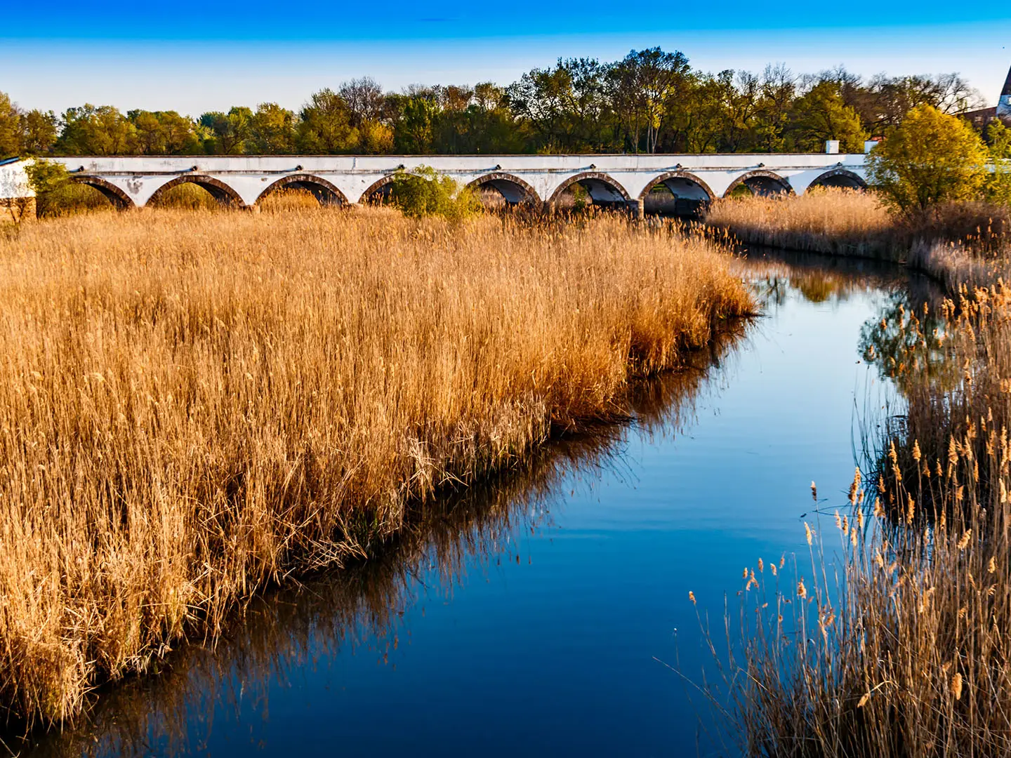
- Nine-Arch Bridge (Kilenclyukú híd): The emblem of Hortobágy village, this classical stone road bridge has nine arches and spans 167.3 m. It marks the old Debrecen trade road and is the park’s best-known built landmark.
- Hortobágy Great Fishponds (Halastó): The flagship walking area, with flat paths, hides, observation towers and a boardwalk over Lake Kondás. It is a Ramsar wetland and an important place for waterfowl.
- Common crane migration: Each autumn, peaking in October, more than 100,000 common cranes gather on the puszta before flying south. It is the main seasonal wildlife event for visiting hikers and birdwatchers.
- The puszta alkaline steppe: A vast, flat, treeless grassland and saline pasture forming the core of the UNESCO landscape. The walking is easy, but the exposure makes weather and sun more noticeable than the elevation.
- Sweep wells — gémeskút: Tall counterweighted well-poles stand across the plain. They are practical historic water-drawing structures and one of Hortobágy’s most recognisable sights.
- Szálkahalom and Egyek-Pusztakócs trails: Quieter marked nature trails beyond Halastó. Szálkahalom passes kurgan burial mounds, while Egyek-Pusztakócs explores restored marshes rich in egrets and other waterbirds.
Challenges to expect
The walking is easy because the terrain is almost completely flat, but the puszta is exposed, with little shade and hot summer conditions. Wetland and marsh sections can be muddy after rain; the “Floodplain mud” trail may require rubber boots. Navigation is between separate marked nature trails, not along one continuous route. An entrance card is required for the national park nature trails, and there are no huts on the walks.
HikeList Score
Hortobágy National Park Trail scored 68/100 on HikeList's trail-quality metrics.
See score breakdownHide breakdown
- Ideal length 55
- Balanced challenge 50
- Scenery & wildness 78
- Varied terrain 71
- Accommodation 66
- Food & support 75
- Path quality 98
- Season flexibility 89
Computed from length, challenge, scenery & wildness, terrain variety, accommodation, food & support, path quality and season flexibility.
 Hungary
Show more data Show less
- Grassland
- Wetlands
- Dirt
- Gravel
- Boardwalk
- Hotels
- Campsites
- Family Friendly
- Pet Friendly
- Restrooms
- Picnic Areas
- Campsites
Photos from hikers
Taken on the trail by people who've reviewed Hortobágy National Park Trail.
Reviews
How would you rate Hortobágy National Park Trail?
Tap a star to start your review — you could be the first.