Via Francigena (Tuscan Segment)
How would you rate Via Francigena (Tuscan Segment)?
Tap a star to share your experience and help other hikers.
Via Francigena (Tuscan Segment): Lucca to Siena Guide
HikeList Score
Via Francigena (Tuscan Segment) scored 91/100 on HikeList's trail-quality metrics.
See score breakdownHide breakdown
- Ideal length 100
- Balanced challenge 100
- Scenery & wildness 65
- Varied terrain 100
- Accommodation 100
- Food & support 88
- Path quality 98
- Season flexibility 89
Computed from length, challenge, scenery & wildness, terrain variety, accommodation, food & support, path quality and season flexibility.
The Via Francigena Tuscan Segment is the Lucca to Siena section of the medieval pilgrimage route across central Tuscany in Italy: 180 km, usually walked in 7 days, moderate, and point-to-point. It suits fit walkers who want historic towns, rolling vineyards, strade bianche and pilgrim accommodation rather than technical mountain terrain. Expect some long days, exposed summer walking and a mix of gravel tracks, woodland paths, minor roads and cobbled town streets.
Route Overview
This listing covers the popular Lucca to Siena walk, not the full Via Francigena crossing of Tuscany. From Lucca, the waymarked pilgrim route heads through Altopascio, Fucecchio, San Miniato, Gambassi Terme, San Gimignano, Colle di Val d’Elsa and Monteriggioni / Abbadia Isola before finishing in Siena. It is a point-to-point route, so plan separate arrival and departure logistics for the start and finish. If you want other Tuscan walking options, compare the Chianti Trail and Crete Senesi Loop; for a coastal Italian contrast, see the Cinque Terre Coastal Trail.
Via Francigena history: Sigeric’s road to Rome
The Via Francigena follows the route recorded by Sigeric the Serious, Archbishop of Canterbury, who travelled to Rome in 990 AD and listed 79–80 return stages between Rome and Canterbury. The “road of the Franks” became a major medieval route for pilgrims, traders and armies, shaping the towns of Tuscany. It was re-mapped in the 1980s, notably by Giovanni Caselli with Italy’s Military Geographical Institute, and became a Council of Europe Cultural Route in 1994.
Notable highlights
- Lucca: The start point is a walled Renaissance and Roman city, with broad tree-lined walls around a Roman-grid old town. The Romanesque Cattedrale di San Martino has long been a pilgrim stop on the route.
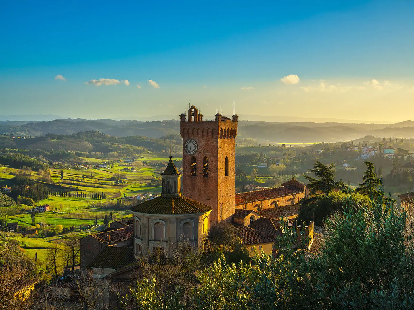
- San Miniato: A hilltop town above the Arno valley, crowned by Frederick II’s tower, the Rocca. It is also known for white truffle and long valley views.
- San Gimignano: A UNESCO World Heritage hill town famous for its surviving medieval tower-houses, often nicknamed the “medieval Manhattan”. The Collegiata contains important fresco cycles.
- Monteriggioni and Abbadia a Isola: Monteriggioni is a tiny circular walled village built by Siena as a frontier fortress against Florence. Nearby Abbadia a Isola adds a Romanesque monastery stop before the final approach to Siena.
- Siena: The finish is a UNESCO Gothic city centred on Piazza del Campo, home of the Palio, and the striped marble Duomo. Santa Maria della Scala was one of Europe’s great medieval pilgrim hospitals.
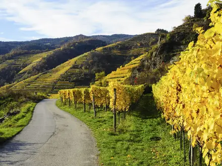
- Strade bianche: The white gravel roads through vineyards, olive groves and cypress-lined ridges are a defining part of the walking between Tuscan towns.
Challenges to expect
The route is moderate rather than technical. The main challenges are long walking days of up to about 28–30 km, rolling climbs on wooded ridges before San Gimignano and towards Siena, and exposed sections with limited shade in July and August. Winter is walkable but wetter, with muddier tracks. Some asphalt on town approaches is hard on tired feet.
HikeList Score
Via Francigena (Tuscan Segment) scored 91/100 on HikeList's trail-quality metrics.
See score breakdownHide breakdown
- Ideal length 100
- Balanced challenge 100
- Scenery & wildness 65
- Varied terrain 100
- Accommodation 100
- Food & support 88
- Path quality 98
- Season flexibility 89
Computed from length, challenge, scenery & wildness, terrain variety, accommodation, food & support, path quality and season flexibility.
 Italy
ItalyShow more data Show less
- Rolling Hills
- Vineyards
- Olive Groves
- Woodland
- Clay Fields
- River Crossings
- Gravel
- Dirt
- Woodland Paths
- Minor Asphalt
- Cobbles
- Pilgrim Hostels
- Parish Accommodation
- Convent Accommodation
- B&Bs
- Agriturismi
- Guesthouses
- Hotels
- Family Friendly
- Pet Friendly
- Restrooms
- Water Sources
- Campsites
- Shelters
Download Our Full Guide to Via Francigena (Tuscan Segment) FREE!
Get our comprehensive guide to this hike for free. Save it for later reading or print out at home.
Photos from hikers
Taken on the trail by people who've reviewed Via Francigena (Tuscan Segment).
Via Francigena (Tuscan Segment): The Complete Guide
 i
Image by stevanzz
i
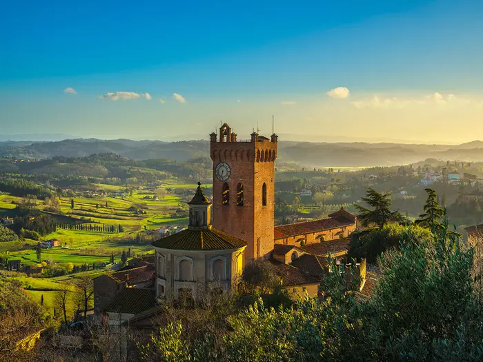
Image by stevanzz The Lucca to Siena section of the Via Francigena is the classic week-long Tuscan pilgrim walk: a point-to-point journey from Lucca’s walled historic centre to Siena’s Piazza del Campo. It suits reasonably fit walkers who want a signed Italian long-distance route with historic towns, rural stages and manageable logistics.
The route starts gently across the Lucca plain, passing Capannori, Porcari and Altopascio before reaching the lower Arno valley around Fucecchio and San Miniato. From there it becomes more recognisably Tuscan, crossing the Val d’Elsa through vineyards, olive groves, Romanesque pievi and the white gravel strade bianche.
San Gimignano, Monteriggioni and Siena give the walk its strongest medieval character, but the quieter sections between them matter just as much. Expect rolling ridges, oak woodland, exposed farm tracks, cobbled town approaches and a steady sense of moving from pilgrim town to pilgrim town.
This is not a technical hike, and the waymarking is generally good, with Via Francigena signs, white-red marks and pilgrim symbols. The challenge is practical: two long stages of around 28–31 km, summer heat, limited shade on open gravel roads, muddy tracks after rain and the need to book carefully in busy Tuscan towns.
This guide covers stages, daily planning, accommodation, food, transport, terrain and the common mistakes to avoid.
Stage-by-Stage Guide
The stage notes below follow the common six walking days from Lucca to Siena. Distances are approximate: official trail figures are shorter than some walking-holiday itineraries because town-centre approaches, climbs to hilltop accommodation and local detours can add meaningful distance.
Waymarking is generally good, with Via Francigena signs, yellow pilgrim markers and white-red CAI-style paint marks, but the official GPX and current diversion information should still be checked before travelling.
Stage 1: Lucca to Altopascio — approx. 19 km
The opening stage leaves Lucca’s historic centre through Porta Elisa / Porta San Gervasio and heads east across the Lucca plain. It is the flattest day of the route and feels more like a practical pilgrim approach than a classic Tuscan hill walk.
Expect a high proportion of paved surfaces, minor roads and built-up edges as the route passes through or near Capannori, Porcari and Badia Pozzeveri. The walking is not technically difficult, but hard surfaces can be tiring on feet at the start of a multi-day walk.
Lucca is the main cultural highlight of the day, with its Renaissance ramparts and Cattedrale di San Martino. Altopascio is also an important historic pilgrim stop, associated with the Ospitalieri del Tau, the church of San Jacopo and the bell known as la Smarrita.
Food and water are easiest to organise in Lucca before departure and again in Altopascio. There are settlements along the way, but opening hours for bars, shops and cafés should not be assumed, especially outside the main season or on Sundays.
Altopascio has pilgrim and town accommodation options, including the type of ostelli, guesthouses and small hotels typical of the Via Francigena. A credenziale is needed for many of the cheapest pilgrim-only beds.
Public transport access is good at both ends: Lucca has its own station, and Altopascio is one of the useful intermediate access points on this section. Live train and bus times should be checked before travelling.
Navigation is usually straightforward, but the main issue is leaving Lucca correctly and staying attentive through suburban and roadside sections where waymarks can be easier to miss than on open tracks. In hot weather this stage can feel exposed and reflective because of the tarmac; start early in July and August and carry enough water.
Stage 2: Altopascio to San Miniato — approx. 28 km
This is one of the long days of the week and should be treated as a full walking stage rather than a gentle transfer between towns. The route leaves Altopascio, passes Galleno, crosses the former wetland landscape around Ponte a Cappiano and continues via Fucecchio towards San Miniato.
The terrain gradually changes from the flatter lower Arno valley to more rolling country as San Miniato comes into view. Surfaces are mixed: paved lanes, rural tracks and sections on the Via Francigena through lowland farmland and settlement edges.
Ponte a Cappiano is the key mid-stage landmark, with its fortified Medici bridge over the former Padule di Fucecchio wetlands. The finish is San Miniato, a hilltop town above the Arno valley, crowned by the Rocca of Frederick II and known for wide views and white truffle.
Food and water planning matters on this stage because of the distance. Altopascio, Fucecchio and San Miniato are the most reliable places to build the day around; intermediate services should be treated as a bonus unless opening times have been checked.
San Miniato has accommodation in and around the town, but walkers should distinguish between San Miniato Basso and San Miniato Alto when booking. The hilltop finish can add effort at the end of a long day if accommodation is in the upper town.
San Miniato–Fucecchio is an important rail access and bail-out point for this section. This makes Stage 2 one of the easier stages to shorten or leave if needed, though the practical connection between the route, station and accommodation should be checked before travelling.
The main warning is cumulative fatigue: the day is long, partly hard-surfaced and can be hot. Carry water from the start, protect against sun, and do not underestimate the final climb or approach into San Miniato Alto if staying there.
Stage 3: San Miniato to Gambassi Terme — approx. 24 km
This stage is where the route begins to feel more like the classic Tuscan Via Francigena. From San Miniato the way moves into the Val d’Elsa landscape of rolling ridges, vineyards, olive groves, clay fields and white gravel roads.
The walking is moderate rather than technical, but it is more undulating than the first two days. Expect repeated small climbs and descents on strade bianche, rural lanes and tracks that can be dusty and exposed in summer or sticky after rain.
The main landmark before Gambassi Terme is the Pieve a Chianni, one of the notable Romanesque country churches on this section. Views open across the Val d’Elsa countryside, especially where the route follows higher ground between farmed valleys.
Food and water should be planned conservatively. San Miniato and Gambassi Terme are the reliable endpoints; between them, services are more limited and should not be relied upon without checking in advance.
Gambassi Terme has pilgrim and small-town accommodation options, including ostelli-style beds, guesthouses and agriturismi in the wider area. Booking ahead is sensible in spring and autumn and essential in the busiest periods.
Public transport options are less immediate than at the larger rail towns, so this is not the easiest day to improvise if plans change. If relying on buses or transfers, times and pick-up points should be checked before travelling.
Navigation is generally helped by the open nature of the landscape, but gravel-road junctions can be deceptively similar. Keep the official GPX to hand, especially where farm tracks, minor asphalt and strade bianche intersect.
Stage 4: Gambassi Terme to San Gimignano — approx. 14 km
This is the shortest stage of the Lucca to Siena week, but it should not be dismissed as a rest day. The terrain remains rolling and the approach to San Gimignano involves the usual Tuscan pattern of descent, climb and hilltop finish.
The route passes through the countryside around Pancole, the Santuario di Pancole and Cellole, including the Pieve di Cellole. Surfaces are mixed rural tracks, white gravel roads and minor lanes, with more cobbled and urban surfaces as the route reaches San Gimignano.
The highlight is the arrival at San Gimignano, the UNESCO hill town famous for its medieval tower-houses, Piazza della Cisterna and fresco-filled Collegiata. It is one of the busiest places on the route, so the final kilometres can feel less solitary than the countryside before it.
Food and water are straightforward at the start and finish, with Gambassi Terme and San Gimignano as the main service points. Carry enough water for the whole walking window, as a short stage can still be hot and exposed on the gravel roads.
Accommodation in San Gimignano ranges from pilgrim-style options to guesthouses and hotels, but demand is high. Book well ahead in peak season rather than assuming a walk-in bed will be available.
San Gimignano is served indirectly by public transport via Poggibonsi, which is the key rail access point for this area. Connections, bus times and any transfer arrangements should be checked before travelling.
Navigation is usually uncomplicated, but the town approach can be busy and waymarks may compete with urban signage and visitor traffic. In high summer, an early start makes sense even on this shorter stage, leaving time to arrive before the strongest afternoon heat.
Stage 5: San Gimignano to Monteriggioni — approx. 30 km
This is the biggest walking day of the itinerary and, for many walkers, the crux of the Lucca to Siena section. It is long, undulating and often exposed, with a sustained sequence of tracks, lanes and ridges before the fortified village of Monteriggioni.
The route leaves San Gimignano and continues through the Val d’Elsa, passing towards Colle di Val d’Elsa, with its lower town around Gracciano / Colle Basso and its medieval upper town. It then continues through countryside towards Abbadia a Isola and Monteriggioni.
Surfaces include strade bianche, rural tracks, minor asphalt and town approaches. The white gravel roads are one of the defining experiences of the route, but they can be punishing in July and August: bright, dusty, reflective and with limited shade.
The main highlights are the long views back and across the Val d’Elsa, the approach through Colle di Val d’Elsa, the Romanesque Benedictine monastery and former pilgrim hospice at Abbadia a Isola, and the final arrival at Monteriggioni’s circular walls and towers.
Food and water need careful planning. San Gimignano, Colle di Val d’Elsa, Abbadia a Isola and Monteriggioni are the logical places to organise the day around, but opening hours should be checked and enough water should be carried to cover long exposed sections.
Some walkers split this stage at Colle di Val d’Elsa or Abbadia a Isola to reduce the distance. This is a sensible option for anyone walking in high heat, carrying a full pack or wanting more time in the towns.
Monteriggioni is small, so accommodation inside or close to the walls can be limited and should be booked well ahead. Wider options may involve nearby agriturismi or transfers; details should be arranged before starting the stage.
For public transport, Castellina Scalo is one of the useful access points for Monteriggioni, while San Gimignano is linked via Poggibonsi. Exact bus, train and transfer options should be checked before travelling.
Navigation is not technically hard, but fatigue can lead to mistakes late in the day, especially around junctions on gravel roads and minor lanes. Start early, carry more water than on the shorter stages, and expect mud after wet weather on unsurfaced tracks.
Stage 6: Monteriggioni to Siena — approx. 21 km
The final stage is shorter than the San Gimignano to Monteriggioni day but still has real walking. It crosses the Montagnola Senese, the most sustained high ground of the week, before making the historic approach into Siena.
The terrain is a mix of wooded hills, rural tracks, strade bianche, minor asphalt and urban approach walking. The route passes through or near Cerbaia and Pian del Lago before entering Siena through Porta Camollia.
The Montagnola Senese section gives a different feel from the open Val d’Elsa ridges, with more woodland and the presence of ruined castles such as Chiocciola and Villa in the wider landscape. The finish in Siena is one of the great endings on the Via Francigena: Porta Camollia, the historic centre, Piazza del Campo, the Duomo and Santa Maria della Scala.
Food and water should be organised before leaving Monteriggioni. Siena has abundant services at the finish, but the intervening countryside and woodland sections should not be treated as reliably serviced unless stops have been checked in advance.
Accommodation in Siena ranges from pilgrim options to hotels and guesthouses, but it is a very busy destination. Book well ahead, particularly around the Palio in early July and mid-August.
Siena has onward rail and bus connections, including links towards Florence and Pisa. Siena station is outside the historic core, so allow time and energy for the final transfer after reaching Piazza del Campo or accommodation.
Navigation remains waymarked, but the approach into Siena requires attention as rural trail gives way to roads and city streets. The final day is not technically difficult, yet heat, hard surfaces and tired legs can make the last kilometres feel longer than expected.
Recommended Itinerary
The most practical Lucca to Siena schedule is six walking days, with an arrival night in Lucca and either a departure or recovery night in Siena. The stage distances below are the core walking-stage figures; allow extra distance for hill-town approaches, accommodation off-route and town walking, and check official mapping before booking.
Standard itinerary — 6 walking days
| Day | From | To | Approx. distance | Why this stage makes sense | Services/accommodation notes |
|---|---|---|---|---|---|
| Arrival | Lucca | Lucca | — | Arriving the day before walking gives time to reach Lucca by train, collect or organise a credenziale, buy food and avoid starting tired after travel. | Lucca has pilgrim accommodation, guesthouses and hotels. Pilgrim-only beds usually require a credenziale; book ahead in busy periods. |
| 1 | Lucca | Altopascio | ≈19 km | A straightforward opening day across the Lucca plain via Capannori, Porcari and Badia Pozzeveri. It is not technically hard, but the flat paving and summer heat can be tiring. | Altopascio is a historic pilgrim stop with accommodation options. Start early in July and August because shade can be limited on exposed sections. |
| 2 | Altopascio | San Miniato | ≈28 km | The first long stage, crossing the lower Arno valley through places such as Galleno, Ponte a Cappiano and Fucecchio before the final approach to San Miniato. This is one of the days to treat seriously. | Check whether accommodation is in San Miniato Basso or San Miniato Alto, as that affects the end of the day. Food and water planning matters because the distance is long. |
| 3 | San Miniato | Gambassi Terme | ≈24 km | A classic Val d’Elsa walking day with more rolling ground after the flatter opening stages. The route passes the area of Pieve a Chianni before reaching Gambassi Terme. | Gambassi Terme is a logical overnight before the short stage to San Gimignano. Book ahead if relying on pilgrim-style accommodation. |
| 4 | Gambassi Terme | San Gimignano | ≈14 km | A deliberately shorter day after two longer stages, passing Pancole, Santuario di Pancole and the Pieve di Cellole area before reaching San Gimignano. It leaves useful time for the hill-town finish. | San Gimignano is popular and accommodation can fill quickly, especially in peak season. Book this night well in advance. |
| 5 | San Gimignano | Monteriggioni | ≈30 km | The toughest standard-stage day for many walkers: long, rolling and exposed, with strade bianche, vineyards, olive groves and the passage through Colle di Val d’Elsa and Abbadia a Isola. | Consider splitting this stage if 30 km is too much, especially in hot weather. Monteriggioni is small, so accommodation should be arranged early. |
| 6 | Monteriggioni | Siena | ≈21 km | A manageable final stage through the wooded Montagnola Senese and then into Siena through Porta Camollia. The distance leaves time to reach the historic centre without rushing. | Siena has a wide range of accommodation but becomes very busy around the Palio in early July and mid-August. Book well ahead and check onward train or bus times before travelling. |
| Departure / extra night | Siena | Siena | — | An extra night is useful if arriving late, visiting the Duomo, Piazza del Campo and Santa Maria della Scala, or avoiding a same-day onward connection after the final walk. | Siena station links towards Florence and Pisa, with train and bus times to be checked before travelling. |
Slower variant — best for hot weather, first-timers or pilgrims using lower-cost beds
The standard itinerary has two long days: Altopascio to San Miniato and San Gimignano to Monteriggioni. Slower walkers, summer walkers and anyone wanting more time in the towns should add one or two extra nights rather than forcing both long stages.
| Where to add time | How to use it | Who it suits | Planning note |
|---|---|---|---|
| Between Altopascio and San Miniato | Break the long lower Arno valley stage around the intermediate towns on the route, such as Fucecchio or the San Miniato Basso / San Miniato Alto area. | Walkers who find ≈28 km too much on Day 2, or anyone starting in hot weather. | Exact overnight point, distance and accommodation availability should be checked before booking. |
| Between San Gimignano and Monteriggioni | Split the long stage at Colle di Val d’Elsa or Abbadia a Isola. | Most useful for walkers who want to avoid the ≈30 km day, or who prefer time for San Gimignano and Monteriggioni. | Check accommodation, transport options and official mapping before booking, as this changes the shape of the stage. |
| Add a rest night in San Gimignano or Siena | Keep the walking stages intact but give more time for recovery and sightseeing. | Walkers carrying full packs, travelling in July–August, or anyone combining the walk with a wider Tuscany trip. | Book early; San Gimignano and Siena are busy destinations. |
Faster variant — only for fit walkers with tight time
The practical fast version is to walk the same six stages on consecutive days, arriving in Lucca the evening before Day 1 and leaving Siena after the final stage or the following morning. This removes the buffer time but does not reduce the daily walking demands.
Reducing the route to five walking days is possible only by combining the short Gambassi Terme to San Gimignano stage with a neighbouring section, creating a very long hill day. This is best avoided in July and August, and exact distances, accommodation points and luggage-transfer arrangements should be checked before booking.
Planning the Route
How many days to allow
Most walkers should plan this as six walking days, with an arrival night in Lucca and a final night in Siena. That fits the natural Via Francigena stage pattern: Lucca → Altopascio → San Miniato → Gambassi Terme → San Gimignano → Monteriggioni → Siena.
The route is often presented as a week-long walk, and that is the sensible minimum for most independent hikers. The shorter Gambassi Terme → San Gimignano day gives some recovery time, but it is balanced by two long days: Altopascio → San Miniato and San Gimignano → Monteriggioni.
Trying to compress the route is possible only for very fit walkers who are comfortable with long road-and-track days in heat. For most people, a slower schedule is better: it gives more flexibility around accommodation, allows earlier starts in summer, and makes the historic towns worth staying in rather than simply passing through.
The natural stage structure
Accommodation and transport make this section easiest to plan around the established stage towns. The main overnight stops are well spaced for a six-stage itinerary, but the long stages need more care than the short ones.
| Stage | Usual planning issue |
|---|---|
| Lucca → Altopascio | Flat and partly paved across the Lucca plain; heat and hard surfaces can matter more than ascent. |
| Altopascio → San Miniato | One of the longer days; plan food, water and an early start, especially in warm weather. |
| San Miniato → Gambassi Terme | Rolling Val d'Elsa walking with more climbing than the opening stages. |
| Gambassi Terme → San Gimignano | A short stage, useful for recovery or for spending time in San Gimignano. |
| San Gimignano → Monteriggioni | The biggest planning day for many walkers; long, exposed and commonly split by those wanting an easier schedule. |
| Monteriggioni → Siena | A final hilly approach through the Montagnola Senese before entering Siena through Porta Camollia. |
For daily mileage, use the stage distances when booking beds and planning food. The headline route figure of about 180 km includes town approaches, detours, accommodation logistics and rounding; the direct waymarked stage total is lower. This matters less than the practical question: where will you sleep each night, and how exposed will the day be?
Shortening, splitting and extending
The easiest stage to shorten is San Gimignano → Monteriggioni, which is often split around Colle di Val d'Elsa or Abbadia a Isola. This turns the hardest long day into a more manageable two-day section and gives more time on the strade bianche and in the Val d'Elsa towns.
Altopascio → San Miniato is also a long day, but it is less naturally broken by the classic stage structure. Walkers who want shorter days should look carefully at accommodation availability between Altopascio, Ponte a Cappiano, Fucecchio and San Miniato before committing. This should be checked before travelling.
Adding time in Lucca, San Gimignano or Siena is usually more rewarding than rushing the walking days. A spare night can also be useful if summer heat, heavy rain or accommodation availability forces a change of plan.
Section hiking and bail-out points
Section hiking is practical on this route because several towns have rail or bus access. Lucca and Siena are the main end points, while Altopascio, San Miniato–Fucecchio, Poggibonsi for San Gimignano, and Castellina Scalo for Monteriggioni can help with joining, leaving or breaking the walk.
Do not plan tight connections without checking live timetables. Train and bus times, especially for links between hill towns and stations, should be checked before travelling.
Accommodation planning
Accommodation is the main planning task on the Lucca to Siena section. The route has a mix of ostelli, parish or convent accommodation, agriturismi, B&Bs, guesthouses and hotels, but availability varies by town and season.
A credenziale is needed for the cheapest pilgrim-only beds. It is also part of the Via Francigena pilgrim system and should be arranged before or at the start of the walk; current purchase points and stamping arrangements should be checked before travelling.
Book well ahead for the Tuscany stages in peak season. Siena needs particular care around the Palio in early July and mid-August, when accommodation demand is high and prices can rise sharply.
Food and water
Plan around towns and villages rather than assuming constant services along the path. The route passes places such as Capannori, Porcari, Altopascio, Fucecchio, San Miniato, Gambassi Terme, San Gimignano, Colle di Val d'Elsa, Monteriggioni and Siena, but opening hours can be awkward on Sundays, public holidays and during afternoon closures.
Carry enough water for long exposed sections, especially on the strade bianche and in July or August. The walking is not technically remote, but heat, dust and lack of shade can make the distance feel much harder than the map suggests.
Navigation and route documents
The Via Francigena is well waymarked with white-red CAI-style marks and yellow pilgrim signs, but a GPX track is still worth carrying. Use the EAVF or Visit Tuscany stage GPX and check for current diversions before setting off.
Navigation is usually straightforward on tracks, minor roads and town approaches, but mistakes are easiest at urban exits, road junctions and where agricultural tracks branch across open country. A phone with offline mapping and battery reserve is sensible, even for walkers who prefer paper notes.
Weather and season choices
April to June and September to October are the easiest months for planning. Summer is walkable, but the route is exposed and often shadeless, so early starts, extra water and flexible afternoon plans are important.
Winter is quieter but wetter and muddier, particularly on tracks and white gravel roads after rain. If walking outside the main season, check accommodation opening dates as well as transport times.
Luggage transfer and credentials
Luggage transfer is available from operators on the Lucca → Siena route, but availability, baggage limits and pricing should be checked before booking. It can make the long hot stages easier, though walkers should still carry water, waterproofs, navigation, food for the day and essential medication.
The Lucca → Siena section does not qualify a walker for the official Testimonium in Rome, which requires walking the last 100 km into Rome. For this route, the credenziale is still useful for pilgrim accommodation and as a record of the journey.
Towns, Villages and Overnight Stops
The standard overnight chain for this Lucca to Siena week is Lucca → Altopascio → San Miniato → Gambassi Terme → San Gimignano → Monteriggioni → Siena. That pattern keeps to the classic six walking stages, but it leaves two demanding days: Altopascio to San Miniato and San Gimignano to Monteriggioni.
Accommodation ranges from pilgrim ostelli and parish/convent beds to agriturismi, B&Bs, guesthouses and hotels. The cheapest pilgrim-only beds usually require a credenziale; budget roughly €10–25 or donation for simple pilgrim accommodation where available, and €30–70+ for B&Bs or agriturismi, with prices rising sharply in the most visited towns.
Book ahead in Tuscany, especially in San Gimignano, Monteriggioni and Siena, and around the Siena Palio in early July and mid-August. Small villages and country churches should be treated as route landmarks unless accommodation has been booked directly.
Lucca
Lucca is the start city and the best place to arrive the day before walking. The route leaves the historic centre through Porta Elisa / Porta San Gervasio, heading east towards Capannori, so accommodation inside or close to the walls keeps the first morning simple.
There is a broad range of places to stay, including pilgrim options such as Ostello San Frediano and Pellegrinaio San Divino, plus hotels, B&Bs and guesthouses. Lucca is also the right place to sort out food, cash, phone data, blister supplies and the credenziale before committing to the countryside stages.
Transport is straightforward. Lucca has its own station on the Firenze–Viareggio line, with frequent regional trains from Pisa International Airport taking about 30 minutes; access from Florence is also possible by train or bus. Live train and bus times should be checked before travelling.
Capannori
Capannori sits on the flat opening stage east of Lucca, before Porcari and Altopascio. For most walkers it is a passing service point rather than a natural overnight, because the Lucca to Altopascio day is one of the shorter stages.
It can still be useful if starting late from Lucca or if the heat makes the paved first day harder than expected. Do not assume pilgrim accommodation or late-opening services without checking locally in advance.
Porcari
Porcari is another practical waypoint on the Lucca plain between Capannori and Altopascio. It is better viewed as a break point on the first day than as a planned stop on a six-stage itinerary.
If splitting the Lucca to Altopascio leg for arrival-time reasons, accommodation and onward transport should be checked before travelling. The value of Porcari is mainly logistical: it gives a chance to pause before continuing towards Badia Pozzeveri and Altopascio.
Badia Pozzeveri
Badia Pozzeveri comes shortly before Altopascio on the approach from Porcari. It is a small route settlement rather than one of the main overnight towns.
Use it as a navigation and rest landmark, not as a guaranteed resupply point. If planning to stop here rather than continuing to Altopascio, accommodation and food availability should be checked before travelling.
Altopascio
Altopascio is the normal first overnight after Lucca and an important historic pilgrim town, associated with the Ospitalieri del Tau. The church of San Jacopo and the tradition of the bell known as la Smarrita make it a meaningful stop, but its main planning value is that it breaks the flat opening stage before the longer walk to San Miniato.
There should be a better choice of accommodation and food here than in the smaller villages on either side, but beds should still be booked ahead in busy periods. Pilgrim accommodation, B&Bs and small hotels may all be relevant depending on budget and whether a credenziale is being used.
Altopascio is one of the useful intermediate bail-out points by rail or bus. It is also the place to prepare carefully for the next stage, which is one of the longer days of the route.
Galleno
Galleno lies on the Altopascio to San Miniato stage and is useful because this is a long day with fewer large towns than the map can make it appear. It can work as a rest or lunch target, but it is not one of the standard overnight stops.
Do not rely on Galleno as a full-service resupply unless opening times have been checked. Carry enough water and food from Altopascio to cover the day, especially in hot weather.
Ponte a Cappiano
Ponte a Cappiano is a key landmark between Altopascio and San Miniato, where the route crosses the fortified Medici bridge over the former Padule di Fucecchio wetlands. It is worth noting in the day plan because it gives a clear sense of progress on a relatively long stage.
It is not usually the best place to plan an overnight. Treat it as a historic crossing and navigation point, then continue towards Fucecchio and San Miniato unless accommodation has been arranged in advance.
Fucecchio
Fucecchio comes before the climb towards San Miniato and is one of the more practical places on the Altopascio to San Miniato stage. For walkers who do not want to take on the whole long day, it can be considered as a possible split point, subject to accommodation availability.
Food and basic town services are more likely here than in the smaller settlements earlier in the day, but opening hours and exact locations should still be checked before relying on them. Rail access for this part of the route is associated with San Miniato–Fucecchio, making the area useful for bail-out planning.
San Miniato (San Miniato Basso / San Miniato Alto)
San Miniato is the standard second overnight and one of the most important planning points on the route. The distinction between San Miniato Basso and San Miniato Alto matters: the historic hilltop town is higher, while transport links are associated with the San Miniato–Fucecchio area below.
Accommodation in San Miniato Alto puts you in the historic centre, close to the views and the hilltop atmosphere, but it means finishing the stage with the climb already done. Staying lower down may be more convenient for transport, but it can leave extra ascent or transfer logistics to manage.
This is a good place for a proper restock before the hillier Val d'Elsa stages. San Miniato is also a realistic arrival or departure point for section-hikers using the rail/bus network; live times should be checked before committing to a connection.
Pieve a Chianni (near Gambassi)
The Pieve a Chianni is an important Romanesque country church near Gambassi Terme and a useful landmark on the San Miniato to Gambassi stage. It sits in the more rural section where the route begins to feel less like valley travel and more like classic Tuscan hill walking.
It should not be treated as a guaranteed food or accommodation stop unless arrangements have been made in advance. The practical overnight target remains Gambassi Terme.
Gambassi Terme
Gambassi Terme is the normal third overnight after the rolling stage from San Miniato. It is smaller and quieter than San Gimignano, but it is strategically placed before the short, scenic walk through Pancole and Cellole to San Gimignano.
Expect a mix of guesthouses, B&Bs, agriturismi and pilgrim-oriented accommodation rather than the volume of choice found in the bigger towns. Book ahead, because missing a bed here can disrupt the stage rhythm.
Use Gambassi Terme to reset after the first hill day. It is also the best place to plan whether to take the following short stage gently or use the easier distance to spend more time in San Gimignano.
Pancole
Pancole lies between Gambassi Terme and San Gimignano on the short fourth walking day. It is a useful mid-stage marker and part of a more relaxed day after the longer approach to Gambassi.
It is not usually needed as an overnight stop on the standard itinerary. Services should not be assumed, so carry what is needed from Gambassi Terme if walking outside normal café or shop hours.
Santuario di Pancole
The Santuario di Pancole is a clear landmark on the way from Gambassi Terme towards San Gimignano. It helps break up the short stage and is useful for navigation and pacing.
Treat it as a visit or rest point rather than a logistics hub. Any food, water or accommodation expectations here should be checked before travelling.
Cellole (Pieve di Cellole)
Pieve di Cellole is one of the notable Romanesque country churches on the approach to San Gimignano. It sits close enough to the end of the stage to be more of a final landmark than a service stop.
There is no need to plan an overnight here unless a specific nearby agriturismo or guesthouse has been booked. Most walkers continue into San Gimignano for accommodation, food and transport connections via Poggibonsi.
San Gimignano
San Gimignano is the standard fourth overnight and one of the busiest places on the whole Lucca to Siena route. Its towered medieval centre is a major visitor destination, so beds can be expensive or full long before the walking season peaks.
Book accommodation early, especially if wanting to stay inside or close to the historic centre. Food options are generally better here than in rural stops, but queues, tourist pricing and limited late availability can still affect tired walkers arriving in the afternoon.
San Gimignano does not sit on the main rail line used by walkers; Poggibonsi is the usual transport reference point for reaching or leaving the town by public transport. Timetables and transfer details should be checked before travelling.
This is also the key decision point before the longest stage of the week. Strong walkers continue to Monteriggioni in one day; others split the stage around Colle di Val d'Elsa or, if accommodation is available, closer to Abbadia a Isola.
Colle di Val d'Elsa (Gracciano / Colle Basso)
Colle di Val d'Elsa is the most practical intermediate town on the long San Gimignano to Monteriggioni stage. The route uses the Gracciano / Colle Basso side, while the historic upper town sits above it.
For many walkers, this is the obvious place to split the 30 km day if the full San Gimignano to Monteriggioni distance feels too long. Accommodation, food and local transport should be checked before travelling, as the exact overnight plan will depend on where beds are available in relation to the route.
Stopping here changes the rhythm of the week but can make the route more comfortable in hot weather. It also gives more margin for the exposed strade bianche and the rolling ground before Monteriggioni.
Abbadia a Isola
Abbadia a Isola is just before Monteriggioni and is one of the most atmospheric pilgrim sites on the route, with its Romanesque Benedictine monastery and old hospice setting. It is an important landmark after the long walk from San Gimignano and Colle di Val d'Elsa.
Because it is close to Monteriggioni, it can be tempting as a softer stopping point if beds in the walled village are full. Do not assume accommodation here; if planning to stop, this should be checked before travelling.
Monteriggioni
Monteriggioni is the standard fifth overnight and one of the most distinctive stops on the route: a tiny circular walled village built as a Sienese frontier fortress. Its size is part of the appeal, but it also means accommodation and evening food need more care than in larger towns.
Book well ahead, particularly in spring, autumn and the summer holiday season. If everything inside or near the walls is full, check options around Abbadia a Isola or nearby country accommodation before committing to the stage.
For transport planning, Castellina Scalo is the rail/bus reference point for Monteriggioni. Live connections should be checked before relying on it as a start, finish or bail-out point.
Cerbaia
Cerbaia lies on the final stage between Monteriggioni and Siena, as the route passes through the wooded and rolling ground of the Montagnola Senese. It is a route waypoint rather than a normal overnight target.
This section is close enough to Siena that most walkers continue to the city. Carry food and water from Monteriggioni unless current local services have been checked.
Pian del Lago
Pian del Lago comes on the approach to Siena after the higher ground of the final stage. It is useful mainly as a progress marker before the route becomes more urban.
It should not be treated as a planned overnight or resupply stop. The practical target is Siena, but this part of the day can still feel exposed in hot weather, so do not run supplies down too early.
Porta Camollia
Porta Camollia is the historic gate where the route enters Siena. It is not an overnight stop, but it is an important navigation point because it marks the transition from countryside walking to the final city approach.
Once through the gate, continue into the historic centre for the finish at Piazza del Campo, with the Duomo and Santa Maria della Scala close by. Keep enough energy and daylight for the city approach, particularly if arriving after a hot final stage.
Siena
Siena is the finish and the best place to plan at least one final night rather than leaving immediately. The historic centre around Piazza del Campo, the Duomo and Santa Maria della Scala is busy throughout the main travel season and exceptionally busy around the Palio.
Accommodation ranges from pilgrim-oriented beds to hotels, guesthouses and B&Bs, but early booking is essential in peak periods. Food, pharmacies and onward travel options are far better here than in the final villages, so it is a good place to recover and reorganise before travelling home.
Siena station is on the Empoli–Siena line, with trains and buses to Florence taking roughly 1.5–2 hours, plus direct bus or train links towards Pisa airport. Live train and bus times should be checked before travelling.
A Lucca to Siena walk is a substantial Via Francigena section, but it does not qualify for the official Rome Testimonium, which requires walking the last 100 km into Rome.
Getting to the Start
The Lucca to Siena walk starts in Lucca, inside the walled historic centre. The waymarked Via Francigena leaves the old town through Porta Elisa / Porta San Gervasio, heading east towards Capannori, so staying inside or just outside the walls makes for the simplest first morning.
By train
Lucca has its own railway station on the Firenze–Viareggio line, making rail the most straightforward way to reach the start. From Pisa, regional trains to Lucca are frequent and take about 30 minutes.
From Florence, reach Lucca by rail via the regional network, with connections depending on the service pattern that day. Live train times and any engineering works should be checked before travelling.
Lucca station is convenient for the old town: from the station, walk through or around the city walls to reach the historic centre and the start area near Porta Elisa / Porta San Gervasio. If arriving late or with heavy luggage, taxis are normally the simplest option for the short transfer to accommodation; availability and fares should be checked locally.
By bus
Bus can work for some approaches to Lucca, particularly from Florence Airport or nearby Tuscan towns, but it is usually less simple than the train for walkers arriving from Pisa or Florence. Timetables, stops and weekend or holiday service levels can change, so this should be checked before travelling.
If using buses to reach Lucca, allow a margin for missed connections, especially if arriving by air on the same day. For a first walking day to Altopascio, it is better to sleep in Lucca rather than rely on an early multi-leg bus journey into the start.
By car
Driving to Lucca is possible, but it is not the most convenient option for this point-to-point route because the walk finishes in Siena. Anyone leaving a car in Lucca must plan how to return from Siena at the end of the hike, using rail or bus connections via the Tuscan network.
Do not assume that accommodation inside the walls will have parking. Long-stay parking options, ZTL restrictions, access rules and overnight charges in or around Lucca should be checked before travelling.
For groups, a pre-booked taxi or private transfer can simplify the final return to Lucca after reaching Siena, but this is likely to be a separate cost and should be arranged in advance.
From the nearest airport
Pisa International Airport (Galileo Galilei) is the most convenient airport for the start. It is about 30 km from Lucca, with frequent regional train connections to Lucca taking around 30 minutes.
Florence Airport (Amerigo Vespucci) is another practical option, about 70 km from Lucca. Reaching Lucca from Florence normally involves train connections via the Firenze/Pisa regional network or bus, depending on arrival time and current services.
If landing late in the evening, check onward transport carefully before booking flights. A night in Pisa or Florence may be more sensible than trying to reach Lucca after the last practical connection. Airport taxi or private-transfer options exist, but availability and current prices should be checked before travelling.
Where to stay before starting
Lucca is the right place to spend the arrival night. It has pilgrim accommodation, including options such as Ostello San Frediano and Pellegrinaio San Divino, as well as guesthouses, hotels and other town-centre accommodation.
A credenziale is needed for the cheapest pilgrim-only beds on the Via Francigena, so arrange it before relying on ostello or parish accommodation. How and where to buy and stamp the credenziale should be checked before travelling.
Book well ahead in busy periods, especially in spring, early autumn and around major events in Tuscany. Staying near the historic centre, the station, or the eastern side of the walls keeps the first morning simple: the route leaves Lucca through Porta Elisa / Porta San Gervasio towards Capannori and Altopascio.
Getting Home from the Finish
The route finishes in Siena’s historic centre, around Piazza del Campo, after entering the city through Porta Camollia. Do not plan onward travel too tightly: the final kilometres into Siena can take longer than expected, and the station and main bus departures require a transfer across the city from the finish area.
If finishing late in the afternoon, staying overnight in Siena is usually the least stressful option. This is especially sensible in peak season, around the Siena Palio in early July and mid-August, or if connecting to a flight the next day.
By train
Siena has a railway station on the Empoli–Siena line, with onward train connections towards Florence. Typical journey times to Florence are around 1.5–2 hours, depending on the service and connections.
From Florence, onward rail and airport connections are straightforward, but the exact routing depends on the day and time. Live train times should be checked before travelling, particularly for evening departures, Sundays and public holidays.
The walk finishes in the historic centre rather than at the station, so allow time to reach Siena station after arriving at Piazza del Campo. If a same-day train is essential, build in a generous buffer rather than relying on a tight connection.
By bus
Buses are also a practical way to leave Siena, with services towards Florence and links that can be useful for onward travel to Pisa airport. Depending on the timetable, buses may be as convenient as the train for reaching Florence.
Bus times, departure points and airport connections are timetable-dependent and should be checked before travelling. This matters if finishing on a weekend, in the evening, or during major events in Siena.
By car/taxi
A taxi can be useful for the short transfer from the historic centre to Siena station, a bus departure point, or accommodation on the edge of the city. It is also the simplest option if finishing tired, carrying luggage, or arriving after dark.
For longer private transfers from Siena to Florence, Pisa airport or another Tuscan town, arrange the journey in advance rather than assuming availability at the finish. Prices and availability vary by operator and season, so confirm current costs before booking.
From the nearest airport
The most relevant airports after finishing in Siena are Florence Airport and Pisa International Airport. Siena has train and bus links towards Florence, with typical Siena–Florence journey times around 1.5–2 hours, and bus or rail links towards Pisa airport.
For flights, avoid same-evening departures unless the connection has been checked carefully and there is plenty of margin. A delayed finish, slow transfer across Siena, or reduced evening service can make tight airport connections risky.
Where to stay at the finish
Siena is one of the busiest places on the route, with hotels, guesthouses and pilgrim-oriented accommodation options, but demand can be high. Book well ahead in peak walking months and especially around the Palio in early July and mid-August.
Staying overnight in Siena gives time to finish the route properly, collect stamps if needed, visit Piazza del Campo, the Duomo and Santa Maria della Scala, and leave the next morning on a less rushed train or bus. For most walkers, this is the most practical end to the Lucca–Siena section.
Which Direction Should You Walk?
Standard direction: Lucca to Siena
For this week-long Tuscan section, Lucca to Siena is the standard and most practical direction. It follows the Via Francigena’s Rome-bound pilgrim logic, leaves Lucca through Porta Elisa / Porta San Gervasio, and builds towards the classic arrival into Siena through Porta Camollia and the historic centre.
It also gives the route a better walking rhythm. The first stage to Altopascio is relatively flat and partly paved across the Lucca plain, so it works well as a settling-in day before the longer, hillier Val d’Elsa and Montagnola Senese stages.
The scenery also improves in a satisfying order. After the plainer opening kilometres through Capannori, Porcari and Altopascio, the route moves into San Miniato, Gambassi Terme, San Gimignano, the strade bianche, Monteriggioni and finally Siena.
Reverse direction: Siena to Lucca
Walking Siena to Lucca is possible, and transport at both ends is still workable. Siena has rail and bus links towards Florence and Pisa, while Lucca has its own station and easy access to Pisa International Airport.
The main drawback is the shape of the journey. In reverse, the route starts with some of the strongest scenery — Siena, the Montagnola Senese, Monteriggioni, San Gimignano and the Val d’Elsa — then finishes with the flatter, more built-up and more tarmac-heavy approach from Altopascio to Lucca.
Reverse walking also puts the longest and more demanding middle stages early in the trip, depending on how the itinerary is split. The San Gimignano–Monteriggioni section remains a long day whichever way it is walked, and the rolling climbs do not become significantly easier in reverse.
Transport and accommodation flow
Both directions are logistically viable, but Lucca to Siena fits the common packaged and guidebook flow better. Many self-guided itineraries, baggage-transfer arrangements and accommodation plans are framed around the Lucca → Altopascio → San Miniato → Gambassi Terme → San Gimignano → Monteriggioni → Siena sequence.
That does not mean reverse walking is difficult, but accommodation and luggage-transfer details should be arranged deliberately rather than assumed. This is especially important in peak season, and around the Siena Palio in early July and mid-August.
Intermediate rail and bus options also support the standard direction well, with useful access points including Altopascio, San Miniato–Fucecchio, Poggibonsi for San Gimignano and Castellina Scalo for Monteriggioni. Live train and bus times should be checked before travelling.
Climbs, weather and comfort
There is no decisive climbing advantage either way. This is rolling Tuscan countryside rather than mountain terrain, and the effort comes from cumulative ascent, long days, exposed gravel tracks and summer heat rather than any single pass or technical climb.
In July and August, direction matters less than timing. Start early, carry enough water, and expect hot, dusty, shadeless strade bianche on the Val d’Elsa and Chianti-style ridges.
Wind is not a major planning factor for this route. Heat, shade, water availability and stage length are much more important.
Recommendation
Walk from Lucca to Siena unless there is a specific transport or accommodation reason to reverse it. It follows the traditional Rome-bound direction, gives a gentler opening day, matches the usual accommodation and luggage-transfer flow, and ends with the strongest psychological finish: entering Siena through Porta Camollia and reaching Piazza del Campo, the Duomo and Santa Maria della Scala.
Accommodation Along the Route
The Lucca to Siena section works well as an inn-to-inn walk, but accommodation is not evenly spread. The strongest choice is in Lucca, San Gimignano and Siena; smaller overnight stops such as Altopascio, Gambassi Terme and especially Monteriggioni need more care when booking.
Expect a mix of pilgrim ostelli, parish or convent accommodation, agriturismi, B&Bs, guesthouses and hotels. The cheapest pilgrim-only beds normally require a Via Francigena credenziale; budget roughly €10–25 or donation-based for pilgrim beds, and around €30–70+ for B&Bs and agriturismi. The credenziale is recommended at €8, but how and where to buy and stamp it should be checked before travelling.
Booking strategy
Booking ahead is strongly recommended on this section. Tuscan hill towns get busy in the main walking seasons, and availability tightens further in July and August, around weekends in the most visited towns, and especially in Siena around the Palio in early July and mid-August.
Pilgrim accommodation can be excellent value, but it is not the same as having a guaranteed hotel bed. Opening periods, booking rules, check-in times and whether a bed is reserved for credential-holders can vary, so each night should be arranged before relying on it.
For a straightforward six-stage walk, the usual overnight chain is:
Lucca → Altopascio → San Miniato → Gambassi Terme → San Gimignano → Monteriggioni → Siena.
The two stages most likely to affect accommodation planning are Altopascio to San Miniato and San Gimignano to Monteriggioni. Both are long walking days, and the San Gimignano to Monteriggioni stage is often the one walkers consider splitting, using Colle di Val d’Elsa or Abbadia a Isola if suitable accommodation is available.
Accommodation table
| Place | Accommodation level | Best for | Notes |
|---|---|---|---|
| Lucca | Good | Arrival night, rest time, widest start-point choice | Strong choice of city accommodation, including pilgrim options such as Ostello San Frediano and Pellegrinaio San Divino. Book an arrival night rather than starting straight after travel. |
| Altopascio | Limited | Standard first overnight stop | A logical stop after the flat opening stage from Lucca. Book ahead, as the next stage to San Miniato is long and not ideal for late starts. |
| Fucecchio / Ponte a Cappiano area | Limited | Possible break or support point on the Altopascio to San Miniato stage | Useful to consider if the full stage to San Miniato is too long, but exact accommodation and transfer arrangements should be checked before travelling. |
| San Miniato | Good | Standard second overnight stop | Check carefully whether accommodation is in San Miniato Alto or San Miniato Basso, as this affects the end of the walking day and onward logistics. San Miniato–Fucecchio is also an intermediate transport point for bail-out planning. |
| Gambassi Terme | Limited | Standard third overnight stop | A practical stop between San Miniato and San Gimignano. Reserve ahead, particularly if using lower-cost pilgrim accommodation or travelling in peak season. |
| San Gimignano | Good, but high-pressure | Standard fourth overnight stop, rest or shorter day | The short Gambassi Terme to San Gimignano stage makes this a useful recovery point, but the town is extremely popular. Book early and do not rely on last-minute availability. |
| Colle di Val d’Elsa | Limited | Splitting the long San Gimignano to Monteriggioni stage | A useful planning point for walkers who do not want the full long day to Monteriggioni. Accommodation availability and any transfer back to the route should be checked before committing to the split. |
| Abbadia a Isola | Limited | Shortening the approach to Monteriggioni | A historic pilgrim stop before Monteriggioni and a useful alternative if the long stage needs breaking. Capacity is likely to be limited, so arrange it in advance. |
| Monteriggioni | Limited | Standard fifth overnight stop | The walled village is small, so beds can sell out quickly. If full, nearby accommodation or a taxi transfer may be needed; this should be arranged before the walking day. |
| Siena | Good, but high-pressure | Finish night, extra recovery day, onward travel | Wide city choice, but heavy demand in peak season and around the Palio. Book well ahead if arriving in early July, mid-August or during busy holiday periods. |
Using luggage transfer or taxi transfers
Luggage transfer makes this route much easier for inn-to-inn walkers, especially on the longer Altopascio to San Miniato and San Gimignano to Monteriggioni stages. Companies such as SloWays offer luggage transfer on the Lucca to Siena Via Francigena; current availability, rules and pricing should be checked before booking.
Taxi transfers can also solve awkward gaps, particularly where the best available room is outside the exact route or where Monteriggioni-area accommodation is full. This works best when arranged in advance through the accommodation, rather than left until the end of a hot, exposed day on the strade bianche.
Practical accommodation tips
When booking, check the exact location against the walking route, not just the town name. This matters around San Miniato Alto / San Miniato Basso, San Gimignano approaches, and rural agriturismi that may sit off the waymarked line.
For the cheapest pilgrim beds, carry the credenziale and ask in advance whether it is required. For private rooms, agriturismi and hotels, expect more conventional booking conditions and higher prices, but usually more predictable check-in and baggage arrangements.
Avoid planning this section as a turn-up-and-see route in peak season. The walking itself is well waymarked and logistically friendly, but the best-value beds and the small overnight stops are the first things to disappear.
Camping and Wild Camping
Camping is not the natural accommodation style for the Lucca to Siena section of the Via Francigena. The route is built around pilgrim hostels, parish/convent beds, agriturismi, B&Bs, guesthouses and hotels in stage towns such as Lucca, Altopascio, San Miniato, Gambassi Terme, San Gimignano, Monteriggioni and Siena.
A tent can work, but only with careful advance planning. Do not assume there is a convenient campsite at the end of each standard stage, and do not plan this as a simple campsite-to-campsite trek unless current campsite locations, opening dates and access from the route have been checked before travelling.
Campsites and tent-friendly accommodation
There are no campsite details for this guide that can be safely named on the standard Lucca → Siena line. If camping is important, check current maps, the EAVF / Visit Tuscany stage information and individual accommodation listings before booking travel.
Some rural accommodation in Tuscany may offer outdoor space or tent pitches, but this must be arranged directly and in advance. Do not arrive at an agriturismo, parish accommodation or pilgrim ostello expecting to pitch a tent unless they have explicitly agreed to it.
The most practical approach is usually a mixed plan: use pilgrim hostels or budget rooms in the main stage towns, and only carry camping gear if specific legal pitches have been arranged for one or two nights.
Wild camping: legality and practical reality
Wild camping should not be treated as a standard option on this route. The Via Francigena here crosses cultivated countryside, vineyards, olive groves, private farmland, village edges, historic towns and managed woodland, with long stretches on strade bianche and minor roads.
Rules on camping outside formal sites can vary by municipality, land ownership and local restrictions. Permission from the landowner is essential on private land, and local rules should be checked before relying on any informal bivouac.
Never pitch in vineyards, olive groves, cultivated fields, church grounds, town parks, beside monuments, on road verges or close to houses. San Gimignano, Monteriggioni and Siena are especially unsuitable for any informal camping because of their historic centres, heavy visitor pressure and limited discreet space.
Stage-by-stage camping suitability
| Section | Camping practicality |
|---|---|
| Lucca → Altopascio | Poor for wild camping: flat, settled, partly paved and agricultural. Better suited to booked accommodation in Lucca or Altopascio. |
| Altopascio → San Miniato | A long stage through the lower Arno valley area, with private land and town approaches. Do not rely on finding a legal pitch late in the day. |
| San Miniato → Gambassi Terme | More rural and hilly, but still largely working countryside. Camping only works if a legal pitch or tent-friendly accommodation has been arranged. |
| Gambassi Terme → San Gimignano | Shorter walking day, but San Gimignano is busy and unsuitable for informal camping. Book accommodation well ahead in peak season. |
| San Gimignano → Monteriggioni | Long and exposed, with strade bianche, villages and agricultural land. Carrying full camping kit makes this already demanding stage harder. |
| Monteriggioni → Siena | Woodland and rolling ground in the Montagnola Senese are followed by the approach into Siena. Do not assume woodland means legal camping; check local rules and permissions. |
Water and cooking
Plan water around towns, cafés, accommodation and known services rather than streams. The route crosses the Arno, Elsa and smaller waterways, but these should not be treated as potable sources.
In July and August the exposed gravel roads can be hot, dusty and shadeless, so carrying extra water matters more than carrying camping equipment. A heavier pack will make the long Altopascio → San Miniato and San Gimignano → Monteriggioni stages noticeably harder.
Open fires are inappropriate on this route and may be restricted, especially in dry summer conditions. If using a stove at a legal campsite or agreed pitch, check the site rules and local fire restrictions first.
Leave No Trace on the Via Francigena
If camping legally, keep the pitch small, discreet and short-lived. Pack out all rubbish, avoid damaging crops or stone walls, keep away from livestock and never leave toilet waste near tracks, churches, watercourses or field edges.
The route is a historic pilgrim way through lived-in rural Tuscany, not a wilderness trail. Respect for private land, farming work and village life is part of walking it responsibly.
Food, Water and Resupply
Food is straightforward at the overnight stops, but less reliable between them. Lucca, Altopascio, San Miniato, Gambassi Terme, San Gimignano, Monteriggioni and Siena all have accommodation infrastructure for walkers and pilgrims, with cafés, bars, restaurants and small shops in or near the historic centres. Opening hours vary, especially in smaller places, so buy the next day’s breakfast, lunch and snacks the evening before whenever possible.
Do not plan this route like a wilderness trail. It crosses a settled part of Tuscany, but several walking days include long stretches of strade bianche, vineyards, olive groves and open farmland where there may be no shop, café or guaranteed refill point for hours. The main practical issue is not lack of towns overall; it is timing, heat and closures.
General resupply strategy
Carry a simple walking lunch each day unless accommodation has explicitly arranged one. Bread, cheese, fruit, biscuits, nuts and other non-cook food are easier to manage than relying on a midday meal at exactly the right point on the route.
Italian bars and cafés are useful for breakfast, coffee, pastries, sandwiches and water top-ups, but rural opening hours can be short. Afternoon closures, weekly closing days and Sunday limitations are common enough that walkers should not depend on one named bar or village shop being open. This should be checked before travelling, especially outside the main spring and autumn walking seasons.
Evening meals are easiest in the larger overnight towns. In smaller pilgrim accommodation, check whether dinner is available, whether there is a nearby restaurant, or whether self-catering supplies need to be carried in.
Water planning
In spring and autumn, most walkers should start each stage with enough water for several hours of walking, then refill in towns, cafés or accommodation. In July and August, start early and carry more: the exposed gravel roads and paved approaches can be hot, dusty and shadeless.
As a practical baseline, carry around 2 litres of water on normal stages and 3 litres or more in hot weather or on the longer days. The Altopascio to San Miniato and San Gimignano to Monteriggioni stages are the days to be most conservative with water, because both are long and can feel much harder in heat.
The route crosses rivers and streams including the Arno and Elsa, but these should not be treated as routine drinking-water sources. Use taps, accommodation, cafés and shops first. If water from a natural source has to be used in an emergency, it should be filtered or treated, and agricultural runoff in the surrounding countryside makes natural water a poor planned option.
Stage-by-stage food and water notes
| Section | Food availability | Water availability | Notes |
|---|---|---|---|
| Lucca to Altopascio | Easy at the start in Lucca and at the finish in Altopascio. Intermediate settlements include Capannori, Porcari and Badia Pozzeveri, but do not rely on every small place being open when passed. | Start full from Lucca and refill in settlements or cafés if available. | A flatter, more paved opening stage, but it can be hot. Carry lunch if leaving early or walking on a Sunday. |
| Altopascio to San Miniato | Good at Altopascio and San Miniato; possible intermediate options around Galleno, Ponte a Cappiano and Fucecchio, but hours can vary. | Carry enough for a long day. Refill where services are open in the intermediate towns. | One of the longer stages. Do not leave Altopascio assuming lunch will be available at the right time. |
| San Miniato to Gambassi Terme | Good at both overnight towns. Between them the route becomes more rural through the Val d’Elsa landscape, so carry food. | Fill before leaving San Miniato. Refill opportunities are less predictable between settlements. | Rolling countryside and exposed sections make water planning more important than the distance alone suggests. |
| Gambassi Terme to San Gimignano | Good at Gambassi Terme and San Gimignano. Pancole and the Santuario di Pancole lie on the route, but walkers should not depend on guaranteed food service there. | Start with enough water for the whole short stage unless a refill point is known to be open. | Shorter day, but still exposed in places. San Gimignano can be very busy, so buy next-day supplies before evening closing if possible. |
| San Gimignano to Monteriggioni | Good at San Gimignano and Monteriggioni; Colle di Val d’Elsa is the main practical intermediate resupply point on this long day. Abbadia a Isola is close to the finish but should not be treated as a full resupply stop without checking. | Carry a full supply from San Gimignano and refill in Colle di Val d’Elsa if services are open. | The longest and most important resupply-planning day. Many walkers split this stage; if walking it in one push, carry lunch, snacks and extra water. |
| Monteriggioni to Siena | Limited at the start in tiny Monteriggioni compared with larger towns; excellent at the finish in Siena. Intermediate rural sections through the Montagnola Senese and towards Pian del Lago should be treated as low-service. | Leave Monteriggioni with enough water for several hours. Do not depend on rural refill points before Siena. | A shorter final stage than the previous day, but still needs proper water planning in hot weather. |
Practical tips for avoiding resupply problems
Book accommodation early in peak season and ask whether breakfast or dinner is included. This matters most in smaller places and around very busy periods in Siena, including the Palio season.
Carry emergency snacks every day, even when the map shows villages ahead. A closed bar, a missed lunch window or a late arrival after a hot stage can otherwise turn a moderate day into a difficult one.
Where accommodation offers a packed lunch, decide the night before. In the morning, cafés may not be open early enough for walkers trying to avoid the midday heat.
Use larger towns for proper resupply: Lucca before starting, San Miniato before the Val d’Elsa stages, San Gimignano before the long day towards Monteriggioni, and Siena at the finish. Smaller villages are useful when open, but they should be treated as bonuses rather than the backbone of the food plan.
Terrain, Conditions and Difficulty in Practice
This is a moderate lowland-and-hill walk, not a mountain trek. The ground is generally non-technical, the route is waymarked, and there is no scrambling, high pass or exposed ridge walking to plan around. The difficulty comes from long days, heat, hard surfaces and repeated rolling climbs rather than from dangerous terrain.
The route is best thought of as two different walks joined together: a flatter, more paved start across the Lucca plain and lower Arno valley, followed by hillier Tuscan countryside on gravel tracks, clay lanes, vineyards, olive groves, cypress ridges and oak woodland. The high ground is in the Val d'Elsa and the Montagnola Senese hills; do not expect one single mountain-style summit despite the page’s headline high-point figure.
Surfaces underfoot
Expect a mix of minor asphalt, cobbled town streets, white gravel roads and rural tracks. The famous strade bianche are a major part of the character of the walk, but they can be tiring underfoot: firm and fast in dry weather, dusty and reflective in heat, and slippery or claggy after rain where clay is exposed.
The opening Lucca to Altopascio stage is the least scenic underfoot and the hardest on feet for many walkers because it is flat, low and largely paved. Later stages feel more rural, but town approaches and exits still bring sections of asphalt and hard surfaces.
Historic centres such as Lucca, San Miniato Alto, San Gimignano, Monteriggioni and Siena add cobbles and stone paving. These are short compared with the rural sections, but they matter at the end of a long day when feet are already tired.
Climbs, descents and daily effort
The total ascent is around 2,500 m on the HikeList profile, spread across the week rather than concentrated in one major climb. The route rarely feels steep for long, but the cumulative effect of climbing in and out of Tuscan hill towns is significant.
The most noticeable hill walking begins after the flatter Lucca–Altopascio opening and continues through San Miniato, Gambassi Terme, San Gimignano, Colle di Val d'Elsa, Monteriggioni and the Montagnola Senese towards Siena. Several towns sit above the surrounding valleys, so the final approach can include an uphill finish.
The two biggest practical tests are the long stages: Altopascio to San Miniato at about 28 km, and San Gimignano to Monteriggioni at about 30 km. Neither is technically difficult, but both require early starts, steady pacing and enough water and food to cover exposed rural stretches.
Stage-by-stage terrain feel
| Stage | Terrain and difficulty in practice |
|---|---|
| Lucca → Altopascio | Flat, low and largely paved across the Lucca plain via Capannori, Porcari and Badia Pozzeveri. Physically straightforward, but hot weather and hard surfaces make it more tiring than the profile suggests. |
| Altopascio → San Miniato | A long day through Galleno, Ponte a Cappiano, Fucecchio and the lower Arno valley, finishing with the climb towards San Miniato. Distance and the hilltop finish are the main challenges. |
| San Miniato → Gambassi Terme | Rolling Val d'Elsa countryside with vineyards, olive groves, clay tracks and gravel roads. More climbing than the first two days, with less urban walking and more exposure. |
| Gambassi Terme → San Gimignano | A shorter stage, but still undulating. The approach to San Gimignano involves the classic hill-town pattern: rural tracks and a final climb into the historic centre. |
| San Gimignano → Monteriggioni | One of the hardest days because of length, rolling terrain and exposed strade bianche. The route passes through the Colle di Val d'Elsa area and Abbadia a Isola before reaching Monteriggioni. |
| Monteriggioni → Siena | Moderate distance with sustained hill-and-woodland walking through the Montagnola Senese before the urban approach to Siena through Porta Camollia. The final kilometres can feel slow after the week’s accumulated fatigue. |
Mud, dust and seasonal conditions
In spring and autumn, the route is usually at its best: temperatures are more manageable, the countryside is greener, and the hills are comfortable for walking. After rain, rural tracks and clay fields can become muddy, especially on the Val d'Elsa and Montagnola Senese sections. Waterproof footwear with good grip is useful outside the driest months.
July and August are walkable but can be punishing. The exposed gravel roads and open agricultural ridges offer limited shade, and the white surfaces reflect heat. Early starts are strongly advised, especially on the longer days to San Miniato and Monteriggioni.
Winter is quieter but wetter and muddier. The route remains low-level, so winter difficulty is usually about rain, short daylight, slippery tracks and reduced services rather than snow or alpine conditions. Accommodation and transport arrangements should be checked before travelling.
Exposure, shade and water planning
The main exposure is to sun and heat, not to height. Long open sections through vineyards, olive groves, clay fields and strade bianche can feel very exposed in warm weather, with little shade between settlements.
Carry enough water for the full stage, particularly on the longer rural days. Do not assume every village or church area will provide open services at the time you pass through. In hot weather, the route is much harder than its modest elevation profile suggests.
Rivers, roads and technical hazards
There are river and stream crossings on this section, including around the Arno and Elsa corridors, but this is not a route defined by difficult fords. Normal caution is enough unless heavy rain or a temporary diversion changes local conditions.
Road walking is part of the route, especially on the first day and on approaches to towns. These sections are not technically difficult, but they are tiring and require attention to traffic, junctions and waymarks.
There is no significant rocky or scrambling terrain. Walking poles are optional rather than essential, but they can help on long gravel descents, muddy clay tracks and the repeated climbs of the hillier stages.
What makes it feel harder than “moderate”
The rating is fair for fit walkers, but several factors can raise the difficulty quickly: consecutive long days, hot weather, hard paved surfaces, dusty gravel, muddy clay after rain, and accommodation that adds extra distance off the main line. The route is forgiving in technical terms, but less forgiving if daily logistics are casual.
Good footwear, early starts in summer, realistic pacing and current GPX/waymarking checks make the biggest difference. The trail is well suited to a first long-distance walk in Italy, provided the long stages are treated as proper walking days rather than sightseeing strolls.
Weather and Best Time to Walk
The best windows for the Lucca to Siena section are April to June and September to October. These months give the best balance of walkable temperatures, usable daylight and open accommodation, without the worst of the midsummer heat on the exposed strade bianche.
This is not a high mountain route, but weather still matters. The route crosses low plains, open agricultural country, gravel ridges and the wooded Montagnola Senese hills, so the main seasonal problems are heat, sun exposure, muddy tracks after rain and short winter days, rather than altitude or technical ground.
Season-by-season planning
| Season | What to expect | Practical advice |
|---|---|---|
| Spring: April–June | Generally the strongest period for walking. The countryside is greener, the long exposed sections are more manageable, and accommodation is usually active for the walking season. | Book ahead in popular towns such as San Gimignano, Monteriggioni and Siena. Carry rain protection, as gravel tracks and field paths can become muddy after wet weather. |
| Summer: July–August | Walkable, but often the hardest time. The opening stage across the Lucca plain and the long Val d'Elsa stages can feel very exposed, with little shade on tarmac, gravel roads and open ridges. | Start early, carry enough water and avoid treating the 28–31 km days as casual sightseeing walks. Accommodation should be booked well ahead, especially around the Siena Palio in early July and mid-August. |
| Autumn: September–October | Another excellent window. Heat is usually less of a problem than in July and August, while the route remains practical for a week-long itinerary. | Still book ahead in the main tourist towns. After rain, expect sticky or muddy sections on the strade bianche and rural tracks. |
| Winter | Quieter, wetter and muddier. The route remains low-level, but winter is less convenient for a first-time itinerary because daylight is shorter and services can be more limited. | Realistic for experienced, flexible walkers, but check accommodation opening, weather and transport before committing. Long stages such as Altopascio to San Miniato and San Gimignano to Monteriggioni are more demanding with short daylight. |
Heat and sun exposure
Heat is the biggest weather-related challenge on this route. The Via Francigena between Lucca and Siena has long stretches of minor asphalt, white gravel roads and open farmland, especially after Altopascio and through the Val d'Elsa.
In July and August, start walking early and plan water stops conservatively. The two longest days — Altopascio to San Miniato and San Gimignano to Monteriggioni — need particular care because distance, exposure and afternoon heat can combine quickly.
A sun hat, high-factor sun cream and a spare water capacity are more important here than mountain equipment. Do not rely on regular shade between villages.
Rain, mud and trail surface
The route is mostly non-technical, but the surface changes significantly after rain. The famous strade bianche can be dusty and hard in dry weather, then muddy or slippery after prolonged wet weather.
Town approaches and the Lucca plain include more tarmac, which can feel hot in summer and tiring underfoot on long days. Cobbled streets in historic centres such as San Miniato, San Gimignano, Monteriggioni and Siena can also be slick when wet.
Waterproof footwear is useful outside the driest months, but heavy mountain boots are not essential for most walkers. Choose footwear that handles gravel, tarmac and repeated daily mileage.
Cold, snow and wind
This section of the Via Francigena crosses rolling Tuscan countryside rather than mountains. The high ground is in the Val d'Elsa and Montagnola Senese hills, so snow is not normally the main planning issue for this itinerary.
In winter and early spring, be prepared for cold mornings, wet ground and wind on open ridges. A lightweight insulating layer and proper waterproofs are sensible even if the forecast looks settled.
Daylight and stage timing
The standard itinerary includes several substantial walking days, including stages of about 28–31 km. In spring and autumn there is usually enough daylight for a steady walker with breaks, but late starts can still make the longer days feel pressured.
In winter, shorter daylight makes the same itinerary less forgiving. If walking outside the main season, consider splitting the longest stages where accommodation and transport allow; availability should be checked before travelling.
Accommodation and seasonal demand
Accommodation is one of the biggest seasonal constraints. Tuscany is busy in peak season, and towns such as San Gimignano, Monteriggioni and Siena attract far more than just Via Francigena walkers.
Book well ahead for July and August, and especially around the Siena Palio in early July and mid-August. In winter, the issue is different: the route is quieter, but not every ostello, agriturismo or small guesthouse will necessarily operate year-round. This should be checked before travelling.
Overall recommendation
For most walkers, May, early June, September and early October are the most practical choices. They avoid the worst summer heat while keeping the route firmly within the normal walking season.
July and August are possible, but only with early starts, disciplined water planning and pre-booked beds. Winter is feasible for flexible walkers, but it is wetter, muddier and less convenient for a fixed six-stage schedule.
Safety Notes
This is a non-technical, well-waymarked pilgrim route, but it should not be treated as a casual town-to-town stroll. The main risks are heat, exposure, long stages, road walking and fatigue rather than altitude or difficult terrain.
Emergency help and phone signal
In Italy, call 112 for emergency assistance. Keep accommodation details, the day’s destination and a charged phone accessible rather than buried in luggage.
Mobile coverage is generally more dependable around towns such as Lucca, Altopascio, San Miniato, Gambassi Terme, San Gimignano, Monteriggioni and Siena, but do not rely on signal everywhere in the rural Val d’Elsa or the wooded Montagnola Senese. Download the official GPX, map tiles and accommodation addresses for offline use before leaving each morning.
Heat, sun and exposure
The most serious routine hazard on this section is summer heat. July and August can be very hot, and many of the strade bianche are open, dusty and shadeless, especially across the Val d’Elsa and on the longer middle stages.
Start early in hot weather, carry more water than usual and plan stops around known towns and villages rather than assuming frequent fountains or cafés. The long Altopascio to San Miniato and San Gimignano to Monteriggioni stages deserve particular care, as fatigue and heat build up over the day.
Spring and autumn are usually more comfortable, but exposed gravel tracks can still feel hot in full sun. In winter and after rain, the same tracks can become muddy and slower than expected.
Road walking and town approaches
The route includes paved sections, minor asphalt and town approaches, with the first day across the Lucca plain towards Altopascio being notably flatter and more tarmac-heavy. Walk facing traffic where there is no pavement, stay visible, and take extra care leaving and entering towns.
Cobbled streets in historic centres such as San Gimignano and Siena can be slippery when wet. Trekking poles are useful on long paved descents and rough gravel, but they need rubber tips or careful handling in busy towns.
Navigation and waymarking
The Via Francigena is well signed with white-red CAI-style marks and yellow pilgrim signs, but waymarks can be missed at junctions, road crossings and on the edges of towns. Carry the current official GPX and check any diversions before setting off.
Do not depend only on following other walkers. Pilgrim routes often split around accommodation, churches, town centres or access roads, and a small navigation error can add unwanted distance at the end of a long day.
Water, rivers and wet weather
The route crosses or passes watercourses including the Arno and Elsa, but this is not a river-fording walk. Use the signed route and established crossings; do not enter floodwater or attempt shortcuts after heavy rain.
After rain, clay fields, woodland tracks and strade bianche can become sticky or slippery. Allow extra time on the hillier stages from San Miniato onwards, and expect shoes and poles to clog with mud in wet conditions.
Solo walking
Solo walkers should find this a manageable route because it links regular towns and villages and has good transport bail-out options at places such as Altopascio, San Miniato–Fucecchio, Poggibonsi for San Gimignano, Castellina Scalo for Monteriggioni and Siena. Even so, long rural stretches should be started with enough daylight, water and phone battery.
Leave the day’s destination with someone if walking alone, especially on the longer San Gimignano to Monteriggioni stage. If heat, blisters or illness develop, use the intermediate towns and transport links rather than pushing on to keep an itinerary.
Livestock and rural tracks
Livestock is not a defining safety issue on this Lucca to Siena section. The route is mainly through towns, vineyards, olive groves, fields, woodland and gravel roads, so normal rural caution is enough: give animals space, do not feed them and keep to the waymarked line through agricultural areas.
Check before setting off each day
Before leaving accommodation, check:
- the weather forecast, especially heat, storms or heavy rain;
- the official route GPX and any current diversions;
- where the next reliable food and water stops are;
- whether the day is one of the longer stages, particularly Altopascio to San Miniato or San Gimignano to Monteriggioni;
- live train or bus times if planning a bail-out or shortened stage;
- phone battery, offline maps and the address of the night’s accommodation.
The safest approach is to walk early, keep the route conservative in hot weather and avoid adding sightseeing detours late in the day when tiredness and dehydration are more likely.
Gear Recommendations
This is a low-altitude Tuscan pilgrim route, not a mountain trek, so the best kit is light, breathable and reliable on long days of mixed surfaces. The main gear challenges are heat, sun exposure, hard tarmac, dusty or muddy strade bianche, cobbled town streets and two longer walking days of around 28–30 km.
Footwear
Choose footwear for repeated impact rather than technical terrain. The Lucca to Altopascio stage has a lot of flat paved walking, while later stages add gravel roads, clay tracks, vineyard lanes, woodland paths and cobbles into towns such as San Gimignano and Siena.
Lightweight walking shoes or trail shoes work well for most hikers if they have a firm sole and good grip on loose gravel. Full boots are not essential, but may suit walkers who prefer ankle support or are travelling in wetter months when tracks can become muddy.
Avoid brand-new footwear. Long tarmac and gravel days make blisters more likely than steep ground does, so carry blister plasters, spare socks and a small foot-care kit.
Clothing and Weather Protection
Pack for hot days and cool starts rather than alpine conditions. A breathable walking shirt, quick-drying trousers or shorts, a light fleece or insulated layer, and a waterproof jacket are enough for most spring-to-autumn itineraries.
Waterproofs still matter. Spring and autumn can bring wet spells, and winter is quieter but wetter and muddier; a compact waterproof jacket and pack cover or liner are sensible even if the forecast looks settled.
In July and August, prioritise heat management. The exposed strade bianche between the Val d'Elsa hills, San Gimignano, Monteriggioni and Siena can be baking and shadeless, so use a wide-brimmed hat or cap, sunglasses, high-factor sun cream and light, sun-protective clothing.
Water and Food Carry
Carry enough water for long exposed stretches, especially in summer. Do not rely on frequent shade or immediate resupply between villages; a bottle-and-bladder system or two-bottle setup is more practical than a single small bottle.
The longer days from Altopascio to San Miniato and from San Gimignano to Monteriggioni deserve particular attention. Start those stages with water already filled and enough food for the middle of the day, as opening hours and services in smaller places can vary.
Carry simple walking food: bread, fruit, nuts, bars or other snacks that tolerate heat. A full camping-style food load is unnecessary for inn-to-inn walkers, but leaving town with no lunch or snacks is a poor plan on the longer stages.
Navigation
The route is well waymarked with Via Francigena signs, white-red CAI-style marks and yellow pilgrim signage, but a phone-based map with the official GPX is still strongly recommended. Current waymarking, diversions and official stage GPX files should be checked before travelling.
Carry a power bank if using a phone for navigation, accommodation details, tickets and photos. Long hot days, high screen brightness and intermittent signal can drain a battery faster than expected.
A paper map or printed stage notes are useful backup, particularly if walking alone or splitting stages via places such as Colle di Val d'Elsa, Abbadia a Isola or the rail-linked towns along the route.
Trekking Poles
Trekking poles are optional but useful. They help on long gravel descents, muddy tracks after rain and the rolling climbs through the Val d'Elsa and Montagnola Senese hills.
They are less helpful on the paved opening day from Lucca towards Altopascio and can be awkward in busy historic centres. Collapsible poles are the best choice if you want the option without carrying fixed poles all week.
For Inn-to-Inn and Pilgrim-Hostel Walkers
Keep the pack light. With ostelli, parish or convent accommodation, agriturismi, B&Bs and hotels available along the route, there is no need to carry camping or cooking equipment on a standard Lucca to Siena itinerary.
Useful extras include a lightweight towel, earplugs, a small toiletries kit, casual town clothing and a compact laundry setup. If using pilgrim-only accommodation, carry the credenziale and keep it accessible for stamping.
If using luggage transfer, still walk with a proper daypack containing waterproofs, warm layer, water, lunch, first-aid basics, sun protection, valuables, phone, power bank and any medication. Do not send all bad-weather or safety kit ahead in the main bag.
For Campers
Camping is not the default way to walk this section. The route is built around towns, ostelli, agriturismi, guesthouses and hotels, and no camping infrastructure should be assumed without checking ahead.
Only carry a tent, stove and sleeping system if overnight stops have been planned around places where camping is permitted or formally arranged. Wild-camping rules and local restrictions should be checked before travelling.
A camper’s pack will feel heavy on the long paved and gravel stages, so minimise load carefully. The terrain is not technical, but 28–30 km days under Tuscan sun are much harder with unnecessary weight.
For Fast and Section Hikers
Fast walkers can strip the kit down, but should not strip out water, sun protection or navigation. The exposed gravel roads and long town-to-town stages punish poor preparation even when the walking is non-technical.
Trail shoes, a small running-style pack, soft flasks or bottles, lightweight waterproof, phone with offline mapping, power bank, snacks and blister care are the core setup. If using trains or buses to section-hike from intermediate points such as Altopascio, San Miniato–Fucecchio, Poggibonsi or Castellina Scalo, live transport times should be checked before travelling.
Seasonal Extras
For April–June and September–October, pack a flexible layering system: sun hat and sun cream for exposed ridges, plus a waterproof and light warm layer for cool mornings or wet days.
For July–August, add extra sun protection and increase water-carrying capacity. Starting early is more important than carrying heavy spare clothing.
For winter or wet shoulder-season walks, choose footwear with better mud grip, add warmer layers and expect slower going on clay tracks and strade bianche after rain.
Budget and Costs
All costs on the Lucca to Siena section are in euros. Prices vary sharply by season, by town and by how early accommodation is booked, especially in San Gimignano, Siena and around the Siena Palio in early July and mid-August. Confirm current prices before booking.
Main cost items
| Cost item | Planning range / guidance |
|---|---|
| Pilgrim credential / credenziale | Recommended official price: €8. Needed for the cheapest pilgrim-only beds and for stamps along the route. Check where to buy and stamp it before travelling. |
| Pilgrim hostels, parish or convent beds | Typically €10–25 per night, or donation-based where stated. These are the key budget option, but availability is limited and may require a credenziale. |
| B&Bs, guesthouses and agriturismi | Typically €30–70+ per night. Prices rise in popular towns and peak months. |
| Hotels | Available in the main towns, with costs generally above the pilgrim/B&B budget. Current rates should be checked before booking. |
| Food and drink | Budget depends on whether meals are bought in cafés/trattorie or kept simple with shops and picnic food. Carrying lunch and snacks is useful on the longer, more exposed stages. Current menu and shop prices vary by town. |
| Transport to/from the route | Lucca and Siena are well connected by rail/bus, with access via Pisa and Florence. Fares and timetables should be checked before travelling. |
| Local taxis / stage transfers | Useful if accommodation is off-route or for shortening a long day, but prices are variable. Agree the fare in advance where possible. |
| Luggage transfer | Available from companies serving the Via Francigena, including Lucca to Siena services, usually priced per bag. Current availability and pricing should be checked before booking. |
| Campsites | Do not base the budget around camping unless specific sites have been identified and booked. This section is better planned around ostelli, B&Bs, agriturismi and hotels. |
Budget, mid-range and comfortable approaches
Budget pilgrim approach: plan around ostelli, parish or convent accommodation, using the credenziale. At €10–25 per night, seven nights would put accommodation at roughly €70–175, plus the €8 credential, before food and transport. This approach needs the most forward planning because the cheapest beds are limited and not every stop has the same range of pilgrim facilities.
Mid-range independent approach: use B&Bs, guesthouses and agriturismi, with simple bought lunches and occasional restaurant meals. At €30–70+ per night, seven nights gives an accommodation baseline of about €210–490+, before food, transport, taxis or luggage transfer. This is the most realistic approach for many walkers wanting private rooms without a fully organised package.
Comfortable approach: choose hotels or higher-end agriturismi, book central accommodation in Lucca, San Gimignano and Siena, and add luggage transfer or taxis where needed. No reliable fixed total should be assumed: the final cost depends heavily on the season, room standard and whether the Siena finish overlaps with busy city dates.
Where costs can jump
San Gimignano and Siena are the places most likely to push the budget up, particularly in spring, autumn weekends and peak summer. The Siena Palio period is a special case: accommodation should be booked well ahead, and prices may be higher than a normal walking week.
The longer stages can also create extra costs if accommodation is unavailable exactly on the route. The San Gimignano to Monteriggioni stage is long, and walkers sometimes need to split stages or use off-route accommodation; any taxi or transfer needed for this should be priced before committing to the booking.
Package versus independent cost
Self-guided walking packages are common on this Lucca to Siena week and may include accommodation, route notes, baggage movement and support. They cost more than a hostel-based independent trip but remove much of the booking work, especially in the busier Tuscan towns.
Independent walkers can keep costs lower by booking early, using ostelli where available, avoiding luggage transfer and relying on the rail/bus network at Lucca, Siena and intermediate access points such as Altopascio, San Miniato–Fucecchio, Poggibonsi and Castellina Scalo. Live train and bus times, luggage-transfer terms and accommodation prices should all be checked before travelling.
Luggage Transfer, Guided Tours and Support Services
The Lucca to Siena section is well suited to supported walking. The route links road-accessible towns, has several long stages, and is popular enough for baggage transfer and self-guided packages to be a realistic option rather than a specialist request.
Support is most useful if you want to walk with a light daypack, are travelling in July or August, or plan to keep to the standard six walking stages, including the longer Altopascio to San Miniato and San Gimignano to Monteriggioni days. Fit pilgrims staying mainly in ostelli may prefer to carry everything, as the route is non-technical and the main towns have regular services.
Luggage transfer
Companies such as SloWays offer luggage transfer on the Via Francigena, including the Lucca to Siena section, with per-bag pricing. Current rates, baggage limits, collection windows and delivery rules should be checked when booking.
A luggage transfer service usually suits walkers staying in pre-booked B&Bs, hotels, agriturismi or guesthouses. It may be less straightforward if using donation-based pilgrim accommodation or parish/convent beds, because luggage delivery depends on the property being staffed and willing to receive bags during the day. Check this with each night’s accommodation before paying for transfers.
For this route, baggage transfer is most valuable on:
| Stage | Why support can help |
|---|---|
| Altopascio to San Miniato | One of the longer days, with the lower Arno valley and the climb to San Miniato Alto at the end if staying in the upper town. |
| San Miniato to Gambassi Terme | Rolling Val d’Elsa terrain with repeated climbs and exposed sections. |
| San Gimignano to Monteriggioni | The longest standard day, often treated as the hardest stage, especially in heat. |
| Monteriggioni to Siena | A moderate final day, but with the Montagnola Senese hills and the approach into Siena. |
If using baggage transfer, keep essentials with you: water, food, waterproof layer, sun protection, medication, valuables, passport/ID, phone, charger or power bank, and the credenziale if walking as a pilgrim. Do not put anything needed during the day in the transported bag.
Self-guided walking packages
The Lucca to Siena week is widely packaged as a self-guided Via Francigena walking holiday. These trips typically arrange accommodation, daily route notes or GPX files, luggage transfer and local support contact details, while you walk independently.
A self-guided package is a good fit if accommodation availability is tight, if you want baggage handling arranged in one booking, or if you prefer not to manage separate reservations in Lucca, Altopascio, San Miniato, Gambassi Terme, San Gimignano, Monteriggioni and Siena. It is also useful if you want the longer stages softened with off-route accommodation transfers, although any extra transfers can change the walked distance from the official stage distances.
Independent booking is still very workable on this route. The waymarking is good, the stage towns are established pilgrim stops, and rail or bus links serve several intermediate points, including Altopascio, San Miniato–Fucecchio, Poggibonsi for San Gimignano, and Castellina Scalo for Monteriggioni. Live public transport times should be checked before travelling.
Guided walking options
A fully guided trip is not essential for most reasonably fit walkers on this section. The walking is on waymarked pilgrim paths, minor roads, strade bianche and town approaches rather than technical mountain terrain.
Guided or small-group departures may still appeal if you want fixed logistics, local interpretation, group company, and less responsibility for navigation, accommodation and daily decisions. Availability and departure dates vary, so this should be checked before travelling.
Taxi transfers and shortening stages
Taxi transfers can be useful for joining or leaving accommodation away from the main route, shortening the two long stages, or recovering from heat, blisters or fatigue. They are particularly relevant around San Gimignano, Colle di Val d’Elsa, Abbadia a Isola and Monteriggioni, where walkers may split or adjust the long San Gimignano to Monteriggioni day.
Do not rely on being able to find an immediate taxi in smaller villages. Arrange transfers through accommodation in advance where possible, especially outside the larger towns and during peak season.
What to book ahead
Book accommodation and support well in advance for April–June and September–October, and especially around the Siena Palio in early July and mid-August. Tuscan towns on this route can be busy with both pilgrims and general visitors.
Before committing to a supported itinerary, check:
- current luggage-transfer prices and baggage limits;
- whether each accommodation will accept transported bags;
- live train and bus times for Lucca, Siena and intermediate bail-out points;
- current waymarking, diversions and official GPX files from the EAVF or Visit Tuscany;
- where to obtain and stamp the credenziale if using pilgrim accommodation.
Shorter Hikes and Best Sections
You do not need to walk the full Lucca to Siena week to get a strong feel for the Tuscan Via Francigena. The best short itineraries are easiest where the route links larger towns, rail stations or known bus connections: Lucca, Altopascio, San Miniato, San Gimignano, Monteriggioni and Siena.
Distances below are approximate stage distances. Allow extra distance for town approaches, accommodation detours and the climb into hill towns such as San Miniato Alto and San Gimignano.
| Best for | Start → finish | Approx. distance | Why choose it | Transport notes |
|---|---|---|---|---|
| Best day walk | Gambassi Terme → San Gimignano | ≈14 km | A short, satisfying section with Val d'Elsa countryside, the Santuario di Pancole, Pieve di Cellole and the arrival into San Gimignano. | San Gimignano is linked by public transport via Poggibonsi. Timetables should be checked before travelling. |
| Best weekend | San Miniato → San Gimignano | ≈38 km over 2 days | Combines the hilltop start at San Miniato, the Pieve di Chianni, Gambassi Terme, rural strade bianche and the classic finish in San Gimignano. | Use San Miniato–Fucecchio for rail access to the start; San Gimignano is usually reached via Poggibonsi. Check live train and bus times. |
| Best 3–5 day section | San Miniato → Siena | ≈89 km over 4 walking days | The strongest condensed version of the route: Val d'Elsa hills, San Gimignano, Colle di Val d'Elsa, Abbadia a Isola, Monteriggioni, the Montagnola Senese and Siena. | Rail access at San Miniato–Fucecchio and Siena; Poggibonsi and Castellina Scalo can be useful for joining or leaving the route. |
| Best scenery | San Miniato → Monteriggioni | ≈68 km over 3 days | The most varied rural stretch, with vineyards, olive groves, cypress ridges, Romanesque pievi, San Gimignano and the walled approach to Monteriggioni. | Start via San Miniato–Fucecchio; leave via Castellina Scalo for Monteriggioni or continue one more day to Siena. |
| Best for beginners | Gambassi Terme → San Gimignano | ≈14 km | Shorter than the other official stages and still scenic, making it a good first taste of the Via Francigena without committing to a long day. | Public transport around the smaller hill towns is less flexible than the rail-served towns, so confirm bus links before booking. |
| Best for public transport | Lucca → Altopascio | ≈19 km | Straightforward logistics, a manageable distance and rail access at both ends, though the walking is flatter, more paved and less scenic than the hill stages. | Lucca has a station on the Firenze–Viareggio line; Altopascio is one of the route’s practical bail-out points by rail or bus. |
| Best for towns and accommodation | San Gimignano → Siena | ≈51 km over 2 days | Links San Gimignano, Colle di Val d'Elsa, Abbadia a Isola, Monteriggioni and Siena, with the strongest sequence of historic settlements. | The first day to Monteriggioni is long at about 30 km. Poggibonsi and Castellina Scalo give transport options near this part of the route. |
Best Day Walk: Gambassi Terme to San Gimignano
This is the easiest single stage to recommend for walkers who want one memorable day rather than a full pilgrimage week. At about 14 km, it is much shorter than the long Altopascio–San Miniato and San Gimignano–Monteriggioni days, but still includes classic Via Francigena ingredients: rolling Val d'Elsa countryside, country churches and a historic hill-town finish.
The route passes Pancole, the Santuario di Pancole and the Pieve di Cellole before reaching San Gimignano. The final approach into the UNESCO hill town is the main reward, but it also means the day should not be dismissed as flat or effortless.
Transport is the main planning point. San Gimignano is not the main railhead; Poggibonsi is the practical public-transport gateway for this area. Bus and train times should be checked before travelling, especially outside the main season.
Best Weekend Section: San Miniato to San Gimignano
San Miniato to San Gimignano is the best two-day sample of the route. It covers roughly 38 km in two stages: San Miniato to Gambassi Terme, then Gambassi Terme to San Gimignano.
This section gives a better impression of the Tuscan Via Francigena than the flatter Lucca plain. Expect hill-and-valley walking, strade bianche, vineyards, olive groves, the Pieve di Chianni near Gambassi Terme and the arrival into San Gimignano.
San Miniato–Fucecchio gives rail access near the start, while San Gimignano is normally handled via Poggibonsi. Accommodation in the hill towns should be booked ahead in busy periods.
Best 3–5 Day Section: San Miniato to Siena
For walkers with three to five days, San Miniato to Siena is the most complete shortened version of the Lucca to Siena route. The full version is about 89 km over four walking days: San Miniato to Gambassi Terme, Gambassi Terme to San Gimignano, San Gimignano to Monteriggioni and Monteriggioni to Siena.
This itinerary includes most of the route’s best-known scenery and towns. It takes in San Miniato, the Val d'Elsa, San Gimignano, Colle di Val d'Elsa, Abbadia a Isola, Monteriggioni, the wooded Montagnola Senese and the final entry into Siena through Porta Camollia.
The only serious caution is the San Gimignano to Monteriggioni stage, which is about 30 km. Strong walkers can do it in one day; others should look at accommodation options around Colle di Val d'Elsa or Abbadia a Isola, but availability and logistics should be checked before booking.
Best Section for Scenery: San Miniato to Monteriggioni
The most scenic continuous stretch is San Miniato to Monteriggioni, about 68 km over three standard stages. It avoids the flatter opening day from Lucca and concentrates on the Val d'Elsa and the approach to the Sienese hills.
This is where the route feels most recognisably Tuscan: white gravel roads, open ridges, vineyards, olive groves, Romanesque country churches and long views between hill towns. The sequence from San Gimignano through Colle di Val d'Elsa and Abbadia a Isola to Monteriggioni is one of the strongest parts of the week.
Transport is workable but needs planning. San Miniato–Fucecchio is the main rail access for San Miniato, while Castellina Scalo is the useful rail point for Monteriggioni.
Best Section for Beginners
Gambassi Terme to San Gimignano is the best beginner-friendly sample because it is short, well defined and rewarding. It gives a real sense of the route without forcing a 25–30 km day.
Beginners should still treat it as a proper hill-country walk. Carry water, start early in hot weather and use the official GPX or current waymarking information rather than relying only on town-to-town signs.
For a more practical first overnight trip, San Miniato to San Gimignano is the better choice. It adds one longer day but keeps the itinerary compact and finishes in one of the route’s best-known towns.
Best Section for Public Transport
Lucca to Altopascio is the simplest public-transport day. Lucca has its own station, and Altopascio is one of the route’s practical rail or bus bail-out points.
The trade-off is that this is not the most scenic section. The walking is flatter, lower and more paved, crossing the Lucca plain towards Altopascio, so it suits logistics-focused walkers more than those looking for the classic strade bianche landscape.
For a more scenic trip with acceptable transport links, look at San Miniato to San Gimignano, using San Miniato–Fucecchio and Poggibonsi. Live bus and train times should be checked before travelling.
Best Section for Villages and Accommodation
San Gimignano to Siena gives the strongest run of historic places: San Gimignano, Colle di Val d'Elsa, Abbadia a Isola, Monteriggioni and Siena. It is about 51 km over the standard two stages, though the first day to Monteriggioni is long.
This section is best for walkers who want characterful towns, pilgrim heritage and accommodation choices rather than a remote trail feel. Book ahead in peak season and especially around the Siena Palio in early July and mid-August.
Camping
Camping is not the natural way to plan this section of the Via Francigena. The Lucca to Siena route is set up around towns, ostelli, parish or convent accommodation, agriturismi, B&Bs and hotels.
Do not assume that wild camping is a practical or permitted option. If carrying camping gear, plan around official campsites or booked accommodation, and check current local rules and availability before travelling.
Highlights and Points of Interest
This Lucca to Siena section is at its strongest when the walking and the historic towns are planned together. Several places are worth building extra time around, especially Lucca, San Miniato Alto, San Gimignano, Monteriggioni and Siena.
Lucca: walled start city and pilgrim heritage
Lucca is one of the best places on the route to arrive early rather than start walking immediately. The historic centre sits inside broad, tree-lined Renaissance ramparts that can be walked or cycled, giving an easy orientation before leaving the city.
Inside the walls, the Roman-grid old town and the Romanesque Cattedrale di San Martino make Lucca feel like a proper pilgrim starting point rather than just a transport hub. The waymarked route leaves the historic centre through Porta Elisa / Porta San Gervasio, heading east towards Capannori.
Altopascio and the Ospitalieri del Tau
Altopascio is more than a convenient first-stage stop. It was an important hospitaller town on the Via Francigena, associated with the Ospitalieri del Tau, and still has a clear pilgrim identity.
The church of San Jacopo and the bell known as la Smarrita are the key points of interest. The bell once helped guide pilgrims across the marshes, a useful reminder that this flat opening section across the Lucca plain and lower Arno valley has long been a practical crossing as much as a scenic walk.
Ponte a Cappiano and the wetland approach to the Arno valley
Between Altopascio and San Miniato, Ponte a Cappiano is one of the most distinctive man-made landmarks on the route. The fortified Medici bridge crosses the former Padule di Fucecchio wetlands and breaks up what is otherwise a long day with a strong historic waypoint.
This stage is one of the longer walking days, so Ponte a Cappiano is best treated as a planned pause rather than a side trip. It also marks the transition towards Fucecchio and the approach to San Miniato.
San Miniato: hilltop views, the Rocca and white truffle country
San Miniato is one of the route’s best viewpoints. The historic upper town, San Miniato Alto, stands above the Arno valley and is crowned by Frederick II’s tower, the Rocca.
The climb into the upper town is part of what makes the day feel tougher than a map distance alone suggests, but it is worth allowing time here. San Miniato is also known for white truffle, making it a good place to plan a slower evening rather than treating it only as an overnight stop.
Val d’Elsa country churches: Pieve di Chianni and Pieve di Cellole
The Val d’Elsa stages contain two of the most atmospheric rural churches on the Lucca to Siena walk. Pieve di Chianni, near Gambassi Terme, and Pieve di Cellole, near San Gimignano, are isolated Romanesque country churches rather than large urban monuments.
They work well as quiet pauses on the hill stages, particularly because the walking here begins to shift into the classic Tuscan pattern of vineyards, olive groves, cypress ridges and white gravel roads. These are not places to rush past simply because the bigger towns are better known.
Gambassi Terme to San Gimignano: short stage, big reward
The walk from Gambassi Terme to San Gimignano is the shortest listed stage of the week, which makes it one of the best days for sightseeing time. The route passes Pancole, the Santuario di Pancole and Cellole before reaching San Gimignano.
San Gimignano is a UNESCO World Heritage hill town famous for its medieval tower-houses. The Collegiata, Piazza della Cisterna and the skyline of towers make it one of the obvious places to book early, arrive unrushed and leave time for the historic centre.
The strade bianche of the Val d’Elsa and Chianti
The white gravel roads are one of the defining experiences of this section of the Via Francigena. They run through vineyards, olive groves and cypress-lined ridges, particularly on the hillier Val d’Elsa and Chianti-flavoured middle stages.
They are beautiful walking in spring and autumn, but they are also exposed, dusty and short of shade in high summer. For photography and comfort, early starts are especially valuable on these sections, before the heat builds on the open gravel.
Colle di Val d’Elsa: lower town, upper town and crystal-making heritage
Colle di Val d’Elsa is a useful cultural stop on the long San Gimignano to Monteriggioni stage. The town is split between a riverside lower town and a medieval upper town, and is known for crystal-making.
Because this stage is one of the longest of the week, Colle di Val d’Elsa is also a practical place to consider when planning breaks or a possible split stage. It gives a more substantial pause than the smaller rural waypoints between San Gimignano and Monteriggioni.
Abbadia a Isola: monastery and old pilgrim hospice
Abbadia a Isola sits just before Monteriggioni and is one of the strongest pilgrim-history stops on the route. Its Romanesque Benedictine monastery and pilgrim hospice date from around the year 1000.
It is a natural place to slow down before the final approach to Monteriggioni. For walkers interested in the Via Francigena as a pilgrimage route rather than simply a scenic Tuscan walk, this is one of the key sites between Lucca and Siena.
Monteriggioni: walled fortress village
Monteriggioni is small, but it is one of the most memorable overnight stops on the route. The village sits inside a circular ring of walls and towers, built by Siena as a frontier fortress against Florence.
Its compact size means it does not need a full rest day, but it does reward arriving with enough time to look around before dinner. It is also closely associated with Dante, who name-checked the fortress in his writing.
The Montagnola Senese: wooded high ground before Siena
The Montagnola Senese provides the most sustained high ground of the Lucca to Siena week. The walking is not mountainous, but the wooded hills before and after Monteriggioni feel noticeably different from the open strade bianche and vineyard country.
Ruined castles, including Chiocciola and Villa, add interest on the final approach towards Siena. This is the section where the route feels most like a sequence of ridges and woodland passages rather than town-to-town valley walking.
Siena: Porta Camollia, Piazza del Campo, Duomo and Santa Maria della Scala
Siena is the strongest finish possible for this Tuscan week. The route enters through Porta Camollia and continues into the historic centre, ending around Piazza del Campo, close to the Duomo and Santa Maria della Scala.
Piazza del Campo is the shell-shaped civic heart of the city and the home of the Palio. The striped-marble Duomo and Santa Maria della Scala, one of medieval Europe’s great pilgrim hospitals, are the essential historic stops for walkers finishing the route.
Accommodation in Siena should be booked well ahead in busy periods, especially around the Palio in early July and mid-August. If there is one place on the route where an extra night is easiest to justify, Siena is it.
Common Mistakes and Planning Tips
| Common mistake | Better plan |
|---|---|
| Booking too late for the Tuscan towns | Reserve accommodation well ahead, especially for San Gimignano, Monteriggioni and Siena. Demand rises sharply in peak season, and Siena is particularly busy around the Palio in early July and mid-August. |
| Treating the route as an easy sightseeing week | The walking is non-technical, but the effort is real: two stages are around 28–30 km, the Val d'Elsa and Montagnola Senese bring repeated rolling climbs, and summer heat can make exposed gravel roads feel much harder. Train before arriving and avoid planning late starts on long days. |
| Underestimating the Altopascio → San Miniato and San Gimignano → Monteriggioni stages | These are the key planning days. If 28–30 km on mixed tarmac and gravel is too much, look at splitting the San Gimignano → Monteriggioni stage around Colle di Val d'Elsa or Abbadia a Isola, and check accommodation before relying on that plan. |
| Assuming the first day is a gentle warm-up in every sense | Lucca → Altopascio is shorter and flatter, but it is partly paved and crosses the Lucca plain through places such as Capannori and Porcari. Hot weather and hard surfaces can still punish feet early in the trip. Wear broken-in shoes and manage pace from the start. |
| Relying only on waymarks | The Via Francigena is well signed with white-red marks and yellow pilgrim signs, but waymarks can be missed on town exits, road junctions and diversions. Carry the current official GPX from EAVF or Visit Tuscany and check current waymarking and diversions before travelling. |
| Planning from the wrong distance figure | The HikeList route is the popular Lucca → Siena walking week, often described as about 180 km including town approaches, detours, accommodation transfers and rounding. The official stage-line total is closer to 137 km. Use the daily stage distances and your actual accommodation addresses for planning, not just the headline total. |
| Misjudging water and food between towns | The route passes many named places, but that does not mean food, water or a shop will be available exactly when needed. Carry enough water for exposed strade bianche sections, start long summer days early, and check meal options at each overnight stop before arrival. |
| Ignoring the summer exposure | July and August are walkable but can be very hot, dusty and shadeless, especially across the white gravel roads of the Val d'Elsa and Chianti countryside. Start at dawn where possible, carry more water than for a shaded hill walk, and avoid leaving the longest stages until the hottest part of the day. |
| Choosing footwear only for cobbled towns | The route mixes cobbled streets, minor asphalt, gravel tracks, clay fields and woodland paths. Lightweight walking shoes or trail shoes with good underfoot comfort usually make more sense than heavy mountain boots, but they must cope with hot tarmac and muddy tracks after rain. |
| Forgetting that Tuscany can be muddy outside summer | Winter and wet spells can make tracks and clay fields slow and sticky. Waterproofing and grip matter more in wetter months, even though this is not a mountain route. Check the forecast before committing to long exposed stages. |
| Leaving the credenziale until the last minute | A pilgrim credential is needed for the cheapest pilgrim-only beds in ostelli and parish or convent accommodation. Check how and where to buy and stamp the credenziale before travelling; the recommended cost is €8. |
| Expecting the Lucca → Siena walk to qualify for the Rome Testimonium | The official Testimonium in Rome requires walking the last 100 km into Rome. Completing Lucca → Siena alone does not qualify, though the credenziale remains useful for pilgrim accommodation and stamps. |
| Assuming luggage transfer is automatic | Luggage transfer is available through operators on this section, but availability, prices, bag limits and collection rules must be checked before booking accommodation. This is particularly important if staying in smaller agriturismi or pilgrim lodgings outside the main town centres. |
| Not planning the finish transport from Siena | Siena has onward rail and bus links, including towards Florence and Pisa, but departures and journey times should be checked before travelling. If flying the same day, allow generous time between reaching Piazza del Campo, collecting luggage and getting to Siena station or bus connections. |
| Overlooking intermediate exit points | Bail-out options exist at places such as Altopascio, San Miniato–Fucecchio, Poggibonsi for San Gimignano, and Castellina Scalo for Monteriggioni. Keep these in mind for injury, heat or severe weather, but check live train and bus times rather than assuming frequent services. |
| Arriving in Siena without checking city events | Siena is not just a trail endpoint; it is a major visitor destination. Accommodation, restaurant space and transport can tighten around major periods, especially the Palio. Book early and avoid making the final night an afterthought. |
Final Advice
This is one of the best Italian long-distance sections for walkers who want a structured pilgrim route without committing to the full Via Francigena. It suits reasonably fit hikers, first-time long-distance walkers who are comfortable with back-to-back days, and pilgrims who want historic towns, waymarking and mixed accommodation rather than remote mountain terrain.
The main planning issue is not navigation or technical difficulty: it is managing the long stages, heat and accommodation. Book ahead in Tuscany, especially in peak season and around the Siena Palio, and do not rely on finding pilgrim beds at short notice. If using ostelli or parish/convent accommodation, arrange a credenziale and check how and where it can be stamped before setting off.
Treat the Altopascio to San Miniato and San Gimignano to Monteriggioni days with respect. Both are long, and the exposed strade bianche can feel much harder in July and August than the elevation profile suggests. Early starts, enough water, sun protection and realistic pacing matter more here than heavy mountain equipment.
The most rewarding walking comes after the flat Lucca plain, as the route rises through the Val d'Elsa and the Montagnola Senese: San Miniato, Gambassi Terme, San Gimignano, Colle di Val d'Elsa, Abbadia a Isola, Monteriggioni and the final approach through Porta Camollia into Siena give the week its strongest sense of pilgrimage and progression.
The route works best as a continuous Lucca to Siena walk because the towns fall naturally into a week-long journey. It is also practical as a section hike, with rail or bus options at Lucca, Altopascio, San Miniato–Fucecchio, Poggibonsi for San Gimignano, Castellina Scalo for Monteriggioni and Siena. Walkers wanting an easier itinerary should consider splitting the San Gimignano to Monteriggioni stage around Colle di Val d'Elsa or Abbadia a Isola.
Before travelling, check current train and bus times, any route diversions, the latest EAVF or Visit Tuscany GPX files, luggage-transfer availability and accommodation opening arrangements. A Lucca to Siena walk is a complete and satisfying Tuscan pilgrimage in its own right, but it does not qualify for the Rome Testimonium, which requires walking the final 100 km into Rome.
Useful Links
Hand-picked external resources for planning and researching the Via Francigena (Tuscan Segment) — official trail sites, maps and GPX downloads, baggage transfer and local information. Each link opens in a new tab.
Official & reference
-
 European Association of the Via Francigena Ways (official site) viefrancigene.org
The official site of the EAVF, the Council of Europe-certified body that manages and waymarks the Via Francigena. Covers the whole route including the Tuscan stages, with news, the pilgrim credential and accommodation.
-
 Via Francigena - Wikipedia en.wikipedia.org
Encyclopedic background on the medieval Canterbury-to-Rome pilgrimage route, including Sigeric's stages and the 400 km Tuscany section through Lucca, San Gimignano and Siena.
Maps & GPX
- EAVF interactive map and GPX downloads viefrancigene.org
The official interactive route map with stage-by-stage GPX tracks you can download for GPS or phone, covering the waymarked Tuscan section from Lucca through to Siena.
-
 Via Francigena Lucca to Siena - stages, maps and free GPX (forwalk) vieromee.forwalk.org
A detailed, free breakdown of exactly this Lucca-to-Siena walk in 7 stages, with distances, times, downloadable maps and GPX tracks tested on GPS devices.
Planning & logistics
-
 SloWays luggage transfer on the Via Francigena sloways.eu
An established Florence-based service that moves your bags stage by stage so you can walk light; covers the Lucca to Siena section with clear per-bag pricing and delivery times.
Local area & national parks
-
 Via Francigena in Tuscany - official regional site (Visit Tuscany) viafrancigena.visittuscany.com
The Regione Toscana / Visit Tuscany official Francigena portal, with stage maps, pilgrim-friendly accommodation, transport and credential info, plus a practical pilgrim FAQ for the Tuscan legs.
External links are provided for convenience and are not affiliated with HikeList. Always check official sources for the latest trail conditions before you set out.
Reviews
How would you rate Via Francigena (Tuscan Segment)?
Tap a star to start your review — you could be the first.