Fife Coastal Path
How would you rate Fife Coastal Path?
Tap a star to share your experience and help other hikers.
Fife Coastal Path: A Complete Hiking Guide
HikeList Score
Fife Coastal Path scored 90/100 on HikeList's trail-quality metrics.
See score breakdownHide breakdown
- Ideal length 97
- Balanced challenge 100
- Scenery & wildness 63
- Varied terrain 100
- Accommodation 100
- Food & support 88
- Path quality 89
- Season flexibility 89
Computed from length, challenge, scenery & wildness, terrain variety, accommodation, food & support, path quality and season flexibility.
The Fife Coastal Path is a 188 km point-to-point coastal trail in Scotland, running from Kincardine on the Firth of Forth to Newburgh on the Firth of Tay. Most hikers take 7–10 days, with about 8 days typical. It is a moderate walk: largely low-level and well waymarked, but long, undulating, mixed underfoot, and with a tougher inland finish over the shoulder of Norman’s Law. It suits hikers who want coastal scenery, frequent towns, public transport options and flexible accommodation.
Route Overview
Walked west to north-east, the route starts at Kincardine in West Fife, passes North Queensferry and the Forth Bridges, then follows the coast through harbours, beaches, dunes, promenades and rocky foreshore. Key places include East Wemyss, Lower Largo, the East Neuk villages of Elie, St Monans, Pittenweem, Anstruther and Crail, then St Andrews before the inland final stage to Newburgh. It is a point-to-point trail, but frequent settlements and good public transport make section walking straightforward. If comparing Scottish coastal routes, see the Arran Coastal Way, Ayrshire Coastal Path and Assynt Coastal Path.
History of the Fife Coastal Path
The Fife Coastal Path was created in 2002, originally running from North Queensferry to Tayport. It was extended west to Kincardine in 2011 and east/north to Newburgh in 2012, forming the current Forth-to-Tay route. The trail is managed by the Fife Coast & Countryside Trust, an environmental charity, and is one of Scotland’s Great Trails, designated by NatureScot.
Notable highlights
- Forth Bridges: Near North Queensferry the path passes beneath the three Forth crossings, including the 1890 cantilever Forth Bridge, a UNESCO World Heritage Site.
- Wemyss Caves: At East Wemyss, sandstone sea caves hold more than 50 Pictish symbols, animal figures and an early-medieval boat carving.
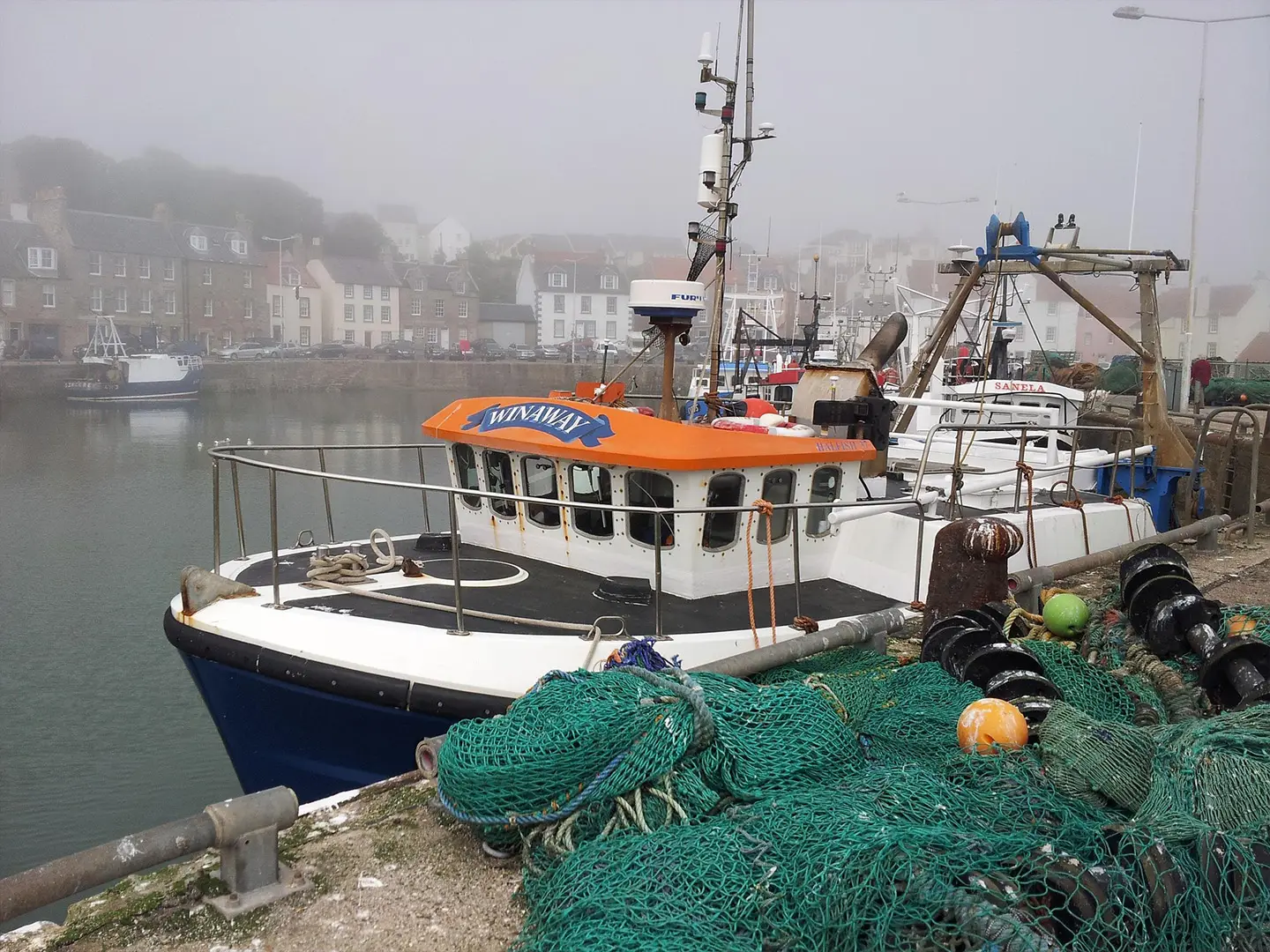
- East Neuk fishing villages: Elie, St Monans, Pittenweem, Anstruther and Crail give the walk its classic harbour-and-cottage coastline; Anstruther is also home to the Scottish Fisheries Museum.
- Elie Chain Walk: This optional short scramble around Kincraig Point uses fixed chains across coastal cliffs and is only passable around low tide.
- St Andrews: The route passes Scotland’s oldest university town, known for the Old Course, ruined cathedral and castle, and West Sands beach.
- Norman’s Law: The final stage climbs over the shoulder of Norman’s Law before dropping to Newburgh, giving broad views over the Tay.
Challenges to expect
The Fife Coastal Path is well waymarked, but expect mixed surfaces: sand, shingle, rock, firm earth, gravel, promenade and pavement. Rocky foreshore can be slippery, and some sections become muddy after rain. The Elie Chain Walk and some shore sections are tide-dependent. The final stage is the hardest, climbing inland over rougher hill ground near Norman’s Law. Winter brings short days and exposed coastal weather.
HikeList Score
Fife Coastal Path scored 90/100 on HikeList's trail-quality metrics.
See score breakdownHide breakdown
- Ideal length 97
- Balanced challenge 100
- Scenery & wildness 63
- Varied terrain 100
- Accommodation 100
- Food & support 88
- Path quality 89
- Season flexibility 89
Computed from length, challenge, scenery & wildness, terrain variety, accommodation, food & support, path quality and season flexibility.
 United Kingdom
 Scotland
Show more data Show less
- Coastal
- Beaches
- Dunes
- Clifftops
- Woodland
- Farmland
- Urban
- Rough Hill Ground
- Sand
- Shingle
- Rock
- Dirt
- Gravel
- Paved
- Hotels
- Guesthouses
- B&Bs
- Self Catering
- Campsites
- Hostels
- Family Friendly
- Dog Friendly On Leash
- Restrooms
- Established Campsites
- Picnic Areas
- Public Transport Access Points
Download Our Full Guide to Fife Coastal Path FREE!
Get our comprehensive guide to this hike for free. Save it for later reading or print out at home.
In these collections
Photos from hikers
Taken on the trail by people who've reviewed Fife Coastal Path.
Fife Coastal Path: The Complete Guide
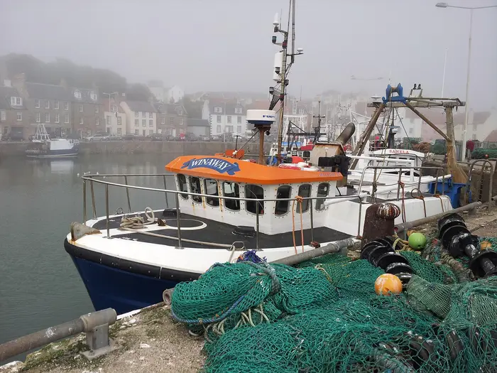 i
Image by Sula1948
i
Image by Sula1948 The Fife Coastal Path is a long, varied coast walk across one of Scotland’s most accessible shorelines, running 188 km from Kincardine on the Firth of Forth to Newburgh on the Firth of Tay. It suits walkers who want a proper point-to-point trail without committing to remote mountain logistics.
The route links working harbours, sandy beaches, rocky foreshore, promenades, old fishing villages and historic towns. North Queensferry brings the drama of the Forth Bridges, while the East Neuk and St Andrews provide the classic harbour-and-stone-cottage character many walkers come for.
This is also a practical first long-distance walk: waymarking is good, towns are frequent, and public transport is strong through the middle of the route. Section walkers are particularly well served by the Fife Circle railway, though both Kincardine and Newburgh require bus planning rather than rail.
The walking is moderate rather than mountainous, but it is not effortless. Long days, sand, shingle, slippery rock, tide-dependent shore sections and the hillier final push over the shoulder of Norman’s Law all need sensible planning.
This guide covers stages, daily planning, accommodation, food, transport, terrain and the common mistakes to avoid.
Stage-by-Stage Guide
The stages below follow the 8-day schedule in the route brief. Distances are approximate, and daily mileage can vary with accommodation location, tide-safe alternatives, short visits into towns and any live diversions. The path is waymarked with blue-and-white Fife Coastal Path markers, but an OS map or reliable offline mapping remains useful, especially on foreshore sections, through towns and on the inland finish.
Stage 1: Kincardine to North Queensferry — approx. 27 km
This is a long opening day along the West Fife shore of the Firth of Forth, starting at Kincardine by Kincardine Bridge and working east through Culross, Torryburn, Charlestown and Limekilns before reaching North Queensferry. It is a good introduction to the route’s mixed character: low-level coast walking, village streets, stretches of path by the water and urban approaches into the Forth Bridges area.
Culross is the key cultural stop, with its preserved royal burgh streets and 16th–17th-century buildings. The day finishes strongly at North Queensferry, where the three Forth crossings dominate the skyline, including the red cantilever Forth Bridge.
Underfoot, expect a changing mix of tarmac, firm path, coastal track and potentially muddy or uneven sections. The stage is not high or technically difficult, but 27 km is a full first day, so starting early is sensible if travelling to Kincardine the same morning.
Food and water are most reliable in the larger settlements rather than on every intervening stretch. Carry enough water and lunch or snacks from the start, particularly if walking outside core café and shop hours. Opening times should be checked before relying on a specific stop.
North Queensferry has accommodation and is one of the better end points on the early route. It also has rail access on the Fife Circle, making it a practical place to finish or break the walk. Kincardine has no railway station, so the start must be reached by bus or road transport; current Stagecoach services to Kincardine should be checked before travelling.
Navigation is generally straightforward where the coast is obvious, but take care through settlements, road edges and any sections where the waymarked route moves away from the immediate shore. Check the Fife Coast & Countryside Trust for live diversions before setting out.
Stage 2: North Queensferry to Burntisland — approx. 18 km
This is a shorter and more serviced day, linking North Queensferry with Burntisland via Inverkeithing, Dalgety Bay and Aberdour. It suits a steadier pace after the long first stage and has frequent opportunities to shorten, pause or leave the route.
The early part has excellent views back to the Forth Bridges. Later, the route reaches Aberdour, a strong mid-stage stop with its harbour village setting, Aberdour Castle nearby and Silver Sands on the Forth.
Terrain remains varied rather than difficult: paved town sections, coastal paths, beaches, firm tracks and short sections where surfaces may be slippery or muddy after rain. The route is low-level throughout, but footwear with decent grip is still preferable to road shoes because the surface changes repeatedly.
Food and drink are easiest to plan around North Queensferry, Aberdour and Burntisland, with Dalgety Bay also on the route. Do not assume every small outlet will be open all day; carry enough water between stops.
Burntisland is a practical overnight base with accommodation and rail access. North Queensferry, Aberdour and Burntisland are all served by the Fife Circle railway, so this is one of the easiest stages to walk as a day section.
Waymarking is generally good, but the main navigation issue is staying alert through built-up areas where pavements, promenades, harbour edges and local paths intersect. If the route appears to leave the shoreline briefly, follow the Fife Coastal Path markers rather than trying to force a line along the water.
Stage 3: Burntisland to East Wemyss — approx. 19 km
This stage follows the more urbanised middle Fife coast from Burntisland through Kinghorn, Kirkcaldy, Dysart and West Wemyss to East Wemyss. It is a varied day with plenty of built-up walking, but also a useful amount of transport access and services.
Kirkcaldy is the major town on the stage and the most obvious place for a longer food stop or resupply. The day’s distinctive finish is East Wemyss, known for the Wemyss Caves, where sandstone sea caves contain an important concentration of Pictish carvings.
Expect promenades, pavements, firm paths, coastal edges and occasional rougher or wetter ground. This is not a remote stage, but the changing surfaces can still be tiring, especially after rain or on slippery shore sections.
Food and water planning is easier here than on the quieter ends of the trail. Burntisland, Kinghorn and Kirkcaldy are useful service points, but it is still worth carrying water and snacks so the day does not depend on a single café or shop.
Accommodation is plentiful in the larger coastal towns such as Burntisland and Kirkcaldy, but East Wemyss itself should be treated as a place where accommodation may be more limited. If not staying in East Wemyss, plan a bus, taxi or transfer to a nearby overnight base in advance.
Public transport is strong on this section, with rail access at Burntisland, Kinghorn and Kirkcaldy and frequent buses along the coast. This makes the stage very suitable for section walking or for adjusting a longer itinerary if weather, fatigue or accommodation availability requires it.
Navigation is mostly uncomplicated, but built-up sections demand attention at junctions and along seafronts. The route can feel less like continuous wild coast here, so keep following the waymarks through towns rather than assuming the nearest waterside line is always correct.
Stage 4: East Wemyss to Lower Largo — approx. 18 km
This stage moves through Buckhaven, Methil, Leven and Lundin Links before finishing at Lower Largo. It is a practical, moderately short day that takes the route from the Levenmouth coast towards the East Neuk villages.
Leven is the main service point on the stage and a useful place to buy food or take a longer break. Lower Largo is the highlight at the end of the day: a harbour village associated with Alexander Selkirk, the marooned sailor who inspired Robinson Crusoe.
Terrain is a typical Fife Coastal Path mix: town pavements, seafront paths, firm tracks, sandy or shingly sections and places that can be wet or muddy after rain. The walking is low-level, but the surface changes often enough that a steady pace is more realistic than road-walking speed.
Food and water should be straightforward to manage if using Buckhaven, Methil, Leven or Lundin Links, but check opening times if arriving early or late. Carry water from the start and top up where services are definitely available.
Lower Largo and the East Neuk villages have accommodation, but they are popular in the main walking season. Booking ahead is sensible, especially for weekends and school-holiday periods.
Bus access is available through the coastal settlements, making this an easier stage to alter than the final inland section. Current bus times should be checked before using public transport as a fallback or to reach accommodation away from the trail.
Navigation is mainly about staying with the waymarks through developed areas and not losing the route where it passes between seafront, pavement and local paths. Check current diversion notices, as coastal works and local path closures can affect low-level shoreline routes.
Stage 5: Lower Largo to Anstruther — approx. 20 km
This is one of the classic East Neuk stages, linking Lower Largo with Elie and Earlsferry, St Monans, Pittenweem and Anstruther. The day has a strong coastal village character, with harbours, cottages, rocky shore and more interest underfoot than the distance alone suggests.
The optional Elie Chain Walk around Kincraig Point is the main caution on this stage. It is a low-tide scramble using fixed chains along the cliff base, and it is not suitable for everyone; it should only be attempted around low water and in safe conditions. Walkers who do not want a scramble should stay with the standard waymarked route and check tide times before setting out.
St Monans, Pittenweem and Anstruther provide the main village highlights, and Anstruther’s harbour front includes the Scottish Fisheries Museum. This section is also one of the best parts of the trail for short stops, but do not let that obscure the need to cover a full 20 km.
Terrain includes firm paths, harbour-side walking, pavement, rocky foreshore, shingle and potentially slippery coastal sections. Good grip matters, particularly after rain or where seaweed and wet rock are present.
Food and water are usually easiest to plan around the East Neuk villages on the route, especially Elie, St Monans, Pittenweem and Anstruther. Carry enough water between villages and check opening times outside the busier season.
Anstruther is one of the more useful overnight bases on the path, with accommodation options and good onward bus connections. As with the rest of the East Neuk, accommodation should be booked ahead in busy periods.
Navigation is generally clear, but this is a stage where tide planning is genuinely important. Do not commit to any shore option unless there is enough safe time before the tide returns, and avoid slippery rocks if conditions are poor.
Stage 6: Anstruther to St Andrews — approx. 23 km
This longer East Neuk stage runs from Anstruther through Cellardyke, Crail, Kingsbarns and Boarhills before reaching St Andrews. It is more committing than the previous day because the distances between reliable service points can feel longer, especially beyond Crail.
Crail is the main intermediate village highlight, while the approach to St Andrews brings the route into one of Scotland’s most significant historic towns. St Andrews has the ruined cathedral and castle, the Old Course and West Sands beach, making it a natural overnight stop rather than just a finish line.
Underfoot, expect a full coastal mix: firm tracks, grassy or earthy path, shingle, sand, rocky edges, town pavement and sections that can be muddy after rain. The stage is not mountainous, but it is long enough that wind, wet ground and uneven shore walking can make it tiring.
Food and water are available at Anstruther and St Andrews, with intermediate settlement options such as Crail and Kingsbarns. The quieter stretches still require planning: carry lunch or snacks and enough water so that a closed café does not become a problem.
St Andrews has plentiful accommodation compared with smaller villages, but it is a busy visitor destination. Booking well ahead is strongly recommended, particularly in summer and around major events.
Public transport is generally good around the East Neuk and St Andrews, though current bus times should be checked before depending on them. There is no need to force this stage if accommodation or weather makes it awkward; it can be split or adjusted using the coastal settlements, provided transport is planned in advance.
Navigation is mostly waymarked coastal walking, but pay attention where the path crosses between beaches, tracks, field edges and settlement approaches. Check tide times for any shore sections and do not assume that a line on the beach is usable at all states of tide.
Stage 7: St Andrews to Wormit — approx. 28 km
This is the longest stage in the 8-day schedule and should be treated as a full day. From St Andrews the route heads through Guardbridge and Leuchars before continuing towards the Tay shore, Tayport, Newport-on-Tay and Wormit.
The character changes noticeably after St Andrews. The route leaves the more famous East Neuk coastline behind and moves into the quieter sands, pinewoods and wide estuary landscape associated with Tentsmuir and the Firth of Tay.
Terrain remains mostly low-level but can be tiring because of the distance and variety: beach or sand, woodland path, firm tracks, pavement through settlements and sections that may be muddy after rain. In windy or wet weather, the open estuary stretches can feel more exposed than the height profile suggests.
Food and water should be planned carefully. St Andrews is the obvious place to start with full supplies, and there are settlements later in the day, including Guardbridge, Leuchars, Tayport, Newport-on-Tay and Wormit, but quiet stretches mean carrying enough food and water is prudent.
Accommodation becomes thinner after St Andrews, particularly towards Wormit and the inland finish of the route. Book this night ahead or arrange a transfer to a confirmed overnight base rather than arriving without a plan.
Public transport and road access are useful through the Tay-side settlements, but services and evening frequencies should be checked before relying on them. This should be checked before travelling.
Navigation is generally manageable with waymarks, but this is not the stage to walk on autopilot. The route shifts between coast, estuary, woodland, roadsides and settlements, so keep an eye on mapping at junctions and where local paths branch away from the long-distance route.
Stage 8: Wormit to Newburgh — approx. 17 km
The final stage is shorter in distance but hillier and more inland than the rest of the walk. From Wormit the route passes through or near Balmerino and then climbs over the shoulder of Norman’s Law before descending to Newburgh on the south shore of the Firth of Tay.
This is the high point of the Fife Coastal Path, with the trail reaching about 230 m on Norman’s Law’s shoulder. The actual summit of Norman’s Law is off-route at 285 m and is a short detour of under 0.5 km with roughly another 50 m of climbing, so allow extra time if adding it.
Terrain changes from coastal and estuary walking to woodland, farmland, tracks and hill paths. Mud is more likely after rain, and the final day can feel unexpectedly strenuous if the previous week has been walked at coastal pace.
Views are the reward for the climb, with broad outlooks across the Tay towards Perthshire in clear weather. The descent to Newburgh completes the route, but the town is small and should not be treated like one of the larger coastal service centres.
Carry food and water from Wormit, as services between Wormit and Newburgh are limited compared with the middle of the trail. Do not rely on finding regular cafés or shops mid-stage.
Accommodation at the Newburgh end is thinner than in places such as St Andrews, Anstruther or Kirkcaldy, so the final night should be booked ahead if staying locally. Many walkers will also need to plan onward transport rather than assume an easy rail departure.
Newburgh has no railway station. It is served by Stagecoach buses, including services 65/64 to Perth, Cupar and St Andrews, with Ladybank or Cupar the nearest railheads to the finish; current timetables should be checked before travelling.
Navigation is more important here than on the seafront stages. The route is still waymarked, but farmland, woodland junctions, hill paths and changing visibility around Norman’s Law make a map or offline navigation sensible. In poor weather, allow extra time and avoid treating the final 17 km as an easy coastal stroll.
Recommended Itinerary
Standard 8-day itinerary
This 8-day schedule follows the practical stage pattern most walkers will find easiest to book: overnight stops are in recognised coastal towns or villages, the daily distances are mostly moderate, and the longest days fall where there are reasonable escape options or services. Distances are approximate planning figures; check official mapping before booking accommodation, especially if staying away from the path.
| Day | From | To | Approx. distance | Why this stage makes sense | Services/accommodation notes |
|---|---|---|---|---|---|
| 1 | Kincardine | North Queensferry | 27 km | A long opening day, but it gets the quieter West Fife section done and finishes at a strong transport point beneath the Forth Bridges. The route passes places such as Culross, Torryburn, Charlestown and Limekilns before reaching North Queensferry. | Kincardine has no railway station, so the start needs bus planning. Accommodation is thinner on the West Fife start, so book ahead or plan transport carefully. North Queensferry is on the Fife Circle railway line. |
| 2 | North Queensferry | Burntisland | 18 km | A manageable day through the more transport-rich Forth coast, passing Inverkeithing, Dalgety Bay and Aberdour before Burntisland. It is a good recovery after the longer first stage. | North Queensferry, Aberdour and Burntisland have useful rail access. Aberdour and Burntisland are among the better-served coastal stops for accommodation and food. |
| 3 | Burntisland | East Wemyss | 19 km | This stage links Burntisland, Kinghorn, Kirkcaldy, Dysart and the Wemyss coast without making the day excessive. Kirkcaldy provides a useful mid-stage service hub. | Burntisland, Kinghorn and Kirkcaldy have rail access. East Wemyss is important for the Wemyss Caves area, but accommodation should be arranged in advance if staying there or nearby. |
| 4 | East Wemyss | Lower Largo | 18 km | A moderate day through the Levenmouth coast, passing Buckhaven, Methil, Leven and Lundin Links before Lower Largo. It keeps the East Neuk approach unhurried. | Leven and the larger settlements on this stretch are useful for food and services. Lower Largo is a smaller overnight stop, so accommodation should be booked early in busy periods. |
| 5 | Lower Largo | Anstruther | 20 km | This is the classic East Neuk stage, taking in Elie and Earlsferry, St Monans, Pittenweem and Anstruther. It is short enough to allow time in the fishing villages and to manage tide-sensitive shore options sensibly. | The East Neuk villages are popular, with accommodation available but often in demand. The optional Elie Chain Walk is only suitable around low water and is not necessary for completing the route. Check tide times before relying on any shore section. |
| 6 | Anstruther | St Andrews | 23 km | A longer but logical day from Anstruther and Cellardyke through Crail, Kingsbarns and Boarhills to St Andrews. St Andrews makes the strongest overnight base on the eastern side of the route. | Anstruther and St Andrews are major accommodation and food stops for this trail. Book St Andrews well ahead in busy periods. |
| 7 | St Andrews | Wormit | 28 km | One of the longer days, but it suits the geography of the route as it turns from St Andrews towards the Tay shore via Guardbridge, Leuchars, Tayport and Newport-on-Tay. | St Andrews has plentiful accommodation and services. Wormit and the inland/Tay-side end of the route have thinner accommodation than the central coast, so this night needs advance planning. Public transport options exist along parts of this side of Fife, but current bus times should be checked before travelling. |
| 8 | Wormit | Newburgh | 17 km | A shorter final day is sensible because the character changes: the route leaves the easy coastal feel and climbs inland over the shoulder of Norman's Law before descending to Newburgh. | Newburgh has no railway station. Finish transport is by Stagecoach bus, with Ladybank or Cupar the nearest railheads; current bus times should be checked before travelling. Accommodation and onward travel at the finish should be arranged in advance. |
Slower 9- or 10-day option
A slower schedule suits first-time long-distance walkers, anyone carrying a full pack, and walkers who want more time in the East Neuk villages or St Andrews. It is also a good choice if tide windows make the shore sections awkward.
The easiest places to add time are the longer or service-rich stretches:
| Where to add a stop | How it helps | Planning notes |
|---|---|---|
| Kincardine to North Queensferry | Breaks the long 27 km first day on the quieter West Fife coast. | Accommodation is thinner at this end, so this only works if a suitable overnight or transport link is arranged in advance. |
| Burntisland to East Wemyss | Allows a shorter day using Kirkcaldy as a practical break point. | Kirkcaldy is one of the larger towns on the route and has rail access. |
| Lower Largo to Anstruther | Gives more time for Elie and Earlsferry, St Monans, Pittenweem and the East Neuk harbours. | Good for walkers wanting a less rushed coastal day, but accommodation in the popular villages should be booked early. |
| Anstruther to St Andrews | Makes the Crail, Kingsbarns and Boarhills section more relaxed. | Exact stopping points and distances should be checked on official mapping before booking. |
| St Andrews to Wormit | Reduces the 28 km Tay-side day. | Possible overnight logistics around Tayport, Newport-on-Tay or nearby settlements should be checked before travelling, as accommodation is thinner towards the Wormit–Newburgh end. |
Faster 7-day option
A 7-day itinerary is realistic for fit walkers who are comfortable with at least one long day and who are not relying on relaxed sightseeing time. The most sensible compression is usually in the middle of the route, where towns and transport make a long day easier to manage, rather than combining the final hillier approach to Newburgh.
| Day | From | To | Approx. distance | Why this stage makes sense | Services/accommodation notes |
|---|---|---|---|---|---|
| 1 | Kincardine | North Queensferry | 27 km | Keeps the standard long opening stage. | Start transport to Kincardine must be arranged by bus; there is no railway station at the start. |
| 2 | North Queensferry | Burntisland | 18 km | A shorter day before the main compressed section. | Rail access at North Queensferry, Aberdour and Burntisland gives useful flexibility. |
| 3 | Burntisland | Lower Largo | 37 km | Combines the standard Burntisland–East Wemyss and East Wemyss–Lower Largo stages into one long but low-level coastal day. | This is the key hard day of the 7-day plan. Kirkcaldy and Levenmouth provide useful services en route, but accommodation at the end should be booked in advance. |
| 4 | Lower Largo | Anstruther | 20 km | Returns to a moderate East Neuk stage after the long previous day. | Check tide times for shore sections and for any plan involving the optional Elie Chain Walk. |
| 5 | Anstruther | St Andrews | 23 km | A full but manageable coastal day into the best-served eastern hub. | St Andrews accommodation should be booked early. |
| 6 | St Andrews | Wormit | 28 km | Keeps the standard long Tay-side stage. | Check current bus options and book accommodation carefully towards Wormit. |
| 7 | Wormit | Newburgh | 17 km | Leaves the hillier Norman's Law stage as a shorter final day, which is the safest way to finish strongly. | Newburgh has no station; arrange bus onward travel and check times before travelling. |
Planning the Route
How many days to allow
Most walkers should plan around 8 days, which matches the natural spacing of the larger towns and the practical stage pattern used by many itineraries. This gives a steady long-distance walking pace without turning the trail into a route march.
A 7-day crossing is realistic for fit walkers who are comfortable with repeated long days, mixed surfaces and tide planning. It leaves less margin for slow rocky foreshore, sightseeing in the East Neuk villages or bad-weather delays.
A 9–10 day plan is often the better choice for a first long-distance walk, or for anyone wanting shorter days around St Andrews, the East Neuk and the tougher finish towards Newburgh. Extra days are easiest to add where there are towns, rail links or bus connections; accommodation availability should drive the exact splits.
| Plan | Best for | Planning implications |
|---|---|---|
| 7 days | Strong, efficient walkers | Expect several long stages and less flexibility around tides, transport and accommodation. |
| 8 days | Most walkers | Fits the main accommodation hubs and keeps the route purposeful without excessive daily distances. |
| 9–10 days | First-timers, slower walkers, sightseeing pace | Use intermediate towns and villages to reduce the longest stages, but book carefully where accommodation is thinner. |
| Section hiking | Walkers based in Fife, Edinburgh, Dundee or Perthshire | Very practical in the middle of the route because of rail and bus links; the Kincardine and Newburgh ends need more bus planning. |
Natural stage planning
The route is strongly shaped by towns and accommodation. The larger coastal places — North Queensferry, Aberdour, Burntisland, Kirkcaldy, Leven, Anstruther and St Andrews — make the easiest overnight stops, while the quieter West Fife start and the Wormit–Newburgh finish need earlier booking.
The following 8-day structure is a practical baseline rather than the only sensible itinerary:
| Stage | From | To | Approx. distance | Planning note |
|---|---|---|---|---|
| 1 | Kincardine | North Queensferry | 27 km | A long opening day, with no railway station at Kincardine, so arrival transport must be planned in advance. |
| 2 | North Queensferry | Burntisland | 18 km | One of the easier stages to adjust because of Fife Circle railway stations and coastal towns. |
| 3 | Burntisland | East Wemyss | 19 km | Good for a steady day, but surfaces and town walking can slow the pace. |
| 4 | East Wemyss | Lower Largo | 18 km | Accommodation and services should be checked around the smaller places. |
| 5 | Lower Largo | Anstruther | 20 km | A classic East Neuk stage where time can easily disappear in the harbour villages. |
| 6 | Anstruther | St Andrews | 23 km | Allow for shore conditions, exposed coastal walking and any tide-sensitive choices. |
| 7 | St Andrews | Wormit | 28 km | The longest standard stage; worth shortening if accommodation or transport allows. |
| 8 | Wormit | Newburgh | 17 km | Shorter on paper, but hillier and more inland, with the climb over the shoulder of Norman's Law before Newburgh. |
If shortening the itinerary, look first at the long Kincardine–North Queensferry and St Andrews–Wormit days. If extending it, the East Neuk and St Andrews areas are the most obvious places to slow down, while the final approach to Newburgh still needs careful accommodation and onward-transport planning.
Walking quickly vs walking slowly
The Fife Coastal Path rewards a measured pace more than a fast one. Although the route is low-level for much of its length, progress is not always as quick as the map suggests: sand, shingle, slippery rocks, promenades, pavements and muddy sections after rain all interrupt rhythm.
Fast walkers should still build in tide checks and realistic timings for shore sections. A long day that looks straightforward on road or firm path can feel very different if it includes soft beach, rocky foreshore or a wait for safer water levels.
Slower itineraries work particularly well because the route passes through many towns and villages. The main constraint is not navigation, but matching daily distances to bookable accommodation and transport.
Section hiking and escape options
This is one of the easier Scottish long-distance routes to section hike. The middle of the route is well served by the Fife Circle railway, with stations including North Queensferry, Aberdour, Burntisland, Kinghorn and Kirkcaldy, and there are also frequent buses along many coastal sections.
The two ends need more care. Kincardine has no railway station and is reached by Stagecoach bus, including the X27 from Glasgow or services via Falkirk, Alloa and Stirling. Newburgh also has no station; Stagecoach services 65/64 link it with Perth, Cupar and St Andrews, with Ladybank or Cupar the nearest railheads. Current timetables should be checked before travelling.
For a section-walking plan, the most straightforward approach is to build days around rail-served towns in the central section, then treat Kincardine and Newburgh as separate bus-linked days. This avoids being forced into awkward car shuttles at either end.
The planning priorities that matter most
Accommodation should be arranged before committing to daily stages, especially at the quieter start and finish. The larger coastal towns offer the broadest mix of hotels, guesthouses, B&Bs, self-catering, hostels and campsites, but smaller villages can fill quickly or have limited options.
Tides matter on several shore sections. Check tide times before walking any low-level foreshore route, and treat the Elie Chain Walk at Kincraig Point as an optional low-tide scramble rather than part of a standard walking itinerary. It uses fixed chains, is only passable around low water and is not suitable for everyone.
Food and water planning is generally easier than on remote trails because the path passes frequent towns and villages. Even so, carry enough food and water for each day rather than relying on every small place having open services at the right time, particularly on quieter stretches and the inland final day.
Navigation is usually straightforward because the trail is waymarked with blue-and-white Fife Coastal Path markers. A map or offline GPX is still sensible for tide alternatives, town exits, woodland or farmland sections, and any temporary diversion. Useful mapping includes OS Explorer 367, 370 and 371, with additional end-area sheets as needed.
Transport should be checked at both ends before booking fixed accommodation. The absence of railway stations at Kincardine and Newburgh is the main trap for walkers used to the convenient rail access in the middle of the route.
Weather and underfoot conditions affect pace more than altitude for most of the trail. Rain can make rocky foreshore, mud and boardwalk sections slower, while coastal wind can make exposed beaches and headlands more tiring. Spring, summer and autumn are the normal planning seasons; shorter daylight and rougher weather reduce margins outside these months.
Permits and formalities are not usually the limiting planning factor for this route. If camping, arranging baggage transfer, joining an organised trip or depending on any specific access arrangement, the details should be checked before travelling.
Before setting off, check the Fife Coast & Countryside Trust information for live diversions or closures, and re-check tide tables and public transport close to the walking dates.
Towns, Villages and Overnight Stops
Accommodation and services are unevenly spread along the Fife Coastal Path. The central coast and East Neuk give the easiest logistics, while the West Fife start and the Wormit–Newburgh finish need more care, especially if walking a fixed 7–10 day itinerary.
Book the end stages early rather than assuming there will be a room in the exact village where a stage naturally finishes. Opening hours for cafés, pubs, shops and buses can also be seasonal or reduced on quieter stretches, so key food and transport details should be checked before travelling.
| Route sector | Practical overnight notes |
|---|---|
| Kincardine to North Queensferry | Quieter for accommodation and services. North Queensferry is the strongest overnight target on the first long day. |
| North Queensferry to Kirkcaldy | Strongest public transport section, with Fife Circle railway stations at North Queensferry, Aberdour, Burntisland, Kinghorn and Kirkcaldy. Good for section walking and shorter stages. |
| Kirkcaldy to Leven | More urban in places, with practical service stops, but not every smaller settlement is a natural overnight base. |
| Leven to Anstruther | Good walking logistics through the East Neuk, with attractive villages and more accommodation options in the popular coastal stops. |
| Anstruther to St Andrews | A longer coastal day with fewer major service centres between Crail, Kingsbarns, Boarhills and St Andrews. Plan food and water rather than relying on every village. |
| St Andrews to Newburgh | Accommodation becomes thinner after St Andrews, especially around the Wormit–Newburgh end. Book ahead and check buses from Newburgh before committing to a finish time. |
Kincardine
Kincardine is the western start of the trail, on the north bank of the Firth of Forth by Kincardine Bridge. It is a practical start point rather than one of the strongest accommodation hubs on the route.
There is no railway station at Kincardine. Access is by Stagecoach bus, including the X27 from Glasgow and services via Falkirk, Alloa or Stirling; current times should be checked before travelling.
If starting early, it is worth arriving with the first day’s food already sorted. West Fife has thinner accommodation coverage than the middle of the route, so any pre-walk night in or near Kincardine should be booked rather than left to chance.
Culross
Culross comes early on the West Fife coast and is one of the most memorable villages on the first section. It is a useful break point between Kincardine and North Queensferry, particularly if the first day is being split.
Accommodation in this western part of the path is less plentiful than in the larger coastal towns farther east. Treat Culross as a possible overnight only if suitable accommodation has been booked in advance.
Culross is also a sensible place to pause for food if services are open, but do not rely on late-day availability without checking. The village’s cobbled historic core can be busy with visitors in peak season.
Torryburn
Torryburn lies between Culross and the North Queensferry approach. For most walkers it is a pass-through village rather than a planned overnight stop.
Use it as a waypoint on the long first stage, but avoid building an itinerary around finding last-minute accommodation here. Food and shop options should be checked before relying on them.
Charlestown
Charlestown sits on the West Fife stretch before Limekilns and North Queensferry. It can help break up the first day if walking a shorter schedule, but it is not one of the main accommodation hubs named for the route.
Any plan to stop here overnight should be arranged in advance. If continuing to North Queensferry, allow enough time and daylight for the remaining coastal walking.
Limekilns
Limekilns is passed before the path reaches North Queensferry and the Forth Bridges area. It is more useful as a rest or food stop than as a default overnight base.
Walkers using Limekilns to shorten the first section should check accommodation and onward transport before committing. North Queensferry remains the more dependable target for ending the first stage.
North Queensferry
North Queensferry is one of the best overnight stops on the western half of the trail. It sits beneath the three Forth crossings, including the Forth Bridge, and is the usual end of the long first day from Kincardine.
Accommodation is more plentiful here than in the quieter West Fife start, and there are better options for food and transport. It also has a railway station on the Fife Circle, making it an excellent place to start, stop or resume a section walk.
If the Kincardine to North Queensferry day feels too long, split the stage farther west rather than relying on arriving late. This first day is one of the key accommodation-planning points on the route.
Inverkeithing
Inverkeithing is passed after North Queensferry as the route continues around the Forth-side settlements. It is a practical town stop rather than a classic scenic overnight halt.
This part of the trail has much stronger public transport than the western start, so Inverkeithing can be useful for flexible section walking. Specific rail and bus times should be checked before relying on them.
Dalgety Bay
Dalgety Bay sits between Inverkeithing and Aberdour. It can be useful for services on a walking day, but it is not usually the most obvious place to build a long-distance itinerary around.
Accommodation may be possible in the wider area, but Aberdour and Burntisland are more established overnight targets on this section. Check food and transport details if planning to finish here.
Aberdour
Aberdour is a strong overnight or shorter-stage stop on the Fife Coastal Path. The village has a harbour setting, Aberdour Castle nearby, and access to Silver Sands beach.
Accommodation is among the more plentiful options on the route’s larger coastal town section, and Aberdour has a railway station on the Fife Circle. It is especially useful for walkers who want to split the North Queensferry to Burntisland stage.
Aberdour also works well for section walkers because it gives easy onward travel in either direction. In summer and holiday periods, book ahead rather than assuming availability.
Burntisland
Burntisland is a natural overnight hub and the usual end of the second stage in an 8-day schedule. It has more dependable accommodation and food options than many of the smaller villages nearby.
The town has a railway station on the Fife Circle, making it one of the easiest places on the trail for arrivals, departures and bad-weather bail-outs. It is also a useful resupply point before continuing towards Kinghorn, Kirkcaldy and the Wemyss coast.
Kinghorn
Kinghorn lies between Burntisland and Kirkcaldy and has a railway station on the Fife Circle. It is useful for shortening or adjusting the Burntisland–Kirkcaldy section.
For most end-to-end walkers, Kinghorn is a convenient intermediate stop rather than a key overnight base. If planning to stay, accommodation and food opening hours should be checked before travelling.
Kirkcaldy
Kirkcaldy is one of the most practical towns on the route. It has a railway station on the Fife Circle and is among the larger coastal towns where accommodation is more plentiful.
This is a strong place for resupply, laundry planning, replacement kit or adjusting an itinerary. It is also a sensible overnight option for anyone wanting a town-based stop before the quieter Wemyss and Leven sections.
The route through and around Kirkcaldy includes more urban walking than the East Neuk villages. That makes it less quaint, but very useful logistically.
Dysart
Dysart comes soon after Kirkcaldy on the way towards West Wemyss and East Wemyss. It is best treated as a short stop or waypoint rather than a guaranteed overnight base.
Because Kirkcaldy is nearby and much stronger for accommodation and transport, most walkers will use Dysart for a break rather than for a night. Check any planned food stop before relying on it.
West Wemyss
West Wemyss is one of the smaller settlements on the coast before East Wemyss. It can be a pleasant place to pause, but it is not a main accommodation hub.
Do not assume full services here, especially late in the day or outside the main season. If using West Wemyss to shorten a stage, arrange accommodation and onward transport in advance.
East Wemyss
East Wemyss is a common stage end between Burntisland and Lower Largo. It is important for the Wemyss Caves, where sandstone sea caves contain Pictish carvings.
Despite being a practical stage break, accommodation is not as broadly available here as in larger towns such as Kirkcaldy, Leven, Anstruther or St Andrews. Book ahead if planning to stop in East Wemyss itself.
Food and local services should also be checked before arrival. If availability is limited, nearby route towns on either side may be needed to make the day’s logistics work.
Buckhaven
Buckhaven lies between East Wemyss and Methil on the approach to Leven. It is part of a more built-up section of the coast and can be useful for daytime services.
It is not one of the main overnight hubs for the Fife Coastal Path. If ending a stage here, confirm accommodation, food and onward transport before committing.
Methil
Methil comes just before Leven when walking east. It can be used as a practical waypoint on the East Wemyss to Lower Largo day.
Most walkers will continue to Leven for stronger accommodation and service options. Check local opening hours if depending on Methil for food or supplies.
Leven
Leven is one of the larger coastal towns with more plentiful accommodation. It is a useful overnight alternative if the East Wemyss to Lower Largo stage needs to be shortened or adjusted.
The town is also a sensible resupply point before the route moves into the smaller villages of Lundin Links, Lower Largo and the East Neuk. Public transport is generally good through this middle part of the route, but current times should be checked.
Lundin Links
Lundin Links sits between Leven and Lower Largo. It is useful as an intermediate stop, particularly for walkers who want to break up the transition from the more urban Leven area to the smaller coastal villages.
Accommodation and food may be more limited than in Leven or the larger East Neuk stops. Check before planning an overnight here.
Lower Largo
Lower Largo is a common stage end and a good overnight target if accommodation is booked. It is a harbour village and the birthplace of Alexander Selkirk, the sailor associated with the Robinson Crusoe story.
As a smaller village, it should not be treated like a large town for services. Arrange accommodation ahead and carry enough food flexibility in case evening options are limited.
Lower Largo is well placed for the following day towards Elie and Earlsferry, St Monans, Pittenweem and Anstruther. It is also a good place to review tide timings before walking the shore sections farther east.
Elie and Earlsferry
Elie and Earlsferry is one of the best-known East Neuk stops and can work well as an overnight if the standard Lower Largo to Anstruther day is being split. Accommodation is generally more available in the popular East Neuk villages than on the quieter start and finish of the trail.
This is the key base for anyone considering the optional Elie Chain Walk around Kincraig Point. The chain walk is only passable around low water and is not suitable for everyone; tide times and conditions must be checked before attempting it.
Even if skipping the chain walk, the shore sections around this part of the coast need attention to tide and surface conditions. Carry enough food to continue if a planned café or pub is closed.
St Monans
St Monans is one of the East Neuk fishing villages between Elie and Pittenweem. It is a useful stop on the Lower Largo to Anstruther stage and can also serve as an overnight for a slower itinerary.
Accommodation should be booked ahead, particularly in busy periods. Food options and opening times can vary, so check before relying on St Monans as the day’s only meal stop.
Pittenweem
Pittenweem lies between St Monans and Anstruther and is another classic East Neuk village. It is close enough to Anstruther to be used flexibly when planning overnight stops.
It can work well for walkers who want a shorter day or who cannot find accommodation in Anstruther. As with the smaller villages, book ahead and check current food availability.
Anstruther
Anstruther is one of the strongest overnight hubs on the eastern half of the route. It is a larger coastal town by Fife Coastal Path standards, with more plentiful accommodation and food options than the smaller villages around it.
It is the usual end of the Lower Largo to Anstruther stage and the start of the longer day to St Andrews. The harbour front also has the Scottish Fisheries Museum, which is useful if arriving early or waiting out poor weather.
Because Anstruther is popular, accommodation can still book up in peak periods. It is a sensible place to resupply before the more open Anstruther–St Andrews stretch.
Cellardyke
Cellardyke sits immediately after Anstruther when heading east. It is effectively part of the same practical stopping area for many walkers.
Use Cellardyke as an accommodation alternative to Anstruther if it fits the day’s mileage. Check food and transport arrangements locally rather than assuming the same availability as in the larger town centre.
Crail
Crail is the main village between Anstruther and the Kingsbarns area. It is a useful break point on the long Anstruther to St Andrews day and can also be used to split that stage.
Accommodation may suit a slower itinerary, but it should be booked ahead. Carry enough food and water to continue beyond Crail, as the next part of the route has fewer major settlements before St Andrews.
Kingsbarns
Kingsbarns lies between Crail and Boarhills on the approach to St Andrews. It is useful as a waypoint and possible break in the long day from Anstruther.
Do not assume that full hiker services will be available exactly when needed. If planning to finish here, check accommodation, food and onward transport before travelling.
Boarhills
Boarhills is a small settlement before St Andrews. It is best treated as a navigation and rest point rather than a main overnight stop.
Most walkers will continue to St Andrews for accommodation, food and transport flexibility. Carry what is needed for this part of the day rather than depending on Boarhills for services.
St Andrews
St Andrews is one of the most useful overnight stops on the whole trail. Accommodation is plentiful compared with the smaller villages, and it is the obvious place for rest, resupply and itinerary changes before the northern leg.
The town is also one of the route’s major set-piece stops, with the university, Old Course, ruined cathedral and castle, and West Sands beach. For walking logistics, its main value is that it provides a strong service base before the quieter St Andrews to Wormit and Wormit to Newburgh stages.
Book accommodation early in busy periods. The next two days are less forgiving for last-minute planning, so confirm the Wormit/Newburgh arrangements before leaving St Andrews.
Guardbridge
Guardbridge comes after St Andrews as the route turns towards the north Fife and Tay-side sections. It is a practical waypoint on the long St Andrews to Wormit day.
This is not one of the main overnight hubs on the route. Check food and transport options in advance if planning to stop here rather than continuing.
Leuchars
Leuchars lies on the route between Guardbridge and Tayport. It can be useful for breaking up the long day after St Andrews, but it is not highlighted as a main accommodation centre for the trail.
If using Leuchars as a start, finish or overnight point, check current accommodation and transport details before booking the rest of the itinerary. The St Andrews to Wormit stage is long enough that small changes here can make a useful difference.
Tayport
Tayport is reached as the route approaches the Firth of Tay. It is a useful place to pause before the path continues towards Newport-on-Tay and Wormit.
Accommodation and services are thinner on this northern finish compared with the central coast and East Neuk. Check availability before deciding to end a day here.
Newport-on-Tay
Newport-on-Tay lies between Tayport and Wormit on the Tay-side stretch. It can be used as an alternative stopping point if Wormit accommodation is unavailable or if the long day from St Andrews needs adjusting.
Do not assume last-minute accommodation will be easy on this part of the trail. Confirm food, buses and any transfer arrangements before committing to a stage end.
Wormit
Wormit is the usual end of the long St Andrews to Wormit stage and the start of the final inland walk to Newburgh. It is one of the key places where advance booking matters.
Accommodation is thinner around the Wormit–Newburgh finish than in the larger coastal towns. If there is no suitable room in Wormit, the itinerary may need adjusting to use Tayport, Newport-on-Tay or transport to accommodation off-route.
The next stage climbs inland over the shoulder of Norman’s Law before descending to Newburgh, so start with food and water sorted. Do not rely on finding full services during the final hillier section.
Balmerino
Balmerino is passed on the final stage between Wormit and Newburgh. It is a small settlement on a more rural, inland-feeling finish to the route.
Treat Balmerino as a waypoint rather than a dependable service stop. Carry what is needed for the day from Wormit to Newburgh, especially if walking outside the main season.
Newburgh
Newburgh is the finish of the Fife Coastal Path on the south shore of the Firth of Tay. It is a small town and should be planned as a finish point, not treated like a major transport hub.
There is no railway station at Newburgh. Stagecoach bus services 65/64 link with Perth, Cupar and St Andrews, and the nearest railheads are Ladybank or Cupar; current bus times should be checked before travelling.
Accommodation around the finish is thinner than on the central coast and in the East Neuk. If staying after the walk, book ahead; if travelling out the same day, leave enough time after the final Norman’s Law stage for delays, tired legs and bus connections.
Getting to the Start
The Fife Coastal Path starts in Kincardine, on the north bank of the Firth of Forth by Kincardine Bridge. There is no railway station at the start, so most walkers reach Kincardine by bus, by car drop-off, or by combining train and bus through a nearby transport hub.
By train
Kincardine does not have a railway station. If travelling by rail, plan to connect onward by bus or taxi from a suitable town on the Scottish central belt network.
Bus links to Kincardine run via places including Falkirk, Alloa and Stirling, so these are practical rail-to-bus interchange points depending on where you are travelling from. Current rail and bus connections should be checked together before booking, as missed connections can make for a late start on a long first stage.
For section walkers, the middle of the route is much easier by rail, with Fife Circle stations including North Queensferry, Aberdour, Burntisland, Kinghorn and Kirkcaldy. That does not help for the Kincardine start itself, but it is useful if you are joining the trail after the opening stage.
By bus
Bus is the main public-transport option for reaching the official start at Kincardine. Stagecoach services serve the town, including the X27 from Glasgow, and other services via Falkirk, Alloa and Stirling.
Check the latest Stagecoach timetable before committing to a start time. This should be checked before travelling, especially if walking the full Kincardine to North Queensferry stage on day one, as that is a long opening day and a late arrival leaves little spare daylight.
By car
Kincardine is straightforward to reach by road because the trail begins by Kincardine Bridge, but the route is point-to-point and finishes at Newburgh, not back at the start. Leaving a car in Kincardine only makes sense if there is a clear plan to return from Newburgh by public transport or taxi at the end.
Long-stay parking at or near the start is not something to assume. Parking rules, availability and any time limits should be checked before travelling. Many walkers will find a lift or taxi drop-off simpler than trying to manage a car at the start of a 188 km linear walk.
From the nearest airport
There is no direct airport connection to the Kincardine trailhead. Arrivals by air should first connect into the wider Scottish train or coach network, then continue to Kincardine by Stagecoach bus or taxi.
Glasgow is a practical public-transport hub because the X27 bus serves Kincardine from Glasgow. Flight arrival times, onward transfer times and the current bus timetable should be checked before travelling, particularly if planning to walk on the same day.
Where to stay before starting
Accommodation is thinner around the quieter West Fife start than in the larger coastal towns later on the route. If starting early, book Kincardine accommodation ahead or stay somewhere with a reliable morning bus or taxi connection to Kincardine.
The first stage from Kincardine to North Queensferry is about 27 km, so it is worth avoiding a complicated same-morning transfer if possible. A late bus into Kincardine can turn the opening day into an unnecessarily pressured walk.
Getting Home from the Finish
By train
Newburgh has no railway station, so finishing the Fife Coastal Path always involves a bus or taxi connection before any onward train journey.
The nearest railheads to the finish are Ladybank and Cupar. For most walkers, the practical plan is to leave Newburgh by Stagecoach bus or pre-booked taxi to one of these stations, then continue by rail from there. Exact connections, last trains and Sunday services should be checked before travelling.
If a same-day rail journey is important, build in a buffer after the final stage. The Wormit to Newburgh day is shorter than some earlier stages, but it includes the hillier inland finish over the shoulder of Norman's Law, so arrival time can slip if conditions are wet, muddy or slower than expected.
By bus
Newburgh is served by Stagecoach bus services 65/64, with connections towards Perth, Cupar and St Andrews. These are the key public-transport options from the trail finish.
Bus times are the detail most likely to affect the end of the walk. Check the current timetable before committing to a final-day plan, especially if finishing late in the afternoon, on a Sunday or outside the main walking season.
A sensible approach is to decide in advance whether the bus target is Perth, Cupar or St Andrews, then plan accommodation or onward travel around that connection. Do not assume there will be a convenient late service from Newburgh after a delayed finish.
By car/taxi
If leaving by car, the simplest arrangement is for a supporter or taxi to meet you in Newburgh at the end of the route. There is no long-stay parking information for Newburgh, so parking arrangements should be checked before travelling.
Taxis are useful if the bus timetable does not line up with your finish time, or if you need to reach Ladybank or Cupar for a train. Pre-booking is strongly recommended for the final day rather than relying on finding a taxi immediately on arrival in a small town.
For end-to-end walkers who left a vehicle near the start at Kincardine, remember that both ends of the trail lack railway stations. Returning across Fife by public transport is possible, but it needs a planned sequence of bus and rail connections rather than a simple train from finish to start.
From the nearest airport
There is no airport at Newburgh, and the practical first step is to reach a larger transport hub by bus or taxi. Use the 65/64 bus towards Perth, Cupar or St Andrews, or take a taxi to Ladybank or Cupar for onward rail travel.
The best airport for departure depends on the available onward connections on the day of travel. Airport transfer routes and timings should be checked before booking flights, particularly if attempting to fly on the same day as finishing the walk.
Where to stay at the finish
Accommodation is thinner on the Wormit–Newburgh end of the route than in the larger coastal towns earlier on the Fife Coastal Path. If planning to stay at or near the finish, book ahead rather than assuming there will be multiple last-minute options in Newburgh.
Staying overnight at the finish is a good option if the final bus connections are awkward, if the last day is likely to run late, or if onward travel requires several changes. It also removes pressure from the final inland stage over Norman's Law, where the walking is more tiring than the low-level coastal sections suggest.
Which Direction Should You Walk?
The standard and most natural direction is Kincardine to Newburgh, following the route from the Firth of Forth round the East Neuk, through St Andrews and on to the Firth of Tay. This is the direction that best matches the official start and finish, and it gives the walk a clear progression from coast-and-town walking to the quieter Tay-side and inland hill finish.
The route can be walked in reverse, but most hikers will find the standard direction easier to plan and more satisfying to complete.
Kincardine to Newburgh: the recommended direction
Walking west to north-east gives the route a strong sense of build-up. The early stages move from Kincardine through Culross and towards North Queensferry, where the path passes beneath the Forth Bridges. The middle of the walk then has the easiest logistics, with rail stations and frequent services around North Queensferry, Aberdour, Burntisland, Kinghorn, Kirkcaldy and other Fife Circle stops.
The scenery also develops well in this direction. After the Forth and the more built-up coastal towns, the route reaches the East Neuk villages — Elie and Earlsferry, St Monans, Pittenweem, Anstruther, Cellardyke and Crail — before continuing to St Andrews. The final two days feel noticeably different, with the Tay shore, Tentsmuir area, Wormit, Balmerino and the inland climb over the shoulder of Norman’s Law before Newburgh.
That final inland stage is the main reason the direction matters. In the standard direction, the toughest hillier walking comes near the end, when the route has already delivered most of its coastal highlights. The climb to around 230 m on Norman’s Law gives the walk a proper final-day objective before the descent to Newburgh.
Transport is workable at both ends, but neither terminus has a railway station. Starting at Kincardine means arranging a bus to the trailhead first, such as Stagecoach services from Glasgow or via Falkirk, Alloa or Stirling. At the finish, Newburgh has Stagecoach bus links towards Perth, Cupar and St Andrews, with Ladybank and Cupar the nearest railheads; current bus times should be checked before travelling.
Accommodation also favours planning in this direction. The larger and more popular coastal towns in the middle of the route give good options as the walk settles into its rhythm, while the thinner accommodation around the Wormit–Newburgh end can be booked deliberately for the final stages.
Newburgh to Kincardine: when reverse makes sense
Walking Newburgh to Kincardine is perfectly possible and may suit walkers whose transport, accommodation or section-walking plans line up better that way. It puts the hillier Norman’s Law stage at the start, which some fit walkers may prefer, as the route then becomes mostly lower-level coast walking for the remaining days.
The reverse direction also works if accommodation is easier to secure westbound on particular dates. This can be useful around the busier East Neuk and St Andrews sections, where availability may dictate the order of travel more than walking preference.
The trade-off is that the route’s strongest finish is lost. Instead of ending with the Tay views and the descent to Newburgh after the inland high point, the walk finishes at Kincardine on the Forth. The Forth Bridges at North Queensferry also come late but not at the actual finish, so the final psychological payoff is less neat than in the standard direction.
Wind, tides and day planning
Weather exposure is not a strong reason to choose one direction over the other. This is a coastal route with exposed beaches, promenades, rocky foreshore and clifftop sections, so wind and rain can affect either direction. Forecasts should be checked stage by stage rather than assuming one direction will be consistently easier.
Tides matter more than direction. Several shore sections require tide awareness, and the optional Elie Chain Walk at Kincraig Point is passable only around low water. Whether walking eastbound or westbound, tide times should be checked before committing to each coastal stage.
Direction comparison
| Direction | Main advantages | Main drawbacks |
|---|---|---|
| Kincardine → Newburgh | Standard direction; best scenery progression; Forth Bridges early, East Neuk and St Andrews in the middle, Norman’s Law as a strong final-stage objective | Requires careful booking for the thinner Wormit–Newburgh end; no railway station at the finish |
| Newburgh → Kincardine | Puts the hillier inland section at the start; may suit particular accommodation or transport plans | Less satisfying finish; starts from a bus-only terminus; loses the natural build towards Norman’s Law and Newburgh |
Recommendation
For most walkers, walk the Fife Coastal Path from Kincardine to Newburgh. It follows the natural direction of the trail, gives the best scenic progression, keeps the strongest inland climb for the finale, and works well with the transport-rich middle sections. Walk it in reverse only if accommodation, public transport or section-walking plans make that clearly more practical.
Accommodation Along the Route
Overall accommodation pattern
The Fife Coastal Path works well as an inn-to-inn walk, especially through the central and eastern sections where coastal towns and villages come regularly. Accommodation is mixed: hotels, guesthouses, B&Bs, self-catering, hostels and campsites all feature along the route, but they are not evenly spread.
The strongest choice is in the larger coastal towns: North Queensferry, Aberdour, Burntisland, Kirkcaldy, Leven, Anstruther and St Andrews. The East Neuk villages also give good options, but they are popular places to stay and can fill quickly in spring, summer, autumn weekends and school holiday periods.
The awkward areas are the quieter West Fife start and the final Wormit–Newburgh end. These sections should be planned first, as there is less flexibility if a preferred stop is full.
Practical overnight stops
| Place | Accommodation level | Best for | Notes |
|---|---|---|---|
| Kincardine | Limited | Night before starting | Useful if beginning early from the official start. There is no railway station at Kincardine, so bus timings and accommodation should be checked before travelling. |
| Culross / Limekilns | Limited | Shortening the long opening stage | Helpful if the Kincardine to North Queensferry day is too long, but choices are thinner than in the larger towns. Book ahead. |
| North Queensferry | Good | First main overnight stop | A practical stop after the West Fife opening stage, with rail access for walkers joining, leaving or section-walking. |
| Aberdour | Good | Shorter stage planning | A useful alternative to pushing on to Burntisland, and a good base for flexible section walking thanks to its station. |
| Burntisland | Good | Classic stage stop | One of the stronger overnight points on the south Fife coast, with rail access and enough choice for most itineraries. |
| Kinghorn / Kirkcaldy | Good | Flexible overnight before the Wemyss coast | Kirkcaldy is one of the best fallback towns if accommodation around East Wemyss is tight. Both also suit rail-based section walking. |
| Dysart / West Wemyss / East Wemyss | Limited | Staying close to the Wemyss Caves section | East Wemyss is a useful stage end, but accommodation is more limited than in Kirkcaldy or Leven. Reserve early or plan a transfer. |
| Buckhaven / Methil / Leven | Good at Leven; limited around it | Alternative stop before Lundin Links and Lower Largo | Leven has the stronger choice in this part of the route and can solve awkward gaps between East Wemyss and Lower Largo. |
| Lundin Links / Lower Largo | Limited | Quieter coastal overnight | A natural stop on an 8-day itinerary, but not as flexible as the larger towns. Book ahead, especially at weekends. |
| Elie and Earlsferry / St Monans / Pittenweem | Good | East Neuk village overnights | Attractive and practical places for shorter days through the East Neuk. Demand can be high in peak walking season. |
| Anstruther / Cellardyke | Good | Main East Neuk overnight hub | One of the most reliable places to aim for between Lower Largo and St Andrews, with a stronger range of places to stay. |
| Crail / Kingsbarns | Limited | Breaking the Anstruther to St Andrews stage | Useful if the day into St Andrews feels too long, but do not rely on last-minute availability. |
| St Andrews | Good | Rest day, resupply and major overnight stop | The strongest accommodation hub on the route, but also one of the busiest. Book well ahead for weekends and holiday periods. |
| Guardbridge / Leuchars | Limited | Splitting the long St Andrews to Wormit stage | Useful for shorter itineraries, but accommodation and onward logistics should be checked before committing. |
| Tayport / Newport-on-Tay / Wormit | Limited | Overnight before the final inland stage | The route becomes less accommodation-rich after St Andrews. Wormit is a practical stage end, but the area should be booked early. |
| Balmerino | Limited | Splitting the final stage | Only suitable with a specific booking or transfer plan. This should be checked before travelling. |
| Newburgh | Limited | Finish night | Sensible if finishing late or connecting onward the next morning. Newburgh has no railway station; buses connect with Perth, Cupar and St Andrews, and current times should be checked before travelling. |
Booking strategy
For a continuous 7–10 day walk, secure the limited end-stage accommodation before filling in the easier central nights. The priority bookings are Kincardine or the first-night area, East Wemyss or Lower Largo if using those as stage ends, Wormit, and Newburgh.
St Andrews and the East Neuk villages should also be booked early. They have good choice, but they are popular with non-walkers as well as hikers, so availability can disappear quickly on summer weekends and during holiday periods.
If a planned overnight stop is full, the route’s public transport makes it possible to adjust the itinerary, especially through the middle of Fife. North Queensferry, Aberdour, Burntisland, Kinghorn and Kirkcaldy sit on the Fife Circle railway, while buses help elsewhere. Current timetables should always be checked before relying on this.
Luggage transfers, taxis and awkward gaps
Luggage transfer or taxi transfer can make the route much easier to book, because walkers are not forced to sleep exactly at each stage end. This is most useful around the West Fife start, the East Wemyss to Lower Largo stretch, and the Wormit–Newburgh finish.
A common approach is to stay in a stronger accommodation hub and use public transport or a taxi to return to the trail. This works particularly well in the rail-served middle section, but becomes less straightforward near Newburgh, where there is no station.
Baggage-transfer availability, taxi coverage and prices change, so these should be checked before booking. Campers and hostel users should also plan carefully: there are campsites and hostels along the wider route, but not at every natural stage end.
Camping and Wild Camping
Does the Fife Coastal Path suit camping?
Camping is possible on the Fife Coastal Path, but it needs more planning than on a remote upland trail. The route is town-rich, low-level and often close to harbours, promenades, beaches, farmland, roads and private property, so there are fewer discreet overnight spots than the map may suggest.
There are campsites and caravan-and-camping parks in the wider coastal corridor, but they are not evenly spaced for every stage. Opening dates, tent-pitch availability and minimum-stay rules can change, so each night should be checked before travelling rather than assuming a campsite will be available at the end of a walking day.
For many walkers, the most practical approach is a mixed itinerary: use campsites where they fit the route, and book indoor accommodation in places where camping options are thin. This is particularly sensible on the quieter West Fife start and on the Wormit–Newburgh end, where accommodation in general is less plentiful.
Wild camping: legality and reality
Scotland’s access rights generally allow responsible lightweight wild camping, provided it is small-scale, short-stay and carried out with care. On the Fife Coastal Path, the practical reality is more restrictive: much of the route passes through settlements, working farmland, popular beaches, dunes, woodland edges, promenades and harbour areas where wild camping may be unsuitable or unwelcome.
Do not camp in gardens, enclosed fields, crops, close to houses, on maintained public spaces, near harbours, on promenades or anywhere signs request no camping. If a location feels exposed to residents, path users or land management, move on and use a booked site or accommodation instead.
Local restrictions, temporary closures and land-manager requests should always be followed. This should be checked before travelling, especially in busy summer periods and around popular beaches and villages.
Best and worst sections for camping logistics
| Section | Camping practicality |
|---|---|
| Kincardine to North Queensferry | A long opening stage with developed coastal stretches and limited end-to-end camping certainty. Plan this night carefully rather than relying on finding a pitch late in the day. |
| North Queensferry to Burntisland / Kirkcaldy area | Stronger transport and more towns make logistics easier, but the coast is also more built-up. Campsites should be booked or checked in advance. |
| East Wemyss to Lower Largo and the East Neuk villages | Attractive walking, but many settlements are small and popular. Camping options may exist in the wider area, but do not assume late availability in summer. |
| Lower Largo to Anstruther to Crail | One of the most appealing parts of the route, but also one of the most visited. Wild camping close to villages, harbours and busy beaches is rarely a good plan. |
| Crail to St Andrews | More open stretches appear between settlements, but the route still uses coast, beaches and shore sections where tides and exposure matter. Carry enough water and have a proper overnight plan before leaving Crail or St Andrews. |
| St Andrews to Wormit and Newburgh | The route becomes quieter around the Tay shore and then hillier inland towards Norman’s Law. Services and accommodation thin out, so this end of the trail should be planned and booked with particular care. |
Water and supplies
Do not rely on natural water along this route. Much of the walk is coastal, and sea water is unusable; other water sources may be affected by farmland, settlements or tidal influence.
Use mains water from accommodation, campsites, cafés, shops and public facilities where available. The larger towns and villages make resupply straightforward on many days, but there are longer quieter stretches, especially towards the Tay shore and the final inland stage to Newburgh, where extra water should be carried.
Leave no trace and fire guidance
Keep camps small, arrive late, leave early and leave no visible trace. Pack out all rubbish, food waste and hygiene products, and avoid damaging dunes, grass, woodland ground or field margins.
Use a stove rather than an open fire. Fires are a poor fit for this route because of dry dunes, woodland, farmland, public beaches and the proximity of settlements; scorch marks and fire rings are not acceptable.
Toileting needs particular care on a busy coastal trail. Use public toilets, cafés, accommodation and campsites wherever possible; if no facility is available, go well away from the path, water, beaches, buildings and livestock, and pack out paper and sanitary waste.
Seasonal considerations
Summer gives the longest daylight and the most flexible walking days, but it is also when coastal villages, beaches and campsites are busiest. Book ahead for weekends, school holidays and the East Neuk sections around Elie and Earlsferry, St Monans, Pittenweem, Anstruther and Crail.
Spring and autumn can be quieter, but campsite opening dates and facilities may be more variable. Wind exposure is also worth taking seriously: even though the route is low-level, many overnight locations near the coast can be unsuitable in poor weather.
Tide planning still matters for campers. Several shore sections are tide-dependent, and the optional Elie Chain Walk is only passable around low water, so a camping itinerary should be built around both safe walking times and realistic overnight stops.
Food, Water and Resupply
The Fife Coastal Path is one of the easier Scottish long-distance trails to resupply on, because it passes through frequent towns and villages for much of its length. Food planning is still needed: opening hours can be seasonal, smaller coastal villages may have limited choice, and the final inland stage towards Newburgh is much quieter than the central coast.
Do not assume every settlement has a shop open when you arrive. Cafes and pubs are useful on the East Neuk and in the larger towns, but rural and coastal businesses may close on certain weekdays, reduce hours outside summer, or finish serving food early. This should be checked before travelling, especially if walking on Sundays or bank holidays.
Practical food strategy
For most walkers, the safest routine is to leave each overnight stop with breakfast sorted, lunch in the pack, and enough snacks for the whole stage. Treat cafes and pubs as a bonus rather than the only meal plan, particularly on longer days such as Kincardine to North Queensferry, Anstruther to St Andrews, and St Andrews to Wormit.
The strongest resupply points are the larger towns and established coastal hubs on the route, including North Queensferry, Aberdour, Burntisland, Kirkcaldy, Leven, Anstruther and St Andrews. The East Neuk villages — Elie and Earlsferry, St Monans, Pittenweem, Anstruther, Cellardyke and Crail — are good for cafe and pub planning, but exact opening hours should be checked before relying on them.
The West Fife start and the Wormit–Newburgh finish need more care. Accommodation and services are thinner at the ends of the trail, so carry a full day’s food where the stage crosses quieter ground or where an early start may put you ahead of opening times.
Water
Tap water is the main reliable source. Refill at accommodation before setting off and use cafes, pubs and other staffed businesses during the day where available. Carry enough to finish the stage if a planned stop is closed.
Natural water should not be treated as a dependable supply on this route. Much of the walk is coastal, urban, agricultural or near settlements, and untreated burns, field drains or standing water should be filtered or treated if used in an emergency. On the final inland section over the shoulder of Norman’s Law, start with enough water for the climb and descent to Newburgh.
In normal UK conditions, most walkers will be comfortable starting each stage with at least 1.5–2 litres of water, plus more in warm weather or if taking long breaks away from settlements. The exposed beaches, promenades and inland finish can feel deceptively dry on sunny or windy days.
| Section | Food availability | Water availability | Notes |
|---|---|---|---|
| Kincardine to North Queensferry | Moderate but should be planned carefully. The stage passes settlements including Culross, Torryburn, Charlestown and Limekilns before North Queensferry, but do not rely on every place having food available at the right time. | Fill before leaving Kincardine and top up in staffed stops where available. | A long first day in the standard itinerary. Carry lunch and snacks from the start. |
| North Queensferry to Burntisland | Generally good, with Inverkeithing, Dalgety Bay, Aberdour and Burntisland on or near the day’s line. | Good opportunities in towns and cafes, but still start with a full bottle. | This is one of the easier sections for flexible eating, especially if using public transport or shortening the day. |
| Burntisland to East Wemyss | Good through the more built-up central coast, including Kinghorn, Kirkcaldy, Dysart, West Wemyss and East Wemyss. | Reliable refills are most likely in towns, cafes and accommodation. | Useful section for replenishing snacks before the quieter East Neuk days. |
| East Wemyss to Lower Largo | Moderate to good, with Buckhaven, Methil, Leven, Lundin Links and Lower Largo on the route corridor. | Refill in settlements rather than relying on natural sources. | Leven is the most obvious place on this stage to organise food for later in the day. |
| Lower Largo to Anstruther | Good in the East Neuk villages, especially Elie and Earlsferry, St Monans, Pittenweem and Anstruther, but hours can be seasonal. | Usually available through cafes, pubs and accommodation if open. | Carry food even if planning cafe stops; small coastal businesses may not open every day. |
| Anstruther to St Andrews | Moderate. Crail is the key named settlement between Anstruther and St Andrews, with smaller places including Kingsbarns and Boarhills. | Start with plenty of water and refill when a staffed stop is available. | A longer coastal stage with quieter stretches. Pack lunch unless current opening times have been checked. |
| St Andrews to Wormit | Good at the start in St Andrews, then more spaced out through Guardbridge, Leuchars, Tayport, Newport-on-Tay and Wormit. | Fill fully in St Andrews; top up in settlements where available. | The Tentsmuir and Tay shore parts can feel quieter than the town list suggests. Do not leave St Andrews short of food or water. |
| Wormit to Newburgh | Limited. This is the hillier inland finish via Balmerino and the shoulder of Norman’s Law before Newburgh. | Carry enough from Wormit to reach Newburgh. Natural water should not be relied on. | Treat this as the most self-sufficient stage: packed lunch, snacks and sufficient water are strongly advised. |
Terrain, Conditions and Difficulty in Practice
The Fife Coastal Path is moderate in practice because it is long, varied and sometimes awkward underfoot, not because it is high or remote. Most of the route stays close to sea level and passes frequent towns and villages, but the surface changes often enough that daily pace can be slower than the map distance suggests.
Expect a mix of promenade, pavement, harbour fronts, firm paths, gravel, boardwalk, sand, shingle, rocky foreshore, woodland and farmland tracks. A pair of comfortable trail shoes or lightweight boots with reliable grip is more useful than heavy mountain footwear for most walkers, though ankle support can help on shingle and uneven rock.
Surfaces underfoot
The easier kilometres are the town, promenade and firm-path sections through places such as North Queensferry, Aberdour, Burntisland, Kirkcaldy, Leven, the East Neuk villages and St Andrews. These are straightforward to follow but can be tiring in a different way: long stretches of tarmac and pavement are hard on feet over an 8-day itinerary.
Beach and dune sections change the rhythm completely. Sand can be slow, especially with a multi-day pack, and shingle is often more tiring than it looks. After rain, lower-lying shore paths and earthy sections can become muddy, so allow more time than the distance alone implies.
Rocky foreshore sections need care, particularly when wet or seaweed-covered. They are not sustained scrambling on the main route, but slips are a realistic hazard where the path uses uneven coastal rock rather than a built path.
Tides and shore sections
Several shore sections are tide-dependent, so tide planning is part of the walk rather than an optional extra. Check tide times before committing to any low-level coastal section, and be prepared to use signed alternatives or wait if conditions are not right.
The Elie Chain Walk at Kincraig Point is optional and should be treated separately from the standard walking route. It uses fixed chains around the cliff base, is passable only around low water, and is not suitable for every walker or for poor conditions.
Climbs, descents and the final inland stage
For most of the route, ascent comes as short climbs and descents between beaches, harbours, clifftops and inland links rather than sustained hillwalking. The cumulative ascent is still significant over the full trail, at roughly 2,431 m, so tired legs tend to notice the small ups and downs more in the second half of a long itinerary.
The main change in character comes after the Tay shore, on the inland finish towards Newburgh. The route climbs over the shoulder of Norman’s Law, reaching about 230 m on the trail itself, before descending to Newburgh. This is the hilliest and most upland-feeling part of the walk, and it comes late enough in the route that it should not be underestimated.
Road and town walking
This is not a wilderness path. A practical part of the experience is walking through built-up areas, along seafront promenades, across harbour fronts and on pavements linking coastal settlements.
That makes navigation and resupply easier, and it gives many escape options by bus or train in the middle of the route. It also means foot fatigue from hard surfaces can be as much of an issue as mud or rough ground, especially on longer days.
Mud, farmland and woodland
Muddy conditions are most likely after rain on earthy paths, woodland sections, farmland links and low-lying coastal ground. The route is not primarily a boggy trail, but soft ground and wet grass can still slow progress.
Where the path passes through farmland, follow the waymarking carefully and leave gates as found. Detailed field furniture and livestock conditions can change locally, so any temporary access instructions or diversions should be followed on the day.
Exposure and weather feel
Although the trail is low-level, the coast can feel exposed on open shore, beach, dune and clifftop sections. There is often little shelter on these stretches, while towns and villages provide more frequent breaks than on many long-distance routes.
The final approach over the shoulder of Norman’s Law is more exposed than much of the earlier coastal walking. In poor visibility or bad weather, that inland stage deserves the same care with navigation and timing as a low hillwalk.
Seasonal conditions
Spring, summer and autumn are the natural walking seasons. Spring and autumn usually bring cooler walking conditions but can mean wetter or muddier paths; summer gives longer daylight for tide planning and longer stages, but hard surfaces, sand and shingle can still make the days tiring.
Outside the main season, shorter daylight and poorer weather make the long stages and tide-dependent sections less forgiving. Transport, accommodation and trail diversions should always be checked before travelling, especially at the quieter Kincardine and Newburgh ends of the route.
Weather and Best Time to Walk
The Fife Coastal Path is primarily a spring, summer and autumn walk. Its low-level character makes it more forgiving than a mountain route, but it is still a long coastal trail with exposed shore, slippery rock, sand, shingle, tide-dependent sections and a hillier inland finish over the shoulder of Norman's Law.
For most walkers, the most practical window is late spring to early autumn, when daylight is better for the longer stages and accommodation, cafés and public transport are easiest to work around. High summer is entirely feasible, but popular places such as the East Neuk villages and St Andrews should be booked well ahead.
Seasonal planning
| Season | What it means on the Fife Coastal Path |
|---|---|
| Spring | A good time for a full traverse if daylight and accommodation line up. Expect changeable conditions and be ready for wet, muddy sections after rain, especially where the route leaves promenade and pavement for shore, dunes, woodland or farmland. |
| Summer | The easiest season for long walking days and section walking by public transport. Accommodation pressure is higher in the larger coastal towns, the East Neuk and St Andrews, so book ahead rather than relying on same-day availability. |
| Autumn | Often a strong choice for quieter walking, but shorter daylight increasingly matters on the 27–28 km stages. Wet rock, shingle and muddy paths can slow progress, and exposed coast sections feel much harder in wind and rain. |
| Winter | Possible in short sections for well-equipped walkers, but less suitable for a continuous end-to-end walk. Short daylight, colder wet weather, stronger winds, reduced service opening and slippery surfaces make the long stages and tide planning more awkward. This should be checked before travelling. |
Weather hazards that matter on this route
Wind is one of the main practical issues. Much of the route is close to open water on the Firth of Forth, the East Neuk coast and the Firth of Tay, so headwinds can turn otherwise modest distances into tiring days, especially on beach, dune and clifftop sections.
Rain affects the route more through footing than altitude. Rocky foreshore can become slippery, some shore sections can be muddy after rain, and shingle or wet sand can be slow going with a full pack.
Fog or low cloud is less serious here than on a high mountain route, but it can still make waymarking, road crossings, harbour exits and exposed shore sections harder to read. The final inland stage over the shoulder of Norman's Law reaches about 230 m and should be treated more cautiously in poor visibility, high wind, ice or snow.
Stormy conditions can also interfere with tide-dependent parts of the walk. Even where a shore section is normally passable around low tide, strong wind and rough sea conditions can make it unpleasant or unsafe; use inland alternatives where available and do not commit to the optional Elie Chain Walk unless conditions and tide are clearly suitable.
Daylight and stage length
The official route is commonly walked in about eight days, with some long stages of around 27–28 km. In summer these are straightforward to schedule; in autumn and winter they require earlier starts and more disciplined pacing.
If walking outside the main season, consider shorter days using the frequent towns and the railway-served middle section of the route. This is particularly useful between North Queensferry, Aberdour, Burntisland, Kinghorn and Kirkcaldy, where public transport makes it easier to avoid pushing on in poor weather.
Accommodation and services by season
Accommodation is generally plentiful in larger coastal towns such as North Queensferry, Aberdour, Burntisland, Kirkcaldy, Leven, Anstruther and St Andrews, but summer demand can be high. The quieter West Fife start and the Wormit–Newburgh finish have fewer options, so these stages should be arranged before setting off.
Out-of-season opening hours for cafés, campsites, hostels and small accommodation can vary. Confirm current availability before booking a winter or early/late-season itinerary, especially if relying on food stops or baggage transfer.
Safety Notes
The Fife Coastal Path is a moderate, well-waymarked lowland trail, but it still needs proper daily judgement. Its main safety issues are not altitude or remoteness; they are tides, slippery shore terrain, long cumulative days, exposed weather, road and town sections, and the hillier inland finish towards Newburgh.
Emergencies and communications
In an emergency in the UK, call 999 or 112. Give your location as clearly as possible: nearest town or village, direction of travel, grid reference if available, and any visible landmark such as a harbour, bridge, beach, cave area or road.
Do not assume mobile signal will be continuous along every beach, wooded stretch, clifftop or inland section. Carry an offline map, keep your phone charged, and make sure someone knows your intended day stage, especially on the quieter West Fife start and the Wormit–Newburgh finish.
Tides, shore sections and the Elie Chain Walk
Several shore sections are tide-dependent, and some rocky foreshore can be slippery even in dry weather. Check tide times before each coastal day, not just before the trip, and avoid committing to a beach or rocky section with a rising tide unless there is a clear and safe way off.
The Elie Chain Walk at Kincraig Point is an optional low-tide scramble using fixed chains across the cliff base. It is only suitable around low water, and it is not a normal walking-path alternative. Skip it in poor weather, rough sea conditions, if unsure of timing, or if carrying a heavy pack.
Sea caves, rocky shelves and harbour edges also need care. Do not enter or linger on low-lying foreshore if the tide is turning, visibility is poor, or waves are breaking across the route.
Underfoot conditions
Expect constant changes underfoot: sand, shingle, slippery rock, promenade, pavement, gravel, boardwalk, firm earth and muddy sections after rain. Footwear with reliable grip is more important than heavy mountain boots for most walkers, but smooth-soled trainers are a poor choice for wet rock and long mixed-surface days.
Take extra care on wet boardwalk, harbour stone, seaweed-covered rock, muddy farmland paths and the rougher inland ground near the end of the trail. Long beach and shingle sections can also be tiring on ankles and calves even when technically easy.
Weather exposure
Much of the route is low-level, but it is open to wind, rain and sudden temperature changes along the Firth of Forth, the East Neuk coast, the Tay shore and the shoulder of Norman's Law. A waterproof layer, warm spare layer and hat or gloves can be needed outside winter, especially if stopping on exposed beaches or clifftops.
In warm weather, the risk is more likely to be sun, dehydration and fatigue than technical danger. Carry enough water between settlements, use sun protection on exposed promenade, beach and dune sections, and avoid underestimating long days such as Kincardine to North Queensferry or St Andrews to Wormit.
Roads, towns and shared paths
The route passes through many towns and villages, with sections on pavement, promenade and local roads. Stay alert at road crossings, harbour areas, car parks and seafront promenades where walkers share space with traffic, cyclists, dogs and visitors.
Waymarking is generally strong, but urban areas can still be where mistakes happen. If the blue-and-white waymarkers disappear, stop and check the map rather than pressing on along the most obvious road.
Livestock, farmland and dogs
The trail includes farmland and rural inland sections, especially towards the final approach to Newburgh. Keep dogs under close control, use gates properly, and give livestock plenty of space.
Avoid walking directly between cows and calves, and never rely on a dog being able to move safely through livestock. If a field situation feels unsafe, retreat calmly and look for the correct mapped or waymarked line rather than forcing a route.
Solo walking
This is a suitable solo long-distance walk for competent hikers because settlements and transport links are frequent through much of Fife. The main solo-walking precaution is to be conservative with tides, weather and late starts, particularly on quieter stretches and the final inland stage over the shoulder of Norman's Law.
Carry a headtorch if there is any chance of finishing late. Do not depend on being able to abandon the walk at every point, even though public transport is generally strong along the route.
Daily safety checks before setting off
Before each stage, check:
- Tide times for any shore or foreshore sections, especially around low-tide-dependent options.
- Weather and wind for exposed beaches, clifftops, the Tay shore and Norman's Law.
- Official diversion or closure notices from the Fife Coast & Countryside Trust.
- Daylight, distance and pace, allowing for slow sand, shingle, mud and rock.
- Public transport times, particularly at Kincardine and Newburgh, which do not have railway stations.
- Food and water availability, especially on quieter end stages.
- Phone battery, offline mapping and emergency contact arrangements.
The safest approach is simple: start early, check tides, do not force shore sections, and treat the final inland hills with the same respect as a short upland walk.
Gear Recommendations
The Fife Coastal Path does not require specialist mountain equipment, but it does punish poor footwear and inadequate weather protection. The key is to pack for mixed coastal surfaces, changeable Scottish weather, tide-affected shore walking and a hillier final inland stage over the shoulder of Norman’s Law.
Footwear
Choose footwear with reliable grip on wet rock, shingle, muddy field paths and firm coastal tracks. Lightweight walking boots or robust trail shoes both work, but the best choice depends on pack weight, season and ankle support preference.
Trail shoes are comfortable for the promenade, pavement and beach sections, especially for inn-to-inn walkers with a light pack. Boots are a safer choice for walkers carrying camping gear, tackling the route in wet weather, or wanting more support on the rocky foreshore and final inland climb.
Avoid smooth-soled trainers. Several sections use slippery shore, boardwalk, sand, gravel and tarmac in quick succession, so a sole that grips on both rock and mud is more useful than a purely road-running shoe.
Waterproofs and warm layers
A proper waterproof jacket is essential, even in summer. The route is mostly low-level, but it is exposed to wind and rain along both the Firth of Forth and the Firth of Tay, and shelter can be limited on open shore, dunes and farmland.
Waterproof trousers are strongly recommended for multi-day walkers. They are particularly useful on long wet days, muddy sections after rain, and the more open stages towards St Andrews, Tayport, Wormit and Newburgh.
Carry a warm mid-layer and a spare dry layer. Coastal wind can make lunch stops and bus waits feel colder than the height profile suggests, and the final stage over Norman’s Law is more hill-like than much of the route.
Navigation and tide information
The path is waymarked with blue-and-white Fife Coastal Path markers, but navigation should not rely on signs alone. Carry offline mapping on a phone and either paper maps or a backup navigation method, particularly for shore alternatives, town exits and the quieter end stages.
Relevant OS mapping includes Explorer 367, 370 and 371, with 349, 350, 366 and 380 covering the ends; Landranger 53, 54, 58, 59, 65 and 66 also cover the wider route. A phone loaded with the route, accommodation locations and public transport options is very useful, but it should be protected from rain and backed up with a power bank.
Tide times are a planning essential, not an optional extra. Some shore sections are tide-dependent, and the optional Elie Chain Walk at Kincraig Point is only suitable around low water; poles should be stowed if attempting any hands-on scrambling.
Water and food carry
Many stages pass through towns and villages, so the route is easier to resupply on than more remote long-distance trails. Even so, do not start a long stage assuming every settlement will provide an open café or shop at the right time.
Carry enough water for the full day’s walk, especially on the longer Kincardine to North Queensferry and St Andrews to Wormit stages, and on the quieter Wormit to Newburgh finish. In warm weather, open beaches, dunes and tarmac sections can feel more dehydrating than the modest altitude suggests.
Pack lunch or reliable snacks each day. This is particularly important when walking early, late, out of peak season, or on days where accommodation is away from the main service towns.
Trekking poles
Trekking poles are optional rather than essential. They can help on shingle, muddy ground, long tarmac stretches when fatigue builds, and the climb and descent around Norman’s Law.
They are less useful on rocky foreshore where hand balance may be needed, and they should be collapsed or securely attached to the pack for any scrambling-style option such as the Elie Chain Walk.
Power and electronics
A power bank is strongly recommended for anyone using phone mapping, GPX files, tide tables, public transport information or digital booking details. This is especially useful because the route is often section-walked using rail and bus links, and the start at Kincardine and finish at Newburgh both rely on buses rather than railway stations.
Use a waterproof phone case or dry bag. Salt spray, rain and sand are all realistic hazards on this route.
Sun, wind and insects
Pack sun cream, sunglasses and a brimmed cap or hat in spring and summer. Much of the route is open coast, beach, promenade or exposed farmland, with limited shade in places.
A windproof layer is useful even when rain is not forecast. Insect repellent is not usually the defining item on this route, but it can be useful for still evenings, woodland edges and campsites.
Camping gear
Campers should use a reliable three-season tent, warm sleeping system and waterproof packing. Coastal wind and rain are the main considerations, rather than altitude.
Camping and accommodation options are not evenly spaced, with thinner provision on the quieter West Fife start and the Wormit–Newburgh end, so overnight stops should be planned before committing to a camping itinerary. Campsite availability and current booking requirements should be checked before travelling.
Gear by hiking style
| Hiking style | Route-specific gear priorities |
|---|---|
| Inn-to-inn walkers | Comfortable footwear for mixed surfaces, waterproofs, warm layer, day food, water, offline mapping, power bank and tide information. A luggage-transfer setup can keep the walking pack light, but wet-weather kit should always stay with you. |
| Campers | Stronger footwear, larger waterproof pack, dry bags, three-season shelter, stove and full overnight kit. Plan food and water more carefully on quieter stages and check camping options ahead. |
| Fast or section hikers | Small daypack, grippy trail shoes or light boots, waterproof shell, spare warm layer, snacks, water, phone mapping and transport information. The Fife Circle railway makes many middle sections easy to access, but buses are needed for Kincardine and Newburgh. |
Seasonal extras
Spring and autumn walkers should add gloves, a warm hat and a headtorch, especially if using public transport or finishing late. Days can feel short once weather delays, tide timing and long stages are factored in.
Summer walkers still need waterproofs, but should give equal attention to sun protection and water carry. The easiest conditions are often underfoot, but the exposed coast can be tiring in heat, wind or glare.
Budget and Costs
The Fife Coastal Path can be walked fairly economically because it passes frequent towns, has strong public transport through the middle of the route and does not require permits. The main cost is accommodation, followed by food; taxis and baggage transfer can add a lot if used on the quieter start and finish sections.
All figures below are planning allowances in GBP for an independent walker. Prices vary by season, day of week, room availability and whether you are travelling solo or sharing, so confirm current prices before booking.
Typical total budget
For the usual 7–10 day itinerary, an 8-day walk is a useful planning baseline. These totals exclude travel to Scotland, specialist gear and optional sightseeing.
| Style | What it looks like on this route | Rough 8-day walking budget |
|---|---|---|
| Budget | Camping or hostels where available, occasional simple room, supermarket lunches, cafés used sparingly, public transport, carrying your own bag | £400–£700 |
| Mid-range | B&Bs, guesthouses or modest hotels, café/pub meals, public transport plus occasional taxi, possibly baggage transfer on selected days | £800–£1,300 |
| Comfortable | Private rooms in preferred towns, regular restaurant meals, taxis where convenient, baggage transfer or a self-guided package | £1,300–£2,000+ |
Solo walkers using private rooms should budget towards the upper end. Two walkers sharing twin or double rooms usually get better value per person.
Accommodation costs
Accommodation is plentiful in larger coastal towns such as North Queensferry, Aberdour, Burntisland, Kirkcaldy, Leven, Anstruther and St Andrews, but choice is thinner around the West Fife start and the Wormit–Newburgh finish. Booking those end stages early is the best way to avoid expensive workarounds.
As a planning guide:
| Accommodation type | Typical planning allowance |
|---|---|
| Camping, where it fits the stage | £10–£25 per person per night |
| Hostel or bunkhouse-style accommodation, where available | £25–£45 per person per night |
| Simple B&B, guesthouse or small hotel | £55–£110 per person per night, usually less per person when sharing |
| More comfortable hotel/B&B rooms | £110–£180+ per person per night, especially for solo occupancy |
Do not assume there is a campsite at every practical stage end. If camping, build the itinerary around confirmed sites rather than the other way round.
Food and drink
This is not a remote backpacking route, so food costs can be controlled by using shops, cafés and pubs in the coastal towns. The East Neuk villages and St Andrews have good opportunities to eat out, but that can quickly shift the trip from budget to mid-range.
| Food style | Daily allowance |
|---|---|
| Mostly groceries, packed lunches, simple breakfasts | £15–£25 per day |
| Café lunch or coffee stop plus pub meal | £30–£50 per day |
| Regular restaurant meals and drinks | £50+ per day |
Carry lunch and snacks before the quieter stretches, particularly where accommodation and services are thinner towards the final Wormit–Balmerino–Newburgh section.
Transport costs
The route is well suited to public transport, which helps keep costs down. There is no railway station at Kincardine or Newburgh, so the start and finish usually require bus connections: Kincardine is reached by Stagecoach bus, and Newburgh is served by Stagecoach services to Perth, Cupar and St Andrews. The nearest railheads to Newburgh are Ladybank and Cupar.
The middle of the route is cheaper and easier to manage because the Fife Circle railway serves places such as North Queensferry, Aberdour, Burntisland, Kinghorn and Kirkcaldy. This also makes section-walking economical, as many days can be linked by train and bus rather than taxis.
Bus and rail fares change, and connections at the start and finish matter more than the fare itself. Check current timetables and prices before committing to accommodation.
Taxis and contingency costs
Taxis are useful as a backup, not something to rely on daily. They can help if accommodation is off-route, if a missed bus affects the Kincardine or Newburgh ends, or if a stage needs shortening.
For a DIY walk, it is sensible to keep a contingency of around £50–£150 for occasional taxis or transport changes. A taxi-heavy itinerary will cost significantly more, especially over longer transfers between stage ends.
Luggage transfer and walking packages
Carrying your own kit is the cheapest approach. Baggage transfer may be available through walking-holiday providers or local services, but coverage, daily cut-off points and prices should be checked before booking.
Self-guided packages can be worthwhile if you want accommodation booking and luggage movement handled for you, particularly through the busier East Neuk and the thinner end stages. They cost more than a DIY trip, so compare exactly what is included: accommodation standard, baggage transfer, route notes, emergency support and transport at the start or finish.
Where costs can creep up
The main budget risks on the Fife Coastal Path are limited accommodation choice at the route ends, solo-room supplements, eating out every night and using taxis to solve avoidable transport gaps. Tide-dependent shore sections are free to plan around, but missing a practical tide window can still create indirect costs if it forces a diversion, delay or taxi.
The best-value strategy is to book accommodation early for Kincardine, Wormit and Newburgh, use the Fife Circle railway through the central stages, carry your own bag if comfortable, and buy lunches before leaving the larger towns.
Luggage Transfer, Guided Tours and Support Services
Do you need support on the Fife Coastal Path?
The Fife Coastal Path is one of the easier Scottish long-distance trails to organise independently. It is well waymarked, passes frequent towns and villages, and the middle of the route is particularly strong for rail and bus access.
Support services are still useful if you want to walk inn-to-inn without carrying a full pack, if accommodation availability pushes you off the trail, or if the longer days into North Queensferry and Wormit are more comfortable with luggage moved ahead. They are most worth arranging in advance around the quieter West Fife start and the Wormit–Newburgh finish, where accommodation and transport options are thinner.
Luggage transfer
Baggage transfer is the most useful paid support service for this route. It allows you to carry only a daypack over the mixed coastal terrain — sand, shingle, rocky foreshore, promenade, pavement and the hillier final inland stage over the shoulder of Norman’s Law.
Most walkers who use luggage transfer arrange it either through a self-guided walking-holiday company or through local taxi/courier arrangements. Availability, prices, bag limits and exact coverage change, so current details should be checked before booking.
Before committing, check that the operator will cover your exact overnight stops, especially if your itinerary includes:
- Kincardine, which has no railway station and sits at the western start of the path.
- Smaller East Neuk villages where accommodation can be busy in season.
- Wormit, Balmerino or Newburgh, where the final stages are less accommodation-rich.
- Campsites, hostels or self-catering properties, as not every baggage service accepts all accommodation types.
Also check the practical rules: maximum bag weight, number of bags per person, drop-off and collection times, labelling requirements, and whether someone needs to be present at either end. If your itinerary includes a rest day in St Andrews or an off-route overnight, make sure the transfer schedule matches it.
Self-guided walking packages
Self-guided packages suit walkers who want the walking to remain independent but would rather have accommodation, daily luggage movement and route paperwork arranged in one booking. They are especially useful for visitors travelling without a car, solo walkers who want pre-booked logistics, and anyone walking in the busier spring-to-autumn season.
Typical self-guided packages may include accommodation booking, baggage transfers, route notes or mapping information, and support contact details. Some operators offer different durations, so compare whether the itinerary is a faster 7-day schedule, the common 8-day version, or a more relaxed 9–10 day plan.
Hillwalk Tours publishes Fife Coastal Path walking information and is one operator to check for current package availability. Package details, departure dates, included services and prices should be confirmed directly before booking.
When comparing packages, look closely at what happens at the start and finish. Kincardine and Newburgh do not have railway stations, so clarify whether the package includes advice or transfers for reaching Kincardine and leaving Newburgh, or whether you need to arrange Stagecoach buses, taxis or rail connections via nearby railheads yourself.
Guided walking
A guide is not essential for most competent walkers on the Fife Coastal Path. The route is waymarked, low-level for much of its length, and has regular settlements, cafés, buses and rail access through the central section.
Guided support may still appeal to walkers who prefer a group format, want local interpretation around places such as Culross, the Wemyss Caves, the East Neuk fishing villages or St Andrews, or are less confident with tide-dependent shore sections. Do not assume that fixed-date guided departures run regularly; availability should be checked before travelling.
For most independent hikers, a self-guided package with baggage transfer is the more common level of support than a fully guided end-to-end walk.
Taxi transfers and off-route accommodation
Taxis are useful as a flexible backup rather than a daily necessity. They can help connect accommodation away from the path, shorten a long day, or link the route to railheads and bus stops when public transport times do not fit.
They are particularly worth considering for:
- Reaching Kincardine at the start if bus times are inconvenient.
- Leaving Newburgh at the finish, especially if connecting onwards by rail from Ladybank or Cupar.
- The longer St Andrews to Wormit stage, if accommodation availability forces a different overnight plan.
- The quieter Wormit–Balmerino–Newburgh end of the route, where services are more limited than on the Fife Circle rail section.
Book taxis ahead for early starts, late finishes and smaller settlements. In busy holiday periods around the East Neuk and St Andrews, same-day availability should not be relied on.
What to book ahead
For a supported Fife Coastal Path walk, the key bookings are accommodation first, then baggage transfer, then any taxi links needed at the start, finish or thinner final stages.
Before finalising the itinerary, check:
- Current accommodation availability in Kincardine, the East Neuk villages, St Andrews, Wormit and Newburgh.
- Whether luggage transfer covers every overnight stop.
- Current bus times to Kincardine and from Newburgh.
- Whether any taxi transfers are needed to connect with Ladybank or Cupar railheads after finishing.
- Live trail diversions and closure notices on the Fife Coast & Countryside Trust website.
If walking independently with a light pack and using public transport for section days, formal support services may be unnecessary. If walking the whole 188 km in one continuous trip, luggage transfer and pre-booked accommodation remove much of the logistical friction.
Shorter Hikes and Best Sections
The Fife Coastal Path is especially easy to break into shorter walks because many of its middle stages pass through towns with rail or bus links. The simplest section-walking is around North Queensferry, Aberdour, Burntisland, Kinghorn and Kirkcaldy on the Fife Circle railway; the start at Kincardine and the finish at Newburgh both need bus planning.
Distances below are approximate and follow the practical stage distances used for the full route where possible. Always check current bus and train times before committing to a one-way walk.
Best single-day walk: North Queensferry to Burntisland
| Detail | Planning notes |
|---|---|
| Start / end | North Queensferry to Burntisland |
| Approx distance | 18 km |
| Why do it | This is the easiest high-reward day on the route: the Forth Bridges at North Queensferry, coastal walking through Aberdour, Silver Sands and a straightforward finish at Burntisland. It gives a strong sample of the path without needing remote logistics. |
| Transport | North Queensferry, Aberdour and Burntisland are on the Fife Circle railway, giving good options for a linear day walk or an early exit. Check current train times before travelling. |
This is also the best choice for newer long-distance walkers who want waymarked coast, towns, food stops and escape options. If 18 km is too much, Aberdour is the natural shorter objective; the exact shortened distance should be checked on mapping before setting out.
Best weekend section: Lower Largo to St Andrews
| Detail | Planning notes |
|---|---|
| Start / end | Lower Largo to St Andrews, usually split at Anstruther |
| Approx distance | 43 km over 2 days |
| Why do it | This is the classic East Neuk version of the trail: Lower Largo, Elie and Earlsferry, St Monans, Pittenweem, Anstruther, Cellardyke, Crail and the approach to St Andrews. It has the strongest concentration of harbour villages, accommodation and food stops. |
| Transport | Rail access is less direct than on the Fife Circle section, so plan around buses and check current timetables before travelling. Accommodation in Anstruther and St Andrews should be booked ahead in busy periods. |
The optional Elie Chain Walk near Kincraig Point is only for low tide and confident scramblers; it is not required for completing the coastal path. If using it, check tide times carefully and be prepared to take the normal route instead.
Best 3–5 day section: Burntisland to St Andrews
| Detail | Planning notes |
|---|---|
| Start / end | Burntisland to St Andrews |
| Approx distance | 80 km over 4 days |
| Suggested stages | Burntisland to East Wemyss, East Wemyss to Lower Largo, Lower Largo to Anstruther, Anstruther to St Andrews |
| Why do it | This is the strongest multi-day slice if there is not time for the full 188 km. It links the Forth-side towns, Wemyss Caves, Leven, Lower Largo, the East Neuk fishing villages and St Andrews without including the quieter logistical ends of the full trail. |
| Transport | Burntisland has rail access on the Fife Circle. From St Andrews, use onward bus links and check current connections before travelling. |
This section gives a proper long-distance feel without committing to the full Kincardine-to-Newburgh traverse. It also avoids the more awkward no-station start and finish, although accommodation should still be booked rather than assumed.
Best section for scenery: Anstruther to St Andrews
| Detail | Planning notes |
|---|---|
| Start / end | Anstruther to St Andrews |
| Approx distance | 23 km |
| Why do it | This stage combines East Neuk harbour character with a more open coastal approach to St Andrews, passing Cellardyke, Crail, Kingsbarns and Boarhills before reaching the university town, cathedral ruins, castle and West Sands area. |
| Transport | Plan around buses at either end; current times should be checked before travelling. St Andrews is a practical end point for accommodation and onward travel. |
At 23 km it is a full day, especially if spending time in Crail or arriving late into St Andrews. Start early if using public transport at both ends.
Best section for beginners: North Queensferry to Burntisland
| Detail | Planning notes |
|---|---|
| Start / end | North Queensferry to Burntisland |
| Approx distance | 18 km |
| Why do it | This is the most forgiving introduction to the trail: moderate distance, clear waymarking, coastal interest, towns en route and straightforward public transport. It avoids the more tide-critical East Neuk options and the hillier inland finish near Norman's Law. |
| Transport | Railway stations at North Queensferry, Aberdour and Burntisland make it easy to shorten the day if needed. Check current rail times before travelling. |
Beginners should still wear proper walking footwear. The Fife Coastal Path is low-level, but surfaces can shift quickly between pavement, beach, shingle, rock, boardwalk and muddy sections.
Best section for public transport: North Queensferry to Burntisland
| Detail | Planning notes |
|---|---|
| Start / end | North Queensferry to Burntisland |
| Approx distance | 18 km |
| Why do it | This is the cleanest public-transport section because the walk starts and finishes on the Fife Circle railway, with Aberdour as an intermediate station. It works well as a day walk from elsewhere in central Scotland. |
| Transport | Use the Fife Circle railway; check current train times and any engineering works before travelling. |
For a longer rail-based outing, continue section-walking east from Burntisland towards Kinghorn and Kirkcaldy on later days. Distances for custom rail-to-rail variations should be checked on mapping before setting out.
Best section for villages and accommodation: Lower Largo to Anstruther
| Detail | Planning notes |
|---|---|
| Start / end | Lower Largo to Anstruther |
| Approx distance | 20 km |
| Why do it | This is the densest village section, linking Lower Largo, Elie and Earlsferry, St Monans, Pittenweem and Anstruther. It is the best short choice for walkers who want harbours, cafés, overnight options and a classic East Neuk feel. |
| Transport | Plan around local bus services and check current times. Accommodation is generally better here than on the quieter West Fife start or Wormit–Newburgh finish, but popular villages still book up. |
This is a good choice for a relaxed overnight trip if combined with time in Anstruther. Check tide times if adding any low-water shore options around Elie.
Best tougher short section: Wormit to Newburgh
| Detail | Planning notes |
|---|---|
| Start / end | Wormit to Newburgh |
| Approx distance | 17 km |
| Why do it | This is the most hill-like short section of the route, leaving the coast-and-town feel behind for the inland finish over the shoulder of Norman's Law. The path reaches about 230 m before descending to Newburgh, with broad views across the Tay. |
| Transport | Newburgh has no railway station. Use Stagecoach bus services 65/64 towards Perth, Cupar and St Andrews, and check current times before travelling. Wormit transport should also be checked before setting out. |
This is not the best first taste of the Fife Coastal Path, but it is the right short option for walkers who want the distinctive final stage without doing the full trail. Accommodation and onward transport at this end should be arranged in advance.
Camping and budget section-walking
Camping is possible on the Fife Coastal Path, but campsite spacing and availability change, and not every village should be assumed to have a practical overnight pitch. Current campsites, opening dates, booking rules and any restrictions should be checked before travelling.
| Best section to investigate | Approx distance | Why it makes sense | Transport notes |
|---|---|---|---|
| Burntisland to St Andrews | 80 km over 4 days | This service-rich part of the route gives the best chance of combining campsites or budget accommodation with shops, cafés and public transport. It also covers many of the route’s strongest coastal sections. | Start at Burntisland by rail; plan buses from St Andrews and check current timetables. |
| Lower Largo to Anstruther | 20 km | A shorter East Neuk option if only one night is available and a suitable campsite or budget bed can be booked. | Bus times and campsite availability should be checked before travelling. |
For camping, avoid building an itinerary around assumed wild pitches or unverified facilities. Book or identify lawful overnight options before setting out, especially in the busier East Neuk and St Andrews areas.
Highlights and Points of Interest
The Fife Coastal Path is strongest when it is not rushed. Several places are worth building extra time around, especially where the route combines walking interest with historic sites, harbour villages or tide-dependent shore sections.
Key highlights in route order
| Where | Why it matters | Planning notes |
|---|---|---|
| Culross | One of the most memorable early stops: a preserved 16th–17th-century royal burgh with cobbled streets, ochre-walled cottages and a palace. It is also known as an Outlander filming location. | Worth leaving time to wander rather than treating it as a quick resupply stop. Check opening times before travelling if planning to visit interiors. |
| North Queensferry and the Forth Bridges | The path passes beneath the three great Forth crossings, including the 1890 cantilever Forth Bridge, a UNESCO World Heritage Site since 2015. | A natural place to pause at the end of the first long stage from Kincardine, with strong onward transport links compared with the start. |
| Aberdour and Silver Sands | Aberdour gives a classic small harbour stop, with Aberdour Castle nearby and Silver Sands beach on the Firth of Forth. | A good section-walking base, as the central Fife coast is well served by rail and buses. |
| Burntisland, Kinghorn, Kirkcaldy and Dysart | This stretch mixes seafront promenade, town walking and older harbour character, with Dysart adding one of the more atmospheric coastal settlements before the Wemyss coast. | Useful for walkers who want easy transport options, shorter days or bad-weather escape points. |
| Wemyss Caves, East Wemyss | The sandstone sea caves hold the greatest concentration of Pictish carvings in Britain, including symbols, animal figures and an early-medieval boat carving. | Do not rush this stretch if caves are a priority. Foreshore sections can be slippery, and current access or safety information should be checked before travelling. |
| Lower Largo | A compact harbour village and the birthplace of Alexander Selkirk, the marooned sailor who inspired Daniel Defoe’s Robinson Crusoe. | A good overnight or lunch stop before the East Neuk villages. |
| Elie and Earlsferry / Kincraig Point | Elie begins one of the most attractive harbour-and-coast sections. The optional Elie Chain Walk rounds Kincraig Point using eight fixed chains across the cliff base. | The Chain Walk is only passable around low water and is not for everyone. Check tide times carefully and use the normal path if conditions, timing or confidence are not right. |
| St Monans, Pittenweem, Anstruther, Cellardyke and Crail | The East Neuk fishing villages are one of the defining parts of the route: harbours, old cottages and close coastal walking. Anstruther also has the Scottish Fisheries Museum on the harbour front. | This is one of the best areas to slow down. Accommodation can be popular, so book ahead in peak season and check museum opening times if visiting. |
| St Andrews | A major cultural stop: Scotland’s oldest university town, founded in 1413, with the Old Course, ruined medieval cathedral and castle, and West Sands beach. | Worth considering as a rest day or shorter-stage endpoint. It has more services than most villages on the trail. |
| Tentsmuir and the Tay shore | After St Andrews the character changes, with quieter sands, pinewoods and wide estuary walking as the route turns towards the Firth of Tay. | This is a more spacious, less village-dense part of the walk; carry food and water appropriate to the day’s stage. |
| Norman’s Law and the approach to Newburgh | The final stage leaves the coast-and-town rhythm behind and climbs over the shoulder of Norman’s Law, where the trail reaches about 230 m, with broad views across the Tay to Perthshire before descending to Newburgh. | The summit of Norman’s Law, at 285 m, is a short off-route detour of under 0.5 km with roughly 50 m of extra climb. Save energy for this hillier finish. |
Best places to spend extra time
Culross is the strongest historic stop on the West Fife side and rewards unhurried walking through the old streets. It is particularly useful if the first stage from Kincardine is being split or softened.
North Queensferry is the set-piece viewpoint for the Forth Bridges. The scale of the crossings is best appreciated from close range, and the location works well for transport-based section walkers.
The East Neuk villages between Elie and Crail are the most consistently attractive built section of the trail. If time is limited, this is the part where slower stages feel most worthwhile, especially around St Monans, Pittenweem, Anstruther and Crail.
St Andrews is the obvious place for a longer break. It has enough history, services and beach walking to justify an overnight stay or rest day without losing trail momentum.
The final inland stage over Norman’s Law should not be treated as a simple coast-path afterthought. It is the main high-level viewpoint on the route and a clear change in character before the finish at Newburgh.
Common Mistakes and Planning Tips
Treating it as an easy seaside stroll
The Fife Coastal Path is low-level for much of its length, but it is still a 188 km / 117 mile trail with roughly 2,431 m of cumulative ascent. Sand, shingle, rock, boardwalk, promenade and pavement all use the legs differently, and the final approach to Newburgh is noticeably hillier than the earlier coastal stages.
Fix: plan it as a moderate long-distance walk, not a string of short beach walks. Build in realistic daily distances, keep footwear suited to mixed surfaces, and allow for fatigue by the time the route climbs over the shoulder of Norman’s Law near the end.
Booking the middle but neglecting the ends
Accommodation is generally easier in larger coastal towns such as North Queensferry, Aberdour, Burntisland, Kirkcaldy, Leven, Anstruther and St Andrews. The quieter West Fife start and the Wormit–Newburgh finish have fewer options, so leaving those nights until late can force awkward taxi or bus logistics.
Fix: book the first and last few nights early, especially around Kincardine, Wormit, Balmerino and Newburgh. If splitting the route differently from the standard 7–10 day pattern, check where the overnight stop actually lands before committing to daily distances.
Assuming both trailheads have railway stations
Kincardine and Newburgh do not have railway stations. Kincardine is reached by Stagecoach bus, including services such as the X27 from Glasgow or routes via Falkirk, Alloa and Stirling. Newburgh is also bus-served, with Stagecoach services 65/64 linking to Perth, Cupar and St Andrews; the nearest railheads are Ladybank or Cupar.
Fix: plan the first and last travel legs as carefully as the walking days. Check current bus times before travelling, especially if finishing late in the day or walking on a Sunday or public holiday.
Underestimating the tide-dependent sections
Several shore sections require tide awareness, and the optional Elie Chain Walk at Kincraig Point is only suitable around low water. It uses eight fixed chains along the cliff base and is not a normal walking path.
Fix: check tide times before setting out on relevant coastal days, not just the night before the whole trip. Treat the Elie Chain Walk as an optional scramble: skip it if the tide, weather, footwear, confidence or daylight are not right.
Planning over-long stages because towns look close together
The route passes many towns and villages, but the walking surface changes constantly and progress can be slower than expected on sand, shingle, muddy sections after rain, or slippery foreshore. The longer practical stages, such as Kincardine to North Queensferry and St Andrews to Wormit, are substantial days even without major altitude.
Fix: use conservative timings and avoid stacking several long days back-to-back unless fitness and daylight are suitable. An 8-day itinerary is a sensible benchmark; a 7-day version suits fitter walkers who are comfortable with longer days.
Assuming every village solves food and water
The route is service-rich compared with many long-distance trails, but not every settlement should be relied on for a shop, café or open pub at the exact time needed. Quieter stretches, seasonal opening patterns and shorter winter trading hours can catch walkers out.
Fix: restock in the larger towns and carry enough food and water to finish the day without depending on one small village stop. Check opening times before relying on a specific meal stop, especially outside the main spring–summer–autumn walking season.
Relying only on waymarkers
The Fife Coastal Path is waymarked with blue-and-white markers, but coast paths can be affected by temporary diversions, erosion, works and local closures. A missed marker in a town, on a promenade or around harbour streets can cost time.
Fix: carry a current map or offline digital mapping as well as following the waymarks. Check the Fife Coast & Countryside Trust for live diversions and closures before starting, and be cautious with old GPX files.
Forgetting that section-walking logistics change by area
The middle of the trail is especially easy to section-walk thanks to the Fife Circle railway, with stations including North Queensferry, Aberdour, Burntisland, Kinghorn and Kirkcaldy, plus frequent buses. The start and finish are less rail-connected.
Fix: use the railway for flexible middle sections, but plan Kincardine and Newburgh as bus-linked ends. If using public transport to shorten a day, check the specific timetable for that location rather than assuming the whole route has the same level of service.
Saving too little energy for the final inland stage
The route’s high point comes late, on the shoulder of Norman’s Law at about 230 m. After days of coastal walking, the inland farmland, woodland and hillier ground before Newburgh can feel harder than its height suggests.
Fix: do not treat Wormit to Newburgh as a simple coastal cooldown. Keep a sensible pace, start with enough food and water, and only add the short off-route detour to the 285 m summit of Norman’s Law if time, weather and energy allow.
Ignoring forecast and exposure
Much of the route follows open coastline, beaches, clifftops, estuary edges and seafront promenades. Wind and rain can make exposed stretches slower and colder, while wet rock and muddy ground increase slip risk.
Fix: check the local forecast each morning and carry layers suitable for exposed coastal walking. Good grip matters more than heavy mountain boots for many walkers, but footwear still needs to cope with wet rock, shingle, sand and long tarmac sections.
Final Advice
The Fife Coastal Path suits walkers who want a genuine long-distance route without committing to remote mountain logistics. It is especially good for a first multi-day walk: the waymarking, frequent towns, rail access through the middle of Fife and regular services make it forgiving, while the full 188 km / 117 miles still demands steady pacing and sensible day planning.
The main detail to get right is timing. Check tide times before any shore section, especially around Kincraig Point and the optional Elie Chain Walk, and allow for slower going on sand, shingle, wet rock and muddy paths after rain. Also check current bus times for Kincardine and Newburgh, as neither end of the trail has a railway station.
For most walkers, the most rewarding stretch is the run through the East Neuk fishing villages towards St Andrews: Elie and Earlsferry, St Monans, Pittenweem, Anstruther, Cellardyke and Crail provide the classic harbour-and-coast character of the route. The Forth Bridges, Wemyss Caves, St Andrews and the final views from the shoulder of Norman's Law give the trail enough variety to feel more substantial than a simple seaside walk.
As a full thru-hike, the route works best over about 8 days, with shorter or longer schedules possible depending on fitness and accommodation availability. As a section hike, it is one of Scotland’s easier long trails to break up, particularly between North Queensferry, Aberdour, Burntisland, Kinghorn and Kirkcaldy where rail access is strong.
Book ahead for the quieter ends of the route, particularly the West Fife start and the Wormit–Newburgh finish. Before setting off, check live diversions and closures with the Fife Coast & Countryside Trust, confirm public transport times, and treat the final inland stage over Norman's Law as a real hill walk rather than a coastal stroll.
Useful Links
Hand-picked external resources for planning and researching the Fife Coastal Path — official trail sites, maps and GPX downloads, baggage transfer and local information. Each link opens in a new tab.
Official & reference
-
 Fife Coastal Path — Fife Coast & Countryside Trust (official) fifecoastandcountrysidetrust.co.uk
The official site from the charity that manages the trail. Breaks the 188 km route into 8 stages with distances, plus interactive maps, downloadable leaflets, tide times and transport links.
-
 Fife Coastal Path — Wikipedia en.wikipedia.org
Concise overview of the trail's route from Kincardine to Newburgh, its history and 2011/2012 extensions, and key landmarks. A good neutral starting point for orientation.
Maps & GPX
-
 Fife Coastal Path — LDWA Long Distance Paths ldwa.org.uk
The Long Distance Walkers Association entry with accurate statistics (114 miles, 2,431 m ascent), an elevation profile, an interactive OS map, the relevant OS sheet numbers, and downloadable route files.
-
 Fife Coastal Path — Walking Englishman (map, GPS files & stats) walkingenglishman.com
Full-route map with free GPX and Google Earth (.kmz) downloads, distance, elevation gain and timing estimates, plus OS map recommendations for the whole trail.
- Download the full Fife Coastal Path GPX — Walk Fife walkfife.org
A free GPX file covering the entire 117-mile route, ready to load into a GPS app or device for navigation and planning.
Planning & logistics
-
 Fife Coastal Path luggage transfer — Starfish Taxis starfish-taxis.com
Local St Andrews firm offering hotel-to-hotel baggage transfer along the path, covering the stages from Lower Largo / Elie east to St Andrews and north to the Tay estuary.
- Travel & transport info — Fife Coast & Countryside Trust fifecoastandcountrysidetrust.co.uk
Official planning page with public-transport links (ScotRail, Stagecoach Fife, Traveline), a list of luggage-transfer taxi firms, tide-safety advice and public-toilet locations along the route.
External links are provided for convenience and are not affiliated with HikeList. Always check official sources for the latest trail conditions before you set out.
Reviews
How would you rate Fife Coastal Path?
Tap a star to start your review — you could be the first.