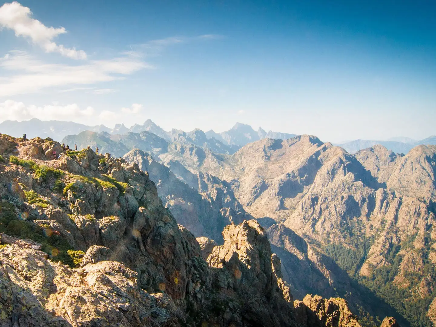
GR20
How would you rate GR20?
Tap a star to share your experience and help other hikers.
GR20: Corsica’s Expert High-Mountain Traverse
HikeList Score
GR20 scored 72/100 on HikeList's trail-quality metrics.
See score breakdownHide breakdown
- Ideal length 85
- Balanced challenge 44
- Scenery & wildness 98
- Varied terrain 45
- Accommodation 58
- Food & support 72
- Path quality 98
- Season flexibility 63
Computed from length, challenge, scenery & wildness, terrain variety, accommodation, food & support, path quality and season flexibility.
The GR20 is a 180 km point-to-point traverse of Corsica in France, running through the island’s mountainous spine from Calenzana to Conca. It is typically walked in 15 days over 16 stages and is widely called the toughest long-distance trail in Europe. Expect about 12,500 m of ascent, rocky ground, scrambling, scree, exposed ridges and fixed chains in places. This is an expert route for fit, confident mountain hikers rather than a first hut-to-hut trek.
Route Overview
The classic direction is north to south, from Calenzana to Conca, though the GR20 is a point-to-point trail rather than a loop. The northern half is the more technical section, crossing high granite ridges around the Monte Cinto massif and the Cirque de la Solitude area before the route trends south towards Lac de Nino and the Aiguilles de Bavella. Accommodation is in mountain refuges and campsites along the way, with no permit required. Verified transport details are not provided in the brief, so plan access to Calenzana and onward travel from Conca separately. For a less technical Alpine circuit, compare the Tour du Mont Blanc; for a pilgrimage-style French trail, see the GR65 (Le Puy Camino).
History of the GR20
Created in 1972, the GR20 is also known as Fra li Monti, meaning “through the mountains”. It was designed to cross Corsica’s mountainous spine from north to south, linking high ridges, passes, lakes and mountain refuges. Its reputation comes mainly from the northern half, where the terrain is more technical than the southern section, with rough granite, scrambling and exposed mountain walking.
Notable highlights
- Cirque de la Solitude area and northern granite ridges: A steep, rocky high-mountain section in the north of the route. It gives the GR20 much of its technical reputation, with scrambling, scree and ridge travel.
- Monte Cinto massif: The route passes through the high mountain area below Monte Cinto, with Pointe des Éboulis listed as the GR20’s highest point at about 2,607 m. This is one of the most demanding parts of the traverse.
- Lac de Nino: A mountain lake on the GR20 and a major change of scenery after the harsher northern ridges. It is a memorable place for hikers crossing Corsica’s interior.
- Aiguilles de Bavella: A cluster of jagged granite spires in the south of the route. The terrain here is still mountainous, but the southern half is generally less technical than the north.
- Mountain refuges: The GR20 is structured around refuges and bivouac areas, making it a classic hut-and-camp trekking route. Facilities are basic, so plan food, bookings and camping arrangements carefully.
Challenges to expect
Expect sustained expert-level mountain terrain: rocky paths, scrambling, scree, ridges and fixed chains in places. The 12,500 m of total ascent over 180 km makes the GR20 physically demanding, and the northern half is notably more technical than the south. The practical season is mid-June to September, when refuges are open and high passes are generally clear of snow. For another rugged French mountain area, compare the Cirque de Gavarnie Trails.
HikeList Score
GR20 scored 72/100 on HikeList's trail-quality metrics.
See score breakdownHide breakdown
- Ideal length 85
- Balanced challenge 44
- Scenery & wildness 98
- Varied terrain 45
- Accommodation 58
- Food & support 72
- Path quality 98
- Season flexibility 63
Computed from length, challenge, scenery & wildness, terrain variety, accommodation, food & support, path quality and season flexibility.
 France
Show more data Show less
- Mountainous
- Rocky
- Huts
- Campsites
- Pet Friendly
- Restrooms
- Water Sources
- Campsites
- Shelters
Download Our Full Guide to GR20 FREE!
Get our comprehensive guide to this hike for free. Save it for later reading or print out at home.
Photos from hikers
Taken on the trail by people who've reviewed GR20.
GR20: The Complete Guide
 i
Image by STxxEN
i
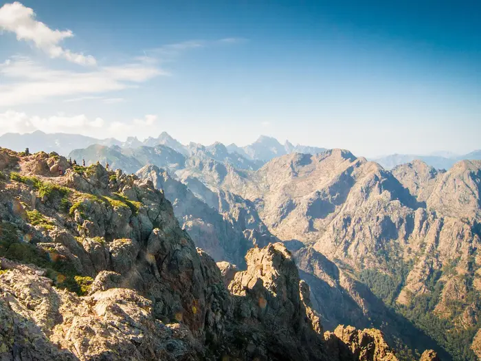
Image by STxxEN The GR20 is Corsica’s great high-mountain traverse: a rough, red-and-white waymarked line from Calenzana above Calvi to Conca near the Tyrrhenian coast. Over roughly 180 km it crosses the island’s granite spine through the Monte Cinto massif, the Niolu, Vizzavona and the Aiguilles de Bavella.
This is not a gentle hut-to-hut walk. The northern half is steep, rocky and technical, with boulder fields, scree, exposed ridges, chains, cables and short hands-on scrambling; the southern half eases slightly but still demands strong legs and steady mountain judgement.
The rewards are equally serious: Pointe des Éboulis at 2,607 m, high refuges beneath Paglia Orba, Lac de Nino’s pozzines, the Cascades des Anglais, the Usciolu ridge and the red-granite towers of Bavella. Vizzavona, on the Ajaccio–Bastia railway, gives the route a natural halfway break for walkers taking on only the north or south section.
Expect basic PNRC refuges, limited beds and bivouac space, simple food, planned water and resupply, and transport that needs arranging carefully at both ends. The usual season is mid/late June to mid-September, but snow can linger on the high northern cols into early summer and July-August refuge places fill quickly.
This guide covers stages, daily planning, accommodation, food, transport, terrain and the common mistakes that catch out GR20 walkers.
Stage-by-Stage Guide
The GR20 is normally walked north to south from Calenzana (Calinzana) to Conca. The stages below follow the classic 16-stage structure and assume a fit, experienced walker carrying enough food, water and bad-weather gear to be self-sufficient between overnight stops.
Refuge beds, official bivouac pitches and rented tents should be booked through the PNRC reservation system before starting, especially in July and August. Food, meals and small refuge shops are seasonal and limited; exact availability should be checked before travelling.
Stage 1: Calenzana to Refuge d'Ortu di u Piobbu — ~11 km
The route leaves Calenzana directly on the red-and-white GR waymarks and climbs from the Balagne foothills into the high mountains. This is a hard opening day: the distance is modest, but the ascent is sustained and there is little time to ease into the route.
Underfoot, expect rocky mountain path, heat-exposed lower slopes in summer and increasingly rough granite terrain as the trail gains height. The stage is a useful early test of pace, pack weight and footwear; anyone struggling here should reassess before committing to the more technical northern stages.
Calenzana is the last village before the mountain refuge system begins. Carry food and water from the start, as intermediate services should not be assumed unless current local information says otherwise.
Refuge d'Ortu di u Piobbu has the standard PNRC set-up: bunk accommodation, an official bivouac area and seasonal wardening with basic food options. There is no useful public transport or rail access at the refuge, so it should be treated as a mountain-only overnight stop.
Navigation is straightforward in clear weather if the GR balisage is followed carefully, but the open rocky ground can feel less obvious in poor visibility. Start early in hot weather and avoid arriving tired after dark, as refuge areas are basic and busy in season.
Stage 2: Refuge d'Ortu di u Piobbu to Refuge de Carozzu — ~8 km
This short stage is not an easy day. It stays in steep northern GR20 terrain, with rough granite, rocky traverses and repeated ups and downs that make progress slower than the distance suggests.
The approach towards the Carozzu area brings the route into one of the classic rugged sections of the northern half. The Spasimata torrent area and the slabs below Refuge de Carozzu are among the notable landmarks around this part of the route, with exposed-feeling granite and fixed protection on the smoothest rock.
Food and water planning should be based on the two refuges rather than on intermediate supply. Refuge de Carozzu has PNRC bunk and bivouac facilities, with seasonal food or shop provision, but exact meals and stock vary and should be checked before travelling.
There is no practical public transport at the end of the stage. The refuge is a mountain stop, so bad weather, injury or a missed booking can become a real logistical problem.
Follow the red-and-white waymarks closely over granite and bouldery ground. In wet conditions, slabs can be slippery; this is a poor place to rush or to treat fixed chains as a substitute for secure footwork.
Stage 3: Refuge de Carozzu to Ascu Stagnu (Haut-Asco) — ~9 km
Stage 3 continues the technical northern character of the GR20, moving through steep, rocky terrain before descending to the road-served site at Ascu Stagnu (Haut-Asco). Although the day is short on paper, it is a serious mountain stage with awkward ground and little fast walking.
The Spasimata footbridge and surrounding slabs are the key feature around the Carozzu side of this section: a wire-and-plank suspension bridge over the torrent, followed by smooth granite slabs fitted with fixed chain. Treat this as a hands-on, concentration-heavy passage, particularly with a large pack.
Ascu Stagnu is one of the important road-access points on the GR20 and has more accommodation options than a basic refuge, including gîtes and hotels in season. It is also a sensible place to review weather, snow conditions and onward refuge bookings before the Monte Cinto flank stage.
Food and water are more dependable at the stage end than on the mountain section itself, but exact opening dates and services should be checked before travelling. Do not leave Carozzu assuming there will be easy resupply before Haut-Asco.
Navigation is generally on the GR waymarks, but the fixed-protection sections demand route awareness rather than blind waymark following. If the rock is wet or visibility is poor, allow considerably more time than the distance implies.
Stage 4: Ascu Stagnu (Haut-Asco) to Refuge de Tighjettu via Pointe des Éboulis — ~9 km
This is one of the defining stages of the GR20 and the highest point actually on the route. The GR climbs onto the Monte Cinto flank and reaches Pointe des Éboulis at 2,607 m before continuing towards Refuge de Tighjettu.
The terrain is severe: scree, rough granite, boulder-hopping, exposed high-mountain ground and hands-on scrambling. Early-season snow can linger on the northern cols into early July, and this stage should not be taken lightly if conditions are uncertain.
Pointe des Éboulis is the high point of the GR20. Monte Cinto, at 2,706 m, is not on the trail; it is an optional out-and-back side ascent from the Pointe des Éboulis area for confident scramblers only, and it adds commitment to an already demanding day.
The former Cirque de la Solitude passage is no longer the official GR20. It was removed from the waymarked route after the fatal 2015 rockfall and replaced by the higher Monte Cinto / Pointe des Éboulis variant; the old cirque is unmaintained and should not be used as part of the GR20.
There are no reliable intermediate services to plan around. Carry enough food and water from Ascu Stagnu, and ensure accommodation at Refuge de Tighjettu is booked before setting off.
Refuge de Tighjettu provides PNRC bunk and bivouac facilities with seasonal wardening and basic food options. There is no road or rail access at the refuge, so poor weather or fatigue on this stage can have serious consequences.
Stage 5: Refuge de Tighjettu to Refuge de Ciottulu di i Mori — ~7 km
This is a shorter stage but still a high-mountain day on rough Corsican ground. The route moves deeper into the central granite mountains and finishes at one of the most dramatic refuge sites on the GR20.
Refuge de Ciottulu di i Mori sits at about 1,991 m beneath Paglia Orba and Capu Tafunatu, at the head of the Golo valley. It is the highest refuge in Corsica and can feel exposed in poor weather, even in the main walking season.
The path remains rocky and uneven, with the usual GR20 pattern of slow progress over granite, slabs and broken mountain terrain. Do not judge the day only by distance; tired legs after Stage 4 often make this a useful shorter recovery stage.
Food and water should be planned refuge-to-refuge. Refuge de Ciottulu di i Mori has PNRC bunk and bivouac facilities and seasonal food provision, but availability should be checked before travelling.
There is no practical road access at the stage end. Navigation is by the GR waymarks, but cloud can make high, rocky terrain confusing; keep a map or reliable offline navigation available rather than relying only on painted marks.
Stage 6: Refuge de Ciottulu di i Mori to Refuge de Manganu via Lac de Nino — ~24 km
This is the longest stage in the classic itinerary and should be treated as a full day, even though the terrain becomes less relentlessly technical than the hardest northern sections. Start early and manage pace carefully, as the distance and cumulative fatigue can be more significant than any single obstacle.
The route passes through the Golo valley area and by Bergerie de Radule before reaching the high open country around Lac de Nino (Lavu Ninu). The lake, at about 1,743 m, is surrounded by pozzines — spongy alpine turf, streamlets and grazing ground — and is one of the most distinctive landscapes on the whole GR20.
Semi-wild horses and cattle graze around Lac de Nino. Give animals space, avoid blocking their movement and keep food secured around grazing areas and camp/refuge sites.
Bergerie de Radule may offer simple shepherds' hut food such as cheese or charcuterie in season, but it should not replace proper stage planning. Carry enough food and water to reach Refuge de Manganu, and check current refuge and bergerie services before travelling.
Refuge de Manganu has PNRC bunk and bivouac facilities with seasonal wardening. There is no useful road or rail access at the refuge, so this is not a convenient place to abandon the trek unless onward mountain arrangements are made.
Navigation across open high pasture and pozzines can be less obvious than on ridge terrain, especially in mist. Stay on the marked GR to avoid damaging wet turf and to keep clear of fragile streamlet areas.
Stage 7: Refuge de Manganu to Refuge de Petra Piana — ~9 km
Stage 7 returns to more dramatic high-level terrain. The route climbs from Manganu onto a celebrated ridge section with views towards the glacial lakes of Capitellu and Melu (Melo), before continuing to Refuge de Petra Piana.
The ground is rough, rocky and exposed in places, with granite underfoot and slow-going sections where hands may be useful for balance. The distance is short, but this is still a technical mountain stage rather than a half-day stroll.
There are no dependable food stops between the refuges. Carry sufficient food and water from Manganu, and make sure the Petra Piana booking is secured in advance.
Refuge de Petra Piana has the standard PNRC accommodation pattern of bunks and official bivouac space, with seasonal wardening and simple food options. It is a mountain refuge without practical public transport access.
In clear weather the ridge gives some of the finest views on the northern half; in cloud it becomes a navigation and exposure problem. Keep to the red-and-white waymarks and avoid being pulled onto unmarked rock by misleading trods.
Stage 8: Refuge de Petra Piana to Refuge de l'Onda — ~10 km
This stage links two remote refuges through high mountain country before the route begins to work towards Vizzavona. The terrain remains rocky and uneven, with the usual GR20 mix of granite paths, slabs and rough descents.
Although the stage is shorter than the following descent to the halfway point, it should not be treated as easy. The northern half continues to demand concentration, especially with tired legs and a heavy pack.
Food and water planning is again refuge-to-refuge. Refuge de l'Onda has PNRC bunk and bivouac facilities, with seasonal wardening and basic meals or small shop provision depending on the time of year.
There is no rail or useful public transport at Refuge de l'Onda. Anyone splitting the trek should normally continue to Vizzavona on the next stage, as that is the practical railway access point.
Navigation is by the GR waymarks, but high Corsican terrain can be confusing in poor visibility. Check the next day's weather before committing to late starts or long rest stops, as Vizzavona is the first major exit point after several remote stages.
Stage 9: Refuge de l'Onda to Vizzavona — ~11 km
Stage 9 descends from the mountain refuge system to Vizzavona, the traditional halfway point of the GR20. It is a psychologically important day: the northern half ends here, and the Ajaccio-Bastia railway gives the best mid-route access on the entire trail.
The descent passes into forest, with beech and pine replacing the exposed granite of the high stages. The Cascades des Anglais, a chain of pools and waterfalls on the Agnone stream, are the main landmark before Vizzavona.
The path is still rough in places, and descents can be tiring after the technical northern stages. Wet rock around streams and cascades can be slippery, so avoid rushing simply because the stage ends at a village and railway.
Vizzavona has road and rail access and more accommodation options than the mountain refuges, including gîtes and hotels in season. It is the usual place to split the GR20 into a northern or southern half, or to take a rest and reorganise food.
Exact food shops, meal availability and train times should be checked before travelling. The railway is the key transport advantage here, but timetables are not something to improvise around after a long mountain descent.
Navigation becomes easier near the settlement, but do not switch off before reaching the actual stage end. If ending a northern-half trek here, allow enough time to collect any stored luggage or reach onward transport without relying on a late connection.
Stage 10: Vizzavona to E Capannelle (Capanelle) — ~16 km
South of Vizzavona the GR20 is generally less technical than the northern half, but it remains a long-distance mountain route. Stage 10 leaves the railway-accessible forest settlement and works through a mix of forested and open mountain terrain towards E Capannelle.
The walking is often less hands-on than the Monte Cinto or Manganu sections, but the path is still rough, rocky and tiring underfoot. Do not assume the southern half is easy; daily distance and cumulative ascent continue to matter.
Vizzavona is the best point to reset food, fuel strategy and bookings before the southern stages. Between Vizzavona and E Capannelle, plan to be self-sufficient unless current local information confirms an open service.
E Capannelle is one of the road-served points on the route and has accommodation options such as gîtes and hotels in season, alongside the broader GR20 refuge network. Exact availability, meals and any onward transport should be checked before travelling.
Navigation follows the red-and-white GR markings, but forest sections can make it easier to miss a turn than on open ridges. Keep an eye on waymarks at junctions and avoid following ski-area or local paths unless they clearly carry the GR balisage.
Stage 11: E Capannelle to Refuge de Prati via Bocca di Verdi (Col de Verde) — ~17 km
This is a longer southern stage, linking E Capannelle with Refuge de Prati via Bocca di Verdi (Col de Verde). It is less technically severe than the hardest northern days, but the distance and ascent still demand a steady, efficient pace.
The terrain alternates between mountain paths, forested sections and open ground. The route begins to feel more like a sustained ridge-and-pass traverse than the boulder-and-scree battlefield of the northern half, but the walking remains rough by normal hiking standards.
Bocca di Verdi is the key named landmark on the stage. Any services or transport possibilities there should be checked before travelling rather than assumed as part of the day's plan.
Food and water should be carried from E Capannelle to Refuge de Prati unless current information confirms an intermediate option. Refuge de Prati has PNRC bunk and official bivouac facilities, with seasonal wardening and simple food provision.
There is no practical rail access at Refuge de Prati. Navigation is generally clear on the GR, but bad weather on open ground can make the stage feel much more serious, especially if arriving late at the refuge.
Stage 12: Refuge de Prati to Refuge d'Usciolu — ~11 km
Stage 12 moves into one of the finest ridge sections of the southern GR20. The approach to the Usciolu area and the Arête a Monda gives airy walking and long views east and west across Corsica.
The terrain is rocky, narrow and exposed in places. Although the southern half is often described as easier, this stage still requires a head for heights, secure foot placement and concentration on uneven granite.
There are no reliable intermediate resupply points to build the day around. Carry enough food and water from Refuge de Prati, and book Refuge d'Usciolu or its bivouac area in advance through the PNRC system.
Refuge d'Usciolu offers the usual mountain refuge facilities in season: bunks, an official bivouac area and basic food or shop options. It is not a road-served trailhead, so it should be treated as a remote overnight stop.
Navigation along ridges is often intuitive in clear weather, but losing the way in mist can quickly place you on awkward rock. Stay with the red-and-white waymarks and avoid unmarked skyline alternatives.
Stage 13: Refuge d'Usciolu to Refuge de Matalza, Plateau du Cuscionu — ~11 km
This stage continues the southern mountain character before reaching the Plateau du Cuscionu and Refuge de Matalza. It is a contrast to the sharper northern granite: still rough and high, but with broader pasture-like landscapes around the plateau.
The route may feel less technical than the Usciolu ridge, yet it remains uneven and tiring underfoot. The main planning issue is not scrambling difficulty but keeping enough time and energy for a full mountain day.
The Plateau du Cuscionu is pastoral ground, so livestock may be present. Give animals space, close or respect any gates or barriers encountered, and avoid contaminating streams or wet ground around grazing areas.
Food and water planning should focus on the refuges. Refuge de Matalza has PNRC-related overnight provision on the GR20 itinerary, with bivouac/refuge-style facilities and seasonal food availability that should be checked before travelling.
There is no railway or simple public transport at the stage end. Navigation across plateau terrain can be less obvious than on a ridge, particularly in mist, so stay disciplined with waymarks and offline mapping.
Stage 14: Refuge de Matalza to Refuge d'Asinao (Asinau) — ~10 km
Stage 14 leaves the Plateau du Cuscionu area and heads towards Refuge d'Asinao, bringing the route back into steeper southern mountain terrain. The day is moderate in distance but should still be treated as a proper GR20 stage.
Expect rough mountain paths, rocky ground and sections where progress is slower than the map distance suggests. Weather and fatigue are often the deciding factors on southern stages, especially after nearly two weeks of walking.
There are no named intermediate resupply points in the stage information, so carry what is needed from Matalza to Asinao. Refuge d'Asinao has the standard refuge/bivouac role on the GR20, with seasonal wardening and basic food options subject to opening and stock.
Public transport is not a practical assumption at the end of the stage. If using Asinao as part of a shorter itinerary, access arrangements should be planned in advance and checked before travelling.
Navigation remains on the GR waymarks. Take care not to underestimate the stage because it sits in the southern half; the route is still a high-mountain traverse with rough ground and limited escape options.
Stage 15: Refuge d'Asinao to Refuge de Paliri via Aiguilles de Bavella (Bocca di Bavella) — ~15 km
Stage 15 is one of the signature southern stages, crossing the Bavella area beneath the jagged red-granite spires of the Aiguilles de Bavella. It is a spectacular but serious day, with more complex terrain than many walkers expect near the end of the route.
The standard GR20 uses rocky mountain paths and steep ground around Bavella. There is also an optional harder alpine variant for scramblers; this should only be chosen by confident, well-equipped walkers in good conditions, and only if time, weather and ability are firmly on side.
Bocca di Bavella is a road-served point and a useful landmark on the stage. It may offer more practical options than the remote refuges, but exact food, accommodation and transport availability should be checked before travelling.
Do not rely on Bavella services as the only source of food or water unless current opening information is known. Carry enough to reach Refuge de Paliri, where PNRC-style bunk and official bivouac facilities are available in season.
Refuge de Paliri is the final mountain overnight stop before Conca and should be booked in advance. Navigation around Bavella requires care because variants and local paths can complicate the route; follow the red-and-white GR markings unless deliberately taking the harder alpine variant.
Stage 16: Refuge de Paliri to Conca — ~13 km
The final stage descends from the mountains to Conca, the official southern end of the GR20. It is less high and less remote than the northern stages, but the path remains rocky and tiring, especially after fifteen previous days on rough ground.
The landscape changes gradually towards lower hills and Mediterranean vegetation as the trail approaches the Tyrrhenian side of Corsica. Keep concentration to the finish: late-route slips are common on tired legs, and the GR20 does not become a pavement walk just because Conca is close.
Carry enough food and water from Refuge de Paliri to reach Conca. Any final refuge breakfast or packed food should be arranged the evening before where possible, as there are no intermediate service points on this stage.
Conca is a village in the hills above the coast near Sainte-Lucie-de-Porto-Vecchio and marks the end of the waymarked traverse. It has no railway station.
Onward transport needs planning. As of 2026, the long-running hikers' shuttle from Conca towards Sainte-Lucie / Porto-Vecchio was suspended, so a taxi should be planned; a taxi to Porto-Vecchio is roughly €55 and can often be shared, while any summer beach shuttle timings should be checked before travelling.
Navigation is straightforward if the GR waymarks are followed to the village, but do not leave transport arrangements until arrival. Mobile signal, taxi availability and seasonal services can all affect how smoothly the finish works.
Recommended Itinerary
Standard 16-stage itinerary: Calenzana to Conca
The classic GR20 itinerary follows the refuge-to-refuge stage pattern from Calenzana (Calinzana) to Conca. It is the most straightforward plan for booking PNRC refuges, bivouac pitches or rented tents, and it keeps the hardest northern ground in manageable daily sections.
Distances below are approximate. Use official mapping and current PNRC refuge information before booking, especially early in the season when snow can affect the northern cols.
| Day | From | To | Approx. distance | Why this stage makes sense | Services/accommodation notes |
|---|---|---|---|---|---|
| 1 | Calenzana (Calinzana) | Refuge d'Ortu di u Piobbu | 11 km | A steep, immediate start from the Balagne into mountain terrain. Keeping the first day to the standard refuge stage avoids beginning the GR20 with an over-ambitious double day. | Calenzana is the last village before the trail. Refuge d'Ortu di u Piobbu has PNRC refuge/bivouac facilities; book ahead in season. |
| 2 | Refuge d'Ortu di u Piobbu | Refuge de Carozzu (Carrozzu) | 8 km | Short on paper but still rough and technical enough to deserve a full day. This stage keeps the early northern section controlled rather than rushed. | PNRC refuge/bivouac at Carozzu. Facilities are basic, so do not rely on village-style services. |
| 3 | Refuge de Carozzu | Ascu Stagnu (Haut-Asco) | 9 km | A compact but serious mountain stage, including the Spasimata area with slabs and fixed equipment. Finishing at Ascu Stagnu is useful because it is one of the road-served points on the route. | Ascu Stagnu has more accommodation options than a remote refuge, including gîtes/hotels. It is a sensible place to reset before the Monte Cinto flank stage. |
| 4 | Ascu Stagnu (Haut-Asco) | Refuge de Tighjettu, via Pointe des Éboulis | 9 km | One of the defining hard days of the GR20, crossing the route’s highest point at Pointe des Éboulis, 2,607 m. This is the official high variant replacing the former Cirque de la Solitude passage; the old cirque is not the waymarked GR20. | PNRC refuge/bivouac at Tighjettu. Do not plan this day casually in poor weather or early-season snow conditions. |
| 5 | Refuge de Tighjettu | Refuge de Ciottulu di i Mori | 7 km | A deliberately shorter stage after the demanding Monte Cinto flank. It positions walkers at Corsica’s highest refuge before the long day towards Manganu. | PNRC refuge/bivouac at Ciottulu di i Mori, set high below Paglia Orba and Capu Tafunatu. Check food and water availability before relying on it. |
| 6 | Refuge de Ciottulu di i Mori | Refuge de Manganu, via Lac de Nino (Lavu Ninu) | 24 km | The longest stage in the standard schedule and a day to start early. It links the high Golo headwaters with Lac de Nino and the pozzines before reaching Manganu. | Bergerie de Radule lies on this section, but refuge accommodation is at Manganu. Carry enough food and water for a long mountain day. |
| 7 | Refuge de Manganu | Refuge de Petra Piana | 9 km | A shorter distance but still a high, rocky day, with the celebrated terrain above the glacial lakes of Capitellu and Melu. Keeping it as a single stage is sensible because the ground is slow. | PNRC refuge/bivouac at Petra Piana. This remains a mountain-refuge night with limited capacity. |
| 8 | Refuge de Petra Piana | Refuge de l'Onda | 10 km | Another northern mountain stage where distance is a poor measure of effort. The standard stop at l'Onda keeps the final approach to Vizzavona manageable. | PNRC refuge/bivouac at Refuge de l'Onda. Book ahead and check current refuge arrangements. |
| 9 | Refuge de l'Onda | Vizzavona | 11 km | A logical descent to the traditional halfway point, with forest walking and the Cascades des Anglais on the way into Vizzavona. This is the main split point for north-only or south-only itineraries. | Vizzavona has the GR20’s railway access on the Ajaccio-Bastia line and more options than the high refuges. It is the best place for a rest day or to leave/join the route. |
| 10 | Vizzavona | E Capannelle (Capanelle) | 16 km | The route enters the generally less technical southern half, though it remains a sustained mountain walk. This is a reasonable first day after the halfway point. | E Capannelle is road-served and has gîte/hotel-style options as well as trail accommodation. Book ahead in the main season. |
| 11 | E Capannelle | Refuge de Prati, via Bocca di Verdi (Col de Verde) | 17 km | A longer southern-stage day, using the natural line over Bocca di Verdi towards the Prati area. It is less technical than the northern core but still requires full GR20 fitness. | PNRC refuge/bivouac at Prati. Bocca di Verdi is a named pass on the route, but do not assume reliable services without checking before travelling. |
| 12 | Refuge de Prati | Refuge d'Usciolu | 11 km | A classic southern ridge stage leading towards the Usciolu ridge/Arête a Monda area. The standard stop avoids compressing one of the best ridge sections into an overlong day. | PNRC refuge/bivouac at Usciolu. Capacity is limited; reserve through the PNRC system. |
| 13 | Refuge d'Usciolu | Refuge de Matalza, Plateau du Cuscionu | 11 km | A practical stage onto and across the Plateau du Cuscionu area. It breaks the southern traverse cleanly before the approach to Asinao. | PNRC refuge/bivouac at Matalza. Expect basic mountain facilities rather than village services. |
| 14 | Refuge de Matalza | Refuge d'Asinao (Asinau) | 10 km | A compact stage that positions walkers for the Bavella day. It is a good place to avoid arriving tired before one of the route’s most distinctive final sections. | PNRC refuge/bivouac at Asinao. Check current refuge status and meal availability before setting food plans. |
| 15 | Refuge d'Asinao | Refuge de Paliri, via Aiguilles de Bavella (Bocca di Bavella) | 15 km | A major southern highlight through the Bavella area. The optional alpine variant is harder and only suitable for confident scramblers in good conditions. | Bavella is road-served and has more services than a remote col, but the standard stage ends at the PNRC refuge/bivouac at Paliri. |
| 16 | Refuge de Paliri | Conca | 13 km | A final descent from the mountains to the official finish at Conca. It is long enough to require a proper walking day, especially if arranging onward transport the same afternoon. | Conca has no railway. As the hikers’ shuttle to Sainte-Lucie/Porto-Vecchio was suspended as of 2026, plan a taxi or check any current summer shuttle before travelling. |
Slower variant
A slower plan suits walkers who are fit enough for the GR20 but want more margin for weather, heat, fatigue and refuge logistics. The simplest slower approach is to keep the 16 walking stages above and add at least one non-walking or flexible day at Vizzavona, where the railway makes stopping, resupplying or leaving the route much easier than at the high refuges.
A second sensible slower option is to walk only one half at a time: Calenzana to Vizzavona for the harder northern half, or Vizzavona to Conca for the generally less technical southern half. Vizzavona is the practical break point because it is on the Ajaccio-Bastia railway.
Do not slow the route by assuming informal camping between refuges. Accommodation and official bivouac places should be planned around the recognised stops and booked through the PNRC system where required.
Faster variant
A faster GR20 is only for very strong, experienced mountain hikers who can move efficiently on rough granite, scree, boulders, chains and exposed ridges for repeated long days. The southern half gives more scope for combining stages than the northern half, but exact combinations depend on fitness, weather, refuge availability and current route conditions.
Avoid compressing the early northern stages unless fully confident on technical ground. In particular, the sequence through Ascu Stagnu, Pointe des Éboulis, Tighjettu, Ciottulu di i Mori and Manganu is not a place to chase a schedule in poor conditions.
For any faster plan, check official mapping before booking and reserve accommodation only where the day’s distance and ascent are genuinely realistic. Missing a refuge booking on the GR20 can create a serious logistical problem, not just an inconvenience.
Planning the Route
How many days to allow
Most independent walkers should plan around the standard refuge-to-refuge schedule of 15–16 days. The listed stages are not long by lowland standards, but they are dictated by mountain terrain, refuge spacing and the time lost on granite slabs, boulder fields, scree and short scrambling sections.
Trying to rush the GR20 is a common mistake. Strong hikers can combine some stages, especially in the southern half, but this reduces margin for heat, storms, tired legs, refuge logistics and the slower technical ground in the north. For a first GR20, a steady schedule is usually safer and more realistic than an aggressive one.
A practical plan is to treat Calenzana to Vizzavona as the harder, more technical half and Vizzavona to Conca as generally less technical but still demanding. The northern stages include the Spasimata slabs, the Monte Cinto / Pointe des Éboulis crossing and several high, rough days where poor weather or lingering snow can change the difficulty substantially.
Why the stages are fairly fixed
The GR20 is not a trail where daily distances can be adjusted casually. Accommodation is concentrated at PNRC refuges, official bivouac areas, bergeries and a few road-served points, so each day is usually planned from one recognised stop to the next.
The main road-served or better-connected places are Ascu Stagnu (Haut-Asco), Vizzavona, E Capannelle, Bocca di Verdi (Col de Verde), Bavella and the trailheads at Calenzana and Conca. These are the logical places for rest days, resupply, joining, leaving or recovering from bad weather.
A standard end-to-end plan follows the chain of refuges and stopping points:
| Section | Practical planning notes |
|---|---|
| Calenzana to Ascu Stagnu | Steep early mountain stages; do not underestimate the first three days just because the distances are short. |
| Ascu Stagnu to Vizzavona | The most committing part of the route, including Pointe des Éboulis, high refuges, Lac de Nino and the descent to Vizzavona. |
| Vizzavona to E Capannelle / Bocca di Verdi | Easier to access and often used as the start of the southern half, but still a mountain route. |
| Bocca di Verdi to Bavella | Includes the Usciolu ridge and the Plateau du Cuscionu area; accommodation planning remains important. |
| Bavella to Conca | The final southern stages, with Refuge de Paliri before the descent to Conca. Transport from Conca must be arranged in advance. |
Fast, slow or flexible?
A slower itinerary is preferable if refuge availability and travel time allow. Extra margin is particularly useful early in the season, when snow may still affect the northern passes, and in July–August, when heat and busy refuges make long improvised days less attractive.
Adding a rest or buffer day at a road-served point is sensible, especially at Vizzavona, which is the natural halfway break and has the Ajaccio–Bastia railway. Ascu Stagnu, E Capannelle and Bavella can also work as practical pause points depending on accommodation and transport.
Extending the route with side trips should be treated cautiously. Monte Cinto is not on the GR20; it is an optional out-and-back scramble from the Pointe des Éboulis area for confident scramblers only. The Bavella alpine variant is also an optional harder line for scramblers, not something to add casually to a tired end-of-route itinerary.
Do not plan to use the old Cirque de la Solitude passage as part of the GR20. It was removed from the official route after the fatal 2015 rockfall and replaced by the higher Pointe des Éboulis / Monte Cinto flank variant; the old cirque is unmaintained and off the waymarked route.
Section hiking and splitting the GR20
Section hiking is practical, but the split points matter. Vizzavona is by far the easiest place to divide the route because it sits on the Chemins de fer de la Corse Ajaccio–Bastia railway and marks the traditional midpoint.
The northern half, from Calenzana to Vizzavona, is the more technical and committing option. It suits hikers who specifically want the roughest granite terrain, exposed passages and higher mountain days.
The southern half, from Vizzavona to Conca, is still serious but is generally the more approachable half for walkers not ready to commit to the full traverse. It still includes airy ridges, rough paths, heat exposure and limited services, so it should not be treated as an easy alternative trek.
Joining or leaving at other road-served places may be possible, but public transport is thin and taxis are often the practical fallback. This should be checked before travelling.
Accommodation planning
Accommodation planning is one of the most important parts of a GR20 schedule. PNRC refuges have limited bunk space, official bivouac areas and, in season, wardens with simple meals or small-shop supplies. Beds, bivouac pitches and rented tents are booked through the official PNRC reservation platform at pnr-resa.corsica.
There is no hiking permit and no guide is required, but that does not mean the route can be improvised in peak season. In July and August, refuge and bivouac bookings should be made as far ahead as possible, and the itinerary should be built around confirmed overnight stops.
Facilities are basic. Plan for crowded dormitories, simple food, limited washing facilities and little flexibility if the weather turns or a stage takes longer than expected. Opening dates, services and current refuge arrangements should be checked before travelling.
Food and water planning
Do not plan the GR20 as if it were a village-to-village trail. Food options are concentrated at refuges, bergeries and the road-served stops, and availability varies by season and location. Simple hot meals or small supplies may be available at staffed refuges, but carrying backup food is prudent.
Longer or more committing stages need particular attention, especially where the route crosses high ground between refuges. Stage 6 from Refuge de Ciottulu di i Mori to Refuge de Manganu is a notably longer day in the standard schedule, passing via Lac de Nino.
Water planning also matters. Do not assume that every source, stream or refuge supply will remove the need to carry enough for the day, particularly in hot weather. Current water availability should be checked locally at refuges before setting out each morning.
Navigation and route choices
The GR20 is well waymarked with red-and-white GR balisage, but waymarks are not a substitute for mountain navigation. Cloud, storms, snow patches, damaged markings or fatigue can make route-finding harder, especially on granite slabs and high passes.
Carry proper mapping and a reliable navigation method. IGN TOP 25 mapping covers the route, and a dedicated GR20 guidebook can help with stage planning, variants and refuge logistics. Exact current map sheets should be checked before travelling.
Be especially careful with variants and old route information. The official line now uses the Pointe des Éboulis crossing rather than the former Cirque de la Solitude, and optional harder lines such as the Bavella alpine variant should only be taken when conditions, fitness and scrambling ability are suitable.
Transport planning
Transport should be arranged before finalising the first and last nights. Calenzana has no railway; most walkers reach it from Calvi by seasonal Corsicar bus or taxi. Bus services are limited, may run only a few times a day and may not operate at weekends, so times should be checked before travelling.
Conca also has no train. As of 2026, the long-running hikers’ shuttle towards Sainte-Lucie-de-Porto-Vecchio / Porto-Vecchio is suspended, so plan on a taxi unless a summer beach shuttle fits the finish time. A taxi to Porto-Vecchio is roughly €55 and can often be shared, but current prices and availability should be confirmed before booking.
For section hikers, Vizzavona is the key access point because of the Ajaccio–Bastia railway. This makes it the most reliable place to start or finish a half-GR20 itinerary.
Weather and seasonal margin
The usual hiking season is roughly mid/late June to mid-September, when refuges are staffed and the high passes are generally clear. Early season plans need a snow check for the northern cols, where snow can linger into early July.
July and August bring the busiest refuges and the hottest walking conditions. September is often quieter, but days shorten and refuge closures begin earlier in the season, so late itineraries need careful date-by-date checking.
Because the GR20 is exposed and technical in places, a weather delay is not just inconvenient; it can affect safety. Build enough flexibility into travel, accommodation and transport plans to avoid being forced onto high passes or exposed ridges in poor conditions.
Towns, Villages and Overnight Stops
Accommodation on the GR20 is built around the Parc naturel régional de Corse refuge network rather than towns. Most nights are spent at high mountain refuges with a bunkroom, an official bivouac/tent area and, in season, a warden with simple hot meals or a small shop. Beds, bivouac pitches and rented tents should be booked on the official PNRC reservation platform, especially for July and August.
Road access and wider services are limited. The main practical break points are Calenzana at the start, Ascu Stagnu, Vizzavona, E Capannelle, Bavella and Conca at the finish; Vizzavona is the key mid-route exit because it is on the Ajaccio-Bastia railway.
Calenzana (Calinzana)
Calenzana is the northern start of the GR20, a hill village above Calvi in the Balagne. The red-and-white GR waymarks lead uphill out of the village, so it is the place to arrive the day before starting if you want an early first climb to Refuge d'Ortu di u Piobbu.
There is no railway at Calenzana. Access is usually via Calvi, using the seasonal Corsicar bus from Calvi to Calenzana, which takes about 30 minutes and runs only a few times a day, often with no weekend service. Taxi transfer is the more flexible option; current bus times and taxi availability should be checked before travelling.
Use Calenzana for final pre-walk sorting rather than assuming it can solve missing kit or food problems at the last minute. Accommodation, food shops and restaurant options in the village should be checked before booking onward travel.
Refuge d'Ortu di u Piobbu
Refuge d'Ortu di u Piobbu is the first classic overnight stop after leaving Calenzana. It comes after a short but steep opening stage that immediately commits walkers to the high, rocky northern GR20.
This is a PNRC mountain refuge with limited bunk space and an official bivouac area. In season, expect basic refuge facilities rather than hotel comfort, with simple food provision depending on the warden and current stock.
It is a useful first night because it keeps the itinerary aligned with the standard north-to-south staging. Booking is strongly advised, and anyone carrying a tent still needs to use the official bivouac arrangements rather than assuming informal camping is acceptable.
Refuge de Carozzu (Carrozzu)
Refuge de Carozzu is the second northern refuge and the usual overnight stop before the Spasimata section. The stage into and out of this refuge is short in distance but technical in character, with rough granite, slabs and exposed ground nearby.
Accommodation is by PNRC refuge bed or official bivouac/tent area. Food is basic and seasonal, so do not treat Carozzu as a full resupply point in the way a valley town would be.
Walkers stop here because it positions the next day for the Spasimata footbridge and chain-protected slabs before continuing to Ascu Stagnu. In poor weather, this area deserves particular caution because smooth granite slabs can become serious underfoot.
Ascu Stagnu (Haut-Asco)
Ascu Stagnu, also known as Haut-Asco, is one of the most important service points in the northern half. It is road-served and sits after the Carozzu stage, before the demanding ascent over the Monte Cinto flank to Pointe des Éboulis and the descent towards Refuge de Tighjettu.
Unlike the more isolated refuges, Ascu Stagnu has gîtes and hotels as well as GR20 accommodation options. It is a sensible place to sleep in a proper bed, eat more substantially, dry kit if conditions have been poor, and reset before one of the hardest stages of the route.
Transport is more practical here than at most high refuges because of the road access, but public transport arrangements are not guaranteed from the route information. Transfers, taxis and any seasonal services should be checked before travelling.
Bocca Tumasginesca / Pointe des Éboulis
Bocca Tumasginesca and Pointe des Éboulis are not overnight stops; they are high mountain passage points on Stage 4. Pointe des Éboulis, at 2,607 m, is the highest point actually reached by the GR20.
There is no accommodation, food or transport here. This section is relevant to overnight planning because it sits between Ascu Stagnu and Refuge de Tighjettu and is one of the places where weather, snow, exposure and fatigue can affect whether a normal stage is realistic.
Monte Cinto, Corsica's highest summit at 2,706 m, is an optional side ascent from near this area for confident scramblers. It is not on the GR20 and should not be built into a standard accommodation plan unless extra time, weather stability and mountain competence are all in place.
Refuge de Tighjettu
Refuge de Tighjettu is the usual overnight stop after crossing the Monte Cinto flank from Ascu Stagnu. It is an important recovery point after one of the most strenuous and technical days on the route.
Accommodation follows the standard PNRC pattern: limited bunkroom space, official bivouac area and seasonal warden services. Food provision should be treated as simple mountain-refuge fare, not a guaranteed full resupply.
Many walkers will be tired on arrival here, especially if snow, heat or poor visibility has slowed the high crossing. Booking and a conservative timing plan matter more here than the modest stage distance suggests.
Refuge de Ciottulu di i Mori
Refuge de Ciottulu di i Mori is the highest refuge in Corsica, at about 1,991 m, set beneath Paglia Orba and Capu Tafunatu at the head of the Golo valley. It is a classic high GR20 overnight and an exposed place to be in bad weather.
Facilities are basic: refuge bunks, official bivouac space and seasonal food or shop provision. Because of its altitude and position, this is not a place to arrive under-equipped or short of food at the end of a marginal day.
It is the normal stop between Tighjettu and the long stage towards Manganu via Lac de Nino. Check refuge opening dates before travelling, particularly outside the core mid/late June to mid-September season.
Bergerie de Radule
Bergerie de Radule is a shepherd's hut stop on the route between Refuge de Ciottulu di i Mori and Lac de Nino. Bergeries on the GR20 can be useful for food such as cheese or charcuterie, but availability is seasonal and limited.
This should be treated as a helpful refreshment point rather than a guaranteed resupply base. Opening, food availability and any overnight arrangements should be checked before relying on it.
For itinerary planning, its main value is breaking up the long Ciottulu di i Mori to Manganu day mentally and practically. It does not replace the need to start that stage with enough food, water and time.
Lac de Nino (Lavu Ninu)
Lac de Nino is a high glacial lake surrounded by pozzines, the spongy alpine turf and streamlets typical of this part of Corsica. It is a major landmark on the long Stage 6 between Refuge de Ciottulu di i Mori and Refuge de Manganu.
It is not a service stop. There is no refuge, shop, café or transport link at the lake, so it should be planned as a scenic and navigational landmark rather than an overnight option.
The stage that includes Lac de Nino is one of the longer days in the standard itinerary. Carry enough food for the full day and avoid assuming that intermediate bergeries or seasonal vendors will be available.
Refuge de Manganu
Refuge de Manganu is the overnight stop after the long traverse from Refuge de Ciottulu di i Mori via Lac de Nino. It marks the transition towards the high ridge and lake country leading to Petra Piana.
Accommodation is in the PNRC refuge, official bivouac area or rented tent if booked. As elsewhere, facilities are deliberately simple and refuge beds are limited.
Manganu is a key place to have a confirmed reservation because the approach stage is long and there are few simple alternatives. The next stage towards Petra Piana is shorter in distance but remains rough mountain walking.
Refuge de Petra Piana
Refuge de Petra Piana is a high mountain refuge between Manganu and Refuge de l'Onda. It sits on one of the more celebrated northern sections, with the route passing above the Lacs de Capitellu and Melu area on the way from Manganu.
Expect the standard PNRC refuge arrangement: bunkroom, official bivouac area and basic seasonal services. It is not a village and should not be relied on for broad resupply.
This is a useful overnight because it keeps the technical northern rhythm manageable. Weather matters: exposed ridges and high ground around this part of the route can make timing and onward decisions more serious than the stage distances imply.
Refuge de l'Onda (a l'Onda)
Refuge de l'Onda is the last main overnight stop before descending to Vizzavona. It is a PNRC refuge with official bivouac/tent options and simple seasonal food provision.
For north-to-south walkers, it is the staging point for the descent through forest towards the Cascades des Anglais and the mid-route services at Vizzavona. For anyone splitting the GR20, it is the final mountain night before the railway exit.
Because Vizzavona has transport and more services, some walkers will be tempted to push on or adjust stages. On the GR20, distance alone is a poor guide; decisions should account for weather, fatigue and the roughness of the previous days.
Vizzavona
Vizzavona is the traditional halfway point of the GR20 and the most important transport break on the route. It sits in forest at about 920 m and is on the Ajaccio-Bastia railway operated by Chemins de fer de la Corse.
This is the usual place to finish the northern half, start the southern half, take a rest night or leave the route if conditions, injury or timing require it. Because it has rail access, it is far more useful logistically than almost any other point on the traverse.
Accommodation options are broader than at a mountain refuge, with gîtes and hotels available in the road-served area. Food and onward transport are easier here than in the high refuges, but opening times, train times and room availability should still be checked before travelling.
E Capannelle (Capanelle)
E Capannelle is the first standard overnight stop south of Vizzavona. It is road-served and has gîtes and hotels, making it one of the more comfortable service points in the southern half.
For walkers continuing from Vizzavona, it provides a practical first night after re-entering the mountains. It is also a useful joining or leaving point only if road transport has been arranged; public transport should not be assumed.
Food and accommodation are generally easier to organise here than at isolated refuges, but reservations remain sensible in the main GR20 season. Current opening dates and transport options should be checked before travelling.
Bocca di Verdi (Col de Verde)
Bocca di Verdi, also known as Col de Verde, is a road pass on the stage between E Capannelle and Refuge de Prati. It is not listed as a standard overnight refuge in the classic itinerary, but it is a practical landmark because road access can affect escape or support plans.
Any food, accommodation or transport possibilities at the pass should be checked before relying on them. Treat it primarily as a pass and route point unless firm arrangements have been made in advance.
For most walkers, the planned overnight remains Refuge de Prati. The E Capannelle to Prati stage is longer than several northern stages, so do not let the easier reputation of the southern GR20 lead to under-planning.
Refuge de Prati
Refuge de Prati is the usual overnight after the stage from E Capannelle via Bocca di Verdi. It is a PNRC refuge with bunkroom, official bivouac area and seasonal basic food provision.
It is a mountain stop rather than a serviced village, so supplies should be planned before arrival. Booking is important during the staffed summer season, particularly for walkers using the standard stage pattern.
The refuge positions walkers for the ridge walking towards Refuge d'Usciolu. The southern half is generally less technical than the northern half, but the days remain long, rocky and exposed in places.
Refuge d'Usciolu
Refuge d'Usciolu is one of the key southern refuges and the standard stop before the Plateau du Cuscionu / Matalza stage. It sits near the airy Usciolu ridge, one of the finest but more exposed sections of the southern GR20.
Accommodation and services follow the PNRC refuge model: limited beds, official bivouac area and simple seasonal meals or shop items. It should not be treated as a full resupply point.
This is a good place to be conservative with timing, especially if wind or poor visibility affects the ridge. Make sure the next day's accommodation on the Plateau du Cuscionu is booked or otherwise clearly arranged.
Plateau du Cuscionu / Refuge de Matalza
The Plateau du Cuscionu is a high pastoral area, with Refuge de Matalza used as the standard overnight on the classic 16-stage itinerary. It comes after Refuge d'Usciolu and before Refuge d'Asinao.
Refuge de Matalza provides the GR20 overnight structure for this stage, with accommodation arrangements that should be booked in advance through the appropriate system. Food and facilities should be expected to be basic and seasonal.
This stop helps keep the southern itinerary manageable rather than forcing an overlong day. Because plateau weather can still be poor and navigation can be less obvious in mist, do not treat this as an easy lowland interlude.
Refuge d'Asinao (Asinau)
Refuge d'Asinao is the usual overnight before the Bavella stage. It sits between the Plateau du Cuscionu / Matalza section and the Aiguilles de Bavella.
It is a mountain refuge with official bivouac arrangements and limited facilities. Book ahead, carry enough food to cover gaps in supply, and expect simple rather than comfortable conditions.
This is a strategic stop because the following stage towards Bavella and Refuge de Paliri includes one of the most memorable southern sections. Strong scramblers may be interested in the harder Bavella alpine variant, but that choice should be made on conditions, ability and time, not on itinerary pressure.
Aiguilles de Bavella (Bocca di Bavella)
The Aiguilles de Bavella and Bocca di Bavella form one of the main road-served points near the end of the GR20. The route crosses this area on the stage from Refuge d'Asinao to Refuge de Paliri.
Bavella has gîtes and hotels, so it can be used as a more comfortable overnight or service stop if the itinerary is adjusted. It is also a logical place for road access, although specific transport options should be checked before travelling.
Food and accommodation availability can make Bavella attractive after many nights in refuges. Do not, however, assume that road access removes mountain risk: the approach and onward route still involve rocky terrain, and the optional alpine variant is only for suitably confident scramblers.
Refuge de Paliri (I Paliri)
Refuge de Paliri is the final mountain refuge before Conca. It is the standard last overnight on the north-to-south GR20 and leaves a final stage of about 13 km to the finish.
Accommodation is by PNRC refuge bed, official bivouac area or booked tent where available. Facilities remain basic even this close to the end, so keep enough food and money for the final night and exit day.
This is a useful stop because it avoids turning the Bavella to Conca finish into an unnecessarily long push. It also gives a cleaner final morning into Conca, where onward transport needs to be pre-planned.
Conca
Conca is the southern finish of the GR20, a village in the hills above the Tyrrhenian coast near Sainte-Lucie-de-Porto-Vecchio. The trail ends here after the final descent from Refuge de Paliri.
There is no train at Conca. As of 2026, the long-running hikers' shuttle to Sainte-Lucie / Porto-Vecchio is suspended, so walkers should plan on a taxi, roughly €55 to Porto-Vecchio and shareable if other hikers are finishing at the same time. A summer beach shuttle may be useful if timings suit, but this should be checked before travelling.
Conca is best treated as an exit village rather than a transport hub. Book any post-walk accommodation and onward transfer in advance where possible, particularly if finishing late in the day or outside the busiest summer period.
Getting to the Start
The GR20 starts in Calenzana (Calinzana), a hill village above Calvi in the Balagne, Haute-Corse. There is no railway at the trailhead, and public transport is limited, so most walkers reach Calenzana via Calvi and finish their final approach by seasonal bus or taxi.
By train
Calenzana itself has no train station. The only railway point that is especially useful for GR20 logistics is Vizzavona, the mid-point of the route on the Ajaccio–Bastia line, but that is for splitting the trek rather than starting the full north-to-south traverse.
If planning to combine Corsican rail travel with the northern start, expect to need onward road transport to Calenzana. Current rail and onward connection options should be checked before travelling.
By bus
The practical public-transport approach is to get to Calvi, then take the seasonal Corsicar bus to Calenzana. The journey from Calvi to Calenzana is roughly 30 minutes, with only a few services a day and often no service at weekends.
Do not build a tight first-day schedule around this bus without checking the current timetable. This should be checked before travelling, especially outside July–August, at weekends, or if arriving in Calvi late in the day.
If the bus does not line up with arrival times, a taxi from Calvi to Calenzana is the normal fallback. Sharing with other GR20 walkers can reduce the cost, particularly in the main trekking season.
By car
Calenzana can be reached by road, making private transfer or taxi straightforward compared with trying to rely on sparse public transport. This is useful if arriving by ferry or airport transfer into Calvi, Bastia or Ajaccio and continuing directly to the start.
Long-stay parking arrangements at or near Calenzana are not something to assume. If leaving a vehicle for the full traverse, parking availability, security and any restrictions should be checked before travelling.
From the nearest airport
Calvi is the most convenient gateway for the northern trailhead. From Calvi, continue to Calenzana by the seasonal Corsicar bus where it fits, or by taxi if it does not.
Bastia and Ajaccio are also possible arrival points for Corsica, but they make the approach to Calenzana more involved. Allow enough time for onward travel across the island and avoid planning to land, transfer and climb to Refuge d'Ortu di u Piobbu on a tight same-day schedule unless all transport is already arranged.
Where to stay before starting
Calenzana is the most convenient place to stay the night before starting, because the red-and-white GR waymarks lead uphill directly out of the village. Staying there avoids an early transfer from Calvi and lets you start the first climb without depending on a morning bus or taxi.
Calvi is the other practical base before the trek, with better access by air or ferry and easier taxi options to Calenzana. If staying in Calvi, arrange the morning transfer in advance and check whether any bus service actually runs on the intended start day.
The key logistical risk is underestimating how thin transport is at the northern trailhead. Book the first night’s refuge or bivouac only after the Calenzana arrival plan is realistic, particularly if starting outside the busiest part of the summer season.
Getting Home from the Finish
The GR20 finishes in Conca, a hill village above the Tyrrhenian coast near Sainte-Lucie-de-Porto-Vecchio. Do not treat the finish as a transport hub: there is no railway at Conca, public transport is limited, and the long-running hikers’ shuttle towards Sainte-Lucie / Porto-Vecchio was suspended as of 2026.
For most walkers, the practical plan is to pre-arrange a taxi from Conca, ideally shared with other GR20 finishers, and to avoid booking a tight onward connection on the same day as the final stage.
By train
There is no train from Conca and no railway at the southern end of the GR20. The useful railway point on the route is Vizzavona, the mid-point of the trail, on the Ajaccio–Bastia railway run by Chemins de fer de la Corse.
If you are walking only the southern half, or need to leave the route before Conca, Vizzavona is the obvious rail access point. From the actual finish in Conca, however, you must first travel by road to reach onward public transport.
By bus
Public transport from Conca is thin and should not be relied on without checking the current timetable. As of 2026, the established hikers’ shuttle from Conca towards Sainte-Lucie / Porto-Vecchio was suspended.
A summer beach shuttle may be useful if its dates and times line up with your finish, but this is timetable-dependent and should be checked before travelling. If finishing late in the day, plan on a taxi or an overnight stop rather than assuming there will be a usable bus.
By car/taxi
A taxi is the most reliable way to leave Conca. The usual onward target is Porto-Vecchio, with a taxi costing roughly €55; this is often shareable with other hikers finishing the GR20.
Book or arrange the taxi before reaching the final stage if you have a fixed onward plan. Mobile signal, refuge phone access and driver availability can all make last-minute arrangements awkward in practice, especially at the end of a long mountain day.
If you have left a car elsewhere on Corsica, remember that the GR20 is a point-to-point traverse with no rail link at Conca. Retrieving a vehicle will normally require a road transfer plus onward island transport; details should be checked before travelling.
From the nearest airport
Conca itself has no airport. The practical first step is to get from Conca to Porto-Vecchio by taxi or any operating seasonal shuttle, then connect onwards from there.
Flight and airport-transfer choices from the southern end of the trail are timetable-dependent and should be checked before travelling. Avoid booking an evening flight on the same day as the final stage unless a taxi and onward connection are already secured with plenty of spare time.
Where to stay at the finish
If the final stage from Refuge de Paliri to Conca runs late, staying locally is often simpler than forcing an onward transfer. Conca is a village rather than a major resort, so accommodation should be booked ahead if you intend to stop there.
The other practical option is to transfer by taxi to Porto-Vecchio, where onward travel is easier to organise. This is usually the safer plan if you need services, food, a wider choice of beds or onward transport the following morning.
Which Direction Should You Walk?
The classic and most common direction for the GR20 is north to south: Calenzana to Conca. This is the direction used by the standard 16-stage itinerary, and it is the simplest way to follow most stage descriptions, refuge sequences and mental landmarks along the route.
Walking south to north is entirely possible, but it changes the feel of the route. It gives you the less technical southern half first, then saves the hardest northern terrain for the second half.
Calenzana to Conca: the standard direction
North to south starts hard. The first week takes you straight into the rougher northern GR20: granite slabs, boulder fields, exposed cols, chain- and cable-protected sections and the high traverse over Pointe des Éboulis on the Monte Cinto flank.
That is demanding, but it has one clear advantage: the route tests fitness, sure-footedness and comfort with exposure early. If the northern stages feel beyond your level, the road-served points at Ascu Stagnu (Haut-Asco) and the railway at Vizzavona give realistic places to stop, regroup or leave the trail.
The scenery progression also works well in this direction. The route begins with the severe high-mountain character of the north, passes through the Niolu and the forests around Vizzavona, then moves into the southern ridges, the Plateau du Cuscionu, the Aiguilles de Bavella and finally down to Conca in the hills above the Tyrrhenian coast.
Transport is mixed. Reaching Calenzana from Calvi is usually manageable by seasonal bus or taxi, but public transport is thin and services may be limited, especially outside the core season or at weekends. Finishing at Conca needs more planning: there is no railway, and the long-running hikers’ shuttle to Sainte-Lucie/Porto-Vecchio was suspended as of 2026, so a taxi or suitable summer shuttle timing should be arranged in advance.
Conca to Calenzana: the reverse direction
South to north is a good option for hikers who want a more gradual technical build-up. The southern stages are still serious mountain walking, but they are generally less severe than the northern half, so the route can feel like it ramps up towards the hardest ground rather than confronting it immediately.
The trade-off is psychological and practical. By the time you reach Vizzavona and continue into the north, fatigue may be building just as the route becomes more technical. The final days towards Ascu Stagnu, Refuge de Carozzu, Refuge d'Ortu di u Piobbu and Calenzana include some of the roughest terrain on the whole GR20.
Reverse walkers should also expect to meet more oncoming traffic, because the standard direction is north to south. On narrow rocky sections, slabs and protected passages, this can make pacing slower and may require more patience.
Transport can be attractive in reverse if you prefer to deal with the awkward transfer at the start. Getting to Conca normally means arranging a taxi or carefully checking any seasonal onward transport from the Porto-Vecchio/Sainte-Lucie side. Finishing at Calenzana then leaves a shorter onward transfer towards Calvi, again depending on current bus or taxi arrangements.
Is one direction easier?
There is no genuinely easy direction on the GR20. The route has roughly 12,500 m of ascent, long rocky days and technical ground whichever way it is walked.
The main difference is not total effort but timing. North to south puts the hardest terrain early; south to north lets you build rhythm in the south but leaves the most technical northern stages until later. Individual climbs and descents may feel easier or harder depending on conditions, confidence on steep ground and whether you prefer scrambling up or descending rough rock, but the route does not become straightforward in either direction.
Weather is not a strong reason to choose one direction from the available planning facts. In summer, the more important considerations are snow lingering on the northern cols early in the season, heat in July and August, shortening days in September, and daily mountain conditions. These should be checked before travelling.
Accommodation and booking flow
Refuge, bivouac and rented tent bookings are made by date and location through the official PNRC booking system. Either direction can be booked, but the standard north-to-south sequence matches the classic stage order and is usually easier to plan from guides and itineraries.
In peak July and August, direction may be partly dictated by refuge availability. If the ideal north-to-south sequence is full, walking a half-route from or to Vizzavona, adding rest days, or reversing the full traverse may open up workable booking combinations.
Recommendation
For most experienced hikers, walk the GR20 north to south, from Calenzana to Conca. It is the traditional direction, follows the classic stage rhythm, gives the clearest progression through the route, and ends with the satisfying final descent to Conca after the Bavella and Paliri stages.
Choose south to north only if the accommodation dates work better, if you want to put the awkward Conca transfer at the start, or if a gradual southern warm-up is more important than saving the hardest terrain for the end.
Accommodation Along the Route
Accommodation on the GR20 is built around the Parc naturel régional de Corse refuge network, not hotels. Most nights are at high mountain refuges with bunkrooms, official bivouac/tent areas, and, in season, a warden with simple hot meals or a small shop.
Facilities are basic and capacity is limited. Treat the refuges as essential mountain infrastructure rather than comfortable huts: bookable sleeping space, water, a place to eat, and a base for the next stage.
Booking refuges and bivouacs
Refuge beds, bivouac pitches and rented tents are booked through the official PNRC reservation platform: pnr-resa.corsica. In July and August, book as far ahead as possible, especially if relying on indoor bunks rather than carrying a tent.
No permit or guide is required for the GR20, but that does not mean accommodation can be improvised in peak season. Reservations are tied to specific refuges and dates, so a missed stage can affect the rest of the itinerary.
Opening dates, meal availability and shop supplies vary with the season. This should be checked before travelling, particularly for early season starts when snow can still affect the northern passes, and for September when days shorten and refuges begin closing earlier.
Where accommodation choice is strongest
The strongest accommodation choice is at the road-served points: Ascu Stagnu (Haut-Asco), Vizzavona, E Capannelle and Bavella. These are the places most likely to offer gîtes or hotels as alternatives to the basic refuge system.
Vizzavona is the most useful planning point. It is the traditional halfway stop, has the GR20’s railway access, and is the obvious place to split the trail into northern and southern halves or add a rest night.
Ascu Stagnu is important because it sits immediately before the demanding Monte Cinto / Pointe des Éboulis stage. E Capannelle gives a more comfortable road-served stop early in the southern half, while Bavella can be useful near the end of the route if adjusting the Asinao–Paliri section.
Where accommodation is limited
Most other overnight stops are PNRC refuges with limited beds and official tent areas. This is especially relevant in the northern half, where terrain is more technical and there are fewer easy ways to leave the route for valley accommodation.
The long Stage 6 from Refuge de Ciottulu di i Mori to Refuge de Manganu via Lac de Nino needs particular attention. Lac de Nino is a major landmark, not an accommodation solution, so the day should be planned around reaching Manganu unless a different, properly booked itinerary has been arranged.
Bergeries can be useful for food, cheese and charcuterie, but they should not be treated as guaranteed overnight stops unless a specific arrangement has been made. This should be checked before travelling.
Does the GR20 work as an inn-to-inn walk?
Not in the normal sense. The GR20 is a hut-and-bivouac mountain traverse, with a few more comfortable road-served interruptions.
A full hotel-to-hotel itinerary would require leaving the route repeatedly or using transport around difficult accommodation gaps. That may reduce pack weight on selected sections, but taxis and luggage transfers cannot solve the high refuge nights because many stops are not road-accessible.
For independent walkers, the realistic choices are: book refuge bunks, book official bivouac pitches and carry camping kit, use rented tents where available through the PNRC system, or mix these with gîtes/hotels at the road-served points.
Accommodation table
| Place | Accommodation level (good/limited/none) | Best for | Notes |
|---|---|---|---|
| Calenzana (Calinzana) | Limited | Pre-start night | Start village above Calvi. Accommodation and transport should be arranged before travelling, especially if arriving late. |
| Refuge d'Ortu di u Piobbu | Limited | First mountain night | PNRC refuge with bunkroom and official bivouac/tent area in season. Book ahead. |
| Refuge de Carozzu (Carrozzu) | Limited | Northern refuge night | Basic refuge stop before/after the Spasimata section. Capacity is limited. |
| Ascu Stagnu (Haut-Asco) | Good | Rest, resupply-style reset, pre-Cinto night | Road-served point with gîtes/hotels as well as GR20 accommodation options. Useful before the Pointe des Éboulis stage. |
| Pointe des Éboulis / Monte Cinto flank | None | High-point passage only | Not an overnight stop. Continue to the booked accommodation for the stage. |
| Refuge de Tighjettu | Limited | Post-Cinto refuge night | Basic PNRC refuge stop after the demanding Stage 4 crossing. Booked space is important. |
| Refuge de Ciottulu di i Mori | Limited | High mountain refuge night | The highest refuge in Corsica, below Paglia Orba and Capu Tafunatu. Expect basic facilities and limited capacity. |
| Bergerie de Radule | Limited | Food stop / itinerary support | Useful as a bergerie stop, but do not assume overnight accommodation without arranging it. This should be checked before travelling. |
| Lac de Nino (Lavu Ninu) | None | Landmark on Stage 6 | Scenic high lake and pozzines, not a standard accommodation stop. Plan to continue to Refuge de Manganu. |
| Refuge de Manganu | Limited | End of the long Stage 6 | Important booked stop after the Ciottulu di i Mori–Lac de Nino crossing. |
| Refuge de Petra Piana | Limited | Northern ridge-stage refuge | PNRC refuge with limited beds and bivouac area. Book ahead in season. |
| Refuge de l'Onda (a l'Onda) | Limited | Final refuge before Vizzavona | Basic refuge stop before descending towards the mid-point. |
| Vizzavona | Good | Halfway split, rest night, railway access | Best place to pause, leave or join the GR20. Road/rail access makes it the most flexible accommodation point on the route. |
| E Capannelle (Capanelle) | Good | Comfortable southern-half stop | Road-served point with gîtes/hotels. Useful after the first southern stage from Vizzavona. |
| Bocca di Verdi (Col de Verde) | None | Pass-through point | The standard stage continues to Refuge de Prati. Do not treat the col as an accommodation stop unless separate arrangements have been made. |
| Refuge de Prati | Limited | Southern refuge night | Basic refuge stop after Bocca di Verdi. Book through the PNRC system. |
| Refuge d'Usciolu | Limited | Ridge-stage refuge | Important stop around the Usciolu ridge / Arête a Monda section. Capacity is limited. |
| Plateau du Cuscionu / Refuge de Matalza | Limited | Southern plateau overnight | Refuge stop on the Plateau du Cuscionu stage. Book ahead. |
| Refuge d'Asinao (Asinau) | Limited | Pre-Bavella refuge night | Basic refuge before the Aiguilles de Bavella section. |
| Aiguilles de Bavella (Bocca di Bavella) | Good | Alternative road-served stop / itinerary adjustment | Road-served Bavella area has gîtes/hotels. Useful if adjusting the Asinao–Paliri stage, but availability should be checked before travelling. |
| Refuge de Paliri (I Paliri) | Limited | Final mountain night | Last standard refuge before Conca. Booked accommodation keeps the final day straightforward. |
| Conca | Limited | Finish night / onward travel | Finish village in the hills above the Tyrrhenian coast. Accommodation and onward transport should be arranged in advance. |
Camping and Wild Camping
Camping on the GR20 is based around the official refuge bivouac areas, not free pitching along the trail. The route runs largely within the Parc naturel régional de Corse, crosses high pasture, forest, granite ridges and privately used shepherding country, and camping arrangements should be treated as part of the refuge system.
Official bivouac areas at refuges
Each PNRC mountain refuge has a bunkroom and an official bivouac/tent area. These are the normal camping stops for GR20 walkers and line up with the classic stage ends, including Refuge d'Ortu di u Piobbu, Refuge de Carozzu, Refuge de Tighjettu, Refuge de Ciottulu di i Mori, Refuge de Manganu, Refuge de Petra Piana, Refuge de l'Onda, Refuge de Prati, Refuge d'Usciolu, Refuge de Matalza, Refuge d'Asinao and Refuge de Paliri.
Beds, bivouac pitches and rented tents are booked through the official PNRC reservation platform: pnr-resa.corsica. In July and August, booking ahead is strongly advised; the GR20 has limited refuge capacity and the official camping areas can still be busy.
| Option | How it works | Practical implications |
|---|---|---|
| Refuge bunk | Sleep inside the refuge | Lightest option, but bunks are limited and facilities are basic |
| Own tent in official bivouac area | Carry your tent and book a bivouac pitch | More flexible than relying on a bed, but adds weight on a very hard, technical route |
| Rented tent at refuge | Book a pre-pitched/rented tent where available | Avoids carrying a tent, but availability must be booked and checked by date/location |
| Hotels/gîtes at road-served points | Possible at places such as Ascu Stagnu, Vizzavona, E Capannelle and Bavella | Useful for recovery nights, resupply and bad-weather contingency |
Wild camping: do not plan on it
The practical GR20 camping model is to use the official bivouac areas. Do not plan an itinerary around pitching wherever you finish the day: the route crosses protected mountain landscapes, grazing areas, forest and land where local restrictions may apply.
Wild-camping rules and any local bivouac restrictions should be checked before travelling and again with wardens or local authorities on the route. If a site is not clearly authorised, assume it is not a suitable place to camp.
This matters especially around fragile areas such as the pozzines near Lac de Nino (Lavu Ninu), high pasture on the Plateau du Cuscionu, forested sections and popular lake or stream locations. These places are not overflow campsites; trampling, waste and informal fire use cause real damage.
Does the GR20 suit camping?
The GR20 can be walked as a camping route, but it is not an easy backpacking trail. Carrying a tent, mat, stove and extra food makes the scrambling, boulder-hopping, scree and long ascents noticeably harder, particularly on the northern half between Calenzana and Vizzavona.
For many hikers, the best compromise is to use official bivouac pitches or rented tents at refuges while keeping the pack as light as possible. A full wild-camping load is a poor fit for the chain- and cable-protected passages, exposed ridges and rough granite terrain.
Water and food when camping
Do not treat camping as independence from the refuge network. Water and food resupply still need planning, and facilities are basic even at staffed refuges.
Fill water whenever there is a reliable opportunity at refuges, road-served stops or other established supply points, and do not assume there will be convenient water between stage ends. Current water availability should be checked locally, especially in hot July-August conditions or late in the season.
Simple meals or small-shop supplies are available at staffed refuges in season, but stock and opening dates vary. Carry enough food to cover gaps and late arrivals, particularly on longer days such as Refuge de Ciottulu di i Mori to Refuge de Manganu via Lac de Nino.
Fire, stoves and summer restrictions
Corsica has serious summer fire risk, especially in hot, dry weather and in maquis or forest. Do not light open fires on the GR20.
Use a stove only where it is allowed and safe, and follow any instructions from refuge wardens, PNRC notices or local authorities. Fire and stove restrictions can change during the season; this should be checked before travelling.
Low-impact camping on the GR20
Keep camping to authorised bivouac areas and leave early enough each morning to clear space for the next arrivals. Use refuge toilets where provided, pack out all rubbish, and never leave food waste around tents or cooking areas.
Avoid washing, soaping or disposing of food scraps in streams, lakes or pozzines. Around Lac de Nino, the Plateau du Cuscionu and other grazing areas, give livestock space and do not pitch on fragile wet turf.
Noise carries easily around crowded refuge sites. Arrive with a realistic plan, keep gear compact, and expect close-quarters camping rather than wilderness solitude.
Food, Water and Resupply
Food strategy
The GR20 is not a village-to-village trail. For most of the route, food comes from staffed mountain refuges, official bivouac areas and occasional bergeries rather than supermarkets, cafés or regular village shops.
In season, PNRC refuges usually offer simple hot meals and/or a small shop, but choice is limited and stock can run down. Treat refuge food as support, not as a guaranteed full resupply system. Book meals where required and check current refuge opening dates before travelling.
The easiest places to reduce pack weight or reset supplies are the road-served points: Ascu Stagnu (Haut-Asco), Vizzavona, E Capannelle (Capanelle) and Bavella. Vizzavona is the key mid-route break because it is on the Ajaccio–Bastia railway and is the usual point for hikers splitting the route.
Carry enough high-energy food for at least the stage ahead, plus an emergency reserve. This matters especially on the longer and more remote days, such as Refuge de Ciottulu di i Mori to Refuge de Manganu via Lac de Nino, and on exposed ridge stages where bad weather, heat or slow scrambling can make the day much longer than expected.
Do not plan around pubs, petrol stations or regular lowland cafés on the trail itself. Corsican rural opening hours are seasonal and can be irregular, and smaller places may close outside the main hiking season. This should be checked before travelling.
Water strategy
Water needs more attention than on many hut-to-hut walks. The route crosses high granite terrain, exposed ridges and long rocky sections where there may be no reliable refill between overnight stops.
Refuges and staffed stops are the main practical refill points. Natural sources such as torrents, streams and high-pasture watercourses should not be assumed safe without treatment, especially around grazing areas such as the pozzines near Lac de Nino. Carry a filter, purifier or treatment tablets if using water away from managed facilities.
Start each day with enough water to complete the stage if intermediate sources are dry, unsafe or off-route. In July and August, heat and exposure can increase consumption sharply, particularly on the northern granite stages, the Usciolu ridge and the approach to Bavella.
Avoid arriving at a refuge with completely empty bottles. Basic facilities, seasonal pressure and dry conditions can all affect availability, so refill early where possible and ask wardens about the next day’s water before setting off.
| Section | Food availability | Water availability | Notes |
|---|---|---|---|
| Calenzana to Refuge d’Ortu di u Piobbu | Start with food already bought before the climb out of Calenzana. Refuge support may be available in season. | Refill before leaving Calenzana and again at the refuge if available. | Do not treat the first stage as a gentle approach; carry a full day’s food and water from the start. |
| Refuge d’Ortu di u Piobbu to Refuge de Carozzu | Limited to refuge food and any carried supplies. | Managed refill points are primarily at refuges; natural water should be treated. | A short distance on paper can still be slow and demanding on rough ground. |
| Refuge de Carozzu to Ascu Stagnu (Haut-Asco) | Better support at Ascu Stagnu, one of the main road-served points. | Refill at Carozzu before leaving; use Ascu Stagnu to reset water and food. | Useful place to top up before the demanding Monte Cinto flank stage. |
| Ascu Stagnu to Refuge de Tighjettu via Pointe des Éboulis | Leave Ascu with enough food for a hard mountain day. Tighjettu may offer refuge food in season. | Carry enough water for the whole stage unless advised otherwise locally. | This is one of the most serious stages of the route; do not depend on finding water high on the granite. |
| Refuge de Tighjettu to Refuge de Ciottulu di i Mori | Refuge-based food only, with possible bergerie support in this part of the route. | Refill at departure and arrival points; treat natural sources. | Refuge de Ciottulu di i Mori is high and exposed, so do not arrive under-supplied. |
| Refuge de Ciottulu di i Mori to Refuge de Manganu via Lac de Nino | Long gap between refuges; carry a substantial lunch and spare food. Bergerie de Radule may provide local food in season. | Streams and wet pasture around Lac de Nino are not a substitute for treated or reliable water. | One of the longest standard stages. Grazing animals make water treatment particularly sensible. |
| Refuge de Manganu to Refuge de l’Onda via Petra Piana | Refuge-to-refuge food; limited choice, so carry snacks and an emergency meal. | Refill at refuges. Natural sources should be treated. | High, rocky terrain can slow progress; do not plan on frequent food stops. |
| Refuge de l’Onda to Vizzavona | Food at the refuge and better resupply potential at Vizzavona. | Refill before descent; water may be present around the Cascades des Anglais area but should be treated if used. | Vizzavona is the main mid-route resupply and exit point. Check opening hours before relying on specific services. |
| Vizzavona to E Capannelle | Start from Vizzavona with renewed supplies. E Capannelle has road-served accommodation support. | Refill before leaving Vizzavona and again at E Capannelle if available. | The southern half is generally less technical, but food and water still need stage-by-stage planning. |
| E Capannelle to Refuge de Prati via Bocca di Verdi | Food support at E Capannelle and refuge support at Prati in season. | Refill at E Capannelle; check locally for reliable water before leaving. | Do not assume road crossings automatically mean shops or regular cafés. |
| Refuge de Prati to Refuge d’Usciolu | Refuge-based food only. | Carry enough water for the exposed ridge walking. | The Usciolu ridge is committing in poor weather and can be hot in summer. |
| Refuge d’Usciolu to Refuge de Matalza | Refuge food and possible pastoral support around the Plateau du Cuscionu area. | Refill at refuges; treat natural water from pasture areas. | Grazing areas increase the need for water treatment. |
| Refuge de Matalza to Refuge d’Asinao | Limited refuge-based food. | Refill before leaving; do not rely on untreated natural sources. | Keep an emergency meal in reserve in case the next refuge has limited stock. |
| Refuge d’Asinao to Refuge de Paliri via Bavella | Bavella is a useful road-served point with better support than the high refuges. Paliri has refuge support in season. | Leave Asinao with enough water for the approach to Bavella; refill where available before continuing to Paliri. | The Aiguilles de Bavella area can be busy, but services are still seasonal. |
| Refuge de Paliri to Conca | Carry food for the final walking day. Conca marks the finish, but onward transport and services should be arranged in advance. | Refill at Paliri before departure. | Do not arrive in Conca assuming immediate onward transport or late-opening food options. |
Terrain, Conditions and Difficulty in Practice
What the ground is like underfoot
The GR20 is difficult because very little of it is smooth walking. Expect rocky mountain paths, rough granite, boulder fields, scree, glacially-scoured slabs, exposed ridges and steep cols, with hands needed in places for balance and scrambling.
Distances can look short on paper, especially in the northern half, but the terrain makes progress slow. A 7–11 km stage can still feel like a full mountain day when it includes awkward boulder-hopping, loose descents, fixed chains or sustained ascent.
Classic muddy lowland walking is not the main problem on the GR20. Wet conditions are more serious because granite slabs, polished rock and steep scree become slippery, and exposed sections feel much more committing.
North versus south
The northern half from Calenzana to Vizzavona is markedly more technical. This is where the route feels most like a high-mountain traverse: rough granite, exposed ridges, steep passes, scree and several of the GR20’s most demanding sections.
Stage 4 from Ascu Stagnu (Haut-Asco) to Refuge de Tighjettu, via Pointe des Éboulis, is a key example. Pointe des Éboulis is the highest point actually reached by the GR20 at 2,607 m, on the flank of Monte Cinto, and the day involves serious mountain terrain rather than ordinary trail walking.
The southern half after Vizzavona is generally less technical, but it is not easy. The route still includes long rocky ridges, rough paths, exposed ground and tiring climbs, especially around Refuge de Prati, Refuge d’Usciolu, the Usciolu ridge / Arête a Monda and the Aiguilles de Bavella.
Technical and exposed sections
Several places require a head for heights and comfort moving on rock. The GR20 is waymarked, but waymarks do not make exposed ground safe in poor weather or for walkers who are not confident on steep rock.
Notable technical or exposed features include:
| Section | What to expect in practice |
|---|---|
| Spasimata footbridge and slabs | A wire-and-plank suspension bridge over the Spasimata torrent, followed by smooth granite slabs fitted with a fixed chain. This is not technically long, but it is awkward and exposed enough to unsettle walkers unused to chains or polished rock. |
| Pointe des Éboulis / Monte Cinto flank | High, rough, demanding terrain on Stage 4, with scree and granite underfoot. This is the GR20’s highest point, not the summit of Monte Cinto itself. |
| Northern ridges and cols | Sustained rocky terrain, exposed traverses and steep ascents or descents where hands may be needed. Bad weather can quickly turn these sections from hard into hazardous. |
| Usciolu ridge / Arête a Monda | An airy rocky crest in the southern half. It is one of the finest ridge sections of the route, but it still demands concentration and sure-footed foot placement. |
| Aiguilles de Bavella | Jagged red-granite terrain near the end of the route. There is also an optional harder alpine variant for scramblers; only take it if conditions and ability are appropriate. |
The Cirque de la Solitude should not be treated as part of the modern GR20. It was removed from the official route after the fatal 2015 rockfall and replaced by the higher Pointe des Éboulis / Monte Cinto flank variant. The old cirque is unmaintained and off the waymarked route.
Climbs, descents and daily effort
The GR20 has around 12,500 m of total ascent, and the effort is spread across repeated steep climbs and descents rather than one or two big mountain days. The cumulative fatigue is a major part of the difficulty.
Descents are often as tiring as climbs. Loose scree, blocky granite and steep rocky steps place heavy strain on knees, ankles and concentration, particularly with a multi-day pack.
The route also gains and loses height through cols rather than following valley paths for long distances. This makes pacing important: strong walkers can lose large amounts of time on technical ground if they are slow on rock or uncomfortable with exposure.
Forest, pasture and lower terrain
Not every section is bare rock. Lower parts of the route pass through pine and beech forest, maquis scrub and high pasture, including the pozzines around Lac de Nino (Lavu Ninu), where spongy alpine turf, streamlets and grazing animals are part of the terrain.
These areas can feel easier than the high granite sections, but they still need care. Pozzines are delicate wet ground rather than a place for shortcutting, and livestock around high pasture should be passed calmly and given space.
Road walking is not a defining feature of the GR20. Road-served places such as Ascu Stagnu, Vizzavona, E Capannelle and Bavella are useful logistical breaks, but the character of the hike remains mountain trail rather than valley road walking.
Conditions by season
The practical season is roughly mid/late June to mid-September, when refuges are staffed and the high passes are generally clear. Even then, snow can linger on the high northern cols into early July, and this should be checked before travelling.
Early-season snow changes the difficulty completely. Snow on steep passes, slabs or scree can turn waymarked summer terrain into mountaineering ground, particularly in the northern half.
July and August bring the busiest trails and the hottest conditions. Heat affects water planning, pace and recovery, especially on exposed rocky ground with little shade between refuges.
September is usually quieter, but days are shorter and refuge closures come earlier. Later starts become less forgiving, and long stages or slow technical sections can push walkers into poor light.
The GR20 is not a spring, autumn or winter route for ordinary hikers. Outside the main summer window, snow, closed or unstaffed refuges, limited services and shorter daylight make the route a very different proposition.
What makes it harder in real life
The GR20’s difficulty is not just the headline distance. The main practical challenges are slow rocky terrain, exposure, fixed-chain passages, repeated ascent and descent, heat, possible early-season snow, and the need to keep moving efficiently between basic mountain refuges.
A light but complete mountain pack helps, but the route should not be underestimated because it is waymarked and has huts. It suits fit, experienced mountain walkers who are already comfortable scrambling, descending loose ground and making safe decisions in high mountain weather.
Weather and Best Time to Walk
The normal GR20 walking season is roughly mid/late June to mid-September, when the Parc naturel régional de Corse refuges are generally staffed and the high passes are usually clear enough for experienced hikers. Outside that window, the route becomes much less straightforward: snow, closed or unstaffed refuges, shorter days and limited services turn an already hard trek into a serious mountain undertaking.
The GR20 is not a low-level Mediterranean footpath. It reaches 2,607 m at Pointe des Éboulis and spends long days on exposed granite ridges, cols, slabs and boulder fields. Weather changes quickly, and poor visibility, strong wind, thunderstorms or lingering snow can make the technical northern stages especially hazardous.
Best months
| Period | What to expect | Practical verdict |
|---|---|---|
| May to early June | Snow can remain on the high northern cols and passes; refuges may not yet be fully staffed. | Not recommended for ordinary hikers. Only suitable for mountaineers with the right equipment and current conditions information. |
| Mid/late June | Often the first realistic window for end-to-end hikers, but snow can still affect the northern high ground into early July. | A good early-season choice if conditions are checked before travelling and plans remain flexible. |
| July–August | Peak season: refuges and bivouac areas are busiest, and lower sections can be very hot. Afternoon storms are a serious planning consideration on exposed ridges. | Best for full services, but book accommodation early and start days early to avoid heat and storm exposure. |
| September | Generally quieter than July–August, with more comfortable walking conditions, but days shorten and refuge closures begin earlier in the season than many hikers expect. | Often the best balance for experienced hikers, provided refuge opening dates and transport are checked before committing. |
| Late September–October and beyond | Reduced services, shorter daylight, colder nights and increasing risk of difficult mountain weather. | Not a dependable season for a standard hut-to-hut GR20 itinerary. |
| Winter | Snow and winter mountain conditions affect the route. Waymarks, chains, slabs and passes may be unusable or dangerous. | Not realistic for ordinary GR20 hikers. This becomes a winter mountaineering proposition, not a trekking route. |
Snow and early-season conditions
The main early-season issue is snow on the higher northern cols and ridges, particularly between Calenzana, Ascu Stagnu (Haut-Asco), Pointe des Éboulis, Tighjettu and the Ciottulu di i Mori area. Snow can linger into early July, and even short snowfields can be consequential where the terrain is steep, rocky or exposed.
Do not treat a staffed refuge season as proof that every high passage is safe for trekking equipment. Current snow conditions on the northern stages should be checked before travelling, especially for departures before July.
Heat, storms and exposed ground
In July and August, heat is a major factor on lower, south-facing and forest-edge sections, particularly once the route drops towards Vizzavona, the southern half and the final approach to Conca. Carrying enough water between refuges and road-served points is essential, because resupply is not continuous and some stages are long.
Thunderstorms are one of the most important summer hazards. The GR20 includes exposed ridges, open cols, chains, cables, ladders and granite slabs; these are poor places to be in lightning, heavy rain or sudden cloud. Early starts are standard practice, both to use the cooler part of the day and to reduce the chance of being caught high in afternoon storms.
Wet granite is also a practical problem. Slabs, boulders and chain-protected passages become slower and more committing when damp, especially around technical sections such as the Spasimata slabs, the Pointe des Éboulis stage and the Aiguilles de Bavella area.
Fog, wind and navigation
The GR20 is well waymarked with red-and-white GR balisage, but fog can still make navigation difficult on open granite terrain, ridges and boulder fields. In poor visibility, walkers can lose time quickly, especially where the route crosses complex rocky ground rather than a clear path.
Wind is also significant on the higher cols and ridges. Strong gusts can make exposed traverses, scrambling sections and narrow crests feel much more serious, particularly with a full pack.
Daylight and daily timing
The standard itinerary already involves long, demanding days, with sustained ascent and slow ground underfoot. In June and July there is more daylight margin; by September, shorter days make late starts and slow progress more problematic.
Plan each day around mountain conditions rather than distance alone. A short GR20 stage can still take a long time if it includes boulder-hopping, scrambling, exposed slabs or major height gain.
Accommodation season and booking implications
The practical walking season is closely tied to the refuge season. In season, PNRC refuges normally have a warden, bunkroom, official bivouac area and simple food or shop options; outside it, services are reduced or absent. Exact opening dates, bed availability, bivouac places and rented tent options should be checked on the official PNRC reservation platform before booking travel.
July and August require the most advance planning because beds and official bivouac spaces are limited. September is quieter, but the trade-off is that refuge closures and shorter days become more relevant.
Overall recommendation
For most experienced GR20 hikers, the best planning window is late June to mid-September, with July–August offering the fullest services and September often offering quieter conditions. Early-season hikers must treat snow on the northern passes as a real possibility, while late-season hikers must plan around reduced services and daylight.
The route should not be approached as a winter, spring or late-autumn trek unless the party has appropriate mountaineering skills, equipment and up-to-date local conditions.
Safety Notes
The GR20 is a serious high-mountain route, not just a long footpath. Its main risks are rough granite terrain, exposure, fast-changing mountain weather, heat, lingering snow early in the season, and the remoteness of several stages between refuges.
Emergency and communications
In an emergency, call 112, the European emergency number. Be ready to give the stage, direction of travel, nearest refuge, col, lake or named feature, and whether evacuation is needed.
Mobile signal should not be relied on across the route. Some road-served points and villages are better connected, but many mountain sections are remote, enclosed by ridges or far from vehicle access. Carry an offline map, a power bank, and do not depend on a phone as the only navigation or emergency tool.
Terrain and exposure
The GR20 involves boulder fields, scree, slabs, exposed ridges, steep cols, fixed chains, cables and short ladders. A fall on dry rock can be serious; wet granite is significantly more dangerous. Trekking poles help on long descents, but hands need to be free on scrambling sections.
The northern half from Calenzana to Vizzavona is the most technical part of the trail. Stage 4 over Pointe des Éboulis is especially committing, with the highest point of the GR20 at 2,607 m on the flank of Monte Cinto. Monte Cinto itself is an optional off-route side ascent and should only be considered by confident scramblers in stable conditions.
The Spasimata footbridge and slabs below Refuge de Carozzu require care, particularly if the slabs are wet. The Usciolu ridge / Arête a Monda and the Aiguilles de Bavella area also demand sure-footedness and a head for heights.
The Cirque de la Solitude is no longer on the official GR20. It was removed from the route after a fatal rockfall in 2015 and replaced by the Monte Cinto / Pointe des Éboulis variant. Do not treat the old cirque as a normal GR20 option.
Weather, snow and temperature
The normal walking season is roughly mid/late June to mid-September, but snow can remain on the high northern cols into early July. Early-season hikers should check current snow conditions before committing to the northern stages. This should be checked before travelling.
Thunderstorms, strong wind, low cloud and intense sun can all affect the route. Exposed ridges and high passes are poor places to be in lightning or severe wind, so start early and avoid pushing onto technical ground if the forecast is deteriorating.
July and August can be very hot, especially on lower, open or south-facing sections. September is often quieter, but days are shorter and refuge opening dates become more important. Carry layers for cold mornings and high refuges as well as protection from sun and heat.
Water, dehydration and wet rock
Water and food resupply need planning on the GR20. Refill where reliable water is available at refuges or known points, and carry enough for the full stage rather than assuming streams will be flowing or suitable. In hot weather, underestimating water needs is one of the easiest ways to turn a manageable stage into a risky one.
There are streams, pools and waterfalls on parts of the route, including around the Cascades des Anglais and mountain torrents such as the Spasimata. Take care on wet slabs, polished rock and pool edges; a slip beside water can be more dangerous than the water itself.
Livestock and animals
High pastures and pozzines around places such as Lac de Nino (Lavu Ninu) are used by semi-wild horses and cattle. Give animals space, pass calmly, and do not feed them. Keep food secured at refuges and bivouac areas.
Road sections and access points
Road traffic is not one of the main hazards of the GR20, but there are road-served points such as Ascu Stagnu (Haut-Asco), Vizzavona, E Capannelle, Bocca di Verdi and Bavella. Take normal care where the trail meets roads, car parks or shuttle/taxi pick-up points, especially in poor visibility or at the end of a long day.
These access points are also useful escape or rest options. Vizzavona is particularly important because it has the Ajaccio–Bastia railway and is the standard place to split the trek.
Solo hiking
Solo hiking is possible for experienced mountain walkers, but it leaves less margin for injury, navigation mistakes or sudden weather changes. Leave an itinerary with someone off-trail, carry offline mapping, and avoid continuing alone onto exposed scrambling ground in poor conditions.
If walking solo, be especially conservative with optional variants and side ascents. The harder Bavella alpine variant and the Monte Cinto side ascent are not necessary for completing the GR20.
Daily checks before setting off
Before leaving each refuge or overnight stop, check:
- the day’s weather forecast, especially wind, storms, heat and visibility;
- snow or ice conditions on high northern passes early in the season;
- whether any PNRC diversions or route changes are in place;
- the distance, ascent and likely time to the next refuge or settlement;
- water availability and how much to carry;
- food reserves for the stage and the next overnight stop;
- whether the next refuge, bivouac or booked accommodation is open and reserved;
- whether the day includes chains, cables, ladders, exposed ridges or optional variants.
If conditions are wrong for a technical section, wait, turn back to the last refuge, or use a recognised exit point rather than forcing the stage. The GR20 is waymarked, but it remains a high-mountain traverse where judgement matters as much as fitness.
Gear Recommendations
The GR20 rewards a light pack, but it is not a route for minimalist road-running kit unless you are already very experienced on rough alpine terrain. The trail has sustained granite, boulder fields, scree, slabs, exposed ridges, chains, cables and short ladders, so every item should be chosen for stability, weather protection and resilience rather than comfort on easy paths.
Footwear
Use footwear with excellent grip on granite, edging support on slabs and enough protection for repeated boulder-hopping. Sturdy mountain shoes or lightweight boots suit most walkers; soft travel trainers and worn soles are a poor choice for the northern stages.
Trail-running shoes can work for fast, sure-footed hikers, but only if they have a sticky, durable sole and enough underfoot protection for sharp rock. The GR20 is hard on footwear, so starting with old shoes close to failure is a false economy.
Waterproofs and warm layers
Carry proper mountain waterproofs even in the main summer season. Much of the route is exposed, and once committed to ridges, cols or chain-protected passages there are few easy escape options.
A warm layer is also essential. The route reaches 2,607 m at Pointe des Éboulis and several refuges and cols sit high enough for cold mornings, wind and sudden changes in weather. Early-season walkers should be especially conservative: snow can linger on the high northern passes into early July.
Navigation and electronics
The GR20 is well waymarked with red-and-white GR balisage, but that is not a substitute for navigation kit. Carry a current map or guidebook covering the whole section being walked, plus an offline GPS app or device with the route downloaded before leaving each road-served point.
A power bank is strongly recommended. Do not assume easy charging at every refuge, and do not let a phone become both the only map and the only torch without backup power.
Useful navigation items include:
- current IGN mapping or a dedicated GR20 guidebook;
- offline route files on a phone or GPS device;
- a small compass or backup navigation method;
- a head torch for early starts, late arrivals and refuge use.
Water and food carrying
Water and food resupply need planning. Refuges usually provide basic services in season, and some bergeries and road-served points offer extra options, but the GR20 should not be treated like a village-to-village trail with shops every evening.
Carry enough water capacity for a full mountain stage, with extra margin in July and August heat. A single small bottle is not adequate for the longer, hotter or more exposed days, especially where progress over rock is slower than the distance suggests.
Carry high-energy food for the day and at least some emergency reserve. Refuge meals and small shops can reduce the amount carried, but availability, opening dates and stock can vary, so this should be checked before travelling.
Trekking poles
Trekking poles are useful on the GR20’s long climbs, steep descents and rough approaches to refuges. They help reduce fatigue over the cumulative ascent and descent, especially with a hut-to-hut or camping pack.
They must be collapsible and easy to stow. On slabs, chains, ladders and scrambling sections, hands need to be free; poles left dangling can become a hazard.
Sleeping and refuge kit
Refuge facilities are basic. Hut-to-hut walkers should still carry a sleeping liner, earplugs, a head torch and enough warm clothing for cold evenings and mornings. A lightweight towel and basic hygiene kit are useful, but keep quantities small.
If using PNRC refuges, beds, bivouac pitches and rented tents are booked through the official reservation system. Availability and opening dates should be checked before travelling, particularly in July and August and towards the end of the season.
Camping and bivouac kit
Campers need to be more selective than on an easier lowland trek. The terrain is rough, climbs are large, and a heavy pack makes the northern scrambling and cable sections significantly harder.
A lightweight, robust tent, warm sleeping bag, sleeping mat and compact cooking setup are the core items if not relying fully on refuge meals. Cooking arrangements and any current refuge rules should be checked before travelling.
Plan camping around the official refuge bivouac areas rather than assuming flexible camping anywhere along the route. The route lies largely within the Parc naturel régional de Corse, and accommodation logistics are centred on the refuges and their managed bivouac areas.
Sun, heat and insects
Corsica can be hot in July and August, and much of the GR20 is above shade on rock, ridge or open pasture. Sun protection is not optional: take a hat, sunglasses, high-factor sunscreen and clothing that covers well without overheating.
Lower forest, maquis and pasture sections can be warmer and more humid than the high ridges. Insect protection is sensible, especially around still evenings at refuges and bivouac areas.
Seasonal extras
For the normal hiking season, the main seasonal adjustment is for early snow and late-season cold. Early-season walkers should check snow conditions on the northern cols before travelling and carry equipment appropriate to the conditions only if trained to use it.
September usually brings quieter trails but shorter days and earlier refuge closures. A reliable head torch, warmer insulation and careful accommodation checks become more important.
The GR20 is not a spring, autumn or winter route for ordinary hikers. Outside the staffed summer season, equipment demands change substantially and should be treated as mountaineering rather than standard hut-to-hut trekking.
Different kit approaches by hiker type
| Hiker type | Gear approach |
|---|---|
| Refuge-to-refuge walkers | Keep the pack light but carry full waterproofs, warm layers, navigation, head torch, sleeping liner, food reserve and enough water capacity for each stage. Do not rely on refuge comfort levels matching alpine hotels. |
| Campers | Add a lightweight tent, sleeping mat and sleeping bag, but be strict with weight. Heavy camping loads make the northern boulder fields, slabs and chain sections much more demanding. Book official bivouac places where required. |
| Fast or section hikers | Weight matters, but safety kit still matters more. Carry waterproofs, insulation, navigation, lighting, water capacity and emergency food even on shorter sections. Trail-running footwear is only suitable for hikers already confident on exposed, rocky mountain ground. |
Budget and Costs
Corsica uses the euro (€). The GR20 has no trail permit or compulsory guide fee, but it is not a free wild trek: most walkers pay for PNRC refuge accommodation or official bivouac pitches, regular food resupply, occasional hot meals, and awkward end-to-end transport.
Current refuge, bivouac, rented-tent and meal prices should be checked on the official PNRC booking platform before committing to dates. Prices, opening periods and availability change by season, and July-August demand can force hikers into more expensive options if the cheapest spaces have gone.
Main cost drivers
| Cost item | What to budget for | Practical notes |
|---|---|---|
| PNRC refuge bunk | Usually the most expensive basic mountain option | Beds are limited and should be booked ahead, especially in July and August. Facilities are simple, not hotel-like. |
| Official bivouac pitch | Usually the cheapest accommodation option | You still need to book the official bivouac/tent area in season. Carrying your own tent keeps costs down but adds pack weight. |
| Rented tent at a refuge | More expensive than using your own tent, cheaper/lower commitment than carrying camping kit | Useful if trying to avoid tent weight, but availability must be booked by date and location. |
| Refuge meals and small shops | One of the biggest variable costs | Simple hot meals and basic supplies are available at staffed refuges in season, but relying on them for every meal costs much more than carrying some food. |
| Bergeries | Food top-ups, cheese/charcuterie and occasional meals | Useful between refuges, but do not treat every bergerie as a guaranteed full resupply without checking current opening. |
| Road-served stops | Gîtes, hotels, restaurants and fuller resupply | Ascu Stagnu (Haut-Asco), Vizzavona, E Capannelle and Bavella can all increase comfort — and cost. |
| Local transport | Bus, train and taxis | Public transport is thin at both ends. The Conca exit often needs a taxi. |
| Emergency margin | Weather delay, injury, missed connection or extra night | A spare cash/card buffer is sensible on a route where delays can quickly affect accommodation and transport. |
Budget approach
The cheapest realistic GR20 plan is to book official bivouac spaces, carry your own tent, and carry a larger share of food from the start and from road-served resupply points. Refuge meals are then used selectively rather than every night.
This keeps accommodation costs down but makes the pack heavier, which matters on the GR20’s scrambling, boulder fields and big daily ascent. A budget plan should not cut safety essentials: weatherproof kit, suitable footwear, navigation, insurance and a reserve for bad-weather delays are not optional extras on this route.
Use this calculation structure once current prices are available:
number of nights × bivouac pitch price + food carried/bought + selected refuge meals + start/end transport + contingency
Mid-range approach
A mid-range plan usually combines refuge bunks or rented tents with some official bivouac nights, plus regular refuge dinners and breakfasts where available. This reduces carried weight and removes some food-planning pressure, but it is significantly more expensive than carrying a tent and more food.
Vizzavona is the obvious place to reset the budget on a full traverse. It has the railway on the Ajaccio-Bastia line and is the usual split point, so it is also where many hikers add a more comfortable night, resupply properly, or leave/enter the route for a half-GR20 itinerary.
Comfortable approach
The most comfortable independent version uses booked refuge beds or rented tents throughout where possible, pays for regular hot meals, and adds gîtes or hotels at road-served points such as Ascu Stagnu (Haut-Asco), Vizzavona, E Capannelle and Bavella. It may also involve taxis at the start or finish rather than waiting for limited buses or seasonal shuttles.
This approach lowers pack weight and logistical friction, but accommodation availability becomes the main constraint. Book the PNRC nights first, then build transport and any hotel nights around those fixed dates.
Transport costs to allow for
There is no railway at Calenzana or Conca. Reaching Calenzana from Calvi can be done by seasonal Corsicar bus when running, or by taxi; bus frequency is limited, with few services and often none at weekends. This should be checked before travelling.
At the finish, Conca has no train. As of 2026, the long-running hikers’ shuttle to Sainte-Lucie/Porto-Vecchio is suspended, so budget for a taxi unless a summer beach shuttle happens to fit your timing. A taxi from Conca to Porto-Vecchio is roughly €55 and is shareable if other hikers are finishing at the same time.
Vizzavona is the exception: it sits on the Ajaccio-Bastia railway, which can reduce costs for hikers doing only the northern or southern half, or for anyone needing to leave the route midway.
Guided, self-guided and luggage-transfer costs
Commercial guided and self-guided GR20 packages can remove much of the booking and transport work, but prices vary heavily depending on accommodation type, meals, luggage arrangements, transfers and whether guiding is included. Compare inclusions carefully: a cheaper package may still require paying for lunches, drinks, transport to Calenzana, transport from Conca, or extra nights before and after the trek.
Do not assume luggage transfer is available between every refuge. The GR20 is a high-mountain traverse with several remote overnight stops, so independent hikers should plan to carry their own overnight kit unless a package operator explicitly includes baggage logistics for the chosen itinerary. This should be checked before booking.
Money-planning tips
Carry more than one payment method and enough cash for small purchases, simple meals, bergeries and transport contingencies. Mountain refuges and small seasonal outlets should not be treated like towns with guaranteed card facilities.
The safest budgeting method is to price the fixed items first: PNRC accommodation or bivouac bookings, any hotel/gîte nights at road-served stops, and start/end transport. Then add food, meals, snacks and a contingency for weather or route changes.
Luggage Transfer, Guided Tours and Support Services
Luggage transfer on the GR20
Do not plan the GR20 like a lowland inn-to-inn walk with a bag moved every day. Much of the route stays high in the mountains, and many PNRC refuges are not road-accessible, so conventional daily luggage transfer is not a realistic end-to-end service.
Most independent walkers carry their own overnight kit, food for the next section and enough clothing for basic refuge life. Keeping pack weight low is a major part of GR20 planning: the scrambling, boulder fields, chains, slabs and steep descents are much harder with a heavy rucksack.
There are, however, useful road-access points where support is more realistic:
| Road / transport point | Practical use |
|---|---|
| Ascu Stagnu (Haut-Asco) | Road-served stop after the early northern stages; possible place for a pre-arranged taxi, food drop or kit adjustment. |
| Vizzavona | Mid-point on the Ajaccio-Bastia railway; the easiest place to start, finish, split the route, replace kit or take a rest night. |
| E Capannelle (Capanelle) | Road-served accommodation area in the southern half. |
| Bocca di Bavella / Aiguilles de Bavella | Road-served point near the final stages, useful for support or onward transport planning. |
| Conca | Finish village; onward transport normally needs arranging in advance. |
If a company advertises luggage support for the GR20, check exactly what is included. It may mean luggage held at road-served hotels or gîtes, a mid-route bag at Vizzavona, or transfer between access points — not a bag delivered to every mountain refuge.
Self-guided packages
Self-guided GR20 packages suit walkers who are technically and physically capable of the trail but do not want to organise every refuge, meal and transfer themselves. Companies such as Corsica Aventure work with GR20 itineraries, and specialist walking-holiday operators commonly structure trips around the classic north-to-south route, one half of the trail, or selected stages.
A self-guided package may typically include accommodation reservations, some meals, route notes, logistical support and start/end transfers where practical. It does not remove the need for mountain judgement: you still walk independently, manage weather decisions, carry appropriate kit and cope with exposed ground.
Before booking, check whether the package uses PNRC refuges, bivouac tents, gîtes or hotels at road-served points. Also check whether any luggage movement is included, and where it is actually available. Current inclusions, prices and dates should be checked before booking.
Guided GR20 trips
A guided trip is worth considering for hikers who are fit enough for the GR20 but want help with pacing, route decisions, exposed passages and daily logistics. This is especially relevant on the northern half between Calenzana, Ascu Stagnu, the Monte Cinto / Pointe des Éboulis section and Vizzavona, where the route is more technical and sustained.
A guide cannot make the GR20 easy. Participants still need strong mountain fitness, sure-footedness, a head for heights and the ability to move safely over rough granite, scree and hands-on scrambling terrain. Guided groups also tend to work to a fixed schedule, so poor weather, fatigue or injury can still affect the itinerary.
Book guided trips well ahead for July and August. Ask specifically about group size, accommodation type, whether meals are included, what happens in bad weather, and whether the itinerary follows the full GR20 or only the northern or southern half.
Taxi transfers and road support
Taxis are an important part of GR20 logistics because public transport is limited at both ends of the route. Calenzana has no railway; most walkers reach it from Calvi by seasonal bus where available, or by taxi. Bus times vary by season and may be limited, including gaps at weekends, so this should be checked before travelling.
At the finish, Conca also has no train. The long-running hikers’ shuttle towards Sainte-Lucie-de-Porto-Vecchio / Porto-Vecchio was suspended as of 2026, so plan on a taxi unless a current summer shuttle fits your timings. A taxi from Conca to Porto-Vecchio is roughly €55 and is often shareable with other walkers, but current prices should be confirmed before booking.
Vizzavona is the key exception: it sits on the Ajaccio-Bastia railway and is the most practical access point for section-hiking. Many walkers use it to walk only the northern half from Calenzana to Vizzavona, the southern half from Vizzavona to Conca, or to exit the route if conditions or fitness dictate.
What to arrange in advance
For independent hikers, the most important bookings are not luxury services but basic trail logistics:
- PNRC refuge beds, bivouac pitches or rented tents via the official refuge reservation system.
- Any guided or self-guided package, especially for July and August.
- Start transport to Calenzana if arriving outside bus times.
- Finish transport from Conca, particularly if relying on a taxi to Porto-Vecchio.
- Any planned bag hold, food drop or mid-route kit transfer at road-served points.
The GR20 rewards self-sufficiency. Support services can make the planning easier, but they do not replace carrying a suitable mountain pack, booking refuges early, and being ready to make conservative decisions in poor weather.
Shorter Hikes and Best Sections
The GR20 is not an easy trail to sample casually. Access points are limited, many stage ends are remote refuges, and even short sections can involve rough granite, exposure and big height gain.
For most walkers, Vizzavona is the most practical short-section base because it sits on the Ajaccio–Bastia railway. The road-served points at Ascu Stagnu (Haut-Asco), E Capannelle and Bavella also help, but onward transport should be arranged in advance.
| Best for | Start → end | Approx. distance | Why choose it | Transport and logistics |
|---|---|---|---|---|
| Best day walk / public-transport taster | Vizzavona → Refuge de l’Onda → Vizzavona, or turn back earlier around the Cascades des Anglais | Up to ~22 km return if going all the way to Refuge de l’Onda | The simplest way to touch the GR20 without committing to a traverse. The route climbs from the forested Vizzavona area, with the Cascades des Anglais on the Agnone stream providing an obvious shorter objective. | Vizzavona is on the Ajaccio–Bastia railway. This is an out-and-back, so no end transfer is needed. The full return to Refuge de l’Onda is still a serious mountain day; turn back earlier if timings, heat or weather make that sensible. |
| Best full-stage taster | Vizzavona → E Capannelle | ~16 km | A practical first taste of the southern GR20, with less of the severe scrambling character associated with the northern half. It works well for walkers who want one proper point-to-point stage rather than a return walk. | Start by rail at Vizzavona. E Capannelle is a road-served point with gîtes and hotels, but onward transport is limited and should be checked before travelling. |
| Best weekend with simple logistics | Vizzavona → Refuge de l’Onda → Vizzavona | ~22 km total over two days | A manageable overnight refuge experience without the problem of finishing at a remote trailhead. It gives a real sense of GR20 terrain while keeping the start and finish at the railway. | Book Refuge de l’Onda or its official bivouac area in advance through the PNRC reservation system. Return to Vizzavona for the train. |
| Best 3-day southern section | Vizzavona → E Capannelle → Refuge de Prati → Refuge d’Usciolu | ~44 km | A compact introduction to the southern half, building from the Vizzavona start towards the airy Usciolu ridge / Arête a Monda. It is still a demanding high-mountain section, not an easy trek. | Vizzavona gives the cleanest start. Refuge d’Usciolu is not a simple public-transport exit, so either continue the GR20 or arrange exit logistics before setting off. This should be checked before travelling. |
| Best 4-day section for refuge/bivouac planning | Vizzavona → Refuge de Matalza, via E Capannelle, Refuge de Prati and Refuge d’Usciolu | ~55 km | A fuller southern GR20 sample with several consecutive hut or bivouac nights, the Prati and Usciolu high ground, and the Plateau du Cuscionu around Matalza. | Book beds, bivouac pitches or rented tents in advance where required. The end at Refuge de Matalza is not as straightforward as Vizzavona for transport, so onward plans should be fixed before committing to this section. |
| Best high-mountain scenery | Ascu Stagnu (Haut-Asco) → Vizzavona | ~70 km | This is the strongest scenic extract of the northern and central GR20: Pointe des Éboulis on the Monte Cinto flank, Refuge de Ciottulu di i Mori beneath Paglia Orba and Capu Tafunatu, Lac de Nino, the high ground around Manganu and Petra Piana, and the descent towards Vizzavona. | Ascu Stagnu is road-served; Vizzavona has the railway. This is an expert section with scrambling, exposure and early-season snow risk on the northern passes. It should only be chosen by walkers who are fit, sure-footed and comfortable on severe terrain. |
| Best Aiguilles de Bavella finale | Refuge d’Asinao → Refuge de Paliri → Conca, via the Aiguilles de Bavella | ~28 km | A strong final two-stage sample, taking in the jagged red-granite Bavella area before dropping towards the official finish at Conca. It suits walkers who specifically want the dramatic southern end of the route. | Refuge d’Asinao is a remote trail refuge, so this is easiest for walkers already on the GR20. Bavella is road-served, and Conca normally requires a taxi or pre-arranged onward travel; the long-running hiker shuttle to Sainte-Lucie/Porto-Vecchio was suspended as of 2026. |
| Best half-route: harder northern half | Calenzana → Vizzavona | About half the GR20 | The classic choice for experienced mountain walkers who want the most technical and rugged part of the route, including the Monte Cinto flank, high granite cols, exposed passages and the central lake country. | Reach Calenzana from Calvi by seasonal bus or taxi. Finish at Vizzavona for the railway. Snow conditions on the northern cols should be checked carefully in early season. |
| Best half-route: more accessible southern half | Vizzavona → Conca | About half the GR20 | The better choice for walkers who want a shorter GR20 without taking on the hardest northern scrambling. It still includes serious mountain days, the Usciolu ridge, Plateau du Cuscionu and the Aiguilles de Bavella. | Start at Vizzavona by rail. Conca has no railway, so plan a taxi or suitable seasonal connection towards Porto-Vecchio; current options should be checked before travelling. |
Which section is best for beginners?
The GR20 is not a beginner-friendly trail, even in short sections. Walkers new to multi-day mountain trekking should not treat it as a first hut-to-hut route.
For fit hikers with some mountain experience but no desire to tackle the hardest northern terrain, the most sensible first choice is the southern side from Vizzavona. Start with Vizzavona to E Capannelle as a single-stage test, or use the Vizzavona to Refuge de l’Onda out-and-back for a weekend refuge sample with the simplest transport.
Best sections for camping and bivouac-style walking
Camping on the GR20 is best planned around the official refuge bivouac areas rather than as free-form wild camping. Beds, bivouac pitches and rented tents should be booked through the PNRC system, especially in July and August.
For a shorter tent-based section, Vizzavona to Refuge de Matalza gives several consecutive nights using the established GR20 refuge network. For a harder and more scenic option, Ascu Stagnu to Vizzavona links the northern high-mountain refuges, but it demands full GR20-level ability and stable conditions.
Highlights and Points of Interest
The GR20’s highlights are not concentrated in towns or visitor sights; they are the hard-won cols, granite ridges, lakes, refuges and forest descents that define each section. If building in spare time, the most useful places to consider are Ascu Stagnu (Haut-Asco), Vizzavona and Bavella, as they sit on or near road-served parts of the route and give more flexibility than the high refuges.
Northern GR20: granite, exposure and high mountain landmarks
| Highlight | Where it fits on the route | Why it matters |
|---|---|---|
| Spasimata footbridge and slabs | Between Refuge de Carozzu and Ascu Stagnu, Stages 2–3 | A classic early test of the GR20: a wire-and-plank suspension bridge over the Spasimata torrent, followed by smooth granite slabs protected by a fixed chain. It is memorable, but it is also a useful reality check for the terrain ahead. |
| Pointe des Éboulis, 2,607 m | Stage 4, between Ascu Stagnu and Refuge de Tighjettu | The highest point actually reached by the GR20, on the scree-and-granite flank of Monte Cinto. This is one of the route’s most demanding days and a major high-mountain objective in its own right. |
| Monte Cinto optional side ascent, 2,706 m | Branches from near the Pointe des Éboulis area | Corsica’s highest summit is not on the GR20. It is an optional out-and-back scramble for confident parties only, and should not be treated as part of the standard itinerary. |
| Refuge de Ciottulu di i Mori | Stage 5, above the Golo valley | The highest refuge in Corsica, set below Paglia Orba and Capu Tafunatu. It is one of the strongest high-refuge settings on the route and a natural place to slow down if the weather and bookings allow. |
| Lac de Nino (Lavu Ninu) | Stage 6, between Ciottulu di i Mori and Manganu | A high glacial lake surrounded by pozzines — spongy alpine turf, pools and streamlets — with semi-wild horses and cattle grazing nearby. It is a rare softer landscape after the rough granite of the northern stages. |
| Lacs de Capitellu and Melu (Melo) | Stage 7, on the route from Refuge de Manganu to Refuge de Petra Piana | Two glacial lakes seen from the celebrated ridge above Manganu. This section is one of the most scenic lake-and-ridge combinations on the GR20, but it still involves serious mountain terrain. |
The northern half is where the GR20 feels most severe: rough granite, boulder fields, slabs, exposed ridges and frequent hands-on movement. Good weather is especially important here, as the best viewpoints are also among the most exposed and slowest parts of the route.
The former Cirque de la Solitude deserves special mention because it still appears in older GR20 descriptions. It was removed from the official route after a fatal rockfall in June 2015 and replaced by the higher Monte Cinto / Pointe des Éboulis variant. The old cirque is unmaintained and off the waymarked GR20, so it should be treated as a historical point of interest rather than a current trail highlight.
Vizzavona and the midpoint
Vizzavona is the traditional halfway point of the GR20 and the only place on the route with a railway station, on the Ajaccio–Bastia line. For hikers splitting the trek into a northern and southern half, this is the key break point.
The descent into Vizzavona passes the Cascades des Anglais, a chain of clear pools and waterfalls on the Agnone stream in beech and pine forest. This is one of the route’s best changes of character: after days of exposed rock and high refuges, the trail drops into a cooler, wooded landscape with water close to the path.
Southern GR20: ridges, pasture and Bavella spires
| Highlight | Where it fits on the route | Why it matters |
|---|---|---|
| Refuge de Prati and the southern ridges | Stage 11 into Stage 12 | The southern half is generally less technical than the north, but the terrain remains mountainous. The approach to and beyond Prati leads towards one of the finest ridge sections of the route. |
| Usciolu ridge / Arête a Monda | Stages 12–13, around Refuge d’Usciolu | An airy rocky crest with long views east and west. It is one of the standout walking sections of the southern GR20 and a reminder that “easier than the north” does not mean easy. |
| Plateau du Cuscionu | Stage 13, towards Refuge de Matalza | A broader high-pasture landscape that contrasts with the sharper granite ridges elsewhere on the route. It is one of the most distinctive changes in terrain on the southern half. |
| Aiguilles de Bavella and Bocca di Bavella | Stage 15, between Refuge d’Asinao and Refuge de Paliri | A dramatic cluster of jagged red-granite spires near the end of the route. This is the major scenic highlight of the final third of the GR20. |
| Bavella alpine variant | Stage 15, near the Aiguilles de Bavella | An optional harder variant for scramblers. It should be chosen only in suitable conditions by walkers comfortable with exposure and more technical ground. |
The southern GR20 is more varied than many first-time visitors expect: forest, pasture, rocky crest walking and the red spires of Bavella all appear before the descent to Conca. Although it is less technical overall than the northern half, the Usciolu ridge and Bavella area still demand full attention, especially in poor visibility or strong wind.
Places worth allowing extra time
Ascu Stagnu (Haut-Asco) is a useful road-served pause before or after the demanding Monte Cinto / Pointe des Éboulis stage. If conditions on the high route are poor, this is one of the more practical places to wait rather than pushing onto exposed ground.
Refuge de Ciottulu di i Mori is worth treating as more than just a bed stop if the itinerary allows. Its position below Paglia Orba and Capu Tafunatu, at the head of the Golo valley, gives it one of the best high-mountain settings on the GR20.
Lac de Nino (Lavu Ninu) is a natural place to pause during the long Stage 6 crossing. The pozzines are fragile alpine ground, so walkers should stay on durable surfaces and avoid trampling wet turf unnecessarily.
Vizzavona is the most practical place for a full rest, resupply or route split because of the railway. It is also the point where many walkers reassess whether to continue south, stop, or return later for the second half.
Bocca di Bavella and the Aiguilles de Bavella are the major scenic draw near the end of the route. If considering the alpine variant, conditions, fatigue and comfort with scrambling should decide the choice rather than schedule pressure.
Common Mistakes and Planning Tips
Treating the GR20 like a normal waymarked hut-to-hut trek
The red-and-white waymarks can give a false sense of security. The GR20 is waymarked, but it is still a sustained high-mountain route with rough granite, boulder fields, scree, exposed ridges, scrambling, chains, cables and short ladders.
Fix: plan it as a serious alpine-style walking route, not as a village-to-village ramble. Full mountain fitness, sure-footedness and comfort with exposure are essential, especially between Calenzana and Vizzavona.
Underestimating the northern half
The northern stages are short on paper, but many are slow and technical. Stages such as Ascu Stagnu (Haut-Asco) to Refuge de Tighjettu via Pointe des Éboulis are not comparable with a lowland 9 km day.
Fix: judge days by terrain, ascent and technical difficulty, not just distance. If the northern half feels too much for the group, Vizzavona is the practical split point because it has the Ajaccio-Bastia railway.
Not booking refuges and bivouacs early enough
No permit is required for the GR20, but that does not mean accommodation can be left to chance. PNRC refuges have limited bunk space, official bivouac areas and rented tents, and July-August is the busiest period.
Fix: book refuge beds, bivouac pitches or rented tents through the official PNRC platform, pnr-resa.corsica, as early as possible for peak season. Also check opening dates before travelling, particularly for September when days shorten and services begin to wind down.
Assuming every stop has village facilities
Most overnight stops are mountain refuges, not villages. Facilities are basic, food options may be limited to simple meals or a small shop in season, and bergeries are useful but should not be treated as guaranteed full resupply points.
Fix: build a food plan around the known road-served points and refuges: Ascu Stagnu (Haut-Asco), Vizzavona, E Capannelle, Bavella and the PNRC refuges. Carry enough food between dependable resupply points and check current refuge services before setting off.
Misjudging water and heat
Corsica can be very hot in July and August, while the GR20 still spends long periods on exposed ridges, slabs and high passes. Water and food resupply need planning; it is a mistake to assume every stage has convenient water exactly when needed.
Fix: check water availability locally at each refuge before leaving in the morning, start early in hot weather, and carry enough for the full stage ahead. Longer days such as Refuge de Ciottulu di i Mori to Refuge de Manganu via Lac de Nino need particular attention.
Planning over-long stages to save time
Combining stages may look tempting on a map, especially in the south, but the GR20’s rough ground makes time estimates unforgiving. Fatigue also raises the risk on exposed scrambles and chained passages.
Fix: use the classic staged itinerary as the baseline unless the party is genuinely experienced, fast and acclimatised to rough mountain terrain. If time is limited, splitting the route at Vizzavona is usually more sensible than trying to rush the full traverse.
Using old route information around the Cirque de la Solitude
The Cirque de la Solitude is no longer on the official GR20. It was removed after a fatal rockfall in June 2015 and replaced by the higher Monte Cinto / Pointe des Éboulis variant.
Fix: follow the current red-and-white GR waymarks and use up-to-date mapping or guide information. Avoid GPX files or descriptions that still route walkers through the old cirque.
Confusing Pointe des Éboulis with Monte Cinto
The GR20’s highest point is Pointe des Éboulis at 2,607 m on Stage 4. Monte Cinto, Corsica’s highest summit at 2,706 m, is not on the GR20; it is an optional out-and-back side ascent for confident scramblers.
Fix: do not build a schedule around summiting Monte Cinto unless conditions, time and ability all allow it. Treat it as a separate mountain objective, not a standard part of the trail.
Ignoring snow and early-season conditions
The best hiking season is roughly mid/late June to mid-September, but snow can linger on the high northern cols into early July. Early-season snow changes the difficulty of already serious terrain.
Fix: check current snow conditions on the northern passes before travelling, especially for departures in June and early July. If high passes are still affected, ordinary hiking kit and summer walking experience may not be enough.
Not checking the forecast for exposed sections
Bad weather matters more on the GR20 than on easier long-distance trails. Exposed ridges, granite slabs, scree and chain-protected passages become more serious in poor visibility, strong wind or wet conditions.
Fix: check the mountain forecast daily at refuges and road-served stops. Be prepared to wait, shorten a day or avoid optional variants such as Monte Cinto or the harder Bavella alpine variant when conditions are poor.
Treating the southern half as easy
The southern half is generally less technical than the north, but it is not easy. The Usciolu ridge / Arête a Monda and the Aiguilles de Bavella still involve airy, rocky mountain walking.
Fix: keep enough time, food and energy for the final week. Do not relax planning standards after Vizzavona simply because the hardest northern stages are behind you.
Relying only on waymarks
The GR20 is well waymarked, but weather, fatigue, boulder fields and old tracks can still cause navigation errors. A phone-only setup is a weak plan if batteries fail or the route information is outdated.
Fix: carry current offline navigation and proper mapping or a dedicated GR20 guidebook, and know how to use them. Check any GPX track against the current official route, especially around the former Cirque de la Solitude and optional variants.
Forgetting how awkward the start and finish transport can be
There is no railway at Calenzana or Conca. Calenzana is reached from Calvi by seasonal Corsicar bus or taxi, while Conca has no train and the long-running hikers’ shuttle to Sainte-Lucie/Porto-Vecchio is suspended as of 2026.
Fix: arrange transport before booking tight flights or ferries. Check Calvi-Calenzana bus times, weekend service, taxi availability and current Conca-Porto-Vecchio options before travelling; this should be checked again close to departure.
Booking travel without allowing for delays
The GR20 is weather-dependent and physically demanding. A single storm day, injury niggle or slower-than-expected northern stage can break a tight itinerary.
Fix: avoid same-day onward travel from Conca if possible, and keep some flexibility around the finish. Walkers with limited time should consider hiking only the northern or southern half rather than forcing the full Calenzana-Conca traverse into an inflexible schedule.
Carrying the wrong load
A heavy pack is a real liability on slabs, boulders, chains and scrambling sections. Going too light is also risky if it leaves no margin for weather, food, water or an unexpectedly long day.
Fix: keep weight disciplined, but do not strip out essential mountain kit. Pack for exposed high terrain, basic refuges and self-sufficient days between reliable resupply points.
Final Advice
The GR20 is best treated as a serious mountain undertaking, not simply a long-distance footpath with huts. It suits fit, experienced hikers who are already comfortable with rough granite terrain, exposed scrambling, chain- and cable-protected sections, long ascents and basic refuge living. If those elements sound marginal rather than appealing, the southern half or a Vizzavona-based section hike is the more sensible choice.
The main planning priority is accommodation and logistics. Refuge beds, bivouac pitches and rented tents should be booked through the official PNRC reservation system as early as possible for the main season, especially in July and August. Transport also needs arranging carefully: Calenzana and Conca have no railway, public transport is limited, and the Conca onward journey should not be left to chance.
Season choice matters. Mid/late June to mid-September is the normal walking window, but early-season snow can still affect the northern cols, while July and August bring heat and the busiest refuges. September is often quieter, but shorter days and refuge closing dates need checking before committing to an itinerary.
The northern half delivers the route’s hardest mountain character: Pointe des Éboulis, the Monte Cinto flank, the Spasimata slabs, high refuges and sustained rocky terrain. The southern half is generally less technical but still demanding, with highlights such as the Usciolu ridge and the Aiguilles de Bavella. The full traverse is the classic challenge, but splitting at Vizzavona is a practical and respectable option, especially for hikers with limited time or uncertainty about the northern scrambling.
Do not build plans around the old Cirque de la Solitude. It is no longer on the official GR20 after the 2015 fatal rockfall, and the maintained route now uses the higher Pointe des Éboulis / Monte Cinto flank variant. Monte Cinto itself is also not on the GR20; it is an optional side ascent for confident scramblers only.
A successful GR20 depends less on speed than on judgement. Start with realistic stage lengths, carry enough food and water between staffed points, check current refuge opening dates, snow conditions and any active diversions before travelling, and be prepared to stop or descend if weather, fatigue or exposure makes continuing unsafe. For the right hiker, the reward is one of Europe’s most memorable high-mountain traverses; for the underprepared, it can become unforgiving very quickly.
The route begins in Calenzana, climbing steeply through fragrant maquis and chestnut woods, before ascending into rocky terrain. The stage features continuous uphill hiking, with impressive views back over Calvi bay and the Mediterranean coast. After navigating several stream crossings and rocky ledges, you’ll reach the refuge at Ortu di u Piobbu.
This stage traverses rugged high mountain terrain, crossing a series of spectacular ridges. The path continues with ups and downs, offering dramatic panoramic views. The descent towards Carrozzu is demanding, passing through pine forests and across the dramatic Spasimata footbridge before arriving at the refuge.
A demanding day that features a steep ascent to the Bocca di l’Innominata, followed by a traverse beneath the craggy Punta Ghialla. The descent to Asco Stagnu is steep and can be slippery, passing through juniper and pine forests. This stage ends at the Asco Stagnu ski station and refuge.
This is one of the toughest sections, featuring the ascent to the highest point of the GR20, the Pointe des Eboulis, near Monte Cinto. The path is very rocky and steep, with challenging scrambles and scree slopes. After the demanding climb, there’s a long descent to the Tighjettu refuge.
A relatively short but scenic day, following the Golo river valley before climbing up through rocky highlands. The well-built trail ascends steadily with stunning views of the surrounding mountains. The stage finishes at the remote Ciottulu di i Mori refuge, situated under the imposing Paglia Orba.
Descent begins through the wild Golo valley, with river crossings and lush vegetation. The route passes the tranquil Bergerie de Radule, then continues over rolling terrain to the lovely Lac de Nino, with grazing wild horses. The trail then meanders across high plateaus before reaching the Manganu refuge.
This stage is known for its high, rugged terrain, including the famous ridge walk above glacial lakes Capitellu and Melo. The trail features steep ascents and challenging crossings, including rocky scrambles and exposed sections, before a final steep approach to the Petra Piana refuge.
From Petra Piana, the trail requires careful navigation of boulder fields and traverses high ridges above the central mountains. Expect exposed paths, windswept conditions, and excellent views. After a descent through grassy slopes, you’ll reach the l’Onda refuge.
This stage drops into the dense forested valley of the Agnone river, with a steady descent much of the way. The walk features the famous Cascades des Anglais waterfalls. The day concludes at Vizzavona, the traditional halfway point, with simple amenities and transport links.
Leaving Vizzavona, the route climbs through mixed forest and past waterfalls, then traverses the forested ridges of southern Corsica. The trail passes the Bocca Palmente, offering panoramas, and finally descends to E Capannelle, a small ski station with a gîte.
This relatively gentle day continues along high plateaus and through shady pine woods, passing ancient shepherd huts and open pastures. Small streams offer the chance to refill water. The stage ends at the Bocca di Verdi refuge, nestled at the edge of the forest.
From Bocca di Verdi, ascend into the forest and then up onto exposed granite ridge lines. Enjoy airy traverses with expansive views and some technical sections along the crest before finally arriving at the windswept Usciolu refuge.
This stage follows the famed granite crest known as the Arête a Monda, with spectacular east-west views. The trail is exposed and rocky, with sharp ups and downs before descending through beech forests to the Croce area for the night.
Walk through forests of pine and beech before ascending to the renowned Bavella massif. The route crosses high passes and traverses the dramatic, jagged spires of the Aiguilles de Bavella. There is an optional alpine variation for the more adventurous before reaching the Bavella refuge.
The final leg descends from the Bavella spires through aromatic scrub, Mediterranean woodlands, and rocky paths. Enjoy views of the Tyrrhenian Sea as you approach lower elevations. The trail ends triumphantly in Conca, marking the completion of the GR20.
Reviews
How would you rate GR20?
Tap a star to start your review — you could be the first.