Chianti Trail
How would you rate Chianti Trail?
Tap a star to share your experience and help other hikers.
Chianti Trail: Walking Through Chianti Classico
HikeList Score
Chianti Trail scored 83/100 on HikeList's trail-quality metrics.
See score breakdownHide breakdown
- Ideal length 70
- Balanced challenge 100
- Scenery & wildness 68
- Varied terrain 94
- Accommodation 92
- Food & support 88
- Path quality 80
- Season flexibility 89
Computed from length, challenge, scenery & wildness, terrain variety, accommodation, food & support, path quality and season flexibility.
The Chianti Trail is a roughly 48 km, 3-day, moderate walk through Chianti Classico in Tuscany, Italy. It is not one official branded long-distance trail; it is a corridor of established Chianti Classico hiking-network paths, strade bianche and mule tracks between Greve in Chianti and Radda in Chianti. It suits hikers who want inn-to-inn hill walking, wine villages, vineyards, olive groves and woodland without technical terrain, but with enough ascent and heat exposure to require reasonable fitness.
Route Overview
The core route runs point-to-point from Greve in Chianti to Radda in Chianti, usually via Panzano, Monte San Michele and Volpaia, with optional loop walks around Greve, Panzano and Radda. Expect white gravel farm roads, old mule tracks, woodland paths and short quiet asphalt sections rather than a single continuous waymarked “Chianti Trail” sign. Monte San Michele, at 892 m, is the high point of the route corridor. Wider commercial versions extend the idea between Florence and Siena, but the best-supported central walking line is the Greve–Panzano–Radda spine. For another Tuscan landscape walk, compare the Crete Senesi Loop; for coastal walking, see the Cinque Terre Coastal Trail.
Chianti, the Lega del Chianti and the Gallo Nero
The hills between Florence and Siena were a contested medieval frontier. Radda, Gaiole and Castellina formed the Lega del Chianti, whose black-rooster — Gallo Nero — emblem is now used by the Chianti Classico wine consortium. The walking follows old farm, pilgrim and military tracks, with some routes of Etruscan or Roman origin, through a landscape shaped by centuries of viticulture, fortified hill villages and rural estates.
Notable highlights
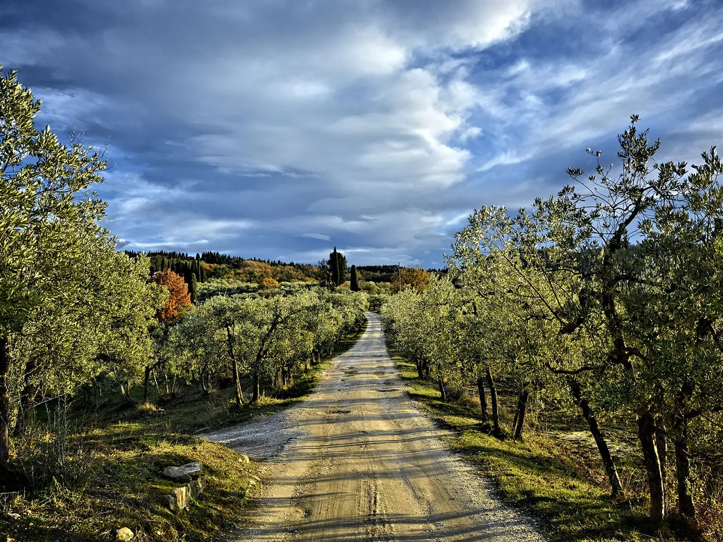
- Chianti Classico vineyards: The route crosses the Gallo Nero heartland, with vines and olive groves defining much of the walking between villages. Panzano’s Conca d’Oro is one of the best-known vineyard amphitheatres in the zone.
- Montefioralle: A small fortified hilltop hamlet above Greve, known for its ring-like medieval layout. It gives a compact taste of the defensive villages that characterise the Chianti hills.
- Monte San Michele (892 m): The highest point of the Monti del Chianti and the route corridor’s main upland landmark. The approach shifts the walk from vineyards into oak, beech and chestnut woodland.
- Volpaia: An intact medieval fortified hamlet near Radda, now closely tied to wine production. Its stone lanes and compact layout make it one of the most memorable village stops.
- Radda in Chianti: A walled medieval town and historic seat of the Lega del Chianti. It is the natural finish for the core Greve-to-Radda walking corridor.
Challenges to expect
This is moderate hill walking, not technical trekking. The main challenges are repeated climbs, mixed waymarking across a network rather than a single branded trail, and heat in high summer. Surfaces include gravel strade bianche, woodland footpaths, mule tracks, short asphalt sections and some old paving. Carry water between villages and use a reliable map or GPS. For higher, more alpine Italian routes, compare Alta Via 1 or the Gran Paradiso Trek.
HikeList Score
Chianti Trail scored 83/100 on HikeList's trail-quality metrics.
See score breakdownHide breakdown
- Ideal length 70
- Balanced challenge 100
- Scenery & wildness 68
- Varied terrain 94
- Accommodation 92
- Food & support 88
- Path quality 80
- Season flexibility 89
Computed from length, challenge, scenery & wildness, terrain variety, accommodation, food & support, path quality and season flexibility.
 Italy
ItalyShow more data Show less
- Hilly
- Vineyards
- Olive Groves
- Forest
- Gravel
- Dirt
- Paved
- Hotels
- B&Bs
- Agriturismi
- Wine Estates
- Family Friendly
- Pet Friendly
- Restrooms
- Water Sources
- Campsites
- Shelters
- Picnic Areas
In these collections
Photos from hikers
Taken on the trail by people who've reviewed Chianti Trail.
Departing from Greve in Chianti, the route ascends gently through patchworks of vineyards and olive groves, passing through the hilltop village of Panzano—an ideal place for a short rest and refueling. Beyond Panzano, the trail rolls through rural countryside and mixed forest, with occasional stone farmhouses and sweeping views over the Tuscan hills. After navigating a mixture of dirt and gravel tracks, you’ll approach Radda in Chianti, a fortified medieval village where you can enjoy the evening and local cuisine.
The second day starts with a gradual climb out of Radda, entering stretches of oak and chestnut forest interspersed with more vineyards and the occasional old castle or stone chapel. The route meanders along quiet gravel lanes, offering panoramic overlooks before descending towards Castellina in Chianti. Along the way, hikers will encounter several traditional estates and picturesque farmsteads. The day concludes in Castellina, another atmospheric medieval town renowned for its historic architecture and wine heritage.
Reviews
How would you rate Chianti Trail?
Tap a star to start your review — you could be the first.